[stormCARIB - Caribbean Hurricane Network'

Caribbean Hurricane Network

- Updates from the Islands -
2005 Season

| home | tools | pleas for help | QHWRN | guide | climatology | archive

This was a record breaking season. A total of 30 tropical systems, with 27 named storms. For the first time ever we ran out of names and had to borrow six letters from the greek alphabeth.

Katrina made most headlines this season. And indeed who would have thought that especially in the United States a hurricane could cause such a disaster! Surely there must have been a lot of 'wishful' thinking going on! I think that it is really shameful how the New Orleans residents weren't pressured more and/or accomodated better to leave the area before the storm struck. And then the aftermath was dealt with even worse. Also, keep in mind, that New Orleans wasn't the only place hit by Katrina. Many other communities in Louisiana, Mississippi and Alabama were affected by Katrina as well, and unfortunately those people are often forgotten.

In any case, despite the continuing headlines about Katrina, at least here in the US, 2005 was a relative quiet season for the Caribbean Islands. It started with some early threats in July, with Dennis which just missed Jamaica but hit Cuba. Then there was Emily which gave Grenada, which is still shaken up from last year, and St.Vincent & Grenadines a big scare. Emily also caused a delay in my visit to Cayman where my family was invited by The Reef Resort as a thank-you from last year's effort. Luckily it was a non-event on Cayman and we had a great time at The Reef. But after that not much happened on the Islands.

However, this year Central America was especially hard hit. A notable 'big' one was the forgotten storm Stan. Many people probably don't realize that this was the deadliest storm of the season, with over 2000 fatalities in Central America (mostly Guatemala). And then of course we have Wilma, who swept through the Yucatan Peninsula and devastated Cancun. Wilma actually broke the Atlantic record for lowest central pressure, and is now ranked number 1 on the list of most intense Atlantic hurricanes.

Last year four storm names were retired by the World Meteorological Organisation. This year there are five: Dennis, Katrina, Rita, Stan and Wilma. They will be replace in the 6-year 21-name rotating system by Don, Katia, Rina, Sean and Whitney.

2005 Season: | Arlene | Bret | Cindy | Dennis | Emily | Franklin | Gert | Harvey | Irene | Jose | Katrina | Lee | Maria | Nate | Ophelia | Philippe | Rita | Stan | Tammy | Vince | Wilma | Alpha | Beta | Gamma | Delta | Epsilon | Zeta|

The heart of the Caribbean Hurricane Network are the personal reports send in by the special hurricane correspondents on the islands. Find out what happened on your favority island during the 2005 Hurricane Season by following the links below.
- Dominican Republic (Apr 7 14:15)
- Tortola (Apr 7 10:09)
- Saba & Statia (Apr 6 7:48)
- St.Maarten/St.Martin (Apr 5 10:45)
- Nevis (Apr 5 8:10)
- Bonaire (Apr 1 15:11)
- Puerto Rico (Apr 1 14:04)
- Culebra (PR) (Apr 1 5:59)
- Cayman Islands (Mar 31 12:18)
- Antigua (Mar 22 20:33)
- St.Croix (Feb 28 15:21)
- Trinidad & Tobago (Feb 26 12:06)
- Jamaica (Feb 15 17:28)
- Barbados (Jan 28 0:00)
- Vieques (PR) (Jan 16 5:24)
- Aruba (Jan 3 1:07)
- St.Thomas (Dec 6 13:58)
- Mexico (incl. Cozumel & Cancun) (Nov 30 21:37)
- Bermuda (Nov 29 10:00)
- Honduras (Nov 20 15:38)
- Belize (Nov 19 20:22)
- St.Vincent & Grenadines (Nov 16 18:37)
- Dominica (Nov 15 14:43)
- St.Lucia (Nov 14 15:01)
- Grenada (Nov 14 11:02)
- Martinique (Nov 13 12:06)
- Bahamas (Oct 26 1:00)
- Turks & Caicos (Oct 25 12:13)
- Haiti (Oct 23 20:06)
- Florida Keys (Oct 23 14:44)
- St.Kitts (Oct 21 15:40)
- Anguilla (Oct 10 15:10)
- Guatemala (Oct 10 11:37)
- St.John (Sep 21 1:00)
- General Update (Sep 12 14:24)
- Guadeloupe (Sep 4 9:52)
- Curaçao (Jul 15 8:15)
- Montserrat (May 24 22:50)

Following is an archive of all weather discussions Dave and I posted. They are in reverse chronological order, with the most recent storm discussion on top. Use the index of storm names above to find your 'favorite' storm. If you want more background information on specific storms, I have found the 2005 Atlantic Hurricane Season section in the Wikipedia a great resource.


- - - Zeta - - -
For the latest hurricane statements and satellite images see our Quick Hurricane Web Resource Navigator
TOOLS: how close is it? - how close can it get? - my satellite - advisories - storm-centered

Friday, December 30, 10:30PM - Zeta
It's not over yet! On one of the last days of the year..., another tropical storm!!! Luckily far out in the Atlantic and already at a more northernly latitude than the islands. Everyone best wishes for the new year! Let it be a boring hurricane season!

Sat, 24 Dec 2005 13:19:00 -0400 - Season's Greetings!

Good evening from Harpendon, North of London in the merry old country of England! No, there's no snow yet but it is due on Tuesday. No problem either!; it's been 6 years since I've seen the stuff!! 
 
Just wanted to wish all correspondents and readers a very Merry Christmas and a safe and happy New Year. And for those of us in hurricane land, let us hope, wish and pray the coming 2006 season will be one where everybody dodges the tropical storm bullet and they all stay out to sea!!
 
Dave


Express yourself instantly with MSN Messenger! MSN Messenger Download today it's FREE!

- - - Epsilon - - -
For the latest hurricane statements and satellite images see our Quick Hurricane Web Resource Navigator
TOOLS: how close is it? - how close can it get? - my satellite - advisories - storm-centered

Thursday, November 28, 3:55PM - Epsilon!
And another one! The 28th named storm of the season! As with Delta no threat to the Caribbean. It is currently in the Central Atlantic, already too far north to be a threat to the islands. At least we are learning our Greek alphabeth.

- - - Delta - - -
For the latest hurricane statements and satellite images see our Quick Hurricane Web Resource Navigator
TOOLS: how close is it? - how close can it get? - my satellite - advisories - storm-centered

Wednesday, November 23, 3:55PM - Delta!
Another one in this record-breaking season! Tropical storm number 25. It formed in the eastern Atlantic, normally the area where the dangerous Cape Verde storms form... Luckily this one seems to be going the wrong way and shouldn't be a threat to the Caribbean at all.

- - - Gamma - - -
For the latest hurricane statements and satellite images see our Quick Hurricane Web Resource Navigator
TOOLS: how close is it? - how close can it get? - my satellite - advisories - storm-centered

Fri, 18 Nov 2005 18:37:14 -0400 - Gamma!

Good evening!
 
The newest member of the Greek fraternity has finally passed his initiation and has been deemed Tropical Storm Gamma! Gamma, part broad low pressure system and part old Tropical Depression #27, is located off the coast of Belize and kicking up some late season heels in an area just newly recovering from Hurricane Wilma. Hopefully, only heavy rain will be the major nuisance although the flooding will be problematic.
 
Speaking of problems, down the road, if Gamma travels as forecast, South Florida could be in for some brief torrential rains as well, and then, the Big One! A Nor'Easter up the Eastern Seaboard for a Thanksgiving present; sure to snarl the travel plans of millions, make hunters in the northeast happy they can track if necessary, and force many municipalities to use up their snow-removal funds earlier than expected. Keep your fingers crossed from the Caribbean to the Northeast!!
 
Dave 


Express yourself instantly with MSN Messenger! MSN Messenger Download today it's FREE!

Friday, November 18, 5:30PM - Gamma!
And another named storm! For a while it looked like #27 was going to fall apart and it did for some time, but this morning's satellite showed that it had become better organized again. Again, not the wind, but the rain will be the major problem for Honduras, Belize, and Mexico...

Monday, November 13, 0:10AM - 27!?
Who would have thought... the twenty-seventh tropical system of the season!!? It is currently about 100 miles west of St.Lucia, and moving away from the Windward Islands. Only threat could be more westward... Hispanolia, Jamaica, Cayman... Don't panic... it's late in the season, and as far as it looks now it will 'never' become a hurricane.

- - - Beta - - -
For the latest hurricane statements and satellite images see our Quick Hurricane Web Resource Navigator
TOOLS: how close is it? - how close can it get? - my satellite - advisories - storm-centered

Wednesday, October 29, 2:40PM - Hurricane Beta
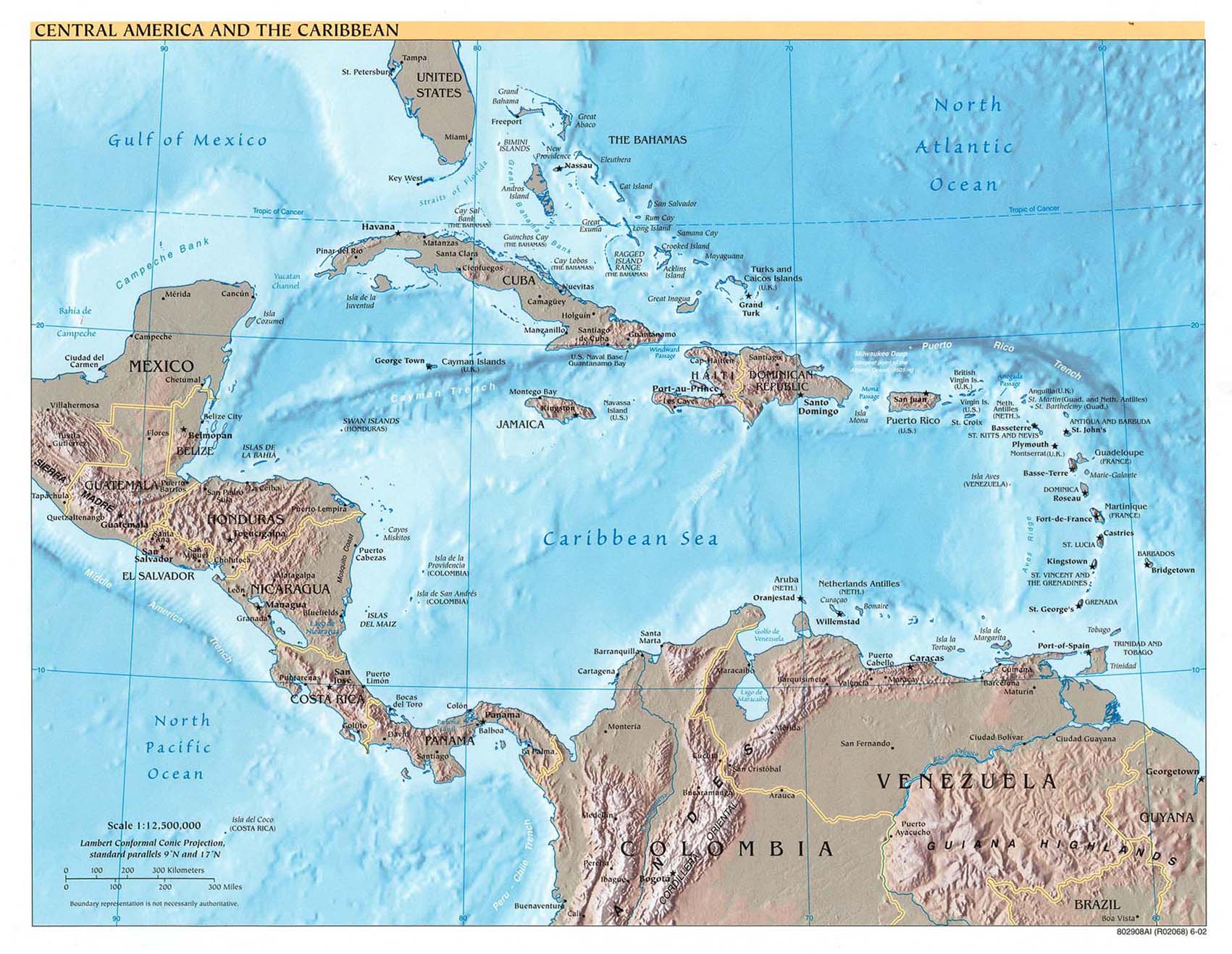
Beta is now a hurricane... currently about 65 miles northwest of Providencia off the Nicaragua coast (see this excellent map from Perry-Castaneda Libray Map Collection at UT). It might become a Category 2 before making landfall. I am more worried about the storm surge flooding and more inland where the torrential rain accompanied with this system which will cause flash floods and mudslides... Hopefully it is not becoming another Stan (or worse, Mitch).

Thu, 27 Oct 2005 09:08:22 -0400 - Gamma???

Good morning!
 
While cleanup and repairs are in full swing on the Yucatan Peninsula and South Florida, Baby Beta just couldn't resist growing up into TS Beta and could even reach minimal hurricane status before lumbering into Central America with very heavy rains. As Gert mentioned previously, it doesn't have to be a strong hurricane to cause death and destruction; especially with slow moving tropical systems encountering mountainous regions. At least this one won't be a "wrong-way" storm like Lenny!
 
Wave activity continues as that formerly weak wave to the immediate east of the Windward Islands has unfortunately decided to get at least some of it's act together and could possibly join the newly formed Greek hurricane fraternity as "Gamma"! Farther out in the central Atlantic Basin is another tropical low but this one is encountering wind shear plus the sea surface temperatures have started to cool down so this one just bears watching for now.
 
Around the US Virgin Islands, plenty of sunshine for now with some rain due in later; not that we need anymore at this time. We have potholes which have reached "SUV" swallowing status!
 
Dave  


Express yourself instantly with MSN Messenger! MSN Messenger Download today it's FREE!

Wednesday, October 26, 11:40PM - Number 26...
Another tropical depression formed. Now off the coast of central America. No problems windwise expected, but those torrential rains again! Not good... as we saw with Stan. I am sure a lot of people don't realize that Stan killed up to 2,000 people in Central America, most of them Maya Indians in Guatemala whose homes were swallowed in landslides.

Tue, 25 Oct 2005 18:57:16 -0400 - Baby Beta?

Good evening!
 
Record setting (seems like they all have been!) Hurricame Wilma is finally out of the Caribbean and the US's hair deciding marriage to tiny Alpha would be a good thing and are currently racing off (53 mph) to a honeymoon around the Canadian Maritimes and extreme south Newfoundland; now only a real danger to northern Atlantic shipping interests.
 
Off to the east, a few waves of note with the closest one, though weak, capable of producing some thunderstorms and heavy rain over mainly the southern islands of the eastern Caribbean with a few pieces breaking off and heading north for good measure.
 
In the southwestern Caribbean, north of Panama, a disturbance is flaring and this is in a climatologically favorable area for development this time of year so it's still not over yet with about 4 1/2 weeks left officially. Baby Beta?
 
Dave


FREE pop-up blocking with the new MSN Toolbar MSN Toolbar Get it now!

- - - Alpha - - -
For the latest hurricane statements and satellite images see our Quick Hurricane Web Resource Navigator
TOOLS: how close is it? - how close can it get? - my satellite - advisories - storm-centered
- - - Wilma - - -
For the latest hurricane statements and satellite images see our Quick Hurricane Web Resource Navigator
TOOLS: how close is it? - how close can it get? - my satellite - advisories - storm-centered

Local reports from Mexico (incl. Cozumel and Cancun) - Pleas for Help Board: Mexico

Monday, October 24, 11:55PM - Getting better...
What a couple of days it has been... Literally millions of hits on this website and over a Terabyte (=1000 Gigabytes!) of data transferred since Friday! And the server(s) just kept humming along! A special thank you to my great webhosting company Pair.com who appreciate my website so much that they waive the overusage costs (which would have been a couple of thousand dollars)!
In any case, Alpha and Wilma are gone. However, the Yucatan is still recovering. There has been a lot of damage, though not as much as I initially feared with a Category-4 hanging around for so long, and as far as I know only three casualties! Also, on the plus side, more and more people are finally able to get in contact with their loved ones stranded in Cancun, Cozumel, etc, of which a lot of them are now being transported to Merida and then flown out. It will take a couple of months for the area to recover I am afraid..., but it could have been a lot worse. The latest reports (including pictures) can be found here. There is also a very active Pleas for Help forum where people are exchange titbits of information, and where you can post a plea for help.
Hopefully this concludes the 2005 Atlantic Hurricane Season!

Saturday, October 22, 7:45PM - Alpha
And there we have it... for the first time ever we have run out of names! So now we are starting with the Greek alphabeth. Tropical depression 25 became tropical storm Alpha. It is currently about 125 miles south of the Dominican Republic, and is expected to pass over the Dominican Republic in the next day. Hopefully it won't stall since the major problem with this system will be the rainfall not the wind, especially in the mountainous regions of Haite and Dominican Republic. After that it is expected to move over the Turks & Caicos islands, but I don't foresee to many problems for them.
Meanwhile in Mexico... the center of Wilma has finally moved of the Yucatan peninsula. It seems to have been there forever! Wilma is still a Category 2 hurricane and pretty close to Cancun. See above for links to reports straight from Mexico by the local hurricane correspondents and for the Wilma-Pleas for Help forum.

Sat, 22 Oct 2005 09:04:24 -0400 - Alpha?

Good morning!
 
First, all thoughts and prayers are with the people of the Yucatan this morning as lumbering Wilma drags her high heels. With sustained hurricane force winds running 6-13 hours, structural damage must be incredible, not to mention the torrential rains and flooding. Our correspondent in Cancun, Kevin, has managed to post several times during the night, some with awesome pictures so check out his postings on the left of the screen across from the GOES 8 image. Great job Kevin and stay safe!
 
While almost everyone's attention is on Wilma and where she will go from Mexico, another system is getting it's act together south of Puerto Rico and the Virgin Islands. An unofficial peak wind gust was reported this morning on St. Croix of 62 mph!! Most of the shower and thunderstorm activity has stayed south of the territory but we are expecting some heavy rain this afternoon. We definitely don't need it as the grounds are still saturated from the last two weeks.
 
Will this reach "ALPHA" status?? From the looks of it on satellite this morning, you would think it had already but with no closed circulation as of yet, it's still classified as a strong tropical wave. My bet is, once classified, it skips elementary school and goes straight to middle school, a/k/a tropical storm status. And once again this season, another record will be set! The DR, Haiti, Cuba, Jamaica and the Caymens must not let there guard down yet; even some areas of Puerto Rico stand to be affected.
 
Wish all well and please play it safe!
 
Dave 


Express yourself instantly with MSN Messenger! MSN Messenger Download today it's FREE!

Friday, October 21, 12:05PM - Cozumel...
Cozumel... hold tight... right now the eyewall is touching the island, will get to Cancun soon... Wilma, a category 4, is moving only at 5 mph, very slow. This is going to be very bad for this part of the Yucatan. If you click above on the 'storm centered image' you will see how impressive this storm looks. If you read this later, I save the images for you: on this page. Link to reports by the special hurricane correspondents in Mexico can be found above.

Thursday, October 20, 12:05PM - Yucatan...
It doesn't look good for the eastern side of the Yucatan peninsula. For the island of Cozumel the closest point of approach (CPA) of the center of Wilma is only 0.9 miles, so a direct hit, and this after they had already Emily back in July. This will be in about 25 hours... For Cancun it doesn't look much better with a CPA of 9 miles in 36 hours... Also, this storm isn't moving as fast as Emily did, so damage will be more extensive. And above this, although Wilma is now a Category-4 Hurricane, it is expected to restrengthen to a Category 5 again before making landfall on Cozumel. Reports from the special hurricane correspondents in the Yucatan region can be found here. Use the tools above to calculate your closest point of approach, make your own satellite images and check the latest advisories. Also, I opened up the pleas for help board esp. for Mexico. There is also a more general please for help board..

Wed, 19 Oct 2005 18:37:55 -0400 - Weebles, Wobbles, and Wilma

Good afternoon!
 
"The Wobbles of Wilma" is now playing in the Western Caribbean and is putting on a "star performance" for the tropical audience. The best scene would be if Wilma went west northwest on a more straight course and missed directly hitting Cozumel, Cancun, and the rest of the Yucatan Peninsula plus the western tip of Cuba and that poor Island of Youth which always seems to be in the path at one time or another.
 
If it wobble too much to the west than west northwest, one of those wobbles would put the eye dangerously close to the northern tip of the Yucatan. A weeble is possible to the east but less likely to happen.
 
Either way, residents of the Yucatan and western Cuba should remain on high alert as these storms do have a tendency to weeble and wobble.
 
The next arae to worry about is the whole western side of Florida; once it emerges into the Gulf of Mexico, it is not a definite the trough which is expected to steer Wilma across southern Florida will be strong enough. Then, it could make landfall farther up the coast or, worse case scenario, the north Gulf Coast. Either way, a probable Cat 3 is going to make landfall and cause significant destruction so please be prepared wherever you may be and follow evacuation orders! We've already seen an unnessary loss of life; not only those who fail to heed evacuation orders but by the hand of emergency officials who haven't made the effort to assist in evacuating those less fortunate. They are important too!
 
Dave 


Don't just search. Find. MSN Search Check out the new MSN Search!

Wed, 19 Oct 2005 08:56:57 -0400 - Another WOW!

Good morning to all!
 
In a year of falling and establishing new records during this years hurricane season, Wilma is trying very hard to make a name for herself as the last alphabet name on this years list! From a Cat 2 to a Cat 5 in less than 11 hours is, as one correspondent aptly put it, "of biblical prportions!" The only things standing in the way of Wilma setting a new record for the strongest hurricane on record in the Atlantic Basin, is the calibration of instruments, and the reconciling of all of the data from the hurricane hunters and NOAA. If all of these factors come together, then Wilma will have set, hopefully, the final record for the year although with 43 days left in the season, Alpha and maybe even Beta still have a shot at unseating Wilma, not in strength, but in final number. In Wilma's case, with a 2-4 nm fluctuating eyewall, who says big things don't come in small packages!
 
As far as maintaining that strength, that's another question. Continual eyewall recycling will fluctuate Wilma's intensity as she is forecast to remain over those deeper warm waters from which she feeds for the next day or two but the longer range forecast shows weakening before slamming into South Florida. Let's all keep our fingers crossed and preparations made quickly.
 
Off to the east, no little Alpha's are expected at this time!
 
Dave


Don't just search. Find. MSN Search Check out the new MSN Search!

Mon, 17 Oct 2005 17:59:19 -0400 - Cat 3 Wilma?

Good afternoon to all!
 
In the costume of a tropical storm, Wilma is forecsat to shed that costume and become a storm of unusual alte season strength as it stops it's southerly movement and turns her sights on a very nervous Gulf Coast. Current forecast's show Wilma moving into the southern Gulf off the western tip of Cuba, curving, and possibly making landfall along the western side of South Florida. Packing potential winds of Category 3 major hurricane status, due to the still very warm, and in that area, deep waters of the southen Gulf, the impacts would be devastating; especially in an area still recovering from last years storms. Lets hope it defies logic.......
 
The rest of the Atlantic basin isn't that quiet either although hostile upper level winds are still our friend for us here in the eastern Caribbean. There is still a possibility ofr these late season pretenders to get their act together so please, now is not the time to be thinking about Thanksgiving just yet! We just might wind up with a turkey named Alpha!
 
Dave 


Express yourself instantly with MSN Messenger! MSN Messenger Download today it's FREE!

Tue, 11 Oct 2005 18:05:27 -0400 - The rain!!

Good evening!
 
A very pesky, slow moving upper level low is trying to emulate the last two Novembers rains by showering us (literally) with copious amounts of rainfall not usually seen outside a tropical sytem (aka depression, storm, hurricane...you get the picture!)
 
Here in the US Virgin Islands and actually, all the way down the island chain have seen their share of rain, thunderstorms, landslides, and flooding. Hey MJ, that report was a day late but still on target! Public schools and most private and parochial schools were closed today in anticipation of more rainfall today but it took it's sweet time getting here; late in the afternoon. Oh well, better to be safe than sorry! 6-8 inches have fallen since Sunday night and more is expected. A look at the radar and latest water vapor images (loops) show plenty more ahead.
 
Off to the east, Vince is now a fleeting memory except for the Iberian coast (Portugal area) with only Wilma remaining as a named name! By that I mean, the Greek alphabet is next after Wilma, if necessary. Funny, I can't seem to find it in my weather heart to have a storm named Alpha or Beta. Reminds me tooo much of my Latin days in high school. Yuck!
 
Seven weeks and counting.
 
Dave  


Express yourself instantly with MSN Messenger! MSN Messenger Download today it's FREE!

Sat, 08 Oct 2005 10:33:29 -0400 - activity!

Good morning!
 
First, thank you Karen and Lee from Vieques. I am feeling much better! And MJ from Culebra, that was a timely posted message; one that needed to get out more due to the possible flood potential the northern islands could be facing. Plus, as St. Martin authorities remind us, there are still 7 weeks left in this years active and destructive season so now is not the time to let your guard down!
 
The large upper level low to our north northeast could possibly and probably will be our next, in a very long list, named storm. Hopefully, it will stay away from Bermuda and only be a threat to shipping interests. We here in the Eastern Caribbean have been very lucky and we have had several timely protectors when potentially threatened: Saharan Dust, hostile upper level winds, and unusual ridging in the Atlantic to name a few.
 
We are expecting heavy rainfall here in the northern islands (see MJ post from Culebra this morning) but so far partly sunny skies with some towering cloud formations is what we see. Looks quiet now but if the forecast holds up, AAUUGGHH!!
 
Have a great and safe holiday weekend!
 
Dave  


Don't just search. Find. MSN Search Check out the new MSN Search!
- - - Adrian through Tammy - - -

For quicker loading and to save bandwidth, the discussions about these storms have been moved to another page.


- - - Local hurricane correspondents wanted! - - -

Do you live on one of the islands? We need your help! We are looking for more people who are interested in sending us a few paragraphs about the situation on your island before, during and after a storm hits. You don't need to be a weatherman or expert on the subject, just share with us what you know, feel and see on your island. Your help will be really appreciated by Caribbean people living abroad with family living on the islands, future visitors who have their Caribbean dream-vacation booked, etc.etc. Reliable, not-sensationalized information is just so hard to get in crisis situations. Help keep the rest of the world up-to-date with what is really happening! We really need you, Georges is proof! If interested, contact gert@gobeach.com.


GoBeach Vacations
- Your source for the best Caribbean vacation you've ever had! -
http://www.gobeach.com | info@gobeach.com

Back to top | home | tools | pleas for help | QHWRN | guide | climatology | archive