|
|
- - - 2019 Hurricane Season - - -
|
- Spring is Here ! -
|
- By Ian Martin Borde <readkrox51 at gmail.com>
- Date: Mon, 23 Mar 2020 01:53:51 -0400
|
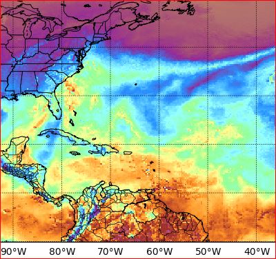
A Solid Mass of Warm-Air is Influencing The Gulf Coasts and East Coast of The USA.
The ITCZ has started a stream of Troughs along the Latitude of The Caribbean. (Southern).
God is Great 
|
|
- (Non-Money) Support Available -
|
- By Ian Martin Borde <readkrox51 at gmail.com>
- Date: Sun, 22 Mar 2020 23:20:22 -0400
|
2020-03-22nd. Sun. 23:05 (11:05) pm. T&T, WI.
I AM SURE: expected, know and can deal with this Pandemic. BUT WE ALL NEED H E L P !
I need support, and, I know, you need support too. (Non-Money Support!)
I am asking the sponsors? Just like a hurricane emergency, let's talk and chat with each other. Borders are closed. But we live in a Global village with tourists among us and nationals abroad.
StormCarib to me, is a Home away from Home!
God Bless 


|
|
- PanDemic Safe-Spots
|
- By Ian Martin Borde <readkrox51 at gmail.com>
- Date: Thu, 12 Mar 2020 10:38:24 -0400
|
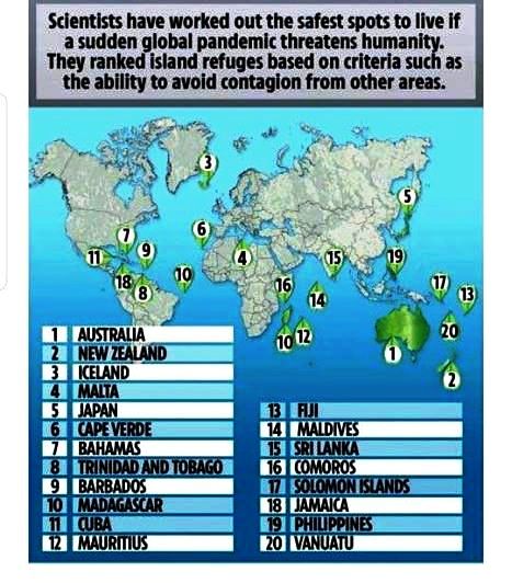
I got this image that substantiates Verification I read previously at The University of The West Indies Library.
The West Indies is a Safe-Spot !
This no one can deny !
This also is a 'good reason' to help The Bahamas Recover, and those islands hit by Irma and Maria.
Addendum: [Reading List] My current leisure time reading is : Trying to substantiate we are entering a New Geological/Anthropological 'Epoch' and this Millenium includes Climate Change.
God Bless
|
|
- Remain Calm !
|
- By Ian Martin Borde <readkrox51 at gmail.com>
- Date: Fri, 6 Mar 2020 00:56:57 -0400
|
Glencoe, Pt. Cumana, Diego Martin, T&T., WI.
2020-03-06th Fri. 00:25am.
People of Paradise,
Trinidad, Tobago, Grenada (and NW Venezuela) had a 5.0 Earthquake with a depth of 91 kms/56 miles, lasting about and maybe over 05 - 08 secs. The soil is SANDY and SHALLOW, while the tremor was marginally deep, the OFFICIAL WARNING CENTRE sees NO Threat of tidal changes.
This is the second (2nd.) tremor and more intense and longer!!!!!!
In the event of future occurences; - Dogs will bark. - Topup your communication devices, friends and emergency lists/contacts and store info, ... - Wear (if possible, even in the place you sleep), working-man clothes with tools. Ie. boots, belt, warm/cotton underwear under your top. Store important documents, medicines and vital necessities TOGETHER, in a safe and accessible place.
AS MUCH AS POSSIBLE: People should stay together in a safe spot!!!!!!!!!!! THAT INCLUDES, ... , the less fortunate ! Loose all animals and let them FREE. Leave (when home but, NOT COMPROMISING SECURITY) as many doors and windows un-locked as possible.
As much as this website has to be scientific and not over-emotional.
The best thing to do is PRAY +++ !!! +++
My take:
Based on recent tremor history, This is for the entire caribbean.
Lord have Mercy 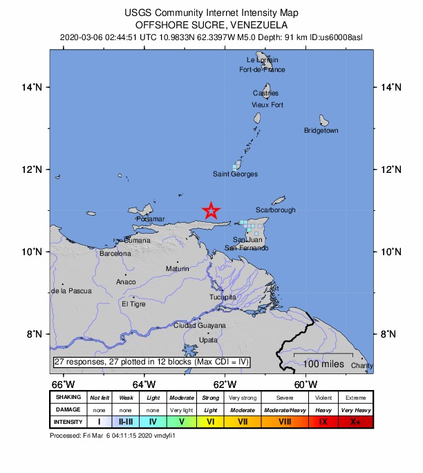
|
|
- Safe, Cool and Happy Carnival, Everyone -
|
- By Ian Martin Borde <readkrox51 at gmail.com>
- Date: Sun, 23 Feb 2020 03:40:23 -0400
|
My take on a weather forecast for Carnival Monday and Tuesday. Always Cloudy, Scattered Overcst Conditions Sometimes Drizzly or Short Rain Periods in Localised Areas, ...
Just be Your Normal, Loving and Peaceful Self, Not Bigoted or Extreme and You will have a Cool Carnival, . . . .
Addendae:
Panorama 2020 Large Bands Results:
✍️✍️👍Well Done ✍️💯💯💯💪👍 Blessings and Love always to all.
Have a happy and safe Carnival. 01st - Desperadoes 286 points
02nd- All Stars 282 points
02nd- Renegades 282 points
04th - Phase II 281 points
05th - Invaders 279 points
06th - Sniffle 277 points
07th - Exodus 276 points
07th - Supernovers 276 points
09th - Tropical Angel Harps 274 points
10th - Redemption Sound Setters 273
11th - Fonclaire 268 Congratulations to all finalists,
the quality of your music was very high and the event was most entertaining. Our culture is in good hands as the real winner tonight is Pan. Blessings and love always to all.
Have a happy and safe Carnival. 


|
|
- - + - Rest in Peace, - + - Miss Mermaid - + -
|
- By Ian Martin Borde <readkrox51 at gmail.com>
- Date: Tue, 18 Feb 2020 11:25:57 -0400
|
I really, really don't know why??? But, Evertime I am rummaging to find an appropriate image to attach to my Blogs. This one reminds me of Dear Miss Mermaid, UNFORGETTABLE !
It's Great for our image and pockets to be a Blogger. But, It's even Greater! (For Our Spirits and The Preservation of Life and Living, ...) If, in our Blogs we can capture the 'Spirit' of Dear Miss Mermaid.
May God, Rest her Soul, . . . . Amen ! |
|
- (Unusual) 2nd Trough in Two weeks -
|
- By Ian Martin Borde <readkrox51 at gmail.com>
- Date: Mon, 27 Jan 2020 02:43:12 -0400
|
Just quickly after a lil' island night life, ...
There is a 2nd trough in the ITCZ approaching this week in OVER 36 hours. More intense than last week that lasted two and a half days. Also more northerly, ... ! One can't say with precision how hazardous ? But to sound like a 'boring teacher', the Key is to remain in an 'adaptable' survival mode, with Climate Change!!!!!!!
I don't know how many stormcarib followers are sailors? But ! Puerto Rico's Electricity problems is no romantic, joy ride !
Please do something 'Real' about it !
Dios Vos Bendiga God Bless 

|
|
- Backwash -
|
- By Ian Martin Borde <readkrox51 at gmail.com>
- Date: Sat, 18 Jan 2020 10:40:43 -0400
|
Just to Note:
There are three parts to a Wave, . . . The wash The backwash The swirl, [Contrary to eyesight, a wave is not a straight line.]
In Rip Currents; The Backwash Kills, . . . ! Stay away from foamy water. Even beyond the high-tide mark !!!!!
Just my (experienced) take !
God Bless 
|
|
- 1st Post of 2020
|
- By Ian Martin Borde <readkrox51 at gmail.com>
- Date: Tue, 14 Jan 2020 05:37:04 -0400
|
Dear People of Puerto Rico and Paradise,
With Climate Change, there is no dry and wet or winter season. There are hurricanes/storms and terremotos and volcanoes ad nauseam. It has not been highlighted, but Trinidad had a mud volcano eruption with evacuations. While in the east and central but further north, flooded.
After the hurricane season!
Adaptability is more important than strenght or intelligence or wealth! (That does not mean, that even I am helping you, as per normal status quo). But, Behind the spotlight !!!!!!!
My continued support is with YOU !
Weatherwise:
I am not even going to try to look for an un-paying weather website
The attached image would show, "Rain coming, ... " (Why even bother to post?) Ans. It could intensify to more than one inch and winds over 20 mph. Based on the hole in the Sahara Dust and Pressure gradient over Trinidad.
Survival Mode without unharnessed energy is the key.
God Bless 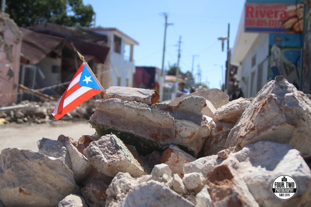

|
|
- Happy New Year -
|
- By Ian Martin Borde <readkrox51 at gmail.com>
- Date: Wed, 1 Jan 2020 09:54:44 -0400
|
Quote:
Gold medalist Jacki Joyner-Kersee said, "It's better to look ahead and prepare
than to look back and regret."
Happy New Year !

|
|
- Merry Christmas -
|
- By Ian Martin Borde <readkrox51 at gmail.com>
- Date: Wed, 25 Dec 2019 07:59:39 -0400
|
|


|
|
- Cessation Coming, . . . ! -
|
- By Ian Martin Borde <readkrox51 at gmail.com>
- Date: Sun, 15 Dec 2019 11:19:20 -0400
|
Tomorrow the weather in Trinidad & Tobago / / Riverine Situation would be BETTER, Not Stop entirely but BETTER, . . .
God Bless 
|
|
- HAZARDOUS Long-Term ITCZ Trough Approaching, ... !!!!
|
- By Ian Martin Borde <readkrox51 at gmail.com>
- Date: Fri, 13 Dec 2019 19:58:27 -0400
|
2019-12-13th. Friday, 7:50pm.
Attention: There is going to be no let up in the heavy riverine situation. From tomorrow morning/tonight a Trough will reach lasting, more than 2 days. First Responders need to be posted.
South Trinidad may need to be 'On Alert'.
Regional Corporations need to Clear Drains over the weekend in North. Shelters and Their Management need to revamp Procedures.
I would help if I can.
Standing by |
|
- Christmas Rain ! -
|
- By Ian Martin Borde <readkrox51 at gmail.com>
- Date: Wed, 11 Dec 2019 09:45:33 -0400
|
Flooding anticipated/reported in Penal !!
GOD Bless ! |
|
- Christmas/Thanksgiving/Retirement/Election Season -
|
- By Ian Martin Borde <readkrox51 at gmail.com>
- Date: Sat, 30 Nov 2019 08:51:00 -0400
|
2019-11-30th. Saturday, Close-Of- Season Day!
Lovely People of Paradise,
Weatherwise: We have Glorious Tropical Sunshine mixed with water-cistern Rain. Everyday !
The Point is; Thanks, to Gert and Dave and the Donors and Volunteers, the collaborators and stakeholders, the Humanitarian People of Paradise, (Personally, I am Thanking, my Inspiration, Dr. Jeff Masters.) Thanks to The Up-and-Coming New Correspondents, . . .
As some (most likely few), may have realised, My posts are less. Less in Data and Less in Time Intervals. I medically need to have less (high-profile) involvement with Emergency Work. (Besides 2020 is Elections in USA and Trinidad and Tobago.) Also in 2020 (sometime late) my daughter will finish her Bachelors Degree. I love what I do And Stand up for what I believe in, So I still will contribute. It's not Goodbye, ... !
G O D BLESS 
|
|
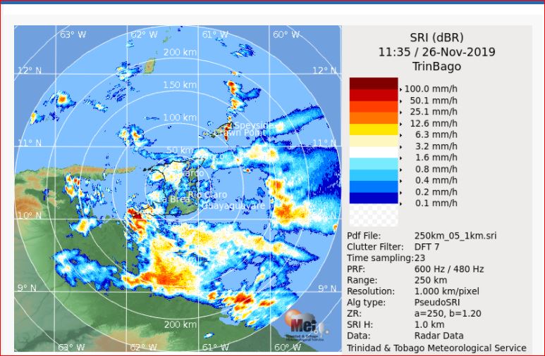
- It Ain't Over -
|
- By Ian Martin Borde <readkrox51 at gmail.com>
- Date: Tue, 26 Nov 2019 08:31:28 -0400
|
2019 - 11 - 26th. Tue. 07:30 am. 
|
|
- Expect Hazardous Conditions -
|
- By Ian Martin Borde <readkrox51 at gmail.com>
- Date: Wed, 20 Nov 2019 06:33:34 -0400
|
My Dear People of Paradise,
While it is HIGHLY Scientific as Dave wrote so Well on the WallPage!
I will try to break it down even further and explain that; The Cold Front, 'Sebastien' and the ITCZ (active) are too CLOSE TOGETHER, for Normal Weather to Persist, ... !!!
Anything can Happen at Any Time !!!
Do NOT Be Complacent
God Bless 

|
|
- On Repeat...
|
- By fedawshercloh <fedawshercloh at gmail.com>
- Date: Tue, 19 Nov 2019 00:29:49 -0500
|
Again, more inclement and adverse weather conditions resulted on Monday- this time in areas of North Western Trinidad with the usual street and flash flooding in some areas. Today similar conditions are expected to persist as what should be Pre-Sebastien pulls away from our area. It would be great if this was the last tropical threat for the year... time will tell.
Sent from my Samsung Galaxy smartphone. |
|
|
- Dangerous atmospheric instability...
|
- By fedawshercloh <fedawshercloh at gmail.com>
- Date: Mon, 18 Nov 2019 06:21:02 -0400
|
Continued instability coupled with light winds aloft and an abundance of low level moisture once again gave rise to adverse weather conditions in parts of south and central Trinidad yesterday. Areas in Claxton bay were hardest hit... And tragically heavy rains which fell in Tobago as a result of similar atmospheric conditions claimed two lives at Argyle falls due to a flash flood event. May their souls rest in Peace in Jesus' Name, and may their family members find strength and hope at this difficult time.
These conditions also resulted in the beginning stages of the formation of a waterspout there. Additionally, there was one reported before which had fully formed just over a week ago near Store bay as well. Unfortunately, similar conditions are likely to persist over the next few days so extra vigilance is advised in the islands especially near water courses etc.
Keep safe people...
Sent from my Samsung Galaxy smartphone. |
|
|
- Funnel activity...
|
- By fedawshercloh <fedawshercloh at gmail.com>
- Date: Sat, 16 Nov 2019 23:56:17 -0400
|
Quite a bit of adverse weather happened across south and central Trinidad over the last couple of days. There has been flash and street flooding, but the most severe threatening hazard was the formation of funnel clouds which occurred twice this week. Apparently, microbursts may have affected some places as well.
Fortunately, there was no further descent of these funnel clouds to the ground, which would have resulted in tornados. However, his latest funnel cloud activity is a very grave reminder for the general population that while extremely rare in the Caribbean these hazards can be a real threat to parts of our territories. Stay vigilant and prepared. Also, hoping that the system forming east of the Leewards does not directly threaten any of the islands...
Sent from my Samsung Galaxy smartphone. |
|
|
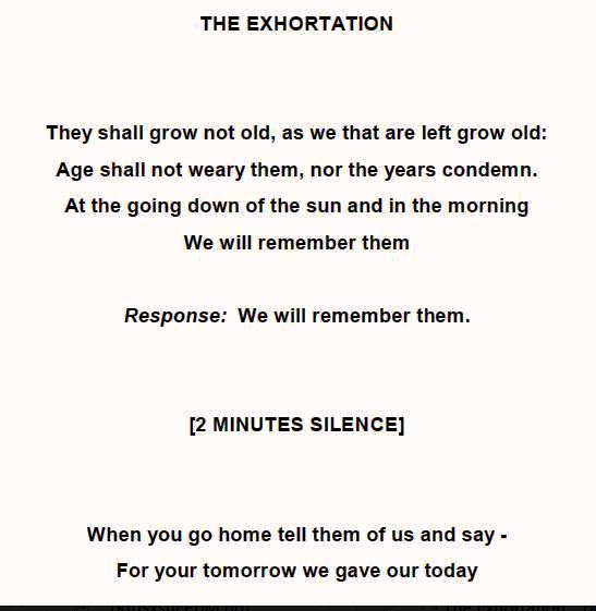
- . . . . We Remember, Lest We Forget ! . . .
|
- By Ian Martin Borde <readkrox51 at gmail.com>
- Date: Mon, 11 Nov 2019 06:51:19 -0400
|
|


|
|
- Forecast- Ongoing vigilance...
|
- By fedawshercloh <fedawshercloh at gmail.com>
- Date: Sun, 10 Nov 2019 03:09:17 -0400
|
As the wave axis continues to pull away from the island chain -isolated showers are expected to continue across parts of the Southern half of Trinidad and Tobago, as Sunday progresses. With isolated heavy showers affecting Southwestern Trinidad and the Western coast of Tobago.
Conditions should become gradually settled again by the late evening across much of Trinidad, with lingering showers across Eastern Trinidad and Tobago much like on Saturday...
Sent from my Samsung Galaxy smartphone. |
|
|
- (Regional) Tropical Wave/ Trough activity...
|
- By fedawshercloh <fedawshercloh at gmail.com>
- Date: Sat, 09 Nov 2019 15:45:05 -0400
|
In keeping with the bulletin issued earlier by the TT Weather center- This current tropical wave (62) is as forecasted further interacting with the ITCZ as it continues to move west of Trinidad & Tobago and the Southern Windwards on Saturday into Sunday, bringing periods of showers and thunderstorms to the islands, with partly cloudy to overcast skies.
From yesterday, moisture and instability associated with the ITCZ and a surface to mid-level trough generated cloudiness with scattered showers, periods of rain and thunderstorm activity. Also, a favorable upper-level diffluent pattern supported showers and thunderstorms yet again today.
Additionally, the possibility remains for shallow low-level cloud patches traversing the region to produce brief scattered showers over Barbados and some of the windward & leeward islands as well... Furthermore, there is also the possibility that some of these shallow cloud patches may be further enhanced, generating moderate to heavy showers and a few isolated thunderstorms as an upper-level jet and trough system lingers over the area. This severe weather pattern developed earlier today in northern Barbados in particular.
There are Reports there of Severe Flash flooding having occurred today in Northern parts of Barbados. Also, nearer to home Street and flash flooding continues along the Western Main Road in Trinidad in the vicinity of Carenage, as well as along the Tucker Valley Road in Northwestern Trinidad.
Keep safe everyone especially 'up the islands' as well... This trough/ tropical wave activity may likely be prolonged and severe at times over the next couple of days. May God Bless us All.
Sent from my Samsung Galaxy smartphone. |
|
|
- 2019-11-09th 2:15 pm.
|
- By Ian Martin Borde <readkrox51 at gmail.com>
- Date: Sat, 9 Nov 2019 14:54:46 -0400
|
and,
This is just a Trough ! |
|
- Newest Approaching weather threat...
|
- By fedawshercloh <fedawshercloh at gmail.com>
- Date: Thu, 07 Nov 2019 02:42:50 -0400
|
As this latest tropical wave pulls away more active weather is expected by the weekend from yet another tropical wave/ ITCZ / trough like system. Although it's not necessarily good news- yet, our reservoirs still need the water so there are some positives from additional rainfall. However, the adverse weather conditions have been pretty impactful overall in many parts of TnT so some folks are understandably weary. I suppose its all part of the 'small price' to 'pay' for living in the tropics. Keep safe and prepared as always everyone. Hopefully the Atlantic hurricane season should be on the wraps...
Sent from my Samsung Galaxy smartphone. |
|
|
- No personally predicted ease, ... !
|
- By Ian Martin Borde <readkrox51 at gmail.com>
- Date: Wed, 6 Nov 2019 14:31:03 -0400
|
2019-11-06th. Wed. 2:20pm.
For the southern Windwards; Now is not a time to put clothes on the line. Wash the car. Leave drains clogged. Or let debris accumulate without removal.
Personally (from unattached data) my take is.
While mixed with Glorious Sunshine, the rains when they come and they will come for the next 3 - 5 days, will be heavy. If not sustained, ... !!
Two things:
- Things are not always how they seem. - Over-Confidence and Under-Confidence (Complacency) can lead to a human-caused error and accidents/mistakes.
I sincerely HOPE, having said that! You enjoy the season, ... !
God Bless 
|
|
- Squally weather...
|
- By fedawshercloh <fedawshercloh at gmail.com>
- Date: Wed, 06 Nov 2019 01:02:41 -0400
|
Squall like conditions are expected to persist into Wednesday across TnT. Hopefully, the resultant flooding will not be as bad as feared...
To those in the usual vulnerable areas- Stay prepared and be vigilant.
Sent from my Samsung Galaxy smartphone. |
|
|
- Weather Alert...
|
- By fedawshercloh <fedawshercloh at gmail.com>
- Date: Tue, 05 Nov 2019 02:00:47 -0400
|
As expected a weather alert has been issued by the Met office due to an approaching tropical wave embedded within the ITCZ. The following weather bulletin issued by the TT weather center is fairly comprehensive and straight forward:
— An Adverse Weather Alert Yellow Level goes into in effect at 2:00 PM on Tuesday through 7:00 PM on Wedesday for both Trinidad and Tobago. Adverse weather is likely to begin prior to the official start of the alert.
— Through Thursday, 2 to 4 inches (50 to 100 millimeters) are possible across Trinidad and Tobago with heavier totals across Eastern and Southern halves of Trinidad, as well as Tobago. There is an elevated threat of street flooding and flash flooding, particularly across Tobago and the Eastern half of Trinidad.
— Seas will remain moderate to occasionally rough, with waves up to 2.5 meters are possible in open waters, occasionally up to and in excess of 3.0 meters and less than 1.0 meter but choppy in sheltered areas.
— Gusty winds in excess of 55 to 65 KM/H possible, particularly on Tuesday. Winds of this strength will produce wind damage including downed trees, utility poles and roof damage. Localized power outages possible.
— Landslides possible in elevated areas.
Be safe and stay prepared folks...
Sent from my Samsung Galaxy smartphone. |
|
|
- SIGNIFICANT ITCZ Trough
|
- By Ian Martin Borde <readkrox51 at gmail.com>
- Date: Sun, 3 Nov 2019 07:12:11 -0400
|
T&T, & the Southern Windwards, People of Paradise,
There is an ITCZ Trough within 24 hours that can be worse than a Tropical Wave, that is minus wind and waves. For Precipitation!!!! It will last more than a day and a half. Most likely two days.
In the Leewards and Northern Windwards, moisture is being fed into an LPS situated north of the Leewards, causing hazardous weather in the islands.
Flora and Fauna - Wise: 'Oranges' are coming back in season. For me, that's a staple after morning coffee.
God Bless and clean the drains, . . . 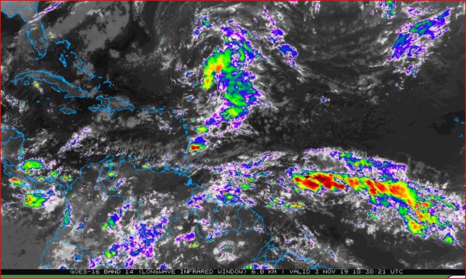


|
|
- Wet weather woes...
|
- By fedawshercloh <fedawshercloh at gmail.com>
- Date: Sat, 02 Nov 2019 02:56:07 -0400
|
The last couple of days have been particularly wet for North Western Trinidad... & the usual street and Flash flooding has been pretty bad in several areas unfortunately. Hopefully, we'll have a bit of a break over the weekend though the seas are forecast to still be rough.
Also, some more active weather is forecast into the coming week. Keep alert & prepared...
Sent from my Samsung Galaxy smartphone. |
|
|
- Disturbed weather...
|
- By fedawshercloh <fedawshercloh at gmail.com>
- Date: Tue, 29 Oct 2019 05:01:12 -0400
|
As was forecast the worst of the weather from this latest tropical wave mostly affected areas in Tobago & northern Trinidad. It appears that some more showers may occur as the day wears on, but they should not be too heavy. There is also the threat of some more disturbed weather on the upcoming weekend. Keep vigilant & Stay safe everyone.
Sent from my Samsung Galaxy smartphone. |
|
|
- Inclement weather...
|
- By fedawshercloh <fedawshercloh at gmail.com>
- Date: Mon, 28 Oct 2019 14:02:32 -0400
|
On this Divali holiday we are having the 'usual' rainy weather which seems to come annually around this time. The high seas alert is in effect for this week and rough surf is being generated along the northern and Eastern coasts. With this current tropical wave activity increased thunderstorm impacts are expected; street, flash flooding and gusty winds are anticipated. Be safe everyone...
Sent from my Samsung Galaxy smartphone. |
|
|
- Inclement Weather -
|
- By Ian Martin Borde <readkrox51 at gmail.com>
- Date: Mon, 28 Oct 2019 10:34:23 -0400
|
People of T&T and The Southern Windwards,
Expect some inclement weather momentarily.
This Tropical Wave is more like a Trough. Because it's going to dip into South America and join the ITCZ. It has no hazardous wind or waves. But, There is no Dry Air (SAL) or Windshear. Copious Rain !
Enjoy The Festival of Lights !

|
|
- A Ray of Sunshine -
|
- By Ian Martin Borde <readkrox51 at gmail.com>
- Date: Fri, 25 Oct 2019 03:40:12 -0400
|
Glencoe, Pt. Cumana, D'go M'rtn, T&T, WI. 2019-10-25th. Fri. 03:20 am.
People of Paradise,
Seemingly, It's the end of Cabo Verde storms. (Affecting the Lesser Antilles.) The ITCZ is now lower than T&T, and the last two Tropical Waves besides dipping south were no longer a treat at 40 - 50 W. Longitude because of Winter and Dry Season currents, (wind-shear). That does not mean that a south american trough can't impact The Southern Windwards. Twice in the past, I have seen storms develop in The Gulf of Paria and Venezuela swamplands.
Keep your survival skills honed and always be prepared. Even in the dry season. While welcoming the tourists, ... Trinidad and Tobago has had a 12% increase in visitor arrivals.
Between now and New Year's, will be a good time to remember all those who suffered loss this hurricane season while we are feting and partying and shopping, ... !!!! May the souls of victims lie in Eternal and Perfect Peace, .... Amen !
God Bless


|
|
- Convergence & Instability generated Severe Thunderstorms...
|
- By fedawshercloh <fedawshercloh at gmail.com>
- Date: Thu, 24 Oct 2019 02:30:37 -0400
|
Intense Thunderstorm activity aided by atmospheric instability, daytime heating and convergence led to the tornadic activity which was witnessed in the Port of Spain area on Tuesday afternoon. This twister activity was combined with some scattered thunderstorm microburst impacts and isolated downdrafts along parts of Western Trinidad. With so much recent active weather lately- for many persons it has understandably felt almost like a 'new normal'...
However, this is really unprecedented for the Port of Spain area which generally doesn't see tornadic activity. This weather phenomenon is usually reserved to parts of central and south Trinidad. & Of late there's also an ongoing social media 'debate' about whether the damage caused by Tuesday's bad weather and associated spotted funnel cloud was actually a bona fide tornado... TT Weather center site quite fittingly issued the following statement-
"On Tuesday afternoon, a severe wind event affected parts of Woodbrook and Invaders Bay (Port of Spain).
We maintain that this was indeed a tornado event based on in situ (on site) damage assessments following the event, assessment of the video from several angles of the funnel cloud, and subsequent tornado eyewitness reports, and radar, and satellite data.
The Trinidad and Tobago Meteorological Service's assessment is that is was not a "fully-formed tornado" and in fact, calls it a "funnel cloud."
However, when winds from a funnel cloud touch down on land, it is designated as a tornado and if it does so over water, it is a waterspout."
(https://ttweathercenter.com/tornadoes-in-tt/the-2019-port-of-spain-tornado)
I think their response is pretty definitive. Nevertheless, whatever the take of the Met office- it was once again another critical wake-up call for TnT; notably that weather related disasters can happen at any time, and anywhere especially during our wet/ hurricane season. Hopefully, tomorrow we may not have an active weather pattern develop like Tuesday's very inclement conditions, although the chance of it occurring seems high at this point according to present atmospheric indicators. Thankfully, Wednesday's weather was fairly good overall with only parts of east and North Eastern Trinidad experiencing some bad weather.
Stay safe & prepared folks...
Sent from my Samsung Galaxy smartphone. |
|
|
- Thunder squalls & Wild weather...
|
- By fedawshercloh <fedawshercloh at gmail.com>
- Date: Wed, 23 Oct 2019 02:09:28 -0400
|
Since the passage of 95L -the last few days of active weather have unfortunately produced a few incidents of damaging and destructive weather conditions in Trinidad and Tobago.
• The last couple of days in particular were quite impactful with widespread to extensive flash flooding occurring yesterday in some areas in and around Port of Spain & along parts of the 'East- West' corridor.
Today, significant impacts came from what appeared to be a weak twister, along with gusty thunderstorms, which caused roofing damage to some structures in the Western-most parts of Port of Spain. We also experienced a brief power outage as well which resulted from Galvanize sheeting being blown into nearby power lines on Wrightson road near the National flour mills. The remainder of the mid-afternoon period brought mostly Moderate to heavy thunderstorms at first with the odd bout of bad weather into the late mid-afternoon period.
This latest adverse weather event apparently developed largely due to afternoon thundershowers enhanced by daytime heating, and convergence, which were further energized by a tropical shear-line, which moved southerly from the Windwards towards Trinidad.
Thankfully, it was not any worse as more areas could have been affected... Hopefully Wednesday's weather will not result in inclement conditions affecting the areas along Western Trinidad etc. as occurred the last couple of days. Keep safe everyone...
Sent from my Samsung Galaxy smartphone. |
|
|
- Former 95L' flexes its muscle...
|
- By fedawshercloh <fedawshercloh at gmail.com>
- Date: Fri, 18 Oct 2019 07:16:00 -0400
|
Unfortunately, as I feared TnT experienced damaging winds and flooding rains from the passage of 'Ex 95L.' In central and south Trinidad as well as in parts of Tobago the effects of 'post 95L' were widely felt.
Heavy afternoon thunderstorms across parts of Western and Northern Trinidad on Thursday were accompanied by some periods of violent rainfall, very frequent lightning and gusty winds. & Heavy rainfall caused street flooding across various parts of Western and Northern Trinidad. Street flooding was reported across the Eastern Main Road between El Dorado and St. Augustine; Freeman and Trantrill Road, Pasea Village; The Southern Main Road in the vicinity of Chase Village and Freeport; the Freeport Mission Road, Freeport; Lime Head Road, Chase Village and Cipero Road, San Fernando according to the full list from the TT weather center.
Also, Frequent lightning knocked out power to several areas across the East-West Corridor, including at Lopinot, St. Augustine and Caroni with a number of traffic lights along the Churchill Roosevelt Highway becoming non-functional...
Additionally, Gusty winds across Southern Trinidad blew off the roofs off several homes in the Bonne Aventure and Caratal villages, near Gasparillo. As of 3:00 PM, yesterday there were confirmed reports of 8 homes affected in Cocoa Piece, Bonne Aventure and Alladin Trace, as well as the Bonne Aventure Presbyterian School. One home completely collapsed. However, thankfully, there were no reports of injuries. This adverse and inclement weather has apparently extended all the way even to sections of the south American mainland to north eastern Venezuela & Guyana. Keep safe and keep prepared folks...
Sent from my Samsung Galaxy smartphone. |
|
|
- Convection building...
|
- By fedawshercloh <fedawshercloh at gmail.com>
- Date: Thu, 17 Oct 2019 06:44:31 -0400
|
Some of the heavier showers and thunderstorms which are concentrated near Barbados are now nearing the vicinity of Tobago. It remains to be seen how these showers will affect our local weather as the little swirl of this system's cloud mass may build into more rotation and organisation of its showers and convection later in the forecast period.
Sent from my Samsung Galaxy smartphone. |
|
|
- Approach...
|
- By fedawshercloh <fedawshercloh at gmail.com>
- Date: Thu, 17 Oct 2019 02:23:09 -0400
|
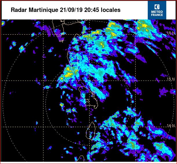
Some of the core convection from what's left of 95L seems to be approaching the Barbados area... This is showing up pretty well on the Martinique radar. (http://www.meteofrance.gp/previsions-meteo-antilles-guyane/animation/radar/antilles)
If this system is able to better align itself and stack its thunderstorm activity- thereby gaining increased circulation and convectional area then much more unsettled and inclement weather could find it's way into our area. We'll see what the rest of Thursday brings. Hopefully it will not be too wet in the islands when this latest system has left our area... To those in the windwards- as always Keep safe and alert.
Sent from my Samsung Galaxy smartphone. |
|
|
- Re-organizing under Wind-Shear -
|
- By Ian Martin Borde <readkrox51 at gmail.com>
- Date: Wed, 16 Oct 2019 04:46:15 -0400
|
My take:
The dissipated TW/LPS is going to Impact the Dominica/Monsterrat area as a Tropical Depression (35 mph. winds) for the entire day tomorrow. Starting in the dark foreday morning.
Get Prepared 


|
|
- Bears watching...
|
- By fedawshercloh <fedawshercloh at gmail.com>
- Date: Tue, 15 Oct 2019 21:45:10 -0400
|
Although further immediate intensification of 95L seems to have halted temporarily, for the time being the system still bears watching as it nears the area of the windward islands. Of course, climatology is still in its favour, And certain models have been trending more southward as well which is concerning. The re-formation of a new more southerly closed low level centre of circulation, or a low level meso- circulation is a real possibility. Also, weakened systems will be more than likely to move more in a westerly direction while re- developing instead of heading more west north westerly or North Westerly. All of the Windward islands need to pay attention to this approaching tropical wave. Hopefully, sudden organisation and intensification may not happen near or directly over the southern windward isles.
Additional vigilance is required once again as this system is already capable of producing winds to at least tropical storm force. Therefore, irrespective of whether this system gets named, or has any further significant development -tropical storm conditions, with the potential for intense trough type impacts will likely spread across most of the southern islands of the Lesser Antilles within 24-36hrs. & With the recent battering that the ITCZ has given to some of the southern isles especially to Trinidad and Tobago; heightened precaution is definitely needed.
I hope that all concerned will Stay prepared, & Remain alert as this weather threat inches ever closer to the southern Windwards with the potential for significant effects...
Sent from my Samsung Galaxy smartphone. |
|
|
- Possible Cyclogenesis...
|
- By fedawshercloh <fedawshercloh at gmail.com>
- Date: Mon, 14 Oct 2019 13:40:20 -0400
|
95L definitely seems to be getting better organized inspite of shear as was hinted at in earlier posts. A closed low level centre of circulation appears to be getting better formed as is evident on 'windy' & earth.nullschool.net Potential tropical cyclone warnings may be necessary for the southern windwards soon... Be prepared and vigilant everyone.
Sent from my Samsung Galaxy smartphone. |
|
|
- Readiness...
|
- By fedawshercloh <fedawshercloh at gmail.com>
- Date: Mon, 14 Oct 2019 01:03:59 -0400
|
The following early forecast was released by the TT Weather Center which speaks to the likely threat(s) of the approaching disturbance:
....Tropical Wave 55 is already producing near-gale-force winds (sustained at 55 KM/H, gusts to 74 KM/H)...
— Much of the heaviest showers, thunderstorms, and winds are forecast to move north of T&T later this week. (This could always change) — Between 1 to 2 inches (25 to 50 mm) with isolated totals up to 4 inches (100 mm) are possible across the Southern Windwards, mainly north of Trinidad and Tobago. There is the threat of street flooding and flash flooding Wednesday into Thursday.(Riverine flooding is a possibilty)
— Moderate seas with waves generally near 2.0 meters and up to 2.5 meters are possible in open waters east of T&T on Wednesday into Thursday.
— Gusty winds in excess of 65 KM/H possible. Winds of this strength will produce wind damage, including downed trees, utility poles and roof damage. Localized power outages are possible.
As I've been hinting in the past - there is a sustained tropical cyclonic threat to the Southern windwards which may materialize with this system. Keep vigilant and safe. Some inclement weather ahead of this system is expected from a tropical wave and the ITCZ...
Sent from my Samsung Galaxy smartphone. |
|
|
- A Hampered & Postponed Analysis -
|
- By Ian Martin Borde <readkrox51 at gmail.com>
- Date: Sun, 13 Oct 2019 09:50:23 -0400
|
T&T, WI. 2019-10-13th. Sun. 09:35 am.
Dear People of Paradise,
I can't wait for The Year 2020, ... !
While I, (the collective We/I), are grateful that I/We have come this far. There is still So much more needs to be done and revisited?
Weatherwise: I had to wait one more day for this post. As the situation unfolding was not certain yesterday.
In 36 hrs. There is a trough, that is more like a tropical Wave.
In 72 hrs. There is a Wave that is more like an LPS.
Both going to affect the already affected southern Windwards.
Once more I am Grateful, and Give "Thanks!".
Things could not have worked out better !
God Bless 
|
|
- Advisory...
|
- By fedawshercloh <fedawshercloh at gmail.com>
- Date: Fri, 11 Oct 2019 05:51:20 -0400
|
The following insights from the TT weather center are very instructive. I should think this forecast still holds true as cited below. Continued precaution is advised...
Through Friday, an additional 1 to 2.5 inches (25 to 62.5 millimeters) are possible across Trinidad and Tobago with heavier totals across Northern and Western halves of Trinidad.
There is an elevated threat of street flooding and flash flooding by the late week period. There is the low chance of riverine flooding.— Seas will remain moderate, with waves between 1.5 meters and 2.0 meters are possible in open waters and choppy in sheltered areas. Swells are forecast to persist through today.—& Gusty winds in excess of 55 KM/H possible, particularly on Tuesday. Winds of this strength will produce wind damage including downed trees, utility poles and possible roof damage. Localized power outages possible.— Landslides possible in elevated areas...
Sent from my Samsung Galaxy smartphone. |
|
|
- Worst of the ITCZ...
|
- By fedawshercloh <fedawshercloh at gmail.com>
- Date: Thu, 10 Oct 2019 15:28:55 -0400
|
The region of the North Western Peninsular of Trinidad, & parts of North & Central Trinidad have been under the relentless assault of the ITCZ, and what appears to be an associated trough system of low pressure from since late morning. Gale type conditions have resulted in some areas, and thundershowers have approached the intensities seen during tropical storm Karen. Within the last hour we witnessed what was probably one of the most intense thunderstorms to have hit the St. James/ Woodbrook area in as many years... This is a very active weather situation.
Of course, All the usual hazards typically associated with adverse weather have been occurring. The power has also dipped somewhat. The ITCZ appears to have been somewhat energized by semi- baroclinic forces from a nearby tropical low near the Panama area as well.
Meanwhile a lot of the highways and roadways are understandably chaotic and flood affected as persons try to head home given the impacts sustained... Nonetheless, motorists are urged to stay off the roads if possible given the situation in some areas, and should seek shelter until flooding has subsided, or conditions have improved far better than they are at present.
So far several areas in & around Port of Spain have flooded and many roadways in the city's environs are experiencing prolonged street flooding and flash flood occurrences at this time. The TT Weather center listed the following areas as flooded below, however, as rains persist some areas which were receeding may have experienced some renewed flooding.
List of Flooded areas- (Not an exhaustive list, and not updated since 1:40p.m.):
- The Southbound lane of the Uriah Butler Highway in the vicinity of Monroe Road and Bejucal Road
- The Uriah Butler Highway in the vicinity of Arthur Lok Jack
- The Churchill Roosevelt Highway in the vicinity of Trincity and again in Tacarigua
- Bamboo Settlement #3 in the vicinity of Grand Bazaar.
- The University of the West Indies (nearly all surrounding roads), St. Augustine
- The Caroni Savannah Road between the Southern Main Road and the Southern Main Road, Caroni.
- The Southern Main Road between Fredrick Settlement and La Paille, Caroni
- Wrightson Road (westbound lanes), Port of Spain in the vicinity of Powergen
- Boundary Road, El Socorro and various areas of El Socorro South
- Agostini Street, St. Augustine
- Eastern Main Road, several areas between Mount Hope and Arouca
- Eastern Main Road in Arouca, in the vicinity of Bon Air at River Line Bar
- Roads surrounding Trincity, Trincity Mall and Trinicty Central Road
- Monroe Road, Central Trinidad
- Saddle Road, Santa Cruz in Hololo
Again flooding and flash flooding is imminent or occurring in many areas of North Trinidad especially in the North Western Peninsular. All measures to protect Life and or property should be taken immediately or should have already been taken especially in those areas which are flood prone.
Thankfully, the hour of Jesus' Mercy (3p.m.) brought a gracious let-up in the weather at my location. Sadly, More rains are likely... Trinidad & Tobago remains under an adverse weather alert at this time. Keep vigilant & prepared during the balance of this wet/ hurricane season everyone.
Sent from my Samsung Galaxy smartphone. |
|
|
- Additional Impacts possible...
|
- By fedawshercloh <fedawshercloh at gmail.com>
- Date: Thu, 10 Oct 2019 02:12:47 -0400
|
As atmospheric conditions set up in a similar fashion to Wednesday's ITCZ weather episode a repeat of inclement conditions are possible on Thursday across both islands of TnT. Stay alert people, and Let's also keep vigilant during the balance of this hurricane season.
Sent from my Samsung Galaxy smartphone. |
|
|
- ITCZ Adverse weather...
|
- By fedawshercloh <fedawshercloh at gmail.com>
- Date: Wed, 09 Oct 2019 15:29:05 -0400
|
Well the Inter Tropical Convergence Zone (ITCZ) continues to negatively affect the weather in Trinidad and Tobago. Here in the North Western Peninsular the worst of the weather so far rolled in near 1p.m., which brought moderate to heavy thundershowers across the Port of Spain area and environs. Of course, there have been the usual reports of street and flash flooding across parts of Western, southern, northern and eastern Trinidad.
However, at present the rains have let up for the most part at my location, and there's a bit of a drizzle still falling. It is expected that some thunderstorms, showers, and broad areas of rain will continue into nightfall across parts of Trinidad and Tobago. According to the TT weather center thunderstorms will continue to favor Northwestern, Western and Eastern Trinidad at this time. Keep safe everyone especially those in the worst affected areas of Tobago.
Sent from my Samsung Galaxy smartphone. |
|
|
- Impending Impacts...
|
- By fedawshercloh <fedawshercloh at gmail.com>
- Date: Wed, 09 Oct 2019 10:22:33 -0400
|
While some showers are still approaching Trinidad's east coast -flash flooding has already been reported in Tobago so far. Mason Hall, Paige Gully has been negatively affected by floods, and a landslide has occurred at Broad Road, Moriah.
It's still a wait and see as to what may happen in Trinidad over the next 24hrs. However, everyone needs to be vigilant and keep safe in TnT as the ITCZ will continue to bring some effects over the islands....
Also, as the hurricane season progresses let's continue to keep alert, hopefully there will be no more majors roaming the Atlantic like Category 5 hurricane Lorenzo which was the latest Superstorm of this 2019 Hurricane season.
Sent from my Samsung Galaxy smartphone. |
|
|
- Adverse weather Alert- 6a.m.
|
- By fedawshercloh <fedawshercloh at gmail.com>
- Date: Wed, 09 Oct 2019 00:45:18 -0400
|
The adverse weather alert comes into effect from 6a.m. on Wednesday as issued by the met office. And as forecasted additional showers from the ITCZ are already showing up on radar near T&T. Extra caution and vigilance is advised especially on the road ways where affected...
Sent from my Samsung Galaxy smartphone. |
|
|
- ITCZ etc. Vigilance...
|
- By fedawshercloh <fedawshercloh at gmail.com>
- Date: Tue, 08 Oct 2019 23:32:52 -0400
|
Thankfully, today's inclement weather was not too impactful. Overall, the East and North East parts of Trinidad seemed to have experienced the forecasted heavy rainfall. Mainly light showers fell here in the Northwestern peninsular which brought some cool breezes which were really welcomed.
However, the ITCZ is forecast to continue affecting Trinidad and Tobago between Tuesday 8th October and Friday 11th October 2019. This will likely bring periods of showers and thunderstorms to both islands, which will most likely trigger some street and flash flooding. According to the TT Weather center it will likely be a wet week, so there is a small chance of riverine flooding including some potential for downed trees, utility poles, and lines; & possibly landslides/landslips; power outages and hazardous seas in the most affected areas. As a result a Yellow weather alert has been issued by the TT met office for the next 24-36hrs.
Over the next 24 hours rain showers, and thunderstorm activity is forecast to persist across both islands. Although heavier activity is forecast across Tobago and the Northern and Eastern halves of Trinidad. In heavy showers and thunderstorms, street/flash flooding and gusty winds in excess of 55 KM/H are possible.
Also, some of the weather models are hinting at possible stormy and potentially cyclonic impacts by the coming week for the windward islands... As always it's a wait and see situation, however let's not become complacent. Already it seems like it has been a fairly stormy start to the week in most of the windward islands with the passage of the latest tropical wave which preceded the ITCZ cloud mass. Michael's prediction appeared to be mostly on target there... Infact, winds recorded at Hewanorra Airport in St. Lucia over the last 24-36hrs measured Tropical storm force gusts to as much as 51mph and near sustained storm force winds at times! That's quite a serious wind event recorded in St. Lucia being unrelated to a named tropical system. & Grenada and Barbados airports also recorded very windy conditions.
Stay prepared everyone, & regards to Ian.
Sent from my Samsung Galaxy smartphone. |
|
|
- Note to Tourists - WELCOME -
|
- By Ian Martin Borde <readkrox51 at gmail.com>
- Date: Tue, 8 Oct 2019 06:27:19 -0400
|
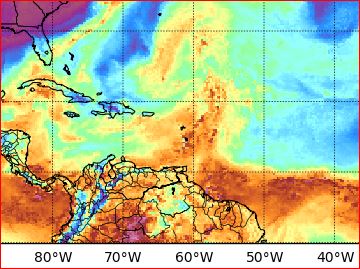
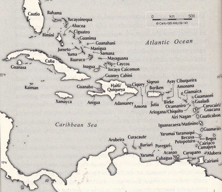
To all The Tourists of Paradise,
Belize and Central America including Mexico, Aruba, Bonaire & Curacao, Margarita, Guyanas, The Bahamas, Caymans, Cuba, Jamaica, Haiti, Santo Domingo, Turks and Caicos, Puerto Rico, The Virgin Islands, Leewards and Windwards, et al.
A Thunderstorm, Tropical Wave, Storm, is Normal. Most times it doesn't last a full day. It leaves the place more PRISTINE and Habitable. Most of all, it has given us tremendous LIFE-SKILLS, . . . This we use to Help God continue His Creations and Gifts. WE SHARE THESE GIFTS FREELY WITH YOU, . . . !
Weatherwise: (see attached) also, a map of the West Indies before 1492.
God Bless 
|
|
- Blob in 24 Hours -
|
- By Ian Martin Borde <readkrox51 at gmail.com>
- Date: Sun, 6 Oct 2019 06:50:08 -0400
|
Good Day, People of Paradise,
There is a tropical wave with Potential going to Impact in 24 hrs.
I have been deterred from sending the amount of data I did before.
I needed a rest from high-level activity anyway.
Also Congratulating
fedawshercloh corresponding from Trinidad on doing a commendable and magnificent job.
Eternal Rest be on the soul of the 'veteran' correspondent from St. Vincent.
God Bless Everyone 
|
|
- A bit too early...?
|
- By fedawshercloh <fedawshercloh at gmail.com>
- Date: Thu, 03 Oct 2019 14:53:30 -0400
|
The discontinuation of the weather alert at 1p.m. by the met may have been a little pre-mature it seems, at least for the north western peninsular of Trinidad.
So far we have had the heaviest thunder- shower this afternoon since we began to be affected early this morning by this latest system. In fact, the most recent round of stormy weather appeared to impact areas a lot more to our west like Point Cumana/ Carenage, compared to the sort of intermittent deluge we have been having in the St. Clair- Woodbrook area. Thankfully, of course, this is not another 'Karen' however, it seems likely that some minor street and flash flooding may be occurring in the urban 'east- west' corridor. We also had a slight dip in the electricity just recently with an overhead thunderstorm... Lightning activity must be waxing near the capital.(Be safe out there)...
Again the likelihood for further inclement weather conditions by not too distant incoming systems, and additional Tropical maritime cyclonic type impact remains for the southern windwards including Trinidad and Tobago -so we do need to remain prepared and vigilant for the balance of this wet/ hurricane season.
Nevertheless, hopefully this inclement weather will benefit the volume and holding capacity of our water reservoirs, which are still in a deficit. Unfortunately, the more glaring effects of accelerated global warming and climate change are becoming increasingly evident here with the growing threat of unpredictable weather patterns, & even "flash droughts" & extended 'heat seasons' disrupting our usual wet season patterns. These are unusual times for our planet for sure. Stay alert folks...
Sent from my Samsung Galaxy smartphone. |
|
|
- Alert...
|
- By fedawshercloh <fedawshercloh at gmail.com>
- Date: Thu, 03 Oct 2019 02:33:42 -0400
|
Well, we are on a wait and see in terms of full expected impacts from this system... Not terribly organized at the moment, which is a good thing of course. It remains to be seen how disruptive this active wave may get here in TnT. We are currently under a yellow alert by the met service beginning from 2am onwards to the afternoon.
So far it seems to have been pretty accurate as I was awoken by peals of thunder just earlier. & showers have been noted in the south and east of Trinidad as a band of convection spreads westward & northward.
Hopefully, when all is said and done the areas still weary of flood waters after tropical storm Karen will not be badly inundated once again.
Keep safe everybody.
Sent from my Samsung Galaxy smartphone. |
|
|
- Potential threats...
|
- By fedawshercloh <fedawshercloh at gmail.com>
- Date: Tue, 01 Oct 2019 15:48:20 -0400
|
If the GFS and a couple other reliable models are to be trusted- it appears that Potential threats are looming for the southern windwards once more, & possibly for the Leewards from this coming weekend into next week respectively.
The latter projected system may pass through the lesser Antilles as a strong wave at the very least, or weak TD Or even possibly a tropical storm or worse...
& given the precedent of the "Lesser Antilles Rule" so far; cases in point Dorian and Karen- the real potential for cyclogenesis is indeed very possible.
Remain vigilant...
Sent from my Samsung Galaxy smartphone. |
|
|
- Simply Incredulous...
|
- By fedawshercloh <fedawshercloh at gmail.com>
- Date: Sun, 29 Sep 2019 01:52:36 -0400
|
This Lorenzo advisory below speaks for itself- truly shocking and unprecedented stuff... Thank God this Category 5 hurricane is headed out to sea.
| Public Advisory: | Hurricane Lorenzo Advisory Number 27
NWS National Hurricane Center Miami FL AL132019
1100 PM AST Sat Sep 28 2019
...LARGE AND POWERFUL CATEGORY 5 LORENZO BECOMES THE STRONGEST
HURRICANE THIS FAR NORTH AND EAST IN THE ATLANTIC BASIN...
SUMMARY OF 1100 PM AST...0300 UTC...INFORMATION
-----------------------------------------------
LOCATION...24.2N 44.9W
ABOUT 1420 MI...2285 KM SW OF THE AZORES
MAXIMUM SUSTAINED WINDS...160 MPH...260 KM/H
PRESENT MOVEMENT...N OR 360 DEGREES AT 10 MPH...17 KM/H
MINIMUM CENTRAL PRESSURE...925 MB...27.32 INCHES
|
|
Sent from my Samsung Galaxy smartphone. |
|
|
- What a N i g h t m a r e -
|
- By Ian Martin Borde <readkrox51 at gmail.com>
- Date: Wed, 25 Sep 2019 01:40:50 -0400
|
- Jerry is still affecting already HIT Bermuda.
- Karen is going over the length of already hit Puerto Rico.
- Lorenzo is NOT going North !
- The Bahamas are in future Cyclogenesis.
"What is going on?"
Lord! Please have Mercy ! |
|
- Impact at 7:00 pm
|
- By Ian Martin Borde <readkrox51 at gmail.com>
- Date: Tue, 24 Sep 2019 19:30:27 -0400
|
The Centre of Circulation went directly over Vieques, Puerto Rico at 7:00pm.
Any wobble to the right, St. Thomas will get a direct hit ! 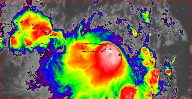
|
|
- Karen re-organizing...
|
- By fedawshercloh <fedawshercloh at gmail.com>
- Date: Tue, 24 Sep 2019 06:54:58 -0400
|
With Karen now back up to Tropical storm status, & re-organising as it approaches Puerto Rico and the Virgin islands the residents there need to take every precaution, and not be complacent. Praying and hoping that You all will not get the same type of flood damages and other wind and surge impacts & hazards which affected parts of Trinidad and Tobago.
Keep safe and Alert...
Sent from my Samsung Galaxy smartphone. |
|
|
- We are Praying -
|
- By Ian Martin Borde <readkrox51 at gmail.com>
- Date: Mon, 23 Sep 2019 18:50:41 -0400
|
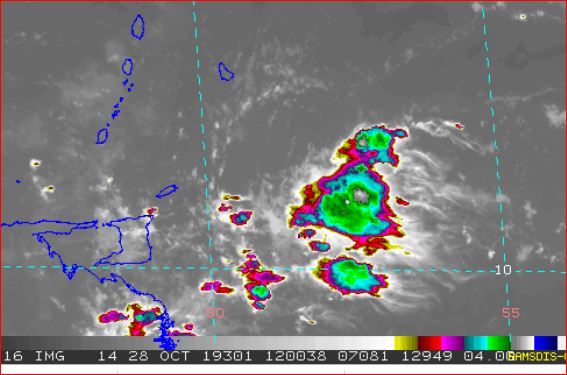
People of Paradise,
While we are praying that Puerto Rico be spared any further hardship, ....
History DOES repeat itself !!! La Cuenta de la Vida es una repetacion de la misma fortuna, si o no !!!
The attached image is EXACTLY THE SIZE AND INTENSITY as it was for two hours off Tobago.
I don't know what else to say, ... ?
Standing By God Bless 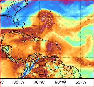
|
|
- Safe and Sound -
|
- By Ian Martin Borde <readkrox51 at gmail.com>
- Date: Mon, 23 Sep 2019 00:19:28 -0400
|
Glencoe, Pt. Cumana, Diego Martin, T&T, WI. 2019-09-22nd. 11:55pm.
Dear People of Paradise,
Cleanup has Started
I am safe and sound. Tired but safe and sound. Up to an hour ago, I got four (04) hours sleep and rest.
Cleanup operations have started and will go on (evacuations too) during the night. Rivers are still full but around half full. Rain has stopped!!!!!!! Winds, no more ! This is not normal, but all coasts including the West Coast have boat damage. Minor but reported. Tobago had just under a Cat 1 Hurricane!
Tobago and Trinidad handled it well, THANK GOD, compared to the severity of the Impact. Just like the earthquake, it could have turned out much worse. Apparently Trinidad's Infrastructure (including personnel), are made of resilient stuff, .... It is a saying in T&T; "We play hard, because we work hard and own our country".
At this time, forget me and think of all the sacrificing souls who leave their own circumstances and risk their lifes to help others (complete strangers) after this disaster, .... Not everything is Money and Politics.
God Bless |
|
- Karen really packed a punch!
|
- By adeshcnanan <adeshcnanan at gmail.com>
- Date: Sun, 22 Sep 2019 23:07:53 -0400
|
|
Karen has moved into the Caribbean sea leaving a trail of latent damage due to severe riverine flooding. At this time people are being evacuated from low lying areas in Central Trinidad due to flooded homes. We have witnessed widespread flash flooding and now there are reports of closure of our main highway. All schools are closed tomorrow as clean up begins. This tropical storm meandered along as a strong disorganised tropical wave that suddenly was upgraded. Although located north of Tobago , its tentacles spread far and wide with such fury that all quadrants were laced with "venom" Let this event be a reality check for all the doubters. Mother nature is definitely the leveller in any chess match. Prayers definitely go a long way God bless Trinidad and Tobago!
Dr Adesh Nanan
Sent from my Samsung Galaxy smartphone. |
|
- Greatly Improved conditions...
|
- By fedawshercloh <fedawshercloh at gmail.com>
- Date: Sun, 22 Sep 2019 22:58:30 -0400
|
Conditions are normalising... Over the last few hours our general Rainfall rates and intensity have let up thankfully. Nevertheless, Life threatening Flood damage resulted in Trinidad after tropical storm Karen brought substantial flooding damage first to Tobago earlier in the day (>132mm) and later to Trinidad (>75mm). In some cases in Trinidad motorists who were trapped in quickly rising flood waters had to swim for their lives to safety. However, the worst damage seemed to have been concentrated in Western and Northern/ Central areas of Trinidad. So far no major injuries or deaths have been attributed to the Storm, thank God.
Notably for the last few hours tropical storm Karen has had a bit of a sheared appearance as a result of strong northwesterly wind shear. & this actually prevented the system from strengthening right on top of us, thank God. Its bands eventually stretched out all the way to Guyana in South America, which no doubt would have triggered flash flooding there too.
We are so Grateful that this storm was Not any stronger as it could have resulted in even more extreme weather conditions over Trinidad, and much more extensive damage in both Trinidad & Tobago. Right now conditions have mostly let up right across Trinidad & Tobago with just a light drizzle occurring at times- a far cry from the deluge which was swamping the nation mere hours ago. Additional rainfall with occasional gusty winds are still forecast into tonight.
As a result of the damaging impacts from the storm earlier today a decision has been taken that Schools will be closed tomorrow, although the U.W.I campus will be opening despite some flooding there. Presently utilities are still being restored in TnT, & TnTec has promised that most outages ought to be fixed in both Trinidad and Tobago by tomorrow God's Willing. Helicopter activity commenced late in the afternoon from the North west helipad facility & likely entailed aerial surveys of flooded regions. Riverine flood alerts remain in full effect as some rivers continue to rise as flood run off gets into their already swollen channels...
Tomorrow please God- the clean up and extensive mop-up of certain communities continues especially in Tobago which was worse hit. In the meantime Government officials have requested that Motorists who don't need to be on the roads- Stay off the nations highways and roads as heavy duty equipment and personnel do the necessary cleanup works post Tropical storm Karen.
Keep safe everyone.... thoughts and prayers are with those who were most affected by Karen today including those islands being threatened soon by storm conditions.
Sent from my Samsung Galaxy smartphone. |
|
|
- Squall Finished - South & West of Grenada
|
- By Ian Martin Borde <readkrox51 at gmail.com>
- Date: Sun, 22 Sep 2019 15:16:29 -0400
|
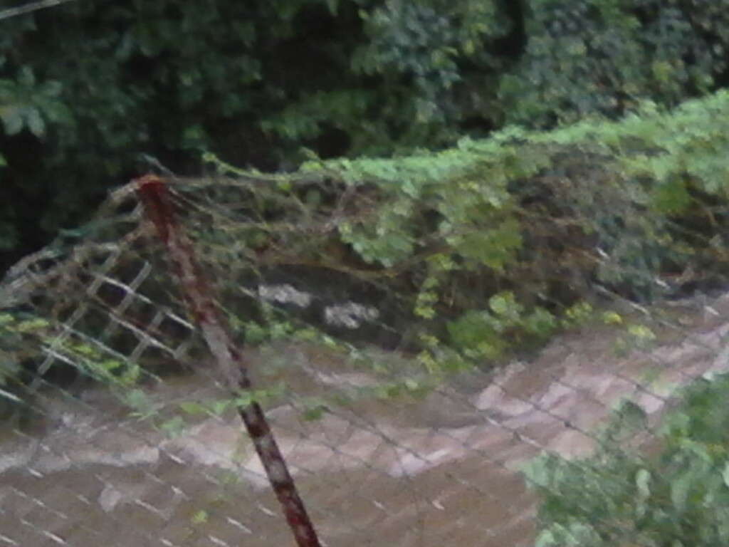
It is NOT All Clear Yet ! It is still raining and water is cresting the river banks. Non-Stop rain (specially North West Trinidad) will continue for at least two more hours.
But Tobago can breathe a sigh of Relief ! Cleanup operations can commence. Before it gets more dark and dangerous!
Land can Slip up to 48 - 72 hours after heavy rainfall. Caution !
The pics are across the road from in front my gallery. As you can see the tree has fallen and the tributary is cresting. The banana trees held up well.
Grenada has not been spared as yet.
God is Goodness and Love 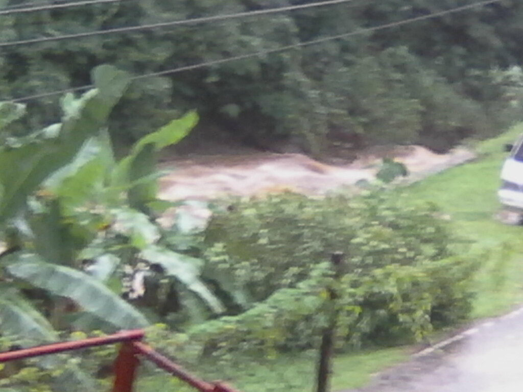
|
|
- Flash Flooding Imminent or Occuring...
|
- By fedawshercloh <fedawshercloh at gmail.com>
- Date: Sun, 22 Sep 2019 13:32:46 -0400
|
Heavy to violent rainfall rates have continued unabated along many parts of Western, Eastern, Southern and Northern Trinidad. Flash flooding is being reported in several locations and riverine flooding of streams and rivers is ongoing. The Diego Martin River among many such water courses is said to be at threshold levels. Those in areas prone to riverine inundation should seek alternative shelter NOW!!! This is a Life threatening situation unfolding. Emergency & Rescue officials may not be able to get to You soon enough.
This is not a good situation at present to say the least... Several more hours of moderate to heavy rainfall is forecast into Monday. Praying and hoping for no loss of life during this unfolding weather emergency.
Please Keep us in thought & Prayer fellow Caribbean islanders.
Sent from my Samsung Galaxy smartphone. |
|
|
- No Air Condition Required today
|
- By adeshcnanan <adeshcnanan at gmail.com>
- Date: Sun, 22 Sep 2019 13:18:36 -0400
|
|
It is cold outside with constant rainfall in Palmiste in San Fernando at this time. There is no breeze and grey clouds all around. Reports are coming in of heavy rainfall concentrated along the western side of the island leading to flash flooding. The once calm Gulf of Paria is now littered with choppy waves as the tropical storm is pulling away from Tobago and its feeder bands are having a profound effect. On the brighter side , let us hope that some of this rainfall makes its way to our catchment areas so that our reservoirs can be replenished. We continue to pray
Dr Adesh Nanan
Sent from my Samsung Galaxy smartphone. |
|
- Adverse Weather Conditions...
|
- By fedawshercloh <fedawshercloh at gmail.com>
- Date: Sun, 22 Sep 2019 13:04:49 -0400
|
As was forecast, and is now playing out- the centre of Karen has moved more West and somewhat south in relation to Trinidad. The latter was shown by the early model runs of the GFS. As a result right now the more intense feeder bands of rain have hit the
Western coastal areas of Trinidad and beyond. Winds have picked up in our area, but are stronger directly along the western coast. Winds right along the coast are near or over 30mph, which is probably being experiened right now in areas like Diego Martin by Ian.
It is pretty squally & a lot more gusty in those areas. However, all utilities are holding fine so far in the Port of Spain area which is great as there are only occasional gusts so things are sort of manageable so far. There has been only one flick in the current so far. TnTec is holding the power so far, which is Great news.
However, Tobago has been hit the worst so far by Karen. The pictures & videos of severe flash flooding and riverine flooding on social media are all from Tobago. Trinidad has only recently started to get prolonged heavy rainfall, which will lead to some flash flooding and
riverine flooding inevitably, but things are still prettt manageable in most areas. Of course, Street flooding is already ongoing in many areas that I'm aware of and with this type of heavy rainfall ongoing flash flooding will follow.
On a positive note though; the Republic of Trinidad & Tobago was well prepared for this severe weather event by the met office and officials, and at risk areas were sufficiently warned of this impending adverse weather system. Most persons stocked up, and many
persons sought out shelters and or sand-bagged their homes in advance.
I'll update later as things progress... Tropical Storm Karen is turning out to be mean enough so far. Hoping and praying for the best. This will be a prolonged impact event.
Sent from my Samsung Galaxy smartphone. |
|
|
- G e e ! - I pray ! -
|
- By Ian Martin Borde <readkrox51 at gmail.com>
- Date: Sun, 22 Sep 2019 11:41:35 -0400
|
For an early report, Dr. Adesh Nanan has summed it up nicely. I can only quantify and put figures to what he said.
First (1st) and Most Important of All: Tobago ?should? in earnest begin mop-up operations in 1 1/2 - 4 hours time.
Trinidad is not that lucky! It has been moist and grey like Dr. Nanan said since 12:30 am. and it's not going to stop before 4:00 pm. Yes it has dipped south. But I waited before writing and I can't see the Centre of Circulation crossing the North Coast and coming inland (over Noth-West Trinidad).
Grenada; no matter what happens, Grenada should take this Very Seriously and go indoors. It's gonna be a long night !! The Circulation has broadened, ... !!!!!
As I am finished typing, Wind (over 35mph.) has started in Diego Martin. It is raining sideways in gusts, ... !!
We are Not alone ! Be Brave 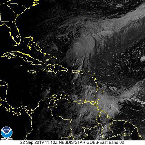
|
|
- Grey Fast Moving Clouds Overhead
|
- By Adesh Nanan <adeshcnanan at gmail.com>
- Date: Sun, 22 Sep 2019 11:07:11 -0400
|
|
Rainfall at present in Palmiste in San Fernando with a slight breeze and we just had an update from the authorities. Satellite picture shows clouds moving to the south east bringing moderate rainfall potential. There is a possibility of thunder showers in the northern quadrant of Trinidad. There are reports of significant flooding in Tobago with wind damage in certain areas. Rough seas are also wreaking havoc along the coastlines with destruction to wooden jetties and damaged boats. At this time Trinidad has been spared the brunt of Karen with only sporadic rainfall and a few wind gusts with no damage reported. We continue to pray
Dr Adesh Nanan
|
|
- EERIE CALM OVER THE ISLAND OF TRINIDAD
|
- By adeshcnanan <adeshcnanan at gmail.com>
- Date: Sun, 22 Sep 2019 08:00:46 -0400
|
|
There is a slight drizzle at this time, no breeze and grey clouds overhead in Palmiste , San Fernando. There are reports of lines at the gas stations ad the reality of an impending storm sinks in. Last night we had a strong tropical wave approaching and this morning there is Tropical storm Karen on our doorstep. The unpredictable nature of the weather can be fascinating and scary. This time there was ample warning over the weekend and preparedness just in case. Still we need to pray!
Dr Adesh Nansn
Sent from my Samsung Galaxy smartphone. |
|
- Karen's Presence...
|
- By fedawshercloh <fedawshercloh at gmail.com>
- Date: Sun, 22 Sep 2019 06:47:29 -0400
|
As dawn has arrived the sure signs of a tropical weather system are evident- not only the inclement weather, but the very unusual movement of over head moisture-laden clouds from West to east. This is not something that's seen too often especially in the more Southern islands.
As the center moves past Tobago more intense bands are likely to affect Trinidad. It's a wait and see situation Re: Trinidad as we watch and pray. Keeping Tobago especially in mind at this time as well.
Sent from my Samsung Galaxy smartphone. |
|
|
- Winds and Warnings...
|
- By fedawshercloh <fedawshercloh at gmail.com>
- Date: Sun, 22 Sep 2019 06:22:14 -0400
|
More watches are about to be issued for the Lesser Antilles islands due to recently formed tropical storm Karen. Of course, Trinidad and Tobago, and Grenada and its dependencies are under a tropical storm warning being in the direct line of fire of this system.
However, further watches for the remainder of the windward islands may be necessary apart from just St. Vincent and the Grenadines at this point...
The first advisory on the system had this to say:- "Tropical-storm-force winds extend outward up to 125 miles (205 km) from the center. Barbados recently reported a sustained wind of37 mph (59 km/h) and a gust to 45 mph (72 km/h). HAZARDS AFFECTING LAND
----------------------
WIND:Tropical storm conditions are expected to first reach those islands within the warning area later this morning and afternoon, making outside preparations difficult or dangerous." Hopefully these winds will not become too strong in Trinidad since we are on the 'weaker' southern part of the system. However, the developing feeder bands of the system are presently affecting the South western and Easternmost part of Trinidad. Wishing the best to Tobago which will get the brunt of Karen first.
Keep alert and safe throughout this storm TnT.
Sent from my Samsung Galaxy smartphone. |
|
|
- New Storm East of the TnT Republic...
|
- By fedawshercloh <fedawshercloh at gmail.com>
- Date: Sun, 22 Sep 2019 05:26:30 -0400
|
Not surprisingly Tropical storm Karen has formed. It's really getting its act together as organisation of the system has increased greatly over the last few hours... Fortunately, it's not a strong tropical storm as yet. As successive rain bands from the system continue to wrap around its core more rainfall of a moderate intensity for now continues to soak my area. Winds are likely to pick up a bit later as the centre nears the Trinidad and Tobago location before crossing into the Caribbean sea. So far only St. Vincent and the Grenadines seem to have watched issued -I expect that to change soon.
Let hope that it does not strengthen too much while it's still spinning on top of our islands. TnT keep safe and stay alert.
Sent from my Samsung Galaxy smartphone. |
|
|
- Highly Possible RI -
|
- By Ian Martin Borde <readkrox51 at gmail.com>
- Date: Sun, 22 Sep 2019 05:18:44 -0400
|
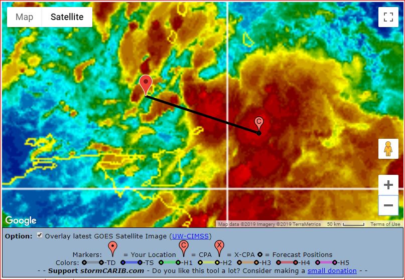
The Centre of Circulation is Virtually Stationary East of Tobago (RI).
Watches and Warnings have to be Expanded, . . . !!!!
The image is at 04:30 am.
Evacuate Waterways' Perimeters. 
|
|
- Gradual deterioration... definite Cyclogenesis
|
- By fedawshercloh <fedawshercloh at gmail.com>
- Date: Sun, 22 Sep 2019 03:09:56 -0400
|
99L is certainly organising and intensifying based on radar imagery etc. Within the last hour or so the weather conditions have become much more inclement in the outskirts of Port of Spain. We have had recent squalls occurring during the last hour or so, and there has definitely been a change in the wind direction. Winds are generally coming out of the North west to North north west as they attempt to wrap around the center of circulation which appears to be forming nearer Tobago. It's likely that we will have a designated tropical system by morning. Expectedly, the chance of formation is increased now to 80%. And a more defined center of circulation is now visible at earth.nullschool.net and on Windy.com. Ongoing development of the system is observable at this time.
Also, lately there appears to be a slight dip in the system which is likely moving slightly south of due west. This will likely bring some of the more intense bands of convection over the Trinidad area as Tobago gets the core of the system affecting their area first. The Early Euro model ensembles and GFS runs on predicting this system were rather accurate.
However, We are most concerned about the rainfall threat here in TnT. The projected estimates while no-where near the totals received in Texas from T.S. Imelda- they will be damaging nonetheless. TnT weather center noted:-That Between 2 to 4 inches (50 to 100 mm) with isolated totals up to 8 inches (200 mm) are possible across the Southern Windwards. There is an elevated threat of street flooding, flash flooding and riverine flooding Sunday into Monday.
Stay vigilant and whatever comes keep out of harm's way everyone... Let's be prudent and take all necessary actions to protect life and property. Lives Cannot be replaced.
Sent from my Samsung Galaxy smartphone. |
|
|
- Damage Control in The Morning after 'All Clear' -
|
- By Ian Martin Borde <readkrox51 at gmail.com>
- Date: Sun, 22 Sep 2019 02:32:46 -0400
|
Sadly,
A Centre of Circulation formed east of Tobago after midnight. Tobago is getting Hit Real Hard. Landfall in Grenada is happening Now !
Tobago, "Call for H e l p" ! 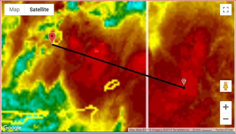
|
|
- Foretaste...
|
- By fedawshercloh <fedawshercloh at gmail.com>
- Date: Sun, 22 Sep 2019 02:16:16 -0400
|
99L/ Or what can already deservedly be called a Potential tropical cyclone (PTC) made its presence felt from early on Saturday- coupled with an energized outflow from T.S. Jerry, which produced intense thunderstorms and heavy convection over western and Northern parts of Trinidad in particular. Street and flash flooding resulted and there were incidents of some minor impacts to general low-lying infrastructure.
It appeared to have been a slight taste of things to come as the system has continued to organize all day to our East receiving a higher percentage of formation into the evening hours from the NHC. I also noted reports out of Grantley Adams International airport indicating wind gusts to Tropical storm force. We are anticipating much of the same here in Trinidad and Tobago. (TnT) Keep safe TnT...
Sent from my Samsung Galaxy smartphone. |
|
|
- 75 - 125 miles east of Tobago '99L'
|
- By Ian Martin Borde <readkrox51 at gmail.com>
- Date: Sun, 22 Sep 2019 00:44:25 -0400
|
Invest '99L' is 75 - 125 miles directly east of Tobago at midnight Sunday 22nd September 2019.
Apparently Hurricane Hunters were sent out tonight.
God Bless 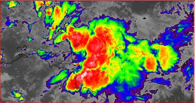
|
|
- '99L' is Starting -
|
- By Ian Martin Borde <readkrox51 at gmail.com>
- Date: Sat, 21 Sep 2019 22:05:50 -0400
|
Good People of Paradise,
'99L' has started in Dominica. (Landfall!!)
What can be called the centre of The Trough/TW will - !! oscillate !! - between St. Lucia and Grenada!!
In 2 - 4 hours !!!!!
Trinidadians are taking things seriously as they should.
As Grenada says, Please avoid 'hysteria'! The Almighty and Disasters are NOTHING to seek FAME & FORTUNE about !
The AUTHORITIES are; Ready, Competent, Equipped and Trained, Do Your Part !!
Comply, Compliment,
Compassion,
In The Name of God ! Amen! 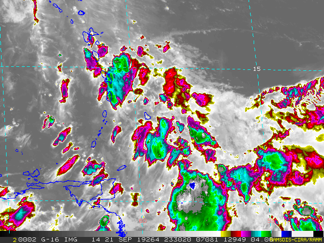
|
|
- Active Weather imminent...
|
- By fedawshercloh <fedawshercloh at gmail.com>
- Date: Sat, 21 Sep 2019 01:37:20 -0400
|
I think the following bulletins and public advisories for 99L speak for themselves, although as mentioned at some point by our hurricane correspondents out of Dominica- the use of the potential tropical cyclone classifications and warnings do serve as the best way to sensitize and sufficiently alert populations which are most likely to be impacted by intensifying systems with imminent impact being likely.
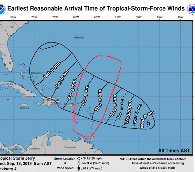
Note (TnT weather center alert): The Southern and Central Windwards are forecast to be affected by this strong tropical wave, with most impacts across the Southern and Central Windwards. This area includes Dominica, Martinique, St. Lucia, St. Vincent and the Grenadines, Barbados, Grenada, and its dependencies, and Trinidad and Tobago.
As mentioned by different sites and weather competencies, regardless of development, this system will be a heavy rainfall threat above all else...
All models, the EMCWF (European), GFS (US), UKMET (UK), ICON (German), ARPEGE (French) and CMC (Canadian) bring heavy rainfall and winds between 40-55 KM/H and gusts in excess of 65 KM/H to Trinidad, Tobago and to the remainder of the Southern Windwards, particularly on Sunday into Monday. Initial Impacts are possible from early Sunday morning.
As a result the Trinidad and Tobago Meteorological Service has issued the Adverse Weather Alert (Yellow Level) as an active tropical wave with medium chances of development nears Trinidad & Tobago and the Southern Windwards. The alert goes into effect from 6:00 AM Sunday 22nd September 2019 through 8:00 PM Monday 23rd September 2019.
This is forecast to be a medium to high impact event, with 2 to 4 inches (50 to 100 millimeters) with isolated totals up to 6 inches (150 millimeters) are possible across the Southern Windwards. There is an elevated threat of street flooding, flash flooding and riverine flooding next week. Rough seas with waves between 2.5 meters and 4.5 meters are possible in open waters east of T&T on Sunday into Monday, with battering swells along the Atlantic Coasts which could cause coastal flooding (surge). Gusty winds in excess of 65 KM/H are expected across both islands. -Be prepared everyone and let's be as proactive as possible this time... The time tested motto is worth recalling- Be prepared for the worst, but pray and hope for the best. However the bottom line is preparation...
God be with our Southern isles & the rest of the Caribbean come what may.
Sent from my Samsung Galaxy smartphone. |
|
|
- Standing By -
|
- By Ian Martin Borde <readkrox51 at gmail.com>
- Date: Thu, 19 Sep 2019 22:02:44 -0400
|
My van broke down. Never planned to work tomorrow anyway.
So I am on standby tonight and tomorrow.
Thanks to the Landlord, I started to get a nice rest today.
God is Blessing You Now 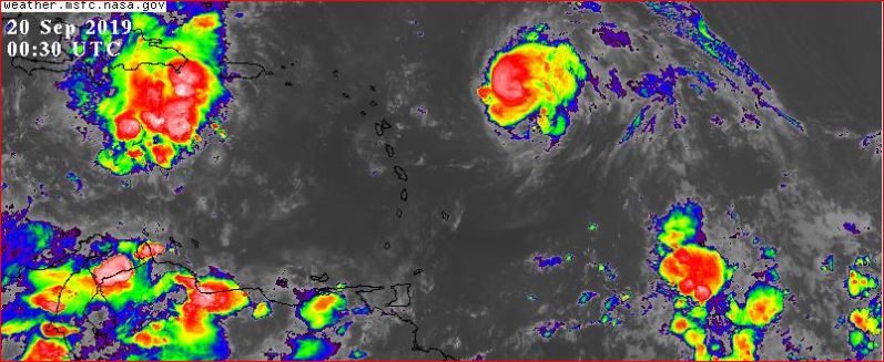
|
|
- ... , here we go again, ... -
|
- By Ian Martin Borde <readkrox51 at gmail.com>
- Date: Wed, 18 Sep 2019 21:53:11 -0400
|
It's 9:30 pm. Gee !
Grenada, Tobago and Trinidad are directly in 'Jerry's feeder band. I am resting from work today (whole week, a new hustle) to get up early tomorrow morning before taking a rest Friday. Which means I don't know if it's drizzling since I came home or the river is flowing with drizzle in the mountain top, 150' feet above me. (Over 400' ft.) It's dark and moist. (I don't want to say 'cold'.)
From 3rd-hand communication at 6:30pm. (social media/news media), - There was flash flooding in Diego Martin - (complete with pics). Another area in Trinidad also had flash flooding. (I can't recall.) I live in the Diego Martin area.
What I know is satellite pics show heavy rain fell over most of Trinidad specially North-West. I was in Port of Spain, and driving was difficult.
Listening to some Jazz Fusion, to go through the syndrome all over again. Before Morphus takes me into his arms. (This is a joke:) Or are we having a nightmare. And I need to wake up?
God Bless 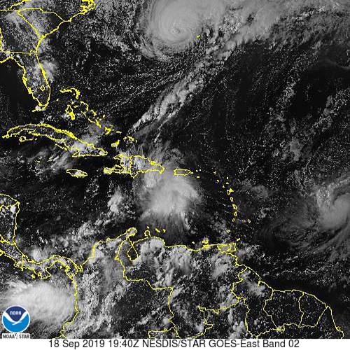
|
|
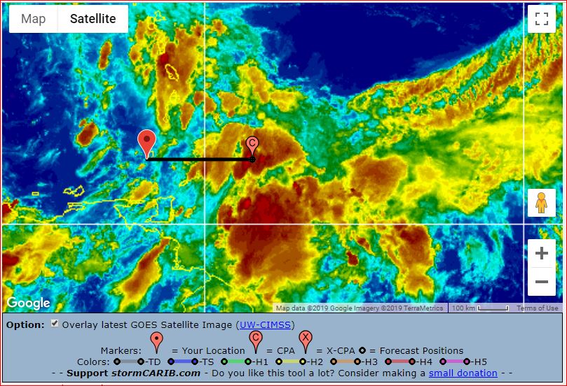
- Tracking...
|
- By Fedaw Shercloh <fedawshercloh at gmail.com>
- Date: Wed, 18 Sep 2019 06:51:48 -0400
|
Much like the rest of the Caribbean Trinidad has been absolutely baking with heat over the last few weeks with high temperatures often soaring to near 35C. It has been truly unbearable at times... Thankfully though the heat has been broken by some wet weather of late- though of course it comes for many as a mixed Blessing in Trinidad and Tobago.
From last weekend bouts of bad weather have accompanied the badly needed rains in our TnT Republic. On Sunday day-time Convergence associated with convective build up from what appeared to be the periphery effects of Ex 96L produced heavy rains mainly along western Trinidad.
Monday's inclement weather was more widespread affecting both the North and West of the island. & atmospheric Conditions were so unstable that day-time heating resulted in intense thunderstorm build-ups which spawned a brief tornado in Cunupia. Fortunately the damage caused was not extensive.
However, yesterday's rainfall in Trinidad and Tobago was a more prolonged event & brought adverse weather conditions to both islands. Unfortunately, Tobago had the Lion's share of damaging severe weather resulting in fallen trees and utility poles, & some blocked roads due to debris and soil flows across the island. Trinidad and Tobago remain under an adverse weather alert until Wednesday afternoon. Let's hope that Wednesday's weather will not be worse than yesterday's. So far pockets of sunshine are coming through so it seems like a pretty bright start; keeping fingers crossed...
We too are also keeping an eye on newly upgraded tropical storm Jerry which is likely to directly or indirectly affect the island chain. Most likely the Leeward islands though- & its a probability that may be growing. In the last few years especially of late the storms have shown that they are highly umpredictable & rapid organisation snd intensification have been the order of the day quite sadly ('Lesser Antilles rule').
Also, let's not forget that "J" storms can be just as destructive and fearsome as 'I' named storms. Of course, the historically disastrous hurricane Janet (1955) comes to mind. & our eyes are still going to be kept eastward as the models are hinting at what could be the "K" or "L" named storm heading westward toward the more southern windward islands. The Tropical atlantic outlook for this morning had this interesting note from the NHC: An area of low pressure is expected to develop this weekend to the
east of the Windward Islands. Some gradual development of this
system is possible as it moves west to west-northwestward over the
islands and across the eastern Caribbean.
* Formation chance through 48 hours...low...near 0 percent.
* Formation chance through 5 days...low...20 percent.
If what happened with Imelda is anything to go by I think Michael is right in his post from Dominica that we need to be extra vigilant with these systems... Hoping that we will not have any Rapid intensification or Rapid organisation for that matter to deal with. Keep alert and remain as prepared as possible. |
|
- Don't Give Up ! -
|
- By Ian Martin Borde <readkrox51 at gmail.com>
- Date: Wed, 18 Sep 2019 06:35:19 -0400
|
When The Going
Gets Tough.
The Tough
Gets Going, . . . !
Ne Quittez Pas ! No Desistan Nunca ! Don't Ever Give Up !
God Bless 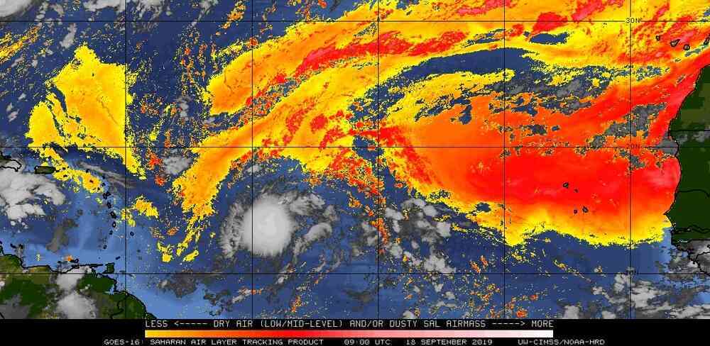
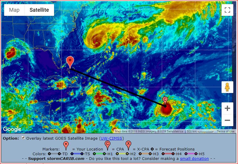
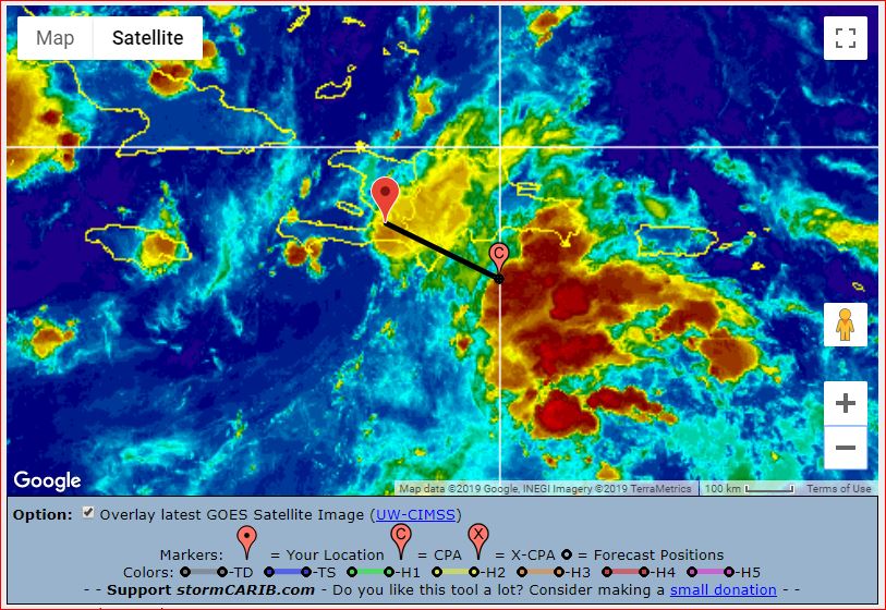
|
|
- Anything Can Happen -
|
- By Ian Martin Borde <readkrox51 at gmail.com>
- Date: Fri, 13 Sep 2019 04:02:23 -0400
|
Beautiful ForeDay Morning, People of Paradise,
It is now 03:55 am. and I was supposed to make an early run leaving 03:45am. However;
'When there is no Sahara Dust, Anything Can Happen!'
So I attach a few 'Real' Images, ...
Make of them what you will? (In the absence of data from a now-paying website.)
God Bless The Bahamas 
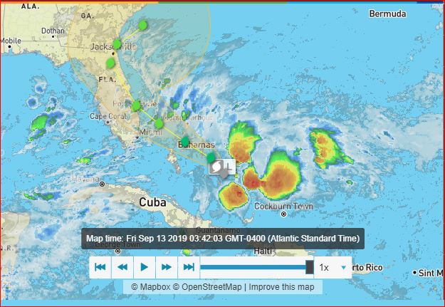
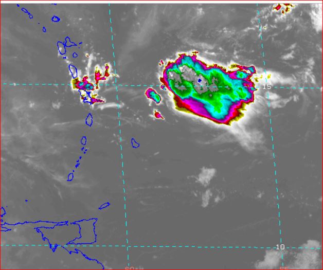
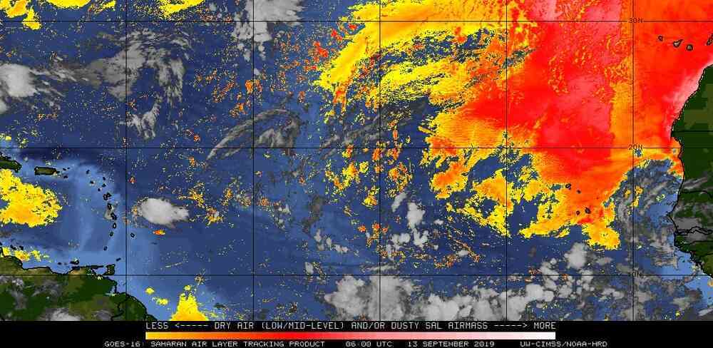
|
|
- 94L
|
- By Ian Martin Borde <readkrox51 at gmail.com>
- Date: Mon, 9 Sep 2019 02:40:59 -0400
|
T&T, WI. 2019-09-09th. Mon.
To all People of Paradise,
Quote:
There is incomparable sadness. When You are Helpless to Help!
While Silence is The Language of The Wise. 'Apathy & Denial' is a Catalyst for Fools.
[ref: Ian M. Borde]
I am sixty-one years old and have been through a lot. But, I have never given up, except once at University.
Because I intend to die with my boots on. I am still alive. I am bone-tired and financially bankrupt. But this among many, many other, inspired works keep me alive. I ask, that you too pray, by not giving up as well.
Images attached are for 94L. My take is a Guadeloupe/Dominica landfall.
SideNote: I will have to pay the website that fed me information. So now my posts will have have less information. Until 2020 when that situation is resolved.
God Bless 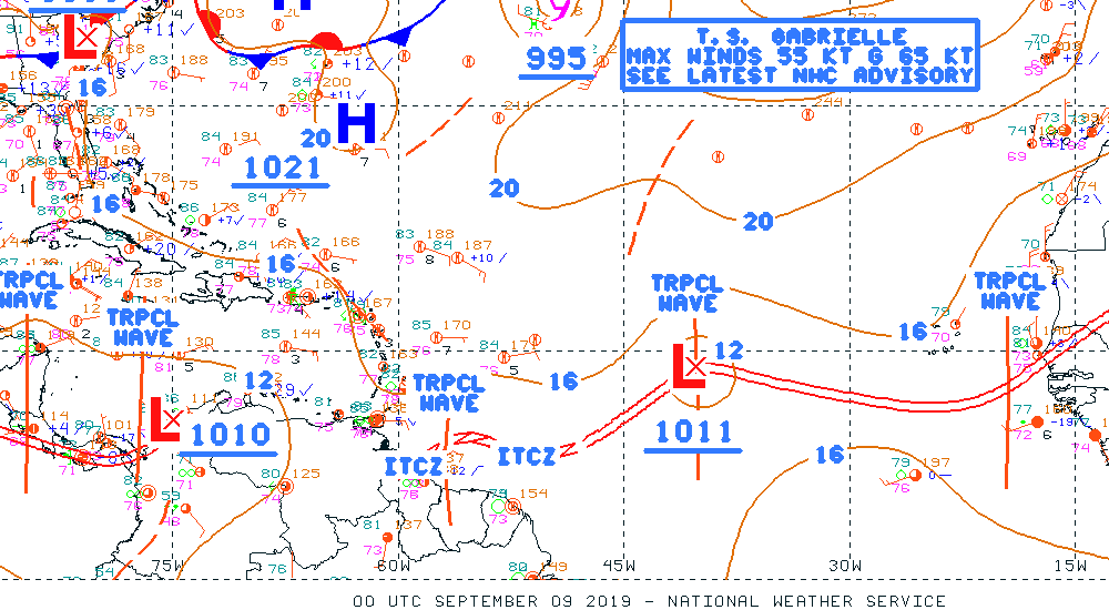
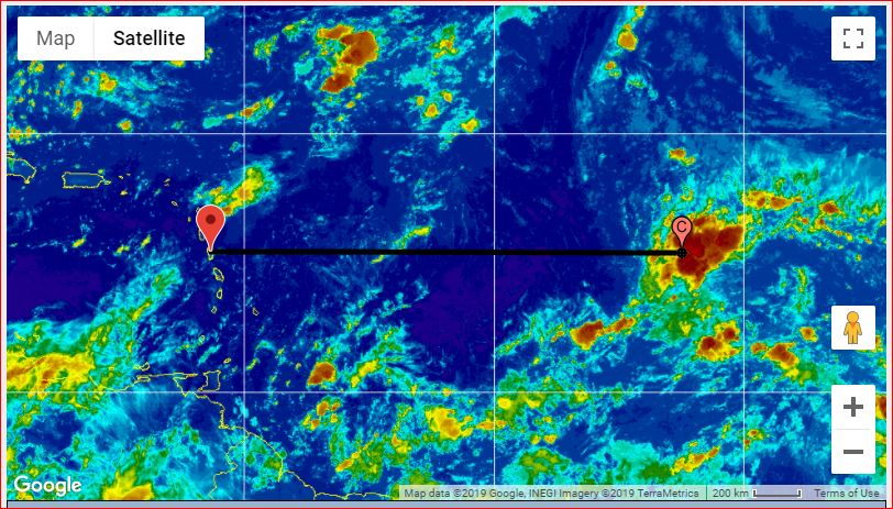
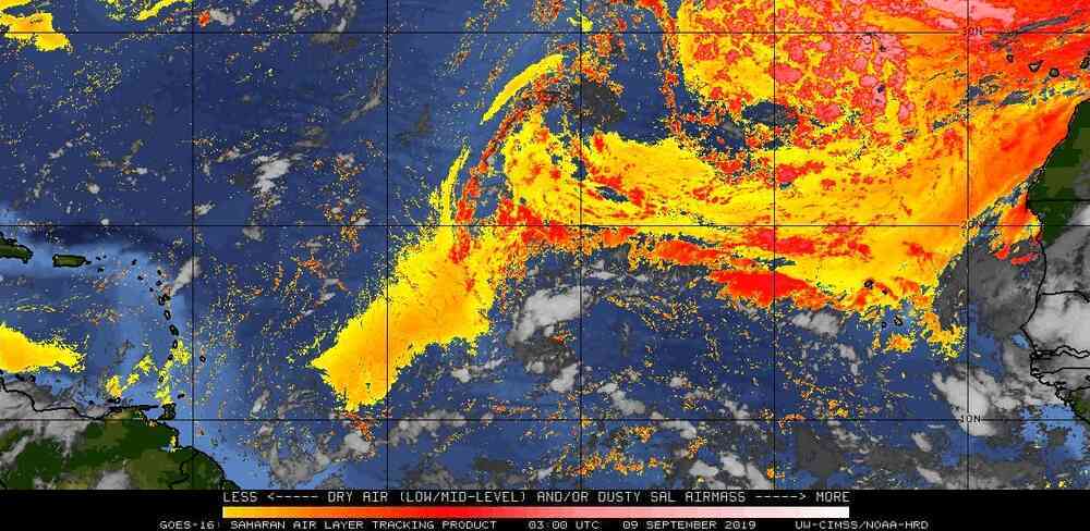
|
|
- "Supernatural Rest and Relief, be given to The Victims in Bahamas, Dear Lord!"
|
- By Ian Martin Borde <readkrox51 at gmail.com>
- Date: Wed, 4 Sep 2019 06:55:08 -0400
|
Trinidad and Tobago, WI. 2019-09-04th Wednesday
Prayers for the people of The Bahamas! [Quote: Dr. Jeff Masters]
Imagine what it would be like to endure a 14-hour period of Cat 5 winds accompanied by flying debris, the insane shriek of the wind, a 20-foot storm surge and 20+ inches of rain.
The people that lived through it are going to need substantial mental health services to address their PTSD issues, not to mention a massive disaster relief response.
For a total of 36 hours, ending near 9 am EDT this morning, Dorian pummeled Grand Bahama Island while at major hurricane strength, with winds of 115 – 185 mph. During the first 14 hours of that period, Dorian was essentially stationary while at Category 5 strength. Damage on Grand Bahama and Great Abaco Island is going to be some of the most extreme ever seen from a hurricane--similar to what a 20-mile wide EF3 or EF4 tornado would do. Imagine what it would be like to endure a 14-hour period of Cat 5 winds accompanied by flying debris, the insane shriek of the wind, a 20-foot storm surge and 20+ inches of rain. The people that lived through it are going to need substantial mental health services to address their PTSD issues, not to mention a massive disaster relief response. Prayers for the people of The Bahamas!
[The following is me, Ian M. Borde]
1) T'dad can expect sustaining rainy conditions beginning today.
2) Most models consensus landfall the night of Thursday / Friday morning in southeast USA. The biggest threat is storm surge. So "Yes!", You have to consider evacuating.
3) Relief Efforts and Mitigation: "People we need to get Real!" - 'Help is Help' (Given in The Right Spirit), 'Help is Help'. - Don't Make it Worse - Do NOT, Complain, Criticize, ... ... , Instead Comply and Compliment, ... !
God Bless, because it's not over.
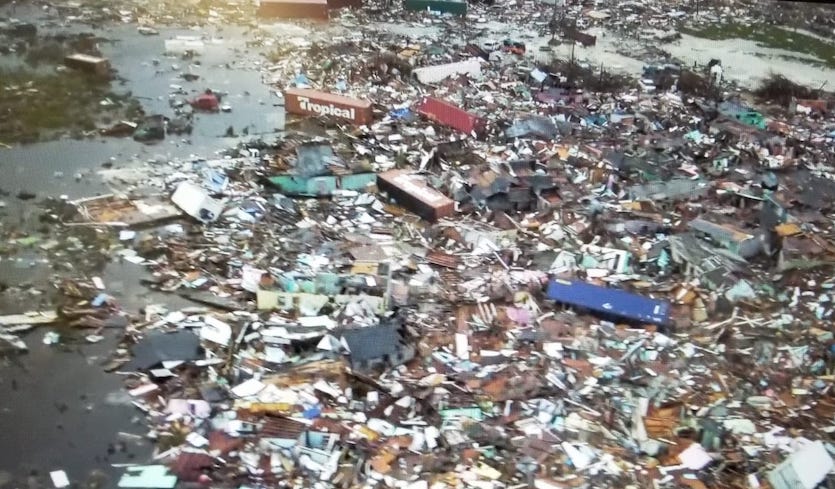
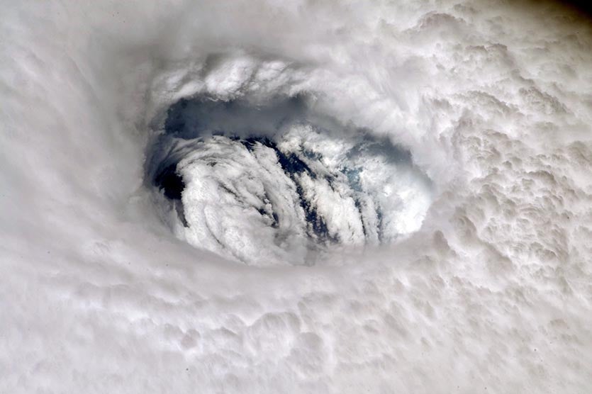
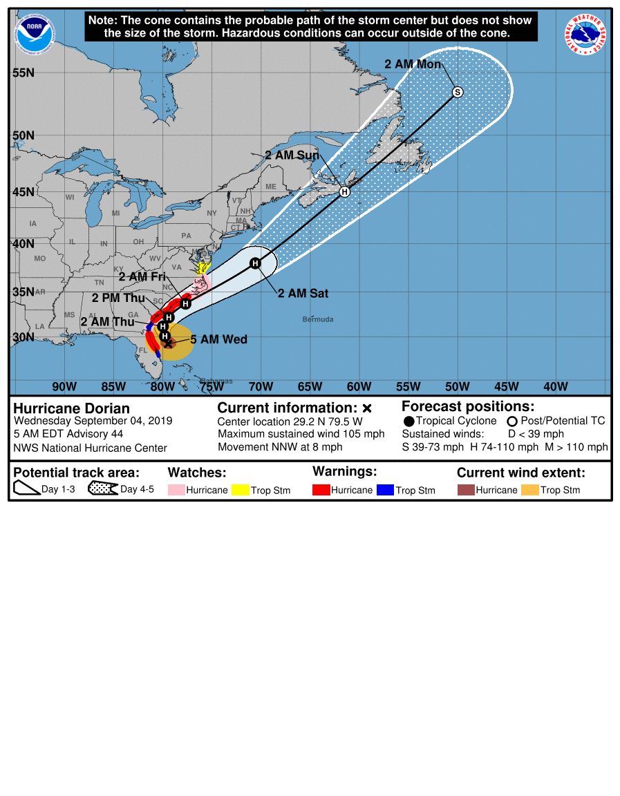
|
|
- St. Croix and Isabel -
|
- By Ian Martin Borde <readkrox51 at gmail.com>
- Date: Thu, 29 Aug 2019 02:24:54 -0400
|
Nice Posts, Isabel. I was worried for You.
Let's hope and PRAY the planes and boats (restricted in part) have safe passage tomorrow.
One Has To Be Aware; Things may appear normal in the morning. But when the mainland has a cold. Everybody sneezes. THE SEASON IS NOT OVER !
Standing By GOD Please Bless ! Amen 
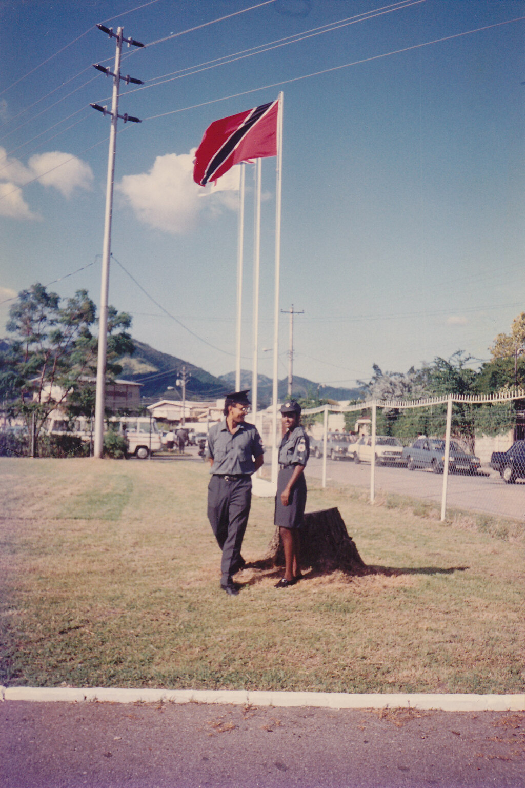

|
|
- Update
|
- By Ian Martin Borde <readkrox51 at gmail.com>
- Date: Wed, 28 Aug 2019 19:51:47 -0400
|
Jane,
(As Dave and Gert say:) "It just takes one".
Among all the stories of Christ as The Good Shepherd. Most people argue it's insane to go after one sheep and leave ninety-nine.
That is, Until you are that one.
God Bless and try to get some sleep/rest. |
|
- From Ian Borde, t'dad & T'bgo, standingby, ...
|
- By Ian Martin Borde <readkrox51 at gmail.com>
- Date: Wed, 28 Aug 2019 19:08:18 -0400
|
Jane as long as you are able and willing I will be on standby whole night (specially for you and those you help).
Or maybe just someone to keep your family company with a world of experience in rescue.
Peace Love
Ian (retired RC51)
Or anyone else who is able and willing to communicate. 
|
|
- BARBADOS IMPACT NOW FINISHING -
|
- By Ian Martin Borde <readkrox51 at gmail.com>
- Date: Tue, 27 Aug 2019 04:07:32 -0400
|
The main part of a 'normal' Tropical Storm PASSED NORTH OF BARBADOS since just before 7:00pm and is now finishing, ... !
God is Good !
I am Hoping and PRAYING (at 03:00am.) that a similar pattern, ... ... , evolves for St. Lucia, who have picked up the baton. While, "God is Good!" and Not to disrespect Him. The 'woobling' of the 'Fighter' is SCIENTIFICALLY giving way to Intensification LATER.
People of Paradise, "This is the original track, intensity and time of The NATIONAL HURRICANE CENTRE at 40 West Longitude!"
Quote: "Give Jack his jacket".
GOD is Good
*3rd image borrowed from Puerto Rico 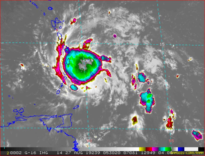
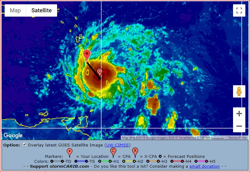

|
|
- Stay Calm - Don't make it worse -
|
- By Ian Martin Borde <readkrox51 at gmail.com>
- Date: Mon, 26 Aug 2019 19:02:54 -0400
|
Stay Calm
Go Indoors
Listen to the authorities
Buckle Down
Just breathing in and out is sufficient ! 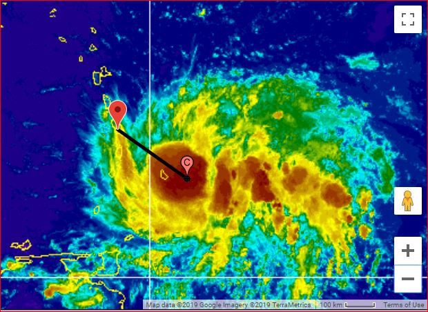

|
|
- Anytime NOW, (Outer Band) Landfall -
|
- By Ian Martin Borde <readkrox51 at gmail.com>
- Date: Mon, 26 Aug 2019 04:34:02 -0400
|
People of Paradise,
"We are in this TOGETHER".
Quote: You can't throw water in a sinking ship on the other side of the boat.
We Need LEVEL-HEADS !
Facts: Effects of 'Dorian' are 200 - 250 miles wide (ie. winds greater than 25 mph. sustained!) Meaning, from Tobago to Antigua and Barbuda will be feeling the effects momentarily.
Seas: Nobody, I mean nobody in the Caribbean needs to be told about the sea during a hurricane. E V A C U A T E , . . . . !!!!
Precipitation: (Because of the SAL the size is a small hurricane). Above 2" inches, once again from Tobago to Antigua and Barbuda. and, Direct Impact (eg. Barbados) 4"- 8" inches.
The Bad, Bad, News is, (copying from reliable sources):
Wobbling and Slowing Down, in other words, RAPID INTENSIFICATION is a Possibility !
Stay Calm and Ask for H E L P ????? 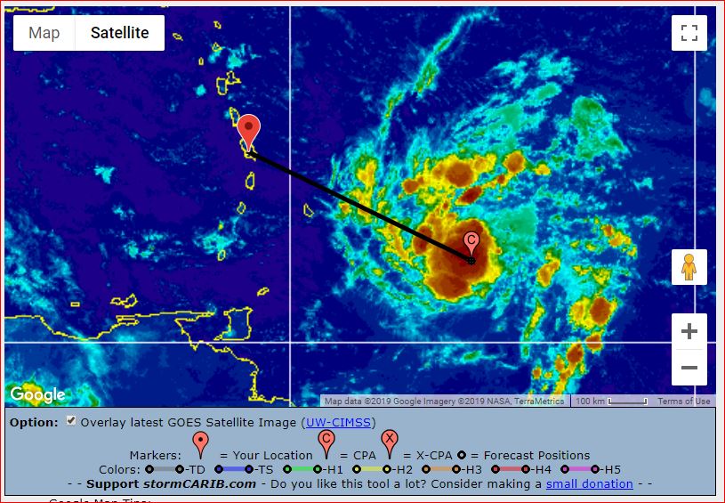

|
|
- Likely Intensification...
|
- By fedawshercloh <fedawshercloh at gmail.com>
- Date: Sun, 25 Aug 2019 14:24:18 -0400
|
Dorian is getting its act together... Also, this snippet from the TnT Weather center is very enlightening: "confidence is increasing that Trinidad, Tobago, and Grenada *may* be affected by outer bands of this system, but not sustained tropical-storm-force winds"...
One thing seems sure- Dorian looks like it's certainly intensifying at this point. & CDO (central dense overcast) seems really evident. This is part of the difficulty with forecasting small storms. The 5p.m. update should be quite informative.
Unfortunately, it may not be surprising to see a track & intensity for Dorian similar to that of Hurricane Emily in 2005 or even Tomas in 2010. The 'Lesser Antilles rule' seems to have definitely kicked in at this time. Interestingly though TnT was affected by both of the above systems. So at this point all of the southern isles should be on alert. And Dorian's wind field may also be wider than suggested. In fact, we are already receiving a stiff North to North North East breeze in the environs of Woodbrook, Port of Spain.
Satellite images seem to show the outer banding of the system extending to the Guyana region. Let's all be prepared & pray & trust that our region and especially the southern Caribbean is spared the worst.
Sent from my Samsung Galaxy smartphone. |
|
|
- Defiant Dorian...
|
- By fedawshercloh <fedawshercloh at gmail.com>
- Date: Sun, 25 Aug 2019 02:56:03 -0400
|
With the system less than 48hrs from impact I think the following excerpt from a recent NHC advisory is a bit sobering:- DORIAN MOVING STEADILY WESTWARD...
...WATCHES WILL LIKELY BE NECESSARY FOR PORTIONS OF THE LESSER
ANTILLES ON SUNDAY...
SUMMARY OF 1100 PM AST...0300 UTC...INFORMATION
-----------------------------------------------
LOCATION...10.9N 50.4W It's current latitude is still troubling for the more southern islands like ourselves in TnT... Hopefully, it will take that forecasted jog to the north, however, a more northerly course will be detrimental to our neighbouring windward islands north of us. However, given the likes of tropical storm Don's (2017) defiant westerly movement prior to its dissipation, and that of tropical storm Kirk in 2018, as well as the infamous Hurricane Ivan track back in 2004; developing systems such as Dorian cannot be watched too closely as they approach the island chain.
& the potential for further intensification is there as noted by Michael's reference out of Dominica to the 'Lesser Antilles rule.' Of course, the weaker Dorian remains the greater its chances of heading in a more westerly direction. Perhaps its center could end up going over the St. Lucia/ St. Vincent area given some of the latest predictions from the weather models. In Time we shall see what happens...
No matter what, don't be complacent- Be prepared as Always this hurricane season.
Sent from my Samsung Galaxy smartphone. |
|
|
- Tuesday Preparations, will be TOO LATE !!!!!!
|
- By Ian Martin Borde <readkrox51 at gmail.com>
- Date: Sat, 24 Aug 2019 21:10:28 -0400
|
|
GOD Bless , . . .
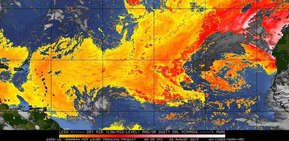
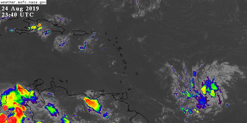
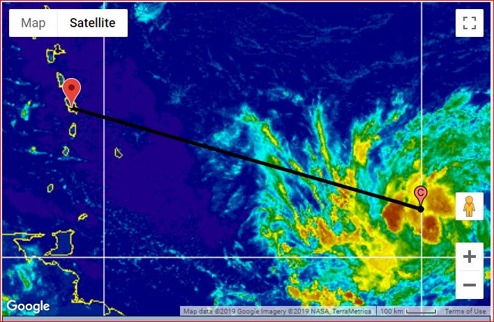
|
|
- Heads- up...
|
- By fedawshercloh <fedawshercloh at gmail.com>
- Date: Sat, 24 Aug 2019 04:19:54 -0400
|
99L may in fact be the first serious tropical threat to the Lesser Antilles for the 2019 hurricane season. We'll have to see what happens as it draws nearer, however at it's current latitude we in Trinidad and Tobago may still need to remain vigilant for possible impacts from this approaching tropical system. Of course, now is a good time to review our hurricane preparedness tips in the islands.
Let's be as prepared as possible- come what may, & May God Bless our islands.
Sent from my Samsung Galaxy smartphone. |
|
|
- Next One -
|
- By Ian Martin Borde <readkrox51 at gmail.com>
- Date: Sun, 18 Aug 2019 15:48:36 -0400
|
Glencoe, Pt. Cumana Diego Martin 2019-08-18th. Sun. 03:35 pm.
Folks,
Whether NHC is correct. Whether your weatherman is correct. Whether you have a financial interest or not. You need to do your own research on atmosphere conditions and preparedness and mitigation. The next one is not even a designated Blob, with waves 6' - 8' feet. That tells you a lot.
The attached photos were taken at 11:00am., 12:30 pm. and 3:00 pm. in that order.
Otherwise, We are glad for the rain.
God Bless 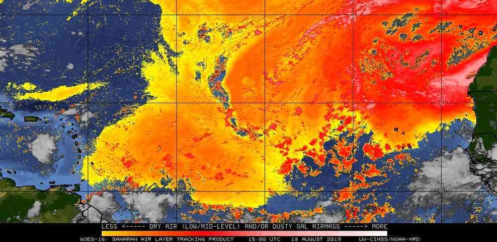
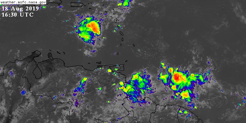
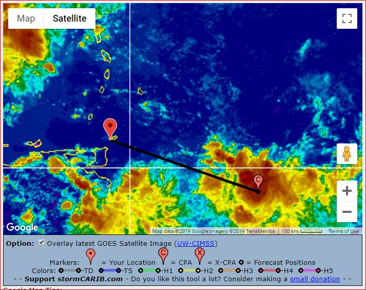
|
|
- St. Vincent Hazard -
|
- By Ian Martin Borde <readkrox51 at gmail.com>
- Date: Sat, 17 Aug 2019 20:44:24 -0400
|
Glencoe, Pt. Cumana, T'dad & T'bgo, WI. Sat. 17th. Aug. 8:30pm.
Hi, all Stormcarib People of Paradise,
Please note the graphic. It was taken at 8:00pm. During the night will get worse.
If Dave and Gert will allow me? This is a greater threat to St. Vincent than the one labelled as 20% in five days. Ask Barbados?
Furthermore, "It's the rainfall that's more dangerous than wind".
Small craft, bathers and squatters near water-flow should be alerted to avoid normal activity, . . . !!!! Ask for Help !
Standing By God Bless 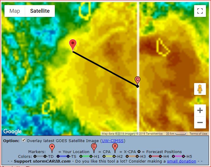
|
|
- Severe weather...
|
- By fedawshercloh <fedawshercloh at gmail.com>
- Date: Fri, 16 Aug 2019 12:52:56 -0400
|
Unfortunately, pretty bad weather prevailed yesterday across most of Trinidad. However, it was much worse in parts of central & south Trinidad where a few severe thunderstorms produced winds in excess of 65kmh which tore off roofs, downed trees and power lines, and cut off power temporarily to some of the same communities which were affected by the passage of the tail of 96L several days ago. This has really been a very untimely double whammy for these south & central communities.
The respective regional corporations have been activated and are assisting affected families especially in the communities of Picton, Penal, Debe, San Francique and Barrackpore. We're all hoping that these unexpected storms associated with the adverse weather conditions from the passage of recent tropical waves are not an omen of anything worse to come.
Keep safe & Take good care this season everyone.
Sent from my Samsung Galaxy smartphone. |
|
|
- stay Calm while Proactively Preparing, . . . !
|
- By Ian Martin Borde <readkrox51 at gmail.com>
- Date: Wed, 14 Aug 2019 06:05:04 -0400
|
Very Good Day, People of Paradise,
All the Indicators are there. And, Nobody contests, Global Warming or Climate Change anymore. "We have gone on from Tsunamis, Earthquakes and Storms. And now are sorting trash and planting trees to finding a next planet". We don't have time to blame or deny anyone.
Survival Preparedness is The K E Y !
Weatherwise: (from today): Waves: 6' - 7' (Normal) Winds: 15 - 20 mph. (relatively normal but gusting, ...) Precipitation: Rain for two days and a half. (ie. over one inch.)
SAL is predominating the Atlantic atmosphere. (for now).
Prepare in Advance, God's Richest Blessings 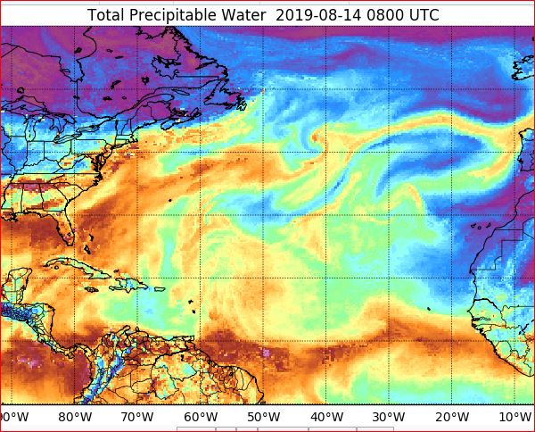


|
|
- Stay Calm & Ask for H e l p ! -
|
- By Ian Martin Borde <readkrox51 at gmail.com>
- Date: Thu, 8 Aug 2019 04:04:38 -0400
|
Glencoe, Pt. Cumana, T&T, WI. It's 03:50 am. (local time/eastern Caribbean) Good Night !
Stay Calm ! If you ask for Help, and you may have to? There are a lot, a lot, a lot of people willing and able.
Countries most affected so far: Haiti, Antigua, Martinique, Guadeloupe, St. Lucia, Trinidad.
Precipitable Water Imagery says severe weather will continue for a maximum of two and a half hours, from 03:45 am.
Except for Haiti (different system). It will continue in Turks & Caicos.
Just ask, . . .
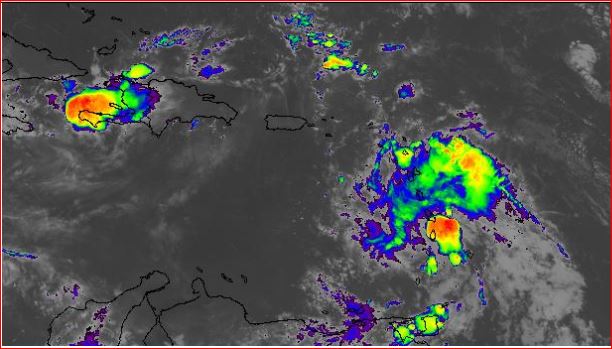
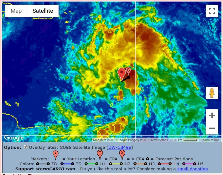
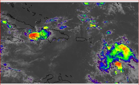
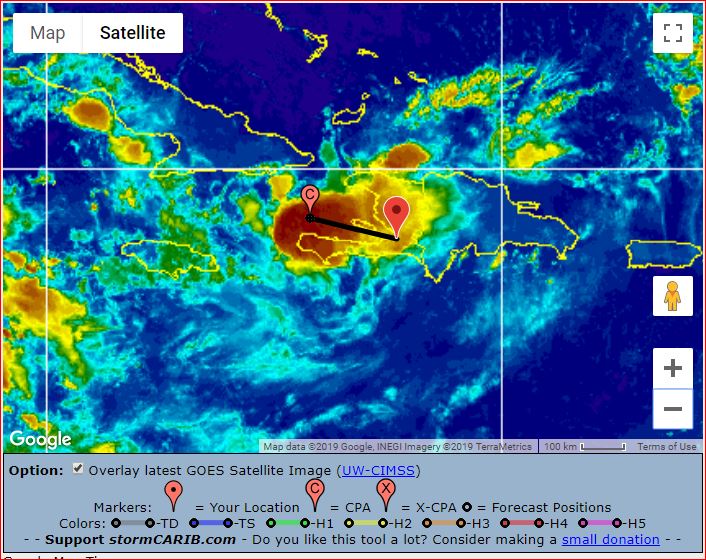
|
|
- Update on 2nd TW/(pos'lb. LPS) -
|
- By Ian Martin Borde <readkrox51 at gmail.com>
- Date: Thu, 8 Aug 2019 00:20:32 -0400
|
I am glad to see how many Faithful correspondents help the authorities and other people of Paradise to prepare, plan, pray and procure, property and people during 'Hazardous' conditions.
Remain Calm, Safe and Sound. 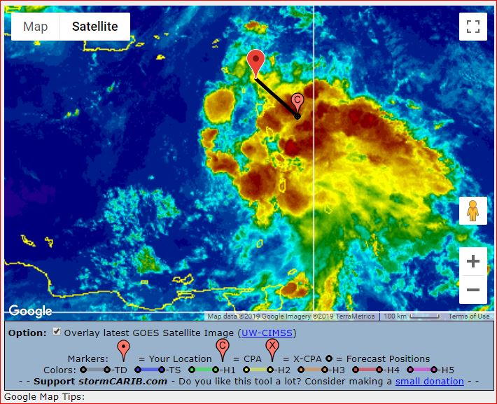


|
|
- Fwd: Favour & Gratitude...
|
- By Gert van Dijken <gert at vandijken.com>
- Date: Tue, 6 Aug 2019 14:38:03 -0700
|
Delayed message from fedawshercloh. Originally sent: Mon, Aug 5, 11:21 PM PDT---------- Forwarded message --------- From: fedawshercloh <fedawshercloh at gmail.com>Date: Tue, Aug 6, 2019 at 12:18 PM Subject: Favour & Gratitude...
Fortunately, for those who heeded the adverse weather alert which was issued from Sunday night- there was a bit more preparation for the bad weather which has been experienced over the last 48 hrs or so... At present the adverse weather alert has been cancelled though the potential for severe weather will continue.
Thankfully there was some Divine favour experienced in my area to the west of Downtown Port of Spain, as the squalls there remained pretty light to moderate as the early Monday morning hours passed. However, in other parts of the island such as in the South, central and the North Coast areas the gusts were apparently much more powerful compared to my location. Some trees and branches fell in such locations bringing down power lines and the like. Also, many areas once again had some flash flooding as heavy showers and thunderstorms continued in various parts of Trinidad into Monday evening & early this morning. Spectacular lightning displays also hit parts of South Trinidad.
Hopefully, the balance of Today's weather will be much more tolerable. However, these bouts of inclement weather are a good wake up call as the heart of the hurricane season gets nearer, & of course its a sober reminder that we are not immune at our latitude in Trinidad and Tobago.
Let's remain vigilant & prepared this season.
Sent from my Samsung Galaxy smartphone.
Sent from my Samsung Galaxy smartphone. |
|
- Update;
|
- By Ian Martin Borde <readkrox51 at gmail.com>
- Date: Tue, 6 Aug 2019 15:06:49 -0400
|
Je suis en attention !
Gardez-vous votres vies et votres essentielles, . . . !!
Dieu vous benisse ! 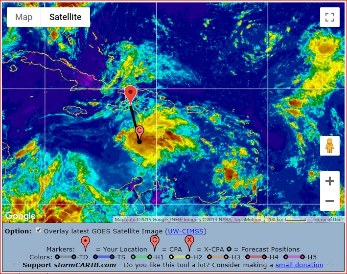
|
|
- Wet...
|
- By fedawshercloh <fedawshercloh at gmail.com>
- Date: Mon, 05 Aug 2019 05:55:57 -0400
|
So far the rains have persisted, heavy at times, but the winds have calmed considerably -though it still coming occasionally from the South to South south West. There is also a bit of mist/ fog visible on the hills which is an uncommon sight. Today will definitely be one for the indoors...
If You must be out- Stay safe & dry today.
Sent from my Samsung Galaxy smartphone. |
|
|
- Squalls & wind reversal... (Tail of 96L)
|
- By fedawshercloh <fedawshercloh at gmail.com>
- Date: Mon, 05 Aug 2019 04:30:35 -0400
|
I was awoken by rain showers and light wind gusts coming from 'the wrong direction'... It looks like some convective build up most likely connected to the fringes of 96L are affecting us from the West in the region of the Gulf of Paria and Venezuela. (Its very unusual to have showers and sustained winds coming from that direction).
Yesterday's showers which were forecast with the approach of 96L through the island chain also brought some flooding to a few of the same areas affected by the tail effects of 95L last Monday. So I'm sure this morning's squalls are not all that welcome.
Thankfully 96L was not enhanced too much in convective build up & intensity of its development & convergence. Had the usual quick intensification caused by the 'Lesser Antilles rule,' which has amply occured in the past taken place as expected - 96L would have been much worse for most of the islands with relatively very little warning time. It was a blessing that the convectively coupled Kelvin wave (cckw) feature was having a negative effect on atlantic tropical cyclone development.
However, I think the concerns of Michael in Dominica are quite valid since there will be certain systems which do not ultimately get named by the NHC for sometimes very technical reasons but, which are nevertheless capable of causing severe and adverse impacts to respective citizens. The special potential cyclone advisories definitely aid in greater public preparedness and sustained vigilance. & indeed, the NHC's rationale of under- classifying & non-designation of some Atlantic systems needs to be more closely looked at.
I hope and pray that the impacts of now downgraded 96L will be minimal enough in the islands to our north.
God's Blessings to all of our islands!
Sent from my Samsung Galaxy smartphone. |
|
|
- TouchDown !! (at 01:00 am. - Martinique)
|
- By Ian Martin Borde <readkrox51 at gmail.com>
- Date: Mon, 5 Aug 2019 01:36:49 -0400
|
Dieu Vous Benisse,
Here are two pics of pre-Chantal's eye directly crossing over the entire Martinique.
Standing By 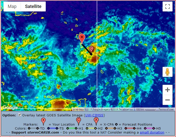
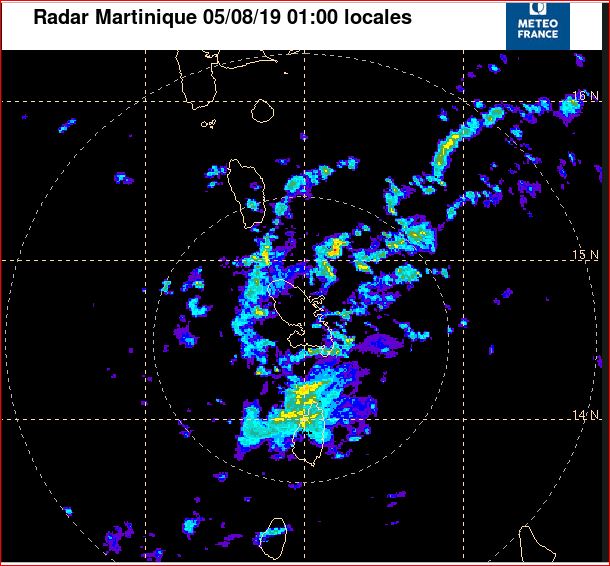
|
|
- 2019-08-04th. Sunday 4:30 pm.
|
- By Ian Martin Borde <readkrox51 at gmail.com>
- Date: Sun, 4 Aug 2019 17:42:03 -0400
|
My post before still Pertains.
I will be on standby tonight.
God Bless 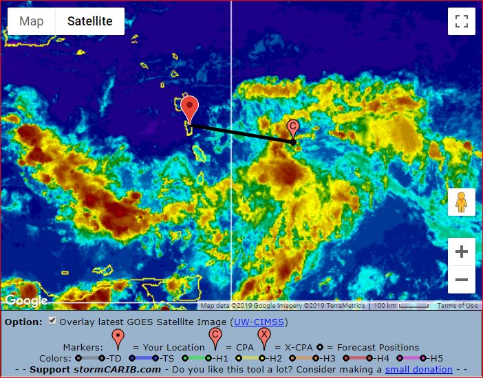
|
|
- Buckle Up ! The LPS/TW is exiting The ITCZ -
|
- By Ian Martin Borde <readkrox51 at gmail.com>
- Date: Sat, 3 Aug 2019 03:41:19 -0400
|
Good Night and Good Day, StormCarib People of Paradise,
Mere words cannot say what is unfolding before our eyes. Whether looking for sympathy or Not ! I am tired, really tired. Other facts are:
[Conditions Tuesday] : (Subject to increases, ... !!)
Waves; 8' - 10' feet (in 36 hrs.) Winds: above 20 mph. (from Grenadines northwards, Tuesday night) Precipitation: (too early and too wide) 1.75" - 4.0" inches
My take: I have it off Dominica, Tuesday. (NHC also) For some un-Godly reason, (millibars - pressure gradient) I see Haiti in the picture.
Business interests in this should be minimized. That way business interests will be well served afterwards. This is a Human/Social, Global Warming Problem.
Don't just standby, Get ready, God Bless 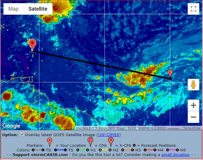
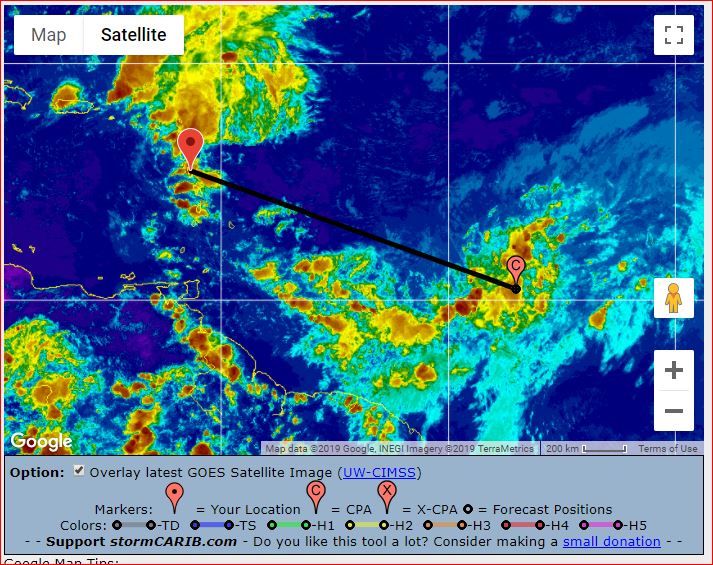
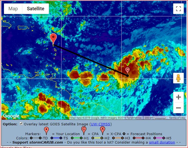
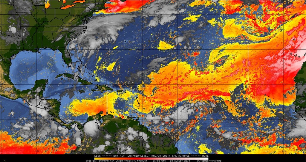
|
|
- Peak of the Season Approaching...
|
- By fedawshercloh <fedawshercloh at gmail.com>
- Date: Thu, 01 Aug 2019 00:44:46 -0400
|
Having had a bit of the sting of the
Tail of 95L here in TnT over the start of this week impacting parts of the East-West corridor region, which were hardest hit by the brief flooding. Major roads along the corridor then were flooded or rendered near impassable at times. Namely, the Priority Bus Route, the Eastern Main Road, and the Churchill Roosevelt Highway were all at one point underwater. This was an additional 'wake up call' yet again as this year's hurricane season advances.
We are now coming to the very heart of the season during a weak El Nino year. & It will be interesting to see how the models fare out with the upcoming systems especially Re: 96L. So far the Euro has definitely been the most reliable, of course. That being said the Northern Leewards certainly need to look out for upcoming impacts early next week from a moderate to strong Tropical system and possibly even a hurricane... Islands as far south as Martinique may need to be vigilant.
Be safe this season all, God Bless!
Sent from my Samsung Galaxy smartphone. |
|
|
- Tomorrow Night, Sunday till Tuesday, Nascent Circulation, . . . !
|
- By Ian Martin Borde <readkrox51 at gmail.com>
- Date: Fri, 26 Jul 2019 19:18:18 -0400
|
Fellow StormCarib People of Paradise,
NHC has two TW's COVERED three hours ago. I continued tracking the ITCZ it's embedded in for three hours , This may be the earliest call. I think they are trying to exit the ITCZ, ... !!!! Because I see LPS characteristics. There are the usual lifesavers of SAL & Wind Shear, ... Nobody ever knows. Least of all, me.
Waves seven (07') feet for quite a while, (maybe till Tuesday). Winds 15 -25 mph. (Not bad as yet!). Precipitation It's too early to tell. But most likely over one inches affecting and area of over 4 islands.
Nobody knows, just monitor for yourself and forget bandwagonism and opportunists.
May God Bless Us 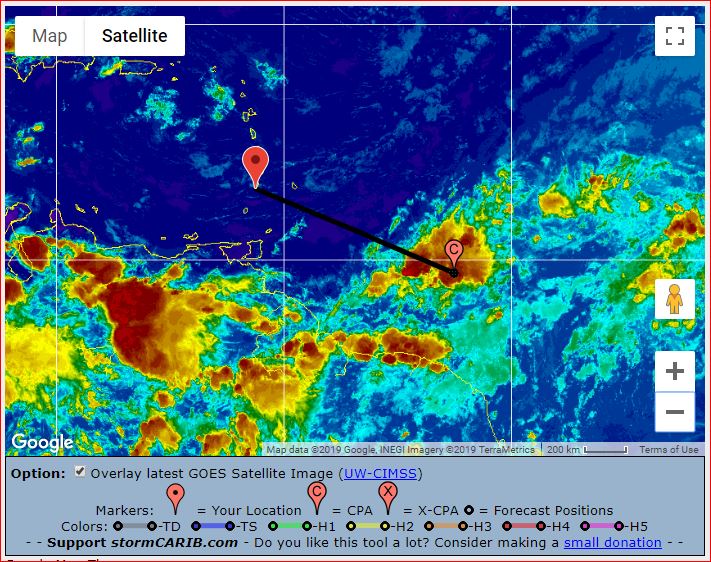
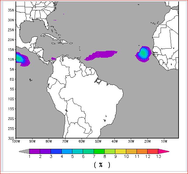
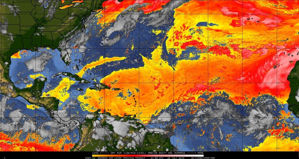
|
|
- Shower activity...
|
- By Fedaw Shercloh <fedawshercloh at gmail.com>
- Date: Mon, 15 Jul 2019 04:54:51 -0400
|
Near the capital We have been having some thunder showers with light winds, but so far the impacts seem quite manageable thank God. However, given the radar imagery & satellite presentation Perhaps Tobago and the North Coast of Trinidad got a bit more hammered from this latest blob of convection associated with Post 93L. Looks like more showers are en-route as the day unfolds too... If any worse weather conditions develop I'll report a bit more later on.
Stay dry and warm today TnT. |
|
- Timing & potential with Post 93L...
|
- By Fedaw Shercloh <fedawshercloh at gmail.com>
- Date: Mon, 15 Jul 2019 01:24:30 -0400
|
So far we have had some intense but short-lived showers late Sunday afternoon near the Woodbrook area of Port of Spain & environs.... Apparently Heavy Showers have largely been scattered around Trinidad & Tobago, which eventually abated by night time. However, adverse weather conditions are in the forecast for Monday morning so it will be an 'interesting' start to the work week for all concerned. Prolonged rainfall along with some squally weather is expected. I'll report further should adverse conditions eventually materialise. Thus far the worst weather seems to have affected the southern windward islands like St. Lucia and St. Vincent etc.
Keep safe & Vigilant everyone. |
|
- Potential Vigorous Tropical Waves...
|
- By fedawshercloh <fedawshercloh at gmail.com>
- Date: Thu, 11 Jul 2019 11:09:16 -0400
|
|
Well, we are getting into the heart of things. July is definitely the month to standby... While the coined term by our fellow correspondent from Dominica- the 'Lesser Antilles rule' may not be in full effect as yet, the upcoming tropical waves do bear watching. Hopefully there will be no substantial threat to any of the islands though there is already potential for some development especially for the wave in the far Eastern Atlantic. However, so far it continues to be mainly dry and hot with the odd shower in Trinidad. There was a solid downpour just recently this morning in the Port of Spain area. Perhaps a sign of things to come. Hopefully these drought type conditions do not break with the flooding rains of a tropical system or an active ITCZ (Inter-tropical Convergence Zone).
No matter what comes- Stay safe this season everyone... & May God Bless our Beautiful island Nations.
Sent from my Samsung Galaxy smartphone. |
|
- Another Blob in July -
|
- By Ian Martin Borde <readkrox51 at gmail.com>
- Date: Thu, 11 Jul 2019 05:52:15 -0400
|
People of Paradise,
I love how NHC puts this. (Couldn't have done it better.)
God Bless;
An Atlantic Ocean tropical wave is along 55W from 13N southward,
moving W at 15-20 kt. A surface trough is analyzed just east of
this wave from 13N49W to 08N51W. Satellite imagery shows a low
cloud swirl along the trough. Scattered moderate convection is
seen from 08N- 12N between 50W- 57W. The wave will bring enhanced
rainfall to the Windward and southern Leeward Islands beginning
early Friday. It will reach the central Caribbean by late Saturday
and Central America by early Monday. 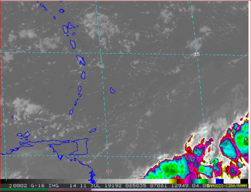
|
|
- In Emergencies, Listen to The Authorities, NOT MEDIA -
|
- By Ian Martin Borde <readkrox51 at gmail.com>
- Date: Sun, 7 Jul 2019 07:04:35 -0400
|
Good People of paradise,
After 'Irma' and 'Maria' any Natural Disaster is going to be COSTLY, if Not Deadly ! Costly: Financially, Socially & Politically !!!!!!!
After Haiti in 2010, a Peace Zone was Shattered !
The following comes from NHC, NOT ME. It does not serve interests to highlight it ! Educate Yourselves and Do Your own Research. "There is no easy way or shortcuts in Disasters, ... !"
NHC: A new tropical wave will enter the E Caribbean Sea on
Sunday, and it will move to the central part of the Caribbean
Sea on Monday night. A second wave will enter the E Caribbean
Sea on Monday night into Tuesday, with rainshowers and winds to
near gale-force associated with it.
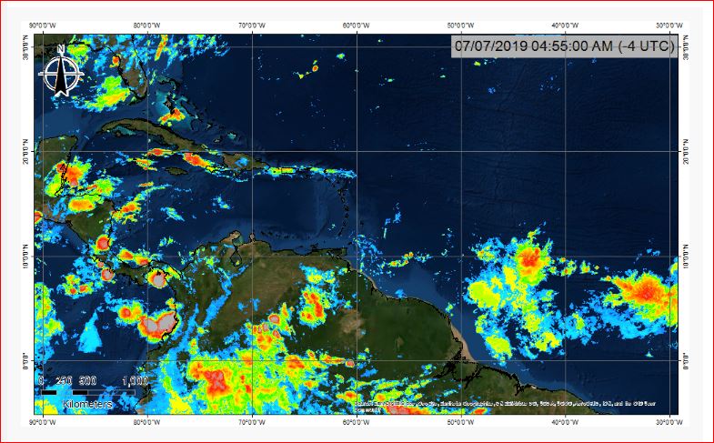
|
|
- Preparedness: The Most Important Thing -
|
- By Ian Martin Borde <readkrox51 at gmail.com>
- Date: Sat, 6 Jul 2019 06:17:18 -0400
|
Dear StormCarib, People of Paradise,
STAY CALM
Remove the Person from the Danger Or, Remove The Danger from The Person
You have to be highly skilled and Equipped to do this. It's not easy to do. In short, However:
DON'T MAKE THE SITUATION GO WORSE
This is one of four steps in Emergency Rescue.
The others are; 1) Survey the scene. Do a preliminary Examination. 2) Call for Help. Giving without shame, criticizing or complaining, identification, location and nature of illness or injury. 3) Check ABC's. (If you are not certified this is illegal.) Call for Help !!!!! 4) Call for Help! With trained help, render assistance. Remove the person from the danger Or, Remove the danger from the person. 5) Do a Secondary Examination. (Do Not Attempt!)
Just Saying, . . .
God Bless 
|
|
- Happy Independence -
|
- By Ian Martin Borde <readkrox51 at gmail.com>
- Date: Thu, 4 Jul 2019 07:23:14 -0400
|
There are a series of Troughs and Waves, (the largest of the season) approaching and here already. They also are the most Northerly so far. (St. Vincent - Northwards, ... !!!!)
I am on standby and will post as necessary. Remember: Input is Welcome, ... ?
God Bless America
|
|
- 12 - 36 Hrs. Insignificant TW. -
|
- By Ian Martin Borde <readkrox51 at gmail.com>
- Date: Fri, 28 Jun 2019 08:33:42 -0400
|
Happy School Closing, To all People of Paradise,
All who are glad when teachers help with the kids, now have to appreciate their own handy work. As the 'mommy masks' come off, .... Happy Summer !
Features of the Blob within a Blob: Waves reaching an average of nine (09') feet. Winds marginally but consistent during downpours of over 20 mph. Precipitation definitely more than one inch. Note: As Tobago is experiencing, There will be short but heavy spurts of weather before and after. This is called 'Localised Rainfall', (for 72 hrs.)
Please note the evidence of other correspondents that "The air is hotter and drier than average records".
Happy Summer ! 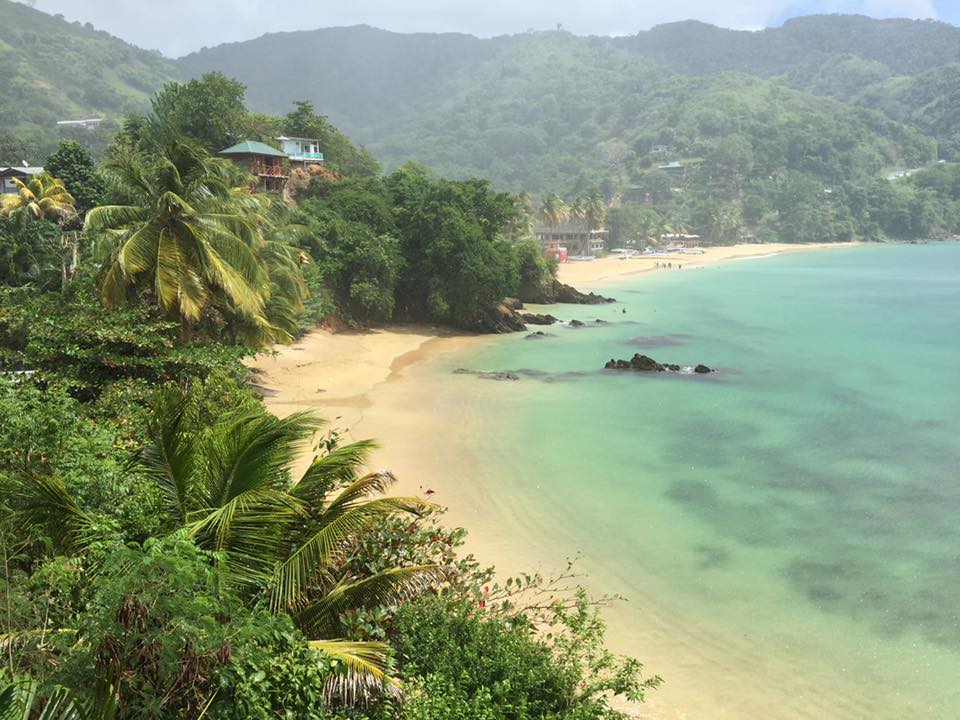
|
|
- T&T, more rain tonight and tomorrow -
|
- By Ian Martin Borde <readkrox51 at gmail.com>
- Date: Tue, 18 Jun 2019 19:38:37 -0400
|
Dear Stormcarib, People of Paradise, specially Trinidad & Tobago,
There has easily, nationwide been three days of rain.
My experienced guess is there will be more Rain tonight and Tomorrow, ... !!
You don't have to be experienced or take a guess, but there is the likelihood of flooding tomorrow.
My secondary take on the matter is, "Why come Port of Spain unnecessarily?"
Ans. "There are enough highways and businesses elsewhere."
God Bless

|
|
- Things Changed -
|
- By Ian Martin Borde <readkrox51 at gmail.com>
- Date: Thu, 13 Jun 2019 15:31:32 -0400
|
Good People of Paradise,
The Sahara Air layer (SAL) was over the top !!!! So even though there is a TW over us presently and continuing. One assumed 'normalcy' and did not post like everybody else.
The latest SAL image shows things are changing and The prediction Now is; for Rain.
There are no wind or waves to talk about.
God Bless 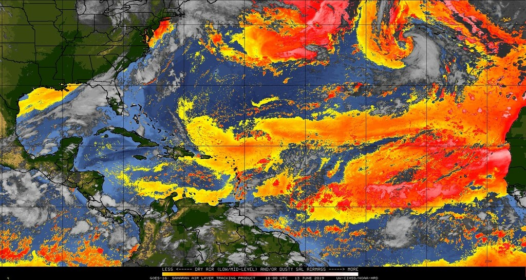
|
|
- Jupiter and its moons -
|
- By Ian Martin Borde <readkrox51 at gmail.com>
- Date: Thu, 13 Jun 2019 01:00:51 -0400
|
Good Night, Dear Folks!
I don't know if you can still see it. But between 10:23 pm and 11:24 pm. tonight, when my overworked computer technician finally got the time to fix my Desktop PC, broken since the earthquake.
Directly overhead, Jupiter was visible with its moons. I saw three moons with and without binoculars.
Peace 

|
|
- rain this weekend -
|
- By Ian Martin Borde <readkrox51 at gmail.com>
- Date: Fri, 7 Jun 2019 08:06:39 -0400
|
Hi, StormCarib People of Paradise,
Two (02) noteworthy News:
We are fighting bushfires in our neighbourhood for three days now. And Boy ! Can I tell you it's scary !
The other is a TW in 36 hours; Waves - Averaging 6' - 8' feet. Winds - More than 20 mph. Rain - (just marginally) above 1" inch.
If you have not prepared as yet ! God Bless You ! 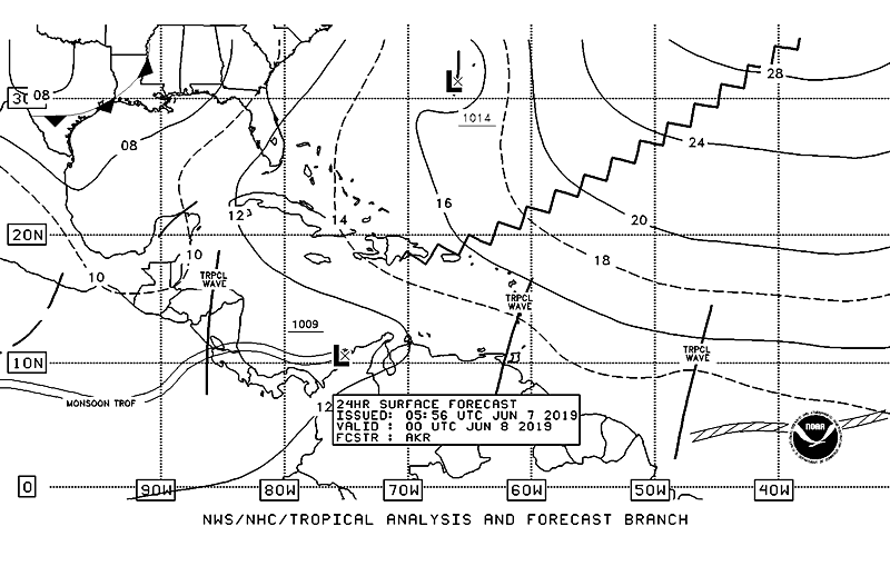
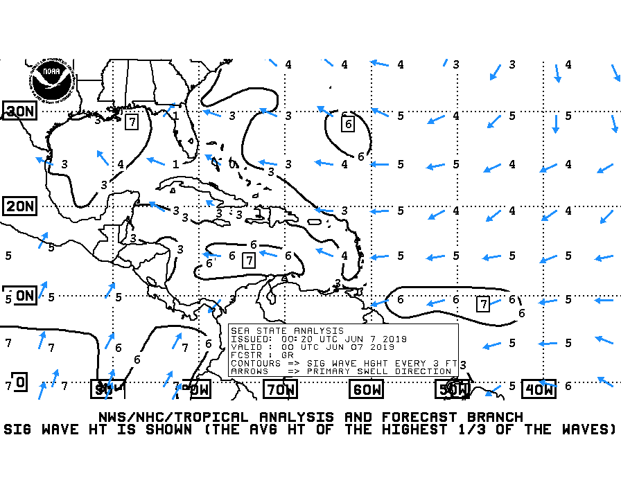
|
|
- Trinidad and South of St. Lucia
|
- By Ian Martin Borde <readkrox51 at gmail.com>
- Date: Sat, 1 Jun 2019 18:46:22 -0400
|
Good Evening, StormCarib People of Paradise,
While not like the Leewards, Trinidad had its share of drought and forest fires. So much so that I missed monkeys leaving the deep forest and coming by the river in front of me. Everybody but me saw them, ....
One can't say the estimated time of arrival, as with all suspicion the next blob should dip into South America. But, drawing a bottomline of preparedness, south Trinidad should be prepared 30% - 50% of hazardous conditions.
Nothing bad, it's just a wave, a South America Wave.
God Bless 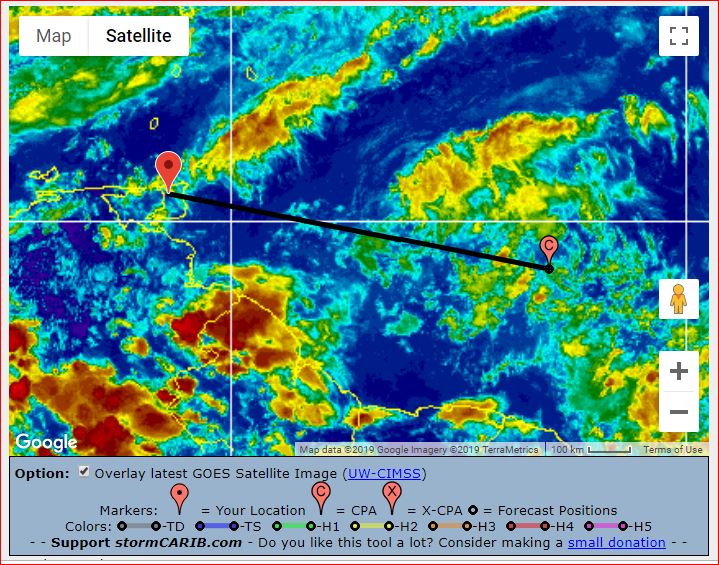
|
|
- for Your Information -
|
- By Ian Martin Borde <readkrox51 at gmail.com>
- Date: Fri, 31 May 2019 06:43:16 -0400
|
People of Paradise, (which includes Belize),
I most certainly did not plan it. But, if you have been following my posts for 2019.
The attached graphic should prove regrettably interesting.
God Bless 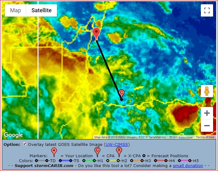
|
|
- (Entire Wind-Is.) Rain in 36 hrs. NOT HAZARDOUS -
|
- By Ian Martin Borde <readkrox51 at gmail.com>
- Date: Mon, 27 May 2019 20:19:06 -0400
|
Rain is coming. I am busy (and tired) so this is gonna be quick.
It's gonna affect all the islands ( in a good way ).
For two reasons if you analyse the attached graphic images, it has the potential to be a LPS. BUT WILL NOT BE. The 1st one !!
I think it is millibars. The 16 millibar ISOMETRIC IS QUITE HIGH. 1) That means it's going to veer north. I have been watching it and it has slowed down. 2) I don't have to tell you what that means? [according to Dominica: The Lesser Antilles Rule]
Enjoy it, ... 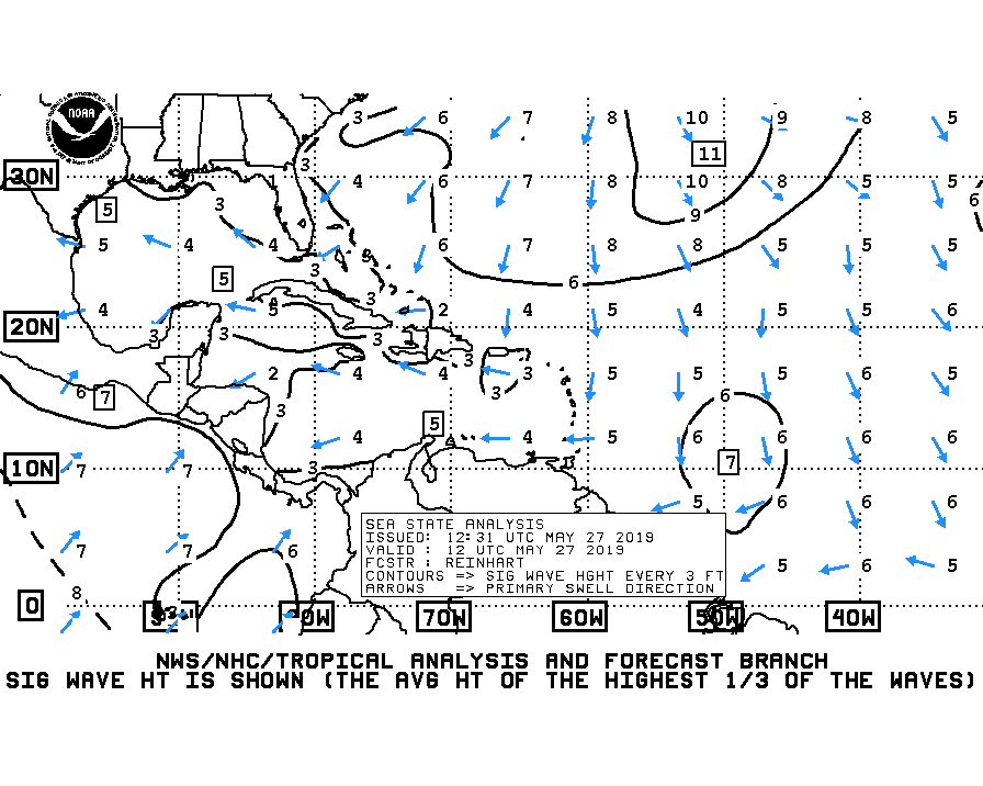
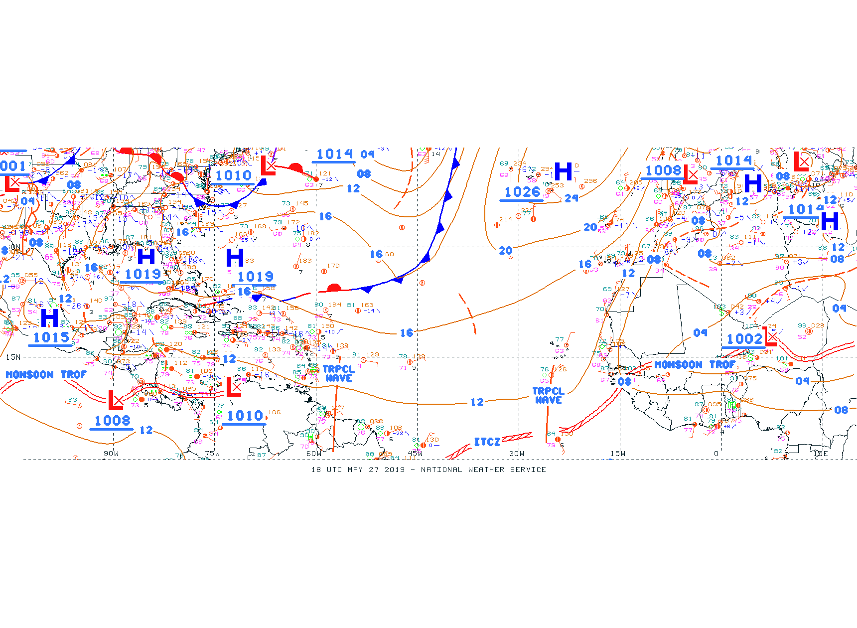
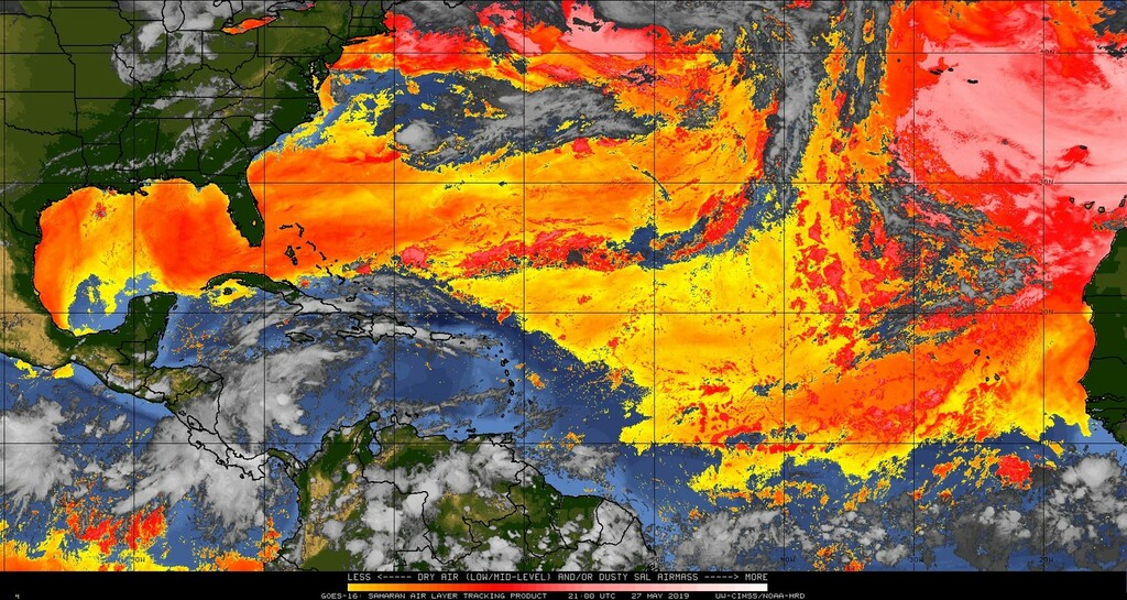
|
|
- 1st Atlantic Tropical Trough
|
- By Ian Martin Borde <readkrox51 at gmail.com>
- Date: Thu, 9 May 2019 05:43:14 -0400
|
Sorry Fellow stormcarib followers,
Due to Dry Air intrusion, a tropical wave, the 1st. remains a trough about to affect the Eastern Caribbean and South America.
It's gonna surprise a lot of people because there is no Dry Air over the Windwards.
God Bless 
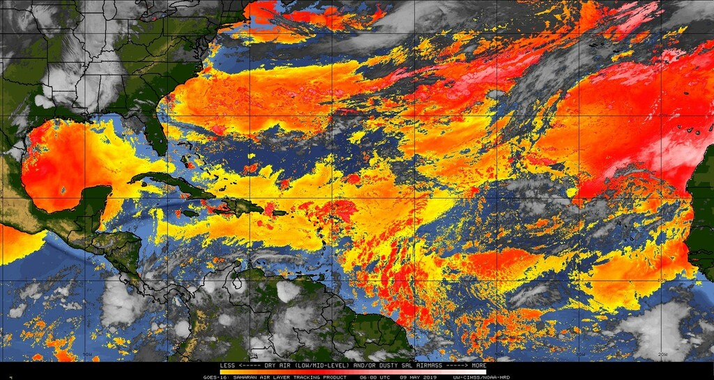
|
|