|
|
|
- Climate Change & 'Bucket Brigades' -
|
- By Ian Martin Borde <readkrox51 at gmail.com>
- Date: Sat, 21 Dec 2024 05:38:46 -0400
|
Hello, to The People of ; The Northern Caribbean & Western Caribbean 'People of Paradise',
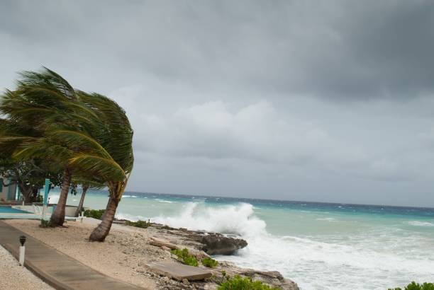
The Water is Boiling, The Caribbean Atmosphere is like Autumn and all we have. In These conditions is 'Wits',....
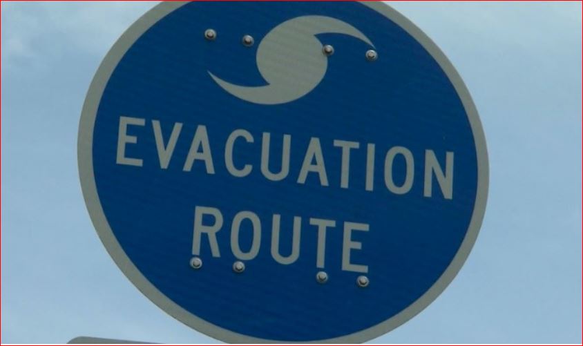
This Post is 'Different', reaching out ! Because ,... ..., We at 'stormcarib', Don't Need to Be Told !!!!! Furthermore, we have Done a lot about Disasters,...!!!!! B U T , "Every bucket Counts!"
This attachment shows. What I Call a New Phenomena? a 'Tropical Trough' ? This is at least !!!! The Third One for , The Non-Hurricane Season,.... !!!! (Yes! A lot of Misnomers!!!!) !
I have said ENOUGH !
The Point is, - "Do Not Be Afraid!" ! -
Unite !
GOD Bless
|
|
- More Bad Weather is Here -
|
- By Ian Martin Borde <readkrox51 at gmail.com>
- Date: Tue, 26 Nov 2024 12:15:27 -0400
|
Trinidad and Tobago,
You have Been Sensitized !
Get pro-Active,...?
Ian Martin Borde
|
|
- Keep Posting, (without FEAR!!!!) -
|
- By Ian Martin Borde <readkrox51 at gmail.com>
- Date: Tue, 26 Nov 2024 06:20:06 -0400
|
Important: Battered People of Paradise, esp. Haiti, Turks and Caicos, Jamaica and the Bahamas, (Belize) !!!!!!
Keep Posting, ... , Till January,...? It's Very, VERY IMPORTANT ! Rehabilitation and Reparation is Directly Proportional To Pro-Active Information from the Caribbean !!!
Temper Yourselves,.... There must be No Fear. PRO-ACTIVE !

|
|
- We Mourn The Passage,... -
|
- By Ian Martin Borde <readkrox51 at gmail.com>
- Date: Mon, 25 Nov 2024 06:38:06 -0400
|
Fellow People of this Beloved Paradise,
We mourn; Individually, The passing of 'Anil Singh'. Who lost his Life, When, because of a landslip, he suffered bodily injuries as his van overturned. 'Singh' was slipping away enroute to the District Hospital, asking about his friends,... (RiP). Before that he broke the Windscreen. As they were trapped in the van.
In General; We mourn the material and emotional Loss of Residents! you know what else, I am not saying.) It is in my Nature, all my Life, to help others. And as Isabel and Jane, and OF COURSE, Gert and Dave, are helping me to. I Try not to Identify too strongly and offer a 'bright side',....
This Passage has us, Nationally, more Sensitized !!!!!!
Eternal Rest! Dear Lord,...! Grant Him, Peace !

|
|
- Fwd: Lest We Forget,....! -
|
- By Ian Martin Borde <readkrox51 at gmail.com>
- Date: Mon, 11 Nov 2024 17:47:04 -0400
|
|

|
|
- Jamaica !!!! -
|
- By Ian Martin Borde <readkrox51 at gmail.com>
- Date: Mon, 4 Nov 2024 23:42:34 -0400
|
Winds: 35 - 48 mph. Waves: 03' - 05' ft. (up till 07'ft.). Water: over 03" ins. an hour. (depends on locality)!!!!
Get Indoors Stay away from Watercourses Ask for HELP
COMPLY! Don't criticize or complain.
Help is Waiting,...
G O D BLESS

|
|
- Attn!!! Caymans, J'ca, Cuba, Haiti and EC !!!
|
- By Ian Martin Borde <readkrox51 at gmail.com>
- Date: Sun, 3 Nov 2024 20:33:19 -0400
|
Hi, Gert! Thanks, for the Post ! How is your Research going! Do YOU have Time for YOURSELF !
People of the Caribbean ! As Gert said, there are two Areas of Concern within 48 hours,...!!! P R E P and, Ask for Help,...!!!
|
|
- 40 West -
|
- By Ian Martin Borde <readkrox51 at gmail.com>
- Date: Tue, 29 Oct 2024 15:30:38 -0400
|
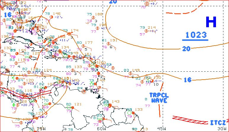
People of Paradise,
There is a System, (lowrider), crossing 40W. I want you all to take a look at it for, Analysis, Preparations, Relief Efforts,...
I won't be doing this Forever. But, my Church, Business and NGO Network should keep holding out !!!!!!!
I will Help You for Free.
God Bless, (Give till it Hurts,...)
|
|
- Another Tropical Wave !!!!
|
- By Ian Martin Borde <readkrox51 at gmail.com>
- Date: Wed, 23 Oct 2024 18:24:24 -0400
|
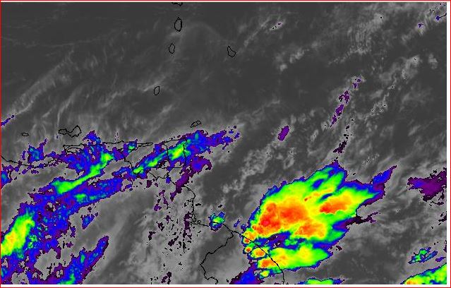
Another TW in less than 48hrs.
P
R
E
P
Remember: It's Climate Change and Complacency Kills !!!!
|
|
- Sorry! More than Hazardous TW (instant for 36hrs.)
|
- By Ian Martin Borde <readkrox51 at gmail.com>
- Date: Mon, 21 Oct 2024 14:21:55 -0400
|
Thank GOD, for the News from Turks and Caicos,... People of Paradise,
It has given me the Motivation to Post. Because I have to buy groceries for four o'clock.
Sorry because this Post is mainly for T&T, & Sorry because it's Late! The Weather is upon us,...
There is a 36hours 'Tropical Wave', That is More than Hazardous upon us.
In my view, for a TW, it's the biggest for the season,...
Got to Go, God Bless
|
|
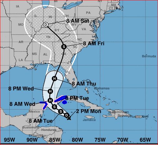
- Nobody Knows -
|
- By Ian Martin Borde <readkrox51 at gmail.com>
- Date: Sun, 13 Oct 2024 20:45:25 -0400
|
My Dear Lost People of Paradise,
Nobody knows,... So Pray for Me, while I write and Post. Something has to be said! And that's what I do, till I die.
While this latest Disaster, is not 'Irma' and 'Maria' on a Caribbean Island. It is too Major Hurricanes back-to-back. Ask the Army! It's a Significant Tragedy!
I can suggest the Normal, Meditation Group Prayers Support Groups Indoor Games Family Bonding Etc.... (Because it is a short space, to provide any solution. But, Save to Say, (This is Inspired,...!) At this stage of my Life and Life Experiences,...! 'Paradise' and 'Heaven' and other Ethereal Concepts,... For me, Is having Pleasant Company and Pleasant Conversation !!!!!!!
Even though it is the USA. I am indirectly Involved. But, I can't work on the 'ground', like I used to. Please,...? "Let's Pray for each other?"
Ian

|
|
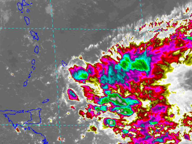
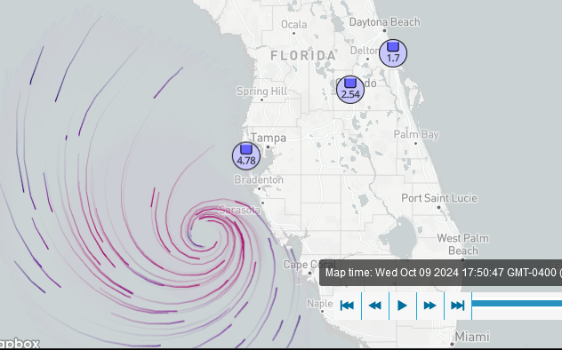
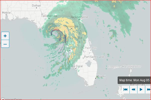
- Centre of Circulation at Landfall 6:00pm !!!! -
|
- By Ian Martin Borde <readkrox51 at gmail.com>
- Date: Wed, 9 Oct 2024 18:22:58 -0400
|
As per Centre of Circulation:
Waves: I agree with 15 feet Stormsurge. Winds: ?Rapid Intensification? but 75 mph right now. Water: 'Ocala' to 'Coral Gables' (and 'Palm Bay') 03ins. so far. But !!!! 'Clearwater' almost 05inches.
My Brother lives 'Palm Harbor'.
Pray
|
|
- 'Caymans', just Ask for HELP !-
|
- By Ian Martin Borde <readkrox51 at gmail.com>
- Date: Mon, 23 Sep 2024 15:16:27 -0400
|
Meanwhile, ...., People of Paradise,
An elongated ITCZ Trough, No possible Circular Motion, But, Advisories, specially for Coastal and Waterway Areas, may need to be issued,... !!
For The Eastern Caribbean.
|
|
- Prep !!!! (Your Survival Skills)! -
|
- By Ian Martin Borde <readkrox51 at gmail.com>
- Date: Tue, 10 Sep 2024 15:40:25 -0400
|
People of Paradise,
On the Plus Side, with all this Rain ! The harvest is Plentiful,....
In over a week, less than two weeks,... [My take]; Two Tropical Waves will go barely North of the Leewards as Storms,... !!!!
B U T !!!!! Scientifically: Seas will be Rough with Rip Currents in 3-4 days !!
I don't Believe in Graphics or History ! With Climate Change !!!!!!!
A Storm is an 'Act of GOD', so too is 'Survival'.
God Bless


|
|
- Heavy afternoon showers
|
- By Stephen Abouhamad <stephen_abouhamad at hotmail.com>
- Date: Thu, 29 Aug 2024 11:27:20 +0000
|
|
Trinidad and Tobago
29/08/24
Stephen Abouhamad
Good morning to all. Please be mindful of the day time heating showers that are expected today. Yesterday in San Juan at lunch time the skies suddenly turned dark followed by intense rainfall. How heavy the rain fell made me wondered if the rain would burst
through the roof. This intense shower only lasted for about 20 minutes which caused the usual flooding in the capital of Port of Spain. These day time showers are expected again today due to the humid mornings we are having. Take care and be safe.
Best regards,
Stephen Abouhamad
|
|
|
- Hazardous Weather, Tonight and Tomorrow !!! -
|
- By Ian Martin Borde <readkrox51 at gmail.com>
- Date: Wed, 28 Aug 2024 17:53:55 -0400
|
(Maybe Longer,...)
If you live in a makeshift shelter? Sprinkle 'Black Disinfectant' to avoid Snakes Entering !
God Bless, You Do the Rest
|
|
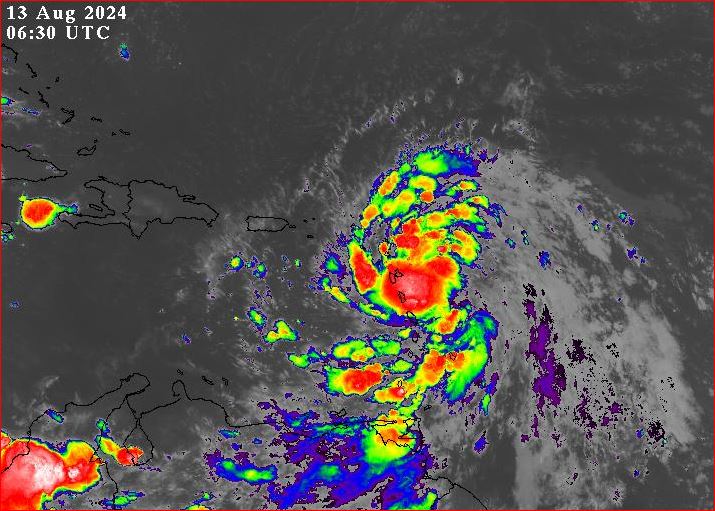
- Major (parasitic) 'Faux-Pas' -
|
- By Ian Martin Borde <readkrox51 at gmail.com>
- Date: Tue, 13 Aug 2024 03:03:31 -0400
|
Devastated People of Paradise !!!!
You can't make this stuff up! GOD is showing us exactly who and what to Blame ! It's UNFORGIVABLE ! Because, It's Right After 'Beryl'. And, More Coming, ... !
Ps. It's NOT OVER till Thursday !!!!!!!
Pray, for Emergency Workers,...
|
|
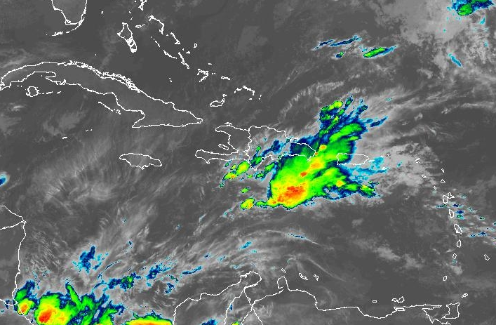
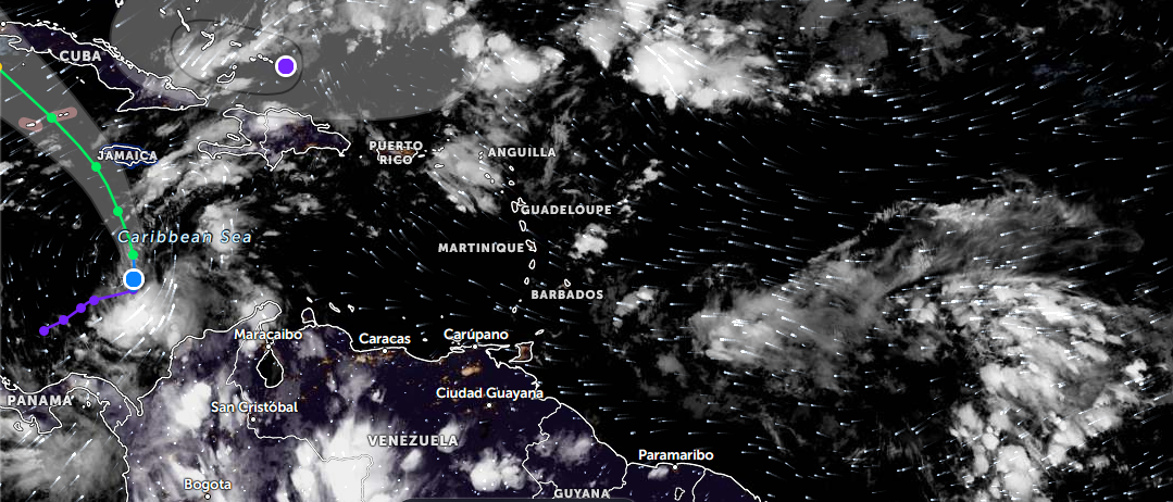
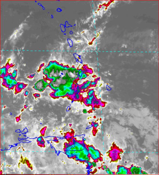
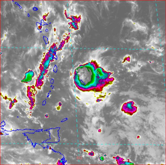
- Disturbance exits West of Grenada -
|
- By Ian Martin Borde <readkrox51 at gmail.com>
- Date: Mon, 5 Aug 2024 09:04:39 -0400
|
|
|
|
- HAZARDOUS, but Barely !!! -
|
- By Ian Martin Borde <readkrox51 at gmail.com>
- Date: Mon, 5 Aug 2024 04:33:30 -0400
|
My Dear People of Paradise,
As of NOW!! Tobago, Barbados and Trinidad have entered
The Circle of Depression Genesis !!
[My Take:]
It will only become a TD after exiting the Eastern Caribbean !!! The Tail will be a bigger problem than the Winds,...!!! Specially for The Grenadines !!!!
Stay away from WaterCourses as of NOW !
God Bless
|
|
- Florida !!!! For Your Information -
|
- By Ian Martin Borde <readkrox51 at gmail.com>
- Date: Mon, 5 Aug 2024 03:50:59 -0400
|
Winds have been filtered to 35mph.
Storm Force Winds have made Landfall !!!!
GOD Bless
|
|
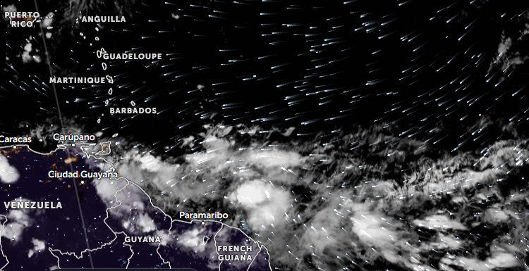
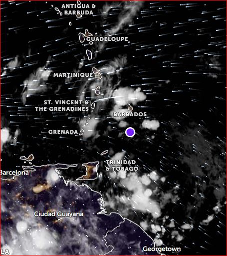
- Circulation forming East of St. Vincent ! -
|
- By Ian Martin Borde <readkrox51 at gmail.com>
- Date: Mon, 5 Aug 2024 01:32:01 -0400
|
Winds = ??? (too early but) 17kph - 33kph. Waves = ??? (too early but) above eight (08') feet Water = ??? definitely 1' - 3' ins. over 24 hrs.
|
|
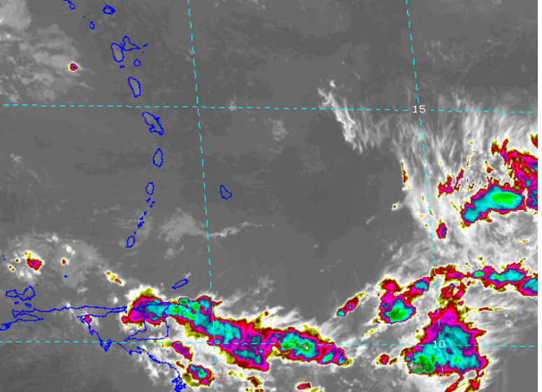
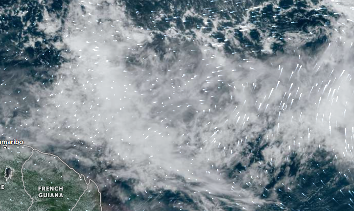
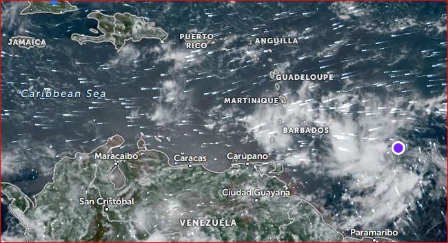
- Update on Disturbance 2024-08-04th Sunday and Monday -
|
- By Ian Martin Borde <readkrox51 at gmail.com>
- Date: Sun, 4 Aug 2024 23:43:46 -0400
|
|
This is not the Centre !
|
|
- Listen to Authority ! - Ask for Help ! -
|
- By Ian Martin Borde <readkrox51 at gmail.com>
- Date: Sun, 4 Aug 2024 12:52:01 -0400
|
|
|
|
- Back to a Normal Post -
|
- By Ian Martin Borde <readkrox51 at gmail.com>
- Date: Wed, 31 Jul 2024 21:21:21 -0400
|
Specially for The Helpless People of Paradise,
I have to Post because we have a 'Depression' over us and People are staring aimlessly.
My vacancy has not yet been filled.
First: even after heavy Rainfall? Boil the Water !!!! You are playing with Death ! (Or use the specified amount of pure chlorine).
Secondly: Don't pick up fruits and just eat them !!!!! SOAK Them in a Large Container with a Capful of Savlon. When Ready, Rub off the Savlon Vigorously with Potable Water.
Lastly Meat: DON'T EAT THEM - DON'T TOUCH THEM !!!!!!! Only if it is absolutely Necessary for You to Dispose of Them ON YOUR OWN? Get Permission to Burn Them before you bury them??? ONLY IF YOU GET PERMISSION from The Authorities.
Otherwise????? Listen to The Authorities, Ask for Help.
Even if that and all won't make you feel better? Admire someone worse off than You?
God Bless

|
|
- ? Is it Really All Clear ? -
|
- By Ian Martin Borde <readkrox51 at gmail.com>
- Date: Fri, 26 Jul 2024 05:03:54 -0400
|
Visitors and People of Paradise,
Together, without Fear ! We have to do a Post-Mortem. No confessions, no blame, no punishment, NO FEAR !!!!!! And, It is REALLY and TRULY a Post-Mortem, . . . . Lifes Were Lost !
Did We Plan Properly !!!! Did We Pray Properly !!!! Did We Prepare Properly !!!! Did We Procure Properly !!!!
Congratulations on The Entire Relief Efforts,...!
But as those in the Relief Efforts KNOW? Ad Hoc Money-Making Publicity in Relief Efforts is only adding 'Shame to Misery'.
Without Money, we can arrest Global Warming by MORE THAN 55%'.
Simple Education and Training; To those 07 - 70 years old can arrest Climate Change and Disasters,... Respect and Followthru for Essential Services is BADLY LACKING. The SURPLUS, from Doing THIS ! Can BE USED For CAPITAL DEVELOPMENT INVESTMENTS,...
Instead we have a 'Solution' Culture of Abandonment and Elimination.
This can't go on!
God Bless


|
|
- A luckly wobble or a miracle
|
- By Adesh Nanan <adeshcnanan at gmail.com>
- Date: Mon, 1 Jul 2024 19:49:28 -0400
|
Dear Gert, Tobago was spared the brunt of hurricane beryl when it moved slightly north.There was a report that tobago would have experienced the most amount of damage of all the islands while beryl was following the predicted track.However in the middle of the night there was eyewall reformation.....you decide if this was heavenly
Dr Adesh Nanan |
|
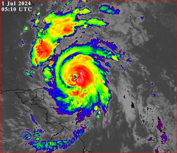
- Deadly Landfall & General Conditions at 10:10am. -
|
- By Ian Martin Borde <readkrox51 at gmail.com>
- Date: Mon, 1 Jul 2024 10:46:05 -0400
|
|
P r a y
|
|
- 2nd Update: Specs for Centre of Circulation !!!!!! -
|
- By Ian Martin Borde <readkrox51 at gmail.com>
- Date: Mon, 1 Jul 2024 07:10:47 -0400
|
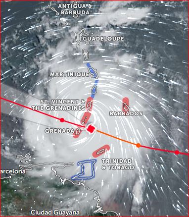
Tobago, Barbados, Grenada, St. Vincent and Trinidad,.... ...., are in the inner Cyclonic Centre at 06:30am !!!!!!!
Winds: 17kph - 74kph and Intensifying Waves: Immeasurable, (10' - 15' was a long time ago). Water: 3" - 4" ins. in an hour. (Not the Main Event for Monday).
Over-Confidence and Under-Confidence causes fatal mistakes,...!!!!!!!

|
|
- 1st Update -
|
- By Ian Martin Borde <readkrox51 at gmail.com>
- Date: Mon, 1 Jul 2024 01:53:11 -0400
|
The entire island of Barbados and Tobago, (inner cyclonic bands), and the entire island of St Vincent and St Lucia, (precipitation bands), have been the subject of Landfall at ten past one.
I am in touch with Gert but we seem to have a bad connection. (To have backroom chat???) Everything is NOT YET, Because the Eye makes Landfall at 08:00am.
|
|
- Eerie calm!
|
- By Adesh Nanan <adeshcnanan at gmail.com>
- Date: Sun, 30 Jun 2024 20:42:36 -0400
|
Dear Gert The temp is 27 deg's in Palmiste San Fernando, extremely calm ...moved my satellite dish as I await the outer bands of Hurricane Beryl.This reminds me of Bret that hit at midnight and was responsible for massive flooding.Since Beryl is fast moving it is more the winds that are a threat I believe.However the ground is saturated from the passage of the last tropical wave so there may still be the possibilty of landslides It is unnerving to just sit and wait Stay blessed all
Dr Adesh Nanan |
|
- Ask for HELP & OBEY AUTHORITY -
|
- By Ian Martin Borde <readkrox51 at gmail.com>
- Date: Sun, 30 Jun 2024 19:58:27 -0400
|
Distressed, People of Paradise !!!!!!
ASK FOR HELP
Then;
Obey the AUTHORITIES , . . . .
GET INDOORS, KEEP YOUR NERVES ! (Until Tuesday Morning !!!!!!).
'Berta', made Landfall at 6:30pm in Barbados. With 40kph Winds,...!!!!!! (Within 6 - 8 hours, most of us won't have. Potable Water, Electricity and Internet, etc.) at the VERY LEAST, keep injury, illness and death DIGNIFIED !
Comply,
(Don't Criticize and Complain, because in Unity. There is Strength,...)


|
|
- Hurricane Beryl
|
- By Adesh Nanan <adeshcnanan at gmail.com>
- Date: Sun, 30 Jun 2024 15:51:37 -0400
|
Dear Gert The sun is shining in Palmiste San Fernando.There is no wind at this time .Nobody knows what the next few hours will bring.The satellite picture looks ominous and we have been told to prepare for storm force winds and heavy rain later tonight Our schools remain open for tomorrow at this time. God will protect us
Dr Adesh Nanan |
|
- Weather In Trinidad
|
- By Stephen Abouhamad <stephen_abouhamad at hotmail.com>
- Date: Sun, 30 Jun 2024 00:36:27 +0000
|
|
Michael Abouhamad
29/06/25
Trinidad
Good night everyone,
This is just an update on hurricane Beryl. Hope everyone is taking this seriously and staying safe.
Beryl's winds are approximately 90 miles per hour.
Weather wise in Trinidad it has been rainy all day with a few thunder storms. We have also had reports of flooding in the capital Port of Spain this morning. With the path of hurricane Beryl passing to the north of Trinidad we are still preparing for a wet
and windy few days. God Bless.
Best regards,
Michael Abouhamad
|
|
|
- !! Centre of Circulation off Grenada 's South Coast !! -
|
- By Ian Martin Borde <readkrox51 at gmail.com>
- Date: Tue, 25 Jun 2024 03:26:03 -0400
|
At 02:00am Tuesday 25th June 2024, The Centre of Circulation passed just off Grenada's South Coast. Tobago, (and Trinidad), were spared for now,... ABC Islands and Haiti and Jamaica keep a Watch !
(Starting to Rain Heavy with the Tail (03:20am.).!.
No Complacency !!!!

|
|
- Beware of Aftershocks,...!!! -
|
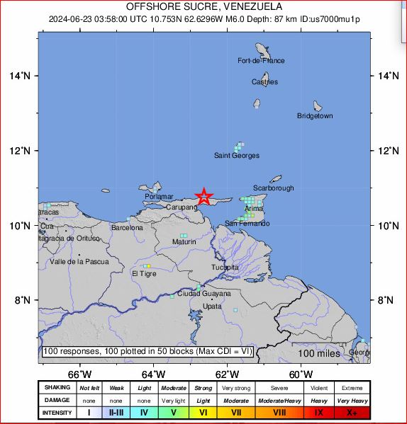
- By Ian Martin Borde <readkrox51 at gmail.com>
- Date: Sun, 23 Jun 2024 02:47:53 -0400
|
T'dad & T'bgo had a 6.0 Earthquake, approx. 90kms. Deep, 70 miles from the tip of Trinidad. Lasting over a minute,... !!!
Lost current and internet for an hour. No Damages.
For three reasons there will be no tidal fluctuations; Epicentre too shallow. Surface to seabed too shallow. Magnitude less than 6.5
Listen, Look, Smell, Touch for symptoms of Hazards,... Whether or Not stay away from Disastrous Locations, SEcure Vulnerable !!!!!!! (The SEa is a Disastrous Location)!!!!!!! Call for Help !!!!!!!
On Standby
|
|
- !!!! Complacency Kills !!!! -
|
- By Ian Martin Borde <readkrox51 at gmail.com>
- Date: Tue, 18 Jun 2024 07:08:11 -0400
|
Thank God for GErt, Dave, Martha, Jane and Isabel ! People of Paradise !!!!
Without this Site , ... , people will be Dead.
Pray for Belize, (Honduras), and Trinidad and Tobago, ... !!!!
Standing By, REALLY STANDING BY


|
|
- ..., here we go again,... -
|
- By Ian Martin Borde <readkrox51 at gmail.com>
- Date: Sat, 15 Jun 2024 10:36:33 -0400
|
People of Paradise,
Do I have to tell You !!!? In 36 hours a stronger Wave is coming,... !!!!
Pray, Plan, Prepare, Procure


|
|
- Rain Intensifying Monday till Wednesday -
|
- By Ian Martin Borde <readkrox51 at gmail.com>
- Date: Sun, 9 Jun 2024 03:20:09 -0400
|
People of Paradise,
This is REAL ! a) We are a few thousands. The population in Small-Island States is in the Millions of which the Elderly are Significant. b) Climate Change is Real. A hurricane before was winds in the 70's, 80's 90's and less than 2" - 3" inches of rain. Now at least once every three years we get winds above 150mph. Rainfall of four (04') inches can fall 27 times in a year with something as simple as a trough. c) I can't talk for everybody and all the Central Caribbean. But, WE ARE NOT EQUIPPED or INVESTED. If part of a tree falls on a high tension, electricity line. We then have a National Blackout. At least Three Different Disaster Groups have to correct the Damage. Then as if to add shame to misery, volunteers help clean up.
If you know me. I talk positively about tourists attractions as well. However our situation is becoming more desperate !!!!!!!!
GOD! Please Bless

|
|
- 48 Hours of Thunderstorms as of NOW -
|
- By Ian Martin Borde <readkrox51 at gmail.com>
- Date: Sun, 2 Jun 2024 13:38:09 -0400
|
I Beg of People of Paradise,...
Please RESPECT OUR EMERGENCY PERSONNEL !!!!!!
During this Hurricane Season !

|
|
- Bad Weather Saturday and Sunday T&T -
|
- By Ian Martin Borde <readkrox51 at gmail.com>
- Date: Thu, 23 May 2024 17:39:56 -0400
|
Brace for it,...
Approx 02ins. of rain,...
Stay away from Rivers and the Beach.
Brace for it !!!!
|
|
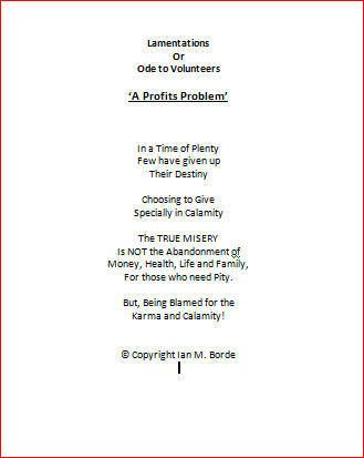
- Lamentations -
|
- By Ian Martin Borde <readkrox51 at gmail.com>
- Date: Sat, 18 May 2024 08:37:16 -0400
|
Our Dearest People of Paradise !
The ITCZ is currently over Trinidad and Tobago. This means over one inch of rain in localized areas. for the next two Days, ...
Instead of God Bless, I include,
|
|
- Proactively, Make a List -
|
- By Ian Martin Borde <readkrox51 at gmail.com>
- Date: Tue, 14 May 2024 13:09:17 -0400
|
Hello, People of Paradise,
We have two weeks of Preparation without Climate Hazards, ...
Use the Time :
Firstly, Get (a List) started getting an Emergency Supply, including a First Aid Kit. Giving a Donation and early Season Shopping gets some things 'Free'.
Secondly, Identify Emergency Shelters and Volunteer in some way.
What is not strictly emergency supplies, like clothes and food and linen. Proactively put aside.
Thirdly, Buy a) a safety deposit box, or b) a vault, and c) a document receptacle.
This is to avoid last minute shopping,... Last minute shopping endangers Lifes.
God Bless

|
|