- Updates from the Islands -

- - Antigua - -

| home | satellite | tools | pleas for help | guide | climatology | archive

- - - 2022 Hurricane Season - - -

- Yet another one to watch
  • By Martha Gilkes <gilkesm at me.com>
  • Date: Mon, 26 Sep 2022 13:04:15 -0400
We continue to track weather coming our way.   This is predicted to go north 
but worth keeping an eye on !  Eyes to the east 

JPEG image


Sent from my iPhone

- Hurricane Fiona
  • By Martha Gilkes <gilkesm at me.com>
  • Date: Wed, 21 Sep 2022 17:41:05 -0400
She was on my doorstep as a storm.  Now watching as she approaches Bermuda 🇧🇲 
and thinking of my Bermuda family.    Hopefully this will stay true below.   🙏

JPEG image


Sent from my iPhone

- Another storm ?
  • By Martha Watkins Gilkes <marthawatkinsgilkes at gmail.com>
  • Date: Tue, 20 Sep 2022 14:11:53 -0400
Watching this one. But looking like it will stay south !?   

https://youtu.be/WjHg9Pn_SpY


- Storm won’t leave us !!!
  • By Martha Gilkes <gilkesm at me.com>
  • Date: Sat, 17 Sep 2022 15:00:56 -0400
Storm update.    Shows how unpredictable  WEATHER is.    The last time we faced 
this was hurricane Irma that devastated Barbuda 5 years ago. So we get 
complacent..   so now.     We though it was gone.  But. Now getting big rain / 
flooding.    Places flooding all over the house !!  Am a real mop gal for now.  
      Fiona slowed down so her  remenants  remain.   Hope she moves on very 
soon.     Big thunder just now !   As we weather watchers always say   Better 
to ere on the side of caution!

JPEG image


JPEG image


JPEG image


JPEG image


JPEG image


Sent from my iPhone

- TROPICAL STORM FIONA PASSING ON
  • By Martha Watkins Gilkes <marthawatkinsgilkes at gmail.com>
  • Date: Sat, 17 Sep 2022 06:05:32 -0400
Early morning  wake up  here in Antigua   although it was a  rough night with howling winds; not much sleep…  Antigua is OFF TROPICAL STORM
WARNING   as   shown below  with the   5  am  advisory…... but  it looks like those islands beyond  may be in for  a  HURRICANE.  
 IT is still  DARK here  but  at first  look it  does not  seem there is   any serious  damage around  us.   Seems  from Facebook post    MANY 
did  not have  electricity during the storm  and mine did go off for  some time  but back on now however our cable  TV 
shows   NO SIGNAL …  assume due to  heavy  cloud cover ?     ALL IN ALL  Antigua seems to have been spared
from any  devastating  damage.  Not sure how much rainfall there was ?  Thanks to those who sent messages of concern. 


BULLETIN
Tropical Storm Fiona Advisory Number  12
NWS National Hurricane Center Miami FL       AL072022
500 AM AST Sat Sep 17 2022

...FIONA EXPECTED TO STRENGTHEN OVER THE NORTHEASTERN CARIBBEAN...
...HURRICANE WATCH ISSUED FOR PUERTO RICO...


SUMMARY OF 500 AM AST...0900 UTC...INFORMATION
----------------------------------------------
LOCATION...16.4N 63.3W
ABOUT 125 MI...205 KM W OF GUADELOUPE
ABOUT 135 MI...215 KM SE OF ST. CROIX
MAXIMUM SUSTAINED WINDS...60 MPH...95 KM/H
PRESENT MOVEMENT...W OR 275 DEGREES AT 13 MPH...20 KM/H
MINIMUM CENTRAL PRESSURE...1000 MB...29.53 INCHES


WATCHES AND WARNINGS
--------------------
CHANGES WITH THIS ADVISORY:

A Hurricane Watch has been issued for Puerto Rico, including Vieques
and Culebra.

The government of Antigua and Barbuda has discontinued the Tropical
Storm Warning for Antigua and Barbuda.

The government of Barbados has discontinued the Tropical Storm Watch
for Dominica.


Martha Watkins  Gilkes
Dolphin View, Half Moon Bay Estate
ANTIGUA, WEST INDIES
FANTA SEA ISLAND LTD
268  764 7722- cell & Whats App
marthawatkinsgilkes at gmail.com

Women Divers Hall of  Fame  2002
https://www.wdhof.org
https://www.wdhof.org/members/martha-gilkes


ELKHORN MARINE CONSERVANCY
 RESTORING CORAL ONE STEP AT A TIME !
Ways to Donate AND MAKE A DIFFERECE
https://www.emcantigua.org

Explorers Club Fellow International 
https://www.explorers.org


- Storm coming
  • By Martha Gilkes <gilkesm at me.com>
  • Date: Fri, 16 Sep 2022 21:16:39 -0400
We are in the storm now.  I ventured out to take photos.    But locked down 
now.   Don’t want to be.  “Gone with the wind “.   Tomorrow will check in.    
Going to be a long night     🙏

JPEG image


JPEG image


Sent from my iPhone

- Storm waves rolling in
  • By Martha Gilkes <gilkesm at me.com>
  • Date: Fri, 16 Sep 2022 21:44:47 -0400
We are ready ! 

JPEG image


Sent from my iPhone

- Happening now
  • By Martha Watkins Gilkes <marthawatkinsgilkes at gmail.com>
  • Date: Fri, 16 Sep 2022 21:48:12 -0400
Download Attachment
Available until Oct 16, 2022
Although  not  facing  a  hurricane  (very thankful)   viewing what is coming  over us   gives one  BIG RESPECT FOR  MOTHER NATURE  and  these  weather  systems.   There is NO ONE    FIT  for a  storm/hurricane and  things change  constantly   with weather.   we have  faced  many  in  HURRICANE ALLEY !!

Click to Download
IMG_1499.MOV
0 bytes


Sent from my iPhone

- Antigua airport closes
  • By Martha Gilkes <gilkesm at me.com>
  • Date: Fri, 16 Sep 2022 10:00:07 -0400

JPEG image


Sent from my iPhone

- STORM FIONA moving south
  • By Martha Watkins Gilkes <marthawatkinsgilkes at gmail.com>
  • Date: Fri, 16 Sep 2022 08:22:01 -0400
Seems  There  is a  SOUTH  turn  for the storm putting  it  further away from Antigua.     


- STORM COMING
  • By Martha Watkins Gilkes <marthawatkinsgilkes at gmail.com>
  • Date: Fri, 16 Sep 2022 07:50:09 -0400
This  early  Friday morn  we are   bracing for the arrival of  TROPICAL STORM  FIONA  this afternoon    and into the  night  but  thankful  not as a  HURRICANE  and  due to wind shear and dry air infusion it is not expect to strengthen before reaching  antigua .   There will be   lots of  rain however  so flooding  could be an issue for some areas.       Stay safe  those  in harms way.   


- Tropical storm Fiona
  • By Martha Gilkes <gilkesm at me.com>
  • Date: Thu, 15 Sep 2022 04:28:03 -0400
Due to pass to our north early Saturday morning.    

JPEG image


Sent from my iPhone

- Tropical Storm 🌀 Fiona forms
  • By Martha Watkins Gilkes <marthawatkinsgilkes at gmail.com>
  • Date: Thu, 15 Sep 2022 04:12:22 -0400
We now have a 50 mph storm.  Due pass near early morning Saturday.  

ZCZC MIATWOAT ALL
TTAA00 KNHC DDHHMM

Tropical Weather Outlook
NWS National Hurricane Center Miami FL
200 AM EDT Thu Sep 15 2022

For the North Atlantic...Caribbean Sea and the Gulf of Mexico:

Active Systems:
The National Hurricane Center is issuing advisories on recently 
upgraded Tropical Storm Fiona, located several hundred miles east of 
the Leeward Islands. 


Sent from my iPhone

- ANTIGUA on TROPICAL CYCLONE ALERT
  • By Martha Gilkes <gilkesm at me.com>
  • Date: Wed, 14 Sep 2022 18:56:25 -0400

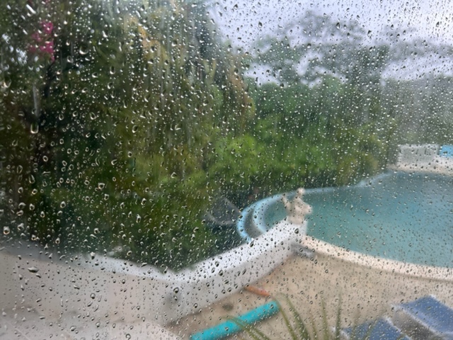
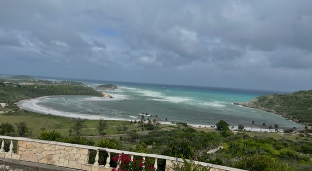
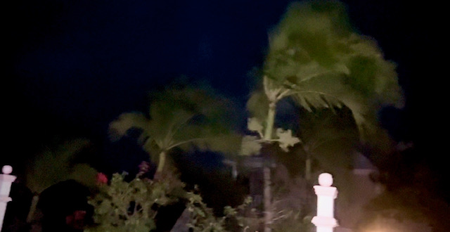
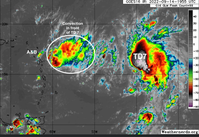
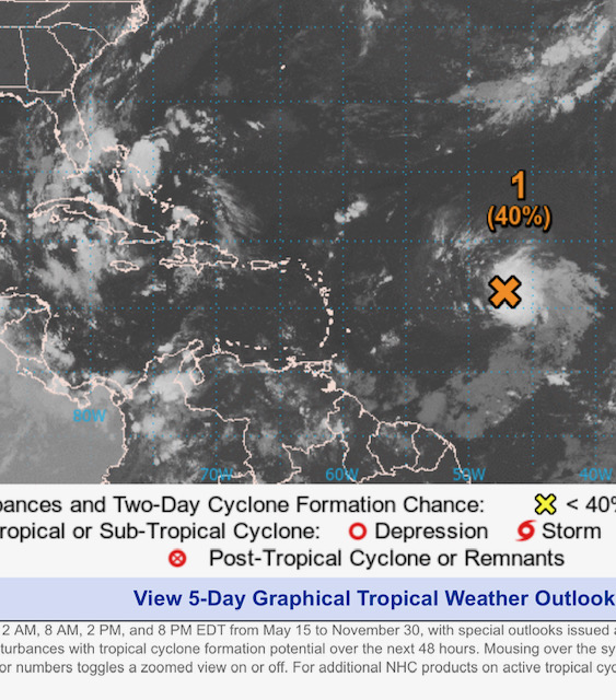
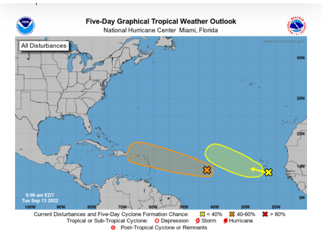
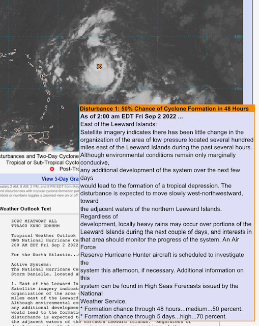
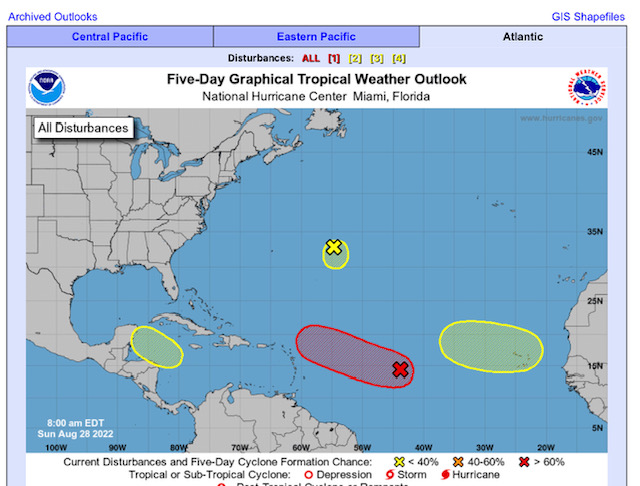
We  find this  system      TROPICAL DEPRESSION  #7   (   to be name  FIONA  if it is  named!    )     VERY CLOSE TO US   here in  Antigua and  Barbuda very  quickly………  with  some  rain to  possibly  come  tonight   (  a welcome thing)  but it is too early  to know  the effects …      and what  strength the winds will be.  

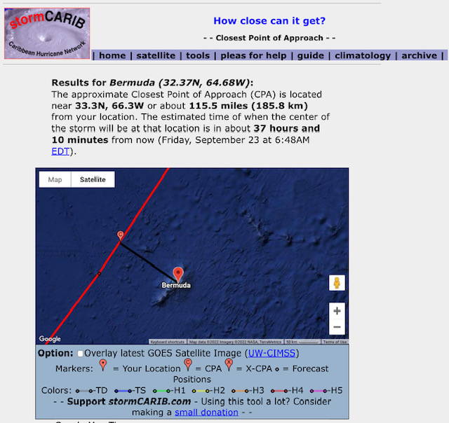
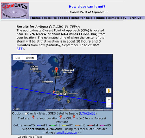
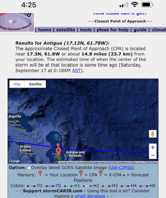
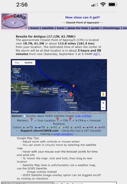
STORM CARIB IS SHOWING  CLOSEST POINT IS    8.9 miles    FROM  ANTIGUA  off our north on SEP  17th  (SATURDAY)  at     2  a.m  !!       OF COURSE WE  know this  can  change as  weather  is  weather !!!

 below  this  Statement   just  sent out from our met office..

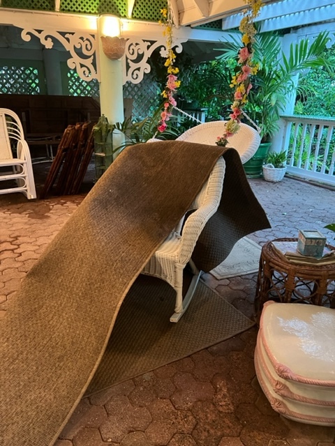
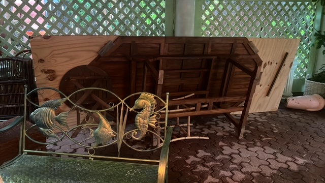
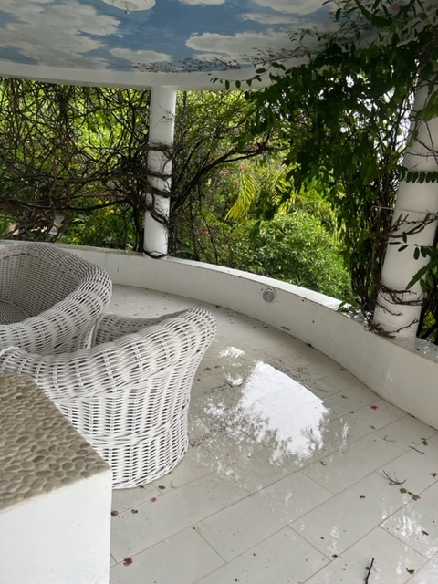
  I  am on  stand by  to put up  hurricane shutters if  needed    but  not  implementing   the plan yet !    But  as  i am located  high on a hill on the  ATLANTIC side  ( 212  feet)   i  always  err  on the side of  caution.

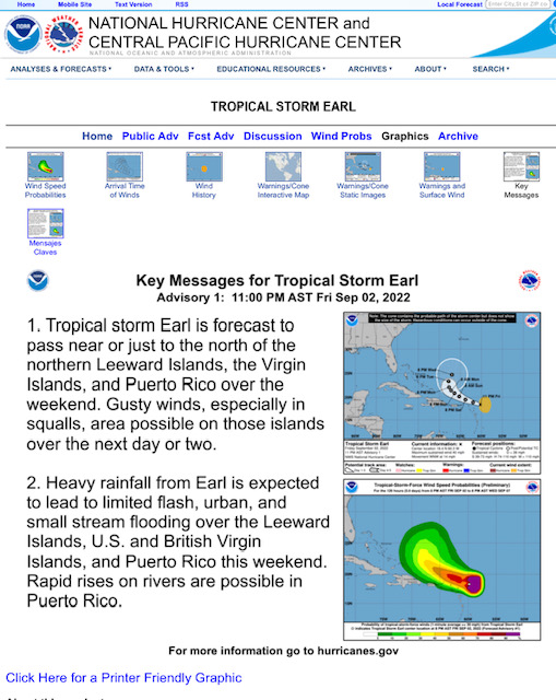
    I  am  always  happy  to know   THE HURRICANE HUNTERS  are  flying the  system   as  that will give us  the  most  accurate information ( more than the  satellite  )  as  they   fly INTO THE SYSTEM  ( been there  done that  with them !!   so first hand  knowledge)      The  Hurricane Hunters  PLAN OF THE DAY  is posted below  .     They will  fly the system  at  1730  ZULU TOMORROW   SEP  15th    ( which  is   1:30 pm Antigua time )       with  repeat flights as shown below and this will  show  the    “REAL DEAL”  of  what is going on   weather wise”.            

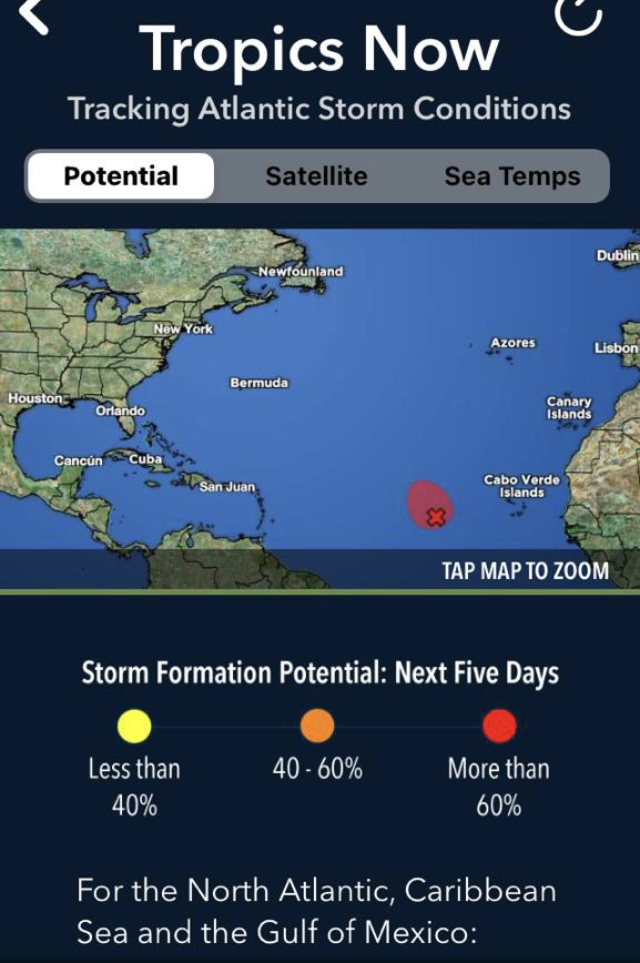
WE need to all  be  prepared as it is  the HEIGHT  of HURRICANE  season in the  tropics!     LETS HOPE this one  is NOT    HURRICANE   FIONA!!  


Will keep you  posted  From  our  Antigua  paradise ….
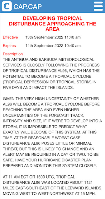


WOCA31 TAPA
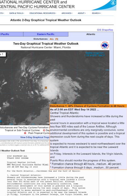
TROPICAL CYCLONE ALERT STATEMENT
ANTIGUA AND BARBUDA METEOROLOGICAL SERVICES 11:30 AM ECT WED 14 SEP 2022

...TROPICAL DISTURBANCE AL96 HAS BECOME TROPICAL DEPRESSION SEVEN AND CONTINUES TO APPROACH THE AREA...

A TROPICAL CYCLONE ALERT IS IN EFFECT FOR THE LEEWARD ISLANDS AND THE BRITISH VIRGIN ISLANDS. A TROPICAL CYCLONE ALERT MEANS THAT, IN THIS CASE, A TROPICAL DEPRESSION IS IN OUR MONITORED AREA OF CONCERN. A TROPICAL STORM WATCH MAY BE REQUIRED LATER.

IT IS A BIT TO EARLY TO DETERMINE THE FULL IMPACTS OF THE SYSTEM, IF ANY, WITH HIGH CERTAINTY. HOWEVER, TROPICAL DEPRESSION SEVEN IS FORECAST TO BE IN THE VICINITY ON FRIDAY AS A MINIMAL TROPICAL STORM. THEREFORE, IT POSES AN ELEVATED THREAT WITH THE POTENTIAL TO CAUSE LIMITED IMPACTS FROM STORM-FORCE WINDS, HIGH SEAS AND MINOR FLOODING, RESULTING IN LIFE- THREATENING CONDITIONS AND MINOR DISRUPTIONS TO DAILY LIFE. TO BE SAFE, BE PREPARED TO IMPLEMENT YOUR HURRICANE DISASTER PLAN.

AT 11 AM ECT OR 1500 UTC, THE CENTRE OF TROPICAL DEPRESSION SEVEN WAS LOCATED NEAR LATITUDE 16.6 NORTH, LONGITUDE 49.6 WEST OR ABOUT 800 MILES EAST OF THE LEEWARD ISLANDS OR ABOUT 1000 MILES EAST-SOUTHEAST OF THE BRITISH VIRGIN ISLANDS.

THE DEPRESSION IS MOVING TOWARD THE WEST AT 14 MPH.

MAXIMUM SUSTAINED WINDS ARE NEAR 35 MPH WITH HIGHER GUSTS. SOME GRADUAL STRENGTHENING IS FORECAST DURING THE NEXT DAY OR SO AND THE DEPRESSION IS FORECAST TO BECOME A TROPICAL STORM TONIGHT OR THURSDAY.

ON ITS FORECAST TRACK, THE CYCLONE WILL LIKELY BE NEAR THE ISLANDS THIS WEEKEND, AS A MINIMAL TROPICAL STORM. THERE IS A REASONABLE WORST-CASE SCENARIO OF THE ISLANDS BEING AFFECTED BY STORM-FORCE WINDS, HIGH SEAS AND MINOR FLOODING FROM POSSIBLE RAINFALL TOTALS OF 1 TO 4 INCHES. NOTWITHSTANDING, IT IS A BIT EARLY TO SAY, WITH HIGH CERTAINTY, THE EVENTUAL PATH, SIZE AND INTENSITY OF THE SYSTEM AND HENCE, THE SPECIFIC IMPACTS, IF ANY. A FEW MODELS HAVE THE SYSTEM PASSING NORTH SIMILAR TO EARL.

NOTE THAT THERE ARE NO WATCHES OR WARNINGS IN EFFECT AT THIS TIME; BUT WILL LIKELY BE REQUIRED LATER.

RESIDENTS ARE URGED TO MONITOR TROPICAL DEPRESSION SEVEN CLOSELY AND BE PREPARED TO IMPLEMENT THEIR HURRICANE PLANS, IF CALLED UPON TO DO SO. THE THREAT IS MINOR, AT THIS TIME, BUT IT COULD INCREASE TO MODERATE/MEDIUM WITH THE POTENTIAL FOR SIGNIFICANT IMPACTS.

THE NEXT ADVISORY WILL BE AT AROUND 6 PM ECT 2200 UTC THIS AFTERNOON OR SOONER IF NEEDED.

FORECASTER
DALE DESTIN/LETITIA HUMPHREYS 


000
NOUS42 KNHC 141600
REPRPD
WEATHER RECONNAISSANCE FLIGHTS
CARCAH, NATIONAL HURRICANE CENTER, MIAMI, FL.
1200 PM EDT WED 14 SEPTEMBER 2022
SUBJECT: TROPICAL CYCLONE PLAN OF THE DAY (TCPOD)
         VALID 15/1100Z TO 16/1100Z SEPTEMBER 2022
         TCPOD NUMBER.....22-111

I.  ATLANTIC REQUIREMENTS
    1. TROPICAL DEPRESSION SEVEN
       FLIGHT ONE - TEAL 71          FLIGHT TWO - TEAL 72
       A. 15/1730Z                   A. 16/0530Z
       B. AFXXX 0107A CYCLONE        B. AFXXX 0207A CYCLONE
       C. 15/1415Z                   C. 16/0245Z
       D. 16.9N 55.5W                D. 17.0N 58.0W
       E. 15/1700Z TO 15/2030Z       E. 16/0500Z TO 16/0830Z
       F. SFC TO 10,000 FT           F. SFC TO 10,000 FT
       G. FIX                        G. FIX

       FLIGHT THREE - NOAA 42        FLIGHT FOUR - TEAL 73
       A. 16/1200Z                   A. 16/1130Z,1730Z
       B. NOAA2 0307A CYCLONE        B. AFXXX 0407A CYCLONE
       C. 16/0800Z                   C. 16/0900Z
       D. 17.0N 59.3W                D. 17.0N 59.2W
       E. 16/0930Z TO 16/1400Z       E. 16/1100Z TO 16/1730Z
       F. SFC TO 15,000 FT           F. SFC TO 15,000 FT
       G. TAIL DOPPLER RADAR         G. FIX

    2. SUCCEEDING DAY OUTLOOK:
       A. CONTINUE 6-HRLY FIXES WHILE SYSTEM REMAINS A THREAT.
       B. NOAA 42 P-3 TAIL DOPPLER RADAR MISSION FOR 17/1200Z,
          DEPARTING TNCA AT 17/0800Z.
    3. REMARK: THE NASA 817 DC-8 WILL BE FLYING AN 8-HOUR RESEARCH
       MISSION TOMORROW OVER THE EASTERN ATLANTIC AT ALTITUDES OF
       25,000 TO 38,000 FT, DEPARTING GVAC AT 15/1200Z.


- Watching
  • By Martha Gilkes <gilkesm at me.com>
  • Date: Wed, 14 Sep 2022 16:44:28 -0400

JPEG image


Sent from my iPhone

- Watching system
  • By Martha Gilkes <gilkesm at me.com>
  • Date: Wed, 14 Sep 2022 06:10:50 -0400
Not serious yet but could develop and looking like track our way !    


JPEG image


JPEG image


Sent from my iPhone

- Tropical disturbance
  • By Martha Gilkes <gilkesm at me.com>
  • Date: Tue, 13 Sep 2022 14:32:51 -0400
WE  are  once  again    watching   some  weather   coming across the   Atlantic  possibly our way  by   Friday or  Saturday.    Too  early to  say  for  sure  but  wise  to  be  alert.   Most important   to have our hurricane plans in place !


Sent from my iPhone

- Tropical Storm Earl has formed
  • By Martha Gilkes <gilkesm at me.com>
  • Date: Sat, 3 Sep 2022 03:02:28 -0400
Watching this one and thankfully it is skirting Antigua & Barbuda!  It is now 3 
am and all is quite with the closest point being 5 am according to this.    
Still hoping for more needed  rain ! 

JPEG image


JPEG image


Sent from my iPhone

- Storm just off Leewards
  • By Martha Gilkes <gilkesm at me.com>
  • Date: Fri, 2 Sep 2022 22:21:11 -0400
We have had showers off and on but for now alll is Quite! Hopefully more rain 
for us 

From The National hurricane center 

"Updated:  Data from an Air Force Reserve Hurricane Hunter aircraft indicate 
that the circulation associated with an area of low pressure located a couple 
of hundred miles east of the Leeward Islands has become better defined today, 
and the plane reported that surface pressures have fallen a bit.  If the 
showers and thunderstorms associated with the low persist through the evening, 
the system could become a tropical depression as early as tonight.  

The disturbance is expected to move slowly west-northwestward, toward the 
adjacent waters of the northern Leeward Islands. Regardless of development, 
locally heavy rains may occur over portions of the Leeward Islands during the 
next couple of days, and 
interests in that area should monitor the progress of the system."


Sent from my iPhone

- Weather
  • By Martha Gilkes <gilkesm at me.com>
  • Date: Fri, 2 Sep 2022 05:27:52 -0400
Waking to thunder with this system off our island 🏝.  The 2 am shows slow 
development so we may be lucky with rain only.  But still pulled the boat up 
!!!   Stay tuned !  
The weekend will tell the story! 

JPEG image


Sent from my iPhone

- ANTIGUA MET OFFICE storm alert
  • By Martha Gilkes <gilkesm at me.com>
  • Date: Sun, 28 Aug 2022 14:30:29 -0400
OUR MET  Office  just   put this  alert up  for  possible    bad  weather   next  weekend.    But   too early  to say  for sure… better to  be  on  alert  ..    EYES  tO THE EAST  all.  


http://antiguamet.com/Antigua_Met_files/ALERT_STATEMENTS/alertStatement_The%20Leeward%20islands%20and%20British%20Virgin%20Islands.html

- STORM watching 91 L
  • By Martha Gilkes <gilkesm at me.com>
  • Date: Sun, 28 Aug 2022 10:55:44 -0400

WE have  been thankful to  have  not  storm activity  to  date this season ….but   things are  changing !!

91L is expected to slowly move towards the West and WNW over the next week or so and could pass near to the NE Caribbean by the end of the week.    

key  is    be  prepared  to  shutter up  if  required !!

stay tuned  and alert 

Martha   


Sent from my iPhone

- WEATHER WATCHING
  • By Martha Gilkes <gilkesm at me.com>
  • Date: Fri, 12 Aug 2022 14:13:45 -0400
   WE have been watching  97L out  in the  Atlantic  but it now looks  like this  will be  nothing  which  we are  very thankful for.  But the season  has  a long time to go !   SEPTEMBER  IS OUR  MOST  ACTIVE MONTH!     

- Weather watching
  • By Martha Gilkes <gilkesm at me.com>
  • Date: Sun, 7 Aug 2022 11:57:49 -0400
We are watching a system just coming off African!! 

JPEG image


Sent from my iPhone

- Storm watching
  • By Martha Gilkes <gilkesm at me.com>
  • Date: Wed, 29 Jun 2022 19:56:51 -0400
Although never a sure thing with weather it is looking like this will not be a 
threat to us ! But we are watching! 

PNG image


Sent from my iPhone

- WEATHER WATCHING
  • By Martha Gilkes <gilkesm at me.com>
  • Date: Tue, 28 Jun 2022 06:23:45 -0400
Watching  this  system possibly  coming our  way   which includes all o the islands in the  cone  so  who knows  !!!     but  thankfully  the  development  is  only  20%  at this time….  However   it is  VERY  early in the  season  to start seeing the activity June has  already  brought us.    Gonna  be  a long one  it seems…    

Was just in London  for  their   HEAT  WAVE… how  strange to have  that  blazing  weather  there !!🤷‍♀️


- HURRICANE HUNTING
  • By Martha Gilkes <gilkesm at me.com>
  • Date: Fri, 3 Jun 2022 09:12:07 -0400
I have long had  a big interest  in  HURRICANES  and  managed to  fly  with  THE ELITE HURRICANE  HUNTERS back in 2003.  Here is a  RECAP  of  that   experience.     I  continue  with my  interest in  following  information on HURRICANES  but  am hopeful  2022  WILL NOT  bring one   my  way  !!    BUT  GETTING  PREPARED  IS  THE  ANSWER  !       


Sent from my iPhone

- 2022 HURRICANE SEASON
  • By Martha Gilkes <gilkesm at me.com>
  • Date: Fri, 3 Jun 2022 08:58:32 -0400
HERE WE  GO  AGAIN…      Another  HURRICANE  SEASON and  this one is starting with  a  bang   with  already    storm activity! 
As the  song  says…   PEOPLE  GET  READY ….  


Back to top | home | satellite | tools | pleas for help | QHWRN | guide | climatology | archive