|
|
- - - 2021 Hurricane Season - - -
|
- All Clear - Possible for a MINIMUM of 3 - 4 Days, ...
|
- By Ian Martin Borde <readkrox51 at gmail.com>
- Date: Sat, 30 Apr 2022 18:10:09 -0400
|
People of Paradise,
USE THIS TIME WISELY !!!!!!!
1) Not Just the absence of Tropical Systems. But, 2) The onslaught of Sahara Dust that has already Started, ...
Will give us a Reprieve to PREPARE for EXTREME SHIFTS in Atmospheric Conditions. Dry or Wet Season !!!!!!!
The National Blackout Report was laid for Public Disclosure. Last Year the strongest Hurricane for the Season passed out at sea, Thousands of miles from us. And I dare say it had the costliest effect on us. EXTREMES !!!!!!
Nobody, I mean Nobody dismisses Climate Change NOW !
God Bless 
|
|
- It's Not Finished -
|
- By Ian Martin Borde <readkrox51 at gmail.com>
- Date: Tue, 26 Apr 2022 21:40:18 -0400
|
(Just a necessary but short Note).
- It's Not Finished - - No All Clear ! -
God Bless 
|
|
- Not a Tropical Wave - ITCZ (moving north) -
|
- By Ian Martin Borde <readkrox51 at gmail.com>
- Date: Sat, 23 Apr 2022 18:12:35 -0400
|
Hi, People of Paradise!
Apparently I put the carriage on the cart and we can only hope the stallions are ready? The northerly travels for 2022 and the ITCZ has reached the Guyanas.
This latest one will be felt early tomorrow morning in southerly isles but the hazardous nature is 48 hours away.
God Bless 
|
|
- Watershed Moment (today) -
|
- By Ian Martin Borde <readkrox51 at gmail.com>
- Date: Tue, 19 Apr 2022 20:21:51 -0400
|
Beloved People of Paradise,
ALL SCHOOLS REOPENED TODAY. (Phew) - (Phew) - (Phew) !
Day Before had 0 ZERO 0 COVID-19 DEATHS. 1ST. TIME IN ALMOST A YEAR.
The most important thing weatherwise is?
"In less than 6 weeks the Hurricane season starts".
Before going into awareness and preparedness.
Let's, "Thank GOD!", we are still ALIVE. 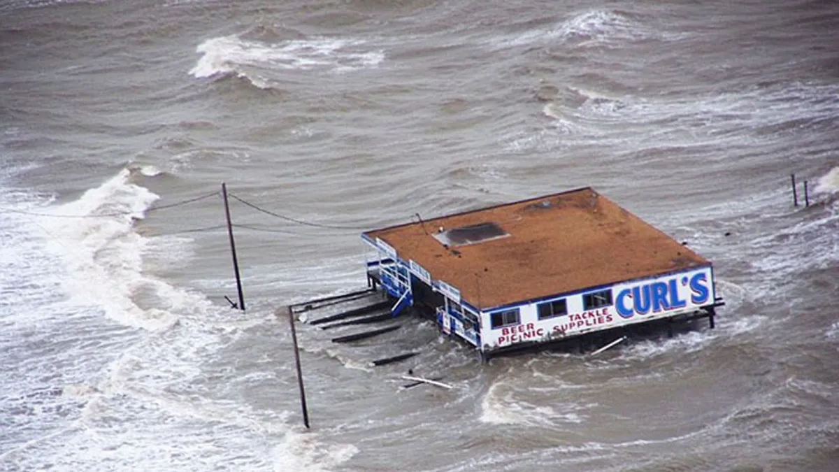
|
|
- Finishes Tomorrow -
|
- By Ian Martin Borde <readkrox51 at gmail.com>
- Date: Mon, 28 Feb 2022 16:12:41 -0400
|
Dear T&T and People of Paradise,
As usual, exercise Caution and don't be Complacent !!
By the way, we have all done Better than expected so far and lately.
The Borderline Weather is finishing tomorrow. But, Will be here Tomorrow.
Definitely Standing By 
|
|
- Caution in this Early Spring !!!! -
|
- By Ian Martin Borde <readkrox51 at gmail.com>
- Date: Mon, 21 Feb 2022 20:12:05 -0400
|
My Dear People of Paradise,
Like Britain, the former Mother Country, we in Trinidad and Tobago, are lifting restrictions, ... For Example; while Carnival 2022 will be held WITH RESTRICTIONS this year on next Monday and Tuesday. Children Must Attend School as usual ! (smle).
I am yet to learn the words to express how Joyous this has made me and 100's of people I am in contact with. If it can't get better. It did. 700,000 have the Full Vaccination Requirement.
The Weather is always reflective of the Mood of Things. It sets the Environment ! It is Truthful !
Here goes; There is an actual tropical ITCZ surge beginning to affect mostly the southern Eastern Caribbean!! It has successfully countered the SAL. That's how strong it is.
Because of the SAL it's too early to forecast it's definite 'hazardous' nature.
Like the spring sunshine before the tropical surge. It's ssooo easy to not remember the 3,500 COVID deaths.
GOD! Rest their Souls, ...


|
|
- Within 24 hrs.
|
- By Ian Martin Borde <readkrox51 at gmail.com>
- Date: Sat, 5 Feb 2022 11:26:42 -0400
|
T&T and The People of Paradise,
The ACTUAL ITCZ (its uttermost northerly reaches), is approaching with less than an inch and a half of rain, within 24 hours. No breeze to talk about (or unusual winter waves).
There seems to be a 30% chance the Body of the wave when it reaches 60 West. Will prolong the Precipitation. With the same chance of it being Hazardous at that time?
The 3rd. Point is that; Climate Change does not only mean GENERAL Global Warming. It means UNPREDICTABLE EXTREMES out of Season and Timing. What I'm trying to say that's obvious is. Stock-up ALWAYS on WATER. As in Nevis' Statistics, each year is warmer and dryer with prolific rain in between the ultra dry spells.
God Bless but do your part, ...

|
|
- All the BEST -
|
- By Ian Martin Borde <readkrox51 at gmail.com>
- Date: Fri, 24 Dec 2021 18:06:00 -0400
|
All the Best for The Season! 
|
|
- Eastern Caribbean <60% in 12hrs. -
|
- By Ian Martin Borde <readkrox51 at gmail.com>
- Date: Tue, 21 Dec 2021 13:00:46 -0400
|
An ITCZ-Wave in the Spirit of Climate Change. Not a Normal Christmas early morning, soft rain. Ran into Dry Air (SAL) 12 hours before Eastern Caribbean Affects. (Localised Affects), ... !!
It is only 60% Hazardous, (in my take), because, Besides SAL, It may last as much as two days, and Localised Areas could possibly get more than a borderline one inch (of rain).
More than SHARING, beaches have reopened (5:00 - 1200am.) (and we have a new acting Commissioner of Police)
People are 'Well-Behaved'. It took three surges to do this. (and an inordinate percentage of deaths)!!!
God, My Lord! Please Bless

|
|
- Respite coming Tomorrow TnT ? -
|
- By Ian Martin Borde <readkrox51 at gmail.com>
- Date: Tue, 14 Dec 2021 11:01:43 -0400
|
Season's Greetings, People of Paradise ,
Remember : "I know Nothing !"
There is a Strong chance of a RESPITE from the inclement Weather between, ... !:30 - 4:00 pm. tomorrow Wednesday. (taking it even further, ... ) Any localised flareups are paling out today.
Congratulations to The Population ! for Not Starting a 'freedom-frenzy' with the lifting of the State of Emergency.
More Come (Use it WISELY!) 


|
|
- Vigorous (>50%) ITCZ-Wave
|
- By Ian Martin Borde <readkrox51 at gmail.com>
- Date: Sat, 11 Dec 2021 11:20:10 -0400
|
|


|
|
- for Eastern Caribbean
|
- By Ian Martin Borde <readkrox51 at gmail.com>
- Date: Sat, 27 Nov 2021 14:40:00 -0400
|
People of Paradise, Season's Greetings !
There is a South American 'ITCZ-Trough' that is a recordbreaker, approaching, ... Ask San Fernando? They had the brunt of it today. It is not specially 'hazardous'. It is non-cyclonic. But, It is not Usual !
It is 'Climate Change'.
As proponents like Dr. Jeff Masters and countless others (some have died trying), have tried to do. We DESPERATELY NEED to reassess. The climate analysis of the 60's and 70's. For example: 'Wet Season', 'Dry Season' and 'Category 5 Hurricanes'.
A lot has Changed.

|
|
- for T&T: Localized heavy rain for 36 hours (from Now) -
|
- By Ian Martin Borde <readkrox51 at gmail.com>
- Date: Tue, 23 Nov 2021 16:38:00 -0400
|
People of Paradise,
Enjoy your Thanksgiving, ... , and Shopping Friday.
For T&T: a NON-CYCLONIC spinoff band in the South American ITCZ is beginning to Impact us.
Bordering on hazardous only in two or three localized spots.
Only because it's for tonight and tomorrow morning. (36hrs.)
We did Well this 'Hurricane Season'.
CONGRATULATIONS ! 
|
|
- Sinopharm is NECCESSARY for some, including me -
|
- By Ian Martin Borde <readkrox51 at gmail.com>
- Date: Sat, 20 Nov 2021 12:35:40 -0400
|
People of Paradise,
Got my 3rd. Dose of Immunization.
God's Blessings
Ps. My daughter was the deciding factor. 
|
|
- Lest We Forget -
|
- By Ian Martin Borde <readkrox51 at gmail.com>
- Date: Thu, 11 Nov 2021 17:30:15 -0400
|
|
Twice: "It all started with Poland".


|
|
- Trinidad and Northwards - Normal TW -
|
- By Ian Martin Borde <readkrox51 at gmail.com>
- Date: Wed, 20 Oct 2021 12:01:38 -0400
|
Hi Folks, All the Best !
In T&T, we have an average (my guess) of 7 deaths a day, from COVID. That clearly is too High! As one death is a death too much. So, ... ?????? Let's all be positive and talk about 'Safe Zones' & Safe-Haven Tourism, Co-morbidities and Variants, The CHILDREN and (exclusively Education), inclusively 'Trauma'. Then, The 'Economy', Digitalisation, Stimulii, Implementation and Controls, ... which means, The 'New' Normal, with The New Poverty, The New Economy (Tourism, (Food & Bevg's) and Services), and
The Laws for same, which means - - A WHOLE NEW PLANNING and DEVELOPMENT -
Then and only then, "Would 'Climate Change' get the Attention it deserves, ... "?
Weatherwise:
There is a 'TW' tonight and tomorrow moving fast. Normal Wind (12mph.) Waves Normal (less than 7'feet) Water (biggest factor) less than 2" per 14 hour period.
Somebody please recognise the trauma.
Ps. The Sunset attached picture is taken from our correspondent in 'Haiti'.
God Bless

|
|
- Following On, Update -
|
- By Ian Martin Borde <readkrox51 at gmail.com>
- Date: Tue, 12 Oct 2021 04:28:25 -0400
|
2021-10-12th Tue. Glencoe, T&T. WI.
Waves greater than four (04') feet Wind 12 - 18 mph. Water/Rain tomorrow night, Over 1.5" ins.
Semi-Stationary and Organizing, ... !!! but, Late Exit, Heading North-West Windshear.
Standing By 

|
|
- 93L at 4:30pm. Monday 11th October 2021
|
- By Ian Martin Borde <readkrox51 at gmail.com>
- Date: Mon, 11 Oct 2021 18:14:17 -0400
|
Standing by, REALLY Standing By !
For Now, Don't let the thunderstorms fool you. The Centre of Circulation is at approx. 58.5 W. and 14.5 N. Kinda East of Grenada and the Grenadines, ...
Impact starts tonight !! IT'S A CONSENSUS.
Standing By 
|
|
- (CCTW) Climate Change Tropical Wave -
|
- By Ian Martin Borde <readkrox51 at gmail.com>
- Date: Sat, 9 Oct 2021 08:17:07 -0400
|
There's so much one person can do!!!!!
There is a ITCZ Trough approaching and already here. (Ask Tobago)?
I don't know if it's deliberately downplayed as with all systems. But, I can do so much research and no more. In that light, I'm attaching yesterday's images (computer and internet problems), And today the problem is more accentuated, ... (Both the TW and Downplaying, ... )
My Take? While it is slightly more than 50% Hazardous.
Wind Shear, Dry Air and Late Exit, Make it just another climate change tropical wave with beneficial remedial precipitation.
(it's as if you're waiting for me to post???)
God Bless,


|
|
- (Caribbean) SOLIDARITY -
|
- By Ian Martin Borde <readkrox51 at gmail.com>
- Date: Sun, 3 Oct 2021 16:37:58 -0400
|
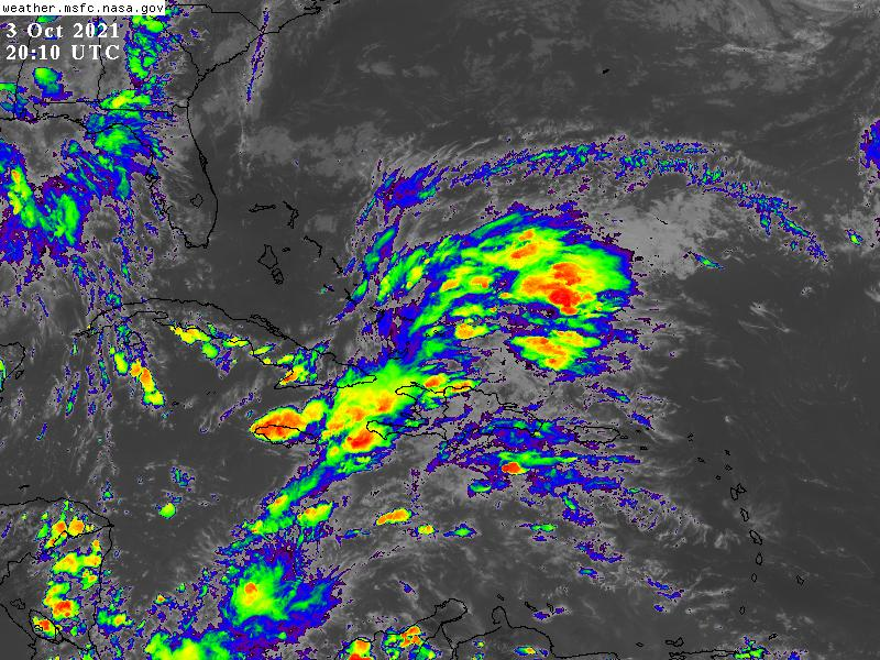
GOD Bless, Please |
|
- 'Night before , ... , the Day After' -
|
- By Ian Martin Borde <readkrox51 at gmail.com>
- Date: Thu, 30 Sep 2021 19:30:15 -0400
|
Most Certainly, we in T&T were aware, that a powerful Hurricane was passing, ....
Future, Weatherwise? Expect a climate change tropical wave in and during the next 4 - 7 days.
What i'm trying to say? "Anybody knows, you can give an 'All Clear' from NOW!"
Thank GOD 


|
|
- Marine Vessels Secure Yourselves from NOW !!!!! -
|
- By Ian Martin Borde <readkrox51 at gmail.com>
- Date: Fri, 24 Sep 2021 19:13:26 -0400
|
My Dearest People of Paradise,
How are you? I hope you are doing Fine !
'SAM' :-
Assumptions: (Working from the Bottom UP !); Historical Experience of Climate Change: - 'Water' has taken over from 'Wind' as 'The Fatal Factor'. - 'Sam' is approx. five (05) Degrees before 50W. (12.5 North). - 'Sam' is deemed to be a Major (Cat. 3 or 4) Hurricane. For clarification of the point of these Assumptions, Ask The entire Bahamas? Who experienced submergence, regardless of the 'eye' of the Storm.
In my calculated opinion, all maritime vessels and crafts need to secure themselves before midnight Sunday Morning, . . . !!! I have some more 'bottom-line' opinions, ... ... , for example, Emergency personnel and equipment need to be serviced and readied by Monday Morning 11:30am. BUT, LET THE AUTHORITIES GUIDE US, . . . .
Bynote: Stop trying to make or save money, during Disasters? YOU ARE NOT TRAINED FOR THIS.
For the last time, "It does not matter where the Eye of The Storm passes at closest point. This is Climate Change !"
Preparing with Faith in the Omnipotent
Ian (ex-RC 51)

|
|
- 30W. - 10.5N. -
|
- By Ian Martin Borde <readkrox51 at gmail.com>
- Date: Wed, 15 Sep 2021 19:54:14 -0400
|
I see an Unclosed, Centre of Circulation at approx 30West. Highly Protected by Moisture between it and SAL.
I wish and pray, Authorities Concerned will Subsidize Bona Fide Websites Proven to affect the difference in Climate Change between, Life and Death !!!!!
(In particular; Wind speeds, Wave Heights and Precipitation an Hour)?
I Pray 

|
|
- Better to be Proactive, than Reactive [Dave] -
|
- By Ian Martin Borde <readkrox51 at gmail.com>
- Date: Sun, 12 Sep 2021 12:03:00 -0400
|
Prepare, People of Paradise,
I'm catching myself So, the attached pics is All.
For Now !
Lord Have Mercy 
|
|
- Back-to-Back (Again), . . .
|
- By Ian Martin Borde <readkrox51 at gmail.com>
- Date: Wed, 8 Sep 2021 09:18:50 -0400
|
People of Paradise Here we go Again !
Please check approx. 40W. <12N. and 20W.
[Tentative Take: Ian M. Borde]
A little North of Dead Centre (EC).
Please Prepare and Don't Panic 
|
|
- a Folder called - 'Larry' Sept. 2021
|
- By Ian Martin Borde <readkrox51 at gmail.com>
- Date: Sun, 5 Sep 2021 15:59:54 -0400
|
Thanks, Thanks! Thanks ! Everyone, . . . !
I still am not ?objective? enough to Post. But, I'll try. It will be disjointed. Might just quit anytime and attach official pics.
Firstly and most Importantly; 1) The tragedy is not just Friday gone. It started week-before. 2) Eg. Do you remember the landslide that claimed a Life. GOD Rest HIs Soul ! Please GOD ! (His wife nearly died trying to save him.) Mercy, Lord! Mercy ! Can't be factual, but as a former first responder first-hand told me two more were missing. Factually: 3) Anaisa, GOD REST HER SOUL, wrapped in Mercy ! Body was found offshore the Trinidad Yacht Club (TYC). The TYC is at the bottom of my street. Anaisa (RiP.) both lived and was hiking (both places different) a little more than a mile from where I lived before. The face is Too Familiar for Objectivity, ... !
I Gone
Ps. 70% Wed./Thurs./Fri. had either no internet or current.


|
|
- Trinidad & Tobago -
|
- By Ian Martin Borde <readkrox51 at gmail.com>
- Date: Sat, 28 Aug 2021 14:28:55 -0400
|
TnT,
A trough in the ITCZ will continue to affect us tonight into tomorrow.
(In other words, landslides material tomorrow!)
God Bless |
|
- Meanwhile, ... , for the Eastern Caribbean, ... !!!
|
- By Ian Martin Borde <readkrox51 at gmail.com>
- Date: Fri, 27 Aug 2021 12:41:06 -0400
|
Attached are two images. Denoting some form of Hazard. From; Rough Seas when it misses us. To, Landfall and everything hazardous we are familiar with !!! However, The point of the Post is:
There are several more coming, ... !!!!
GOD Bless and Prepare 

|
|
- ALL Incoming and Outgoing Airlines Return -
|
- By Ian Martin Borde <readkrox51 at gmail.com>
- Date: Tue, 24 Aug 2021 20:48:56 -0400
|
|
|
|
- Caymans, Beware -
|
- By Ian Martin Borde <readkrox51 at gmail.com>
- Date: Wed, 18 Aug 2021 00:34:16 -0400
|
Something has to be said ? Which appropriately, Dave, Haiti and Jamaica are doing/starting.
For correspondents who are daunted about reporting, ... , ... , Don't Be ! It will take a whole interactive website for you to know my journey. (By the way), This time, I did not cry. I am busy. (Which Dominica alluded to.)
Okay! so what I got to say is Minor, ... , a kind of emergency procedure relief. That is, "It is human to salvage". Pick up the pieces. There are a lot of debris, fallen food, and God Rest Their Souls, 'Corpses' . It will take the professionals to do that !!! Among these professionals, spiritual elders, ... !
For us, the retired, the indirectly involved and assistants, as the islands most affected by Irma and Maria can teach us. It will be, "To burn them!" They are toxic, for a lot of reasons. Let the politicians and professionals control the aftermath.
At first, this post will seem bitter. But, on reflection it will provide professional insight and relief ! and, As we too focus on the dead and living Souls, "May their Souls find Eternal Rest and Peace in a Greater Paradise, ... , Amen!" 
|
|
- Je Regrette -
|
- By Ian Martin Borde <readkrox51 at gmail.com>
- Date: Mon, 16 Aug 2021 09:50:46 -0400
|
|

|
|
- Nous sommes Prets, Haiti !
|
- By Ian Martin Borde <readkrox51 at gmail.com>
- Date: Sat, 14 Aug 2021 15:46:58 -0400
|
Haiti: Qu'arrive-t-il ?
Grace's Landfall sees less than 25mph. winds. No precise Centre. (Almost) strong climate change tropical wave rain.
Nous sommes Prets. We are ready to Help. |
|
- Remain Calm AND Level-Headed
|
- By Ian Martin Borde <readkrox51 at gmail.com>
- Date: Fri, 13 Aug 2021 17:47:12 -0400
|
People of Paradise,
Excuse Me ! For, not posting about Hazardous Weather between the passages of 'Fred' & PTC#7. To be Honest, that was Deliberate.
Moving On: If anyone here asked me the 'one most singular thing' to Focus On, in terms of Pro-active Emergency Procedures !!!! It will be, "NHC estimated landfall time is 02:00 am. Sunday''. With it's attendant Waves, Winds and Precipitation Saturday Night, ... !!
Maximum Winds are 25mph. in the NNE Sector, Not 30 mph. Nowhere. Sadly however, (Worst-Case Scenario), The Centre of Circulation could become an 'Eye' tonight.
Pro-actively Prepare 


|
|
- Landfall -
|
- By Ian Martin Borde <readkrox51 at gmail.com>
- Date: Tue, 10 Aug 2021 01:56:15 -0400
|
Here we see Landfall with the Centre of Circulation at 01:45am. Brushing south Dominica with less than Storm Condition Winds but over 2" ins. Rain an Hour. 


|
|
- Next 3hrs. - Waterways Perilous
|
- By Ian Martin Borde <readkrox51 at gmail.com>
- Date: Tue, 10 Aug 2021 00:17:24 -0400
|
In order of 'Hazardous':- Dominica, Guadeloupe, Martinique, (Montserrat),
GO INDOORS !! EVACUATE 200 YARDS FROM WATERWAYS !!! CALL for HELP ! For at least the Next Three (03) Hours, ... If you haven't done so already?
Bynote; The Centre Closed off (without rainclouds to the south) between 10:30 -11:30pm. 50mls. - 75mls. East of north Martinique !!!! with Top Consistent Winds just over 20mph.
I'm fully awake now!
Thanks, Dave 

|
|
- Update
|
- By Ian Martin Borde <readkrox51 at gmail.com>
- Date: Mon, 9 Aug 2021 21:38:04 -0400
|
The Centre is less than 125 miles from Martinique. BUT, The Centre is NOT CLOSED !!!!
Dominica is getting 25 mph winds and over one inch an hour. |
|
- "I don't know. What to say!!!!" -
|
- By Ian Martin Borde <readkrox51 at gmail.com>
- Date: Mon, 9 Aug 2021 18:25:20 -0400
|
I don't know. What to say!!!!
Maybe,
"Rapid Intensification!!!!"
I will try to be up all night !!!!!
Thank God! The Diameter is Small !!!!
Get ready to go indoors. Move away from Waterways. |
|
- EXAMPLES of EMERGENCY Rational Planning -
|
- By Ian Martin Borde <readkrox51 at gmail.com>
- Date: Sun, 8 Aug 2021 11:02:57 -0400
|
Hi, People of Paradise!
Here is how a cash-starved but rational planner plans when Normalcy Flows, ... (There are things more important. Which I wrote about before.) " I Respect all Religious Practises ", . . .
- Water
- Medicines - Water - Waterproofing Documents and Identifications (Remember old filing-cabinets?) - Yeast - Is better than baking powder (Respecting emergencies and religion) - Chlorine - to go with WATER - Generator - Some Islands need a Licence/Candles and Kerosene (last resort) - Water and some Rubbing 'Spirits'
God Bless


|
|
- Back-to-Back Realities, from 45W.
|
- By Ian Martin Borde <readkrox51 at gmail.com>
- Date: Sat, 7 Aug 2021 14:28:29 -0400
|
This is the latest Graphics to Help.
Except for the Saharan Air Layer. They are easy to underestimate.
Prepare
God Bless 

|
|
- Southerly Islands (EC) - from (tomorrow?)
|
- By Ian Martin Borde <readkrox51 at gmail.com>
- Date: Thu, 5 Aug 2021 11:59:41 -0400
|
Hi, People of Paradise !
You can imagine, How busy I am?
The 1st. TW approaching with a Centre of Circulation (and nothing else to Identify it!) Is developing a feeder-band (tail). Due to less SAL which it is doing on its own. At a quasi-stationery 40W.
That's my take. But if you read between the lines, That is ITCZ exiting, ... !
Not today, but most likely tomorrow, the Emerging tail will affect southerly islands, with localised heavy but short rain.
As I said that's my take during preparations time.
God Bless |
|
- 40W. (and 25W.) -
|
- By Ian Martin Borde <readkrox51 at gmail.com>
- Date: Wed, 4 Aug 2021 18:54:07 -0400
|
Good Night, Good Day, People of Paradise,
There are two (02) African/Atlantic Tropical Waves. With both a Centre of Circulaion, moving into less and less SAL.
The one at 40W. is southerly and dead centre.
The one at 25W. is too early to call but more northerly.
Qu. Can we prepare without panic, surprise and drama? Ans. The answer is, "Yes!".
Prepare, because this is just the beginning, . . . !
|
|
- Centre of Circulation - Clear and Present -
|
- By Ian Martin Borde <readkrox51 at gmail.com>
- Date: Mon, 26 Jul 2021 20:13:04 -0400
|
My Apologies Haiti ! But, I myself am daunted about 'reporting'. As what was free, clinical, life-saving data is now a rare and costly occurrence. Secondly the youths are not taking up the baton. The truth is twisted to make money.
Weatherwise:
The graphic speaks for itself with a visible centre of circulation. Thank GOD! The winds are less than 25 mph.
Dieu vous Benisse 
|
|
- TW in 36 hrs. -
|
- By Ian Martin Borde <readkrox51 at gmail.com>
- Date: Thu, 22 Jul 2021 00:53:20 -0400
|
Dominica and Barbados, all People of Paradise,
A Tropical Wave is at 55W approaching in 36 hours.
Winds are 15 - 20 mph. Waves are going to be greater than three (03') feet. Precipitation is hard to predict at this time but more than one inch in Barbados.
The Windshear is to the West of the Eastern Caribbean. It's difficult to get a current SAL Map.
Noteworthy:
There was a 7.0 earthquake south of Panama with Moderate Damage!!
Standing By 

|
|
- No Complacency, without Drama, Please ?
|
- By Ian Martin Borde <readkrox51 at gmail.com>
- Date: Tue, 13 Jul 2021 12:20:04 -0400
|
People of Paradise,
This Webpage is Free! By any Definition, ... ! With Freedom. Comes Responsibility. In this Case, over (life & death) Emergencies, ... Taking action on just One view on a Low Pressure System, is as silly, as it sounds. Or, Leaving everything upon the Gov't and Authorities.
Otherwise: Weatherwise;
There are two Tropical Waves (TWs) approaching at just after 30W and 40W respectively, ... !! Battling SAL and losing ! They are also two low in Latitude to be Perilous. The Bad News: Any TW in Climate Change has 'Erika' Potential.
God Bless 
|
|
- Hue & Cry -
|
- By Ian Martin Borde <readkrox51 at gmail.com>
- Date: Sun, 11 Jul 2021 19:32:12 -0400
|
Beloved People of Paradise,
I am solely posting a PHOTO.
(Only because Trinidad (and Tobago) is the day-before weather for other territories). Recall: A key point in an emergency is "Don't Panic!"
The photo can be comic or serious. It can be mildly informative or precautionary.
Here goes, . . .
God! Please Bless 
|
|
- Caution, Tobago !!
|
- By Ian Martin Borde <readkrox51 at gmail.com>
- Date: Tue, 6 Jul 2021 14:31:56 -0400
|
Tobago,
Exert Vigilance. As a typical Climate Change Tropical Wave that is leaving part of south Trinidad and the entire North West is heading a little more vigorously in your direction, ... !!
We had 3.42 ins of rain.
God Bless 
|
|
- Apparent feeder band from Elsa!
|
- By Storm Carib <stormcarib>
- Date: Fri, 2 Jul 2021 18:06:12 -0700
|
Loud thunder overhead with sporadic rainfall and stiff breeze at times.Temp falling.This report from Palmiste, San Fernando.
Dr Adesh Nanan |
|
- Pray for St. Vincent -
|
- By Ian Martin Borde <readkrox51 at gmail.com>
- Date: Fri, 2 Jul 2021 12:46:23 -0400
|
The Centre of Circulation passed over the Middle of St. Vincent between 10:30 - 11:15 am. Pray !
Historically: 'Elsa' Will strengthen on Exit. (Before any graveyard). So? MAINTAIN INDOOR POSTURE !!!!
Emergencies and Emergency Personnel in BARBADOS ONLY ! Should be Possible. But More in Three (03 - 04) hours time.
Pray for St. Vincent, the Grenadines and St. Lucia 
|
|
- Update from Trinidad
|
- By Stephen Abouhamad <stephen_abouhamad at hotmail.com>
- Date: Fri, 2 Jul 2021 15:12:26 +0000
|
|
7/2/2021
Trinidad
Good morning folks.
I trust that everything is ok with Barbados and St Vincent. Hope that no damage has been done through the passing of hurricane Elsa. Lots of rain Trinidad which began during the night and lasted throughout the morning. Reports of flooding in the southern part
of the island. No wind is present at this time.
Best Regards,
Michael Abouhamad
|
|
|
- Barbados - Stay Indoors
|
- By Ian Martin Borde <readkrox51 at gmail.com>
- Date: Fri, 2 Jul 2021 04:21:08 -0400
|
Good Night, People of Paradise, Stay Calm ! ASK FOR HELP !!!
The attached Image is with Winds 30 mph. (+) plus Winds ONLY !!! Barbados stay Indoors - Impact started. But NOT A DIRECT HIT.
The Grenadines, St. Vincent, in 02 hrs. - 04 1/2 hrs. - a Direct Hit - St. Lucia, in 02 hrs. - 30mph(+) Winds - From Martinique to Trinidad, - move 200 yards away from ANY Waterway !!! - ByNote: Tobago and Toco, ALREADY in the Tailend/Feeder Band !
Look at the Map !!
G O D! Please Bless 
|
|
- (Sigh) - Here's to an Overactive 2021
|
- By Ian Martin Borde <readkrox51 at gmail.com>
- Date: Thu, 1 Jul 2021 14:33:07 -0400
|
"Would someone please let the pressure out of the 'Steamer'?" Hello, July 2021 Hello, People of Paradise!
Before I wrote this Post. I was Reading. I was Reading and Researching, capturing images and reading some more, ... (Started off with Dr. Jeff Masters, by the way!)
Before I was 'Reading', I was 'thinking and praying'. Enhanced by the river in front of me in the gallery. Giving it an aspect of 'Unitarian Meditation'?
Anyway, I was more than thinking. I was saying to myself. "If just south of Barbados is The 1st. Impact Point. Then why is there no talk of Grenada and Tobago getting 20mph (+) plus winds?" Which science leads me to say. That winds will play an equal part to water in this one.
Even though it's 50 West and Designated My take is: LET'S WAIT on The HURRICANE HUNTERS, ... ?
That way, "We'll be waiting for an Update!!! Not a downscale".
God Bless 

|
|
- Ask for Help and OBEY the Authorities -
|
- By Ian Martin Borde <readkrox51 at gmail.com>
- Date: Tue, 22 Jun 2021 12:54:44 -0400
|
It's 12:45pm. and, I'm Now Doing Morning Chores and Prayers.
So! I'll be Short, ... , and standing by !!!!
There is a ?TW? approaching and to some have reached! It is VERY Difficult to Analyse. I have Nothing to Add.
Obey the Authorities !
Don't Criticize or Complain. C O M P L Y !
If you want 'My Take'? They have it Right, . . . .
Obey the Authorities, . . . .
and "Yes!" Dominica: These simple Tropical Waves have 'Erika' potential, . . .
Standing By GOD Bless |
|
- 40 West & African TW's
|
- By Ian Martin Borde <readkrox51 at gmail.com>
- Date: Fri, 11 Jun 2021 11:35:37 -0400
|
Good Day, Good Everything, People of Paradise
The 1st. (of Significance) Tropical Wave coming from Africa is medium-large BUT embedded in the ITCZ with Nascent Circulation.
My Take: Good News first,I don't see it exiting the ITCZ before 50 West. Bad News! Because of its size, When it reaches it will be more than 50% Hazardous.
Trinidad had I believe 3 instances of minor floods already.
BIG Public Shoutout to Isabel. I don't know 'bout you? But Isabel keeps me Sane and even Calm during Emergencies.
GOD Bless Isabel and all Correspondents, ...
Peace |
|
- When the Dust Clears, . . . !
|
- By Ian Martin Borde <readkrox51 at gmail.com>
- Date: Tue, 4 May 2021 23:05:26 -0400
|
Happy May Flowers, People of Paradise !
While surrounded by more than a Hint of Wet Season. Let's remember today as 26 days (less than 4 weeks) before the Official Start of The Storm / Hurricane Season.
There are ssooo many topics to talk about, . . . . I had to come out from; Resting, Hibernation/Self Isolation, Scientific and Rescue Sabbatical.
Since 2010 and the Haitian Earthquake and Tsunamis WE HAVE COME A LONG WAY !
Ok, Then ! There's, ... , COVID, There's, ... , Vaccinations, There's, ... , Safe Haven Tourism.
There's Earthquakes, Volcanos, Evacuations, Emigrations. There's Smoke, Dust, Ash, Lava, Old Craters and New Vents, There's Poisonous Gases, Liquids and Materials. Water Scarcity. There's Communications, Security, Solidarity, Relief and Rescue.
To stop! (Distressing, what is Stressful!!!!!) There's more than one inch of rain, floods, rough seas, rip tides
Thank GOD, nobody reported HIGH WIND, . . . ?
PS. Volcanic Ash is the Best-Known Fertilizer, ....
May God show us the Good in this.


|
|
