|
|
- - - 2019 Hurricane Season - - -
|
- TONIGHT MIDNIGHT END OF 2019 HURRICANE SEASON
|
- By Martha Watkins Gilkes <marthawatkinsgilkes at gmail.com>
- Date: Sat, 30 Nov 2019 20:37:06 -0400
|
| FOR MY WEATHER WATCHING friends ... tonight at MIDNIGHT our 2019 HURRICANE OFFICIALLy ends and we are breathing a BIG SIGH OF RELIEF. This has been a bad season as is so well summarized in this review by Mr. Dale Destin....with great respect. Each season it is a more anxious time for those of us "in harms way" with the changing weather patterns. My thoughts continue to go out to those in Bahamas who struggle to rebuild their lives and some never will. The aftermath of a hurricane is a hard time. For me the 1995 LUIS devastated our life and we were without electricity for FOUR ( YES 4) months after. But we rose again ! Hurricanes are a way of life it seems. So i wanted to share this review. Meanwhile we focus on the HOLIDAY SEASON and I wish a Happy Holiday time to all.
|
|
|
- Frightening super storm in the pacific
|
- By Martha Watkins Gilkes <marthawatkinsgilkes at gmail.com>
- Date: Mon, 7 Oct 2019 18:23:15 -0400
|
|
|
|
- ANTIGUA weather last few days
|
- By Martha Watkins Gilkes <marthawatkinsgilkes at gmail.com>
- Date: Wed, 25 Sep 2019 07:29:45 -0400
|
Download Attachment Available until Oct 25, 2019
Martha Watkins Gilkes P.O. Box W1924 Antigua, West Indies 268 460 4423 Cell 2687647722 Sent from my fab iPhone Marthawatkinsgilkes at gmail.com
|
|
|
- Tropical Storm Karen
|
- By Martha Watkins Gilkes <marthawatkinsgilkes at gmail.com>
- Date: Wed, 25 Sep 2019 05:53:14 -0400
|
We have had an unexpected rough 2 days weather wise.     At least on the
Atlantic side high on the hill (210 feet) above half moon bay.   We did not
expect this “lashing” from Tropical Storm Karen but we sure got it.    My phone
and internet still out and. Electricity been off and on for who knows when
And a few big tree branches been broken!    Not complaining looking at hard hit
 Bahamas   But we are having some challenges too.

Martha Watkins Gilkes
|
|
- Six named storms
|
- By Martha Watkins Gilkes <marthawatkinsgilkes at gmail.com>
- Date: Thu, 19 Sep 2019 20:54:23 -0400
|
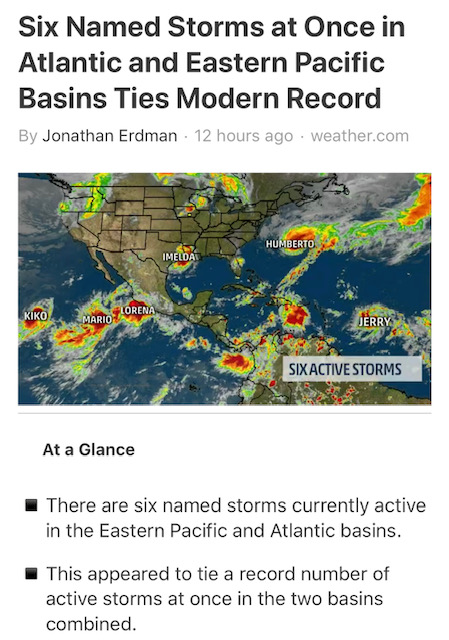
Evidence of the terrible damage done to our environment... and the price we are
paying..   what makes my  blood boil is the fact that  the big  "industrial"
countries are the ones who have  caused the problem.. with the damage to the
ozone layer and with pollution  ..   we "small island states"  are   "fisher
folks, agricultural / farmers and  cause little harm in  comparison and yet  WE
ARE  THE ONES PAYING THE  BIG PRICE due to our location  in  "hurricane ally"
where these monster  storms come across and form and destroy our way of life  (
which is  a simple easy going  lovely way of living with  nature and our
surrounds)   THE BIG COUNTRIES dont  pay nearly the price  we do  living on an
isolated island where  there is not help when we are  "blown apart"   case in
point..  Beautiful little  Barbuda with HURRICANE IRMA and then HURRICANE MARIA
with "THE NATURE ISLAND  DOMINICA  2 years ago.. and now the  magnificent
BAHAMAS  just now..  sooo  terribly destroyed!  Because of what  "they "  have
and  are  doing.  IT MUST BE STOPPED.. People have to change their way of
living to protect "Mother earth"  before it is too late.
Martha Watkins Gilkes
|
|
- Antigua storm update
|
- By Martha Watkins Gilkes <marthawatkinsgilkes at gmail.com>
- Date: Thu, 19 Sep 2019 09:29:27 -0400
|
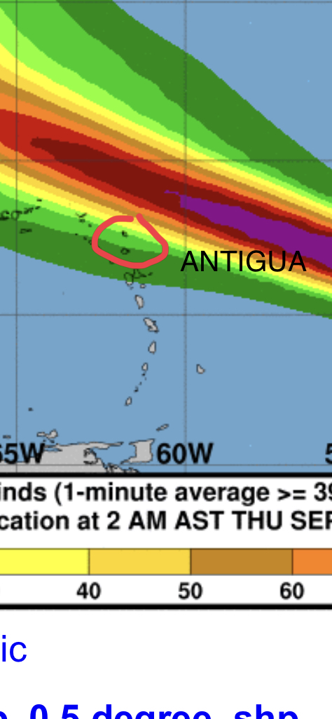
This morning good news with a more north turn of The Storm!  ANTIGUA In more of
the green which is good news
Still watching just in case a turn south.
We are very thankful.
Martha Watkins Gilkes
P.O. Box W1924
Antigua, West Indies
268 460 4423
Cell 2687647722
Sent from my  fab iPhone
Marthawatkinsgilkes at gmail.com
|
|
- Antigua now
|
- By Martha Watkins Gilkes <marthawatkinsgilkes at gmail.com>
- Date: Wed, 18 Sep 2019 20:39:39 -0400
|
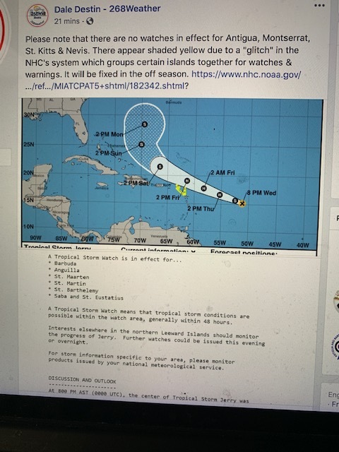
Just posted by Dale Westin. Looking better for Antigua as no watch had been put
out for us.   Thinking of those in harms way.
Martha Watkins Gilkes
|
|
- Tropical Storm Jerry
|
- By Martha Watkins Gilkes <marthawatkinsgilkes at gmail.com>
- Date: Wed, 18 Sep 2019 14:54:01 -0400
|
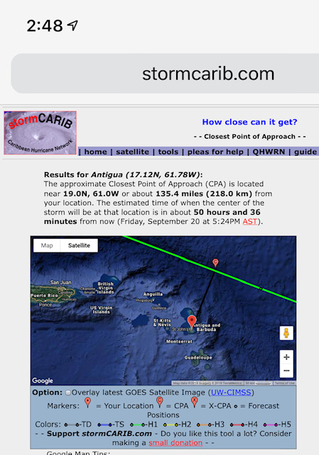
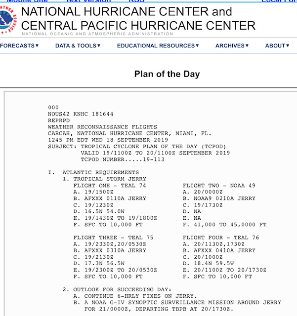
The system is showing slight  south move closer to ANTIGUA . Fear for our
Sister isle BARBUDA  as it will be nearer there.

 The Hurricane Hunters will fly the storm at 1500 zuloo. (11 am) tomorrow
Thursday and this will give us much better info than only satellite data.
Standing by for how this plays out.
Martha Watkins Gilkes
|
|
- Development in Strength
|
- By Martha Watkins Gilkes <marthawatkinsgilkes at gmail.com>
- Date: Wed, 18 Sep 2019 06:38:30 -0400
|
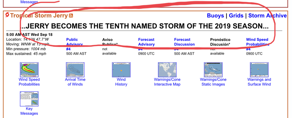
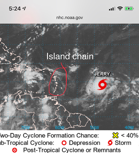
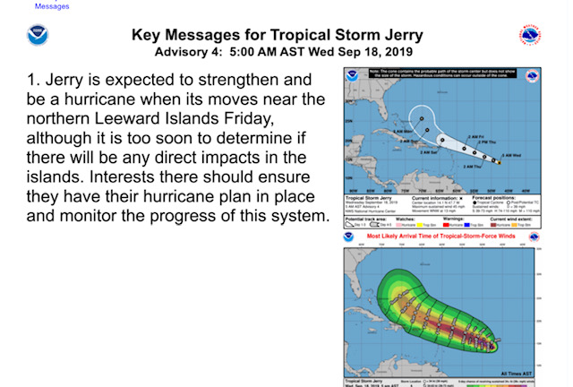
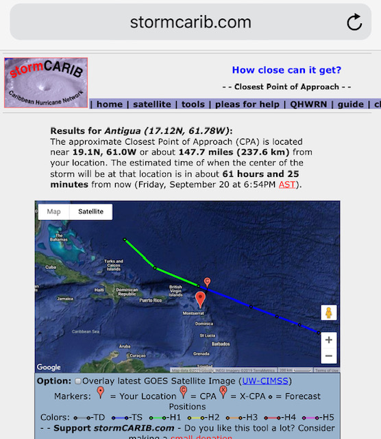
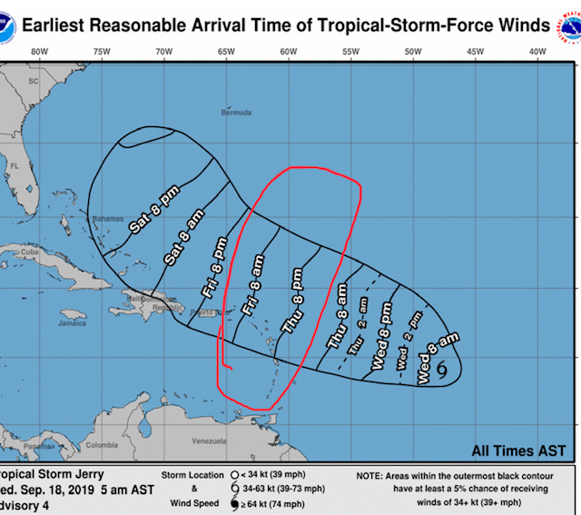
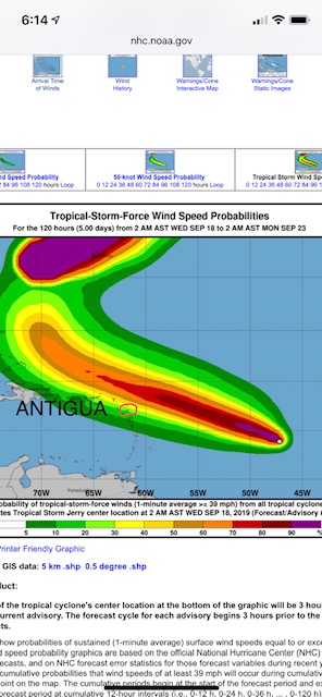
Early morning on Wednesday.   It is now TS Jerry.  To strengthen to a hurricane
most likely.     Due east of the islands 🌴 with expected effects between
Thursday night and Friday as shown below. Right now tracking north of us but
over the next day this could change.   The bottom photo shows Antigua just on
the edge of the worst weather  so we have to careful monitor this !   Hopefully
the future track takes it out to sea with no harm to other islands 🌴
Martha Watkins Gilkes
|
|
- HURRICANE to come
|
- By Martha Watkins Gilkes <marthawatkinsgilkes at gmail.com>
- Date: Tue, 17 Sep 2019 21:26:45 -0400
|
TROPICAL DEPRESSION 10 has formed and will most likely become a hurricane before it reaches the Northern leeward islands. We have been looking at a more northern turn but it now looks like it will come very close to the islands so we will all need to be ready to take quick action in our hurricane shutters and securing things. Antigua Is the tiny red dot within the cone below … located just north of Guadeloupe ( the “butterfly shaped island) Some models are still showing a north turn but as we know with weather it is not predictable. THE www.stormcarib.com site puts it about 129 miles from Antigua. But any shift south could put it right over us. We will know more in 24 hours but in the meantime best to be as prepared as possible. We will all be closely watching this one! and with the hope it certainly does not develop into a strong hurricane and head the way of the Bahamas… they need to be spared for sure! Stay tuned folks as we “island people” get ready!
|
|
|
- Weather watching this week
|
- By Martha Watkins Gilkes <marthawatkinsgilkes at gmail.com>
- Date: Tue, 17 Sep 2019 06:40:14 -0400
|
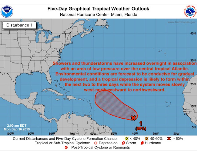
System 97 L has developed and should be passing just north of the islands 🌴 on
the weekend but we need to watch closely in case of any change.
There are 3 more weather systems off the African coast behind this one.  That
time of the year !!
Martha Watkins Gilkes
|
|
- Update
|
- By John Fuller <fullaw at candw.ag>
- Date: Mon, 9 Sep 2019 17:11:41 -0400
|

Sent from my iPhone
|
|
- Update
|
- By John Fuller <fullaw at candw.ag>
- Date: Mon, 9 Sep 2019 17:18:26 -0400
|
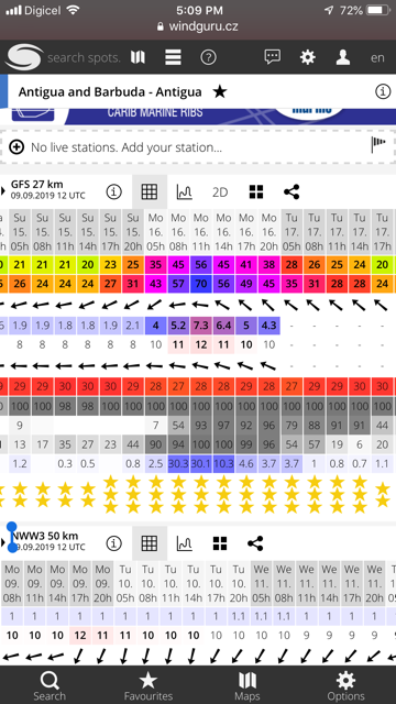
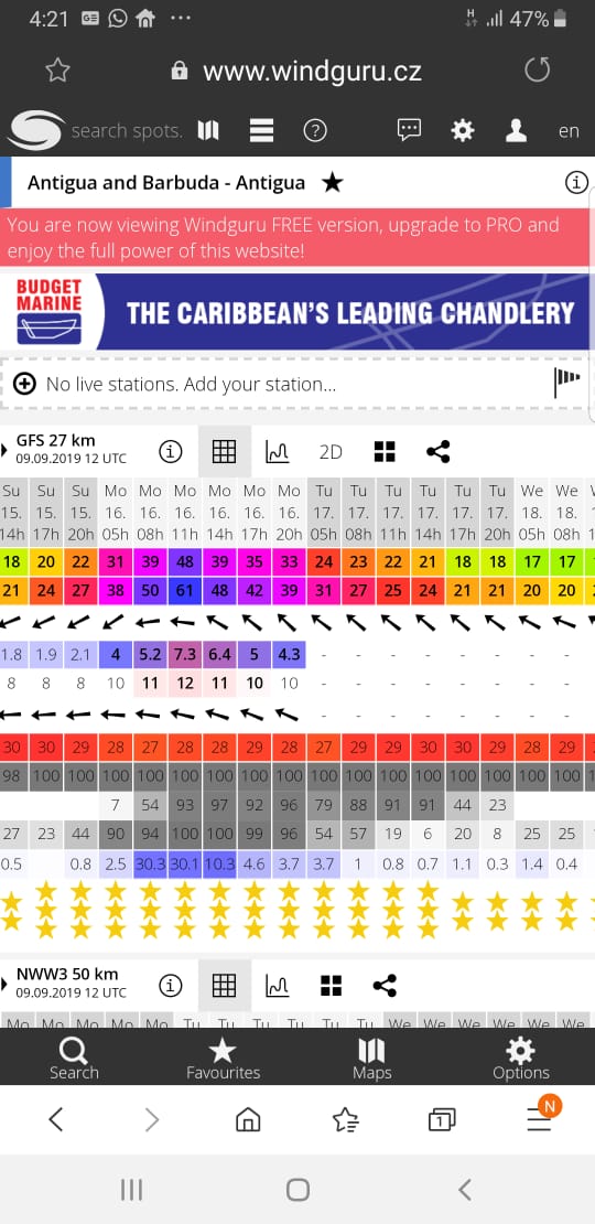
Sent from my iPhone
|
|
- Stormy night.
|
- By Martha Watkins Gilkes <marthawatkinsgilkes at gmail.com>
- Date: Sun, 8 Sep 2019 20:44:45 -0400
|
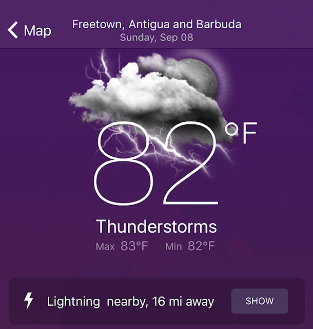
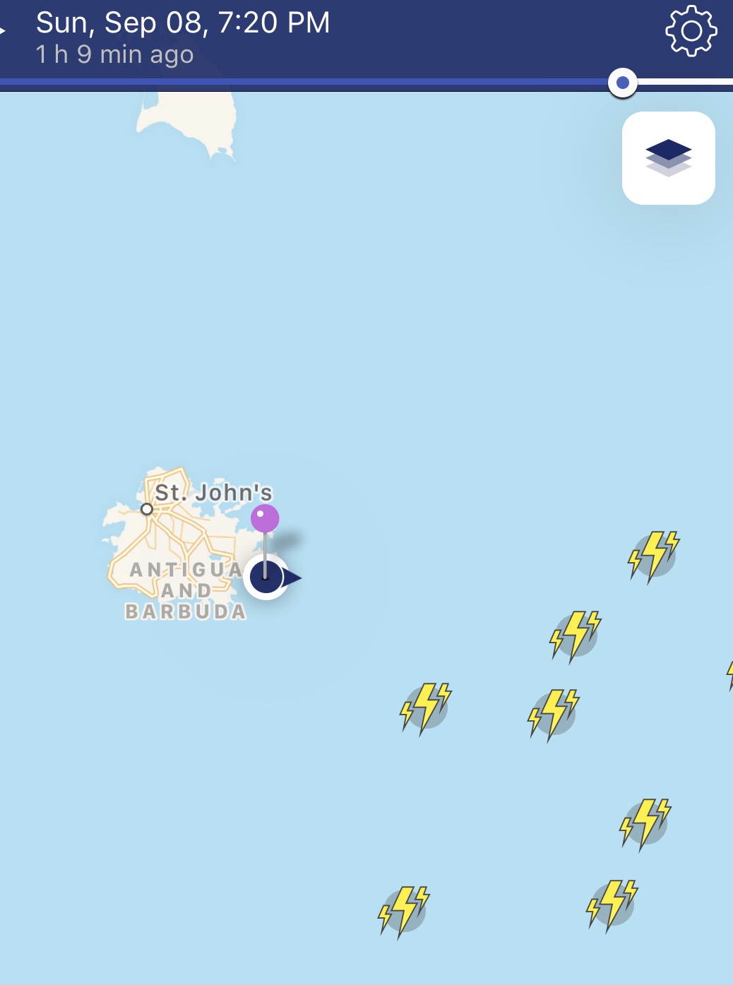
Lots of lightning around tonight.    My NOAA site shows 16 miles away.   Seems
much closer.    Nature !
Martha Watkins Gilkes
P.O. Box W1924
Antigua, West Indies
268 460 4423
Cell 2687647722
Sent from my  fab iPhone
Marthawatkinsgilkes at gmail.com
|
|
- Weather Watching invest 94
|
- By Martha Watkins Gilkes <marthawatkinsgilkes at gmail.com>
- Date: Sun, 8 Sep 2019 08:29:25 -0400
|
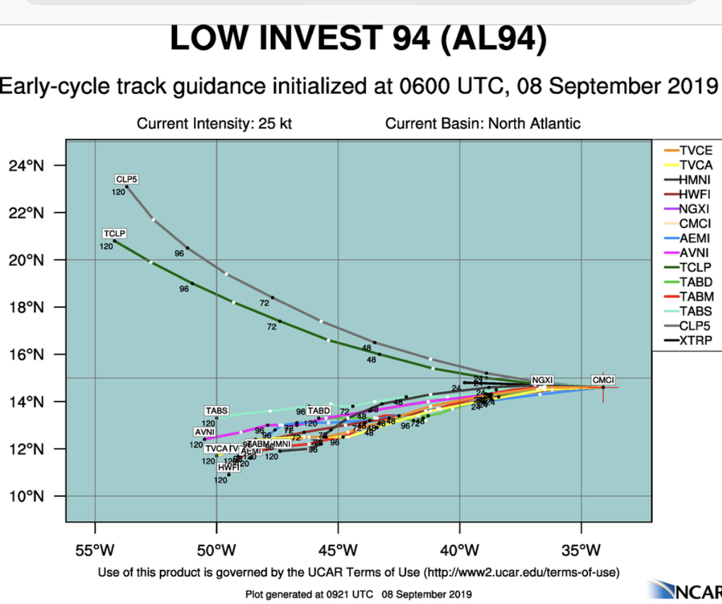
Eyes to the east with this system... All models but 2 (CLPS & TCLP) track the
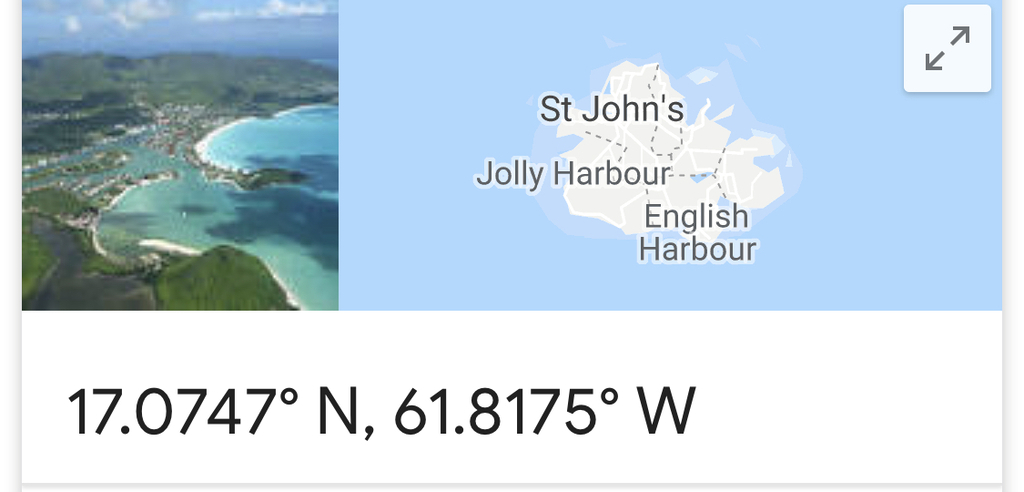
system to the South of ANTIGUA.  Around 12 to 14 N and ANTIGUA is 17.1 N.  But
it is early days so we will keep alert as we are in prime time for hurricanes.
 Today in Antigua there is not a breath of air!   It is going to be a 🥵 hot hot
one !
Martha Watkins Gilkes
|
|
- HURRICANE DORIAN
|
- By Martha Watkins Gilkes <marthawatkinsgilkes at gmail.com>
- Date: Tue, 3 Sep 2019 16:12:52 -0400
|
It has been a HARD WATCH to witness this devastating hurricane lashing the poor Bahamas. HEARTBREAKING.. I personally have a number of friends there and have been so concerned for them. We here in Antigua have faced similar devastation when our “little sister island” Barbuda was so destroyed in Hurricane Irma 2 seasons ago…... and in 1995 with Hurricane Luis hit, although not to this magnitude. OUR HEARTS GO OUT TO Those in the Bahamas and I hope many countries come together to help in the recovery. Meanwhile we are still watching as Dorian moves right now towards the US east coast hoping there will not be major destruction.
We are in the HEIGHT of Hurricane season with September being the most active month. There are a number of active areas out there but the area that we in the Leewards are keeping an eye on is mentioned by Dave on STORM CARIB that will probably be 94L. We watch and advance preparation is the key as we all know. Be prepared people… “The Boy scout motto”! ( not too early to check your own home/ yard for any objects that could fly… for your hurricane shutters being ready.. for food and water supply …
FROM DAVE : "The interesting one is behind 91L ready for splashdown off the African coast. An area of interest, soon to be probably designated 94L, this wave could be a business shaker down the road. Way too early to tell at this time." |
|
|
- Weather watching.
|
- By Martha Watkins Gilkes <marthawatkinsgilkes at gmail.com>
- Date: Sun, 1 Sep 2019 12:31:54 -0400
|
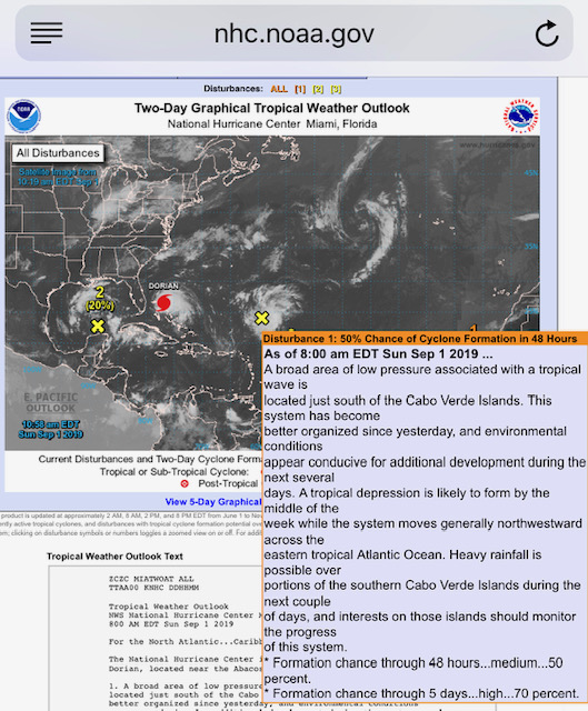
We are all absorbed with this monster Dorian.   But we need to keep eyes to the
east as a system is just off Africa with a 50% chance to develop   Could be
with us in 8 to 10 days.      Thinking of all In The path of hurricane Dorian.
|
|
- Tropical Storm Dorian
|
- By Martha Watkins Gilkes <marthawatkinsgilkes at gmail.com>
- Date: Mon, 26 Aug 2019 13:59:31 -0400
|
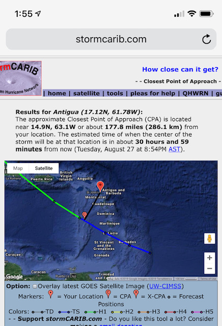
We are breathing a big sigh of relief as it seems the Storm Dorian which could
become a hurricane today is tracking south and will not effect ANTIGUA!   We
have certainly had our share of big blows so thankful this go round.   But we
have September to go — the worst month for hurricanes.  So still.  Eyes to the
east !  Thinking of those facing the bad weather!
Martha Watkins Gilkes
P.O. Box W1924
Antigua, West Indies
268 460 4423
Cell 2687647722
Sent from my  fab iPhone
Marthawatkinsgilkes at gmail.com
|
|
- Watching Tropical storm Dorian
|
- By Martha Watkins Gilkes <marthawatkinsgilkes at gmail.com>
- Date: Sat, 24 Aug 2019 19:43:03 -0400
|
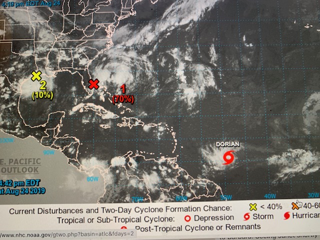
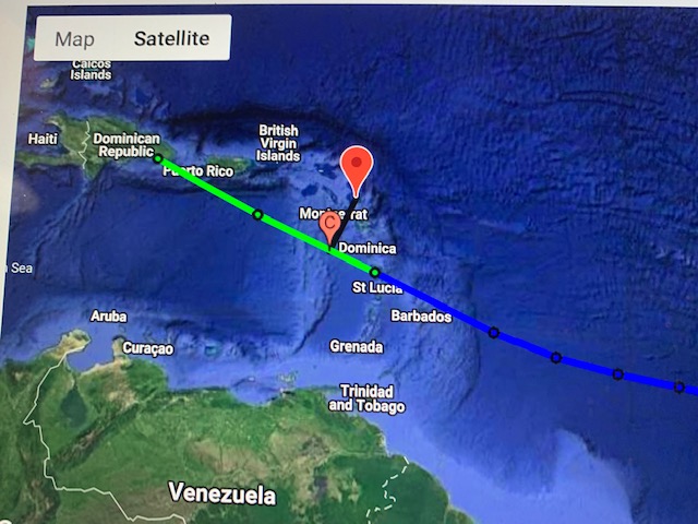
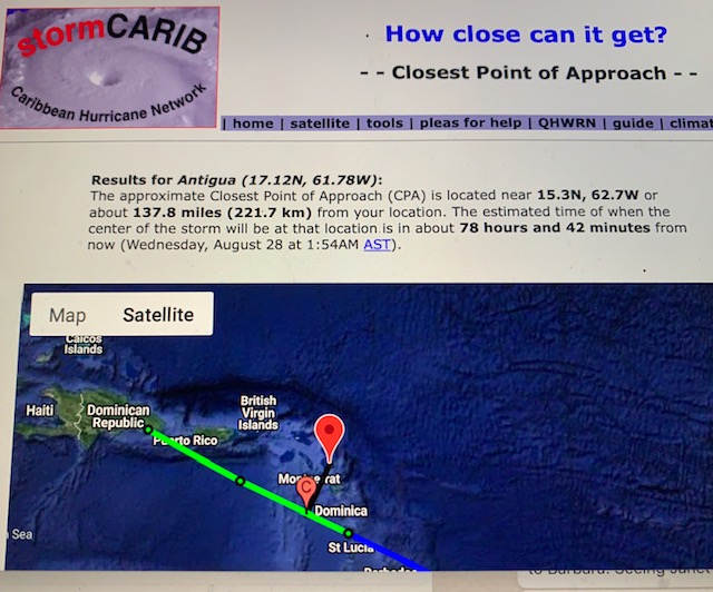
Watching this.        Closest point right. Now.
137? Miles
 This is fluid.

Be  ready. People
H
Martha Watkins Gilkes
|
|
- Invest 99L
|
- By Daniella Seepaul <daniellaseepaul at gmail.com>
- Date: Fri, 23 Aug 2019 10:29:18 -0400
|
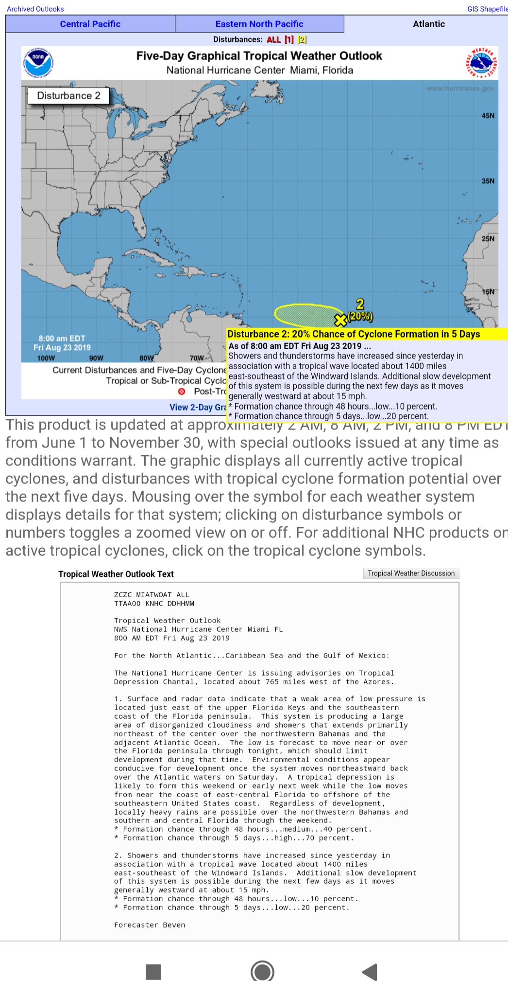
Hi Fellow Islanders, Seems we have an Invest to keep an eye on. 99L?
Be vigilant! Be prepared!
Regards, Daniella Seepaul
|
|
- CARIBBEAN storms
|
- By Martha Watkins Gilkes <marthawatkinsgilkes at gmail.com>
- Date: Sun, 4 Aug 2019 07:15:32 -0400
|
From today’s view things look good that we will not get bad weather or a
tropical storm ⛈ over the next days.  The system we have been watching seems to
be breaking up and if any thing will just bring more rain over the next days.
But as Dave on Stormcarib.com has said

“Will it be a quiet season this year or will the season suddenly explode with
activity and possible calamity? It will be interesting and problematic at the
same time. Interesting to see how it all pans out. Problematic if just one
storm is the calamity. After all, it does, only take one.

Be safe. Be prepared.”

   (I am still remembering Hurricane Irma that destroyed BARBUDA and was
heading direct to us with that last minute north turn 😱)

Have a good Sunday ☀️

Mine just got better reading the lastest weather updates here 🙏
|
|
- Still weather watching ! COULD BE TROPICAL STORM CHANTAL
|
- By Martha Watkins Gilkes <marthawatkinsgilkes at gmail.com>
- Date: Sat, 3 Aug 2019 07:59:29 -0400
|
IT IS NOT A CLOSED BOOK.. and this Weather watching thing is NOT FOR THE FAINT OF HEART or sissies ! This system could STILL develop at least into a TROPICAL STORM ( which can do plenty of damage too.. of course NOT A HURRICANE - hopefully.. but i dont take anything for granted after IRMA 2 years ago …. SO we need to keep eyes peeled… this would be near us early next week. BE SURE to note DAVEs comments on the main STORM CARIB PAGE ( as posted blow ) 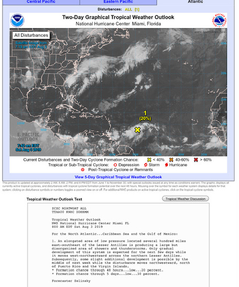 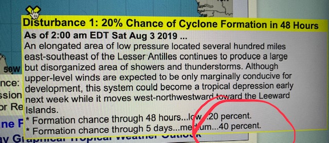 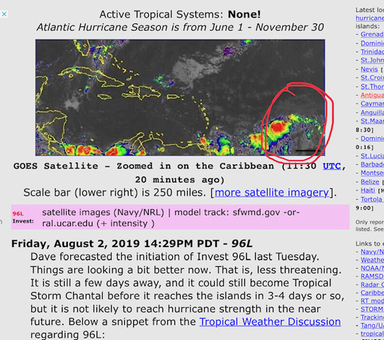 Martha Watkins Gilkes |
|
|
- Weather watching
|
- By Martha Watkins Gilkes <marthawatkinsgilkes at gmail.com>
- Date: Fri, 2 Aug 2019 12:42:07 -0400
|
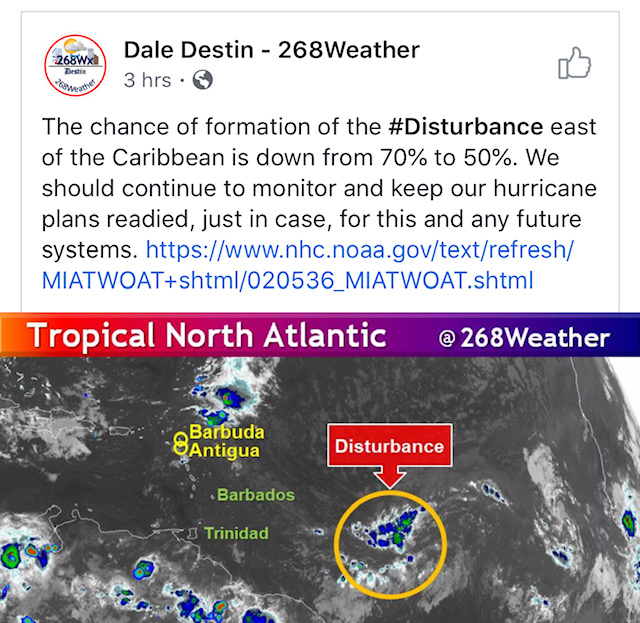
From our Met Office.  Seems  96L may not develop which is good news.   still
watching however.   This is a good “get ready” call
|
|
- Watching
|
- By Martha Watkins Gilkes <marthawatkinsgilkes at gmail.com>
- Date: Thu, 1 Aug 2019 05:37:21 -0400
|
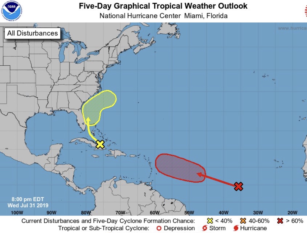
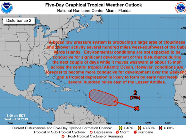
Now classified as invest 96L

If it comes Over the weekend or early next week    We are watching.  Get ready
people.
|
|
- We are watching
|
- By Martha Watkins Gilkes <marthawatkinsgilkes at gmail.com>
- Date: Wed, 31 Jul 2019 20:40:45 -0400
|
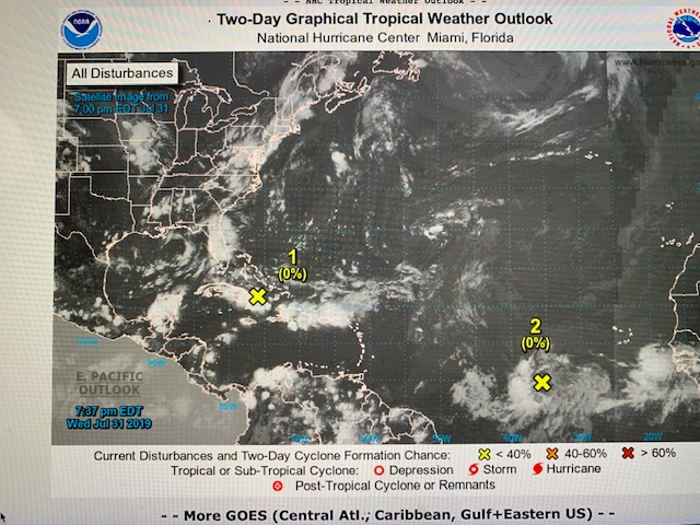
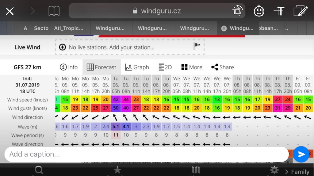
First one that really has our attention. But early days. Standing by
Martha Watkins Gilkes
|
|
- Hurricane Sector - Satellite Imagery
|
- By John Fuller <fullaw at candw.ag>
- Date: Wed, 31 Jul 2019 19:26:18 -0400
|
https://stormcarib.com/goes.htm


Sent from my iPhone
|
|
- Update
|
- By John Fuller <fullaw at candw.ag>
- Date: Wed, 31 Jul 2019 19:25:51 -0400
|
Sent from my iPhone
|
|
- Screenshot 2019-07-31 at 7.08.31 PM
|
- By John Fuller <fullaw at candw.ag>
- Date: Wed, 31 Jul 2019 19:11:56 -0400
|

Sent from my iPhone
|
|
- Standing by
|
- By Martha Watkins Gilkes <marthawatkinsgilkes at gmail.com>
- Date: Sun, 21 Jul 2019 22:10:41 -0400
|
We are standing by to report to you if needed.  Thankful so far all quiet on
the home front.
|
|
- Rainy Weather
|
- By Daniella Seepaul <daniellaseepaul at gmail.com>
- Date: Sat, 1 Jun 2019 08:17:01 -0400
|
Hi Fellow Islanders,
Could this be the most rain Antigua have seen for the past 5 years? Sure feels like it!
Be Safe! Be Prepared!
Regards,
Daniella 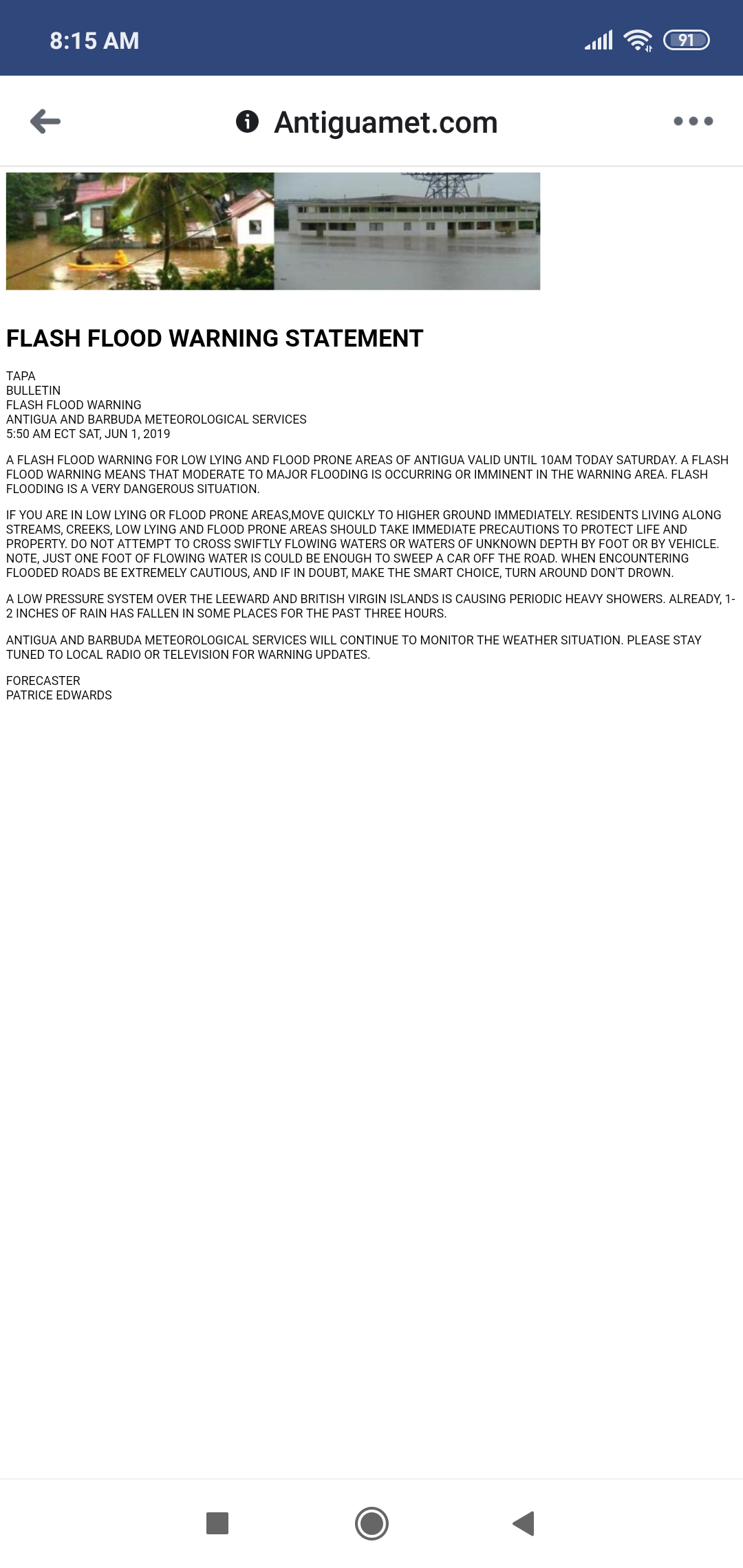
|
|
- Rain. 4.5 inches since 4 am
|
- By John Fuller <fullaw at candw.ag>
- Date: Sat, 1 Jun 2019 07:47:37 -0400
|
Sent from my iPhone
|
|
- 2019 HURRICANE SEASON
|
- By Martha Watkins Gilkes <marthawatkinsgilkes at gmail.com>
- Date: Thu, 2 May 2019 09:38:06 -0400
|
Hello all you weather watchers… been since NOV 11th 2018 that i Posted.. The months have literally FLOWN by as we are warned happenes.
A VERY EARLY start to weather disturbance ……The old saying in the islands is JUNE TOO SOON JULY STAND BY AUGUST A MUST SEPTEMBER REMEMBER OCTOBER ALL OVER
We are still a month away from the JUNE 1 official hurricane start and yet this has developed ! So good warning for us to all be on our toes. This of course, is far too north to effect the Leeward islands but a good eye opener for us to take heed.
On another note sending wishes for a full recovery to long time STORM CARIB REPORTER JOHN ELI FULLER from Antigua ( part of those “boys in the backroom” ) from a stroke he had yesterday. We wish him a full recovery and hope to see him posting in due course.
|
|
|

