
|
|
Climatologyof Caribbean Hurricanes |
|
|
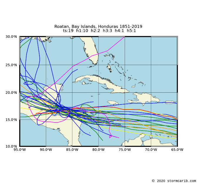
Tropical systems passing within 60nm (= 69mi.) of the island. Used latitude/longitude coordinates (16.38N, 86.45W) might not be the center of the island. Often the location of the island weather station was used, which is normally at the airport.
Please note that not only hurricanes (h1-h5) are included but also tropical storms (ts). Wind/category reported is maximum measured while the system moved through region (box). Each category storm has its own color (see color bar below; ts=tropical storm; h1=category 1 hurricane; etc., see the guide for definitions). Different projections can be selected, the island projections are most zoomed in (select if you want to see how close the systems passed by the island [not available for regions]), while the world projection most zoomed out (select when you want to see the complete path of the storm). Winds are in miles per hour. It is also calculated how close the center of the storm came to the island, the so-called closest point of approach (cpoa, in miles).
Below you can see all stormtracks since 1851 for Roatan (for more details about individual storms skip to another page where storms are separated per decade). In the climatology section there is also a weekly analysis of the data which shows when the real peak of hurricane season is for Roatan and a five-year analysis to find out if more storms have passed close by Roatan recently.
| 1851 - 2019 | |
 | |
|
Roatan, Bay Islands, Honduras: all dec peak 5yr rank
Copyright © 2020 Caribbean Hurricane Network. All Rights Reserved
| Back to top |
![[ts=tropical storm; h1=category 1 hurricane; etc.]](colorbar.png)