Having experienced Ivan and then Emily, Beryl was not as bad as Ivan but a little worse than Emily.
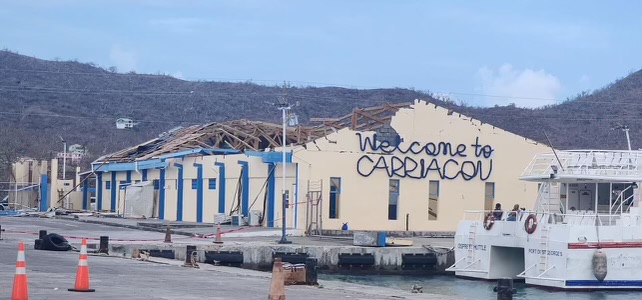
I live in North St. George so relatively the southern half if the Island so we were lucky...not much in the way of damage, just some water in our house from under doors (note to self...sandbags next time). There was one death though on the mainland and at least two on Carriacou...there was also some roof damage I believe here in Grenada.
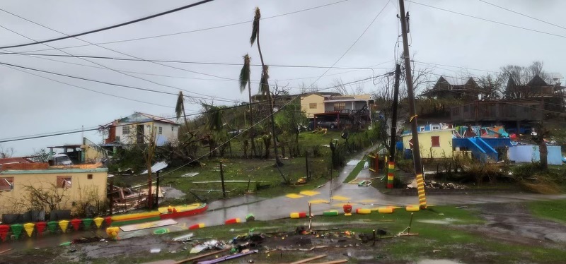
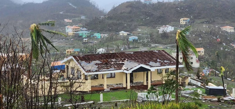
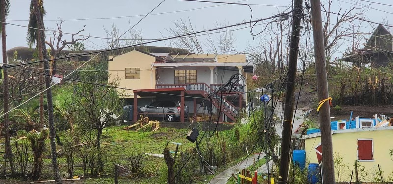
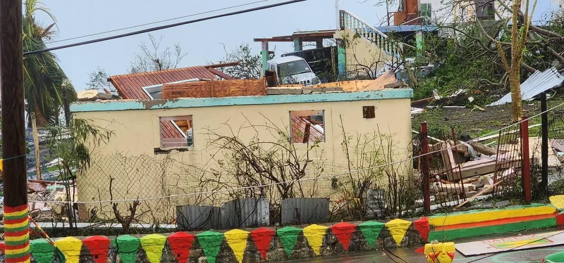
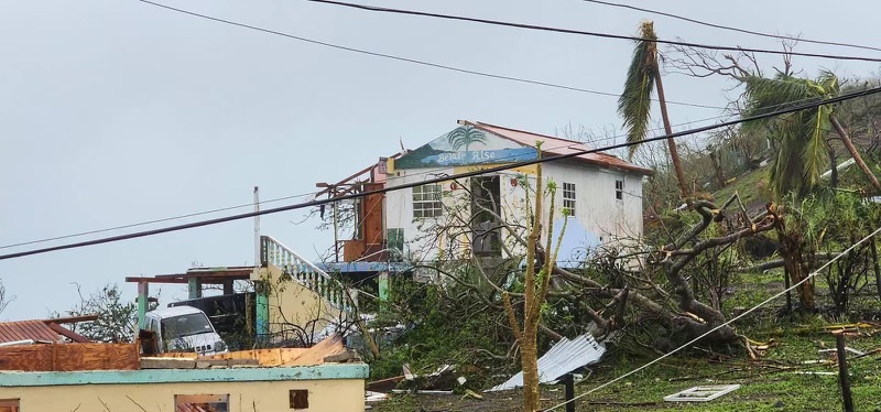
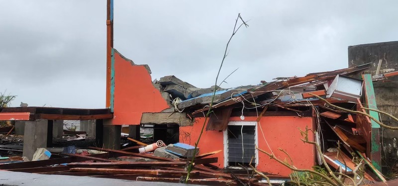
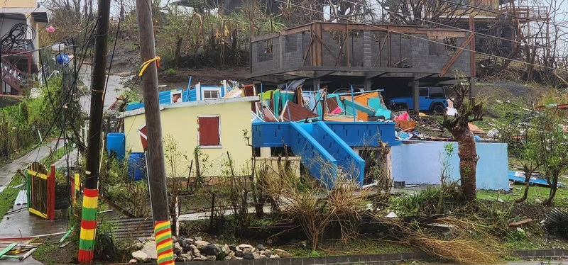
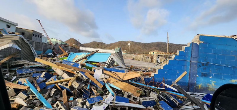
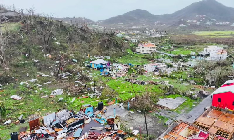
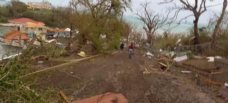
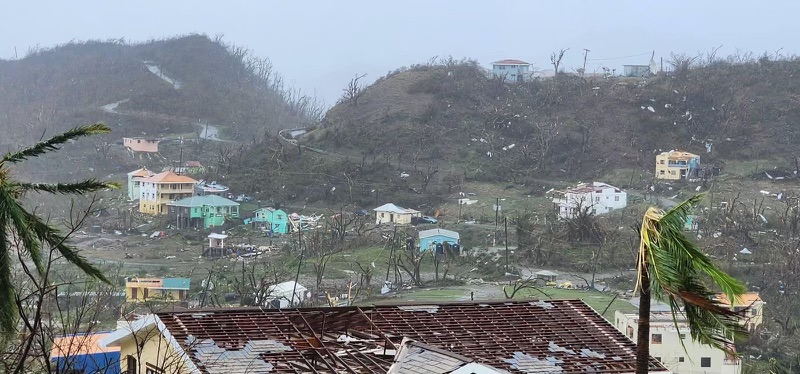
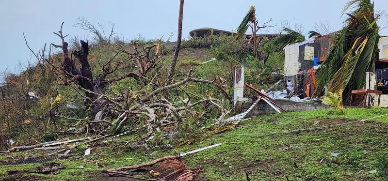
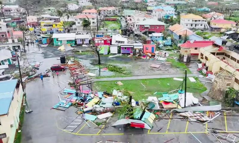
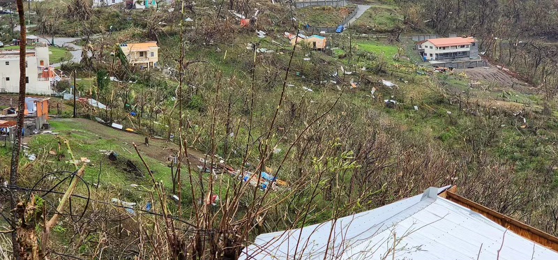
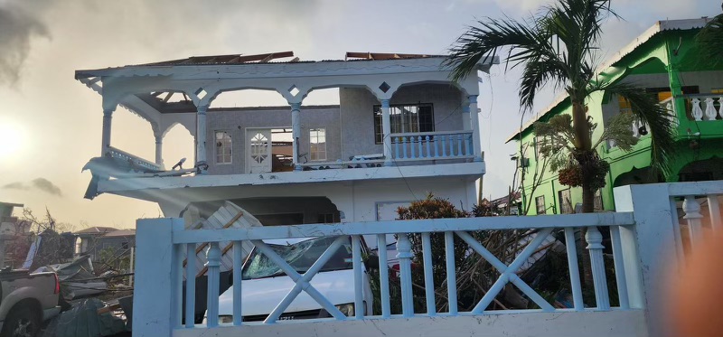
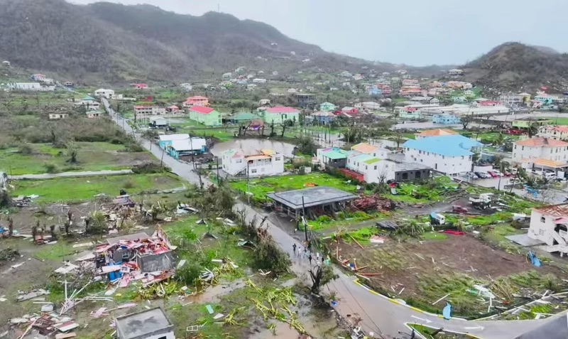
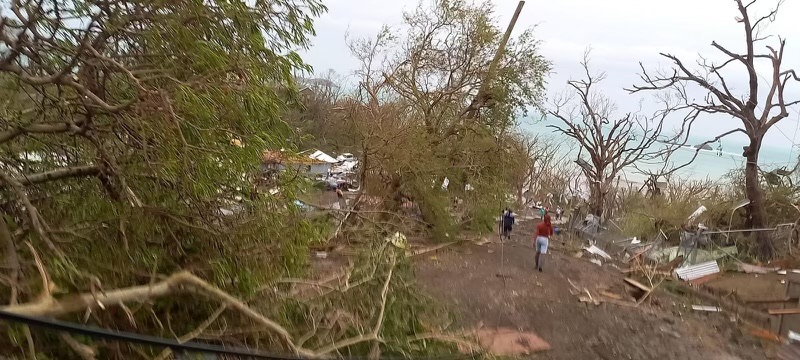
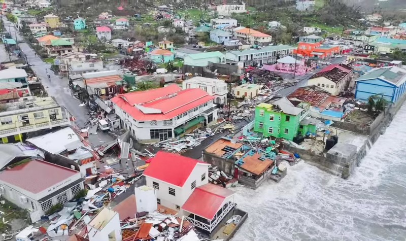
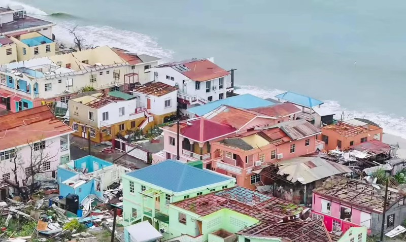
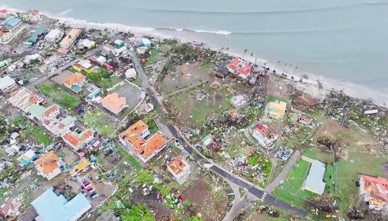
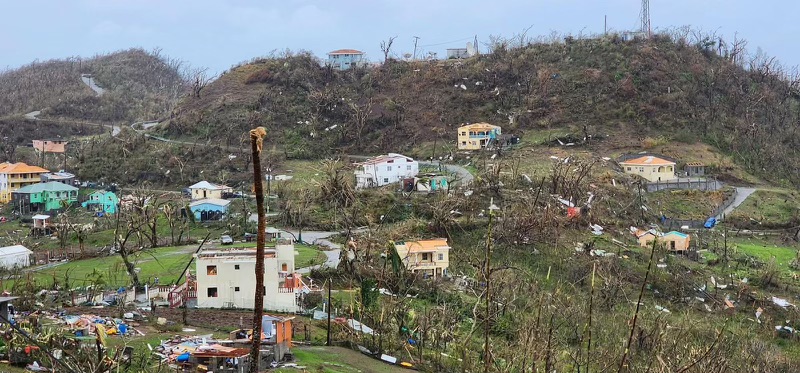
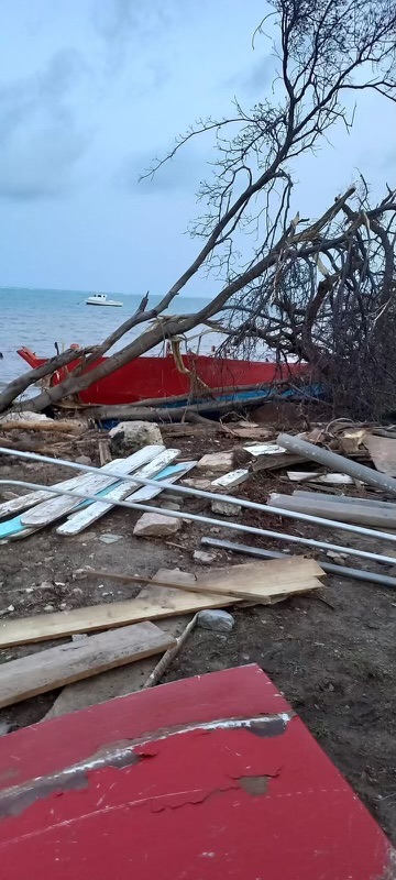
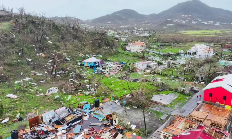
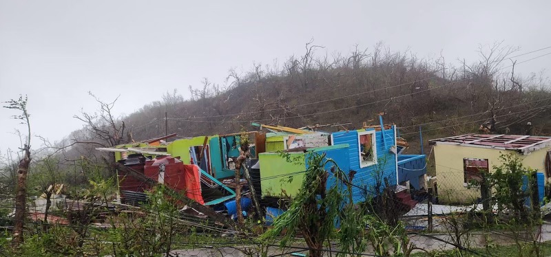
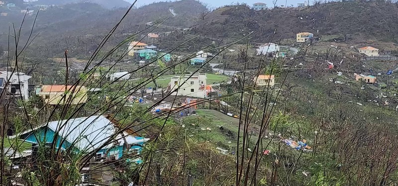
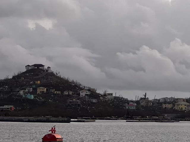
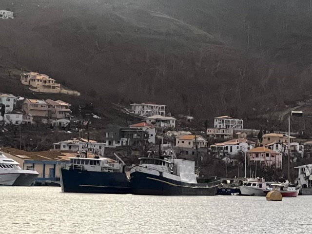
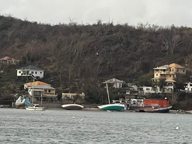
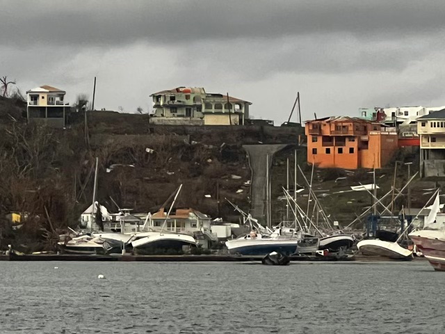
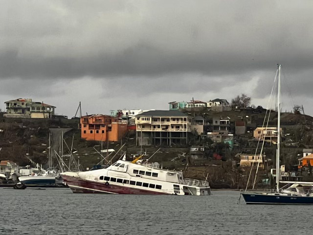
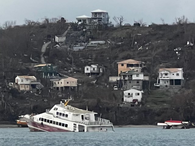
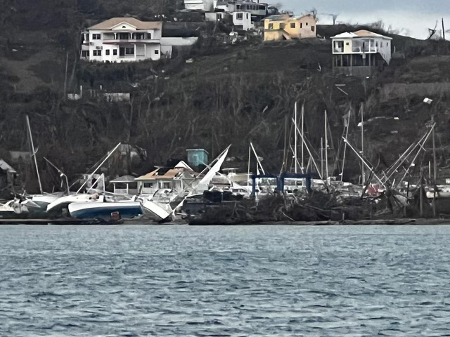
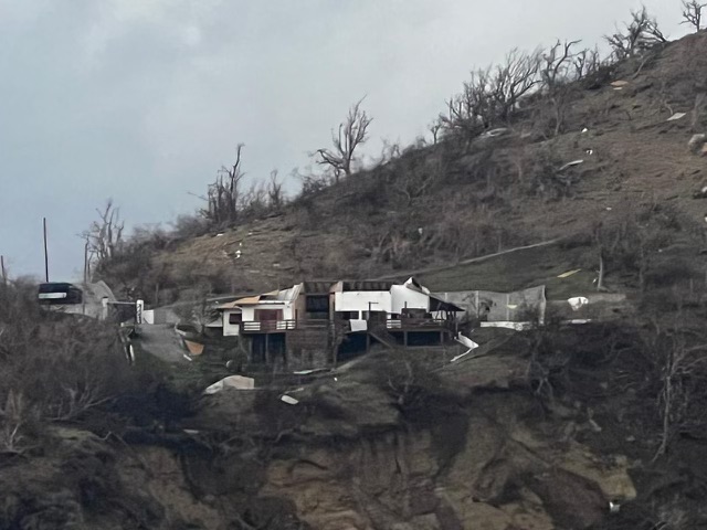
The north (St. Patrick) and the Islands of Carriacou and Petite Martinique took the full force of the storm and our PM has been over to Carriacou to assess the damage and aid to the Islands is well under way. They are in a bad way with so much damage.
Here on the mainland Grenlec and NAWSA have been troopers...we got power back at 10.30 pm last night and water shortly after. Some are still without water and of course we are still recovering from the previous drought. Hopefully most will have power and water by the weekend as they work their way round the Island.
I just feel a sense of relief then a touch of guilt when I think if the Islands, especially as I know what they are going through... .
Once again we will bounce back.
Stay safe everyone and prepare.
Jacquie xx
Sent from my TCL T431A