
|
|
Climatologyof Caribbean Hurricanes |
|
|
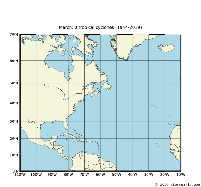
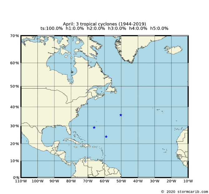
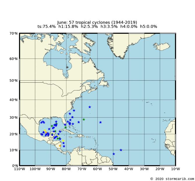
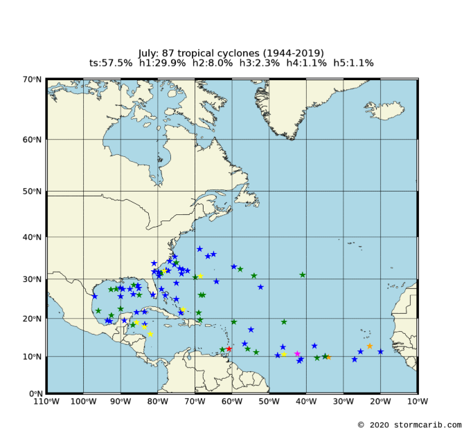
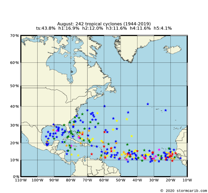
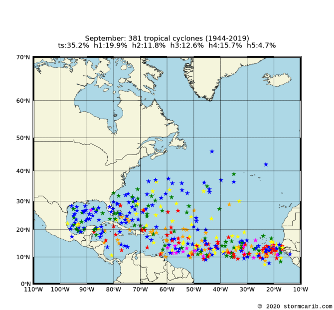
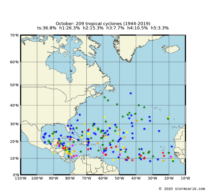
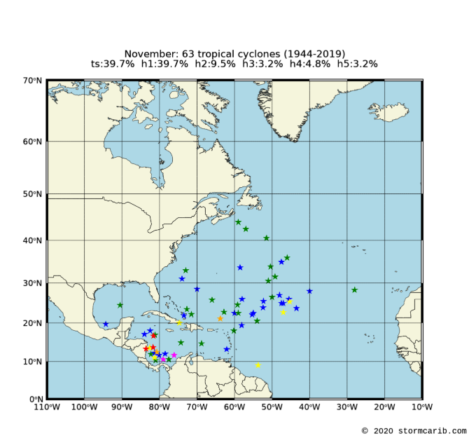
History can tell us where we should look for hurricane development. This changes month by month. Normally tropical systems can only form and/or sustain themselves when the sea surface temperature is higher than 28C/82F. Early in the season the central Atlantic is still too cold, therefore no tropical systems usually form in that area. The Gulf of Mexico is already pretty warm however, so we have to closely watch that area in June. Later on in the season storms start to develop more and more east in the central Atlantic.
The plots below are based on data from 1944-2019. There is data available back to 1851. However, 1944 is generally regarded as the start of accurate observations because then aircraft reconnaissance flights began and later on satellite observations were added (it is difficult to determine where in the middle of the ocean a storm first developed without satellites or reconnaissance flights).
The storms are color coded by how strong they ultimately got. See the colorbar below.
![[ts=tropical storm; h1=category 1 hurricane; etc.]](colorbar.png)
| J a n u a r y |
 |
| F e b r u a r y |
 |
| M a r c h |
 |
| A p r i l |
 |
| M a y |
 |
| J u n e |
 |
| J u l y |
 |
| A u g u s t |
 |
| S e p t e m b e r |
 |
| O c t o b e r |
 |
| N o v e m b e r |
 |
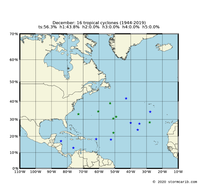
| D e c e m b e r |
 |
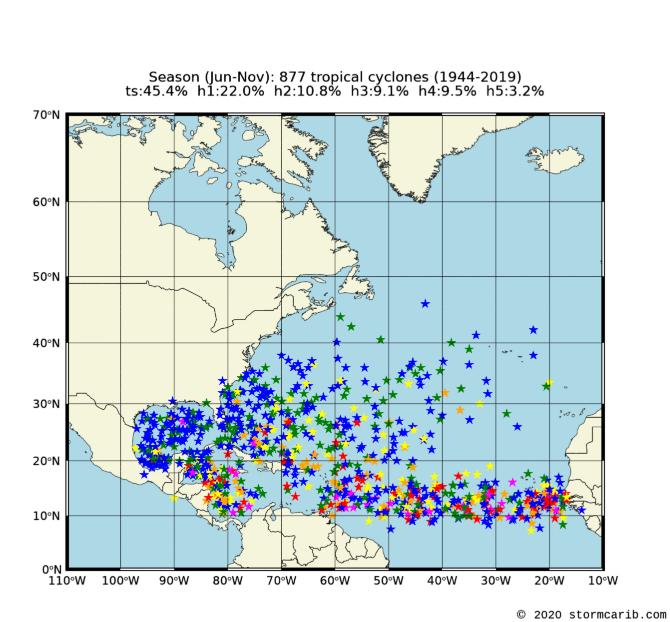
| Hurricane Season (Jun-Nov) |
 |
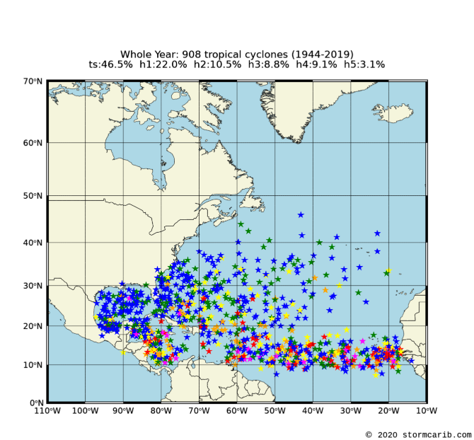
| Whole Year (Jan-Dec) |
 |
Copyright © 2020 Caribbean Hurricane Network. All Rights Reserved
| Back to top |