|
|
|
- Nevis Feb. Weather Date from Station
|
- By H Hallstrom <hwh888 at gmail.com>
- Date: Mon, 3 Mar 2025 13:39:45 -0400
|
Greetings All,
For those interested see attached file for month of February. Attachment:
02_Feb_NOAA Nevis Weather Data.pdf
Description: Adobe PDF document
|
|
- January Weather Data for Nevis
|
- By H Hallstrom <hwh888 at gmail.com>
- Date: Sat, 1 Feb 2025 23:10:13 -0400
|
Greetings All,
Attached
January 2025
Weather Station data for those interested.
Attachment:
01_Jan_NOAA Nevis Weather Data.pdf
Description: Adobe PDF document
|
|
- Corrected Annual Weather Data for May
|
- By H Hallstrom <hwh888 at gmail.com>
- Date: Wed, 1 Jan 2025 15:07:57 -0400
|
Greetings All,
Discovered the incorrect Excel data location for May and corrected.
Attachment:
Nevis Annual Weather 2024.pdf
Description: Adobe PDF document
|
|
- Monthly NOAA Data for Nevis
|
- By H Hallstrom <hwh888 at gmail.com>
- Date: Wed, 1 Jan 2025 14:58:08 -0400
|
Greetings All,
.....and a Happy New Year 2025 to everyone.
Attached December weather data for those interested. Also attached a annual report for Nevis.
Attachment:
12_Dec_NOAA Nevis Weather Data.pdf
Description: Adobe PDF document
Attachment:
Nevis Annual Weather 2024.pdf
Description: Adobe PDF document
|
|
- November Weather data for Nevis
|
- By H Hallstrom <hwh888 at gmail.com>
- Date: Wed, 4 Dec 2024 20:40:41 -0400
|
Greetings All,
Attached November data from station for those interested.
Attachment:
11_Nov_NOAA Nevis Weather Data.pdf
Description: Adobe PDF document
|
|
- October Weather Data Info
|
- By H Hallstrom <hwh888 at gmail.com>
- Date: Fri, 1 Nov 2024 11:26:36 -0400
|
Greetings All,
Attached Nevis October Weather data from station for those interested.
Attachment:
10_Oct_NOAA Nevis Weather Data.pdf
Description: Adobe PDF document
|
|
- 10 year temp data
|
- By H Hallstrom <hwh888 at gmail.com>
- Date: Sun, 20 Oct 2024 12:05:52 -0400
|
Greetings All,
Seems everyone is talking how hot it's been this year on Nevis & I'm sure else ware.
So I decided to go back and have a look at temperatures from 2014 to present.
Below is the attached data. It doesn't seem to differ much from averages. So what is the reason. One thought is very little in way of daily tropical showers and little in tropical breezes.
Anyone have other thoughts about this subject?
Attachment:
Nevis Monthly Temperatures 2014-2024.pdf
Description: Adobe PDF document
|
|
- Links to weather station
|
- By H Hallstrom <hwh888 at gmail.com>
- Date: Thu, 3 Oct 2024 11:48:06 -0400
|
Greetings All,
Many years ago I posted a direct link to read weather direct from station. Here is the link, also weather underground link. Enjoy
|
|
- September Weather Station Data
|
- By H Hallstrom <hwh888 at gmail.com>
- Date: Thu, 3 Oct 2024 11:40:02 -0400
|
Greetings All,
For those interested, attached September Weather Station data.
Attachment:
09_Sep_NOAA Nevis Weather Data.pdf
Description: Adobe PDF document
|
|
- TS Results at Fern Hill ……
|
- By H Hallstrom <hwh888 at gmail.com>
- Date: Wed, 14 Aug 2024 11:08:01 -0400
|
|
Greetings All,
So this is what I read on the weather station reports for this month to date. Saturday & Sunday: 3.89” rain; 38 mph highest gust at rooftop
Not all that bad. Cistern topped up! 😀
Harry Hallstrom
|
|
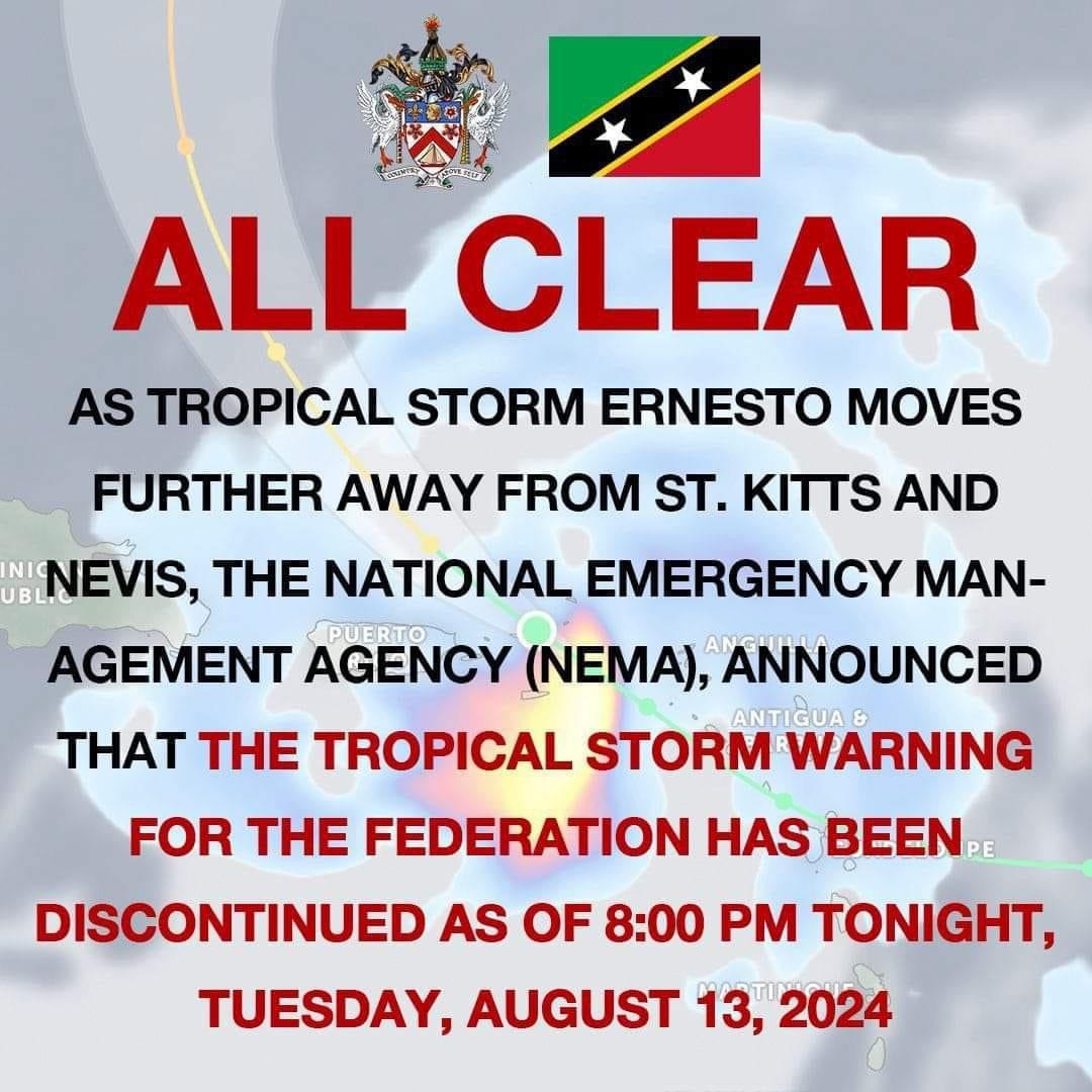
- TS Ernesto - 9pm
|
- By Frank Goodwill <nevis.storm at hotmail.com>
- Date: Wed, 14 Aug 2024 01:36:33 +0000
|
|
Good evening all,
As rain bands following the storm pass by we are still seeing showers and the occasional rumble of thunder.
The St Kitts NEMA team have given the all clear for the Federation as of 8 pm.
Regards,
Frank Goodwill
|
|
|
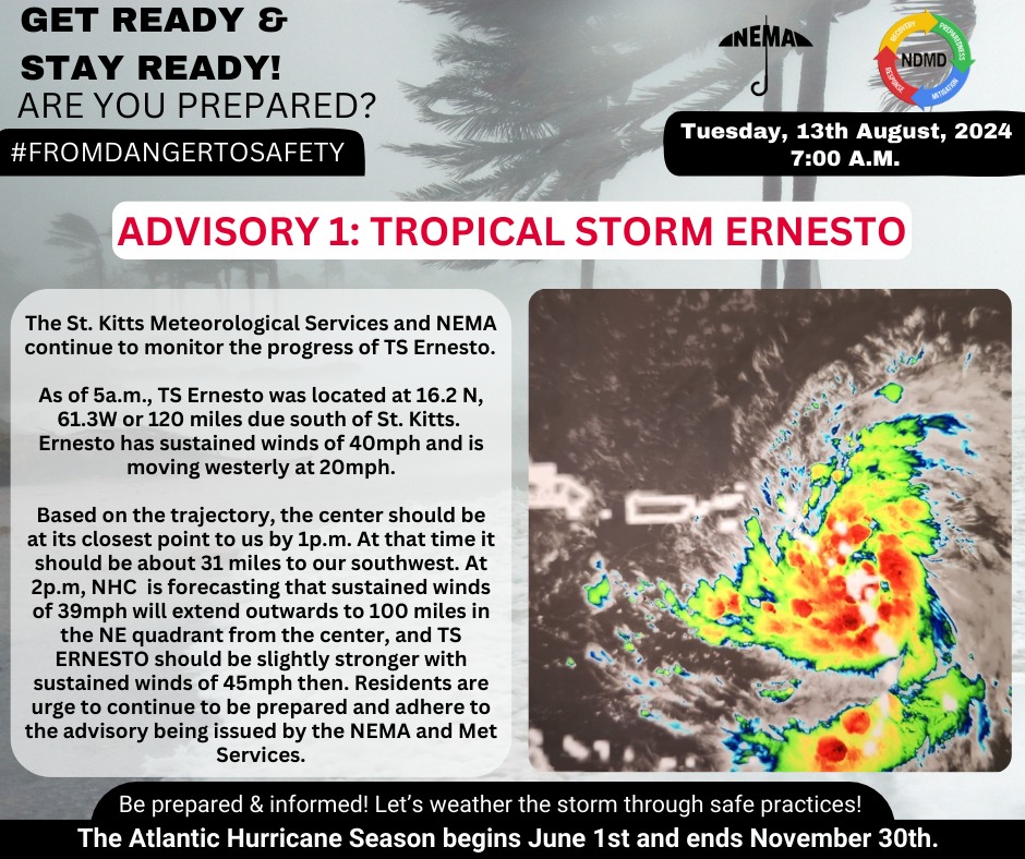
- TS Ernesto - 2pm
|
- By Frank Goodwill <nevis.storm at hotmail.com>
- Date: Tue, 13 Aug 2024 18:42:44 +0000
|
|
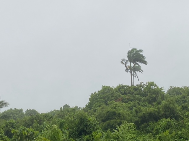
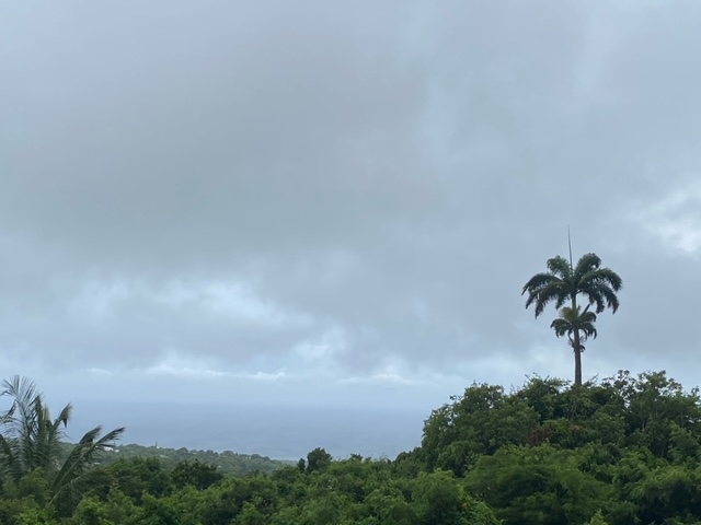
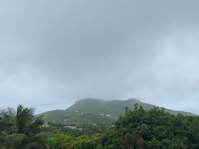
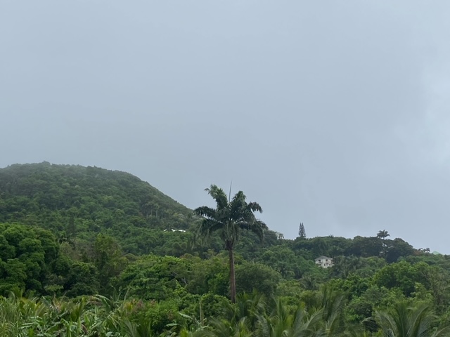
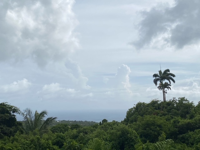
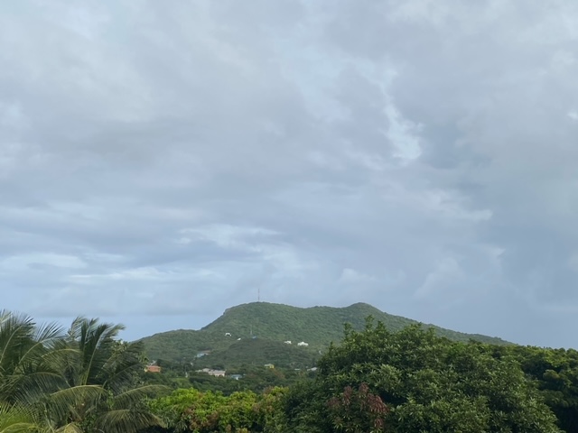
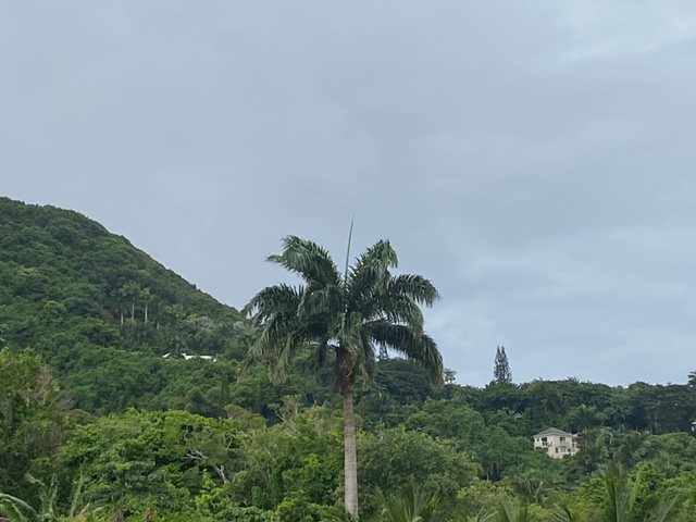
Good afternoon everyone,
After a pretty quiet morning the centre of Ernesto passed us a little to the south of Nevis.
Interesting watching the prevailing wind shift from the Northeast to the southeast and now the southwest.
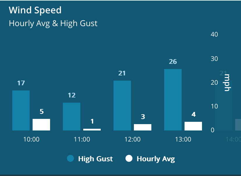
Ernesto certainly has a sting in its tail as from about 11:45 am we were hit with gusty winds and heavy rain.
The rainfall measured since midnight has jumped to 2.31 inches. Things are starting to brighten up a bit now and the wind has eased off. Looking at the Guadeloupe rain radar things should continue to ease off.
Other parts of the island may have different measurements.
The NEVLEC electricity grid network has taken a few hits:
“Dear Valued Customers,
Please be advised that we are experiencing a power outage on the Gingerland Feeder and parts of Hamilton. This outage is a result of inclement weather due to the passing of Tropical Storm Ernesto. Restoration efforts will begin once the weather conditions
improve. We urge everyone to stay safe and avoid any electrical hazards.”
The Gingerland feeder supplies the south and east of the island.
We also lost internet access for a while.
I have attached a couple views and the change in wind strength as the centre passed us.
Regards,
Frank Goodwill
|
|
|
- TS Ernesto - 8 am Tuesday
|
- By Frank Goodwill <nevis.storm at hotmail.com>
- Date: Tue, 13 Aug 2024 12:48:20 +0000
|
|
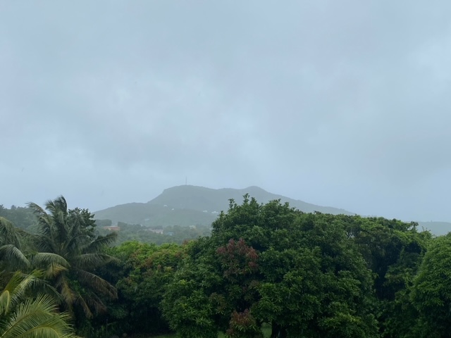
Good morning all,
The weather is pretty calm so far. We did have a lively shower cell pass by at about 6:30 am., with strong winds and heavy rain. It lasted about 5 minutes. I measured a wind gust of 28 mph.
Wind speeds in general have been moderate and rain has consisted of light showers or drizzle for the most part.
Rain measured since midnight up in the Nevis Peak foothills 0.35 inches(9 mm).
Other areas on island may measure more or less.
Views and St. Kitts NEMA advisory.
More later.
Frank Goodwill
Sent from my iPhone
|
|
|
- TS Ernesto - Monday
|
- By Frank Goodwill <nevis.storm at hotmail.com>
- Date: Tue, 13 Aug 2024 01:49:58 +0000
|
|
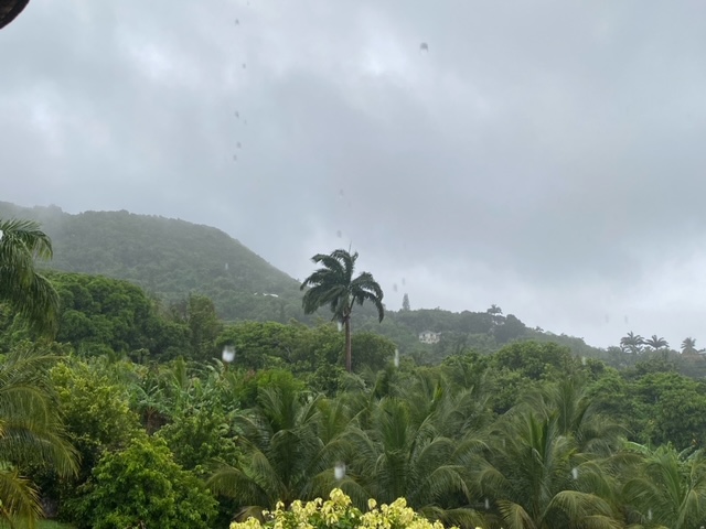
Good night all from the Nevis Peak foothills😀
Monday has been cloudy with some hazy sunshine breaking through on occasion.
See attached pictures taken at 4pm
Not much shower activity during the day here, with most rain being south of the island of Guadeloupe. This will probably change as we move into the night hours.
We are a small island in a big ocean and there have been scattered showers around but have missed us.
Wind gusts did pick up in the afternoon with measurements in the morning being 14 mph and then rising to 21 mph. The average wind speed has stayed steady at about 6 mph to 7 mph,
Most of the island is preparing for a shut down tomorrow, Tuesday. I have started to see notifications from various businesses and Government Offices will be closed.
The Vance Amory Airport will close at noon on Tuesday.
Inter island ferries and water taxis will probably be disrupted on Tuesday. I have seem one notice from a water taxi company saying they will not be running services.
So let’s see what tomorrow brings.
Regards,
Frank Goodwill
|
|
|
- Latest 8am update……
|
- By H Hallstrom <hwh888 at gmail.com>
- Date: Mon, 12 Aug 2024 08:12:53 -0400
|
Greetings All,
According to latest 8 am data from NHC very little has changed since my late post. The depression is still a depression with winds in the 30-40 mph range. It’s path remains the same, turning northwest ward as it moves away from the Leeward Islands towards the Virgin Islands.
Dare I say it doesn’t seem to be a serious threat to Nevis/St. Kitts. wind wise, not sure about sea conditions or rain amounts?
Harry Hallstrom
|
|
- Invest 98……..
|
- By H Hallstrom <hwh888 at gmail.com>
- Date: Sun, 11 Aug 2024 11:50:19 -0400
|
Greetings All,
Invest 98 will most likely become a TS (Tropical Depression) today and later a named storm. Most of the track models (25) are split as to path. Half put the storm passing to the north and other half to the south. Five put the path directly over Nevis & St. Kitts.
Based on current location 1233 miles East and moving at 23 MPH it will be over our area early Tuesday morning, 6am. Effects will be felt before that time. No forecast of wind strength until is becomes a named storm.
Will post again later today or early Monday morning. All things point to a storm for our area and later developing to a hurricane as it moves towards Puerto Rico and beyond.
Harry Hallstrom
|
|
- Invest 98 info….heading our way
|
- By H Hallstrom <hwh888 at gmail.com>
- Date: Sat, 10 Aug 2024 10:47:40 -0400
|
|
Greetings All,
Time to keep a lookout for this disturbance 1600 miles to our East.
Moving at 23 mph which would put it over our area in three days time. So far it predicted, most likely, to become a storm as it approaches the Leewards. Clouds and rain for Monday, Tuesday & Wednesday. NHC isn’t predicting a hurricane but most likely one will develop after it passes our area. Even as a storm we could still get some blustery conditions.
Will continue to monitor and report again tomorrow Sunday as it moves closer how steering winds, dust & dry air affect movement and development.
Harry Hallstrom
|
|
- July 2024 Nevis Weather Data
|
- By H Hallstrom <hwh888 at gmail.com>
- Date: Fri, 2 Aug 2024 17:30:35 -0400
|
Greetings All,
July Weather Data from station for those interested.
Attachment:
07_Jul_NOAA Nevis Weather Data.pdf
Description: Adobe PDF document
|
|
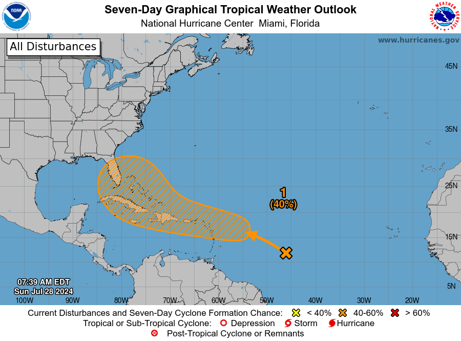
- Tropical weather to our East!
|
- By H Hallstrom <hwh888 at gmail.com>
- Date: Tue, 30 Jul 2024 08:18:28 -0400
|
|
Greetings All,
Much talk about this disturbance to our immediate East. Here are the facts…… It has been weakened based on satellite images this am. 1. Caused by bumping into dry air and Sarah dust in the atmosphere. 2. Two Bermuda Highs have steered it to the north of the leewards. 3. Rain chances from yesterday to today have decreased, guessing it will decrease even more as it approaches us.
As of this time it is of no consequence to the leeward islands.
As a note…..there is another disturbance moving off the African coast, many days away. Much to early to say anything about that one.
Harry Hallstrom
|
|
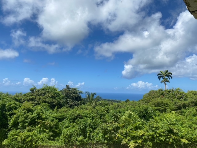
- Sunny Sunday - Weather Change
|
- By Frank Goodwill <nevis.storm at hotmail.com>
- Date: Sun, 28 Jul 2024 14:46:04 +0000
|
|
Good morning all,
A change in the weather as the heavy Saharan Dust plume departs. A Sunny Sunday with a partly cloudy sky and a gentle breeze, up in the Nevis Peak foothills.
As always at this time of year the weather is due for a change. An active Tropical Wave on the Atlantic is due to reach us on Wednesday. Lots of ifs and buts’ but as usual keep an eye on the forecasts - local and NHC.
|
|
|
- June Weather data for Nevis
|
- By H Hallstrom <hwh888 at gmail.com>
- Date: Sat, 13 Jul 2024 09:41:48 -0400
|
Greetings All,
Attached station weather data for those interested.
Attachment:
06_Jun_NOAA Nevis Weather Data.pdf
Description: Adobe PDF document
|
|
- #Beryl update 2:20 pm 01/07/2024
|
- By Frank Goodwill <nevis.storm at hotmail.com>
- Date: Mon, 1 Jul 2024 18:24:33 +0000
|
|
Good afternoon all,
It looks as is one of #Beryl’s rain bands has caught up with us. Some wind gusts in the region of 25 to 28 mph. About a 30 minute downpour from 1:45 pm giving about 0.25 inches of rain up in the Nevis Preakness foothills. Plenty of rain to the south of
Nevis looking at the Guadeloupe radar.
Short video attached of the downpour.
Stay safe,
Frank Goodwill
|
Attachment:
Video.mov
Description: Video.mov
|
|
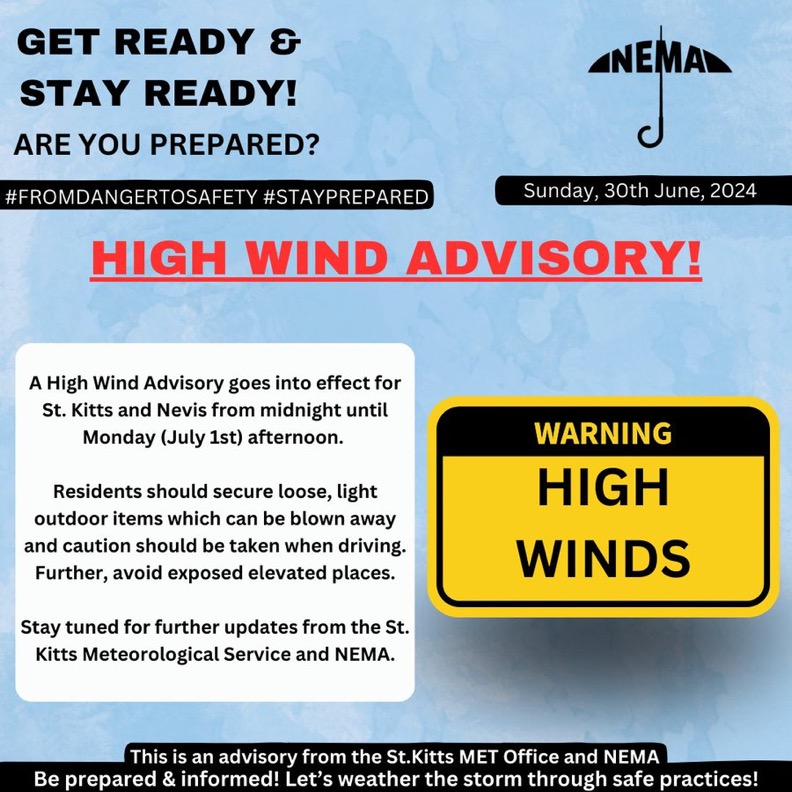
- #Beryl - Nevis update
|
- By Frank Goodwill <nevis.storm at hotmail.com>
- Date: Mon, 1 Jul 2024 03:24:23 +0000
|
|
Good night all,
Though we are some 300 odd miles to the north west of the centre of Hurricane Beryl, the St Kitts NEMA and Met Office have issued a high winds advisory warning (see attached).
There have been wind gusts around the 15 to 20 mph during Sunday. The weather forecast for Monday is partly cloudy, becoming increasingly cloudy with a high chance of showers. Winds northeast to east at 16 to 28 mph with possible gusts of 43 mph.
Looking at the satellite pictures, though #Beryl is a small hurricane in diameter there are rain bands on the northern side that could result in those showers for us.
It will be interesting to see how things develop tomorrow.
Stay safe.
Frank Goodwill
Sent from my iPhone
|
|
|
- Storm Beryl Latest Information
|
- By H Hallstrom <hwh888 at gmail.com>
- Date: Sat, 29 Jun 2024 12:06:58 -0400
|
Greetings All,
The latest 8am data from NHC puts Beryl strengthening to a Category 2, maybe 3 hurricane, as it moves toward & past the Windward Islands. The latest projected path will put the storm 300-320 miles to our south. The estimated time passing St, Vincent & the Grenadines is Monday 8am.
Presently as things stand this storm possesses no danger to Nevis/St. Kitts. Unless things change I will not post any additional information on Beryl. |
|
- Invest 95L info….
|
- By H Hallstrom <hwh888 at gmail.com>
- Date: Thu, 27 Jun 2024 23:40:12 -0400
|
|
Greetings All,
The latest track models (all models) put 95L well south of Nevis/St.Kitts. All models are predicting it will become a storm as it moves to the Windward Islands. It’s questionable if our island will even get any rain amounts as it passes. We are on the very northern edge.
Doesn’t mean we should relax though. More later as it progresses towards the Caribbean.
Harry Hallstrom
|
|
- Saharan Dust Pulse
|
- By Frank Goodwill <nevis.storm at hotmail.com>
- Date: Wed, 26 Jun 2024 00:31:10 +0000
|
Good day all,
Another plume of Saharan Dust (dry air) has arrived and is likely to be with us until Friday. This will be a dampener on shower activity. So far up in the Nevis Peak foothills I’ve measured 1.77 inches (45 mm) of much needed rain so far this month.
A Tropical Wave may develop into something interesting for the Lesser Antilles next week, is being monitored by the US National Hurricane Center. Early days yet but something to keep an eye on.
Also remember that at this time last year (2023) we had two Tropical Storms in the neighbourhood - TS Bret and TS Cindy.
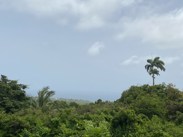
Added a couple of views highlighting the Saharan Dust and the varied “wild life” running around my yard. None of which belong to me! 😀 Plus the Tropical Wave to watch in the Atlantic.🤔
Regards.
Frank Goodwill
Sent from my iPhone
|
|
|
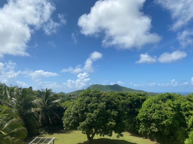
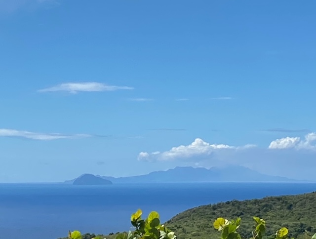
- The Heat Is On
|
- By Frank Goodwill <nevis.storm at hotmail.com>
- Date: Fri, 14 Jun 2024 23:05:05 +0000
|
|
Good day everyone,
My first post for hurricane2024 season. Lots of speculation that this will be a very active season. Interesting that we didn’t have a pre-season named storm this year. A direct hit from a hurricane is a low risk but as they say it only takes one. People
seem to dwell on storm wind speeds, but more problems result from heavy rains and storm surge.
A tropical depression or tropical storm can dump a lot of rain. Flash flooding and run-off can cause problems.
So we keep an eye on the forecasts.
At the moment on Nevis there are high temperatures and not a lot of rain. Government supplied water conservation seems to be a way of life with large areas of the island having their water turned off at night. Note in the attached temperature picture 88F
is about 31C but the ‘feels like’ is higher. This is lower than temperatures at see level.
Keeping oneself hydrated with water and prevention against the impact of heat and strong sun are more on one’s mind at the moment.
As with every year you should prepare for the worst and hope and pray for the best.
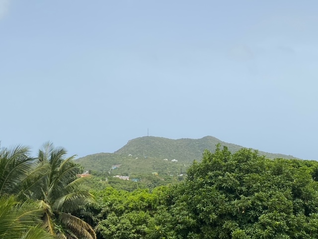
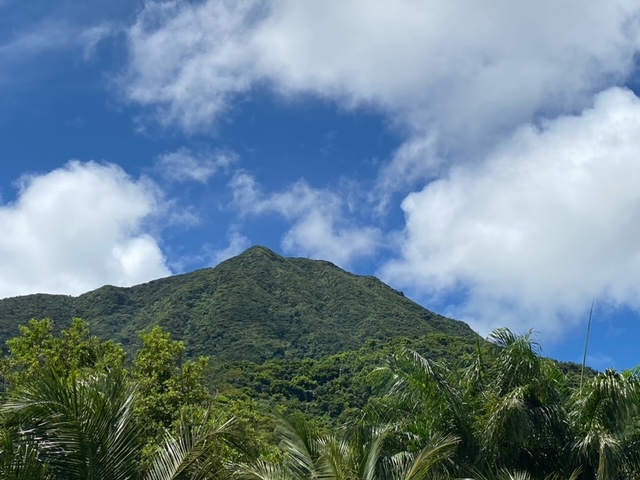
I’ve added some photos:
Nevis Peak
On the horizon Antigua
Closer Redonda and Montserrat
The green foothills of Nevis Peak
Regards,
Frank Goodwill
|
|
|
- Historical Record of hurricanes around Nevis
|
- By H Hallstrom <hwh888 at gmail.com>
- Date: Sat, 8 Jun 2024 14:28:01 -0400
|
|
Greetings All,
Below is a NOAA website of hurricanes Cat 3,4 & 5 from 1890 - 2023. There were 34 storms many unnamed in the beginning years of hurricane tracking. Note these are storms that passed within a 70 mile radius of Nevis. Data shows some of these hurricanes did not reach Cat 3 or above til after passing beyond our area. Statistically that equates to a 25% chance based on above information. In actuality it is much less due to the 70 mile radius and the later development of hurricanes after passing Nevis.
|
|
- Nevis Weather Data For May
|
- By H Hallstrom <hwh888 at gmail.com>
- Date: Sat, 1 Jun 2024 16:42:30 -0400
|
Greetings All,
Attached Nevis Weather Data for May 2024, for those interested. Attachment:
05_May_NOAA Nevis Weather Data.pdf
Description: Adobe PDF document
|
|
- Another way of analyzing data
|
- By H Hallstrom <hwh888 at gmail.com>
- Date: Wed, 22 May 2024 09:37:56 -0400
|
|
Greetings All,
Here are a few more facts about past hurricane events in and around Nevis/St. Kitts.
Since 1851 to 1922 (151 years) there have been a TOTAL of 38 hurricanes passing within a 70 mi radius of our islands. Of those 38 hurricanes 8 were classified as Tropical storms not hurricanes, leaving a total number of 30 hurricanes ranging from Cat1 to Cat 5.
So now lets change to storm radius from 70 mi down to 50 mi. Now there are only nine hurricanes. As listed below. 1871 - category 3 Unnamed 1876 - category 3 “ 1898 - category 2 “ 1999 - category 4 “ 1908 - category 3 “ 1922 - category 3 “ 1924 - category 3 “ 1928 - category 5 “ 1932 - category 4 “
|
|
- Some Hurricane History for Nevis/St.Kitts
|
- By H Hallstrom <hwh888 at gmail.com>
- Date: Tue, 21 May 2024 15:31:10 -0400
|
Greetings All,
I've been reading and listening to all the worried up hype about this upcoming hurricane season. I've done a bit of research on the subject as it pertains to our area of the Caribbean. While we definitely need to pay attention, I also feel there is way too much "scare" being played into the subject. Take a look at what transpired around Nevis/St. Kitts over the last 42 years, and you tell me if I'm wrong.
Attachment:
Hurricane History St. Kitts & Nevis.pdf
Description: Adobe PDF document
|
|
- Nevis April Weather Data
|
- By H Hallstrom <hwh888 at gmail.com>
- Date: Wed, 1 May 2024 09:37:38 -0400
|
Greetings All,
Attached weather station data for month of April for those interested. Early this month....for a change
Attachment:
04_Apr_NOAA Nevis Weather Data.pdf
Description: Adobe PDF document
|
|
- Info on Upcoming hurricane season
|
- By H Hallstrom <hwh888 at gmail.com>
- Date: Sat, 20 Apr 2024 18:16:02 -0400
|
Greetings All,
This info is from
Colorado State University team.
Today Klotzbach and his team at Colorado State University issued their well respected forecast
for the upcoming season. And it is not looking good... This may come
as no surprise, since last year we had the battle between El Nino, which
decreases hurricane activity, and warm sea surface waters, which
increases hurricane activity. El Nino lost... This year we won't have
an El Nino, but La Nina conditions, which normally enhances hurricane
activity, plus the record warm sea surface temperatures are still here!
As it pertains to St. Kitts & Nevis there normally is a 9% chance of being hit with a hurricane, statically speaking. For the 2024 season, they are forecasting a 15% chance of a storm over or near our twin island. Which equates to a 60% increase of a possible "chance".
Maybe nothing to worry about, but still be aware of the potential.
Thanks to La Nina.
Perhaps a saving grace is large Sahara Dust movement across the Atlantic in our direction.
|
|