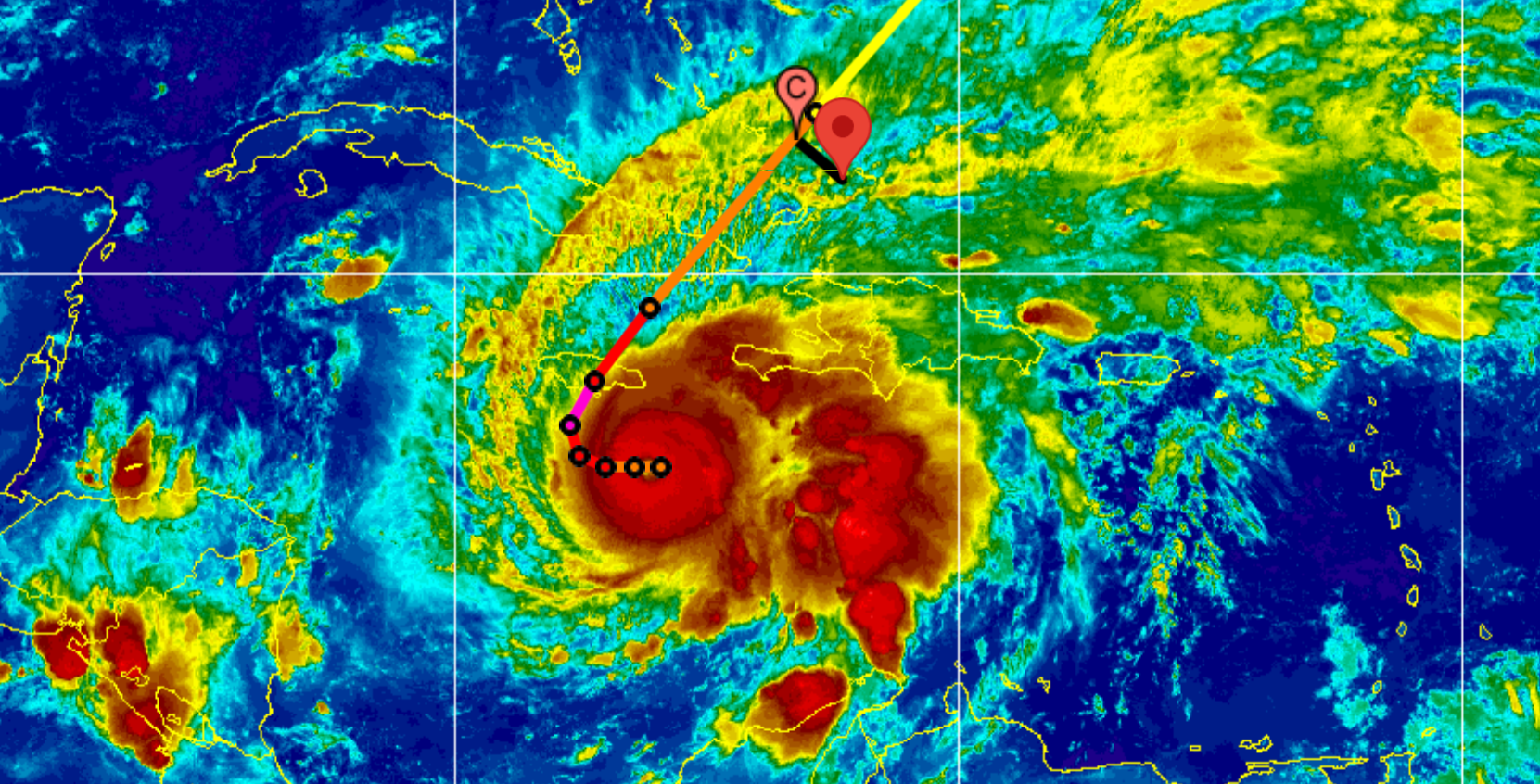
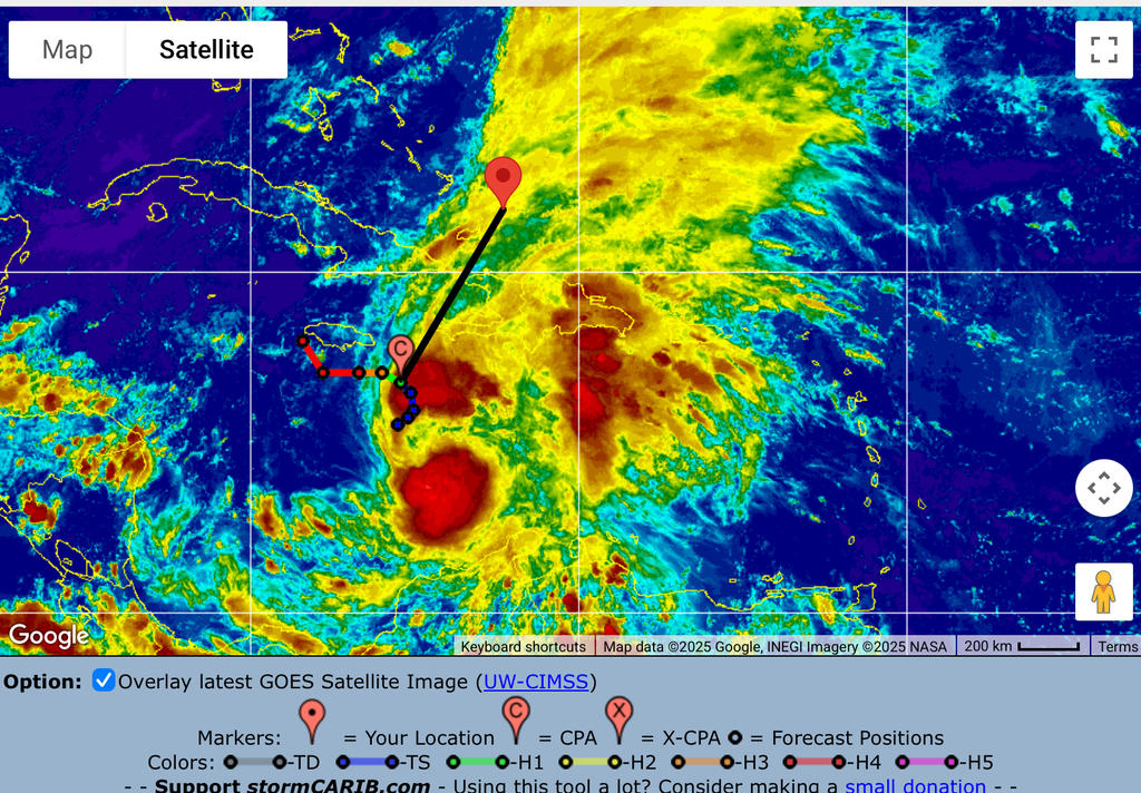
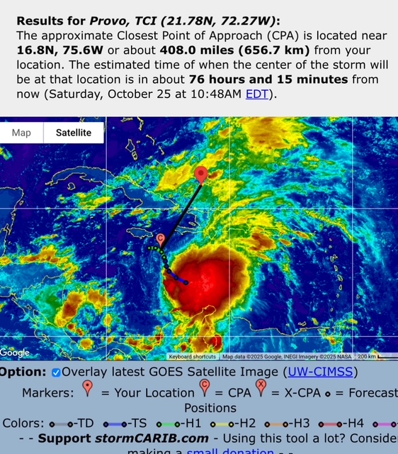
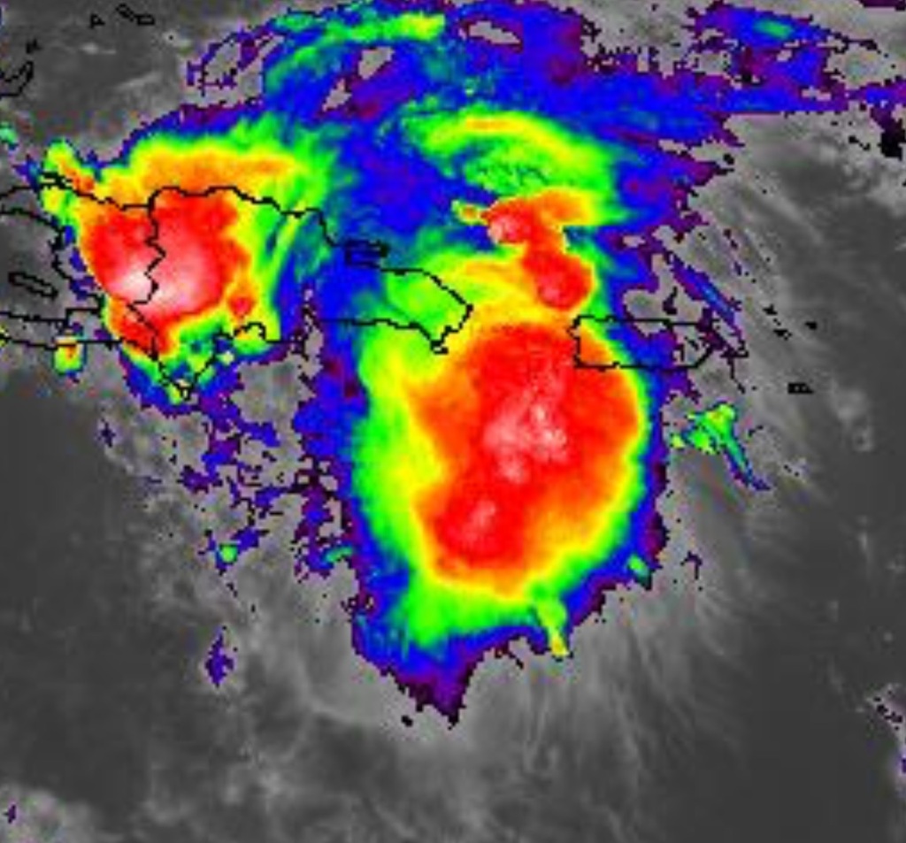
We under a tropical storm warning and indications are the Melissa will pass us today. She is just separated from Cuba and has been taken down a few pegs.
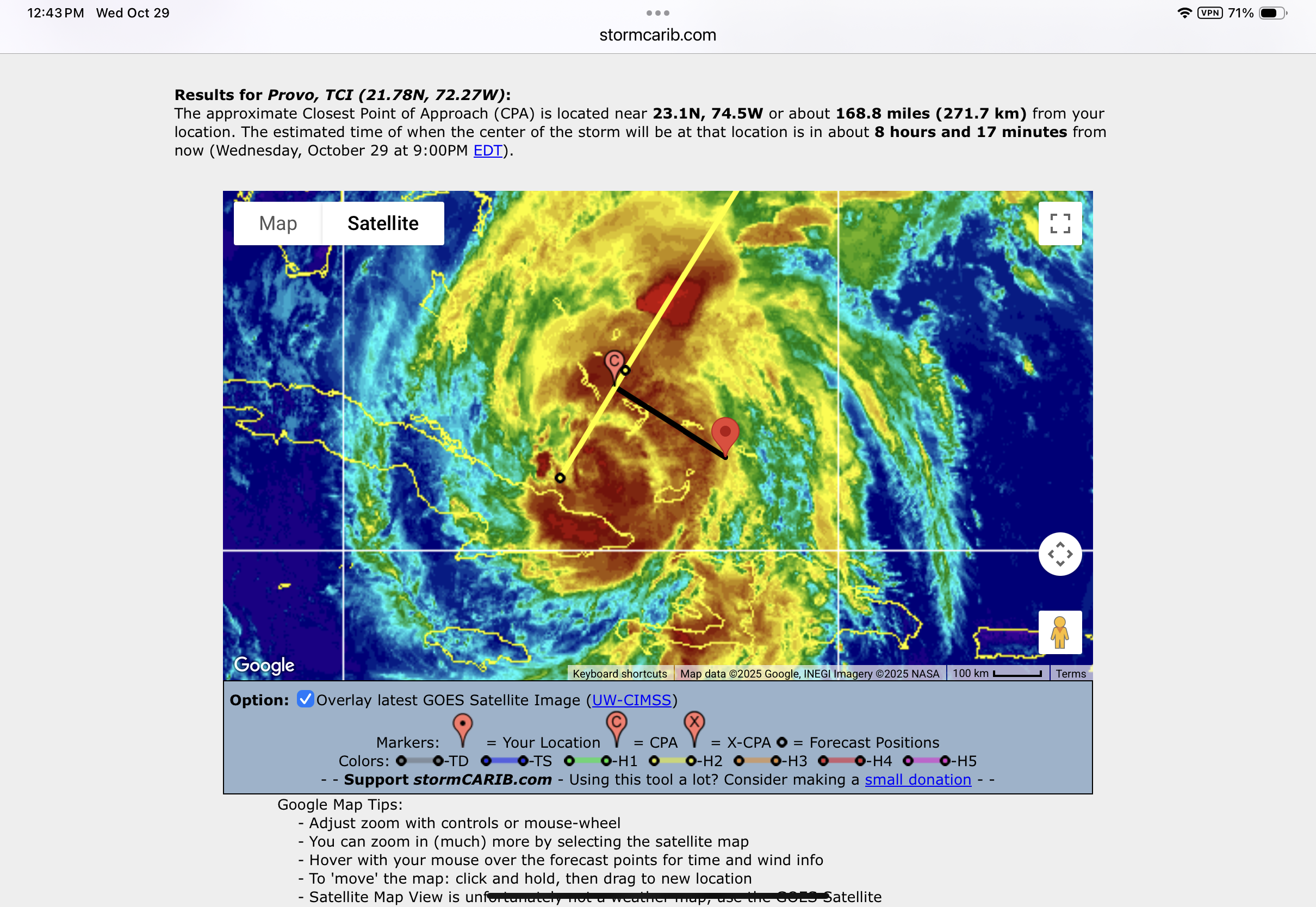
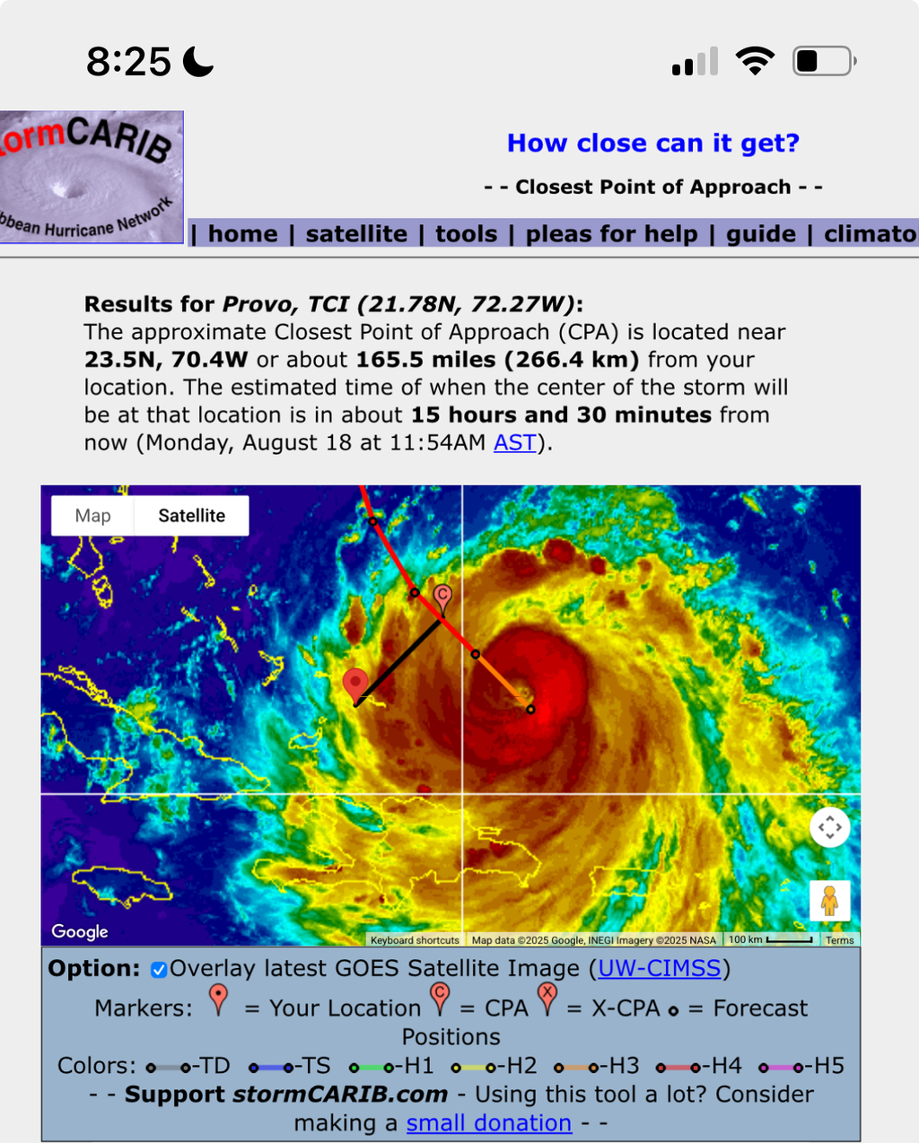
Her closest point of approach is about 170 miles and TS winds are said to be out 185 miles, although that is likely being reduced.
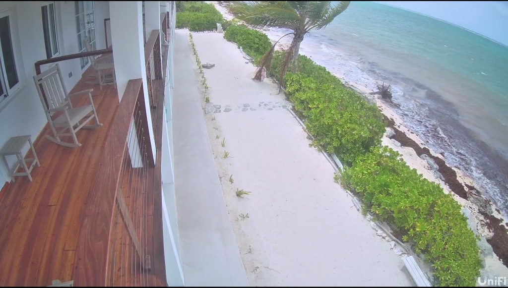
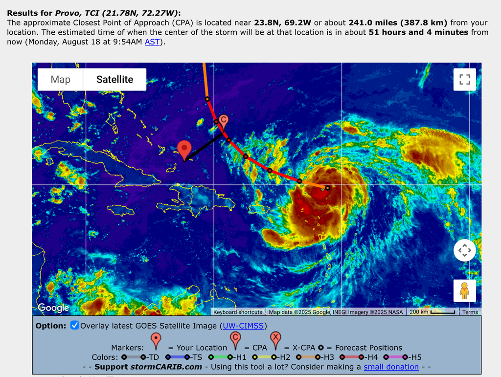
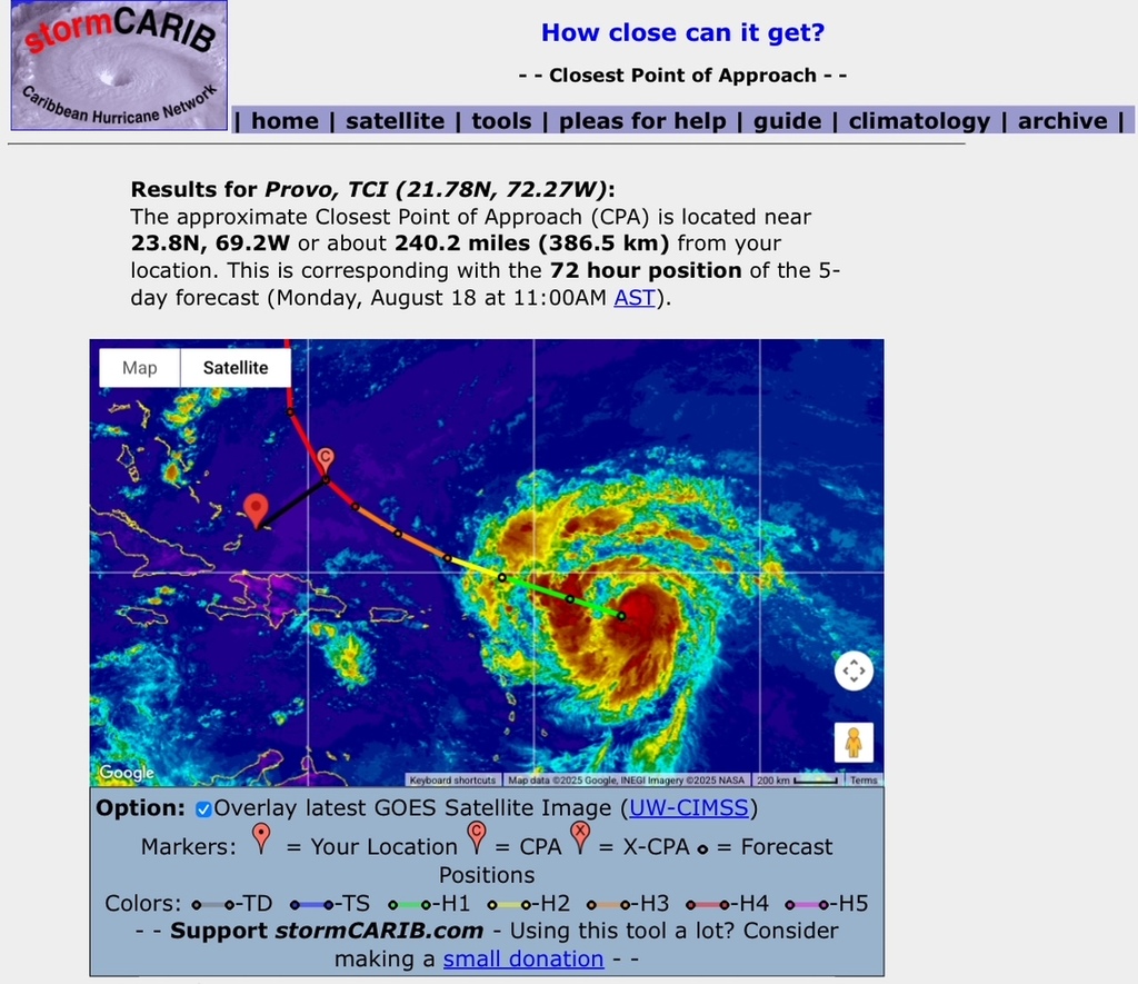
As can be seen in the above graphic, we are now on the edge of the storm. On Whitby Beach, North Caicos, conditions are lovely. Little wind and no rain.
Everything is shut down on North and Provo, and the government has issued a shelter in place order. We may see an increase in winds from the current 15mph, but we may not see TS winds. It also seems like all the rain has left the system as there is very little in our forecast.
I have stopped cleaning up branches as I blew a tire on a tree stump and the truck and trailer are now abandoned on the vacant lot.
I’ll send an update if conditions worsen, but for now it looks like we dodged a bullet!
Prayers go out to those on the direct path in Jamaica, Cuba and Bahamas.
Best Regards,
John Lawson
(649)431-5646
- A quiet Good Morning
By John Lawson Lawson <j.lawson3 at me.com>
Date: Wed, 29 Oct 2025 08:17:49 -0400
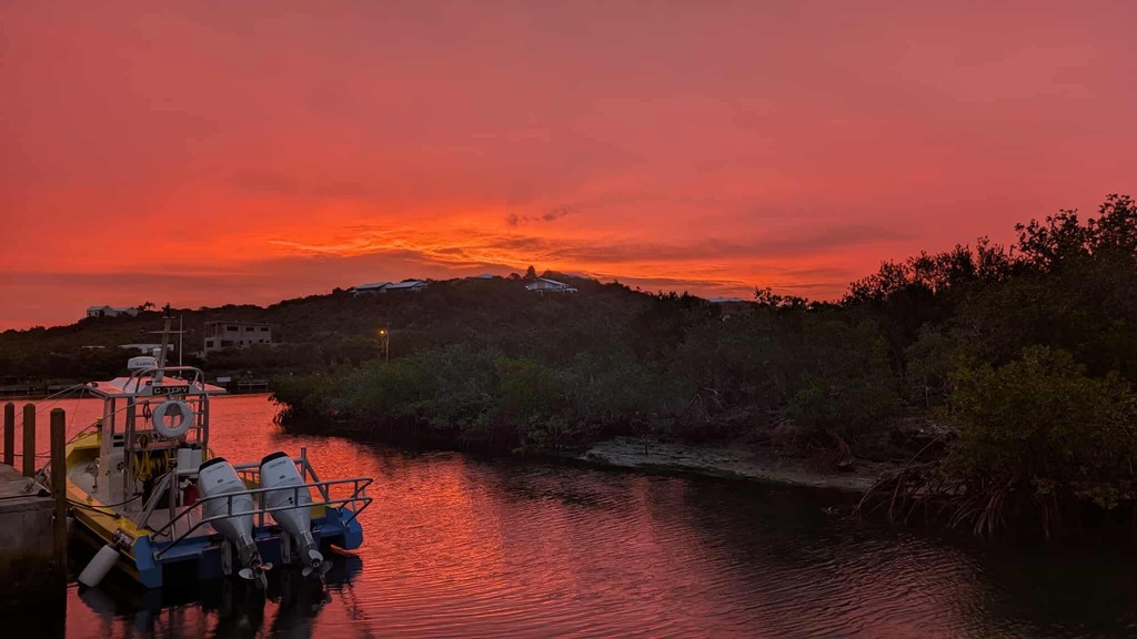
It was a lovely orange, almost red sunrise. I was thinking that the old sea chant,
Red sky at night, sailors delight
Red sky at morning, sailors take warn.
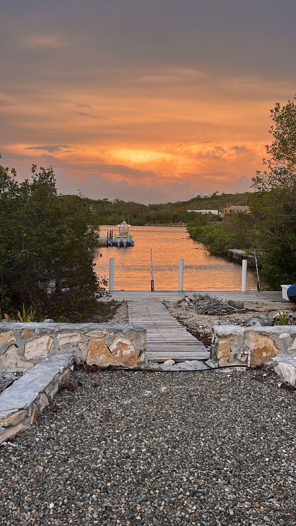
Pelican Beach Club, Whitby, North Caicos
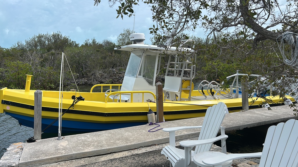
Thompson Cove, Provo. (🎥:Krinkle) Our new Rescue Vessel at the ready!
I wondered if the chant Could be forecasting the days events, but it does not seem so. The storm intensity has lessened to 105mph, she has sped up to 14mph. She is still boasting a wind field (radius) of 185mi and at a closest point of 156mi, we are just on the edge.
She has dropped down to cat3 and when she leaves Cuba she will weaken further before she gets to TCI.
She will pass through the Bahamas (Acklins, Rum, Long Island, etc) as a Cat2 and a direct hit will be serious.
It will be tonight, just after dark (that always makes it worse!) that she will pass us. As she is moving quickly, she will be past us and through the lower Bahamas by morning.
Current forecasts show surprisingly little rain although the outer bands are difficult to predict.
I’ll continue clearing brush off the vacant lot next door as it seems that Melissa is not going to do it for me! 🤣🤣
Best Regards,
John Lawson
(649)431-5646
- Not Much Change
By John Lawson Lawson <j.lawson3 at me.com>
Date: Mon, 27 Oct 2025 05:03:50 -0400
Hurricane Melissa is a large powerful storm that is about to hit Jamaica. A hurricane watch has been issued for TCI which means hurricane conditions could be seen in 48 hours.
She has increased in diameter which means that her destructive impact will be felt across an area that is now about 400 miles wide. This is the width (technically the diameter) of the tropical storm force swath. Tropical storm is defined as 50mph or greater.
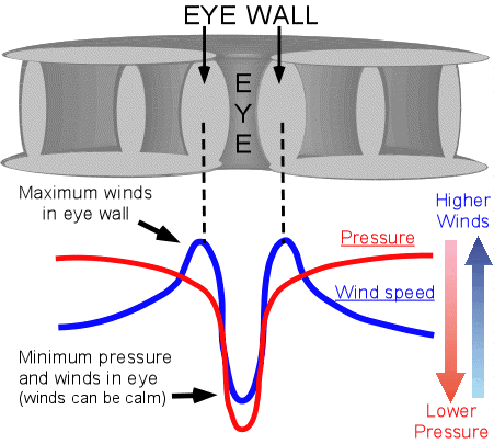
Here is a brief scientific (sorry I am an engineer!) description of the distribution of wind forces in a hurricane. AI wrote this for me:
The wind strength in a hurricane is not evenly distributed but
follows a characteristic radial profile, with the strongest winds occurring in the eyewall surrounding a relatively calm eye. The distribution is also asymmetric, with wind speeds being stronger on one side of the storm due to its forward motion.
Radial distribution of wind speed
Eye: The eye is the calm center of a hurricane, typically 20 to 40 miles across, where winds are very light (usually less than 15 mph). This area has sinking air, which suppresses clouds and leads to fair weather.
Eyewall: Surrounding the eye is the eyewall, a ring of intense thunderstorms where the fastest and most destructive winds are found. This is where air moving toward the storm's center is forced upward, leading to intense thunderstorms and the highest wind speeds.
Rainbands: Beyond the eyewall, winds gradually decrease in speed as they spiral outward in curved bands of clouds and thunderstorms. These rainbands can still produce heavy rain and strong, gusty winds, along with tornadoes.
Asymmetry of wind speed
A hurricane's overall forward motion creates an asymmetric wind field, particularly noticeable in the Northern and Southern Hemispheres.
Northern Hemisphere: The right-front quadrant of the hurricane (relative to the direction of motion) is the most dangerous area. This is because the storm's counter-clockwise rotation and its forward movement combine to increase wind speeds on that side.
For example, if a hurricane with 90 mph winds is moving forward at 10 mph, the winds in the right-front quadrant will be boosted to 100 mph. On the left side, where the rotational and forward motion oppose each other, the wind speed will be reduced to 80 mph.
The Bottom Line
If Melissa is a Cat2 storm (100mph) as she passes TCI (which is the current forecast) and she stays at least 120 miles away (which is the current forecast) we are likely to experience TS strength winds (50mph) with occasional higher gusts. It will be rainy and stormy for about two days (Wednesday and Thursday). The storm is moving relatively slowly and a very small change in forward speed will have a big impact on her arrival time in TCI.
The government schools have been closed now, to allow preparation time to turn them into hurricane shelters. Although no formal announcements have been made, the airport is likely to be closed on Wednesday and Thursday.
Similarly, the TCI Ferry, might be able to complete its 8am return trip to North, but suspend the 2pm and 4pm services on Wednesday. It will resume services when the “all clear” is given, likely on Friday Morning.
Best Regards,
John Lawson
(649)431-5646
- Melissa is now a “proper” hurricane.
By John Lawson Lawson <j.lawson3 at me.com>
Date: Sun, 26 Oct 2025 03:09:23 -0400
Since my last update, Melissa has crossed the 75mph sustained wind threshold. She has lost the upper level shear. Her “eye wall” is starting to form and she is becoming a model hurricane. These conditions and attributes allow for her to very quickly develop into a major hurricane.
If there is any good news in this, it might be that we can now, with a much greater degree of certainty, predict her movements.
The bad news includes the fact that she will hit Jamaica possibly as the strongest hurricane to ever make landfall on that island. In speaking to a Jamaican relative, it is concerning that a great number of vulnerable people live close to the sea on the south side right where the storm will hit. Between insufficient construction, saturated ground and therefore flooding and land slides, it seems that this storm could be particularly bad for many Jamaicans. They will need our help!
Closer to home, the path of the storm has moved a little away from TCI, but still well within the 50mph radius.
Below, the “closest point of approach tool” indicates that the center of the storm will pass by us on Wednesday afternoon. At that point, the storm will be half over. It is predicted to be a CAT3 as it approaches and we are likely to experience stormy conditions on Tuesday and Wednesday.
Our local government office DDME will keep us informed of government office closures through their app called DDME.
If I was a gambling man, I would put money on the airport being closed Tuesday and Wednesday if the current forecast plays out.
Best Regards,
John Lawson
(649)431-5646
- Another Quick Update
By John Lawson <j.lawson3 at me.com>
Date: Sat, 25 Oct 2025 12:22:16 -0400
We are closer to the storm (bad trend) at 83 miles.  TS conditions are out 125
miles.  I am not sure what happened in the last update, but this storm’s path
is getting closer to us.
Overall strength has been down graded to CAT 2 due to passing over Cuba
landmass.  Hopefully that happens.
I think we are in good shape for a CAT 1 in Provo.  Cat 3, I am not so sure, it
could cause issues.

All the Best,
John Lawson
(649)431-5646
- Quick Update (5am)
By John Lawson <j.lawson3 at me.com>
Date: Sat, 25 Oct 2025 05:38:21 -0400
This is a quick update based on the 5am info.
Melissa’s path moved slightly closer to us, but her projected size and strength
has been reduced.
For the moment we are outside of the 50mph wind range.  This is good.
No change in forecast speed so still looking at Tuesday.
Keep in mind that she has not really started moving yet, so this (and all)
updates are subject to significant change.

All the Best,
John Lawson
(649)431-5646
- General Agreement
By John Lawson Lawson <j.lawson3 at me.com>
Date: Sat, 25 Oct 2025 01:40:24 -0400
There seems to be growing agreement about the forecast for Melissa. The specifics include;
-rapid intensification on Saturday and Sunday
-strong CAT4 and maybe even CAT5
-approaching the southern shores of Jamaica, then turning NE through Jamaica
-over Jamaica (this will be very bad for Jamaica)
-center of storm on Jamaica Tuesday
-significant increase in movement of storm after Jamaica
-across Cuba
-some weakening over Jamaica and Cuba, although forecasts are not indicating much decline and it could remain a major hurricane after Cuba which is very unusual
-the “closest point of approach” for Provo has increased from 123 miles to 130 miles and this, while only a small increase, is a very good trend. Hopefully it continues!
-the center of the storm will be at its closest to Provo late Wednesday (currently saying 9pm)
-storm conditions will be felt in Provo on Tuesday
-bad weather will affect Provo from now through Friday. Keep in mind that May and November are rainy season in TCI, so a bit of rain in November is normal.
Best Regards,
John Lawson
(649)431-5646
- Storm Tracking with Storm Carib
By John Lawson Lawson <j.lawson3 at me.com>
Date: Fri, 24 Oct 2025 18:36:00 -0400
Here is what I like to do:
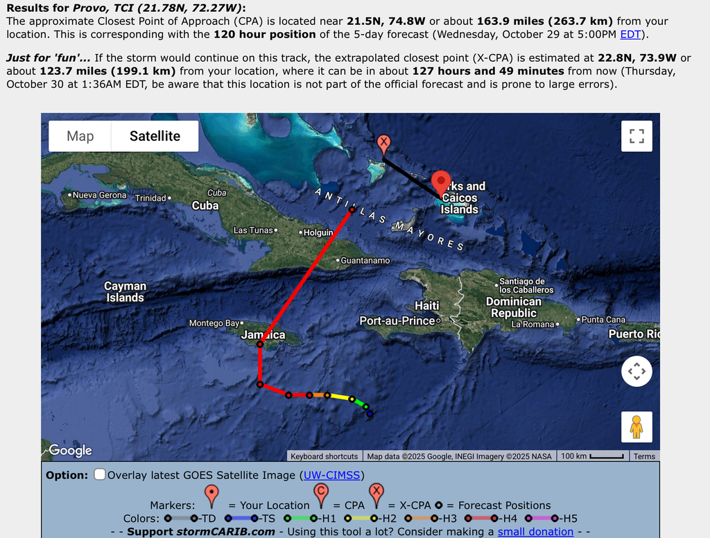
1/ Click on the “Distance” tool for the storm. Click on Provo (because that is where I live)
Note the size of the storm. Radius of 140 miles. That is the area that is within 140 miles of the center is going to experience at least TS (50+ MPH) winds.
2/ Click on the Closest Point Tool. Then Provo (starting to question that choice!)
Note that the storm center is forecast to pass us at 123.7 miles away according to current forecasts.
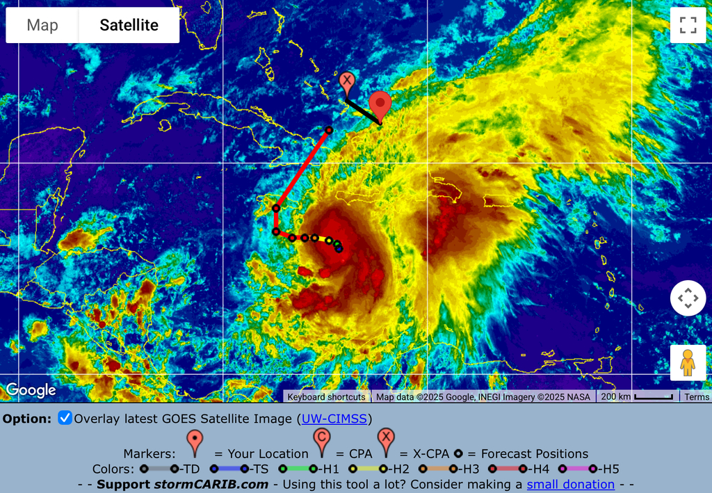
3/ Click the option to display current satellite image
This shows the track, the storm and my location. Clearly, if the storm follows the current track, Provo will be well within the 140 mile TS zone. The dots on the forecast track indicate 12 hour increments and provide a sense of how fast it will be going and when the storm might pass. The closest point info also suggests that it will be at the closest point at a certain time, in this case, Wednesday evening.
4/Recheck this info regularly. I tend to check more frequently if a storm seems to be coming towards us. The last time I noted the closest point, it was 309 miles, it is now 123 miles, the track changed and it is going to pass closer to us. That might continue to happen. No one really knows the forecast track and it can change frequently, so checking this info can produce a trend. In this case, the storm track is getting closer to us.
The bottom line is that by all accounts, this is likely to be a very powerful (read catastrophic) hurricane and it could pass close to the TCI. We are already in the outskirts of Melissa and that is why we are getting rain. We will likely continue to get rain and likely even some wind. (On the current track at least 50mph)
Continue to monitor the storm and try to figure out what you need to do and when you need to do it. (That is the preparation part!) Keep in mind that if it comes towards us, we will get really bad weather a day or two prior to the storm arriving (that is a bad time to be putting up plywood and taking down shade sails). DO IT EARLY! Some folks might have to prepare job sites and offices and haul boats and other work related tasks. Remember to leave time to prepare your home too.
While there is nothing more exciting than preparing for your first storm, remember that you also need to prepare for the “aftermath”. Days without power or city water. No gas stations open, bank ATMs empty, driveways and streets flooded, power poles down, etc, etc. What do you need to have at hand to “camp” for a few days. The power was off after Irma for 40 days. Are you ready for that? No ice, no phone charger, no internet, hmmm…
Of course it is frustrating to not know, but it is far worse to not be ready if it does happen…
This storm is going to be bad for some people, we hope not us, but let’s get ready to help the ones that are affected, as they are going to need help!
Best Regards,
John Lawson
(649)431-5646
- Total Uncertainty (Melissa Update Thursday Aft)
By John Lawson Lawson <j.lawson3 at me.com>
Date: Thu, 23 Oct 2025 18:36:04 -0400
Good Evening;
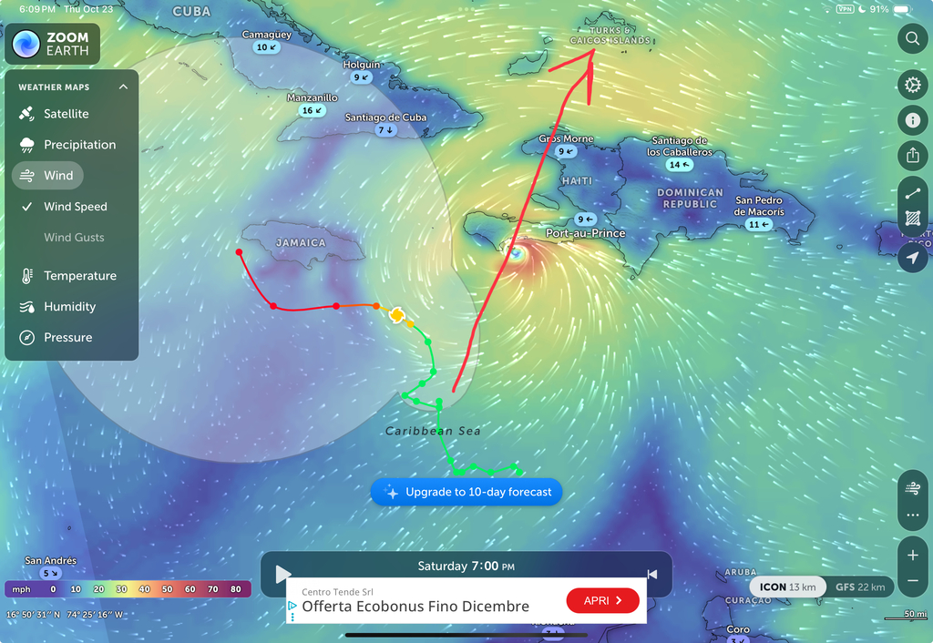
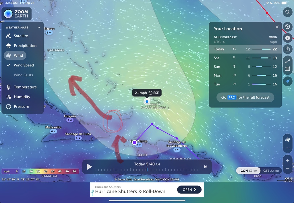
I see that a couple of the models predict a NE direction. In fact, Zoom Earth, a graphical website with lots of good info, seems to show the center of Melissa abandoning the forecast track to Jamaica and opting instead to move NE tomorrow and head for Les Cayes, Haiti.
It is moving slowly, and independent of direction, forecasts seem to agree that it will strengthen. Perhaps CAT4 in the next 2 days.
It would seem that this will be a very serious storm, that will hit somewhere, (or several places!) but we are not yet entirely sure where.
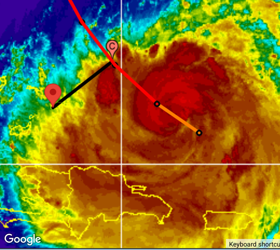
Based on the image above, and on various other models that predict a northeast motion, TCI is far from out of danger. We have had a lot of rain recently. There are flood warnings out now and we could get more.
The above image shows the forecast track as CAT 4 as it moves under Jamaica (where the line turns red). Even with this forecast, one can see considerable unfavorable weather passing by TCI. Should it turn NE (basically the black line) it would head directly towards TCI and be unencumbered by both Haiti and Cuba.
Typically storms in the Caribbean are diminished greatly on impact with Hispaniola and this protects TCI. In this case, the storm could stay over the warm Caribbean water and head towards TCI. As unusual as this course seems to be, it is a possibility.
The next few days will be very telling.
Best Regards,
John Lawson
(649)431-5646
- Hey Melissa, you stopping in?
By John Lawson <j.lawson3 at me.com>
Date: Thu, 23 Oct 2025 02:33:44 -0400
Right now it seems to be a whole pile of uncertainty. The storm is slow moving
which could cause intensification over warm water in the Caribbean, but a turn
to the north will introduce shear and land.
Either way it is a big system with a lot of rain.

TCI will have some affects for sure, but who knows if it will be any more than
showers.
All the Best,
John Lawson
(649)431-5646
- Not a bad Weekend!
By John Lawson Lawson <j.lawson3 at me.com>
Date: Sat, 27 Sep 2025 10:00:40 -0400
Since my plan was to be inside painting anyway…
What is to become Imelda, is now trying to pry herself from the shores of Cuba. Later today, she’ll establish real circulation and we will wake up to finally meet her. That is, when you wake up on Sunday, I am guessing that she will finally be worthy of a name. And then she is off to Atlantis! Well, at least headed towards Nassau. For sure, out of TCI waters now!
TCI will be back to being a tourist Mecca by lunch on Sunday!
Hope you enjoy a quiet weekend!
John Lawson
- Just a Drizzly Day
By John Lawson Lawson <j.lawson3 at me.com>
Date: Fri, 26 Sep 2025 15:54:47 -0400
Good Afternoon,
All of the rain forecasts and indicators that I have seen suggest that overall forecast amounts are being reduced hour by hour. Indicators suggest that the rain will diminish Saturday possibly as early as noon.
I have been told that Punta Cana and Santo Domingo may have gotten all the rain from this storm.
Currently, on North Caicos, we are receiving bouts of light drizzle interspersed with very light drizzle. We are still planning on attending the outdoor BBQ tonight for dinner. I’ll probably take my rain jacket just to ensure it doesn’t rain!🤣
The disturbance itself, yet to be named Imelda, is bouncing along the north coast of Cuba. If she can pull away from the land mass, which looks like it will happen around 12noon tomorrow, she’ll strengthen. There is a strong possibility that she will be formally named and track due North towards Nassau.
Stay Dry!
John Lawson
- Netflix and Chill!
By John Lawson Lawson <j.lawson3 at me.com>
Date: Fri, 26 Sep 2025 05:59:41 -0400
Close call I’d say! What is soon to be Imelda seems to have slipped between Hispaniola and Cuba. Now that she is over water, she can strengthen as she moves to the northwest. The Bahamas need to track her carefully, but with current information it seems she has passed TCI.
That is not say that it will be bright and sunny in TCI. This strength of this system is to the northeast and that is exactly where TCI is. We will continue to see gusty winds and significant rain events throughout Saturday and into Sunday. Lots of rain! The roads and streets of TCI are saturated so there will be accumulation of water and probably flooding. Fortunately, it is a long weekend here and many people can stay home.
It is a Netflix and chill weekend!
Best Regards,
John Lawson
(649)431-5646
- Rain and Wind…
By John Lawson <j.lawson3 at me.com>
Date: Thu, 25 Sep 2025 18:53:05 -0400
The mass of “soon to be Imelda” looks south of Hispaniola.  Even if she
ventures over Hispaniola that has been historically good for TCI.

Obviously, not so good for the DR and Haiti!

The system is currently weak and is not likely to strength over land.  There is
some talk of intensification and the naming, which are most likely to take
place once she exits Hispaniola and is in the open area between us, or at the
very least, over water.
Fortunately, that doesn’t leave a lot of time for development before she is
past us.
Bottom line … TCI is currently forecast to get some windy, rainy days.  It
should be gone late Sunday or early Monday.
Stay tuned as these kind of things are not written in stone.
Have a safe weekend.
All the Best,
John Lawson
(649)431-5646
- Looks like a wet Weekend!
By John Lawson Lawson <j.lawson3 at me.com>
Date: Wed, 24 Sep 2025 15:00:36 -0400
The forecasted track/s of invest 94 seem focused on running between TCI and the DR. Chances of development seem fairly low at the moment, but this could change quickly. At this point, TCI is likely up for some rain days. No wind to speak of.
Rain is usually good, but we are feeling pretty good about our cisterns and the plants right now. The ground may reach its saturation point and the puddles may get deeper.
From Providenciales, TCI
More wind last nite than Sunday. Total rainfall up to 6:30 this morning is 4.5”, and there may be more to come. Lots of thunder.
Have a good day
Kathi
Sent from my iPad
- Another day of squally rain?🤷🏼♂️
By John Lawson Lawson <j.lawson3 at me.com>
Date: Tue, 19 Aug 2025 05:47:11 -0400
I think most people would like to get back to work, but we are not yet sure what the day will bring in terms of government shut down?
Will the airport remain closed? The winds have died down a little and the storm has weakened, but and planes coming from the US have to go around Erin to get here. Could be bumpy.
Best Regards,
John Lawson
(649)431-5646
- So long Erin!
By John Lawson Lawson <j.lawson3 at me.com>
Date: Mon, 18 Aug 2025 17:21:29 -0400
She is on her way out!
165mi from us and growing! We are still well within the gusty wind and occasional down pour part of the storm, but that seems fine. It is high tide now and that is causing some extra spray and probably erosion, but that is acceptable.
Attachment:
Video.mov Description: QuickTime movie
The airport is closed for the rest of the night. I fully expect it will be business as usual tomorrow.
Best Regards,
John Lawson
(649)431-5646
- Erin
By Jimmy and Sharon <piratesofsaltcay at mac.com>
Date: Mon, 18 Aug 2025 09:30:35 -0400
Morning,

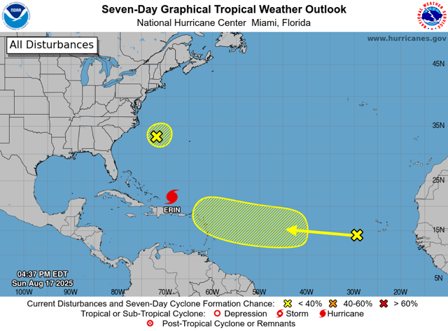
Looks like Erin is getting close to Providenciales in the Turks and Caicos
Islands.

Rain has started and winds have picked up. Last gust was 25 MPH. Bad news is
she is now a cat 4!

Stay safe and be careful if you go outside as the wind gusts will knock you
down>

JS
Provo has gusty winds and rain squalls. The airport is closed and DDME has shut down public services.
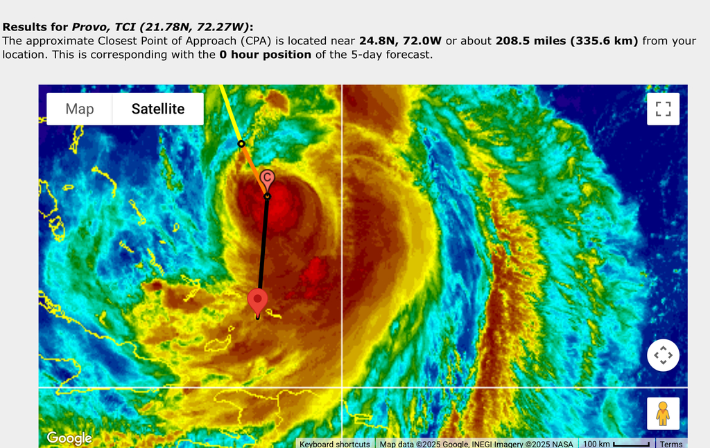
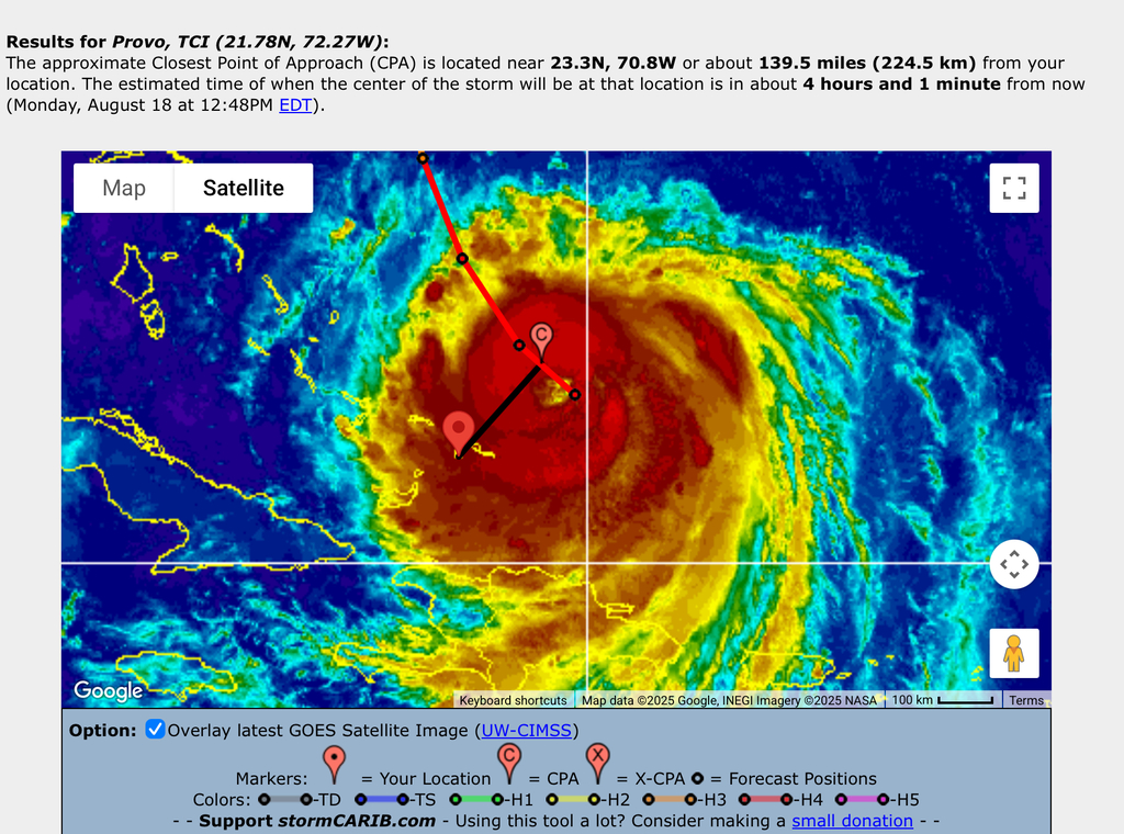
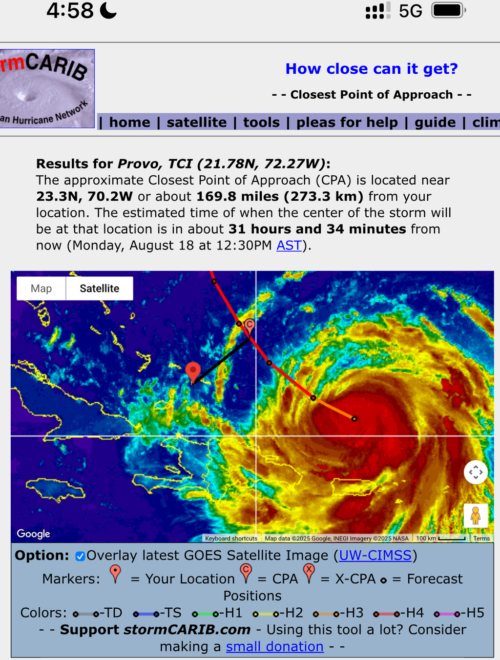
The center of the storm will pass us in 4 hours. It is currently CAT4 with winds of 130mph. The TS winds extend out 230mi and the center is 145mi away from us. We are expected to have high, gusty winds and rain all day.
The power flickered earlier this morning, but it is on now. I could not connect to my North Caicos cameras so they may have had an outage.
Best Regards,
John Lawson
(649)431-5646
- Hurricane Erin
By Kathi Barrington <kathi at svminx.org>
Date: Mon, 18 Aug 2025 06:58:29 -0400
Good morning Gert
Erin is now north of us - Providenciales. Don’t have any way to measure wind,
but it’s a blustery day. No branches down on our property and no leaves on
driveway. Rain gauge at 6:30 this morning:   .25”.     More on its way right
now. We really need it, so hope it continues.
Hope all is well, and goes well with you and all the islands.
Cheers
Kathi
649 431-6257


Sent from my iPad
- It’s Showtime!
By John Lawson <j.lawson3 at me.com>
Date: Sun, 17 Aug 2025 20:41:25 -0400
A gorgeous sunset and colourful sky!
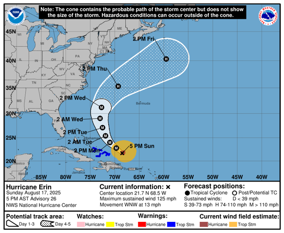
The storm slowed a little, we could feel the gust increase but only a little bit. The TS conditions will be here at 9:30pm.
At some point during the night, Erin will strengthen to CAT4. With any luck that won’t affect her impact on us.
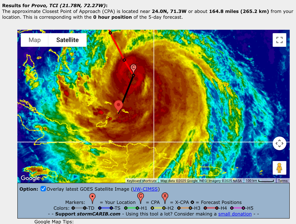
Currently her winds are still 125mph, extending out 205mi and passing us at 165 mi.
The forecast would indicate that the eye will pass north of us at 12noon on Monday and that we’ll have stormy weather possibly until 8pm on Monday.
The wind has certainly picked up on North Caicos, but I have not seen rain at Pelican Beach Club yet. The is no rain on Provo yet that I have seen.
All the Best,
John Lawson
(649)431-5646
- Hello from Pine Cay!
By William Smith <wpns at geekho.com>
Date: Sun, 17 Aug 2025 17:34:02 -0400
Nothing much happening yet, current conditions at http://geekho.com/ as long as the Internet stays up.
Wind has swung around to the North, 21MPH gusting to 33, and the sun is only occasionally visible, but no rain yet, and it’s just a blustery day with a falling barometer.
Shows we’re definitely going to get some tropical storm winds, as the Track That Refuses To Bend North continues to disappoint.
Actually looking forward to a bit of rain to refill the cistern and water the plants for free. The potential follow-on storm is following a more southerly track, so that’s going to bear some watching as well.
More News As It Happens!
- Sittin’ and Waitin’
By John Lawson <j.lawson3 at me.com>
Date: Sun, 17 Aug 2025 16:04:47 -0400
What’s that, an hour until she reach?

The storm will be CAT4 soon.  Winds have stayed consistent at 125mph and the TS
winds extend out 205 mi. The closest point is still 160mi. I still say that we
will get a good storm tonight made worse by the fact that it is dark!😳

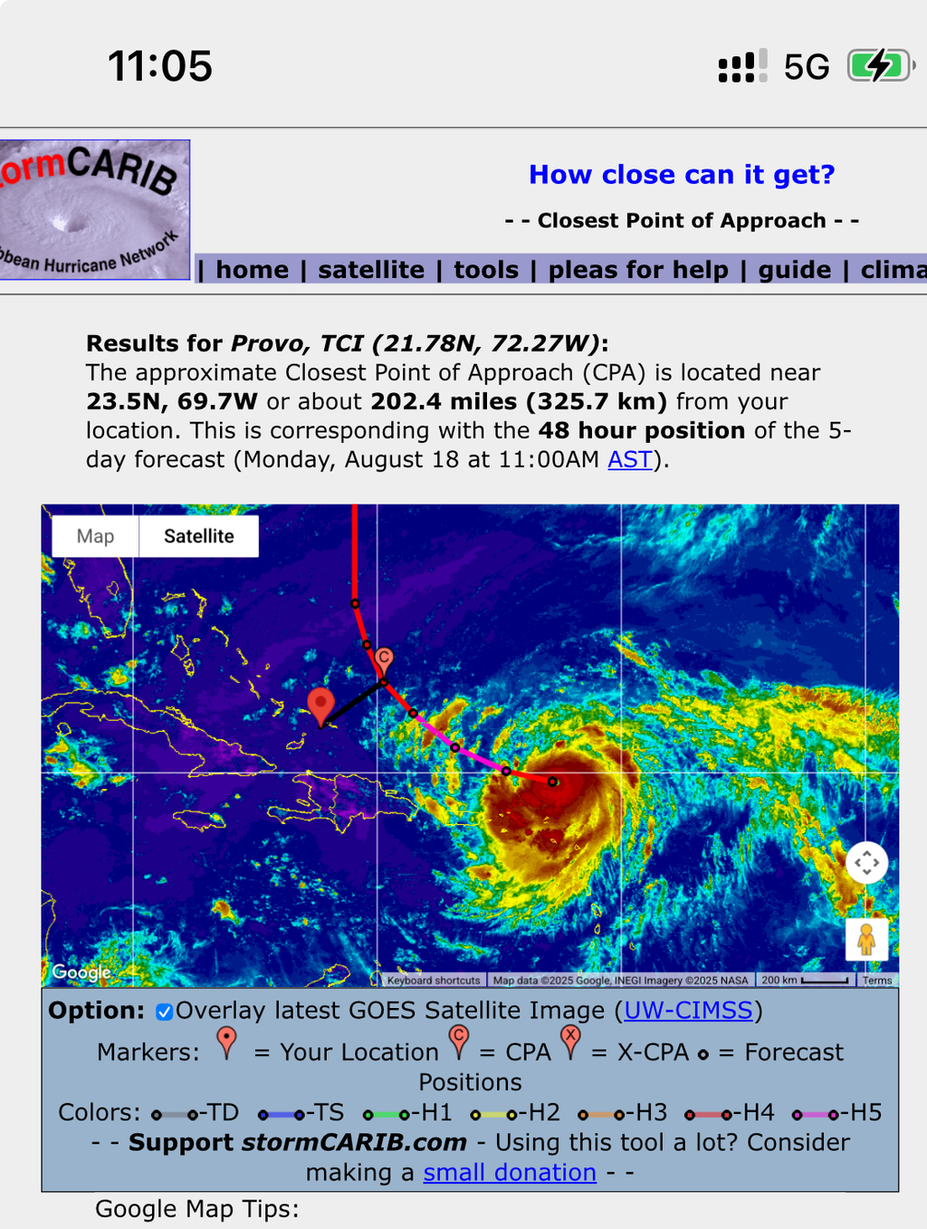
By way of clarification. The black line in the image above is “the closest
point” and it is drawn at 160mi.  I think this gives a good idea of how big
this storm is.

My boat is staying in the water but I have doubled the lines, added 4 fenders
and threw an anchor off the far side.
The tide looks really high already and I bet tomorrows high tide will bring
some good surge with it.

All the Best,
John Lawson
(649)431-5646
- Pelican Beach Club, Whitby, North Caicos
By John Lawson Lawson <j.lawson3 at me.com>
Date: Sun, 17 Aug 2025 14:33:54 -0400
North Caicos is about 30 miles closer to the Storm than Provo. Watching this live feed from Pelican Beach Club on North Caicos would indicate that the wind has picked up a little bit over there already.
On Provo, the wind is just a little bit gusty. It is high tide right now., I believe, so the waves are coming right over the reef
Best Regards,
John Lawson
(649)431-5646
- Erin will be here for dinner!
By John Lawson Lawson <j.lawson3 at me.com>
Date: Sun, 17 Aug 2025 14:18:26 -0400
As of the 2pm report, Erin is hours away. Islands to the east of us will feel her first. She will be felt just as it gets dark in Provo.
Her closest point is 160mi and TS conditions go out 200mi. Her top speed remains at 125mph as a CAT3, but she will intensify and is forecast to be a CAT4 as she passes us.
I just landed in Provo a few minutes ago, so I am going to put a few more lines and fenders on the boat, move the cardboard boxes into the house and make sure I can find the generator in the dark!
Best Regards,
John Lawson
(649)431-5646
- Erin (fwd)
By Gert van Dijken <gert at stormcarib.com>
Date: Sun, 17 Aug 2025 12:19:33 -0400 (EDT)
Date: Sun, 17 Aug 2025 15:56:04 +0000
From: Keith Burant <keith.burant at meridiantrust.tc>
Subject: Erin


Greetings from Providenciales in the TCI.

Skies are overcast and the wind has picked up a little bit, however nothing
major here yet.   Folks are preparing for the storm to intensify, but calm
atmosphere still.  Those in the boating business are a little more active
securing their vessels in anticipation of higher winds and seas.   Most are
watching the storm track and hoping that Erin starts to turn North more than
she currently has tracked.  Most homes in the TCI are newer and have been
built to withstand Hurricane force winds so very little frantic boarding up
occurring.


Regards


Keith Burant
- Erin is coming to town
By John Lawson <j.lawson3 at me.com>
Date: Sun, 17 Aug 2025 05:11:54 -0400
TS winds out 205mi. Closest point is 169miles. That means we are pretty much
guaranteed at least tropical storm conditions.
Max winds for the storm have gone down to 125mph.
Provo, North, Middle, South and GT should all be preparing for TS conditions.
Winds to 74mph and heavy rains.
All the Best,
John Lawson
(649)431-5646
- Erin popping in!
By John Lawson <j.lawson3 at me.com>
Date: Sat, 16 Aug 2025 20:31:02 -0400
The most recent forecast has Erin at CAT5, a very serious storm. She extends
her TS Force winds 185mi and will pass us at 195mi. That 10 miles is going to
be as good as 10ft.

We are definately going to see TS winds!

All the Best,
John Lawson
(649)431-5646
- Erin likely to hit CAT5
By John Lawson <j.lawson3 at me.com>
Date: Sat, 16 Aug 2025 11:30:51 -0400
All the Best,
John Lawson
(649)431-5646
- Erin really wants to visit!
By John Lawson <j.lawson3 at me.com>
Date: Sat, 16 Aug 2025 11:15:54 -0400
As of the 11am today, Erin is a strong CAT4 with 155mph winds.  TS winds extend
out 150mi and she is currently forecast to pass 200mi NE of Provo (North,
Middle, South and GT closer!)
We will likely see tropical storm conditions.

All the Best,
John Lawson
(649)431-5646
- The seas are angry this morning!
By John Lawson Lawson <j.lawson3 at me.com>
Date: Sat, 16 Aug 2025 06:59:09 -0400
Hurricane Erin rapidly intensified to a CAT4 hurricane with winds of 130mph. This is a big deal for anyone in her direct path. Fortunately Provo is not in her direct path, but we are only a little bit out of it.
The map below shows a big area of disturbance, associated with the storm, but extending well below the actual center of the storm. This area carries gusty wind and rain. It appears as though we will see some of both over the next few days.
Best Regards,
John Lawson
(649)431-5646
- Darn! Closer Still
By John Lawson <j.lawson3 at me.com>
Date: Fri, 15 Aug 2025 11:32:27 -0400
Hurricane Erin has crept a little closer to us with a 240mi closest point of approach.
She has also grown and has TS winds extending out 115mi.
That is not a lot of room for error!
She has thankfully started her turn to the north and that is expected to continue.
When you look at it on the map, the little symbol for Provo seems to be in the path of some good wind and rain!
All the Best,
John Lawson
- TS Erin is being shifty
By John Lawson Lawson <j.lawson3 at me.com>
Date: Fri, 15 Aug 2025 07:10:29 -0400
The “stay away Erin” dance is not working. Yesterday, we noted that a substantial part of TS Erin appeared to be below the forecast line. This made it seem like the forecast center position was too far north in the storm. This mornings report includes some activity to the north that looks like it will become part of Erin. This report also expands the size of Erin by 50%, moving her TS conditions 30miles closer to Provo. This has the effect of her moving south and her Closest Point is now 248miles. The bottom line is that while she is forecast to go north, we have seen the opposite so far.
So in summary, Erin is getting bigger, more intense (Cat4) and is tracking closer to Provo.
We are going to monitor closely. We are also making arrangements to move any items that might blow away in a 50 mph gust as it seems very likely that we will get 50mph gusts and some good rain. At times it may feel like we are in a TS.
Best Regards,
John Lawson
(649)431-5646
- Erin pushing West
By John Lawson <j.lawson3 at me.com>
Date: Thu, 14 Aug 2025 17:57:35 -0400
Erin’s track is being pushed farther west.  The experts (Dave!) says that a
high pressure, low sea temps, some Sahara dust and a bit of wind shear are all
contributing to a more westerly trek with no Northern element to her travel …
yet.

One she gets to the warmer water and other factors permit, She will increase in
strength going from TS to CAT1, CAT2, CAT3 and possibly higher. At this point
she will turn north.

She will stay above Turks and Caicos, but the big question is, what will the
impact be? When will she turn North?

At this point it looks like we will get some rain bands with gusts around
50mph. That will feel like a pretty serious storm at times.

The current forecast puts the highest activity on Monday afternoon.  She be
closest to Provo at 5pm on Monday. The closest point being 271 miles. This is
well outside the hurricane winds and probably the TS sustained winds, but we
will get stormy weather.

All the Best,
John Lawson
(649)431-5646
- Erin moves a little south😳
By John Lawson <j.lawson3 at me.com>
Date: Thu, 14 Aug 2025 10:58:48 -0400
Erin’s path has dropped a little and the center is predicted to be 295mi north
of Provo. (It had increased to 325mi)
A more defined center is starting to appear as the intensity increases. A big
part of the storm appears to be below (to the south of) the designated center
point. This will have an adverse affect on TCI as we may feel some winds.
It still appears as though we will be well out of the TS winds on the current
forecast track.
It is still too soon to know for sure.


All the Best,
John Lawson
- Erin is Ramping Up
By John Lawson Lawson <j.lawson3 at me.com>
Date: Wed, 13 Aug 2025 09:40:14 -0400
Current forecasts for Erin include her becoming a major hurricane (CAT3). Fortunately, the projected path continues to turn north. Her projected path is now 288 miles to the north of Provo. As long as she continues to the north, Provo will not be impacted.
Unfortunately, a storm like this will impact some. She has already claimed 5 lives in Cape Verde Islands. Hopefully everyone prepares and losses are minimal.
Best Regards,
John Lawson
- The approach of Erin
By John Lawson Lawson <j.lawson3 at me.com>
Date: Tue, 12 Aug 2025 23:01:31 -0400
TS Erin continues to move in a westerly direction toward the TCI and the Bahamas. She is forecast to be a CAT3 by the time she reaches us. Fortunately, the current path shows her 200 miles north of us. Her TS winds have grown from spreading 45 miles out to, now, 60 miles out, but that is still WELL out of our waters.
This is the time to be checking your generator, getting fuel for it, buy some extra water, make sure the car fuel tank is full, fill the bbq tank, get a bit of cash out of the atm so you can spend when the power is out and the CC machines are down, buy SPAM of course! Just pretend that this is a rehearsal for the real thing! One day you will be thankful that you prepared (and practiced!) early.
Best Regards,
John Lawson
- Monitoring a Possible Erin
By John Lawson Lawson <j.lawson3 at me.com>
Date: Mon, 11 Aug 2025 09:32:07 -0400
The word is out, a depression out of Africa is likely to form TS Erin. There is a possibility the this could even become a hurricane. On the current track, it looks like it will pass to the North of TCI but it is way too soon to place that bet. It would be best to get prepared and monitor for further, more accurate forecasts.