
|
|
- Updates from the Islands -- - Curaçao - - |
|
|
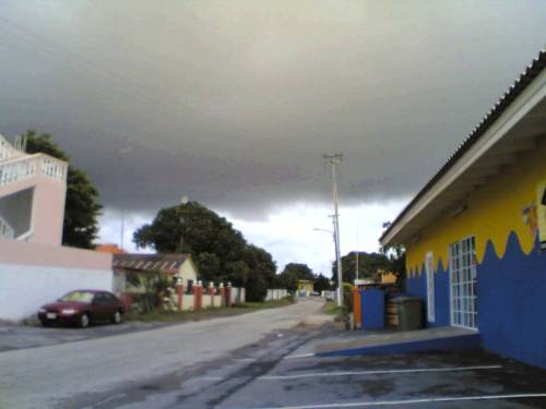
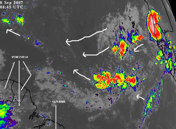
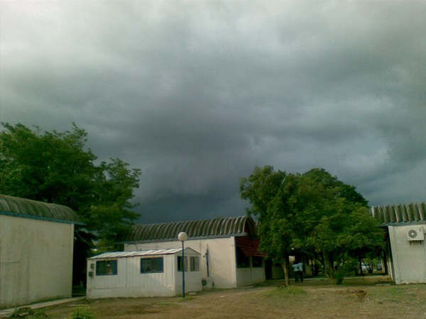
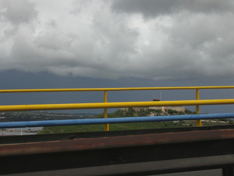
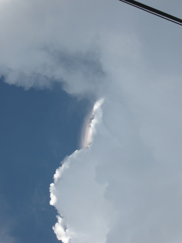
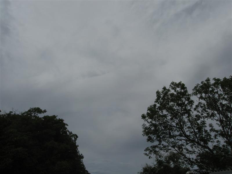
| - Waterspout right of the coast | |
| |
|
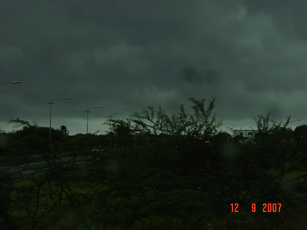
| - chilly weather... |
|
| So if the excess CO-2 is causing a global warming... how come it is getting chilly in the Dutch Caribbean islands in the tropics? During the past week we experienced record lows. Last sunday the temperature dropped even to 21 degrees celsius. Did the earth shift in its axis? Is the equator elsewhere right now? Hello Houston, we got a problem! |
| - earthquake somewhere in the Caribbean or Venezuela? |
|
|
Has anyone experienced earth shocks on Saturday evening? At approx 10 pm local time GMT-4, I felt a earth shock that caused the wall of my office to vibrate for a second or two. I decided to wait for a newscast but thusfar nothing in the news. regards, Marcus |
| - seasons greetings and all the best in 2008 from DeMaaijer family |
|
 Thank you for your time. warm greetings, Marcus DeMaaijer Curacao Wildlife Website: http://www.curacaowildlife.com Email: demaaijer at yahoo.com ALARM PHONE: +(599-9) 668-3500 Fax/phone: +(599-9) 737-9005 Skype: marcus.demaaijer |
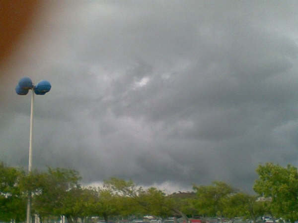
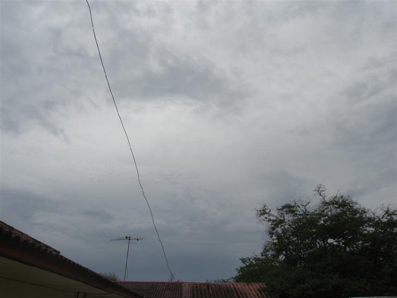
| - weather sat vs radar |
|
|
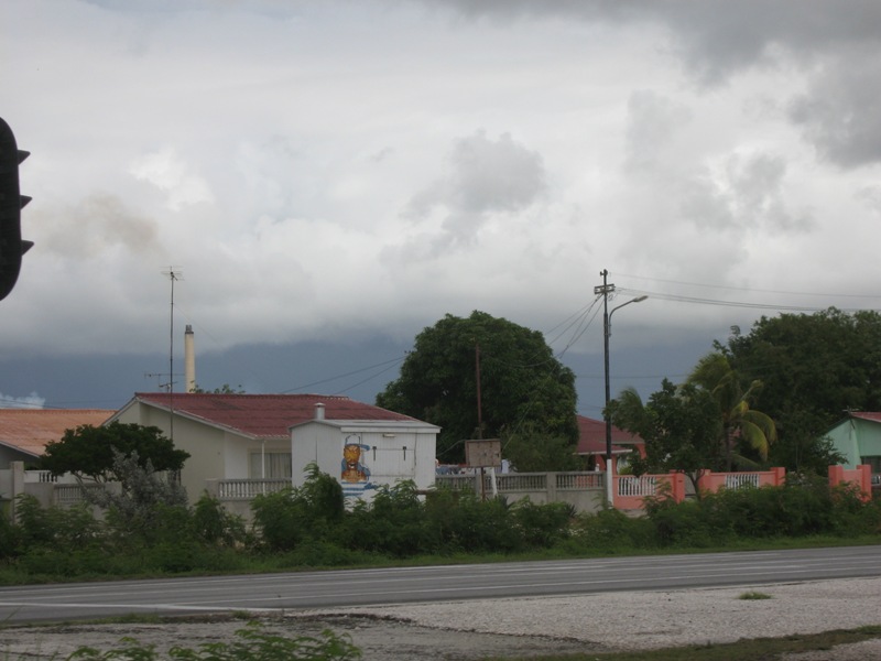
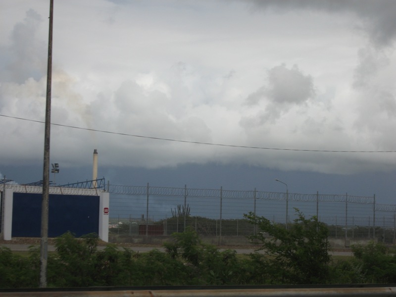
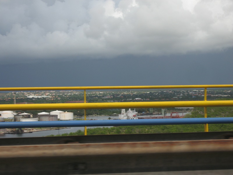
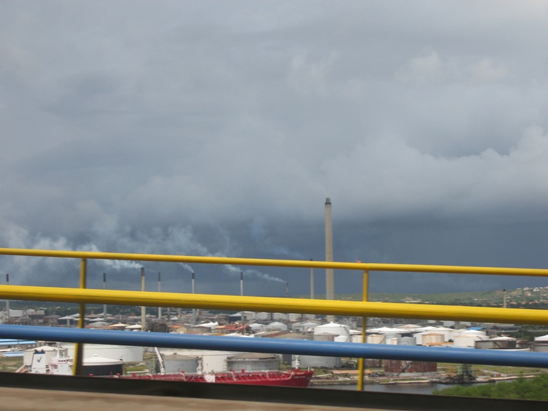
The weather sats were a handy tool during the hurricane season, but currently they suck at monitoring rainshowers without lightning for Curacao. Yesterday for example, we experienced massive amounts of rain pouring down, causing the roads and highways to flood, causing massive traffic jams all over the island. Right now the visibility at the southern seashore is minimal: at the horizon you xan not see where the sea ends and the sky begins. At this very moment a very intense shower is located in the region of Sint Joris Bay which is moving very poko poko towards southwest SW. Thank God for radar at http://www.meteo.an/ ps: we felt that earthquake in the early afternoon last thursday... greets, Marcus DeMaaijer |
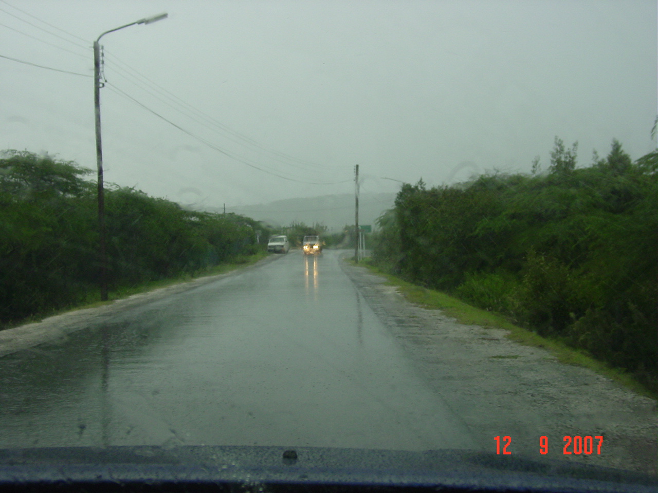
| - Rain all day | |
| |
|
| - Some activity, No Rain :( | |
| |
Attachment:
241024.jpg Attachment:
241025.jpg Attachment:
241026.jpg Attachment:
241028.jpg Attachment:
241029.jpg |
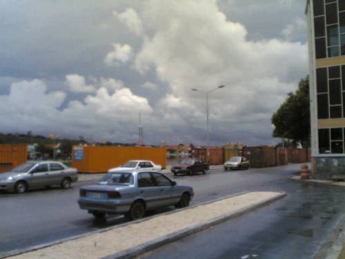
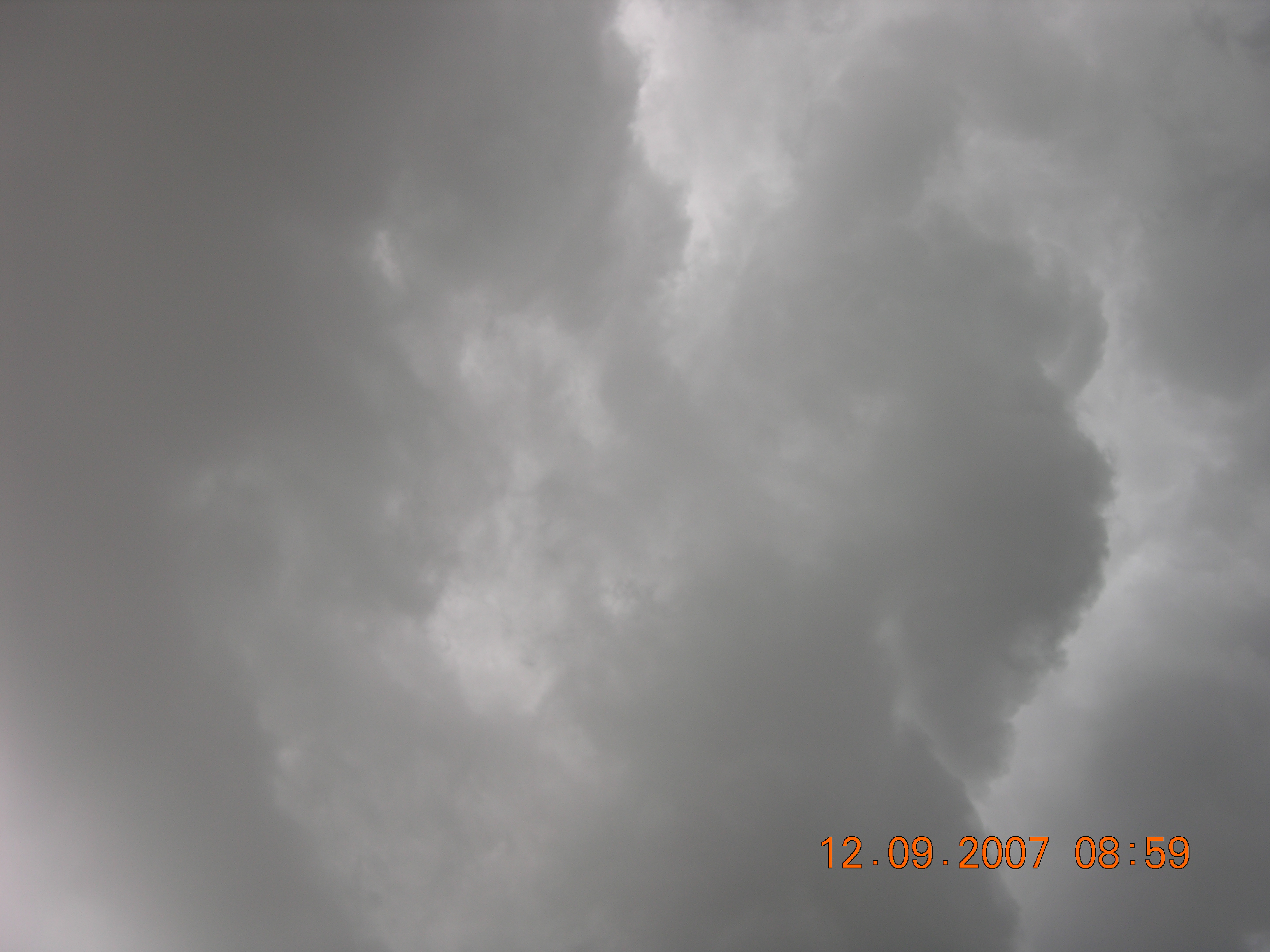
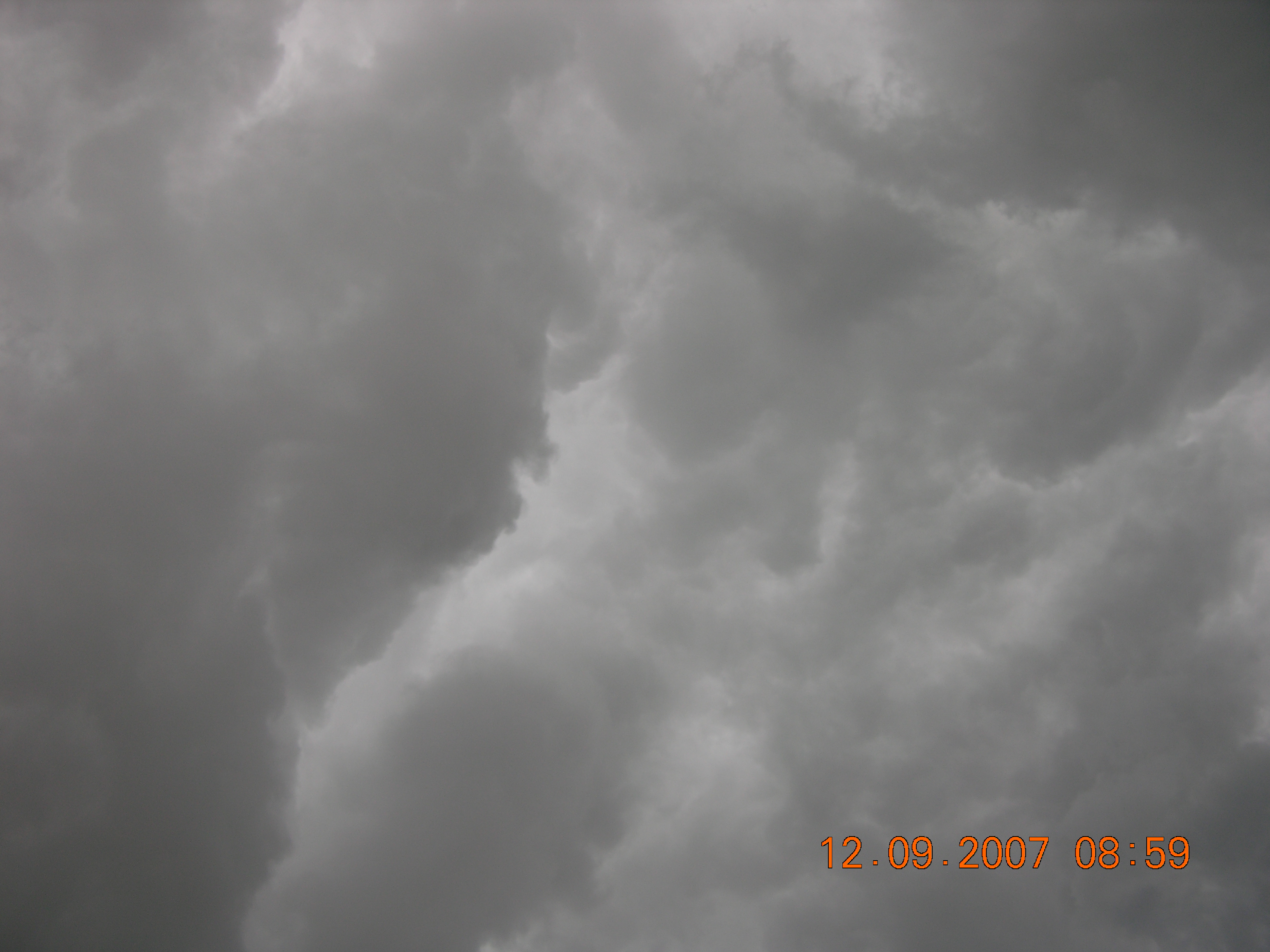
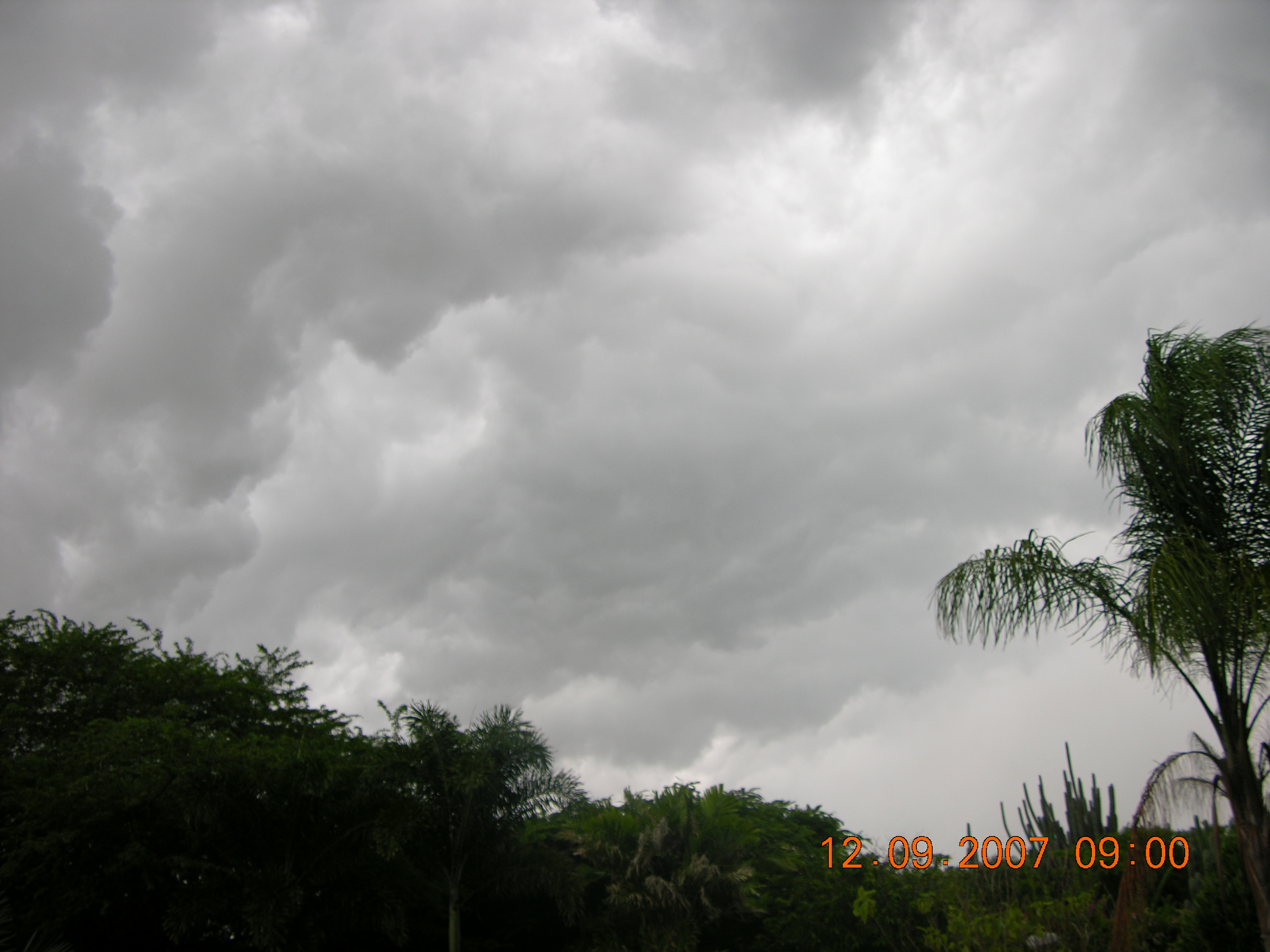
| - Great day for weather spotting! | |
| |
Attachment:
IMG_8416.jpg Attachment:
IMG_8419.jpg Attachment:
IMG_8421.jpg Attachment:
IMG_8423.jpg Attachment:
IMG_8424.jpg Attachment:
IMG_8425.jpg Attachment:
IMG_8426.jpg Attachment:
IMG_8427.jpg Attachment:
IMG_8431.jpg Attachment:
IMG_8433.jpg Attachment:
IMG_8434.jpg Attachment:
IMG_8437.jpg |
| - Update |
|
|
After 2 days of rain thunder and lighting from a BIG wave passing by, I decide it was time for me to post some images for every one out there. Best Regards, Reynald G. Dovale
Pinpoint customers who are looking for what you sell.
|
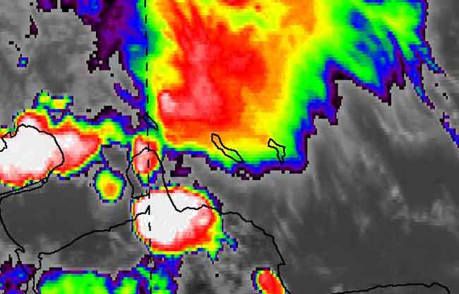
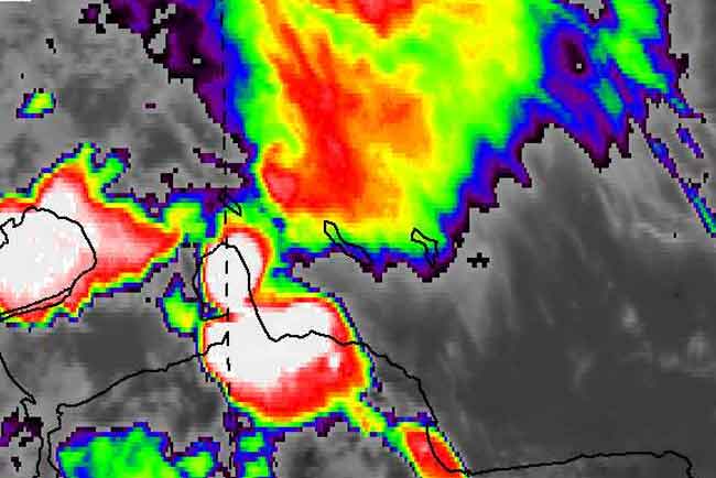
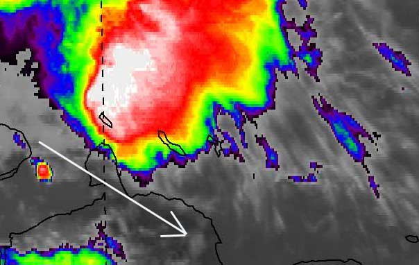
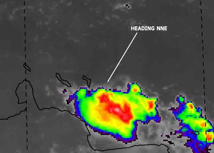
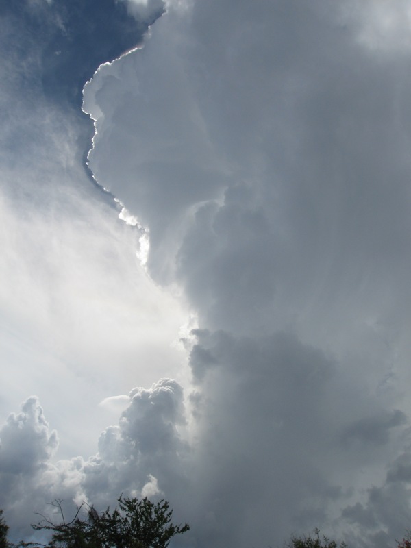
| - Something is brewing in the tropics? | |
| |
|
| - Another morning, another thunderstorm | |
| |
|
| - More info about the lightning storm | |
| |
|
| - it rained? where? |
|
Devin, where are you located in Curacao, because it did not rain at all on Saturday at my house. The sky was cloudy but that was about it. No thunder and lightning either other than some thunder in the distance. So lightning hit your house? What damage did that do? Upload some pictures of the where the lightning struck at your house. Or give me your address so that I can do that for you... |
| - Rain, Rain | |
| |
|
| - 2 months 2 go |
|
With just a few days over 2 months 2 go in the hurricane season it has been rather quiet down here in Curacao during the past 2 weeks,... |
| - hmm | ||
| ||
|
| - heads up... | ||
| ||
|
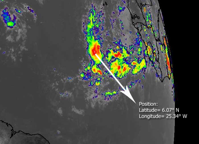
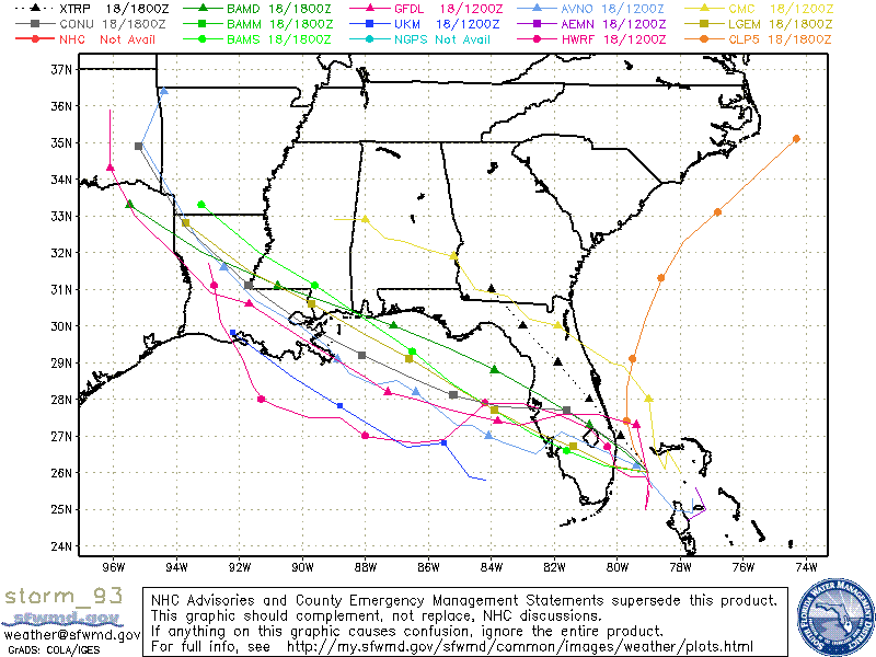
| - storm 93 |
|
| Storm 93 just stuck out its neck east of Florida....I am gathering data now... |
| - Satellite and realtime picture |
|
|
Here is a Satellite picture and a realtime digital picture. Look like there is a lightshow comming up tonight. Best regards, Reynald G. Dovale
Looking for a deal? Find great prices on flights and hotels with Yahoo! FareChase.
|
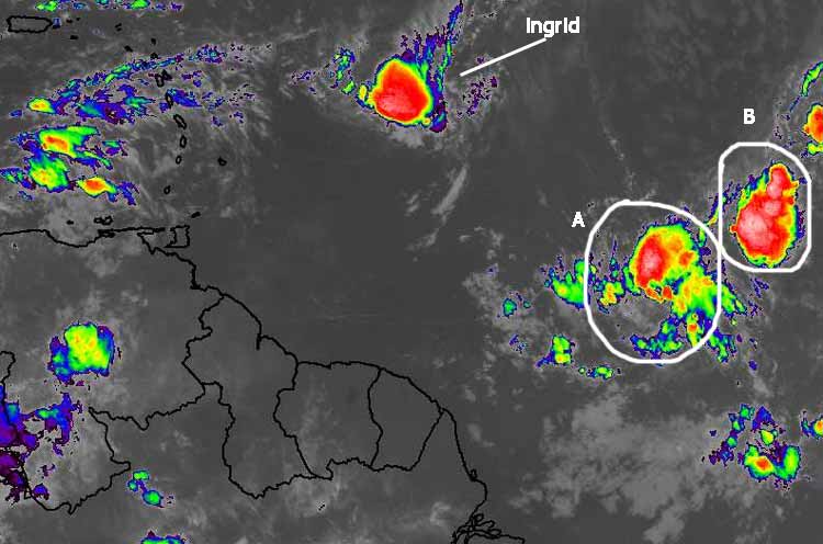
| - all clear now... |
|
|
Whatever took care of Ingrid also caused the blobbette just due north of the ABC islands to dissipate as well. ps: I forgot to bring along my datastick with the lightning pictures of last night in the skies above Curacao...It was quite a show!! |
| - from SWS instead of NWN... | ||
| ||
|
| - here comes the rain.... | ||
| ||
|
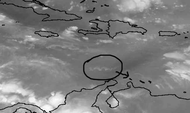
| - tiny wave heading 2 Korsou sat image | |||
| |||
|
| - Good riddens Ingrid and hello you two.... | |||
| |||
|
| - storm nr 9 - Ingrid | |||
| |||
|
| - storm 9 is humberto and storm 8 is still 8... | ||
| ||
|
| - Is TD Number 8 heading South? |
|
The skies are mostly clear right now and due to the rain we got this morning the temperature is pretty cool at around 27 degrees. (Well cool for Caribbean standards at least) These past few days we have been getting morning and night-time showers, so chances are we might get some tonight or the next morning. Watching the tropics and things have really heated up! If I’m not mistaken yesterday was the peak of the hurricane season and they were commenting on the Weather Channel that it doesn’t happen that often that on the 11th there’s no active system. One day and things become active. About TD #8, is it me or is this thing taking a WSW track instead of the Northerly track they are forecasting? Bon nochi, Devin Balentina www.gadgetnutz.com www.thenokiaguide.typepad.com _________________________________________________________________ Discover the new Windows Vista http://search.msn.com/results.aspx?q=windows+vista&mkt=en-US&form=QBRE |
| - blue skies are back | ||
| ||
|
| - 2 hours ago. |
|
|
Greetings This is how the weather looked 2 hours ago. Make way for a Tropical wave. Gusty winds, rain & thunder and lighting. Best regards, Reynald G. Dovale
Got a little couch potato? Check out fun summer activities for kids.
|
| - Cooler temperatures: Rain rain rain |
|
Today I got up at around 9am and was awaken by the sound of some pretty gusty winds. Right now it’s 10:30am and it has been raining since. It started with some heavy showers accompanied by some fairly gusty winds. In the past minutes the thunder has been getting louder and louder. My prefect kind of weather! This is a welcome change from the pretty hot temperatures last night. Regards, Devin Balentina www.gadgetnutz.com www.thenokiaguide.typepad.com _________________________________________________________________ Invite your mail contacts to join your friends list with Windows Live Spaces. It's easy! http://spaces.live.com/spacesapi.aspx?wx_action=create&wx_url=/friends.aspx&mkt=en-us |
| - weer | |||||||||||
| |||||||||||
Attachment:
DSCN6603.JPG Attachment:
DSCN6604.JPG Attachment:
DSCN6606.JPG |
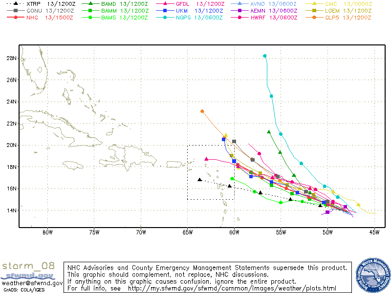
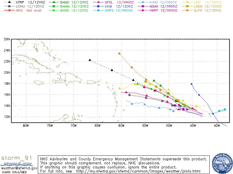
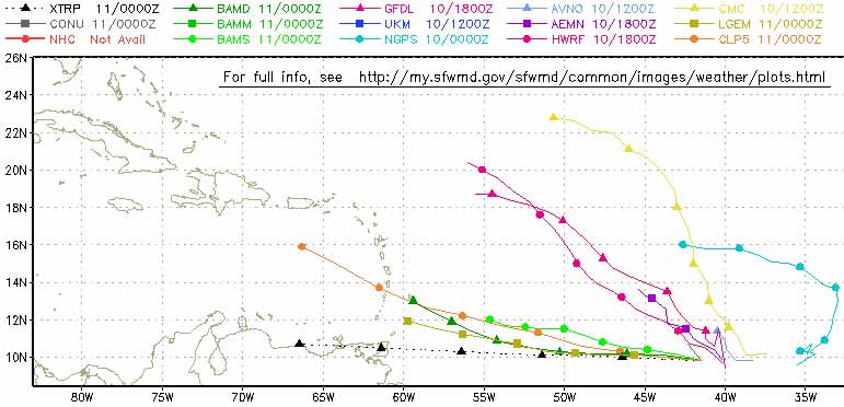
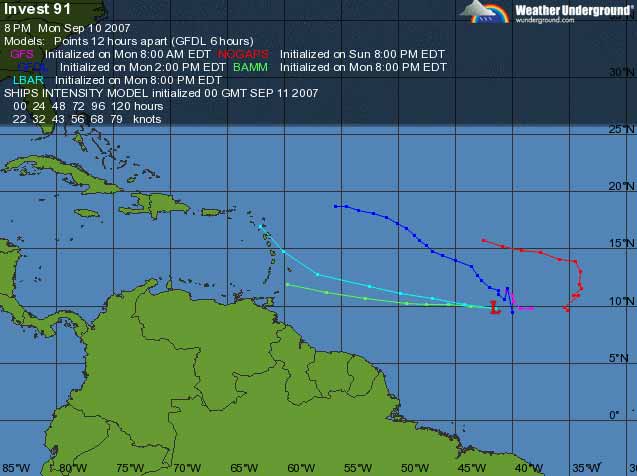
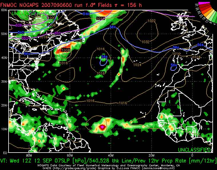
| - more projections of invest 91 | |||
| |||
|
| - september is the month to remember... | |||
| |||
|
| - H! synergy P.... | |||
| |||
|
| - Happy Birthday to Bonaire's Flag !!! | ||
| ||
|
| - forecast for 6 days from noon today | ||
| ||
|
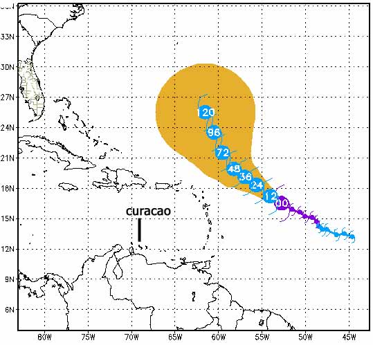
| - Invest 98 at 11.6 N !! | |||
| |||
|
| - pictures of Canoa | |||
| |||
|
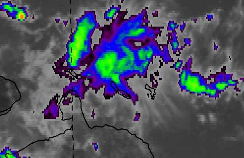
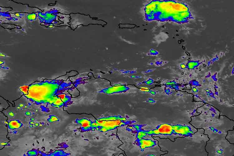
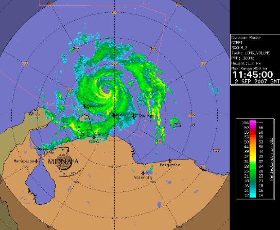
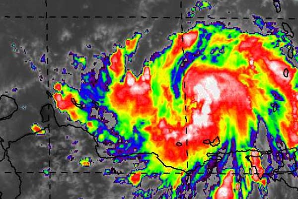
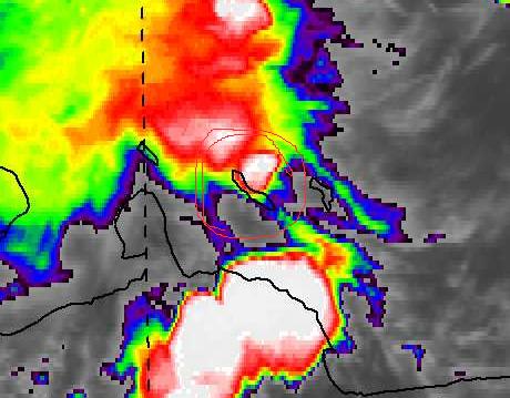
| - Latest radar image from Curacao radar |
|
|
Yahoo! oneSearch: Finally, mobile search that gives answers, not web links.
|
| - Winds from the South. (fwd) |
|
Received earlier.

*
**
*** Gert van Dijken ( gert at vandijken.com )
**** Caribbean Hurricane Network - http://stormcarib.com


---------- Forwarded message ----------
Date: Sun, 2 Sep 2007 04:55:04 -0700 (PDT)
From: Reynald Dovale <reynald_dovale at yahoo.com>
Subject: Winds from the South.

Willemstad ,Curacao
  7:45 Winds are coming from the south as the center comes to its closest point
to the island.
  I would say gust at 30 km/h , sustained at 15 to 20 km/h at this moment.
  Just a lot of rain for now.

  Best regards,
  Reynald G. Dovale
|
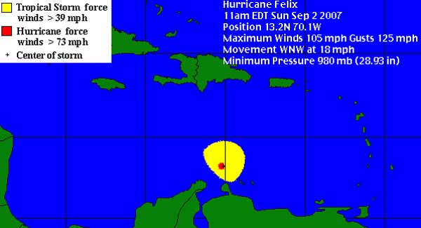
| - bye bye Felix |
|
|
USA NHC update: AT 800 AM AST...1200Z...THE CENTER OF HURRICANE FELIX WAS LOCATED BY A NOAA HURRICANE HUNTER AIRCRAFT NEAR LATITUDE 13.0 NORTH... LONGITUDE 69.3 WEST OR ABOUT 380 MILES...615 KM... SOUTH OF SANTO DOMINGO IN THE DOMINICAN REPUBLIC...AND ABOUT 60 MILES...95 KM... NORTHEAST OF ARUBA. The storm winds never reached Curacao!! |
| - Felix |
|
|
Update
wind from the SSW at 18 MPH gusting to 32 MPH according to our Airport
Where I am on the island winds do not seem so strong.
Sky is overcast and raining
Rain total 58mm
Preasure 1008 hPa
|
| - Felix |
|
|
Winds have started coming from the west not very strong.
Breezy my guess between 10-15 mph with light gusts not more then 15 mph
Total precipitation so far 40mm.
|
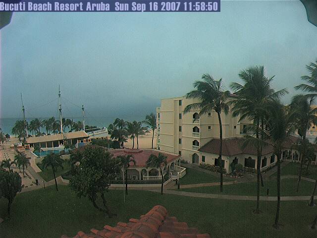
| - here comes the sun | |||
| |||
|
| - Felix |
|
|
new advisory out
AT 500 AM AST...0900Z...THE CENTER OF HURRICANE FELIX WAS LOCATED
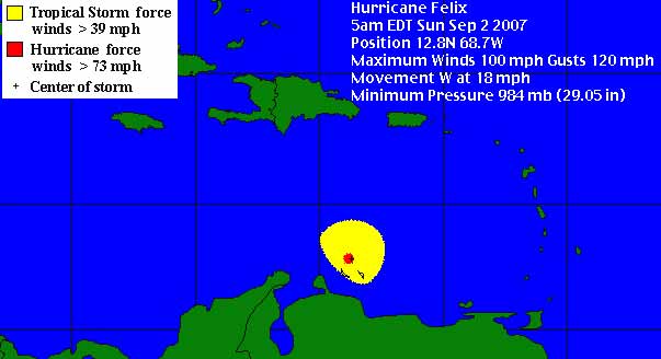
NEAR LATITUDE 12.8 NORTH...LONGITUDE 68.7 WEST OR ABOUT 400 MILES... 645 KM...SOUTH-SOUTHEAST OF SANTO DOMINGO IN THE DOMINICAN REPUBLIC...AND ABOUT 85 MILES...135 KM...EAST-NORTHEAST OF ARUBA. |
| - USA NHC update |
|
|
AT 500 AM AST...0900Z...THE CENTER OF HURRICANE FELIX WAS LOCATED NEAR LATITUDE 12.8 NORTH...LONGITUDE 68.7 WEST OR ABOUT 400 MILES... 645 KM...SOUTH-SOUTHEAST OF SANTO DOMINGO IN THE DOMINICAN REPUBLIC...AND ABOUT 85 MILES...135 KM...EAST-NORTHEAST OF ARUBA. |
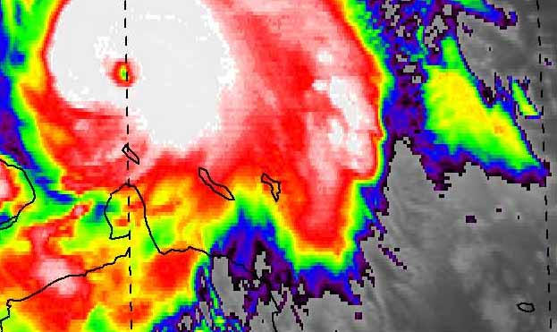
| - Felix is a Cat 2 now | |||
| |||
|
| - Felix |
|
| its now 4:29 the last squal that came by with rain brought us 24 mm that was in 20 minutes time ..at the moment the rain slowed down to a steady drizzle no wind. |
| - Heavy rain, wind | |
| |
|
| - Felix |
|
|
It's just before 4 am
thunder can be heard.
At the moment we are having gusty windows and the rain is coming down hard
|
| - Felix |
|
|
Its now 3 am the rain has slowed to a drizzle. No wind
This past hour it rained 6 mm.
Michèle
|
| - Felix is getting closer |
|
|
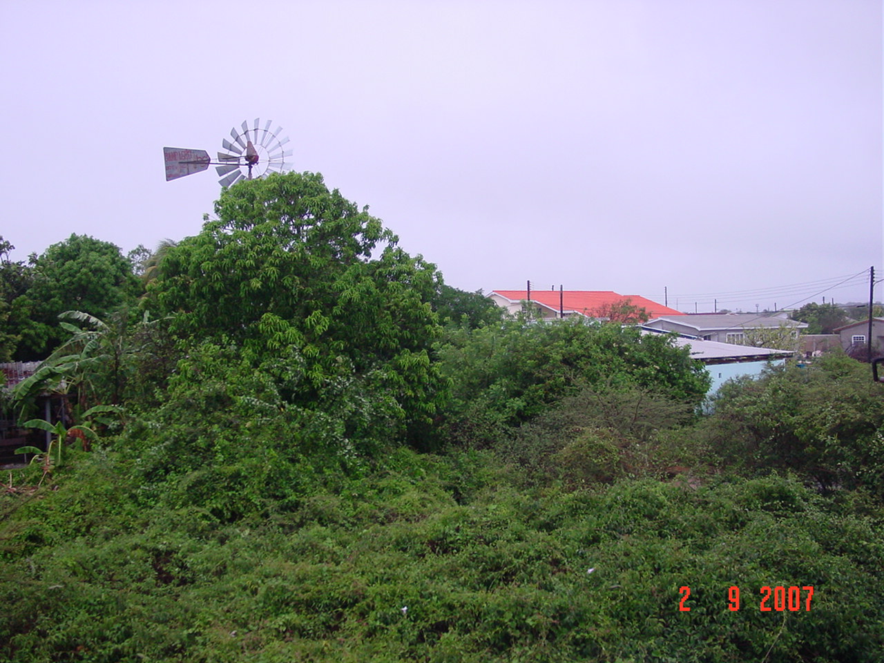
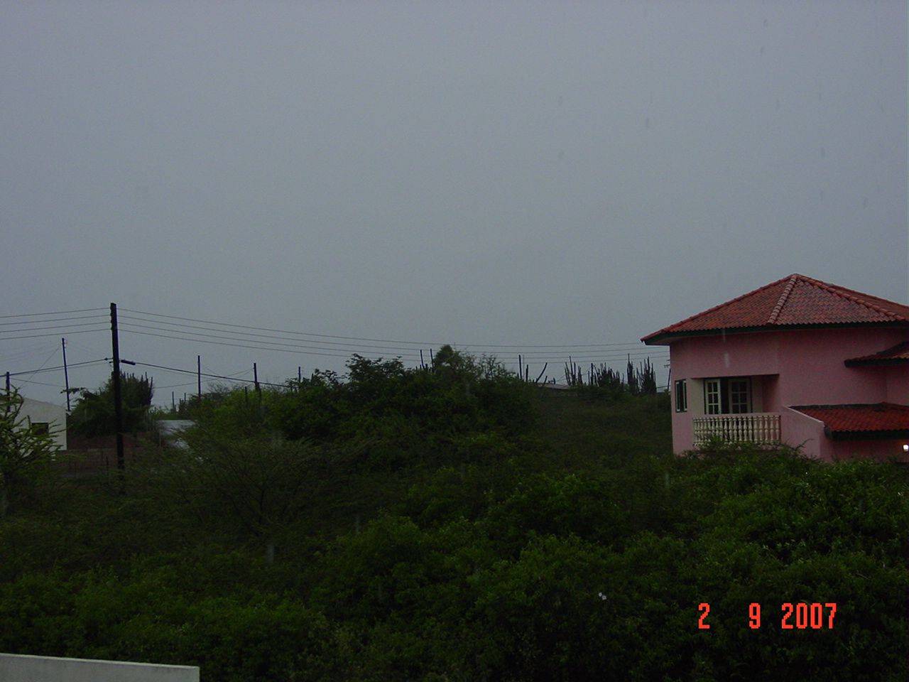
We had this evening a very quiet evening. There was no wind and if you looked up into the sky you saw scattered clouds which were floating by toward the south east direction. This was an unusual sight for us here on Curaçao since our clouds always come from the east.
At 11 pm the government of Netherlands Antilles placed us on a Hurricane watch. And tropical storm warning.
Its now 2 am and it has started to rain heavily. No thunder to be heard and no lightning to be seen and no wind.
Felix is coming closer according to the last advisory of 2 am
AT 200 AM AST...0600Z...THE CENTER OF HURRICANE FELIX WAS LOCATED
NEAR LATITUDE 12.7 NORTH...LONGITUDE 67.8 WEST OR ABOUT 45 MILES... 70 KM...NORTHEAST OF BONAIRE AND ABOUT 145 MILES...235 KM... EAST OF ARUBA. Good news the eye will pass north of us. Interestingly Felix is still at 12.7N latitude which will place the eye of the storm fairly close to our island (circa 100 miles). We will see tropical storm winds I am afraid, which we do not want but the rain will be welcome for our dry little island.
I will keep you posted
Michèle
|
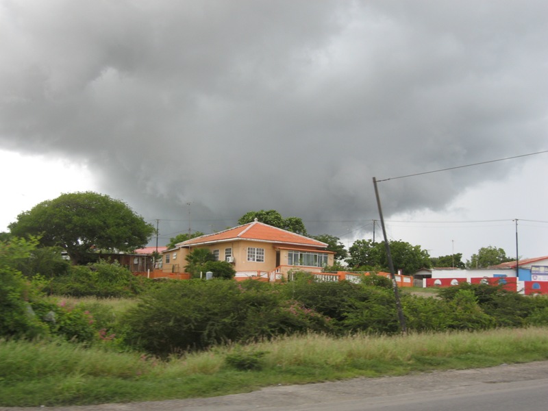
| - the quiet b4 the storm |
|
|
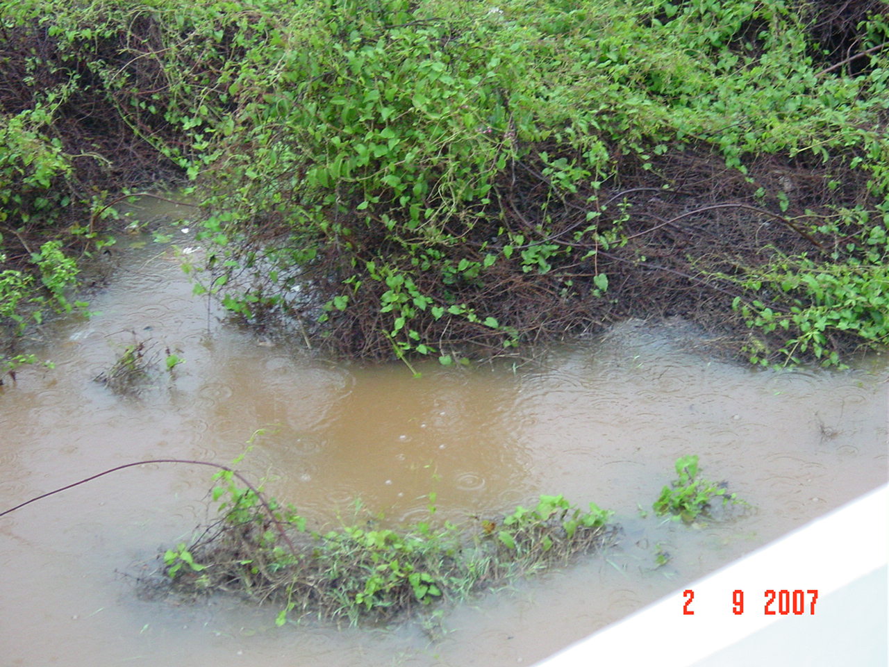
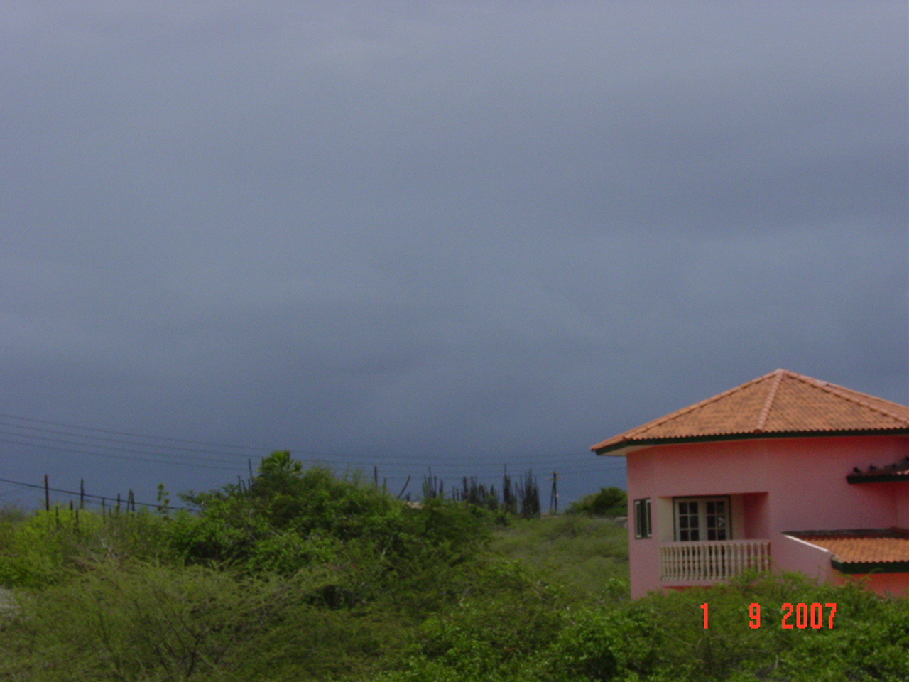
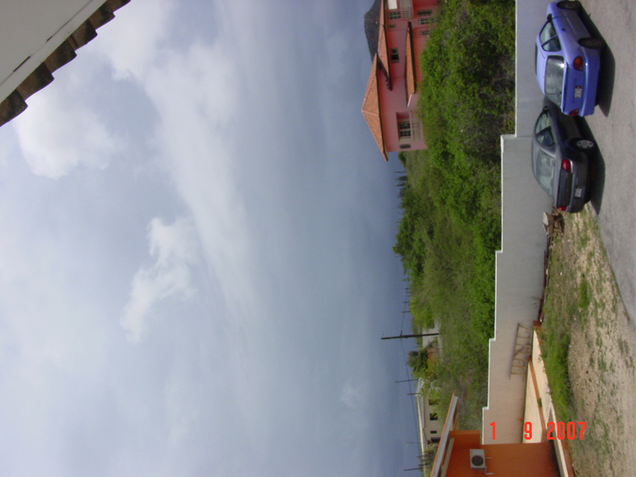
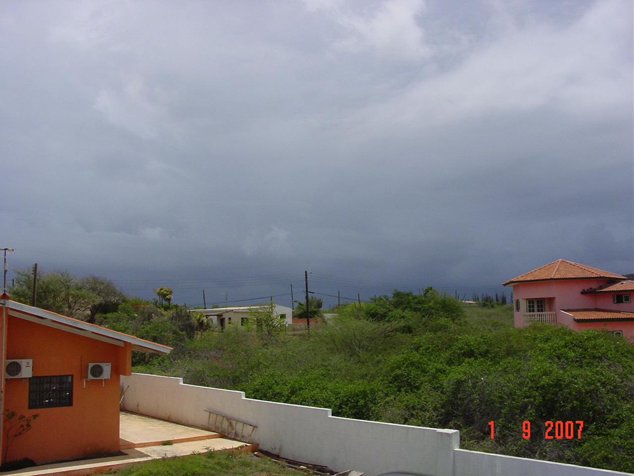
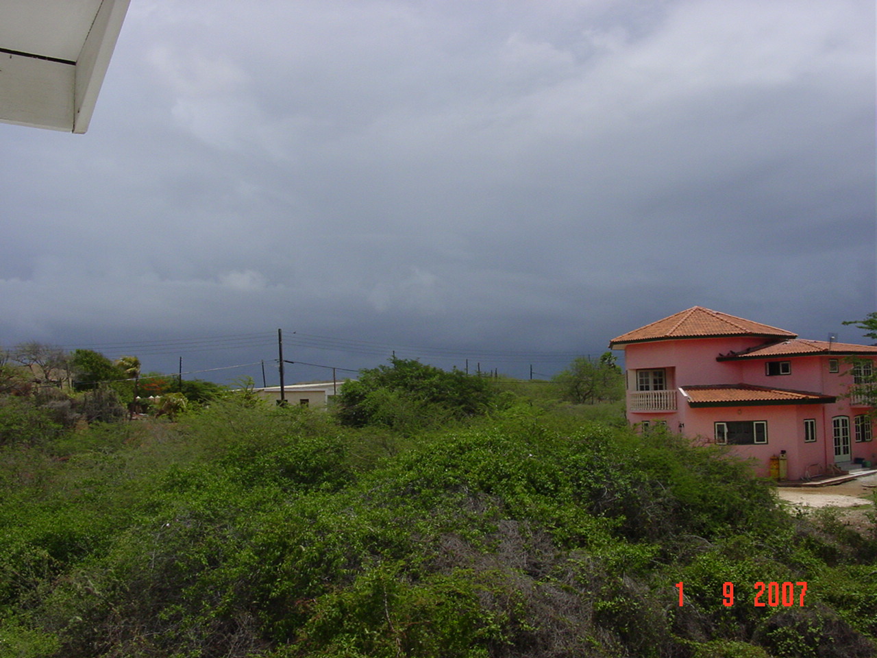
Weather past, current and future conditions Willemstad, Curacao, the Dutch Caribbean. Lat/Lon:12.2° N 69.0° W Ever since 3pm it has been an earie calm. Currently the sea has flattened along the southern coastline, but the waves are still approx 10 ft at Canoa due to the stormsurge. This weathe ris similar to our experience with Ivan: a gail with strong wind for a brief period of time ahead of the storm and then nothing..nada..njet. Felix is now a category 1 hurricane. Thank God the eye and the hurricane winds are according to the computer models 200 miles due north of Curaca when Felix passes us tomorrow. But when the storm takes a southern dip within the next 12 hours...THAT will make things interesting...but still it will still pass us by... so sit tight and get some sleep for tomorrow is the big day... ps: those of you out there who did not want to quit the whale watch...happy camping, sleep tight, don't let the lisembei bite... Current conditions: 20070901 - 22:25 pm local time of Curacao (September 2 2007 - 02:25 am UTC) Temperature: 82.4 °F / 28.0 °C Humidity: 88% Sea level pressure: 29.92 in / 1013 hPa (falling) Visibility: 6.2 miles / 10.0 kilometers Wind: 20° (NNE) 12.7 mph / UV index: 0 out of 16 Sky: Scattered Clouds 1600 ft / 487 m; Mostly Cloudy 35000 ft / 10668 m Waves: due to stormsurge northern seashore 6 to 10 ft waves (increasing next 24 hrs), southern seashore 1 ft waves (increasing next 24 hrs). Godspeed to all of ye... Marcus DeMaaijer Thank you for your time. warm greetings, Marcus DeMaaijer Curacao Wildlife President & Emergency Animal Care Coordinator Website: http://www.curacaowildlife.com Email: demaaijer at yahoo.com ALARM PHONE: +(599-9) 668-3500 Fax/phone: +(599-9) 461-0739 Skype: marcus.demaaijer |
| - update | |
| |
|
| - one more time | |||
| |||
|
| - here pussycat.. | |||
| |||
|
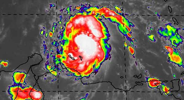
| - Spiral Band earlier, all is quiet now |
|
Hey guys, Devin from Curacao here. I’m the newest member of the local hurricane
correspondents.  I’m happy to be part of the team. So let’s get things rolling!
This morning the skies were blue with a few puffy clouds, until about one hour
ago. We had a spiral band move in with thunder here and there and strong gusts
of about 30-35 km/h. All is quiet now; all that’s left now are some high
clouds, left over from the thunderheads (Cumulonimbus).  See picture below.

Regards,

Devin Balentina
www.thenokiaguide.typepad.com
www.gadgetnutz.com

_________________________________________________________________
Discover the new Windows Vista
http://search.msn.com/results.aspx?q=windows+vista&mkt=en-US&form=QBRE
Attachment:
IMG_7878 (Medium).JPG Attachment:
IMG_7879 (Medium).JPG |
| - Fwd: Felix heading toward Curaçao (fwd) |
|
---------- Forwarded message ---------- Date: Sat, 1 Sep 2007 13:52:37 -0400 From: "[ISO-8859-1] Michčle van Veldhoven" <mvanveldhoven at gmail.com> To: gert at gobeach.com Subject: [ISO-8859-1] Fwd: Felix heading toward Curaçao Dear Gert here are two pictures of our weather taken at approx. 1:45 pm As you can see drizzle and very high clouds with small blue patches Michčle Attachment:
Bands of Felix.JPG Attachment:
Drizzle 01-09-07.JPG |
| - Felix heading toward Curaçao |
|
|
Hi Gert,
My name is Michèle I've been watching this system develop since yesterday morning. I had a feeling he might end up coming our way. Conditions looked right.
Its 1:30 pm here on Curaçao, the first bands have arrived. Some rain fell up till now 2mm . Its drizziling and thunder could be heard 30 mintes ago.
I live in the center of the island and we are not experiencing any gusts yet the wind is very slight if any at all.
Keep you informed
Regards
Michèle van veldhoven
|
| - Feeder bands |
|
|
Dear Gert, My name is Reynald I am 41 and I live in Curacao. I have some photo's of the first feeder bands comming in to Curacao. A lot a wind (gusts 30 km/h and a lot of thunder. Will be keeping you informed Best regards Reynald Dovale
Park yourself in front of a world of choices in alternative vehicles. Visit the Yahoo! Auto Green Center.
|
Older reports from Curacao have been moved to another page.
| Back to top |


