|
|
- - - 2014 Hurricane Season - - -
|
- The season starts today (ample evidence) -
|
- From: Ian Martin Borde <readkrox51 at gmail.com>
- Date: Thu, 14 May 2015 00:23:57 -0400
|
Good Day, Good Everything People of Paradise,
Today, Thursday 14th. May 2015 has hovering over it ample evidence that the rains are here. For the Caribbean, The Season has Started ! May God Bless Us in Our Endeavors, .... Attachment:
13th may 2015 1115 pm.jpg
Description: JPEG image
Attachment:
India & Nepal's earthquake april 2015.jpg
Description: JPEG image
|
|
- Dual Case Scenario - possible but not probable - 36 hrs.
|
- From: Ian Martin Borde <readkrox51 at gmail.com>
- Date: Sat, 9 May 2015 09:44:05 -0400
|
Good Fellows of Paradise,
I forecast rain, (specially as it just fell). (tee hee) ( like Grenada ) ! AND SOON. TS. Ana is 12 - 36 hrs. from true landfall but my opinion is it will head out to sea. There is a system forming, ( possible after eastern Caribbean ), at 40 W. That 's not where the rain came from. But at 60 W. the bands (I call feeder bands that make it cyclonic) are touching the coast of Trinidad. Definite rainfall, ..., in 12 - 36 hrs., (If like all the previous the whole gamut doesn't go Venezuela or even Brazil.). Thanks and Praise |
|
- PreP & PrevenT / Personal & Infrastructure deadline approaching, ...
|
- From: Ian Martin Borde <readkrox51 at gmail.com>
- Date: Thu, 23 Apr 2015 03:46:23 -0400
|
2015 - 04 - 23rd Thu. 03:20 am. Trinidad & Tobago, W.I.
Dear friends,
Without paranoia or denial the 'wet' season is approaching, ...
I mean, like in days. (Ask the cricketers?)
1) Do you a. Know your emergency shelter, infrastructure personnel and tools phone number, what is allowed before, during and after in an emergency shelter.
2) Do you know where a. All your identification documents and numbers are? Are they in the house? Are they in the car? Are they at work? Does the assistant have them? Do you have zip - lock bags and folders? Alternatives and options for communication, electricity, water, non-perishable food, prescription medicine, transport and waste disposal.
3) Have you remembered, To cut rotten branches, cleared roofing & waterways, drains, and in General, KEEP THE PLACE CLEAN ? ( of possible flying objects ).
With a 50% chance of accuracy, Next week Saturday morning / Friday night, we should have seen our first hazardous occurrence.
In the immediate future, (Eastern Caribbean), Intermittent showers are possible today tomorrow and the following day. Nothing hazardous but remember what happened in St. Vincent in April. (Either 2012 or 2013) ?
To be fore - warned is to be fore - armed, ... Attachment:
23rd apr 145am.jpg
Description: JPEG image
|
|
- Rain Harbinger -
|
- From: Ian Martin Borde <readkrox51 at gmail.com>
- Date: Fri, 20 Mar 2015 06:05:02 -0400
|
P/Vly, D'go M'rtn, T'dad & T'bgo, W.I. 2015 - 03 - 20th Fri. 05:15 a.m.
Good Day, Good Everything, People of Paradise,
I must apologize that within 48 hours of all my forecasts since the 'record winter blizzard' the absolutely contrary conditions to the forecasts began to show themselves in the tropics. To put it another way, "Sorry for all the precipitation." But believe me, that is a very, very good thing. (water wise).
This pleasant morning, foreday morning, after my kitten healed from having his first fight, one has to put his 'pen to paper', again.
Yesterday in the progress of the ITCZ travelling back North for the 2015 northerly summer season, 'wet' season, or hurricane season, we in Trinidad & Tobago had our first full-fledged tropical rain shower. White - out midday in Port of Spain! (From a full-blown ITCZ).
IN NORMAL CONDITIONS: This will mean the 35% possibility of thundershowers at midday for the next two week. After which for a duration of three weeks a return to the 'dry' season conditions prevailing, .... At the end of these five weeks, we will have rain practically every day in T'dad & T'bgo. This and in addition possible cyclonic showers and systems. In the mean time we thank the Almighty for warm sunshine and fresh breezes. During these five weeks the sea calms and fish and birds, dangerous marine life migrate. Plants and flowers are germinated by bees and butterflies, ...
Whatever development, building and construction taking place should finish in five weeks as accidents don't just happen but are caused and rains will wash away 'out-of-timing' construction.
To repeat,
Thank God for warm sunshine and fresh breezes!
Attachment:
20th march 415 am.jpg
Description: JPEG image
|
|
- about Normalizing or ? stabilizing ?
|
- From: Ian Martin Borde <readkrox51 at gmail.com>
- Date: Thu, 12 Mar 2015 06:13:04 -0400
|
Just a short note that wont affect the time I report for duty, ...
I will like to say that what I am referring to in the 2015 - 2016 'wet' season, (based on this dry season) is that normalizing is different to stabilizing.
CLIMATE CHANGE HAS NOT STOPPED.
Back to the forecast for the next few days:
"Some stabilizing of 'dry' season conditions could ensue, ..."
As a by note, having explored the sea coasts and seas vigorously as a lad, the attachments show what my new epitome of nature is really like.
God bless Attachment:
IMG_1861.JPG
Description: JPEG image
Attachment:
IMG_1863 (2).JPG
Description: JPEG image
Attachment:
IMG_1864.JPG
Description: JPEG image
Attachment:
IMG_1886 (2).JPG
Description: JPEG image
Attachment:
IMG_1949 (2).JPG
Description: JPEG image
Attachment:
IMG_1952 (2).JPG
Description: JPEG image
Attachment:
IMG_1962.JPG
Description: JPEG image
Attachment:
IMG_1963 (2).JPG
Description: JPEG image
|
|
- Party Done!
|
- From: Ian Martin Borde <readkrox51 at gmail.com>
- Date: Wed, 18 Feb 2015 17:29:20 -0400
|
How I love Paradise and
The People of Paradise,  Party Done ! It's Ash Wednesday ! Attached are pics of the weather most of the day. And seas last night. I will be a lil familiar and guise the affection by forecasting as follows, ... Anyone will include in his predictions further rain. But, but when it is caused in a scenario of skew. (SAL, non-tropical cyclones, dry season = normal) "One has to take each cloud at its own merit." Because: 1) These are nigh-level, cold-top clouds. 2) It's the height of hills and the temperature of the soil that makes rain fall. (Hazardous Precipitation) 3) Any prediction will be inaccurate because of SAL and many other things. By the way, (in affection), I would give a measured guess of precipitation for a further two weeks hardly bordering on hazardous. Lent [ref: 'fast and pray'] God bless Attachment:
18th feb 2015 345pm.jpg
Description: JPEG image
Attachment:
atlsea_latestBW.gif
Description: GIF image
|
|
- Good News - 'Nature is Balanced'
|
- From: Ian Martin Borde <readkrox51 at gmail.com>
- Date: Wed, 11 Feb 2015 05:55:37 -0400
|
2015-02-11th Wed. 05:25 a.m. P/Vly, D'go, T&T, W.I.
People of Paradise,
"There is good news on the horizon."
Besides the fact, that in dry conditions, 'flora and fauna' blossom and bloom to preserve the lineage.
(Accompanied by fresh breezes to scatter the seeds that bear further future fruit.)
There is a vigorous (non-tropical) cyclonic system off the northern part of the Atlantic sea-board. This will have several beneficial effects to restore the balance to a skewed ecological pattern. It is also a 'perfect' example of the need and 'good nature' of cyclones. Most likely predictions and forecasts will alter after its transit.
One of the effects it will have in a day and a half time, Is the likely hood of precipitation or copious rain. This as it drags moisture over the Caribbean to feed 'its good nature'.
For those who are late to celebrate, This weekend is; - Carnival Week-End -
(You don't have to fine tune your receivers to participate just 'press a button'.)
Remember to conserve water, God bless
|
|
- C O N S E R V E - W A T E R -
|
- From: Ian Martin Borde <readkrox51 at gmail.com>
- Date: Thu, 5 Feb 2015 06:16:49 -0400
|
2015 - 02 - 05th. Thurs. D'go, T&T, W.I. 06 : 05 a.m.
My dear People of Paradise,
"Hark! What is this I spy yonder." [ref: I forget whose literature]
With less than 5% accuracy, (but able to give reasons),
I predict;
The rest of February will have 'little or no' rain!
(And since March is the dryest month in Trinidad, so too March)!
- The SAL (dry air) that kept us safe from hurricanes last year is very present and deterring. (More work needs to be done on this phenomenon.) - The precipitable water imagery (possible rainfall data) all show no rain for (about) the coming two weeks.
This is not good news but is inaccurate as SAL can do what he wants when he wants.
God bless, (for there are all types of emergencies) |
|
- Probably last menacing approachment - 36 - 48 hrs. -
|
- From: Ian Martin Borde <readkrox51 at gmail.com>
- Date: Fri, 23 Jan 2015 06:44:41 -0400
|
Ain't life in the tropics, T O P S !!
Carnival, Masquerade, Music and so much more, .... Who needs the beach to show off ? As sweet and salty as it is ? Well people of Paradise, What should be our last take on the effects of cold fronts and high-pressure on the eastern Caribbean is approaching. It is fairly southern. The main danger area is 24 - 36 hrs. away. The sun and pressures are returning to normal. The sea is manageable with steadfast advice. While I abhor 'complacency' (a necessary necessity) This one should be about 65% harmless. To end: "Disaster preparedness while it should be an everyday routine must not be paranoia or denial but steeped in reality because by definition, It's - Life or Death - " God bless |
|
- Today is a Watershed Moment -
|
- From: Ian Martin Borde <readkrox51 at gmail.com>
- Date: Thu, 15 Jan 2015 06:04:15 -0400
|
2015 - 01 - 15th. Thurs. 05:30 a.m.
Petit Valley, Diego Martin, Trinidad & Tobago, W.I.
Shalom, Salem, Chow Saann, Eka Aro, Bonjour, Buenos Dias, Najmaste,
Peace - People of Paradise,
Regardless of Your Ultimate Belief re: Higher Ideals,
TODAY IS A WATERSHED MOMENT
Around today the sun treks back up north.
Therefore a new 'global warming - climate change' season starts.
The winter storage is depleting. So too sales, income, grain, et al.
Spring & Summer starts it's 'culture' of 'ploughing, sowing and planting.
So too Spring and Summer bring exams, graduations, projects and planning.
In the longer term, Spring and Summer bring the next harvest time.
Weather-wise;
Having last year not just marginally but totally less disaster events and casualties.
High Pressure (as in snow and ice) would not come any more southern this winter.
Seas while not placid are normal winter-rough and full of currents (presently).
To end, most of all normal barometric pressure is present today.
What can we do. What are we going to do. Where do we go from here.
"Each man to his or her own order."
But, (I firmly believe),
"We are our brother's keeper."
- Not a bunch or parasites and predators at the top of a food chain -
For, ( THE WEATHER SHOWS US )
"When a door is closed a window will open."
God bless,
Peace
Attachment:
'Lord Nelson'.jpg
Description: JPEG image
Attachment:
refuge.jpg
Description: JPEG image
|
|
- What 2015 will bring!!!
|
- From: Stephen Abouhamad <stephen_abouhamad at hotmail.com>
- Date: Wed, 14 Jan 2015 00:37:12 +0000
|
Trinidad and Tobago Port of Spain 13/1/15 Happy 2015 to all the StormCarib readers where ever you are located. Hope that 2015 will be the year full of blessings to all. Well we are officially in the dry season but we still welcome day time and early morning showers. In Trinidad there are still light to moderate showers which brings a cool and refreshing start to the day. These light showers are due to the Inter Tropical Convergence Zone drifting south after the hurricane season. The ITCZ drifts to south America this time of year which affects the moisture around Trinidad and Tobago. Hope everyone is having a great night. Regards,
Michael and Stephen Abouhamad
|
|
|
- Carnival Celebrations started, ...
|
- From: Ian Martin Borde <readkrox51 at gmail.com>
- Date: Mon, 12 Jan 2015 03:52:01 -0400
|
Last Friday (this weekend) Carnival characters invaded Port of Spain The capital city of Trinidad & Tobago. This showcase of grandes dammes and moko jumbies and bats and devils in Port of Spain is the process of launching a season of not just non-stop partying but one of The Greatest Shows on Earth.
It's a spirit, it's a party, it's man in his true form, Glory and Shame. Everyone is represented freely.
While it might be almost impossible to get a flight you should not miss this freeing up of the soul and spirit. While hopping thru the other islands each virgin in beauty.
Play mas
God bless Attachment:
Lost in Paradise.png
Description: PNG image
|
|
- Something Eventful in 12 - 36 hrs.
|
- From: Ian Martin Borde <readkrox51 at gmail.com>
- Date: Thu, 8 Jan 2015 01:33:21 -0400
|
Good Morning,
People of Paradise, Just when I was looking to call a 'Reprieve', from high seas, it is my calculated and experienced opinion the situation is going to augment. Never have I or we seen a system (actually a group of systems) like this in an environment we call 'tropical'. Never have I seen such temperatures, winds and pressures not approaching but having actually reached South America ( 10 North Latitude ) already. One of the images attached actually puts in a tropical wave. Which by the way I agree with. Prepare & Be vigilant Attachment:
jan 8th 2015.gif
Description: GIF image
Attachment:
thurs 8th jan 2015.png
Description: PNG image
|
|
- As forecasted -
|
- From: Ian Martin Borde <readkrox51 at gmail.com>
- Date: Sun, 4 Jan 2015 05:31:05 -0400
|
Well the second approachment is on the way ( by early afternoon )
but beginning pre-dawn tomorrow.
This is NHC: HIGH PRESSURE OVER THE W ATLANTIC WILL PERSIST
WHILE SLOWLY SHIFTING EAST OVER THE NEXT COUPLE OF DAYS.
A COLD FRONT WILL EXIT THE SE CONUS COAST
ENTERING THE WESTERN ATLANTIC SUNDAY NIGHT
WITH CONVECTION. Should I fail to tell you this one is no better than the last and waves will be two feet higher. And convection will be stronger even hazardous. While we still have hazardous time for prevention, while removing the danger or removing us (and property) from the danger. Let well enough alone! Because LOCAL Conditions Vary ! God bless Attachment:
4th january 415am medium panorama.jpg
Description: JPEG image
|
|
- ( < 72 hrs.) Reprieve
|
- From: Ian Martin Borde <readkrox51 at gmail.com>
- Date: Fri, 2 Jan 2015 04:15:03 -0400
|
Beginning before midday today Friday, there will be a notable anti-climax in sea and other distressing conditions.
No one knows what the future holds but The Father. But a recurrence seems more than reasonable within 72 hrs.
As usual there is no room for complacency and Reprieves are a source of learning, prevention and restoration.
Let's use any tropical sunshine this weekend to pro-actively shore up our concerns, ...
God Bless & Happy New Year |
|
- The approachment climaxing and continuing for another 36 - 48 hrs.
|
- From: Ian Martin Borde <readkrox51 at gmail.com>
- Date: Mon, 29 Dec 2014 09:48:43 -0400
|
will continue to be destabilizing today and well into tomorrow. God bless |
|
- 1st. Approachment -
|
- From: Ian Martin Borde <readkrox51 at gmail.com>
- Date: Sat, 27 Dec 2014 02:31:18 -0400
|
2014 - 12 - 27th. Sat.
02 : 05 a.m. T&T, W.I. Hi People of Paradise, (Just thinking; Wouldn't it be nice if instead of - T&T, W.I.- we could all just say Eastern, Western, Northern and Southern Caribbean?) Our first (what I call) 'approachment' for winter is bearing down on us. It is noteworthy for two reasons, ... - The effects of this first one will tell us what to ignore in the next. (Prevention-wise) - The north coast and Tobago last year in the second approachment had 7 foot waves battering and grounding small sailing vessels unexpectedly. This is NHC: CARIBBEAN SEA...
A GALE IS IN EFFECT ALONG THE COAST OF COLOMBIA. SEE ABOVE.
20- 30 KT TRADEWINDS ARE OVER THE CENTRAL
AND EASTERN CARIBBEAN.
15 KT TRADEWINDS ARE OVER THE NW CARIBBEAN.
SCATTERED SHOWERS ARE ALONG THE COAST OF N NICARAGUA
N OF 13N. MOSTLY FAIR WEATHER IS OVER THE REMAINDER
OF THE CARIBBEAN. IN THE UPPER LEVELS... AN
UPPER LEVEL HIGH IS CENTERED OVER HAITI.
STRONG SUBSIDENCE COVERS THE ENTIRE CARIBBEAN.
EXPECT OVER THE NEXT 24 HOURS FOR
SCATTERED SHOWERS TO ADVECT OVER THE WINDWARD ISLANDS...
AND ELSEWHERE OVER THE GULF OF HONDURAS. We welcome the cold (not cool) mornings and the pleasant trade winds. We tried to welcome Santa Claus with milk and cookies but did a better job singing and observing the manger scene with The Baby Jesus, Father Joseph (our Father Christmas) and My Heavenly Mother, that makes us all brothers and sisters. Now in thru Caribbean fashion, the next party, New Year's. Bonne Nuit and Dieu vous benisse God Bless Attachment:
1st approachment 200am 27th dec 2014.png
Description: PNG image
|
|
- Forecast is for Brilliant Sunshine, ..., 4 - 5 days, ...
|
- From: Ian Martin Borde <readkrox51 at gmail.com>
- Date: Sat, 13 Dec 2014 15:41:02 -0400
|
Season's Greetings here in Paradise,
Hello to Belize, and the ABC islands, ... (Margarita Is.) I don't know, but I am almost sure the visitors 'had a time' jumping the surf, ..... And that's why i'm posting: This brilliant, wonderful weather is going to get better and while it may still be too much for those that can't brave 'rough' waters and need to stay in the pool and help the barman, It's going to get better for a while to come. Thank, God ! Attached are a few pics of what i'll be doing if I were younger, (Thanks, because I borrowed some correspondents pics.) (tee hee). All the best for the season Attachment:
graphicast_at_latest.png
Description: PNG image
Attachment:
Billy 'straight to the shore'.jpg
Description: JPEG image
Attachment:
Dec 20-21 2011 Bonaire Windsurfing.jpg
Description: JPEG image
Attachment:
- one (01) of The Borde boats -.jpg
Description: JPEG image
|
|
- A Very Good Season Ends -
|
- From: Ian Martin Borde <readkrox51 at gmail.com>
- Date: Sat, 29 Nov 2014 05:45:55 -0400
|
Wonderful people of Paradise,
The season is ending. The season is ending how it began. In 24 hrs. a less than 50% impact chance will arrive. With the jet stream over us and when the jet stream moves dry air will take its place. The sunny surroundings afterwards will be sensationally super even more so than the dry spell we are having now. Being the least of the disciples, I will still venture to say: Global Warming still exists. Its effects on climate change are twofold; Not as bad this year as the years before. The human species are handling prevention & restoration of extreme climate change better. If that is correct and is not good news tell me what is? That's all for now because I'm going to watch cricket in the Oval. Thank You, Lord! God bless, ..... Attachment:
Port-of-Spain.jpg
Description: JPEG image
Attachment:
IMG0367A.jpg
Description: JPEG image
Attachment:
baby iguana.jpg
Description: JPEG image
Attachment:
IMG0310A.jpg
Description: JPEG image
Attachment:
Stock Exchange Area of Promenade.jpg
Description: JPEG image
Attachment:
Tobago-Caricom-Fishing Jetty.jpg
Description: JPEG image
|
|
- Reprieve but don't Repeat (complacency), ...
|
- From: Ian Martin Borde <readkrox51 at gmail.com>
- Date: Wed, 26 Nov 2014 13:03:12 -0400
|
Trinidad & Tobago is going to have a little less
than three days of sunshine from midday today, ....
Thank You, Almighty ! (So too many other islands, ....) Check your local authorities on this one, ...: "It may be safe to fish, even pleasure craft, but seas are not comfortable as yet. (Maybe tomorrow for southerly islands)! Attachment:
desperately needed dry-air Wed 26th nov 2014.jpg
Description: JPEG image
Attachment:
IMG_0007.jpg
Description: JPEG image
|
|
- Rain everyday at Piarco
|
- From: Stephen Abouhamad <stephen_abouhamad at hotmail.com>
- Date: Tue, 25 Nov 2014 13:38:12 +0000
|
Trinidad and Tobago Good morning to the StormCarib family. For the past few days here in Trinidad we have had moderate showers which would just spring up on us from out of no where. Espically in the Piarco area at the airport. These rains are welcomed cause they bring a cooling to the hot mid day sun. I welcome the rain once it stays moderate though. Hope you all have a blessed day. Regards,
S. Abouhamad
|
|
|
- Festina Lente, ..., because here we go again, ....
|
- From: Ian Martin Borde <readkrox51 at gmail.com>
- Date: Thu, 20 Nov 2014 02:18:33 -0400
|
Good Day, Good Everything,
for US here in Paradise, 3 - 5 ft. of snow in New York in November!!!!!!! Besides bob-sledding from the top of the garage to the bottom, Climbing on top the roof to finish snowmen, One can only wonder what's next come January and February, .... OK, ..., the above Latin means, "with care please hurry, you're moving too slow!" If you don't have a plan to work with,Then your work wont go with the plan. It's plan and simple. For Trinidad and Tobago, this morning Thursday precipitation could go either way during the day. No rain, drizzle for extended period or heavy rain but not for long? After Friday lunch time however there will be precipitation and it's too early to call the effects. Most likely wet weekend weather. For St. Vincent to Guadeloupe, rain (instant) for the next 24 - 36 hrs. possible wind but not detrimental. For the Lesser Antilles or as the french and Dutch call them 'The Antilles' No rain, but after 36 hrs. close to depression conditions could form if dry-air and jet stream are not present. Two conditions apply instant to all Western Caribbean interests; No. 1 For minor pleasures the sea is dangerous for the next 36 - 48 hrs. No. 2 Whoever was affected so far, you have 36 hrs. to get your act together before the possibility of a re-occurrence. It's plan and simple. If it doesn't occur before January then I am totally wrong. Get together, Get it together, Let's get it together. |
|
- The (T&T) situation warrants Posting, ....
|
- From: Ian Martin Borde <readkrox51 at gmail.com>
- Date: Mon, 17 Nov 2014 03:14:40 -0400
|
Reality: We are in the middle of an Impact. But there is no need for fear, for three reasons,
Instead we MUST Hope and work hard at recovery. 1) There is a re-entry of dry-air (Sahara Dust) into the Caribbean. (The low at 20 N. 46 W. is multiplying this.) 2) The system is moving (its most intense areas) further north and even further east. 3) By sunrise, yea sunrise (full bloom) tomorrow morning Tuesday, we will have much drier weather.
Apart and Aside, - for all Caribbean Concerns :- "The sea is not friendly and may even get worse." That is for minor activity like recreational swimming and sea-bathing. However anything is possible if you seek advice and follow it.
Mid-Term overview of Mayaro Flood:
"Crises demand reality checks and often!" Draw a minimum and work strenuously to avoid further injury or illness towards normalcy. Crises precaution and prevention should be a way of life and is not paranoia, or something to be ridiculed, be pessimistic or optimistic about.
Life and Reality is about extremes, human systems must create normalcy by avoiding these extremes.
God bless Attachment:
Noah Ark post-card.jpg
Description: JPEG image
|
|
- "Well! What do you know?"
|
- From: Ian Martin Borde <readkrox51 at gmail.com>
- Date: Sat, 15 Nov 2014 15:08:26 -0400
|
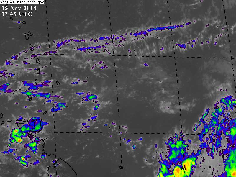 I am really and truly, truly sorry to say, ... ..., clouds are accumulating again!!!
Further to that which is not why I knew I had to post.
There will be another Impact within 24 - 36 hrs. nevertheless.
See two (02) attached pics, ....  |
|
- Flood Bulletin issued
|
- From: Katy Young <katy at sbms.co.tt>
- Date: Thu, 13 Nov 2014 12:04:37 -0500
|
Afternoon all TT Met has issued a flood bulletin TTMET Issues Flood Bulletin for Trinidad and Tobago
The Trinidad and Tobago Meteorological Service has issued a flood bulletin at 11:30 am informing the public that due to recent rainfall activity, citizens will experience more prolonged and widespread street and flash flooding, as well as riverine flooding. Reports from the Water Resources Agency indicate that some sm...all rivers particularly in North Eastern and Central Trinidad have over spilled its banks, while water levels in the large rivers are significantly high and may reach threshold levels as a result of expected run-off from the current rainfall. Citizens are advised to be vigilant and cautious as they conduct their daily activities given forecast weather conditions. All citizens (especially those residing in the Caroni area) are asked to be on alert for rising river levels and possible overspill at this time.
Rainfall activity is expected to continue over the next 2 to 6 hours. The ODPM, as the lead coordinator of disaster management, is in contact with all first responder agencies (TT Fire Service, TT Defence Force and the municipal corporations) so that immediate assistance can be rendered if any adverse impact occurs.
Stay safe everyone Katy
--
|
|
- Stay focused and pray for high altitude deterrents
|
- From: Ian Martin Borde <readkrox51 at gmail.com>
- Date: Wed, 12 Nov 2014 05:40:50 -0400
|
People of Paradise, Good, Morning, Good Day, Good Everything,
I saw something. Moving north. Beginning to circulate and break off below. Too far away to judge. Needed to check dry-air, wind-shear, and sea-swells. Too skimpy and foolish to base fact on. In other words, I have other thing to do with my time. Then I saw these graphics. (attached).
My God is Good!
"You know I am forthright and face my own consequences." So hear goes, ... Another one is coming. (Please pause and pore over graphics.)
God bless Attachment:
atlsea_latestBW.gif
Description: GIF image
Attachment:
atlsfc48_latestBW_sm3.gif
Description: GIF image
|
|
- Sub-Tropical turning Tropical -
|
- From: Ian Martin Borde <readkrox51 at gmail.com>
- Date: Fri, 7 Nov 2014 18:10:40 -0400
|
Just got home.
The sub - tropical system is turning tropical,... (..., apparently over The Lesser Antilles and Puerto Rico, in that order!!!)
ALWAYS REMEMBER TWO THINGS:
I CAN BE WRONG and DON'T PANIC!
In addition, what is making it tropical is coming for the next 30 hrs. (instant), from Trinidad & Tobago to Haiti. (Probably will pass thru the Passage between Haiti and Puerto Rico).
The bottom - line is for the next 30 hrs. it's going to get worse for those already affected.
My take is: Try to keep damage control reports coming, ....
& Keep away from the sea.
Standing by Attachment:
07th nov 445 pm.jpg
Description: JPEG image
|
|
- Mild Impact - 16-72 hrs. -
|
- From: Ian Martin Borde <readkrox51 at gmail.com>
- Date: Tue, 4 Nov 2014 22:55:59 -0400
|
Lovely Day! Lovely Day! Boy it sure feels good to get your work done without traffic in flood.
To us here in what is truly paradise,
The beginnings of mildest impacts will start in the Amazon and Trinidad (Tobago first) and work its way up, ..., in 16 hrs. Maybe midday rain (more likely night time rain). Most likely a 07mins. drizzle. - Christmas rain -
Recall, (last winter): The Trade Winds are normally North Easterly. Last winter specially the last part (January and February) I believe The ABC islands reported trades from the south-west. Definitely not forecasting for winter and North America but the cold fronts, sub-tropical systems and high pressure systems I can't see allowing north easterly gentle breezes. My guess is wind for winter, but from the south-west. (And the more south, the more south American rain.) However that's a long way off. Lastly wind means sea-swells.
Whatever happens, Santa Claus and Baby Jesus is coming to town soon.
Peace on Earth, Goodwill to all men. Attachment:
Bro Billy (surfing).jpg
Description: JPEG image
|
|
- Ebola Threat in check in T & T, The Show Goes On, ....
|
- From: Ian Martin Borde <readkrox51 at gmail.com>
- Date: Thu, 30 Oct 2014 09:34:45 -0400
|
2014 - 10 - 30th. Thurs. 09:20 a.m. P/Vly, D'go M'rtn, T & T, W.I.
Hi People of Paradise
Cause for Celebration
The Trinidad & Tobago Carnival 2015 Is On, ...!
Not postponed or cancelled, it's on, ....
(Official word from the designated authorities: ie. The Ebola treatment centre chairman, The Ministry of National Security, (Prevention), and the other Medically-Related Personnel, et al.)
It is not in my place to tell you to play mas. But what it means is that 'The Gov't took swift action, and did something about it.'
Secondly for those travelling, It appears that 'border controls' have been tightened.
Attached are two photos.
May The Almighty continue to bless us all, .....
Attachment:
Gulf of Paria from Port of Spain.jpg
Description: JPEG image
Attachment:
Maracas Beach.jpg
Description: JPEG image
|
|
- !!!! Impact !!!! - (In progress)
|
- From: Ian Martin Borde <readkrox51 at gmail.com>
- Date: Sun, 26 Oct 2014 11:56:25 -0400
|
To all my people living in Paradise,
We have !!!! Impact !!!! (At least Tobago and Barbados so far, with lots more to come.)
I am sorry about two things; If I don't call 'Impact', people seem to want to say it will not happen. and I did not call this one in 36hrs. because I had a relapse of 'chicungunya'.
Sally from Grenada is awfully correct. (Thanks for giving me a lighter side to the morning.) This is the biggest of the last three, inclusive.
I am only guessing but the wind seems to have been driven out of it. To repeat "Lots of precipitation ensuing, ...."
My take on coping with it, ..., If you have no business in traffic stay out of it.
Need to do more research (when able) just an early post.
God bless Bermuda and all of us
|
|
- Tropical wave to continue to affect Trinidad and Tobago over the next 6-8 hours
|
- From: Katy Young <katy at sbms.co.tt>
- Date: Thu, 23 Oct 2014 09:28:50 -0400
|
Latest update from TT Met - stay safe out there Katy
Date: Thursday 23rd of October 2014
ISSUED AT:06:28AM
TROPICAL WAVE TO CONTINUE AFFECTING TRINIDAD &
TOBAGO OVER THE NEXT 6 to 8 HOURS
The axis of the Tropical Wave has passed over
Trinidad and Tobago and the hind leg of the wave
is currently affecting both islands producing...
light to moderate showers and some of which have
been heavy and thundery in some areas over the
last few hours.
Cloudy periods can be expected today with
intermittent showers and thundershowers. Gusty
winds are expected to accompany thundershowers.
Current analysis and Weather Prediction Models
suggest that the weather conditions associated
with the passage of this wave will continue to
affect Trinidad and Tobago for at least the next
6 to 8 hours with improvement from mid-afternoon.
Tonight is forecast to be settled despite few
periods of light rain.
Rainfall accumulations from this wave is expected
to be between 25 to 50 mm. The showery activity
can yield moderate to severe street or flash
flooding and strong bursts of gusty winds are
expected to be in excess of 55 km/hr especially
in thundershowers.
Citizens are advised to be alert to electrical
discharges from thundercloud activity and to
adopt measures which would safeguard lives and
property given the forecast conditions.
WE STRONGLY UNDERSCORE THAT TRINIDAD AND TOBAGO IS
NOT UNDER ANY TROPICAL CYCLONE WATCH OR WARNING.
The Trinidad and Tobago Meteorological Service is
closely monitoring weather conditions and will
issue another bulletin at 6:00 p.m. today or
sooner if the situation warrants.
--
|
|
- SEA BATHERS IN TOBAGO AND ALONG THE NORTH COAST OF TRINIDAD ARE ADVISED TO EXERCISE CAUTION.
|
- From: Katy Young <katy at sbms.co.tt>
- Date: Wed, 22 Oct 2014 07:23:09 -0400
|
Morning all,
Latest from TT Met
FOR THE PERIOD TODAY UNTIL MIDNIGHT: TRINIDAD,TOBAGO
Light to moderate showers at times heavy, would interrupt sunny conditions today in varying localities.
Thundershowers are likely in few areas this afternoon. Partly cloudy
skies expected tonight with showers occurring in a few areas.
Street/Flash Flooding is likely in heavy downpours and in the event of a thundershower, gusty winds can be expected.
SEAS: Normal occasionally Choppy
WAVES: Up to 2.0m IN OPEN WATERS
Less than 1.0m IN SHLTD AREAS
SEA BATHERS IN TOBAGO AND ALONG THE NORTH COAST OF TRINIDAD ARE ADVISED TO EXERCISE CAUTION.
Stay safe everyone Katy |
|
- I can't believe this blob, ...?
|
- From: Ian Martin Borde <readkrox51 at gmail.com>
- Date: Tue, 21 Oct 2014 22:27:49 -0400
|
People of Paradise,
I must have fallen asleep.
"Within 24 hrs. we have a blob bigger and more organised than the one that blew off roofs just passed (early Gonzalo) bearing down on the entire eastern Caribbean."
What an undesirable thing !
This one also has wind. And while the wind shear before was worthy enough to push cyclonic wind out into the Atlantic. If this blob survived that and is circulating (maybe not us) but down the road, imagine how strong?
I am highly satisfied with my input here. Many correspondents now reflect what was once though to be sensational fabrications by my posts and doing the job before me.
Aside from whimpering about the past, my sister left Glasgow, Scotland and is sailing around the globe. Just like Dave and Gert she now has an appreciation for 'fish storms'. She and her husband were caught up in the gale off north Africa ( near Tenerife ). From the way she communicated, the worst is over.
Why I bring this up is if we think that it is inconvenient to go to the supermarket in traffic before adverse weather. And the other fashionable preparations. Imagine being surrounded in 'soft-land' with only 27 ft. of elope wood. And definitely no street lights or electricity on a full time basis.
God bless us tomorrow and the next few days.
~ Peace ~ Attachment:
21st oct 915pm.jpg
Description: JPEG image
|
|
- ACTIVE TROPICAL WAVE EAST OF TRINIDAD AND TOBAGO TO PRODUCE INCLEMENT WEATHER TOMORROW
|
- From: Katy Young <katy at sbms.co.tt>
- Date: Tue, 21 Oct 2014 17:53:19 -0400
|
Evening all,
Latest from TT Met
Information Bulletin - 21st October 2014 Re: Active Tropical Wave
ACTIVE TROPICAL WAVE EAST OF TRINIDAD AND TOBAGO TO PRODUCE INCLEMENT WEATHER TOMORROW
An active Tropical Wave with axis approximately 560 km east of Trinidad
and Tobago is forecast to produce inclement weather conditions
tomorrow 22nd October 2014 and lasting for about 48hours thereafter.
This wave shows no sign of further development before it approaches the Eastern Caribbean islands.
Moderate to heavy showers can be expected with some showers becoming
heavy and thundery. Rainfall accumulations from this wave is capable of
producing 25 to 50 mm of rainfall. These downpours can yield moderate
to severe street or flash flooding and strong bursts of gusty winds in
excess of 55 km/h especially in thundershowers.
All
interests in Trinidad and Tobago are asked to adopt measures which would
safeguard lives and property given the forecast conditions.
WE STRONGLY UNDERSCORE THAT TRINIDAD AND TOBAGO IS NOT UNDER ANY TROPICAL CYCLONE, WATCH OR WARNING.
The Trinidad and Tobago Meteorological Service is closely monitoring
weather conditions and will issue another bulletin at 9:00 am tomorrow
or sooner if the situation warrants.--
|
|
- Chain Reaction
|
- From: Stephen Abouhamad <stephen_abouhamad at hotmail.com>
- Date: Sun, 19 Oct 2014 13:28:26 +0000
|
Trinidad and Tobago These few days have been filled with both hot and humid conditions followed by heavy rain fall. Here in Trinidad we have had record temperatures in day time heating. Temperatures reaching over 35 degrees. With this intense day time heating we have had mid day thunder showers as any time after lunch you can look outside and see dark thunder clouds growing in the distance. We have had some intense rainfall. Lets just continue to watch the chain reaction with the day time heating and thunder showers. Regards,
Stephen Abouhamad
|
|
|
- Adjustment Correction
|
- From: Ian Martin Borde <readkrox51 at gmail.com>
- Date: Sun, 19 Oct 2014 05:37:57 -0400
|
People of Paradise,
There is an adjustment to my last post. In that wind shear stalled everything east of 55W. The precipitation should start today instead.
So, therefore, (just joking), Today after some proper reflection, go-2-d-beach and if it drizzles, I promise it wont last more than 20 mins.
May The Name of The Most High be held up Forever and Ever, Amen. Attachment:
'Billy' - d man -.jpg
Description: JPEG image
Attachment:
family fun.jpg
Description: JPEG image
|
|
- Tropical Wave Impact - 12 -36 hrs. - Western Caribbean -
|
- From: Ian Martin Borde <readkrox51 at gmail.com>
- Date: Thu, 16 Oct 2014 17:37:43 -0400
|
2014 - 10 - 16th. Thursday P/Vly, D'go M'rtn, T&T, W.I.
5:20 p.m.
People of Paradise,
What were considered probable fatalities in St. Martin and St. Bartholomew (not Anguilla) have been recovered and rescued. [read: St. Martin/Martinique]
So, ..., let's see, Grenada and Trinidad have to be thankful. Anguilla is not only thankful but highly proactive. Most islands experienced manageable conditions. The fishermen were recovered in the French dependencies.
Let's hear a Great Big ~ THANK YOU ~ "to whatever you believe saved us from further disaster." (and retribute.)
" 'Bermuda' you will never know how much I am in this with you."
Locally and Regionally, a tropical blob disengaged from a low-pressure center moving due north. (What we call a fish storm.) This tropical wave is invisible and is going to affect us in 12 - 36 hrs. I don't know how long it will last. All I know the early part of it is very weak.
AN ATLANTIC OCEAN 1009 MB LOW PRESSURE CENTER IS NEAR 17N45W. A
SURFACE TROUGH EXTENDS FROM THE LOW CENTER TO 14N48W TO 12N54W.
WIDELY SCATTERED MODERATE CONVECTION IS ALONG THE TROUFG
AXIS FROM 11N-14N BETWEEN 45W-54W.
All it takes is one.
May God Bless You ! |
|
- - * IMPACT * -
|
- From: Ian Martin Borde <readkrox51 at gmail.com>
- Date: Sun, 12 Oct 2014 11:07:06 -0400
|
I am real busy right now and this weekend. I can't help you now. And there is a bigger one behind.
My entire and WHOLE focus, will be to help you afterwards.
Don't say I say, But storm surge can be 10' - 12' feet. (This is not my area.)
God bless |
|
- Phew ! -
|
- From: Ian Martin Borde <readkrox51 at gmail.com>
- Date: Tue, 7 Oct 2014 05:46:30 -0400
|
Pleasant Day, People of Paradise,
The rain hasn't stopped falling each day. It however is no longer in any way hazardous except for saturated soil, a drizzle to high level cloudy scattered showers.
In 72 hrs. all the islands (specially north of Trinidad), will experience what Grenada & T'dad felt. There is a cyclonic axis at 40 W. We have drizzly conditions. And there's a Tropical wave in between.
During this season when the situation described below occurred islands were adversely affected.
...TROPICAL WAVES...

AN ATLANTIC OCEAN TROPICAL WAVE IS ALONG 18N38W 13N38W 9N36W.
THE WAVE IS MOVING WESTWARD WESTWARD 15 KNOTS. THE WAVE IS
MOVING THROUGH THE AREA OF A MIDDLE LEVEL TO UPPER LEVEL
CYCLONIC CIRCULATION CENTER THAT IS NEAR 25N38W. CONVECTIVE
PRECIPITATION...SCATTERED TO NUMEROUS STRONG FROM 10N TO 12N
BETWEEN 38W AND 42W. SCATTERED MODERATE TO ISOLATED STRONG FROM
8N TO 13N BETWEEN 30W AND 35W. THIS PRECIPITATION IS OCCURRING
AROUND THE PERIPHERY OF THE CYCLONIC WIND FLOW THAT IS MOVING
AROUND THE 25N38W CYCLONIC CENTER.

AN ATLANTIC OCEAN TROPICAL WAVE IS ALONG 25N54W 19N56W 13N57W.
THE WAVE IS MOVING WESTWARD 10 KNOTS. THE WAVE ALREADY HAS MOVED
THROUGH THE AREA OF A MIDDLE LEVEL TO UPPER LEVEL CYCLONIC
CIRCULATION CENTER THAT IS NEAR 25N38W. THE WAVE IS JUST TO THE
WEST OF A MIDDLE LEVEL TO UPPER LEVEL TROUGH THAT IS ALONG
25N51W 22N53W 19N53W. A SEPARATE MIDDLE LEVEL TO UPPER LEVEL
CYCLONIC CIRCULATION CENTER IS NEAR 17N58W. CONVECTIVE
PRECIPITATION...SCATTERED STRONG FROM 17N TO 23N BETWEEN 48W AND
55W.
Don't lower your guard but thank God for dry-air. |
|
- ??? Boomerang Depression ???
|
- From: Ian Martin Borde <readkrox51 at gmail.com>
- Date: Fri, 3 Oct 2014 17:35:26 -0400
|
I really don't know what to make of the weather patterns we are having in the southerly islands.
Everyone, I mean everyone said it was going to be short-lived. When I even begin to start to think subconsciously it will stop.
It rains with wind.
As if that was not enough, when perplexed I look at the barometric readings. Some goon for the past three days keeps putting back a tropical wave line joining the the Sahara Sandwich at 50 W. and 10 N. everytime his line reaches T'dad & T'bgo. (ie. 60 W.)
I refuse to assist the traffic situation and general instability and will stay indoors and break my diet and try new recipes (specially with fruit) with my one child family and no wife.
God bless |
|
- Repeating to avoid unnecessary risk, ...
|
- From: Ian Martin Borde <readkrox51 at gmail.com>
- Date: Wed, 1 Oct 2014 17:53:11 -0400
|
As is visible and reported, rain started in T'dad and will continue overnight well into tomorrow.
AN ATLANTIC OCEAN TROPICAL WAVE IS ALONG 36W/37W FROM 11N
SOUTHWARD MOVING WESTWARD 10 TO 15 KNOTS. THE WAVE IS MOVING
THROUGH AN AREA OF MIDDLE LEVEL TO UPPER LEVEL ANTICYCLONIC WIND
FLOW. CONVECTIVE PRECIPITATION...WIDELY SCATTERED MODERATE TO
ISOLATED STRONG FROM 6N TO 11N BETWEEN 27W AND 40W. IT IS EASILY
POSSIBLE THAT SOME OF THE CONVECTIVE PRECIPITATION THAT IS
ASSOCIATED WITH THIS TROPICAL WAVE ALSO MAY BE ASSOCIATED WITH
MONSOON TROUGH AND ITCZ CONVECTIVE PRECIPITATION.

AN ATLANTIC OCEAN TROPICAL WAVE IS ALONG 53W/54W FROM 10N TO
20N. THE WAVE HAS BEEN MOVING WESTWARD 20 KNOTS DURING THE LAST
24 HOURS. CONVECTIVE PRECIPITATION...BROKEN HIGH LEVEL CLOUDS
ARE FROM 11N TO 18N BETWEEN 42W AND 56W. PRECIPITATION THAT IS
ASSOCIATED WITH MIDDLE LEVEL TO UPPER LEVEL CYCLONIC WIND FLOW
THAT IS BETWEEN THE WAVE AND 60W IS IMMEDIATELY TO THE WEST OF
THE TROPICAL WAVE.
(Before I read NHC above I too couldn't believe I saw cyclonic movement (barely visible) in the more westerly wave.) It definitely has some sort of wind in it !
God bless Attachment:
01 st Oct 445pm.jpg
Description: JPEG image
Attachment:
01st Oct 213 pm.jpg
Description: JPEG image
Attachment:
01st Oct 517pm.jpg
Description: JPEG image
|
|
- Medium to Sharp Impact - 36 - 60 hrs. -
|
- From: Ian Martin Borde <readkrox51 at gmail.com>
- Date: Tue, 30 Sep 2014 08:07:31 -0400
|
These days when I wake up in the morning, It's a lovely day, lovely day, lovely day, ... Life in The Tropics, .. - BESS ! -
However in slightly more than 36 hrs. a short-lived tropical blob will slow down and reign over us. Presently it's moving at 20 kts. hence its potential is invisible to the naked eye.
Two concerns are: It's an amalgam of systems. Good times don't last forever.
The one good thing is: It is not a three day event and will be short-lived.
TROPICAL WAVE IN THE W TROPICAL ATLC EXTENDS FROM 18N41W TO
9N45W MOVING W NEAR 20 KT OVER THE PAST 24 HOURS. WAVE IS
EMBEDDED WITHIN A SURGE OF DEEP MOISTURE AS DEPICTED ON TOTAL
PRECIPITABLE WATER IMAGERY. SCATTERED SHOWERS AND POSSIBLE
ISOLATED THUNDERSTORMS ARE FROM 14N-18N BETWEEN 43W-46W.
God bless Attachment:
Scenic Maqueripe.jpg
Description: JPEG image
|
|
- Rain and more rain
|
- From: Stephen Abouhamad <stephen_abouhamad at hotmail.com>
- Date: Tue, 23 Sep 2014 20:11:31 +0000
|
23/9/14 Good Afternoon. After a hot and sunny morning there came a tremendous amount of rain with some huge boomers and some ferocious lightening. All seems quiet at the present moment with cloudy skies. Waiting to hear if any damage was done. Bye for now.
Michael Abouhamad
|
|
|
- Tropical Wave continues Monday re: Eastern caribbean
|
- From: Ian Martin Borde <readkrox51 at gmail.com>
- Date: Sun, 21 Sep 2014 22:45:33 -0400
|
The weather in T'dad for the weekend as I mentioned was rainy but somehow during the night while cool and wintry was devoid of thunderstorms. Only during the day. One can read between the lines in Grenada to see if this continues what to expect. Right now at 10;OO p.m. Sunday Barbados will get her chance.
In the following reference, note that the middle is passing tonight and the tail has not reached as yet.
If you can trust my analysis Tuesday morning it will all be over and the sun will shine.
A TROPICAL WAVE IS CROSSING THE LESSER ANTILLES WITH AXIS
EXTENDING FROM 21N59W TO 11N62W...MOVING WEST AT 15-20 KT. SSMI
TPW SHOWS A LARGE MOIST AREA FROM 6N-22N BETWEEN 47W-63W.
SCATTERED MODERATE CONVECTION AND ISOLATED STRONG CONVECTION ARE
FROM 8N-19N BETWEEN 54W AND 65W WHICH INCLUDES THE WINDWARD AND
LEEWARD ISLANDS.
The salient point in any illness, stormcarib-wise, mosquito or pipe - borne, is climate change helping eradicate it or making it worse with the drought we had before. (Just a thought?)
God bless
Attachment:
21st sept 1005pm.jpg
Description: JPEG image
|
|
- T'dad specific addendum to TW, ...
|
- From: Ian Martin Borde <readkrox51 at gmail.com>
- Date: Fri, 19 Sep 2014 09:28:36 -0400
|
It will be a reasonably good guess with a high level of confidence that for T'dad & T'bgo ( moreso t'dad than t'bgo) that,
THE ENTIRE WEEKEND WILL HAVE RAIN.
(There therefore is the likely hood of flooding.)
If I can join in about the 'chicken ganja virus' I am sorry to say I feel flat for it for practically three straight days. "Torture and Therapy in One"
God bless
Attachment:
Daddy in t'dad.jpg
Description: JPEG image
|
|
- Leeward Islands Impact - 24hrs.
|
- From: Ian Martin Borde <readkrox51 at gmail.com>
- Date: Wed, 17 Sep 2014 17:00:33 -0400
|
Hi Stormcarib people of paradise,
Trinidad had two heavy downpours within three days but this was due to a South America system.
If you look at just the graphical images you will feel that the tropical wave approaching the Leewards is going to miss them completely. This is not so. There is moisture down to Barbados.
[ref: NHC] A TROPICAL WAVE IS AT ABOUT 200 NM E-NE OF THE LESSER ANTILLES
WITH AXIS EXTENDING FROM 23N57W TO 12N58W...MOVING WEST AT 15-20
KT. MODERATE LOW-LEVEL MOISTURE IS ASSOCIATED WITH THIS SYSTEM.
SCATTERED MODERATE CONVECTION IS DEVELOPING ALONG THE WAVE AXIS
FROM 23N55W TO 15N58W. It is not cyclonic and should not stop the beautiful weather we are having.
God bless |
|
- Note and Recall, ...
|
- From: Ian Martin Borde <readkrox51 at gmail.com>
- Date: Tue, 9 Sep 2014 05:34:03 -0400
|
P/Vly, D'go Martin, T'dad & T'bgo, W.I. Tuesday 09th September 05:00 a.m.
Good Morning, Good Day, People of Paradise,
The iguana and its babies have not appeared for me to share any further pics. I wonder if its afraid of the kitten that is now a bob-cat. (Or the dog with three-legs.) Anyway those of us I share my thoughts with before writing, would like you to interpret three factors in the attached images: - SAL (dry air) Latitude and Longitude. - Southerliness of High Barometric Pressure and The ITCZ (moisture). - The pattern of the last three tropical waves and a couple before that.
(By the way and at the same time the actual Bahamas seem to be having a tough go this season.)
Recall, working backwards for your edification and awareness:-
After a storm: 1. It's the worst part. 2. There is no cooked food (for many reasons). 3. Water and Waste is a big, big problem. There may be a state of emergency which means life and death situations where trained people are risking their life for others.
During a storm: 1. A storm is a long drawn out normally three day occurrence. 2. When it stops it's not finished. 3. There will be optimists and pessimists feeding information. Listen only to easily identifiable authority. Don't panic, ask for help.
Before the storm: 1. There is no escape. 2. Don't try to outsmart it. 3. Authorities will give clearly defined Procedures to Prepare, Plan, and Preserve all Property and Persons.
It only takes one. God bless!
Attachment:
09th sept 2014 tuesday.jpg
Description: JPEG image
Attachment:
Tues 09th Sept 500am.gif
Description: GIF image
|
|
- Happy 52nd. Independence Anniversary T&T.
|
- From: Ian Martin Borde <readkrox51 at gmail.com>
- Date: Sun, 31 Aug 2014 20:33:28 -0400
|
Happy Independence T&T., We worked and played together for it! Remember: "Freedom is also a consequence of our actions, ..."

2014 - 08 - 31st. Sun. 20:00 (8:00) p.m. P/Vly, D'go M'rtn, Trinidad & Tobago, W.I.
I would like to thank God, Dr. Jeff Masters, Steve Gregory, Dave and Gert, specially to name a few life-savers
in the Tropical scheme of things. I was not on hiatus and my daughter says the word does not truly exist. "It's another stupid modern invention."
The bottom - line for rain, ..., for T'dad.
Weather patterns are forming 1) at 53 W. that has a possibly cyclonic tail at 42 W. With little wind shear and dry air. BUT, moving about 22 - 25 mph. due west at 10 N. Latitude. Which in the long-term (if I were to write in red) is a direct hit.
2) Weather patterns are forming in the Orinoco and south-T'dad. (Normally a three and a half day occurrence.) 3) Whenever that is since global warming, there is a genuinely Gulf of Mexico storm, a blob slows down and stops 300 - 500 miles
west from St. Vincent, becomes an unnamed depression off Martinique, and leaves Dominica and Guadeloupe as a named storm.
I leave a panoramic view of all the above coming tonight or in 36 hrs.
"There was a lecturer in my under-graduate studies that kept looking up to me and say, 'If you fail to prepare, Prepare to fail.' Plan your work and your plan will work."
God bless Attachment:
31st aug 514pm.jpg
Description: JPEG image
|
|
- One can't envy weather men now, ...
|
- From: Ian Martin Borde <readkrox51 at gmail.com>
- Date: Fri, 29 Aug 2014 05:40:59 -0400
|
2014-08-29th. Friday 05:10 a.m. T & T., W.I.
People of Paradise,
Just as two tropical waves slipped thru the cracks in SAL (dry-air) and the first becoming Cristobal. There is another that
for the definition of weather time 'is upon us'. That is not just the southern Windwards. But the Eastern Caribbean.
Before, due to weariness, we panic, it's in no way 'life-threatening'.
But once again there is unity and a universality in dealing with this season's events and like the weather reports say for T'dad & T'bgo today, there is a 100% chance of thunderstorms.
Aside: The one in Texas in loops available this morning before the forecasts suggest a modest chance of becoming a depression while inland.
Between what we have now and 'Cristobal', the one that just passed us.
One prays that it bites the dust, (but is an extremely weird one).
N o w , ..., the one at approx. 35 W. Longitude. I am going when I drop my keyboard typing to fast and pray. And take steps to be
vigilant, very vigilant. You may not hear from me as I will be doing the above.
God bless
Attachment:
29th aug 405am.jpg
Description: JPEG image
Attachment:
Weather June 2011 Desktop.jpg
Description: JPEG image
|
|
- Bertha's brief glance
|
- From: Christine Westmaas <chrisalis1003 at yahoo.co.uk>
- Date: Sat, 2 Aug 2014 04:05:03 +0100
|
The rain cleared up by the early afternoon and tonight is quiet and dry. There was some flooding in Debe, an area south of here. The pictures taken by a motorist show that it was very bad in parts and that both homes and small business places suffered from the flood waters. Work on the highway extension to Point Fortin is being blamed for at least some of the flooding in Debe but this is still speculation and has to be confirmed. I hope that Bertha brings only blessed water to the parched islands and that there will be no serious damage or destruction and certainly no injury or death. |
|
- Tropical Wave reaches southern Windwards
|
- From: Ian Martin Borde <readkrox51 at gmail.com>
- Date: Tue, 26 Aug 2014 16:58:08 -0400
|
2014-08-26th. Tue. 4:45 p.m. P/Vly, D'go Martin, T'dad & T'bgo, W.I.
We are a little under the weather with a flu and elections coming and a new era of youth involvement that needs the steadying hand of the older and wiser, (God forbid!). I love to read and research (besides entertaining in my home) and this is a time for not only that but producing literary work.
- The Sahara Dust is coming back. - Most model guidance heads the circulating tail of this tropical wave north of The Leewards or dismiss it totally. (Quite a probable fish - wave- )?
However it has reached T'dad & T'bgo and is nothing more than 'more than one rain shower a day'. I really, really don't know but I suspect that there is quite a shift in coastal sea temps hence the seas are generally going to get worse until after Winter. Winds as I said are not mentionable.
But then again, who am I to know. Back to research, ...
God bless
Attachment:
26th aug 345pm.jpg
Description: JPEG image
|
|
- Psycho, ..., I mean Cyclogenesis today? (tee hee)
|
- From: Ian Martin Borde <readkrox51 at gmail.com>
- Date: Fri, 22 Aug 2014 07:29:41 -0400
|
It is highly likely it will become a depression at minimum today.
Let's thank God, (so far),
Thank You, Lord |
|
- The following pertains to all interests, ...
|
- From: Ian Martin Borde <readkrox51 at gmail.com>
- Date: Thu, 21 Aug 2014 01:29:04 -0400
|
Results for Barbados (13.07N, 59.48W):
The eye of the storm is about 302 miles (486 km) away. If the system keeps moving at its current speed of 17.5 mph and directly towards you, it will take around 17.3 hours* to reach you. Given the current windfield (175 miles from the center), tropical storm winds will be felt in 7.3 hours.
This is a rough guide to:
IMPACT !
|
|
- In God We Trust
|
- From: Ian Martin Borde <readkrox51 at gmail.com>
- Date: Thu, 21 Aug 2014 00:39:12 -0400
|
Only one good news:
The first one has more or less gone, bah, bye!
On the other hand: It's extremely hot and humid. The first one had notable wind in the sideways drizzle.
The first one is feeding moisture to what seems very, very cyclonic. Moozies are killing us.
Once we leave it to God we will get thru this one.
Standing by
|
|
- 12 - 72 hrs. - Medium IMPACT - 12 - 72 HRS.
|
- From: Ian Martin Borde <readkrox51 at gmail.com>
- Date: Tue, 19 Aug 2014 19:16:49 -0400
|
2014-08-19TH. Tues. 18:50 (6:50) p.m. P/Vly, D'go Martin, T'dad & T'bgo, W.I.
People of Paradise, Pray, Plan, Prepare and Procure, ..., Persons and Property,
cause we are going to enjoy Impact from tonight in Trinidad. Even though Moderate, it will strengthen and procrastinate.
For Tobago, Grenada and further north, ..., expect:
Later impact, Three (3.0) inches of rain over approx. 3 days, Winds gusting to 25 - 27 mph., Seas (not - friendly).
For St. Lucia, Barbados, Dominica, expect either double impact or the worst of them.
(The 2 of them.) Possible depressions on impact?
For The Leewards, VI's, and antillean dependencies, expect one impact but the worse one. (Look at the model guidance, ...)
They are not going to be life-threatening unless in the midst of the first one we lose our cool.
There are plenty people willing, able and equipped to help
and stand by for free for these occurrences, ...
God bless Attachment:
19th aug - 94L.gif
Description: GIF image
Attachment:
96L-aug19th.jpg
Description: JPEG image
|
|
- Learning Lesson - Waves vs Cyclones
|
- From: Ian Martin Borde <readkrox51 at gmail.com>
- Date: Mon, 18 Aug 2014 06:42:14 -0400
|
Whatever the outcome, we can learn for the future from 94L. Because i'm convinced I know nothing at all about anything. So I pray and leave it to God.
94L exited Cuba, between Florida and Cuba.
And the point I made at the beginning of the season that I am watching for; Is not Sahara Dust, But, Wind-Shear & Warm Water, ...
Excuse me if I am wrong but former 94L
is in the warmest waters of the tropical Atlantic now. Follow it and see if you agree, ...
God bless
Ps. Which by the way is an antidote for climate change.
|
|
- One to watch, ..., (actually three to watch).
|
- From: Ian Martin Borde <readkrox51 at gmail.com>
- Date: Sat, 16 Aug 2014 03:34:40 -0400
|
(Sorry if I sound dramatic.)
This tropical wave that is former 94L was re-positioned by NHC, quite rightly so because its axis passed over Grenada exactly 24 hrs. earlier ie. 10:30 p.m. Friday.
Because of its southerly nature South America absorbed the danger out of the hazard. My gut feeling is the separation northwards will reactivate north of the islands what we call Bahamas. It flooded in Port of Spain and the lightning was terrible.
All this will ease tonight (Saturday night) by early tomorrow morning (Sunday morning).
There is going to be alot of sunshine during the early part of next week and quite humid.
Then two tropical blobs with circulation will touchdown. As what, we don't know.
It only takes one. Attachment:
Windsurfing (Billy & Ian).jpg
Description: JPEG image
|
|
- Be Prepared!!
|
- From: Stephen Abouhamad <stephen_abouhamad at hotmail.com>
- Date: Thu, 14 Aug 2014 00:43:59 +0000
|
Trinidad and Tobago 13/08/14 Good Night. Its has been a while since I posted on this network. Seems like something is about to give in the next couple of weeks of the hurricane season. Trust that everyone will be prepared. Bye for now. Regards,
Michael Abouhamad
|
|
|
- An ill wind blows no good
|
- From: Ian Martin Borde <readkrox51 at gmail.com>
- Date: Wed, 13 Aug 2014 17:26:25 -0400
|
2014 - 08 - -13th. Wed. 17:05 (5:05) p.m. Trinidad & Tobago, West Indies
Good afternoon, People of Paradise,
Trinidad, Tobago and Grenada had two tropical blobs pass thru within the last 7 days.
Another one is passing tonight and tomorrow. Rainfall was non-significant, waves were not dangerous, and what I want to talk about, ....
Winds are coming from the ESE at period gusts fairly sustained at 12 - 17 mph.
By now this everybody knows is a bad sign. When overcast, the clouds are about 1,200 - 1,500 ft. with even higher tops. Colossal rain clouds travelling (from experience) at over 35 mph. (But no significant rain.)
Typical hurricane weather in the 60's and 70's. Besides my arthritis and daughter's hay-fever have acted up within the estimated time of arrival.
Former 94L center or axis is estimated by using stormcarib.com tools to arrive 10:30 p.m. Saturday night! I am postulating that we are already feeling its formulative effects.
My dearest brother out of a family of 5 children lives in Florida as well as alot of my friends. I am very inclined to say whatever happens in the Caribbean, The High-Pressure Gradient might just drive
former 94L straight into south-eastern USA. HOPEFULLY, (as in the West Indies) WITH NO CONSEQUENCES. Then again who knows where the sun goes when it disappears.
Prepare, plan, pray and procure,
God bless
|
|
- Paradise
|
- From: Ian Martin Borde <readkrox51 at gmail.com>
- Date: Sat, 9 Aug 2014 08:56:54 -0400
|
2014 - 08 - 09th. Sat. 8:05 a.m.
Good Day, Good Everything, People of Paradise,
I am learning more and more about SAL (dry-air) as well as how much more
I don't know.
Hopefully this week-end is going to be perfect for sport and marine activity. As I said i'm beginning to understand the effect dry-air has on tropical waves and storms.
This might sound ridiculous, but Carnival bands are launching this holidays and it's not to early to book your costumes and tickets. ie. for Trinidad & Tobago Carnival 2015, ...
Unity is greater than the sum of the parts.
God bless.
Attachment:
archive billy 3.jpg
Description: JPEG image
Attachment:
archive billy.jpg
Description: JPEG image
Attachment:
archive david 2.jpg
Description: JPEG image
|
|
- Housekeeping update, ...
|
- From: Ian Martin Borde <readkrox51 at gmail.com>
- Date: Wed, 6 Aug 2014 17:36:02 -0400
|
Port of Spain and Diego Martin had rain for practically the whole time during daylight today. Why i'm writing is because they will have more of the same for at least tonight and tomorrow. The rest of the Lesser Antilles has SAL inhibiting convection. (For the time being, ...)
God bless Attachment:
6th aug 445pm.jpg
Description: JPEG image
Attachment:
IMG_0025.jpg
Description: JPEG image
Attachment:
IMG_0026.jpg
Description: JPEG image
|
|
- "Water, wonderful water, ..., not a woe."
|
- From: Ian Martin Borde <readkrox51 at gmail.com>
- Date: Tue, 5 Aug 2014 05:47:02 -0400
|
2014-08-05th. Tue. 5:25 a.m. P/Vly, D'go, T'dad & T'bgo, W.I.
To all readers, researchers, writers of Paradise, excuse me for saying so but this is not the extreme and
exaggerated weather we have been getting in the 21st. century so far, but mind my saying so, "a normal hurricane season". What it was like when I was a kid learning geography.
Ok, ... There has always been a blob, 'cept not visible, until this morning off Barbados. It (the not visible part) has arrived already to T'dad & T'bgo and will continue.
For my normal geographical triangle, the two bad news are; It's diameter - & - it's closeness. Good News: There is no circulation, no high winds as yet or when it touches down,
waves are below 7 ft. and it's moving fast. (But due west.)
My take, What could have been a three day depression because of SAL is between 1/2" - 1 1/2" ins. of rain and scatterd thunder showers
for a day and a half. (Depending on the island.) My take.
Two other items are, 'They gave their all, ( including their lifes), so that our loved ones can live in the Peace we enjoy. Never, ever forget them
and may their souls rest in P e a c e.
Pray for the less fortunate caught up in disasters, natural or otherwise.
Attachment:
5th aug 415am.jpg
Description: JPEG image
Attachment:
5th aug 434am.jpg
Description: JPEG image
|
|
- After- Mat(hematics)
|
- From: Ian Martin Borde <readkrox51 at gmail.com>
- Date: Sat, 2 Aug 2014 03:41:52 -0400
|
Very solemn and sleepy but my inner seventh sense told me to post this.
This is the bottom of the scale and we - have to - work ourselves above this.
Flood-possible rain will continue.
Predominantly hot and humid.
Guard against infectious diseases and dehydration.
Seas rough at times. Squalls possible in gusts.
Geez, I hope i'm not to tired to fall asleep immediately. (tee hee)
God bless in co-existing brotherhood
Attachment:
2nd aug 134am.jpg
Description: JPEG image
|
|
- Axis, Centre, Eye - Land-Fall, ....
|
- From: Ian Martin Borde <readkrox51 at gmail.com>
- Date: Fri, 1 Aug 2014 20:22:06 -0400
|
May God preserve life and limb, ..., Amen
Between 4:00 p.m. and 7:30 p.m. the high-end storm 'Berta' made landfall. First west and north in Martinique then straight over Dominica, the entire island of Dominica.
What appears to be a somewhat protected eye is forming 40 - 75 miles north-west of Dominica, south-west of Guadeloupe. That's all I observed.
Save to say, It's storm area is not much less 200 miles.
and It's diameter stretches from Trinidad to way past Anguilla. With a eastern side that has no keep-back from delivering a blow.
In other words landfall, lay low !!!!!!!!!!!!!!!
Whole night !!!!!!!!!!!!!!!!!!!!!
Pray, Plan, Prepare and Procure in the Name of God. |
|
- More rain!
|
- From: Christine Westmaas <chrisalis1003 at yahoo.co.uk>
- Date: Fri, 01 Aug 2014 13:35:12 -0400
|
The rain is coming down in torrents now and we are having more lightning and
thunder than before. Bertha obviously didn't want Trinidad and Tobago to be
left out! We need the rain as we, too, have not had enough rainfall to meet the
needs of our reservoirs. As has been mentioned by correspondents from other
islands earlier though, we don't need flooding or landslides as an extra...
Regardless of the annual mouthing of our politicians, utility authorities and
of our citizens, we really do not play a proactive role when it comes to
preventative measures re flooding. Efforts may be made by a few individuals in
communities and perhaps in positions of power but it has to be a collaborative
effort on the part of ALL of us.
|
|
- South Trinidad
|
- From: Christine Westmaas <chrisalis1003 at yahoo.co.uk>
- Date: Fri, 1 Aug 2014 17:34:59 +0100
|
We awoke to a bright, sunny and stiflingly hot morning but by 11.00 a.m. dark clouds began to gather and we could hear the odd rumble of thunder. We have had a few flashes of lightning and some loud thunder in the last half hour or so and it is raining steadily at the moment. As the day progresses, I will keep updating, especially if there is any dramatic change in the weather. |
|
- Close enough
|
- From: Ian Martin Borde <readkrox51 at gmail.com>
- Date: Thu, 31 Jul 2014 07:11:45 -0400
|
2014-07-31st. Thu. 06:45 a.m. Trinidad & Tobago, W.I.
a 'blob' that requires emergency preparations and future operations
is about 60 hrs. away from full Impact. Or 7:30 a.m. Saturday morning! Bearing waves over 10ft., winds of 30 kts. with higher gusts, Rainfall is dependent on forward speed and SAL content near the center.
Which could be anything over one inch which will be a relief to all islands baring its hazardous nature.
Talking about 'Hazards and Perils', it makes landfall on a Saturday, probably nowhere near you. So stay put in one place and don't add to any type of trauma or confusion thus endangering the situation and first responders. If necessary, continuously and without criticizing, ASK FOR HELP! Before, During and After, .... ASK FOR HELP! You have to be certified, qualified and equipped to handle emergencies. Lastly, remember it's a team effort!
Pray, Plan, Prepare and Procure!!
God bless
God bless
Attachment:
31st july 645am.jpg
Description: JPEG image
|
|
- Stalling Troughs, Waves and Depressions
|
- From: Ian Martin Borde <readkrox51 at gmail.com>
- Date: Sat, 26 Jul 2014 06:43:45 -0400
|
1) My weather forecast for Trinidad, Tobago and The Windward and Leeward Islands is the same as international forecasts. 60% chance of rain and scattered thunderstorms Winds from the ESE in excess of 10mph.
Sea swells averaging 7 ft.
(If you look at it that's not bad.)
2) The stalling and gut feelings??? If the pressure drops, the winds pick up and are consistent,
And, (that is actually what's stopping all the above), SAL dry-air and upper level jet stream reduces or are not relevant, what we actually have is 'Bertha' forming over us.
Then again, I don't know squat.
God bless |
|
- Bare with me, ...
|
- From: Ian Martin Borde <readkrox51 at gmail.com>
- Date: Fri, 25 Jul 2014 16:30:30 -0400
|
I've just came from work one hour. Facts are: The weather forecast is 40% chance of thunder-storms tonight. Min. = 76 F. with persistent cloudiness.
There is going to be a third direct hit. (soon).
And the one tonight and the two previous had circulation.
If you leave out, barometric pressure and consistent and gusting wind speeds, one will have to agree with Dominica - based on damage -
They are all low-end tropical depressions.
I definitely will have to write again soon. Thank God it's week-end.
God bless Attachment:
25th july 315pm.jpg
Description: JPEG image
|
|
- Wow
|
- From: Ian Martin Borde <readkrox51 at gmail.com>
- Date: Fri, 25 Jul 2014 07:53:36 -0400
|
I am a half hour late for work.
Where did this all come from?
I don't know but Tobago and Grenada seemed to have had it hard so far.
Got to go, .... Attachment:
25th july 715am.jpg
Description: JPEG image
|
|
- ~~ Keep Calm ~~ -
|
- From: Ian Martin Borde <readkrox51 at gmail.com>
- Date: Thu, 24 Jul 2014 03:26:47 -0400
|
Peace, Glorious Peace, Please, ....
Keep Calm !
ONCE you have prepared and at this point, there is nothing you can do but, KEEP CALM.
BY DOING THAT, you remove the object from danger, and danger from the object.!.!.!. So, keep calm!
To Martinique: "Notres sentiments vont a la gente."
For Dominica (right now): "Ca beau, pas tene peur." To the Lesser Antilles (and Puerto Rico) : "You barely have two more hours to prepare."
God bless because, My God walks on water.
|
|
- Reality and Truth
|
- From: Ian Martin Borde <readkrox51 at gmail.com>
- Date: Wed, 23 Jul 2014 03:43:45 -0400
|
2014 - 07 - 23rd. Wed. 03:10 a.m. Petit Valley, Diego Martin, T'dad & T'bgo, W.I.
Pray, Plan, Prepare and Procure, People of Paradise,
When I look at the NHC forecast,
The Weather Forecast for T'dad, ( a quick glance at the weather forecast of other islands {notably Barbados and Guadeloupe} ), the indisputable comments of Dr. Jeff Masters and whosoever he puts to write, and other pertinent but not less significant in their own right writers, I see:
T'dad: 80% chance of rain with thunderstorms. B'dos: Cloudy. Guadeloupe: Cloudy. Other areas: passing clouds.
NHC: (couldn't be better written):
...SPECIAL FEATURES...

THE CENTER OF TROPICAL DEPRESSION TWO...AT 23/0300 UTC...WAS
NEAR 13.4N 51.4W...ABOUT 590 NM TO THE EAST OF THE LESSER
ANTILLES. THE DEPRESSION IS MOVING WEST-NORTHWEST 16 KNOTS. THE
ESTIMATED MINIMUM CENTRAL PRESSURE IS 1012 MB. THE MAXIMUM
SUSTAINED WIND SPEEDS ARE 30 KT WITH GUSTS TO 40 KT. PUBLIC
ADVISORIES ON TROPICAL DEPRESSION TWO ARE ISSUED UNDER WMO
HEADER WTNT32 KNHC AND UNDER AWIPS HEADER MIATCPAT2.
FORECAST/ADVISORIES ON TROPICAL DEPRESSION TWO ARE ISSUED UNDER
WMO HEADER WTNT22 KNHC AND UNDER AWIPS HEADER MIATCMAT2.
CONVECTIVE PRECIPITATION...NUMEROUS STRONG FROM 13N TO 14N
BETWEEN 51W AND 53W. RAINSHOWERS ARE POSSIBLE ELSEWHERE FROM 9N
TO 16N BETWEEN 50W IN THE ATLANTIC OCEAN AND 64W IN VENEZUELA
AND IN THE SOUTHEASTERN CORNER OF THE CARIBBEAN SEA.
This I wholly agree with and couldn't be better written.
However I would translate some facts contained above that people need like how they need graphic satellite images which is not reality and far more so is not what represents a tropical depression.
- TD. #2 is about 36 hours away. (the axis). - a. It is 600 miles away and is about 100 miles in diameter moving 15 kts. WNW. (averaging). - b. That means when not if it dissipates or intensifies, it will be 175 - 325 miles in diameter.
- a. i. It presently is responsible for 10 ft. waves and 30 - 40 kt. winds. - b. i. A feeder band within its radii will be responsible for winds over 15 mph. and possible rainfall over an inch.
- The following link shows what exists already for small-island states, ie. the smallest islands are most vulnerable, ...
I am not looking for work or leadership and feel greatly pleased we now have truth and reality on the pages of our media. It was unbalanced before. People can take care of themselves even children, given reality.
God bless
|
|
- Thunder!!!!!
|
- From: Stephen Abouhamad <stephen_abouhamad at hotmail.com>
- Date: Sun, 20 Jul 2014 16:30:46 +0000
|
|
Trinidad and Tobago
As I finished post I heard some intense thunder in the background. Hope everyone stays safe and dry.
Regards,
Stephen Abouhamad
|
Attachment:
IMG_20140718_092552.jpg
Description: JPEG image
|
|
- Rain Rain Rain
|
- From: Stephen Abouhamad <stephen_abouhamad at hotmail.com>
- Date: Sun, 20 Jul 2014 16:23:52 +0000
|
Trinidad and Tobago Rain continues over these few days in Trinidad. This is from a weak tropical wave that is passing the the southern windward islands. These showers are not as intense as Friday but the ground is still saturated with all the rain over these days. Flights are still disrupted due to the bad weather especially domestic flights to Tobago. Regards, Stephen Abouhamad |
|
|
- Huhm, ...
|
- From: Ian Martin Borde <readkrox51 at gmail.com>
- Date: Sun, 20 Jul 2014 05:27:22 -0400
|
2014 - 07 - 20th. Sun. 04:55 a.m. Petit Valley, Diego Martin, T'dad & T'bgo, W.I.
No room for complacency, ...!
To tell you the honest truth, it was difficult and uninteresting to get true my reading of the daily news this morning. However there were two areas that are heartening;
The news have sub-treated the interests of their stakeholders and conveys more reality. Stephen from Trinidad in stormcarib posted what I wanted to say. He is from South and Trinidad is bigger than people realize.
I don't like how things will look or are looking.
And the simple reality (which everyone is facing and conveying) are the forecasts are for rain to continue today and tomorrow with a blob that has no room for complacency 4 - 7 days away.
(I agree with earlier posts before the season began 'Bertha' will be the one to watch. More from historical experience than superstition.)
Well the solution is first to define the problem then give it to the Lord in prayer.
Pray, Plan, Prepare and Procure, ..., then pray again.
God bless
Attachment:
18th july 545am.jpg
Description: JPEG image
Attachment:
18th july 1215pm.jpg
Description: JPEG image
Attachment:
20th july 415am.jpg
Description: JPEG image
|
|
- Rain came down in buckets!!!!
|
- From: Stephen Abouhamad <stephen_abouhamad at hotmail.com>
- Date: Sat, 19 Jul 2014 04:03:17 +0000
|
|
Trinidad and Tobago
A pleasant good night everyone in the StormCarib family. Hope everyone is dry tonight after what transpired earlier today. Today was a wet day from early as 5am. Showers, Thunder Storms and Gusty Winds. This was cause by a Tropical Wave that was intensified with the I.T.C.Z. Continuous rain fall was felt throughout Trinidad and as the media reported tonight that many areas were flooded out with some streets being submerged.
Its been a long while since I have seen weather conditions change so quickly. Many times today I was tricked to think that the rain was going to stop and within five minutes the dark clouds just rolled back in to prevent any sunshine from squeezing in.
The intense weather caused many flights today to be delayed and even cancelled which made my work more difficult. Hope you guys have a good night.
Regards,
Stephen Abouhamad
|
|
|
- Passing Clouds and Showers, ..., - (Conserve) -
|
- From: Ian Martin Borde <readkrox51 at gmail.com>
- Date: Thu, 17 Jul 2014 09:34:18 -0400
|
Only because of the 36 hour deadline I comment on a few items of interest.
Otherwise it's all passing clouds and showers that I give thanks for, .... Thanks Almighty!
TROPICAL WAVE EXTENDS FROM 07N52W TO 12N50W MOVING W AT 15 KT.
THE WAVE APPEARS AS PART OF A GREATER 700 MB TROUGH BETWEEN 50W-
60W...OF WHICH THE WEAKER 700 MB TROUGH IS S OF 12N ALONG 51W.
SCATTERED MODERATE CONVECTION IS FROM 08N-10N BETWEEN 50W-57W.

TROPICAL WAVE EXTENDS FROM 13N56W TO 20N53W MOVING W AT 10-15
KT. SIMILAR TO THE WAVE SE OF THIS WAVE...THE WAVE LIES WITHIN A
BROAD 700 MB TROUGH ALOFT BETWEEN 50W-60W. IT IS LIKELY ENERGY
FROM BOTH THESE WAVE WILL MERGE OVER THE NEXT SEVERAL DAYS. NO
SIGNIFICANT DEEP CONVECTION IS ASSOCIATED WITH THE WAVE AT THIS
TIME.
Thanks alot Christine for your posts. (Very helpful). I miss Michelle but she told me why.
God bless Attachment:
17th july 845am.jpg
Description: JPEG image
Attachment:
IMG_1802.jpg
Description: JPEG image
|
|
- More rain
|
- From: Christine Westmaas <chrisalis1003 at yahoo.co.uk>
- Date: Fri, 11 Jul 2014 17:09:35 -0400
|
Although we have had overcast skies all day, we have only had a few short-lived
showers. At the moment, though, it's raining very heavily in San Fernando.
Thankfully, our reservoirs will be getting some much-needed inches if this
continues. I heard a news report that says that a dam in Tobago is operating at
25 per cent capacity.
|
|
- Out of Nowhere, (No circulation), ...
|
- From: Ian Martin Borde <readkrox51 at gmail.com>
- Date: Mon, 14 Jul 2014 06:26:12 -0400
|
I am afraid in less than 24 hrs. the SAL air layer has dispersed enough for the next tropical wave less than 24 hrs. away from Port of Spain to hit us with precipitation that needs attention.
Aside: Tobago and the Point Fortin and parts of South-Central Area were hit by heavy winds in the last tropical wave. Attachment:
14th july 500am.jpg
Description: JPEG image
Attachment:
14TH JULY 515AM.jpg
Description: JPEG image
|
|
- Defining Cyclonic? ie. Circulation and Wind, ...
|
- From: Ian Martin Borde <readkrox51 at gmail.com>
- Date: Thu, 10 Jul 2014 05:18:24 -0400
|
2014-07-10th. Thursday, 5:00 a.m. Petit Valley, Diego Martin, T'dad & T'bgo, W.I.
Why worry when you can pray and give thanks? Which in itself presents a solution to any problem.
Attached are a three pics of what began around 7:00 - 8:00 p.m. yesterday and continued on and off with light to sometimes moderate showers, (no wind), during the night.
Aside: My method of seeing circulation are time-lapse satellite images. But that's not what i want to impart. I remember from wind-surfing days that, ... 5 -15 mph. winds will flutter leaves and twigs even.
15 - 25 mph. winds will bend the branches in shrubs or small trees. 25 - 35 mph. winds will bend the trunk of a small tree and make big tree branches bend but not break.
Just a little low-tech info one can share presently.
God bless Attachment:
baby iguana.jpg
Description: JPEG image
Attachment:
9th july 200pm.jpg
Description: JPEG image
Attachment:
9th july 245pm.jpg
Description: JPEG image
Attachment:
9th july 345pm.jpg
Description: JPEG image
|
|
- Several Points of Passing Interest, ...
|
- From: Ian Martin Borde <readkrox51 at gmail.com>
- Date: Mon, 7 Jul 2014 18:04:50 -0400
|
2014-07-07th. Mon. T'dad & T'bgo, W.I.
Good Day, Good Everything, People of Paradise,
One can only say thanks and hope that the respite from the barren heat and dryness
is replaced with the refreshing waters of The Trade Winds in this summer season of blossoms and plenty.
There are a few points of interest that as brothers and sisters with experience some others may miss and are worth mentioning.
If things continue to pan out as they are unfolding, there will be no cause for alarm.
First, my heart-felt feelings go out to the people of Mexico who have experienced today what will turn out to be,
a possibly fatal earthquake. (They already live in a desert and the mouth of a volcano and experience Pacific and Atlantic storms.)
The Bahamas just recovering from the 1st. on the 1st. July
is also worthy of attention again because the blob that keeps rejuvenating in wind-shear is up to it again.
Also of more than passing interest is the next blob 4 - 7 days away;
TROPICAL WAVE EXTENDS FROM 11N29W TO 02N25W MOVING W AT 20 KT. A
MID-LEVEL VORTEX IS NEAR 08N29W. THE SYSTEM HAS MAINTAINED AN
IMPRESSIVE SATELLITE PRESENTATION WITH DEEP CONVECTION INTACT
SINCE LEAVING WEST AFRICA. SCATTERED MODERATE CONVECTION IS FROM
6N-9N BETWEEN 28W-31W. SCATTERED SHOWERS ARE WITHIN 180 NMOF THE
TROUGH AXIS.
As for t'dad & t'bgo, locally, the next blob will pull a draught thru us from tonight bringing mild refreshing showers.
If not for yourself, for your neighbour,
remain alert, God bless
Attachment:
07th july 415pm.jpg
Description: JPEG image
Attachment:
7am 7th july mexico.jpg
Description: JPEG image
Attachment:
7th july 415pm.jpg
Description: JPEG image
|
|
- Correction to previous post
|
- From: Christine Westmaas <chrisalis1003 at yahoo.co.uk>
- Date: Mon, 7 Jul 2014 05:21:40 +0100
|
Sorry, made a serious blooper, but my husband's travels cover the years from 1972 (not 1992 as I mistakenly wrote previously) to 2013. The mosquitoes are merciless. To bed I must go. |
|
- Not an awful lot of rain - yet
|
- From: Christine Westmaas <chrisalis1003 at yahoo.co.uk>
- Date: Mon, 7 Jul 2014 04:57:50 +0100
|
While we have had some rain in Trinidad and Tobago since the start of the rainy season, it has not been enough to pacify the water management authorities who are watching reservoir levels with some concern. There has been some scheduling of the water supply to conserve supplies and to alert the population to the need to use water wisely. Before we know it, the dry season will be upon us but hopefully the rains will come in sufficient abundance to satisfy the country's needs and to have enough extra stored as well. On a personal note, my husband launched his book of travel tales yesterday. Entitled "Out of the Box", it is a compilation of his adventures from 1992 to 2013 and covers Latin America from Mexico to Argentina, some of the Caribbean countries (including
but not limited to Cuba, Jamaica, Martinique), Morocco and South Africa and parts of Europe. At the launch we exhibited artifacts that we have collected since our honeymoon through Venezuela to Peru in 1974 to those collected from Spain and Morocco last year. Unpacking and re-placing them in the house is not on my list of eagerly anticipated things to do! The occasion was made even more special as it coincided with our 40th wedding anniversary. The mosquitoes are out in their usual huge numbers tonight, despite every effort to eliminate breeding places. It seems that this is a problem plaguing many areas around the country. With dengue fever a very real threat, the mosquito masses are a cause for serious concern. Even when the health authorities spray the area, there is no relief from the creatures which even find their way under the soles of your feet to inflict their itchy bites by day and by
night. I think that's my cue to say "Good night!" |
|
- Out of my area but not League
|
- From: Ian Martin Borde <readkrox51 at gmail.com>
- Date: Sat, 28 Jun 2014 21:56:12 -0400
|
I have to comment on a blob that just passed us and rekindled its blob nature right in the middle of wind - shear. (May I add it's pulling wind-shear with it.) It's going to hit out of my area in less than 36 hours
but not as a cyclone but wave, heavy wave.
Don't panic, but pray, plan and prepare, ... If I am right.
God bless
This year we have all got it right
and should applaud ourselves. Attachment:
29th june 915pm mid-range.jpg
Description: JPEG image
Attachment:
29th june 915pm.jpg
Description: JPEG image
|
|
- Met Services warns of drier than usual weather conditions
|
- From: Katy Young <katy at sbms.co.tt>
- Date: Sat, 28 Jun 2014 18:10:25 -0400
|
In Tobago, the below average rainfall is expected to continue until August. Will keep you all update Katy |
|
- Water Conservation - Capital vs. Current - Private vs. Gov't
|
- From: Ian Martin Borde <readkrox51 at gmail.com>
- Date: Thu, 26 Jun 2014 20:41:53 -0400
|
2014-06-26th. Thurs. Petit Valley, D'go Martin, Trinidad & Tobago, W. I.
Well talk about how not all optimism is a good thing, ... I surely hope that no one was set up for disappointment by
the poor display of rain we have been getting.
You know I sometimes put my foot in my mouth but bear the consequences well. So I forecast rain at midday tomorrow and early or midday Saturday (Minimum).
Rain from tomorrow ( Windwards) and over the weekend for 2 1/2 days (Maximum).
When I was allowed and invited to contribute here after the disaster in Haiti. I have always said the legislation for Mother Nature are archaic and not money-making. In fact they seem to have been ad hoc means to deal with a current situation and not capitally planned, financed and income bearing. The grouse then was spastic electrical outages esp. during bad weather. Now today we have to do something about pools, dams and reservoirs. Irrigation and Drainage.
I remember throwing stones in a river so that infants could bathe in a pool. (Primitive times I know.) Any way the fact that monopolies control electricity, the water-courses and water retention and distribution seem to need some attention and may I say be given to private individuals like those who remember the good ole days. (Not forgetting the role of first responders.)
God bless
|
|
- Thanks, thanks, ..., Thanks!
|
- From: Ian Martin Borde <readkrox51 at gmail.com>
- Date: Mon, 23 Jun 2014 05:29:24 -0400
|
Good Day, Good Everything, People of Paradise,
Thank God, so far, .... The following could be a problem for The Windwards tonight and tomorrow and The Leewards the following day in terms of street flooding
IF and ONLY IF: IT SLOWS DOWN OR THE (SAL) DRY-AIR CLEARS.
...TROPICAL WAVES...
AN ATLANTIC OCEAN TROPICAL WAVE IS ALONG 17N39W 12N41W 6N41W MOVING WESTWARD 25 TO 30 KNOTS DURING THE LAST 24 HOURS.
CONVECTIVE PRECIPITATION...RAINSHOWERS ARE POSSIBLE WITHIN 360 NM TO THE NORTHWEST OF THE LINE 19N32W 15N41W 9N46W 7N52W. Attachment:
MON 23RD JUNE 445 AM.jpg
Description: JPEG image
|
|
- Sitting in wait
|
- From: Stephen Abouhamad <stephen_abouhamad at hotmail.com>
- Date: Tue, 17 Jun 2014 20:49:13 +0000
|
Trinidad and Tobago 17/06/14
Well we are already at the 17th of June and it shows that the rainy season has begun. It has been a slow start to the season as always with no named storms as yet. But thats the norm here. Lets sit and wait to see how it shapes up. These days we are hardly having any rain at all with lots of sun. But its only the start. We need to keep our eyes open. Regards, Stephen Abouhamad
|
|
|
- Rain
|
- From: Stephen Abouhamad <stephen_abouhamad at hotmail.com>
- Date: Mon, 16 Jun 2014 05:02:12 +0000
|
Trinidad and Tobago 16/06/14 Pleasant Good Morning. Happy Belated Fathers to everyone. Hope you all had a wonderful day. Lots and lots of rain early yesterday morning. Hope no one got flooded out. The tropical wave made its presence felt. We are all sitting in wait for the next tropical wave which is expected in the Caribbean in the next 48 hours. Bye for now. Michael Abouhamad
|
|
|
- Wave and Cyclone - 2 Different Things
|
- From: Ian Martin Borde <readkrox51 at gmail.com>
- Date: Wed, 11 Jun 2014 16:44:40 -0400
|
2014 - 06 - 11th Wed. T'dad & T'bgo, W.I. 16:30 (4:30) p.m.
Let's recall please, - A tropical wave and a tropical cyclone is two different things.
- A tropical cyclone can develop anywhere at anytime. (Heat and Pressure). - Satellite images and conditions on the ground and on the sea are different.
Having gotten that out of the way, a tropical blob will peak 48 hrs. from now and start in Trinidad and Tobago tonight. In my opinion;
[see: NHC forecasts, ... (Everybody has it right.)]
God bless
|
|
- Rain and more rain
|
- From: Stephen Abouhamad <stephen_abouhamad at hotmail.com>
- Date: Sun, 8 Jun 2014 02:00:40 +0000
|
Trinidad and Tobago San Juan 07/06/14
Wow the rainy season has started off with a bang. These past two days here in Trinidad and Tobago have been filled with lots of rain, wind, thunder and lightning. I felt the effects of it last night as i made my way home from work. The rains came down a little after 9pm while i was on work and the rains continued straight into this morning. It was some weather i must say. Hope everyone is safe tonight. Regards, Stephen Abouhamad. |
|
|
- Hot Sun
|
- From: Stephen Abouhamad <stephen_abouhamad at hotmail.com>
- Date: Thu, 5 Jun 2014 05:36:33 +0000
|
San Juan Trinidad and Tobago 5/6/14 A pleasant good morning to all readers on Storm Carib. Seeing that it is the start of the hurricane season we are hoping that this season will be quite but as faith would have it it takes just one storm to make its presence felt in the Atlantic basin. At the present moment these days it is hot and sunny with a light breeze at times. Everyone be safe. Regards,
Michael Abouhamad
|
|
|
- (Typical) Borderline Convective Conditions
|
- From: Ian Martin Borde <readkrox51 at gmail.com>
- Date: Sun, 1 Jun 2014 11:54:30 -0400
|
2014 - 06 - 01st. Sun. 11 : 45 a.m. T&T, W.I.
Hi everyone, Happy Sunday !
This post is historical reporting in three parts rather than future forecasting.
One, it's more relevant to areas further in the chain of tropical things. Two, it is typical trinidad weather ( refreshing ) at the beginning of the rainy season. Three, it is bordering on cyclonic but definitely convective for the last day and a half.
Winds, very few, gusting just below 35mph. No blackout, but a serious attempt at a white-out. The insane heat of previous years before and after rain is not present. The humidity (pressure) is bearable if not refreshing.
You can see clearly in attached. God bless
Attachment:
1st june 115am.jpg
Description: JPEG image
Attachment:
1st june 1045am.jpg
Description: JPEG image
Attachment:
1st june 1117am.jpg
Description: JPEG image
|
|
- Repeating Salient and True Media Info
|
- From: Ian Martin Borde <readkrox51 at gmail.com>
- Date: Tue, 27 May 2014 03:28:27 -0400
|
This is just to state the obvious which the media has gotten right from day #1.
There is going to be rain. In the early part of the rain, Winds will average 10 - 15 kts.
Peaking at 15 - 20 kts. Seas (off-shore) will be dangerous at times.
The periphery of the third blob has reached Trinidad and will contest wind-shear west of St. Vincent and Grenada.
My wish for 2014: If you have no important business to do in forecasted periods. Then do just that. Stay home.
God bless
Attachment:
27th may 305am.jpg
Description: JPEG image
|
|
- Thank God for Water
|
- From: Ian Martin Borde <readkrox51 at gmail.com>
- Date: Mon, 26 May 2014 01:24:26 -0400
|
2014-05-26th. Mon. Petit Vly, D'go M'rtn, Trinidad & Tobago, W.I.
Thank almighty God for the heavenly juice that gives us life in a moderate shower.
Thank God!
That was the second tropical wave, leaving the southern Windward Islands and going up to the northern Windward Islands.
The third tropical wave is about 48 hours away and too early to call.
It left the ITCZ with notable activity, or circulation but once again it's too early to tell. As for me it seems to be headed for inland south America.
Thank God |
|
- Rain
|
- From: Katy Young <katy at sbms.co.tt>
- Date: Sun, 25 May 2014 07:30:40 -0400
|
Morning all,
The first real rain for months is now falling on Tobago. For the last two hours we've had rain, which the island desperately needs as many areas are now on a water schedule because the reservoirs are so low. Below is the forecast for the rest of the day.
Have a great Sunday Katy ISSUED AT: 05:36AM
Date:Sunday 25th of May 2014
Meteorologist: Gary Benjamin
FOR THE PERIOD TODAY UNTIL MIDNIGHT:
TRINIDAD,TOBAGO AND THE Southern Windwards
Cloudy periods with showers or rain in varying
localities and the chance of thundershowers in a
few confined areas.
THE REMAINDER OF THE LESSER ANTILLES
Sunny with interruptions of mainly light showers
in a few areas.
SEAS: Normal to Moderate occasionally Choppy
WAVES: 2.0 to 2.5m IN OPEN WATERS
1.0m IN SHLTD AREAS
Temperature Units:Celsius
LAST NIGHT MIN. TEMP.
Piarco: 24 Crown Point: 24
FORECAST MAX. TEMP.
Piarco: 32 Crown Point: 30
Tides ISSUED AT: 05:38PM
Date:Saturday 24th of May 2014
Port of Spain HIGH 1.04a 2.00p LOW 7.39a 7.33p
Scarborough HIGH 1.03a 1.27p LOW 7.36a 7.41p |
|
- Rainy season official begins in Trinidad and Tobago
|
- From: Katy Young <katy at sbms.co.tt>
- Date: Tue, 20 May 2014 15:14:54 -0400
|
The Trinidad and Tobago Meteorological (Met) Office has
official declared the start of rainy season today.
In a statement is says:
Trinidad and Tobago experienced cloudiness and showery
activity overnight into this morning. This showery activity has been associated
with the passage of a Tropical Wave over the Southern Caribbean. Rainfall activity as a result of the passage of a Tropical
Wave or the influence of the Inter-Tropical Convergence Zone (ITCZ), whichever
is first, heralds the start of the Rainy Season each year. Over the 12-hour period beginning at 8:00 pm (19th May
2014), the Trinidad and Tobago Meteorological Service recorded 1.6 millimeters
of rainfall at Piarco, Trinidad with higher rainfall accumulations occurring in
other localities. Sequences of rainy episodes can be anticipated to ensue over
the next four (4) to five (5) months, interrupted by short-lived fair
conditions. The rainy season is initially forecast to be near normal. The Trinidad and Tobago Meteorological Service wishes to
re-assure the national community, that in keeping with our mandate, we continue
to closely monitor weather conditions around Trinidad and Tobago and will
continue to advise the general public in a timely manner about any impending
adverse weather conditions which are likely to affect our islands.
Have a great afternoon all Katy
--
|
|
- Elles sont venues, les pluies, ....
|
- From: Ian Martin Borde <readkrox51 at gmail.com>
- Date: Sun, 20 Apr 2014 14:43:43 -0400
|
Petit Valley, Diego Martin, Trinidad & Tobago, W.I. 2014 - 04 - 20th. Sun.
 Happy Easter, People of Paradise Happy Easter, People of Paradise
Definitely from tonight, Sunday night, the weather we've been having for the last two to three weeks will become more pronounced. That is rainfall will become more sustained and recurring. Sometimes a little over-bearing. Tonight I forecast will last definitely more than a day and a half, (less than three).
This is for Trinidad & Tobago. I haven't factored in the other islands.
Sea conditions have nothing to do with what T'dad & T'bgo is experiencing currently. This as we all know will improve over the coming months if not weeks.
Lastly I normally write Gert at gobeach when the season starts, but I include everybody this time and invite you to look at wind-shear over a) Eastern Caribbean b) Colombia c) Florida and Bahamas. Then look at sea temperatures. Qu./ Isn't there a common hazardous point?
The good news is I agree with even the skeptics that 'out-of-control' global warming is on the wane and with 'El Nino' almost normal conditions will apply this season. Thus predictable. But then again there is SAL (Sahara-Dust) or (Dry-Air). Going back to Gert whom I have alot to thank for, "It only takes one."
God bless
Attachment:
20th april 115pm.jpg
Description: JPEG image
|
|
- 2014 - 04 - 14/15 Full Moon
|
- From: Ian Martin Borde <readkrox51 at gmail.com>
- Date: Wed, 16 Apr 2014 04:46:55 -0400
|
I couldn't resist sharing this pic. courtesy Mr. Maurice Darlington, Bermuda, a Trinidadian, of Port of Spain's 'National Academy of the Performing Arts'. |
|
- Springing into Summer
|
- From: Ian Martin Borde <readkrox51 at gmail.com>
- Date: Wed, 2 Apr 2014 22:03:30 -0400
|
Dear People of Paradise,
Recently, (since my mom's passing), I did not have my vehicle. So my ability to see the coast and fishing depots and what I mean, the bigger birds, the migratory birds has gone caput.
The leaving of the scissors-tail (maybe swallow), back to the Northern Hemisphere, also signifies besides Spring, that 3 - 5 weeks after the rainy season is coming. Its leaving is normally accompanied by the first set of heavy showers, then a long dry period.
However there are other signs. One we know very well. The poui tree blossoming and decorating the dry hill slopes.
I can go on. But what we need to predict is not only Spring is here. But in 3 -5 weeks the rainy season will be here. (Even if it's a dry, humid one.) Attached is the South American weather coming north or The Inter-Tropical Convergence Zone rising above the equator to 10 Latitude.
God bless
Attachment:
2nd april 845pm.jpg
Description: JPEG image
|
|


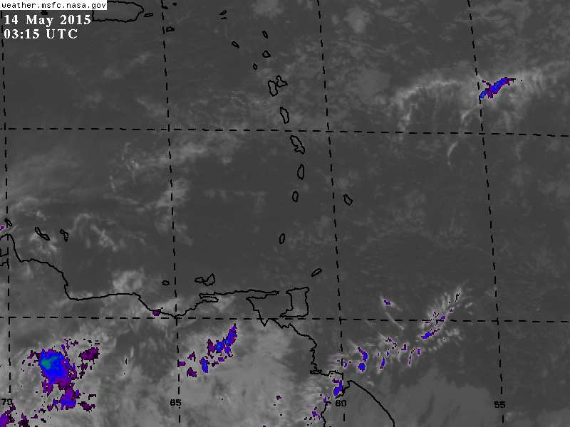
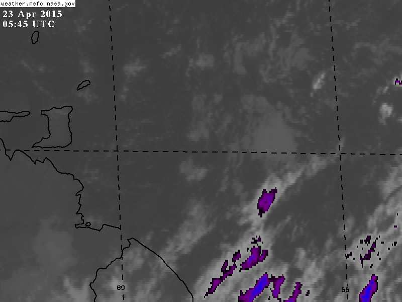
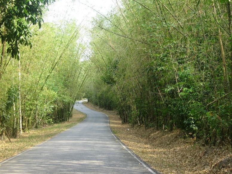
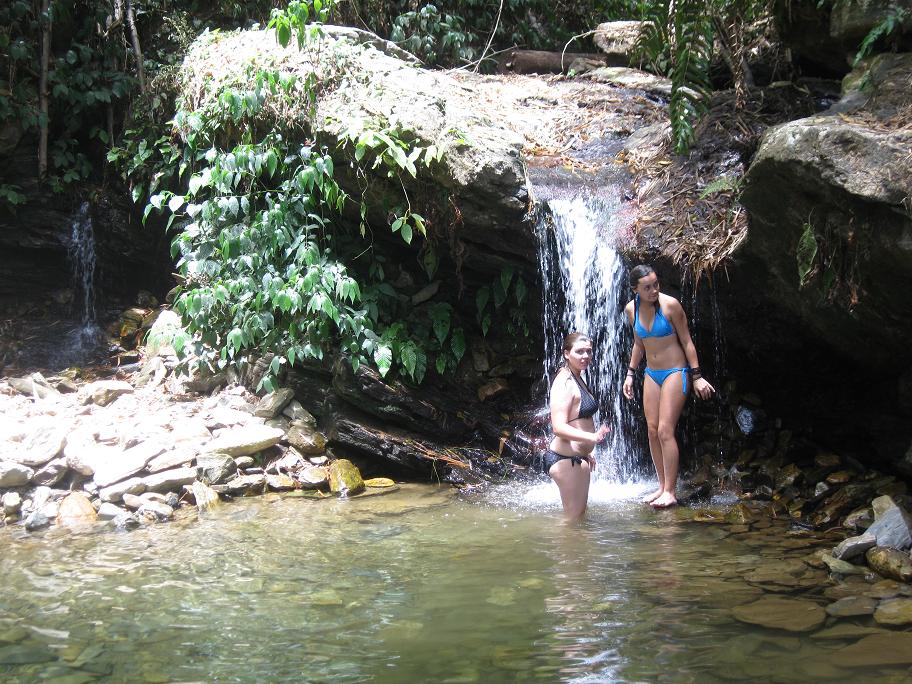
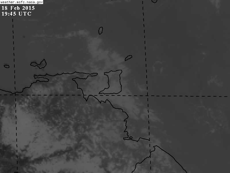
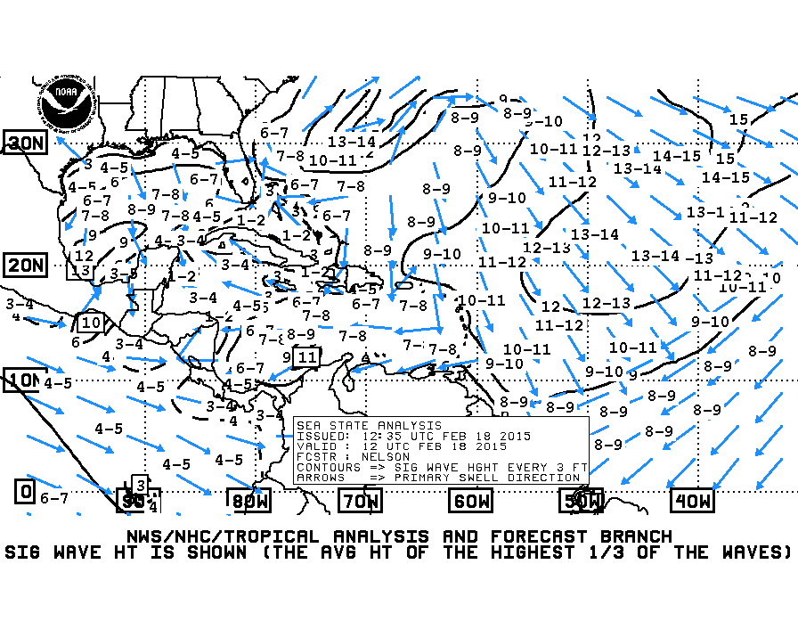
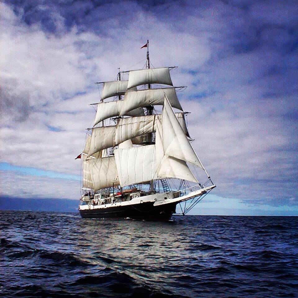
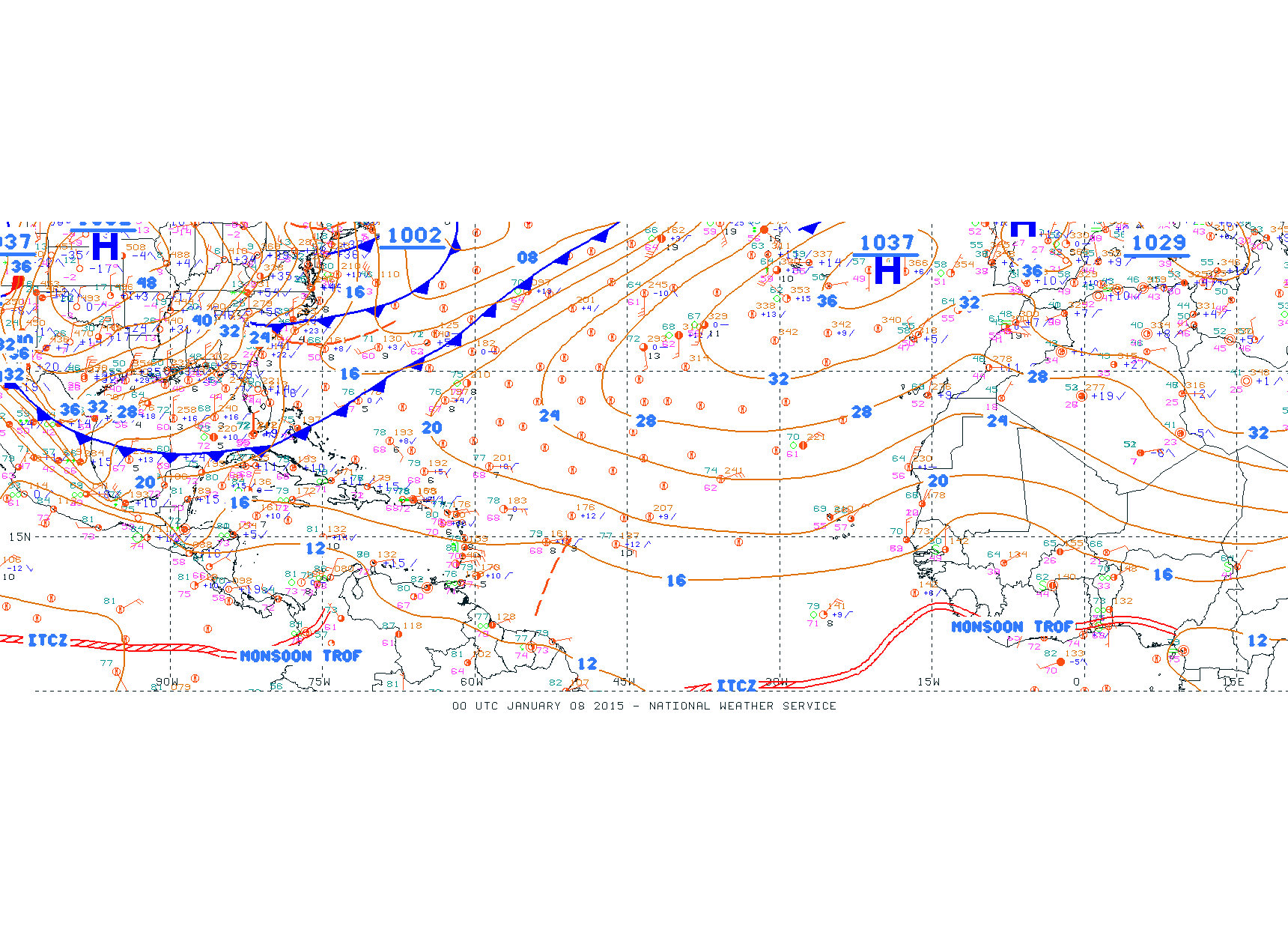
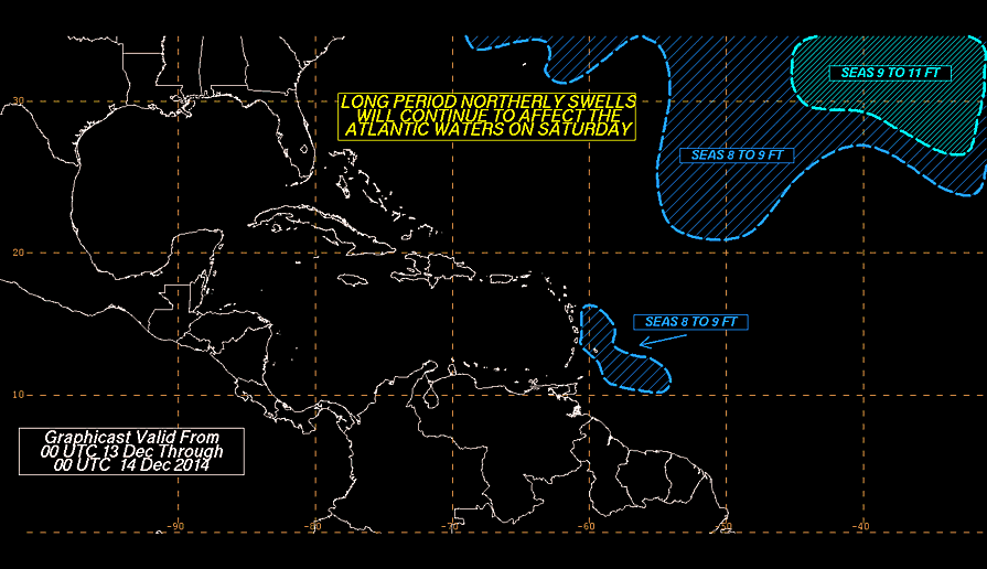
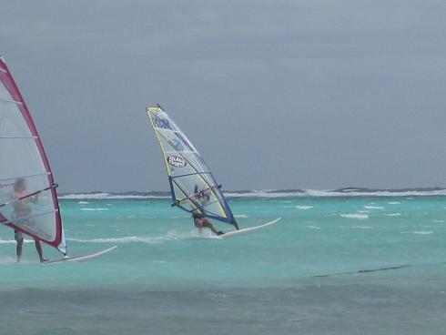
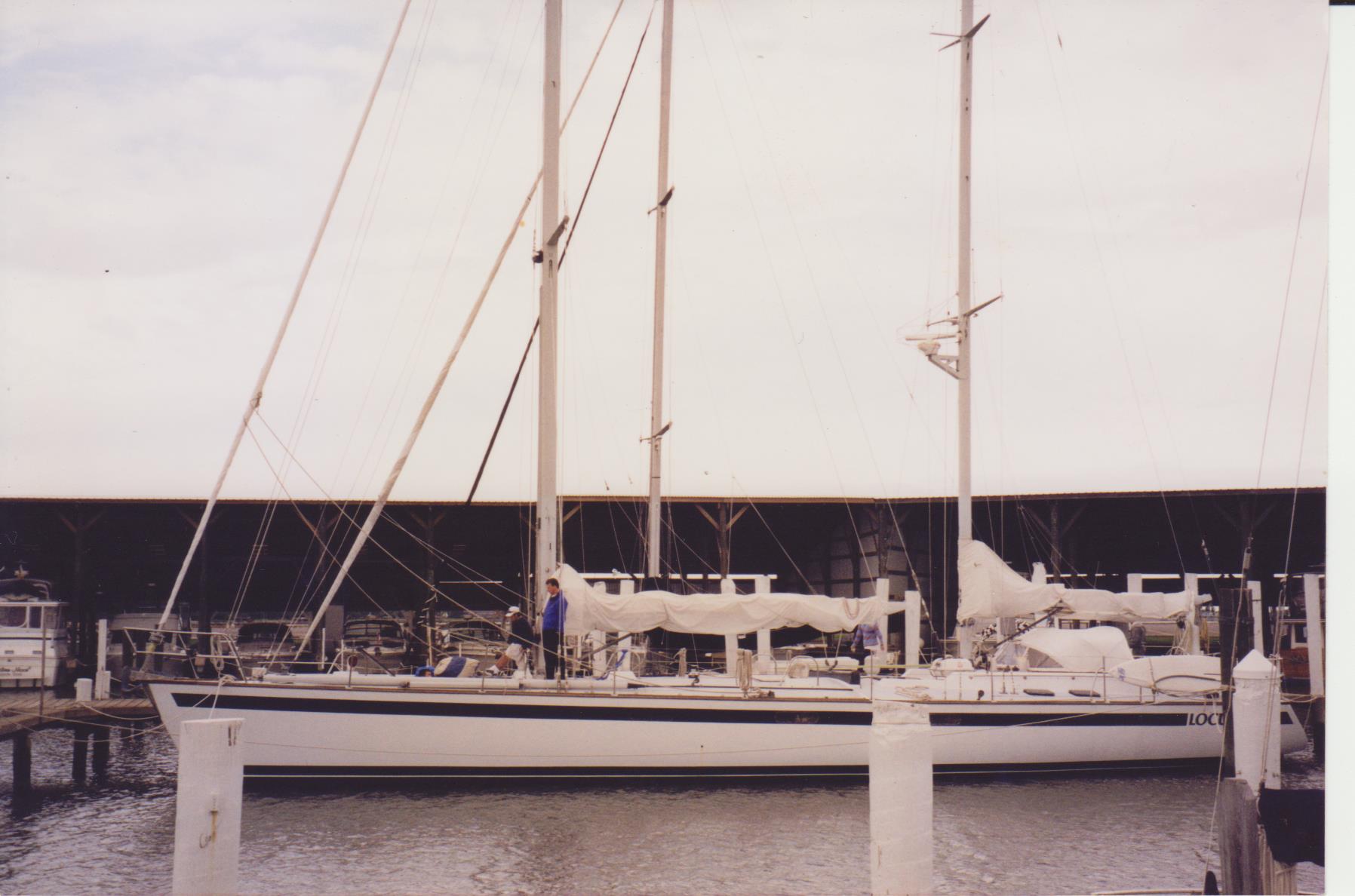
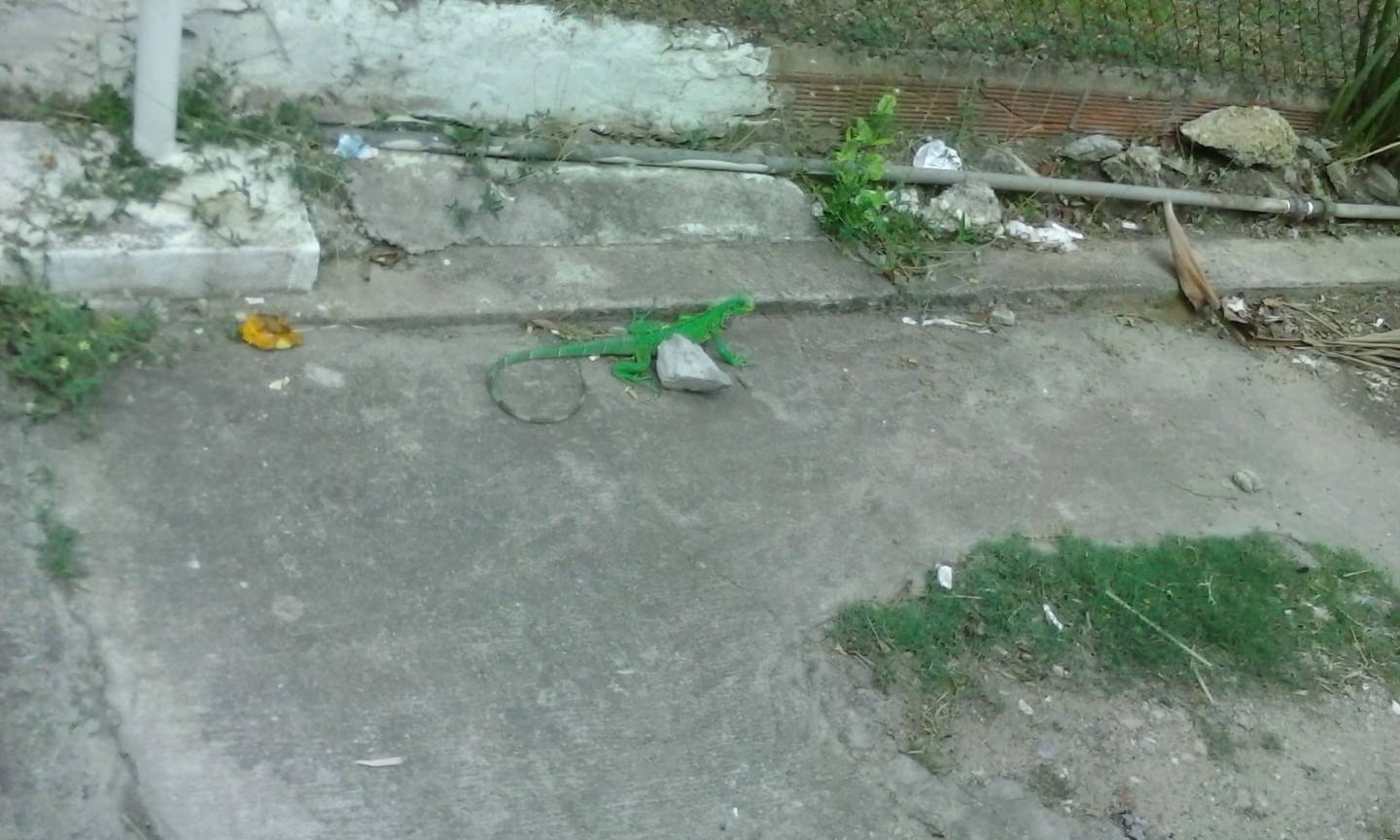
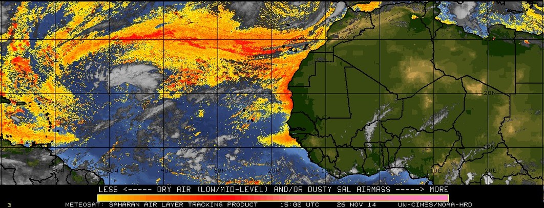
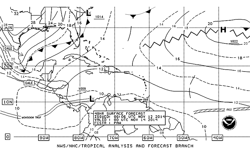
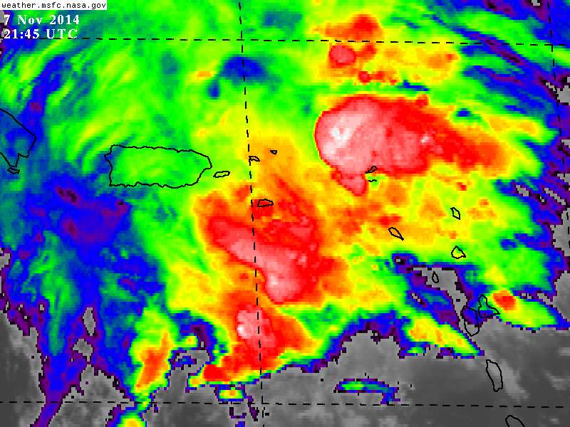
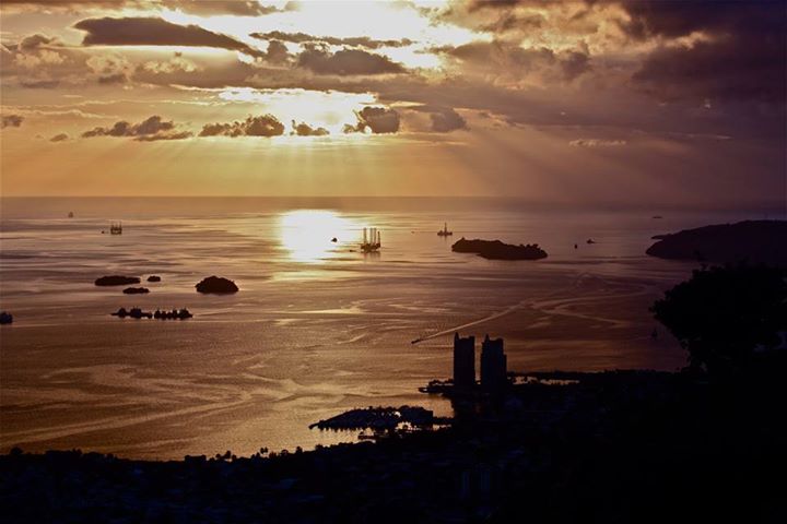
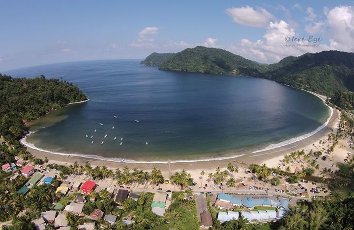
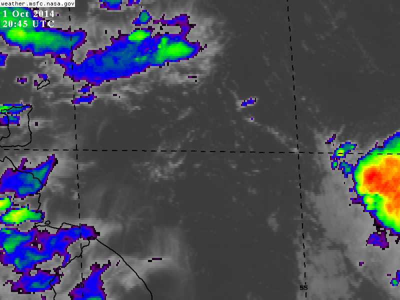
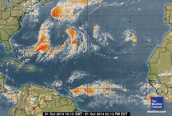
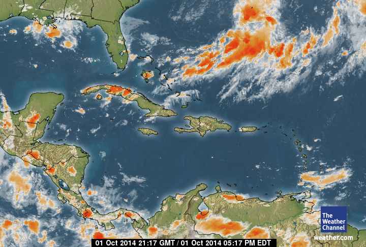
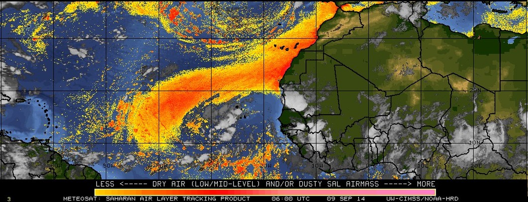
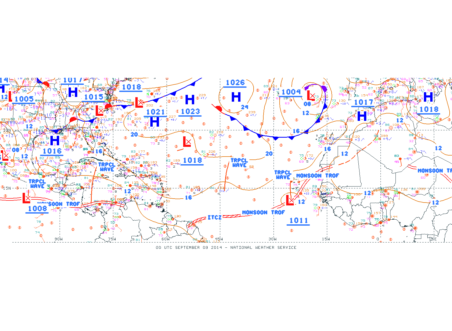
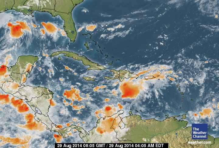
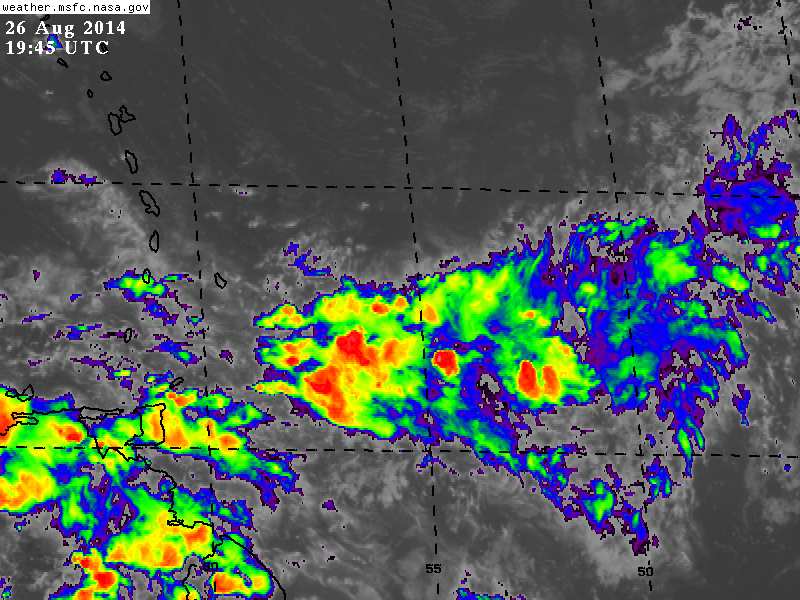
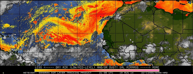
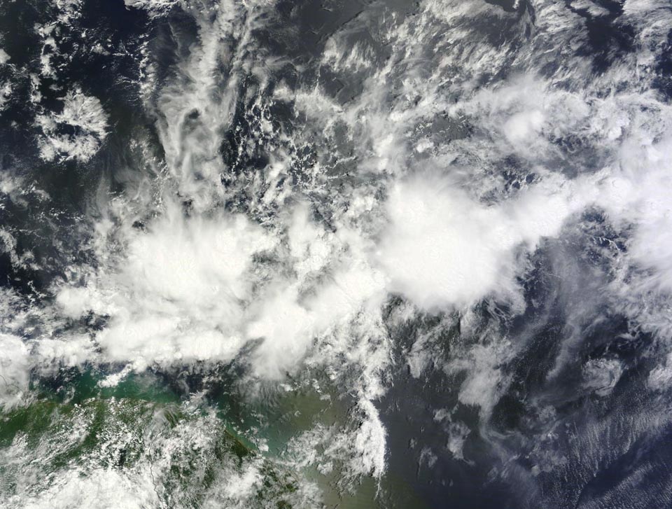
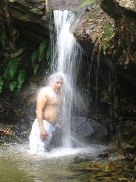
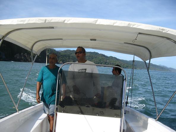
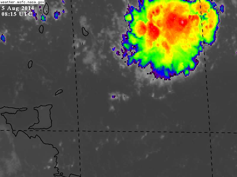
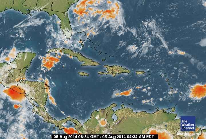
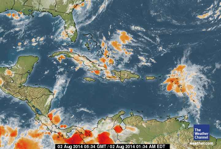
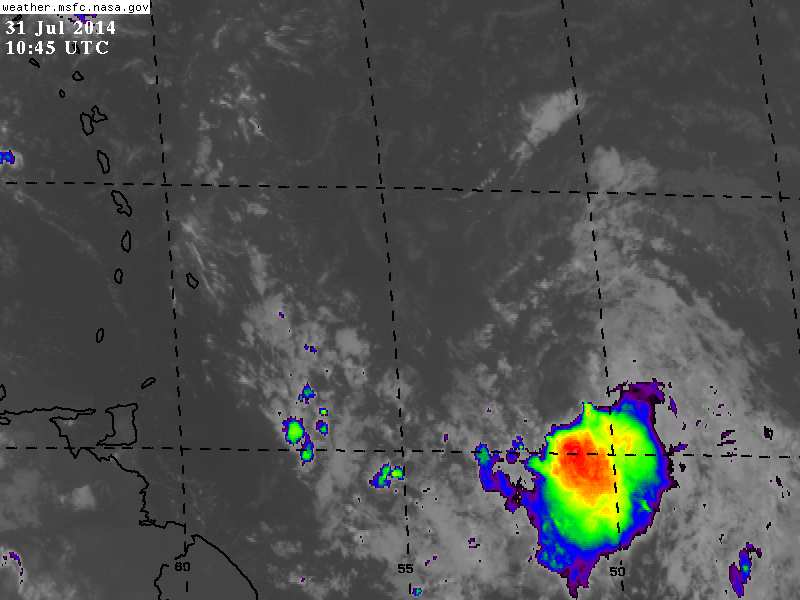
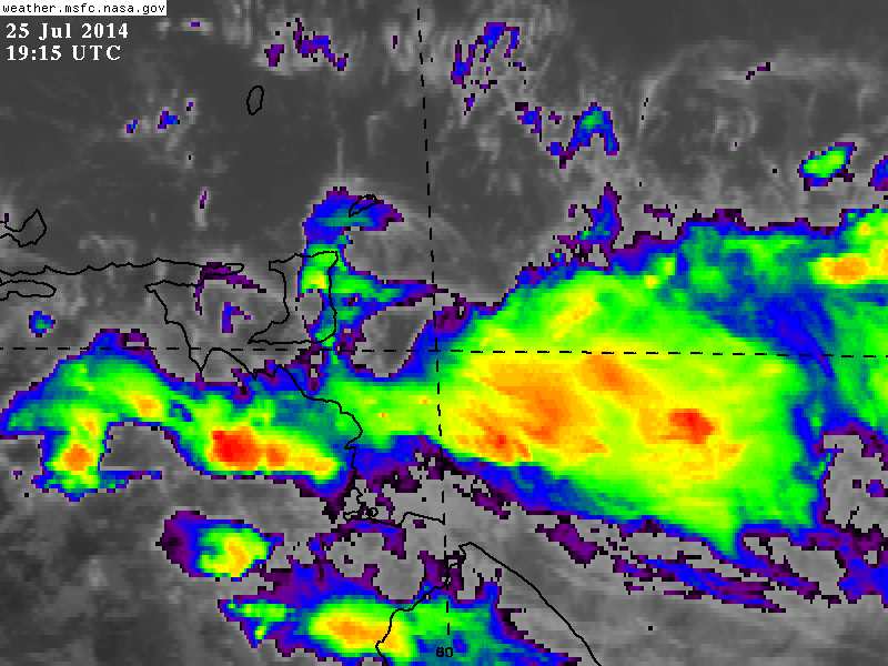
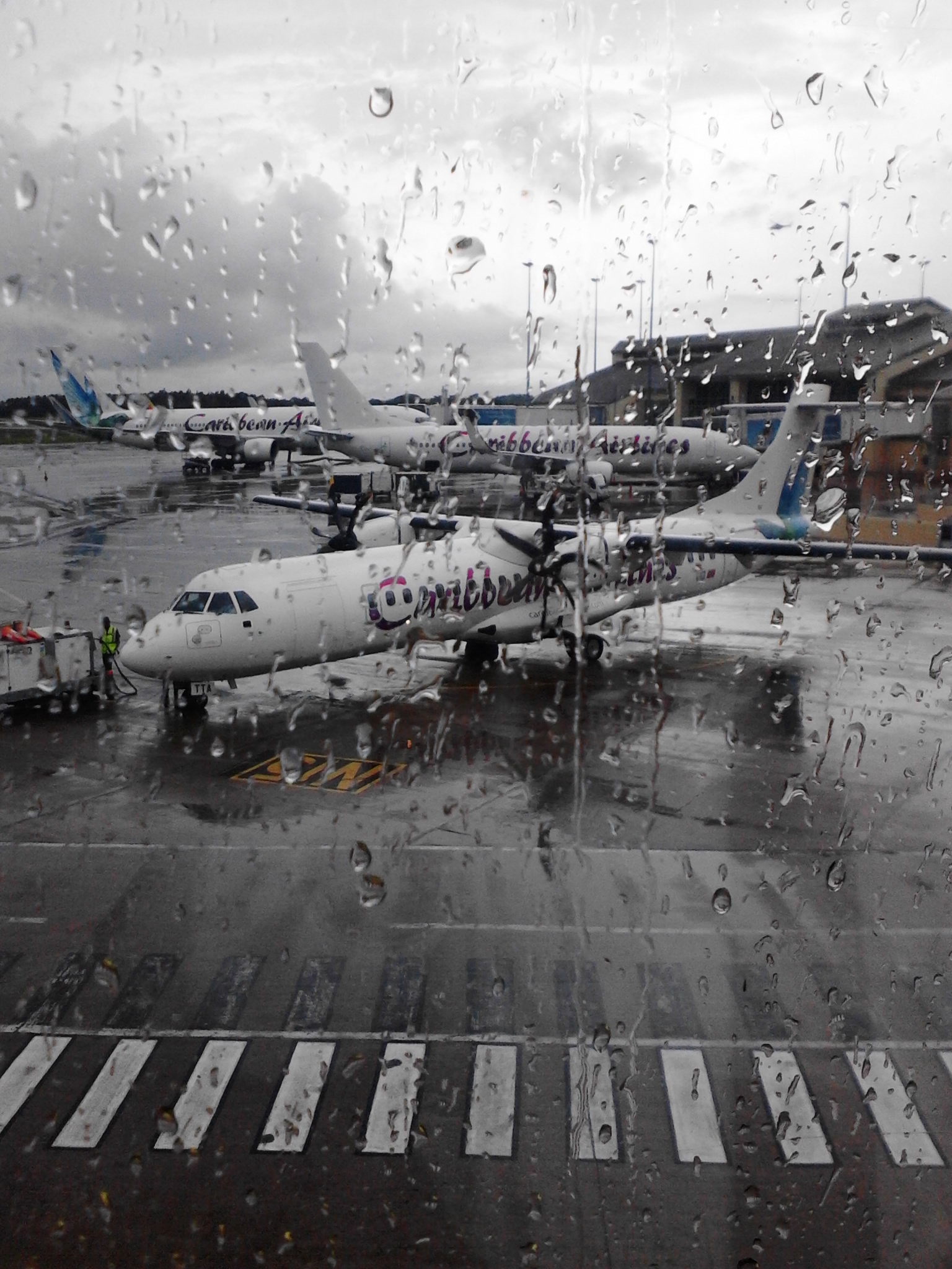
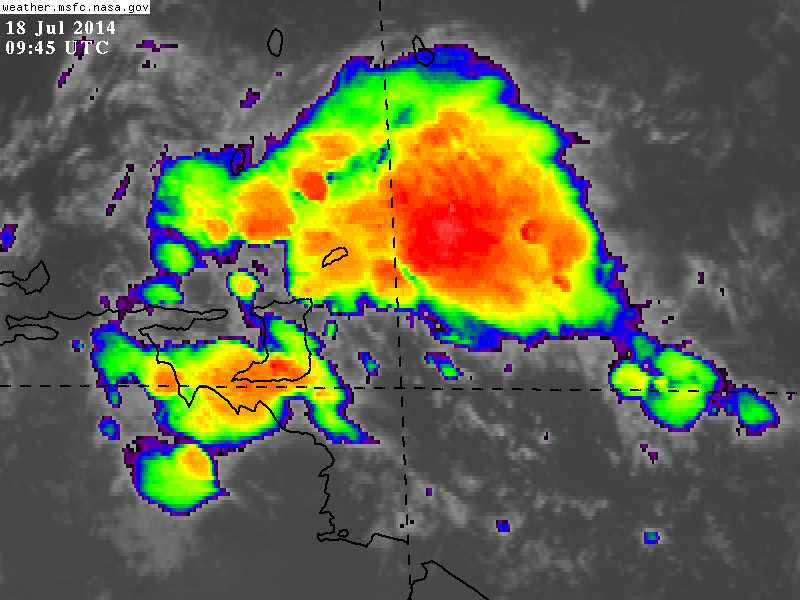
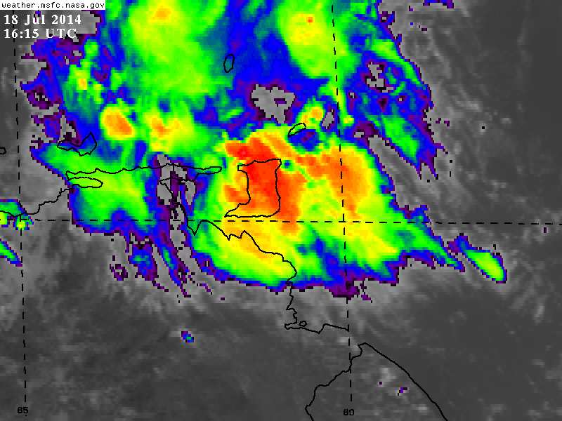
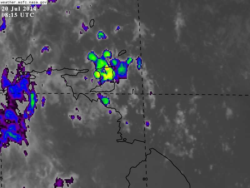
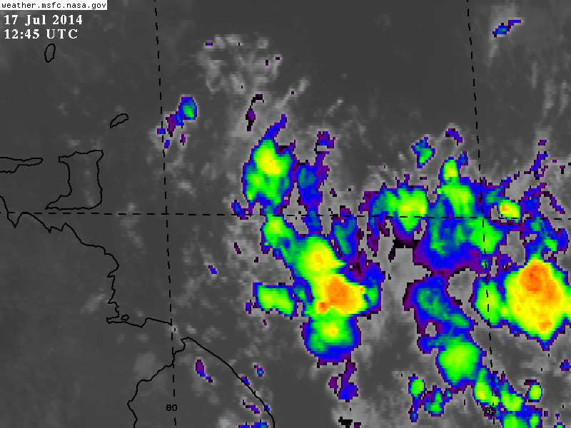
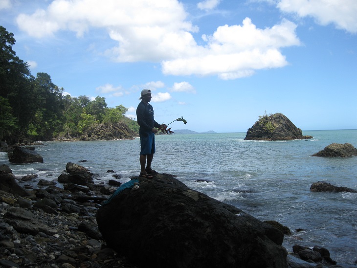
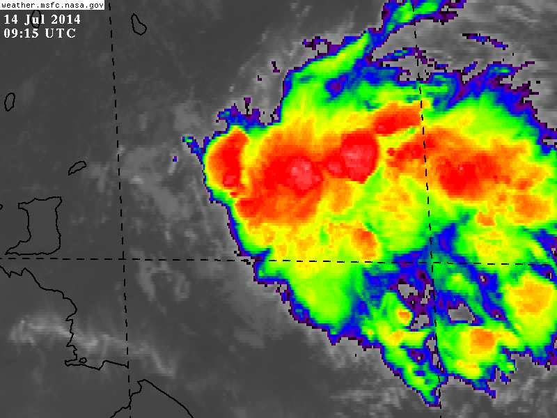
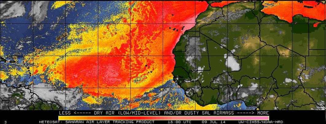
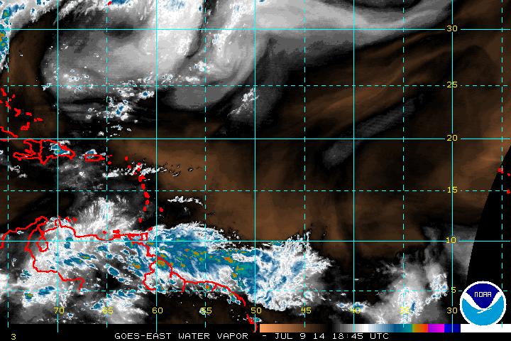
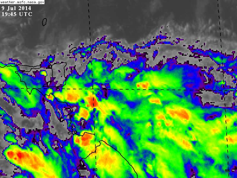
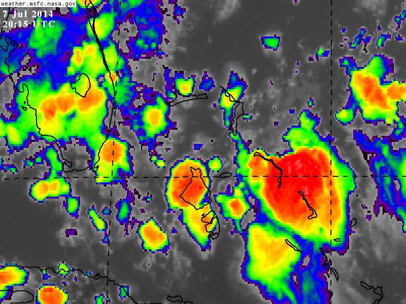
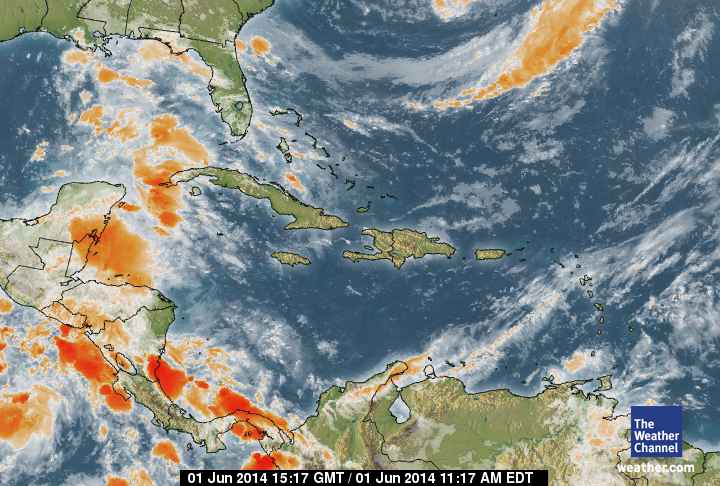
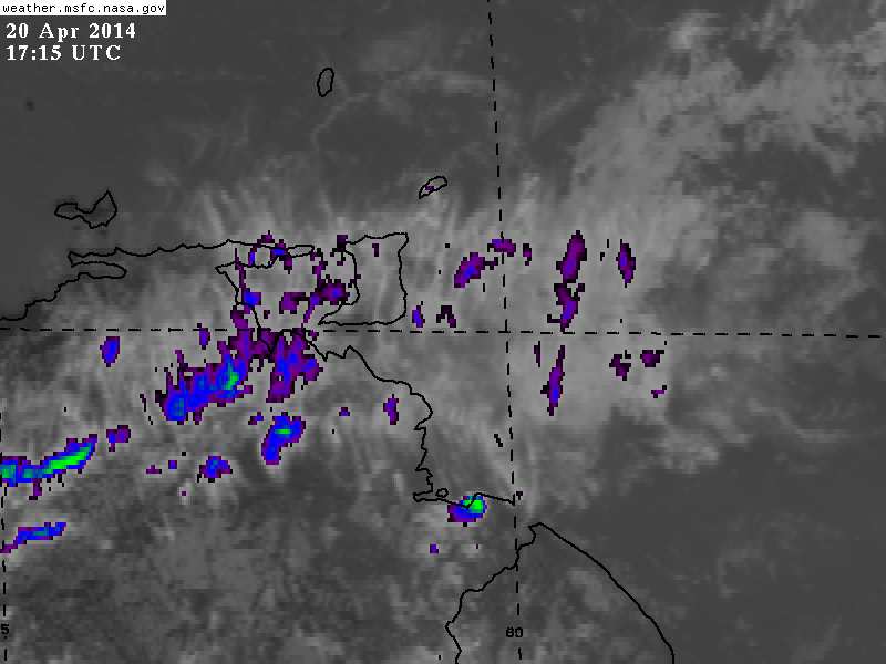
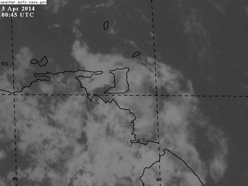