|
|
- - - 2014 Hurricane Season - - -
|
- Update
|
- From: "Barbara Cannegieter" <barcann at hotmail.com>
- Date: Fri, 17 Apr 2015 19:07:20 -0400
|
Today was a cloudy somewhat rainy day on St
Maarten.
We had some much needed showers..enough to end the
drought? not quite, but a good start.
People here know rain is coming
though.
It’s Carnival time and it always rains during
Carnival! 
|
|
|
- Update
|
- From: "Barbara Cannegieter" <barcann at hotmail.com>
- Date: Mon, 30 Mar 2015 18:14:48 -0400
|
Asking the rain Gods for some rain for St
Maarten.
Everything is very brown and dry
here.
|
|
|
- Update
|
- From: "Barbara Cannegieter" <barcann at hotmail.com>
- Date: Sat, 8 Nov 2014 12:56:29 -0400
|
St Maarten has had terrible flooding from all the rain
yesterday, last night, and this morning. The rain has stopped for now. They say
we will get more but the satellite shows that the worst has
passed.
There is a curfew in effect from noon so the badly
flooded roads can be cleaned up.
Star safe everyone. This system has affected many
islands.
|
|
|
- Update
|
- From: "Barbara Cannegieter" <barcann at hotmail.com>
- Date: Fri, 17 Oct 2014 09:20:02 -0400
|
|
|
|
- GONZALO: Missing people in St. Barts and St. Martin (French part) retrieved | Les disparus ont été retrouvés
|
- From: nettlebay <nettlebay at gmail.com>
- Date: Thu, 16 Oct 2014 11:39:57 -0400
|
It's official: no fatalities in St. Barts and St. Martin, French side. All missing mariners (16) have been retrieved or rescued. C'est officiel: pas de victimes à St Barth et St Martin, côté français. Tous les plaisanciers manquants (16) ont été retrouvés ou secourus.
Patrice Airiau, St Martin, Baie Nettlé
|
|
- Update
|
- From: "Barbara Cannegieter" <barcann at hotmail.com>
- Date: Thu, 16 Oct 2014 10:13:09 -0400
|
Good morning
Clean up on St Maarten
continues.
We are bouncing back as quickly as we
can.
FYI, here are some before and after pictures compiled
showing the devastation on the French side.
I believe NHC continually under forecast this storm.
We were not prepared for such an intense storm. They called it a CAT 1 when it
came over us and we definitely experienced much stronger winds than that. From
what I hear, the same thing happened in Antigua.
Thinking of our friends in Bermuda. Please be safe and
careful! Take every precaution!
|
|
|
- SxmDCOMM: 4TH COPI UPDATE - POST HURRICANE GONZALO NATIONAL CLEAN UP AND RECOVERY
|
- From: Roddy Heyliger <roddyheyliger at gmail.com>
- Date: Wed, 15 Oct 2014 18:23:18 -0400
|
4th POST
HURRICANE GONZALO NATIONAL CLEAN UP AND RECOVERY
On Wednesday a second follow-up COPI (operational
disaster management group) met to assess the current recovery phase of the
country. Additional information will be
provided on Thursday as the national cleanup effort continues and additional
updates come in from the various Emergency Support Functions that are leading
the national clean up and recovery effort.
INTRODUCTION:
This is the fourth update in connection with the
post-Hurricane Gonzalo recovery phase.
COPI continues to receive on-going assessment reports as recovery and
cleanup efforts continue:
NV
GEBE ELECTRICITY & WATER SUPPLY:
·
GEBE Electricity: Unsafe situation concerning
live wires have been completed. GEBE
crews have now started reconnecting households in areas that still have outages.
Call GEBEs emergency number to provide information about your outage such as
your address and phone number: 1 844 4323 213.
·
Water: all consumers should have water service by
7.00pm, Wednesday evening. 12 water
storage tanks are being filled to capacity.
The country’s three water plants are working full capacity to restore
water to consumers. Some challenges
during the course of Wednesday have been resolved. Customers who still have challenges with
water Wednesday evening should call GEBEs emergency number 1 844 4323 213 to
report the aforementioned.
SCHOOLS:
·
Contractors start work on eight schools on
Thursday. CIA school will be open on
Thursday. Traffic Police will be in the
Cupecoy area to assist with any traffic congestion. Ministry VROMI is currently assisting with 12
schools in order to have them ready in time for a possible Monday re-opening. A final assessment will be carried out on
Sunday, October 19.
·
It has been decided that schools will remain
closed until Monday, October 20. This
would allow adequate time for cleanup activities and repairs to take place.
·
The Ministry of Education will meet with school
management/boards on Friday, October 17 to assess the overall progress being
made in connection with the cleanup/repairs of schools.
FRONT
& BACK STREET UPDATE/BEACH PROMENADE/GREAT BAY BEACH:
·
Front Street: Ministry VROMI announces that the
cleaning of Front Street has been completed;
·
Back Street: Clean up operations will continue on
Back Street on Thursday and should be completed on Thursday;
·
Clean up of the Beach Promenade and Great Bay
Beach will start on Thursday and all efforts will be made to have it completed
by Friday at the end of the day;
DEPARTMENT
OF SOCIAL SERVICES:
·
Registration for Assessment of damage due to
Hurricane Gonzalo will continue at the Department of Social Services (Pondfill)
until Wednesday, October 22. Office
hours are from 8.00AM to 3.30PM.
Priority is for senior citizens, disabled/handicapped.
·
There is an urgent need for donations of
tarpaulins, home repair tools and wood.
Donations should be made to the St. Maarten Red Cross!
NATIONAL CLEAN UP CONTINUES:
• SPECIAL NOTICE:
Police will be shutting down certain streets in collaboration with Ministry
VROMI in order to facilitate the clean up efforts currently taking place. Clean up crews have experienced aggressive
behavior from motorists and this is totally unacceptable. Vehicles should also not be parked in a
certain manner that obstructs clean up efforts.
Police will be present to have these vehicles removed whenever necessary.
The removal of “closed road street barriers” by individuals is punishable by
law and this measure will be enforced should the person(s) be caught in the
act.
• Landfill
is open: persons taking debris to the landfill need to be patient and wait
their turn to enter the area;
• Clean
up continues under the Ministry VROMI and private contractors;
• Large
Green Waste Bins: have been placed at various locations along the main roads to
collect hurricane related debris; these will also be placed along secondary
roads as well;
• Homeowners
and businesses busy with cleanup, do not dump bush or tree trimmings or other
garbage/debris on top of GEBE water meters or electrical meters; this is to
prevent damage to the aforementioned and outage of service to consumers;
Best regards,
Roddy Heyliger - BB pin 21437DBE
Sint Maarten Online Newsday Source Checkout my profile on LinkedIn.com
RSH Consultancy Inc. (MedPRO), Corporate & Government PR/Communications
MedPRO - Designed to broaden public knowledge by informing. 'Communications are at the heart of delivering results and winning support.' CONFIDENTIALITY NOTICE
This e-mail message is intended only for the individual(s) to whom it is
addressed. This e-mail may contain information that is privileged,
confidential and exempt from disclosure under applicable law. If you are not
the intended recipient, you are hereby notified that any dissemination,
distribution or copying of this communication is strictly prohibited. If you received this e-mail by accident, please notify the sender immediately and destroy this e-mail and all copies of it.
|
|
- St.Maarten News
|
- From: Gert van Dijken <gert at vandijken.com>
- Date: Wed, 15 Oct 2014 13:14:11 -0700
|
|
|
|
- SxmDCOMM UPDATE - 3rd POST HURRICANE GONZALO NATIONAL CLEAN UP AND RECOVERY
|
- From: Roddy Heyliger <roddyheyliger at gmail.com>
- Date: Wed, 15 Oct 2014 16:13:18 -0400
|
3rd POST
HURRICANE GONZALO NATIONAL CLEAN UP AND RECOVERY
On Wednesday COPI (operational disaster
management group) met to assess the current recovery phase of the country. Additional information will be provided later
in the day Wednesday or early evening as the national cleanup effort continues
and additional updates come in from the various Emergency Support Functions
that are leading the national clean up and recovery effort.
INTRODUCTION:
This is the third update in connection with the
post-Hurricane Gonzalo recovery phase.
COPI continues to receive on-going assessment reports as recovery and
cleanup efforts continue:
ELECTRICITY/WATER
SUPPLY:
·
GEBE continues to work to repair the national
grid where current outages exist. The utility company is first addressing any
potential dangers that may exist. There are several crews from GEBE that are
working on addressing the situation with downed poles.
·
Water: there are some challenges with respect to
water resumption in the areas of South Reward (hill side area), Mary’s Fancy
and Belvedere. The resumption of water services is taking place in a cautious
manner in order to avoid water leakage into the system. An alternative temporary water supply source
is also being worked on for those areas mentioned above that doesn’t have piped
water.
SCHOOLS:
·
It has been decided that schools will remain
closed until Monday, October 20. This
would allow adequate time for cleanup activities and repairs to take place.
·
The Ministry of Education will meet with school
management/boards on Friday, October 17 to assess the overall progress being
made in connection with the cleanup/repairs of schools in order to determine
when schools can re-open. A further
update will be provided based on the outcome of this meeting on Friday as all
schools and the public works department will work closely in the interest of a
safe school environment for the students.
PORT
OPERATIONS:
·
Cargo: the cargo port operations are up and
running;
·
Cruise: preparations are well underway to make
the cruise facilities ready, and additional information will be forthcoming
with respect to this;
NATIONAL CLEAN CONTINUES:
• Landfill
is open: persons taking debris to the landfill need to be patient and wait
their turn to enter the area;
• Clean
up continues under the Ministry VROMI and private contractors;
• Large
Green Waste Bins: have been placed at various locations along the main roads to
collect hurricane related debris; these will also be placed along secondary
roads as well;
• Homeowners
and businesses busy with cleanup, do not dump bush or tree trimmings or other
garbage/debris on top of GEBE water meters or electrical meters; this is to
prevent damage to the aforementioned and outage of service to consumers;
• Mudslides/Rock
falls: residents in hilly areas should be mindful of the aforementioned;
• Retaining
Walls: if a retaining wall has given away at your home, do not remove it at
this point in time; let the ground dry out; removing it now would create
further slippage of earth;
Best regards,
Roddy Heyliger - BB pin 21437DBE
Sint Maarten Online Newsday Source Checkout my profile on LinkedIn.com
RSH Consultancy Inc. (MedPRO), Corporate & Government PR/Communications
MedPRO - Designed to broaden public knowledge by informing. 'Communications are at the heart of delivering results and winning support.' CONFIDENTIALITY NOTICE
This e-mail message is intended only for the individual(s) to whom it is
addressed. This e-mail may contain information that is privileged,
confidential and exempt from disclosure under applicable law. If you are not
the intended recipient, you are hereby notified that any dissemination,
distribution or copying of this communication is strictly prohibited. If you received this e-mail by accident, please notify the sender immediately and destroy this e-mail and all copies of it.
|
|
- SXM Dutch Side Report
|
- From: Alex - SXM <sxmwx at miwww.com>
- Date: Wed, 15 Oct 2014 08:20:57 -0400
|
Lots of people, specially on the boats in the lagoon, got complacent
as they only expected it to be a tropical storm that would pass 70
miles to the south and we would hardly only experience 45-50knot
winds at most, but this one got nasty very fast. At around 5pm we
started getting strong occasional gusts of wind beating the palms and
vegetation, very little rain, but it really started to get bad around
6-6:30pm. This thing went from TS to Hurricane cat2 in just a few
hours and grew into hurricane status practically at our doorstep and
head on. Around 7-7:30pm during the peak of the storm there where
very strong continued gusts with lots of rain and lightning. By
8:30pm the effects started to subside in my area.
Fortunately here at pelican key we never lost electricity (only had a
couple of flickers), water or Internet throughout the storm, although
one of the nearby resorts was running their generators, still on late
afternoon Tuesday. Even cable-tv stayed on for most of the storm so
all in all we got very lucky that all utilities stayed online (except
one of the wireless Internet providers that went down at around 6pm).
Its been said that water distribution mains where somehow damaged
during the storm, but are being repaired, so many areas reported
without water service, at least up until Tuesday afternoon.
Inland it seems many people also lost power and unfortunately as of
Tuesday evening still in the dark. Some houses in those areas also
reported to have lost roofs. In Simpson Bay area many signs and trees
also down, some wooden docks swept away and or destroyed. A few power
boats blown off their lifts. At Pelican only a few old trees down and
mostly loose branches on the roads, but no roofs lost, and very minor
damage, as in general houses here stood up very well even though at
some point we where facing right into the strong wind when it was
coming in from the south. Princess Juliana airport was open Tuesday
morning but only small Winair and Liat planes where taking off, no
big ones where coming in probably until they could asses the
situation to be safe. But in the afternoon its was again business as
usual with big planes landing and taking off normally.
People on boats in the lagoon hit very hard, again many because of
lack of preparation, some reported gusts reached at least 90-100Mih
and possibly 120Mih at some point. Many boats, estimated at least
50-60, damaged, sank or shored up in lagoon, a lot of those on the
french side. Boats at St Barts (Gustavia) got also hit very hard too
as that harbor offered practically no protection in this case, so in
view of the approaching storm quite a few boats made a mad dash from
Gustavia over here to get into the lagoon, but apparently some got
caught midway in the open sea. So far in the lagoon only one casualty
reported, an older gentlemen on his boat that was unable to make it
out when the storm was sinking it. Even though he was docked right
next to St Maarten Boat yard where the floating restaurant is, next
to airport runway. He was not very mobile and walked with a cane.
People commented that Monday afternoon some people tried to convince
him to leave the boat but he insisted on weathering the storm in it,
saying something like "I've done it before, how bad can this one
get". I was told he was declared missing Tuesday and where looking
for divers to try to locate him, but then sadly his lifeless body was
quickly spotted in shallow water around the nearby restaurant.
One unattended sailing boat that was in the french side in Marigot
harbor was blown all the way over to the dingy dock at Lagoon marina,
close to Budget marine, all the way over to the Dutch side. In the
process it lost its mast while passing blind under the causeway
bridge, and at least there at the marina where it ended up caused
direct or indirect damage to 3 boats, and indirectly caused the
sinking of another smaller sailing boat right next to the dock when
yet another sailing boat was pushed on top of it. A few people
commented on seeing the boat drift aimlessly during the storm and
wondering what the intentions where, but of course nobody was on
board. And it didn't help that this boat is made of steel, so it was
like a blind missile hitting everything in its path. Among other
things it tore a clean 3 feet diameter hole on the fiberglass side of
a catamaran that was at FKG dock awaiting some work done, but
fortunately it happened above the water line so it is still afloat.
Looking at the charts, there is already another Invest that needs to
be watched, but so far they are only giving it 10% chance of
developing. Gonzalo was also only 10% early last week. So just in
case keep your attention on it.
Alex at Pelican Key
|
|
- update
|
- From: "Barbara Cannegieter" <barcann at hotmail.com>
- Date: Tue, 14 Oct 2014 14:54:06 -0400
|
One man lost his life while on his boat in Simpson Bay
Lagoon.. very sad..
40 boats sunk during
storm.
I also heard several people missing at sea between
French SXM and St Barth’s. I am trying to confirm that story
now.
for those of you who read French, that story is from
this source:
|
|
|
- Fwd: SxmDCOMM - EOC UPDATE/ASSESSMENT Current State of Affairs Post Hurricane Gonzalo;
|
- From: Roddy Heyliger <roddyheyliger at gmail.com>
- Date: Tue, 14 Oct 2014 13:59:17 -0400
|
POST HURRICANE GONZALO ASSESSMENT & CLEAN-UP
On Tuesday morning the Emergency Operations Center (EOC) met
to assess the situation in the country. The
following information is available; additional information will be provided
later today after a follow-up meeting related to a number of issues:
INTRODUCTION:
The Emergency services as well as technical crews from the
utility companies have been working during the passing and after the passing of
the hurricane; and since sunrise to deal with the aftermath of the passing of
Hurricane Gonzalo. Their efforts
continue unabated throughout Tuesday and into the night and for the coming
days.
This is the first update with respect to reports coming in
from assessment teams:
NATIONAL CLEAN:
Clean-up is well under way by the Ministry VROMI
and private contractors who are assisting with the national clean-up. Primary focus is Front Street, Back Street
and the main roads. Secondary roads will
follow. Primary roads should be clear within another 24
hours; secondary roads, complete clean-up could take up to 14 days. Motorists/sightseers should stay off the roads
to allow clean-up crews to move around quickly in clearing debris and other
obstructions; this would also allow various crews from utility services to
restore electricity/telecoms; Police and the Military will be assisting
Ministry VROMI clean-up and certain streets and roads will be closed
temporarily to facilitate quick clean-up; Large Green Waste Bins: have been placed at
various locations along the main roads to collect hurricane related debris;
these will also be placed along secondary roads as well; Downed trees are being removed in order to
facilitate clean-up operations; Homeowners and businesses busy with clean-up, do
not dump bush or tree trimmings or other
garbage/debris on top of GEBE water meters or electrical meters; this is to
prevent damage to the aforementioned and outage of service to consumers; Mudslides/Rock falls: residents in hilly areas
should be mindful of the aforementioned; Retaining Walls: if a retaining wall has given
away at your home, do not remove it at this point in time; let the ground dry
out; removing it now would create further slippage of earth;
PUBLIC HEALTH ISSUES:
Homes/residents as well as businesses, having
issues with sewage water should use disinfectant (Clorox) to clean with;
remember to wash your hands frequently; keep young children away from where the
cleaning is taking place; if you don’t have water, you can still throw the
disinfectant on the area that needs to be cleaned and sweep/mop it away; clean
hands properly and avoid touching your mouth with dirty hands; Persons should not fish in the ponds; persons
should not eat any fish from the ponds because they are contaminated with
runoff water; consuming the fish is bad for your health! Residents/Businesses: should check their yards
and clean spouts, drains etc; remove containers that could become a mosquito
breeding ground; prevent mosquito breeding;
FIRE
DEPARTMENT/POLICE:
Fire department continues to carry out
assessments; additional fire officers have been mobilized; a review of critical
infrastructure is a priority; during the passing the department responded to
several emergencies and continues to deal with any eventualities; Police and Marines are working together
assisting other government services where it concerns facilitating debris
removal eg. Temporary Road closure or traffic diversion; and also fulfilling
their national responsibilities;
SCHOOLS:
PORTS (Airport and
Port):
The national Airport is open; Port St. Maarten is busy with clean-up
operations; divers have to go into the water to assess the situation to see if
there are any undersea obstructions that could inhibit the safe docking of
vessels; the port will resume operations as soon as the all clear sign has been
given;
WATER:
TELECOMMUNICATIONS:
POND--LANDFILL:
Ministry VROMI continues to lower water levels
in the Great Salt Pond; this operation is an ongoing 24 hours until water
levels are at a normal level; Fresh Water Pond levels are at a safe level; The Pond Island Landfill is open and in full
operation accommodating the delivery of hurricane related debris from clean-up
crews;
HOTELS:
PHOTO: EOC Meeting at the Fire Department, Cay Hill on Tuesday morning. DCOMM Photo
Attachment:
IMG_1047[1].JPG
Description: JPEG image
|
|
- SXM Update
|
- From: Barbara Beaumont <bmyacht1 at yahoo.com>
- Date: Tue, 14 Oct 2014 09:45:24 -0700
|
Hi Gert
Below I have pasted all I know. I have a house at Monte Vista, Pointe Blanche in St Maarten so I was checking on my house and my tenants so what I have written below is all I know. The bottom paste is from SXM Boaters. I have emailed several other people but have had no reply. I suspect you are not on island either.
Take care Barbara Beaumont
Well Last night Hurricane Gonzalo category 2 past over St Maarten. It was a tropical depression several hours before, a hurricane warning closed all businesses on the island. It passed over Monte Vista and took a huge chunk out of Sangs roof (the biggest house in the complex) and did considerable damage to Randy's house No 114. My house was thankfully spared any damage. Pat next door had some leakage. A lot of trees down. The internet went down too. The main road out of Monte Vista is blocked by a huge live cable so no one can get
past until Gebe come and fix it. Even though I was aware of the storm the speed with which it developed was frightening. I spoke to Pat and Manuel just now to find out if everything was OK. Thank goodness Apparently a lot of flares were fired off in Simpson Bay during and after hurricane Gonzalo went through but no news yet of what damage was or if any people were injured down there Hope they are OK
Lots of boats need help!
We won't be able to see much till tomorrow. My dinghy flipped so I have to do the engine before I ca help. We need people to scout all the boats in the water and washed up to see who needs help and who is OK. Need to do that asap in the morning!
|
|
- clean up day on St Maarten!
|
- From: "Barbara Cannegieter" <barcann at hotmail.com>
- Date: Tue, 14 Oct 2014 10:32:59 -0400
|
St. Maarten is a mess! Gonzalo was a nasty storm. We
definitely got CAT 2 winds where we live. There are large trees down all over
the island.
Some property damage. Some
flooding.
Everything is a mess but everyone
survived.
Today is clean up day!
Here are some pictures of our garden and our
boat.
Be safe out there!
|
|
|
- Current condition + SSB Nets
|
- From: Alex - SXM <sxmwx at miwww.com>
- Date: Mon, 13 Oct 2014 18:48:33 -0400
|
Right now experiencing very strong gusts with lots of rain.
Electricity is so far holding in my area, although we had a couple of
flickers, not sure other parts of the island. Switched to backup DSL
modem for internet, lost conectivity to main wireless provider. Storm
shutters so far holding ok, but someone seems to be banging on the
outside to get in. About 3 hours and change to go for closest
approach point, the eye apparently will pass within 9 miles south of us.
If anyone looses its Internet connection and/or electricity, and has
access to a SSB capable shortwave receiver, you can still listen in
to the National Hurricane Center advisories. If you are a Ham radio
operator you can also check in with them.
The Maritime Mobile Service Net: is operational every day from
12:00pm until 9:00pm Eastern Standard Time, and from 12:00pm until
10:00pm Eastern Daylight Time, on the 20 meter *Global Emergency
Center Of Activity frequency of 14.300 MHz USB.
http://www.mmsn.org/
Friendly 7.188 Net: daily net operations at 7.188MHz LSB (40m band)
are between the hours of 6:00 to 8:00 a.m Eastern Caribbean time /
1000 to 1200 UTC.
http://www.friendly7188net.net

List of other Caribbean Nets:
http://www.friendly7188net.net/admin/carib_nets.php

Alex  at  Pelican Key
|
|
- Update
|
- From: "Barbara Cannegieter" <barcann at hotmail.com>
- Date: Mon, 13 Oct 2014 18:28:22 -0400
|
St Maarten continues to get hit hard by Hurric ane
Gonzalo.
This is a short video of friends trying to tie
down our boat in the Simpson Bay lagoon.
The lagoon is where boats go for safety but look at
those waves.
|
|
|
- Update
|
- From: "Barbara Cannegieter" <barcann at hotmail.com>
- Date: Mon, 13 Oct 2014 17:47:27 -0400
|
Hurricane Gonzalo right over us.
Heavy heavy rain and strong strong
wind.
|
|
|
- SxmDCOMM - HURRICANE ADVISORY UPDATE - ODM: Country under a Hurricane Warning; Gonzalo Now a Category 1 Hurricane and continues to strengthen; Schools to remain closed Tuesday;
|
- From: Roddy Heyliger <roddyheyliger at gmail.com>
- Date: Mon, 13 Oct 2014 17:36:43 -0400
|
Department of Communication (DCOMM), Philipsburg, Sint
Maarten W.I. Tel. +1 721 543-1162, 542-4119, Fax:
543-1169; Email: gis at sintmaarten.net or
dcomm at sintmaartengov.org; Website: www.sintmaartengov.org
For Immediate Release: Monday, October 13, 2014/N174-5.30PM
ODM:
Country under a Hurricane Warning; Gonzalo Now a Category 1 Hurricane and continues
to strengthen; Schools to remain closed Tuesday;
GREAT BAY, Sint Maarten (DCOMM) – The Department of Disaster Management (ODM) officially announces that Gonzalo
is now a category 1 Hurricane located at 5.00PM 20 miles south east of Sint
Maarten.
Residents should remain indoors until the hurricane
clears the island.
The country is under a Hurricane Warning. Weather conditions have deteriorated. Hurricane
conditions will continue to spread through the area tonight.
Schools are to remain closed on Tuesday. Ministry VROMI/Public Works after carrying
out an assessment when weather conditions subside will then plan clean-up
operations to clear any debris on the public road network.
Business owners/operators should use their discretion
on Tuesday morning after assessing their business whether staff should report
to work. Government employees are
expected to report to work on Tuesday.
Hurricane Gonzalo at 5.00PM has 75 mile per hour winds
with higher gusts, and further strengthening is forecasted during the next 48
hours. Gonzalo could become a major
hurricane by Wednesday when it is located over the open Atlantic Ocean and is
no longer a threat to the country.
Hurricane force winds extend outward up to 10 miles
per hour; and tropical storm force winds extend outward up to 105 miles from
the center.
For weather updates visit the site of MDS at:
www.meteosxm.com
ODM will continue to monitor the progress of the storm. Additional updates will be provided.
# # #
Roddy Heyliger (Email/Blackberry: roddyheyliger at gmail.com; roddy.heyliger at sintmaartengov.org;
Cells: +1 721 520-4217, 581-6323)
Department of Communication (DCOMM), Sint Maarten
Best regards,
Roddy Heyliger - BB pin 21437DBE
Sint Maarten Online Newsday Source Checkout my profile on LinkedIn.com
RSH Consultancy Inc. (MedPRO), Corporate & Government PR/Communications
MedPRO - Designed to broaden public knowledge by informing. 'Communications are at the heart of delivering results and winning support.' CONFIDENTIALITY NOTICE
This e-mail message is intended only for the individual(s) to whom it is
addressed. This e-mail may contain information that is privileged,
confidential and exempt from disclosure under applicable law. If you are not
the intended recipient, you are hereby notified that any dissemination,
distribution or copying of this communication is strictly prohibited. If you received this e-mail by accident, please notify the sender immediately and destroy this e-mail and all copies of it.
|
|
- Fwd: SxmDCOMM - STORM ADVISORY - ODM: Country under a Hurricane Watch and Tropical Storm Warning; TS Gonzalo continues to Strengthen; Drivers urged to get home and stay off road network
|
- From: Roddy Heyliger <roddyheyliger at gmail.com>
- Date: Mon, 13 Oct 2014 15:30:47 -0400
|
News Release
Department of Communication (DCOMM), Philipsburg, Sint
Maarten W.I. Tel. +1 721 543-1162, 542-4119, Fax:
543-1169; Email: gis at sintmaarten.net or
dcomm at sintmaartengov.org; Website: www.sintmaartengov.org
For Immediate Release: Monday, October 13, 2014/N173-3.25PM
ODM:
Country under a Hurricane Watch and Tropical Storm Warning; TS Gonzalo continues
to Strengthen; Drivers urged to get home and stay off road network
GREAT BAY, Sint Maarten (DCOMM) – The Department of Disaster Management (ODM) officially announces that motorists
currently on the road should get home as soon as possible driving in a safe
responsible manner.
The country remains under a Hurricane Watch and a
Tropical Storm Warning. A Hurricane Watch
means that hurricane conditions are expected in the warning area within 24
hours.
Weather conditions have deteriorated and could get
worse as Tropical Storm Gonzalo approaches our area. Residents are advised to
remain indoors.
There is no curfew in affect, and hurricane shelters
will not be activated under a tropical storm or a category 1 hurricane.
Tropical Storm Gonzalo at 2.00PM was located 65 miles south
east of Sint Maarten. The storm has also
strengthened with 70 mile per hour winds and higher gusts, and further
strengthening is forecasted during the next 48 hours, and could become a
hurricane Monday night.
Meteorological Department of St. Maarten (MDS) says
forecasted rainfall is between four to eight inches with isolate maximum totals
of 12 inches.
A heavy rainfall advisory and a flood warning are in
effect for the country as well as a rough sea advisory.
Under a Tropical Storm Warning; the warning means that
there could be sustained wind speeds of between 39 and 73 miles per hour within
24 to 36 hours or less.
For weather updates visit the site of MDS at:
www.meteosxm.com
ODM will continue to monitor the progress of the storm. Additional updates will be provided.
# # #
Roddy Heyliger (Email/Blackberry: roddyheyliger at gmail.com; roddy.heyliger at sintmaartengov.org;
Cells: +1 721 520-4217, 581-6323)
Department of Communication (DCOMM), Sint Maarten
Best regards,
Roddy Heyliger - BB pin 21437DBE
Sint Maarten Online Newsday Source Checkout my profile on LinkedIn.com
RSH Consultancy Inc. (MedPRO), Corporate & Government PR/Communications
MedPRO - Designed to broaden public knowledge by informing. 'Communications are at the heart of delivering results and winning support.' CONFIDENTIALITY NOTICE
This e-mail message is intended only for the individual(s) to whom it is
addressed. This e-mail may contain information that is privileged,
confidential and exempt from disclosure under applicable law. If you are not
the intended recipient, you are hereby notified that any dissemination,
distribution or copying of this communication is strictly prohibited. If you received this e-mail by accident, please notify the sender immediately and destroy this e-mail and all copies of it.
|
|
- Outer bands arrived
|
- From: Alex - SXM <sxmwx at miwww.com>
- Date: Mon, 13 Oct 2014 15:18:56 -0400
|
We are starting to experience the effects of the storm's outer
rainbands arriving on the island. Rain and some strong wind gusts,
but right now only light rain and moderate wind. Windguru site
currently is predicting that stronger winds (35Kts/40Mih with gusts
of 45Kts/51Mih will start to hit us after 8PM AST tonight.
http://www.windguru.cz/int/index.php?sc=51227


Alex  at  Pelican Key
|
|
- Update
|
- From: "Barbara Cannegieter" <barcann at hotmail.com>
- Date: Mon, 13 Oct 2014 14:52:58 -0400
|
Very heavy wind on St Maarten as Gonzalo comes closer.
It is definitely strengthening. The wind is very strong but there is not a lot
of rain so far.
St Maarten is under a hurricane warning
now.
|
|
|
- Fwd: SxmDCOMM - STORM ADVISORY - Country under a Hurricane Watch and Tropical Storm Warning; TS Gonzalo continues to Strengthen; Residents urged to complete storm preparations before nightfall
|
- From: Roddy Heyliger <roddyheyliger at gmail.com>
- Date: Mon, 13 Oct 2014 11:23:39 -0400
|
News Release
Department of Communication (DCOMM), Philipsburg, Sint
Maarten W.I. Tel. +1 721 543-1162, 542-4119, Fax:
543-1169; Email: gis at sintmaarten.net or
dcomm at sintmaartengov.org; Website: www.sintmaartengov.org
For Immediate Release: Monday, October 13, 2014/N172-11.20AM
ODM:
Country under a Hurricane Watch and Tropical Storm Warning; TS Gonzalo continues
to Strengthen; Residents urged to complete storm preparations before nightfall
GREAT BAY, Sint Maarten (DCOMM) – The Department of Disaster Management (ODM) officially announces that the
country is under a Hurricane Watch and a Tropical Storm Warning.
A Hurricane Warning means that hurricane conditions
are expected somewhere in the warning area in this case within 24 hours.
Weather conditions are forecasted to further
deteriorate this afternoon as Tropical Storm Gonzalo approaches our area. Residents
should rush to protect property.
Motorists are advised to avoid using the public road
network as of 4.00PM Monday. This is for
your own safety; this is not a curfew but a safety advisory.
Tropical Storm Gonzalo at 11.00AM was located 10 miles
north west of Antigua. The storm has
also strengthened with 65 mile per hour winds and higher gusts, and further
strengthening is forecasted during the next 48 hours and could become a
hurricane Monday night.
Tropical storm conditions are expected according to
the MDS to reach Leeward Islands/Sint Maarten Monday afternoon and evening;
expected rainfall between four to eight inches with isolate maximum totals of
12 inches.
A heavy rainfall advisory and a flood warning are in
effect for the country as well as a rough sea advisory.
Under a Tropical Storm Warning; the warning means that
there could be sustained wind speeds of between 39 and 73 miles per hour within
24 to 36 hours or less. Any preparedness
measures should be completed as soon as possible under such a warning.
Contractors should have secured construction and
building sites.
For weather updates visit the site of MDS at: www.meteosxm.com
ODM will continue to monitor the progress of the storm. Additional updates will be provided.
# # #
Roddy Heyliger (Email/Blackberry: roddyheyliger at gmail.com; roddy.heyliger at sintmaartengov.org;
Cells: +1 721 520-4217, 581-6323)
Department of Communication (DCOMM), Sint Maarten
Best regards,
Roddy Heyliger - BB pin 21437DBE
Sint Maarten Online Newsday Source Checkout my profile on LinkedIn.com
RSH Consultancy Inc. (MedPRO), Corporate & Government PR/Communications
MedPRO - Designed to broaden public knowledge by informing. 'Communications are at the heart of delivering results and winning support.' CONFIDENTIALITY NOTICE
This e-mail message is intended only for the individual(s) to whom it is
addressed. This e-mail may contain information that is privileged,
confidential and exempt from disclosure under applicable law. If you are not
the intended recipient, you are hereby notified that any dissemination,
distribution or copying of this communication is strictly prohibited. If you received this e-mail by accident, please notify the sender immediately and destroy this e-mail and all copies of it.
|
|
- wind is picking up!
|
- From: "Barbara Cannegieter" <barcann at hotmail.com>
- Date: Mon, 13 Oct 2014 11:07:46 -0400
|
|
|
|
- SxmDCOMM - STORM ADVISORY - ODM: TS Gonzalo Strengthens Further; Businesses advised to close at 12.00PM; Residents urged to complete storm preparations before nightfall; Country under a Tropical Storm Warning
|
- From: Roddy Heyliger <roddyheyliger at gmail.com>
- Date: Mon, 13 Oct 2014 09:31:07 -0400
|
Department of Communication (DCOMM), Philipsburg, Sint
Maarten W.I. Tel. +1 721 543-1162, 542-4119, Fax:
543-1169; Email: gis at sintmaarten.net or
dcomm at sintmaartengov.org; Website: www.sintmaartengov.org
For Immediate Release: Monday, October 13, 2014/N171-9.20AM
ODM:
TS Gonzalo Strengthens Further; Businesses advised to close at 12.00PM; Residents
urged to complete storm preparations before nightfall; Country under a Tropical
Storm Warning
GREAT BAY, Sint Maarten (DCOMM) – The Department of Disaster Management (ODM) advises businesses to close
their operations at 12.00PM today Monday and allow their employees to go home
in order to complete storm preparations.
Businesses should also use the opportunity to secure
their premises. Anything that could blow
away should be secured eg. yard furniture, plastic containers, garbage bins should
be brought indoors etc.
Weather conditions are forecasted to further
deteriorate this afternoon as Tropical Storm Gonzalo approaches our area.
Motorists are advised to avoid using the public road
network as of 4.00PM Monday. This is for
your own safety.
Tropical Storm Gonzalo at 5.00AM was located 165 miles
south east of Sint Maarten. The storm
has also strengthened with 60 mile per hour winds and higher gusts, and further
strengthening is forecasted during the next 48 hours and could become a
hurricane Tuesday morning.
The country is under a Tropical Storm Warning. Gonzalo
has started to move through the Leeward Islands Monday morning and is in the
vicinity of Antigua & Barbuda.
Tropical storm conditions are expected according to
the MDS to reach Leeward Islands/Sint Maarten late Monday afternoon and evening;
expected rainfall between four to eight inches with isolate maximum totals of
12 inches.
A heavy rainfall advisory and a flood warning are in
effect for the country as well as a rough sea advisory.
Under a Tropical Storm Warning; the warning means that
there could be sustained wind speeds of between 39 and 73 miles per hour within
24 to 36 hours or less. Any preparedness
measures should be completed as soon as possible under such a warning.
Contractors should secure construction and building
sites.
For weather updates visit the site of MDS at:
www.meteosxm.com
ODM will continue to monitor the progress of the storm. Additional updates will be provided.
# # #
Roddy Heyliger (Email/Blackberry: roddyheyliger at gmail.com; roddy.heyliger at sintmaartengov.org;
Cells: +1 721 520-4217, 581-6323)
Department of Communication (DCOMM), Sint Maarten
Best regards,
Roddy Heyliger - BB pin 21437DBE
Sint Maarten Online Newsday Source Checkout my profile on LinkedIn.com
RSH Consultancy Inc. (MedPRO), Corporate & Government PR/Communications
MedPRO - Designed to broaden public knowledge by informing. 'Communications are at the heart of delivering results and winning support.' CONFIDENTIALITY NOTICE
This e-mail message is intended only for the individual(s) to whom it is
addressed. This e-mail may contain information that is privileged,
confidential and exempt from disclosure under applicable law. If you are not
the intended recipient, you are hereby notified that any dissemination,
distribution or copying of this communication is strictly prohibited. If you received this e-mail by accident, please notify the sender immediately and destroy this e-mail and all copies of it.
|
|
- Some gusty wind, only little rain
|
- From: Alex - SXM <sxmwx at miwww.com>
- Date: Mon, 13 Oct 2014 07:26:34 -0400
|
Gusty intermittent occasional winds since early last night, but mostly
calm, so far. At around 12:30am AST (last night) there was a bit of rain
for 10 minutes. Present cloud cover is about 75%, and seas still look
relatively calm from my vantage point. Guess that is what the saying
"calm before the storm" means.
Position predictions of Gonzalo seem to have changed slightly, as of
yesterday the center was forecast to pass St Maarten about 69 miles to
the south. Now it is forecast to pass within mere 13.4 miles in about 14
hours (Monday, October 13 at 10PM AST). This information was derived from
the "How close can it
get?" Gonzalo tool on this website. The forecast also call for
some strengthening, so it is extremely important for all preparations to
have been completed before the weather deteriorates.
Alex at Pelican Key
PS. Just after taking the attached picture, there where a few stronger
gusts, and it started raining.
Attachment:
IMG_2600_800x600.jpg
Description: JPEG image
|
|
- SxmDCOMM - ODM: TS Gonzalo Strengthens; Schools closed on Monday; Residents urged to complete storm preparations by early tonight; Country under a Tropical Storm Warning
|
- From: Roddy Heyliger <roddyheyliger at gmail.com>
- Date: Sun, 12 Oct 2014 18:59:58 -0400
|
Department of Communication (DCOMM), Philipsburg, Sint
Maarten W.I. Tel. +1 721 543-1162, 542-4119, Fax:
543-1169; Email: gis at sintmaarten.net or
dcomm at sintmaartengov.org; Website: www.sintmaartengov.org
For Immediate Release: Sunday, October 12, 2014/N169-6.45PM
ODM:
TS Gonzalo Strengthens; Schools closed on Monday; Residents urged to complete
storm preparations by early tonight; Country under a Tropical Storm Warning
GREAT BAY, Sint Maarten (DCOMM) – The Department of Disaster Management (ODM) advises residents to complete
securing loose obstacles outside in the yard by early this evening eg. plastic containers,
garbage bins etc.
All schools are to remain closed on Monday due to the
passing of Tropical Storm Gonzalo. This
is a precautionary measure in the interests of the safety of school children,
teachers, school bus drivers and parents.
School management and teachers are urged to report to their respective
schools to ensure that measures are taken to prevent any possible damage due to
possible flooding.
Businesses can operate as normal, but should monitor
weather forecasts as well as information coming from ODM on Monday morning as
well as the Meteorological Department of St. Maarten.
Government services will continue as normal on Monday
as well.
Tropical Storm Gonzalo at 5.00PM was located 258 miles
east south east of Sint Maarten. The
storm has also strengthened and further strengthening is forecasted during the
next 48 hours and could become a hurricane Tuesday morning.
The country is under a Tropical Storm Warning. Gonzalo
is expected to move through the Leeward Islands by early Monday morning.
Tropical storm conditions are expected according to
the MDS to reach Leeward Islands/Sint Maarten on Monday morning; expected
rainfall between four to eight inches with isolate maximum totals of 12 inches.
Sea swells generated by the storm will start to affect
the islands Sunday night and Monday morning and are likely to cause
life-threatening surf and rip current conditions.
Under a Tropical Storm Warning; the warning means that
there could be sustained wind speeds of between 39 and 73 miles per hour within
24 to 36 hours or less. Any preparedness
measures should be completed as soon as possible under such a warning.
Contractors should secure construction and building
sites.
For weather updates visit the site of MDS at:
www.meteosxm.com
ODM will continue to monitor the progress of the storm. Additional updates will be provided.
# # #
Roddy Heyliger (Email/Blackberry: roddyheyliger at gmail.com; roddy.heyliger at sintmaartengov.org;
Cells: +1 721 520-4217, 581-6323)
Department of Communication (DCOMM), Sint Maarten
|
|
- Fwd: SxmDCOMM - ODM: Country under a Tropical Storm Warning. TS Gonzalo expected to pass through Leeward Islands by Monday morning
|
- From: Roddy Heyliger <roddyheyliger at gmail.com>
- Date: Sun, 12 Oct 2014 14:32:42 -0400
|
News Release Department of Communication (DCOMM), Philipsburg, Sint
Maarten W.I. Tel. +1 721 543-1162, 542-4119, Fax:
543-1169; Email: gis at sintmaarten.net or
dcomm at sintmaartengov.org; Website: www.sintmaartengov.org For Immediate Release: Sunday, October 12, 2014/N168-2.30PM ODM:
Country under a Tropical Storm Warning. TS Gonzalo expected to pass through
Leeward Islands by Monday morning GREAT BAY, Sint Maarten (DCOMM) – The Department of Disaster Management (ODM) hereby informs the Sint
Maarten community that the country is now under a Tropical Storm Warning as the
system east of the islands has been upgraded to Tropical Storm Gonzalo. Under a Tropical Storm Warning; the warning means that
there could be sustained wind speeds of between 39 and 73 miles per hour within
24 to 36 hours or less. Any preparedness
measures should be completed as soon as possible under such a warning. Residents should use Sunday daylight hours to secure
anything in their yard that could blow away eg. Plastic containers, garbage
bins etc. Contractors should secure construction and building
sites. At 2.00pm on Sunday TS Gonzalo was located 200 miles
east of Guadeloupe. According to the National
Hurricane Center (NHC), Gonzalo is forecast to pass through the Leeward Islands
by Monday morning. The Meteorological Department of St. Maarten (MDS)
will be sending out a special weather bulletin with respect to localized
weather conditions from the passing of TS Gonzalo. For weather updates, visit the MDS website:
www.meteosxm.com ODM will continue to monitor the progress of the storm. Additional updates will be provided. # # # Roddy Heyliger (Email/Blackberry: roddyheyliger at gmail.com; roddy.heyliger at sintmaartengov.org;
Cells: +1 721 520-4217, 581-6323) Department of Communication (DCOMM), Sint Maarten
Best regards,
Roddy Heyliger - BB pin 21437DBE
Sint Maarten Online Newsday Source Checkout my profile on LinkedIn.com
RSH Consultancy Inc. (MedPRO), Corporate & Government PR/Communications
MedPRO - Designed to broaden public knowledge by informing. 'Communications are at the heart of delivering results and winning support.' CONFIDENTIALITY NOTICE
This e-mail message is intended only for the individual(s) to whom it is
addressed. This e-mail may contain information that is privileged,
confidential and exempt from disclosure under applicable law. If you are not
the intended recipient, you are hereby notified that any dissemination,
distribution or copying of this communication is strictly prohibited. If you received this e-mail by accident, please notify the sender immediately and destroy this e-mail and all copies of it.
|
|
- Fwd: SxmDCOMM - ODM Calls on Public to Monitor Weather System to the East. Possible Tropical Storm in the making
|
- From: Roddy Heyliger <roddyheyliger at gmail.com>
- Date: Sun, 12 Oct 2014 12:48:00 -0400
|
Department of Communication (DCOMM), Philipsburg, Sint
Maarten W.I. Tel. +1 721 543-1162, 542-4119, Fax:
543-1169; Email: gis at sintmaarten.net or
dcomm at sintmaartengov.org; Website: www.sintmaartengov.org
For Immediate Release: Sunday, October 12, 2014/N167-12.45PM
ODM
Calls on Public to Monitor Weather System to the East. Possible Tropical Storm in the making
GREAT BAY, Sint Maarten (DCOMM) – The Department of Disaster Management (ODM) is closely monitoring the
progress of a Low Pressure system which is located less than 300 miles east of
the Leeward Islands.
This system has the potential to develop into a
Tropical Depression or Tropical Storm within the next few hours. The National Hurricane Center (NHC) will be
sending a Hurricane Hunter plane to investigate the system this afternoon.
ODM will continue to monitor the progress of this system
as it approaches the islands. An additional
update will be provided later this afternoon.
If a Tropical Storm Warning is issued for Sint Maarten
later this afternoon; the warning means that there could be sustained wind
speeds of between 39 and 73 miles per hour within 36 hours or less. Any preparedness measures should be completed
as soon as possible under such a warning.
# # #
Roddy Heyliger (Email/Blackberry: roddyheyliger at gmail.com; roddy.heyliger at sintmaartengov.org;
Cells: +1 721 520-4217, 581-6323)
Department of Communication (DCOMM), Sint Maarten
Best regards,
Roddy Heyliger - BB pin 21437DBE
Sint Maarten Online Newsday Source Checkout my profile on LinkedIn.com
RSH Consultancy Inc. (MedPRO), Corporate & Government PR/Communications
MedPRO - Designed to broaden public knowledge by informing. 'Communications are at the heart of delivering results and winning support.' CONFIDENTIALITY NOTICE
This e-mail message is intended only for the individual(s) to whom it is
addressed. This e-mail may contain information that is privileged,
confidential and exempt from disclosure under applicable law. If you are not
the intended recipient, you are hereby notified that any dissemination,
distribution or copying of this communication is strictly prohibited. If you received this e-mail by accident, please notify the sender immediately and destroy this e-mail and all copies of it.
|
|
- Hot weather, occasional rain, recent nearby storm
|
- From: Alex - SXM <sxmwx at miwww.com>
- Date: Wed, 08 Oct 2014 03:05:52 -0400
|
Its been a very hot couple of weeks, with occasional rains, mostly in
the mornings, and in general very little or no breeze at all. That
changed Monday 2am with quite a show of lightning and rumblings as
viewed towards the south from my location at Pelican Key hill, with
moderate rain and winds from the storm passing the island. I was told
that at the time there where heavy winds on the east side of the
island (hills at Dawn beach area) and at times the trees there where
bending quite a bit in the wind.
Again around 2am tonight some moderate rain but with no wind, and as
always the tree frogs seemed to enjoy the watering quite a bit as
they got very vocal afterwards. Fortunately so far its been a rather
quiet "H" season (knock-knock on head), although we still have a
couple of weeks to go, so be sure to check daily your preferred
on-line WX information each morning before leaving the house (have
included my favorite links bellow). Lets hope it stays quiet, and the
tradewinds will return soon to ease this baking summer heat.
Every season I always leave open the first four tabs in Firefox with
the WX links bellow, and I lock the tabs to prevent me from
accidentally closing them. I also set them to reload every 30 minutes
(or shorter intervals if there is any important developing near by
activity) to keep the content up to date (although some sites do
refresh the page automatically). My favorite seasonal
"bread-n-butter" links are:
Tropical Prediction Center (Atlantic Basin):
http://www.nhc.noaa.gov/?atlc

Tropical Atlantic AVN Color IR Loop:
http://www.ssd.noaa.gov/goes/east/tatl/flash-avn.html

CaribStorm:
http://stormcarib.com/

WindGuru Sint Maarten:
http://www.windguru.cz/int/index.php?sc=51227&sty=m_spot


Until next time,
Alex  at  Pelican Key
|
|
- SxmDCOMM - ODM Says Tropical Depression #6 Not a Threat to Country. Passing several hundred miles away
|
- From: Roddy Heyliger <roddyheyliger at gmail.com>
- Date: Thu, 11 Sep 2014 19:14:14 -0400
|
Department of Communication (DCOMM), Philipsburg, Sint
Maarten W.I. Tel. +1 721 543-1162, 542-4119, Fax:
543-1169; Email: gis at sintmaarten.net or
dcomm at sintmaartengov.org; Website: www.sintmaartengov.org
For Immediate Release: Thursday, September 11, 2014/N157
ODM
Says Tropical Depression #6 Not a Threat to Country. Passing several hundred miles away
GREAT BAY, Sint Maarten (DCOMM) – The Department of Disaster Management (ODM) on Thursday said the
formation of Tropical Depression (TD#6) #6 in the far central Atlantic Ocean
does not pose a threat to the country.
The system will pass several hundred miles away from the country.
At 5.00pm on Thursday afternoon September 11, the
National Hurricane Center upgraded a Low Pressure system
To TD#6 which was located 940 miles west of the Cape
Verde Islands.
Maximum sustained winds are 35 miles per hour with
higher gusts. Strengthening is forecast
during the next 48 hours and the depression could become a tropical storm.
TD#6 is moving northwest at 15 miles per hour. There are no coastal watches or warnings in
effect as the system is in the open Atlantic Ocean.
# # #
Roddy Heyliger (Email/Blackberry: roddyheyliger at gmail.com; roddy.heyliger at sintmaartengov.org;
Cells: +1 721 520-4217, 581-6323)
Department of Communication (DCOMM), Sint Maarten
Best regards,
Roddy Heyliger - BB pin 21437DBE
Sint Maarten Online Newsday Source Checkout my profile on LinkedIn.com
RSH Consultancy Inc. (MedPRO), Corporate & Government PR/Communications
MedPRO - Designed to broaden public knowledge by informing. 'Communications are at the heart of delivering results and winning support.' CONFIDENTIALITY NOTICE
This e-mail message is intended only for the individual(s) to whom it is
addressed. This e-mail may contain information that is privileged,
confidential and exempt from disclosure under applicable law. If you are not
the intended recipient, you are hereby notified that any dissemination,
distribution or copying of this communication is strictly prohibited. If you received this e-mail by accident, please notify the sender immediately and destroy this e-mail and all copies of it.
|
|
- SxmDCOMM - Tourism Sector and Business Community Reminded It Only Takes One
|
- From: Roddy Heyliger <roddyheyliger at gmail.com>
- Date: Wed, 20 Aug 2014 09:42:30 -0400
|
News Release
Department of
Communication (DCOMM), Ennia Bldg., Longwall Rd., Philipsburg,
Sint Maarten W.I. Tel. +1 721 543-1162,
542-4119, Fax: 543-1169; Email: gis at sintmaarten.net
or dcomm at sintmaartengov.org; Website: www.sintmaartengov.org
For Immediate
Release: Tuesday, August 19, 2014/N141
Tourism Sector and
Business Community Reminded It Only Takes One
GREAT BAY, Sint
Maarten (DCOMM) – Office of Disaster Management is advising the country’s economic
mainstay, the tourism sector and business community, to review hurricane
preparation plans since we just started the most active part of the 2014
hurricane season which runs from August 15 and through October 15.
The tourism sector, business
community and also residents are advised to pay keen attention to weather
reports with special focus on the Eastern Atlantic Ocean where tropical weather
systems that form off the African Coast (Cape Verde Islands) can become a
serious threat to the Eastern Caribbean island chain.
At this stage of the
hurricane season, tourism-oriented businesses should be prepared. The prevention of the loss of life of our
visitors and staff along with protecting property from damage is the
responsibility of every business owner.
The engine of the
economy is every single business operation on the island. Each one plays a very important role in the
island’s tourism-oriented service economy.
As the Office of
Disaster Management annual theme says, “It only takes one!” Now is the time for
business community in its entirety as well as residents to review what
preparations are in place, and not when a storm is about to hit.
The hurricane season
runs through November 30.
# # #
Roddy Heyliger (Email/Blackberry:
roddyheyliger at gmail.com,
roddy.heyliger at sintmaartengov.org; Cells: +1 721 520-4217, 581-6323)
Department
of Communication (DCOMM), Sint Maarten
Best regards,
Roddy Heyliger - BB pin 21437DBE
Sint Maarten Online Newsday Source Checkout my profile on LinkedIn.com
RSH Consultancy Inc. (MedPRO), Corporate & Government PR/Communications
MedPRO - Designed to broaden public knowledge by informing. 'Communications are at the heart of delivering results and winning support.'
CONFIDENTIALITY NOTICE
This e-mail message is intended only for the individual(s) to whom it is
addressed. This e-mail may contain information that is privileged,
confidential and exempt from disclosure under applicable law. If you are not
the intended recipient, you are hereby notified that any dissemination,
distribution or copying of this communication is strictly prohibited. If you received this e-mail by accident, please notify the sender immediately and destroy this e-mail and all copies of it.
|
|
- SxmDCOMM - Boat owners advised to review hurricane season preparatory plans
|
- From: Roddy Heyliger <roddyheyliger at gmail.com>
- Date: Fri, 15 Aug 2014 18:41:25 -0400
|
News
Release
Department
of Communication (DCOMM), Longwall Rd., Philipsburg, Sint Maarten W.I. Tel. +1
721 543-1162,
542-4119, Fax: 543-1169;
Email: gis at sintmaarten.net or
dcomm at sintmaartengov.org; Website: www.sintmaartengov.org
For
Immediate Release: Friday, August 15, 2014/N140
Boat
owners advised to review hurricane season preparatory plans
GREAT
BAY, Sint Maarten (DCOMM) – Boat owners are being advised by the Office of
Disaster Management to review their hurricane preparatory plans so they can be
ready to take action in the event of a storm/hurricane threat to the island
during the remaining part of the 2014 Atlantic hurricane season.
The
2014 hurricane season
has already seen two systems form. With the start of the peak months from
mid-August and September up to mid-October, preparation is essential in order
not to be caught off guard.
The
Office of Disaster
Management hereby advises mariners to ask themselves, “How have
you prepared yourself for the hurricane
season?”
Hurricanes
have been the cause of many maritime disasters.
Systems
that are forecast to make landfall within 50-100 nautical miles of a particular
port tend to be more destructive than those that approach the port from over
land or parallel the coast in the vicinity of the port. Also, ports
located in the right front quadrant, based on direction of movement of
hurricanes during landfall tend to have higher winds, seas, and storm surge.
The
decision to leave port for hurricane avoidance must be made very clearly.
Consideration to the latest safe departure time and likely avoidance routes
must be balanced with a number of other factors. Most important of these
is time versus distance.
The
risk of damage to a vessel at sea increases as the motion of the hurricane
increases towards the maximum safe speed of the vessel attempting to leave port
in advance of that system.
Considerations
to remain in port during hurricane passage must include an evaluation of the
amount of protection afforded by the port. The direction from which the
strongest winds are forecast to blow along with the potential for storm surge
must be factored in when deciding whether to seek haven pier side or at
anchorage.
ODM
says, ‘Remember It Only Takes One to Make It a Bad Season.’
#
# #
Roddy
Heyliger (Email/Blackberry: roddyheyliger at gmail.com;
roddy.heyliger at sintmaartengov.org)
Department
of Communication (DCOMM), Sint Maarten
Best regards,
Roddy Heyliger - BB pin 21437DBE
Sint Maarten Online Newsday Source Checkout my profile on LinkedIn.com
RSH Consultancy Inc. (MedPRO), Corporate & Government PR/Communications
MedPRO - Designed to broaden public knowledge by informing. 'Communications are at the heart of delivering results and winning support.'
CONFIDENTIALITY NOTICE
This e-mail message is intended only for the individual(s) to whom it is
addressed. This e-mail may contain information that is privileged,
confidential and exempt from disclosure under applicable law. If you are not
the intended recipient, you are hereby notified that any dissemination,
distribution or copying of this communication is strictly prohibited. If you received this e-mail by accident, please notify the sender immediately and destroy this e-mail and all copies of it.
|
|
- SxmDCOMM - ODM says Tropical Storm Bertha was a wakeup call for the nation
|
- From: Roddy Heyliger <roddyheyliger at gmail.com>
- Date: Mon, 4 Aug 2014 21:22:40 -0400
|
Department of Communication (DCOMM), Philipsburg, Sint
Maarten W.I. Tel. +1 721 543-1162, 542-4119, Fax:
543-1169; Email: gis at sintmaarten.net or
dcomm at sintmaartengov.org; Website: www.sintmaartengov.org
For Immediate Release: Sunday, August 03, 2014/N136
ODM
says Tropical Storm Bertha was a wakeup call for the nation
GREAT BAY, Sint Maarten (DCOMM) – The Department of Disaster Management (ODM) says the passing of Tropical
Storm (TS) Bertha on Friday night into Saturday was a wakeup call for the
nation.
Bertha, the second named storm for the Atlantic
hurricane season, passed well south of the country, however the northern
fringes of the system did influence weather conditions on the island as had
been forecasted by the Meteorological Department of St. Maarten (MDS) late Friday
afternoon.
MDS issued a Small Craft Advisory whereby sea
conditions were expected to deteriorate quickly as TS Bertha passes south of
the island. Seas were expected to peak
at nine feet sometime Friday night into Saturday. An increase in shower activity and thunder
activity with high winds were also anticipated.
ODM would like to remind the nation that the country is
approaching the peak period of the 2014 Atlantic hurricane season.
The peak period runs from mid-August to mid-October
with most storm activity taking place in September.
ODM would like the public to use this opportunity to
review their personal home and business hurricane season preparations.
For the home, residents should look at what items they
have in their yard that could blow away.
These should be properly secured in the event of inclement weather.
Other items that are not needed but can be found
around the yard should be put outside for waste haulage companies to throw
away.
Political party contractors need to review their plans
with respect to the billboards that have been erected in different parts of the
country. Many billboards were blown
down, and therefore parties need to review their plans with respect to the
impact that inclement weather can have and what action they will take in the
near future.
Contractors and builders need to review their plans
with respect to construction sites and to make sure that building materials,
containers and other items that could blow away are properly secured in the
event of inclement weather.
# # #
Roddy Heyliger (Email/Blackberry: roddyheyliger at gmail.com; roddy.heyliger at sintmaartengov.org;
Cells: +1 721 520-4217, 581-6323)
Department of Communication (DCOMM), Sint Maarten
Best regards,
Roddy Heyliger - BB pin 21437DBE
Sint Maarten Online Newsday Source Checkout my profile on LinkedIn.com
RSH Consultancy Inc. (MedPRO), Corporate & Government PR/Communications
MedPRO - Designed to broaden public knowledge by informing. 'Communications are at the heart of delivering results and winning support.'
CONFIDENTIALITY NOTICE
This e-mail message is intended only for the individual(s) to whom it is
addressed. This e-mail may contain information that is privileged,
confidential and exempt from disclosure under applicable law. If you are not
the intended recipient, you are hereby notified that any dissemination,
distribution or copying of this communication is strictly prohibited. If you received this e-mail by accident, please notify the sender immediately and destroy this e-mail and all copies of it.
|
|
- Fwd: SxmDCOMM - ODM Calls on Public to Monitor the Progress of Tropical Storm Bertha
|
- From: Roddy Heyliger <roddyheyliger at gmail.com>
- Date: Fri, 1 Aug 2014 09:37:32 -0400
|
News Release
Department of Communication (DCOMM), Philipsburg, Sint
Maarten W.I. Tel. +1 721 543-1162, 542-4119, Fax:
543-1169; Email: gis at sintmaarten.net or
dcomm at sintmaartengov.org; Website: www.sintmaartengov.org
For Immediate Release: Friday, August 01, 2014/N134-9.30AM
ODM
Calls on Public to Monitor the Progress of Tropical Storm Bertha
GREAT BAY, Sint Maarten (DCOMM) – The Department of Disaster Management (ODM) is closely monitoring the
progress of the second Tropical Storm (TS) for the Atlantic hurricane season, TS
Bertha.
Based on the 8.00am advisory, TS Bertha does not pose
a threat to country Sint Maarten.
ODM will continue to monitor the progress of this fast
moving storm and will provide an additional update later today-Friday should
this be warranted.
The population is advised to monitor weather reports
for any further updates.
A Small Craft Advisory will come into effect from
6.00pm today-Friday according to the Meteorological Department of St. Maarten
(MDS). Sea conditions are expected to
deteriorate quickly today and tonight as TS Bertha passes south of the
island. Seas are expected to peak at
nine feet sometime tonight into Saturday.
An increase in shower activity and thunder activity with high winds
according to MDS are expected.
TS Bertha was located on Friday morning at 8.00am was
110 miles east north east of Barbados and 220 miles east south east of
Martinique.
TS Bertha is forecasted to pass north of Barbados
today-Friday and through the central Lesser Antilles on tonight-Friday and into
the Northeastern Caribbean on Saturday.
The Ministry of Public Housing, Spatial Planning,
Environment and Infrastructure (Ministry VROMI) has been busy cleaning various
areas in the event of any rainfall that should come from the system when it
passes south of the country.
The three storm pumps are on standby and the ministry
has made the necessary preparations for the season overall.
# # #
Roddy Heyliger (Email/Blackberry: roddyheyliger at gmail.com; roddy.heyliger at sintmaartengov.org;
Cells: +1 721 520-4217, 581-6323)
Department of Communication (DCOMM), Sint Maarten
Best regards,
Roddy Heyliger - BB pin 21437DBE
Sint Maarten Online Newsday Source Checkout my profile on LinkedIn.com
RSH Consultancy Inc. (MedPRO), Corporate & Government PR/Communications
MedPRO - Designed to broaden public knowledge by informing. 'Communications are at the heart of delivering results and winning support.'
CONFIDENTIALITY NOTICE
This e-mail message is intended only for the individual(s) to whom it is
addressed. This e-mail may contain information that is privileged,
confidential and exempt from disclosure under applicable law. If you are not
the intended recipient, you are hereby notified that any dissemination,
distribution or copying of this communication is strictly prohibited. If you received this e-mail by accident, please notify the sender immediately and destroy this e-mail and all copies of it.
|
|
- SxmCOM - Minister Lake calls on community and political parties to monitor weather
|
- From: Roddy Heyliger <roddyheyliger at gmail.com>
- Date: Tue, 29 Jul 2014 19:18:09 -0400
|
Ministry of
Public Housing, Spatial Planning, Environment and Infrastructure, Government
Administration Building, Clem Labega Square, Philipsburg, Sint Maarten W.I., Website:
www.sintmaartengov.org
For Immediate Release: Tuesday, July 29, 2014/N189
Minister Lake calls on community and political parties
to monitor weather
PHILIPSBURG, Sint Maarten – Minister of Public Housing,
Environment, Spatial Planning and Infrastructure (Ministry VROMI) Hon. Maurice
Lake is calling on the community and political parties to monitor the weather
in the coming days.
There is a weather system located over 1400 miles east
of the Southern Windward Islands.
The system according to weather sources remains
organized, and could develop into a Tropical Depression.
“We have some bad weather out in the Atlantic Ocean
several days away. It should be closely
monitored by residents. I am also
calling on the political parties to monitor the weather closely as well.
“The country is awash with political campaign paraphernalia
from posters to billboards. Public
safety is priority number one. I would like all political parties to review
their planning at this point in time with respect to removing their billboards
and posters in the event of bad weather,” Minister Hon. Maurice Lake said on Tuesday.
# # #
Roddy Heyliger (Email/Blackberry: roddyheyliger at gmail.com;
roddy.heyliger at sintmaartengov.org)
Cells: +1 721 520-4217, 581-6323)
Press Secretary to the:
Ministry of Public Housing, Spatial Planning, Environment and
Infrastructure,
Ministry of Tourism, Economic Affairs, Transportation & Telecommunications,
Ministry of Finance
Best regards,
Roddy Heyliger - BB pin 21437DBE
Sint Maarten Online Newsday Source Checkout my profile on LinkedIn.com
RSH Consultancy Inc. (MedPRO), Corporate & Government PR/Communications
MedPRO - Designed to broaden public knowledge by informing. 'Communications are at the heart of delivering results and winning support.'
CONFIDENTIALITY NOTICE
This e-mail message is intended only for the individual(s) to whom it is
addressed. This e-mail may contain information that is privileged,
confidential and exempt from disclosure under applicable law. If you are not
the intended recipient, you are hereby notified that any dissemination,
distribution or copying of this communication is strictly prohibited. If you received this e-mail by accident, please notify the sender immediately and destroy this e-mail and all copies of it.
|
|
- SxmDCOMM - ODM: Do not be complacent this hurricane season; First hurricane of the season forms
|
- From: Roddy Heyliger <roddyheyliger at gmail.com>
- Date: Thu, 3 Jul 2014 21:37:55 -0400
|
Department of
Communication (DCOMM), Ennia Bldg., Longwall Rd., Philipsburg,
Sint Maarten W.I. Tel. +1 721 543-1162,
542-4119, Fax: 543-1169; Email: gis at sintmaarten.net
or dcomm at sintmaartengov.org; Website: www.sintmaartengov.org
For Immediate
Release: Thursday, July 03, 2014/N117
ODM: Do not be
complacent this hurricane season; First hurricane of the season forms
GREAT BAY, Sint
Maarten (DCOMM) – The first hurricane of the 2014 Atlantic hurricane season, Hurricane Arthur, formed this week off the
U.S. coast of Florida/Carolinas.
Even
though the system does not pose a threat to the country, it is indeed a
reminder that we are in the hurricane season and everybody needs to be
prepared.
The Office of Disaster
Management (ODM) is appealing to residents not to let their guard down,
preparedness pays off, do not be complacent.
The Eastern
Caribbean island chain will see an increase in the formation of tropical wave systems
coming off the coast of Africa from now until after mid-October, and these
waves have the potential to develop into a tropical storm.
ODM is calling on
the Sint Maarten community to view the formation of the first hurricane of the
season as a reminder that they should not become complacent and to make sure everybody
has everything in place and are storm ready.
Home owners and
business operators must take the required actions to minimize the risk of
injury and damage to property in case there is a hurricane strike, and the time
to act is now if you haven’t already.
Being prepared is
essential prior to a hurricane strike. Businesses and government must
survive and recover from a disaster as quick as possible which would ensure
that the economy can be up and running and our way of life returns to normal.
Remember, it only
takes one to make this a bad hurricane season for the country.
The hurricane season
runs through November 30.
# # #
Roddy Heyliger (Email/Blackberry:
roddyheyliger at gmail.com,
roddy.heyliger at sintmaartengov.org; Cells: +1 721 520-4217, 581-6323)
Department
of Communication (DCOMM), Sint Maarten
Best regards,
Roddy Heyliger - BB pin 21437DBE
Sint Maarten Online Newsday Source Checkout my profile on LinkedIn.com
RSH Consultancy Inc. (MedPRO), Corporate & Government PR/Communications
MedPRO - Designed to broaden public knowledge by informing. 'Communications are at the heart of delivering results and winning support.'
CONFIDENTIALITY NOTICE
This e-mail message is intended only for the individual(s) to whom it is
addressed. This e-mail may contain information that is privileged,
confidential and exempt from disclosure under applicable law. If you are not
the intended recipient, you are hereby notified that any dissemination,
distribution or copying of this communication is strictly prohibited. If you received this e-mail by accident, please notify the sender immediately and destroy this e-mail and all copies of it.
|
|
- Update
|
- From: "Barbara Cannegieter" <barcann at hotmail.com>
- Date: Wed, 4 Jun 2014 09:35:10 -0400
|
Greetings from St Maarten
It is starting out to be another hot hazy day today .
I suspect the heat will be intense today as it has been for the last several
days. The haze and humidity without much of a breeze has been making it
uncomfortable.
Gert’s post on June 2 welcomes us to the 2014
hurricane season.
And then I see he quietly mentions the need for
donations. So, Gert, I just made a donation. Any one of us who can donate a
little something should do so. We all rely on this site for so much during the
hurricane season.
Have a great day everyone.
Here is a picture of some Surinam cherries we picked
from our tree.
|
|
|
- Update
|
- From: "Barbara Cannegieter" <barcann at hotmail.com>
- Date: Sat, 10 May 2014 21:43:40 -0400
|
We just had a very heavy thunderstorm with LOTS
of rain, and it is still raining.
I went out in the rain to check my rain gauge.
(I must be crazy to do that)
It had 4 inches of water in it.
Now I am wet and cold but I know how much rain
fell.
|
|
|
- Update
|
- From: "Barbara Cannegieter" <barcann at hotmail.com>
- Date: Fri, 9 May 2014 10:08:56 -0400
|
Good
morning
St
Maarten had heavy rain yesterday into the night. My rain gauge measured a little
over 2 inches.
We
needed the rain as the island was very dry.
It is overcast this morning but
no significant rain so far.
Regards to
all
Barbara
|
|
|


![IMG_1047[1].JPG](jpgw74n0ZlOpe.jpg)
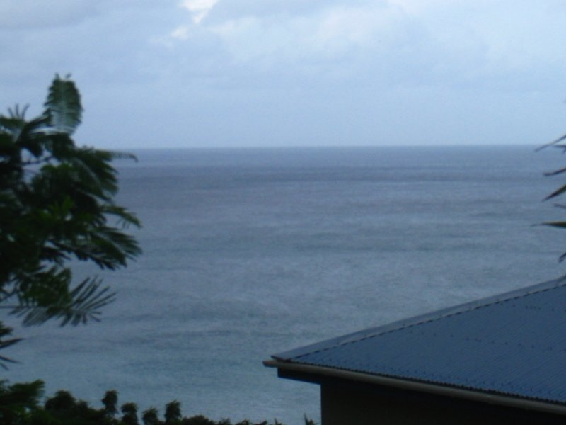