
|
For the most recent reports from St.Croix see this page.
- - - 2009 Hurricane Season - - -
|
- Remembering Hurricane Hugo
|
- By Ehsan Said <esaid09 at gmail.com>
- Date: Thu, 17 Sep 2009 11:46:42 -0400
|
|
Hello Everybody,
Lets take this time to remember the day Hurricane Hugo brought destruction to St. Croix. Our prayers and thoughts goes out to those who lost their lives by this devastating storm. Lets continue praying we never experience an event like it again.
Take care.
|
|
- Remembering
|
- By MelissaE Keyes <melissae.keyes at yahoo.com>
- Date: Thu, 17 Sep 2009 06:50:27 -0700 (PDT)
|
Yes, today, years ago, We here on St Croix awoke to a different world. One of total devastation. Everything completely destroyed. The vegetation was gone, the trees not only had no leaves, their twigs up to a quarter inch in diameter had been thrashed off. Grass was gone, soil had been replaced with gravel. Not to mention what happened to buildings. And I see those people in the "Other Virgins" believe there wasn't much damage, hmm. Or that STT/STJ were hit, also. Hmm. The day before Hugo, a Saturday, had been a beautiful, sunny day, with puffy little white clouds floating by. No hint of what was to come. People were nervous about the forcast, but no one was really very afraid. "Oh, it'll turn North, they all
do." St Croix hadn't had a hit in something like thirty five years. The breeze started picking up about four oclock, and by sunset was a sustained 65. The night was unbelieveable. As dark as the deepest cave. That couldn't be just wind, it sounded like being under a bridge with a fully loaded coal train roaring, thundering a few feet overhead. Unbreaking, solid thunder, louder than you've ever heard. The lower back part of the solid house where I cowered under an overturned sofa for protection was shaking and shimmying, and I mean the floor as well as the wall. The windows were breaking. The storm slowed to eight miles an hour going over us. Construction was flimsy. I'd watched a normal, for someplace in the States, stick built house go up just below the hill I lived on. Stick built means a wooden house, with drywall inside. A very pretty two story house, that should have
been in the North Carolina mountains, not here. The people had just moved in, been there about a week. The next morning, there were some 2X4's scattered around the foundation. The house and all the furniture and everything was simply gone. The morning was totally strange. Everyone agreed that, at first, you thought it was only you that had been smashed. Then you'd look out, and "Oh, Lord! Look at the neighbors!" Their roof gone, most walls crushed to the ground. Silence, no traffic, no breeze sighing through the leaves. There were no leaves. It was as if they'd been put in a blender, and the specks sprayed, stuck all over any structure still standing. "Oh, no! The Bucaneer resort was hit, too!" As if commercial places would be OK. It was a day before you could believe the entire Island had been weedwakked by God. Nothing had been spared.
The Eye had come ashore by the refinery on the south shore, and crossed Frederiksted. All wind indicators were broken. I heard one's needle was stuck above 225 mph. And it was hot. No breeze, and no shade. You no longer had a roof on the porch, or house to get under, and the trees were stripped more than bare. Get out the machette, or a chainsaw if there was one, and start cutting your way out. I heard that there was a fellow out at the Divi resort who wanted a cold beer. He got on his backhoe, and pushed and shoved his way to Christiansted and thereby sort of opened the main road for all of us out East. And the Jack Spaniard wasps were homeless and dazed, they would fly to you, and just land and sting. And I haven't ever seen any of those tiny hummingbirds, the size of a bumblebee, since. I put out some sugar for the Sugar Birds, and had 75 the first day, then the next day there were
about 200. And the looting, the ugly looting.
Alex Hamilton wrote about a hurricane of similar strength. Ah, well, enough. No more hurricanes. The weather just is not acting like it always had, is it? For the Caribbean? Let them start off Africa and meander up into the central Atlantic, far from land. But that has its' set of problems, also. Owell. Cheers, folks. Melissa ~~~~~~~~~~~~~~~~~~~~~~~~~~~~~~~~~~~~~~~~ Melissa E. Keyes St. Croix, U.S.Virgin Islands http://coralreefpainter.blogspot.com/
|
|
- Circulation
|
- From: MelissaE Keyes <melissae.keyes at yahoo.com>
- Date: Tue, 15 Sep 2009 14:49:16 -0700 (PDT)
|
Hi, folks! I don't know about Fred, but looking at the animation, there's a circulation getting going with Puerto Rico in the center. Actually I noticed it yesterday, when St Croix was in the middle. Looks like it'll draw rain here, we'll see. I've been happy to have nothing much to talk about here. Cheers, Melissa ~~~~~~~~~~~~~~~~~~~~~~~~~~~~~~~~~~~~~~~~ Melissa E. Keyes St. Croix, U.S.Virgin Islands http://coralreefpainter.blogspot.com/
|
|
- Keeping an EYE on FRED
|
- From: "Isabel Cerni" <hicerni at viaccess.net>
- Date: Sun, 13 Sep 2009 20:06:43 -0400
|
|
Good Sunday Evening!
Hope everyone had a great day! I did, thank you. We had a
beautiful day with some spotty showers now and then. The tree frogs and
crickets, which were silent for a long time, have been celebrating since the BIG
rain from ERIKA last Saturday. What a difference a day made, on Sunday evening
we were having a dinner party on the west deck, what a blessing! One night very
stormy, the next very tranquil. That's the tropics for
you.
I noticed that FRED is still fighting. I suggest we all
keep an eye on him. He is still there, waiting for something. Don't think
for a moment he is gone. He is now moving West, very slowly, nonetheless, he is
still very much alive. I find Stormpulse very good. Check it after you do your
tour of StormCarib. You get one big picture which you can move around, add,
subtract, and when there's an active storm it shows the track and potential
path. So far, it seems that FRED is following along very well. He is now circled
in orange meaning a 30-50% chance of becoming a tropical cyclone in two days.
He's not done as yet. None of the waves in the Atlantic are circled, other than
the remnants of Fred, so we are not looking at anything else for the near
future, unless there's a ghost out there.!! Be well, be happy, and God bless us
all.
Isabel
|
|
|
- The 11th hour of 9/11
|
- From: "Isabel Cerni" <hicerni at viaccess.net>
- Date: Fri, 11 Sep 2009 23:12:07 -0400
|
|
It's late in the day. Today we all remembered the
infamous day. It was such a clear, beautiful day in New York! It had to be clear
to carry out that act of terror. Days prior to that it was cloudy, low
visibility. The terrrorists needed to see the target! They had gone through a
practice, knowing that the flights are not always full and seats always
available as to make a same day decision. They waited for that day, ironically
the date turned out to be the number for emergency calls. And what an emergency.
Today, it was a very rainy, cool day by comparison
to 8 yrs. ago. I think it reflected the sorrow that the survivors still feel,
especially those who never had closure. This evening I saw an interview with a
Trinidadian woman who worked on the 64th floor and managed to make it down to
the 13th floor when the whole building came down. She was the last person to be
rescued, after 27 hours.! She spent the whole time praying. Apparently the
rescuers saw the jacket of an Emergency Responder and she happened to be just
below that. She heard them and the rest is history. She was rescued and finally
after 8 yrs she was able to return to Ground Zero. She never thought she would
be standing there telling about it.
I remember the many times we went to the 110th
floor to see the sights from there. Also, went to dinner at Windows of the
World, where the clouds sometimes became natural curtains. I liked standing on
the grand plaza below, looking up at those immense towers. I remember looking
down from the top and seeing little matchbox cars on the street below. I
reflected on the many who jumped from those towers to avoid the intense heat of
the fire around them.
From our home we had a view of the twin towers. I
miss seeing them when I'm in New York. I feel a stronge sense of pain for all
those who lost loved ones that day. I cringe at the thought that the terrorists,
including homegrown, are working on other plans. I pray that they never come to
fruition. God bless us all and God bless the United States of
America!
Isabel
|
|
|
- Good job Roddy Heyliger!
|
- From: Jill Fisher <heygirllll at aol.com>
- Date: Wed, 9 Sep 2009 22:23:43 -0400
|
Your message is one that should be communicated and shared on all of
the islands. Thank you!
~Jill~

Sent from my iPhone
|
|
- Hurricane Fred
|
- From: "Isabel Cerni" <hicerni at viaccess.net>
- Date: Wed, 9 Sep 2009 20:01:06 -0400
|
|
Good evening,
Stormpulse is showing a turn to the NW on Monday. That
would be in the direction of Bermuda or somewhere on the mainland. I thought it
was going out to sea? To the Northeast? Quoting Max today, "..at best,
forecasting is an imperfect science.." Ah, well, I guess that's why we have to
monitor these systems. It probably will head out to sea after a few acrobatics,
but in the meanwhile, we remember HUGO and where HE came from. Have a good night
and God bless us all.
Isabel
|
|
|
- Studying FRED - Hurricane FRED?
|
- From: "Isabel Cerni" <hicerni at viaccess.net>
- Date: Tue, 8 Sep 2009 20:37:08 -0400
|
|
Good Evening, all!
According to the CPA, (Closest Point of
Approach) if FRED should decide to follow one of the computer models, he
should be on top of us by the 14th. All the other models have him going every
other direction, mostly up and out. Let's face it, we are all worrywarts by
nature, whether we want to or not. When you think of another HUGO -like possibility, who would not worry! Our local news, this
evening, would like to put our fears to rest. FRED will become a hurricane
only for a short while - a fish hurricane way out in open Atlantic, where he
will not be a threat to any land. That is, if he does curve northward. Let's
enjoy the week as best we can and keep an eye to the weather. God bless us
all.
Isabel
|
|
|
- Frightful? Or, Friendly Fred?
|
- From: "Isabel Cerni" <hicerni at viaccess.net>
- Date: Tue, 8 Sep 2009 13:09:00 -0400
|
|
Good afternoon!
I guess after all of ERIKA's antics no one wants to
take the computer models seriously. They predict that FRED is going to curve to
the north away from any land. How close to us before it curves out depends on
two systems. If the first one does not do it, the second one should get it, if
not, we're in trouble, especially if it continues going straight across. If I
remember correctly, that is where HUGO came from. His 20th anniversary is coming
up on the 17th for us here where HE left an indescribable devastation. We have
to watch FRED and hope that HE is friendly and follows the computer models
"spaghetti". Historically, most of the storms coming from Cape Verde made it
across. Check the "historical" image on Dr. Master's blog. This one definitely
bears watching. Remember to "watch and pray". God bless you.
Isabel
|
|
|
- Margarita Murray
|
- From: MelissaE Keyes <melissae.keyes at yahoo.com>
- Date: Sun, 6 Sep 2009 17:10:11 -0700 (PDT)
|
Margarita Murray, You are SO RIGHT!! We do tend to be worrywarts here. The Caribbean is a lovely, gentle place, let's enjoy! Folks really do look at me funny any time I sigh and say, "Ah, another beautiful day in Paradise!" Cheers, Melissa ~~~~~~~~~~~~~~~~~~~~~~~~~~~~~~~~~~~~~~~~ Melissa E. Keyes St. Croix, U.S.Virgin Islands http://coralreefpainter.blogspot.com/
|
|
- WHAT is that??
|
- From: MelissaE Keyes <melissae.keyes at yahoo.com>
- Date: Sun, 6 Sep 2009 16:43:03 -0700 (PDT)
|
|
|
- Sunshine!
|
- From: MelissaE Keyes <melissae.keyes at yahoo.com>
- Date: Sun, 6 Sep 2009 03:58:02 -0700 (PDT)
|
A bright, pretty sunrise, with sunshine. Boy, the gardeners are going to be busy weedwakking. If you look at a weather map that includes the south east USA, you can see a swirl out in the Atlantic, about 1,000 miles north of us, and 1,000 miles east of northern Florida. The very bottom of that is dragging through the VI, and that must be what happened to "The remaining moisture" from Erika. That's what the fellow on the radio called it. On the map that drawn in red lines, with highs, lows and tropical waves marked, there seems to be a Tropical Wave line up there where the center of this 'naked swirl' is. Hum, changes, hey? Oh, and last night's flight was cancelled, so my dear brother didn't fly out in that awful storm. From what I saw,
driving from the airport to LaVallee, the South Shore got the majority of the rain. Electricity didn't go out in the Cane Bay area. OK, have a lovely day! Melissa ~~~~~~~~~~~~~~~~~~~~~~~~~~~~~~~~~~~~~~~~ Melissa E. Keyes St. Croix, U.S.Virgin Islands http://coralreefpainter.blogspot.com/
|
|
- ERIKA, ERIKA !!!
|
- From: "Isabel Cerni" <hicerni at viaccess.net>
- Date: Sat, 5 Sep 2009 22:57:17 -0400
|
|
Really now! I thought all Hell broke loose late
this afternoon when thunderbolts split the skies repeatedly and huge
thunderclaps shook us all. We were on the porch, three adults, two children
enjoying the show. The storm was getting closer and closer, west to east. I
thought THAT strange. Was not this system supposed to go WNW? What was it doing
back in our neighborhood?! It was traveling east! We went inside just on time.
NOAA Radio said that there would be gusty winds of 33mph, torrential rain, and
dangerous lightning. And so it was! I remembered Dave's famous "towel
brigade" and had to smile. Water, water, everywhere!! Now, according to him, we
are to expect more, of the heavier variety, tonight...?? Where's THAT
coming from, east to west.? Really now, ERIKA! Haven't you had enough fun, as
yet, making fools of every computer model and forecaster? We certainly have
received a whole lot of RAIN and are very grateful! However, the
garden party tomorrow looks highly unlikely as everything is thoroughly
saturated. Ah well, there's always another time. I'm curious to see what ERIKA
will do next. SHE does not like the word "downgraded" and she's trying real hard
to become a name to remember. Good night, all, and God bless you!
Isabel
|
|
|
- squall aftermath
|
- From: Sylvie Renaud <sandzill at yahoo.com>
- Date: Sat, 5 Sep 2009 19:51:10 -0700 (PDT)
|
I am surprised at the amount of damage the squall did in two hours to STX power grid. The power crews are out in force reconnecting numerous feeders that went out. Transformers and fuses had to be reconnected but I heard of no downed poles. Rain has stopped. Moon is barely visible but rain clouds are moving still west to east.Slowly. South, North and East end got a good hammering from the thunder. Kudos to our power company. STX should be up to full power sometime this evening by what I am hearing on WX radio.
Where is NOAA radio? |
|
|
- Crazy
|
- From: MelissaE Keyes <melissae.keyes at yahoo.com>
- Date: Sat, 5 Sep 2009 16:38:25 -0700 (PDT)
|
Totally crazy weather. Dropped off my dear brother at the airport at 3 for his 4:30 flight, that, oops, was then supposed to arrive at 6. He said, no, leave me here. I went out West, Frederiksted, and watched a low black cloud come in from the west. I went back to the airport in terrible thunder and lightnings, as the sky opened and the floods came from the heavens. I raved at ten people in "authority" that I wanted to retrieve my brother, that he should NOT be flying in such strange and horrible storms. They all pooufed me off. I guess once you're through Security, you're in custody! I gave up, to let the Lord take care. The lightning moved its' ugly pinkish stuff off to the east, the plane landed, and I gave up again, and sort of went
home. Erika should have gone on by early today, or even yesterday. Nothing should have come in from the west. Have a nice evening, and a beautiful Sunday, Melissa ~~~~~~~~~~~~~~~~~~~~~~~~~~~~~~~~~~~~~~~~ Melissa E. Keyes St. Croix, U.S.Virgin Islands http://coralreefpainter.blogspot.com/
|
|
- off guard
|
- From: Sylvie Renaud <sandzill at yahoo.com>
- Date: Sat, 5 Sep 2009 16:37:31 -0700 (PDT)
|
| At 5pm there were some spectacular bolts of lightning over the waters of Frederiksted itself.In 3 minutes the situation got ugly with three strong Thunder hammers that zapped the power in Plaza Fsted the first time but came back. Saw the bolt hit the mountain when the power went the first time. Three thunder cells traveled west to east this time. The second thunder hammer was due south of Plaza but the third fought with Mt eagle to cross.THAT was practically on top of us. Power out on the third Thunder clap that made the windows in the mall shake.Traffic Lights were out when we left Plaza. Sections of h way with out light so be carefull! Rain is not letting up with squally gusts. Thunder and lightning is practically a strobe light and a bit red. Eased up now. Centerline has some
flooding going to Fsted. But some traffic lights on the H way are out and not even blinking. Passed through main road of Williams Delight that connects Centerline with H way and some flooding but it is building up. H way still passable. lightning diffused now, thunder is not as menancing as before.Do not be outside if you have to be. The thunder and lightning was intense with squalls! With what I saw over F'sted it has bolts that arcs wide! Now its mild but not to be toyed with! This cloud burst means buissness! neverending rain as well. |
|
|
- Growling Thunder
|
- From: Dahlia Francis <flowerchampagne at hotmail.com>
- Date: Sat, 5 Sep 2009 17:24:58 -0400
|
The skies look mean.They're heavy and black. There's lightning and thunder. Grrr! Seems like Erika is just hanging around. Definitely more rain to come...
Great minds think alike--
Dahlia :)
flowerchampagne at hotmail.com
check out the rest of the Windows Live™.
More than mail–Windows Live™ goes way beyond your inbox.
More than messages
|
|
|
- 4 pictures of Stormy Afternoon
|
- From: "Isabel Cerni" <hicerni at viaccess.net>
- Date: Sat, 5 Sep 2009 17:16:07 -0400
|
|
Part 2
Sorry, I could not attach these with the email I wrote.
With Picasa one selects the pictures it automatically reduces them for email,
but it has to be written also on Picasa. So, here they are.
Enjoy your weekend!
Isabel
You have been sent 4
pictures.
675A0954.JPG
675A0955.JPG
675A0956.JPG
675A0957.JPG
These
pictures were sent with Picasa, from Google.
Try it out here: http://picasa.google.com/
|
Attachment:
675A0954.JPG
Description: JPEG image
Attachment:
675A0955.JPG
Description: JPEG image
Attachment:
675A0956.JPG
Description: JPEG image
Attachment:
675A0957.JPG
Description: JPEG image
|
|
- Stormy Afternoon!!
|
- From: "Isabel Cerni" <hicerni at viaccess.net>
- Date: Sat, 5 Sep 2009 17:16:14 -0400
|
|
The air got heavier and heavier until the clouds burst and
it pour for a while, now we are mostly having an extremely threatening sky with
a continuous rumble of thunder sometimes nearer than others. NOAA Radio is
warning of torrential rains in parts of the affected area, St. Croix
included, which is under an extended flash flood watch until 8:00 p.m. We
the dark clouds coming towards the east it almost seems as if the storm is
backtracking! I did notice that a big blob which was immediately south of Puerto
Rico has moved to south of St. Croix. Yet the center of the storm itself is
between PR and the DR. !! I think it's coming back to give us some more rain. I
guess our garden/house party tomorrow is in jeopardy as this could continue
until Tuesday before we finally see some clear skies again. So it goes. We just
have to make the best of every situation. I will try to post later again. In the
meanwhile, attached are some photos which I took at mid-afternoon. God bless us
all. ( the electricity is beginning to fluctuate - we can lose it any
minute...)
Isabel
|
|
|
- Great Weather!
|
- From: "Isabel Cerni" <hicerni at viaccess.net>
- Date: Fri, 4 Sep 2009 23:12:43 -0400
|
|
Good Night, all!
Yes, great weather for one who waited so long for
such a day. Rain, rumbles of thunder, clouds promising more rain, cool air. I
finally had to use the warm water in the shower, the cold was too cold. It
usually is almost as warm as the warm, but now our cistern has water from the
"cold cloud tops" (?) We are getting a breeze from the south which is quite
cool. That's from the blob to our southeast. It is tracking WNW. Sometimes
there's a strong gust, like the one that knocked down a few things on the porch
today. According to the latest forecast on NOAA Radio, we should be getting
another 1 - 3 inches of rain tonight. If our cisterns are not full as yet, that
should do it. I did not hear the official word on how many inches of rain we got
today, but I would go out on the limb for 6 inches, perhaps 8 in areas that
always get more. We appreciate every drop.
For those who missed out on a Labor Day Weekend
event, like my grandson's camping trip, I wish you a relaxed and fun
celebration, there's always lots to do. We are also planning a house and garden
party this Sunday for a friend who is receiving chemotherapy, we definitely need
dry weather for that. I have to pray the reverse now. So, enjoy and we'll try
not to think of the next one, right? Right! God bless us all.
Isabel
|
|
|
- Planes
|
- From: Sylvie Renaud <sandzill at yahoo.com>
- Date: Fri, 4 Sep 2009 11:49:23 -0700 (PDT)
|
| Check with your airlines! The fly overs have increased! The airport seems to be up and running since 1pm! |
|
|
- Yeah Rain!
|
- From: Ehsan Said <esaid09 at gmail.com>
- Date: Fri, 4 Sep 2009 14:34:44 -0400
|
|
Okay, I give up, we did get lots of rain today. I know I predicted that there will be no rain for St. Croix but I guess I am wrong. I so happy for this rainy day. I always wished for this day to come. I hope this can go on for another day. :>
|
|
- RAIN.!!!
|
- From: "Isabel Cerni" <hicerni at viaccess.net>
- Date: Fri, 4 Sep 2009 13:23:41 -0400
|
|
Good Afternoon!
And what a good afternoon it is! True to NOAA's
forecast the RAIN arrived after midnight. We got the whole works. It stopped and
started again before dawn and went on with heavy downpours throughout the
morning. There are more thunderstorms in the forecast for the rest of the day. I
noticed on the satellite imagery that there's a big blob just below St. Croix. I
don't know if it's moving north over us or west. There's also another mess
of convection further south, which I hope does not come this way.
So, I for one am very pleased with all the rain.
Now, after a brief rest, we will have to concentrate on the East again. This is
the busiest time of the season. Will try to post again later today. God bless us
all.
Isabel
|
|
|
- Post observations
|
- From: Sylvie Renaud <sandzill at yahoo.com>
- Date: Fri, 4 Sep 2009 10:25:34 -0700 (PDT)
|
Not many planes are flying today at least this morning from the airport to or from St.Croix but its just a few. I live close to the airport so I hear and see them pass by. Call your travel agent for the flight confirmation!
So far the white birds or Egrets are in open feilds, on the ground, in clusters pecking at everything. What is unusuall is that they stay on the ground for long periods of time,in open feilds and hunker down when it pours. They fly away usually but not this time. That must mean high winds or unstable winds for their flight habits.
So far I have seen a wayward heron( not the great white Egret) on our property-yes I will find the name later.
A frigate bird as well was flying N to S Wed and flying low over land. Not normal for an ocean bird.
The bees were agressive this week! We have two birdbaths for our birds. Thrushes, two species of Doves, the chincheres (name later), Sugarbirds, Finches, and a dark feathered bird with a long dark tail my grand mother would call the "Rain Bird" all attempted to drink and bathe in the bird bath. The bees refused to let anyone of them to approach the water. Forget the second birdbath. The birds could not get there as well. The amount of bees was very unsusuall. From 6 to 15 in one day. I saw our white cuban frogs usually "white" turned up "brown" last night. They were climbing high on our porch wall as well. That's a sign of rain! The higher they climb the wetter the storm.
Avocado tree, not one single flower or fruit. I suspect the tree has been traumatized since Omar of last year. We lost two significant trunks during that storm and all of the fruit. Usually this tree tells of the possibility of a hurricane that might come to the island. Can't tell it this year.
Wonderful rainy day, no real wind just rain. Just right for our cisterns. No flooding so far. Not all of St.Croix last night got rain or most of the light show. At about 12-2am the Thunder shfted from south to a rolling rumble to the north. Right between STX and STT. I saw lightning but really spread out. Few bolts.
Take care. |
|
|
- BIG rain
|
- From: Heygirllll at aol.com
- Date: Fri, 4 Sep 2009 11:02:56 EDT
|
|
Holy cow ... it's raining cats & dogs. Looks like we've had 1.11" of
rain since it started around midnight ... yipppeeee!
We're scheduled to fly via Liat to St. Martin at 1:40 ... and so far it
hasn't been canceled.  I can't imagine planes
flying in this weather ... maybe they're hoping for a break in the weather.
Looks like we'll be spending some quality time at the airport today. 
|
|
|
- Overcast sky
|
- From: Sylvie Renaud <sandzill at yahoo.com>
- Date: Fri, 4 Sep 2009 06:09:28 -0700 (PDT)
|
Hello everyone,
The weather radio had it right. Starting at midnight or just after midnight the thunder and light show began rolling in. Then 2 hours of steady rain with the light and sound show. No wind. But at 10-10:30pm we could see diffused lightning ( no thunder) to the south of the island past the airport going or drifiting to the south side of F'sted. The wind simply died from 6pm on last night. Poor full moon could barely shine through the clouds that were low, slow moving from the SE to SW.
We had morning showers, I mean good downpours. Absoultly no mention of flooding anywhere so far.
Erica just gave us much needed rain.
Later. |
|
|
- Drizzle
|
- From: MelissaE Keyes <melissae.keyes at yahoo.com>
- Date: Fri, 4 Sep 2009 06:00:48 -0700 (PDT)
|
Drizzle isn't a tropical kind of rain, but that's what I'm getting here on the north shore of St Croix. My rain bucket on the deck has about three inches of rainwater in it. Thunder and hard rain last night for about an hour around midnight. And several short, hard showers since then. On the Satellite, STX is on the edge, and the other Virgins are just outside the white color, the high cloud tops that rain on us. All that stress for several days, I think I need a break. I'm planning on figuring on a Hurricane, or Himmacane, 24 hours before it hits. Not from hundreds of miles East of here. OK, 100 mile limit! Have an easy day, Pleasantly-Soggy-Melissa ~~~~~~~~~~~~~~~~~~~~~~~~~~~~~~~~~~~~~~~~ Melissa E.
Keyes St. Croix, U.S.Virgin Islands http://coralreefpainter.blogspot.com/
|
|
- Sept. 3rd --Promising Skies, no action
|
- From: "Isabel Cerni" <hicerni at viaccess.net>
- Date: Thu, 3 Sep 2009 23:07:05 -0400
|
|
Good Night, all!
I've had a long day. No rain as yet, but according
to NOAA Radio a few minutes ago, the rain will start in earnest after midnight
lasting through Friday. We can get up to 6 inches in parts. We'll see. Attached
are some photos of the "teasing" clouds, which I took late this
afternoon/early evening.
Right now I'm too pooped to paddle! I expect to be
out all morning so I shall not be posting until early p.m. Sweet dreams and God
bless us all.
Isabel
You have been sent 3
pictures.
675A0944.JPG
675A0945.JPG
675A0947.JPG
These
pictures were sent with Picasa, from Google.
Try it out here: http://picasa.google.com/
|
Attachment:
675A0944.JPG
Description: JPEG image
Attachment:
675A0945.JPG
Description: JPEG image
Attachment:
675A0947.JPG
Description: JPEG image
|
|
- High and Dry
|
- From: "Isabel Cerni" <hicerni at viaccess.net>
- Date: Thu, 3 Sep 2009 21:44:41 -0400
|
|
Good night, all!
We are still waiting, and hoping for some of that
rain. We don't want a deluge, we just wish for rain. I read that the island
chain has received huge amounts. That's great, especially if they longed for it.
Our share of it should arrive--"...any day now." And I hope that that day is
today, especially tonight when we were told it should begin to rain with ERIKA's
arrival. The grandkids are hoping for an extra day off from school tomorrow.
With so many things canceled tomorrow it had better rain!! (Ha! As
if it works that way!) At the moment it is very quiet and the almost
full moon is shining brightly. I will try to post one more time before I retire
for the day. God bless us all.
Isabel
|
|
|
- I Guess No Rain for Us!
|
- From: Ehsan Said <esaid09 at gmail.com>
- Date: Thu, 3 Sep 2009 16:55:17 -0400
|
|
Hello,
It has been sunny on and off and it doesn't seem Erika is coming our way. I don't think we will get any of her rich rain because most of her convection is fading away. I guess next time we will get some rain in much rather friendly way.
See Yah!
|
|
- No sign of ERIKA
|
- From: "Isabel Cerni" <hicerni at viaccess.net>
- Date: Thu, 3 Sep 2009 13:30:31 -0400
|
|
Good afternoon, one and all!
Judging by the satellite imagery it looks as if we
are about to be devoured by a huge BLOB! Well, not exactly. The sun has been
shining. On and off it seems as if ERIKA is arriving, then it clears up again. I
ran out a couple of times trying to take a picture of the Hurricane Hunter as it
flew nearby our house on a hill overlooking the Christiansted pier.
The Boy Scouts camping trip was canceled. I hope it
will be justified with some copious rain, otherwise, it does not make sense to
children.
The Dolpin Swim Team, my grandson included, will
meet this afternoon as usual, unless the weather finally starts showing signs of
ERIKA, the elusive storm.
Well, so much for that. I will post again later and
maybe I can tell you that ERIKA has arrived. Stay safe and God bless
you.
Isabel
|
|
|
- Looks
|
- From: MelissaE Keyes <melissae.keyes at yahoo.com>
- Date: Thu, 3 Sep 2009 04:07:58 -0700 (PDT)
|
Six am track. The black is what is. The purple is what they are guessing, and they have not been correct so far. If it stays straight, it's headed toward STT. If it turns more N, Tortola. The rain, I'm going to call it rain, is mostly following tht little curlicue spot. the center they are giving this rain. It turned so to go across Guadeloupe, and seems, from the animation that I just looked at, 7am, they're really getting heavy rain now as I write, the center being ahead of most of the rain. So, we still have uncertainty, the rain is coming into warmer sea. We'll know for sure where the rain will go by the time it's past, tomorrow. OK. Weather forms here, so predictions are guesses. I wish for you no leaks. Sheesh,
what if it goes so far south that we get nothing? Ha! OK, talk at you later, Melissa ~~~~~~~~~~~~~~~~~~~~~~~~~~~~~~~~~~~~~~~~ Melissa E. Keyes St. Croix, U.S.Virgin Islands http://coralreefpainter.blogspot.com/
|
|
- Closest Point of Approach
|
- From: "Isabel Cerni" <hicerni at viaccess.net>
- Date: Wed, 2 Sep 2009 20:55:56 -0400
|
|
Good Evening!
I just checked the CPA and if it holds true
for tomorrow, Thursday 3rd of Sept., ERIKA in whatever form will pass us by 15.2
miles in 25.9 hrs. at 6:54 p.m. How accurate can one get! I get the feeling,
though, that ERIKA is going to continue surprising us as she goes along. So
far she has not done what was expected of her, so why should she do that now.
There's a good chance that the warm Caribbean Sea will energize her and she
could become a hurricane yet. All I know is that we need rain, a good rainful,
no "spotty showers" , a good, heavy downpour, our cisterns need it, our plants
need it, we need to see and hear it. We're so high and dry that I was
planning to add a tropical rain CD -complete with thunder, to my
ipod!! Ha! Ha! (AS I WRITE WE ARE JUST GETTING A HEAVY SHOWER !! Oops! Just a
"spotty" heavy shower!) I guess those are going to become more numerous and
continuous as the storm approaches. So, let's see what the mysterious ERIKA
is up to for the rest of this night. God bless us
all!
Isabel
|
|
|
- Intermittent Showers
|
- From: "Isabel Cerni" <hicerni at viaccess.net>
- Date: Wed, 2 Sep 2009 15:01:56 -0400
|
|
We have been having some light showers on and off
since this morning. The surf has picked up on the reef, and I hope the sunshine
we are still having will be enough, with the breeze, to dry the clothes which I
dared hang on the clothesline. All for the sake of conserving energy. As I am
expecting it to rain for the next three days or more, I had to take the
risk. So far, so good. ERIKA's fringes are upon the chain of islands, that is,
according to the satellite imagery. When the storm enters the warmer waters of
the Caribbean Sea, there could be dramatic changes. One of the models has it
becoming a Cat 2 over the Virgin Islands, then a Cat 3 after it passes. All
this, we are told should happen Thursday night into Friday. I hope everyone's
ready. God bless us all.
Isabel
|
|
|
- "Monitor the system..."
|
- From: "Isabel Cerni" <hicerni at viaccess.net>
- Date: Wed, 2 Sep 2009 11:39:17 -0400
|
|
Why is everyone surprised!! ? ERIKA is doing
her own thing!! That is WHY we are to monitor these systems!! Helloooooo!! Our
job is to be prepared. We are told that, time and again. So then, let's stop
putting blame on everyone else and get on with preparing for this storm if it
should hit. Okay? Be cool, calm, and collected. We need all of that to deal with
ERIKA.
We especially have to prepare for a lot of
flooding, I understand, in areas where it tends to flood. Mudslides are also a
danger with a system like this. We have to pray that it picks up speed and is
out of here. If it lingers too long we're in for some serious problems. It can
also become a Cat 2 Hurricane before it's out of our neighborhood. We have to
take it hour by hour. Watch! Monitor! Pray!
At the moment it is partly cloudy. Increasing
cloudiness tonight with a bigger chance of rain according to the forecast.
We are looking for some much needed rain. We have had to buy water too often
this year.
Many events are in jeopardy this Labor Day Weekend,
including my grandson's camping trip. He's already whining. Can't blame him. He
has been so excited about this trip and has all his things packed already. Ah
well, maybe it will still be possible. Thank God this storm is not a major
hurricane, it could have easily happened. Let's keep monitoring and applauding
everyone working on deciphering this storm. Women are hard to figure out
sometimes even when they come in the form of a storm! Ha! Ha! God bless us all.
He has, so many times already..
Isabel
|
|
|
- "Monitor the system..."
|
- From: "Isabel Cerni" <hicerni at viaccess.net>
- Date: Wed, 2 Sep 2009 11:33:26 -0400
|
|
Why is everyone surprised!! ? ERIKA is doing
her own thing!! That is WHY we are to monitor these systems!! Helloooooo!! Our
job is to be prepared. We are told that, time and again. So then, let's stop
putting blame on everyone else and get on with preparing for this storm if it
should hit. Okay? Be cool, calm, and collected. We need all of that to deal with
ERIKA.
We especially have to prepare for a lot of
flooding, I understand, in areas where it tends to flood. Mudslides are also a
danger with a system like this. We have to pray that it picks up speed and is
out of here. If it lingers too long we're in for some serious problems. It can
also become a Cat 2 Hurricane before it's out of our neighborhood. We have to
take it hour by hour. Watch! Monitor! Pray!
Many events are in jeopardy this Labor Day Weekend,
including my grandson's camping trip. He's already whining. Can't blame him. He
has been so excited about this trip and has all his things packed already. Ah
well, maybe it will still be possible. Thank God this storm is not a major
hurricane, it could have easily happened. Let's keep monitoring and applauding
everyone working on deciphering this storm. Women are hard to figure out
sometimes even when they come in the form of a storm! Ha! Ha! God bless us all.
He has, so many times already..
Isabel
|
|
|
- Update
|
- From: MelissaE Keyes <melissae.keyes at yahoo.com>
- Date: Wed, 2 Sep 2009 06:21:51 -0700 (PDT)
|
I just looked at an animation (9:20 am), and Erika seems to be shrinking and heading a tiny, repeat, tiny, bit south, in size anyway. Totally wierd. ~~~~~~~~~~~~~~~~~~~~~~~~~~~~~~~~~~~~~~~~ Melissa E. Keyes St. Croix, U.S.Virgin Islands http://coralreefpainter.blogspot.com/
|
|
- Dave!
|
- From: MelissaE Keyes <melissae.keyes at yahoo.com>
- Date: Wed, 2 Sep 2009 06:16:13 -0700 (PDT)
|
Dave, could you please speak normal, understandable English? Thank you. Melissa ~~~~~~~~~~~~~~~~~~~~~~~~~~~~~~~~~~~~~~~~ Melissa E. Keyes St. Croix, U.S.Virgin Islands http://coralreefpainter.blogspot.com/
|
|
- Orchids for ERIKA?
|
- From: "Isabel Cerni" <hicerni at viaccess.net>
- Date: Tue, 1 Sep 2009 23:15:45 -0400
|
|
A few days before OMAR raged around us, a spray of
orchids bloomed on a centrally located tree, wide open to the wind. I said "they
are doomed" , but the next morning, even though there were tree limbs
everywhere, the orchids seemed none the less for wear. Then just before ANA came
along, a new spray of orchids bloomed again, "Orchids for ANA.?" Those orchids
are still blooming,(see photo below) --so now, they
will be shared with ERIKA. There's something about those orchids...I wonder. Such fragile looking flowers, yet so strong, like a
woman. H.m..m.m.mm. Anyway, let's call it a day, get a good night's sleep and
see what ERIKA's plans are for tomorrow. Good night, all. God bless
you.
Isabel
675A0928.JPG
These pictures were
sent with Picasa, from Google.
Try it out here: http://picasa.google.com/
|
Attachment:
675A0928.JPG
Description: JPEG image
|
|
- NO, Not FRED!!!
|
- From: "Isabel Cerni" <hicerni at viaccess.net>
- Date: Tue, 1 Sep 2009 20:41:51 -0400
|
|
Just a correction! FRED is not a storm as
yet. I don't want anyone to worry about it, not yet. The disturbance was circled
as a future storm. It has the potential to become one. It will be the next one
to watch after ERIKA. It left the coast of Africa somewhat higher than ERIKA, so
it's quite possible that it will not affect us in any way, shape, or form, yet
on the other hand, it can travel straight west. You never know! That's why they
have to be monitored.. so there! Until the next post. Keep smiling. Try, at
least.. God bless..
Isabel
|
|
|
- TS ERIKA at 0 mph..?
|
- From: "Isabel Cerni" <hicerni at viaccess.net>
- Date: Tue, 1 Sep 2009 20:31:24 -0400
|
|
That's not very fast, is it..?!
Good evening, folks! I think ERIKA will stay
right there and wait for FRED. He's on his way already. Why should SHE be
stationary, otherwise? As if we haven't had enough tension already, now, who
knows. OMAR was stationary for a few days and when it took off it surprised
everyone, that is, everyone who was not paying attention. Many boats were lost
as a result. Is ERIKA going to do the same, travel west instead of north, when
SHE decides to get going? Watch out! Well, we have plans for the weekend, so
we'll just go right ahead and keep an eye on ERIKA. I hope SHE does not spoil a
perfectly good weekend. Be well, be happy, and may God bless us all.
Isabel
|
|
|
- ERIKA is Born
|
- From: Ehsan Said <esaid09 at gmail.com>
- Date: Tue, 1 Sep 2009 16:41:15 -0400
|
|
Hello everyone,
94L has just been named ERIKA based on recon flight data and wundergroun blogs.
|
|
- Hurricane Statement Update from NHC
|
- From: Ehsan Said <esaid09 at gmail.com>
- Date: Tue, 1 Sep 2009 09:13:06 -0400
|
Hurricane StatementTROPICAL DISTURBANCE LOCAL STATEMENT
NATIONAL WEATHER SERVICE SAN JUAN PR
524 AM AST TUE SEP 1 2009
...TROPICAL DISTURBANCE TO THE EAST OF THE LEEWARD ISLANDS COULD
AFFECT THE U.S VIRGIN ISLANDS AND PUERTO RICO BY THE END OF THE
WORK WEEK...
.AREAS AFFECTED...
THIS LOCAL STATEMENT PROVIDES IMPORTANT INFORMATION AND
RECOMMENDED ACTIONS FOR RESIDENTS ACROSS THE U.S. VIRGIN ISLANDS
AND PUERTO RICO.
.WATCHES/WARNINGS...
AT THIS TIME...THERE ARE NO TROPICAL CYCLONE WATCHES OR WARNINGS
IN EFFECT FOR OUR AREA.
.STORM INFORMATION...
A BROAD AREA OF LOW PRESSURE ABOUT 350 MILES TO THE EAST OF THE
LEEWARD ISLANDS HAS A HIGH CHANCE OF BECOMING A TROPICAL
DEPRESSION OR NAMED STORM IN THE NEXT 48 HOURS.
.SITUATION OVERVIEW...
AT THE PRESENT TIME...A BROAD AREA OF LOW PRESSURE LOCATED ABOUT
350 MILES EAST OF THE LEEWARD ISLANDS CONTINUES TO SHOW SIGNS OF
ORGANIZATION...BUT STILL DOES NOT APPEAR TO HAVE A WELL-DEFINED
SURFACE CIRCULATION CENTER. MODELS CONTINUE TO ADVANCE THE SYSTEM
TO THE WEST NORTHWEST IN THE GENERAL DIRECTION OF THE NORTHEAST
CARIBBEAN.
REGARDLESS OF WHETHER OR NOT THE SYSTEM DEVELOPS INTO A DEPRESSION
OR NAMED STORM...THIS DISTURBANCE HAS THE POTENTIAL TO PRODUCE
HEAVY RAINS THAT COULD TRIGGER FLASH FLOODING...LOCALLY GUSTY
WINDS...AND ROUGH SEAS. THEREFORE...IT IS IMPERATIVE THAT
INTERESTS IN THE U.S. VIRGIN ISLANDS AND PUERTO RICO PAY CLOSE
ATTENTION TO THE LATEST DEVELOPMENTS IN ITS POSITION AND
INTENSITY.
.PRECAUTIONARY/PREPAREDNESS ACTIONS...
PRECAUTIONARY/PREPAREDNESS ACTIONS...
REGARDLESS OF WHETHER OR NOT THIS SYSTEM DEVELOPS INTO A NAMED
STORM...IF THIS DISTURBANCE AFFECTS THE LOCAL ISLANDS...FLASH
FLOODING MAY OCCUR. IF YOU ARE IN A FLOOD PRONE AREA...YOU SHOULD
FIND OUT WHICH LOCAL SHELTER WOULD BE AVAILABLE TO YOU IN CASE OF
FLOODING.
PEOPLE ARE URGED TO REMAIN INFORMED AND LISTEN FOR ANY SIGNIFICANT
CHANGES TO THE FORECAST THROUGH YOUR FAVORITE MEDIA OUTLET.
MARINERS SHOULD KEEP INFORMED OF THE LATEST COASTAL WATERS
FORECAST AS CONDITIONS MAY DETERIORATE LATER IN THE WEEK.
NOW IS THE TIME TO ENSURE THAT YOUR TROPICAL CYCLONE PREPAREDNESS
KITS ARE IN ORDER AND READY TO GO IN CASE DISASTER STRIKES.
&&
.NEXT UPDATE...
THE NEXT LOCAL STATEMENT WILL BE ISSUED BY THE NATIONAL WEATHER
SERVICE IN SAN JUAN AS CONDITIONS WARRANT.
AMZ710-712-715-722-725-732-735-741-742-745-PRZ001>013-VIZ001-002-
020930-
/O.NEW.TJSJ.HU.S.0002.090901T0924Z-000000T0000Z/
ATLC WATERS OF PUERTO RICO AND USVI FROM 10NM TO 19.5N-
COASTAL WATERS OF NORTHERN PUERTO RICO OUT 10 NM-
COASTAL WATERS OF NORTHERN USVI AND CULEBRA OUT 10 NM-
ANEGADA PASSAGE SOUTHWARD TO 17N-
COASTAL WATERS OF SOUTHERN USVI VIEQUES AND EASTERN PUERTO RICO
OUT 10 NM-CARIBBEAN WATERS OF PUERTO RICO FROM 10 NM TO 17N-
COASTAL WATERS OF SOUTHERN PUERTO RICO OUT 10 NM-
MONA PASSAGE SOUTHWARD TO 17N-
COASTAL WATERS OF NORTHWESTERN PUERTO RICO OUT 10 NM-
COASTAL WATERS OF SOUTHWESTERN PUERTO RICO OUT 10 NM-
SAN JUAN AND VICINITY-NORTHEAST-SOUTHEAST-EASTERN INTERIOR-
NORTH CENTRAL-CENTRAL INTERIOR-PONCE AND VICINITY-NORTHWEST-
WESTERN INTERIOR-MAYAGUEZ AND VICINITY-SOUTHWEST-CULEBRA-VIEQUES-
ST. THOMAS/ST. JOHN/ADJACENT ISLANDS-ST CROIX-
524 AM AST TUE SEP 1 2009
...RAIN AND SEAS MAY INCREASE BY LATE IN THE WORK WEEK...
...NEW INFORMATION...
ALL INFORMATION CONTAINED HEREIN.
...PRECAUTIONARY/PREPAREDNESS ACTIONS...
PRECAUTIONARY/PREPAREDNESS ACTIONS...
REGARDLESS OF WHETHER OR NOT THIS SYSTEM DEVELOPS INTO A NAMED
STORM...IF THIS DISTURBANCE AFFECTS THE LOCAL ISLANDS...FLASH
FLOODING MAY OCCUR. IF YOU ARE IN A FLOOD PRONE AREA...YOU SHOULD
FIND OUT WHICH LOCAL SHELTER WOULD BE AVAILABLE TO YOU IN CASE OF
FLOODING.
PEOPLE ARE URGED TO REMAIN INFORMED AND LISTEN FOR ANY SIGNIFICANT
CHANGES TO THE FORECAST THROUGH YOUR FAVORITE MEDIA OUTLET.
MARINERS SHOULD KEEP INFORMED OF THE LATEST COASTAL WATERS
FORECAST AS CONDITIONS MAY DETERIORATE LATER IN THE WEEK.
NOW IS THE TIME TO ENSURE THAT YOUR TROPICAL CYCLONE PREPAREDNESS
KITS ARE IN ORDER AND READY TO GO IN CASE DISASTER STRIKES.
&&
...INLAND FLOODING...
FLASH FLOODING APPEARS TO BE THE BIGGEST THREAT FROM THIS SYSTEM
DUE TO THE EXPECTED SLOW MOVEMENT. REGARDLESS OF WHETHER OR NOT
THIS DISTURBANCE BECOMES A NAMED SYSTEM...HEAVY RAINS CAPABLE OF
PRODUCING FLASH FLOODING MAY OCCUR. THE MOST LIKELY TIME FRAME FOR
POTENTIAL IMPACTS FROM THIS DISTURBANCE LOOKS TO BE BETWEEN THURSDAY
NIGHT AND FRIDAY NIGHT.
...MARINE...
SEAS ARE EXPECTED TO INCREASE MID WEEK...PEAKING AT 7 TO 8 FEET
THURSDAY NIGHT INTO FRIDAY AS THE SYSTEM MOVES ACROSS THE REGIONAL
WATERS. MARINERS ARE URGED TO HEED CAUTION AND ADVISORIES AS THIS
SYSTEM GETS CLOSER.
$$
ROSA/BERMUDEZ
|
|
- OMG!
|
- From: Ehsan Said <esaid09 at gmail.com>
- Date: Tue, 1 Sep 2009 09:09:52 -0400
|
Okay, This so called Invest 94L is really looking like a Tropical Storm. The National Hurricane Center is still not upgrading it to at least a tropical depression because they could not find a closed circulation at the surface. I just hope it is not to late when they do discover there was actually a surface low. The best thing to do now is be prepared because you might never know where this thing is going. They are saying that the stom would pass between 70 to 80 miles north of the Virgin Islands but that alone is very close to the islands. You got to remember that the storm is not just a point on the map it can extend over 100 miles from the center. Talking about going north of us, I just don't think this thing is going so far north because if you look at the tracking map from hurricanecity.com front page you can see the storm is starting to make a more westerly turn. See the map below.
God Help us!
|
|
- Such Suspense!
|
- From: "Isabel Cerni" <hicerni at viaccess.net>
- Date: Mon, 31 Aug 2009 22:36:07 -0400
|
|
A Good Night to all! I think everyone is
sitting on pins and needles wondering when and if ERIKA is going to make her
appearance. She's acting rather coy and has us all in suspense. I heard this
evening on our local news that we may have "some active weather" on Thursday.
Nothing about the advisory that was issued by the NHC this afternoon alerting us
and the entire region of a possible landfalling storm, or the flashflooding that
comes with heavy rain, regardless of whether or not it hits us directly. Today I
spoke on the phone with a local friend who had no idea that we were being
threatened by a system to our east!! I get the eerie feeling that if a survery
was taken, 4 out of 5 would be totally ignorant of what's going on,--anywhere!
Scary!
We will be watching and praying and hope that
ERIKA decides to be as gentle as ANA. I am certainly thankful that we don't have
the rage of JIMENA at 155mph, like HUGO, which is threatening Baja
California. However, a very vigorous looking wave came off the coast of Africa
so, in another week we could be dealing with another system. Let's face it, it's
the season to be wary, and weary! We go through this every year. We should be
pros at Hurricane Preparedness. Let's hang in there. Monitor this system
carefully! God bless us all.
Isabel
|
|
|
- It might be coming near us
|
- From: Ehsan Said <esaid09 at gmail.com>
- Date: Mon, 31 Aug 2009 15:18:51 -0400
|
|
Special Statement was released this afternoon from NHC. This is a serious situtation so please be prepared.
Hurricane StatementTROPICAL DISTURBANCE LOCAL STATEMENT
NATIONAL WEATHER SERVICE SAN JUAN PR
254 PM AST MON AUG 31 2009
...ADVANCING TROPICAL DISTURBANCE COULD AFFECT THE U.S VIRGIN
ISLANDS AND PUERTO RICO BY LATE IN THE WEEK...
.AREAS AFFECTED...
THIS LOCAL STATEMENT PROVIDES IMPORTANT INFORMATION AND
RECOMMENDED ACTIONS FOR RESIDENTS ACROSS THE U.S. VIRGIN ISLANDS
AND PUERTO RICO.
.WATCHES/WARNINGS...
AT THIS TIME...THERE ARE NO TROPICAL CYCLONE WATCHES OR WARNINGS
IN EFFECT FOR OUR AREA.
.STORM INFORMATION...
A BROAD AREA OF LOW PRESSURE EAST OF THE LESSER ANTILLES IS BEING
ACTIVELY MONITORED FOR SIGNS OF TROPICAL CYCLONE DEVELOPMENT.
.SITUATION OVERVIEW...
AT THE PRESENT TIME...SHOWERS AND THUNDERSTORMS ASSOCIATED WITH A
BROAD AREA OF LOW PRESSURE LOCATED ABOUT 500 MILES EAST OF THE
LESSER ANTILLES CONTINUE TO SHOW SIGNS OF ORGANIZATION...HOWEVER
THERE IS NO WELL-DEFINED SURFACE CIRCULATION CENTER. MODELS
CONTINUE TO ADVANCE THE SYSTEM TO THE WEST NORTHWEST IN THE
GENERAL DIRECTION OF THE NORTHEAST CARIBBEAN.
REGARDLESS OF WHETHER OR NOT THE SYSTEM DEVELOPS INTO A DEPRESSION
OR NAMED STORM...THIS DISTURBANCE HAS THE POTENTIAL TO PRODUCE
FLASH FLOODING...LOCALLY GUSTY WINDS /ESPECIALLY IN THE HIGHER
ELEVATIONS OF PUERTO RICO/...AND ROUGH SEAS. THEREFORE...IT IS
IMPERATIVE THAT INTERESTS IN THE U.S. VIRGIN ISLANDS AND PUERTO
RICO PAY CLOSE ATTENTION TO THE LATEST DEVELOPMENTS IN ITS
POSITION AND INTENSITY.
.PRECAUTIONARY/PREPAREDNESS ACTIONS...
PRECAUTIONARY/PREPAREDNESS ACTIONS...
REGARDLESS OF WHETHER OR NOT THIS SYSTEM DEVELOPS INTO A NAMED
STORM...IF THIS DISTURBANCE AFFECTS THE LOCAL ISLANDS...FLASH
FLOODING MAY OCCUR. IF YOU ENCOUNTER FLASH FLOODING...DO NOT TRY
TO CROSS FLOODED ROADWAYS IN YOUR VEHICLE.
PEOPLE ARE URGED TO REMAIN INFORMED AND LISTEN FOR ANY SIGNIFICANT
CHANGES TO THE FORECAST THROUGH YOUR FAVORITE MEDIA OUTLET.
MARINERS SHOULD KEEP INFORMED OF THE LATEST COASTAL WATERS
FORECAST AS CONDITIONS MAY DETERIORATE LATER IN THE WEEK.
NOW IS THE TIME TO ENSURE THAT YOUR TROPICAL CYCLONE PREPAREDNESS
KITS ARE IN ORDER AND READY TO GO IN CASE DISASTER STRIKES.
&&
.NEXT UPDATE...
THE NEXT LOCAL STATEMENT WILL BE ISSUED BY THE NATIONAL WEATHER
SERVICE IN SAN JUAN AS CONDITIONS WARRANT.
AMZ710-712-715-722-725-732-735-741-742-745-PRZ001>013-VIZ001-002-
011900-
/O.NEW.TJSJ.HU.S.0002.090831T1854Z-000000T0000Z/
ATLC WATERS OF PUERTO RICO AND USVI FROM 10NM TO 19.5N-
COASTAL WATERS OF NORTHERN PUERTO RICO OUT 10 NM-
COASTAL WATERS OF NORTHERN USVI AND CULEBRA OUT 10 NM-
ANEGADA PASSAGE SOUTHWARD TO 17N-
COASTAL WATERS OF SOUTHERN USVI VIEQUES AND EASTERN PUERTO RICO
OUT 10 NM-CARIBBEAN WATERS OF PUERTO RICO FROM 10 NM TO 17N-
COASTAL WATERS OF SOUTHERN PUERTO RICO OUT 10 NM-
MONA PASSAGE SOUTHWARD TO 17N-
COASTAL WATERS OF NORTHWESTERN PUERTO RICO OUT 10 NM-
COASTAL WATERS OF SOUTHWESTERN PUERTO RICO OUT 10 NM-
SAN JUAN AND VICINITY-NORTHEAST-SOUTHEAST-EASTERN INTERIOR-
NORTH CENTRAL-CENTRAL INTERIOR-PONCE AND VICINITY-NORTHWEST-
WESTERN INTERIOR-MAYAGUEZ AND VICINITY-SOUTHWEST-CULEBRA-VIEQUES-
ST. THOMAS/ST. JOHN/ADJACENT ISLANDS-ST CROIX-
254 PM AST MON AUG 31 2009
...RAIN AND SEAS MAY INCREASE BY LATE IN THE WORK WEEK...
...NEW INFORMATION...
ALL INFORMATION CONTAINED HEREIN.
...PRECAUTIONARY/PREPAREDNESS ACTIONS...
PRECAUTIONARY/PREPAREDNESS ACTIONS...
REGARDLESS OF WHETHER OR NOT THIS SYSTEM DEVELOPS INTO A NAMED
STORM...IF THIS DISTURBANCE AFFECTS THE LOCAL ISLANDS...FLASH
FLOODING MAY OCCUR. IF YOU ENCOUNTER FLASH FLOODING...DO NOT TRY
TO CROSS FLOODED ROADWAYS IN YOUR VEHICLE.
PEOPLE ARE URGED TO REMAIN INFORMED AND LISTEN FOR ANY SIGNIFICANT
CHANGES TO THE FORECAST THROUGH YOUR FAVORITE MEDIA OUTLET.
MARINERS SHOULD KEEP INFORMED OF THE LATEST COASTAL WATERS
FORECAST AS CONDITIONS MAY DETERIORATE LATER IN THE WEEK.
NOW IS THE TIME TO ENSURE THAT YOUR TROPICAL CYCLONE PREPAREDNESS
KITS ARE IN ORDER AND READY TO GO IN CASE DISASTER STRIKES.
&&
...INLAND FLOODING...
FLASH FLOODING IS EXPECTED TO BE THE ONE OF THE MAIN THREATS AS
THIS SYSTEM APPROACHES THE AREA. REGARDLESS OF WHETHER OR NOT THIS
DISTURBANCE BECOMES A NAMED SYSTEM...SHOWERS AND THUNDERSTORMS
ASSOCIATED WITH THE WAVE ARE EXPECTED TO AFFECT THE LOCAL ISLANDS
CAUSING FLOODING OF LOW-LYING AREAS. EXPECT THIS THREAT TO PEAK BY
THURSDAY AND CONTINUE THROUGH THE END OF THE WEEK...DEPENDING ON
THE SPEED OF THE SYSTEM.
...MARINE...
SEAS ARE EXPECTED TO INCREASE LATER IN THE WEEK...PEAKING AT 7 TO
8 FEET BY THURSDAY AS THE SYSTEM APPROACHES THE AREA. MARINERS ARE
URGED TO HEED CAUTION AND ADVISORIES AS THIS SYSTEM GETS CLOSER.
|
|
- Time to dance!
|
- From: MelissaE Keyes <melissae.keyes at yahoo.com>
- Date: Mon, 31 Aug 2009 03:22:48 -0700 (PDT)
|
Time to start doing our "Go North!" dance, hop around some and push your hands in a --wave it on by-- motion. But the winds are still only 25k and the mb is 1006. and the plots have it going on past. No names yet, tho' this morning it's looking like it's popping up now that it's blowing into warmer water. OK, have a sweet day, Melissa ~~~~~~~~~~~~~~~~~~~~~~~~~~~~~~~~~~~~~~~~ Melissa E. Keyes St. Croix, U.S.Virgin Islands http://coralreefpainter.blogspot.com/
|
|
- No name yet!
|
- From: MelissaE Keyes <melissae.keyes at yahoo.com>
- Date: Sun, 30 Aug 2009 17:57:12 -0700 (PDT)
|
No name yet. Here's the 8pm, Sunday evening report: TROPICAL WEATHER OUTLOOK
NATIONAL HURRICANE CENTER MIAMI FL
800 PM EDT SUN AUG 30 2009
FOR THE NORTH ATLANTIC...CARIBBEAN SEA AND THE GULF OF MEXICO...
SHOWERS AND THUNDERSTORMS ASSOCIATED WITH A BROAD AREA OF LOW
PRESSURE LOCATED ABOUT 850 MILES EAST OF THE WINDWARD ISLANDS HAVE
DECREASED DURING THE LAST FEW HOURS.
HOWEVER...ENVIRONMENTAL CONDITIONS STILL APPEAR FAVORABLE FOR DEVELOPMENT
...AND THIS SYSTEM HAS THE POTENTIAL TO BECOME A TROPICAL DEPRESSION DURING
THE NEXT DAY OR SO AS IT MOVES WEST-NORTHWESTWARD AT AROUND 15 MPH. THERE IS
A HIGH CHANCE...GREATER THAN 50 PERCENT...OF TROPICAL CYCLONE
FORMATION IN THIS AREA DURING THE NEXT 48 HOURS. INTERESTS IN THE
LESSER
ANTILLES SHOULD MONITOR THE PROGRESS OF THIS SYSTEM.
~~~~~~~~~~~~~~~~~~~~~~~~~~~~~~~~~~~~~~~~~~~~~~~~~~~~~~~~~~~~~~~~~~~~~
So, watch we do. I just don't have storage space for any more supplies.
Cheers,
Melissa
~~~~~~~~~~~~~~~~~~~~~~~~~~~~~~~~~~~~~~~~ Melissa E. Keyes St. Croix, U.S.Virgin Islands http://coralreefpainter.blogspot.com/
|
|
- 94L was just taking a nap!
|
- From: "Isabel Cerni" <hicerni at viaccess.net>
- Date: Sun, 30 Aug 2009 13:51:43 -0400
|
|
Good Afternoon!
Yesterday we thought, or some of us thought,
that 94L had fizzled. Others thought right, that these systems peter out for a
while --like taking a nap-- and when they wake up they are ready for action.
It's almost as if they feed and nap and get bigger and explode. Did someone say
that 94L could become a Depression by early Monday? How about today. That's an
awful lot of convection. I can see rain for an entire week.
It spans quite a large area!
Just this morning I was speaking with this family
who's no longer bothering with the season. They have become complacent. We
prepare and the storms go elsewhere, so what's the use! Well, praise the Lord
that they don't come this way, but monitor them in case they do. I declare, some
people act as if they're living on the moon. Not good at all.
Whether 94L becomes a storm or not, it is worth
keeping an eye on it. The action can happen right over our heads as in the past.
Granted some models have it going north; that's why we need to monitor this
system in particular. As the NHC said in the advisory, "interests in the Lesser
Antilles should monitor the progress of this system..:"
Have a great Sunday. "Watch and pray". God bless us
all.
Isabel
|
|
|
- 94L's Fight for Survival
|
- From: "Isabel Cerni" <hicerni at viaccess.net>
- Date: Sat, 29 Aug 2009 23:12:04 -0400
|
|
A Good Night to All!
It looks as if 94L is trying to regroup. It has
happened before. Many seem to remember "Emily". She was also a survivor. It is
still so far away that anything can happen. The sea is very warm and getting
warmer. The days are hot and humid. We had a good downpour this morning,
otherwise it has been rain free. We are hoping that a promised wave for early
next week will provide us with some rain. Let's keep an eye to 94L. We have time
to take care of whatever is still lacking.
Be safe, not sorry. God bless us all!
Isabel
|
|
|
- Is 94L gone?
|
- From: Ehsan Said <esaid09 at gmail.com>
- Date: Sat, 29 Aug 2009 11:28:10 -0400
|
|
Hey 94L is drying up! Is this a sign that the Caribbean would be spared for this season? Let us hope this is the final threat. I think the atmosphere is just to dry for 94L or any other tropical disturbances to develop into anything major. This season is just to dry and humid. I hope this continues but I would like for some rain.
Enjoy.
--
Ehsan A Said esaid at stx.k12.vi
Systems Analyst
Department of Education
Division of Human Resources
Web: teachusvi.net
Phone: 340-772-3848 ex 33
Fax: 340-773-5844
|
|
- 94L's destination..?
|
- From: "Isabel Cerni" <hicerni at viaccess.net>
- Date: Fri, 28 Aug 2009 20:34:29 -0400
|
|
Greetings this Friday Evening!
I can see everyone sitting on the edge of their
chairs and/or running around preparing for 94L soon to be the BIg Mama
ERIKA. Let's face it, that blob is far too serious looking to be just an
ordinary wave. AND it has a pretty good chance of entering the Caribbean. It
will take a series of weather features to pull it to the north. It's too low to
the south, so when it starts climbing it should be right in our front yard. It
started moving faster which is a good sign for us, it has trouble developing as
when it moves slowly. All we can do for the moment is "watch and pray"
that we don't get caught in a catastrophic
situation. We'll soon find out her potential destination and intensity at that
time. Some has it as a Cat 3!
It seems that DANNY was being pushed south. We were
at the beach late this afternoon enjoying a relaxing conversation with friends
in the warm sea, when we noticed the sky to the east looking rather threatening.
It came down in heavy, pelting drops for a few minutes. Then, I noticed on the
internet a while ago that DANNY's tail end was extending to the chain and
curving around. That was our rain. That storm is not getting out of our area
fast enough. I wonder if Ms. you- know- who will catch up to it. Sometimes I
wonder if these 09 storms are playing "follow the leader, leader, leader...."
Look at the waves on the continent of Africa
getting ready to exit the coast, one after another and each one as big as the
other. Are they all to become tropical cyclones? I wonder if the Colorado
Scientists have noticed? Anyway, they did say ten named storms, or was it
eleven? Nevertheless, a below average season. Hmmmm... That's to be seen. We'll
keep tabs and see how accurate they are. In the meanwhile, we in the Caribbean,
are the ones who have to deal with these many systems coming our
way.
We'll keep checking on 94L and hope it just goes
out to sea. Have a great weekend. Take care of yourselves. Laugh lots--it's the
best medicine. It's also called "Inner jogging". God bless us all.
Isabel
|
|
|
- Rain should be here any minute ...
|
- From: Heygirllll at aol.com
- Date: Fri, 28 Aug 2009 15:17:09 EDT
|
|
We just had a truckload of water delivered!
Crap ... it's HOT!
|
|
|
- Is Erika Next on our List!
|
- From: Ehsan Said <esaid09 at gmail.com>
- Date: Fri, 28 Aug 2009 14:30:06 -0400
|
|
For some apparent reason I keep thinking that Erika is the sister of Marylin. I just have this feeling she is heading straight for us. I just hope this is not the case. According to the professionals, she should be heading north. Lets hope this is the case. Wait! why I am calling it a she? LOL! It haven't gotten a name yet. Anyways, its very hot and humid on St. Croix. There was just a 10 seconds rain this morning and that was it.
I wish it would rain hard so it cool down this heat. I am fasting during the month of Ramadan and it is kind of hard when its hot.
Take care.
--
Ehsan A Said esaid at stx.k12.vi
Systems Analyst
Department of Education
Division of Human Resources
Web: teachusvi.net
Phone: 340-772-3848 ex 33
Fax: 340-773-5844
|
|
- A Well-Shaped Lady in the Distance..
|
- From: "Isabel Cerni" <hicerni at viaccess.net>
- Date: Thu, 27 Aug 2009 22:49:40 -0400
|
|
A Good Night to All!
I don't even want to think about DANNY anymore. What I
have noticed is a very well formed figure in the distance and I think that
figure belongs to you know who. I don't want to be the first to mention her
name. I think it will happen in a few days. I hope SHE does not gain too much
weight on her trek across the Atlantic. The bigger she becomes the more trouble
for us or others elsewhere. By the time she arrives in our region it will
probably be the sweet month of September already; we are down to the last days
of August.
We have been having very hot, mostly dry weather. We are
always hoping for rain in Christiansted and all of East End; it's the driest
part of the island. September is when the rainy season kicks in, that should
help to bring us the rain we need so badly. My husband collects all the water he
can from whatever "spotty" showers we get and bottles it to be used for
watering potted plants or newly planted plants and so on. We have a terraced
garden, which people find very interesting because of the many paths and variety
of plants, places to sit and enjoy the view, names of plants --it's a real
botanical garden. As a matter of fact, we were told by a Danish tour guide that
this hill was, once upon a time, a botanical garden. Amazing! Well, you can
imagine, all of our guests - and we do get many - always get a
tour.
Let's keep an eye to our east, forget about that D
storm..and concentrate on the blob in the middle of the Atlantic that is getting
bigger every time I check it. Most of the ensemble models bring it into our neck
of the woods, -a Caribbean hurricane. The computer models take it mostly to
our north, perhaps following BILL's path. In another few days we should
have a better idea what direction it's heading. It is forcasted to become a
Tropical Depression by the weekend. Let's just be ready, we have enough time to
do so. God bless us all.
Isabel
|
|
|
- DANNY
|
- From: "Isabel Cerni" <hicerni at viaccess.net>
- Date: Wed, 26 Aug 2009 12:04:20 -0400
|
|
A happy lunchtime to all!
Am I ever estatic that DANNY is away from this area!
That name has a string of bad memories for us. I hope HE does not hurt anyone
else. He does look as if He is going straight to Florida! I hope they are paying
attention. I have lots of family and friends mostly in Central Florida, also in
Georgia, the Carolinas. As a matter of fact, I have a recently widowed friend on
Hilton Head who has her bag packed for the season in the event of a hurricane
making landfall on her shore. She and everyone else there have received
the "evacuation route" they must follow in case it becomes necessary.
I think that in another week we should be looking out for
ERIKA. BUT that is too much too soon, so we'll keep an eye on DANNY who will be
a monster even if He only remains a Tropical Storm.
As for lunch, recently we tried Harry Connick, Jr.'s
JAMBALAYA! Delicious! You can find this and other celebrity recipes at
goodhousekeeping.com/celebritydish . You will either need a whole
lot of company to finish off this dish, or you can have it several times, it's
quite a hefty portion. We had company for dinner and still had lots leftover.
Smile! Without it you are only half-dressed, "they" say. As far as I'm
concerned, you're downright naked!
God bless you,
Isabel
|
|
|
- Ah
|
- From: MelissaE Keyes <melissae.keyes at yahoo.com>
- Date: Wed, 26 Aug 2009 06:33:39 -0700 (PDT)
|
Ah, yes, everyone, a bit of breathing space. This year is seeing very little Solar activity, as in Sun Spots, storms. So perhaps this is why we are having such a calm year, coupled with so much Saharan dust. Oh, Miss Mermaid, over there on Tortola, I can't seem to post on your blog, nor send an email at the address you provided! Oh, my. I'm trying to help with The Great Sinking-Plant Mystery. Last night I sat on my porch which has a northeast view, and watched an amazing and the very distant lightning. Such a show! Very happy to see it in the far distance, but sorry for any ships or little boats in that mess. OK, enjoy the day, and be as happy as you
can! Melissa ~~~~~~~~~~~~~~~~~~~~~~~~~~~~~~~~~~~~~~~~ Melissa E. Keyes St. Croix, U.S.Virgin Islands http://coralreefpainter.blogspot.com/
|
|
- An Active August, so far
|
- From: "Isabel Cerni" <hicerni at viaccess.net>
- Date: Tue, 25 Aug 2009 21:19:21 -0400
|
|
Greetings!
Will September be suave or savage..? TV2 is
encouraging those who will to send in their story of HURRICANE HUGO on
the occasion of the 20th anniversary, coming soon, of this most
dreadful of all hurricanes.
I hope September will be surprisingly calm even
though it will be the peak of the season. Why does it always have to be bad? So
many people are afraid of September. For us, it's sweet september. My husband
and I will be celebrating our 46th wedding anniversary on the very
first day. I guess we would be as fearful if we had lived through HUGO. I came
down from NY where we lived at the time, one month later, to check on my
relatives/friends/and property. The two former were in good spirits, the latter
was in shambles. HUGO burst in one way and went out the other taking everything
with him including two of the tenants who had to hold on to the side of the door
for the rest of the night, but HUGO left a
wonderful sign on the ceiling of the condo - a large cross near the
entrance.
Active August is not over as yet. We still have
another week plus to go. There are other ominous waves coming out of Africa. Are
the storms always going the track of BILL, or perhaps a gentle ERIKA will be our
guest.?.Like ANA?..Only God knows.
As for the current, wanna be Tropical
Storm/Hurricane DANNY, there's someone out there who believes it is NOT
going to follow the computer models. Rather, it is going to Florida, near
Melbourne.? Watch out, Floridians! He's quite good at predictions!
Enough of that! We must stay focused and ready for
anything, and if we do, we can handle the remaining six predicted
storms.
My nine-yr-old, fifth grader, grandson has to write
an essay on a storm. Easy! He experienced OMAR, his very first
hurricane.
Be well, be happy, and God bless us
all.
Isabel
|
|
|
- WET Children --First day of school!
|
- From: "Isabel Cerni" <hicerni at viaccess.net>
- Date: Mon, 24 Aug 2009 13:16:13 -0400
|
|
A warm good afternoon!
WET children is right! Just what I feared. There we were,
loaded with all sorts of school supplies and paraphernalia, when suddenly a drop
or two, then a heavy downpour. The new uniforms were soaked, the shirt
and blouse clung to the skin. They were upset. I said as calmly as
possible, "Before you know it, they're going to be dry. In the meanwhile,
doesn't it feel cooler...?" I'm not sure if they agreed or not, but soon the
rain passed and the wet clothes was forgotten and eventually dried as they
busied themselves getting settled (for the year) in their respective
classrooms.
The Weather Channel has noticed the huge blob of
convection to our east, the one I mentioned yesterday. There's some wind shear
in play. Will it be enough to kill any potential storm from developing out of
this. There is concern that it could very well be something to watch as it moves
towards the mainland. We expect some gradual deterioration of the weather
as the day goes and certainly tomorrow sounds like a rainy day when that area of
disturbed weather reaches our neck of the woods. It has been raining on and off since that first heavy downpour this
morning.
Now for some siesta, it has been a very busy morning. God
bless you and all the children as they begin a new school year here and
everywhere, and keep smiling, rain or shine!
Isabel
|
|
|
- Keeping an Eye to Weather
|
- From: "Isabel Cerni" <hicerni at viaccess.net>
- Date: Sun, 23 Aug 2009 23:16:38 -0400
|
|
A Good night to all! I am seeing a mess of
convection coming in this direction (?) , but I guess it's nothing to be
concerned about, just a Wave. Today was breezy and lovely. Tomorrow is
the first day of the new school year and it would sure be great if the
weather would as lovely for the sake of the little people who look as
if they're going off to college, logging so many things, as if they are moving
into the school for the year! Yes, definitely, dry weather would be best, who
has hands for an umbrella. Even Grandma will have her hands full. I
certainly will keep an eye to the weather, not that I can do anything about it
if it rains and pours.
About the effects of Hurricane Bill along the East Coast.
Too bad some people throw all caution to the wind and do their own thing.
Several people were curious to see the big waves and were swept off their feet.
A little girl was not responding when she was taken to the emergency
vehicle.
Why can't people pay attention to warnings. It's for their
own benefit. Granted, there is very little beach time in such a short Summer
season, not like us who can swim in the sea all year, so in a way it is
understandable that people will want to be at the beach while it is still warm.
I hope that others will remember the unnecessary tragic deaths that occurred
during the passing of Hurricane Bill and will pay attention to the
authorities. I heard in the news that one of the bouys registered a wave of 40
ft in the general area of the storm, those same waves spread out and arrive at
the shores as crashing, thundering waves. Exciting? Sure! Dangerous? Yes! DANNY
is next on the list. Beware! Be prepared as of yesterday and always "keep an eye
to the weather".
Be well, be happy, and God bless us all.
Isabel
|
|
|
- Lovely Days
|
- From: MelissaE Keyes <melissae.keyes at yahoo.com>
- Date: Sat, 22 Aug 2009 09:28:22 -0700 (PDT)
|
Hello,
It's very nice to be back in boring, no weatherland, for a day or two, anyway.
Some of you, dear readers, may not have found the second page of this glorious site--- Right under the satellite picture, in red, it says 'more satellite imagery. A click of that will reveal many interesting interpretations, including some that can be clicked for loops: animations of what's been passing by recently. Try several until you find the one that pleases you most.
Regards,
Melissa
~~~~~~~~~~~~~~~~~~~~~~~~~~~~~~~~~~~~~~~~
Melissa E. Keyes
St. Croix,
U.S.Virgin Islands
http://coralreefpainter.blogspot.com/ |
|
|
- Out of Africa (Sequel)
|
- From: "Isabel Cerni" <hicerni at viaccess.net>
- Date: Fri, 21 Aug 2009 15:00:50 -0400
|
|
Good Afternoon!
The weather today was not at all as predicted. No stormy
weather. It was a great day for school orientation for the returning students at
St. Mary's. Now, whether the weather allows them to attend school on Monday is
another story. There is a hefty looking wave near Venezuela, is it traveling
across or up? Is that the wave we were told to expect, or not? A wave has been
predicted for Monday; one that can possibly become something, or should I say
someone..? I dare not say the name!! Has anyone noticed the many "hefty" looking
waves coming out of Africa.?? Hmmmm..Well, we still need rain. As I write, there
are some dark clouds rolling in. It was looking great for a dip in the sea. Now,
I'm going off to a very important meeting, so, I shall check out the beach
possibility later. Hasta luego. Have a great weekend. God bless
you!
Isabel
|
|
|
- Hurricane BILL's tale end...
|
- From: "Isabel Cerni" <hicerni at viaccess.net>
- Date: Thu, 20 Aug 2009 22:45:40 -0400
|
|
Greetings! As the tale of BILL comes to an
end for us, his tail end gave us some heavy downpours early morning and midday,
after that, though the sky looked threatening, we did not have additional
rainfall on our part (east) of the island. As I've mentioned before, it often
rains more on the west end where the highest mountains are located.
However, our local forecasters see a lot of rain and even a thunderstorm on
Friday. The wind is to start picking up tonight and we will be getting a last
swishing of BILL's tail tomorrow. At the moment it's quiet, except for the
crickets and frogs having the time of their lives celebrating the rain we got
today; I hear music in the distance from a bar somewhere on the main road,
and the TV in the next room. No wind, no nothing, weatherwise.
We must admit that it has been quite a relief
that Hurricane BILL did not swallow all the islands whole and entire. We are
truly thankful that it was not allowed to run us over. Are all the male-named
storms going to be that gigantic and powerful? So far, Ana and Claudette have
been small and kind of gentle. The next named storm will be DANNY. I read a
report, today, about a wave developing either near, or over us by Monday.
It is already on the way, but not much attention has been given it, afterall,
it's only a Wave. Anyway, we were advised to keep an eye on
it. I hope and pray that Bermuda escapes BILL's wrath. (He's still upset
about ANA) All the best to everyone out there. Be safe and God bless us
all.
Isabel
|
|
|
- Hurricane BILL - So far, so good
|
- From: "Isabel Cerni" <hicerni at viaccess.net>
- Date: Wed, 19 Aug 2009 20:18:11 -0400
|
|
Good evening!
The day was quite lovely with sunshine, showers,
mostly sunshine, and a wonderful breeze throughout. I'm sure that the visitors
who stayed and the ones who decided to come anyway have no regrets. We
expect to feel the effects as BILL passes north tomorrow. The effects
meaning some additional showers and wave action. We do hope we get some rain
from the long tail that almost touches Venezuela.. What a huge storm! We
definitely have a lot for which to be thankful. The next storm according to Dave
is about 10 - 12 days away and that one should also be far from us. So, we can
breathe easy from now, but there's still a way to go. Now we need to focus on
school again, hoping that there won't be too many interruptions during the rest
of this hurricane season. Be well. be happy, and God bless you.
Isabel
|
|
|
- Rain
|
- From: MelissaE Keyes <melissae.keyes at yahoo.com>
- Date: Wed, 19 Aug 2009 04:55:24 -0700 (PDT)
|
Hi, folks!
Such excitement! I read someplace that Egypt doesn't have weather, it's cloudless and hot and sunny 365 days a year, period. How boring! (I am being facetious!) (Am I correct about Egypt?? Let me know if I'm wrong)
This Bill guy is getting right up there with Hugo. We are blessed with technology to be able to witness this beast go on by our tiny Island. All of STX could fit in the eye! Otherwise we'd be in ignorance and have no worries today.
Oops!
OK, Here in LaVallee, on the North Shore of St Croix there was a very heavy rain shower at about 7am. No wind with it, but it really pounded for many minutes. My weathergirl over on Weathercarib.com has an easily clickable animation that shows the downpour was indeed an outer band of Bill's. (Yes, my weather
heart is fickle!)
Now that the sun is shining brightly again, I can hear loud groans and squeals: my grass, weeds, and Tantan growing. Tantan, for any non-Crucians, is a small tree that is a weed of Biblical proportions, right up there with Witchgrass, or Wiregrass, as my Pa called it. STX would be naked without the stuff. At least the blooms are fragrant.
Today is looking like, according to the Satellite, another gorgeous beachie day in Paradise here on St Croix, for our visitors who all deserted the Divi Hotel(It was EMPTY two days ago!), and for us who tolerate this place, our home.
Peace and Love,
Melissa
.
..
.
 
~~~~~~~~~~~~~~~~~~~~~~~~~~~~~~~~~~~~~~~~
Melissa E. Keyes
St. Croix,
U.S.Virgin Islands
http://coralreefpainter.blogspot.com/ |
|
|
- Rain
|
- From: MelissaE Keyes <melissae.keyes at yahoo.com>
- Date: Tue, 18 Aug 2009 18:21:00 -0700 (PDT)
|
Hi, everyone!
Anyone else think we could get a LOT of rain as Bill goes by? He sure has a long 'bottom', south side. Hum.
Melissa
~~~~~~~~~~~~~~~~~~~~~~~~~~~~~~~~~~~~~~~~
Melissa E. Keyes
St. Croix,
U.S.Virgin Islands
http://coralreefpainter.blogspot.com/ |
__________________________________________________
Do You Yahoo!?
Tired of spam? Yahoo! Mail has the best spam protection around
http://mail.yahoo.com
|
|
- BILL - A GROWING CONCERN
|
- From: "Isabel Cerni" <hicerni at viaccess.net>
- Date: Tue, 18 Aug 2009 15:50:05 -0400
|
|
A good afternoon everyone!
We're all in the same boat and it's beginning to
rock wildly. Sometimes I wonder if the stiff breeze we are getting on and off is
leftover from ANA, or is it from BILL way off in the distance. Somehow, we have
no need to fear, on the other hand, we know that a slight change in the
atmospheric conditions could bring it over the islands. If so, God help us. BILL
has room to grow! Okay, let's calm down and take it an hour at a time, shall we?
Do we have everything we need? Or have we taken care of everything! The
government folks met on Sunday, an emergency meeting, to address and ready
everything that needs to be in place before any storm hits. So, it seems we are
in good hands. But then, there's a thing called PANIC. Let's try to remain as
cool as we can and hope that BILL recurves out to open sea without touching any
land. God bless us all.
Isabel
|
|
|
- Ana and Bill
|
- From: MelissaE Keyes <melissae.keyes at yahoo.com>
- Date: Tue, 18 Aug 2009 03:31:42 -0700 (PDT)
|
Ana's whole life was just to frighten us!
Bill looks freaky, on the satellite image you see when you get here to StormCarib, hey? Glad he's jumping northward every day. The long swirl of a tail he has looks like we might get some real rain. Hum!
OK, who's next? We're all ready now. Let's not eat our hurricane provisions until Thanksgiving. Oh, ugh, a lot of canned and boxed food for Thanksgiving???
Sunny day, have fun when you can!
Melissa
~~~~~~~~~~~~~~~~~~~~~~~~~~~~~~~~~~~~~~~~
Melissa E. Keyes
St. Croix,
U.S.Virgin Islands
http://coralreefpainter.blogspot.com/ |
|
|
- Conditions..
|
- From: "Isabel Cerni" <hicerni at viaccess.net>
- Date: Mon, 17 Aug 2009 14:21:40 -0400
|
|
ANA sped pass this morning with a quick hello and
the gift of rain and was gone. Some sky-cracking thunder were left as
punctuation marks and that was that. In all of this there seems to be a bit of
romance. After being chased by BILL for a spell She decided to split to the
Caribbean as fast as possible; Bill was so angry He became a hurricane and took
off and is tracking northwest instead, hopefully not to us. He is getting
angrier by the minute. He is expected to reach major hurricane
status. I think He is trying to impress ANA, but SHE could not
care less. As a matter of fact, SHE is so tired after that long trek from Africa
with BILL at her tail, that SHE's just about done in. It could well be that ANA
will find her final resting place in the DR, unless SHE has been enjoying all
this, which means SHE will re-energize after a short hiatus on the mountains,
then to proceed to the opposite of wherever the computer models are sending her.
On the other hand, CLAUDETTE fooled everybody by turning up in the GOM. SHE
would've chased BILL, a former heart-throb, but decided that HE was not worth
the trouble and preferred to go off on her own adventure. And, so it is with
these characters each year during the hurricane season. It would be a funny,
romantic story if not for the havoc, pain, destruction and death they cause each
year.
At the moment, it's cloudy and breezy. Would be
good to get more rain. We now have to watch carefully. Is BILL really going off
to Bermuda or thereabouts? Or is HE going to disregard the "trough-guard" and
visit the Virgin Islands instead? We must remain alert. It could very well be
that many of us will be in for a very BIG surprise visit. All the best to
everyone in the Caribbean and beyond, especially to the folks in Bermuda if this
angry BILL is headed your way. God Bless you and all of us as we watch and
pray.
Isabel
|
|
|
- Ana is passing over us ...
|
- From: Heygirllll at aol.com
- Date: Mon, 17 Aug 2009 08:26:24 EDT
|
|
As I tried to send a report earlier this morning, the power flickered and
internet was goobered up momentarily. Right now, we're having light rain and
winds are showing on the weather gauge as gusting to around 14 mph. Hearing more
thunder in the distance. As I was writing early, we had some large lightning and
HUGE thunder ... I was ready to head for the closet and sit with Zoe, our big
dog. An hour ago, the rain gauge said 0.21, it now reads 0.39 ... yippeeeeee ...
and humidity is at 90% ... yuck!
Looks like blob Ana is over us and moving onward, glad to get some rain and
hoping for the best with hurricane Bill.
Stay safe everyone.
|
|
|
- Waiting........
|
- From: "Isabel Cerni" <hicerni at viaccess.net>
- Date: Sun, 16 Aug 2009 23:09:16 -0400
|
|
All is quiet for the moment. How much longer, who knows!
Maybe what's left of ANA will arrive and leave during the night the way it's
moving along. The night may not be an uneventful one, afterall. The
correspondent in Antigua mentioned a squall earlier that knocked out the
electricity. ( A tree frog outside is anticipating the rain.) When ANA
enters the warmer Caribbean Sea there's always the possibility that it can
regain some strength. It is apparently going to decrease in speed also; those
two factors should keep our guard up. I think most people here are prepared.
We'll see...Have a good night, everyone, and God bless you!
Isabel
|
|
|
- Is ANA playing tricks.?
|
- From: "Isabel Cerni" <hicerni at viaccess.net>
- Date: Sun, 16 Aug 2009 19:00:58 -0400
|
|
Hi, there!
Great news! ANA was downgraded! BUT did that not happen
once before? Whatever we do, let's not let our guard down, because we know that
a Tropical Depression packs a LOT of rain! We know how much damage in lives and
property continuous heavy rain can cause. We are hoping for a good amount of
rain to saturate the ground which has been panting for water for the longest
while and that's it. Hope it comes with this system. We are doing
everything to get ready for whatever happens. We thank God that BILL is
recurving, maybe Bermuda will also be spared and get just the rain they need and
no more. Let's not lose our focus. There's lots more to come. Hang in there and
don't party too soon. It's not over 'til it's over! God bless us
all!
Isabel
|
|
|
- Closest Point of Approach (CPA)
|
- From: "Isabel Cerni" <hicerni at viaccess.net>
- Date: Sat, 15 Aug 2009 22:10:15 -0400
|
|
A Good Night to All,
For those of you living away concerned for your relatives
and friends here; the latest info I can give you as relates to St. Croix itself,
is that the closest point of approach by ANA will be at 10:42 p.m. on Monday
passing us to the South by just 5.1 miles, practically on top of us!
Fortunately, the wind is still at 40 mph (with higher gusts), however,
strengthening is expected in the next 48 hrs. We will soon be under a hurricane
watch / warning soon. It takes a minor wobble to bring it directly over the
island. It can also move farther South. We are praying that ANA does not
get any larger and that everyone can be spared life and limb. God bless us
all!
Isabel
|
|
|
- Ana and Bill
|
- From: Jane Smith <brutalfootballfan at yahoo.com>
- Date: Sat, 15 Aug 2009 15:00:08 -0700 (PDT)
|
Hi all, and welcome to the 2009 season...
Looks like Ana will be the "warm up act" and Bill may very well be the first "big show" of the season... just a quick reminder that today, tomorrow and Monday will be great days to make your ice at home, and store it in ziploc bags. Also, now is a great time to start trading out gallon jugs of drinking water from the freezer to the cooler and back. It only takes a little electricity now, and saves an awful lot of headache over the storm times....
Also, now is the time to buy up some lamp oil, check the jenny's, and fill up the vehicles you'll be using after the storm(s) is/are over... get a head start now, and you'll be able to focus on the things that count - family, friends, pets when the winds start blowing.
More later, and best of luck to us all,
Jane
|
|
- ANA and BILL
|
- From: "Isabel Cerni" <hicerni at viaccess.net>
- Date: Sat, 15 Aug 2009 16:56:10 -0400
|
|
Good afternoon, Stormcarib friends!
Who would have thought that ANA and BILL would be
out and about in the Atlantic, together? Well, well! Woe to us! They are
tracking straight towards us. Gathering from the info on ANA's track, she should
be over St.Croix on Monday evening. BILL is determined to follow her by the
middle of next week. I just wish he would trick her and go another route, like
out to open sea? Afterall, that's where some forecasters were sending ANA. I
just hope that Claudette--just coming off the coast of Africa, does not
have a love-hate relationship with BILL and plans to follow and get
even. Ah well, we have to get moving if we haven't done so as yet. There's
going to be a lot of action around here. This morning the supermarket was busier
than usual. I wonder why...hmmmm. With schools opening soon, the kids are hoping
that there would be a delay; when they were reminded that any time lost would
have to be made up in extra days, they changed their minds. No storms, please!
For the moment, there is no change in the track. Let's hang in there and hope
for the best. God bless us all!
Isabel
|
|
|
- Hmmmm
|
- From: MelissaE Keyes <melissae.keyes at yahoo.com>
- Date: Sat, 15 Aug 2009 08:03:52 -0700 (PDT)
|
Looks like Monday about sunset.
Melissa, entertaining visitors from Virginia?
~~~~~~~~~~~~~~~~~~~~~~~~~~~~~~~~~~~~~~~~
Melissa E. Keyes
St. Croix,
U.S.Virgin Islands
http://coralreefpainter.blogspot.com/ |
|
Even older reports from St.Croix have been moved to another page.
|


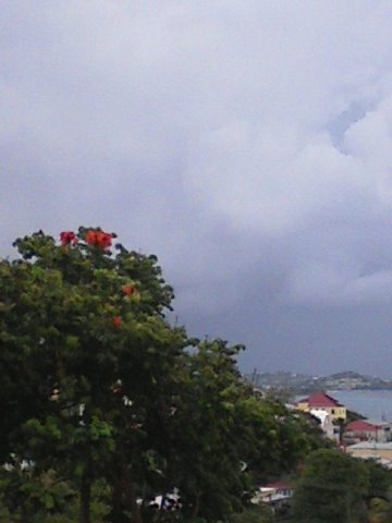
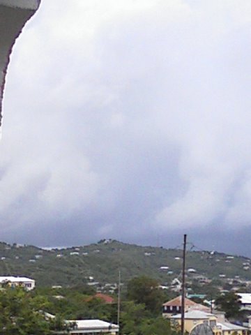
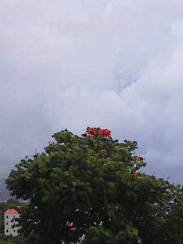
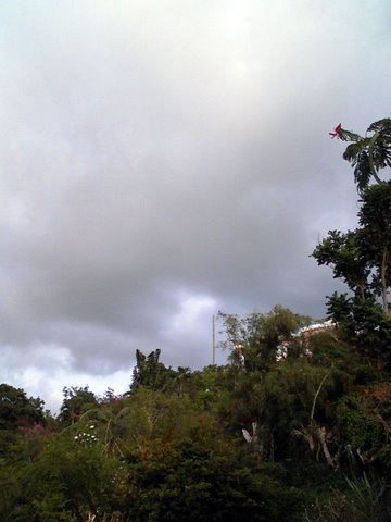
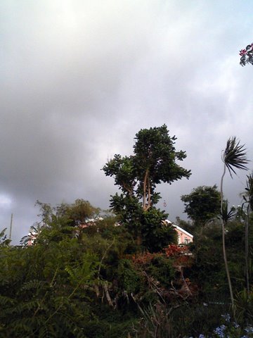
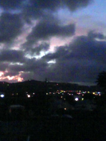