
|
|
- Updates from the Islands -- - St.Croix (USVI) - - |
|
|
For the most recent reports from St.Croix see this page.
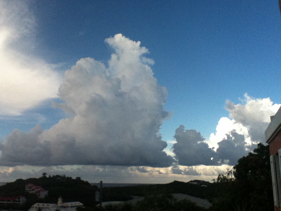
| - Our Eyes are on the Northeast |
|
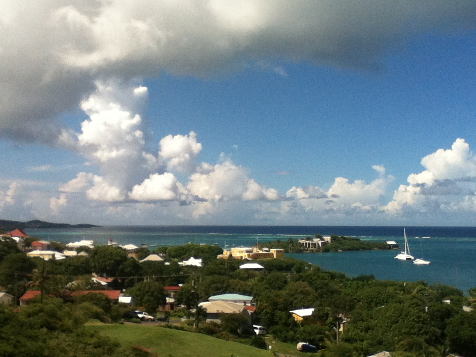
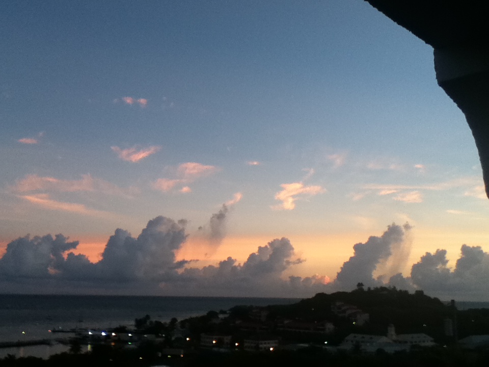
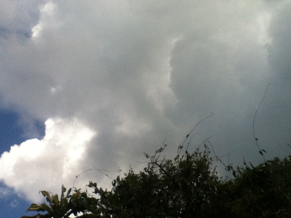
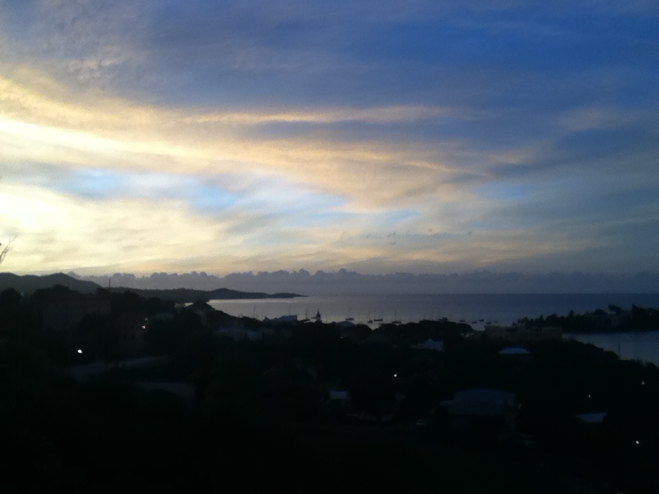
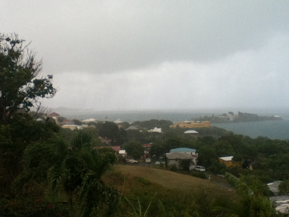
While at Shoys Beach (see photo) we could not help thinking of a different
scenario along the Northeast Coast and inland where stress is building by the
hour. I was not surprised to hear some people say that they are going to ride
out the storm in areas where there will be mandatory evacuations. This time
they are going to have to fill out a form. I still remember the woman that was
taken away by IKE'S storm surge. She was determined to ride it out. If only
they would take these things seriously. This mega storm will be a frightful
experience. The barometric pressure can drop to 949! That's lower than any of
the previous big storms in the same area. There probably will be tornados as
well. I spoke with a friend in NY who was quite worried. It definitely is a
very stressful situation, we know how it is from past experience. All we can do
is hope and pray that everyone will obey the evacuation orders and leave while
there's still time. The toll of SANDY'S victims has surpassed 40!
May God bless us all!

Isabel
Sent from my iPod |
| - Drizzly Evening |
|
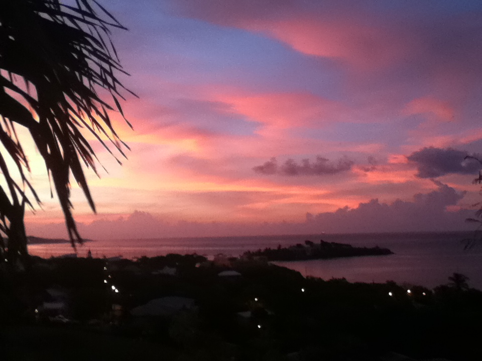
Hello out there!

We are having a fine drizzle which started at Shoys Beach (see photo). One swam
and one walked picking up little stones to decorate the little grave of a cute
little dog who went on to Rainbow Bridge to catch up with his mother and other
dear friends. A big Ginger Thomas bush with the yellow bell-shaped flower of
the Territory provides a cascade of flowers daily. Royalty deserves the best
and he was a real prince by name "Prinz" and by behavior. I shall never forget
how he wanted to go outside at midnight to do his necessities during the raging
power of Hurricane LENNY. It was hilarious after the fact! I wrote a story
based on the storm, which I will be sharing in the near future in November the
13th anniversary of that hurricane.

In the meanwhile SANDY is raising havoc all along the Northeast Coast. She has
left a" trail of death and destruction" in the Caribbean and threatens some 50
million people with such a terrifying force that she is being referred to as
"Frankenstorm" because it will all happen around Halloween ( better known as
All Saints Eve).

We wish everyone there a safe passage of those turbulent days. Let's watch and
pray and may God bless us all.

Isabel
Sent from my iPod |
| - Morning Clouds |
|
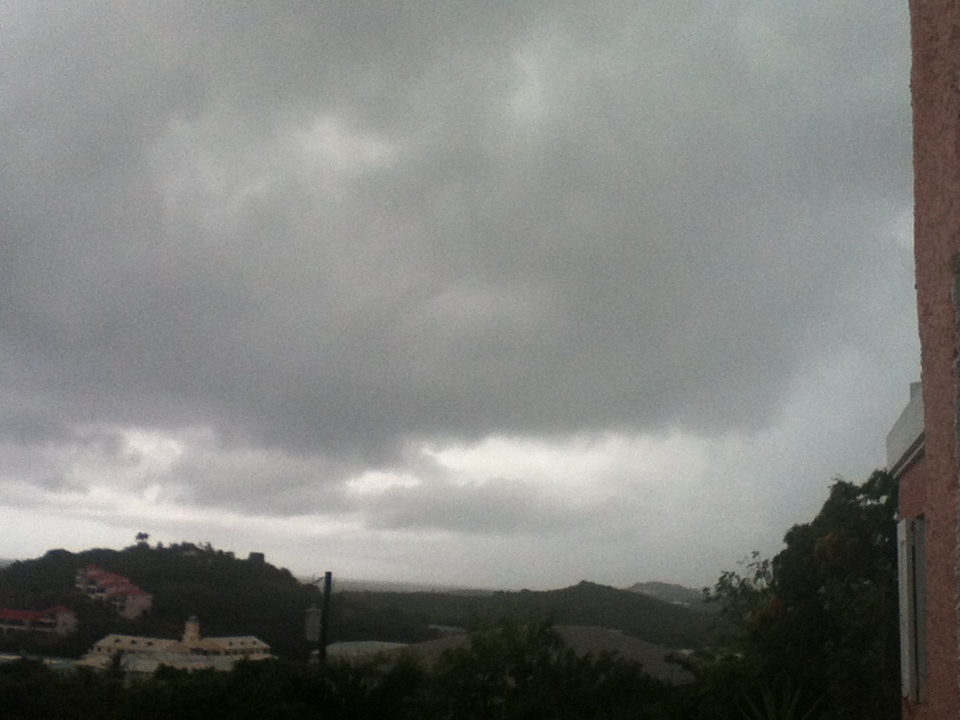
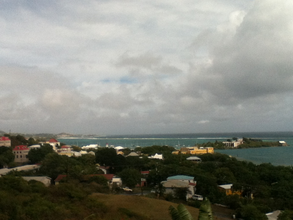
Good Morning!

Is there good weather anywhere in the world? If so, raise your hands. We can't
really complain. The huge monster to our West passed us to the South as a
fairly timid tropical wave, but forecast to develop later the following week.
SANDY exploded into a massive system becoming a hurricane before impacting
Jamaica. Some 21 lives were lost so far, in various places and now threatens
over 50 million people along the Northeast Coast. Everyone is on high alert
there preparing for what is being called a "nightmare scenario". Let's watch
and pray in own way, as they prepare, and be thankful for interesting, harmless
clouds in the sky. May God bless us all.

Isabel
Sent from my iPod |
| - Morning Clouds |
|
Good Morning!

Is there good weather anywhere in the world? If so, raise your hands. We can't
really complain. The huge monster to our West passed us to the South as a
fairly timid tropical wave, but forecast to develop later the following week.
SANDY exploded into a massive system becoming a hurricane before impacting
Jamaica. Some 21 lives were lost so far, in various places and now threatens
over 50 million people along the Northeast Coast. Everyone is on high alert
there preparing for what is being called a "nightmare scenario". Let's watch
and pray in own way, as they prepare, and be thankful for interesting, harmless
clouds in the sky. May God bless us all.

Isabel
Sent from my iPod |
| - SANDY on the way to the Northeast Coast.? |
|
|
Good Night, everyone! I have alerted all my family and friends living along the coast in case they are not paying attention. If this scenario plays out it will be of "historic proportions" because it is going to join another force to create an even bigger one. I hope and pray that it does not go that far. I was so sure we would get some rain today from those threatening clouds coming from SANDY, but nothing happened. We are getting some refreshing breezes though. The high season has officially begun and the visitors are arriving by ship and by a special flight from Denmark to St.Croix every two weeks.There was a lot of activity in Christiansted's Historic site, for us, that simply means, the town. Be well, be happy, and may God bless us all. Isabel |
| - Hurricane SANDY |
|
|
We have been in suspense with this enormous storm in the Caribbean, thinking of all the people there and what they must be going through. Each hurricane is unique, like a person, and each of us also survive them in different ways. It has been interesting, for example, to hear the different stories of survival during Hurricane HUGO. Each one was amazing! It does not have to end in tragedy, but then there are those who are most vulnerable and lay open to the elements in some places where perhaps the resources are not that bountiful. I have been trying to get information from the lands affected, hoping that they all made it safely through. We did not get any rain, but tonight again the moon had a huge ring around it. I guess this will last until the storm is out of the region. There are several waves to watch out in the Atlantic and as Dave said, we could very well be adding more names to the list, but hopefully they will all go out to the open sea. We shall know by Saturday if SANDY is going to go up the coast or away from it. I'm sure those who are aware of it will be keeping an eye on this storm. The scenario would be disastrous if it plays out the way the experts are describing it to us. We have to watch and pray. Have a good night and may God bless us all. Isabel |
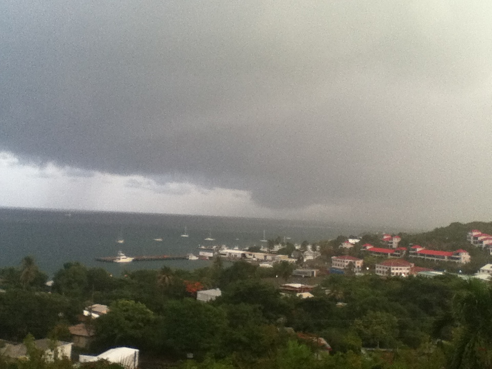
| - SANDY Clouds |
|
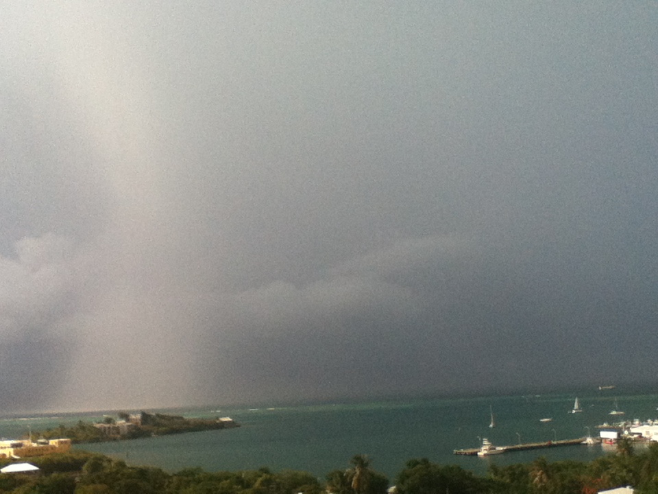
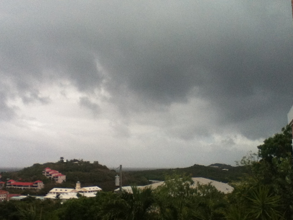
Late this afternoon an eerie sky to the West announced the presence of
Hurricane SANDY as it moved up to our latitude.   Dave referred to the clouds
as debris from the hurricane. Our neighbors to our West were being hammered. I
read posts from two of the correspondents in Jamaica. One of them included
photos of the storm surge and the high waves. I wrote wishing them well. I will
try to contact someone in Haiti this evening. The mounting fears are for a
"perfect storm" scenario along the Northeast Coast this coming weekend.
We do not expect rain from SANDY, but it could be that some rain bandsaw reach
us. It is a very large hurricane with the eye measuring 55 miles across. Let's
continue to keep the folks there in our prayers and may God bless us all.

Isabel
Sent from my iPod |
| - An Imminent Disastrous Scenario Unfolding |
|
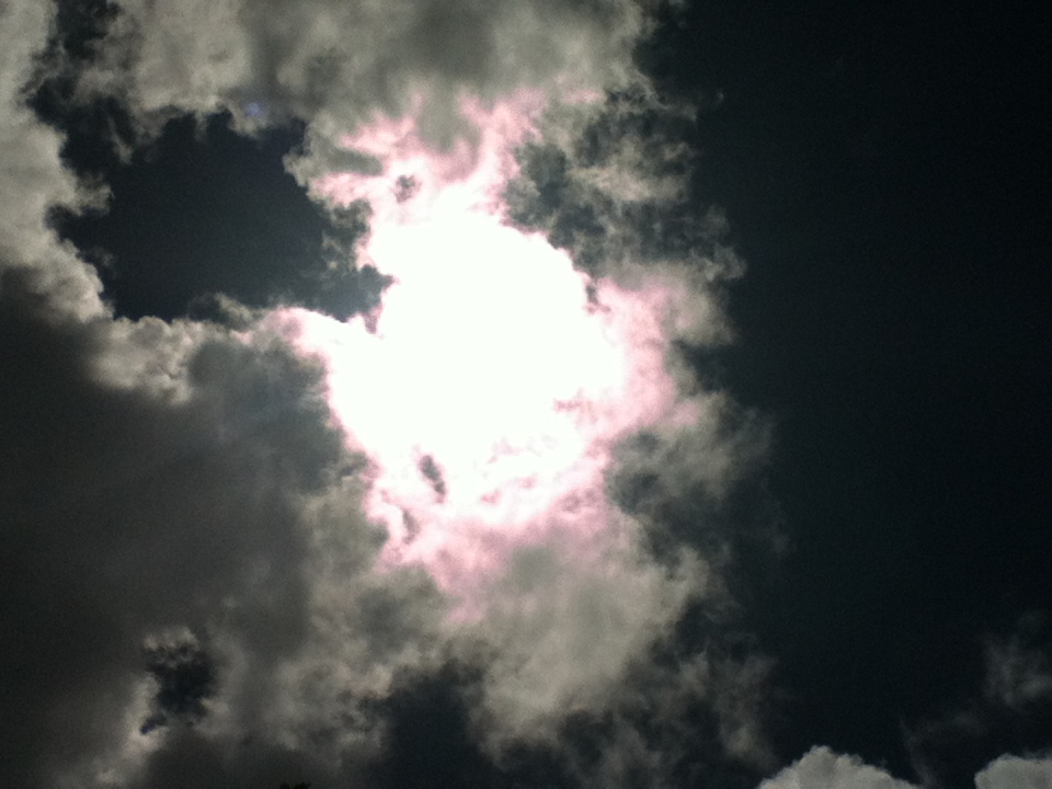
Tonight I saw a huge circle around the moon and a smaller circle within around
the moon. There were no stars visible. The moon itself was comforting as it
reminded me of  the Holy Communion we receive. That whole picture together with
the report this evening about the disaster in the making in the Caribbean was
enough to chill the night. It's heart wrenching to know that some people will
refuse to leave their makeshift dwellings and lose the little they have. I
spoke with people locally who are in touch with folks in Jamaica, Haiti and the
DR; they all say it's been raining. SANDY is forecast to become a hurricane
very soon even before it arrives in Jamaica. It does not look good for any of
these islands in the path of the storm. Increasing concern now for the Eastern
Seaboard due to reliable computer models taking the storm in that direction;
others take it in the opposite direction. Tension is building all around. SANDY
is proving to be a rather slow and powerful storm. I understand their position.
I've been there and it's nerve wrecking. May God bless them and us as we go
through the rest of this hurricane season. I wish you all love, peace, and joy.
Have a good night.

Isabel

The circle is not visible in the photo.
Sent from my iPod |
| - SANDY preparing to make a Grand Entrance |
|
|
Good Afternoon! Our weather continues to be very pleasant, very blue sky and sea with a smattering of decorative clouds. There's always rain and thunderstorms in the forecast, but nothing on our side of the island. There's been intense activity of a search and rescue helicopter flying around all morning in the vicinity of the harbor and I wondered what that was all about. The Piper airplane that went down a week ago was found 130 ft under the sea near Water Island, more than 40 miles away from us. Only one person survived that crash, spending some nine hours in the sea before she was rescued. One body was extracted from the wreckage but it was not determined if it was a male or female. Another trip to the wreckage was underway to try to find the two other people. I'm watching this developing system in the Central Caribbean, T.D 18, with tremendous concern for the folks in those lands. I heard on a report this morning that it should be almost stationary for a couple of days and drop double digits of rain on that whole region. I hope that won't be the case. Haiti seems to be in the middle and most intense part of the storm, which should be named SANDY by tomorrow morning. It is expected to become a hurricane by Wednesday morning. I know in what "state of emergency" we would be if we were in that mix. I hope that they are preparing for this storm. The last storm caused a lot of damage in Haiti, but this one will be even more damaging. How does one secure a tent with one's meager possessions? Are there any shelters whatsoever for so many? This is a real serious situation because of the bare hills that become mudslides with a system like this.I know people there and it causes me a great deal of stress to see how vulnerable they are and how quickly lives get snuffed out. The people I know are there to help the poor, but that does not make them any safer than the rest. They really are all in the same boat! All we can do is watch and pray for them. May God bless everyone in the region there and us. Isabel |
| - Sunday's Weather |
|
A Fine Good Afternoon to All!

It has been calm and peaceful here, however, I am concerned about the
"dangerous" 99L that's heading towards     Haiti, Jamaica and Cuba; places
where deadly landslides occur during rain events of this kind. It has a 70%
potential of becoming a cyclone, at this time probably more advanced. Let's
keep these folks in our prayers and all others who can be affected along its
path. Be well. May God bless us all.

Isabel
Sent from my iPod |
| - A Change in the Weather |
|
|
Good Night to All! Well, what a change since this morning. It was to be a very rainy day with numerous showers and after the morning rain we had a mixed bag of sun and clouds. We were hoping it would be dry for the multicultural celebration at the kids' school..Dances were performed; one group came especially from a public high school to demonstrate the Quadrille. Afterward, the Principal announced that in three weeks it will be taught at our school. Yeah! I think I'll join the kids! The slice of moon was shining brightly in the sky. What a relief! It could have been raining and the whole program would have had to be eliminated. There was no room in the school hall for performances. One side of the hall was being used for the class exhibits of the different countries represented at the school, the other for a buffet table containing all the dishes prepared by the families of the students. Quite an interesting selection! And no rain, so the music, and the fun, and eating outdoors continued until we'd had enough and went home. Love, peace, and joy reigned. I'm keeping track of two circled areas of concern for tropical development. One in the Atlantic, may have no impact at all in our region, the other is in the Caribbean. This one is moving West and has already increased and most probably will be the next name storm. May it not try to copy the LENNY nor the OMAR stunt. This will be one to watch! Let's keep an eye to the weather as we go about our weekend, and may God bless us all. Isabel Last night I was reminiscing with the LENNY story I wrote almost thirteen years ago. Prinz was very much a part of that adventure. I'm inserting a photo of him and will eventually attach the story.. |
| - NOAA: "Numerous Showers.." |
|
Good Morning!

It's going to be a very wet day, according to NOAA, but have no fear. As long
as you have a song in your heart and a smile on your face, it should be a very
good day! So, enjoy and I'll check back later. Blessings!

Isabel's
Sent from my iPod |
| - Rainy Morning....(see previous post) |
|
|
Sent from my iPod |
| - Rainy Morning...Rainy Day Ahead.? |
|
Good Morning, I wish the sounds came with the photos. It's raining, sometimes heavy, sometimes lighter. It's the kind of day to stay indoors, snuggle up, or grab a book (I would grab my Kindle where I can select from over a hundred books which I selected.) , or finally get that indoor work done. After my dashing through the raindrops this morning, I will tackle serious work indoors. Enjoy your day, I plan to enjoy mine. May God bless us all. Isabel Sent from my iPod |
| - A Beautiful Day for Prinz |
|
It was most appropriate to have sunshine and a garden  of flowers on Wednesday
morning when we laid our dear, faithful pet to rest. Later in the afternoon
there was one crazy cloud which exploded with the whole works. It was to our
north, but nevertheless the swimmers had to get out of the pool at the
Dolphins. Thursday could be a rainy day from what I'm hearing. Whatever the
case may be let's enjoy it the best we can. I often hear it said that it could
be the last one. May God bless us all.

Isabel
Sent from my iPod |
| - Hurricane RAFAEL to Bermuda |
|
|
A Good Night to All, We were spared the ravages of Hurricane RAFAEL! As a TS it threatened to come this way during the weekend, but in the end it avoided us altogether. Nevertheless, the Piper airplane carrying the pilot and three passengers went down 8 miles from St. Thomas on Saturday when returning from St. Croix with a delivery of St. Croix AVIS newspapers. One female passenger was rescued some nine hours later and three are still missing, the pilot, a lawyer, and another lady. Our beloved little "PRINZ" is now resting in peace. We are going to miss him. I thank everyone who sent in such kind words to see us through these last days. Thank you for the Rainbow Bridge poem. If anyone knows the story of the little girl who had a near death experience and came back having seen her dog, please share it with me. Since Monday we've been having some heavy downpours often with strong gusts of wind. It is quieter now. I read today on AccuWeather.com that another system could develop in the Southern Caribbean late next week. Have a good night/day and may God bless us all. Isabel |
| - T.S. RAFAEL'S Sculpture |
|
Good Evening!

We did not get the storm, but very windy today, a wee bit of rain, and
spectacular sculptures in the horizon. We have so many reasons to be thankful.
Blessings!

Isabel
Sent from my iPod |
| - Ready and Waiting for T.S. RAFAEL |
|
Good Evening!

It's been quiet as you see from this photo. No wind, no rain. We are still
under a Tropical Storm Warning with the threat of 2 to 3 inches of rain
beginning after midnight with wind gusts up to 55 mph. The storm has slowed
down to 8 mph and is almost at our doorstep. The storm symbol is just to the
East of us on Sxmcyclone/storm pulse. The blob is huge. if it's accurate the
rain should be with us for a while. I shall post later if there's any tropical
activity. Have a good night and may God bless us all.

Isabel
Sent from my iPod |
| - T.S. RAFAEL'S First Rain Bands |
|
|
Good Early Afternoon! Before noon we had a rain band from the storm. This is going to become more continuous as the afternoon progresses. I think the sunshine is fighting a losing battle. Once T.S. RAFAEL takes over we can expect only rain.On NOAA NOW (free app) the situation overview is the following: "..RAFAEL WILL BE MOVING OVER OR NEAR THE VIRGIN ISLANDS TONIGHT. RAIN AND SQUALLS WILL CONTINUE TO EXPAND ACROSS THE U.S.VIRGIN ISLANDS AND EASTERN PUERTO RICO TODAY AND THEN CONTINUE THROUGH TONIGHT AND SUNDAY. So. it looks like a very wet weekend. Follow the necessary precautions, watch, wait, and "give thanks and praise to the Lord" for it could have been a lot worse with a major hurricane. Those of you living away from the islands, thank you for reading the updates. A Big heartfelt thank you to those of you who sent in words of encouragement as we watch (the little) Prince gradually slip away. He has bouts of life and is aware that we are talking about him so he wagged his tail as he lay flat on his tummy. The tumor in his throat has grown quite large and is what most likely is keeping him from eating. We're taking it hour by hour. I will check back later. The sky is somewhat overcast, but no more rain since before noon. I noticed on the satellite imagery that there's strong wind shear. That's always in our favor. If you will, check AccuWeather.com for a video weather update. Be well, be happy, enjoy the day and may God bless us all. Isabel |
| - T.S.RAFAEL ? |
|
|
Good night, All! It's very quiet. The stars are shining. Where is Tropical Storm RAFAEL.? It's coming, according to all the experts. By tomorrow morning we should have a lot of tropical action around here. Everything is to the East of the center, and that is not here as yet. It has slowed down to 10mph. Not good. I hope it does not slow down any farther.. There is a tropical storm warning for the Virgin Islands and Puerto Rico. We will be affected by the storm from Saturday morning to Monday morning. Heavy rain and winds gusting to 70 miles are expected. It's sad that one of our pets is dying. It is not a good time for a pet or a person to die. I would be happily surprised if I see him, our faithful on all four legs tomorrow. He has been a real Prince, like his name, all his 15 years. He will be sorely missed when he does leave us, I will sleep if I can and sometime in the morning will update. May God bless us all. Isabel |
| - Time to break out the Thundershirt |
|
The dark clouds have moved in and the thunder is booming randomly in the
background. Our poor pup, Maully, is terrified of thunder, our other 2 pups
aren't phased by it. I put her THUNDERSHIRT on her and she's feeling much more
relaxed now ... such a relief for her and for us, I've always felt so sorry for
her during storms.

Looks like we're in for a stormy weekend, happy to be getting more rain. Will
post again with updates, stay safe all.

~Jill~
Sent from my iPad |
| - 98L / RAFAEL ? |
|
Interesting sky in this photo, but does it mean anything? We have had threats
all day mixed with sunshine. However, at some point we should be getting the
rain. I think this time the towel brigades will be very busy. The wind is
stronger now and there are thunder rumbles approaching. I shall check back
later. Have a nice evening. Blessings!

Isabel
Sent from my iPod |
| - 98L Looks like the "R" Storm! |
|
|
Hello Caribbean Neighbors, family, and friends, near and far! I know that many people have their eyes on this immense system that's threatening our little islands. Unfortunately, 98L is looking very much like the next name storm, which would be Rafael. Not only that but all of the computer models has it coming up this way, and it has slowed down to 9 mph.! When Hurricane HUGO crawled over St.Croix at 6 mph the whole island was devastated. I hope that none of the islands will have to go through something like that this time around. If we don't have everything in place, this is the time to get it ready. Sure, it's quiet and we can become complacent, but when the storm arrives it will be too late.to do anything. Let's pray that this system, soon to become a cyclone, will speed up again so that it can clear the islands as quickly as possible. As of this evening 98L has a 70% chance of becoming a cyclone. By the looks of things, it should be a Depression, if not, a Tropical Storm by tomorrow. The weather experts don't expect it to become a cyclone until after it passes the islands, but it seems to be developing faster than they think.Let us watch and pray and may God bless us all. Isabel |
| - Suspense heightens.! |
|
|
Good Morning! A trof is moving through our area starting from last night with lightning and thunder. I tried to capture the lightning to share with you today, but it was impossible, as you can imagine. It always happened when I was not ready. Today we're having a mixed bag of sunshine, dark clouds, and showers. This type of weather is going to continue for the next few days. Then, along will come 98L over the weekend as a "vigorous" tropical wave bordering on tropical storm status. We have been urged to pay attention to this system which is forecast to bring gusty winds and heavy rain. At the moment, in it's present location, the buoys are registering tropical storm force winds. This system is forecast to make a northwest turn bringing it over us or on the fringes. Regardless, NOAA Radio said that we will be having the strong winds and rain. The bottom line is that we could very well be exposed to a tropical cyclone which can develop shortly after it passes us. This same scenario happened with IRENE. It came over us as a Depression and shortly after got the unforgettable name of IRENE which raged havoc along the Eastern Seaboard. So, it's better to be safe than sorry and prepare from now, if we haven't as yet. A friend of mine just wrote me to say that she had just taken down her shutters because it was too dark in the house. One thing we should remember is that there are two peaks to the hurricane season, one in September and one in October. So, here we are, right at the second peak, and this vigorous wave, which is going to travel to Bermuda after it leaves our area, according to the forecast. Let's prepare and hope we don't have to experience anything more than a tropical wave. We can still use more rain. Have a nice day and may God bless us all. Isabel |
| - While Watching Invest 98L |
|
We are enjoying this beautiful weather, but at the same time in suspense as to
what 98L is going to bring and how close it will pass. We shall see beginning
on Thursday night according to NOAA Weather Radio. Blessings!

Isabel
Sent from my iPod |
| - Monitoring 98L! |
|
|
Hello, again! It seems to me that 98L is getting sheared. If you take a look at the animation on stormcarib. It seems to have dropped a notch. That does not mean much since it is quite a large system. Let's keep monitoring. At 7:00 p.m this evening it was at 10.9N 49.0W. Earlier it was at 11.4N. Usually the northward turn happens at 50 degrees. If that does not happen then it will go straight into Barbados and the Windward islands. One of the computer models had it going in that direction. We have to keep tracking it. I'll check it later again. Have a good night and may God bless us all. Isabel |
| - Trouble Ahead with Invest 98L ! |
|
|
Good Afternoon, I think, rather, I hope, that everyone along the island chain is monitoring 98L. It is in our best interest to pay attention to this system. The report from the Atlantic Tropical Weather Services is that both the GFS and the European Compt. models both seem to suggest developement into a tropical storm in the vicinity of the Virgin Islands and Puerto Rico by Sunday and Monday. The Canadian Compt. model "goes absolutely bonkers" and forecasts this system to impact Barbados and the Windward islands as a moderate Tropical Storm by Thurs. then significantly intensifying it into a hurricane and turn northward impacting much of the islands in the Leewards on Friday into Saturday bringing hurricane conditions by Saturday night. Rob Lightbown of the ATWS strongly suggest that all residents and vacationers in the Lesser Antilles and the island of Barbados keep close tabs on the progress of this system. 40 to 50 mph winds and rough seas can be expected along the entire island chain of the Lesser Antilles. This squally weather is then expected to spread across the US and British Virgin Islands as we get into Saturday. So, there we have it. Now it's a matter of monitoring this system and hope that it just dissipates or goes out to sea. But most importantly is to make sure that we have all our hurricane supplies in place and not have to run out at the last minute. I suggest that you watch the updates on the Weather Channel at 10 mins to the hour for the latest on the progress of this system, those of you on the mainland and here locally. Those in the other islands will have other weather services for updates. There are many Internet sites that are monitoring hurricanes; go to Google search for information. Until later when I will report on our present conditions which so far have been somewhat mixed and to see where 98L is located. All the best to everyone in the direct route of 98L. May God bless us all. Isabel |
| - Watching Invest 98 Closely...! |
|
|
A Gentle Good Night/Morning to All! After checking the information that's coming at us about this ominous Invest, I cannot help but write a few lines even at this late hour. According to Accuweather.com this Invest should be a strong tropical wave, by the time it reaches us on Friday and through the upcoming weekend. It will border on cyclone status by Sunday or early next week. That is compatible with what NOAA Weather Radio is saying, that a tropical wave will be entering the Eastern Caribbean by the weekend. We definitely have to take this one seriously and monitor it closely. Let's hope that it can just break up like so many have done in the past. At the moment it's quite disorganized. So, be watchful and be prepared as we ought to be, and let's hope for the best. May all our neighbors and friends out there be safe. God bless us all! Isabel |
| - Sunny, Wet day |
|
Good Saturday Evening!

After the heavy rain from the trof this morning it has been mostly sunny and
quiet. I went into the supermarket when it was sunny and there was a "deluge"
as I checked out. The photo was taken a few minutes ago with the  island of
Tortola in the distance. There's more rain in the forecast and possibly
thunderstorms. We hope the long weekend will have enough dry moments to enjoy
the extra day. Have a nice one and may God bless us all.

Isabel
Sent from my iPod |
| - OSCAR is traveling to Europe! |
|
|
Have a Good Night! In the meanwhile, since I'm still awake, I have to say something about OSCAR for the record. He decided to skip the Caribbean and travel to Europe instead according to the last look at the computer models. One of them had it going to the UK and all the way to Italy! We're by no means out of the woods as yet if those waves to our south have any intentions with us. I just dread the name Patty for a storm. It's too cute. I wonder who is responsible for choosing the names. Why don't they throw it to the public. I'm sure they would get names from A to Z without skipping a letter! We're having real nice weather at the moment, but could be a trof coming through on the weekend. As long as it does not spoil the 'Blessing of the Pets" event on Saturday morning. Have a nice weekend and stay alert. May God bless us all. Isabe; |
| - The Colors of the day in Paradise |
|
Good Wednesday Morning!

Blue, White, and Green are the colors dominating the photo with some pink
Oleander peeking in on the right side. We feel especially blessed when we think
of the early blizzard in Minnesota today. I wonder what name it's going to get.
As you might have heard, blizzards are going to be named just like the
hurricanes. This reminds me, we should soon have a name storm in the Atlantic
to our east; apparently it's no threat to us. Let's enjoy one day at a time and
may God continue to bless us today.

Isabel
Sent from my iPod |
| - Same View-Mixed Weather |
|
Good Afternoon!

Thunderstorms expected in our mixed bag later today. Our view cleared since
this morning's photo. See previous post to compare. 96L is getting better
organized. I understand that we need not worry about that one. Until it's above
our latitude we should remain alert. Enjoy the rest of the day! May God bless
us all.

Isabel
Sent from my iPod |
| - Rainy Day Ahead |
|
A very wet Good Morning to you!

A passing trof promises rain throughout the day. We are going to have to race
between showers. Lightning and thunder will also accompany this trof. As for
96L, it has not developed much more since last night, but is expected to do so,
however, it is forecast to stay away from the Northern Lesser Antilles. Let's
track it! Blessings from the land above!

Isabel
Sent from my iPod |
| - Potential Disturbance! |
|
|
Good Night, All! This evening I found out that there's a disturbance at 9.9N 36.0W moving WNW at 14mph. There's a 60% chance that this one can become a Tropical Depression in a couple of days. Two of the computer models has it coming towards us. It's quite large, so let's hope that the strong winds aloft will remain in place. It has been tearing everything apart. Thankfully, we have been able to get some rain and can now say that we are in the rainy season. Overnight showers are expected due to a trof that's passing through east to west. Let's keep an eye to the east and this disturbance and pray that it moves away from us. Have a good night and may God bless us all. Isabel |
| - Update |
|
Good Morning!

Threatening skies will rule the day; however, it is sunny as well and quite
warm. We look forward to each drop of rain when it happens. Our hurricane
season has been very quiet. I am sorry for all the folks on the mainland and in
Asia who have suffered devastations due to severe weather and cyclones during
the course of this year. My thoughts turn also to the farmers hit hard by the
drought. I hope the rest of the year will be less dramatic. May God bless us
all.

Isabel
Sent from my iPod |
| - Yesterday's "END" |
|
Good Evening!

The photo I referred to yesterday did not make it; hope it does today. A dry
spell is in the forecast for the next few days. Great for outdoor activities!
Tonight is movie night at the wharf's park at the Christiansted Fort. I hope it
will be rain free. Have nice weekend and may God bless us all.

Isabel
Sent from my iPod |
| - The End...of another day in paradise! |
|
Good Night, All! What an awesome way to end the day! It had its good sprinkles here and there and even a heavy shower after sunset. I got acquainted with a couple visiting from New Jersey and they were having such a wonderful time that they are planning on becoming "snowbirds" and spend six months here six there. Today, I visited a sweet, little lady of 102 and a half years. She has quite a charming personality, good memory, and walks about unaided. On clear days she can see the islands to the north from her porch. Her motto is "see but don't see and hear but don't hear". Something for all of us to consider. May God bless us all. Isabel Sent from my iPod |
| - Sister Moon's Splendor |
|
What a lovely night! The moon has the sky to herself, the frogs are having a
concert, the crickets are doing their thing, and the world is at peace, well,
we're still working at that last one. We had some good downpours again and
everything is blooming. May God bless us all.

Isabel
Sent from my iPod |
| - Morning Glory! |
|
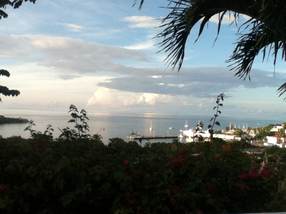
Greetings!

I wish you all a wonderful day and a continuation of the quiet hurricane season
we've been having. The rainy season has finally kicked in here for which we are
truly grateful. However, so that visitors may know, it is not raining all the
time, but showers that come through for a brief or longer duration depending on
the source of the moisture. The trees and plants are smiling, and even though
the weeds are coming back with a vengeance, we tackle them and keep smiling.
This photo was taken with our view the north facing St. Thomas and the BVI.
Enjoy this day and may God bless us all.

Isabel
Sent from my iPod |
| - RAIN !! |
|
Greetings on this rainy night! Since late this afternoon a thunderstorm initiated a series of heavy downpours, which from all indications is coming from the tropical wave to our south. The precipitation forecast is 20% but it's more like 100%! That's great! We need the rain! Have a good night and may God bless us all! Isabel Sent from my iPod |
| - Another Beautiful Sunday |
|
Good Night, All!

Hope it was a wonderful day weather wise and otherwise. We had partly cloudy
skies, breezy, and great family conversations and lots of laughter. We
celebrated with our Chilean  friends, though a few days later, their National
Day. We lived there for five and a half years. We enjoyed the country and it's
people; even after more than thirty years we're in touch with our Chilean
friends and look forward to visiting again. This tranquil photo was taken
towards the end of the day. May God Bless us all.

Isabel
Sent from my iPod |
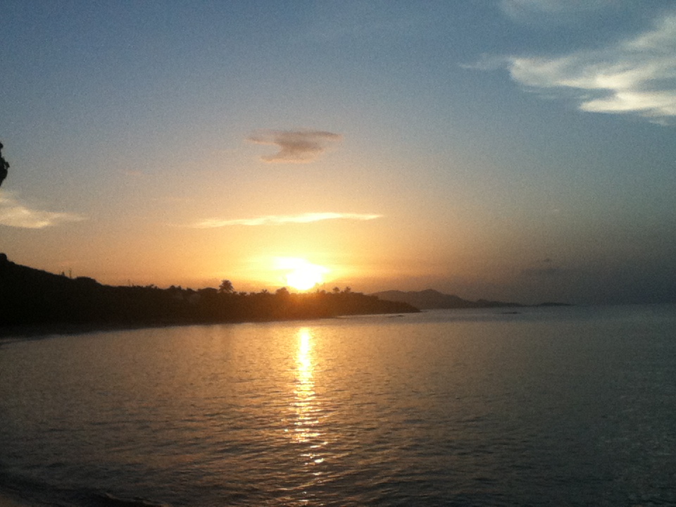
| - Sunset at Shoys Beach |
|
Beautiful, quiet days! We should enjoy good weather during the hurricane season
while we can. Have a wonderful weekend! May God bless us all.

Isabel
Sent from my iPod |
| - "Face in the sky" |
|
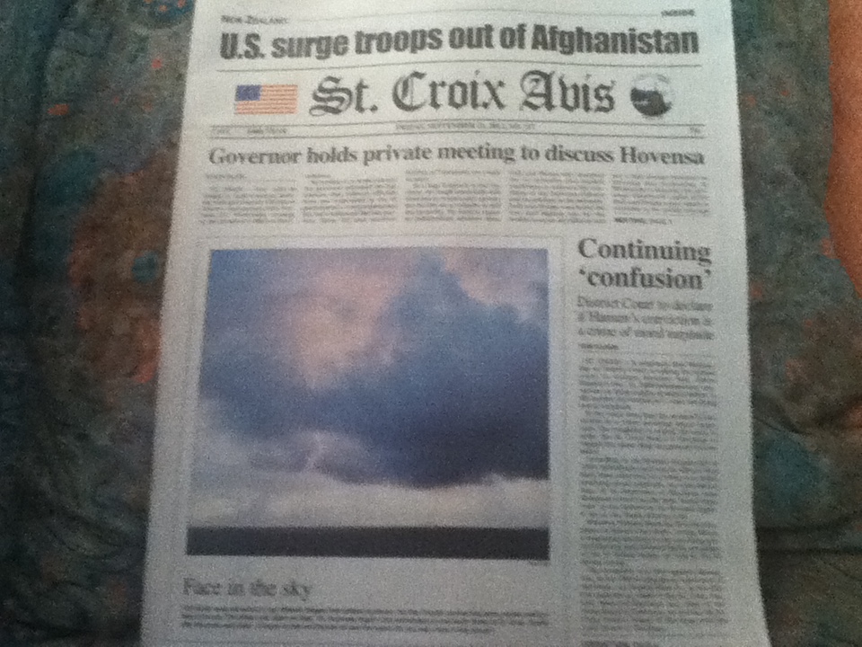
Good Afternoon!

This photo is of today's St. Croix Avis. The caption under the photo goes as
follows: "Our mind's eyes are wired to see different images from person to
person, but this Crucian sunrise has some people seeing a face in the sky. The
photo was taken on Sept. 18, Hurricane Hugo's 23rd anniversary, on the  North
Shore of St. Croix. Shortly after the photo was taken, it began to rain and
thunder all over the island. Do you see a face in this picture? "

I wanted to share this because in my update of Sept. 14th I mentioned the
interesting formations in clouds.

Today has been sunny with a smattering of clouds, but probably won't be long
before another wave comes by. We can still welcome more rain; we had a long
drought. Have a nice evening. Blessings!

Isabel
Sent from my iPod |
| - A Good Rain Day! |
|
|
Good Night, All! This morning we had some very heavy downpours that caused instant street flooding. I had to cross a little "river", a wide little one, so the water went into my sandals and out again. No sense in trying to jump across. I know a young woman, some time ago, who tried that thinking she could jump on the sidewalk and ended by breaking her ankle. Ouch!! This afternoon was quieter, but we had enough rain in the morning to last us for quite a while. I can see from the satellite imagery that there are a few waves to our east, and many crossing the African continent. I heard on the Weather Channel this morning that the atmosphere is becoming more favorable again for tropical formation. Well, we still have quite a bit of hurricane season left; anything can happen. Apparently, Vladivostok has been hit twice recently with cyclones, something totally foreign to them. Read about it on Dr. Jeff Masters blog. Could it be that icebergs will pop up in the Caribbean or Atlantic..? My grandchildren thought that was funny and not at all possible. Only Time will tell. Be well, dream sweet, and may God bless us all. Isabel |
| - Tropical Wave (92 L) Still Passing By... |
|
Good Morning!

Showers through the night, breezy, very pleasant, heavy threatening clouds this
morning mostly to the south, some showery moments;  nothing like yesterday
although that can still happen this afternoon. There is a 50% chance of rain
today. Have a nice day in your "neck of the woods". Blessings from the Land
above to us all.

Isabel
Sent from my iPod |
| - A Swiss Barometer |
|
This Swiss barometer is usually very accurate. When it's sunny the lady is out,
and when it's going to rain the man comes out, prepared with his umbrella.
However, I think that he does not like thunderstorms and it's not her "cup of
tea" - this weather. So, they're kind of watching and waiting. Will update
later. Blessings,

Isabel
Sent from my iPod |
| - Very Active Tropical Wave! |
|
Greetings on this very stormy morning. The photo was taken a few seconds before
the thunder and heavy rain in progress at the moment. This morning I was in a
small chapel when a huge thunderstorm passed overhead. The lightning and
thunder happened seconds apart, extremely loud. I wondered about the younger
children in the school next door. They must have been scared. According to NOAA
Weather Radio, St. Croix is getting the bulk of the rain; this should continue
through Wednesday to a lesser degree until it passes the area. Dave thinks it
can develop as it gets to the Western Caribbean. It's something to watch "down
the road". Until later. Blessings!

Isabel
Sent from my iPod |
| - Quiet is the Night! |
|
|
Sh-h-h-h-h !! I don't want to intrude on your sleep, nor do I want to wake you too soon, but before I retire, I wanted to let you know that conditions here are absolutely quiet. Whatever is happening is to our south. We had a fantastic show during the mid afternoon hours, but then it settled down and even though we have a high percent chance of rain in the forecast for tonight and tomorrow, it is yet to be seen. I think the wind shear took care of destroying any chances. I know Dave is as disappointed as I am about the lack of rain. We have not been able to put our towel brigades into action. Nevertheless, we are grateful for any rain whatsoever received on and off recently, but it did not save our banana plants, one after the other is coming down. It is the most visible proof of how bad the drought has been here. This, by the way, is our rainy season! Perhaps it's going to rain in the dry season? One day at a time.... God bless us all! Isabel |
| - Arrival of 92L |
|
Good Afternoon!

It's thundering! That cloud of lightning bolts and thunder is passing by. You
can appreciate the stream of rain heading towards Judith's Fancy. Our side is
sunny. How we wish we had some of that rain. It's in the forecast for everyone
and this could be the beginning. The potential for cyclone development dropped
to zero percent because of the wind shear, but has the chance of building
again, as I was informed. Lightning strikes are very dangerous. Hope everyone
is safe out there. Will check back later. Blessings!

Isabel
Sent from my iPod |
| - Day of Rest |
|
Greetings on this beautiful Sunday before the squalls Monday night into Tuesday
from Invest 92 approaching the Leeward Islands. It has been HOT and for the
most part dry. Our Siamese cat, Skypee, chose the cool bathroom sink for his
nap. We welcome any rain and cooler weather we can get from 92L. Have a
wonderful day and may God bless us all.

Isabel

Skypee has beautiful blue eyes, too bad they are napping in this photo taken by
my daughter.
Sent from my iPod |
| - NADINE'S Surf? |
|
Hi! At Pelican Cove earlier today. The sea was unusually rough. Rip Current
warnings were posted. I could only think of NADINE so far away. However, we
have a system some 900 miles from the Windward Islands moving west northwest.
It has a 10% chance of developing. We must keep our eyes on this system.
Blessings!

Isabel
Sent from my iPod |
| - Family of Clouds |
|
See previous post. Sorry, the photo did not appear. Here it is now. Blessings!

Isabel
Sent from my iPod |
| - A Family of Clouds |
|
Thought I would share this with you anyway. I was sending it out yesterday with another text and Iost it. Does it not look like a family of sorts? We had this and other amazing cloud formations around during some unsettled weather in the late afternoon. Clouds are very interesting. Well, it's now time to turn in after a very long day. Let's keep our eyes on the two systems to our South; they could mean trouble, or better still, rain! Have a good night and may God bless us all. Isabel Sent from my iPod |
| - Brother SUN |
|
Greetings on this glorious day!

There's a charming breeze that's tempting me to sit still and doze off. The
clouds are flirting with the noontime sun increasing the chances of a sad
shower of tears, perhaps, as we had to get more bad news of the killing of the
U. S. Ambassador and others. Then let it rain torrents!

NADINE is going to pass too far from us according to the experts, to even think
of getting brushed  by a shower or two
but that's fine. She looks kind of mean. So, let's enjoy the lovely weather
while we can and may God bless us all.

Isabel
Sent from my iPod |
| - T. S. NADINE born on 9/11 |
|
|
Good Night/Morning ! I could not tear myself away from the interesting programs on the History Channel about 9/11. I saw raw footage that was very captivating. Never seen it before. It's as if it all happened today. No matter how many years pass we will relive that day. Thank God that many other attempts have been foiled.!! They are still trying... So, here I am now watching NADINE at this late hour. She is going to recurve and apparently not come close enough for some rain. However, we have been getting some showers on and off during the last 12 hours, not bad after the long, dry spell we've had. And if you read Dave's report on the homepage, there are others coming. The next one is recurving also but should come closer, and the one after that could be a threat for us around the 9/23. I was looking through my photos of OMAR and saw the chaos it caused around our house and how we spent weeks filling up a bin to be hauled away when we were done. We don't want to go through that again; we just would like some more rain. I thnk all the islands are in the same boat, water, water, everywhere, and not a drop to drink. Let's not lose hope, but be careful that what we wish for does not come in the form of a cyclone.! In the meanwhile, I'm going to dream sweet and hopefully be ready for another day. May God bless us all. Isabel |
| - Good Morning, Rain! |
|
Greetings on this rainy dawn! It's the trough that was predicted for mid week.
The rain was intense while it lasted. I think we got a good soaking, and expect
more. Have a nice day! Blessings!

Isabel
Sent from my iPod |
| - Nadine - SOON! |
|
|
Good afternoon! Even as I write these lines invest 91 is at 90% potential of becoming a cyclone, and could very well be one at this hour. The name will be Nadine and is expected to recurve out to the Central Atlantic. How close to us will it get? I haven't put in the coordinates to find out, but being a large system, we can hope for some rain, perhaps? I noticed in my last check of the system a few minutes ago that there is wind shear and the blob is not as impressive as earlier. The "interference" coming from above us is influencing it and another system to our south. According to NOAA Weather Radio by mid-week we should be getting rain from a low pressure system. It could be that very one that's swooping down shearing 91L somewhat. It's just a matter of Time before we find out. RAIN in the forecast...? That would be quite a treat!! As usual we're having nice, sunny, warm weather, with a gentle refreshing breeze on our hill. We do look forward to a change in the weather though. Have a nice day, and may God bless us all. Isabel |
| - Looking Out |
|
A hazy, lazy looking day. Very hot out there. Perfect to stay in until later.
If you like getting a toasty tan then it's what you need. Be sure to protect
your skin!

I've been watching the new disturbance. It now has a 40% chance of becoming
Nadine very soon. The good news is that it's already on15.6N 24.6W. Hurricane
MICHAEL seems to be influencing it. That's fine with us! Of course, we still
have to be attentive in the event of any drastic changes that  could affect us.
Blessings,

Isabell
Sent from my iPod |
| - Potential Tropical Disturbance to the East! |
|
|
Good Night, All! The weather here continues tranquil. There's no rain in the forecast until next week. Except for the rough surf at the beach late this afternoon, probably from LESLIE, all is quiet. Just as predicted, a strong tropical wave came off the coast of Africa and has already a 10% chance of becoming a cyclone. It looks very "healthy" so we can see this number going up rapidly. It is expected to be a Depression by the middle of next week. However, it is already at 13.4N 19.1 W, which means that it would have to continue straight across in order for it to get to the Lesser Antilles. It is another large system sure to get a pretty name like Nadine. I expect, judging from past storms, it would take more than a week for it to arrive in our region; that, of course, depends on its speed. Right now it's traveling at 15 mph. Let's monitor this one closely. The weekend of the 16th is HUGO's 23rd anniversary. So, let's pray this away to the north. (Maybe to attend the wedding of LESLIE and MICHAEL as they merge.) Be well, be happy, and may God bless us all. Isabel |
| - Prepare For A Hurricane |
|
|
Good Evening, Folks! Here we are, prepared in the event of a hurricane, or a tropical storm that can be as mean and big as ISAAC. How well prepared are we? This morning I looked out at the sea and it looked like glass, like an ice skating rink, a big one! Our days have been so serene and beautiful that a storm is the farthest thing from our minds. Even LESLIE who danced around above us for quite some time did not disrupt the calm. We were disappointed that she did not even give us enough rain to fill a bucket, a small bucket.The rain, when it did come, was in fits and starts as if she was throwing a tantrum and then it passed and that was that. Well, have no fear, or rather, should we fear what they're telling us about the BIG cluster of thunderstorms that's coming off the west coast of Africa tomorrow? At Accuweather the computer models think that this is going to be a strong tropical wave becoming more organized in the eastern Atlantic by early next week. It would be traveling west across the Atlantic. However, Dr. Jeff Masters said in an earlier blog that it is perhaps too far north and the Lesser Antilles may not be affected, but he said it's too early to tell. So, how well prepared are we? We don't want to think about HUGO, but we must. Some people were so traumatized that they said if another one like that comes again, they are boarding up and moving out. They are not going to stay for that one. Well, let's hope that we don't have to deal with another HUGO-like hurricane. So far, MICHAEL has been the only major hurricane of the season. It went up to a Cat 3. So, as of tomorrow start tracking that "cluster of thunderstorms" and pray that it goes fishing, where it cannot harm anyone. The last number of fatalities in Haiti caused by ISAAC was 24, by now it could be higher with countless others suffering from the effects. Let's help the victims in whatever way we can and may God bless them and us all. Isabel |
| - And the Beat Goes On....! |
|
|
Good Night, All! It looks as if Nadine will be making an appearance in the Gulf of Mexico. It is already at 50% for developing and that is an offshoot from ISAAC.. We are to keep a watch on the wave that will be coming off the coast of Africa on Friday. That one looks mean. It can be something for us to deal with next week. Our thoughts and prayers are with the folks in Bermuda who could be trashed by LESLIE on Saturday night.. The new hurricane MICHAEL, Cat 1 storm is going off to Europe. No need to fear him. Oscar is the one that could threaten us. We'll be finding out more as we go. Be alert, watch and pray, and may God bless us all. Isabel |
| - MICHAEL has formed! |
|
|
Good Afternoon! I was reading earlier on the Caribbean 360 News that experts can see up to 20 name storms this season. MICHAEL is # 13. There is a very large wave to our south that bares watching, but the NHC does not seem to find anything serious about it. Perhaps its just a nice, big tropical wave that's going to bring the rain we so badly need. Or, is it one of those that forms right over our heads? The next one shall be Nadine. It's not over until it's over, so remain in a preparedness mode. It's always best to prepare as if a Cat 5 is going to hit us, so that we can get serious about preparing. If we go through the season unscathed, then we have all the more reason to praise the Lord. Blessings! Isabel |
| - LESLIE'S Mountain Range |
|
Good Evening!

Those are not mountains in the horizon; those are LESLIE'S clouds. She seems to
be in the same place, but is quite a distance away. The cloud cover according
to the satellite images extend along the chain of islands. TD 13 formed in the
Central Atlantic and another large wave to the south is looking for attention.
This is not the time for a surprise. We should remain alert. Have a nice
evening and may God bless us all.

Isabel
Sent from my iPod |
| - Evening in Christiansted |
|
What a beautiful end to another beautiful day! I think this delightful
afterglow was courtesy of LESLIE. One can appreciate the mountain of clouds in
the distance. The earlier mention of a potential storm was not off the coast of
Africa and by the afternoon was already down to10%; however, one of the
computer models has it coming down to the chain of islands. Where is LESLIE
headed? We'll have to wait and see. There are more waves "rolling towards the
Atlantic" as Dave mentioned in his update at noon, so eventually another one
can head this way. We look forward to some rain, hopefully it will come with a
wave, not a storm. A friend in So. Carolina said they got lots of rain from
ISAAC.
Have a nice evening, a good night, and may God bless us all.

Isabel
This is symbolic of our golden year beginning today. Sent from my iPod |
| - LESLIE |
|
At Christiansted's Historic wharf, along the boardwalk,  where the celebration
continued. The sea got rougher and the clouds to the northeast heralds the
closest approach of LESLIE later this afternoon. The next potential storm was
already at 20% this morning according to NOAA Weather Radio. Have a nice day
and may God bless us all.

Isabel
Sent from my iPod |
| - LESLIE'S Veil is Spreading Out! |
|
|
Good Night, All! We had a wonderful evening out on the terrace celebrating under a beautiful sky, nice breeze, bright moon. We commented on how fortunate we were to have such nice weather. Now, if anyone takes a look at the satellite images, you're going to notice the voluminous size of Leslie scraping by the islands chain, clouds spreading out to the VI. The moon is surrounded with clouds and the breeze is a bit stronger causing the once still wind chimes to chime. We should have taken them down. The track is still the same, we hope, away from us. Some rain would be good. There are many of us wishing the same. Let's hope that on Sunday when we continue to celebrate our 49th wedding anniversary, we will have a special blessing in the form of a shower or two. May God bless us all. Isabel |
| - Hurricane Season 2012 |
|
 ISAAC?  KIRK ?  LESLIE ?  So far, so good, but we still have to keep an eye on
LESLIE, especially late this weekend. Blessings!

Isabel

(photo taken at Shoys)
Sent from my iPod |
| - Does Anyone Know LESLIE's Size.? |
|
|
Hello, once more! Before I bid you good night, I want to share something with you which I picked up from the desk of Alex Sosnowski, the expert Senior Meterologist at AccuWeather.Com. This paragraph made me think of LESLIE's size. What is it? ISAAC was 1000 miles BIG! How big is LESLIE. Here is what I read that raised this question: "Even though Leslie will pass north of the Lesser Antilles later this weekend, it is likely that gusty squalls, downpours and building seas will move in and continue into early next week over some of the northeastern islands in the Caribbean. These areas would wind up near the "dirty" part of the storm that typically fills up with showers and thunderstorms". That made me think that perhaps because of LESLIE's size, even though the center will be some 300 miles away the rest of it, the "dirty" part might extend far enough to reach the islands. That would definitely catch a lot of people off guard if it turned out the way Mr.Sosnowski said. Well, we shall soon find out. We have to be vigilant and prepared backing that up with prayer. Let's sleep on this and hope that LESLIE does not play a fast one on us. No stalling please. Have a good night/morning and may God bless us all. Isabel |
| - Evening Sail |
|
Hello, again!

Nice evening for sailing while we keep an eye to the East and beyond. Nice
breeze! Enjoy blessings!

Isabel
Sent from my iPod |
| - Goodbye Leslie! Hello Michael..??? |
|
|
Good Evening! Don't want to scare you but an awfully big tropical wave just came off the coast of Africa, a bit lower than the others, and is as large as LESLIE. I'm hoping as always that nothing comes of it, but we are getting to the peak of the hurricane season when nightmare-memories of HUGO and LUIS come back to haunt us. Horrors! Why did I even mention those, especially when we have our eyes on LESLIE, an enormous-looking menace!! Let's hope the experts are right. I have been keeping track and so far it is moving as they said it would. On NOAA Weather Radio I heard that from Saturday night the sea is going to get very rough around here, and the closest approach will be on Sunday night, after midnight. Let's pay attention and pray! God bless us all. Isabel There was a tsunami warning for the Central American Coast, and one for the Philippines, and I saw footage of the shaking and quaking in California, and every so often I get an "earthquake alert" of yet another minor quake in the Virgin Islands region. What does it all mean? Wasn't it earlier this year that the Seismological Center in PR talk about being over due for a BIG one in the Caribbean? I suggest we get a link with info as to how to protect ourselves. I know that removing loose decorate objects from above and securing bookshelves, china cabinets, etc.. to the walls is another way to prevent major accidents and deaths when everything starts falling from a strong quake. Going under a dining table, any high table is another safety measure. I've seen that in the Japanese training. They get lots of quakes there so they prepare everyone from the littlest ones on. So far our quakes are no higher than the 5.--- range. Yes, I would say, be prepared for that, too,! |
| - Watching TS LESLIE |
|
|
Good Night, All! TS LESLIE is still moving west. The promised turn is yet to come. Perhaps by tomorrow morning when we take another look she will be moving away. Perhaps, also, some rain will follow. NOAA Weather Radio does promise us some rain from a tropical wave entering the eastern Caribbean on Friday night, but I don't see any signs of that. Maybe a phantom wave..? Let's get some rest. Be well, be happy, and may God bless us all. Say one for the folks on the Gulf Coast. Isabel |
| - TS LESLIE |
|
|
Good Afternoon! We got an alert about the formation of the new tropical storm LESLIE which should be passing us on Sunday by 400 miles at its nearest point. The reason for the alert was the fact that many holiday boaters will probably want to be out there and the wave action will be somewhat agitated due to the presence of a cyclone in the vicinity. LESLIE will become a hurricane before it passes us, according to the track info and we will probably be holding our breath until we are out of danger. I hope the boaters will take heed of the caution and be aware that waves generated by a cyclone are different to ordinary waves. I would think that swimmers on the north shores of the islands must beware of rip currents as well. This is the earliest recorded 12th TS and that indicates that the season is more active than originally thought. There are more potential disturbances on the way. Take a look at the African continent on stormcarib--a full picture of the globe with animation of these waves will show what I mean. They're all heading out to the Atlantic. Let's face it. It's hurricane season until the end of November. Blessings! Isabel |
| - Watching TD 12 / Leslie |
|
|
Good Afternoon, TD 12 is official and looks very much as if it could get the L name today. It looks large and mean and it does not necessarily have to follow the track of the computer models. There are other factors that determine the course of a storm. It can stay straight West, or as NOAA Radio has said, it is going into the Eastern Caribbean, or either pass close or far to the north.Our weekend can be impacted by this system. That is what we have to be prepared for by keeping up with the latest coordinates and see where it's headed. I will check back later. Hope everyone locally and in the Caribbean is paying attention. This is definitely not the time to become complacent.Be happy and alert. God bless us all. Isabel |
| - Beautiful, peaceful evening |
|
Good Evening,
While we are enjoying lovely weather, the folks on the Gulf Coast have been
having pure misery. How much longer are we going to have this lovely weather?
That can change this weekend. It all depends on how close the tropical
disturbance 98L , soon to be a Depression, will do. It is HUGE- another ISAAC?
Let's keep an eye on it and pray.
God bless us all.

Isabel
Sent from my iPod |
| - 98L is following KIRK |
|
|
Good Afternoon! Just saw the coordinates and the computer models and all indications are that the potential Leslie (98L) is following KIRK. It has started the West-Northwestward turn. We can breathe a sigh of relief that another ISAAC type is not going through the Caribbean. However, we cannot throw all caution to the wind. These systems have to be monitored for a reason. They can change direction. A slight wobble and they're on another level. 98L is also a large system and depending on it's strength TS or Hurricane when it passes us, can still affect us with wind and rain. We're still hoping for more rain. And there's hope, behind 98L is a train of tropical waves.. It's definitely a very active season.We're in the thick of it now. Those of you planning activities for this upcoming Labor Day Weekend (U.S. holiday) here in the Virgin Islands might have great weather after all, nevertheless, I heard on NOAA Weather Radio this morning that a trough could linger near us on Friday. Not a total loss as if a Depression came by. Again, it looks good for us, but please be aware that it's out there and that we're not out of the woods until it has passed our area. Be well, be happy and may God bless us all. Isabel |
| - Invest 98L - Our Next Challenge? |
|
|
Well, well, here we are, another weather challenge almost here. I have not been able to get coordinates, perhaps it's too soon. 98L is being investigated as a potential disturbance with a 30% chance of becoming a cyclone. It has become better organized and it can very soon become a Depression by the end of this week as predicted. If gets a name for itself it will be Leslie. I was surprised to learn that KIRK went from a Depression to a Tropical Storm rather quickly late Tuesday afternoon. Fortunately, it is not to threaten any land according to most of the computer models. Now here we are with this enormous looking disturbance heading west, towards us. Let's monitor and see what happens. Is Leslie having serious plans of visiting us on Sunday (Sept. 2), or thereabouts? We'll watch and pray. Have a good night/morning and God bless us all. Isabel |
| - Isaac impacting the Gulf Coast | |
| |
|
| - Hurricane ISAAC is official! |
|
|
Good Afternoon, While we are enjoying beautiful weather, there are those along the Gulf Coast that are preparing for the arrival of what is officially now a hurricane. The storm surge is expected to be huge up to 14 ft. in some areas. Our hearts and prayers go out to them. We know what it's like to have such a big storm approaching and spending several hours before it's all done. ISAAC is moving at 11 mph which is very slow with a potential for up to 25 in. of rain.! We hope they stay safe. We have a very large, ISAAC-like tropical wave coming this way, west, with a potential for developing. We have to monitor this one carefully. It does not look good. Let's keep an eye on it and do what we have to do. May God bless us all. Isabel |
| - Beautiful Laundry Day! |
|
We are enjoying perfect weather, so, if you would like to take advantage of AA
low fares, today is the last day for booking.
Come on down! Blessings!

Isabel
Sent from my iPod |
| - Drippy Weather |
|
|
Good Afternoon, Folks! I slept so well last night that I did not hear the thunder, nor see the big flashes of lightning, nor hear the intense rain! Why doesn't that happen when I'm wide awake in the middle of the night!? Anyway, the day is gray and it's quite drippy. It is not raining outright, at times it gets a wee bit heavier, but most of the time it's drippy. It can become annoying especially since we still need water in the cisterns. I heard on NOAA Weather Radio that this afternoon it should be more intense. We shall see! As Gert said, there's talk of another wave that came off the coast of Africa on Sunday and is posing a threat to us around the 2nd of Sept. Dr. Jeff Masters, chief Meteorologist, says the following in today's blog: "This disturbance is moving west at 10-15 mph and could arrive in the Lesser Antilles around Sept. 2. Several models develop this disturbance into a Tropical Depression late this week. The NHC is giving it a 10% chance of becoming a Depression by Wednesday morning." So, there we have it, however, being that it's so far out could change things dramatically. It is in a position and a course, unfortunately, that brings it in our direction if it does not change from the current movement. The main concern here is that the NHC thinks it will be a Depression by Wednesday. It will have lots of room to grow before it arrives in our vicinity. It is also of the large variety. The next name storm is Kirk, if nothing develops sooner elsewhere. Once again, please monitor this system and hope and pray it goes away. May God bless us all. Isabel |
| - All's Quiet |
|
Good evening, We had a beautiful day today. And the next days should also be beautiful. Not for long it seems. There's a system coming off the coast of Africa with the potential for disrupting the Labor Day Weekend. Let's be attentive, Sent from my iPod |
| - All's Quiet |
|
Greetings!

Hope everyone had a restful Sunday. It's quiet here now after ISAAC's
drama. It promises to remain quiet at least for a few days. It seems
that there's a system coming off the coast of Africa which could
disrupt our Labor Day Weekend. Watch and pray. God bless us all.

Isabel


IMG_0720.JPG
Attachment:
IMG_0720.JPG |
| - ISAAC'S Immensity |
|
|
I had to check in before this day is over. We have been seeing some terrible images coming from Haiti. If only this could be the last system to trouble them for the season. We, nevertheless, can be thankful that ISAAC was in reality a gentle giant. Considering the immensity of this storm, which never could get it's act together, always a tropical storm, never a hurricane; It is headed now for the GOM and Floridians and Gulf Coast residents are preparing for an impact, perhaps as a hurricane, somewhere there.The entire entourage of ISAAC comes all the way back to the chain of islands. Our skies today were mostly cloudy with dark, threatening clouds, and always the moist air, an indication that there are still remnants of ISAAC trailing. In the meanwhile, we're looking to the next system that has a 50% chance of becoming a Depression in the next day or so. This one which at first was feared as coming close to our neighborhood, does not seem to be a threat to us. That would be the K storm. However, the L storm is the one that Dave says is expected to be the next threat to the Caribbean around the Labor Day Weekend. As he said, it is too early to tell, but then again, it is that time of year. There are many waves, large waves, coming off the coast of Africa, one if not more, will make it straight across to the Caribbean. We must remain in a state of hurricane preparedness. Continue to watch and pray. May God bless us all. Have a good night and a good Sunday. Isabel |
| - After the Storm |
|
Our sister islands, north of us, were clearly visible in this photo. I guess
they saw us to the south.

We had one very strong rain band at midday with gusty winds as if ISAAC was
saying goodbye. Now we are asked to monitor 97L (possibly KIRK). There's a
train of waves heading towards the Atlantic, looking mighty healthy. Have a
nice evening and may God bless us all.

Isabel
Sent from my iPod |
| - Frequent power outages |
|
|
Good Afternoon, We're having a cozy afternoon. ISAAC is now on 16.0 N almost at our latitude. We are having constant rain now and strong gusts of wind from time to time. We expect this to continue for days now, as Dave wrote in his report, this storm is "Immense"! I thought 500 miles was BIG, he said it's 1000 miles of ISAAC that we're dealing with. So, let's see what tomorrow brings. It could be much more of the same. I will try to update later depending on whether we have power or not. These outages have been going on all day. Let's keep DR and Haiti in our prayers and may God bless us all. Isabel |
| - Squally, Squally. . . . |
|
We have ISAAC below us and JOYCE above us; same strength. We feel like a
sandwich.

This photo just taken shows the squally weather which has increased in the last
couple of hours. I read a report that ISAAC might go ". .south of the border
down Mexico way...". If only Haiti could be spared. Suspense! Let's pray and
hope for the best. God help us all. Blessings!

Isabel
Sent from my iPod |
| - Squally ISAAC ! |
|
Good Morning,

No BIG storm so far. I even went out this morning. We all expected turbulent
weather! Squally it has been. However, we are still under a watch/warning. I
still hope we get the rain, enough to at least fill the cisterns. Will update
later. The photo was taken a few minutes ago. God bless you and us all.

Isabel
Sent from my iPod |
| - Quiet night, a little breezy now | |
| |
|
| - ISAAC is Knocking at Our Door! |
|
|
Good night, all! This is my last, I think, update before I retire. We just got heavier rain and a very strong, sustained gust of wind, which indicates that ISAAC is nearer. Soon that rain and wind will get stronger with the hours. As the Atlantic Tropical Weather Service said today " Isaac is strengthening and will impact much of the Northeastern Caribbean before it sets eyes on Florida". Early I saw a news video on Accuweather in which it showed the colors streaming from this storm. The color magenta being where the most concentrated rain is found. It goes well behind the system. "Flooding rains are expected in Puerto Rico and the Virgin Islands". If anyone is living in a flood prone area, it is urgent that you move as far away from there. There is a flash flood watch in effect until Saturday. (That can be extended.) As the storm intensifies, the wind will be stronger, the rain more intense. We can get a clearer picture in the morning. I will try to take some photos; hope that works. We can only hope and pray that everyone will be safe and no one need die as a result of it. Have a good night and may God bless us all. Isabel |
| - Just got some rain |
|
|
There is rain just now. Don't know how long it will last. Ehsan A Said |
| - Awaiting on Isacc |
|
|
Hello Folks, Its 12:08 am, August 23, 2012, and lighting and thunder are beginning to make an appearance. Winds are also picking up. There are no rain yet. Will keep you updated if WAPA (our electricity provider) allows me to.
Ehsan A Said |
| - ISAAC is in the Neighborhood. |
|
|
Greetings from quiet St. Croix! I'm sure many of you who live away in other parts of the States or the world are waiting with bated breath to find out how it's going. So far, so good. We just got a stronger gust of wind a little while ago, and a little shower, otherwise it's quiet. I'm certain that it won't be long, though, before we get a steady dose of ISAAC's presence in the Caribbean. The main event for us is on Thursday, then every day after that; enough rain to work itself up to at least 10 inches by the time it's all over. The grandchildren just started back to school this past Monday and already have two days off. By the looks of it they are going to get many days off with the train of huge waves coming off the coast of Africa. The next one that could have an impact is Kirk and he is only at 10% potential for development, moving W, which is how ISAAC began. I'll try not to think too far ahead. We have enough with ISAAC for the moment. I'm especially concerned about Haiti with so many people living in shelters since the earthquake. So, hang in there with us. I'll try to post an update again tonight before I retire to keep you informed. God bless us all. Isabel |
| - The First Signs of ISAAC |
|
It is almost high noon and getting dark. The breeze has changed to a strong
wind. Some drops are beginning to fall. Yes, with such a large storm we are
going to have it around for days to come. Blessings!

Isabel
Sent from my iPod |
| - Tropical Storm Isaac is on the Way Up! |
|
|
Good Night, folks! (And greetings to you in Europe and wherever in the World you are reading the updates!) It is a nervous time for family and friends as they watch a TS or Hurricane approach these little islands, which will get lost in the 500 mile size of the storm. We know what we have to do to keep safe. We can begin to reassure them that we are ready for ISAAC. But are we all? Some people want to close off any thought of an impending storm as if that makes it go away. For everyone's information, ISAAC is now moving WNW and we are very much now in the cone. It had been on a westward track all along until this evening. It went back up to 15.6N and I won't be surprised if it keeps on creeping closer to our latitude which is 17.4..It's so important to look at the coordinates and either write them down or mark them on a tracking map. There should be many of those available. ISAAC is expected to intensify and by the looks of it could very easily become a hurricane before it reaches the chain of islands and the Eastern Caribbean. This evening it was still 690 miles from the U.S.Virgin Islands. That's room for growth. Schools will be closed on Wednesday in St. Martin and I expect that our school will be closed on Thursday. We could have a three day RAIN event, the worse day being on Thursday, with continuous effects for days. When Hurricane FLOYD passed us to the North it rained for an entire week. We have been through them before, but it's always like the first time. Each has it's own personality. What will ISAAC be akin to? We shall see, our sleeves are rolled, our fists are up and we are ready!  God bless us all. God bless us all.Isabel |
Even older reports have been moved to this page.
| Back to top |


