|
|
- Updates from the Islands -- - St.Croix (USVI) - - |
|
|
For the most recent reports from St.Croix see this page.
| - Tropical Storm Watch in Effect for us |
|
|
Good Afternoon! ISAAC has everyone in suspense and if he does not hurry up, Joyce (96L) is going to take his place and he will be Joyce! What a confusion!; 96L already has a 60% chance of becoming a cyclone. Today we have been getting sprinkles from the wave that's coming through. We need much more than that, which we hope we'll get from TD 9. Is it doing the wobble? Computer models have it moving over the Northern Antilles, but I'm noticing that each time I check it's a "titch" lower. A couple days ago it was at 15.6N, now it's at 15.1N. Is it going to wobble up North again? I'm sorry for the folks in Dominica who have had more than their share of rain. We on the other hand can use it. We have been dry for some time, with only a quick passing shower here and there. So much so, that when it rains, we marvel at it. "Wow, it's raining!" Before we know it, it's gone. I don't like the word "torrential" when it comes to rain, but if that's what's coming on Thursday, we'll take it! I just hope everyone is safe out there. So, be prepared, help a neighbor in need of help, and may God bless us all as we watch and pray. |
| - What was that..? |
|
|
It came suddenly, like a micro burst, strong winds, heavy rain, and just as suddenly it ended. We lost internet and Tv in that short space of time. We switched our Internet Service to Broadband VI a few months ago, because with the other we had very poor service. This one is very good and it comes back much faster than the previous one. I hope that in the event of a storm I can still send out posts. We were told to expect torrential rain Wed into Thurs. We don't have a generator, that's risky, but we never needed one in the past. So, I'll be contacting Gert in the event of a blackout. I know that I can charge the phone in the car, provided we have cell phone service. With 94L at 90% already and reaching 50W soon I think we will be dealing with something more than a tropical wave. We've had enough time to get ready. Now is the test! Be prepared and stay prepared as just behind this system is another that is developing rapidly. 96L is already at 40% chance of developing. Just yesterday it was at 10%.. Let's see what the morrow brings. God bless us all. Isabel |
| - The H Orchids |
|
Here are the 2012 H orchids mentioned in the previous post. I just heard on
NOAA Radio that there's a 90 per cent chance of a cyclone developing and the
Leeward Islands will soon be posting warnings. Hope the orchids arrive. Sent
with blessings.


Isabel
Sent from my iPod |
| - Hurricane Orchids |
|
These days we are enjoying a lovely spray of orchids (see photo) from a plant attached to the Divi Divi tree nearest to our house. With a potential cyclone approaching, it is reminiscent of OMAR in 2008. The hurricane raged around us with winds of 130 mph during the night. Much to our surprise a similar spray of orchids from the same plant on the same tree survived. In the meanwhile we're waiting to find out what 94L plans to do. All the best to everyone here in the Caribbean. Be safe, not sorry, be prepared. May God bless us all Isabel Sent from my iPod |
| - 94L Approaching 50 W |
|
|
Good Evening, All! We shall soon find out if this tropical wave ramps-up at 50W into a Depression, or stays the same. That's usually a determining factor. I'm looking for the rain it can bring us. However, the first signs of intensifying appeared in my last study this evening. It's up to winds of 35mph with a barometric pressure of 1009, that dropped also. If those changes continue it means that the wave is getting organized. This could very well be the same scenario as with IRENE for us. It had become a Depression already when it passed over us around midnight. Then quickly intensified into Tropical Storm IRENE near Puerto Rico, which caused havoc all along the Northeast. The breeze has been picking up all day. Nice breeze. I expect that to get stronger soon. We have to put away all loose objects in case it does. So far there's been no need for that. It's been a very quiet hurricane season. The wave behind this one has more action in it and there's even a possibility of that one becoming Isaac before this one, which means this one could be Joyce, and I'm sure it will be as gentle as the Joyce we know.  Monitor, watch and pray, and may God bless us all. Monitor, watch and pray, and may God bless us all.Isabel |
| - Survival of the Fittest |
|
The old, old Divi Divi tree: "Can I survive a storm this hurricane season."
These trees are rare on our island. We happen to have several on our hill.

The tropical wave we are watching is continuing on a westward track. Suspense
increases. When is Isaac going to surface? Is he? The chance was 80 per cent
last time I checked. It's breezy this morning, the sea is a bit choppy, sunny;
a beautiful day for the first day of school at St. Mary's.  God bless them and
all of us.

Isabel
Sent from my iPod |
| - Are We Ready..? |
|
|
A Gentle Goodnight to All and a very happy Sunday! I'm guessing that by now everyone, or rather, most people are aware that we could be threatened by a cyclone (tropical storm or hurricane) by Wed/Thurs! The computer models are pointing in our direction and even though none of them seem to indicate a direct impact on St. Croix, we have to recognize that this system did not get the nickname "son of the beast" for nothing. When a storm is very large it covers a very wide area. LENNY passed us to the south in 1999 and it felt as if it was right over us, all night! That was quite an experience, especially when you go through it alone as I did. All information received as of this hour is that the name of Isaac should surface soon. With it having a 60% chance of developing, tomorrow could be "naming day". According to NOAA the wave in advance of the disturbance should arrive here by Tues. Well, we need the rain, we don't need Isaac and his friends right behind him, Joyce, Kirk, and Leslie. So, stay tuned to the Weather Channel at 10 mins to the hour, or the Internet, or radio, and soon the local newspaper as well will contain information about this impending arrival of a cyclone. Be well, be ready, and may God bless us all. Isabel |
| - Hurricane Weather...? |
|
|
Good afternoon, folks! It is hot and humid, and yes, very much like hurricane fuel is being prepared. At this time I'd like to draw your attention to the fact that based on human and computer calculations we could be in the midst of a hurricane, perhaps a major one, by Wednesday/Thursday of next week. It will be named Isaac when it reaches that status. It already has a 50% chance for developing into a cyclone. The NHC thinks that by Sunday it should be a Depression, others that it will be a tropical storm by then. It is all about watch, see, wait, and especially pray. Please monitor it carefully and share the information with those who do not have access to such information, especially if there's going to be a definite impact. If the situation looks critical I will send out my special alert to my family and friends on St. Croix. The Weather Channel is usually very good at informing the public on a frequent basis when lives are in danger. Those of you who can, please check all available sites, beginning with the satellite imagery on this site. Be informed, be prepared, be safe, and may God bless us all. Isabel Isabel |
| - Rainy Evening in Christiansted |
|
A wave is passing through which is giving us some much needed rain. It will
take much more to fill our cisterns, but it's a beginning. The wave we do not
want is the one that came off the coast of Africa yesterday and has potential
for developing into a cyclone with the possibility of heading to the Northern
Lesser Antilles. It bears watching. God bless us.

Isabel
Sent from my iPod |
| - 94L has a good chance to Develop! |
|
|
Good afternoon, This being the case it will be called Helene, (unless the one in the GOM develops). The NHC gives it a 10% chance at the moment, but if you look at the imagery on stormcarib, it is a very large wave with a lot of potential and the chances should rise dramatically as it crosses the Atlantic. There is also a chance that it can recurve out to open sea as Gordon did, but this one has little hindrance. The NHC thinks it will become a Depression by Sunday. If it does not recurve, it will be heading in our direction and then on to the mainland. We should monitor this system and pray that it recurves, if not, we know what we'll be dealing with and should start thinking about that. Supplies dwindle very fast when a storm is coming. It is very hot and feels very much like that kind of weather, -hurricane weather. Let's keep track, there are lots of resources available to track hurricanes. May God bless us all. I will check back later. Isabel Isabel |
| - What did he say...? |
|
|
Good Evening, or Night! Was anyone besides me listening to Carl Parker, on the Weather Channel, this evening? If I understood correctly, he said that the atmosphere in the Atlantic is getting friendlier, which means that anything coming off the coast of Africa will stand a good chance of getting straight across. He went on to show the big wave that's stepping off and will track across the Atlantic, to us. It should arrive in this area by the next weekend. How about that! And if we look at the African continent, there are many other such waves behind it. Bizarre! I somehow understood earlier in the season that the latter half of the hurricane season will be quieter, not more active. See? Goes to show that even the experts can get confused when it comes to the weather. So, now, I urge you to pay attention to the Weather Channel when Carl Parker dissects the tropics and let's see if his calculation is looking accurate, because if it is we are soon going to start seeing the H storm coming towards the Northern Caribbean.We remember what the H storm did to St Croix in 1989. We don't want a repeat performance, but then again, it's not up to us, is it? We just need to do our part and if we are not prepared for a storm as one lady told me yesterday, then we're in for trouble. Let's hope Carl Parker is wrong. We continue enjoying quiet, lovely, enjoyable weather. Our late afternoon swim at Shoys was wonderful. The blue sky was still blue at that hour. Puffy, white clouds framed the blue. I raced my grandson in the Butterfly and that was a joke! We're talking about someone who wants to be another Michael Phelps! It was a perfect ending to a perfect day, until we told him he was scheduled for a trim the next day! Ah, well!  Don't forget to keep an eye on Carl Parker and his predictions for the end of the coming week. God help us, if that's accurate. Be well, be happy, and may God bless us all! Isabel |
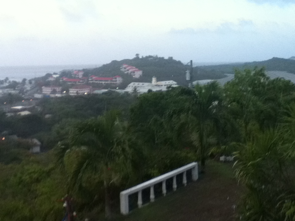
| - City in the Sky |
|
Awesome! Always something going on up there! The weather is great down here,
hot and breezy! Perfect for noon time and it's almost time for lunch!
Sent from my iPod |
| - A New Day In Paradise |
|
Good Morning!
As we keep track of the activity around us, and monitor the waves coming off
the coast of Africa, we can enjoy the gift of another beautiful day!

Isabel
Sent from my iPod |
| - CRUCIAN Weather |
|
|
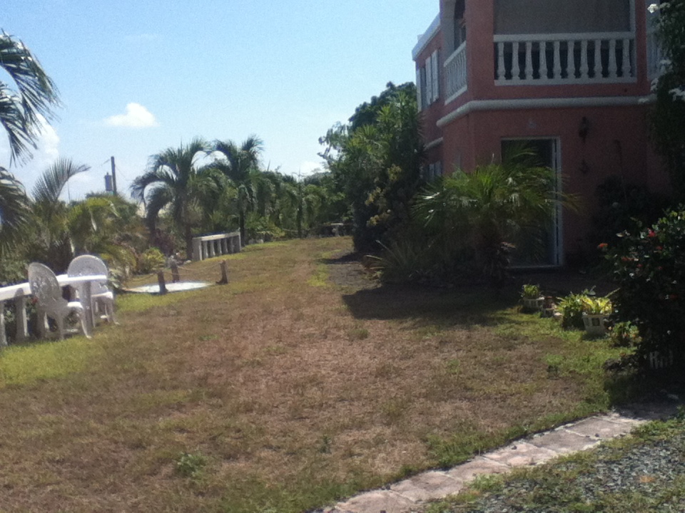
Good Afternoon on this beautiful day-August 15th! This morning when I posted the picture of part of our garden I wrote a few words; I noticed that some Crucian crept in there. "It rain..." Word endings are usually not significant in the Crucian dialect. It's spoken or written without one even noticing. In the speaking there's the particular intonation and in writing it looks like bad grammar. In any case, the weather has been making an impact with its heavy showers of short duration, but certainly more than we've been having in the recent past. It is overcast right now and there could be a shower coming by us this afternoon; perfect! Another huge wave still over Africa is being watched by the experts. It has a low barometric pressure of 1004 and has a good possibility of becoming a name storm. It remains to be seen. So far the dust has done a fine job of inhibiting the tropical waves, some of them very big ones, but how long is this going to continue.? Be well, be prepared, and may God bless us all. Isabel Isabel after |
| - With A Little Bit of Rain... |
|
There is more color! Last night it rain with "gusto", and this morning too, and
there's more on the way! Thanksgiving is due. Greetings from our home.

Isabel
Sent from my iPod |
| - VERY Quiet !! |
|
|
That's VERY good on this Good Night! A quiet Hurricane Season is always a blessing. BUT, even the tropical waves are staying away from us, that's bad! Those are the ones that usually guarantee the rain we need so badly. So, we are running out of water again, soon. If we don't get it from Heaven, we'll have to buy another truck full. So, therefore, I'd better storm Heaven with petitions. I see many waves along the ITCZ (Intertropical Convergence Zone). That's very low. Is there a chance that perhaps those waves could come up higher? I shall ask. In the meanwhile, I'm glad we don't have to worry so much about grass trimming, etc. and we still get to see enough greenery to keep us happy, the flowering trees and plants are thriving on the dry weather it seems. So, we just have to be patient and know that eventually the rain will come as it always does. So, on this point, I shall wish myself "sweet dreams" and you, a wonderful day on Tuesday when you probably will be reading this post. Come on down. The mainland is being battered by severe weather continuously. You need a break! Visit us and enjoy a real vacation. gotostcroix.com is a website you can use for all the information you need. Ask me if you will, as some folks do. Be well, be happy and may God bless us all. Isabel |
| - Good Sunday Afternoon! |
|
|
The day has been sunny and very windy, but the clouds are thickening as the once TD #7 which now has a 10% chance of regenerating into a cyclone, is passing close to our South. We may yet have some rain out of it. We would be happy if it comes. The days have been hot and dry. I'm noticing that the "Beast" that left the coast of Africa a few days ago and I thought was going to become "fish food" seems to be heading more in a Westerly direction. That being the case, it is heading straight for the mainland. It's original track according to the reliable predictions was for it to pass to the North of the Leeward Islands. Let's hope the wind shear tears it apart or that it gets blown out to sea. Have a great day and may God bless us all. Isabel |
| - Dry and Very Breezy! |
|
|
Good night, All! When we look at what's happening on the U.S. mainland with all the severe weather, tornadoes, flooding, hurricane type storms, we can appreciate better our quiet conditions. We have a refreshing breeze now courtesy of the dissipated TD #7. I was hoping it would come higher so that we could also benefit from some rain. Instead, Trinidad and Tobago, which rarely is affected by these systems, suffered massive flooding. See the photos the correspondent from from T & T attached with today's post. A friend of mine was about to leave for Trinidad to visit family when she became ill and had to postpone her trip. Perfect timing for her. She was surprised when I told her that TD#7 was getting close to Trinidad. Another huge wave is moving off the coast of Africa. I'm sure we'll be hearing about it soon. It looked like a bloody mess. I counted seven waves on the African continent heading out to the Atlantic. It could be a very busy time ahead if all of those become name storms. Be well, be happy. Congratulations to all the athletes who made their countries proud by winning medals and for those who tried. Just the training alone is worthy of a medal. God bless them and us all. Isabel |
| - Checking on the "Beast" |
|
|
Good night, All! Sleep tight! Rather, relax! If the computer models are right, the Beast is going to become Fish Food. The coordinates already show how high it's going! (Unless it decides travel straight across opposing the c.models!) Depression #7--possibly Gordon by then will pass us 179+ miles to our south. Too far for rain? We shall see! The season is just getting hot, so always be on guard. God bless us. Isabel |
| - Potential Disturbance #4 Out of Africa! |
|
|
Good Evening, everyone! This is the first time in the years that I'm tracking and updating on conditions that I've ever seen a disturbance begin to show signs of developing even before it left the African coast. It has been watched for some time now by the NHC and all the reliable models seem to indicate that it will develop and track near the Northern Leeward Islands if not through them. TD Seven could become the next name storm very soon. That one should have minimal impact on us as with ERNESTO. If we do get anything out of it, that would be early Sunday afternoon. We're planning to be out at a Food Festival, weather permitting. In the meanwhile, we're hoping for some steady rain. Be safe out there, those of you who will be impacted by TD #7 (Gordon ?). God bless you and all of us along the way. Isabel |
| - Correction! |
|
In the previous post I mentioned that the wave in the middle of the Atlantic had diminished, but it has rather increased from 50% potential to 70%. The remnants of FLORENCE has 0% potential for developing as it stands now. The one in the middle of the Atlantic will be coming up in our "neck of the woods" if it does not change its current track. That was pointed out on the Weather Channel today. Good night!  Blessings, Isabel |
| - It's Raining! |
|
|
Good Night, All! What a wonderful sound! Rain on the roof! Not very common these days. This one is due to the wave that is passing through. Tomorrow night we are to get some from the remnants of FLORENCE, which have now revived to a 70%, We'll see..Next week we should be getting the one mentioned on the Weather Channel that's half way from Africa. However, that one is struggling and has dropped down in activity. We have to be prepared!!!. God bless us all. Isabel |
| - Singing In the Rain. |
|
|
I wish I was singing in the rain! But there's no rain to be had! Good Afternoon, folks! What a gloomy day! Pleasant, but gloomy! Cloudy, hazy, dry weather! I keep hearing about the rain in the forecast, but I also noticed in the animated satellite image that there's some strong wind shear west to east. Any rain that could be coming this way is soon done away with in due time. That could also happen to the "Beast" as Dave called that giant storm about to exit the continent of Africa. For some reason the GFS model as well as others seem to think that this is a survivor and can develop with all the chaos it brings. It is expected to pass by the Northern Caribbean on the way to the mainland. We can still hope for a possible invasion by the SAL or another destination way out to sea. If not, we should have trouble with a capital "T" in another week or so, is that right? Did I really read that somewhere? Or was I having a nightmare! Gosh! It sounds like the mother of storms! Are we prepared for such a BIG one? I'll pass on whatever information I get. We must keep tabs on this one! Be well, try to be as happy as you can, and may God bless us all! Isabel |
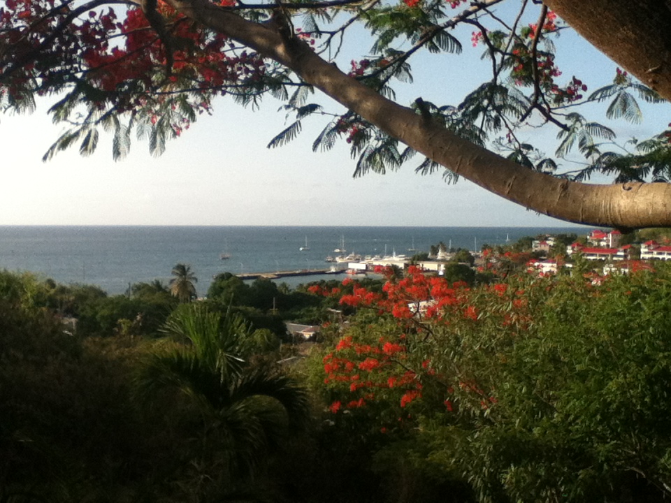
| - 2nd try! |
|
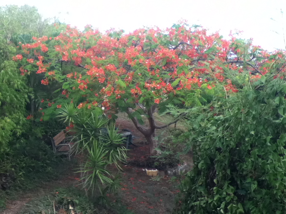
Beauty amidst the drought. The Flamboyant, or Flaming Tree.
Sent from my iPod |
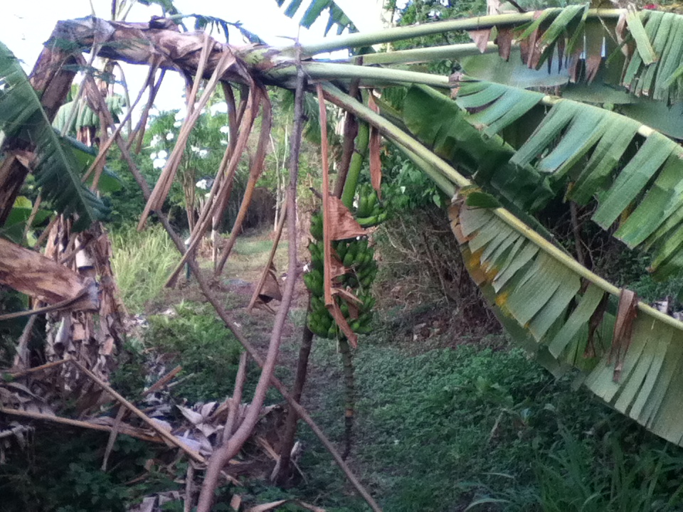
| - The Drought Continues |
|
Affecting our mini banana plantation. . .
Sent from my iPod |
| - Beauty Amidst Drought |
|
The Flamboyant or Flaming tree.
Sent from my iPod |
| - Whatever happened to FLORENCE? |
|
|
Good Night! Our fairly dry weather continues. We just had a sprinkle; no real rain for some time. There's a tropical wave which according to NOAA Radio is to pass through or by us on Tuesday night. Another one just off the Cape Verde Islands is being investigated. It's a Low Pressure System labeled 92L. Both waves could develop along the way, but apparently not soon. The one of most concern, according to Accuweather is the one that has not yet exited the coast of Africa. That one bears watching. So, which of these is going to become the next name storm? We'll see what the near future brings. "Gordon" would be next in line.As for FLORENCE, we lost all hope of getting any rain from her after we saw the distance between us. She was unable to survive the dust and wind shear and is just a remnant.Throughout this time it's good to keep track of what's going on so as not to be caught by surprise. God bless us all. A BIG Congratulations to Jamaicans on their Independence Day and it's Super hero "Lightning" BOLT !! Isabel |
| - T S Florence is struggling.1 |
|
|
Good Night, All! Florence is going through some dry, dusty area and is having trouble. She will be passing to our north in a couple of days. Perhaps some trailing moisture will reach us. We had a beautiful day today; later in the day the clouds began to gather, but nothing came of it. We don't expect rain for a few days and hope to make it to the beach now that the kids are back. Our very own "Michael Phelps" has to get back into the water while it's possible. Another look at the African coast shows a wave exiting; it may not be of significance to the experts, but this is the season when every wave can become a potential foe. Have a good night and may God bless us all. Isabel |
| - Ernesto's Surprise Rain! |
|
|
Sent from my iPod |
| - Does FLORENCE have a tail.? |
|
|
Good Afternoon, all! That's great news to know that we should have no fear of FLORENCE, but in studying the "Waves from Africa" satellite images, I noticed that it has a very long tail that reaches all the way down to South America! Bizarre! Perhaps one of the experts can explain.? I really should not look at those images too long because I start seeing all kinds of strange things. The next wave, for example, it looks enormous! And after that a whole battalion! It just keeps the suspense on a high level as to what these are going to bring. I wonder what the weather is like on the African continent itself.! Other than the stormy weather late last night and a brief heavy shower at the airport today, early afternoon, the day has been very cloudy. There's lots of rain in the forecast but none to be seen in Christiansted all day. Let's keep a watch on ERNESTO. It would be good if it can bring some reasonable rain to areas that need it. Be well, be happy, and may God bless us all. Isabel |
| - TD # 6 -the future Ms. Florence is on her way! |
|
|
Hi, Again! The wind is probably gusting to 40 mph!! It is very strong. No rain, just very strong wind. The rain is right around the corner. I'm sure. I heard on NOAA Radio that we would be getting these strong winds. It's time to hit the sack but I just had to check on that worrisome disturbance one more time. I was surprised to discover that the potential disturbance I wrote about earlier is already a Depression #6. !! That's much sooner than the NHC predicted. They thought by Sunday morning it could already be a Depression. Unfortunately, it is tracking this way, towards us. It is located on 13.8N 27.8 W; it is not expected to go to the north of us, however, it should weaken considerable before it reaches the islands. Let's hope and pray! Have a good night and may God bless us all. Isabel The wind is howling around our house on the hill. Spooky! |
| - Rain ... Finally! |
|
The rain started late this afternoon ... Hallelujah! After the last rain event
that never happened, we're so happy to finally be getting some much needed
rain. One cisterns are getting close to the empty level, I'm relieved we may
not need to order a truckload of water.

With the rain we also had thunder, which I don't mind, but one of our three
dogs is terrified of thunder. It's always so sad to try to help her relax,
nothing worked to stop her from shaking and shivering and panting and pacing
until ....... drumroll please ... THUNDERSHIRT! I was skeptical, but willing to
give it a try. The success rate is 80%, and fortunately Maully was in the 80%.
The difference is amazing, she lays down and is actually relaxed, I was very
pleasantly surprised. I've attached a photo of Maully rockin, her Thundershirt.
The rain has stopped for now, perhaps we'll have more while we're sleeping. Good night to all. ~Jill~ Sent from my iPad |
| - ERNESTO.? |
|
|
What a surprise! ERNESTO ? What you doing all the way up here..? Thanks for the rain! Good Evening, folks! I've been trying to send out some photos, no luck, hopefully it will still work later. I haven't seen moving rain in a long while and dark, low hanging clouds. Wow! I checked to see what's going on and at 5 p.m. ERNESTO which is still on latitude 13 was on longitude 64.1. We're on 64.4 ! The storm seems to have edged up a bit. Concern is mounting for the travelers who arrive early afternoon tomorrow. I hope the worse will be over by then although NOAA Radio is talking about a high percentage of rain overnight and tomorrow for the northern islands. An eyewall was beginning to form, according to Dr. Masters, and it could be that ERNESTO is approaching hurricane status as it slows down in the Caribbean. It has been speeding along. The potential disturbance #1 in the Eastern Atlantic, way out there, is traveling WNW at 10-15 mph so it could be that it will pass us to the north, but it may not. I don't know what latitude it's on. It's a matter of time before we get all the details. Soon all eyes will be on that one which is expected to approach our area by the following weekend. All we can do is watch, wait, and pray. I will check in later if there's anything noteworthy. It has quieted down for the moment. I hope to get those photos out. Take care and God bless us all. Isabel |
| - Tropical Disturbance 90L - our Florence? |
|
|
Good afternoon, Those of us north of Ernesto can forget about him except for any pain he might have caused and will be causing in the near future. We will have our own problems with the next name storm if that huge wave develops. And it is developing very rapidly. The NHC gave it a 30% chance of developing into a Tropical Depression by Sunday morning. That's not good for us. It is tracking slightly higher than the previous one did. ERNESTO started with a 10% in the same area and was very disorganized from the beginning so much so that it took a while to consider it a Depression. This one is already at 50% chance of developing as of 2:00 p.m. or perhaps earlier. I just logged on. At this rate it could already be a TD by tomorrow or maybe even skip that step and go on to being a TS!! It has happened several times before. The bottom line is that we have to do some very, very serious preparation now. This one looks like twice the size of ERNESTO. Let's keep watch together, and may God bless us all. Isabel |
| - T S ERNESTO |
|
|
Greetings! Let's hope he swiftly moves on without causing any major havoc.( Has anyone noticed that the wave behind ERNESTO is larger and more ominous looking.?? Hm-m-m). Our day was hot and dry again and once more the water truck made its way up to our hill. According to the driver, we won't be getting rain from Ernesto, nor the wave behind it. Not very encouraging. I'll take them one tropical wave at a time and hope we get some rain some time in the near future. My thoughts are with the folks in St. Lucia and those who will be most impacted by TS ERNESTO. (Power outage!) We can expect many tropical waves and several more storms before the season is over. The important thing is to be prepared. There was an earthquake felt in the BVI today. I did not feel it here, perhaps others did. We do have to be mindful of the fact that we are in a seismic zone and that is the whole year, not just six months as with the hurricane season. Let's keep an eye on the antics of TS ERNESTO and hope for a fairly quiet season. God bless those affected and us all! Have a good night! Isabel |
| - AUGUST- Lion or Lamb ?? |
|
|
Good Night, All! We had a sunny, breezy day today. No rain, and probably won't get any from T D #5 as it is will be passing to the south of us. Nevertheless, the track has changed from W to WNW. In that case, it could pass at least a hundred miles, if not closer, to our south as HORTENSE (1996) did and we got torrential rain then. The northern line of the cone of uncertainty comes close. I think we could have a better chance at some rain. What could be the answer to the above question! Lion or Lamb? Let's see, July went by quietly, that would be a Lamb. Now August! This is only the first day and already we are seeing the potential for a hurricane! That would be a lion. Other large waves are emerging from Africa which could have a potential of development. This is now the Cape Verde season when the storms are most formidable. What do we know about Depression #5 as of this afternoon at 5 p.m.? It was battling wind shear making rapid intensification difficult. However, most of the reliable experts are in agreement that it will continue to intensify becoming a Tropical Storm or ever a hurricane before reaching the islands. I noticed this evening, on the satellite imagery, that the circulation was somewhat disrupted. It did not have the healthier appearance as before. So, unless it regains it's former strength, intensification may not happen until well after it passes the islands. Monitor! Monitor! August has all the features of a fierce lion! Be on guard, and may God bless us all. Isabel |
| - Left High and Dry! |
|
 My little cube cistern (left) is sad! No rain! Gusty wind at times, but no rain! Same all over the island I heard. The satellite enhancement is not the reality. I wish the Weather Channel would know this. They kept saying how we were having heavy rain, all the islands, when in reality it was as dry as before the wave. My little cube cistern (left) is sad! No rain! Gusty wind at times, but no rain! Same all over the island I heard. The satellite enhancement is not the reality. I wish the Weather Channel would know this. They kept saying how we were having heavy rain, all the islands, when in reality it was as dry as before the wave. We could be getting the real deal with the next one which could be ERNESTO itself.! Already stormpulse has it at 50% chance of developing into a cyclone. That would mean going from one extreme to the other. Be safe out there! And Crown Weather - is it going out on a limb? Here is what their chief says, "I do think that we will see 99L continue to slowly develop over the coming days and I do think that we will see it become a tropical depression on Wednesday and then strengthen into Tropical Storm ERNESTO as early as Thursday.......I currently expect that this system will track very near the island of Barbados on Saturday morning as a tropical storm and then affect the Southern Leeward Islands and the Windward Islands with strong tropical storm conditions including strong winds with gusts to 50 mph, heavy rainfall and rough seas". I spoke with a friend who works at the airport and she informed me that the airport usually closes down with sustained winds of 50mph. I urge you to track the storm and let your relatives and friends know that the Caribbean Hurricane Network ( www.stormcarib.com) has correspondents on all the islands who update on conditions before, during, and after a storm/hurricane. Watch and pray. God bless us all. Isabel |
| - Not one drop of rain |
|
|
Hello Everyone, I just wanted to express my disappointment on this tropical wave. I can't believe not one drop of rain fell on St. Croix. Yet, St. John received over 2 inches of rain. hhhmmmmm.... |
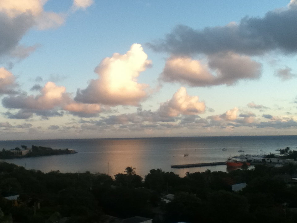
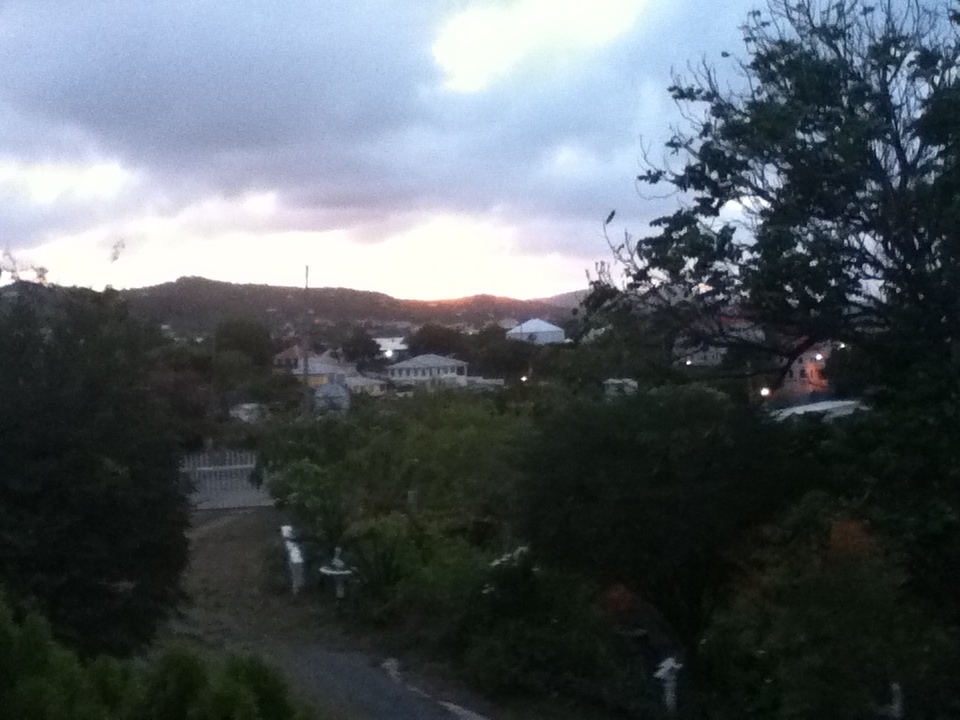
| - Severe Alert! |
|
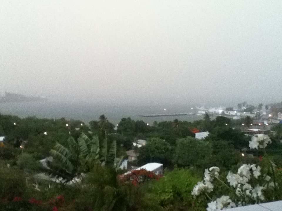
A severe flood watch is in effect for us from 2 a.m. Tues. to Tues. afternoon.
This came in after I wrote the update for stormcarib. Please see My previous
post about 99L which could threaten us this coming weekend. This photo was
taken today with the after glow of the setting sun.
Sent from my iPod |
| - The Minute Rainfall |
|
|
Good Night, All! That was the biggest hype and the littlest rain I ever saw, at least for Christiansted. It came swiftly this morning and that was that. It lasted about a minute. But let me not complain! We could have a major problem on our hands this coming weekend. The National Hurricane Center (NHC) is investigating a tropical wave which they listed as 99L . It is in the middle of the Atlantic, and while it could have some challenges to prevent it from becoming a full blown hurricane right away, they are giving it a 20% chance that it will be a Depression by this Wednesday. Dr. Jeff Masters, chief Meteorologist, who wrote this information in his blog, gives it a 50% chance of it developing into Tropical Storm ERNESTO some time in the next ten days. He said that residents and visitors to the Lesser Antilles Islands should anticipate heavy rains and strong winds by Friday night as the storm reaches the islands on Saturday, 4th. It seems as if, indeed, it will follow the same path as this recent tropical wave. We anticipated heavy rain for two days but the wave moved up to the islands on the outer fringes of the Lesser Antilles. (Read the updates from the correspondents on those islands for the details.) All we can do is pray that 99L runs into so much dry air that it gets disrupted. We must monitor this system. Turn to the Weather Channel for the Tropical Update 10 mins to the hour, and soon more often if this gets really serious. Get all those emergency supplies. I noticed that the stores are stocking up, but even so, those supplies can dwindle. May God bless us and help us through this hurricane season! Isabel |
| - July's Rain treat! |
|
|
Good Afternoon! Finally! Rain! So far, it has been coming in fits and starts with gusty winds; then the sun shines! However, later is when we are going to get the bulk of this wave. I think that "down the road" this can become something, because of the way it's behaving. Only Time will tell. We are happy to have the rain! Now as for the newly formed 99L in the Atlantic. That one looks mean. The NHC says it has a 20% chance already of becoming a cyclone in 2 days and a hurricane in 4 days, before it gets to the islands. It is low, but just as this current wave turned NW towards us, that one can do the same. This definitely bears watching, very carefully. We cannot afford to waste time if we don't have our hurricane preparedness in check, and the "towel brigade"  for heavy rain. This morning I was out when we got a short duration deluge and there was instant flooding in some areas. What will happen when the rain is continuous and heavy? We have our work cut out for us the rest of the season! Be well, be ready, and God bless us all. for heavy rain. This morning I was out when we got a short duration deluge and there was instant flooding in some areas. What will happen when the rain is continuous and heavy? We have our work cut out for us the rest of the season! Be well, be ready, and God bless us all.Isabel |
| - Keeping Watch... |
|
|
Good Night, folks! I just finished watching the highlights of today's Olympic competitions while I kept an eye on the "vigorous" tropical wave which is just beginning to cross the chain at Guadeloupe. It has consolidated in part into a very big blob. I'm not sure if it's traveling west or northwest, but it definitely will be bringing RAIN by the looks of it, even if it passes to our south. NOAA did say that the rain should be arriving after midnight. Judging from the satellite imagery, depending on it's accuracy, we could very well have some rain overnight. We'll see, or rather hear it, if it does. Be well. God bless us all. Isabel |
| - A Dusty Horizon |
|
|
Sent from my iPod |
| - Dust! |
|
|
Good Afternoon, If you cannot see the horizon it's because of the Saharan dust, a small patch of it, that is persistent in our area. The tropical wave to our East has a clear passage and our hope is that it can get through to the islands and bring us the rain we need. The early morning showers we received were thanks to a small trof passing through. We are grateful for every drop. Let's pray that with the heating up of the tropical Atlantic we will not be seeing any threatening name storms. I'll try to write later. I'm in suspense as to whether NOAA's forecast for after midnight will be accurate. God bless us all. Isabel |
| - Concerns for next week.. |
|
|
A Good Sunday to all! I wish you all a wonderful day! We should regard each day as if it will be our last, but that's too morbid for some, so, have a good, full day and laugh a lot. It's called "inner jogging"! The "phantom" wave I mentioned in my last post is now visible to my eyes, very visible, and indeed does look like the "strong tropical wave" that has been mentioned several times. If you check on the satellite imagery, you can see it clearly. All of the red color usually means convection--thunderstorms! Heavy rain is in the forecast. That wave is expected to be around for a few days. The ground should get a good soaking. Unless any remaining dust stifles it, we could get some real rain for a change. Have a great day. I'll check back later. God bless the athletes and us all! Isabel |
| - Hello RAIN! Welcome! |
|
|
(I'm just practicing for when the RAIN really arrives!) Good night, all! Today. Was it partly cloudy, or was it partly sunny? Was the glass half full, or was the glass half empty? Well, the day was partly cloudy depending on what part of the island you were at, and the glass was half empty because I had already finished half of it -- ice tea! Now, according to AccuWeather the Big Rain arrives at the Island chain on Sunday night, moving through the Lesser Antilles during the course of the week. We expect it anywhere between Monday and Wednesday. We can hardly wait. I think I'll go outside and jump around just like when I was a skinny little kid. Nah! On second thought I'd better stay indoors, this "strong tropical wave" can come with gusty winds! Let's hope this is not going to be a big HYPE. To tell you the truth, I cannot define the wave in the satellite imagery, so I'll leave it in the "phantom" category for now. However, I do see the other one that should become the "E" storm. It is located between Africa and the Lesser Antilles. It may be a nobody when it reaches us, but the name is expected to appear around Aug. 2 -3, according to Dr. Jeff Masters, chief Meteorologist. We need to watch and pray! God bless us all. Isabel |
| - Quiet evening in Christiansted. |
|
|
Sent from my iPod |
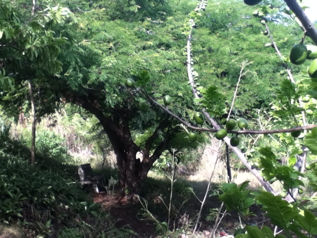
| - Hot and Dry! |
|
|
Good Afternoon, All! We are being baked, or roasted, still hoping for a steady rainfall. Some nights we get a quick passing shower, and on the roof it sounds like "WOW!" I'm probably exaggerating, but that goes to prove how hot and dry it is. I was happy to hear that Lisette is having a abundance of avocados this year. I hope that that does not mean a bad hurricane year! I personally don't believe in all those "old wives tales", well, some maybe, especially the one with the bloated belly of the fish. That means a storm is on the way. I'm sure there are others. Avocados, I say, enjoy them! Now, as for those cannonballs in the Atlantic. They sure look mean! All we're asking for is rain, but that could be rain with a vengeance. Only Time will tell. Time should be a matter of days according to the experts. We'll keep watching. Enjoy the Opening Ceremony of the Olympics 2012 this evening. God bless them and us all! Isabel |
| - Big RAIN coming...? |
|
|
Good night, folks! The entire Caribbean should get drenched with this very strong tropical wave next week. Never mind the little one over the weekend. The talk is all about next week! The feeling is that it could develop into the next name storm somewhere within the Caribbean Sea perhaps. It could also be before. This is that time of year. August is already proving to be more active than July and it hasn't even started. Judging by all the vigorous tropical waves following that one next week we could be having a lot of activity. Stay safe, be ready for anything, and may God bless us all. Isabel |
| - The latest, latest in the forecast... |
|
|
Good afternoon, Before I turn in for a delayed siesta, I want the locals, especially, to know that a tropical wave is expected on Friday night, but another very vigorous wave will be arriving in the Lesser Antilles by Sunday, Monday, or Tuesday depending on what radio station you're listening to. According to NOAA it will arrive on Monday and it will have a lot of thunderstorms and heavy rain with it, lasting through Wednesday. The rain sounds good. On the other hand, I just sent off and email alert to my children in NY, as a "dangerous outbreak of organized severe thunderstorms with strong, damaging winds" is expected there this afternoon, traveling east from Ohio, says Dr. Masters. When people are having a good time they do not pay attention to the weather. So what if it rains!! When you have hurricane force winds blowing with a threat for tornadoes its no longer a la dee dah situation, it's a matter of life or death! There or here, or anywhere in the world, the weather speaks the same language.Be safe, be happy and may God bless us all. Isabel |
| - Looking East to Africa... |
|
|
A Very Gentle Good Night! The word is that a possible storm could form from a tropical wave off Africa on Aug.1. As for the near future, NOAA says that some rain should be here by Sunday from another tropical wave. Let's hope we have some decent rain. Our day today was partly cloudy, warm, humid, and it felt great to go into the Post Office to cool off. I don't think I could live like that all day, I don't want to age too fast.! My 12 yr old grandson says I look like fifty! What a compliment! Give me the humidity and good ceiling fans, standing fans that shut off by themselves, cool evening breezes on the terrace and I'm good for another "fifty". Keep smiling! Watch out for Aug.1 and see if the prediction is correct. God bless us all. Isabel |
| - A Cloudy Day, Breezy.... |
|
|
Good Evening! Not much to report, however, I can tell you that the bananas ( in the previous post ) are still hanging on. Not much relief as far as rain. It was threatening to rain all day, but didn't in our area. We have a wonderful breeze on this hill; quite a blessing on very hot days. We do look forward to more rain and there's a good chance that some of the next tropical waves will bring copious amounts. They are huge! The number of waves is definitely increasing! This is a good time to go through the "to-do" list. There's so much to do without a storm! We have been doing "spring cleaning" for months, trying to discard the items that are taking up much needed space. I remember when Hurricane LENNY (1999) was heading our way, we cleared out the garage to make room for our vehicle. That was history! It's never been used as a garage since then; it became a storage room again!! Enjoy the quiet hurricane season and pray that it stays this way. God bless us all. Isabel |
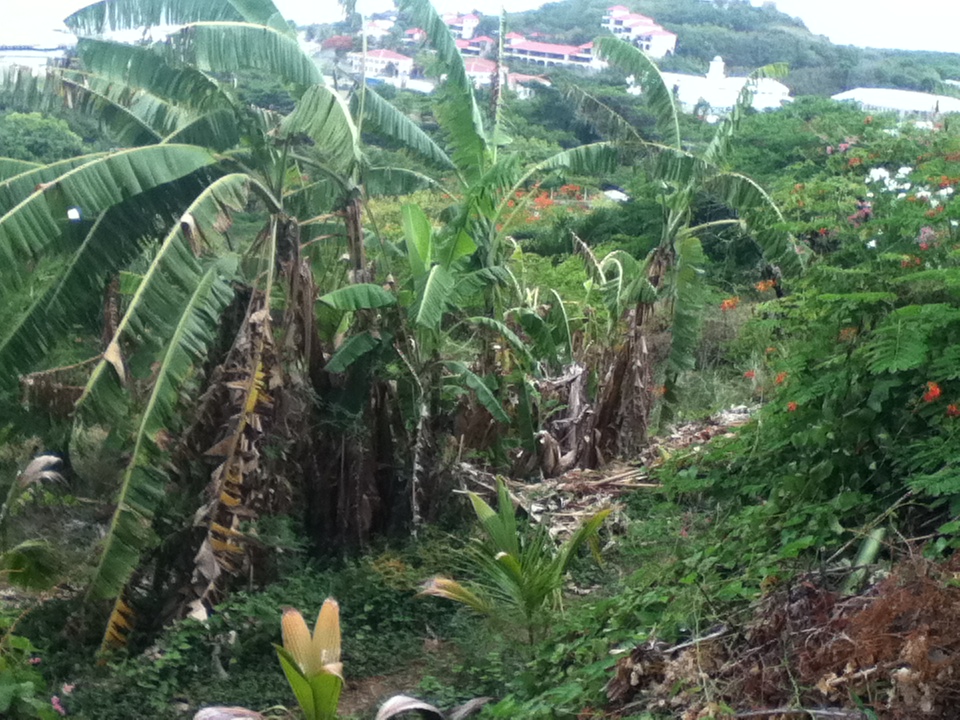
| - A casualty of the drought |
|
One of our banana plants collapsed gasping for a rainy breath of water.
Sent from my iPod |
| - Saharan Dust vs. Tropical Waves |
|
|
Good Evening on this Good Sunday, After the early morning passing showers, we have had very little rain in Christiansted, perhaps others received more. One of our banana plants collapsed gasping for water. It has been so hot and dry for a spell now. But that could change soon... I'm watching with great interest a battle between the Saharan dust and the enormous tropical waves coming from Africa. How much longer is the dust going to be able to protect us? Is it going to be overcome by the abundant moisture accompanying these waves. I think, unfortunately, that we will have to start dealing with some bigger waves that can form before they reach our vicinity, that is the norm at this time of year. The one that passed us as a small wave a few day ago, is now threatening Florida with a 10% potential at the moment of becoming a Depression, dropping "tons" if rain that cause flooding. What's important for us now, as far as hurricane preparedness goes, is to make sure we have the emergency supplies we would need in case of a serious storm. I know for a fact that some people wait until the last minute to get serious. It's time to wake up and smell the coffee! And remain alert, it could save your life and property. Watch and pray. May God bless us all. Isabel |
| - Choked by Saharan Dust |
|
|
Good night or Good morning! Either one counts. The Tropical Wave did not make it through the dust. So far, no sign of any rain. The Low Pressure system in the Atlantic is beginning to feel the weight of the dust as well. Look at the images on stormcarib; the huge orange cloud of Saharan dust is bearing down on that system. We'l take it a day at a time, but one cannot help thinking, if July is this quiet, can we expect the same of August.? Not necessarily. It could be the complete reverse, like June. Remember how many storms appeared in June? Four to be exact. So, as much as we would like to relax and become complacent, no, not a good idea. Just watch, pray, and be prepared. God bless us all. Isabel |
| - More Rain on the Way! |
|
|
Good Evening! The air has changed, becoming cooler, and in fact, I checked earlier and the next Tropical Wave is at the Island chain and nearer. I won't be surprised if it arrives well before the forecast time. Whatever the case, enjoy the rain and be thankful. So many people are suffering from lack of it, especially the farmers in the "Bread Basket" region on the mainland. What about those who are inconvenienced by the over abundance of rain? That's for the Meteorologists to answer, they always have one.We just have to adapt to every situation. A kayak is not a bad thing to consider, if you have the space to keep one. It can come in real handy. Be well and happy, things can get worse in a hurry. May God bless us all. I'll try to check back later. Isabel |
| - Re: Saturday's T W .......... |
|
|
Sorry, I think the page was hit by a tremor ! Hope you can piece it together.! Have fun! Isabel |
| - Saturday's Tropical Wave in the Forecast |
|
|
Good Evening! We received a good amount of rain today and yesterday by comparison with the past very brief showers. At the moment there is a lot of lightning to our North in the vicinity of St. Thomas and the BWI. We needed the rain we received these days and need more. New Orleans is flooded with all the heavy rain they've been having, but we don't want that at all. That would be the end of our road, which at the moment is now at an acceptable level. It used to be called "the worst road on the island", however, that was an exaggeration. We've seen worse. Another T W is expected on Saturday. It should bring us some more rain, we hope. The Giant system I mentioned coming off the coast of Africa has been labeled a Monsoon Trof. I think these systems pack a lot of rain, more so, than the usual T W. The chances of it developing into a storm seems slim due to the amount of Saharan dust in its vicinity. The dust works in our favor. We should still pay attention as things change from moment to moment. Suddenly the dust layer can rise and open the way for storms to develop. There is still that possibility that we can see a storm before the end of July. I'm assuming that we are all prepared for whatever comes, which reminds me, I've received two earthquake alerts this week on my ipod of 4.0 and .1 quakes near PR. Be well, be ready and may God bless us all with a special thought for the folks in Aurora, Colorado. Isabel |
| - Tropical Wave Passing Through |
|
|
Good Day! A good, gloomy day for a change. It has been raining through the night, on and off, and it's very dark at the moment. Most of the heavy convection is to the south of us as the last one. I would like to draw your attention to the Giant system that's about to step off the coast of Africa. It has a huge angry- looking red eye. Al Roker of the Weather Channel mentioned it this morning as something of concern. It's way too early for the mainland to be concerned but it takes about a week to arrive in our vicinity if it does. Let's pay attention to this system and get serious about out hurricane preparedness if we are not. I'll check back later. The current wave should still be with us on Friday, it's effects, and soon after another one will be in the vicinity. We certainly can use the rain. Have a great day and God bless us all.. Isabel |
| - Is that a TW approaching? |
|
|
A Gentle Goodnight! Sh-h-h-h! Last night I did not need my recorded Rain to help me to sleep. I had natural rain instead. It was such a great and wonderful sound, one I had not heard in a while, that I could not sleep, but I did after it passed. This rain event lasted a few minutes longer than the last ones; maybe that's a sign that they will be more frequent from now on. There is a wave on the way according to NOAA and the Satellite Imagery on Stormcarib; a Thurs.-Friday system. A very large system is getting ready to exit the African coast. Let's hope that one breaks up the way the other big ones have. The dry air is surely helping to prevent storms from forming, but for how much longer. Make sure we have everything we need. We run only on electricity, so, today, we bought a small two burner gas stove in case of power outages. We've been having them frequently without storms. A power outage with a storm would last longer. Yes, that was a wise purchase, better than the older version of the one burner camping stove we have from our camping days. It should come in real handy if there's a need, and yes, we did get the Coleman Gas to go with it.! Be well, be happy, and pray. God bless us all. Isabel |
| - Mid July Jitters |
|
|
Sweet Dreams! Exactly one year ago (on the 16th) EMILY was battering the Caribbean as a Cat. 4 hurricane. She went into the Yucatan. So, we can dream sweet for another while. Nothing as yet, this July. While the East Pacific is already seeing its sixth storm, we have no clue when, nor where our "E" storm will appear. As I floated on my back in the sea this evening I saw five Frigate birds flying overhead. These are the birds with the scissor tails. They are also known as the weather birds. Whenever they're around we know that the weather is unstable. They were flying towards the East; towards unstable weather. That's where it will be coming from. The tropical waves from the African coast are plentiful and the Saharan dust is lifting in tonight's satellite images. That would mean that very unstable weather should be approaching as soon as the dust allows..The St. Lucia correspondent was already complaining of too much rain with the wave that just passed us to the south. We barely got anything out of that one, but we probably will be complaining when and if it gets to be too much. For the moment, we'll take what we can get. Today after several threats the day went by without any rain on our side of the island. It's been quite hot. We are fortunate, on our hill, to enjoy a very pleasant refreshing breeze quite frequently. Let's not delay in preparing for the season. May God bless us all. Isabel |
| - Spotty Sunday Showers |
|
|
Good Night, Sweet Dreams! I hope it was a good day for everyone. We received spotty showers throughout the day. So refreshing! Now it's very quiet and judging from what I see beyond, it does not look good for some abundant, cistern-filling-kind-of-rain any time soon. We're grateful for any drop of rain we get, I am! However, we need lots more "free water" from Heaven, so that we do not have to buy it by the truck full. The best things in life are free, water is one of them when it comes from up above. That is, a good measure of rain, not a flooding event that destroys properties and kills people and animals, etc. As long as the dry air, caused by the Saharan dust, stays in place there's little chance for any substantial rain. If you check the SAL (Saharan Air Layer) on stormcarib, you will see how much of it is around the Atlantic Basin. Again, the dust is a blessing in disguise, as it keeps storms from forming. What a dilemma! Be well, keep smiling, and may God bless us all. Isabel |
| - A Phantom Wave...? |
|
|
Good Sunday Morning to All! Normally, I would not be writing at this hour, especially on a Sunday morning, but I must say that the Wave that started affecting us shortly after 5:00 a.m. with a frenzy caught me by surprise even though I did hear on NOAA Radio that it would arrive today; however, since I did not detect it on the Satellite Imagery earlier, I like to refer to these as "phantom waves". We are so happy for the rain that came with it and should be with us throughout the day according to NOAA. (It's sunny at the moment.) It seems to me that since it is passing to the South of us, we may not necessarily get a lot more out of it. I shall post later concerning this wave. What we need to pay attention to these days are the waves which are coming from Africa and are already considerable sized blobs. Would not surprise me if the first one is already labeled a "potential disturbance". I will check soon. Besides Dave McDermott, there is another Meteorologist, Jeff Masters, whose blog I read every day. Dave thinks we could be seeing something substantial from the current waves in the Atlantic, but Jeff thinks that July will end without a name storm. All we can do is take it day by day and pray that if anything comes it will not be a threat to anyone. God Bless us all. Isabel |
| - A Peek into the near future! |
|
|
Good Evening Everyone, This morning I logged on to stormcarib, as I do everyday, and I noticed an interesting letter from Dave McDermott. He is one of my favorite Meteorologists and I'm always interested in what he writes, because when he does, it means something. I suggest you read it for yourselves. It's right at the beginning, can't miss it. He's taking a peek into the near future. He thinks that the quiet we have now is not going to last much longer. He wants rain as much as we do and it could be coming very soon, in a big way perhaps. Sorry, visitors, but we do need rain. How else is the island to remain such a lush green and the fruit of the loom be so bountiful.? As long as it's not a storm it should be alright. I worry about the farmers on the mainland. If the crops fail due to drought, food becomes more expensive, and eventually, no food. Already, people locally are finding food too expensive. So, rain is very important. We need rain, however, he thinks something more that just rain is coming in the near future and urges us not to become complacent. Read Dave's letter/report. Have a great weekend and may God bless us all. Isabel |
| - Monsoon Trof with 1002mb to be watched! |
|
|
Good Evening! I just noticed an angry looking monsoon trof coming off the coast of Africa. It looks as if has a spin and I think it should be watched very carefully. It has a low 1002 mb and right behind it is another one with 1003 mb. Unless the dust takes care of these they have a good chance of crossing the Atlantic.They're higher than the previous waves and trofs. It's a bit too soon for the Cape Verde storms, but the trof is quite close to the Cape Verde Islands unless the satellite imagery is inaccurate, or I am not reading it accurately. I'm sure it's being monitored by the NHC. We'll soon find out if there's anything to all this activity. Keep alert, pray, and may God bless us all. Isabel |
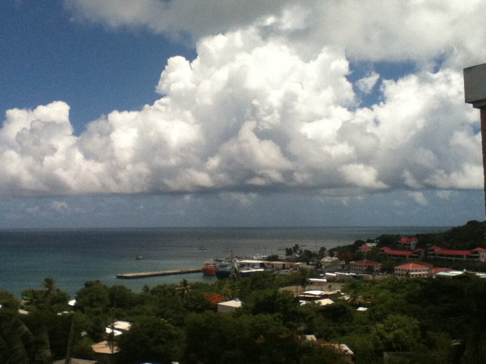
| - Sunny St. Croix |
|
|
Good Afternoon, We had some nice showers, but the sun always manages to peek out. There are some clouds decorating the sky at the moment, and that's about all that will happen for now. We have been promised more showers, hopefully they arrive eventually. Visitors are getting a real treat with the weather, the bright red splashes of Flamboyant trees, the sea is blue, the mangoes that are in season, we can eat them morning, noon and night. The huge, breadfruit trees have been producing a lot of fruit. Each Breadfruit must weigh at least two pounds, if not more. Yesterday, I prepared some CRISPY BREADFRUIT TOAST, for lack of a better name. Our dinner guests thoroughly enjoyed them. If anyone cares for the recipe you can drop me a few lines. Let's face it, we don't have to sit and wait for the storms. They may not come at all! Won't that be great? In the meanwhile, there's lots to do, and one of them could be trying new recipes. Share a favorite if you wish. We are all Hurricane Season Buddies, aren't we? In other words, we're all in the same boat in the Caribbean. Be well, consume a lot of natural coconut oil in your meals (to keep mind and memory alert, they say) and may God bless us all. Isabel |
| - Protected by Dust! |
|
|
Good night and sleep tight! Another day of dust behind us. It looked like London fog for a while there on Tuesday. The Saharan dust is keeping the rain away, but at the same time it's protecting us from anything that can develop. There are many waves coming off the African coast, traveling the southern route for the moment. Soon they will be higher and that's when we're going to have trouble. That's when I would keep that tracking map handy. I noticed that the stores have a good amount of the supplies that we need at this time. Are we stocking up? Or are we waiting for the 11th hour? Maybe supplies would have dwindled by then. Be safe, not sorry. Enjoy the quiet while it lasts, but remain in a state of hurricane preparedness. God bless us all. Isabel |
| - Some welcome showers |
|
|
Good night, All! What a wonderful day! Great weather: bright, breezy, blue sea, blue sky or vice verse. It was so perfectly beautiful that we could share it on Face Time live with friends in Switzerland where our children are visiting right now. It's such a great technology. You can speak with them face to face, and show them the view of the beautiful Caribbean Sea and our garden with so many Flamboyant trees and other flowers blooming. They were overawed. They're still having rather cool weather. Summer has not fully arrived as yet in some parts of Europe. We have been receiving some very refreshing showers, which are most welcome, especially when it gets quite warm. The tropical waves are on the way. The Saharan dust is keeping the air dry and preventing much headway, but as soon as the dust is out of the way, more in the form of squalls should become rather frequent as I've noticed from past seasons. Hopefully, squalls are all we shall see.God bless us as we prepare for any hurricane activity. Isabel |
| - A Train of Waves.. |
|
|
Good Sunday Afternoon, I only have a few minutes at the moment, Just want you to know that you should keep a watch on the train that's moving across the Atlantic. There are so many waves that it looks like one long tropical wave which looks like a train. It goes to show that before long things are going to get quite active. Let's pray that nothing BIG forms in the near future or beyond. God bless us all. Keep smiling! Isabel |
| - Present conditions, or future? |
|
|
Good Evening! At the moment we are fine. What a difference a day makes (24 little hours! )--as the song goes! Yesterday it was gray and stormy with scattered showers passing through and today its clearer, a wonderful breeze, and a good day for a swim and exercise on the beach. According to Accu Weather, a few minutes ago, we could be in for a formidable amount of storms during mid August onwards, however, the El Ninio can take care of lessening the amount of storms during the latter part of the season, if it is strong enough. However again, why project the future into the present moment.?? It is beautiful, and calm, and ChristIansted is treating its visitors to a "Jump up" celebration with lots of music, food, and entertainment. The stores stay open until late to look for those specials sales and souvenirs, and everyone has fun. It's a social event for the local residents who run into friends they have not seen for a while. It's great! And the weather is great for it. God bless us all and keep us safe and happy. Isabel |
| - Where did it go! |
|
|
Hi! Just to let you know that the wave is moving so fast that we hardly got a trace of rain out of it. I was very disappointed. I'm hearing thunder in the distance and I noticed on one of the other sites that it has been circled as a potential disturbance, but the NHC does not think anything will form. At the moment, it is a huge blob just to the south of PR. There does not seem to be any other threat anytime soon. But then, this is only July. Hope it was a great holiday for everyone in the US Territory and beyond. Be well, be happy, and may God us and the United States of America. Isabel I read rhis line today "Remember, all love begins with a smile." My technician is away at the moment and I was wondering if anyone out there can help me adjust the size of this text. Ever since the power outage this morning it changed and I'm sure there's a way to get back the normal size, but how?? Throughout the email I have had to keep changing it to LARGE. I appreciate any help. My daughter is the one who helps me with all these computer challenges.and she's away. Thank you in advance. (Smile!) |
| - Finally, Some Rain! |
|
|
A hearty 4th of July to all who celebrate and to all our friends and neighbors in the Caribbean! The promised rain in the form of a tropical wave arrived before 9:30 a.m. today. The sky darkened to the East and the wind was getting stronger and cooler by the minute. The rain poured, but not long enough considering how long we waited for it. But this is only the beginning of this wave I understand. The real stuff is coming later. Of course, we immediately lost power and I had no internet. As a matter of fact, the power outage lasted longer than the rain itself. This is not a good sign at all. Consider that it was not even a full fledged storm and already we lost electricity. What does that tell us? That's why we have to get all of those emergency supplies together as soon as possible. Candles are not advisable, especially with children around. Though, I must admit that I keep one of those scented candles in a jar in the bathroom lit when I'm showering, just in case we have a blackout!! Imagine finding yourself in dense darkness, all soapy, in your eyes and all, groping for a towel, making sure you don't slip and kill yourself in the process. No way. So, I advise you to either have a candle in a jar, or a battery powered lantern, turned on, before the shower, or any other safe alternative. Don't get caught in the dark, in the shower, during a blackout!! It's quiet now, and I expect company later, so I have to plan a different strategy for dinner, just in case it does get stormy later. Perhaps. it will be a good time to put on the DVD Fireplace and stay cozy inside as we won't be able to dine under the stars. Yet, it could be that I am getting ahead of the weather. It could just turn out to be a brilliant moon in a clear sky. You never know. The thing is, make the best of any situation and thank God that you're alive and well. With that in mind, may God bless us all, and may God bless the United States of America and all peace seeking Nations. Isabel. |
| - The Tropical Wave is passing to our South. |
|
|
iGood Afternoon, The Wave did not dissipate as a TW, only as 97L. I was noticing just a few minutes ago on the Satellite Imagery on Stormcarib that there's a lot of convection to our south.It looks healthy enough to cause some trouble down the road. We have another Tropical Wave entering our neighborhood on Wednesday according to NOAA. I hope we get some rain out of that one. I'm happy for the Mango Melee celebration today that it was not hampered by rain. It was a nice afternoon to join the crowd there, we opted to have our own Mango Melee at home as we watched Spain beat Italy in the European Soccer Tournament 4 - 0. We have one Spaniard in the family who said they are the best in the world. I guess he's right, this is the third time in a row.! A toast to the winner, as for the loser, there's always another tournament coming up before long. God bless you all and remember to get ready if you aren't as yet. This is only the beginning of July, however, the storms increase by 8% and I notice many waves coming off the coast of Africa. Let's pray and enjoy whatever peace we can, while we can. Isabel |
| - Potential Disturbance 97L has dissipated.. |
|
|
Or so they say! A Gentle good night to all! I'm still hoping for some rain. I hope it comes. It will be very refreshing. We nevertheless are grateful for what we have when we compare with other places. That evening swim at Shoys with the sun sinking in all it's glory to the other side of the globe. Wow!........ Okay, okay, I know, the sun does not move, it's the earth that turns!! It's still more poetic the other way.! Looking ahead, we have lots of time to prepare for what's coming! Whatever it is, it's coming. At this time of year we usually can expect some storms in our neighborhood, so don't forget to check your roofs and get all that stuff from the Supermarket and don't forget to smile as you go. It's a stress-releaser. One of our newest residents on St. Croix is Captain Morgan. I managed to see him at the Taste of St. Croix event. There he was, looking like a true Captain Morgan with three beautiful ladies on either side. I hope he's ready for the hurricane season. He has quite a place! I haven't visited as yet, but I heard from others that it's worth the tour, and if you get lucky, he could be there to greet you. When I do go I'll take some info on hurricane preparedness. I think he'll appreciate the concern. Sincere thanks to all who have been writing to me. I appreciate the time you take to read the updates.Be well, be happy, and God bless you. Isabel |
| - A Tropical Wave with Potential |
|
|
This wave has been remaining to the south. It's still more than a thousand miles away so that can change. It's starting to develop more thunderstorms and the wind is blowing at 30mph. It has not been said, but it could become a Depression soon if the wind continues to increase. According to NOAA Radio we should feel its effects beginning on Sunday night and for the next two days. Squally weather is expected. The Flamboyant trees are absolutely gorgeous and the mangoes are in abundance. Squally weather can cause a loss of the beautiful flowers, and the fruit can fall off prematurely, but we need the rain more than anything else at the moment. However, we can capture everything in pictures and movies. On Sunday St. Croix is going to celebrate a day to the Mango at the annual Mango melee. It's amazing how many different varieties of mangoes are on displayed at this event. There's also a mango eating contest. Fun! Local cuisine, pastries and candies are also available. I hope this tropical wave does not speed up and enter our neighborhood with a lot of drama earlier than expected ruin everything. So, enjoy the weekend and have a great Sunday! Praise the Lord.! I'll be keeping an eye on this T.W. and updating each day. My daughter and grand kids flew off to Switzerland today and they would like to keep updated on this and any other disturbance during their vacation. God bless us all Isabel |
| - Watching the Disturbance in the Atlantic |
|
|
A Good Afternoon to all! So far we can breathe a sigh of relief that the disturbance in the Atlantic is not showing signs of organizing into anything threatening, The most recent forecast is for it to pass us on Monday with some squally weather. Other waves are coming off the African coast which do not seem to pose a threat in the near future. We certainly can use any rain that the waves leave us as they pass by or through us. Our weather continues hot and dry. Some drops fell on us while we had dinner with friends on the deck last night and that was it, no need to scramble to put things away. This morning we had some short-lived rain. We're looking forward to the squally weather on Monday. Let's hope it materializes. God bless us all. Isabel; |
| - Low Potential Disturbance # 1 in the Atlantic ! |
|
|
At this wee hour I write a gentle "Hello" to all you folks in your deep slumber. I don't want you to have a rude awakening, but I just got wind that there is a disturbance half way here in the Atlantic. At 7:00 p.m it was at 8.9N 37.1W movement is westward at 10 - 15 mph. We have to keep an eye on anything labeled "Potential Disturbance". You can start tracking it from its beginnings. Let's pray that this one is not looking for DEBBY, which is just now finally crossing Florida leaving a Flooding Disaster of humungous proportions. It was reported this evening(26th) that some 30 inches of RAIN fell in some areas!! God help us! Blessings, Isabel |
| - Rain, Rain, Go Away! |
|
|
More than twenty inches of RAIN have fallen over parts of Florida and into Georgia; the RAIN moves on relentlessly. Rescues are being made of people who were surprised by this slow moving system. Some on Dog Island claimed they did not know a storm was coming! They had to be rescued by helicopter and thankfully lived to tell of a nightmare they hope will never happen again. Had they monitored the storm from the time it entered the Gulf, they would not have been on that island. Our friends in Kings Land, GA knew about it long before the torrential rain arrived. This morning the Weather Channel reported that 12 inches of RAIN had fallen in that area, which is not far from Jacksonville. The heavy rain is expected to continue at least through Thursday. In the meanwhile, we are getting ready to order a water delivery as our cisterns are very low. It has been very hot and dry for quite a spell now. The plants are droopy and sad, but we cannot water them except with whatever remains in the "Water Buffalo", a tank reserved for that purpose. Since our return from our trip, three weeks ago, we've have a few drops of rain, which does not make up for the amount that's being used daily by five people in the family. This is typically the driest part of the year. When the tropical waves begin rolling across from East (Africa) through the Atlantic/Caribbean, we usually get lots of rain; until then we must buy water if we run out. It is said, "Be careful what you wish for.." so, I'll not wish for any of the three feet of water covering many areas in Florida and vicinity. It will be several days, the authorities said, until these areas dry out. Many people don't seem to be aware that their Insurance Companies do not cover floods. There's lots of hurricane season left. Let's hang in there and just be ready for anything. Monitor every system, especially if it's coming in the general direction of our homes or vacation destinations. God bless us all. Isabel |
| - Quiet Haze and Quiet Nights |
|
|
Keeping an eye on Florida, what a mess! At 10:00 p.m. tonight DEBBY was moving at 2mph, dumping huge amounts of rain everywhere. My niece and family managed to do some quick mopping and boarding up before heading for the airport. Fortunately, they were able to leave and are now enjoying very dry, quiet conditions here. Late this afternoon the sea was like glass; hardly a ripple, however, the sea is feeling a tad too warm. Our days have been hot, same concern around the Caribbean. It brought memories of hurricane LUIS, a BIG one which came just after a heat wave as we are having now. The haze continues and the dust covers the cars. The Saharan Air Layer (SAL) looks as if it plans to continue for some time. That's good and bad. I always remember Dave McDermott saying that the dust keeps tropical waves from forming into storms, that's good. the bad part is that the dust is every where, not like a roaring dust storm, but a quiet haze. So, I'm for, haze. Be well, be happy and may God bless us all. Isabel |
| - T.S DEBBY'S Cone of Uncertainty |
|
|
A definite turn to the West is expected with the center of the cone being Corpus Christi, Texas. That, of course , can change again. Everyone living along the coast must monitor this storm. I'm keeping an eye out to the west and one to the east. Before long we will be living in suspense. For the moment we are having very nice weather. The Friends of Denmark Org.held their annual dinner and bonfire at Cheney Bay. It turned out rather well; a starry sky, smiley moon, and everyone wrote on pieces of wood shingles and threw them into the fire to burn up their worries, bad habits, sins, etc.. A Danish tradition. Apparently, there are bonfires all around Denmark as people celebrate on this night as we did keeping up the tradition as best we can with the Danes who live here, the locals, and all who would like to be a part of the celebration. We are very pleased with our weather (though some rain would be good) and pray that it does not get too much out of hand this season. There is one very interesting point made by Dr.Jeff Masters in his blog that caught my attention; he wrote that the fourth storm of the season is usually mid to late August and yet here it's only June, the beginning of the season!! That has to mean something, which we shall find out over Time; Be well, have a restful Sunday and may God bless us all. Isabel |
| - T S DEBBY |
|
|
It's official! The name is DEBBY and she's heading north at 6 mph according to the NHC. Others have her tracking well away from Florida. Whew! What a relief! The speed is slow, not good. It gives storms a chance to take advantage of the warm Gulf waters. :Let's hope the wind above is strong enough to take some of the steam out. Blessings to everyone in the vicinity. Be well and God bless you. Isabel |
| - 80% Chance in the Gulf! |
|
|
This system, currently being identified as 96L is becoming "more defined" and has a very high chance of becoming a tropical cyclone in the next 24-48 hours. Again, one cannot stress too often the importance of monitoring and taking action if it becomes necessary to leave the coastal area that will be affected. Let's keep an eye on it As for us, we wish for some cooling rains. We are bone dry and dusty. Looking towards Africa we can see some tropical waves and hope they get here. These waves are usually short in duration and drop some much needed rain. We now have a large blue water storage tank to help out during times as these days. We water the plants most in need and use it for the turtles' pools. For our own personal hygiene and other household use we depend on the water from the cisterns; if the water gets too low then it is time order a truck full. The best part about dry weather is that we don't have to mow the lawn as often.So, I'm having mixed emotions about our current weather. Have a wonderful weekend and may God bless you. Until the next ! Isabel   |
| - A High Potential Disturbance-70% in the Gulf! |
|
|
Wasn't it at 50% when I posted earlier.? Now, it's 70%! Judging from past disturbances, it won't be long before we have another name storm and this is only JUNE! The problem is that the experts cannot say in which direction it's going to travel. It all depends on the Jet Stream. It can go through Florida, or it can veer off to the west towards Texas. One thing for sure, everyone along the coast, without exception, must keep a focus on what can develop into a monstrous storm. Keep informed by whatever means is at your disposal. Listen to local authorities as to what steps to take. Let's pray that this system just evaporates. If only! God bless the Gulf Coast Residents, and us. Isabel |
| - Potential Disturbance #1 at 50%! |
|
|
To Any and Everyone living in the Gulf of Mexico Region, or have interests there: It's wise to monitor the disturbance that has increased since yesterday. While we are having calm conditions at the moment, that will be changing as we know from past years. Even if we do not get a direct hit, we often suffer as a result of storms passing by. One way or another we get it and that's why we are asked to prepare and remain in a state of hurricane preparedness. Those who are living in the potential path of this disturbance must take notice. It's moving rather slowly at 3 mph, but as we know, the size, intensity, and speed of a storm changes from one moment to another. The worst that we can expect these days is haze, lots of it, due to the Saharan dust which NOAA Radio says should last through the weekend. If we notice the satellite imagery at stormcarib.com, the bright orange color indicates how the dust extends from Africa to the Caribbean. Contact relatives and friends living in the vicinity of that disturbance in the Gulf in the event that they are unaware of what's happening. Maybe they can "pray it away"? God bless us all. Isabel |
| - A growing concern.. |
|
|
The experts at the Weather Channel are becoming increasingly concerned about the disturbance headed towards the GOM. Tampa in particular has always been considered dangerous where water can build with no escape. Tampa Bay is featured in one of the It Could Happen Tomorrow series. Well, we hope it doesn't happen tomorrow. I have some folks in that area, I just hope they are paying attention. As for us, it's been quiet except for a sporadic shower. Last night I scared the dickens out of the pets by putting on the recording of a Thunderstorm. It usually lulls me to sleep, but I guess in their case, especially Skypee, the Siamese cat, his ears were pulled back. Sorry. I guess it's been a while since his last storm. Except for some Saharan dust moving in tomorrow and through the weekend, not much else is in the works. The "foot soldiers", as Dave McDermott likes to call the tropical waves from Africa, are beginning to get in line for the trek across the Atlantic. Be well, be prepared, and may God bless us all. Isabel |
| - Update |
|
|
We counted the raindrops today. Maybe tomorrow there will be a few more if all the "colors" in the Satellite Imagery move closer this way. The Cayman Islands have been pummeled by heavy rain today--read the update. That's a lot of rain. I expect that our road will wash out completely with any heavy rain we get in the future. We'll wait and see. In the meanwhile, the blob off the coast is looking rather impressive and could even have a chance to develop. It apparently has a chance of developing.I think this is going to be a very busy season, after all. What do you think!? Blessings, Isabel |
| - Humidity is good for the complexion |
|
|
It continues hot and humid with heavy air and hanging clouds.Though air-conditioning is refreshing, it is not as good for the skin as humidity. Cold air keeps in impurities, humidity expels them. That's why people in cold countries age so much faster, especially if they continue to expose the skin to air conditioning in the Summer. True, humidity might be bad for some gadgets, but health wise, humidity is a plus, though some relief is absolutely necessary. With that said, I can promise you more of the same if that big blob to our west does not get here soon with some much needed rain. It is not too far away judging from the satellite imagery, and NOAA Radio keeps mentioning the rain and thunderstorms we are to be getting soon. Well, let's hope it does happen soon. While the Bougainvillea are at their very best, other plants are screaming, "we can't take this anymore!" Hope a Happy Father's Day was truly enjoyed by all. Here it was a great day to just sit and soak in the refreshing sea, if you could, we had a stay in celebration. One of Dad/Grandpa's favorite meals was prepared and we all enjoyed it with him around a very happy table, then we Skyped some friends in Switzerland and later watched our team win the European Soccer match between Germany/Denmark. The icing on the cake was prayer which we did for All Dads and before we knew it the night curtain fell and this Father's Day went down in history as the first for some and the last for others. God bless everyone of you and us. Isabel |
| - Three H Weather |
|
 It was HOT, HAZY, and HUMID today! We have been promised a refreshing change this weekend It was HOT, HAZY, and HUMID today! We have been promised a refreshing change this weekendin the form of a tropical wave which is forecast to pass through our area. That would be a welcome relief. As we watch Carlotta bearing down on the Mexican coast, we're thankful that "our" C storm (CHRIS) in nowhere in sight. There are many tropical waves. coming off the coast of Africa which will cross the Atlantic and bring us rain or something ominous.In the meanwhile, we can cool off in the sea. It's going to be a very busy weekend for us, so I'll wish you a good one and may God bless you! Isabel |
| - The quiet before the storms.. |
|
|
We don't want to think about them, the storms, that is, but we should, we must as a matter of fact. We have a tendency to wait until the very last minute to stock up on non-perishable food, bottles of water, and the usual necessities to carry us through emergencies such as hurricanes and earthquakes. Did I say "earthquakes"? We hardly ever think about those, but yes, the same rules apply. Prepare! And if you like ice cubes in your beverage, it's best to learn to do without from now. No power, no refrigeration, no ice cubes. I am reminiscing about a friend of mine who went around like a crazed woman after Hurricane Hugo devastated St. Croix. She needed ice cubes! And if you tend to live in an air-conditioned environment, that would have to come at a cost of fuel for the generator, if fuel will be available. It's an eerie feeling to drive by the once thriving Hovensa Refinery. More than three thousand people suddenly lost their jobs when the announcement to close was announced almost at the beginning of the year. Hovensa was the third largest refinery in the Western World. When Hurricane Hugo flattened St. Croix the low pressure of the storm crushed some of the huge storage containers spewing oil around the vicinity. Every effort was made to assist those whose homes were affected; there were many. Now the refinery is standing still except for the hundred or so workers who were left to man the fort. Is anyone out there interested in buying a refinery? On our recent trip, we visited a former steel mill in Germany which has been turned into a museum, or center of interest for those who would like to know how steel becomes steel. A tour guide takes one up and down and all around and as the daylight dims various colors illuminate parts of the mill, and torches are handed out for the rest of the tour. During the Summer, we are told, sand is brought in by the truckload and the floor becomes a beach scene, a huge section of the mill becomes the largest open air, enclosed, theater. There's also a former storage cylinder which is used as a diving tank in which one can see a wreckage, etc..So, again, if anyone out there can please come and turn our refinery into a fascinating playground and educational center, you will not regret it, especially with the turquoise sea so within easy access. Think of the yachts and varied sailing crafts...It could very well become the main attraction of the Caribbean. Keep smiling, be happy, and do keep us in your prayers this season. God bless us all. Isabel |
| - Weather to be, or not |
|
|
Tuesday was another very warm, lazy, hazy day. Rather take out the "lazy". There's no time for that around here. Not enough hours in the day as it is. Definitely, at least one of those hours must go towards an under ten minute trip to the beach, where it often seems like one's very own sometimes at Shoys. The SST (Sea Surface Temp) has many hot spots, and I don't mean WiFi internet connections, I mean that the sea is warming in preparation for what could be a very hot Caribbean Summer with a long list of names of would be storms to deal with sooner or later. For us, it usually means August onwards, but you never know. I've received emails asking how the weather will be in two weeks. All I can tell them is to be prepared for rain on and off. The closer we get to September, the rainier it gets, that's when the tropical waves parade across the Atlantic from Africa and generally pass below, above, or through us. If anyone reading this would like to visit our island, it is an absolutely perfect time to do so; the flaming Flamboyant trees are gorgeous and the mangoes are ripe for the picking. I remember as a child we used to drive to the Rain Forest where there was one mango tree after another along the road, and we would return home with boxes of them to enjoy until the next expedition. Now, at our place, we have several pineapples and papayas, red plums, and sweet saps to enjoy throughout the next several months. Let's enjoy one day at a time and live life abundantly. God bless us all. Isabel |
| - An Unusual Start for the 2012 Hurricane Season |
|
|
Dear fellow correspondents and folks all around the Caribbean and beyond. Gert pointed out that this year the hurricane season began on June 1st with the letter "C". That meant that two name storms had already had their day. I was away, just returned a few days ago, so I was not able to follow, track these two. I think Gert said that one of them was curving out towards Germany, just where I was headed! Well, we had Caribbean weather in Berlin and in all the other places we visited, until we arrived at the North Sea coast where the Wadden Sea is found, where the ebb and flow takes place at its regular 6hr intervals allowing the hardy to cross on foot, walking on a living seafloor to an island 6 kilometers away, returning by boat if the tide comes in at an hour when walking would not be possible, like, too late in the day. The weather changed and it became very windy, cold (for us), and rainy. Perhaps that was the storm system that was headed to Germany? Large horse drawn carts are available to take passengers to the island of Neuwerk, We have done both in the past, walking, and riding in a cart. This time the most that was done was squishing the muddy seafloor between the toes while braving the cold blast of wind.You can read more about this fascinating place on the internet. (Wadden Sea National Park). It's great to be back. We're having fantastic weather. Some refreshing showers on and off. Mostly off. We could use more, but not the kind they're getting in Florida. We have a hurricane season to contend with and who knows what a season with a "funny" (weird) start is planning? Let's remember the warning I mentioned in one of my earlier updates last month. We have to be prepared for the possibility of a major earthquake in our region as well. To top it off, the Colorado hurricane experts have "upped" the activity of storms for this season. It's looking to be a rather interesting year, then there are those concerned with the 2012 end of Mayan Calendar in December. All I can suggest for the rest of the year is to be prepared for anything, but do enjoy one day at a time! God bless us all! Isabel |
| - Caribbean Heat in Germany! |
|
|
Greetings! We have been enjoying Caribbean weather in Germany! From Berlin to Hamburg it' s been sunny, completely blue skies, lots of happy vacationers and locals everywhere. This kind of weather in not typical for the month of May and they thnk it has to do with Global warming. They like it this way so they're not complaining. How long are these beautiful days going to last...? We need sunny weather during the next week as we go off in a rented car, so, we hope it lasts much longer. I was surprised to see that BERYL is already highlighted with a possible landfall near Jacksonville as a subtropical storm. Be prepared for whatever comes, and be well, be happy, and God bless us all. Isabel |
| - An Early Start to a Below Average Season |
|
|
A Hearty Greeting to all our friends and neighbors in the Caribbean and all over the world who keep up with the updates! I am in New York right now, traveling on to Germany on Monday with my husband and son.
However, I have been checking the updates and the very first alarm was the one from the Nevis correspondent who alerted us that the region is due for a major earthquake. When it happens it will probably be in the 8.0 range. Are we ready for such a BIG one? We have been
having many little tremors on the increase from the beginning of the year. Perhaps that is why our dogs are so restless some nights/days? They feel the small ones, we don't. In the event of a major earthquake we can have a sunami. We have been having tsunami drills in preparation, but it's not that good as yet, for
instance, my daughter, a teacher in the PreK-4 class never heard the sirens nor the loudspeaker on the vehicle going around town. That surely needs improvement. The increase in concern over a possible sunami and now, of a major earthquake, which has been issued for the region seem to be compatible.
We just have to hope and pray that it does not happen. Today, I received a news release from Caribbean 360 News with the headline of a possible Depression or storm in the Western Caribbean next
week. Which way is it moving? That I don't know as yet, but most likely out to the Gulf. One thing I do know is that we have never had so much rain as we have so far in May. I will be keeping my eyes on this and everything else that comes up. I will try to check as often as I have access to a computer and will be
in touch with my daughter in St. Croix for updates on conditions. I wish everyone a safe Hurricane Season and even though a below average season, or less active than previous years, is predicted, just prepare as
if, one is threatening your island. IRENE came right over St. Croix last year as a Depression and developed soon after it passed us in its monstrous threat up the Northeastern coast. So, let's be ready, and prepare for both hurricanes and a possible major earthquake.
God bless us all, Isabel
|
| - The rain has cleared |
|
|
A bright and beautiful morning here on St. Croix. We had some nice rain on Wednesday. The national weather service says conditions will be favorable for tropical moisture until Sunday. You have to take their forecasts with a grain of salt over here on St. Croix since they are predicting the weather for Puerto Rico. Puerto Rico compared to St. Croix has much taller mountains and also rivers and reservoirs which aid the development of tropical moisture. So while the probability for Puerto Rico to get some more rain today through Sunday is high- it is probably much less over here. We love the rain though. It fills our cisterns, makes all the vegetation happy and green, and it cools things off. The trade off is more mosquitoes and more humidity once the sun comes
out. In the Virgin Islands, many people collect water from their roof with gutters and the water is funneled into a cistern. So when it rains and you hear the water filling the cistern, its a very comforting sound knowing you can ease up on the water rationing. In the height of rainy season around September, many people's cisterns get full and start overflowing. There is nothing better than having it rain, watching your cistern overflow, and be able to stand in the shower for as long as you want. It's the simple things in life :) So we are looking at some very favorable marine conditions over the weekend with very light winds. No kiteboarding for me, but some diving is definitely on the agenda. My life revolves around the ocean so I do whatever activity the mood of the ocean dictates: Waves - Surfing Wind - Kiteboarding, Sailing Waves and Wind
- Kitesurfing Flatwater - Diving, Swimming, Stand up Paddleboarding, Kayaking, Fishing The Ironman triathlon is also going on this weekend. This is a big deal for the island as it brings lots of athletes and tourists and gives locals something to watch. I don't usually watch though becuae I would rather be doing some type of activity on or in the ocean. Have a good weekend and, T.G.I.J - Thank JAH its Friday! WeWata |
| Back to top |