|
|
- - - 2016 Hurricane Season - - -
|
- Fall in the Keys
|
- By Scott Papp <scottpapp17 at gmail.com>
- Date: Wed, 26 Oct 2016 16:20:42 -0400
|
It has been a beautiful fall here in the Florida Keys with mostly blue skies and temperatures in the mid 80s. This week has seen a slight cooling trend with an increase in the wind out of the ENE.
We are in a small craft advisory with seas rising to four and five feet and more inside the reef. We rarely experience more than twos and occasional threes, so it has been quiet at the local boat ramp and most of the dive outfits are taking some time off.
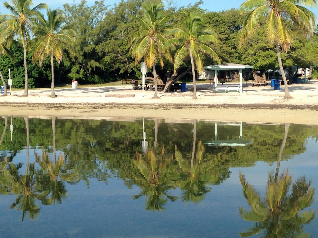
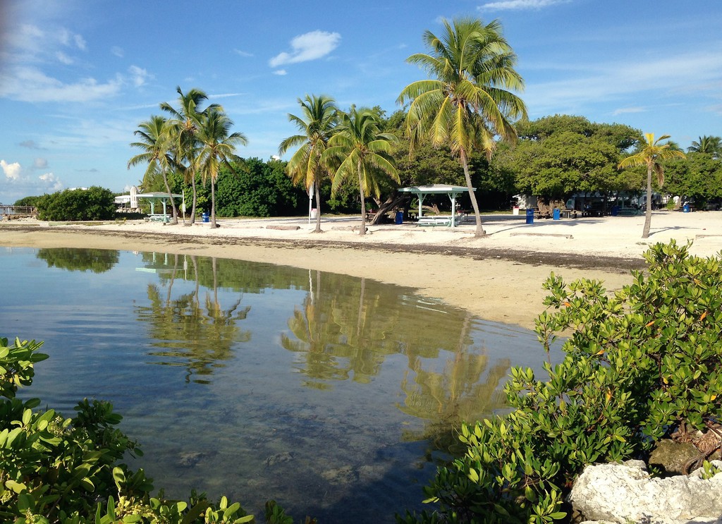 Early morning at the park in Tavernier Early morning at the park in Tavernier
Last week king high tides brought some flooding to low lying areas, including our local park. It was shameful to see the amount of plastic trash left behind as the tides receded. Thanks to all who helped with the clean-up.
These islands eagerly await the end of hurricane season.
Regards all Stay safe
Scott
-- ![]() John Scott Papp John Scott PappLicensed Real Estate Broker Postcard Properties Inc. 90775 Old Highway Tavernier, Florida 33070
|
|
- NOAA Local Statement for the Florida Keys
|
- By Scott Papp <scottpapp17 at gmail.com>
- Date: Wed, 5 Oct 2016 08:12:12 -0400
|
-- ![]() John Scott Papp John Scott PappLicensed Real Estate Broker Postcard Properties Inc. 90775 Old Highway Tavernier, Florida 33070
|
|
- Matthew Redux
|
- By Scott Papp <scottpapp17 at gmail.com>
- Date: Tue, 4 Oct 2016 12:51:41 -0400
|
Our thoughts are with our neighbors in Haiti and the DR, as well as Cuba. Matt is not giving up all his secret plans just yet, but he is indicating a slightly less eastward path than he was showing yesterday. This will mean more likelihood of direct coastal Florida impact, but I predict he will see land somewhat north of the Keys, maybe Pompano up to Jupiter area. Hard to tell now, but the Bahamas can expect a pretty direct hit.
Key Largo and southwest to Long Key should experience tropical storm conditions with waves, gusty wind and some rain Wednesday into Thursday. Right now the weather is beautiful, hot and typical for this time of year.
-- ![]()  John Scott Papp John Scott PappLicensed Real Estate Broker Postcard Properties Inc. 90775 Old Highway Tavernier, Florida 33070
|
|
- Welcome Matt
|
- By Scott Papp <scottpapp17 at gmail.com>
- Date: Sun, 2 Oct 2016 22:31:47 -0400
|
Very concerned about the track of this beast over Haiti. It is hard to imagine that this could become anything but a major disaster for these people. The conditions could not be any worse and their ability to prepare is still hampered by the excruciatingly slow recovery from the earthquake. At this point the best we can hope for is a rapid movement of the storm over land and a weakening over time. Best of luck...
Not much activity here in the Keys. I think our good fortune relative to hurricanes over the last few years has made us a bit too complacent. This could be the week we test our evacuation plans.
-- ![]() John Scott Papp John Scott PappLicensed Real Estate Broker Postcard Properties Inc. 90775 Old Highway Tavernier, Florida 33070
|
|
- Matthew looming
|
- By Scott Papp <scottpapp17 at gmail.com>
- Date: Fri, 30 Sep 2016 23:46:14 -0400
|
Bet wishes and thoughts to all in the path of this storm. I know we in the Florida Keys are still far from direct impact, but we have seen tall, unsettled clouds and lightning, the kind of sky that catches your eye and draws comments. Be safe and prepared, and please watch out for your children and animals.
-- ![]() John Scott Papp John Scott PappLicensed Real Estate Broker Postcard Properties Inc. 90775 Old Highway Tavernier, Florida 33070
|
|
- Hermine leftovers
|
- By Scott Papp <scottpapp17 at gmail.com>
- Date: Tue, 6 Sep 2016 17:03:14 -0400
|
The Florida Keys and south Florida for the most part escaped any serious impact from Hermine, but the same cannot be said for the northern part of the state as she took a turn through the Gulf onto land. Flooding and power outages as expected. On a sad note though, we have had a number of dolphin strandings in the Florida Bay about ten miles north of Islamorada. These were Spinner dolphins normally found in fairly deep waters, not the shallows around Rabbit Key. Local experts believe they may have gotten disoriented from the storm. Due to extreme dehydration and high heart rates most were euthanized almost immediately. The survivors have not fared much better.
-- ![]() John Scott Papp John Scott PappLicensed Real Estate Broker Postcard Properties Inc. 90775 Old Highway Tavernier, Florida 33070
|
|
- Ruffled feathers
|
- By Scott Papp <scottpapp17 at gmail.com>
- Date: Thu, 25 Aug 2016 16:33:07 -0400
|
Greetings from the Florida Keys! It appears that we will be seeing some activity in the next few days and I expect our fowl neighbors will be getting their feathers ruffled a bit. It looks as if the beast approaching us is having some trouble getting organized, a good thing for now, but the NWS is still saying, and I quote: Interests in South Florida and the Florida Keys should monitor the
progress of this disturbance since it is possible that some impacts,
at a minimum heavy rains and gusty winds, will occur beginning this
weekend. Getting organized, my perennial weakness, has a pretty good probability of happening over the next two days. We will be checking batteries, water and libations just in case.
-- ![]() John Scott Papp John Scott PappLicensed Real Estate Broker Postcard Properties Inc. 90775 Old Highway Tavernier, Florida 33070
|
|

