|
|
- - - 2013 Hurricane Season - - -
|
- 9 11
|
- From: John Fuller <johnefuller at gmail.com>
- Date: Wed, 11 Sep 2013 19:50:35 -0400
|
|
At northern end of Barbuda. Wind from north. Brisk.
|
|
- Very windy and wet
|
- From: "scholla candw.ag" <scholla at candw.ag>
- Date: Tue, 3 Sep 2013 11:50:28 -0400
|
At the moment, it is very overcast and blowing at 20-25mph.
Rain is falling but not heavy, though we had very heavy showers last night.
|
|
- Perfect windsurfing conditions
|
- From: eli fuller <eliantigua at gmail.com>
- Date: Sun, 1 Sep 2013 08:52:30 -0400
|
|
You can tell how quiet this hurricane season has been simply by seeing how excited people get when a strong tropical wave is passing through. I had people asking me what I was going to do with my boats yesterday!
Anyway, plenty of talk about rain too, but that seems to be in the southern islands from Dominica go down. Here today is just cloudy and windy. The few peeps still windsurfing will be stoked. My few hard core SUP friends will be doing quick down winders from English Harbour to Johnson's Point and a few brave kiters will be getting some nice air time.
Meanwhile Facebook is alight with talk of rain and the "storm".
It's been 14 years since we've experienced hurricane conditions in Antigua. A tropical wave is a far cry from that. Let's not be too eager!
Enjoy the 20-25 knots of breeze. Yesterday was too hot anyway!
Have a great September.
Eli
www.adventureantigua.com
www.twitter.com/Antigua
+1 268 725 7263
|
|
- TROPICAL WEATHER UPDATE
|
- From: Maleek Joseph <maleek1998 at hotmail.com>
- Date: Sun, 18 Aug 2013 17:50:21 -0400
|
TROPICAL DEPRESSION ERIN DEGENERATE TO A REMNANT LOW AT 5PM THIS EVENING, SEE THE LAST INFORMATION BELOW5:00 PM AST Sun Aug 18
Location: 20.4°N 39.8°W
Moving: W at 8 mph
Min pressure: 1009 mb
Max sustained: 35 mph
OUR ATTENTION NOW TURNS TO A WESTWARD MOVING DISTURBANCE OFF OF THE COAST OF AFRICA (INVEST 94L), intensity models have this developing into a TS but track models are all over the place with regards to track, SOMETHING WE'LL HAVE TO WATCH, THE NHC GIVES IT A 10% CHANCE OF DEVELOPMENT WITHIN THE NEXT 48 HOURS AND A 20% CHANCE OF DEVELOPMENT WITHIN THE NEXT 5 DAYS.
|
|
|
- Earhquake
|
- From: mark harrold <beefbaron57 at gmail.com>
- Date: Sat, 17 Aug 2013 10:27:35 -0500
|
|
Looks like we had an earthquake in the vicinity here at 11.06am. I certainly felt it.
A loud bang on my front door, plus shaking in my arm chair while watching the EPL on Sportsmax 2
|
|
- TROPICAL DEPRESSION ERIN 5:00PM UPDATE
|
- From: Maleek Joseph <maleek1998 at hotmail.com>
- Date: Fri, 16 Aug 2013 17:19:10 -0400
|
|
ERIN STILL A TROPICAL DEPRESSION……SEE LATEST DETAILS BELOW AT 500 PM AST...2100 UTC...THE CENTER OF TROPICAL DEPRESSION
ERIN WAS LOCATED NEAR LATITUDE 17.7 NORTH...LONGITUDE 33.3 WEST.
THE DEPRESSION IS MOVING TOWARD THE WEST-NORTHWEST NEAR 17 MPH...28 KM/H...AND
THIS GENERAL MOTION IS EXPECTED TO CONTINUE WITH A GRADUAL DECREASE IN FORWARD
SPEED DURING THE NEXT DAY OR SO.
MAXIMUM SUSTAINED WINDS REMAIN NEAR 35 MPH...55 KM/H...WITH
HIGHER GUSTS. LITTLE CHANGE IN STRENGTH
IS FORECAST DURING THE NEXT 48 HOURS. THE ESTIMATED MINIMUM CENTRAL PRESSURE IS 1008 MB...29.77
INCHES. ERIN DOES NOT POSE ANY THREAT TO THE LESSER ANTILLES OR ANY
OTHER LANDMASS REPEATING THE 5:00PM DETAILS: LOCATION...17.7N 33.3W MAXIMUM SUSTAINED WINDS...35 MPH...55 KM/H PRESENT MOVEMENT...WNW OR 300 DEGREES AT 17 MPH MINIMUM CENTRAL PRESSURE...1008 MB...29.77 INCHES
|
|
|
- TROPICAL STORM ERIN 11:00AM UPDATE
|
- From: Maleek Joseph <maleek1998 at hotmail.com>
- Date: Thu, 15 Aug 2013 14:34:46 -0400
|
|
TROPICAL STORM ERIN CONTINUES TO BE FAIRLY ORGANIZED, SEE THE LATEST STATS BELOW
11:00AM DETAILS: LOCATION...14.4N 26.5W MAXIMUM SUSTAINED WINDS...40 MPH...65 KM/H PRESENT MOVEMENT...WNW OR 205 DEGREES AT 15 MPH MINIMUM CENTRAL PRESSURE...1006 MB...29.71 INCHES
ON THE LATEST FORECAST TRACK THE SYSTEM SHOULD MISS THE NORTHERN LESSER ANTILLES , IN FACT, IT MAY DISSIPATE INTO A TROPICAL WAVE BEFORE THAT, HOWEVER RESIDENTS ARE ASKED TO JUST BE VIGILANT OF THE TROPICS IN THE UPCOMING DAYS
|
|
|
- TROPICAL STORM ERIN FORMS
|
- From: Maleek Joseph <maleek1998 at hotmail.com>
- Date: Thu, 15 Aug 2013 09:00:26 -0400
|
TROPICAL DEPRESSION FIVE WAS RECENTLY UPGRADED TO TROPICAL STORM ERIN THIS MORNING
TROPICAL STORM ERIN 8:00AM DETAILS: LOCATION...14.5N 25.6W MAXIMUM SUSTAINED WINDS...40 MPH...65 KM/H PRESENT MOVEMENT...WNW OR 290 DEGREES AT 16 MPH MINIMUM CENTRAL PRESSURE...1006 MB...29.71 INCHES
RESIDENTS IN THE LESSER ANTILLES ARE JUST ASKED TO REMAIN VIGILANT.
|
|
|
- Thunder
|
- From: Steve Selim <steve.in.antigua at gmail.com>
- Date: Sat, 10 Aug 2013 16:22:59 -0400
|
|
Dark clouds, rain and thunder this afternoon in St. John's.
Attachment:
Aug 10 2013.jpg
Description: JPEG image
|
|
- Dorian. The dud.
|
- From: MARTHA WATKINS GILKES <marthawatkinsgilkes at gmail.com>
- Date: Sun, 28 Jul 2013 06:07:26 -0400
|
Seems Dorian is. Breaking up. Great for all in front of her.
|
|
- Storm Dorian
|
- From: Martha Watkins Gilkes <gilkesm at me.com>
- Date: Sat, 27 Jul 2013 06:54:18 -0400
|
Beautiful morning in Antigua today.. And looks like we will be lucky with storm Dorian... This is the forecast this morn ..... But still watching her path... Hope the rest of the islands are lucky and she does not get stronger...
Results for Antigua (17.12N, 61.78W):
The approximate Closest Point of Approach (CPA) is located near 19.8N, 61.3W or about 189.3 miles (304.6 km) from your location. The estimated time of when the center of the storm will be at that location is in about 1 day, 10 hours and 52 minutes from now (Sunday, July 28 at 5:36PM AST).
For the. Photo see. http://www.stormcarib.com/closest.cgi
|
|
|
|
- TROPICAL STORM DORIAN
|
- From: Martha Gilkes <marthawatkinsgilkes at gmail.com>
- Date: Fri, 26 Jul 2013 07:12:02 -0400
|
DAVE IS NOW TALKING ABOUT DORIAN - SEE BELOW WITH MORE ON THE HOME PAGE OF STORM CARIB........
WE NEED TO KEEP WATCHING THIS........ although the National Hurricane Center says it has become less organized...but that could change....
The fourth named storm of the 2013 season, TS Dorian, continues to steamroll towards the northern Leeward Islands at a 17 mph clip, roughly 1800 miles away from Antigua. Moving slightly NW of West, Dorian is expected to pass about 190 miles to the north of the northern Leewards probably on Monday as a still tropical storm. It must be noted while almost all of the computer models are in close agreement with this, a wobble to the south will bring far greater impacts to the northern Caribbean as 4-5 day track forecasts have almost 200 miles of margin for error.
| Public Advisory: |
TROPICAL STORM DORIAN ADVISORY NUMBER   9
NWS NATIONAL HURRICANE CENTER MIAMI FL       AL042013
500 AM AST FRI JUL 26 2013

...DORIAN BECOMING LESS ORGANIZED... |
INTERESTS IN THE NORTHERN LEEWARD ISLANDS SHOULD MONITOR THE PROGRESS OF DORIAN.
|
|
|
- TROPICAL STORM DORIAN FORMS
|
- From: "marthawatkinsgilkes at gmail.com" <marthawatkinsgilkes at gmail.com>
- Date: Thu, 25 Jul 2013 08:24:31 -0400
|
 |
TROPICAL STORM DORIAN ADVISORY NUMBER 5
NWS NATIONAL HURRICANE CENTER MIAMI FL AL042013
500 AM AST THU JUL 25 2013
...DORIAN STRENGTHENS SLIGHTLY OVER THE OPEN TROPICAL ATLANTIC...
The system has been named as a Tropical Storm now but still tracks put it NORTH of the leewards... However
We need to watch this one... There are signs that it MAY NOT CONTINUE to strengthen, but anything can happen with the weather as we seasoned storm watchers know....
|
 |
|
|
|
- TROPICAL DEPRESSION #4 JUST FORMED
|
- From: Martha Gilkes <marthawatkinsgilkes at gmail.com>
- Date: Wed, 24 Jul 2013 08:41:36 -0400
|
THE BLOBS I WAS SPEAKING OF IN MY POSTING on Storm Carib BEFORE THIS ONE HAS FORMED.. GOOD NEWS IS IT SEEMS IT WILL TRACK TO THE NORTH OF THE Antigua .. SEE MORE BELOW
|
|
|
- Dickenson Bay
|
- From: Steve Selim <steve.in.antigua at gmail.com>
- Date: Sun, 21 Jul 2013 13:04:24 -0400
|
Sunday at the beach.
Mix of sun and clouds at Dickenson Bay.
Attachment:
photo.JPG
Description: JPEG image
|
|
- things coming off African coast
|
- From: Martha Gilkes <marthawatkinsgilkes at gmail.com>
- Date: Sun, 21 Jul 2013 07:57:41 -0400
|
| DONT LIKE THE LOOK OF ALL OF THESE BIG BLOBS JUST COMING OFF THE AFRICAN COAST NOW.. ( SEE LINK BELOW). FAR TOO EARLY TO TELL WHAT THEY WILL DO BUT HAD COMMUNICATION FROM SOMEONE SUGGEST THE FOLLOWING... WHICH I HOPE IS NOT THE CASE FOR THE LEEWARD ISLANDS. WILL BE WATCHING THIS OF COURSE!
"For the past four days, the GFS and Canadian model runs have shown a vigorous tropical wave moving off the West Africa coast beginning development late Monday July 22, 2013 or early Tuesday July 23, 2013. According to the models,as the wave tracks west, gradual intensification seems likely, with a tropical storm or hurricane effecting the Lesser Antilles Island chain approximately one week (07/28/2013) from today."
THIS IS THE SAT PIC SHOWING THIS:
|
|
|
- Another Beautiful Morning In Antigua
|
- From: Steve Selim <steve.in.antigua at gmail.com>
- Date: Sat, 20 Jul 2013 07:47:28 -0400
|
Attachment:
photo 1.JPG
Description: JPEG image
Attachment:
photo 2.JPG
Description: JPEG image
|
|
- Waterspout makes landfall and trees fall!
|
- From: eli fuller <eliantigua at gmail.com>
- Date: Tue, 9 Jul 2013 19:44:20 -0400
|
|
The windsurfing was epic today and it wasn't until sunset that we got some rain and a short thunderstorm. The highest winds where we were windsurfing felt like about 35 mph, but during that sunset thunderstorm a big waterspout came through the north of Antigua touching Long Island (jumby bay) and then over the former Navy Base into the med school's football pitch and further into the Jabbawock swamp. Quite a few trees were uprooted and destroyed, and there are reports of minor property damage. Such a strange thing. There's videos and photos all over Facebook. Check the Antigua weather page on Facebook for some of them. The video shows the big spout trailing the rear end of a fairly unimpressive cloud. Here's one that has made the instant message rounds.
www.adventureantigua.com
+1 268 725 7263
sent from Samsung S4
Attachment:
IMG-20130709-WA0011.jpg
Description: JPEG image
|
|
- Beautiful and prefect windsurfing conditions
|
- From: eli fuller <eliantigua at gmail.com>
- Date: Tue, 9 Jul 2013 07:31:10 -0400
|
|
Check the video I just took to get an idea of the weather here now as Chantal passes south.
www.adventureantigua.com
+1 268 725 7263
sent from Samsung S4
Attachment:
VID_20130709_072357.mkv
Description: video/webm
|
|
- Storm chantel. 630 am Tuesday
|
- From: Martha Watkins Gilkes <marthawatkinsgilkes at gmail.com>
- Date: Tue, 9 Jul 2013 06:47:48 -0400
|
Looks like we are lucky. Here in Antigua as of early this morn....but we need to monitor today.
Results for Antigua (17.12N, 61.78W): The approximate Closest Point of Approach (CPA) is located near 15.0N, 62.7W or about 157.8 miles (253.9 km) from your location. The estimated time of when the center of the storm will be at that location is in about 13 hours and 20 minutes from now (Tuesday, July 9 at 7:54PM AST).
| Public Advisory: |
TROPICAL STORM CHANTAL ADVISORY NUMBER   6
NWS NATIONAL HURRICANE CENTER MIAMI FL       AL032013
500 AM AST TUE JUL 09 2013

...CHANTAL JUST EAST OF BARBADOS...


SUMMARY OF 500 AM AST...0900 UTC...INFORMATION
----------------------------------------------
LOCATION...13.3N 58.4W
ABOUT 75 MI...120 KM E OF BARBADOS
ABOUT 180 MI...285 KM E OF ST. LUCIA
MAXIMUM SUSTAINED WINDS...50 MPH...85 KM/H
PRESENT MOVEMENT...WNW OR 290 DEGREES AT 26 MPH...43 KM/H
MINIMUM CENTRAL PRESSURE...1010 MB...29.83 INCHES


WATCHES AND WARNINGS
--------------------
CHANGES WITH THIS ADVISORY...

THE GOVERNMENT OF THE DOMINICAN REPUBLIC HAS EXTENDED THE TROPICAL
STORM WATCH FOR THE NORTHERN COAST OF THE DOMINICAN REPUBLIC FROM
WEST OF CABO FRANCES VIEJO TO THE BORDER WITH HAITI.

SUMMARY OF WATCHES AND WARNINGS IN EFFECT...

A TROPICAL STORM WARNING IS IN EFFECT FOR...
* BARBADOS
* DOMINICA
* ST. LUCIA
* MARTINIQUE
* GUADELOUPE
* PUERTO RICO
* SOUTHERN COAST OF THE DOMINICAN REPUBLIC FROM CABO ENGANO TO THE
BORDER WITH HAITI

A TROPICAL STORM WATCH IS IN EFFECT FOR...
* ST. VINCENT
* U.S. VIRGIN ISLANDS
* VIEQUES AND CULEBRA
* NORTHERN COAST OF THE DOMINICAN REPUBLIC
* HAITI

INTERESTS IN THE REMAINDER OF THE NORTHERN LEEWARD ISLANDS...THE
SOUTHEASTERN BAHAMAS AND THE TURKS AND CAICOS SHOULD MONITOR THE
PROGRESS OF CHANTAL.

A TROPICAL STORM WARNING MEANS THAT TROPICAL STORM CONDITIONS ARE
EXPECTED SOMEWHERE WITHIN THE WARNING AREA...GENERALLY WITHIN 36
HOURS.

A TROPICAL STORM WATCH MEANS THAT TROPICAL STORM CONDITIONS ARE
POSSIBLE WITHIN THE WATCH AREA...GENERALLY WITHIN 48 HOURS.

FOR STORM INFORMATION SPECIFIC TO YOUR AREA IN THE UNITED
STATES...INCLUDING POSSIBLE INLAND WATCHES AND WARNINGS...PLEASE
MONITOR PRODUCTS ISSUED BY YOUR LOCAL NATIONAL WEATHER SERVICE
FORECAST OFFICE.  FOR STORM INFORMATION SPECIFIC TO YOUR AREA
OUTSIDE THE UNITED STATES...PLEASE MONITOR PRODUCTS ISSUED BY YOUR
NATIONAL METEOROLOGICAL SERVICE.


DISCUSSION AND 48-HOUR OUTLOOK
------------------------------
AT 500 AM AST...0900 UTC...THE CENTER OF TROPICAL STORM CHANTAL WAS
LOCATED NEAR LATITUDE 13.3 NORTH...LONGITUDE 58.4 WEST. CHANTAL IS
MOVING TOWARD THE WEST-NORTHWEST NEAR 26 MPH...43 KM/H...AND THIS
GENERAL MOTION IS EXPECTED TO CONTINUE FOR THE NEXT COUPLE OF DAYS.
ON THE FORECAST TRACK...THE CENTER OF CHANTAL WILL MOVE THROUGH THE
LESSER ANTILLES LATER THIS MORNING...MOVE INTO THE EASTERN CARIBBEAN
SEA THIS AFTERNOON AND EVENING...AND BE NEAR THE DOMINICAN REPUBLIC
ON WEDNESDAY.

MAXIMUM SUSTAINED WINDS ARE NEAR 50 MPH...85 KM/H...WITH HIGHER
GUSTS.  SOME STRENGTHENING IS FORECAST DURING THE NEXT 48 HOURS.

TROPICAL STORM FORCE WINDS EXTEND OUTWARD UP TO 90 MILES...150 KM
...MAINLY TO THE NORTH OF THE CENTER.

THE ESTIMATED MINIMUM CENTRAL PRESSURE IS 1010 MB...29.83 INCHES.


HAZARDS AFFECTING LAND
----------------------
WIND...TROPICAL STORM CONDITIONS ARE EXPECTED TO REACH PORTIONS OF
THE WINDWARD ISLANDS LATER THIS MORNING...AND REACH PUERTO RICO
TONIGHT OR EARLY WEDNESDAY.  TROPICAL STORM CONDITIONS ARE
EXPECTED TO REACH THE SOUTHEASTERN PORTION OF THE DOMINICAN
REPUBLIC BY WEDNESDAY MORNING.  TROPICAL STORM CONDITIONS ARE
POSSIBLE IN HAITI BY LATE WEDNESDAY.

STORM SURGE...A STORM SURGE WILL RAISE WATER LEVELS BY AS MUCH AS 1
TO 3 FEET ABOVE NORMAL TIDE LEVELS IN THE LEEWARD ISLANDS...
WINDWARD ISLANDS...AND PUERTO RICO.  A STORM SURGE WILL ALSO RAISE
WATER LEVELS BY AS MUCH AS 2 TO 4 FEET ABOVE NORMAL TIDE LEVELS
ALONG THE SOUTHERN COAST OF THE DOMINICAN REPUBLIC.  NEAR THE
COAST...THE SURGE WILL BE ACCOMPANIED BY DANGEROUS WAVES.

RAINFALL...CHANTAL IS EXPECTED TO PRODUCE RAIN ACCUMULATIONS OF
2 TO 4 INCHES OVER THE LEEWARD AND WINDWARD ISLANDS...PUERTO RICO
AND THE U.S. VIRGIN ISLANDS...AND PORTIONS OF THE DOMINICAN
REPUBLIC AND HAITI...WITH MAXIMUM AMOUNTS OF 6 INCHES POSSIBLE.


NEXT ADVISORY
-------------
NEXT INTERMEDIATE ADVISORY...800 AM AST.
NEXT COMPLETE ADVISORY...1100 AM AST.

$$
FORECASTER CANGIALOSI/PASCH |
|
|
|
- STORM CHANTEL
|
- From: Martha Gilkes <gilkesm at me.com>
- Date: Mon, 08 Jul 2013 15:31:11 -0400
|
WATCHING THIS ONE... AT 2 P.M. WE LEARNED RECONNAISSANCE AIRCRAFT IS HEADING TOWARD CHANTAL SO THAT WILL GIVE MORE INFO for the upcoming advisories.
IT SEEMS STORM CHANTEL WILL STAY SOUTH OF US... BUT THERE ARE STORM WARNING OUT FOR MANY OF THE SOUTHERN ISLANDS ---AS FOLLOWS: A TROPICAL STORM WARNING IS IN EFFECT FOR...
* BARBADOS
* DOMINICA
* SAINT LUCIA
* MARTINIQUE
* GUADELOUPE
GUADELOUPE IS OUR NEAREST NEIGHBOR..ABOUT 50 MILES TO THE SOUTH.. SO NEED TO WATCH FOR ANY NORTH TURN OF THIS STORM... ALSO THIS IS THE LATEST ON THE STORM CARIB SITE ON HOW CLOSE IT WOULD COME ON THE PRESENT TRACK -- SO WE ARE LOOKING AT TOMORROW NIGHT ( TUESDAY) FOR THE CLOSEST POINT TO ANTIGUA..
Results for Antigua (17.12N, 61.78W):
The eye of the storm is about 723 miles (1163 km) away. If the system keeps moving at its current speed of 25 mph and directly towards you, it will take around 28.9 hours* (Tuesday, July 9 at 6:54PM AST) to reach you. As ELI mentioned in his earlier post.. THIS IS A GOOD "dry run" to get and keep us on our toes as this is early days in this hurricane season.
|
|
|
- Chantal
|
- From: eli fuller <eliantigua at gmail.com>
- Date: Mon, 8 Jul 2013 05:34:22 -0400
|
|
Now a tropical storm, Chantal is expected to pass very quickly through the island chain south of Antigua far enough and fast enough that we shouldn't experience conditions that are too threatening. It isn't expected to reach hurricane strength but you and I think this will be the perfect storm to get people energized, motivated and reminded about hurricane preparedness. If you know fishermen and people who don't normally listen to forecasts please give them the info. We could get gusts of 40mph in squalls and I imagine the south shore will get some extreme windsurfing conditions!! Extra lines and fenders on the boats just in case today because it's due to effect here late tonight and tomorrow.
www.adventureantigua.com
+1 268 725 7263
sent from Samsung S4
|
|
- Wonderful weather
|
- From: eli fuller <eliantigua at gmail.com>
- Date: Sat, 6 Jul 2013 20:24:05 -0400
|
|
So far it's been a beautiful season and I hope that continues. The long term swell forecasts show a little/weak system passing mid week.
www.adventureantigua.com
Instagram: at Antiguan
+1 268 725 7263
sent from Samsung S4
|
|
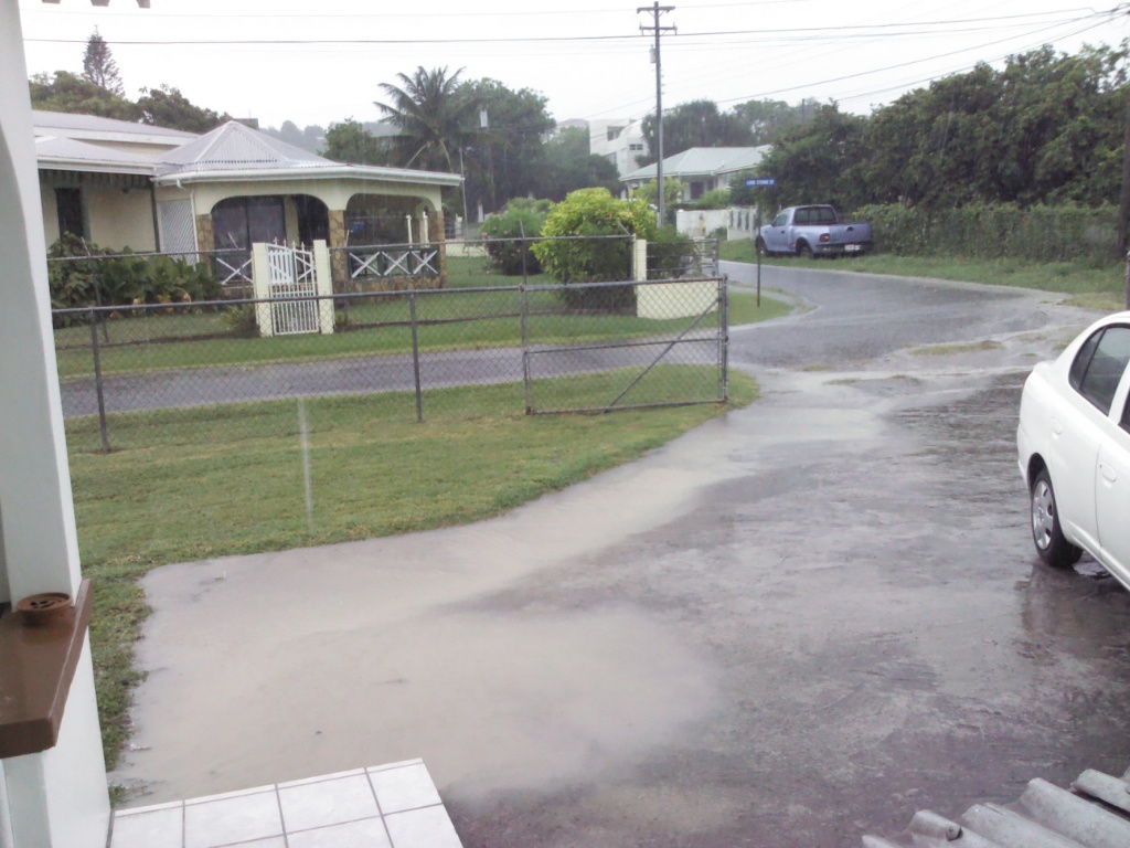
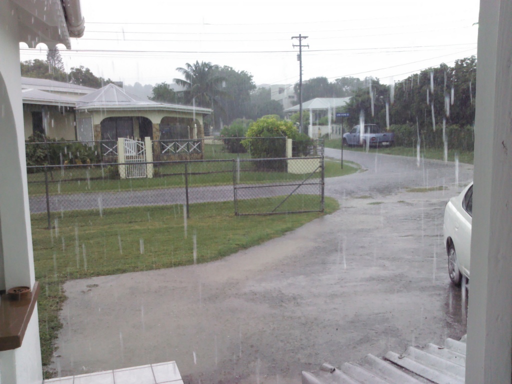
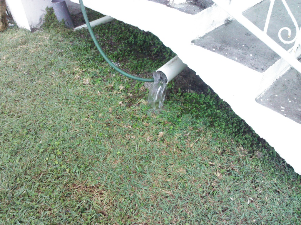
- Heavy Rain
|
- From: mark harrold <beefbaron57 at gmail.com>
- Date: Sun, 30 Jun 2013 10:13:50 -0400
|
|
Bouncing down at the moment in the North of the island.
The view from my kitchen door out into the yard.
The cistern is oveflowing at the moment.
Regards
Mark
Attachment:
IMG_20130630_095553.jpg
Description: JPEG image
Attachment:
IMG_20130630_100649.jpg
Description: JPEG image
Attachment:
IMG_20130630_101218.jpg
Description: JPEG image
|
|
- upcoming hurricane season forecast
|
- From: Martha Gilkes <marthawatkinsgilkes at gmail.com>
- Date: Fri, 7 Jun 2013 07:39:14 -0400
|
|
|
|
- this Hurricane season
|
- From: Martha Gilkes <marthawatkinsgilkes at gmail.com>
- Date: Sun, 2 Jun 2013 18:50:43 -0400
|
| Tomorrow our MET OFFICE will post thier take on the upcoming hurricane season as seen on thier twitter post below.
We will issue a consensus forecast on Mon, Jun 3 instead of today. We await Drs & 's forecast due Mon |
|
|
- Another foto
|
- From: John Fuller <johnefuller at gmail.com>
- Date: Sat, 1 Jun 2013 18:41:06 -0500
|
|
Attachment:
IMAG0179.jpg
Description: JPEG image
|
|
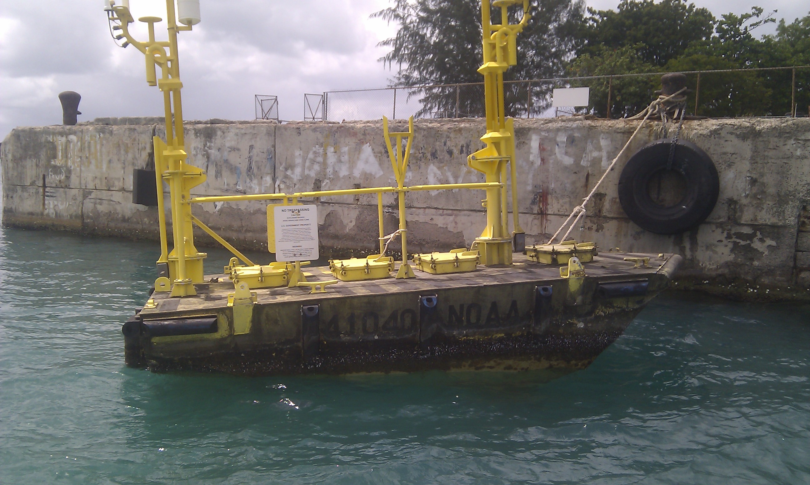
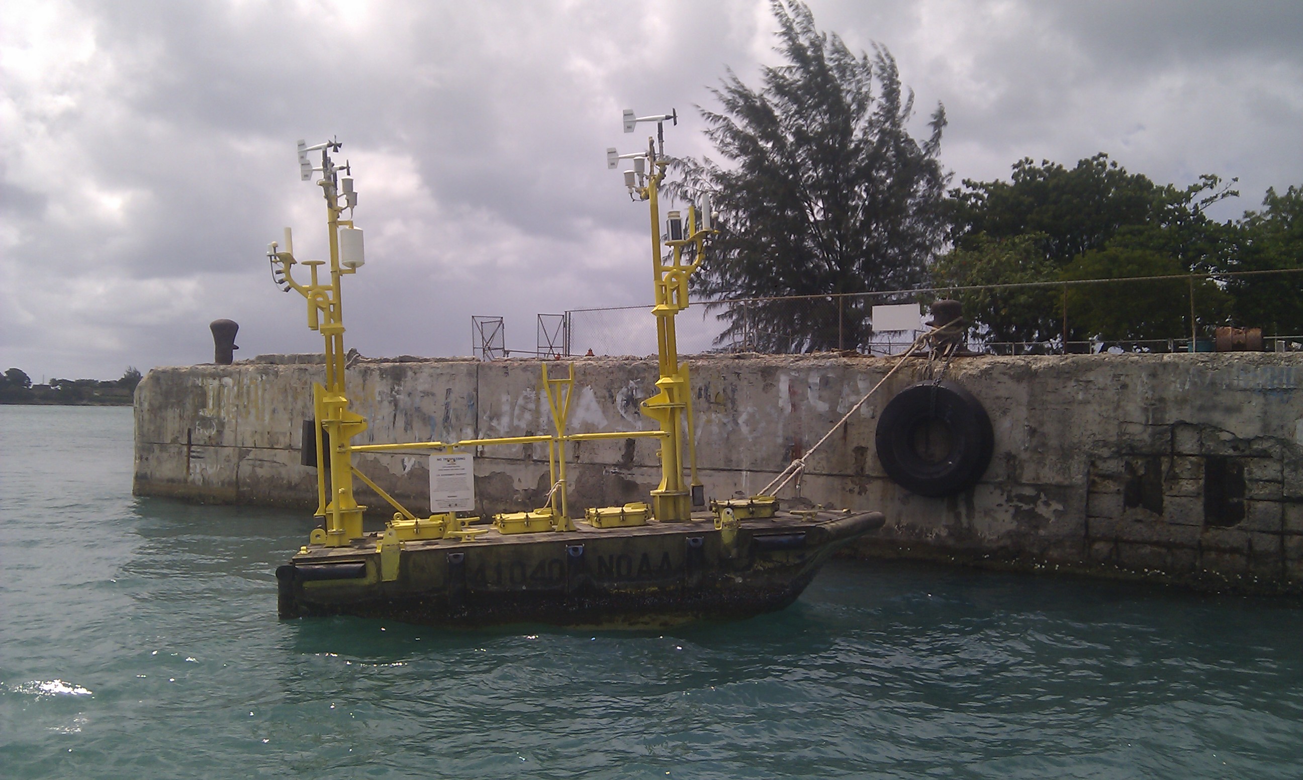
- Fwd: weather station
|
- From: Fullerj <fullerj at candw.ag>
- Date: Sat, 1 Jun 2013 18:27:43 -0400
|
The NOAA weather station 41040 got loose and some guys found it drifting 18 miles south of Antigua and towed it in here. Their website says it was anchored 450 miles northeast of Martinique
Begin forwarded message:
|
|
|
- RAIN LOVELY RAIN
|
- From: MARTHA WATKINS GILKES <marthawatkinsgilkes at gmail.com>
- Date: Sun, 26 May 2013 17:21:36 -0400
|
BEEN RAINING off and on in Antigua this week (BADLY NEEDED) but thank goodness not yesterday as there was a special wedding here with 100 guests coming in from east coast so the beautiful bride could enter the church without an umbrella! GOOD THINK IT WAS NOT TODAY AS THE SKY IS OPENED UP TODAY!! and as we get ready for this hurricane season starting JUNE 1 concerning to read DAVES COMMENTS on the stormcARiB site about the US satellite! LETS HOPE IT GETS SORTED SOON! being ready is the key! For those who follow wonderful STORM CARIB we "locals" are here for you to keep you abreast of the weather on island!! thanks for caring about what is going on with our special little "rock".
|
|
|
- UPCOMING hurricane season
|
- From: Martha Gilkes <marthawatkinsgilkes at gmail.com>
- Date: Mon, 15 Apr 2013 17:13:15 -0400
|
JUST READ this below from GERT on his wonderful STORM CARIB SITE and not pleased with that.... have not heard other reports but guess we just have to be ready for JUNE 1 ( start of hurricane season) to roll round as we know we are in "hurricane alley"
Today the Tropical Storm Risk group at University College London, UK, came out with a forecast for the upcoming season (yes, only 2 months away...). They predict an above average season. Atlantic basin tropical cyclone activity in 2013 is forecast to be about 30% above the long-term (1950-2012) norm but slightly below the recent 2003-2012 10-year norm. They forecast 15 tropical storms, including 8 hurricanes and three major hurricanes (11, 6 and 3 is 'normal') |
|
|
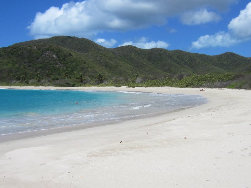
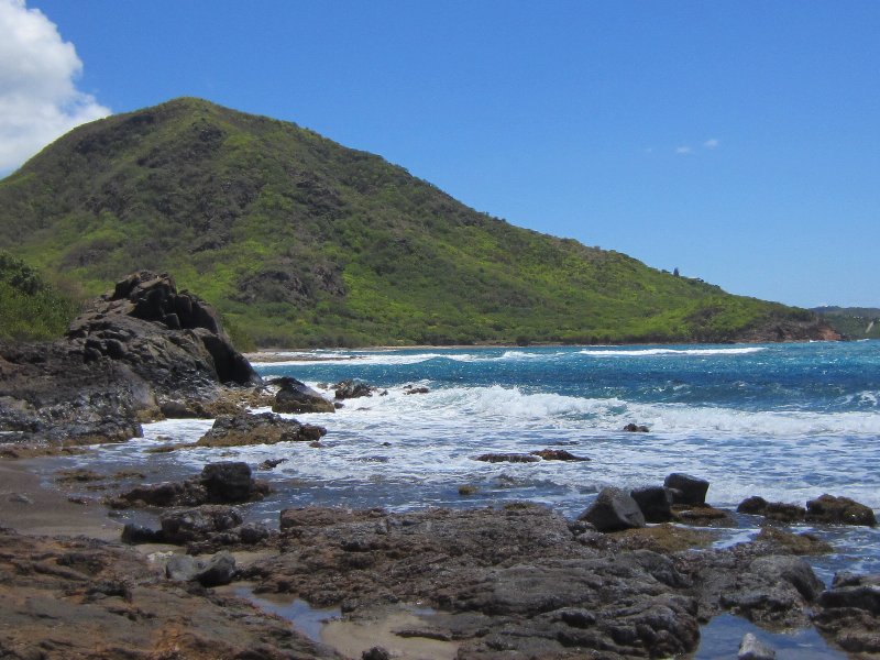
- Beautiful day
|
- From: mark harrold <beefbaron57 at gmail.com>
- Date: Fri, 12 Apr 2013 09:00:53 -0500
|
|
Enjoyed a beautiful day on Thursday at wonderful Rendezvous Bay. Gorgeous weather.
Attachment:
IMG_2713_800x600.jpg
Description: JPEG image
Attachment:
IMG_2703_800x600.jpg
Description: JPEG image
Attachment:
IMG_2729_800x600.jpg
Description: JPEG image
|
|


