- Updates from the Islands -

- - Jamaica - -

| home | tools | pleas for help | QHWRN | guide | climatology | archive

- - - 2011 Hurricane Season - - -

- Met Service Gets $5.2m Grant from ODPEM to Upgrade Radar System
  • By Blayz Brooks <blayzbrooks at yahoo.com>
  • Date: Wed, 19 Oct 2011 21:13:11 -0700 (PDT)
The past two days has been sunny, and great weather. Interesting article.....
 
      
KINGSTON — The Office of Disaster Preparedness and Emergency Management (ODPEM) on (October 18) handed over a cheque for $5.2 million to the Meteorological Service (Met Service) of Jamaica to facilitate upgrading of its radar software.
ODPEM Board Chairman, Danville Walker, speaking at the handing over ceremony at the agency’s headquarters on Haining Road in New Kingston, informed that the grant, which represented an act of support, was taken from the National Disaster Fund.
He said that as a critical partner in the disaster preparedness process, it is important that the Met Service is provided with the proper technology and equipment to effectively carry out its work. “The Met Office can only be as good as the technology that is available to it and we’re committed, even with our own meager resources, to share them with you,” he stated.
Acting Director of the Met Service, Jeffery Spooner, expressed gratitude to ODPEM for the grant, noting that it will “put us in a better position to provide the requisite surveillance and to support the country’s early warning system."
The grant to the Met Service will provide for the replacement of its old system with the upgraded (Enterprise Doppler Graphic Environment) EDGE 5.0 package, which was developed to provide the most comprehensive set of features for weather analysis.
Mr. Spooner explained that the existing Doppler weather surveillance radar, installed in 1999 to replace the old analog radar that was severely damaged by Hurricane Gilbert in 1986, has been encountering periods of downtime in recent months and the EDGE application software crashed sometime ago.
“This had forced the radar observers to perform their task using workstations that were intended solely for maintenance purposes, making it impossible to effectively discharge their duties to the nation,” he remarked.
 
The manufacturers of the radar indicated that the version of the EDGE software being used had become obsolete and recommended the EDGE 5.0 upgraded package to be procured, along with the requisite hardware and three years software maintenance and support.
Mr. Spooner said the new system will allow the Met Service to fully utilise the Doppler radar once again, to among other things, “pinpoint exact features of a weather system, for example the longitude and latitude, the eye of the hurricane, and where it is moving to, in very short time.”
“In other words, it will enable us to effectively monitor and track monster hurricanes, which are increasing with frequency and intensity and have been very ravishing to our infrastructure,” he said.
 
The new software, he noted further, will also help in delineating rainfall catchment areas and to analyse rainfall intensity and the potential for flooding.
He informed that the system will also pinpoint where freak storms are taking place. “These are rapid developments in thunder storm clouds and with (its) three dimensional (3D) features, we’re able to tell how winds are behaving and be able to pinpoint again where these damaging features are developing, and of course, will help us in early warning,” he added.
This upgraded software will also allow for the transfer of the radar image from the radar section to the meteorological website, which will now become available to the entire nation. Information on the website will entail very useful information in real time that will allow citizens to see what is happening, Mr. Spooner said.
 
Director General, ODPEM, Ronald Jackson, said he is looking forward to the installation of the new system, as it provides a number of critical features that will be beneficial to the ODPEM in carrying out its functions.
“It provides us with the early warning information with which we seek to get our business going, both in terms of responding to these adverse climatic events, but also for planning and developmental purposes,” he stated.
Mr. Jackson said that as the “country moves forward in the uncertain future of climate variability and climate change”, the Met Service must be provided with critical resources.
“In fact, I think the Met Office ought to be empowered to become that entity, working in close conjunction with ODPEM and other key stakeholders, for leading the process of research in climatology to inform the development stakeholders,” he stated.
By Athaliah Reynolds, JIS Reporter


- Sunny Sunday morning after rainy Saturday
  • By Blayz Brooks <blayzbrooks at yahoo.com>
  • Date: Sun, 16 Oct 2011 08:19:04 -0700 (PDT)
The sun has returned this Sunday morning after a rainy Saturday in which many areas saw 3-6 inches of rain especially across Eastern Jamaica and several reports of flooding .The flash flood warnings and watches have been discontinued see release from metservice below.
Sunday, October 16, 2011 – 6:00 a.m.
*** FLASH FLOOD WARNING AND FLASH FLOOD WATCH DISCONTINUED ***
The Meteorological Service has discontinued all Flash Flood Watches and Warnings for the island with immediate effect.
Through the course of last night, rainfall activity across Jamaica has significantly decreased and the Low Pressure system which had been affecting weather across the island is now moving toward the northwest and away from Jamaica. Additionally, the Low Pressure system has become better organised during the last 6 hours and now have winds near tropical storm strength. Gradual development of the system is still possible and there is a medium chance (40%) of becoming a tropical cyclone during the next 48 hours as it moves slowly northwestward.
Although weather conditions across Jamaica will gradually improve, the forecast is for light, scattered showers and thunderstorms to affect sections of most parishes today. Isolated heavy rainfall is still possible over some sections of the island.
The Meteorological Service will continue to monitor the progress of this system.

- Rainy days
  • By Blayz Brooks <blayzbrooks at yahoo.com>
  • Date: Sat, 15 Oct 2011 11:18:18 -0700 (PDT)
Its the height of the rainy season and it has been rainy every afternoon between 1-4pm. Today the rain started from this morning and its a cool, overcast day. Below is a news release from the metservice.


 Saturday, October 15, 2011 – 8:20 a.m.
 
  
**FLASH FLOOD WATCH IN EFFECT FOR EASTERN AND CENTRAL PARISHES**
The Meteorological Service has issued a Flash Flood Watch for low-lying and flood-prone areas of Kingston and St. Andrew, St. Thomas, Portland, St. Mary and St. Ann as well as, St Catherine, Clarendon and Manchester until 5:00 p.m. today.
A FLASH FLOOD WATCH means that flash flooding is possible and residents are advised to take precautionary measures, keep informed by listening to further releases from the Meteorological Service and be ready for quick action if flooding is observed or if a Warning is issued.
Satellite images show a large area of disturbed weather associated with a broad area of Low Pressure across the western Caribbean. Through last night into this morning, the Radar has detected light to moderate showers and isolated thunderstorms, across sections of most parishes, especially eastern parishes.
The forecast is for outbreaks of showers and thunderstorms, which could be heavy at times, to continue to affect the island this afternoon through this evening.
Fishers and other marine interests are advised to exercise caution due to strong winds and rough seas in the vicinity of showers and thunderstorms mainly over inshore and offshore areas of the south coast.
The Meteorological Service will continue to monitor the situation.

- A Trough Passes Over Jamaica
  • By Debbie Davidson <clickerqueen06 at yahoo.com>
  • Date: Sat, 15 Oct 2011 09:44:36 -0700 (PDT)
It began raining in the early hours of Saturday morning, and persists.  Sometimes the showers get quite heavy; other times the sky  simply drips.  I haven't ventured out of my home, but I understand that several roads in the Eastern part of the country are now impassable.  Parts of my own garden are underwater!  The dogs have the right idea, however.  They, all seven of them, are curled up fast asleep in various parts of the house.


- very wet pattern for first part of October
  • By Blayz Brooks <blayzbrooks at yahoo.com>
  • Date: Fri, 7 Oct 2011 21:59:32 -0700 (PDT)
The past week has been rainy, with moderate to heavy rainfall and lots of lightning.The mornings are sunny and fair  but between 1-6pm we have  rainfall which gets heavy  at times.It continues almost like a cycle around the same time everyday...sunny morning, then rain starts at 1pm continues through 6pm, cloudy through 10pm...fair until 1pm again ..... The wet weather will stick around through at least Monday, and officals are monitoring for the possibility of flooding. October is Jamaica’s rainiest month, but even by October standards the pattern is setting up for an above average wet October.
*** INCREASE IN RAINFALL THIS WEEKEND TO MARK THE BEGINNING OF SEASONAL “OCTOBER RAINS” ***
A persistent Trough, which has been across the Jamaica area since the start of the month, is expected to enhance showers and thunderstorms across the island starting tomorrow afternoon, with some increase in frequency and intensity as of Sunday.
Expect occasional outbreaks of showers and thunderstorms, which could be heavy at times, to affect most parishes starting Saturday afternoon until Monday.
Sea conditions could deteriorate in the vicinity of showers and thunderstorms, as such, fishers and other marine interests should exercise caution.
There is a possibility that this system could result in some flash flooding, however, the Meteorological Service will continue to monitor the progress of this system.

- 97L Lurks in the Wings
  • By Debbie Davidson <clickerqueen06 at yahoo.com>
  • Date: Sat, 17 Sep 2011 20:27:14 -0700 (PDT)
It's in the Eastern Atlantic with just a 30% chance of developing at the moment.   It may stay south and move through the Caribbean en route to Central America.  At any rate, folks in the Eastern Caribbean should monitor this. 


- partly cloudy skies
  • By Blayz Brooks <blayzbrooks at yahoo.com>
  • Date: Wed, 14 Sep 2011 22:08:11 -0700 (PDT)
It’s been three weeks since my last update and the weather pattern has remained  virtually the same and is forecast to continue for at least the next 5 days. Sunny to Partly cloudy skies and light winds recently on average I would say about twice weekly we have brief light afternoon showers which last around an hour and typical less than 1inch/25mm. The daily highs are 33 deg C /91 deg Fand Lows 26 deg C/ 79 deg F.

- Normal weather conditions return..Sunny and breezy
  • By Blayz Brooks <blayzbrooks at yahoo.com>
  • Date: Tue, 30 Aug 2011 11:25:37 -0700 (PDT)
Normal weather conditions have returned with sunny conditions and a NE 'stly sea breeze with High Pressure Ridge to the north mostly sunny weather forecast for the next 5 days with a chance for scattered afternoon showers especially on Saturday. Highs  daily  33 deg C Lows  26 deg C
 
**FLASH FLOOD WATCH DISCONTINUED**
The Meteorological Service has discontinued the Flash Flood Watch for low-lying and flood-prone areas of eastern and central parishes.
Throughout last night, satellite and radar imagery indicated that the area of disturbed weather which produced heavy showers and thunderstorms have moved towards the west away from Jamaica.
Projections are that weather conditions will return to near normal today.
 

- Unsettled weather brings flooding
  • By Debbie Davidson <clickerqueen06 at yahoo.com>
  • Date: Mon, 29 Aug 2011 18:08:42 -0700 (PDT)
An area of unsettled weather south of Jamaica has brought well-needed showers and cooler temperatures.  Unfortunately there's some flooding in Spanish Town, including St. John's Road, Burke Road, and Barrett Street.  The eastern part of the island is currently under a flash flood warning, as rains are expected through the night.  All's quite at the moment.
 

- Squally weather across Central and Eastern Jamaica
  • By Blayz Brooks <blayzbrooks at yahoo.com>
  • Date: Mon, 29 Aug 2011 15:38:36 -0700 (PDT)
The rain has tapered off in the Montego Bay area, but it is still overcast and cool. The flash flood watch has been extended for Central and Eastern Parishes of the Island and observations indicate rainfall and gusty winds are occurring across much of Eastern Jamaica. A check of weather observation in Kingston shows the squally weather conditions in the Capital today. There was a 44mph/71km/h wind gust at 12:42pm with a total of 61.4mm/2.46inches at 5pm.
 
To check current weather conditions Weatherlink wait for stations to load, type Jamaica is search box, press go twice
 
 
Interesting Jamaica fact: Montego Bay became Jamaica’s Second City in 1982.
 
**FLASH FLOOD WATCH IN EFFECT FOR EASTERN AND CENTRAL PARISHES**
 
 
The Meteorological Service has issued a Flash Flood Watch for low-lying and flood-prone areas of St Catherine, Clarendon and Manchester and has continued the Watch for Kingston and St. Andrew, St. Thomas, Portland, St. Mary and St. Ann until 5:00 a.m. tomorrow.
 
A FLASH FLOOD WATCH means that flash flooding is possible and residents are advised to take precautionary measures, keep informed by listening to further releases from the Meteorological Service and be ready for quick action if flooding is observed or if a Warning is issued.
 
Satellite images show large thunderstorms associated with an Area of Disturbed Weather to the south of Jamaica. Outbreaks of showers and thunderstorms, as well as gusty winds have been affecting sections of most parishes.
 
The forecast is for outbreaks of showers and thunderstorms, which could be heavy at times, to continue to affect the island this evening through tonight.
 
Fishers and other marine interests are advised to exercise caution due to strong winds and rough seas in the vicinity of showers and thunderstorms mainly over inshore and offshore areas of the south coast.
 
 
The Meteorological Service will continue to monitor the situation.
 
Updated 5:38pm edt

- Rainy Monday, Tropical disturbance prompts flood watches
  • By Blayz Brooks <blayzbrooks at yahoo.com>
  • Date: Mon, 29 Aug 2011 13:45:55 -0700 (PDT)
It is a rainy ,bleak overcast day. Theree are some ocassional 25-30mph gusts, no watches or warnings in Western Jamaica but Flash Flood watch for the East.
 Automated Weather Stations across Jamaica
http://www.weatherlink.com/map.php  wait for stations to load, type Jamaica is search box, press go twice
** FLASH FLOOD WATCH IN EFFECT FOR EASTERN PARISHES AND ST. ANN **
  The Meteorological Service has issued a Flash Flood Watch for  low-lying and flood-prone areas Kingston and St. Andrew, St. Thomas, Portland, St. Mary and St. Ann until 5:00 p.m.
A FLASH FLOOD WATCH means that flash flooding is possible and residents are advised to take precautionary measures, keep informed by listening to further releases from the Meteorological Service and be ready for quick action if flooding is observed or if a Warning is issued.
Satellite images show large thunderstorms associated with an Area of Disturbed Weather to the south of Jamaica. Outbreaks of showers and thunderstorms, as well as gusty winds have been affecting sections of eastern parishes and northern parishes.
The forecast is for outbreaks of showers and thunderstorms, which could be heavy at times, to continue to affect the weather for the remainder of the afternoon through tonight.
The Meteorological Service will continue to monitor the situation.


- CDEMA Situation Report #4 August 27th 2011
  • By Blayz Brooks <blayzbrooks at yahoo.com>
  • Date: Mon, 29 Aug 2011 09:48:25 -0700 (PDT)
Message: Hurricane Irene was a initially a Category 2 and then a Category 3 storm which passed over the Bahamas from August 23rd to August 26th 2011. Irene passed over almost the entire chain of islands causing significant damage in some islands. Hurricane Irene also passed over the Turks and Caicos Islands on August 24th 2011 as a Category One hurricane resulting in severe flooding. Event
Based on information from the National Hurricane Centre, The Bahamas experienced Hurricane conditions as Hurricane Irene moved across the archipelago. Hurricane force winds generally extended from 70 to 80 miles from the centre and tropical storm winds outward up to 270 to 290 miles. The storm impacted most of the islands in The Bahamas.


Turks and Caicos Islands:
The Turks and Caicos Islands had minor infrastructure damage and some localized flooding occurred in Grand Turk, including roads being impassable due to flooding of up to three (3) feet in some areas. Power was disrupted on both Grand Turk and Providenciales in the immediate aftermath of Hurricane Irene. Communications were also disrupted with intermittent contacts made via cell and satellite phones.

The All-Clear was given on Wednesday August 25th 2011. At this time, power has been restored to the majority of the island of Grand Turk and Providenciales including Long Bay and Blue Hills. Flood waters subsided in Grand Turk and Providenciales both through pumping and natural run-off. The roads were cleared of fallen cables and stalled vehicles. By Thursday, August 26th, 2011 the Turks and Caicos Islands were in the process of returning to business as usual.

On Saturday, August 27, 2011, the Turks and Caicos Islands formally made an offer to use Providenciales as a Forward Staging Area for relief into the Southeastern Bahamas.

The Commonwealth of the Bahamas:

Impact
Hurricane warnings have been lifted for The Bahamas.

Hurricane Irene impacted several islands in the Southeastern, Central and Northwestern Bahamas. Preliminary indications are that significant impacts occurred on the Southern and Central Islands of Cat Island, Exumas, Crooked islands, Acklins, Rum Cay, North Eleuthera and Harbour Island Eleuthera.

Initial indications are that there was flooding in several communities and several government buildings, clinics, schools, police stations and other infrastructural facilities, experienced serious structural damage across some south-eastern and central islands of the Bahamas archipelago.

Approximately 1383 persons occupied 22 shelters throughout the island chain as a result of the passage of Hurricane Irene; 156 persons were accommodated in New Providence. Several persons are returning home in the least affected areas. No injuries or fatalities have been reported.

The following is a summary of preliminary impacts throughout The Bahamas.

SOUTHEASTERN BAHAMAS
Inagua
There was little damage to homes in Inagua, however shelters were activated for 54 persons some of which are Haitian migrant populations. Government buildings were secured with little or no damage. The airport remains opened.

Mayaguana
No injuries were reported but the road leading to the main town is flooded. Several homes experienced damage, utility poles have been downed and power shut off. Three (3) shelters were activated. The clinic and the police station have experienced some damage. Communications were also affected, but the airport remains open. Several churches also suffered severe damage.

Crooked Islands
The settlements in Crooked Islands have experienced considerable amount of roof damage to homes and other buildings. Some flooding occurred in parts of the island. Two shelters were activated. Communication on Crooked Islands is currently based on battery charged phones and the police communication system. The Clinic also suffered roof damage. No injuries were reported. The Colonel Hill airport is clear.

Acklins Island
The electricity is off as power lines are downed. At Lovely Bay, ninety percent (90%) of the settlement has been severely affected, this includes the roofs and several homes blown away. Eight (8) shelters were activated with one hundred and forty seven (147 people). Schools in Acklins have considerable damage. Communication was also severely affected.
The airport is open.

Long Cay
Long Cay experienced power shutdown and six (6) persons were placed in a shelter.

CENTRAL BAHAMAS
Long Island

Flooding occurred in Clarence Town and several of homes and a church have experienced roof damage. Power was also down around the area of Hamilton’s and Deadman’s Cay. Shelters were activated in these areas. Communication was also affected. Nonetheless, the Deadman’s Cay & Stella Maris airports are open.

Rum Cay

In Rum Cay minor damage occurred to the settlements as fifteen (15) homes were damaged and two (2) were destroyed. Flooding occurred in some areas, with some areas impassable. The Port Nelson bridge was damaged. The island had no power for sometime but generators provided back up supplies. One shelter was activated. Communication via landlines was not feasible, however cellular phones are operational.

San Salvador

Most impacts were due to flooding of homes and some places impassable as a result of flood waters. Minor damages such as lost shingles to roofs occurred. Power failure occurred. Six (6) shelters were activated. Communications have also been negatively impacted.

Ragged Island
At Ragged Island shelters were activated and the airport is open.

Cat Island
Homes and Government Buildings have received severe structural and roof damage. Arthur’s Town and Dumfries are experienced flooding with roads impassable. Power Lines and poles were downed and power out. Two (2) shelters were activated. The Clinic has also suffered some roof damage as well as the Police Station in Arthur’s Town and the St. Andrew’s Church roof. Little or no communication has been reported on Cat Island as all power lines and phone lines are down.

Andros
The Airport has been cleared with no visible damage to terminal building, however there is no power.

Central Andros
Central Andros had little or no damage to settlements or utilities. Power and communications have been restored there.

Eleuthera
In North Eleuthera approximately twenty percent (20%) of homes had lost shingles. There was minimal damage to electrical lines. Communications are down as a result of damage to phone lines, poles and cables.

In Harbour Island – Eleuthera, there was roof damage to settlements in Harbour Island and minimal roof damage to the clinic. There is no electricity and damage to communications. There was extensive damage to the Public Library while minimal damage occurred to the Administrator’s complex & the Police Station. The dock at Valentine resort is also damaged.

In Spanish Wells Eleuthera, minor roof damage occurred and some marine damage to vessels. Residents were without electricity which is gradually being restored. The health facility has structural damage. Phone lines are down. Persons were evacuated from Russell Island to the main land. Water supply has been affected but most persons have access to private wells and rain water reserves. All roads are accessible.

In Central Eleuthera, homes sustained shingle damage and some homes in Cupids Cay were flooded. These is no electricity, some power lines and poles are down. Utility poles are down at the airport. Six (6) shelters were activated. There is no communication from the Airport in Central Eleuthera heading North. The Governor’s Harbour airport is open.

South Eluethera experienced flooding and damage to roofs throughout the community. Power supply was also affected but is partially being restored. Five (5) shelters were activated. The Clinic and police station suffered roof damage. Several schools have suffered extensive damage. Communication is limited. The airport is open.

In Rock Sound - Eleuthera, shelters were activated and communication is limited between settlements. The airport is closed.

Exuma
Flooding, power failure and communication challenges have been experienced in some settlements. Many homes and other buildings including the clinic, the administrator’s building and residence have experienced damage to the roof. Seventeen (17) shelters have been activated on the Main Land.


NORTHWESTERN BAHAMAS
Abaco

In Central Abaco - Marsh Harbour, three (3) shelters were activated. Communication is undertaken via cellular phones only.

In South Abaco - Sandy Point, there is slight flooding and no power. One (1) shelter has been activated. The cellular service is functioning but the land lines are down. The airport is open.

Grand Bahama
Grand Bahama was not severely impacted. In Freeport, some flooding occurred and some homes received structural damage. There is no power as lines and poles are down. Ten (10) shelters were activated. The Airport is flooded.

Preliminary Needs Identified

Water, tarpaulin, food, building materials

Regional Response


1. A shipment of relief supplies from the CDEMA Sub-regional Warehouse in Jamaica, left Kingston today (Saturday, August 27, 2011) for hurricane impacted Acklins and Mayaguana Islands in the Bahamas. The 4,000 lbs of humanitarian supplies comprising, tarpaulin, blankets are for the hardest hit areas. This is a follow-up to the aerial reconnaissance yesterday.

2. CDEMA supported the Government of the Bahamas in undertaking an aerial reconnaissance of Acklins, Crooked Island, Long Island, Rum Caye, Cat island and Eluthera for an initial overview of the extent of damage on Friday August 26, 2011. The reconnaissance team included representatives from the National Emergency Management Agency (NEMA), The Bahamas Meteorology Office, United States Agency for International Development/ Office of Foreign Disaster Assistance (USAID/OFDA) who funded the flight, Jamaica Red Cross, and CDEMA. This provided authorities in The Bahamas with a preliminary assessment of overall impact and damage that would allow for immediate planning, prioritization and emergency relief.

3. CDEMA CU has deployed two representatives to the staging area who are working to facilitate a coordinated deployment and redeployment of relief supplies and technical teams to support the impacted for a CARICOM response if necessary.

4. Regional Technical Teams in key areas of emergency response remain on standby from the Caribbean region. This includes technical teams from the Southern Caribbean and from the Sub-regional focal point for the north-western sub-region (Jamaica).

5. The regional warehouses located in the North-western sub-region (Jamaica), Eastern sub-region (Antigua), Central sub-region (Barbados) and Southern sub-region (Trinidad) remain on standby, and the regional inventory for emergency supplies have been updated.

6. CDEMA continues to collaborate with regional partners within the Regional Response Mechanism (RRM) including its 18 Participating States, Regional Security System Central Liaison Office (RSS/CLO), University of the West Indies (UWI), Caribbean Electricity Services Corporation (CARILEC), who have placed their teams on standby both for rapid needs assessment and for response/recovery efforts as required.

7. CDEMA is also collaborating with international partners who interface with the Regional Response Mechanism such as the Department for International Development (DFID), Pan American Health Organisation (PAHO) and the United States Agency for International Development/Office for Foreign Disaster Assistance (USAID/OFDA), the United Nations Office for Coordination of Humanitarian Affairs (UN OCHA) and the Government of Brazil to complement the efforts of the Caribbean region to support the affected states as necessary.

8. The CDEMA Coordinating Unit continues to monitor the situation, with at least twice daily contact with the impacted states. So far the CDEMA CU has prepared and shared five (5) Information Notes and four (4) Situation Reports on the system since its development.

The RRM remains on standby. The CARICOM Disaster Relief Unit (CDRU) is also on standby and arrangements continue to be advanced for deployment of military engineering teams if needed.

CDEMA will continue to monitor and assess the situation and provide updates as required.

Contact Details: The CDEMA CU 24hr contact number is 1 246 425 0386


- Nema Southern Bahamas Reports
  • By Blayz Brooks <blayzbrooks at yahoo.com>
  • Date: Wed, 24 Aug 2011 23:31:28 -0700 (PDT)
Listening to ZNS-1 (1540AM/104.5FM) which has great updates  from ther various Islands. Happily no loss of lives at this point reported in the Bahamas. In addition to the reports below from the Nema, briefing  there are unconfirmed reports that a school in Cat Island has sustained damage .  George Harris of Coast 106FM in Matthew Town, Inagua  was on zns 1 reported that the only minor damage reported on that island was a power line 'was clipped'. A BEC technician on the island waited until the winds died down in between the outer bands of Hurricane Irene and was able to restore power to the island. He said there is not even any real sign of debris following the storm. SO varying degrees on damage on the different Islands.
Some reports from Nema at 10pm (Wednesday 24, 2011).
Mayagauna - NEMA received reports that the church roof has been damaged. The island has been without power since yesterday. The administrator also reported that approximately 40 houses have received level 2 damages, inclusive of the Community of Betsy Bay, Pirate Wells and Abraham’s Bay. Concerns were also expressed to the Asst. Commissioner of Police John Ferguson in reference to 3 persons detained at Police Station
Crooked Island - The school in Colonel Hill has lost its roof and have also lost two classroom block. St. John’s Baptist Church has also lost its roof. Some of the buildings on the island have also lost roofs. Still experiencing winds around 120mph.
Acklins - In Lovely Bay some 90% of the settlement is reportedly gone. House roofs and several homes blown away. Power lines and trees down in the road, The shelters population has increased. Still experiencing winds in excess of 90-110mph winds.
Long Island - Administrator Mr. Jordan Ritchie reported that the main concern is flooding in Clarence Town. A number of homes and St. Paul’s Anglican Church received roof damages. Is experiencing winds at 70mph.
Exuma - Administrator Ferguson reported that the weather has been deteriorating winds are up to about 50knts, The pond at Victoria Pond is rising.
Eleuthera - Central Eleuthera experiencing gale force winds. BEC having difficulties with emergency generator.
Shelters
Eleuthera - Rock Sound, Church Of God, Green Castle School, Whymms Bight Primary, Deep Creek Middle School, and Bannerman Town Library are all open. Weather is deteriorating, Persons in low-lying areas were asked to move to the various shelters or seek higher ground
New Providence - For the efficient use of shelters, persons planning to go to Epiphany Anglican Church, Prince Charles Drive, Church of God of Prophecy, Augusta and Patton Street, St. John’s Baptist Cathedral, Meeting Street and Worker’s House are being redirected to St. Barnabas Anglican Church, Hillview Seventh Day Adventist Church, Tonique William Darling Highway, the Salvation Army Centre on Meadow Street. Disabled persons are being directed to the New Providence Community Church, Blake Road.
All other shelters (22 in total) are open.
South Abaco - The shelter in Sandy Point is open.
Shelters are now open on the islands of Cat Island, Exuma and cays.

- Dangerous Hurricane Irene headed for Turks Cacios and Bahamas
  • By Blayz Brooks <blayzbrooks at yahoo.com>
  • Date: Tue, 23 Aug 2011 05:52:22 -0700 (PDT)
It’s a sunny fair morning, across Jamaica. We are fortunate to not have to deal directly with Irene. There are approximately   4,000 Jamaicans who live and work in Turks and Cacios and several hundred similarly in the Bahamas. In 2008, there were evacuations ahead of Hurricane Ike not seen any news reports of any evacuations this time around. Best wishes to everyone in the path of this dangerous hurricane and follow the advice of your local emergency management and meteorology service.
Live media from the Bahamas
Zns The Broadcasting Corporation of The Bahamas ( national voice of Bahamas live tv and radio)
weather info on Hurricane Irene

- repost of previous post to correct wrong live stream link
  • By Blayz Brooks <blayzbrooks at yahoo.com>
  • Date: Sun, 21 Aug 2011 15:19:20 -0700 (PDT)

Listening to great Tropical storm Irene coverage from WSTX http://www.mainstreamnetwork.com/listen/player.asp?station=wstx-am&
 
 
Thats St.Croix in the center  of Irene . 998.2 mb and falling


- St.Croix right in the middle
  • By Blayz Brooks <blayzbrooks at yahoo.com>
  • Date: Sun, 21 Aug 2011 15:14:36 -0700 (PDT)
Listening to great Tropical storm Irene coverage from WSTX FM http://www.wstxfm.com/


Thats St.Croix in the center  of Irene . 998.2 mb and falling
 

- Irene may come knocking!!!
  • By O'Neil Clarke <hurricane_spotter at hotmail.com>
  • Date: Sat, 20 Aug 2011 19:11:35 -0500
Good Evening. Current conditions in Spanish Town is just one word (HOT).   Tropical Storm Irene has just formed and may come knocking at our doorsteps by next week. Climatology has it that majority of storms to affect Jamaica with winds were male named while the feminine gender were major rain events.   Looks like the same might happen with Irene...time will tell. I wish that all in its path a safe passage.

Bless.

- HH finds 60mphs winds in 97L
  • By Blayz Brooks <blayzbrooks at yahoo.com>
  • Date: Sat, 20 Aug 2011 14:45:56 -0700 (PDT)
A quick update… the Hurricane Hunters have found 50-60mph winds, pressure of 1006mb and weak W in Invest 97L. Awaiting the official word of an upgrade from the National Hurricane Center. Everyone in the immediate path should prepare. The offical advisory on Tropical Storm Irene will likely be issued anytime now. It is the start of a terrible week.

- Tropical storm Harvey spans tornado in Crooked Tree Village Belize video
  • By Blayz Brooks <blayzbrooks at yahoo.com>
  • Date: Sat, 20 Aug 2011 14:18:34 -0700 (PDT)
Video confirmation http://youtu.be/QZaVWE7Nwh0
I am listening to Love fm  out of Belize online and there are reports of damage resulting from a tornado which moved through the Crooked Tree village area of Belize. Ryan Sealy captured the tornado as moved through the area (see link above). The reports are  it started as a watersport before  moving  inland relocated a house, trees, and power lines. Aside from the tornado tornado Preliminarily no significant damages mainly heavy rain reports and flooding.

- Funny weather and birds shifting
  • By Carolyn Gomes <carolyn.gomes at gmail.com>
  • Date: Sat, 20 Aug 2011 13:44:06 -0500
The dark clouds gather over the hills behind Kingston and thunder rumbles.  Hope Belize not being too badly hit by Harvey. 
Keeping an eye on Invest 97 - it is very impressive. 
Maybe the birds know something we don't cause they seem to be hiding (gone away?) on this opening day of bird shooting season.

- Mainly fair,Jamaica network of automated weather stations
  • By Blayz Brooks <blayzbrooks at yahoo.com>
  • Date: Fri, 19 Aug 2011 19:40:35 -0700 (PDT)
Interesting Jamaica fact: After the 1912 hurricane in Jamaica, a ship named Latonia , ended up in the middle of  Great Georges Ship in Savanna-La-Mar,Westmoreland
Friday was a mainly fair day across the Montego Bay area. The afternoon brought a few passing light afternoon shower but these developed and cleared within an hour. Tropical storm Harvey head for Belize, but the real concern for the Us and Caribbean continues to be a tropical disturbance which will become a big story in the days ahead. Sunday is a crucial day as the system passed 55 w , the potential path and intensity will have more bearing , but for now this early everyone should be on guard.
I came across the Government automated weather observation for a network of 9 weather stations mostly Eastern Jamaica and Negril. Negril Aerodrome had 11mm/0.47in of rain today (Friday) which was the higher of the totals , eastern Jamaica had generally less. You can always access this network of weather stations by:
visit  the link, http://www.weatherlink.com/map.php
Then type Jamaica in the search bar
click go.
click colored circle to view data

- Saying Goodbye with a Prayer and Watching the Wings
  • By Debbie Davidson <clickerqueen06 at yahoo.com>
  • Date: Thu, 18 Aug 2011 17:56:32 -0700 (PDT)
We breathe a sigh of relief as the system has passed us rather quickly, and we send our prayers for our friends in South America, particularly Guatemala and Belize.  In the meantime we watch the other two systems lurking in the wings. 


- Not much impacts from 93L remained well south
  • By Blayz Brooks <blayzbrooks at yahoo.com>
  • Date: Thu, 18 Aug 2011 11:52:54 -0700 (PDT)
A few light showers thus far this afternoon, no rain yesterday and this morning was fair . The heavy rain remained south of Jamaica and the area of disturbed weather is moving away at a good clip. Normal weather conditions returning tomorrow with partly cloudy to mostly fair skies. The Caribbean coast of Honduras, Guatemala and Belize should closely monitor this system as it will try to develop before moving over land. There is a new disturbance (97L) behind this we will have to closely monitor which may be a serious concern next week for Caribbean and Us Southeast.
 
More information on these systems

- Heavy but brief rains came our way
  • By Debbie Davidson <clickerqueen06 at yahoo.com>
  • Date: Wed, 17 Aug 2011 20:50:20 -0700 (PDT)
We had a much cooler day today, and the rains predicted by the Met Office finally arrived, but they were short-lived.  At about 8:00pm the clouds had all departed revealing a night-sky bejeweled with stars.  However, by about 9:30pm clouds blanketed the sky once more. Keeping fingers crossed for more rain tomorrow. We need it.


- Increased rainfall through Friday
  • By Blayz Brooks <blayzbrooks at yahoo.com>
  • Date: Wed, 17 Aug 2011 07:41:38 -0700 (PDT)
Interesting fact: Jamaica is the only place in the world that considers the fruit Ackee edible. Ackee is the national fruit of Jamaica, and ackee and saltfish is the national dish.Ackee was first introduced to Jamaica and later to Haiti, Cuba, Bali, Barbados and others.
Newsrelease from the Metservice Jamaica
AN active Tropical Wave now across Puerto Rico is expected to move across Jamaica on Wednesday night, according to the Meteorological Service.
The wave currently has a low chance of becoming a tropical cyclone during the next 48 hours but slow development of this wave is possible during the next few days.
The Service has forecast scattered showers and thunderstorms, which could be heavy at times, to affect most parishes, as well as inshore and offshore waters beginning tonight and continuing tomorrow.
Fishers and other marine interests are advised to exercise caution mainly over southern waters, as strong winds and rough seas are likely in areas of showers and thunderstorms.
 - - - - - -
For the most part, the heaviest rain will remain south of Jamaica. Honduras , Guatemala and Belize should really monitor this system as development and intensification of this system is possible.
More information on this system

- An active tropical wave to influence local weather Wednesday night through Friday
  • By Blayz Brooks <blayzbrooks at yahoo.com>
  • Date: Tue, 16 Aug 2011 16:39:58 -0700 (PDT)
It has been a wet week. We have been having afternoon showers for the past few days with more to come. A tropical wave is forecast to move across the Island tomorrow (Wednesday night) and continue to influence local weather through Friday so cloudy weather with outbreaks of showers and thunderstorms showers likely.

- Sunny weather Independence Day, fair weather for the next 7 days.
  • By Blayz Brooks <blayzbrooks at yahoo.com>
  • Date: Sat, 6 Aug 2011 10:25:29 -0700 (PDT)
Happy Birthday Jamaica!!!!!!
Interesting Jamaica fact: In February 1962, a new constitution was approved by the Legislation and the Premier Norman Manley called General Elections.
Alexander Bustamente was elected in April and became the first Prime Minister of Jamaica. “On August 6, 1962, Jamaica became an independent nation and a member of the British Commonwealth”.
Jamaica becoming an independent nation now meant that Britain, no longer controlled the affairs of the country. It was now the responsibility of the newly elected Prime Minister and the locally elected Cabinet.
Independence also meant that a constitution, symbols, emblems, an army, Jamaican currency and passports had to be developed for the country.
As an Independent nation, Jamaica assigns Ambassadors overseas who represent the country. They sign treaties on behalf of Jamaica and become members of various international organizations. This is important as it gives Jamaica equal rights on various issues relating to international trade, policies and treaties.
Every year on August 6, (previously first Monday in August), Jamaicans celebrate the removal of our dependence on Britain to control specific functions of the country. At this time we also honour all those persons who were responsible for the transfer of power.
Independence Day messages
 
The weather is sunny and fair across the Island as Jamaicans at home as well as across the world celebrate Independence Day. Today’s high temperature will get up to 33 deg C/91 deg F. Tonight’s low 27 deg C/80 deg F. Winds e-se 10-18kts (11-20mph).The partly cloudy to fair weather and today’s forecast  highs and lows  will persist  for at least the next seven days.

- More on yesterday rain in Kingston
  • By Blayz Brooks <blayzbrooks at yahoo.com>
  • Date: Fri, 5 Aug 2011 12:27:02 -0700 (PDT)
Montego Bay experienced some light to moderate rainfall and thunderstorms within the last hour, but the weather has now tapered off. Yesterday based on media reports, heavy rain and severe lightning storm affected Eastern Jamaica .Traffic stood at a standstill for hours across sections of Capital city, Kingston and there were some reports of urban , street flooding .Some of news media reports below.
The National Works Agency (NWA) is advising motorists to exercise extreme caution in using some intersections in St. Andrew and St. James, as the traffic lights are now being affected by technical difficulties. (radiojamaica)
Stephen Shaw, the Manager of Communication and Customer Services at the NWA, says in St. Andrew heavy rains and lightning on Thursday, August 4, affected five intersections.
Mr. Shaw says the traffic light at the intersection of Constant Spring Road and Dunrobin Avenue was repaired Friday morning, August 5.
However, he says there are still several others in St. Andrew which motorists are being to advised to be aware of:
"The intersection at Molynes Road, Woodglen Avenue, Hagley Park Road, Maxfield Avenue, Constant Spring Road, Shortwood Road and Old Hope Road are all being impacted by what we suspect to the lightning strike," he said.
Mr. Shaw added that preliminary checks have revealed that some of the traffic systems are being affected by low voltage and this has been reported to the Jamaica Public Service Company.
In the meantime, over in St. James, work started Friday morning to reposition signal heads that had been knocked out of place by trucks.
And traffic signals at Embassy Place and St. James in Montego Bay
Still in St. James, traffic signals at Embassy Place and St. James Street in Montego Bay are also out of service due to major defects, while the traffic light at the intersection of Alice Eldermire Drive and AGS Coombs Highway is not functioning after being damaged by an overloaded truck.
 
A motorist narrowly escaped death on Thursday after his car was washed away in the Charlton Ford in St. Andrew. (radiojamaica)
It's reported that the man was attempting to cross the ford which was flooded following torrential rain.
The car stalled and was eventually washed away by the flood waters.
Director-General of  the Office of  Disaster Preparedness and Emergency Management, (ODPEM) Ronald Jackson, told RJR News the motorist was quickly rescued.
“From our understanding he attempt to go across a fording  which is typically the problems we experience during this kind of urban flooding He managed to escape the vehicle and was rescued but the vehicle was not recovered. Again we caution persons to avoid using these fordings and gullies during this kind of rainfall” he said.
In the meantime, ODPEM says an area of  disturbed weather could produce periods of  showers and isolated thunderstorms mainly over eastern parishes on Friday.
It's therefore advising persons to remain vigilant as urban and localised flooding may occur.
Fishers and other marine interests are advised to exercise caution, as possible strong winds and rough sea conditions are expected in the vicinity of  showers and thunderstorm
ODPEM says members of  the public should continue monitoring the radio for further advisories and avoid areas that are at risk from flooding and landslides.
They should also be ready to evacuate and avoid fords, gullies, streams or rivers, either on foot or in vehicles.
*** MORE RAINFALL EXPECTED TODAY *** (Friday, August 05, 2011 6am news release)
A Trough, the remnants of Tropical Storm Emily is located across the central Caribbean including Jamaica. This system which produced heavy showers and thunderstorms over eastern parishes yesterday will continue to influence weather conditions across the island today.
Throughout last night Doppler Radar detected light to moderate showers over eastern and some central parishes.
The forecast is for outbreaks of showers and thunderstorms, which may be heavy at times, to continue over the island especially during the afternoon and into this evening
Fishers and other marine interests should exercise caution as strong winds and rough sea conditions are likely in the vicinity of showers and thunderstorms.

- Scattered Heavy rainfall affect Eastern Jamaica
  • By Blayz Brooks <blayzbrooks at yahoo.com>
  • Date: Thu, 4 Aug 2011 21:23:10 -0700 (PDT)
Interesting Jamaica fact: Jamaica is the first in the Western world to build a railway only 18 years after Britain and before the United States.
The weather is fair weather in Western Jamaica. Today was hot and dry fairly typical whenever there is a system to our east. Based on media reports Eastern Jamaica especially St. Catherine, Clarendon, and Kingston have been experiencing moderate to heavy rainfall all afternoon into tonight. The rainfall is associated with a trough extending from  the remnants of Tropical Storm Emily. I am not aware of any  reports of flooding or damage at this point. The ODPEM had a precautionary statement, but there are currently no flash flood watches or warning as the weather is scattered and localized.
According to the Jamaica Observer
"JAMAICANS are being warned to prepare to brace for urban and localised flooding due to periods of showers and isolated thunderstorms occurring mainly over eastern parishes and forecast to continue tonight and into tomorrow morning.
In a statement today, the Office of Disaster Preparedness And Emergency Management (ODPEM) warned persons living in low-lying or flood-prone areas to be ready to evacuate and to decide on their likely evacuation routes now. Flooded waterways – such as fording, gullies, streams or rivers – should also be avoided whether travelling by foot or by vehicle.
Fishers and other marine interests are advised to exercise caution, as possible strong winds and rough sea conditions are expected in the vicinity of showers and thunderstorms.
The ODPEM said that Tropical Storm Emily has weakened to a trough of low pressure."

- TS from Emily affects Jamaica
  • By Debbie Davidson <clickerqueen06 at yahoo.com>
  • Date: Thu, 4 Aug 2011 18:57:40 -0700 (PDT)
It only rains in Spanish Town when there's a system in the area, and it's usually just a drizzle, unless, of course, we're experiencing a Tropical Depression or stronger.  Well it poured with thunder and a major lightening show today.  I was at a wedding rehearsal in the evening and could see the night sky light up as though there were fireworks taking place outside the Cathedral.  Truly spectacular.

The rains have held up now, but a distant rumble of thunder still lingers.  I understand from members in the wedding party who traveled from Kingston that the roads in country's capital were flooded out causing major traffic jams.


- Happy Emancipation Day, 91L not better organised
  • By Blayz Brooks <blayzbrooks at yahoo.com>
  • Date: Mon, 1 Aug 2011 11:21:08 -0700 (PDT)
Happy Emancipation Day!!!
Today’s Interesting Jamaica fact: Jamaica was the first country in the Caribbean region to launch a web site, jamaicatravel.com. This was in 1994! And is the official visitor information website for Jamaica. This website is now the popular www.visitjamaica.com
It is mostly sunny in Montego Bay the expected high temperature for today 32 deg C/90 deg F. All eyes are east of Martinique with Invest 91L. Reconnaissance has found the system does not have a closed circulation which is a requirement to be classified a Tropical Depression or Storm. There is still a 80% chance of this system been classified within 48 hours. A huge change has been in model guidance which has shifted left and put areas like the Dom.Rep, The Bahamas and Florida at an increased chance of been affected than yesterday. Until there is a definite center closed center of circulation the potential track can change quite a bit so continue to closely monitor this system.
For more expert information and analysis on this system check out :

- Tropical Storm Emily likely within 24 hours
  • By Blayz Brooks <blayzbrooks at yahoo.com>
  • Date: Sun, 31 Jul 2011 15:06:31 -0700 (PDT)
Heads up to those in the potential path, begin your preparations.Crown Tropical weather graphic on 91L/Emily (subject to changes).
 
Expert  information on this developing system

- What a TEASE!
  • By Debbie Davidson <clickerqueen06 at yahoo.com>
  • Date: Sat, 30 Jul 2011 17:27:23 -0700 (PDT)
Well, we were told to expect rain, and we eagerly looked forward to it.  It drizzled a bit last night, a gentle, polite downfall.  Then it stopped, but lightening danced across the night sky while the trees and shrubs stood stock still in my backyard.  Maybe it would rain...

It got dark early this afternoon, and the distant thunder suggested that rain would be coming our way.  The air was pregnant with moisture.  It rained for about 1 minute, then stopped. That's the last we saw of the rains.  Tomorrow's another day here in sunny Spanish Town.


- Mainly fair weather this festive period
  • By Blayz Brooks <blayzbrooks at yahoo.com>
  • Date: Fri, 29 Jul 2011 13:09:17 -0700 (PDT)
Interesting Jamaica fact: Jamaica is the third largest Caribbean island. It is 146 miles long from east to west and 51 miles at its widest point, from north to south. Slightly smaller than the state of Connecticut in the USA
The end of July into the first week of August is a festive period in Jamaica where people head to the beach, party, spend time with family and reflect on our history and achievements as a nation. The weather is shaping up to be great for the period. Showers and thunderstorms are likely this afternoon and tomorrow with the passing of a tropical wave, but thereafter mainly fair weather in the forecast. Some of the larger celebrations in the period:
Dream weekend in Negril (July 29-Aug 1)
National Independence Thanksgiving Service Sunday, 31 July 2011
 
Denbigh Agriculture show in Denbigh Clarendon (July 30-August 1)
Emancipation Day on August 1, 2011
Jamaica Cultural Development Commission events
Jamaica Festival Songs Finals   Saturday, 30 July 2011
Miss Jamaica Festival Queen Coronation Saturday, 30 July 2011
Jamaica Gospel Song Final Sunday, 31 July 2011
World Reggae Dance Championships - Aug 1,2011
Augus Fair - Aug 1, 2011, Kingston
Mello Go Roun -Festival of the Performing Arts. Aug 4,2011
National Independence Float Parade, August 6, 2011, Kingston
 Western Jamaica Independence Street Parade and Gala - August 6, 2011. Montego Bay
Don continues towards the Texas coast as a 50 mph tropical storm, not much strengthen anticipated before landfall overnight and the rains will be welcomed in the drought stricken areas of Southern Texas and Northern Mexico. Our primary concern in the region is a tropical wave about 1150miles east of the Lesser Antilles .This system will likely become the next named system, but it is still too early to predict they path whether it will move through or miss the Lesser Antilles. It is a situation we will have to closely monitor over the coming days.
more on these systems
Levi’s Tropical Tidbits
Raleigh Weather Examiner
 

- sunny and hot, back to normal in Montego Bay
  • By Blayz Brooks <blayzbrooks at yahoo.com>
  • Date: Wed, 27 Jul 2011 14:51:15 -0700 (PDT)
Today’s interesting Jamaica fact: Jamaica was the first Caribbean island to enact legislation, "The Motion Picture Industry (Encouragement) Act" to promote the making of films.
The weather is sunny and hot across Jamaica. High Pressure Ridge will persist today but weaken tomorrow as a Tropical Wave moves into the central Caribbean and over Jamaica on Friday bringing an increased chance of showers and thunderstorms this weekend. Montego Bay is back to normal after the largest annual event, Reggae Sumfest. Despite, the absence of R.Kelly, one of the festivals main acts due to medical reasons they stilled managed to execute a great show and business as usual was great for the city. The Ministry of Tourism reported hotels in the Parish fully booked and even adjoining parishes benefited as well.
 I came across a short 2 minutes segment of Nicki Minaj performance at Reggae Sum fest
Despite the great reception and love from the crowd especially with her integrating local language and culture in her performance. We are a very conservative Christian country, who also hold the Guinness world record for the most churches per capita and the authorities would have none of  the curse words and  booty shaking moves in front of the crowd of  about 100,000 people. After exiting the stage she was presented with a summons and charged for using expletives and sexually suggestive dance moves. Minaj pleaded guilty and paid the fine of $1,000($11usd) according to Jamaica Observer. She did not allow that experience to affect her love for Jamaica .Following her performance, Minaj took to Twitter to share her excitment of the night, "OMG!!! I swear I just had the TIME of my LIFE at ReggaeSumFest in JAMAICA!!!! Jamaica I fell in love tonite! WOWWW!!!! [sic]."
 The focus is on Tropical storm Don which North of Cancun, Mexico which  on Friday night will likely affect the texas coast as an upper end tropical storm or a low end Category 1 hurricane. For more info see…
Good morning America had a short video and the lionfish. Let us save Jamaica’s Fisheries and economy eat lionfish. Hunting the Lionfish

- Weather Conditions in Spanish Town
  • By Debbie Davidson <clickerqueen06 at yahoo.com>
  • Date: Mon, 25 Jul 2011 09:51:01 -0700 (PDT)
After weeks on end of searing heat that baked the earth, withered the plants, and made everyone sweaty and miserable, relief has arrived.  A steady rain punctuated with the occasional thunder-roll has lowered temperatures in Spanish Town to 22-degrees Celsius. 

Apparently much of Eastern Jamaica is experiencing rain and thunderstorms, but I am unable to find, from a credible source, the source of this widespread, persistent rain.  Jamaica's Meteorological Service's website has been down for a couple of weeks now.  Let's hope they get the site up and running so that the public can remain informed.

I'll provide further updates as they become available.

WeatherGirl


- Rainy monday forecast
  • By Blayz Brooks <blayzbrooks at yahoo.com>
  • Date: Mon, 25 Jul 2011 09:39:49 -0700 (PDT)
The past week has been sunny and fair with no rainfall.  Showers and thunderstorms are expected across the Island today as a Tropical Wave moves across the Island.More on the wave and  the potential for an active September/October  at http://www.crownweather.com/?page_id=4557

- Afternoon showers and thunderstorms,The weather forecast for Reggae Sumfest.
  • By Blayz Brooks <blayzbrooks at hotmail.com>
  • Date: Sat, 16 Jul 2011 14:59:19 -0500

In the Montego Bay area, we are having some heavy afternoon showers and thunderstorms (Saturday afternoon). Yesterday, we had light to moderate showers and thunderstorms which went into the evening. On Wednesday, skies were mostly cloudy with a trace of rain. There is a trough east of Jamaica which has been providing some instability to get the afternoon storms going. The trough is expected to weaken tonight as weak High Pressure rebuilds across the Northern Caribbean. The forecast for the next three days is for mainly fair, sunny weather with scattered afternoon showers.

It is that time of year again, when thousands visit Montego Bay for the greatest reggae show on earth. Despite being the off season, hotels temporarily experience high to fully booked occupancies; flights have a good load factor and business is generally good for the city for the three days. This year’s Reggae Sumfest is July 17-23.

Almost every year it rains for the sumfest Last year, the weather made conditions miserable with days of rain turning the venue into mudfest. They have been paving and upgrading the facility so hopefully better this year. High pressure should bring sunny and windy conditions, so there should not be much in additional rainfall for the duration event aside from the daily afternoon showers we have already had this week which has saturated the soil. The big international acts this year are R.Kelly and Nicki Minaj . Last year, they had Chris Brown and Usher. For those interested visit their website http://reggaesumfest.com/


- Showers likely across most parishes this afternoon .
  • By Blayz Brooks <blayzbrooks at yahoo.com>
  • Date: Wed, 13 Jul 2011 13:43:24 -0700 (PDT)
The skies are dark and threatening with thunderstorms this afternoon. There is a trough is across the Central Caribbean including Jamaica. Scattered showers and thunderstorms over sections of most parishes expected some areas will get rain, while others cloudy skies.  The trough will move slowly towards the west and mainly sunny mornings and partly cloudy afternoons will return tomorrow.
There was a microburst (most people call freak storm locally)reported by local media. This occurred in a section of Santa Cruz, St. Elizabeth. Residents reported dark clouds, then a sudden burst of rain and very strong winds which uprooted/broke large branches and damaged some roofs. This was a very localized incident as some areas nearby did not even have any rain. This happens quite often, every few months somewhere on the Island gets a microbursts especially in the hiller areas. People in the affected communities always say they had a tornado, but tornados are extremely rare originating from waterspouts. Last year, a tornado came from the sea and damaged sections of savanna-la-mar

- The lionfish a threat to our fisheries, recreational diving ,food security and economic well-being
  • By Blayz Brooks <blayzbrooks at hotmail.com>
  • Date: Mon, 11 Jul 2011 17:24:38 -0500

Sunny and windy this week

The weather is mainly sunny and windy across Jamaica Monday. As a high pressure ridge lingers across the Northern Caribbean, the great weather will stick around through Thursday with sunny mornings and partly cloudy afternoons.

In 1992, Hurricane Andrew smashed an aquarium tank in Florida. About a half-dozen spiny, venomous lionfish washed into the Atlantic Ocean (they are native to the Indian and Pacific Oceans).The red lionfish, (Pterois volitans), migrated southward throughout the Caribbean Sea. By 2006, the reefs around Jamaica became a safe harbour for this very invasive species of fish. Now, in 2011, almost every reef in Jamaica has uncounted numbers of lionfish flourishing at the expense of marine fish, shrimp, crabs , young lobster and other crustaceans, leaving behind a devastated ecosystem.
Studies have shown that one lionfish can consume 20 to 30 reef fish in less than an hour and can kill three-quarters of a reef's fish population in just five weeks. Usually, Lionfish are not aggressive towards humans. They have venomous spines that are used purely for defense. It should be noted that while their stings are not likely to be fatal, they are very painful.
They have no known predators and can reproduce rapidly, a mature female releases roughly two million eggs a year.”Another source states that females are reproductively active all year round, and could produce even more than that, “Females spawn year round, every 4 days and produce 25,000 eggs per batch or spawning. ”
The fish are already impacting our nation as it's already reducing fisherman's daily catch and could potential harm our tourism /hospitality sector. Popular fish such as parrot, grouper, snapper and lobster could eventually vanish from local waters if we do not tackle this invasive species.This is not only a Jamaica concern,but the entire region is at risk.
The Ministry of Agriculture and Fisheries is embarking on an aggressive public awareness campaign to encourage the catching and consumption of lionfish. There are already many local combinations like jerk lionfish, curry lionfish, lionfish rundown, fry , escovitch, brown stew. Below are links to some videos to harvest and prepare the lionfish.
Harvesting and cooking lionfish
Preparing and eating lionfish (okay, until 6:40min, microwaving fish does not taste great)
How to fillet a lionfish
Lionfish delicacy
More information of the lionfish
BBC Oceans report on lionfish
ap report lionfish
First Aid Procedure
With many sightings near of popular beaches. Here is what you do if you
If you are stung by a Lionfish:
· Check for and remove any obvious pieces of the spines left in the wound.
· Hot water, as hot as one can tolerate (not more than 100-110°F), should be applied directly to the wound for 20 to 30 minutes. While at sea, hot water is accessible via the jet on the outboard engine of the boat. Repeat if pain re-turns.
· Over the counter painkillers can also be considered for additional pain relief.
· If pain and swelling persist seek medical attention as some people are more susceptible (allergic) to venom than others.

- Jamaica fast-tracks efforts to deplete lionfish stock
  • By Blayz Brooks <blayzbrooks at yahoo.com>
  • Date: Mon, 11 Jul 2011 07:48:55 -0700 (PDT)
from the Jamaica Gleaner Online
 
Christopher Serju, Sunday Gleaner Writer
 
Jamaica is on track to overtake The Bahamas as the Caribbean country most affected by the lionfish, which has pretty much established itself in local waters, according to marine biologist Dr Dayne Buddo, who is spearheading the National Lionfish Project.
"We are not (yet) as bad as The Bahamas, but we are worse than the south coast of the United States, where it started in the first place. So we are on the road to being as bad as The Bahamas, which is seeing the greatest densities now where the latest report was almost 300 individuals per hectare of reef," he told The Sunday Gleaner.
Jamaica is now averaging about 100 individuals per hectare of reef, a situation which has pushed the University of the West Indies (UWI) Discovery Bay Marine Laboratory to fast-track its efforts to control this invasive species.
"The thing about an invasive (species) is that once it gets here, you can't really do anything about it apart from trying to control it. We are - in trying to get as much of it out of the water as possible - trying to cushion that blow," Buddo said.
Research to develop special traps for lionfish that would be more effective than spearfishing in removing them is yet to bear fruit, the academic coordinator of the UWI Centre for Marine Sciences admitted. He pointed to the impressive reproduction rate of the lionfish, which has the ability to reproduce every four days, all year round. The female's capability of producing two million eggs each year, coupled with its remarkable survival skills, makes the threat posed by this invasive specie frightening.
"It is inevitable that severe impacts on fisheries will occur if nothing is done to dent the population of the lionfish in the region," he said, noting that its presence in the Caribbean has spawned the most rapid fin-fish invasion in history.
 
15 species found in stomach
Research by the UWI Discovery Bay Marine Lab shows that over 15 different species have been found in the stomach of the lionfish, including numerous species of parrot, doctor, snapper, grunt, and crustaceans. Some of these species are in themselves commercially valuable, while others sustain the diet of commercially important fishes.
"Already, the Jamaican fisheries are heavily impacted by overfishing, among other threats, and now the lionfish, which is targeting juvenile fish, does not seem to be preferring any particular species. Essentially, any fish or crustacean that can fit into its large mouth is under threat," Buddo said.
Found on coral reefs mainly, as well as in mangrove lagoons, seagrass beds, on beaches, in rocky areas of the coastline and on artificial structures in the water such as piers, breakwaters, groynes, and artificial reefs, it has also been seen at depths of 335 metres (1,100 ft) below the surface, with sizes of 51 centimetres (20 inches) recorded in Jamaican waters.
The ineffectiveness of natural predators such as groupers, moray eels, and sharks in checking the lionfish spread has led to a national campaign under the theme 'Let's Eat It To Deplete It' to get Jamaicans to consume the lionfish with a vengeance. However, the extent to which Jamaicans are biting is yet to be determined, according to Buddo.
"The success of this initiative is yet to be assessed, but it is far more important to promote rather than to do nothing. Simple but effective methods of handling and preparing the lionfish for consumption are important to teach during any campaign to use the lionfish for food when caught. It is of paramount importance that it is clearly understood that any such campaign does not aim to sustain a lionfish population as a food source or economic venture. Therefore, all lionfish are targeted for removal - the adults and the juveniles."

- sunny weather , mostly cloudy increased rain Sat night through Sunday
  • By Blayz Brooks <blayzbrooks at yahoo.com>
  • Date: Sat, 9 Jul 2011 09:46:23 -0700 (PDT)
It is mostly sunny and windy on the Island today. Yesterday, there were light to moderate afternoon showers and thunderstorms in Montego Bay with the airport reporting 17mm/0.67in.There is a tropical wave east of Jamaica, which is expected to move across the island this evening and into Sunday morning resulting in an increase cloudiness with ocassional  showers and thunderstorms.
3- Day Forecast from the met service Jamaica
Sun… Mostly cloudy morning across eastern parishes. Scattered afternoon showers and thunderstorms across most parishes.
 Mon....  Mostly cloudy morning across central and western parishes. Isolated showers and thunderstorms during the afternoon central and western parishes.
 Tue… Mainly sunny morning. Isolated afternoon showers across hilly inland areas.

- sunny and windy weather returns
  • By Blayz Brooks <blayzbrooks at yahoo.com>
  • Date: Thu, 7 Jul 2011 10:39:32 -0700 (PDT)
The weather has returned to normal …sunny and warm. It is a bit windy (20-25mph), but no complaints as it would a very hot day otherwise. Yesterday, skies were mostly cloudy with some scattered light afternoon showers. There was only a trace at the airport, 10 mm/0.39 in the Rose hall area (my area) further east, while the western side of town in the Bogue and secrets resorts area no rain.
Live  webcam views from western side of town


- Heavy rain in Montego Bay Tuesday evening, Mostly cloudy wednesday thus far.....
  • By "Blayz" <blayzbrooks at hotmail.com>
  • Date: Wed, 6 Jul 2011 15:05:11 -0500

After a very wet and stormy Tuesday, skies are mostly cloudy across the Montego Bay area. Yesterday afternoon, there were widespread showers and thunderstorms which affected most areas of the country. In Montego Bay, very heavy rain and strong thunderstorms occurred between Midday and 1pm with lighter intermittent shower which continue through the night. There was some street flooding among portions of the Hip Strip, which has now receded.

More showers and Thunderstorms this afternoon to evening

A magnitude 3.6 earthquake felt in Eastern sections of Jamaica the epicenter of the quake was recorded at Fruitful Vale in Portland & was also felt in parts of St. Andrew. Local media had received reports from several persons that they had felt the minor quake around 3:00am, however there was no report of damage or injury.

24hr total Tuesday July 5-Wednesday, July 6, 2011 ending 7 am.

Sangster International Airport (Montego Bay)…..71.6 mm/2.82 inches

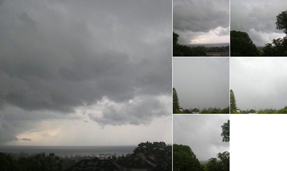
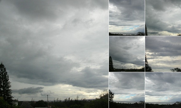
Below are some pictures I took yesterday afternoon. The pictures are facing the direction of the airport when they were having the heavy rain. I had not had the rain at home yet when I was taking the pictures, but the air was cooling rapidly from the rain and soon he had the heavy rain here too.


View album
This album has 6 photos on SkyDrive.

- mostly cloudy morning, shower later.....
  • By Blayz Brooks <blayzbrooks at yahoo.com>
  • Date: Tue, 5 Jul 2011 08:56:44 -0700 (PDT)
It is mostly cloudy in Montego Bay this morning. Yesterday, Montego Bay had only experienced a trace of rainfall, but Kingston and Eastern Jamaica experienced several hours of mostly light showers in association with some lingering   moisture from a tropical wave now in the Western Caribbean. More showers and thunderstorm likely this afternoon.
24 hr rain totals Monday July 4, 2011-Tuesday July 5,2011ending 7am
Montego Bay airport…… trace
Kingston airport……..38.8mm/1.53in

- mostly cloudy in the west , light to moderate showers in the east.
  • By Blayz Brooks <blayzbrooks at yahoo.com>
  • Date: Mon, 4 Jul 2011 07:13:10 -0700 (PDT)
Skies are mostly cloudy in Montego Bay, while in Kingston as well as eastern and southern parishes there are light to moderate showers this morning. A tropical wave moved across Jamaica yesterday with most areas across western Jamaica receiving a trace to no rain with higher rainfall amounts further east. The tropical wave will continue to influence the weather across Jamaica through Wednesday. Mostly cloudy skies with periods of showers and thunderstorms forecast. Today and Tuesday will be wetter than Sunday as much of the moisture is behind the tropical wave.
24 hr rainfall totals Sunday, July 3-Monday, July 4 2011 ending 7am
Montego Bay airport…0.04in/1mm
Kingston airport……0.59/15mm


- Slow moving Tropical wave to bring cloudy weather with periods of showers and thunderstorms Sunday-Tuesday
  • By Blayz Brooks <blayzbrooks at yahoo.com>
  • Date: Fri, 1 Jul 2011 13:45:27 -0700 (PDT)

Montego Bay Weather recaps (June 24-July 1)

Jamaica’s weather continues to be dominated by a high pressure ridge which has provided fair weather this past week. Since my previous blog last Thursday (June 23), the weather has been sunny and warm; we had three days of light showers in the afternoon. The first two (June 24 and 25) were in association with a tropical wave and the third  being some seasonal relief showers on Wednesday (June 29)  there (4mm at airport).The daily highs this week has been between 31-33 deg  C/88-92 deg F with lows between 24 -26 deg C/75 -79 deg F. Winds have been e-ese  10-21mph.

Forecast

The fair weather will continue for the next two days meanwhile the high pressure ridge to the north will begin to weaken tomorrow; thereafter a tropical wave (currently affecting the Leeward Islands) will slowly move across the Central Caribbean including Jamaica on Sunday and will influence local weather through Tuesday. Partly cloudy to mostly cloudy skies with periods of light to moderate showers forecast, thereafter the fair weather returns.


Tropical Atlantic

The Atlantic season's first tropical storm came ashore over Mexico's central Gulf coast early Thursday morning, bringing much needed rains to a wide swath of the country. Drought-stricken areas of Tamaulipas, suffering from the worst dry spell in 50 years, were mainly grateful for the rain. There were two confirmed two deaths from Tropical Storm Arlene as remnants of the storm continued dumping rain over the country's central highlands.

Otherwise Atlantic is quiet, and none of the computer models is predicting tropical cyclone formation for the next two weeks. There was an article yesterday from 28 storms entitled : Cape Verde tropical storm development by mid July?  Interesting read.


Local

attached are cartoons from local papers on the Jamaica Barbados diplomatic row


Attachment: jambarbados1.jpg
Description: JPEG image

Attachment: jambarbados2.jpg
Description: JPEG image

Attachment: jambarbados3.jpg
Description: JPEG image

Attachment: jambarbados4.jpg
Description: JPEG image

Attachment: jambarbados5.jpg
Description: JPEG image

Attachment: jambarbados6.jpg
Description: JPEG image


- Increased rain chances of Friday, fair thereafter
  • By Blayz Brooks <blayzbrooks at yahoo.com>
  • Date: Thu, 23 Jun 2011 11:43:22 -0700 (PDT)

The weather is mostly sunny across Jamaica and this has been the general trend since the bad weather and flooding rains in the first two weeks in June. A high pressure ridge has been the dominant influence on our local weather providing dry, stable conditions. In fact, since  June 9th, in this section of Montego Bay we have not had any rainfall (bearing in mind we are in the rainy season). Other areas have had light afternoon showers, especially the western side of town.

In the short term, there is currently a tropical wave which extends from south of the Dom.Rep to the North Coast of Venezuela . This tropical wave will likely provide some showers and thunderstorms on Friday (June 24). The sunny, fair weather returns on Saturday June 25 and will persist into next week. The forecast is for partly cloudy to mostly sunny skies with highs daily 89 deg F/32 deg C. The lows at 79 deg F/26 deg C. Winds e-ese 10-20mph.  The tropical wave to influence our weather tomorrow  wave will move into the Western Caribbean this weekend  and into  the Western Gulf of Mexico next week where it will likely become the first named storm of the Atlantic Hurricane Season affecting NE Mexico late next week.

When Jamaica experienced the heavy rainfall and flooding earlier this month, One particular bridge was swept away. A news team (television Jamaica) went out to the road and interviewed people on the scene, including one very spirited local explained with the bridge gone noboday cannot cross it. Our people being among the most creative in this world actually added a beat to the news report and this song has gone viral even to cbs. See the link , the song is quite catchy.

http://www.cbsnews.com/8301-504784_162-20071653-10391705.html

non weather related

It is a sad day for the nation as Grammy-winning reggae star Buju Banton this morning was ordered to serve 10 years and one month in federal prison for conviction of cocaine trafficking in Tampa,Fla. He will be incarcerated at the FCI prison facility in Miami.

Yesterday, US Secretary of State, Hilary Rodham Clinton, visited Montego Bay where she held high-level talks with Caribbean Community Foreign Ministers. She announced The United States will be increasing its financial support to the Caribbean Basin Security Initiative (CBSI) with US$77 million in funding committed for fiscal year 2011/12.

She described the relationship between Jamaica and the United States as excellent, and that she is personally very heartened and pleased about it. Meanwhile, Deputy Prime Minister and Minister of Foreign Affairs and Foreign Trade, Kenneth Baugh, said the relationship between both countries is strong, very productive and improving.

See link for photos from yesterday’s visit

http://www.jis.gov.jm/news/117-leads/28093

Live views from across the Montego Bay area

http://www.secretsresorts.com/stjames/index.asp

http://www.secretsresorts.com/wildorchid/webcam.asp

http://www.palladiumaddict.net/jamaica-lucea/?c=web-cams


- US Secretary of State to visit the city Today
  • By "Blayz" <blayzbrooks at hotmail.com>
  • Date: Wed, 22 Jun 2011 13:51:04 -0500


US Secretary of State to visit Jamaica

US Secretary of State Hillary Clinton.

US Secretary of State Hillary Clinton is due in the island on Wednesday [June 22].

Mrs. Clinton is scheduled to arrive in Montego Bay, St. James on Wednesday afternoon where she will attend a meeting of CARICOM Foreign Ministers.

She is expected to use the talks to reaffirm the U.S. commitment to the region, and underscore joint partnerships in enhancing citizen and regional security; promoting economic development; as well as strengthening democratic institutions.

Mrs. Clinton's visit comes two weeks after she met with Prime Minister Bruce Golding at the US State Department while he was on a four day visit to Washington D.C.

source radiojamaica.com

current weather

live webcams from Secrets Resorts showing the great weather.

http://www.secretsresorts.com/stjames/index.asp

http://www.secretsresorts.com/wildorchid/webcam.asp


- Pattern change from rainy and wet last week to hot and dry this week and beyond
  • By Blayz Brooks <blayzbrooks at yahoo.com>
  • Date: Wed, 15 Jun 2011 14:27:19 -0700 (PDT)

Jamaica has moved from two weeks of rain, flooding and landslides to hot, dry and windy weather. For the past week, it has been hot. The daily highs in Montego Bay have been 33 deg C/94 deg F, and combined with the humidity feels even warmer. The seasonal cooling afternoon showers have been absent this past week. Luckily, during the warmest time of the day, sea breeze has been steady between 10-20mph which provides some level of relief.  Visitors to the island will be happy to know the forecast for the next two weeks shows little to no changes. Mostly sunny and fair conditions likely with a 20% chance of a brief afternoon showers and thunderstorm. Highs 90 deg F/ Lows 79 deg F.


- Normal conditons returning, Flash Flood Warning Discontinued. Met officeissues last release on Tropical Disturbance(94L)
  • By Blayz Brooks <blayzbrooks at yahoo.com>
  • Date: Thu, 9 Jun 2011 19:38:01 -0700 (PDT)

There are a few light showers in some areas of Montego Bay; otherwise it is a mostly cloudy evening. There is some good news especially for nervous vacationers; normal conditions are expected beginning tomorrow. Normal conditions in June by my definition would consider June being in the rainy season. We typically have sunny mornings, in the afternoon between 3-5pm local time there is a chance for a brief afternoon showers. The skies usually clear up thereafter. Highs around 32 deg C Lows around 25 deg C. It does not rain every afternoon (on average ten days out of the month), mostly when the mornings are so hot and sticky you can expect a brief cooling afternoon shower.


June 09, 2011 – 5:00 p.m.

*** FLASH FLOOD WARNING DISCONTINUED ***

The Meteorological Service has discontinued the Flash Flood Warning for western parishes and the Flash Flood Watch for eastern and central parishes with immediate effect.

Satellite imagery and radar reports indicate that the Area of Low Pressure, which has been producing showers and thunderstorms across Jamaica, has drifted farther northwards, away from the island.

Weather conditions are therefore expected to return to near-normal this evening. A High Pressure Ridge will be the dominant feature across the region over the next few days.

This is the final News Release to be issued by the Meteorological Service on this system.


- mostly cloudy ,flash flood warning extended for Western Jamaica
  • By "Blayz" <blayzbrooks at hotmail.com>
  • Date: Thu, 9 Jun 2011 08:38:07 -0500

Skies are mostly cloudy in Montego Bay this morning. It rained all evening yesterday ending at midnight and has been overcast to mostly cloudy since. The rain was light, but we have had so much rain this past week and any further rainfall can cause problems with the earth saturated. A Flash Flood Warning remains is in effect for St. James which includes the Montego Bay area with showers and thunderstorms forecast this afternoon.

As the country moves into assessment mode, Minister Daryl Vaz has indicated that the cost arising from damage to infrastructure caused by the heavy rains in the last few days would be significant. With an estimate expected to be completed within days, Vaz told journalists during a post-Cabinet press briefing at Jamaica House yesterday that based on observations in Kingston alone, the Government would have to dig into its coffers to carry out repairs.

below pictures from the roof this morning

 
View album
This album has 8 photos on SkyDrive.


Below the latest news release for the Met Service Jamaica

Thursday, June 09, 2011 – 5:00 a.m.

*** FLASH FLOOD WARNING REMAINS IN EFFECT FOR WESTERN PARISHES ***

The Meteorological Service has extended the Flash Flood Warning for low-lying and flood-prone areas of Trelawny, St. James, Hanover, Westmoreland and St. Elizabeth until 5 p.m. today whereas; a Flash Flood Watch remains in effect for all other parishes.

A FLASH FLOOD WARNING means flooding has been reported or will occur shortly. Motorists and pedestrians should not attempt to cross flooded roadways or other low-lying areas as strong currents are likely. Residents in low-lying areas should be on the alert for rising waters and be ready to move quickly to higher ground.

The Area of Low Pressure across the western Caribbean remains disorganised and continues to drift slowly northward, away from Jamaica. However, unstable weather conditions associated with this system continues to linger mostly across western parishes. Satellite and RADAR reports indicate that light to moderate showers, affected western parishes with cloudy conditions across eastern and central parishes.

The forecast is for periods of showers and thunderstorms to continue across the island, today, with the heaviest showers and thunderstorms expected across northern and southwestern parishes. Thereafter, a gradual improvement in the weather is expected.

Fishers and other marine interests are advised to exercise caution, as strong winds and rough sea conditions are expected in the vicinity of showers and thunderstorms.

The Meteorological Service will continue to monitor the progress of this system.


- Rainy Wednesday Evening,FLASH FLOOD WARNING REMAINS IN EFFECT FOR WESTERN PARISHES, BUT DOWNGRADED TO A FLASH FLOOD WATCH FOR THE REST OF THE ISLAND
  • By Blayz Brooks <blayzbrooks at yahoo.com>
  • Date: Wed, 8 Jun 2011 19:53:55 -0700 (PDT)


It is another rainy afternoon into evening in Montego Bay. The rain started after midday and has been intermittent up to 9pm. The rain has been mostly light. Below the latest news release from the met office Jamaica.

Wednesday, June 08, 2011 – 5:00 p.m.

The Meteorological Service has extended the Flash Flood Warning for low-lying and flood-prone areas of Trelawny, St. James, Hanover, Westmoreland and St. Elizabeth until 5 a.m. tomorrow whereas; a Flash Flood Watch remains in effect for all other parishes

A FLASH FLOOD WARNING means flooding has been reported or will occur shortly. Motorists and pedestrians should not attempt to cross flooded roadways or other low-lying areas as strong currents are likely. Residents in low-lying areas should be on the alert for rising waters and be ready to move quickly to higher ground.

The Area of Low Pressure across the western Caribbean remains disorganised and continues to drift slowly northward, away from Jamaica. However, unstable weather conditions associated with this system continues to linger across most of the island. Satellite and RADAR reports indicate that light to moderate, and at times heavy showers, affected northern and southwestern parishes throughout the day, with moderate afternoon showers across eastern parishes.

The forecast is for periods of showers and thunderstorms to continue across the island, tonight and tomorrow, with the heaviest showers and thunderstorms expected over northern and western parishes. Thereafter, a gradual improvement in the weather is expected. 

Fishers and other marine interests are advised to exercise caution, as strong winds and rough sea conditions are expected in the vicinity of showers and thunderstorms.

The Meteorological Service will continue to monitor the progress of this system.


- Mixture of sun and clouds, flash flood warning extended
  • By Blayz Brooks <blayzbrooks at yahoo.com>
  • Date: Wed, 8 Jun 2011 10:15:46 -0700 (PDT)


There is a mixture of sun and clouds across the Montego Bay area this morning. Monday night into Tuesday saw some heavy rain which had flooded some houses, blocked roads even stripping a few of their asphalt. The damage across Western Jamaica was minimal especially compared with some areas of Central and Eastern Parishes. Most the blocked roads have been cleared and flood waters are receding. The flash flooding warning is still in effect seeing the latest release below….


Wednesday, June 08, 2011 – 5:00 a.m.

*** FLASH FLOOD WARNING REMAINS IN EFFECT FOR ALL PARISHES….. AS UNSTABLE CONDITION PERSISTS…***

The Meteorological Service has continued the Flash Flood Warning for low-lying and flood-prone areas of all parishes until 5 p.m. today.

A FLASH FLOOD WARNING means flooding has been reported or will occur shortly. Motorists and pedestrians should not attempt to cross flooded roadways or other low-lying areas as strong currents are likely. Residents in low-lying areas should be on the alert for rising waters and be ready to move quickly to higher ground.

Satellite imagery and Radar reports indicate that light to moderate showers with isolated thunderstorm affected most parishes last night.

The unstable condition persists across Jamaica, while the stationary Area of Low Pressure is becoming weaker across the western Caribbean and remains disorganised. We expect gradual improvement across the island during the next 12 to 24 hours. However, cloudy conditions will continue with showers with isolated thunderstorm mostly during the afternoon/evening especially across northern parishes, as the situation return to normal. 

Fishers and other marine interests are advised to exercise caution, as strong winds and rough sea conditions are expected in the vicinity of showers and thunderstorms, especially offshore the west coast.

The Area of Low Pressure currently has a low chance of developing into a tropical cyclone during the next 48 hours, and the Meteorological Service will continue to monitor the progress of this system.


Forecast from met service

SIGNIFICANT FEATURE… Broad Trough across the central Caribbean, including Jamaica.

Additionally, there is an Area of Low Pressure west of Jamaica

Comment… The area of Low pressure is expected to linger across the western Caribbean

over the next three days.

24-HOUR FORECAST

This Afternoon ... Mostly cloudy with periods of scattered showers and thunderstorms across

sections of most parishes.

Tonight…Mostly cloudy with periods of showers.

Tomorrow… Partly cloudy with scattered showers and isolated thunderstorms

across northern and southwestern parishes.

3-DAY FORECAST (after tomorrow)

Fri/Sat… Partly cloudy with scattered showers and isolated thunderstorms

Sun… Partly cloudy with isolated late afternoon showers.

Regionally… The persistent area of low pressure over the western Caribbean

continues to produce a disorganized area of showers and thunderstorm.

Furthermore, there is a Tropical wave across the eastern Caribbean.


- News Release from the Meteorological Service of Jamaica *** FLASH FLOOD WARNING NOW EXTENDED TO ALL PARISHES AS RAINS CONTINUE***
  • By Blayz Brooks <blayzbrooks at yahoo.com>
  • Date: Tue, 7 Jun 2011 16:09:53 -0700 (PDT)

issued at 5pm on Tuesday , June 07,2011


The Meteorological Service has extended the Flash Flood Warning for low-lying and flood-prone areas of all parishes until 5 a.m. tomorrow.

A FLASH FLOOD WARNING means flooding has been reported or will occur shortly. Motorists and pedestrians should not attempt to cross flooded roadways or other low-lying areas as strong currents are likely. Residents in low-lying areas should be on the alert for rising waters and be ready to move quickly to higher ground.

Satellite imagery and Radar reports indicate that light to moderate showers affected all parishes today, with heavy showers and thunderstorms affecting western and central parishes.

The Area of Low Pressure across the western Caribbean remains disorganised and continues to move slowly northward. Unstable weather conditions are expected to persist over Jamaica for the next 24 to 36 hours. Therefore, outbreaks of showers and thunderstorms are expected to continue, especially across northern and western parishes tonight and tomorrow.

Fishers and other marine interests are advised to exercise extreme caution, as strong winds and rough sea conditions are expected in the vicinity of showers and thunderstorms, especially offshore the west coast.

The Area of Low Pressure currently has a low chance of developing into a tropical cyclone during the next 48 hours, and the Meteorological Service will continue to monitor the progress of this system.


- updates on flooding and damage from radio jamaica
  • By Blayz Brooks <blayzbrooks at yahoo.com>
  • Date: Tue, 7 Jun 2011 15:30:40 -0700 (PDT)

Land slippages block roads in Western Jamaica

Heavy rainfall which lashed Western Jamaica on Monday night caused several land slippages from Trelawny to Hanover.

Several roads have also been left with a build up of silt while others have been rendered impassable.

National Works Agency (NWA) personnel have been kept busy all morning clearing silt in the four western parishes.

Sections of the Salt Spring Road are impassable, forcing motorists leaving Cornwall Courts to travel through Porto Bello to Montego Bay.

The road, which is being developed under the Jamaica Development Infrastructure Programme, has been badly scoured with recently laid material washed away.

Janel Ricketts, NWA Public Relations Officer for the region, said some of the reports such as road breakaways in Westmoreland remain unconfirmed.

She notes however that teams have been busy all of Tuesday morning clearing debris in the vicinity of the Sangster International Airport and the Examination Depot in Flanker.

“We are at a section of Hobbs Avenue where there was significant damage and this problem has resulted in a bit of washed down silt being washed onto the roadway and we have just now cleared this section of the roadway so motorists can traverse the area freely,” she said.

Miss Ricketts adds that there is also a build up of silt along the Marchmont to Retrieve road in St. James.

Over in Hanover there is land slippage and a number of roads are partially blocked.

In Trelawny, the Martha Brae to Kinloss Road has a large amount of washed down silt between mile posts 5 and 6.

There is also a landslide by Church Tower.

The National Works Agency is urging motorists to proceed with caution along the affected roads.


Freak storm and flooding wreaks havoc in Clarendon

Several residents of Four Paths and Osbourne Store in Clarendon are on Tuesday afternoon still counting their losses following a freak storm and flood waters on Monday.

When the RJR News team stopped at a section of the Swansea main road several persons including motorists were viewing the trail of destruction by Mother Nature.

A resident from the Swansea community, who witnessed the freak storm, spoke with our newscentre.

“Yesterday evening at about four o’clock there was some rain and then we heard this sound and when we looked outside we saw the breeze tearing down trees, house tops then the rain started. That did a little damage, not severe damage then at 6:30 there was another set of breeze and that one just took off the other roofs down the road,” said the resident.


Heavy showers put residents in peril

 Noel Arscott, Member of Parliament for South West Clarendon, says several residents in the constituency had to seek alternative shelter Monday night as they were unable reach home. 

 He said some persons had to sleep in their motor vehicles.

 “The shelters are not opened and persons are trying to find places where they can stay for the night. I saw one family with about six young children trying to find shelter and the situation is pretty bad,” Mr. Arscott said. Meanwhile, it was a sleepless night for several residents of Waterford in Portmore, St. Catherine as rising water threatened their houses.blocked drains resulted in flooding in parts of the community.

 One resident told our news centre that if the drains are not cleaned soon the situation could worsen.

 “The water is not flowing through the drain because I understand that the main drain by Dyke Road is flooded and overflowing and it has come over onto Adair Drive also so we have to be waiting and watching. Let’s hope we can get someone to come in and clean the drain, otherwise we will be flooded out,” said a resident of Waterford.

 In the meantime residents of Treadways in St. Catherine, who are now demonstrating in the town, are blaming the construction of the highway for the flooding now affecting them.

 “Vehicles can’t pass, nothing at all, everything comes over on us right now. Where I live that’s where they built the highway and they turned all the water down here, you want to see the amount of stone and mud that washed down from off the highway come down here. Mud and water, right through the house,” said a resident of Treadways in St. Catherine.


 No ODPEM shelter activated as yet

Despite reports of flooding in several communities, the Office of Disaster Preparedness and Emergency Management (OPDEM) is reporting that none of its shelters has been activated.

 Speaking on RJR's Hotline on Tuesday morning, ODPEM Director General Ronald Jackson disclosed that affected persons are relying on each other.

 “Fortunately for us the citizens in a number of the communities there are those who are having problems but most of the persons we have been liaising with said they have been having problems but they are not willing to go to a shelter right now, they are willing to ride it out which is a good thing in the context that their lives are not threatened and we’re not having to deploy resources so early in the field given the resource constraints,” Mr. Jackson said. 

 And Mr. Jackson appealed for residents to be more proactive in guarding against flooding.

 “To really be responsible in terms of the disposal of waste because whilst we’ve heard that funds have been released to clean the drains immediately after they are cleaned they are packed up with garbage. It is really unfair to ask the taxpayers to have their dollars being used to clean up the mess when we can deal with it in a much better way,” he said.


NWC reservoirs full to the brim

The National Water Commission (NWC) is reporting that due to the continuous rains two of its major catchment facilities in the Corporate Area are now full to capacity.

 “Storage as at this point would not be a significant issue for us, we are at 100% storage at our two major reservoirs, Hermitage is up to its 393 million gallon capacity and the Mona reservoir is up to its 809 million gallon capacity as of early in the weekend,” said Charles Buchanan, the NWC's Corporate Public Relations Manager.

 He added that there will not be any water restrictions in the immediate future, unless there are unforeseen circumstances.

 “There wouldn't be any restrictions now as a result of not having water. Any disruptions in water that customers may experience should be for an entirely different reason,” he said


- Met office news release Tuesday, June 07, 2011 – 5:00 a.m
  • By Blayz Brooks <blayzbrooks at yahoo.com>
  • Date: Tue, 7 Jun 2011 13:54:37 -0700 (PDT)

Tuesday, June 07, 2011 – 5:00 a.m


*** FLASH FLOOD WARNING CONTINUES …..AS AREA OF LOW PRESSURE BECOMES STATIONARY WEST OF JAMAICA… ***

The Meteorological Service has continued the Flash Flood Warning for low-lying and flood-prone areas of St Mary, Portland, St Thomas, Kingston and St Andrew, St Catherine, Clarendon, Manchester until 5:00 p.m. today. While, A Flash Flood Watch remains in effect for western parishes also until 5:00 p.m. today.


A FLASH FLOOD WARNING means flooding has been reported or will occur shortly. Motorists and pedestrians should not attempt to cross flooded roadways or other low-lying areas as strong currents are likely. Residents in low-lying areas should be on the alert for rising waters and be ready to move quickly to higher ground.


Satellite imagery and Radar reports indicate that light to moderate and at times, heavy showers and thunderstorm affected most parishes last night into early this morning.

The Area of Low Pressure has moved over the western Caribbean to the south south-west of Grand Cayman but the unstable conditions are expected to persist over Jamaica. Therefore, outbreaks of showers and thunderstorm are expected to continue, especially across northern parishes today.


Fishers and other marine interests are advised to exercise extreme caution, as strong winds and rough sea conditions are expected in the vicinity of showers and thunderstorms.

The Area of Low Pressure currently has a medium chance of developing into a tropical cyclone during the next 48 hours, and the Meteorological Service will continue to monitor the progress of this system.


- Rainy night in Montego Bay,Flash Flood Warning extended for some parishes
  • By Blayz Brooks <blayzbrooks at yahoo.com>
  • Date: Mon, 6 Jun 2011 19:26:38 -0700 (PDT)

Today was mostly cloudy in Montego Bay, occasionally we would have sunshine until this afternoon when the weather changed (at 1pm) and the rain begun .It has been intermittent since then. The rain has for the most part been light, briefly getting moderate to heavy at times light .The 6hr rainfall reported at 7pm this evening was 26mm/1.02inches.

Monday, June 06, 2011 – 5:00 p.m.

*** FLASH FLOOD WARNING CONTINUES AS AREA OF LOW PRESSURE BECOMES BETTER ORGANISED***

The Meteorological Service has continued the Flash Flood Warning for low-lying and flood-prone areas of St Mary, Portland, St Thomas, Kingston and St Andrew, St Catherine, Clarendon, Manchester, and St. Elizabeth until 5:00 a.m. tomorrow. A Flash Flood Watch remains in effect for all other parishes also until 5:00 a.m. tomorrow.

A FLASH FLOOD WARNING means flooding has been reported or will occur shortly. Motorists and pedestrians should not attempt to cross flooded roadways or other low-lying areas as strong currents are likely. Residents in low-lying areas should be on the alert for rising waters and be ready to move quickly to higher ground.

The Area of Low Pressure over the Caribbean Sea began moving slowly toward the northwest during the course of today and is now located west of Jamaica. Satellite imagery and RADAR reports indicate that light to moderate showers affected all parishes today, with heavy showers mainly across central parishes.

The Area of Low Pressure is gradually becoming better organised and additional strengthening is possible. Consequently, periods of showers and thunderstorms, which could be heavy at times, are forecast to continue affecting most parishes tonight and tomorrow. A gradual reduction in rainfall is expected after Tuesday.

Fishers and other marine interests are advised to exercise extreme caution, as strong winds and rough sea conditions are expected in the vicinity of showers and thunderstorms.

The Area of Low Pressure currently has a medium chance of developing into a tropical cyclone during the next 48 hours, and the Meteorological Service will continue to monitor the progress of this system.


- update to previous post on Flooding reports from Central and Eastern Jamaica various news media
  • By Blayz Brooks <blayzbrooks at yahoo.com>
  • Date: Sun, 5 Jun 2011 12:38:09 -0700 (PDT)

Updates on flooding in Central and Eastern Jamaica from various news media


Radio jamaica/RjR news

The Office of Disaster Preparedness and Emergency Management (ODPEM) has received confirmed reports that the Yallahs river is in spate, and has left several communities in the Llandewey area of St. Thomas marooned.

ODPEM says the communities, which are all located across the river, include Guinea Corn Piece, Orange Tree and Gordon Castle.

The Agency says the Ministry of Labour and Social and Security has been placed on standby, in the event the rains persist into Monday and Tuesday.

Meanwhile, ODPEM has also received reports that the Hordley Crossing to Golden Grove Main Road, in Eastern St. Thomas, is now impassableHordley Crossing is the main arterial from St. Thomas to Portland and no official alternative route exists.

And, the police are advising motorists are not to attempt to cross the roadway in the vicinity of Eastern Banana Ltd., as that road is flooded.
The Bath to Hordley Crossing is impassable, at Wheelers-field as the road is now under seven feet of water.

Still in St. Thomas, the Airy Castle to Bath main road is impassable to small vehicles.
The road is now flooded by the Plantain Garden River, which has overflown its banks, at Potosi. In Western St. Thomas, the Old Road in Danvers Pen is blocked by a mudslide, while the main road between Trinityville and Cedar Valley is impassable at Banana Gully, which has overflown its banks.
The Eleven Miles Fords are also impassable.

In view of the Flash Flood Warning in effect for six parishes including St. Thomas, ODPEM is advising motorists to avoid these areas and others that are at risk from flooding and landslides.

Boulders Falling In Gorge
RJR News has just been informed that boulders are falling in the Bog Walk Gorge.
Deputy Superintendent, Steve Brown, of the Constabulary Communication Network (CCN) is advising motorists to avoid using the gorge until further notice.


From the Jamaica observer


Suspected drowning at Bob Marley beach

A man is suspected to have drowned at Bob Marley Beach, Nine Miles, Bull Bay yesterday.  Reports from the Office of Disaster Preparedness and Emergency Management (ODPEM) are that two men in a fishing boat were trapped by flood waters. One was rescued and taken to hospital. The other is suspected to have drowned.

The ODPEM will continue to monitor the situation.


St Thomas communities flooded

THE Office of Disaster Preparedness and Emergency Management (ODPEM) says the Yallahs river is in spate, leaving several communities in the Llandewey area of St Thomas flooded.

 The communities include Guinea Corn Piece, Orange Tree and Gordon Castle, all located across the river. Community members are now marooned.


The Ministry of Labour and Social and Security has been placed on stand by in the event the rains persist into tomorrow and Tuesday.

 Meanwhile, the water levels at the gorge are currently at four feet high. The Water Resource Authority reports that this is below the sub critical level; critical level of the gorge is eight feet.


Chapelton under water

MOTORISTS are being advised that sections of Chapelton and Milk River in Clarendon are impassable at this time due to the inclement weather. The areas affected are as follows:

 CHAPELTON:

Chapelton Road, Bushy Park, Bucknor, Havanna, Cross Hill and Trout Hall.

MILK RIVER:

Gravel Hill and Parnassus.


Hordley Crossing now impassable

 Be ready to evacuate, ODPEM says

THE Office of Disaster Preparedness and Emergency Management (ODPEM) says it has confirmed reports that the Hordley Crossing in Eastern St Thomas is now impassable. This is the main arterial from St Thomas to Portland and there is no official alternative route. Motorists are being encouraged to avoid that area


From Go Jamaica


ODPEM urges caution as heavy rains trigger flooding in sections of the island

The Office of Disaster Preparedness and Emergency Management (ODPEM) says it is carefully monitoring several communities in southern Clarendon and sections of St. Andrew, St. Thomas and Portland, as a flash flood warning remains in effect for the island.

  Director General of the ODPEM, Ronald Jackson says the disaster agency is keenly monitoring vulnerable communities along the banks of the Hope River in St. Andrew, including Kintyre.

 He says parish disaster coordinators and other emergency personnel have been put on alert to assist persons to evacuate if necessary.

 He says sections of roads in Gordon Town and Mavis Bank in St. Andrew have collapsed, while the agency has received reports that some main roads in the Corporate Area have also sustained structural damage. He says the drainage along Molynes Road has been damaged by flood waters.

 Meanwhile the ODPEM says the Hordley Crossing in eastern St. Thomas is impassable. The ford, which is the only route from St. Thomas to Portland, has been flooded by torrential rain pelting the island since Friday.

 The agency is advising motorists to avoid the area. And residents of Big Pond in St. Catherine are worried as the pond in area has begun to overflow. Marsha- Lee Richards, a resident for the community for more than 23 years says residents are appealing for help.


- Light to moderate and at times heavy showers affecting Central and Eastern Jamaica, Flash Flood Warning now in effect
  • By Blayz Brooks <blayzbrooks at yahoo.com>
  • Date: Sun, 5 Jun 2011 11:43:36 -0700 (PDT)

It’s been a cloudy Sunday thus far in Montego Bay with no rainfall as of 1pm.Yesterday’s weather was similar to today’s,  cloudy weather but no rain. In capital city Kingston, 120 miles to our se , It has been raining almost continuously since 8pm last night.

The Norman Manley International airport reported for the 24 hr period ending 7am today (Sunday) 85mm/3.35 inches. Since then (Sunday 1pm report) the 6hr rainfall reported  was 32mm/1.26in. So  in total between 7am Saturday and 1pm the airport in Kingston saw 117mm/4.61inches . As a result of the at times, heavy rainfall been experienced in some areas the metservice has upgrade the flash flood watch to a warning . see latest release below…..Sunday, June 05, 2011 – 5:00 a.m.

*** FLASH FLOOD WARNING NOW IN EFFECT ***

The Meteorological Service has issued Flash Flood Warning for low-lying and flood-prone areas of St Mary, Portland, St Thomas, St Catherine, Clarendon, Kingston and St Andrew, while a Flash Flood Watch remains in effect for all others parishes until 5:00 p.m. today,


A FLASH FLOOD WARNING means flooding has been reported or will occur shortly. Motorists and pedestrians should not attempt to cross flooded roadways or other low-lying areas as strong currents are likely. Residents in low-lying areas should be on the alert for rising waters and be ready to move quickly to higher ground.


The area of Low Pressure over the Caribbean Sea, south of Jamaica has remained almost stationary over the past 12 hours. This area of disturbed weather is expected to linger across the region until Tuesday and will continue to influence the weather over the island during the period.

Satellite imagery and RADAR reports indicate that light to moderate and at times heavy showers affected mostly eastern and central parishes last night.

However, the forecast is for periods of showers and thunderstorms, which could be heavy at times, to continue to affect most parishes today and continuing into early next week.


Fishers and other marine interests are advised to exercise caution, as strong winds and rough sea conditions are expected in the vicinity of showers and thunderstorms.

The Area of Low Pressure currently has a low chance of developing into a tropical cyclone during the next 48 hours, and the Meteorological Service will continue to monitor the progress of this system.

Beach  webcams from Gran Pallidium in Lucea

http://www.palladiumaddict.net/jamaica-lucea/?c=web-cams

below radar courtesy of Instituto de Meteorología Cuba


- Saturday a sunshine and clouds mix, but no rain
  • By Blayz Brooks <blayzbrooks at yahoo.com>
  • Date: Sat, 4 Jun 2011 20:41:55 -0700 (PDT)

Saturday was a mixture of sunshine and clouds but no measurable rainfall. The Montego Bay airport reported for the 24hr period  ending Saturday morning at 7am 41mm/1.61in or rain, while a weather station further west reported 51mm (due to a localized thunderstorm). The areas east of the airport generally saw less than 15 mm.

Below the latest news release for the met office Saturday, June 4, 2011 at 5pm

The Meteorological Service has extended the Flash Flood Watch for low-lying and flood-prone areas of all parishes until 5:00 p.m. tomorrow.

A FLASH FLOOD WATCH means that flash flooding is possible and residents are advised to take precautionary measures, keep informed by listening to further releases from the Meteorological Service and be ready for quick action if flooding is observed or if a Warning is issued.

The area of Low Pressure over the Caribbean Sea, south of Jamaica has drifted further toward the north. Satellite imagery and RADAR reports indicate that most of the showers occurred over eastern and southwestern parishes today. However, the forecast is for continued periods of showers and thunderstorms, which could be heavy at times, to affect most parishes tonight, tomorrow and the next two days.

Fishers and other marine interests are advised to exercise caution, as strong winds and rough sea conditions are expected in the vicinity of showers and thunderstorms.

The Area of Low Pressure currently has a low chance of developing into a tropical cyclone during the next 48 hours, and the Meteorological Service will continue to monitor the progress of this system.


- Strange rain
  • By "Blayz" <blayzbrooks at hotmail.com>
  • Date: Fri, 3 Jun 2011 18:43:35 -0500

Montego Bay’s weather could be divided into two areas today. From the airport westward including the city of Montego Bay, experienced heavy rainfall this afternoon. The area saw 51 mm/2 inches of rain in a two hour period which led to minor street flooding. East of the airport including the Rose Hall /elegant corridor areas saw no rain. I live 15 minutes drive away to the east of the airport in the Coral Gardens/Ironshore area and It was sunny through much of today, cloudy this afternoon but no rainfall.

 A stationary area of low pressure, located south of the Island is forecast to remain almost stationary in our area bring the threat for heavy rainfall, flooding and landslides. The system is looking likely to strengthen to a tropical system and is forecast to weaken early next week before dissipating to our south on Wednesday. below are some pictures of the skies at p.m. est.


Clouds today: low… multilevel cumulus and stratocumulus

                         Middle… mostly transparent altocumulus

                          Upper…. cirrostratus not covering sky but not invading


Below latest news release from the metoffice Friday, June 02,2011 –5pm


*** FLASH FLOOD WATCH REMAINS IN EFFECT FOR ALL PARISHES ***


The Meteorological Service has extended the Flash Flood Watch for low-lying and flood-prone areas of all parishes until 5:00 p.m. tomorrow.

A FLASH FLOOD WATCH means that flash flooding is possible and residents are advised to take precautionary measures, keep informed by listening to further releases from the Meteorological Service and be ready for quick action if flooding is observed or if a Warning is issued.

The area of Low Pressure over the Caribbean Sea, south of Jamaica has become a little better defined today. Satellite imagery and RADAR reports indicate that cloudy conditions with scattered light to moderate; and at times heavy showers, affected mostly central and eastern parishes in the morning and northwestern parishes during the afternoon.

The forecast is for periods of showers and thunderstorms, which could be heavy at times, to continue affecting most parishes tonight and continuing into the weekend.

Fishers and other marine interests are advised to exercise caution, as strong winds and rough sea conditions are expected in the vicinity of showers and thunderstorms.

The Area of Low Pressure currently has a low chance of developing into a tropical cyclone during the next 48 hours, however, the Meteorological Service will continue to monitor the progress of this system.


- Cloudy skies , heavier weather stayed south and east.Flash Flood Watch In Effect for all Parishes
  • By "Blayz" <blayzbrooks at hotmail.com>
  • Date: Thu, 2 Jun 2011 17:55:16 -0500

Skies were mostly cloudy in Montego Bay with no rainfall experienced today; much of the island saw mainly the high clouds associated with the broad area of low pressure. The showers and heavy rain stayed mostly to the East of Jamaica impacting the Island of Hispaniola. The met service has extended the flash flood watch the latest release is below.  


METEOROLOGICAL SERVICE, JAMAICA

Thursday, June 02, 2011 – 5:00 p.m.

The Meteorological Service has extended the Flash Flood Watch for low-lying and flood-prone areas of all parishes until 5:00 p.m. tomorrow.

A FLASH FLOOD WATCH means that flash flooding is possible and residents are advised to take precautionary measures, keep informed by listening to further releases from the Meteorological Service and be ready for quick action if flooding is observed or if a Warning is issued.

A second Tropical Wave had merged with an Area of Low Pressure over the Caribbean Sea, south of Jamaica. Consequently, the low pressure area has intensified even further during the course of today with the major area of activity being east of Jamaica. Satellite imagery and RADAR reports indicate that cloudy conditions with scattered light to moderate, and at times, heavy showers affected mostly northern parishes today.

The forecast remains for periods of showers and thunderstorms, which could be heavy at times, to continue affecting most parishes tonight and continuing into the weekend.

Fishers and other marine interests are advised to exercise caution, as strong winds and rough sea conditions are expected in the vicinity of showers and thunderstorms, especially east of Jamaica.

The Area of Low Pressure currently has a low chance of developing into a tropical cyclone during the next 48 hours, however, the Meteorological Service will continue to monitor the progress of this system.


Below are some pictures I took from my roof at 5:00pm local.

View album
This album has 7 photos on SkyDrive.
 

More information of the development potential of the area of low pressure.

Dr. Jeff Masters Wunderground

http://www.wunderground.com/blog/JeffMasters/

Rob and Meg Lightbown Crown tropical weather

http://www.crownweather.com/?page_id=4557


- Flash Flood watch in effect for Jamaica , mostly light, shower thus far
  • By Blayz Brooks <blayzbrooks at yahoo.com>
  • Date: Wed, 1 Jun 2011 21:53:40 -0700 (PDT)

 Mostly light rainfall across Western Jamaica Wednesday afternoon into evening

Montego Bay had light showers this afternoon which cleared as we went into the evening hours. The light rain started at 2pm and ended at 7pm totaling only 5mm/0.19in.Areas of southern Jamaica have seen heavier  rainfall being closer to the weather system. Based on the observations from the Kingston airport, the light rain continues into its twelfth hour, total at 11pm 20mm/0.79in.


FLASH FLOOD WATCH IN EFFECT FOR AS RAINFALL EXPECTED TO CONTINUE AND INTENSIFY

Wednesday, June 01, 2011 – 5:00 p.m.

The Meteorological Service has issued a Flash Flood Watch for low-lying and flood-prone areas of all parishes until 5:00 p.m. tomorrow.

A FLASH FLOOD WATCH means that flash flooding is possible and residents are advised to take precautionary measures, keep informed by listening to further releases from the Meteorological Service and be ready for quick action if flooding is observed or if a Warning is issued.

An Area of Low Pressure over the Caribbean Sea, south of Jamaica is merging with a Tropical wave also south of Jamaica. As a result, the low pressure area has intensified through the course of today. Satellite imagery indicates cloudy conditions across the island while RADAR indicates widespread light to moderate showers affecting most parishes.

Expect periods of showers and thunderstorms, which could be heavy at times, to continue affecting most parishes this evening and continuing through the weekend.

Fishers and other marine interests are advised to exercise caution, as strong winds and rough sea conditions are expected in the vicinity of showers and thunderstorms, especially south of Jamaica.

The Area of Low Pressure currently has a low chance of developing into a tropical cyclone during the next 48 hours, however, the Meteorological Service will continue to monitor the progress of this system.


- Heavy rain threat begining Thursday
  • By Blayz Brooks <blayzbrooks at yahoo.com>
  • Date: Tue, 31 May 2011 15:01:46 -0700 (PDT)

Current weather…. Tuesday Evening Intermittent Light Rain Showers

After mostly cloudy weather all morning, light rain showers have developed this afternoon. Since last Friday, Montego Bay has seen daily rainfall (except yesterday) as a persistent trough continues to influence the weather across the Central Caribbean including Jamaica.

Developing weather situation

The situation is about to worsen when we factor into the mix a developing area of low pressure in the SW Caribbean.

 According to Rob Lightbown, Crown Weather Services

Jamaica really needs to monitor the disturbance in the SW Caribbean. Latest European and UKMET model, which are both reliable models, bring this system across Jamaica as a tropical storm in 6 to 8 days from now. This definitely, at the very least looks like a prolonged heavy rain producer with flash flooding a concern, even with the very dry conditions that was experienced.”

Water restored

Water has been restored to the thousands served by the Martha Brae Treatment Plant. I will be stocking up on water, with heavy rain forecast beginning Thursday. It is likely they will shut down the system if turbidity levels are high.

Crab Season

It is crab season which coincides with the rainy season. The rainy season has started late this year, but better later than never. In Jamaica, crabs usually have a large and small claw, but there is a left hand crab, very versatile, with two small claws. The crab can bite by turning its claw around; however, it releases the victim when the eye is squeezed. Some live in trees, but the most popular type live in wetlands and swampy areas, whenever It rains they leave and are all over the place, usually in swarms of thousands roads , houses they can be all over. Things to remember….Crabs, when purchased alive or caught, should be vigorous and lively. Drop live crabs one at a time; head first into boiling, salted water enough to cover them. Reheat water to boiling after adding each crab. Cook 20 to 25 minutes, drain and rinse. Break off claws. Remove the hard top shell working from tail end. Discard the spongy fibre and apron. Crack claws with a nut cracker. Remove meat discarding all bony spines. Crab meat may be used in most recipes instead of lobster, since lobster season is over (in recipes calling for lobster). A popular recipe is to curried crab, there is crab rundown many spin off recipes. In all towns there are people with large pots who sell crabs.  

below link to a good article a few years ago from the gleaner called how to catch a crabs.

http://jamaica-gleaner.com/gleaner/20020608/life/life1.html 

pictures of our local delicacy


alive


Jamaican Land Crab


cooked

Courtesy  pictures from jamaica


Jamaica :: Crab :: View Full Gallery at http://www.jamaicamix.com/


- News Release from Metservice Jamaica*** INCREASE IN RAINFALL EXPECTED TO MARK THE START OF THE 2011 ATLANTIC HURRICANE SEASON ***
  • By Blayz Brooks <blayzbrooks at yahoo.com>
  • Date: Mon, 30 May 2011 19:08:38 -0700 (PDT)

From Metservice Jamaica.

Monday, May 30, 2011 – 5:00 p.m.


An Area of Low Pressure is developing over the Caribbean Sea, south of Jamaica. This system is expected to bring an increase in rainfall activity in the coming days with some increase in intensity as of Thursday.

Expect periods of showers and thunderstorms, which could be heavy at times, to affect most parishes starting on Thursday and continuing through the weekend.

There is a possibility that this system could result in some flash flooding, however, the Meteorological Service will continue to monitor the progress of this system.


- Rainy week ahead, possible tropical dev end of this week
  • By Blayz Brooks <blayzbrooks at yahoo.com>
  • Date: Mon, 30 May 2011 09:02:13 -0700 (PDT)

There are mostly cloudy skies across the Montego Bay area this morning. Yesterday, It rained all day, while It was mostly light It is annoying to have so much water around yet have no water. Since Friday, The National Water Commission has shut down the Martha Brae Treatment plant due to Turbidity. The Martha Brae Treatment plant is in the adjoining parish of Trelawney, but also serves the Greater Montego Bay area including Greenwood, Liliput, Ironshore, Coral Gardens and Flankers.  Turbidity is related to the amount of sediment a river or stream carries in the flowing water. Whenever there is heavy rain , and the raw water gets  too muddy for chlorination, they shut down the treatment plants and we have no water.  I would have like for some rain this morning so I could set the oil drum to at least catch some water for the toilets, but we should see some rain before the end of the day.

Rainfall totals

Sunday 29-Monday 30 ending 7am

Airport … 12mm/0.47in


Saturday 28-Sunday 29 ending 7am

Airport….16mm/0.63in

Friday 27-Saturday 28 ending 7 am

Airport …..20mm/0.70in


Blogs on possible tropical system

Dr. Jeff Masters Wunderground

http://www.wunderground.com/blog/JeffMasters/

Rob and Meg Lightbown Crowntropical weather

http://www.crownweather.com/?page_id=325


- Possible tropical development south of Jamaica end of this week,rainy week ahead
  • By Blayz Brooks <blayzbrooks at yahoo.com>
  • Date: Sun, 29 May 2011 11:37:09 -0700 (PDT)

Currently, Light rainfall in the Montego Bay Area and across the Jamaica area as the setup for a wet week and possible tropical development later begins. Below are two links with commentary today on the possible developing system as well as graphics.

Crown Tropical Weather


Tropical Tidbit for Sunday, May 29th, 2011


Canadian Model Forecast For Thursday Morning, June 2:

Canadian Model Forecast For Friday Morning, June 3:

GFS Model Forecast For Thursday Morning, June 2:

GFS Model Forecast For Thursday Morning, June 2:

European Model Forecast For Thursday, June 2:

European Model Forecast For Friday, June 3:

European Model Forecast For Monday, June 6:


- Tropical disturbance may form between Jamaica and Central America
  • By Blayz Brooks <blayzbrooks at yahoo.com>
  • Date: Fri, 27 May 2011 14:50:54 -0700 (PDT)

The hurricane season may well start early for us in the Jamaica area. Already, the various computer models have been hinting that a tropical disturbance may form between South of the Island and Central America between next Tuesday and Friday, as a portion  of the Eastern Pacific Intertropical Convergence Zone (ITCZ) pushes across Central America into the Caribbean. We will have to monitor that area next week and the potential for heavy rainfall.


The Montego Bay area is currently experiencing light rainfall. We had no rain yesterday; only dry thunderstorms. The trough across the Central Caribbean continues to influence the weather across Jamaica.


- Mostly cloudy skies...showers and thunderstorms later.
  • By Blayz Brooks <blayzbrooks at yahoo.com>
  • Date: Thu, 26 May 2011 11:45:27 -0700 (PDT)


Currently, (at 1:45pm) there are mostly cloudy skies across the Montego Bay area; there is also the occasional rumble of thunder. Satellite imagery shows a trough across the Central Caribbean and Jamaica. The daytime heating is enhancing the showers and thunderstorms along the trough and a line of showers has developed over the North Coast (Trelawney, St. Ann and St. Mary). Light to moderate rainfall likely across our area shortly. 24hr rainfall total ….trace.

Happenings on the Island…..The wikileaks cables are creating quite a stir locally. The Gleaner has a page called the secrets are out. The Jamaica Observer also has an article called visa worries. They are an interesting read (the secrets page is updated daily).

updated to correct previous "secrets"hyperlink


- Mostly cloudy skies...showers and thunderstorms later.
  • By Blayz Brooks <blayzbrooks at yahoo.com>
  • Date: Thu, 26 May 2011 11:39:52 -0700 (PDT)

Currently, (at 1:30pm) there are mostly cloudy skies across the Montego Bay area; there is also the occasional rumble of thunder. Satellite imagery shows a trough across the Central Caribbean and Jamaica. The daytime heating is enhancing the showers and thunderstorms along the trough and a line of showers has developed over the North Coast (Trelawney, St. Ann and St. Mary). Light to moderate rainfall likely across our area shortly. 24hr rainfall total ….trace.

Happenings on the Island…..The wikileaks cables are creating quite a stir locally. The Gleaner has a page called the secrets are out. The Jamaica Observer also has an article called visa worries. They are an interesting read ( the secrets page is updated daily) .


- A mix bag
  • By Blayz Brooks <blayzbrooks at yahoo.com>
  • Date: Wed, 25 May 2011 12:54:33 -0700 (PDT)

The weather today across the Montego Bay has been mixture of sun and clouds. We have had a cooler day with all the clouds around today. The ground is still moist with all the rain we had yesterday. There is a light sea breeze from the ENE (less than 10mph). Today's high (thus far 3:00pm) 30 deg C.The 24 hr rain total ending 7am (no rain since)  34.9mm/1.37in.


all times are local time same as CDT or GMT -5 hours


- rainfall total Monday 24 hr
  • By Blayz Brooks <blayzbrooks at yahoo.com>
  • Date: Tue, 24 May 2011 22:20:57 -0700 (PDT)

Update: The 24 hr rainfall (7am Monday-7am Tuesday local time) from the Montego Bay Airport 7mm. I should  have today's rain which was moderate and lasted almost five hours on Wednesday. Interesting revelations continue to come from the Jamaica Gleaner's partnership with wikileaks article 84 Jamaicans placed on US terrorist watch list


- rainy Tuesday
  • By Blayz Brooks <blayzbrooks at yahoo.com>
  • Date: Tue, 24 May 2011 16:04:56 -0700 (PDT)
The rain has tappered off for the evening. Sad situation developing in Oklahoma, where a massive tornado outbreak is underway there are five tornadoes on the ground right now across that state.
 
live streaming

- moderate to heavy rainfall across Western Jamaica
  • By Blayz Brooks <blayzbrooks at yahoo.com>
  • Date: Tue, 24 May 2011 11:14:42 -0700 (PDT)

It has been overcast all morning, until moderate rainfall started around 12:30pm local time.A weather station on the western side of town has already seen over an inch of rain. It is not as heavy here in the Rose Hall, but enough to have pondingand settling more to come later….


News release from yesterday


A Tropical Wave west of Jamaica along with a Trough across the island, will continue to influence the weather for the next 24 – 48 hours. Satellite imagery indicates mostly cloudy conditions with occasional outbreaks of light to moderate showers affecting most parishes.

The forecast is for periods of showers and thunderstorms to continue affecting the Island tonight, Tuesday and on Wednesday especially during the afternoon.

Sea conditions could deteriorate in the vicinity of showers and thunderstorms due to gusty winds. Fisher and other marine interests should exercise caution.

The Meteorological Service will continue to monitor the progress of this system.


- light rainfall
  • By Blayz Brooks <blayzbrooks at yahoo.com>
  • Date: Mon, 23 May 2011 19:52:30 -0700 (PDT)

Most parishes experienced light showers this afternoon. In Montego Bay, the rainfall occurred between 3-5pm and like much of Jamaica was less than 10mm/0.39in. We are returning to a seasonal pattern (rainy season) of light afternoon, short lived afternoon showers especially through Wednesday with the trough in the area.

The death toll from Joplin, Mo has sadly climbed to 116 persons resulting from a deadly tornado that swept through that city. The outlook for tomorrow is grim as another tornado outbreak is likely across Texas, Oklahoma, Arkansas, Nebraska and Missouri (including Joplin). This puts cities at direct risk including Tulsa, Oklahoma, Kansas City, Missouri, Wichita Kansas, and Topeka Kansas. Persons in those areas should review their tornado plans and have their weather radio ready. Our thoughts and prayers to the persons who have been affected by severe storms.


Link

s The SevereStudios Live ChaseCam Network will have active video feeds on days when storm chasers are in the field tracking storms. You will be able to follow the chasers LIVE, and watch the storms as they happen

http://www.severestudios.com/


- News Release from the METEOROLOGICAL SERVICE, JAMAICA
  • By Blayz Brooks <blayzbrooks at yahoo.com>
  • Date: Mon, 23 May 2011 19:29:09 -0700 (PDT)


Monday, May 23, 2011 – 5:00 p.m.

***RAINFALL TO CONTINUE ***

A Tropical Wave west of Jamaica along with a Trough across the island, will continue to influence the weather for the next 24 – 48 hours. Satellite imagery indicates mostly cloudy conditions with occasional outbreaks of light to moderate showers affecting most parishes.

The forecast is for periods of showers and thunderstorms to continue affecting the Island tonight, Tuesday and on Wednesday especially during the afternoon.

Sea conditions could deteriorate in the vicinity of showers and thunderstorms due to gusty winds. Fisher and other marine interests should exercise caution.

The Meteorological Service will continue to monitor the progress of this system.


- No rain, despite a great setup.
  • By Blayz Brooks <blayzbrooks at yahoo.com>
  • Date: Sun, 22 May 2011 22:28:33 -0700 (PDT)
We had a few sprinkles Sunday evening  with threathing clouds but still no rain .  The rain threat is decreasing as the tropical wave that merged with the trough of low pressure in western Caribbean Sea is moving  from just south of the Island toward Central America. This system will enchance the rain chance on Monday which may trigger scattered moderate showers and thunderstorms especially in the hilly interior.
 
Our thoughts and prayers to the people of Joplin , Mo in the US , after tornado over a mile wide destroyed 75% of the city of 50,000 people. At this time over 30 persons confirmed dead . The damage and devastation is like Tuscaloosa,Al after April's tornados.

- Rain finally on the horizon,after an extended dry season
  • By Blayz Brooks <blayzbrooks at yahoo.com>
  • Date: Sun, 22 May 2011 12:27:03 -0700 (PDT)

Changing Seasons…. Transitioning from drought to the rainy season….


Every year, Jamaica has a dry season which brings drought conditions to the Island. Each year this runs between December and April. This year has been particularly dry , and has been described as one of the worst in many years. Since the start of the year, Montego Bay has yet to experience any significant rainfall aside from a few minutes of drizzle. The rainy seasons starts in May, The rainiest months in Jamaica are normally May-June and September-October (sometimes lasts until November).So far May has been dry, but this evening the sky is overcast. Hopefully not another dry thunderstorm which causes more a fire risk than anything else.

Rain is likely this evening and  tomorrow which should kick off the rainy seasons .According to the met service a  Tropical Wave interacting with a trough is producing showers across sections  of the  central Caribbean .As the tropical wave moves across our area showers are likely .


Article from jamaica observer on water woes caused by drought

http://www.jamaicaobserver.com/news/Prolonged-drought-hurting-NWC-customers


- Light earthquake felt across Jamaica. Uwi mona earthquake unit 5.0, USGS report 4.7
  • By "Blayz" <blayzbrooks at hotmail.com>
  • Date: Mon, 16 May 2011 12:20:09 -0500
A quick update on the earthquake from Rjr news
 

There has been no report of injury or damage following a 5.0 magnitude earthquake which rocked several parishes this morning.

The epicentre of the quake, which was felt at 10:07 Monday morning, was 20 kilometres south of Black River with a focal depth of 21 kilometres.

RJR News has received calls from residents in several parishes with reports of more than one tremors within minutes of each other.

Raymond Stewart, Seismic Analyst in the Earthquake Unit at the University of the West Indies, sought to explain why this happened.

"An earthquake comes with two main phases, so one might feel the first and the second but some people might only feel one. But what they’re feeling is two different waves or phases for the same event … some people feel that jerk but it’s possible for a person to feel another for the same event," Mr. Stewart said adding that he would not relate this tremor to the one which occurred last week.

"The other one which occurred last week occurred in the northern part of St. Andrew in the Blue Mountain area. It’s two different locations and I’m not sure we can tie them together."

There have been no reports of injury or damage.

News from the Jamaica Gleaner...

"According to the Earthquake Unit the intensity of the quake was felt in Negril, Montego Bay, Mandeville, Santa Cruz, Spanish Town and Kingston.

This is the latest tremor in a series of earthquakes to rock the island.

Reports coming into our newsroom are that several buildings in New Kingston and downtown Kingston have been evacuated.

Reports have also been coming in that several cracks have appeared in buildings in downtown Kingston along the waterfront. This has not been independently verified by The Gleaner”
 
picture from Jamaica observer website


Report from USGS Earthquake

Magnitude 4.7
Date-Time
Location 17.897°N, 77.895°W
Depth 31.6 km (19.6 miles)
Region JAMAICA REGION
Distances 62 km (38 miles) S of Montego Bay, Jamaica
117 km (72 miles) W of KINGSTON, Jamaica
304 km (188 miles) SSW of Bayamo, Cuba
903 km (561 miles) SSE of Miami, Florida
Location Uncertainty horizontal +/- 7.8 km (4.8 miles); depth +/- 15.1 km (9.4 miles)
Parameters NST=102, Nph=102, Dmin=52.8 km, Rmss=1.29 sec, Gp= 47°,
M-type=body wave magnitude (Mb), Version=8
Source
  • USGS NEIC (WDCS-D)
Event ID

- Earthquake
  • By Blayz Brooks <blayzbrooks at hotmail.com>
  • Date: Mon, 16 May 2011 10:32:05 -0500
Just felt the most significant earthquake I have ever felt (about 15 mins ago , 
)the building was shaking I am sure it was an islandwide event .more info to 
come hopefully no damage. From montego Bay

Back to top | home | tools | pleas for help | QHWRN | guide | climatology | archive