
|
|
- Updates from the Islands -- - St.Croix (USVI) - - |
|
|
| - Beautiful Lazy days in St Croix | |
| |
|
| - Evening Fire in the Sky! |
|
You have been sent 3 pictures.


675A2571.JPG
675A2572.JPG
675A2573.JPG

These pictures were sent with Picasa, from Google.
Try it out here: http://picasa.google.com/
Attachment:
675A2571.JPG Attachment:
675A2572.JPG Attachment:
675A2573.JPG |
| - This morning's rainbow - December's promise. |
|
You have been sent 4 cell phone pictures.


675A2538.JPG
675A2539.JPG
675A2536.JPG
675A2540.JPG

These pictures were sent with Picasa, from Google.
Try it out here: http://picasa.google.com/
Attachment:
675A2538.JPG Attachment:
675A2539.JPG Attachment:
675A2536.JPG Attachment:
675A2540.JPG |
| - Christmas is in the Air!! |
|
|
Good Night and Good bye folks! This is the end of the hurricane season 2010. I will not write again until June 2011, if I'm still on this side, unless there is some really unusual weather event. Thank God this season is over and that it did not go to the end of the alphabet nor was it as severe as earlier predicted. My condolences go out to the families who lost loved ones during the storms that raised havoc on various places, most recently in St. Lucia. It feels like Christmas here. Not only the signs of Christmas, but the air is cooler, the wind is currently howling, rain showers on occasion pummel the rooftop. Christmas is in the air. We have a calendar of events and always hope that the weather cooperates. Any outdoor activity is risky at the moment. NOAA Weather Radio has mentioned a system with a 10% chance of developing. Between that low pressure system and a frontal boundary sweeping down to the south, it's causing the wind to blow up to 25 mph, sounds like more sometimes. I have a question for lovers of Red-Footed Tortoises. One of our two took a walk and we haven't seen her since. She can not get out of our property easily. She escaped from the domain especially designed for them. What are the chances of such a tortoise surviving without water. She disappeared on Saturday 27th. Thank you for any information you may have. So, all the best to everyone out there. Enjoy the Christmas Season and all the wonderful life around it. And if you haven't seen the classic movie IT'S A WONDERFUL LIFE with Jimmy Stewart, it's time. Enter safely into the New Year. Party with a good conscience. Don't drink and drive. My 21 yr old nephew had a horrific crash in Florida after leaving a party. He was tired and left the party alone. It's a wonderful life if we treat it and each other with respect. God bless you and our planet Earth. May we save it from total destruction. Keep an eye to the weather and pay attention to the signs of the times. All the best for 2011! Smile! Isabel P.S. I could be sending some photos on and off. |
| - The Cold Front - Br-r-r-r-r-r! |
|
|
A Good Chilly Night to All! Well, it's really not as chilly for some as for others. However, there's some high pressure mixed in with the cold front that's causing some very windy conditions. I think the air is very cool because of the moisture in the atmosphere. We had another very heavy downpour this afternoon in Christiansted, where it went from here, I don't know. It never arrived at the swimming pool where my grandchildren do their Dolphins training. The schooner ROSE WAY got company this morning with the arrival of the CORWITH CRAMER, a sailing research vessel. It has been coming to the US Virgin Islands for more than thirty years. For several years it has been stopping at St. Croix. The students learn many things including piloting. Sounds like fun.Throughout this week we probably will be having some scattered showers. Tomorrow, I will attach a photo. God bless us all. Isabel |
| - The ROSE WAY - Sailing Along with the Cold Front |
|
|
Good Afternoon, Through the night and this morning we were bombarded with heavy rain that caused whiteout conditions, mini flash floods, and ponds of water everywhere. In the midst of all that the Bostonian Schooner ROSE WAY sailed unnoticed into the harbor where it enjoys a good life through the US winter months each year. Many people take the opportunity to sail on such a magnificent boat while it is here. Not me, I prefer to admire it from land. The crew must have had a wild sail coming in with the Cold Front as they did. The wind was very strong and the rain together caused some very stormy conditions. At the moment we are still having a rough surf and very breezy conditions, but it has not rained since this morning. The sky is very overcast with a threatening look. Could be that another round of storminess is approaching. All of this began yesterday late afternoon as our guests were arriving. They felt cozy with the fireplace setting, the music, the food, the good company of all the guests present. We enjoyed the weather. However, not everyone can say the same. I was told of a young boy who lost his life, swept away in a ravine when it began to rain in St. Lucia recently after he went out on an errand. I don't know how accurate this story is and would appreciate it if someone from St. Lucia can correct it or fill in details. As for the woman who was dragged by the flash flood during the monsoon type rain we received two weeks ago. She was carried quite a distance and was very badly bruised and beaten by the many blows she received until her dead body rested in an area in Frederiksted, detected by the Search and Rescue Team. The end of a hurricane season does not always mean the end of bad weather. We get many Cold Fronts from the mainland and these as described above can cause havoc and even death if we are not careful. We always should keep an eye to the weather and be safe. Let's thank God for every breath we take and may we help others wherever and whenever we can. God bless us all. Isabel |
| - Cold Front on Warm St. Croix |
|
|
Good Afternoon! We were out of Internet for a while. I just want to inform anyone coming this way that a Cold Front will begin affecting us as of this afternoon and has already started. The chance of rain will increase dramatically and by Monday it should be up to 70%. Again that's to be seen to be believed. In the meanwhile, we are going to have guests so we shall turn our get together this evening into a "fireside party". We should always make the best of every occasion regardless of the weather, unless of course, it's a hurricane. As for hurricanes, we look pretty much done for the season, or are we? Let's not get complacent. The season is not over as yet. A day at a time is the best way to take any day of the week. Take care of yourselves, you in the snowy scenarios on the mainland. Take a break and come visit. God bless you and us. Keep smiling. Isabel |
| - Rainy Weekend in the Forecast. |
|
|
Good Evening, We are having some spectacular days, clear, sunny, and cool nights. Perfect! However, there is rain in the forecast for Sat, and Sunday. So, for those of us here, I suggest we go ahead with our plans and make the necessary adjustments as we go. Sometimes the rain moves away and it remains dry. There was a lot of damage caused by that slow moving system which was spawned by TOMAS. Fortunately, the Cruise ship passengers haven't been inconvenienced. There were two ships on Saturday just two days after the massive flooding that took place in Frederiksted, and one ship on Sunday. The ones on Sunday did not fare as well weather wise as we had an unprecedented 20% chance of rain DELUGE which lasted more than an hour. The remainder of the day was drizzly and threatening. We still went ahead with the swimming pool party for our grandson and luckily it turned out to be a very sunny, lovely afternoon on the East End where we were celebrating. It would seem that we are winding down this hurricane season. We still have to watch and pray that it finishes quietly. Now, at most we should only have to deal with Cold Fronts like the one approaching this weekend. Don't get me wrong, those can be very stormy as well. So enjoy the days one at a time and "give thanks and praise to the Lord". God bless us all. |
| - Too Beautiful for Words |
|
|
All is quiet on the homefront. Sh-h-h-h! Good Night to all. Blessings, Isabel |
| - "Coastal Flooding" - NOAA |
|
|
Greetings and a Good Night to all! There is an alert about some 15 - 20 ft. waves that are to affect the north facing coasts on the Atlantic side. These waves are developing and should reach their peak on Sunday. Everyone along these coasts must pay close attention to this threat from the sea. We are not in danger as we are further away from the Atlantic. We do get high waves, but as far as this particular event is concerned, St. Croix is out of the loop. Thank God. However, I am watching two possible threats in the not too distant future. One is coming from the south, the other is a huge tropical wave coming from Africa. Both of these can become a problem for us. I'm not concerned about Invest 94 as this one is moving west away from out area. I'll try to take it a day at a time and enjoy each one. Tomorrow we're having a big celebration, rain or shine. When the heart stores up sunshine, it shines on a rainy day. Smile more, it's good for you. Have a great Sunday and may God bless us all. Isabel |
| - The Aftermath - not good! |
|
|
Good night to all! Everyone is still reeling from the tremendous damage and floods caused by the low pressure system at the tail end of TOMAS which eventually became 93L with potential for development. It did not reach that level, but the destruction it caused by being almost stationary at 2 mph destroyed the beach at the pier in Fredriksted where the cruise ship visitors would relax on land and enjoy the blue sea, the white sand; it flooded the ballpark near by and made it look like a swimming pool. Roads collapsed, trees down, schools and buildings flooded, cars stranded in deep water where jet skis were used to rescue the motorists/passengers. "The ocean came in.." "I have never seen rain like this before..." As I mentioned in an earlier post, a woman was washed away as she walked with her husband. He managed to grab on to some debris, she continued on down the gut. She was found early today. It makes me wonder what makes people defy Mother Nature and risk their lives, when they could be safe inside, and live. Two cruise ships are scheduled to arrive on Saturday morning. It's a pity that they would not be able to see the beauty others have seen. Many parts of Fredriksted were devastated. Four school are unusable and it is still to be seen if it will be possible for all the schools to open. I think that a bad decision was made to allow the children to start out for school on Wednesday morning just when the rain was approaching. Didn't they hear what I heard all along? NOAA Radio said it over and over that "a significant rain and flood event" was unfolding with the approach of a slow moving low pressure system associated to TOMAS. This was going to cause dangerous flash flooding. For several days this announcement was being made repeatedly warning everyone about the impending chaos. The government and Meteorologists need to work together to help spread the word. Not everyone has a computer, much less VI Alert. Radio and newspapers are the best means by which to alert the public about such an approaching menace. 93L was big, was slow, was dangerous. Tonight we received another very heavy downpour and "numerous" showers are expected overnight. On one hand we were told not to go out, on the other, the government is resuming as normal on Friday. We'll see what dawn brings. I'll keep you posted. God bless us all. Isabel |
| - Weather today - A Mixed Bag |
|
|
Good Afternoon! A Happy Day to All Veterans! In the distance towards St. Thomas and the BVI I see very dark clouds with sheets of rain. At the moment we are having a partly sunny day. It's a chancy day for hanging laundry on a line, but the breeze is so perfect, that the risk is worth it. NOAA Radio is announcing a continuation of the unstable weather, with a Flash Flood Watch in effect until Friday morning. We've had a good amount of flooding everywhere. A woman disappeared in the sea yesterday when she was taken away by the force of the flooding waters--(the details still to be verified). A car also went into the sea, it was not sure from this morning's radio report if the woman was in the car, or if it was two separate incidents. It is being investigated. Due to the heavy rain and flooding, the military parade in honor of the Veterans was canceled. The ceremony was held at the American Legion Hall. Tractors are scraping mud from the roads and dumping it into trucks. It seems that that job will keep those workers busy for a long time. There's also other debris besides mud. Let's remain on guard and remember that when it comes to the weather Mother Nature is in charge, and nature is subject to the necessary changes. Likewise, we should also learn to adapt to changes in the weather patterns. Have a great day and may God bless us all. Isabel |
| - A Tremendous Finale, Or..? |
|
|
Greetings again and a good night to all! Whew! What a wallop we received today rain wise,--more than seven inches by evening, then after a quiet spell, another round punctuated by huge lightning, followed by tremendous thunder and intense RAIN! All that in a 45 min. space. That must have been the 2 - 4 additional inches of rain that I heard about on the Weather Radio this evening. It's quiet now, except for a rumbling in the distance, leaving or coming??. The rain is over for the moment, but the Flash Flood Watch has been extended an extra day, until Friday morning. There is talk of a cold front being responsible for any other activity. The satellite imagery shows this particular system almost completely out of our area, so we can hope for sunshine for the veterans tomorrow. They sure can use it as they march along to the music of the band. Schools and government offices closed early today due to the stormy conditions. A lot of flooding has been reported. Roads are impassable. Seven inches is a lot of rain and with these additional inches it could be up to at least 12 inches.Tomorrow we shall hear about the total rainfall for each of our islands. I hope it remains quiet. In the meanwhile, watch and pray, that there be a definite end to this season. Be well, be happy, and May God bless us all. Isabel |
| - Dark High Noon! |
|
|
Greetings! It's been raining all morning! It's getting darker and stormier. I just had to "light" the fireplace, the DVD fireplace. Cozy! No swimming for our dolphins today, that's for sure! This weather should subside by Thursday morning, though some lingering effects could be with us until the weekend. Plus, there's a cold front that's also due this weekend. I'm not sure if it means more rain or just high waves, the latter was mentioned. Regardless of the weather, we're going to celebrate our Georgian visiting friends along with our grandson's birthday. It is thundering and the rain is just torrential at the moment. I heard on NOAA Radio that this system can backtrack and go over the same saturated areas, that's why there is so much concern about flooding, landslides, etc.. I haven't seen a November like this in a long time. Also, I heard on the Weather Channel that even though the hurricane season ends on the 30th, the season can continue into December!! Enough bad news for the day! Let's take it a moment at a time and enjoy what we have as best as we can. Until later when I report on the conditions. Could be that the sun will be shining, only God knows! May He bless us all! Isabel |
| - "A Significant Rain and Flooding Event" |
|
|
A Good Early Afternoon! I want to share with you what I've been hearing on NOAA Weather Radio; that's right, the title of this post says it all. If you check the satellite imagery on stormcarib you will notice the blob that's just below PR and our islands. This is what NOAA is referring to; apparently it's a slow mover and is expected to drop from three to five inches of rain, some areas more than others. There is concern because of the previous rains and the saturated ground which can easily lead to flash flooding, landslides, etc.. Please pass this information to everyone you know. According to NOAA it should get here by tonight and not end until Thursday morning with continuing wet weather the rest of the week. We also have to watch the tropical wave to the east which is quite hefty and looking mighty ambitious to join the 2010 club! Be prepared! We're not done yet! God bless us all! Isabel |
| - Drippy Weather! |
|
|
A Soggy, Good Night to all! What a wet day! The Sun was too shy today, so the rain had it's way. All day, all evening, drip...drip...drip! Apparently, there's heavier stuff in the forecast, because we still have a flash flood warning in effect. I'm not so concerned about the present state of the weather, what concerns me and I'm sure it's worrisome to those who just had a visit from TOMAS, is that very large, rather vigorous looking wave to the east of the islands, seemingly on the same track as TOMAS. When Dr. Jeff Masters mentioned VIRGINIE, I felt that he must have done so for a reason. The only source a new threat could possibly come from is that particular wave. Nothing has been said about it, nor has it been circled, so it is not considered a potential disturbance, as yet. Let's pray that it does not form into anything dangerous for the sake of our dear people on the island chain to the south, and for the sake of my grandson who is looking forward to celebrating his 11th birthday with a "pool party" --a swimming pool party, to make that clear. Ha! The 2010 Hurricane Season is not over as yet. According to the experts at the beginning of this severe season, the US mainland was going to have five land falling hurricanes. I hope they are wrong. They have been hit with everything else in the book, but not one single hurricane. That is most unusual, especially during a severe season as we have had so far. It seems as if the mainland has been protected; may that blessing continue. Let's keep an eye to the weather, especially on that vigorous looking wave to our south east and always be prepared. The hurricane season is not over as yet. If we remember that, we'll remember to be prepared, on guard, not surprised the way TOMAS surprised so many people. God bless us all. |
| - It's been HELLO, TOMAS for us today! |
|
|
A Very WET Good Evening to all! WHAT a very stormy day, especially this afternoon. WHAT wind and heavy RAIN!! Just when the National Weather Service in San Juan announced that the flood advisory in St. Croix was going to end at 4:30 p.m, the bottom fell out and it was HELLO, TOMAS! ( Or, so it seemed.) At 4:00 p.m. TOMAS was located at 26.1N 69.1W - Maximum sustained wind 60mph, movement NNE at 3mph. At that speed, TOMAS is not going to leave our area soon enough. I'm beginning to wonder about school tomorrow. It was reported that there was a "river" flowing near my grandchildren's school and, whereas, their school is on higher ground, many of the schools here are on sloping grounds. They look attractive, but flood easily. One of the most expensive schools with the Olympic size swimming pool, lost a lot of equipment due to the recent flooding rains. This rain storm is comparable to the past storms, which did not impact us directly but spread their massive amounts of RAIN on us. We can be sure that many of the schools and many homes are having their share of water all around. Tomorrow we shall find out. I shall keep you posted on the conditions here, perhaps later again. Be well, and God bless us all. Isabel |
| - It's raining - Severe weather alert |
|
Local Severe Weather Alert for Christiansted, VI (00820) THE NATIONAL WEATHER SERVICE IN SAN JUAN HAS ISSUED AN * URBAN AND SMALL STREAM FLOOD ADVISORY FOR THE FOLLOWING ISLAND... IN THE U.S. VIRGIN ISLANDS SAINT CROIX * UNTIL 430 PM AST * AT 1223 PM AST...NATIONAL WEATHER SERVICE METEOROLOGISTS DETECTED VERY HEAVY RAIN DEVELOPING AND MOVING ACROSS THE ISLAND OF SAINT CROIX. BRIEF PERIODS OF VERY HEAVY RAINFALL...PONDING OF WATER ON ROADWAYS...AND THE FLOODING OF GUTS CAN BE EXPECTED WITH THIS SHOWER AND THUNDERSTORM ACTIVITY THROUGH AT LEAST 430 PM AST. IN ADDITION...DUE TO VERY SATURATED SOILS...MUDSLIDES WILL BE POSSIBLE IN AREAS OF STEEP TERRAIN. MOST FLOOD DEATHS OCCUR IN AUTOMOBILES. NEVER DRIVE YOUR VEHICLE INTO AREAS WHERE THE WATER COVERS THE ROADWAY. FLOOD WATERS ARE USUALLY DEEPER THAN THEY APPEAR. JUST ONE FOOT OF FLOWING WATER IS POWERFUL ENOUGH TO SWEEP VEHICLES OFF THE ROAD. WHEN ENCOUNTERING FLOODED ROADS MAKE THE SMART CHOICE...TURN AROUND...DONT DROWN. && Sent from my iPhone |
| - A Taste of TOMAS |
|
|
Good Sunday Morning! We are having torrential rains, lightning, BIG thunder, the whole works! Thankfully the satellite imagery shows a short spell of this, even though, NOAA tells us on their radio reports that we will have this kind of weather until Monday evening! I hope everyone prepared well. I'm concerned for those who live in flood prone areas, and for the slope behind us. It has been eroding gradually through the years. There's a road above us that can eventually be jeopardised. Someone from Public Works was here and took pictures; I took additional pictures and sent them when I saw that nothing was being done. To this day, it remains as is. I pray and hope that we don't have a major problem "down the road". The additional hangup is that I can't even enjoy a good rain without worrying about that slope! Phooey! Well, be good today, be happy and have a wonderful day! God bless us all! Isabel |
| - Hurricane TOMAS is On Again |
|
|
Good Night, All! TOMAS is a tough cookie, that is, a tough hurricane to keep down. Can't get rid of him.Thank God Haiti fared better than was feared. They still have lots to deal with, especially with a lot of mud. It's not easy getting around. Six deaths have been reported. May they rest in peace now in a far better place. The heavy showers that were predicted are getting closer. This evening we had a brief, very heavy shower. The raindrops were like bullets. A flash flood watch is in effect for our area. Most of the big precipitation will be on Sunday with some three inches expected. It's going to be a very wet SUN day. Praise the Lord for any day! God bless us all! Isabel |
| - Rough Weather on the Horizon? |
|
|
Good Afternoon, NOAA Weather Radio has been alerting us that we should expect "numerous showers and isolated thunderstorms" . It sounds like OTTO all over again. We heard that for days before the flash flooding took place. It rained for three days. This time as TOMAS moves away at a rapid speed it should be a far different scenario. He is going to turn to the east and as he does that's when he will be coming in our direction. The fact that he is going to be some four hundred plus miles does not change the fact that the trough(blob) caused by TOMAS has to pass up through us. The intensity of the storm has diminished and the speed is increasing. That's a good sign. Maybe we won't get as much rain, but that's wishful thinking when we look at the blob that TOMAS is going to pull up as he goes, someone has to get it. I hope that everyone is aware of what NOAA has been telling us for several hours already. Those who live is flood prone areas have to be especially vigilant. I hear how the thinking goes, "TOMAS is nowhere near...." But the trough is and it's part of TOMAS!! Whew! I'll check back later. I'm way past siesta time already. The day has been very cloudy, to partly cloudy, to partly sunny, breezy, and the weather birds (Frigates) have been announcing "weather is coming". Enjoy the day, smile more, let a smile be your umbrella--hmmm, sounds like the title of a song. Is anyone familiar with it ? Would be interesting to know. May God bless us all. Isabel |
| - TOMAS acrobatics |
|
|
Good night, folks! TOMAS is looking mighty strange for a hurricane; elongated and split in two long halves. I am accustomed to round, spinning hurricanes with a hole in the middle. TOMAS is weird. Two long halves; the half on the right hand side must be the one that will bring us unstable weather for a couple of days, if not more, beginning on Sunday. It looks very close. I tried MY Sat and that looks like an awful lot of weather coming towards us from the west. TOMAS is not done with his acrobatics as yet. He is doing the split, but he is also turning to the east, eventually, and will drag whatever is trailing behind him. Whatever happens to us will not come close to as bad as what is happening in Haiti. Tomorrow we'll know more, today the people were knee deep in water, everything was getting flooded. God help them and bless us all. Isabel |
| - TOMAS' Wind |
|
|
Good Night to All, It's getting windier as TOMAS is in the vicinity of our latitude. The storm is strengthening. I fear for the poor Haitians who have suffered so much already and for the many people who are there to work with and for them. The wind was at 60 mph at 7:30; it is howling. I don't have a recent update. I hope TOMAS does not get stronger. That blob in the Atlantic is looking rather ominous. Not a good sign at all. Let's hope it disintegrates before it causes any harm. We've had a lot to deal with in a short space of time. The severe season started late and it looks as it wants to continue for quite a while longer. Be ready, be safe, pray for our neighbors in Haiti and do more if we can for them and for Gert that he can get the help he needs to carry on with this much needed website. I expect to send a donation soon. God bless us all. |
| - All eyes on TOMAS and on Haiti |
|
|
Good Morning! All eyes are on Haiti and surroundings as TOMAS travels north at 8 mph. He is not forecast to intensify too much, nor stall, thanks to a trough which should pull it away. This should minimize the catastrophic scenario earlier predicted. However, there is always loss of life with a regular rainfall in Haiti due to the deforestation of the land and the many mountains that surround them. We have to keep on praying that the toll will not be high and that people can live to continue rebuilding their lives and helping each other. Certainly, Haiti has received a compassionate outpouring of sympathy and help of every sort from the international community, and this is a plus. Now, we hope that it will be a quick passing for TOMAS and that the effects will not be too devastating. We are having dark clouds to our west and breezy conditions. In studying the animated False Color Loop of NOAA, I noticed the outflow of the system coming this way. Again, we are not to get anything of serious consequence from TOMAS, but as he is being pulled up north and then to the east, we can get some of the moisture. One of the computer models, BAMS, has turned down towards the south and us. We have to be prepared. There was concern earlier by the NHC of this system recurving back to our region. Hopefully, that will not be the case. We are also watching another large wave heading in this direction. It has not been circled as yet, so possibly this is just going to be a rainmaker, not a potential disturbance. We must monitor all systems, no surprises, and always remember that Mother Nature does not go according to the hurricane experts, nor to the calendar. It seems to me there is a lot of activity coming from Africa. Be well, be kind to one another, and may God bless Haiti and us all. Isabel |
| - TOMAS and Haiti |
|
|
A Good Midnight to All! I'm burning "that oil" again! We're all in suspense and in dread as to what TOMAS is going to do to the poor people in Haiti! Is this a story of the seven plagues, or what!? Poor Haiti! So many disasters, so much suffering. Let's pray for them and do lots more if we are able to do so. We were in the cone of uncertainty for a while, but now the cone has lifted and the "closest point of approach" for us will be some 523+ miles on Saturday morning. We really don't expect much out of it, but that's to be seen. Mother Nature can be very unpredictable. The Weather Channel has thunderstorms in our forecast from the weekend and beyond. There are other waves approaching from the east that might also be contributing to this forecast. Our sympathy goes out to the Netherlands Antilles which suffered such incredible flooding and a special thanks to Marcus who shared with us the information on the Minicraft 100% silicone rubber sealant to create a watertight seal. We certainly can benefit from that information. We hope life is getting back to normal there soon, as well as in the Lesser Antilles/Windward islands. Be well. God bless us all. Isabel |
| - TOMAS, the Terrible |
|
|
Good Evening! Most likely TOMAS is being called all kinds of names by the people most affected by his passing through their islands., Barbados, St. Lucia, St. Vincent. There were fourteen deaths reported in St. Lucia, destruction everywhere, roads impassable, and the usual anxiety of getting things back to some order. While all these disruptions in our lives are hard to take sometimes, we always have to think that it could have been worse. For example, today I was reading Dr. Jeff Masters report on the hurricane history of this same region in 1780. : "The deadliest hurricane in Barbados history was the Cat 5 Great Hurricane of 1780 which killed approximately 4500 people on the island and leveled every building including the stone governor's mansion. The Great Hurricane of 1780 was also the Atlantic's deadliest hurricane of all time with 22,000 fatalities mostly in the Lesser Antilles Islands". Fortunately building codes and construction of more solid houses have improved through the years, but mostly Cat 5 hurricanes have stayed off shore or lose their intensity before they make landfall. That can all change. "Frightful hurricanes" have been predicted as we go through Time. A frightful hurricane has to be a Cat 5. These hurricanes are catastrophic. We hope and pray that these never happen. Our weather has been relatively quiet, with a few light showers, however, we're keeping an eye on Hispaniola where Haiti can be impacted by a regenerated Hurricane TOMAS. By Thursday it's projected to turn to the north and remain stationary as a Cat 1 hurricane dumping huge amounts of rain.Then it could turn to the east and that's where we have to watch out. We're definitely not out of the woods as yet. So, let's hang in there and pray for each other and may God bless us all. Isabel |
| - TOMAS' Adventure in the Caribbean |
|
|
A Good Night to all! I can see that TOMAS is making his rounds. He's been like a ping pong ball. The cone of uncertainty has him tracking upwards through Hispaniola and east towards Puerto Rico and the Virgins. We were alerted a couple days ago as to the possibility of this happening. We have a lot of rain in the forecast for the end of the week with the recurvature of TOMAS. I understand from Natalie's update in Curacao that they have had a lot of rain from this system. No wind, just lots of rain, a lot of flooding. We can expect the same if TOMAS decides to swing around. What an adventure. I just wonder if he might be waiting for the next one in line. I don't even want to mention the name! That very large wave waiting in the wings is most worrisome. We had lots of sunshine in the afternoon, where there were supposed to be thunderstorms instead. Our dear Georgia friends arrived in good weather. That's always a plus. We had a wonderful time with them and look forward to a month of the same regardless of the weather. Let's keep tuned in during the rest of the season. Keep an eye to the weather. You never know. It's very active out there. Be well, be happy and may God bless us all. Isabel |
| - TOMAS - Hmm, to the South? |
|
|
Hello! TOMAS is driving everyone bananas! Now he is going down south, yet our understanding is that he is supposed to turn northeastward! We were told, PR and the VI, to be on alert for this possibility. None of the models has TOMAS going south. We've been having breezy, scattered showers, partly sunny weather all morning. Thunderstorms are in the forecast for the afternoon, but with TOMAS traveling south away from us I don't see that happening. That, of course, is out of our hands. Mother Nature is the one that decides. I'll update later. Blessings. Isabel |
| - Beware of TOMAS! |
|
|
Hello, again! TOMAS could have some tricks yet. He is just a minimal hurricane now compared with this morning, but he is still very much alive and in just a matter of time he can become dangerous. NOAA Radio had alerted us as to the possibility of high winds and very squally weather for tonight. That's yet to be seen. Perhaps it's too early. We secured whatever we had outside that needed securing and are ready for whatever TOMAS might send our way. We have had bands of fast moving rain showers and so far that's been it. We are thankful for a calmer day than was predicted. We are sorry that St. Lucia and neighboring islands suffered such severe damage. We hope they will get all the help they need to get things back to normal. A reminder that the hurricane season is not over as yet. It still has a while to go. We should not become complacent. Take a look at Africa and all the waves that are coming off the coast. TOMAS came from one of those waves and there are others following. These storms should not be a surprise to us if we follow closely the track of these waves. The sea has been warmer than ever this year. The moment one of the waves is circled as a potential disturbance we have to keep an eye on it, that is, unless it's way above us or out in the GOM, etc.. Anything to the east of us bears watching and we should keep others informed as well. So, let's keep an eye to the weather and pray for those who were affected that they are able to cope with this crisis. God bless us all. Isabel |
| - A Ragged TOMAS Halloween Costume |
|
|
Good Afternoon! I was noticing how ragged looking TOMAS has become. He no longer is as impressive as earlier. In reading Dr. Jeff Masters report he confirmed it. TOMAS has weakened considerably due to strong wind shear. The wind is keeping it from exploding into a major hurricane. There is the added suspense --perhaps, because it's Halloween??? He will make a turn to the north. At the moment that turn is projected as happening just when it's near Hispaniola, unfortunately with Haiti being the target, nevertheless, we in the Virgin Islands and in Puerto Rico have been urged to pay close attention as the turn can come earlier, especially as the progress of this storm can slow down even more. It also can regenerate and become a monster, after all, it's Halloween, anything scary and terrible can happen. We are having quiet weather at the moment; some cloudiness, a slight breeze, a relatively nice day. And my grandson is coming to claim the promised Good Humor ice cream treat. So, I'm on my way to the garden, well, soon. Let's be on guard. Be prepared. And don't be afraid to smile, maybe TOMAS will be the one to get scared and dissipate entirely. Ha! Enjoy the day with God's blessings. Until later. Isabel |
| - Sunny, Cloudy, Breezy Greetings from TOMAS! |
|
|
Good Morning (again!), So far the day is lovely; a smattering of everything. I understand that that loveliness is going to change to storminess later. NOAA Radio has been announcing numerous showers, thunderstorms, and even tropical storm force winds. The worst of it is going to stay out to sea unless TOMAS approaches closer than projected. "Variety is the spice of life" it is said, so it seems that with the present weather we're having just that; there's nothing like a nice breeze on a hot day. I'll report later in the day. I wish you all a Happy All HALLOWS EVE - (All Saints Eve). Be smart, be safe, and be ready for Hurricane TOMAS. God bless us all. Isabel |
| - Hurricane TOMAS' Halloween Trick |
|
|
Good Sunday Morning! What's good about it? It's Sunday the Lord's day! After a quiet night, we're now having a burst of storminess from Hurricane TOMAS which as of 5:00 a.m. this morning has increased winds of 100 mph! It has slowed down another notch to 8 mph. At this rate, if it keeps slowing down, it will take "forever" for it to pass us. Tonight is when it is projected to affect us the most at it's closest point. We are on 17.7N 64.8W and TOMAS, as of 5:00 a.m., is at 14.0 N 62.9 W. So, as we can see, when people are planning to go "trick or treat" they will have the biggest trick of all. Hurricane TOMAS will be at our doorstep. I suggest that everyone stay put and be in a preparedness mode. Hurricanes can do tricky things. TOMAS could move up much higher than projected and with the span it has and the convection it carries, we can be in big trouble before this day is over. My thoughts and prayers go out to our neighbors in the Caribbean who have been feeling the wrath of TOMAS for quite a long spell now, to the point when they ask, "How much longer is this going to last.!" So, turn to the Lord on His day. Pray! (Crossing your fingers will only give you arthritis!) Keep an eye to the weather and may God help and bless us all. I will update later when we return from Church. Isabel |
| - Hurricane TOMAS, the Blob |
|
|
Good Saturday Evening, All! I hope all of you in the Windward Islands did not get beaten badly by TOMAS. I heard on the news that Barbados sustained a lot of damage. The wind is stronger now at 90 mph and I fear for anyone in it's path. At the moment TOMAS is tracking along in the middle of the Caribbean Sea. We have not had any rain since that heavy downpour earlier today. My grandchildren who were participating in the swimathon were in the 50m pool when the heaviest rain fell. They forged ahead. My almost 11 yr old grandson did 125 laps and my 9 yr old granddaughter did 68 laps. They were none the worse for wear. When they returned home, they got ready for an early Halloween party with Mom and family friends and are still out. They were concerned that it might rain, so far it hasn't. It's been very quiet, though, I noticed on the satellite imagery that it won't be long now before we are enmeshed in the huge blob that is TOMAS. A big concern is that this system which is packing a lot of rain, is slowing down and could slow down to 5 mph when it's near Hispaniola. That would be a terrible scenario for Haiti. As for us, we may only get "fringe effects" according to our weather lady on our local TV news. We'll see in the coming days if she's on target with the forecast. Our dear Georgia friends are looking forward to their arrival on Monday and so are we. I'll update later tonight if there's any change in our weather. Right now, it's quiet. God bless us all. Isabel I guess some attention will be shed later on the wave that's behind TOMAS. |
| - Heavy Rain ... is this the beginning of Tomas? | |
| |
|
| - Helloooooooo, TOMAS ! |
|
|
Good Morning!! It's not noon as yet and it is quite dark.! I think these first rain bands from TOMAS are going to surprise many people. The last thing I heard this morning from the weather man on our local station is that we can watch comfortably as TOMAS goes by to the south. If they were paying attention, they would know that TOMAS is quite BIG and capable of reaching far distances. It is pouring torrentially now, with whiteout conditions. My grandchildren are participating in a swimathon. Who is going to tell them otherwise when the ones in charge of this event should have been keeping closer tabs on this system.??? So, they are out there. I already called to tell them it's only going to get worse as the day progresses. We may have an occasional respite, but from what I can see on the Internet, the rain bands are going to be with us until TOMAS leaves the region. I will check back later. Have a nice day and God bless us all. Isabel |
| - T.S. TOMAS |
|
|
Good night, folks in the Caribbean! Worrisome, isn't it? A tropical storm, probably soon to become a major hurricane. The NHC is very concerned. Read about this in the Weather Discussion at Crown Weather. It's intensifying faster than they projected it would. We don't know how close it's going to come to St. Croix, but the initial forecast was for it to come directly at us. It has a NNE track which could very well bring it into our neighborhood. At the moment, I'm not hearing much about this, rather, I'm not hearing anything about it from our local folk. I think we will soon, because a Tropical Storm warning will probably be posted in the Island chain up to St. Lucia at the 11:00 p.m. advisory, according to the NHC. If TOMAS keeps moving up, so will the TS warnings for all of us. It is a huge storm. So, let's be prepared. Remember, that this is perfectly, or imperfectly, normal, whichever you prefer. The official hurricane season is until the end of November. This being an unusual and very active weather year all over the world, don't be surprised if it goes beyond the official time allotted for hurricanes. There are many other waves coming off the coast of Africa. Be prepared at all times. God bless us all. |
| - 91 L is on a West or Northwestward Track |
|
|
Good evening! There seems to be some uncertainty as to the track of 91L. One model still has it coming this way, others have it moving off to the Netherlands Antilles, Jamaica, and so on, however, it's still moving WNW. We were told this evening only to expect fringe effects from it. I noticed that it is a large system, reminiscent of IGOR, it's covering a lot of surface. The potential is now medium or 30% for development. We should not lose interest in it as it can decide to stay on a WNW track which is what it's doing now.That would bring it in our direction. A more westerly track would keep to the south of us. Our friends on the South Shore don't seem to be concerned; I hope for theirs and everyone else's sake that we would be spared this weather event. Besides, we are expecting friends from Georgia and we would like them to have the best weather. They realize that they are coming during the hurricane season and are willing to experience a storm if they have to during their month's stay. I told them about this system and hoped they did not speak too soon. Let's keep tracking 91L ( IGOR was also 91L before it became a cyclone! I hope we are not seeing a similar pattern). In a few days we shall find out exactly what to expect. Keep smiling and helping others to do the same. God bless us all. Isabel |
| - Keep an Eye on Disturbance #3 !! |
|
|
Good Night, folks! You are probably already aware of the presence of Invest 91L in the Atlantic. One of the current three models has it aiming for St. Croix. I guess the others are not sure what to think. Lately the storms have been driving them crazy. Let me share what I have so far on this system, in case you don't have the information. At 7:30 p.m., this evening, it was located at 6.0 N 43.0 W --if you have a tracking map, this is a good time to use it. It has a pressure of 1008 mb, wind at 30mph, movement to the WNW at 17 mph. This could be SHARY, or TOMAS, or VIRGINIE. There are two other disturbances out there with the same potential. Disturbances #1 and #2 are no threat to us, but #3 definitely has to be watched. It is moving fast at 17mph so if it's going to be a real threat for us, this should happen in the coming week. It seems to be running into favorable conditions for developing into a cyclone. Keep tracking it until it's no longer a threat to us, which I hope will be the case. Our weather here has been fantastic. The breeze is most delightful after the very hot days we've had. The sea has been very choppy, the reef has been foamy white, and there's a small craft advisiory in effect. For those who like sailing it might be good weather. I noticed a fishing boat that seemed to be having some challenges going north against the current. Have a good night and rest of week and may God bless us all. Isabel |
| - Ever Since LENNY! |
|
|
Good Night, Caribbean and beyond! Ever since hurricane LENNY in 1999, one can safely say that the season continues until the end of November. So, we're not done as yet. However, I think these very cool, low humidity nights that we're having, along with that breeze, and sometimes gusts of wind, are reminiscent of Autumn, and soon Christmas! We really should not be having any storms with such a welcoming climate. Mind you, the days can be very hot, especially if Mr. Sun has the whole sky to himself, just wide, open blue sky with hardly a cloud in sight. Scorchers! Keep that sunscreen handy even when some clouds block the sun for a time, and I recommend slippers on very hot sand. A friend of mine had skin cancer on the soles of the feet. He died a few years ago. Baking/roasting in the sun is not a good idea either. A tan is not worth the pain of skin cancer later, which is what another friend is going through. Thankfully she is doing well, so far, enjoying life on a cruise with her husband somewhere in Europe. The UNICEF Retirees Reunion came to a successful and very happy end yesterday. Departures began today, will end on Wednesday. Everyone was exhilarated and will be sure to "rub it in" when they speak to those who decided not to come. We all had a great time, definitely laughed lots. So, with that alone, I'm sure they'll return quite healthy. Everyone was in a very happy, singy, joyful mood. The weather was great! Let's keep an eye on all those little blips and bloops, and blobs out there. Nothing threatening at the moment. Let's pray that the Cholera outbreak in Haiti will be stopped before more people succumb to this terrible illness; and certainly, if we can do more, then, more power to us. God bless them and us. Isabel |
| - Eyes on East and West! |
|
|
Good Night, All! We are having wonderful weather. RICHARD does not seem to want to come this way, rather over the Yucatan Peninsula and beyond. However, there's a new system 90L which is being monitored by the NHC. It's not supposed to threaten us. Models have it tracking northwest. The one that I'm curious about is the 1008 mb blip in the Atlantic that is in a position to threatened us. Our weather lady mentioned that we need to monitor that one. We'll do just that. In the meanwhile the UNICEF Retirees reunion is going great. We had beach time this morning, We got a tour of the government house this afternoon. Beautiful building, great history, and even got to see the Governor. The building where Alexander Hamilton worked is just across the street. His portrait hanging on a wall was an occasion for the guide to talk about his young years living and working on St. Croix. He also pointed out what used to be the Danish Comedian, Victor Borge's house, which can be seen from the top terrace. So far so good. Let's be thankful that we are not being hit by major typhoons. MEGI is still causing havoc in the orient and GIRI is said to have walloped Myanmar. The last time this happened over 138,000 people died in a more populated area. It is feared that since the storm, GIRI developed so fast into a Cat 4, the people did not have a chance to get ready and may have been affected by the storm surge. This can happen anywhere. It can happen to us. That's why we should always monitor these systems. The blip out there in the Atlantic could easily become something huge in a short space of time, for example. We cannot let our guard down. God bless us all. Isabel |
| - Tropical Storm RICHARD |
|
|
Good Early Afternoon! So, should we say "Welcome to the 2010 Hurricane Season, RICHARD?" Not so soon! He may very well make it all the way here. We don't want to welcome him.True, the models have him going into the Gulf, but also true, he is still tracking east, very slowly. The worse kind. He is meandering, that means he's trying to make a decision. Don't bind the models to their calculations, it's a matter of a small investment of one's time to study the location of the storm by longitude and latitude to see if it has moved up or down or nearer or farther away. We should monitor this storm until it is out of the Caribbean. Thankfully, the sun has been shining all morning. It's looking good for the Garden Tour, and outdoor activities. My grandchildren will be singing The Canticle of the Sun by Marty Haugen for the UNICEF Reunion guests. The moon should also be shining brightly tonight for the Caribbean dinner on the deck, unless it's cloudy. So far so good. Let's keep an eye on RICHARD. We hope he does not get too mean. GOD bless us all. Isabel |
| - Tropical Depression # 19 |
|
|
Good Night to All! According to the forecast models TD 19 (RICHARD?) is going west or northwest, but not east. Then why is all the cloud/rain mass heading east? That could be because the winds aloft, those little pesky arrows were all pointing to the east, but that is all going to change, lifting to the west, according to the Weather Channel experts and it will allow the system to track west rather than east in our direction. We shall hope and see if Mother Nature goes along with that plan. For us, and I'm sure for everyone on this side of the Caribbean, that would be the best scenario. So, let's have a good night's rest and we'll take another look at it in the morning. Sweet dreams and may God bless us all. Isabel |
| - RICHARD's Calling Card |
|
|
A Very Good Afternoon to one and all! I'm postponing Siesta for a while to catch up a bit, especially with all the goings on out there in the Northwestern Caribbean. By the looks of it, RICHARD wants very much to be a part of that "Severe Hurricane Season 2010" . I recommend that you read Dave"s post on the first page of Stormcarib. It's spine tingling and nerve chilling. What did he say? Did I understand that we could be having a hurricane on the weekend or shortly thereafter??? Naw, I have to read that again! On second thought, it would be very ironic, but in 1999 when we had the first UNICEF Retirees Reunion, along came LENNY from the same direction. They had left already at that point, but now they are only just arriving for an extended weekend beginning Thursday. There's only one thing to do, we'll have to dance around RICHARD with our plans. It certainly would be a memorable reunion. At the moment it's raining! We had dry, hot weather all along, now it's raining. A moment ago there were jet skiers out there by the Christiansted Fort in the Bay and now it's total whiteout. Nevertheless, I just love this tropical weather! It has a sparkling personality all it's own. Last night we kept track of the two local forecasts, as we usually do, the weather lady of TV2/CBS said we would be having some "showers" nothing big. Well, this is more than a passing shower, it's downright RAIN! And it has been happening since mid morning. Then, our very own "Leonardo dicaprio" on Channel 8 said we won't have anything much in the rain department. He's often right and she's wrong (whoever the weather lady happens to be.) This time they were both wrong. It's raining pitchforks! I suggest we keep an eye on that threatening disturbance to the west, heading this way at the moment, but which can change. The models as usual are having a very crazy time with some of the last ones, this one included. The last I heard from the Weather Channel was that it was going eventually to turn back down and exit to the Pacific, then I noticed that it was not going in that direction but on a more easterly track. Dave confirmed that in his post. If it stays on that track then we definitely can expect RICHARD to visit along with the U. Retirees, if he drops to the south, we should be fine, but the Dutch Antilles will have to deal with him. Either way, many people are going to be affected by this disturbance possibly in the form of a storm or maybe even a hurricane. Until this evening when I hope to post again, hopefully with a clearer picture for the weekend. Be well, be happy. God bless us all. Isabel |
| - Are We Done? |
|
|
Greetings! That's the question that's hanging in the air and with such a gorgeous night and bright moonlight it almost seems like we're done for the hurricane season. Sorry, for the folks in the Philippines who have to deal with Super Typhoon MEGI. They have been hit several times this season in that same region. I hope that we are done, but that would be wishful thinking. We'll enjoy this beautiful spell and make the most of it while we keep an eye to the weather. It is a gift from above when we can have so many wonders to enjoy at the same time. It's important to "stop and smell the roses"; "all work and no play makes Jack a dull boy", makes Jane even duller. So, get out and about with family and friends and thank God for life! A picnic at the beach is ideal, great fun and one does not have to spend a lot. Mother Nature provides sea and surf free of charge. Smile more often and stay healthy. God bless us all! Thanks for the responding to my query on the Bette Davis movie! Isabel |
| - Whatever Happened to PAULA ? |
|
|
Good Evening! Remember a similar movie title with a different name? It starred Bette Davis. I'll let you guess. I wonder if anyone can come up with the movie. It was real spooky! Anyway, I don't know if PAULA is being plain spooky or if she plans to just spend the rest of her time in Cuba. She's plodding along with hardly any energy left. We won't feel sorry for PAULA, rather for the folks who are dealing with whatever precipitation she's dumping on them. We are enjoying perfectly calm seas, like a lake. Perfect weather for all those fun get-togethers and the many activities around the island. For those of you away from home, we look forward to seeing you back here. It's pretty safe now. On the other hand, I should take that back, for one particular reason that stands out: November is typically a done deal, no more storms. My husband had to make a business trip in '99 and along came LENNY.!! So, it's not over until Mother Nature says it is. She does not care for calendars and is not going to be boxed into a six month schedule if she does not want to be. The bottom line is "always be ready" for a hurricane, an earthquake, a volcano eruption, and whatever else she may have designed. Be well, be happy and God bless us all. Isabel |
| - The Moon's Halo |
|
|
Good Night, All! This evening I was admiring the half moon and the halo that surrounded it. Surely, this must mean something. Well, there's good weather ahead, "at least until the middle of the week"; that's what we heard on our local tv weather report this evening. Does that mean that it's going to get better? We're hoping that will be the case. We are having a retirees reunion of UNICEF colleagues and would really like them to have dry weather. We have an interesting program prepared for them, which includes a welcome reception at our Villa-La Casita Rosada, including a tour of the garden. It would be nice to have dry weather for that; followed by a Caribbean buffet in the main house. Dinner on the deck usually means no rain, or else, we dine inside. Among other things there will be a tour of the new Captain Morgan Rum Distillery. It is an absolutely amazing construction and site; For us, locally, it will be a first as well. It has not opened officially as yet. We will be touring in a Safari bus on our route in order to be totally absorbed in the surroundings and charm of the island, especially through the Rain Forest. If it rains, we'll have to be absorbed in that too. The Sand Castle will provide the perfect setting for lunch in Fredriksted. How can we resist a swim? The sea is the bluest blue, my favorite color. That makes me wonder if that splash of Satellite Imagery color in the middle of the Atlantic will be of any concern by the middle of next week. We have to keep an eye to the weather. True, we have to do the best we can with what we have; enjoying anything that comes our way, if we are so inclined. The important thing is to make each minute count. Laugh until it hurts. It's a therapy. Rain or shine, we are awaiting the UNICEF colleagues with open arms to enjoy the days we'll be having together. Each year, there are more and more empty spaces where once others stood, and it is most admirable that these fine folk do not mind the hassle of travel to meet in one place each year. They chose us for a second time. May the weather be fine to match the folks that are coming. God bless us all. Isabel Isabel |
| - T.S. PAULA |
|
|
Good Afternoon! There are some concerns out there that T.S. PAULA, or the remnants, could be coming this way in the near future. Well, not even PAULA seems to know where she's going. Her "spaghetti factory" indicates a wild and undecided path that could lead just about anywhere. We definitely have to keep a watch on this system as LENNY came from that direction. We are having another beautiful day. We don't have much rain in the forecast: blue skies and the usual puffy clouds. We don't mind a refreshing passing shower to cool down the heat of the day, plus it's also good for the plants. All the events that were canceled last week are trying to make it up this week. The seawater was tested and now most beaches are clear for swimming. It's better to be safe not sorry. A Staphylococcus infection is no joke. The Chilean miners, all 33 were rescued from the "bowels" of Hell, well, somewhere in the vicinity, it was hot as ....... They came out to a clear, pure, dessert landscape, some to the heat of the day, others to the cold night air. The happiness was palpable. It was a joy for us especially who have so many Chilean friends, having lived there ourselves. God is great! Be good, be happy, life is short. God bless us all. Isabel |
| - Paul and TS PAULA |
|
|
Good Night Caribbean and beyond! What a coincidence that TS PAULA should emerge on the eve of my son, Paul's birthday! I told him that I hope she does not go towards NY to see him. They are having their share of severe weather. I did not get to see the report, but my husband said they were even getting hail. I read that a Nor'easter is expected in New England and I'm wondering if that could be it. Today has been busier than ever so I have not been able to really check out the news items. We are having very quiet, dry weather, although last night we got one quick torrential downpour reminiscent of the heavy rains we had last week. According to one of our local weather reports on TV there is "nothing" in the Atlantic coming from Africa. Then what is that long mess that stretches for hundreds of miles? Just a rainmaker? There's no such thing as "just" in reference to a rainmaker. I think everyone had their share of heavy rain and floods from 97L even before it became OTTO. The schools are finally going to re-open tomorrow, after three days of rain and one holiday, plus the weekend in between!! It's been a long time without school, without the normal routine, without seeing school friends, without homework! Boy, are they ever looking forward to school! I hope that we don't have to deal with anything soon, we have events coming up. Thankfully, in the desert, there is not much that can interfere with the rescue of the Chilean miners, like weather. We lived in Chile for five and a half years with my husband's job and it's a country and people that we hold dear to our hearts. Our Chilean flag has been hanging on our porch and will be there until the men are rescued, which could be very soon thanks to the American engineers who dropped what they were doing to respond to the need there. It's been warm and dark 2000 ft. down in the mine, when they emerge it's going to be very cold if it's at night, and very bright if it's during the day. There are special sunglasses available for those who will emerge during daylight. Then they will be kept in a dark place for a while so that they can gradually adjust to light after two months. What suspense! Be well, be good, be happy and know that in Him we live and move and have our being. God bless us all. Isabel |
| - The Stars Are Starring! |
|
|
A Good Night to All! We are having a most beautiful night, starry skies, chirpy, more like croaky concert coming from our pals in the animal kingdom, and jumpy music coming from the jumpy group in the bar "down the road"! What a night! After all that storminess and never ending wet weather, we are dug out enough to appreciate all the goings on around us and especially the stars. I was outside looking up at the sky (how did you guess!); there was a planet staring down at me. Planets don't twinkle, they are like big eyes always staring without blinking once. Stars twinkle all the time. That's how "twinkle, twinkle, little star" was inspired. The sky had disappeared, the sun had disappeared. After four days we were running out of hot water, no sun! We have a large solar panel on the south side of the roof which keeps us going with solar powered hot water, never running out, until we have several days of dense cloudiness and stormy skies. We usually don't need hot water to shower, but do for the washer, especially whites, and the dishwasher and other hand washed items. Our grandchildren were beginning to get whiny about the water being too cold, well, that did not last too long. As soon as the sun started to peek out on Friday the water heated up real fast. However, we are still in the woods, and there will be times when we will perhaps get lost in other storms, not see the sky, we just have to be prepared. Some friends and other folks on the island are unable to leave their houses due to the amount of soft soil. Everything gets stuck in the mud. There are telephone problems. We gave up our land line a long time ago because of all the problems we were having and now only have cell phones. There were glitches with EARL in the cell phone and land line service; no problems with cell phones with IGOR, nor with OTTO either. Our fears have been allayed. The towers were able to resist the stronger winds since we switched solely to cell phones. Hope that will always be the case. Living in "paradise" can be heavenly if one makes it so. Since "happiness does not exist, only happy moments" -- (I read that somewhere)--it is up to us to create those happy moments and we can do that even during a storm. Our hardships here are short-lived and soon become just a memory. So, cheer up, and keep smiling, and always keep an eye to the weather. God bless us all. Isabel One of our policemen decided to go fishing on Wednesday, with some buddies, unmindful of the weather, perhaps. The storm came into the Caribbean Sea and upwards where it remained almost stationary, moving ever so slowly. The policeman was diving and seemingly unaware of the increasing stormy conditions, he might have drifted from the others and disappeared. His body was ultimately found. It was a sad day for the entire department and the island, especially having served 26 years and was getting ready to retire in the near future, a matter of months. That's why we say "always keep an eye to the weather" --see if Mother Nature has any plans of her own first before going ahead with our own plans. It's very important to use the right judgment. It's a matter of life or death. |
| - OTTO is Gone! |
|
|
Good Night! We can bid OTTO "good riddance" and an end to all that rain. Hopefully we can begin to dry out, though not too fast as this is good planting time. The soil is at its best. We've seen the grass grow before our eyes! Now we can start trimming and I would think that the whole neighborhood will be doing the same. With all the standing rain the main concern is the increase of the mosquito population and the rise of Dengue Fever. There have been several cases, no deaths, but there was a rumor of a woman in good health dying of Dengue after a few days. That was false information. The Health Department is keeping track of all the cases and there have been no deaths reported as yet. We have to make sure we do not have receptacles around the house/property with standing water. There are some Tropical Waves to the East and there's a potential disturbance in the Caribbean. The season is far from over which means that we must still be aware that anything can form and that we're not out of the woods as yet. In the meanwhile we should enjoy each day. Unfortunately, we are not to go into the sea until the all clear is given. There are contaminants in the sea after a storm and the danger of an infection is very high. DPNR has said it usually takes a week. They make an announcement after they have tested the waters for bacteria. We are all longing for a good, salty swim in the blue sea. Enjoy the weekend. Happy holiday to those of us who are celebrating Columbus Day. God bless us all. Isabel |
| - ONCE UPON a DRY DAY ! |
|
Hello Again!

Has it really been that long since we had a dry, sunny day? One day
can seem like a thousand years when we live in "Paradise". It seems so
long that I had to look at some pictures and I'm sending some along.

We heard this evening that schools are going to be closed again
tomorrow. The RAIN is relentless and is expected to continue through
tomorrow. Tropical Storm OTTO is dragging along. We've already wished
him a hearty farewell, but he wants to hang around longer and add some
more rain to the already 18 inches reported by the Government. Well,
thanks buster, the banana plants, the new coconut plants, the papayas
and all the upcoming fruit of the seasons are well watered for at
least a year! I'm experimenting with watermelons too, ultimate weight
20 lbs.! We won't mention the amount of weeds sprouting, the mushrooms
popping up, the lawn growing even as we look at it. We're going to
have to recruit some hearty, happy folk to help us get back on track.
We've given tours of our "park" in the past, and are looking forward
to doing this again, if we ever have another dry day! It's something
to dream about.

We can't do anything about the weather, so complaining is not going to
help. Enjoy the weather for a change. Go for a walk. Feel the
raindrops on your cheeks. Spread laughter, not gloom,after all, we ARE
on the greener side of the tracks! Will keep you posted. In the
meanwhile, we're getting adequate coverage on the Weather Channel in
case you didn't know. There was even some video footage of flooded
roads here! So, have a good night and may God bless us all.

Isabel

P.S. There's an eerie sound. No Rain on the rooftop! (For how many
seconds..?!)

You have been sent 6 pictures.


DSC00069.jpg
675A0111.JPG
DSC00029.jpg
675A0084.JPG
675A2302.JPG
675A2135.JPG

These pictures were sent with Picasa, from Google.
Try it out here: http://picasa.google.com/
Attachment:
DSC00069.jpg Attachment:
675A0111.JPG Attachment:
DSC00029.jpg Attachment:
675A0084.JPG Attachment:
675A2302.JPG Attachment:
675A2135.JPG |
| - WEATHER Has Come and is STAYING! |
|
|
A Very WET Good Afternoon!! It's perfect for a snooze by the fireplace! That reminds me, I must look for the fireplace. (Oops! That was thunder!) Yes, I'm surprised at myself that I don't have that fireplace crackling as yet, with OTTO literally dragging his feet at 2 mph! What fireplace, did you ask? The DVD fireplace! It comes with firewood and even someone to light the match! It's so cozy! Well, that's the kind of WEATHER that OTTO is producing for us. This morning, it rained cats and dogs! We have four cats, and three dogs, and I'm sure many of you in the region got your share as well. The BIG question is when are the schools going to reopen here. We haven't had so much rain in a long time. And it's still raining as I write. When we greet each other these days we're interested in what type of boat we are using! That should say something! I don't want to scare any potential visitors to our beautiful island, just remember that every cloud has a silver lining, and silver in reality is more valuable than gold! OTTO, please leave! It's so wet! But thank God it's not worse. In Asia they have lost many lives with the monsoon rains they're having. No matter how bad things look, or are, they could be worse, and usually are somewhere else. So, we always have a reason to be grateful. Let's take it an hour at a time, pray, and laugh lots. God bless us all. Isabel |
| - Good Morning! | |
| |
|
| - Greetings from OTTO in St. Croix! |
|
Hello Again! My husband took these photos today, Wednesday, and I
forgot to attach them. After those were taken we had other heavy
showers with complete whiteout conditions. This was like the beginning
of things to come. OTTO seems to like our islands. I hope he leaves
soon though, we've had enough of this. We have things to do outside.
Like planting? Gardening? Landscaping?  Bye, OTTO!

Blessings,
Isabel

You have been sent 2 pictures.


BILD0005.JPG
BILD0007.JPG

These pictures were sent with Picasa, from Google.
Try it out here: http://picasa.google.com/
Attachment:
BILD0005.JPG Attachment:
BILD0007.JPG |
| - Thunderstorm courtesy of OTTO ! |
|
|
Good Night, All! At the moment we are being bombarded with more heavy rain and for the first time we are actually hearing some thunder! I noticed the satellite imagery before writing and that blob seemed to have grown! We had some very strong winds prior to the rain. This is expected to continue for the next twenty four hours and though the worse should be over by Thursday afternoon, some residual effects are to continue at least until Saturday. By then we should start drying out, we hope. The schoolchildren missed one day of classes and tomorrow seems most likely again. The roads are in poor condition and each of these blasts of wind do rip off branches and toss around other debris. We had some lightweight garden furniture which took a tumble, the table almost went down the slope. We did not put them away as we did not expect anything but rain. Well, they're cleaner with the rain and they're inside now. We'll see what tomorrow brings. In the meanwhile, have a good night, sweet dreams. God bless us all. Isabel |
| - Oh My GOODNESS | |
| |
|
| - TORRENTIAL RAINS !! |
|
|
Good Morning! Last night we had some real hurricane type force winds that made one think there was more to this system than what was being reported. The rain came sporadically but heavy, and in the eerie quiet before dawn when I was up and about, I could not see as yet that the dark clouds were gathering. A real threat was hanging over us. It soon broke and it was torrential! All schools were closed for the day. Government workers were asked to report by noon. Now, according to NOAA, this is not going to cease at noon. We are to expect such weather for the rest of the week. The last report I heard was that 97L had a 90% chance of becoming a tropical cyclone and even though it's more than 200 miles to the north of Puerto Rico, it's packing a lot of "deep tropical moisture" and is moving like "molasses going uphill". It is going to be with us for a while. It's quite possible that we are going to have OTTO - the 15th name storm of the season, before the day is out. The roads are dangerous. I went out early this morning (to church) as I do each morning. I avoided the lower road where the water was gushing down and flooding the intersection. Instead, I crossed the road directly across only to see a very large branch lying across where I had to pass. I was able to get around it only to have to skirt a large rock which was brought down in a gut to the road. I was only going a very short distance, but clearly, the best thing was for everyone to stay in because of the dangerous conditions, debris, flooding, and poor visibility on the roads. The town of Christiansted was very flooded in parts. We have whiteout conditions even as I write. Where does so much water come from.!!? When back at home, an ambulance wailed it's way eastbound, most likely an accident. There are people out there who speed no matter what the weather. I would suspend their licenses if they caused an accident, especially if someone got hurt or killed as a result. Those of you affected, as we are by, this system, be careful out there! God bless us all! Isabel |
| - Geezzz what another morning | |
| |
|
| - Stormy Night! |
|
|
Good Night, and greetings from a very stormy St. Croix! Earlier this evening I thought we were in the midst of a hurricane! What a very strong wind! With this system having now an 80% chance, there is no doubt that it will become a Depression before long. We haven't had the whole works, thunder and lightning, just some very heavy rain and strong wind. The rain continues to be an on and off event, no long lasting showers. This storminess is expected to last until Wednesday afternoon. In the meanwhile, we enjoy the weather and watch out for whatever else is coming in the near future. God bless us all. Isabel |
| - Potential Disturbance has a 60% Chance! |
|
|
Good Afternoon! The RAIN arrived in earnest this morning before dawn. We have been getting some very heavy downpours, but not a continuous RAIN which is a blessing. Perhaps the worst is yet to come later. On the other hand, it could be raining more on the West End area where Fredricksted is located. The disturbance now has a 60% chance of becoming a Depression soon. The name OTTO has been mentioned more than once. This would be the 15th name storm of the season. I hope that the remaining storms are going to be gentle. We are going to keep an eye on this and all of them and hope for the best. Will post later. God bless you. Have a good day. Isabel |
| - Fw: IMG00094.jpg | |
| |
Attachment:
IMG00094.jpg |
| - Rain Rain Rain and more Rain! | ||
| ||
|
| - Expecting SLOW MO.. |
|
|
A Good Night to All! It's been raining in fits and starts throughout last night and today, but no real RAIN like the kind NOAA is warning us about. The kind that is heavy, consistant, flooding, etc.... Nothing like that. As a matter of fact, I just read all of today's updates from the other islands and I get the feeling that 97L is stuck somewhere. It is suppose to track WNW up in our direction. But it does seem to be moving very slowly, like molasses going uphill! Those are the worse kind. I remember when MITCH remained over the same area of Honduras and Nicaragua and killed some 10,000 people from mudslides. Stationary storms are killers, especially in places where there are high mountains and rivers. After a little shower this evening, it has been very quiet, yet the BLOB is almost on top of us! I will never understand the Satellite Imagery. Well, I guess we'll find out sooner or later. I shall report tomorrow on the outcome of that ominous stormy weather which has been predicted for days. I noticed that not too far away, heading west towards the islands is another good size blob. We have to keep an eye on that one too. So, in the meanwhile, have sweet dreams and may God bless us all this night. ("and don't let the bedbugs bite!") Isabel |
| - Good Evening | |
| |
|
| - Sunny in St. Croix! |
|
|
Good Morning! It's sunny, but we're being told since the end of last week that we are going to get a big rain event from 97L. We expected it each day. Now, it could very well happen this afternoon and for the next few days. It's a slow mover. There's a Flash Flood Watch in effect through Tuesday evening. This Watch has been moved consistently as NOAA follows this system approach the islands. Will it really arrive this afternoon? We'll see. There is a 90% chance of rain! Will report on that later this evening. I'm more concerned about what this system can do to other places like Haiti, or Jamaica where they've had their share of heavy rain recently. There are other waves coming off the coast of Africa, and as Dave said, we're not done as yet with those. So, keep alert, and be prepared. God bless us all. Keep smiling! Isabel |
| - Oh, That name OTTO! |
|
|
Good Evening, That name OTTO popped up in the local news this evening. It was the first time I heard it mentioned. That's serious. Anyway, it was good to know that the disturbance with potential for developing into OTTO, has lost some of its punch and it down to 30% chance. However, it can be playing one of those games we often see, a constant change going on until it gets its act together. We, nevertheless, are preparing for something BIG early next week. It might be just a BIG rainmaker. Last night and today we had heavy rain and a very "cold" air, from a combination of a trough to the north and a tropical wave from the east. We are also having some effects from the mess in the Western Caribbean. It is soupy! It has been quiet a good part of the day, just very overcast with some light drizzle occasionally. The chance of rain increases for tomorrow, so I'm sorry for all the activities that are being planned. One of them is the Blessing of the Pets at our church, which includes a donkey ride, food, lots of activities, a chance to mix with the creme de la creme in our Pets' Social, and an adopt a pet moment with the Animal Shelter present bringing some of their cutest darlings. Who can resist! We're taking two of our own. The others will just have to get blessed at home! We must keep an eye to the east, and remain well stocked for whatever comes along. As a matter of fact, there's so much talk about Tsunamis recently that it almost seems we may have one soon. Yesterday, on the news, we heard that we are going to have special sirens erected all over the island to warn in case of one. We saw those in Hawaii. That certainly is a good investment.Take care and enjoy one day at a time. God bless us all. Isabel |
| - OTTO is Getting Ready! |
|
|
A Good Night to All, It's no surprise at all that this system is coming at this time. We've been following it for a while. Certainly, can't call it a phantom, new, nor old. It's been there all along and now we have to prepare in case it does become a cyclone before it gets here. There isn't much time. There are so many celebrations taking place this weekend that there's no thought to the arrival of a very strong Tropical Storm OTTO, or anything of that nature. The forecast track takes it right through the Northern Antilles. Regardless of whether it becomes OTTO or not, we expect heavy rain and all the package that goes with it. Sorry for Jamaica and that region which now also has another potential disturbance #1 and in addition will get this stronger storm in the near future. I will keep you posted. We've had rain, lightning and thunder earlier this evening. It's quiet now, but perhaps not for long. Have a good night and may God bless us all. Isabel |
| - Rain Rain Rain | |
| |
|
| - WEATHER is Coming! |
|
|
Good Night, All! We can a expect a good soaker- "weather"- during the next days. It only has a 10% chance of developing into a Depression by Friday, according to the NHC, but we'll just keep an eye on it and prepare for whatever comes. As I've said before, "rainmakers" can cause havoc. It does not always take a hurricane to disrupt lives. The TW behind this one has a better potential of becoming a cyclone with the diminishing wind shear in a few days. Well, this is all about the season, the hurricane season. Those of us who are interested in Meteorology have certainly been having a time and a half studying the various systems this very active season. The East Coast might be spared a TS as NICOLE seems to have called it quits and decided to ride along with a trough. That's taking it easy. However, as the correspondent in Jamaica said, 9 deaths have been reported from the drenching they got today. They'll be remembering NICOLE for a while. How much is the EC going to get out of all this mess? Probably not as much as they expected and might be breathing a sigh of relief. Like us, they should keep an eye to the weather. You never know. Be good. Smile. And may God bless us and our loved ones this night and always. Isabel |
| - NICOLE ! |
|
|
Good Afternoon! The "son of MATTHEW" turned out to be a daughter, NICOLE! She is spinning over Cuba, eventually traveling up the east coast. They have had more severe weather than we've had so far, and now here comes another system packing lots of rain. One day someone asked me how we could possibly live in a hurricane prone area, well, some examples proved that in the long run we are less affected as most systems tend to pass us by and go on to the mainland. We need the rain, so we certainly don't mind that at all. When we do have some disruption like with OMAR, and more recently with EARL, we pick up the pieces (mostly branches), clean up, and move on to enjoying our beautiful climate. I do believe that we need some challenges once in a while to help us understand what others are going through on a more continuous basis. Now, it's very sad to hear that some 100,000 children may die of starvation in Pakistan, due to the recent storms and massive flooding, according to a UNICEF spokesperson. That is something that we may never have to experience, but then, as the saying goes, "never say never". We have a 50% chance of rain for today, so far there's no sign of it. We'll take whatever comes, in whatever form, after all, we cannot argue with Mother Nature, complaining will get us no where. Que sera, sera. We just have to be ready. Keep smiling. God bless us all. Isabel |
| - 2010 - A Severe Season |
|
|
Good Afternoon! I guess the experts were right when they predicted a "severe hurricane season". What a season it has been! To the skeptics who have calm weather it might seem as though it has been quiet so far. On the contrary, it is a very active season, the difference for us here, on our island, is that we have not been hit by one, thank God. We have, nevertheless, had EARL and FIONA close our schools for three days, and the huge waves of IGOR, the giant, caused havoc on our shores and even took the life of a teenager who perhaps misjudged those waves. No, it has been far from quiet so far. However, in looking at the satellite imagery one would think that there we are experiencing stormy conditions at the moment. It looks that way to me as well, but it's not. We've had a cloud cover all day with no rain since last night. An interesting feature in the sat imagery is that though the forecast models are predicting TD 16 to move upwards, I noticed that each time I check it is rather moving closer to us. Maybe it's just an optical illusion. There is talk that the tropical wave in the Atlantic should develop in another week northeast of the Lesser Antilles. What does that mean for us? It's hard to say at the moment, however, I dread it every time I recall that the experts predicted one land falling hurricane in the Caribbean. It has not happened as yet. But then they also predicted five land falling hurricanes on the mainland. Does this mean that we still have a long way to go in this very active hurricane season? Let's keep those less fortunate in our prayers, those who have been hit, have suffered immense losses, especially loss of life, not only in our region but all over the world. The collapse of a mountainside in Mexico has killed hundreds of people due to the passage of the remnants of MATTHEW after the torrential rains of KARL. Let's also remember that it does not have to be a hurricane, just a big rainmaker can cause situations like these. We have been fortunate so far, let's hope and pray that our good fortune continues. In the meanwhile, we have to keep an eye to the weather and monitor these storms to our left and to our right. There's still a way to go as yet. May God bless us all. Isabel |
| - What Next.?! |
|
|
Greetings! That weather mess in the Western Caribbean is looking messier by the minute. The forecast models has it going off in various directions mostly southeast. Some are heading off near Bermuda again. The cluster which was originally #2 potential disturbance midway in the Atlantic seems to have lost it's potential momentarily. That cluster is quite large and I would not be surprised if it becomes #3 potential disturbance. In any case, it's a system that's heading towards the Caribbean to join the mess that is on going there. We are to expect some action from all of this towards the end of the week. Believe it or not, now #2 potential disturbance is still from JULIA trying to make a comeback! Well, we certainly have to keep an eye to the weather. It looks quite active. At the moment, we're still having quiet weather. Clouds come and go, they tease, and move on. Most probably somewhere on the island they drop the promised 20, or 30% chance of rain. We're on hold for things to come. Perhaps we can think of returning to the beach again. The sea is finally quieting down. The days are hot, a good swim in the sea would be perfect. It also helps the healing process. Surgery was three weeks ago. All is well. Thank God and may He bless us all with big and small favors. Isabel |
| - A Quiet Spell - for the moment? |
|
|
Greetings! The night is quiet. No TV. No Radio. No music from the happy bar "down the road". Just lots of tropical sounds. Weather wise, we are getting those heavy showers especially overnight and early mornings, that's why there's so much joy out there. We had a beautiful day as often is the case. The blue sea was bluer than ever. The surf was on the reef and it's still a bit rough for small craft. We have our eyes on the Western Caribbean now. That's where LENNY formed. However, whatever forms there is expected to go towards Florida and the South. I urged everyone along that route to pay attention. These systems are packing a monsoonal kind of rain. According to Crown Weather there is : " a very complex and fairly unusual tropical weather pattern that is going to unfold this week across the Caribbean.....there is interaction between the remnants of MATTHEW, a monsoonal low pressure system, and "energy" advecting (transferring heat by horizontal currents of air) from the Pacific.." It is feared that this "mess" can spawn two or more tropical cyclones all of which will trek off to Florida. For more information read The Caribbean Sea of Confusion on Crown Weather Tropical Discussion. The forecast models are perplexed as they should be. It's necessary to keep monitoring this activity in our area. On NOAA Radio I heard yesterday and earlier today that moisture is expected to reach us making the end of this coming week rainier than usual. I will take it a day at a time and do what needs to be done each day and whatever comes, we'll deal with it. Perhaps my greatest concern at the moment is not the next tropical system but the Dengue Fever. Just recently a perfectly healthy woman died within days of becoming ill. She was diagnosed as having contracted Dengue. Wherever the rain collects and stands is fertile ground for the mosquitoes to breed. All the flat concrete roofs are like ponds, a perfect breeding ground for mosquitoes. We have one below us. Fogging has been done is some areas, not in general as was done after HUGO. I think that with all the rain we've had recently and all the ponding water on roofs, in abandoned tires, etc.. fogging should be done more frequently. It is not pleasant, but necessary to prevent the spread of Dengue. Let's keep an eye on the Western Caribbean and have a great last week of September. God bless us all. Isabel |
| - An Eye on the Region |
|
|
Good Night, All! I just took a quick tour of the Atlantic Basin and I found out a few things. MATTHEW is raising havoc. The people in Haiti suffered an additional blow today with the effects of this latest storm. To make matters worse for all of us next week, but especially for Haiti and any other country, like Guatemala, which has been hit very hard this season, there is a low pressure system coming in to play towards the end of next week with lots of tropical moisture. We are in for a share of that. Let's pray that there won't be fatalities as a result. As for the season being over soon, well, there are several waves in line to move off the coast of Africa. Is NICOLE waiting her turn.? There is severe weather in many parts of the world and the US Mainland. We are grateful that we've not had a major storm making a direct impact. We've had EARL and IGOR passing by, creating huge waves and disrupting utilities, causing coastal flooding, etc., and now begins the Caribbean activity, therefore, we should keep the hurricane mode on until no longer necessary. Have a good night and may God bless us all. Isabel |
| - Matthew, the Mystery Storm |
|
|
A Good High Noon to All! We are having a beautiful day! The blue sky is absolutely lovely and even the occasional smattering of threatening clouds are not enough to rob us of that sight. There's a most welcome breeze also. Truly, this is paradise when we see how the mainland is riddled with severe weather all over the country. Floods, fires, tornadoes even in NYC! The recent heavy rains and flooding in the Midwest in Southern Minnesota and moving, is due to Hurricane Karl. It moved up to that region raining heavily along the way. A tropical rain is different from a regular rain. It is more intense. There's more rain in a tropical one than in a regular one during the same amount of time. Don't mind me, that's just my theory. Has anyone noticed that the forecast models for Matthew are going crazy? They have no idea where he could be going. Can you imagine that two of the models are pointing back towards us..? Let's remember that OMAR came back this way! They could very well be right. It's expected that at some point Matthew will remain stationary; God help those who are underneath. At that point, it can backtrack just as those two models indicated or it can turn to the north towards Florida. It's just a matter of time before we find out what Matthew's intentions are on his run. I will check back later. Have a great day. Blessings, isabel |
| - TS Matthew in the Caribbean! |
|
|
Good Night, All! We had evidence all day that there was and still is a disturbance in the vicinity. It is Matthew! He started out as 95L and was watched suspiciously as he approached the Caribbean where the sea is warmer and "ripe" for any tropical wave that entered therein. One can only hope and pray that he does not become a major hurricane. Wherever he goes he will strike land. As it is he could very well hurt quite a few lands and people before his end. The correspondents of those "spaghetti" targeted regions should keep a close watch on Matthew and alert their people in whatever way possible. Some people, I know, don't believe, especially if the sun in shining. The sky can become black and threatening at a moments notice. We can survive a hurricane, if we take the necessary precautions. Living near the shore and there's a costal flood warning.? Move away! Drivng and suddenly there's water ahead? "Turn around, don't drown"! You are told to evacuate an area in danger of mudslides? Follow orders and leave! It goes on and on. Life is precious. We should protect ourselves and others from those things that can endanger one's like. The hurricane season still has a way to go. This is when we are going to see a lot of action closer to home, and at the same time still see waves coming off the coast of Africa. This season was a late bloomer. It could very well be that we will have quite a few more storms coming our way. For that reason, we must remain prepared to meet all the challenges of the rest of 2010. Let's hang in there. Keep an eye on Matthew and may God bless us all. Isabel |
| - Matthew is waiting to be named a cyclone.. |
|
|
Good Early Afternoon, It's almost time for Siesta, and do I every need it! So, all I would like to say for the moment is that our weather lady was wrong again,--we did and are having rain from 95 L contrary to what she said.It rained on and off during the night and early morning, and we just had a very heavy downpour with whiteout conditions. It is very cloudy and I think we should be getting more rain today. 95L will probably be upgraded to a tropical cyclone today. The larger, stronger, it becomes the more chances for showers reach other islands like ours which is the farthest south. I'll check back later. Have a nice day. God bless you. Isabel |
| - MATTHEW's imminent appearance.. |
|
|
Good Evening! We had wonderful breezy conditions today. IGOR's waves are still churning out there gradually quieting down in a few days. We are in between high pressure to our north and a low pressure (95L) to our south. No rain in sight for the next few days according to our weather lady this evening. Quite often it's the opposite. It's a matter of wait and see. Weather has a habit of happening whenever it wants to. This is the time when the storms form closer to us. MATTHEW is about ready to appear on the scene. There is concern that he might decide to go to the US mainland. That will be known by the end of the week. I can imagine all eyes on this approaching menace. Let's hope it's not going to be a BIG one. At the start of this season, it was predicted that there would be one land falling storm in the Caribbean and five on the mainland. We thought IGOR might have been ours, thank God, that was not the case. When he was in our neighborhood he got close to Cat 5 status! This time of year, the rainy season, is great for planting as the soil is moist and easy to work and excellent for the plants which get all the moisture early on to grow and produce. We have some coconut trees and eventually when the papaya plants become bigger, those will be planted. Papayas trees grow fast and if it's a female and gets pollen from a male tree, each flower is guaranteed to become a delicious papaya, We seriously, all of us who like gardening, should consider planting FOOD. There is one crisis after another in the world; everyone is encouraged to plant food, even just a box garden if there's not enough space for more. And those who have more should share or trade with those who do not have. I gave my sister yellow plums recently and she gave me guavas. Unfortunately, we live on a stony hill so that whatever we plant does not bear fruit in abundance with the exception of the plums. Whenever we buy a pineapple we cut the top off with at least an inch of fruit attached, place it in water for a couple of days before we plant it in a pot. Later, when it has grown, we transfer it to the ground. We have enjoyed some very sweet pineapples using this method. Some forecast models are expecting another depression to form in the Caribbean by next week and one coming off the coast of Africa should also become a depression around the same time. We must maintain a hurricane preparedness mode. Take a deep breath (don't forget to breath out again!) and have a good night. God bless you. Isabel Attachment:
100615NPineapple.jpg |
| - TD 14 = LISA? |
|
|
A Good Night to All! We hope that Bermuda fared as well as we are hearing on the various reports. The correspondents updated us throughout for as long as possible and it must be said that it was a blessing that IGOR lost his image of a giant before he arrived there. And we hope that's it for Bermuda. No more storms for the season. The Weather Channel announced a while ago that TD 14 formed in the Eastern Atlantic. It is very far away, at 7:00 p.m. it was at 15.7W 33.8N, almost 2000 miles away. It would have to travel straight West to reach us. The forecast models has it all over the place. Some models are going south, others, north, east, and west. It was also said that this will be a "fish storm" going off into open sea. Then, why the forecast models.? However, we have something closer to us, namely a tropical wave which can mean trouble for the folks in the GOM. It's to our south, but we could get some squally weather tomorrow as it goes by. It is expected to develop as it moves west. Our weather has been really beautiful after Sunday's stormy conditions, still part of IGOR's long, trailing tail. The seas are beginning to subside. We are all asking ourselves, how can a family go swimming at the peak of IGOR's highest waves and wind for us. At a time when all the coastal restaurants were getting flooded by the sea, when homes were getting flooded by the heavy rain. Why choose such a dangerous time to go swimming at a beach where it's often so rough as it is. It's mind boggling. Now a local 16 yr old is gone. A family mourns a death and a bad decision. Rescuers from PR flew over to search, but it was at 7:00 a.m. the next morning that his body washed up on the shore. I think that the best, safest thing to do in the future, is for beaches to be closed until further notice, especially at resorts as this one where there could be some control, whenever there's a situation as with IGOR. Let's hope this never happens again. Be well, be happy, be prepared at all times to meet the challenges of Mother Nature, without going out to challenge her. God bless us all. Isabel |
| - Very Active Sunday Afternoon Weather! |
|
|
Good Night! Hope it was a good day. For Bermuda it certainly has been rough. I've been reading the updates from the correspondents there. Thank you. Very interesting. It no doubt has been a stressful time for them. Only when it's all over will the true picture of IGOR's wrath be seen.The constant pounding must have been a strain on the nerves. As for us, I heard on NOAA Radio since yesterday that there would be thunderstorms today. Well, all was relatively clear and quiet into noontime. My husband and I got ready to go to a relative's birthday celebration. Outside I noticed the dark sky to the west, then to the east, and before we arrived at our destination, there was clearly a storm approaching. I urged my husband to try to get there before it arrived. We just made it. No sooner did we get inside that the heavy rain arrived with the whole works, lightning and thunder. Total whiteout conditions. The wind was strong and very cool. We were in a porched area, so we could be inside, or on the porch to peek at the weather. The general agreement was that this was still part of IGOR. I was not sure, as I noticed before we left that there was some convection in the Caribbean moving upwards towards us. I understand from NOAA that tomorrow we are to have a 70% chance of rain, a continuation of today's weather. There is still a high surf advisory. I heard at the gathering that the H2O Restaurant on the beach, at Cormorant in the central part of the island, was reached by waves that sent the guests running. Surely the reef was unable to restrain the huge, battering waves and the sea did make it beyond the beaches in many areas. Another couple, in Estate Solitude in the eastern end, said it was the first time that the sea came so close to their house. They also informed us that there was a lot of damage to the boardwalk in Christiansted. All of that from a hurricane that passed us more than 425 miles to the north. Bermuda was already beginning to feel the first effects of IGOR. We will continue to watch and to pray for Bermuda and for ourselves as we still have a good chunk of hurricane season to go, with one wave after another coming off the coast of Africa, and no sign of a decrease in the 2010 prediction of some 20 name storms, we must, indeed, do a lot of watching and praying. God bless us all. Isabel |
| - The Quiet Between Storms |
|
|
Bermuda, we're with you in our thoughts of concern and prayers for your safety. Good night, neighbors and beyond. We are having quiet as far as wind and rain, but there are still large breakers that are potentially dangerous. This is not something that visitors necessarily notice. They visit for the sun, the blue waters, the surf. Unfortunately, yesterday at 5:30 p.m. a 16 yr old boy was dragged out to sea by a rip current at Carambola Beach Resort to the West. His father helped his daughter and then tried to reach his son, but he was too far out. Yesterday, was definitely not a day to be in the sea. If you saw my photos of the breakers on the reef taken from my home, you'll see why it was a no beach day. The waves were huge. At that particular beach it is usually rough, so, a storm would only make it so much the more dangerous. We are now between storms. The potential disturbance in the Atlantic, off the coast of Africa, is already at 40%. The Weather Channel is already referring to it as LISA. It was moving WNW, but I just heard on NOAA Radio that it is moving West. Here we go again. The computer models has it coming in this general area. We'll wait and see. Karl is dumping a lot of rain in Mexico. The folks there must be having a tough time.Let's drop the Bermuda correspondent(s) a word of encouragement. I hope that they can remain in touch with the world. God bless us all. Isabel |
| - Wind/Heavy Rain from IGOR! |
|
|
Good Evening, again! We're having a thunderstorm! The attached photos will show the dark sky and perhaps the waves on the reef can be appreciated. Photos can never replace the eye witness itself. What a sight! We watched in awe as the huge waves crashed on the reef and moved towards the St. C Condominiums and towards Judith's Fancy where it was all foam and seaspray whiteout. We are to experience more of this through the weekend. The satellite imagery shows IGOR, the giant, seemingly scraping by our islands but it reality it's some 450 miles to the northeast, moving WNW. As long as it stays on that route we are going to continue to feel the effects. We are not complaining about the weather in the least, it could have been worse. We do fear for Bermuda and wish them well during this stressful time and that they do not suffer any major damage, or fatalities. We'll keep watching and praying. God bless you, folks in Bermuda, and all of us during this hurricane season. Isabel Attachment:
675A2307.JPG Attachment:
675A2308.JPG Attachment:
675A2310.JPG Attachment:
675A2314.JPG |
| - IGOR Passing By.. |
|
|
Good Afternoon/Evening! The sky to our north is VERY dark! The waves on the reef are HUGE! (I capitalize to show the extent of the depth and size.) If we did not have that reef, all of Christiansted would have been flooded in a big way. The air small "fishy". This morning our kitten held his nose to the breeze, thinking "fish!". It's threatening to rain, but has not done so all day. It's quite possible that it'll rain at any moment. IGOR was 1200 miles large at one time, maybe those rain bands are still capable of reaching us even though he is now more than 450 miles northeast of Puerto Rico according to NOAA information. Small craft advisory is in effect until Tuesday morning. I heard on NOAA this morning that there's a system out there that should become a cyclone in a couple of days. Dave mentioned one on 8N 40W, but I did not hear if that's the one. Dave said he thinks this one will either move into the Caribbean Sea, or come up to the Northern Leeward islands. That could be happening by midweek according to the weather lady on TV who just considers it a tropical wave at the moment. The Weather Channel circled it as a disturbance. We certainly are not out of the woods this hurricane season. Let's hang in there. Say one for the folks in Bermuda, we understand your situation very well. Hopefully, IGOR does not stick around too long. God bless you. Isabel |
| - Very Windy!! |
|
|
A Good Night to all, and a Big Thank you to our Heavenly Father for having spared us from IGOR, the giant! It has been very windy all day, with a very heavy rainfall this morning. That was it. Though IGOR looks as if it's menacing us, it's relatively peaceful on land. Now in the sea it's a different story. It is a very dangerous surf out there and NOAA is warning everyone to stay out of the water until these conditions subside, that should be until Saturday night. For those of you concerned for our safety, especially if you see the satellite Imagery on stormcarib, I want you to know that we are fine, enjoying the nice, cool wind from IGOR, sunny skies today, a very warm day. At the moment, we're having a wonderful tropical night. We were told that before long we should be dealing with more tropical systems. It is the season, after all, and a very active one at that, as predicted. We only hope and pray that they will not be land falling storms. We fear for Bermuda which seems to be in the path of IGOR. Please take all the precautions and then some. Hopefully it will veer off and miss the island. God bless you. |
| - No End in Sight? |
|
|
Good Afternoon! Yesterday was so busy that I could not send in an update, however, I kept an eye on IGOR. I did not like that he slowed down to 7mph at one point, even at this moment he's only moving at 8mph. Without a doubt, we were all very relieved to see it finally turning. Now, we have to see what's next on the list for us. According to Dave there are some hidden areas of concern that have not been picked up as yet. Have they not been noticed? Or, not easy to notice? Perhaps they are in the trail of waves coming off the coast. Too low? Well, those are precisely the ones which come up to us, or enter the Caribbean. One such became 92L and now it's on its way to Mexico as TS KARL. There are "phantom storms" out there, lurking, hiding, until one day they get the title of LOW Pressure System. Until anything else appears, we will be enfolded in whatever conditions IGOR sends our way. The surf has been building. Many white caps out there, even where it's usually tranquil. It is to become windier the next days and I even heard of thunderstorms in the forecast. Otherwise, for now, the sky is blue, its sunny, nice breeze and its a blessed day. We're not out of the woods as yet for the season. So don't let the guard down. Be always in a state of hurricane preparedness. God bless us all. Isabel |
| - Let's all Shout -- Turn, IGOR, Turn ! |
|
|
Good evening friends in the Caribbean! Will anyone sleep tonight..?? Dave says that this hurricane is 1200 miles from stem to stem! On the Weather Channel they said this evening that it could cover from Dallas to Washington, D.C.! Has there ever been a hurricane like this before? Probably in strength, perhaps not in size. It is still moving to the West, in our direction. The islands look like ants next to IGOR, the giant! That one model - XTRP- is still pointing straight West; (this model is based on a consistent 12 hour motion). All the other models are pointing upwards to Bermuda. I hope those folks are ready for this one. They certainly are getting more than their share of hurricane stress this season. Earlier, IGOR did a small wobble to the WSW. It dropped a bit south and now it's at 17.7N again where it was all day yesterday. IGOR seems to like this latitude. Hurricane wobbles are nerve wrecking. It's not something that can be controlled by science or by computer models. Hurricanes are not marionettes by any means. This one may not even react to the trough that's expected to move it away from us. The troughs themselves could be steering clear of IGOR! Well, well, what are we to do but wait, watch, and pray that IGOR follow "suggestions" and move beyond latitude 18..It would be good if we can get some "shut-eye" in the meanwhile, better still, if we can shut IGOR's big eye, so much the better. Will try to check back later. God bless us all. Isabel |
| - IGOR TRACK ALERT! |
|
|
Good Afternoon, We are enjoying a beautiful day on St. Croix while keeping an eye on IGOR, and he's keeping his BIG eye on us. IGOR is a powerful, major Cat. 4 hurricane; still on our latitude, and has indeed wobbled from 17.7, to 17.6, to 17.7, to 17.5 and is now at 49.7 W. Instead of a movement west, it is now moving west south west. That means that it has dropped. It should be turning to the northwest not to the southwest. Tomorrow, according to the experts and the computer models it will make that turn north. If it continues dropping we are going to have a similar scenario as with EARL. It's important to check the last info with the current. From 17.7 to 17.5 is a significant drop. Compare the coordinates with the next update. That's how we can track a hurricane. Do not rely solely on computer models. Tomorrow IGOR should be at lat.18 and climbing if it is going to miss us. Let's pray that this will be the case. I will check back later. God bless us all. Isabel |
| - Comparing IGOR 2010 with LUIS 1995 |
|
|
Good Evening! We are all in suspense as to what IGOR is going to decide! Well, no, not everyone. The suspense might be there, but the conviction that the models hold supreme power over these storms is also there. The models, as have often proven, have had to change their track because the storm was not headed where they indicated. It is our intense prayer that IGOR will miss the Lesser Antilles altogether. In Sept. 1995, Hurricane LUIS, also a Cape Verde storm, had the strength of a Cat. 5 (150 mph) when it was at 17.0 N 58.0 W moving at 12 mph hr. Fortunately, it went down to a Cat, 3 by the time it impacted St. Martin and surroundings. I was not here at the time, but I understand that there was a lot of damage on St. Croix. LUIS was a huge hurricane. In Sept. 2010 now, we have IGOR following almost an identical track. In has not moved from latitude 17 all day. All the models with the exception of XTRP - The Extrapolation model - "using the past 12 hr. motion", is the only one consistent in a westward movement. Let's hope it's wrong. God help us, because it would bring it straight towards us as it stands right now. According to the information we would like to believe, is that IGOR will be a few hundred miles from us when it passes. The closest would be on Tuesday with a strength of 150 mph. It being so large, can very well still impact us in one way or another. On Wednesday it is predicted to be at 155 mph, passing some 449 miles from St. Martin. We hope and pray that this will be the case. We know that a slight wobble to the south would be devastating for all of us. The recent memory of how EARL defied the models and dropped to the south in a huge "wobble" and brushed very close to the Northern Lesser Antilles, is still very much of a concern. Is IGOR planning something similar? If so, are we prepared to meet the challenge ? It took two weeks for some people to regain electrical power from damage caused by this storm which did not even come close, but was very large, like LUIS and IGOR. We should monitor this hurricane, which at the moment is a Cat. 4, predicted to be a Cat. 5 by Wednesday. God forbid, but this could very well become a US mainland nightmare. I'm sure this hurricane is being followed with intensity, over there, seeing similar patterns in this one as with former hurricanes. LUIS eventually bypassed the mainland and "headed north becoming a strong extra tropical storm over Newfoundland". We hope and pray that IGOR does not make landfall anywhere. God bless us all. Isabel |
| - Flash Flood Watch! |
|
|
Good Evening! It's quiet now, except for the frog concert all around, and the nice "oldies' music coming from a bar in the distance. Nevertheless, NOAA expects us to get lots more rain and posted this Watch to be in effect until 4:00 a.m. Sunday morning. Another Watch is that of IGOR! Looks are deceiving. IGOR is not expected to come close to the Northern Leewards, but we remember EARL well, he was not supposed to come close either. There are those who will take no chances with this one. On Tuesday morning we should know for sure and might be feeling some impacts even if only in the form of high swells from the north. The Weather Channel made it a point to tell us that we must monitor this future hurricane closely for any changes in the forecast track. I wish you all a wonderful Sunday. Stay in a state of readiness for any emergency situation. God bless us all. Isabel |
| - It's raining - severe weather alert |
|
We're currently experiencing heavy rain, loud thunder ... The big blob is right over us. ~Jill~ Local Severe Weather Alert for Christiansted, VI (00820) ...FLASH FLOOD WATCH IN EFFECT THROUGH 400 AM SUNDAY... THE NATIONAL WEATHER SERVICE IN SAN JUAN HAS ISSUED A * FLASH FLOOD WATCH FOR PORTIONS OF PUERTO RICO AND THE U.S. VIRGIN ISLANDS...INCLUDING THE FOLLOWING AREAS...IN PUERTO RICO...CENTRAL INTERIOR...CULEBRA...EASTERN INTERIOR...NORTH CENTRAL...NORTHEAST...PONCE AND VICINITY...SAN JUAN AND VICINITY...SOUTHEAST...SOUTHWEST...VIEQUES AND WESTERN INTERIOR...AND IN THE U.S. VIRGIN ISLANDS...ST CROIX...ST THOMAS...ST JOHN AND THE ADJACENT /ADJACENT ISLANDS. * THROUGH 400 AM SUNDAY * A BROAD AREA OF LOW PRESSURE LOCATED OVER THE EASTERN CARIBBEAN SEA EARLY THIS AFTERNOON...WILL CONTINUE MOVING SLOWLY WEST NORTHWEST THE REST OF THIS AFTERNOON THROUGH TONIGHT AND EARLY SUNDAY. DEEP TROPICAL MOISTURE AND INSTABILITY ASSOCIATED WITH THIS SYSTEM...WILL CONTINUE TO LIFT WEST NORTHWEST ACROSS THE LOCAL AREA THROUGH AT LEAST EARLY SUNDAY AND WILL COMBINE WITH LOCAL EFFECTS AND FAVORABLE UPPER LEVEL CONDITIONS...TO PRODUCE BANDS OF SHOWERS AND THUNDERSTORMS ACROSS THE WATCH AREA. * ALTHOUGH THESE SHOWERS AND THUNDERSTORMS WILL GENERALLY BE QUICK MOVERS...THEY WILL BE CAPABLE OF PRODUCING PERIODS OF VERY HEAVY TO TORRENTIAL RAINFALL ACROSS THE WATCH AREA. THIS RAINFALL HAS THE POTENTIAL TO RESULT IN AREAS OF FLASH AND RIVER FLOODING. IN ADDITION...MUDSLIDES ARE POSSIBLE OVER AREAS OF STEEP TERRAIN. PRECAUTIONARY/PREPAREDNESS ACTIONS... A FLASH FLOOD WATCH MEANS THAT CONDITIONS ARE FAVORABLE FOR HEAVY RAIN ACROSS THE WATCH AREA...WHICH MAY LEAD TO FLOODING. IF YOU ARE IN THE WATCH AREA...CHECK YOUR PREPAREDNESS REQUIREMENTS... ESPECIALLY IF YOU HAVE INTERESTS ALONG AREA RIVERS. KEEP INFORMED...AND BE READY FOR QUICK ACTION IF FLOODING IS OBSERVED OR IF A FLASH FLOOD WARNING IS ISSUED. PEOPLE IN THE WATCH AREA SHOULD CONTINUE TO BE AWARE OF THE POSSIBILITY FOR HEAVY RAINFALL. AVOID LOW LYING AREAS...AND BE CAREFUL WHEN APPROACHING HIGHWAY DIPS AND UNDERPASSES. PLEASE STAY TUNED TO NOAA ALL HAZARDS RADIO...LOCAL TV...RADIO OR YOUR CABLE TELEVISION PROVIDER FOR LATER STATEMENTS AND POSSIBLE WARNINGS. THIS PRODUCT...ALONG WITH OTHER WEATHER...HYDROLOGICAL AND CLIMATE INFORMATION... Sent from my iPhone |
| - Invest 92L is here!! |
|
|
Good Morning! At the moment we're having thunder, heavy rain with whiteout conditions! This has arrived earlier than was expected. I noticed in the satellite imagery that 92L has grown in size and has the looks of a Depression; as far as I know it's still 92L. We expected this heavy rain late tonight and all day tomorrow. I'm not surprised given it's present location, immediately below and almost on top of us! I can almost see JULIA ready to make an appearance under the cover of all this stormy weather. I alerted local friends on Thursday about this weather event today. One of them said he was tracking IGOR, did not know about 92L. They know me as the "Weather Lady" so, they know that whenever they receive an email "Greetings from your Weather Lady" they know something's coming. I hope they paid attention. Many people are always caught unawares no matter how often it's said on the radio, printed in the newspaper, etc.. Blue skies, blue seas, sunny weather, these tend to create a dubious attitude until it hits. So, here we are, seemingly engulfed by 92L. Voters are out there for the Democratic Primary probably wondering what's this all about. I voted when it was sunny! Did my civic duty; so much easier when it's sunny. I'll check back later about this system, and IGOR, and 93L coming off the coast of Africa. Blessings, Isabel |
| - Two Eyes on Two Storms! |
|
|
Good Evening! At the moment, we are urged to keep an eye on the disturbance to the southeast with a 50% chance for potential development. Judging from the model tracks, it will miss us, but nevertheless we can expect "heavy" rain on Saturday night into Sunday, according to NOAA Radio. We are planning to attend the 9/11 Remembrance Ceremony on the boardwalk in Christiansted at 5:30 p.m. Three of our people died on that terrible day in NYC. The weather had been overcast for several days before 9/11. That morning, it was very clear. The sky was blue and one could see forever. How were we to know that indeed so many hundreds of people would see forever that day, and that they would be no more? it was necessary to have a clear day to commit those terrorist acts. They had to use visual aid. They had to see the towers, the Pentagon, and the White House where it was believe the fourth jet was going to crash. Thankfully, many people who worked in the towers did not make it in at the usual time due to school openings for one. A dentist friend of mine was going with her visitors for breakfast at Windows of the World that morning; there was one problem, a good one, she could not get up. Always a very early riser, that day she could not get up. Her friends were upset that she was not ready. On the way there, they heard that the towers were on fire! They would've been having breakfast when the plane hit! They were spared, but so many others were not. They died on that beautiful, sunny day on 9/11, which suddenly turned gray and ugly. Can anyone forget that day? I don't think so, but we do need Remembrance Ceremonies like the one here tomorrow in honor of those who died that day. I hope that the rain will hold off until it is over. We are also keeping an eye on IGOR, which should be a hurricane before it gets into the region. Most models has it passing far from us, except for BAMS - Beta and advection model, shallow. That one is doing a crazy loop down to Antigua and back up! Imagine how that would be to have a hurricane dancing around in the Atlantic, raising havoc everywhere! We have to keep an eye on IGOR. It did a wee, but noticeable dip south; that brought the "cone of uncertainty" lower. That happened with EARL. It dropped farther south than originally anticipated. Early next week, Tuesday/Wednesday we shall know for sure what IGOR's intentions are for our neck of the woods. Be safe, be watchful, be thankful. God bless us all. Isabel |
| - What a Surprise! |
|
|
Good Afternoon! Surprise, indeed! Look towards the Southeast! It is being referred to as probably "the most dangerous system yet" with potential to develop and it's almost in the Caribbean sea. Dave thinks it's coming up to the VI and PR, but Dr. Jeff Masters only mentions PR. Are we that tiny that he cannot see us.? The main concern here is that we can be suddenly faced with a surprise storm because all the while we've been watching IGOR. That system is struggling, "barely hanging on", while 92L, which is ballooning out and looking rather vicious could become "gentle" JULIA! And she could very well be visiting us! So, no more watching IGOR, at least for a while. He might even die a watery death out there; we DO have to concentrate on the system to the southeast. This morning I heard NOAA Radio mention a disturbance that will soon "impact" the Caribbean Sea. Until I read Dave's report I was not aware of this imminent threat. Thank you, Dave. As usual, we must monitor this system very closely, especially because of it's proximity. I'll check back later. It's siesta time and do I ever need it. Blessings, Isabel |
| - Good Morning! | |
| |
|
| - IGOR, The Next Potential Threat |
|
|
Good Night, All! --When I find myself in times of trouble, Mother Mary comes to me, speaking words of wisdom, let it be-- Beatles Surgery went well on this special day, Sept. 8th. Great doctor! Typing should become easier hour by hour. Just a few lines of concern that IGOR is developing rather fast. He went from TD to TS in a short time and is expected to become a hurricane by the weekend. A Category 2 by Monday. I hope this monster does not have a land falling destination. Please keep track of it with all the sources available. The Weather Channel is very busy with the aftermath of TS HERMINE's chaotic spin through Texas and beyond. You won't be hearing much from them about IGOR, but pretty soon he will be the main topic. I pity all those who are suffering from the many natural disasters all over the world. It seems as if the whole planet is in a state of upheaval. What gives..? One question before I sign off. What is the correction pronunciation for this name storm? EE-gore, or Eye-gore? I've heard both. I always use the first, but maybe the second is also correct.? Whatever, the case, he looks like bad news coming hot off the press. Keep an eye on the weather and pray. God bless us all. Isabel |
| - 91L to Become Hurricane IGOR in five days! |
|
|
Good Morning! In my little research prior to writing this report I found out that 91L has a 70% chance of becoming a cyclone in the next couple of days. The NHC said it should be a Depression by this Friday. One of the models has it becoming a hurricane by Sunday or Monday. Most of the models seem to agree that it is going to travel WNW during the next days bringing it a few hundred miles north of the Lesser Antilles. Of course, we have to remember that the computer models are NOT the last word. These tropical systems move by "atmospheric power"; It all depends on what's happening all around and above. Dry air seeped into GASTON and gradually suffocated its potential to develop into a hurricane in our area. Anything can happen with IGOR. Let's also remember that EARL was tracking well to the northeast of the Lesser Antilles and then it started to drop to the south. It would have been on top of us these days had that not happened. Again, the reason we have to monitor these storms is to find out where exactly they're going and if we have to protect ourselves from them. IGOR, if allowed to develop to it's full potential will be a Cat 5. It is already large and it's only the beginning, so, let's start praying from now that it will go out to sea and become a fish storm. The fish know how to protect themselves. They fill themselves with water and sink as far down as possible out of harm's reach. Hurricanes dig deep for fuel, at least 200 ft. deep. I guess the fish have had as much practice as we in preparing for hurricanes. In the meanwhile, we are enjoying a beautiful day. From time to time we'll be having clouds and perhaps some leftover rain, but the next days should be mostly dry and sunny. I'll check back later with more on IGOR. Be sure to see all the satellite imagery and the information provided by Dr. Jeff Masters and other Meteorologists on the Caribbean Hurricane Network, and check Stormpulse for a complete picture and coordinates of 91L. God bless us all. Isabel Isabel |
| - GASTON is Checking Out. |
|
|
Good Night, All! We had some additional rain around 10:00 p.m., otherwise it has been quiet. That's good. We have to gear up for the next ones. I'm glad that the remnants of GASTON stayed off to the south. There are many people still without power and have been promised to be up and running by Thursday. EARL was the culprit! Stormy conditions would only have hampered that work. We have to be ready for what Dave referred to as "3 - 4 weeks of active, interesting, and potentially dangerous" time ahead. ( I hope I got that right. I did not jot it down.) I'm really beginning to believe that the first peak of the season will be in October and the second one in November. So many strange things are happening this year. We just have to take it a day at a time and wait and see, and PRAY! God bless you! Isabel |
| - Remnants of Mr. "G" to Our South |
|
|
Good Afternoon! The remnants of GASTON brought heavy rain during the night. There have been frequent showers throughout the morning. According to NOAA, it is passing to the south of us this afternoon and evening and should then bring the heaviest rain and higher gusts of wind. GASTON's remnants are so weak that it has only a 10% chance of developing as it stands right now. NOAA wants us to remain alert in the event of any change with this system. For Wednesday, there's a 90% chance of rain. I am concerned about the gigantic Tropical Wave that has left the African coast. That could be IGOR! The name alone represents a BIG guy! We'll have to wait and see if that's him way in the distance. Dr. Knabb of the Weather Channel said it will take a week to cross the Atlantic. If it moves on a straight line west, it should be in our vicinity by next Tuesday or Wednesday. Well, the gives us some time to relax and to refresh our emergency supplies. Later today, I shall give an update on conditions here. At the moment, just some cloudiness and a refreshing breeze. Blessings, Isabel |
| - A Struggling GASTON |
|
|
Greetings! The remnants of GASTON are struggling with the dry air around it. This system is approaching the Leewards as I write and may even have crossed over into the Caribbean Sea where lots of moisture awaits. That will be the boost that it needs to revive fully. NOAA Radio warns us that regardless of whether it becomes a cyclone or not, we can expect heavy rain, gusty winds, some tropical force winds, etc.. Not everyone is listening, as usual. Some don't even want to hear. They just want to get caught unawares. "Where did all this come from...?" Tonight we are expecting some rain, which should get heavier in the morning and continue that way throughout the day as the system approaches our area. There is still a high chance that it can develop into a cyclone, a Tropical Depression, by Tuesday/Wednesday. If the atmosphere becomes friendlier for Gaston (remnants) in the Caribbean, it will take very little time for it to become a cyclone. That's the reason for NOAA's warning to residents and tourists alike to monitor this system closely. I remember once a tropical storm forming right over our heads. it was mentioned on the Weather Channel. Unfortunately, I don't remember the name as that was before I started tracking and studying these systems. So, it pays to pay attention. Let's keep an eye on this and hope that GASTON does not surprise us big time! Have a good night. God bless us all! Isabel |
| - Is GASTON winning or losing? |
|
|
Greetings! The answer to that question is, yes and no, that is, as far as becoming a cyclone before it arrives in our neighborhood. The fact that it has survived this far, against all odds, means that it has a pretty good chance of becoming a cyclone. The moment of truth is when it reaches the 55 W degree mark. At 7:00 p.m. it was at 54.4W. It can start building energy, it can change direction, or it can disintegrate. This last one is unlikely. According to other sources, the forecast models are bringing the remnants, or a revived GASTON, into the Caribbean. NOAA Radio still has this system impacting us by midweek. It warns residents and tourists alike to keep an eye on it. I guess it's a matter of time before we find out what's going to happen. I heard that Guatemala was hit by a BIG Rain event that took some 38 lives. We don't have to have cyclones to cause havoc. A big rainmaker can cause as many problems and loss of life as in this case. We've been blessed with a beautiful Sunday. We hope everyone else was as well. Let's hang in there and deal with whatever comes the best we can. We should always be prepared during the hurricane season. An update should be forthcoming from the experts in the field, Colorado U., NOAA, and the NHC. I hope that the season has been downgraded and we don't have to worry about "severe" activity in the future. Have a good night and may God bless us all. Isabel |
| - GASTON - To Be or Not to Be |
|
|
Good Evening! I've been reading the posts of today from the local correspondents of our neighboring islands and they have GASTON up and down, wondering if he really is going to persevere, etc. etc. etc. Well, let me share with you what I picked out of Dr. Jeff Masters fine print. I almost needed a magnifying page to read it! He wrote his update with the following info: "..the NHC is giving GASTON a 70% chance of regenerating into a TD by Monday-" (Stormpulse has it at 80% at this time.) in continuation, " the models are in fairly good agreement bringing GASTON through the central or Northern Lesser Antilles islands on Tuesday." (At the moment Stormpulse has "GASTON" moving west in a straight line between Guadaloupe and Dominica at a distance of 804 miles.) If it enters the Caribbean Sea there's a good chance that it can explode into a major hurricane as the sea warmer, however, as we know, it all depends on favorable atmospheric conditions. I'm not more knowledgeable than any of you out there. We all are aware of how these systems act and re-act to the environment. Apparently, the environment in the Caribbean is very moist making it conducive to added strengthening of a cyclone, or a potential cyclone. In addition, NOAA Weather Radio has a trough coming through Sunday into Monday and has GASTON "impacting" the local waters by the middle of the week. They repeat this often in English and in Spanish. When they repeat something frequently it's because they want the listening public to pay attention to the weather that's about to become real active. Looks like it's going to be a rather soggy, squally week ahead. Let's wait and see. The forecast is not written on stone. This morning I heard a spokeswoman from the VI Water and Power Authority on the radio saying that "full restoration of power will be completed by next week Thursday". Great, right? Just when we are told that another system should be "impacting" us by then!! The forecast models had the future HERMINE moving northwest, now they have dropped it all together as the system is rather disorganized and they're not sure. I've learned over Time that when a system becomes disorganized it's because it's changing in intensity and in direction. I hope that that one does not decide to follow GASTON. In the meanwhile, forecast models already have IGOR becoming a named storm in 4 - 5 days from now and it has not even come off the coast of Africa!! Talk about a busy season!! So, everyone out there in the Caribbean/Atlantic, don't ever write off a system until there's absolutely nothing left of it. We've been urged not to swim in the surrounding waters until at least Thursday when tests results will be available). Imagine, no swimming at beach picnics during Labor Day weekend.?? All because of EARL! Well, I guess we have to find something else to do. Keep smiling and thank God for life. Blessings, Isabel |
| - GASTON is Only Taking a Nap! |
|
|
Good Afternoon! Sorry, folks! The National Hurricane Center (NHC) is giving GASTON a 40% chance of regenerating and becoming a Depression by Sunday; Dr. Jeff Masters is saying that 60% is more likely and it should be in our neighborhood by Wednesday. Now, is seems to be dragging a "tag-along" friend that prefers the Windward islands. In other words, according to the satellite imagery, the LOW - remnants of GASTON (before napping) is now in two sections, one higher, one lower, but all of it soon to be the old GASTON! What a crazy season! Let's hang on to our hurricane hats, there's a lot more coming! Sorry, but that is the reality. If we could have our wish for the season, it would be that all these storms evaporate. Here's a childish memory for you. When I was a child growing up on St. Croix, and another child did not like something you did or said, they would say, "Why don't you evaporate!" Of course, you would have to say that with a Crucian accent. It's so much more hilarious in our island dialect. So, all together now, let's shout towards the East,-Why don't you evaporate! Maybe they might just do that! Ha! And thanks again for that hilarious video of a dog dancing the merengue with his master. I can't help laughing every time I think of it. It's a good "hurricane season stress medicine". Keep monitoring the crazos out there, I mean the storms, and always stay one step ahead of them, two, if they moving fast. Stay hurricane prepared until the end of 2010 and you're making a good, sound decision. Keep smiling. God bless us all. Will post later after I see what new tricks GASTON is up to. Hasta luego! Isabel |
| - Correction! |
|
|
LET'S NOT BE SO SURE.... (THAT GASTON IS DEAD.) IN ANY CASE, IN IT'S CURRENT TRACK, AS A LOW REMNANT, IT CAN STILL BRING US SOME UNSETTLED WEATHER NEXT WEEK. Be well, be happy! Blessings, Isabel |
| - Is GASTON Really Dead...? |
|
|
Good Night, All! Isn't that great news? The NHC has declared GASTON dead! Really..?? Let's be so sure about that! Until we see every wisp of cloud disappear, I refuse to write it off. Storms have been known to regenerate out of nothing. I prefer to think that GASTON is just going through a difficult battle and that this is a passing phase. If I'm wrong, and I hope I am, so much the better. It is not over until it is completely over. I was just studying the latest satellite imagery and the clouds are looking healthier, with some red blotches again. I do hope the NHC is right, but I think we should continue to monitor this system. Both EARL and FIONA have stirred the waters so that the sea perhaps is not as warm, since it was sucked up by those two, but let's remember that the remnants of GASTON will soon be moving as a LOW over untrod water untouched by the previous two. GASTON was heading for the Caribbean, or through it to the North Atlantic. The SST in that area is in the 80's, warm enough to re-energize GASTON. Before we start celebrating it's demise, be cautious and wait until the LOW dissipates. Tomorrow is another day. Let's enjoy whatever quiet Mother Nature allows these next days. We are only halfway through the hurricane season. St. Croix is still cleaning up, and returning to normal after EARL's glancing blow. Some people are still experiencing outages and lack of phone and other services. We hope all this will be settled soon so that everyone can have a fun, relaxed weekend. Many thanks to the correspondent in St. Maarten for making me laugh! I needed that! May God bless us all and keep us safe. Isabel |
| - A Ragged GASTON |
|
|
Good Afternoon, We are watching a rather ragged GASTON at the moment, but we are still being told that computer models has it strengthening and becoming a hurricane by Sunday. There is, apparently, a lot of dry air inhibiting development of this TS. It is only moving at 7mph from 12mph earlier. On the other hand, the one behind it, which could become HERMINE in the near future, is looking rather healthy. So far it has only a 10% chance during the next couple of days of developing into a tropical cyclone. That's how they always start out. Wind shear is very low in that region that's why GASTON is a definite for gaining strength. The dry air around it is on the losing side, that's bad for us. So, here we are, watching yet another threat to our islands. This one is the biggest threat so far this season, unless the course changes. If all goes as the forecasters think, we should be staring into the face of GASTON by Tuesday. That being the case, I guess the tendon in my left hand can wait longer for surgery which is due on Wednesday afternoon. So much for that. We have to deal with the storms. Whatever the discomfort, it just has to be tolerated a while longer. I remember that with LENNY I got stung by a bee, same hand, just the day before the hurricane arrived. It was quite a challenge to saw that wedding ring off with the help of a friend who owns a jewelry shop in the town. Her husband came in to alert us that the sky was getting mighty black and we had to hurry home. The ring finally came off and the hand/forearm was swollen to twice the size or more. I was alone. I had to deal with LENNY with one fist! Ha! We were expecting GASTON by the middle of next week, however, unless it picks up speed. it's going to take longer to reach our area. The suspense is what wears us out. I say, "get it over with GASTON, so that we can have a breather before HERMINE follows you around". You can tell, when we start talking to the hurricanes, stress is starting to build. So, it's time to laugh. I have to find something really funny to laugh about. Will post later. God bless you. Isabel |
| - EARL'S Glancing Blow! |
|
|
Good Afternoon! I can finally write again since EARL'S glancing blow! What a horrific event that was for us, even though he did not pass close to us. We are 40 miles from St. Thomas and it felt as if EARL was right here. We lost electrical power at 4:30 p.m. on Monday, and did not get it back until 6:45 a.m. the next morning, From then on it was on and on. It's been on for a long time now, thank God. Many people are without power since EARL reached the closest point to us on Monday evening. In the morning we had a break in the weather, but were told to get back inside before noon because from then on we were going to get the brunt of the hurricane as it reached its closed point to us. Did it ever! What a force of nature! It is something worthy of respect. The force of the wind was incredible! The rain, --a deluge! That lasted well into the night. We were able to receive cell phone calls until a certain point. Then both cell phones and some land Iine phones were both down. The internet was down. It's frustrating when you have to reach someone locally and cannot do that by any means whatsoever, unless you drive there, and that was being discouraged by the authorities because of the debris on the roads. Some people were without access to their potable water service. Problems galore! How well we appreciate basic things when we don't have them, like water from a faucet; it can be so easily taken for granted. Early this afternoon, FIONA brought some heavy, flooding rain to an already saturated ground. There has been a break and at this moment it looks as if we are going to get another round of activity. Fortunately, she was gentler, but that could be thanks to EARL who took the wind out of her. She just could not catch up to him and ran out of steam. Lucky for us! We are now waiting to see what GASTON, when he develops, is going to do. He probably will be another EARL by the looks of the system right now. Computer models has it passing pretty much in the same direction as EARL. As of now, we are in the "cone of uncertainty". It would not be surprising if that system enters the Caribbean, or at least passes lower than the projected path, directly over the islands this time. We must wait, watch, and pray! Monitor, monitor, monitor! In the meanwhile, parochial schools had one week of school, then three days off courtesy of EARL. The public schools were supposed to open on Monday; it seems they will do so finally on Thursday. Monday is Labor Day, and with it comes GASTON! That is the projected arrival time of this storm/hurricane by that time, that can be earlier still or later depending on the speed. Someone told me this morning that it's expected to arrive on Saturday! According to Dr. Jeff Masters, it is more like Monday. We must keep an eye on this system which is already a Depression as of this morning. I wonder, are the children ever going to be able to attend uninterrupted classes before December? That is the question! As for the folks on the mainland, especially along the coast, if you're told to evacuate an area, do so immediately! In my mind, I'm seeing the many times, people refused to leave because they felt they could handle the situation, and they ended by losing their lives. The same goes for our islands here, though, I think islanders have more respect for these hurricanes than people on the mainland. "We live and we learn", goes the saying, but how many hurricanes does it take to really learn? We have to learn with each one and remain prepared during the rest of the season. God bless us all! Isabel Will try to send some EARL pictures soon. |
| - Good Afternoon!! | |
| |
|
| - Hurricane Earl ... GOODBYE! | |
| |
|
| - looking like in the clear for now | |
| |
|
| - Hanging in there | |
| |
|
| - TORRENTIAL RAIN courtesy of Hurricane EARL! |
|
|
Good Afternoon! EARL is now in the vicinity of the US Virgin Islands. We are having heavy rain with whiteout conditions; very windy, a veritable hurricane! EARL is making sure we get a share like all the other islands. Everyone was preparing for this, it was announced over and over again, it was discussed, warnings were out for flash flooding and just about every detail was covered. We could get as much as 12' of rain. This should go on for a couple of hours. I will post later with an update on conditions. God bless you. Isabel |
| - Little break | |
| |
|
| - Here he comes | |
| |
|
| - Monster EARL! |
|
|
Good night! Sleep tight! EARL is growing into a monster size hurricane! He probably will be a Cat 4 by Monday evening! This hurricane is doing things unseen in other hurricanes. I wonder if he is setting a trend. The SST is so warm that it's driving him nuts. We're in for something big, especially if we closer. I have been following NOAA Radio on and off all day, they are urging everyone to rush to completion any preparations still necessary. I understand that 97L, soon to be FIONA, is going to be here on Wednesday or Thursday. That's a lot of battering to take in one week! The wind out there is howling right now. We've had some very strong gusts. The dogs (brothers) are out on the deck enjoying the stiff breeze, as long as it's not raining and thundering, they're fine. According to NOAA we should start getting some bands of heavy rain after midnight. However, I noticed that EARL has slowed down somewhat, that could mean that those bands of rain will not arrive until much later. Whatever the case, this system is packing a lot of rain. Most of it was to the south, but EARL is doing some strange wobbly stuff, maybe it's the Regaeton! Let's see what tomorrow brings! Won't that be something if the sun is shining in a perfectly blue sky? It does not cost anything to dream. As a matter of fact, I'm off to bed right now. Good night and God bless us all! Isabel |
| - EARL is Watching Us! |
|
|
Good Evening! I hope our neighbors on the island chain are faring alright. EARL looks like a little monster looming over the little gems in the sea. A local friend just informed me that we are in the clear, but as long as we are under a watch/warning, we are not in the clear. Those have to be lifted. They cannot be lifted until EARL has made a definite move to take all the threat of inclement and dangerous weather away with this system. Just the other day we got a heavy rainfall on parts of the island courtesy of DANIELLE and everywhere it was flooding. That was just a short rainfall. EARL could drop a much at 8 inches in some parts here, 12" in PR. On NOAA Radio it was announced that schools will be closed tomorrow, that's when we should be getting the heaviest weather. EARL has slowed to 14mph, that again is another factor to consider; an eye is forming and it is slowing down. The means it is getting stronger. I'm sorry for anyone who may have to contend with EARL later this week. We, on the other hand, will probably have to deal with FIONA if it develops into a named storm. Even as a Depression it can bring torrential rain, and we know that water can be more dangerous than wind. We have closed most of the important shutters; secured garden furniture and picked up anything that can fly. Now, we are watching EARL and he is watching us, and FROM A DISTANCE, God is watching us, so sings Bette Midler! Let's keep watching and stay safe. God bless you. Isabel |
| - Hurricane EARL - Westward |
|
|
Good Afternoon! I've been noticing that EARL has not moved any higher. It's stuck between latitudes 15 and 20. He looks like a giant pinwheel heading in this direction. So far, we continue to have a wonderful breezy afternoon, the sea is very choppy, the clouds are gathering more by the minute. We don't expect to see anything in the way of rain until much later. The children get all excited about not going to school tomorrow, even though they enjoy school. When we tell them that they will have to make up the lost day, their excitement gets deflated. It still remains to be seen whether the schools will be closed tomorrow. We usually have to wait until the very morning to hear it on the radio. According to the information we're getting, EARL is moving WNW, but that is not what's happening. Maybe it will really wait a couple of days before turning to the northwest. That being the case we should be in the thick of it. I'll report back later. God bless you. Isabel |
| - Earl | |
| |
|
| - EARL is Around the Corner. |
|
|
Good Morning! Conditions currently are becoming overcast and quite breezy. From the sound of the wind chimes on the porch those will have to be taken down soon. The sunshades will not be necessary, and I don't think the birds are thinking of a bath at the moment. They are probably preparing their place of refuge. Where DO the birds go in the event of a hurricane?? Good question. Hope someone can answer it. All I know is that after HUGO, which devastated all the Flora on the island, there was not a bird to be seen or heard for a few days. It was eerie; no flora, no fauna, no roofs, no electricity, but praise the Lord, there was life! Everyone lived to tell all about it and still do. I will check in later to report on conditions which are definitely going "downhill" with the approach of EARL. Have a wonderful day. God bless us all. Isabel |
| - Watching EARL! |
|
|
A Good, Restful Night to All! EARL has everyone in suspense. What is he going to do now! He is not following the rules. So, here we are watching and waiting. EARL is very large and already he's reaching out to the folks in the chain of islands. Will he continue going West? or will he make that NW turn? Tomorrow we'll get a better idea. I hope that we can still celebrate my cousin's 70th birthday. He was recently diagnosed with Cerebral Palsy and is none to happy. I'm planning a scrumptious meal to celebrate. Our weather should only start getting rough on Sunday night. We went to Shoys Beach, for a noontime swim. The sand was so hot, we raced into the sea. "A thing of beauty is a joy forever"' There we were in the most beautiful turquoise water, then it was a sparkling emerald green! We felt so blessed to be able to have such a beautiful beach, so near to us, to share with so few people while in Italy it was reported that the beaches are so very crowded; it's wall to wall people. Actually, that goes for many other parts of Europe. The sea is also warm besides being so tantalizingly beautiful. That's why EARL has his "eye" set on it. When I checked a while ago, it did seem to be forming an "eye". It is strengthening! That deep red convection, which a weather blogger describes as "a colonoscopy gone bad" has increased and though NOAA Radio says we can expect 3 - 5 inches of rain, I think it'll be lots more. I guess the Department of Education will have another week off, and with the next storm also heading here, it could be quite a while before they have their first day of school. My grandchildren have one good week behind them already. Sunday is the Lord's Day-(every day in my book), let's pray that we can remain safe throughout this hurricane season. God bless us all. Be well, be happy.. Isabel |
| - EARL -Tropical Storm Watch in Effect! |
|
|
Good Evening! The track of EARL is still "uncertain", but as this storm has been rather sneaky, dropping to the south as it did, and not following the forecast models' paths, we were put under a WATCH, to make sure that we do! We are to expect deterioration of the weather from Sunday night. EARL will either be on top of us or bypassing us to the north on Monday anytime from noon on. It seems to be a very large system. It should cover a broad area. It is expected to become a hurricane perhaps by Sunday. Behind EARL, there is the next system which already has an 80% chance of becoming FIONA very soon. Computer models have her following the same track as EARL, if she chooses to. Ha! What if she doesn't like EARL! Behind that one, is the next system just off the coast of Africa, which will be GASTON if it develops; and the very big one that's still on the continent would be HERMINE if it develops. Ever since HUGO we are wary of the "H" storms. The mainland is on notice now, as these next storms should make it across. Five named storms are predicted to make landfall along the coast. All we can do is pray that these storms do not become too devastating. God bless us all. Isabel |
| - Re: EARL'S TRACK |
|
|
Midnight Greetings! The track of EARL is "uncertain at this time" . Some weather bloggers have been noticing a move southwestish. I notice a lot of Saharan dust in the vicinity. EARL does not like dust. He is trying to dodge it by moving downwards and definitely on a westward path. There is a good chance that EARL is going to impact one or more land masses. I think he's upset about DANIELLE. He might just decide to stay somewhere and wait for FIONA who should get her act together at any moment. There's is a chance that those two could join forces and have a "common center". Has that ever happened before? When? Let me hear from someone out there. Those who care are watching, with an intense passion, as EARL does his thing in the middle of the Atlantic; they are visualizing a dramatic approach to the Northern Leewards islands. In a couple of days we shall find out. Perhaps a more certain track can be established. In the meanwhile, get things ready just in case. EARL is gearing to strengthen and will be doing so before it reaches our neighborhood. Perhaps we'll wake up in the morning to find out that EARL "high-tailed" it and went after DANIELLE. Hang in there and keep watching! God bless us all. Isabel |
| - FIONA is Getting Ready for a Grand Entrance! |
|
|
Good Night to All! Believe it or not, tonight 97L has a 60% chance of becoming FIONA in a couple of days, if not sooner. With each one that emerges from the African Coast, the possibility of having a hurricane impact the islands becomes greater. The forecast models are sending them all up and away, for the moment, but that cannot continue for much longer. Behind wanna be FIONA is the next one in the alphabet, GASTON. There's no end in sight. EARL is moving "westward"--towards us. This track is suppose to change before it gets here, but the drop to the south during the day will bring it a lot closer than was predicted when it started out. We have to really keep an eye on it and prepare for the worse, for this one or the next. Ready or not, they are coming! Tonight, at 11 p.m., I "happened" to be up and the Weather Channel "happened" to be on when Storm Stories began about the filming of Jurassic Park and how five weeks into the filming a trough picked up Hurricane INIKI and slammed it into the Hawaiian island where the crew worked on this film. It was a horrendous experience to see roofs being blown off, the sea which was beautiful and calm before was now roaring; angry, with the waves growing in height by the minute. The devastation on the island left everyone speechless. All the beauty that once was laid totally destroyed. IT CAN HAPPEN TOMORROW anywhere in the Atlantic during this hurricane season. Prepare well. God bless us all! Isabel |
| - DANIELLE'S Veil |
|
|
Good Afternoon, folks! I interrupt my siesta to inform you that if EARL catches up to DANIELLE, there will be a cyclonic wedding. DANIELLE'S veil is over and around us. Somehow, I don't see the match happening, though, and EARL could be waiting for FIONA instead. But what if she fooled him and is appearing somewhere in the GOM? Who knows, that is, except for Dr. Jeff Masters who seems to think that all of the future storms to develop in the Atlantic will go the way of DANIELLE. We are having sprinkles every now and then, but the weekend is when we should see some real rain out of this system. It's hard to believe that this is the rainy season, or maybe I have it all wrong, perhaps it only starts in September? It has been a rather confusing hurricane season thus far, especially to those folks who don't count the ones that stay out to sea. If it does not hit them, or come close enough to bring torrential rains, somehow it does not count. Well, thank God, it's been quiet for us. See what the poor folks in other parts of the world have had to suffer with no end in sight. We definitely don't want anything to go close to Haiti where so many people are living in tents. So, let's just be thankful and pray that we don't get hit by a major one down the road. And keep smiling! It's good for you and those around you. They'll smile with you even if they don't know what you're smiling about.! (Or maybe not.) Enjoy the weather, whatever it's doing. God bless you. Isabel |
| - TS EARL Soon to Become a Hurricane |
|
|
Good Night, Folks in the Caribbean and Beyond, At this moment we're probably all doing the jitterbug, wondering if Tropical Storm EARL plans to move closer to the islands. Some of the islands are already in the "cone of uncertainty". This is when we have to be most attentive. Storms are very unpredictable and EARL is aiming to become a hurricane in the next couple of days. There is nothing to prevent it from growing in intensity. What does that mean for us here? It means that we must take this seriously and keep an eye on it while we go about making those last minute preparations. It should have some kind of impact on us by Tuesday morning. The size of the impact depends on how close it gets to us. We have to use all the media at our disposal to follow the track of this system. Hopefully we can all let out a sigh of relief instead of battling with what could be a major hurricane. The sea temp. is in the 80's. Just today, while swimming, we were commenting on how very warm the sea felt. Here is an excerpt from my report: HURRICANE HUGO - A Night on St. Croix "Scientists tell us that hurricanes get their energy from the warm sea; that the storm needs at least a 200 ft. depth of warm water in order to live. This water in turn is churned about, picked up, and lashed out with tremendous fury. The result of this is similar to a fire storm. The combination of hot air and salt water blowing at *245mph burned every living bit of flora on St. Croix. The islanders said it looked as if fire had swept over the land; when it was over, steam was emanating from some areas of the scourged land; war veterans said it was like a bombing raid at low altitude, and that it was worse than anything they had ever seen..... The destruction was terrible! Many trees were uprooted and bare, many of them hundreds of years old. Only a few remained standing, stark-naked and strange-looking in a place known for its abundant, rich, luscious vegetation." *The wind gauge at the airport broke at 245 mph. All around the region the sea is warm enough to supply the fuel for all the storms that form off the coast of Africa. Are we prepared to handle the challenges? How can we not but take these storms seriously? Prepare well and God bless us all. Isabel |
| - A Parade of Storms.? |
|
|
Good Morning! TD#7 is now 100% ready to become EARL! According to the experts and forecasts models he should be following DANIELLE, but don't count on it. Monitor the storm and see if they are right or not. For us in the Caribbean it would be great if they all passed by. We are having such beautiful weather today. Yesterday's dust bowl lifted and the sky is blue with patchy white clouds. The breeze is enough to knock one out into a very pleasant 100 yr. sleep.,--in a hammock, on a shaded porch. The wind chimes are chiming; an occasional sound from the rest of the world can be heard. It is peaceful and everything is blooming, including everyone who allow themselves to bloom and be happy. Let's keep watching and informing the uninformed. Some people have neither newspaper, nor radio, nor TV. Normally they won't be missing anything much, but at a time like this they need to be informed. Mainland friends, remain alert for the rest of the season! God bless us all. Isabel |
| - Storm Watch Duty |
|
|
Greetings Sleepy Heads! (I went to bed very early and got up early and plan to go back to bed. Sweet dreams!) How long are we in the Caribbean going to be protected we don't know. On Tuesday we had a dust bowl over us which did not allow the heavy rain in the forecast to materialize. Would that this dusty situation appears when we need it most. So far, DANIELLE is staying far from us. She's going back and forth from a hurricane to a TS to a hurricane. That has been bringing her closer to Bermuda which is now in what is referred to as the "cone of doom"; I prefer the "cone of uncertainty". Computer models have their most recent tentacles stretching out to New York beyond Bermuda. As for TD #7 or the future EARL, he can come closer to the Northern Leewards, one of the models has it scraping by! All that changes hour by hour. As one of the weather comments I read earlier on the WeatherUnderground said, "Computer models are like politicians, flip-flop". FIONA, if the wave next in line on the African coast becomes a named storm, has an ugly face. If she decides to go straight west, that would mean trouble for the Caribbean. Let's hang in there and do our own storm watch duty and be prepared, most important of all, pray! Be safe, not sorry! God bless us all! Isabel |
| - Rumors of a Tropical Romance! |
|
|
Good evening, folks! There was talk today that DANIELLE has attracted EARL, so much so that he is putting his act together real fast. By the looks of things, he is going to be a name to reckon with and he will try to follow her. Jim Cantore said this evening that the one can influence the other. At the moment he said, they are doing a dance. Imagine that. Romance in the Tropical Atlantic! Well! On Stormcarib I animated the colorful globe and one clearly sees the huge systems that are lined up on the African continent, ready for take off. I played it in a 9 frame speed and one can see how Danielle's chaser, which was kind of ragged at first, curled up with each frame as it develops into what can become a major hurricane. And, are those, FIONA and GASTON in the distance? God help us if any of these should hit land. Check out the globe. Very interesting. I hope, as we all do I'm sure, that DANIELLE does not decide to visit Bermuda. I do hope we get some of the rain as it goes by us. Our local weather lady said this evening that it is such a big storm that the rain can very well reach us. It has been very HOT here. How close is it going to get to us? At the moment not too close, but that can all change with the atmospheric conditions. That's why we must always monitor the storms until they are well out of the region. Keep an eye to the weather, keep tracking the storms, be prepared, respect the power of Mother Nature and move if you're told to do so. God bless us all. Isabel |
| - DANIELLE and Company |
|
|
A Good Night to All! Tonight TD #6 was upgraded to Tropical Storm DANIELLE.! That's the 4th named storm of the season. We have many more yet to go, or to come. And coming they are, I am more concerned about EARL and FIONA. They have the same face as DANIELLE and it's a matter of time before the Computer models forecast their track. As far as our current storm, it is already on latitude 14 and on longitude 35 moving NW, so unless there's a drastic change in direction it will pass well to the east. I wish I could say the same for EARL, yet to be named officially. It's quite obvious that the activity is beginning to take shape. This evening, as I baked some oatmeal/chocolate chip cookies for the grandkids' first day of school tomorrow, I kept an eye and an ear on the Weather Channel which had a series of episodes of various hurricanes. There were people who refused to leave when they were told to do so, and after almost getting killed in a horrifying hurricane experience, the head of one family asked "Why me!!" I couldn't help answering, "..because you made a stupid decision to stay, so there!" I just hope that people think before making decisions like that, especially when they are responsible for a family. His little daughter, who had Asthma, was crying for help under a mattress for protection from flying glass and other debris. He could not do anything to help her. Thank God they survived! I can bet, without a doubt, that they and others like themselves who refused to leave, will be the first to evacuate in the future when the order is given. It is very important that we track the storms. We all should have a tracking map or have the internet available with all the information at your fingertips. This network is excellent and we should do whatever we can to support it financially. This is our local Network, where we can keep track of what's going on in the neighborhood and help each other as the storms get closer. Many people all over the world read the correspondents' reports on Stormcarib. Just recently a friend of ours who is visiting London logged on and contacted me after she read my report. Let's keep an eye to the weather as we go about our busy lives and know that what we have today we may not necessarily have tomorrow. Let's not take things for granted. Watchout for DANIELLE's entourage! God bless us all. Isabel |
| - Tropical Depression #6 |
|
|
Good Evening, I was commenting today on how in 2005 we were already at the "K" storm (KATRINA) and here we are barely at "D". That's probably why so many people are pessimistic about the forecast for a "severe" season. Just this morning on the Weather Channel they were talking about the high numbers and that those numbers still stand (at least until further notice..). We know that there are a series of big WAVES making their way through Africa to the Atlantic, that the SST is very warm, that we're having a lot of "hot air" as one of the correspondents put it, and we're all wilting with the heat, so something has got to give! It was a perfect day to cool off, if that's possible, in the sea. We did not get to do that, but I'm sure many people headed for the beach, or a swimming pool to take that plunge. We've not had much in the way of rain to cool us off either. So, we're counting on the Wave that's arriving on Monday ( just on time for the first day of school!) with squally weather. We hope that the children do not get soaked as they did last year. Although, that could be a blessing. Our children had a great school year! We're waiting and watching and hoping that we can cope with whatever may be in the plans for our neighborhood. TD #6 may not necessarily be the BIg One for us, but it could be the next, or the next, or the next...... Let's hang in there and hope that they all go to the Atl. graveyard where hurricanes die. God bless us all. Have a wonderful Sunday. Isabel |
| - Opening the Way... |
|
|
Good Evening, The disturbance in the Atlantic is perhaps merely opening the way for the train of waves and potential disturbances that are crossing the continent of Africa as we "speak". It would really be great if this disturbance goes out and away from land. That's exactly what we hope would happen to all the disturbances out of Africa. That is highly improbable. The complacency and skepticism, though, that I'm encountering about the so called "severity" of this season is worrisome. They fail to see that there are still three months to go. These are the most active months in the season. We had a most beautiful day today. The Saharan dust lifted and the sky was the bluest blue. We went for a swim in the evening in the warmest of water and talked with a friend, while in it, about the hurricane season. He thought it was kind of quiet considering the number of storms that were predicted. I told him that this is the time when it really begins. I could not say much more as the grandkids wanted to play with him in the water. The important thing for him and everyone to remember is that it only takes one hurricane to change the setting and alter one's life. I dread the thought of a land falling hurricane and all the terror it brings with it. Fifteen year old Alexander Hamilton wrote about the 1772 hurricane in this manner: "Good God! What horror and destruction! It is impossible for me to describe or for you to form any idea of it. It seemed as if a total dissolution of nature was taking place. The roaring of the sea and wind, fiery meteors flying about in the air, the prodigious glare of almost perpetual lightning, the crash of falling houses, and the ear-piercing shrieks of the distressed, were sufficient to strike astonishment into Angels.." Whatever we do, let us prepare well for the months ahead, let us pay attention to the weather reports, let us not have our heads buried in the sand totally unmindful of what's happening, and thank the Lord whenever a potential hurricane passes us by. This Sunday a tropical wave is forecast to come through. It is followed by two others, one is the potential disturbance. Always keep an eye to the weather and pray. God bless us all. Isabel |
| - Potential Disturbance # 2 in the Atlantic! |
|
|
Good Night to All, I wish to bring your attention to a disturbance in the Atlantic which has a very good chance of becoming a cyclone and it is heading in our direction. It is still very far away, but some of the models has it coming this way. It should be in this region by the middle to end of next week. Dr. Jeff Masters thinks its going northeast of the islands. That was the route that COLIN took. We'll hope for the best; that it does not affect any land masses. We went for a swim this evening, had the beach all to ourselves, and found the sea very warm. Everything is in place for a named storm, no less. At the moment development potential is at 20%. I can see that changing rather quickly as it moves west. We should keep a close watch on this system and not wait until the last minute to see where it's going. I was not here then, but it's my understanding that most people did not believe that HUGO was coming this way. After not having had a hurricane in 60yrs., they felt that this one would also turn off and go away. It did not. HUGO made a beeline to St. Croix and went down the backbone at six mph. It destroyed just about everything along the way. I was able to come home a month later. Here's a quote from my report: "It is not easy to measure D-A-M-A-G-E of this extent, but in order to try to have an inkling of how much of it there was on the 82 sq. mile island of St. Croix, let's measure it by the amount of waste debris left by HUGO. On Nov. 5 - 6th, 1989, over 200 million tons of it, --25 feet high, about the size of 10 football fields, was scheduled to be burned. A controlled burn of this sort with that amount of debris would take 24 - 36 hours, otherwise, according to the authorities as stated in the St. Croix Avis, " It would take about 4,000 days for the island's two incinerators working around the clock to burn the debris.." .The 200 million tons represented only 20% of the storm-related trash that must be burned. Based on that percentage, the amount of HUGO debris on St. Croix totaled an estimated 1.8 billion pounds." We certainly don't want another HUGO, nor do we want any storm that size to "swallow us alive". That's exactly why we need to pay attention and do what the authorities dictate at such a time, if a storm should make it's way in our vicinity. Let's watch disturbance # 2 in the Atlantic and pray that it dissipates or goes away from any land. May God bless us all. Isabel |
| - Action Alert for Next Week! |
|
|
Dear Caribbean Friends and Beyond, There seems to be an eerie feeling about next week. Our local weather lady said it again this evening. The system being watched is expected to become a hurricane and track right at us. Well, we expected something for a while now, so it should not be a surprise if it actually does arrive. The Saharan dust has been protecting us longer than it usually does. Now the powers of Mother Nature is ready to sweep the dust away and bring on the entourage of names that have been pre-announced. DANIELLE! Is she the one coming this way? We'll have to wait and see, and while we wait, start picking up those things around the yard/garden that we've been too lethargic to touch all these past two months and let's pray that things don't get too much out of hand. Dr. Jeff Masters says in his blog on the Caribbean Hurricane Network that we can expect 2 - 3 named storms before the end of August. So, let's hang in there and keep an eye to the weather. God bless us all. Isabel |
| - Are We Ready? |
|
|
Good Night, Sleep Tight, and don't let the mosquitoes bite! This morning I heard Stephanie Abrams of the Weather Channel say, "So much for an active hurricane season, right?" She was speaking to Dr. Knabb who'd just finished saying that the Atlantic was quiet, but that we had to keep an eye on a wave coming off the coast of Africa. This wave was referred to by the GFS model as one that will be in our region by the middle of next week. Now, this evening I was reading the "Analysis" in Dr. Jeff Masters Weatherunderground blog on the Caribbean Hurricane Network, and I urge you all to read it. All I can share with you is this quote, "...I expect we will see 2 - 3 named storms in the Atlantic by the end of August, including one hurricane..." He's really putting himself out on a limb, however, he is a man of experience and knowledge. He can afford to put himself in that position. Everything is pointing to the part of the season which has been announced for some time. A very active season. It is coming in bunches and batches and could last longer than normal. Are we ready? If not, use this "quiet before the storm" mentioned by Dave, and do something about it. Be well, be happy and God bless you. Isabel |
| - The Next Ten Days |
|
|
Greetings! Well, this is the beginning of the peak of the hurricane season. The GFS model has gone out far enough on limb to report that a burst of storms will be forming. Dates were provided. Check the St. Lucia correspondent's post of Aug. 15th. Christopher Jenkins has the details. It seems highly unlikely that this could happen, but on the other hand, the ingredients are all present. it's a matter of time. Let's hope that with the fleet of aircraft made available by NOAA / NASA to study and track the storms we will learn more about hurricanes, and perhaps even how to disrupt them. I personally think they're alergic to dust and if the ones in authority can pour some barrels of dust into a storm it might just do it. We are being affected by a weak wave at the moment. Rumblings in the sky. Some rain fell today more in some areas less in others. Overnight more is expected. During the next ten days, we should be in a completely different situation according to the GFS model. Let's enjoy the quiet while it lasts. God bless us all! Isabel |
| - Alexander Hamilton in St. Croix |
|
|
Good Night to All, As Dr. Knabb, hurricane expert, said on Friday, "It is eerily quiet." It is! So, I will take this moment to share a thought or two with you. One day I was in line with my two grandchildren to pay for some juices. I gave my grandson a ten dollar bill and as we waited I asked the children "Whose picture is that on the bill ?" The answer came back, "Alexander Hamilton". I went on to tell them how he lived here as a boy and learned a trade as a teenager. A gentle voice behind us said, "Tell them where he was born." Small world, the woman behind us was from Nevis, the island of Alexander's birth. it's a long story, but somehow the years in St. Croix propelled Alexander to one day being the First Secretary of the Treasury of the United States of America. Strange enough, it was a hurricane in 1772, similar to HUGO, which made Alexander write an impassioned letter to his father describing his experience throughout the hurricane. That letter became famous. His father was so impressed with it that he had it published in the local paper and it took off from there. That hurricane brought Alexander to his knees. I can picture him as all teenagers who think they're smarter than their elders.This was a blessing is disguise for him. The moment of truth. "Where now, oh vile worm, is all thy boasted fortitude and insufficiency? Why dost thou tremble and stand aghast? How humble, how helpless, how contemptible you now appear. And for why? The jarring of the elements, the discord of the clouds? Oh, impotent presumptuous fool! How darest thou offend that omnipotence, whose nod alone were sufficient to quell the destruction that hovers over thee, or crush thee to atoms? See thy wretched helpless state and learn to know thyself.." He certainly learned to know himself. He became famous. On the Heritage Trail on St. Croix one can visit sites where Alexander lived and worked. Our airport was once named Alexander Hamilton Airport; that was changed years ago to the Henry Rohlsen Airport. He was a member of the Tuskegee airmen. I guess that makes more sense, however, those of us who "grew up" with the Alexander Hamilton Airport cannot help remembering it as such. Now we know, perhaps, a little more about Alexander Hamilton, and definitely that hurricanes, powerful ones, are not recent to our island. Is this going to be such a season? It is highly suspect that this season is going to run it's course and....beyond? For a season that has been predicted as "a severe one", this eerie quiet is not a good sign. With that awful thought I take my weary self to bed and hope for a restful night. I wish you all the same. May God bless us as we prepare! Have a wonderful Sunday. Isabel Please excuse any separation in the text. How that happens I don't know. And I never know when it's going to happen. It's a technical glitch. |
| - Beautiful day on the island | |
| |
Attachment:
Clear day in STX 015.jpg Attachment:
Clear day in STX 011.jpg Attachment:
Clear day in STX 014.jpg |
| - Preparing to Prepare! |
|
|
Good Evening, This morning, Dr. Knabb, the new Hurricane expert at the Weather Channel, pointed out that there's a tropical wave leaving the coast with a spin. Some of the computer models has this wave becoming a Depression early on its trek in the Atlantic. This is marking the beginning of the infamous Cape Verde storms, which are large and dangerous. One of these storms was HUGO. Here, in St. Croix, as well as people on other islands in the Caribbean, and on the mainland affected by this hurricane, will never forget that nightmare in 1989. If you had a chance to read the link from the Miami Herald provided by the correspondent in Jamaica, Blayz Brooks, you would know about the "arsenal" in place to track hurricanes, to provide swifter, more accurate information, during the six busiest weeks of the season. ".....a fleet of aircraft, including an unmanned drone capable of monitoring a storm for 16 hours straight.." The fleet consists of NOAA's Hurricane Hunter, to which NASA will add a DC-8 jet based in Fort Lauderdale, a longe-range converted WB-57 bomber based in Texas, and the Global Hawk, the unmanned drone mentioned above which will be based and controlled out of California. (For more information read the referred link.) We have been enjoying a mixed, very interesting weather pattern. It was sunny, then mostly cloudy late in the day, not appealing for an outing to the beach, but we decided to go anyway. The enticement was too great to resist. The sea was calm and refreshing. Looking back, we had to go to the beach today, had we not, a woman would most probably have drowned. She had drifted too far with her daughter, while snorkeling, and panicked when her glass started to fill with water. She did not know how to swim and her daughter who was not that good at it either was being pulled down by her agitated mother; it took us a while to realize that there was a serious problem unfolding. The poor woman was in shambles during and after the rescue. She was very grateful and said they often went to the beach late in the day and would be there alone. That's not a good idea, especially when they don't know how to swim and that goes for all non-swimmers. So, be safe out there, and have a wonderful weekend. God bless us all as we prepare! Isabel |
| - Suspense is Increasing! |
|
|
Good Evening! I can safely say we had a "thunder day". It sounded as if someone was moving around a lot of heavy furniture up there. The morning was fine for touring and seeing the sights, but as the hours passed it was clear that "thunder" wanted to have a say in things. I didn't understand what was going on, there was no rain, just a persistent rumble that should make anyone stay clear of the water. Perhaps it was some sort of communication that things are going to start getting rough just in case we are getting a bit complacent. If you haven't done so as yet, I would like you to read today's post by the correspondent in Jamaica, Blayz Brooks. Make sure to read the attached link. Very important, interesting, and to some degree suspenseful information. A hint, the "experts" are preparing for extended trouble with a capital T. We have another tropical wave approaching us by Saturday, otherwise, the weather provides enough time to enjoy activities between downpours. The temperature tomorrow will be around 90 F. and the heat index 100% like today. No wonder we're all feeling so droopy. (Keep smiling!) Be well, be happy, and God bless us all. Isabel |
| - Disturbance #2 in the Atlantic near the Windwards! |
|
|
Hello again, This is like a post script to my post a few minutes ago. I checked Stormpulse and they have the system I mentioned as Disturbance # 2 with a 10% chance at the moment of becoming a tropical cyclone in 48 hrs. At 1:00 a.m. this morning is was located at 11.8 N 55.4 W. It was more to the south then, according to NOAA on the weather radio this morning it was located higher. When you see the cloud formation around it you'll notice how widespread it is. I still think that a better idea of it can be seen on the Loop I mentioned this morning. Let's keep both eyes on it! Blessings! Isabel |
| - The "Primers" are in Place |
|
|
Good Morning! At 6:30 this morning we got hit with some monsoon type rain that helped me to understand, even if only in a small way, what is happening in Pakistan, China, and India. Imagine this on a more prolonged and larger scale, on a 24 hr. basis.. It is no wonder that thousands of people have died! Where did this weather come from all of a sudden? In a way, not "all of a sudden"; it is part of the "unstable weather" for this whole week that I mentioned in an earlier post. What was almost comical was that I was listening to our local weather forecast on the radio as we were being told of a partly cloudy day. It was a monsoon rain at that very moment. Well, well! Another curious situation was that I checked the satellite weather images and there was no indication that there was anything like this coming. This is one of those "phantom" systems that creep into the daily weather pattern and surprises everyone. I would like to draw your attention to the Western Atlantic-False Color RGB Loop (whatever that is!). It is interesting and informative without words. An animated black and white screen where one can see what's moving where. To the lower left you will notice clearly a wave with ominous looking potential mentioned on NOAA Radio this morning. It was not taken into account by the Weather Channel, which is only interested in the Depression #5 closer to home. According to NOAA, this system closer to the northern Windwards, with movement to the west, but seems more wnw to me, has a chance of becoming a Depression in 48 hrs.! Those of us in the region should monitor this system closely. We have entered the most active time of the hurricane season and now we can expect lots of action. The atmosphere is obviously charged with "primers" that include the ingredients for a good stew, in this case, a hurricane. Don't become complacent just because the sun shines when the clouds pass. There are more clouds, more convection, and WOW those were horrendous thunderstorms early this morning. I felt like running under anything with the pets who were beside themselves, and I'm usually a little braver!! Ha! Be safe, not sorry, prepare well. I will check back later today. May God bless us all. Isabel |
| - Look Your Best, it's Lightning! |
|
|
Good Night, friends near and far, When it's lightning, watch out! Someone could be taking flash pictures of you! That being the case, there were lots of pictures being taking along the south of St. Croix. It was not very long after that when we got one of those very strong, heavy showers. That's how it's been for a couple of days now and its expected to continue until the end of the week I heard on NOAA Radio. We are two months and 11 days into the hurricane season. So far, so good. However, "quiet waters run deep" and the sea is very warm quite a way down. It is like dynamite waiting to be ignited. AND when the sea becomes still and the wind drops to nil, we know that something is brewing. That's when any fish with bloated bellies are a sign of an impending storm. Avocados, someone said today, is a sign of a busy hurricane season. Could she have mean the harvesting? No, she meant that when there is an abundance of avocados, it's because of approaching hurricanes. Ants, they say play a part in the forecasting of storms. All I can say, is thank God that we haven't had a name storm here as yet this season. Alexander Hamilton once experienced a hurricane while living on St. Croix. It was his dramatic description in a letter to his father, according to some, that propelled him into his eventual role as the very first Secretary of the Treasury of the United States. God works in mysterious ways. We were blessed to have Alexander live here for a time. In one of my next posts I shall share some of his words with you. He was only a teenager then. So, until the next post, be well, be happy, and God bless you. Enjoy one day at a time and bloom where you are planted.! Isabel |
| - Waking up to a little rain | |
| |
|
| - Unstable Weather in the forecast |
|
|
Good Afternoon! We were bombarded from the south most of the morning right through lunch. Dark skies, flashes of lightning which started through the night already with rumbles of thunder. On NOAA radio I heard that it was a trough that even after it passed us was going to leave the air rather unstable for the rest of the week. That usually means that the pattern of quiet weather is going to be disrupted at any moment with some downpours and other activity. We are glad for the rain, but sorry for the visitors who look forward to the sunshine. I do hope that Mother Nature is going to allow a fair amount of sunshine. It otherwise looks quiet as far as threatening name storms. Most of the waves are traveling along the ITCZ. It's possible that with the lifting of the Saharan Dust and the low wind shear the activity will commence. Let's pray that it does not get too out of control. The main thing is for us to do our part and have everything in place. I will check back later if there is anything noteworthy to report for this day. Be safe out there and may God bless us all. Isabel |
| - Clouds Across the Sea |
|
Good Evening!

I was admiring the beautiful, blue sky and the tri-blue sea today. A
perfectly beautiful moment. Later in the day some dark clouds took
over for a while, we got a few drops. They must've moved across the
sea to St.Thomas/St. John. I took these pictures from our house with
my cell phone. I had not seen clouds like that for a while. I guess I
did not stop to smell the roses, or I would've seen the sights.

For the moment, it is quieter than quiet in this our "very active
hurricane season". We are, of course, grateful that we have not been
threatened with any storm and hope it stays that way. We do need rain
again that's for sure.

I wish everyone in the tropical Atlantic a good and safe week. God bless us all.

Isabel

You have been sent 3 pictures.


675A2178.JPG
675A2179.JPG
675A2180.JPG

These pictures were sent with Picasa, from Google.
Try it out here: http://picasa.google.com/
Attachment:
675A2178.JPG Attachment:
675A2179.JPG Attachment:
675A2180.JPG |
| - The Lazy, Hazy, Days of Summer |
|
|
Good Night! Another day of intense heat in Russia. We are used to hot weather year round, but in Russia their buildings are not equipped for hot weather. According to Dr. Jeff Masters report today, it is expected that the number of premature deaths credited to this heat wave is going to surpass 40,000. Please read and be informed. We've been having the refreshing mornings, the very warm to hot daytime hours, the very pleasant evening/night hrs. and the welcome breeze that soothes and relaxes the spirit. This evening, I enjoyed this as I sat under the sprawling Flamboyant tree with it's flaming, red flowers. i reminisced how I had to straighten the flattened, young tree after the passage of LENNY. Here it was more than ten years later in all its majesty--the Royal Poinciana (another name for Flamboyant tree). Will it survive another hurricane if put to the test? 93 L is moving out to sea. Below it is another blob which seems to belong to 93L, yet it looks as it is on it's own.We shall soon find out if it's going to continue to the west. Nothing has been said about it. The computer models apparently do not see anything significant in the next seven days. Have a great weekend. Enjoy the quiet spell. God bless you. Isabel |
| - Dry Spell during Rainy Season |
|
|
Good Night, folks! I was just thinking today that it has not rained for a while, at least not in Christiansted where we live. I'm not complaining. I know that there's lots of it on the way, after all, this is the rainy season. We just have not had as many tropical waves coming by as we usually expect at this time. Something's up. An eerie feeling. In the meanwhile, a disturbance with medium potential for developing into a cyclone has it tentacles reaching out to Bermuda in the form of forecast models. One of them is pointing slightly north of the islands. It has potential to become a Depression this weekend. That usually mean lots of rain. It seems like a broad area, very broad area, so chances are we will get some rain out of it, and who knows... Did I ever tell you about the young couple who inquired of the pastor if November is a good month weather wise for a wedding? He told them it's good, no hurricanes at that time anymore. The wedding was planned. They came to get married here and so did LENNY! They spent their first night and more, perhaps, with others seeking refuge in the parish house! The pastor was not amused, nor were any of us who did not expect a hurricane in the middle of November. I was alone in my house when this unexpected visitor arrived! But then, the hurricane season officially runs until November 30th --as if they go according to our calendar! They come when they will. WE have to be prepared at all times for storms during this period, from early June to late November. Be well, be happy, have a great weekend. God bless us all. Take care out there, Bermuda. And watch out for potential disturbance #1 in the Atlantic. It has it's eyes on you according to the forecast models. Monitor it carefully. We have to do the same in case it changes direction. All the best. Isabel |
| - 2010-Will it be a Hurricane Record Breaking Year.? |
|
|
Good Night, All! if you wish to read the updates concerning the number of storms for this season I'd like to guide you to Dr. Jeff Masters blog on stormcarib . NOAA, according to a radio report, lowered their numbers by three. Perhaps they should have increased the number by three considering that this is a record breaking year in many places. Pakistan has not had RAIN like this in generations-at least 80 yrs. Monterey-it "hardly ever rains there". Well, they received 34 inches of rain with ALEX, and those are only two examples of the many catastrophes that are occurring due to unusual weather. Why should it be any different for this region. That's why it's so important to start thinking of hurricane preparedness. Dave mentioned in his last post that a storm could be affecting us next week. Today, I read in Dr. Masters' blog that the GFS model is predicting a Depression to form early next week from a wave that left the coast of Africa yesterday. it's the same one that Dave is concerned about. He said it was an impressive wave. What does one say to vacationers looking for sunshine? Can we guarantee sunshine? Not really. So, the best bet is to take the risk and hope that it will be mostly sunny during the stay. On my first trip to London, it rained the entire time. The second trip was very sunny and we saw the changing of the guard at Buckingham Palace and enjoyed the beautiful sites; did London Bridge and all the rest. Granted, more can be done and enjoyed in sunny weather than in a soggy one. When our daughter came to visit for a week, some years back, it rained non stop. She lives here now and can enjoy sunny weather most of the time. All I can do is to wish the best of luck to all who are traveling to St. Croix, may your days be sunny, may your vacation be all you would like it will be. Blessings, Isabel |
| - After Colin - What next? |
|
|
Good Morning! There's a huge mess in the Atlantic that is being overlooked by the Weather Channel. I agree with Dave that it looks impressive. The season has been too passive for some people; that, of course, is due to the overload of numbers of storms predicted by the experts. In December we shall know for sure if they over reacted or if their predictions were accurate. In the meanwhile, before that system out there, gets here, we are having lovely weather. Visitors must be enjoying each day with all it has to offer. Unfortunately, we are not on vacation. We have a garden to tend to, a lawn to mow, the trimming of bushes, pruning of branches... Which reminds me, did you know that you should thin out the branches of trees before a hurricane so that the wind goes through, and not uproot the whole tree? In our case, a 75 ft African Tulip tree, which is too tall to work on without a "bucket", took the brunt of OMAR's 130 mph wind on our hill. We saw the wind flick the branches here and there, gone with the wind! Fortunately, it was not uprooted, instead the thinning out of the branches was done by the hurricane itself. That was the same storm that respected a dainty spray of orchids out in the open. We thought we would not see that one again. We hope we don't have to deal with another hurricane, but that's wishful thinking, whether it gets here or not, we can be affected almost as if it was on top of us, especially if it's a cat 5.. Wind is bad, but too much water is worse because it floods, drags people and animals away, stays longer....Look at what is happening in Pakistan and what has happened on the mainland is various places, and around the world. A rain event is a disaster in the making. Let's hope we don't have to deal with that. Have a great day. I will check back later tonight after studying the Atlantic. God bless you. Isabel |
| - COLLIN Passes by.. |
|
|
Good Night! That's it for today! We got a sudden, heavy downpour late this afternoon that could only have been from COLIN! I ran outside to close the car windows and was soaked in that brief space of time. It was an intense rain, like nails, straight down.! Then it passed and the sun was shining as gloriously as ever. We had a beautiful evening sky and a quiet night thus far. NOAA Radio is announcing the unsettled weather that PR and the VI will be having during the next couple of days. I think St. Thomas and St. John are the islands in the VI that will receive the unsettled weather since they are farther north. St. Croix is to the south, far away from the activity. The Colorado State University (CSU)'s forecast for the number of storms, remains unchanged, according to Dr. Jeff Masters. He seems to have had the same question as I voiced in one of my previous posts. You can check the information in his Wunderblog on Stormcarib. He said,"This season has held three named storms so far. It will be difficult to have a season with 19 named storms since the four seasons that had at least 19 named storms had at least five named storms by this point (Aug.4)." NOAA, which had predicted the most named storms--23, is issuing their update soon. I can hardly wait! Let's hope for the best. God bless us all. Isabel |
| - Hot hot hot | |
| |
|
| - The Remains of TS COLIN |
|
|
Good Morning! Whew! That could of been major had it not been for the many factors in play that prevented it from happening, the most important one being, prayer. Regardless of what has become of TS COLIN, the NHC warns that, "locally heavy rains and strong gusty winds are possible over portions of the Leeward and Virgin Islands today and tonight". In looking at the satellite imagery shortly before writing this post, I noticed that the lower part of the system is the part that could impact us as it moves WNW. At the moment conditions are calm, just a slight breeze, mostly sunny, with no hint of anything on the way. We shall see as the day progresses. I heard the name DANIELLE mentioned this morning on the Weather Channel, as the next one in line out in the Atlantic. An area is being watched for development. It stands a very good chance and very soon we may be dealing with another Tropical Storm. If 23 named storms were predicted by NOAA, we have another 20 to go!! I expect that in the near future there will be an updated prediction and it would not be surprising if the numbers go down. Yet, with all the weather-related catastrophic events taking place all over the world, it can happen that we will be getting an unusual number of hurricanes in a short space of time. It is HOT out there!! Concern about the warmth of the sea (SST) has been voiced from well back in April. That means something; it's the fuel the storms need. When all the right ingredients are in place, it could be an action packed rest of hurricane season. Let's take it a day at a time and see how the experts guide us through this period. I think that the forecast models are going to have a busy time ahead. COLIN surely had them baffled for a while. With a fast moving storm it is hard to tell what's going to happen. It can change at any moment. As it is, there is still a chance that it's not a done deal as yet. Have a wonderful day. Will be back later. Blessings, Isabel |
| - Too Early to Tell |
|
|
Good Night, All ! We are enjoying a very quiet night so far. No tropical wave, as yet. It was forecast to reach us this night. No COLIN either. He is having a battle of his own. He may not survive much longer as a tropical storm, but then, it's better to wait and see before checking it off. There are many more where that one came from. The waves are rolling off the coast of Africa and by the looks of it we should have another named storm before long. This is a good time to pick up around your property anything that can fly. Why wait for a storm? Sooner or later it's a task we must do. For the moment, let's face east and hope that any future storms will be gentle, passing swiftly by. COLIN, according to the last report, was traveling at 35mph.That's quite a speed! We have a long way to go this hurricane season. Be well, be happy, and God bless you. Isabel |
| - Watching COLIN ! |
|
|
Good Morning! We've been having some sudden bursts of rain of short duration; then sunny, then cloudy and so forth, while it's quite warm and humid. My family who is back from Germany/New York said it was hot and dry there so that their skin was being affected. Here, with less than a day back they have normal, shiny, healthy looking skin from the humidity. I think we all have our eyes on COLIN this morning, except for those who are convinced that he is going to pass us to the north. We hope that is the case. However, in doing my little study, I noticed on Stormpulse that now there is a second forecast model over the islands. XTRP (blk) is going over Guadeloupe and straight to Tampico, Mx.; while CLPS (orange) is going through Guadeloupe and northwest. I also noticed Antigua and St. Martin are now within the "cone of uncertainty". It has dropped lower since yesterday. St. Croix is within the mix. If and when COLIN clears our neighborhood we must keep alert. The forecast models are indicating that there could be a change in direction to our disadvantage. So, let's pay attention and be prepared. Until later. God bless us all. Isabel |
| - Computer models and the current storm |
|
|
Good Evening, "They" say that the computer models are taking TD-4, or whatever else it becomes, north of the islands. We are standing on guard and at the first sign of change in our direction we should be able to jump into action as long as we have all that is needed. Can we really trust the computer models, after all, they are only computers. It would be an interesting study to see how accurate they are. As of 4:00 p.m. one of the forecast models XTRP (blk. color) was bringing the storm over St. Martin, St. Thomas, brushing close by all islands towards the Bahamas.That would be one model for us to track to see if it is accurate. For us it would mean dealing with possibly a Tropical Storm in the next few days. In which case I prefer the other forecast models that take it more to the north. We are having the usual hot weather for this time of year, but with a nice breeze, especially on a hill like ours. The palm fronds are swaying in the breeze and all is well. There is the chance of getting some effects from a Tropical Wave passing to our south tonight. Be well, be happy, and enjoy the abundant life to the fullest. God bless us all. Isabel |
| - Is this the one? |
|
|
Hello, This is my first post of the season since there was nothing to talk about previously. Folks, this looks like we could have trouble to deal with. Based on my research, we could have Colin forming no time soon, and he could be in our backyards by mid week. According to experts, the storm could take a more westerly track than anticipated by the last computer model runs this morning. This is due to a weakness in the ridge shifting more to the west and thus a more westerly track of the storm. There is one good news; we have strong wind shear (40-50 kts) to the north of us that will weaken the storm if it dares to approach us. Lets all be prepared and pray to God for protection. Get him WIND SHEAR!!!! -- Ehsan A Said |
| - 90%Chance of cyclone formation |
|
|
Good Night! As we see the chance of a cyclone forming in the Atlantic is greater by the hour. It could be COLIN by Wednesday. It's quite possible that when we awake tomorrow it will be a Depression. It would be a relief if the computer models are right and it passes us to the north. Except for one of the models, which is pointing downwards to the Caribbean almost through St. Croix, all the others continue on a WNW track. The National Hurricane Center (NHC) said it poses a threat to the mainland and urges everyone to get their hurricane preparedness in action. It is currently in the middle of the Atlantic moving slowly probably getting more organised. We, in the Caribbean, are in danger until it passes us as the models indicate. The wisest thing to do is check regularly on its speed and intensity of the storm and calculate "How close will it get." by using the chart on Stormcarib. All we can do is wait and watch as we go about our day; better still, we can pray. God bless us all. Isabel |
| - 80% Chance of Cyclone Formation! |
|
|
Good Sunday Afternoon! At this time everyone in the Caribbean and hopefully beyond knows that 91L is forming rapidly and a Depression should be declared soon. It is still far away; traveling at 4 mph as of 1:45. It's moving WNW and is expected to be in our neighborhood by Thursday night. All the computer models are pointing it in this direction. Two scenarios are possible, if it turns to the west again it will become a hurricane if it isn't already before that. If it goes to the north of the Lesser Antilles it will run into some wind shear. Whatever the case, we will be impacted one way or another. Need we wait any longer to get things in order? The days go swiftly by and soon we are going to be dealing with a cyclone. Home/business owners who live away part of the time should closely monitor this system and start making arrangements to protect their properties. We are enjoying some beautiful weather and I see many visitors. The ships have been arriving. They must be enjoying the amazing sight of the Flamboyant trees in all their glory. The red amidst the green green is truly worth the trip. I drove by Queens Quarters on Saturday and I just wished I could stop to take pictures. A visitor once told me that this is his favorite time to be on St. Croix. It's too bad that storms damage so much of the Flora, especially if it's a hurricane. I'm sure that everyone on the islands have these trees and feel the same way as I do. There are also the fruit trees to consider. We've been having a rich harvest of fruit as well. All of this is jeopardised by a hurricane. Also, an effort is being made to bury all cables underground, but I think there's a long way to go with that. We haven't heard anything recently. There's a lot of work at every turn; would be good if the more urgent things be addressed first. I will check back later to read reports from other correspondents on the island chain who get impacted before we do. St. Croix is not part of the chain and is forty miles away from the other American Virgin Islands. I shall report any word of imminent action, if any, in preparation by the government. Being Sunday, there's no local news in the evening, that's where one would get the details locally, otherwise, NOAA radio keeps us updated, as well as the Weather Channel which is focusing more on the Eastern Atlantic now. The local radio programs bring an update every so often for those who listen a lot to radio program/music or otherwise. The people are being informed, but are they listening! Let's hang in there and hope this system goes out to sea. God bless us all. Isabel |
| - Disturbance #1 is slowly developing! |
|
|
A Good Night to All! I wrote earlier about this system. (Please excuse those whacky mistakes. They are worse than typos as they make the sentence rather confusing.) The update from my research tonight is that "potential disturbance #1" is slowly developing and could become a cyclone in the next 48 hrs. It is moving westward, but it's still far away and I think it most likely will not remain on a westward track all the way. As mentioned in a previous post, I was observing how the waves were tracking in a west northwest direction. I was listening to NOAA weather radio this evening and they are predicting the arrival of a strong tropical wave on Monday evening. This was once 90 L if I'm not mistaken. I still think that this system has a chance to develop. We should not only monitor carefully this and all threatening systems, but should also alert any relatives and friends who might be living in its path. Tomorrow is another day. We shall see if this potential disturbance has gone through any transformation. Have a good night's rest and a wonderful Sunday. God bless us all. Isabel |
| - Medium-Potential Disturbance # 1 |
|
|
Good Afternoon, I was just reading Dr.Jeff Masters blog. It's an "eye-popper"! According to him 90 L is no longer of any interest, but rather what is coming behind it. That, he predicts, should become a Tropical Storm in the coming week, heading towards the Lesser Antilles, and not only that, but other waves coming off the coast of Africa are posing the same threat. Check Stormcarib and take a look at the various systems, they are even growing in size.! This very hot weather that the Caribbean that we are experiencing is the beginning of what has been predicted for this season. Is it going to be comparable to the Monsoon Depression/storm that killed 800 people in Pakistan? It is on going, and they fear the number can go as high as 3000! Read Dr. Jeff Masters blog for more information. As for us, if we are not prepared at this point, then we could be looking into the face of Trouble. COLIN and companions are scheduled for a visit, not as tourists, but as friends of HUGO and KATRINA maybe. Sometimes it's good to expect the worse so that we can prepare for it. If we constantly keep shrugging these systems off, we are in for a rude awakening. So, far we have not lost a large number of people during a hurricane, as Haiti has in the past, let's hope there will never be a first time in that department for us. I will check back later to see if perhaps, as if by wishful thinking, all these potentially dangerous systems that threaten us will have disappeared from the map. Now, that 90L is of no longer of consequence, does not mean that it cannot arrive as a vigorous wave. We're not going to be out of the woods until November and l would not be surprised if the hurricane season will be naturally extended. These alerts must also be taken seriously by folks on the mainland, especially along the shoreline. Remember that five hurricanes have been predicted to make landfall there, the very storms which go through or by us. So many people die every year during hurricanes and yet there is the same carelessness. When are we going to become more hurricane savvy and more prepared? Now is the time. Hasta luego! I'll check in later. God bless you. Isabel |
| - Keep an Eye on 90L! |
|
|
A Good Night to All! (I should say "Good morning" instead.) At this time of year, especially towards the beginning of August, everyone starts getting edgy and anxious. I think that is the case even more so this year with so many dire predictions for a severe Hurricane season. Still, it's best to be cautious and be ready for whatever comes. That is easier said than done. The usual always happens, when a storm is at the door, that's when many people decide to shop for emergency supplies. Plywood is one of the first items that goes fast. Here, most people have shutters, but the demand for plywood is always there. Then there is the demand for sandbags. I know for a fact, having experienced it myself, that one of the branches of government here, always waits for the last minute to gave out sand bags and some shovels to fill them with the sand which they provide. We got some sandbags the very day that Hurricane OMAR was arriving. They did not want to give out the bags unless they were absolutely sure a storm was approaching. That was cutting it too close.! Why wait so long? Those who needed the sandbags had to compete with crowds, parking, and the effects of the approaching storm. Our grandchildren thought it was all very exciting. They had no idea how bad a hurricane can be. They soon found out. The sandbags came in handy that time to keep some of the water out, but this time we are using Quad, so far it has worked. According to Dave in his post late last night, 90L has "potential and possibly bad intentions". It is not looking like much at the moment because it is interacting with another wave, nevertheless, these systems go through many transformations before they reveal their true nature. It has happened before and this one could very well be the next named storm. Be ready if it is, be happy if it isn't. Hurricane preparedness is not a waste of time. It is very essential to surviving a hurricane, before, during, and in the aftermath. Let's watch this and all the waves coming towards us and do the right thing. Prepare! I like to invite visitors to our beautiful island, however, it's the responsibility of the visitors to check for future conditions during the time of their visit. For instance, it takes a good week, perhaps a little more, for a storm in the eastern Atlantic to reach the island chain. This one, if it develops, should be around here by the end of next week. That depends on how fast it moves. So, please get all the information necessary before making that trip, so that your stay is not dramatically shortened or ruined. I worry about people who shrug, "I'm not afraid of the weather!" Obviously people like that have never been through a hurricane. They would never make a statement like that if they did. Be safe. God bless us. Isabel |
| - An Area of Disturbed Weather in the Atlantic! |
|
|
Good Night to All! I'm tired. But after seeing the latest, I am alert! There are two areas of disturbed weather. We have to watch the 2nd which is to our east in the Atlantic--90L. It is showing signs of organization and is traveling west, or west northwest. It is over 2000 miles from us. If it follows the second track it will be in our neck of the woods by the end of next week unless it fizzles. That would probably be unlikely as we are entering the most active part of the season. It could curve out to sea eventually. Only time will tell. We need to monitor it closely. Today, Meteorologist, Jim Cantore, of the Weather Channel was referring to all the waves as "Primers". He said these waves maintain moisture in the air preparing the atmosphere for a storm. These storms cannot survive in dry air that's why Saharan dust inhibits their development. At the moment we have a lot of moisture in the air. Every day has its shower, and every shower has its day. It's perfect for whatever is coming. Have a good night's rest and we'll be in touch tomorrow. God bless us all. Isabel |
| - Waiting for COLIN? |
|
|
Good Evening! This morning on the Weather Channel, Meteorologist Bette Davis asked, "When is COLIN calling?" That would be storm #3 in the lineup, but why is she so anxious for a Tropical Storm, or worse yet, a hurricane. They have so much severe weather on the mainland to keep them busy. Why tempt Mother Nature? Unfortunately, for us, COLIN will appear one of these days, and with so many waves coming off the African Coast, the dust lifting, and the sea way too warm, all the ingredients are in place. I just checked Stormcarib, prior to writing this update, and I noticed a huge blob that came off the coast. It certainly looks like something to keep an eye on the next few days to see if it develops. Another Meteorologist, Stephanie Abrams, took notice of the waves coming off the coast and did not give them too much importance because as she said, "..They are so far away that they often break up before they get here (mainland)." However, we know for a fact that just a vigorous tropical wave can create flash flooding, landslides, and the usual mess of problems for us as we had a week ago. This type of wave survives the long stretch and develops into T.Storms or Hurricanes as we have seen many times, heading for the mainland. As I write, we are being affected by a trough that's passing to the south. A tropical wave is expected later tonight into Thursday. There's a 50% chance of rain according to NOAA Radio. That means there's a 50% it will not rain. The next one for the weekend could be stronger. Today NOAA held a drill. They will do this every Wednesday. At any given moment they will interrupt the program with a long, sharp signal before issuing the emergency in question. At the end they have a different signal. Now I don't know if they are referring to their own Weather Station information or other radio stations as well. That would make sense. Who else, besides myself has NOAA radio on as background music..?? Ha! Ha! My husband has been very patient. He sometimes wonders if those people are real. If NOAA used this emergency alert on all radio stations, say in case of a Tsunami threat, it would reach many people. Most people have the radio on all day, unless it's the TV. There would have to be a similar thing for TV that scrolls, but then not all people read.!! What a dilema. I will not try to figure out that one. Let NOAA take care of it. So, all's well that ends well. The washing machine is repaired; (the pump/timer) were shot. I did a load already to test it as the repairman recommended, and guess what, it started to rain! So I had to use the dryer, which was not possible the last time. Al Did you know that "In 1938, a hurricane put downtown Providence, Rhode Island, under 10 feet of ocean." ? Did you know that "The waves generated by that storm were so huge that they literally shook the earth" ?; And that, "seismographs in Alaska picked up their impact five thousand miles away.".? from, THE PERFECT STORM by Sebastian Junger Read the book and be ready to leave the shoreline as soon as the civil authorities say so. It's so sad, when people refuse to leave, then they want to leave in the height of the storm and cannot be rescued, and they die, swept away by the surge. May we all be safe this hurricane season. God bless us all. Isabel |
| - Classifying Spotty Showers |
|
|
Good Evening! This evening in the weather report of the local news, the weather lady said that at most we should expect some spotty showers. Not long after, it RAINED! I really think those spotty showers should be classified as Big or Small spotty showers. Did that ever come down! I hope that does not mean that the grass will grow fast. I just mowed the lawn today! Are we ever satisfied? When we had a drought we wished it would rain. Now it rains ever so often and we wish it does not rain as much so that the grass does not grow. A report on TV last night showed the winter storms and how people interviewed wished for Spring and Summer. Now it's sizzling and they're wishing for cold weather. How soon people forget. The Regional Doppler Radar is showing many spotty showers coming our way. Maybe they are the forerunners of the Tropical Wave that should arrive here on Wednesday night. "A typical hurricane encompasses a million cubic miles of atmosphere and could provide all the electric power needed by the United States for three or four years". From The Perfect Storm by Sebastian Junger If you don't want to buy the book, you can get it from the Library. Live, read, learn more, especially about what we can expect from any hurricane this season. The couple I mentioned in my previous report, were not prepared in the least for ANDREW as you read. They had to fill the tub with water for their personal needs, including drinking, and then finally had to jump into it when the hurricane was at it horrendous heights. Lucky for them the baby did not decide to arrive that night! Don't let this quiet fool us. Be in a state of hurricane preparedness mode. Always keep an eye to the weather. God bless you. Isabel |
| - Good Morning St Croix | |
| |
|
| - Types of Storms to Fear |
|
|
Good Night, Folks! Here's something to suggest for a quiet season. Read the book THE PERFECT STORM by Sebastian Junger. If you have seen the movie, then you must read the book. It came first and it contains information not provided in the book. It will give you a spine chilling account of a hurricane, how it forms, and how much power it generates, etc. etc. There's information in that book that I'm sure you've never heard. Did you know that birds drown in flight? That tropical birds can get caught up in the eye of a hurricane for a week? The perfect storm is one of the storms I fear. The one that consists of three different systems, one of them being a hurricane. This event --the perfect storm really happened and It can happen again right in our neighborhood. The other one I fear is the one that comes unannounced. Like the "phantom storms". Today I saw, by chance, Storm Stories on the Weather Channel. On a perfectly quiet day, perhaps too quiet, a woman took her two sons for a sail. It was the first time she was doing this by herself. The weather was quiet. Two guys went fishing with their young sons. The meteorologists were quiet too. Somehow or other, out of the clear blue sky came a storm, a powerful storm. They were all caught by surprise. Miraculously they all lived to tell about it. They were all sure they were going to die including the Coast Guard search and rescue teams. It was a horrible experience as we can all well imagine. In the movie, THE PERFECT STORM, you get a feel of the towering waves, you're in the midst of it. However, if you have not seen the movie, read the book first, then get the DVD. I highly advise it during this current lull in the season. And make sure everything is in place.!! I could not believe how this couple, about to have a baby, were totally nil about the approaching HURRICANE ANDREW. No shutters, no plywod, no drinking water!! That hurricane had traveled a distance before it made landfall in Florida. There's more than enough time to prepare. There's no valid excuse in a case like this. Instead of going around saying, "Oh, this is going to be bad...it's going to be bad." Do something about it! And don't forget to help the children prepare with the new book especially for that, Time to Get Ready...A Hurricane is Coming to Our Town by Jill Klaskin Press. I have to stop watching TV. I get so exasperated with what I hear! I talk back to the TV. That's when you know that I am getting too involved. So, after all this I hope to get some sleep this night. Good night and God bless you. Isabel |
| - A Chance to Relax.? |
|
|
A Happy Sunday evening to all, It seems that some weather experts are taking time off during the course of this next and last week in July, because all is quiet. Nothing to report. Well, I'm glad it's quiet. With my family still away this week it gives me a chance to spruce up the garden and take care of all the final touches before they arrive. Gardening is best when you don't have to contend with rainy, stormy conditions. The dust is doing a fine job! I checked all the way back to the African coast and there is nothing at all to indicate any action any time soon. However, let us not forget those "phantom storms" as I like to call them. They are hidden. Somehow or other, they are there and suddenly burst out taking advantage of the smallest window of opportunity. Anyway, enjoy each day. Do something for someone the first chance you get. Smile. Greet someone who does not expect it. A smile goes a long way. When we lived in Chile some years back, there was a motto, "Un gesto amable no cuesta nada." It means that an act of kindness does not cost anything. God bless us all. Isabel |
| - Dust - Good and Bad ! |
|
|
Good night to All! I just finished seeing the program WHEN WEATHER CHANGED HISTORY. Amazing! Here we are being protected from storms by Saharan Dust. That's good! On the other hand, it was a dust storm that prevented the American Hostages in Iran from being rescued. Everything was in place. The transport plane had landed and waited with waning hope for the choppers which got confused in the growing cloud of dust.They made it, and unfortunately, due to a "freak" accident, one of the choppers collided with the airplane causing an explosion. Eight men died. Allah was thanked for causing the dust storm that botched the rescue, and the hostages were dispersed making another rescue attempt impossible. The hostages were eventually released. This program will most probably be repeated on Sunday if you're interested in seeing it. Dust. It's good as long as it's hovering over the Atlantic. May it stay out there. Have a Happy Sunday and may God bless you. All the best with your endeavors. Isabel Isabel |
| - Blue skies | |
| |
|
| - No Whining, Please! |
|
|
Good Afternoon! Is it really possible that people are really whining about the lack of storms? Just because some 23 named storms were predicted for this season, they expect them to show a better turn out by now. Well, it so happens, that July is usually quiet around our neck of the woods. However, if you notice the Saharan Air Layer chart indicates that whatever waves are coming off the coast of Africa are either breaking up or are being pushed down to the south. The predicament here is that the dust doesn't fully extend across, which means that the waves are curving up towards us. I've been noticing this pattern. According to Dave, who peps us up every now and then with one of his updates, Saharan dust is common for the month of July. This month is coming to a rapid close and we'll be entering the peak months of the season. So, if you're all set and ready to go at the first sign of trouble, you're in good shape. No need to whine about the high cost of insurance, the expense of shutters, the hoarding of water and non-perishable goods, and most of all the lack of storms to justify all of that.!! Ha! Isn't it comical? We pray daily that we do not get hurricanes and we wonder why the season is so slow! Helloooooo! Florida is being visited by Tropical Storm BONNIE today. They are getting the same treatment we received, according to the Weather Chanel, gusty wind, heavy rain, the usual stormy conditions we experience in a vigorous wave as we did with BONNIE before it became a named storm. Our next wave was predicted for tomorrow. We may get some squally weather over the weekend. I hope my clothes drips out enough on the lines outside (see yesterday's report) so that I can throw them in the dryer. Thanks for the concern and words of encouragement I receive from the wonderful correspondents in the neighborhood. God bless you. Keep smiling! Isabel |
| - Surprise! Surprise! It's raining! |
|
|
Good Afternoon, neighbors and beyond! What a beautiful, blue sky, just speckled here and there with little puffy, white clouds. It was very sunny and everything looked such a bright, kelly green; the flowers looked extra pretty. So, after much reverie, I decided to do a load of laundry. It was a perfect afternoon after so much rain the last few days. We, by the way, always take advantage of the solar energy to dry the clothes on lines, that also provides a type of exercise for the body, the arms, and so on. All that is fine. However, all of a sudden it started getting VERY dark and the breeze was cold! WHAT! I did not know it was going to rain! That's what I get for not checking the sat imagery on Stormcarib first. ( There it was, the tail of TD #3 was brushing by, and still is.) Well, I thought, no problem, mon! I will throw everything in the dryer, that's why we changed the damaged vent hose so that on rainy days we can use the dryer if we had to do such a thing as laundry on a rainy day! Then, sometime later I heard a continuous, unusual sound coming from the Washer. How exasperating! The water refused to flow out! Now what! I transferred the soggy clothes to the large sink next to the Washer and ran water into it to rinse by hand. I went to the computer to write my traveling family an email as it filled and forgot about the running water until it overflowed! What next! What next?? I'm stuck with a sink full of wet clothes, which I cannot wring out by hand as I'm currently handicapped in one finger. And the lines will not take anything too heavy, besides it's going to continue raining it seems. All I need is to see all the clothes on the ground. I think at that point I'll just check myself in somewhere!! Ha! Anyway, thank God for life. Today, a grieving family said goodbye to a young man, 35 yrs. old. My troubles are nothing by comparison. Be well, be happy, and may God always bless you and your loved ones. Isabel P.S. It's too late to call the repairman as yet, but does anyone know why the water does not flow out? I will also check the trouble shooting page of the manual, maybe I can still learn something before the day is out. |
| - Colorful Trailing Moisture... |
|
|
A Good Night to all! We did not get much in the way of rain in Christiansted, but most likely Fredriksted did as the sky was very dark out west. There were some flashes and rumblings of thunder in the evening with a soft drizzle, otherwise, the day went by without the drama of the day before. We were told to expect some more active weather, though not as vigorous, this coming weekend. I had a lovely house and garden day. It was perfect for weeding. The turtles were also out exploring the larger space on the lawn. I managed to harvest a large Sweet Sap before the birds got it; one was hanging half eaten, and two smaller ones were on the ground. My indoor projects are almost done and the family will be returning soon. They are happy that so far the Atlantic has been quiet. There are many waves coming off the coast of Africa and there's also dust. The wave that was looking rather formidable has lost its wind and looks ragged. One has to be careful about discarding these systems so fast. They tend to look ragged while, in reality, they are just reorganizing themselves. We have to keep monitoring them. Be safe and enjoy the fruits of the season. God bless us all. Isabel |
| - Good Morning!! | |
| |
|
| - A 3D Day: Dark, Damp, Dreary! |
|
|
Good Evening! It was a perfect day for indoor projects! Nothing at all dreary about that, especially with some nice music on the side and comfort food to see me through. With the internet down most of the day it was impossible to get anything out. Hope that this is not going to happen too often. The day started out kind of mixed as if it could not decide what to hand us. Well, to my surprise I heard from a few friends that we had been pummeled all night by thunderstorms. I fell into such a deep sleep the night before that I don't think I moved once. I was dead to the world. I did not hear a thing. Very unusual. By noon, it started getting kind of dark. I was amazed at how accurate the weather forecast has been. "Thunderstorms in the afternoon..." And that's how it was all afternoon and has not stopped raining since; sometimes lighter, sometimes heavier. On the Weather Channel the wide area of heavy rain was shown covering the Virgin Islands with St. Croix being mentioned as being hit first and then beyond. It's coming from south to north. To me it seems like a wheel of rain, a rotation, it goes round and round. As a matter of fact, it will be investigated tomorrow from below and above to find out if it has the ingredients proper for a Depression. The general belief is that it could very well be BONNIE getting ready to make her appearance. The computer models have this system going towards Florida. Behind this system there are other tropical waves moving along from east to west; most of them will pass near us or through us. As we approach the peak months of the hurricane season, Aug., Sept., and October, we will see more and more of this activity on a heightened level. NOAA went so far as to predict 23 named storms. We've only seen one so far, ALEX. That makes the dubious lose confidence and let their guard down. Watch and pray and learn about hurricane preparedness. There's a lot of flooding out there in all the affected region. Be safe if you must go out. The rain should last at least another day, if not longer. The next system is expected on Saturday, according to the local weather lady on TV2. Have a good night and God bless us all. Isabel |
| - It begins again! | |
| |
|
| - Invest 97L spending Time with us.. |
|
|
Good Night/Good morning! It's been a very busy day. Got to do lots of indoor work because of the torrential rains and very stormy conditions. I thought, "This looks like it could be something.." Well, this morning the National Hurricane Center (NHC) stamped it Invest 97 L.. Computer models has it moving into the Gulf, or over to the Caribbean Sea, etc...According to Jim Cantore on the Weather Chanel it has signs of developing. Wind shear might inhibit it somewhat. St. Croix got three inches today, more like ten in my opinion. There's a flash flood watch which is in effect until tomorrow, Tuesday evening. I missed one meeting today, it looks as I will have to meet the one tomorrow as well if things shape up the way the forecast goes. More heavy rain is expected as Invest 97 L continues moving through at 15 miles per hour. The weather lady on our local channel pointed out another ominous looking wave that should arrive by the weekend. A friend called earlier to ask me what it's going to be like, weather wise, on Saturday. She wants to have a birthday party at Gentle Winds for her three year old. (I guess some of my friends think that I am a weather guru!) It does not look good for the weekend. The Weather Channel has this system circled as a potential disturbance with a chance to develop into a tropical cyclone. It is not circled at Stormpulse; either they are late or don't consider it a threat. In the next several hours we will find out more. I wish you all a good night's rest. Be well and happy. God bless you. Isabel |
| - Rain finally stopped | |
| |
|
| - Stormy weather - stay safe |
|
We're experiencing heavy downpours, lightning and LOUD thunder. ~Jill~ Heads up: Local Severe Weather Alert for Christiansted, VI (00820) ...FLASH FLOOD WATCH IN EFFECT FROM THIS AFTERNOON THROUGH TUESDAY AFTERNOON... THE NATIONAL WEATHER SERVICE IN SAN JUAN HAS ISSUED A * FLASH FLOOD WATCH FOR PORTIONS OF PUERTO RICO AND VIRGIN ISLANDS...INCLUDING THE FOLLOWING AREAS...IN PUERTO RICO... CENTRAL INTERIOR...CULEBRA...EASTERN INTERIOR...MAYAGUEZ AND VICINITY...NORTH CENTRAL...NORTHEAST...NORTHWEST...PONCE AND VICINITY...SAN JUAN AND VICINITY...SOUTHEAST...SOUTHWEST... VIEQUES AND WESTERN INTERIOR. IN VIRGIN ISLANDS...ST CROIX AND ST. THOMAS/ST. JOHN/ADJACENT ISLANDS. * THROUGH TUESDAY AFTERNOON * AN ACTIVE TROPICAL WAVE WILL CONTINUE TO MOVE ACROSS THE LOCAL AREA THIS AFTERNOON THROUGH TUESDAY MORNING. SHOWERS AND THUNDERSTORMS WILL CONTINUE TO AFFECT...VIEQUES...CULEBRA...THE U.S. VIRGIN ISLANDS AND PUERTO RICO THIS AFTERNOON AND THIS EVENING. THE MOISTURE ASSOCIATED TO THIS TROPICAL WAVE WILL LINGER ACROSS THE REGION THROUGH TUESDAY AFTERNOON. THIS SYSTEM COULD PRODUCE PERIODS OF SHOWERS AND THUNDERSTORMS WITH MODERATE TO HEAVY RAINFALL. TOTAL RAINFALL ACCUMULATIONS THROUGH TOMORROW AFTERNOON WILL ALSO INCREASE THE POTENTIAL FOR DANGEROUS MUDSLIDES OVER AREAS OF STEEP TERRAIN. PRECAUTIONARY/PREPAREDNESS ACTIONS... A FLASH FLOOD WATCH MEANS THAT CONDITIONS ARE FAVORABLE FOR HEAVY RAIN ACROSS THE WATCH AREA...WHICH MAY LEAD TO FLOODING. IF YOU ARE IN THE WATCH AREA...CHECK YOUR PREPAREDNESS REQUIREMENTS... ESPECIALLY IF YOU HAVE INTERESTS ALONG AREA RIVERS. KEEP INFORMED...AND BE READY FOR QUICK ACTION IF FLOODING IS OBSERVED OR IF A FLASH FLOOD WARNING IS ISSUED. PEOPLE IN THE WATCH AREA SHOULD CONTINUE TO BE AWARE OF THE POSSIBILITY FOR HEAVY RAINFALL. AVOID LOW LYING AREAS...AND BE CAREFUL WHEN APPROACHING HIGHWAY DIPS AND UNDERPASSES. THE HEAVY RAIN COULD ALSO CAUSE MUDSLIDES IN AREAS OF STEEP TERRAIN. Sent from my iPhone |
| - BIG RAIN = Dengue Fever ! |
|
|
Good morning! It's raining "pitchforks" right now. Whiteout conditions! My weather dog ran to hide under one of the beds when he heard thunder. He does not wait around for change! This weather is going to continue for the next couple of days. There are a few systems fooling around in the atmosphere and are obviously having fun. This morning there was a report on the radio about the above record rainfall we are getting this year. As a matter of fact, the health experts are urging everyone to beware of Dengue Fever. The numbers are rising in the territory and there have been several deaths. They want us to make sure that water does not collect anywhere. Any receptacle that can collect water should be turned over. Water for pets should be checked often and changed if they don't drink it fast enough. Unfortunately, there are old tires, notorious for collecting and hiding water where ever they lay, sometimes hidden by bushes along the way. Mosquitoes lay their eggs in standing water and as their population increase, so does the danger of Dengue Fever. This tropical rain is a favorite for mosquitoes, they know they will thrive in the warmth and with so much water! Hurray! Now, we have to do everything possible to win the battle and not be a casualty. We have to use all the armament available on the market, and especially take an inspection tour around the house/garden to make sure that we're not making it too cozy for the mosquitoes while putting our lives in danger. That having been said, I can tell you, it is still raining with "gusto" out there. I may have to go in a boat to my meeting this afternoon, unless we have a power outage and the electric gate does not open. Enjoy your day as best you can and may God bless us all. Isabel |
| - Another Screaming Eagle! |
|
|
Good Sunday to all! Judging from the huge BLOB, on the the satellite imagery of the Caribbean Hurricane Network, we're in for a lot of rain. And why not! We haven't had any since yesterday! The weather experts have a name for certain waves, the one that passed us was referred to as a Screaming Eagle, because the wave had the noticeable shape of the head of an eagle. I noticed on another site that this current wave has increased in size. The bright orange color usually indicates convection (lightning and thunder). That being the case, it should be more than just a "weak" wave as has been reported. It is moving west northwest, so there's a good chance that being some 288 miles away, it will move up beyond our area, before it arrives. I don't mind if it thunders, but whenever it thunders that means there was lightning somewhere. Lightning is very dangerous. My 99 yr. old father used to say that he was afraid of thunder. Lightning is the one to fear and it's possible he remembered the friend who was killed by a lightning strike and that strike was followed by thunder. Light travels faster than sound as we know, therefore, the delayed reaction of the one with the other. To me, thunder is like the voice of God. Awesome power! That's one way to scare the Hell out of us! (The combined effects of HUGO threw many, if not all, to their knees begging the Lord to spare them.) I will report later on the results of all this show of color. We were told to expect it tonight! At the moment it's partly cloudy, or partly sunny; the sea is choppy and reef is white with foam. Stay well, enjoy the day. It's the Lord's gift to us. God bless us all! Isabel |
| - Scary Time is Hurricane Time! |
|
|
Greetings again! The little girl this morning said a hurricane is scary and she's right! What were those trains that very frightened Crucians heard in the middle of the night during Hurricane Hugo.? Tornadoes! Many children were traumatized by that hurricane. There's no need for that if they are included in the preparations and adults stay calm enough to handle whatever situation can arise at such a time. Some people crawled on all "fours" to safety underneath a parked vehicle outside in the raging storm just before their house was blown away! How does one prepare a child for something like that? Talk with them about it from now. Give them chores to do as you prepare. We always feel so much better when the hurricane has passed and everyone is safe. Keep an eye on Low Potential Disturbance # 1 to the east of the Windward islands! Regardless, of whether it develops or not, it can be scary. BIG Hug to the little ones out there! God bless you! Isabel 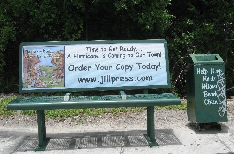 |
| - Potential Disturbance #1 ! |
|
|
Good evening! Rain! Rain! Rain! And lots more rain in the forecast with another wave coming through on Sunday night. However, the ALERT is for the Low Potential Disturbance # 1 that should be of immediate concern to all of us. It is traveling west northwest, is some 700 miles from the Windward islands and it is a wave that has been monitored since it left the African coast. Just last night on one of our local news programs it was mentioned as "Something to keep an eye on.." If you have never checked Stormpulse, it's a great way to track these systems. As I mentioned before, Plaza East Supermarket has a large flatscreen tv right at the entrance of the grocery section with Stormpulse on all the time. This current system is circled with yellow to indicate that it has a low potential of becoming a cyclone in the next 48 hours, however, as it moves closer conditions could become more favorable for development. It is not too far from the chain of islands, so please monitor this system carefully as it seems to have a rotation. Make sure all preparations are in place. Today, I had an opportunity to speak with some children about hurricanes. When I ask, "What is a hurricane?" This sweet, little girl said in her cutest voice, "It is scarey..." As for preparation, one of the boys said, " picking up things around the house" and "getting food and things we need.." They all said there's wind and rain, and so on. A hurricane is definitely a scarey prospect for all of us, but most of all, for the little ones. They should be adequately prepared. One excellent way is by reading to them or having them read TIME TO GET READY....A Hurricane is Coming to Our Town by Jill Klaskin Press. In a most colorful and interesting manner they will learn and know the importance of hurricane preparedness. Now, let's do our homework in Meteorology. Start monitoring, from every angle, this disturbance that's heading in our direction. And PRAY that is does not mean trouble with a capital "T". Have a wonderful Sunday. God bless us all! Isabel |
| - Dark clouds are moving in! | |
| |
|
| - NOAA: "100 % chance of rain!" |
|
|
Good evening! We have a little Swiss Weather Station. It's a little house with two doorways. A little man with an umbrella comes out when rain is in the forecast. A little woman comes out when it's fair. They both stay in if it's undecided. The little man is out! No wonder! With 100% chance of rain in the forecast for tonight, he's well prepared with his umbrella. I wonder where he's going without the little woman. Hmmm.. I think they're going to use one umbrella. Cozy! It better be made for two with all that rain! For a moment this afternoon, it got very dark. I was sure we were going to have a deluge! The threatening clouds moved on to Fredriksted, but between the cloudiness and the haziness visibility is only 9 miles according to some information. I raced outside with the dogs to get some food to the turtles, I got carried away doing some gardening, and spent a good hour outside trying to get things looking good in case the visiting children from the Housing Project are coming tomorrow morning to run around in the garden. The "100 %" chance of rain holds for tomorrow as well. That, if it happens, is not good for all the outdoor activities this weekend. That's bad! But we have to look at the bright side, we're not dealing with a hurricane, it's only rain. Where is BONNIE? A tune just crossed my thoughts, "MY BONNIE LIES OVER THE OCEAN, MY BONNIE LIES OVER THE SEA...! And guess what! A typhoon walloped the Phillipines, lots of casualties, people missing, and many are homeless. It's now a Tropical Storm heading towards Vietnam. That could have been our BONNIE. Be thankful, folks! Let's do the best with what we have. God bless you! Isabel |
| - Unstable Weather! |
|
|
Good evening! Around 5:00 p.m. we experienced very squally weather. It came and went fast, but it was strong. It could be the beginning of a TW which is in the forecast for tomorrow. I looked at the first image on to stormcarib and there's a small blob to our east. It extends a way back, perhaps that is why we hear of rain through the weekend. That may not necessarily be the case though. Unfortunately, in the past, we've had to cancel or postpone events due to the forecast and then the weather turns out to be sunny and beautiful. I have a similar preoccupation as the Missionaries of Charity are planning to bring several children to run around our garden and have special treats at the end of a week of activities for them. Unless we have dry weather they already have a backup plan in place for them. We'll not cancel until that morning if it's necessary. I guess it's a chance we all have to take. If only it would rain at night and the daytime be sunny. That's always my wish for visitors. Good luck to all visitors with outdoor plans in mind and may God bless you and keep you safe. Isabel Please keep the little ones in mind during the hurricane season. Get the new book geared for children ages 4 - 8. Title: TIME TO GET READY... a Hurricane is Coming to Our Town! by Jill Klaskin Press. It is published by Black Rose Writing, their website: www.Black Rose Writing.com. The children should be well prepared in the event of a hurricane coming to town and this book will meet that need. |
| - Sea Surface Temperature |
|
|
Good Night, Sleep tight! But before we do, I want to share something I just read in Dr. Jeff Masters Wunderblog, in case you have not seen it. He wrote that the sea surface temp. in June was the warmest on record! Please read what correspondent Steve Donahue of Anguilla had to say today concerning the SST where he was diving. Very interesting. It is very quiet in the tropical Atlantic, but this could be the year for mega hurricanes. That's not a good thought to take to bed, not at all. That's why in addition to monitoring each wave, it's good to wake up each morning and open the PRESENT with thankfulness. God bless us all. Isabel |
| - What's that !? |
|
|
Good Afternoon! It's probably nothing that looks like something. Last evening the Weather Channel's new hurricane expert, Mr. Knab, pointed at a large wave emerging from Africa. He said we need to watch this one. It is not in the dust as yet, up to a few minutes ago when I checked. I studied it move in a 9 frame animation. It definitely seems to have a rotation. I'm not an expert. All I can see is that the dust bowl in the Atlantic is not as dense as before; that being the case, this wave, which could mean trouble for us, can develop into something. That's why it's good to monitor these waves early. Besides, we are approaching the time when we should be ready for anything. I hope we are. Will check back later. Be safe out there. Blessings, Isabel |
| - A Stormy Night.. |
|
|
A good night to all! What a surprise! A little storm has been raising havoc since early this evening. BUT, just yesterday the charming weather lady on the local news, said it was going to be a quiet week until Saturday when a Tropical wave will be affecting us. Huh? I guess there must have been a crack in the dust bowl in the Atlantic and a wave got through undetected! I think pretty soon that that dust bowl is going to break apart all together. It 's getting overwhelmed with so many waves crossing over. We have to keep an eye to the east.! Be well, be happy, and God bless you Isabel |
| - Time to be Funny! |
|
|
Hi, all ! I was at one of the supermarkets this morning - PUEBLO - to be exact, and I could not believe my eyes. What?? A shelf with D-Icer including scraper, you know, to get all that ice off of your windshield. Ha! What a laugh! Then, I start thinking....a few days ago, the temp. was 46 in Christiansted according to the Weather Channel "local on the 8's" report. Well. it was almost double that, but the manager probably took that seriously and decided to stock up on D-Icer.!! Again, you never know, maybe Mother Nature is planning a surprise! Be well, and happy, and thank God for life! Blessings, Isabel |
| - Cloudy, Breezy, Sun Day! |
|
|
Good Evening! What a mix of weather today. The only thing that did not happen were the thunderstorms that were predicted. But then again, who knows, that could have been happening on the other end of the island. Many people were geared up with outdoor events to see the final of the World Cup between the Netherlands and Spain. It was great weather for hanging out, outdoors. Spain won! Sorry for the Dutch fans. They certainly played well and got the second spot. I guess that's not good enough. Weather wise it has been good enough. All eyes are focused on the far eastern Atlantic wondering perhaps what's going on. Why is it so quiet. Shhhhhh! Don't wake the sleeping giants! In the meanwhile, start preparing the little ones for a hurricane. How about that? They should understand, first of all, that during this time of year hurricanes form in the Atlantic and we have to prepare for such an event. One such book that children ages 4 - 8 would not only enjoy but learn lots on how to prepare for a hurricane was recently published. This book is a must read Time to Get Ready... A Hurricane is Coming to Our Town by Jill Klaskin Press. You'll be finding out more about this book soon. It is better to prepare them gently with time than to wait until a hurricane is on the way, everyone is nervous, and the children are not properly prepared to handle the situation. So, thank God for this quiet time. Let's use it well. Blessings, Isabel |
| - 46 degrees in Christiansted! |
|
|
Good Morning! That's right! It was on the TV screen and it was said aloud during the local forecast given every 8 minutes! I did a double take. There it was, 46 degrees! You think the guy that read the information would know that that could not be correct. Are we dealing with robots? It makes me wonder sometimes. No, it was not 46 degrees, more like 75 heading for a high of 90 today. As Dave mentioned, there are some blobs out there. I think that if it were not for the plume of dust that's protecting us, we would already have had some serious storms out there.That one blob heading northwest looks promising. Maybe I don't have to wash my car after all. We'll see if it does come up this high. We cannot always rely on Computers to tell us what we are seeing. It's best to do our own study and prepare accordingly.Have a wonderful day. I'll check back later. Blessings, Isabel For you, World Cup Fans, I want you to know that Germany put together their team 6 weeks before the tournament. Spain has had the same team for 3 years. As we all know, Spain won, but considering that Germany won a few 4 - 0, that's not bad for such a baby of a team. These, of course, are all professional players with other teams in their country, but unless a team practices together for a long time, there's bound to be problems beating a more experienced team. How do I know all this? My family is part German and they're touring the country right now, having a great time. |
| - Hurricane Season's Starry Sky |
|
|
Good night, all! This evening there was a ten minute power outage and I was delighted with the heavenly sight, a trillion stars at one glance! What an amazing sight! Hey, if that's the only way we can see the stars, then....... I'll say no more. Be careful what we wish for, right? Shortly after the power was back on I heard an emergency vehicle speeding by. Aha! I bet someone knocked down a utility pole! That's life in the tropics! One gets used to it, after a while. Besides, we have to make the best of everything. Think of all the things that can be done during a power outage. It takes little imagination, but one of the most innocent things one can do is sit out on the deck, have another happy hour and enjoy the beautiful sky. Try it next time, unless you have a better idea. Big, angry looking clouds came by this afternoon. I think we got about two drops out of them. I prefer that to what they are having along the Texas-Mexico border today and for the past week. ALEX dropped some 34 inches of rain and now more with this Tropical Depression that followed the same path as ALEX. One weather blogger said there are going to be many T.Ds this season, how depressing! Everyone, or just about, is preparing for a very active hurricane season in the Atlantic. Last year it was the Pacific side that had to deal with one storm after another, BIG ones at that, now all eyes are on this side. The rush is on more than ever to find a way to stop the oil from spewing out. BP said it will take another two weeks. That's cutting it a bit tight. Trouble with a capital T is on the horizon. We known that BONNIE is soon going to start looking for ALEX. So much for that. Let's see what tomorrow brings. Tonight, turn off all the lights, enjoy the starry sky and be thankful. God bless you. Isabel |
| - Saharan Dust vs. Tropical Waves |
|
|
A Good Afternoon to all! The T.Waves are coughing their way through all the Saharan dust. That's good. As long as the dust is just off the coast of Africa, the Waves don't have much of a chance to develop early. We have a lot of dusty haze around here too, and it shows on the vehicles as well. For those who like squeaky clean cars, you just have to wash it everyday if it's parked outside, or get rid of all the junk in the garage and park it inside. (I wish I could do that!) Seriously, the dust has its pros and cons. Good for keeping storms down and bad for the many who suffer health wise as a result. So, what should we have, dust? or no dust? I'll take the latter for the sake of those who are affected by it. (And I still wish I could put my car in the garage.) We are expecting some rain from the T.Wave on Saturday. Depending on the weathermen, it could pass close to us or farther south. So, we'll just have to plan the day according to how it turns out. Whatever the case, enjoy the day and be thankful for life. God bless us all. Isabel |
| - Days ah comin' !! |
|
|
Good night islanders and beyond! That's right! "Days ah comin" and I don't mean days of the week either, I mean "They are coming". There is a big wave in the middle of the Atlantic or closer which should show it's presence by Saturday, hopefully only as a wave. I heard about it today on the evening news and can see it on Stormcarib's satellite imagery. Behind that, just off the coast of Africa, not too far from the Cape Verde islands is a whopper! It's a Low already at that point. It's barometric pressure is 1002, a storm in its own right. When they hold together that far out, and the pressure continues to drop below 1000, we are looking at trouble. The Cape Verde storms are the biggest, most powerful. Are we going to have an early Cape Verde season.? If so, God help us. After some rumblings of thunder this morning the tropical wave moved out of the area.. The afternoon wore on with a heavy, dense sky but no rain in Christiansted. Uruguay and the Netherlands battled during the semi-final World Cup match today; it was definitely not an easy match for either of them. Keep an eye to the weather. Let's monitor those waves. God bless us all! Isabel |
| - Wave, Goodbye! |
|
|
Good night. folks! That ominous looking tropical wave arrived just before 3 p.m. with whiteout conditions and gusty wins. Impressive, short, and sweet. How can anything like that pose a problem for anyone? Before I knew it, it was gone! After the meeting which was almost canceled, I returned to do some gardening in what was left of our daylight. The sun was peeking through the remaining clouds. Tonight and tomorrow hold a high percentage of rain in the forecast, but I think that should not materialize. Rain or shine, I have work to do, either way I'm going to get something done, health permitting. When you live alone, even temporarily, get LIFE ALERT. I saw the ad on TV. I often wonder what would happen if I had an accident and there was absolutely no one around but the pets. Yikes! I tend to put myself in precarious situations. Of course, if I got hit by a tree it would not help, like the day, I was mysteriously yanked to the side and (WHAM!) the half sawed tree I was working on broke off when I had my back turned to it, and came crashing down right where I stood a few seconds earlier. (Don't believe in Guardian Angels? Think again!) It was a papaya tree, but nevertheless a solid trunk. It would have been fatal; a pity on such a beautiful, sunny day. The clock is ticking, soon BONNIE will make an appearance. Where? Only God knows. Monitor the suspects, the tropical waves, until they're off the "dangerous" list. God bless us all and keep us safe! Isabel |
| - Sunny and quite Breezy! |
|
|
Hello fellow correspondents along the island chain! As I read from your reports the rain has arrived. We are still having dry, sunny weather here, however, that should change later. The breeze makes it a pleasure to work outside in the garden, but I have a lot of indoor stuff to take care of and I need the rain to keep me inside. So, I hope it rains, I need to get started on some important indoor projects the sooner the better. Leave it to me, I prefer puttering about outside. I've been battling the "spaghetti" on the bushes. Anyone has any idea how to be rid of that!? I understand it's medicinal. Well, I hope it's good for stress! If so, I need to boil and drink a whole potful. That stuff seems to thrive especially at this time of year. I'd appreciate any input from anyone out there. I laugh when I remember how as a child I used to pretend it was spaghetti with sauce and stir it around in a little pot. Back to this current disturbance, it does look, as someone mentioned, that it could pose a threat down the road. For us, the rain is often a welcome thing, especially when the cisterns are low. Right now they are full as I expect they'll be for a long time as long as these Waves keep coming. Let's hang in there and be ready for whatever comes. God bless us all! Isabel |
| - The BLOB-potential disturbance #4! |
|
|
Not a good thing to sleep on, but yes, I just saw it on Stormpulse. Low potential disturbance #4 is on 14.3 N 59.6 W (I'm not sure if this is the current position at this hour.) "An area of disturbed weather approaching the Lesser Antilles will bring heavy rainfall and gusty winds to the Leeward and Northern Windward islands, the Virgin Islands, and Puerto Rico during the next couple of days..." There it is. It's quiet now weather wise; some music in the distance, the Tropical night sounds all around, but that should be changing very soon. Monitor this system! All the best. Blessings, Isabel |
| - BLOB Alert !!!! |
|
|
Good Evening, folks! Hope it was a happy 4th! Dave is right. I've been studying this BLOB to our east on and off throughout the day. It does look very impressive, as if something is going to come of this one. I have not been able to get NOAA on their Weather Station, so I have not gotten enough information on this system. The Weather Channel folks did say this morning that they are keeping an eye on it. It's quite possible it will be invest 97. I hope it will not be the tricky kind to develop right over us. I kind of expected July to be very active, because as we remember, the seawater in May was as warm as it is in July. I believe that with the warmer seawater, the activity will be earlier. The month of July is only just beginning and there are three areas of concern already!! The Monterrey friends I was concerned about have arrived in St. Croix, but now there's another system with similar traits as ALEX following the same path. It will take that city a long time to recover from the catastrophic damage it sustained with the 34" of rain delivered by the storm. They don't need more rain!! Are we prepared? I'm concerned about a slope behind us, which looks like it can come crashing down. It will not affect the house so much as the road above. I had someone here from Public Works take a look at it and he did agree that it was dangerous. He took photos to send to St.Thomas. There has not been another word since concerning this situation. Don't they usually wait for something really bad to happen before they do something? Well, I took other, more recent, photos since the last heavy rain we received from the Tropical Wave that was the beginning of ALEX. More deterioration took place. We'll see how it fares after more heavy rain with this Tropical Wave, Get ready, get set, and God bless us all. Isabel |
| - Rainy or Shiny 4th? |
|
|
A Happy Fourth of July weekend to all of us who celebrate it ! The forecast sounds good for our next two days, but then it all goes down hill with the next tropical wave. One channel says it begins on Sunday evening, another says more like Monday. We need dry weather for good fireworks, we'll see. The people in Monterrey are reeling from the torrential rains from ALEX. At least 20" were predicted; according to Dave about 34 " fell. It's a catastrophe of mega proportions. Not even the present government had seen anything like this before, nor had prepared accordingly. It goes to show that this year is going to be full of surprises. Our friends' daughter and family in Monterrey are fine though without water and power. Getting around is a challenge since many streets and avenues are a mess of mud and debris. Some amazing video footage has been shown`on TV. Are we prepared for a surprise of mega proportions this hurricane season? Let's take another look around and see what else we need to check off from our list. It's so easy to become complacent when the weather is nice and everything is moving along. The tropical waves are also on the move, across Africa, and into the Atlantic, and on the way to us. Dave calls them "foot soldiers wanting to be king"--they start out small and become BIG enough to make headlines. Enjoy the celebrations, be safe out there, don't drink and drive.! Blessings. Isabel |
| - "Monitor" - the key word! |
|
|
A good afternoon to all! I was very concerned for the daughter, of some very good friends, who lives in Monterrey, Mexico with her family. I noticed that ALEX was turning more in that direction. Word back from the daughter was that it was not going to get close to them. Her Dad said that Monterrey is surrounded by mountains and that they hardly got any rain there. So much for that. Then later in the evening I heard the weatherman mentioning Monterrey and was showing how ALEX was making a beeline to that city, surrounded by mountains; a bleak scenario indeed. If it hit that city, the weatherman said it would cause catastrophic flooding, especially because of the high mountains around the city. My hope is that the 20" of rain expected with ALEX would not cause fatalities and that our friends' daughter can come to St. Croix with the grands this weekend as planned. I sent out the alert early in case there was any chance of them leaving before ALEX arrived. It is so important to monitor the storms. They have a mind of their own and can change paths previously announced. I'm anxious to find out how they fared. Yesterday at this time we were anxious about another matter closer to home. We were contemplating the burial of our little Pomeranian pooch. It was a beautiful, clear day. The large Flamboyant tree at the Pet Cemetery in our lower garden was dropping bright red petals. Our family group gathered some of the petals to place on her place of rest. She was a Grand old Lady, worthy of respect. The Saharan dust is battling the tropical waves, at the moment they are both sharing the skies, however, some rain is supposed to break through. All in all, a nice day to do some gardening, especially lawn mowing. And yes, referring to other correspondents' reports, there's an abundance of fruit thanks to all the rain we've been having. I received a tip recently which came from an old, know- it- all, man. If you want your tree to bear large, plentiful fruit, throw some constr. nails around the base of the tree. Bizarre, but it seems to work. Memories of Marilyn. Is that the title of a book? Is it about Marilyn Monroe or Hurricane Marilyn..? Considering the season we're in, I'm sure Dave meant the latter. This year could have a repeat performance, that is the fear. Let's pray and watch, and hope. God bless you. Isabel |
| - Beautiful day | |
| |
|
| - Yesterday and Today |
|
These two days were identical, almost. The photo mentioned in the
previous post did not appear, so here it is; taken from our porch.
Hope tomorrow will bring some nice weather as well, especially for our
visitors.

Blessings,
Isabel

You have been sent 1 picture.


100626sunset.jpg

These pictures were sent with Picasa, from Google.
Try it out here: http://picasa.google.com/
Attachment:
100626sunset.jpg |
| - Sunny Sunday! |
|
|
Greetings! Even though we have rain in the forecast we haven't seen any, which is great as we had a farewell party for some wonderful friends today whom we are going to miss. Heavy downpours as we've had recently would have put a damper on the event. It has been sunny and very WARM! Someone was commenting that it's still so warm in spite of the rain. We are, after all, in the warmest months of the year; it's going to get warmer, and hotter as we go. (Thank God for air conditioning, where ever we can get it!) Be ready! A wild roller coaster ride awaits us. Alex started it off with Walter wrapping it up, or...? Is it really going to be as active as the experts have said.? Only Time will tell. So, stay tuned in to your favorite weather source, channel, radio station and be ahead of the next one. It should not be long before Bonnie appears somewhere in the Atlantic. Enjoy the rest of Sunday and don't forget to rest! God bless us all! Isabel The attached photo taken yesterday, by all appearances, shall repeat itself today. |
| - Blue Skies!! | |
| |
|
| - Good news about 94L! |
|
|
Good night, folks! According to a very reliable source, we won't have to be concerned about 94L as it is heading out to sea. Perhaps only Bermuda will have to watch out as it could be moving that way. Whew! This evening we had torrential rain, wind, and the works, lightning and thunder! It last quite a while. I was sure we would have a power outage, but it never happened. That's progress! All eyes now are on the Tropical Depression which form this evening from 93L. There are many nervous people out there. I can't blame them. It's such a sorry sight, all that oil in the Gulf. What is worse, is that all work there must cease if a storm is headed that way, which means the oil will continue spewing out into the Gulf, non-stop!It's a nightmarish scenario. Hopefully it turns away and does not affect the on going work. Some 12-15 inches of rain is expected to fall on the surrounding islands and countries. That always triggers mudslides and flooding. I must remember Hurricane MITCH at this moment as that storm stood stationary for three days over the Nicaraguan/Honduras mountains. Thousands of people lost their lives then. A bleak scenario for the weekend is in store for the Western Caribbean. I wish you all well. God bless you. Isabel |
| - Invest 94 in our neighborhood! |
|
|
A very good afternoon to all! What a wet day! It has been raining since this morning! Some real heavy downpours; some thunderstorms! And what a pain that our electric gate is waiting to be repaired. That means getting out of the car to open/close it manually. Couldn't be at a worst time, but hey, this is nothing compared to what some others are getting. And it almost seems that 94L, which has an ominous appearance, looking rather huge and threatening to become something, is about to enter our neighborhood! We have to keep an eye on this one as we do all the others coming off of Africa. It's going to be a long haul. For those who don't like rain,--grin and bear it. However, there is an endless number of activities to beat the rainy blues and be happy. Hang in there. God bless us all! Isabel |
| - Ants and the Weather |
|
|
Hello, this wee hour! The topic is about wee insects. Ants! Watch out if you are extra sweet! There are MANY of them.! I heard that the amount of ants in a given hurricane season indicates what kind of season it's going to be. MANY ants has to mean that it will be a bad season right? The Ants are foraging like crazy! They don't want to be out there looking for food during bad weather! Smart! So, they are getting it now from every source. Does anyone out there have any information concerning ants/hurricanes?? One thing that is really interesting is that ants won't cross a chalk line. If you can't be rid of them and don't want them in a specific area, draw a line, they won't cross it.!! Amazing! We should be doing what the ants are doing, --getting our emergency supplies. The new hurricane expert at the Weather Channel said June/July are typically quiet. He did not put into consideration that this is not a typical year. The sea has been warm early in the year. I would not be surprised to see a few named storms in July. Certainly, the ants are trying to tell us something. Let's do some research! There was a lot of haze again and lots of threatening clouds, but not a drop of rain. We are to get that during the weekend. The Mango Melee could be on the wet side, but that's the least of our worries when we see what a rain system did to a town in Brazil. God bless us all. Isabel |
| - A Dry Thunderstorm! |
|
|
Good evening! We are having, at the moment, a dry thunderstorm. Perhaps the rain is falling elsewhere, or it is still coming? In any case, the forecast calls for RAIN through the night and into tomorrow for a good part of it. We had a mostly sunny day yesterday, quiet weather wise. We expect the weather to continue unstable for the next months with one Tropical Wave after another heading in this direction. Our cisterns are full as I'm sure is the same for everyone, or not? If not, it won't be long now. What do we do with the excess water! So much waste! Everything is looking a bright green! The weeds are thriving, too, unfortunately. But the crickets and the frogs are having the time of their lives. Those who mind will just have to get earplugs. Sorry for the visitors who look forward to beach days and sightseeing. These heavy downpours are not encouraging. I remember when as a child, I used to run out in the rain to play, as well as all children at that time; now children are so protected from rain that they are sick most of the time. We looked forward to the rain so that we could play in it.!! Alas, how times have changed! Until the next post. Be well, be happy, and God bless you. Isabel The Pomeranian is hanging in there. A very strong pooch. |
| - Rain? Tears? |
|
|
It's almost tomorrow, folks! It is already tomorrow! And here I am still up and tired and listening to thunder in the distance. I think Invest 93 is trying to tell me something, like " Go to bed, and you don't have to use the ipod with the Thunderstorm on it to fall asleep tonight ''! Well, I guess that's what I'll do. Princess, the Pomeranian, is sleeping on a mat in my bedroom. She has refused the soft, round bed I made for her. She probably feels too warm. She is so amazing. She still tries to follow the rhythm of the household, but is too weak. It is raining very hard now. NOAA radio has been issuing warnings on this heavy rain we are having now. The ground is very saturated and many places are flooding. I feel sorry for all those in low lying areas. Invest 93 is one to watch. It is giving us rain, lots of it, but it has that potential of becoming a dangerous system, perhaps heading to the Gulf of Mexico where so many people are working feverishly to clean up the oil spill, to stop the flow; a storm would interrupt that tremendous effort. Let's hope that the new day will bring some good news with it for everybody. I get my share of good news everyday when I attend Mass and lead the singing. It certainly is very comforting and provides the strength I need to carry on when some burdens become too difficult to deal with. May God bless us all! Isabel |
| - Low cloud cover, torrential rain.. |
|
|
Good evening, folks! It has been raining "cats and dogs" since 5 p.m..As we looked earlier at the satellite imagery on stormcarib it was clearly visible. This convection is a salute from Invest 93L, which has a medium potential of developing into a tropical cyclone. It was moving earlier at 12mph. This area is ripe and ready for the Waves as they trek through. It is a hotbed for TSs and Hurricanes. Concern is focused on Haiti which will definitely feel the effects of this system. Here, in a province or estate called William's Delight - many homes were flooded after the torrential rains on Sunday. It was a very sad and trying time for them; with today's heavy rain it could only have tripled their misery. This may very well stay with us for a while. We can only hope that those in authority to work at improving conditions for the people in W's D, will work quickly to get the job done. It must be horrible to have to wade through water in your own home. In the meanwhile, all the rain we had late this afternoon has moved on precisely to the West where the flooding took place yesterday. The skies are threatening and we expect more rain. We certainly got our wish for full cisterns! I will post later according as conditions warrant. God bless us all. Isabel |
| - Rain! Rain! Rain! |
|
|
Good evening! This is the wettest Father's Day on record! (Our records, at least..) What a day! I just listened to NOAA and 92L is still trailing a long tail, which is going to continue causing light to heavier showers this evening, with some thunderstorms! This was the kind of day on which I would put on the fireplace (DVD) and curl up with a book, snooze, and just have a perfectly cozy time; however, it was another kind of day. We celebrated Father/Grandfather's day with a favorite homecooked meal, had a short siesta with the soothing rain on the roof, and then we were set to see the World Cup Soccer/Football match between Brazil and the Ivory Coast. It was a great game, except they got feisty towards the end. Brazil won 3:1. (The rain is coming down heavier again.) Throughout these days, much on our minds, is our ailing Pomeranian pooch who is reaching the end of the road, heading towards the "cross over bridge". Yesterday, with a heavy heart, I toured the lower garden looking for a burial site. The Vet said it's a matter of time. She's lived a good long life, certainly been spoiled a good many years, first by her original owner who died, then by us. In the meanwhile, she is still strong enough to fight us as we try to feed her Nutri Cal and an antibiotic in a syringe. With both "kidney and liver failure", how does she get her energy to fight.? It took three people to hold her still enough to administer both. Even though she likes the Nutri Cal she still resists. An amazing little creature. Enjoy what's left of this day, only God knows what tomorrow will bring. Be well, Be Happy, God bless you. And "let a smile be your umbrella". Isabel |
| - Happy wet Fathers Day to all | |
| |
|
| - Whiteout ! |
|
|
Good morning and a very happy Father's Day! We are currently having whiteout conditions as of 6:30 this morning. Instead of getting lighter, the pre-dawn hours became darker. The clouds were descending upon us and when they burst it was a deluge! According to NOAA, we will be having the effects of this system (92L) until this afternoon when it clears the area entirely. In the meanwhile, we can be truly thankful to God that we are not dealing with a major hurricane instead. There's always a reason to be happy. Keep smiling. God bless you. Isabel |
| - 92L at the head of a colorful parade! |
|
|
Good night, folks! Well, it seems that we all got a good drenching last night! The whole percussion! The worst thing about the blackout around midnight is that all fans go out too. It was so hot! Funny, that earlier in the evening I showered by candlelight (in a glass jar) just in case of a power outage. Then later when it did go out, the candIe was out, nor did I have my little solar powered flashlight with me; nor the cell phone that comes in handy as a flashlight as well. The pets were all around me, scared to heck with the thundering. The frequent lightning when it happened offered enough illumination. It was pitch dark otherwise. What's interesting is the colorful parade of tropical waves behind 92L as if it's leading them! Though, I must say that all that color does not really indicate the true nature of things. After last night's rain, we have had just a few sprinklings; yet in the satellite imagery it looks as we are being bombarded left, right, and center. It has been a rather quiet day here with lots of cloud cover. The sun did peak through and that seems to be tomorrow's outlook as well. The indications are that we're in for a lot of activity through the next months. All correspondents seem to agree with that. I'm glad that Max has emailed his thoughts on this present activity and where it's going. Thank you, Max. Have a peaceful night and God bless all the Fathers/Grandfathers out there! Isabel |
| - Fwd: What's up? | |
| |
|
| - The Weather Channel |
|
Power is out, heavy rain and thunder and lightning ... Cats warned us!

~Jill~

Local Severe Weather Alert for Christiansted, VI (00820)
...FLASH FLOOD WATCH REMAINS IN EFFECT THROUGH SUNDAY AFTERNOON... THE FLASH FLOOD WATCH CONTINUES FOR * ALL OF PUERTO RICO...CULEBRA...VIEQUES...AND ALL OF THE U.S. VIRGIN ISLANDS. * THROUGH SUNDAY AFTERNOON * A TROPICAL WAVE APPROACHING THE U.S. VIRGIN ISLANDS LATE THIS FRIDAY AFTERNOON...WILL MOVE SLOWLY WEST NORTHWEST ACROSS THESE ISLANDS EARLY TONIGHT AND THEN ACROSS PUERTO RICO LATE TONIGHT THROUGH EARLY SATURDAY. THIS FEATURE AND ITS ASSOCIATED MOIST AND UNSTABLE AIR MASS...WILL COMBINE WITH LOCAL EFFECTS AND FAVORABLE UPPER LEVEL CONDITIONS TONIGHT THROUGH SATURDAY AND LIKELY CONTINUING THROUGH SATURDAY NIGHT AND SUNDAY...TO PRODUCE PERIODS OF SHOWERS AND THUNDERSTORMS...SOME WITH MODERATE TO HEAVY RAINFALL ACROSS THE LOCAL ISLANDS. * TOTAL RAINFALL ACCUMULATIONS OF 3 TO 5 INCHES...WITH LOCALLY HIGHER AMOUNTS...ARE EXPECTED THROUGH THE WEEKEND. THIS RAINFALL HAS THE POTENTIAL TO PRODUCE LIFE THREATENING FLASH AND RIVER FLOODING AND MUDSLIDES WITHIN THE WATCH AREA. ALL LOCAL RESIDENTS...VISITORS AND EMERGENCY MANAGEMENT OFFICIALS ARE URGED TO REMAIN ALERT TO DEVELOPING WEATHER CONDITIONS BEGINNING TONIGHT AND CONTINUING THROUGH AT LEAST SUNDAY AFTERNOON. PRECAUTIONARY/ PREPAREDNESS ACTIONS... A FLASH FLOOD WATCH MEANS THAT CONDITIONS ARE FAVORABLE FOR HEAVY RAIN ACROSS THE WATCH AREA...WHICH MAY LEAD TO FLOODING. IF YOU ARE IN THE WATCH AREA...CHECK YOUR PREPAREDNESS REQUIREMENTS... ESPECIALLY IF YOU HAVE INTERESTS ALONG AREA RIVERS. KEEP INFORMED... AND BE READY FOR QUICK ACTION IF FLOODING IS OBSERVED OR IF A FLASH FLOOD WARNING IS ISSUED. PEOPLE IN THE WATCH AREA SHOULD CONTINUE TO BE AWARE OF THE POSSIBILITY FOR HEAVY RAINFALL. AVOID LOW LYING AREAS...AND BE CAREFUL WHEN APPROACHING HIGHWAY DIPS AND UNDERPASSES. PLEASE STAY TUNED TO NOAA ALL HAZARDS RADIO...LOCAL TV...RADIO OR YOUR CABLE TELEVISION PROVIDER FOR THE LATEST INFORMATION ON THIS DEVELOPING WEATHER SITUATION. THIS PRODUCT...ALONG WITH OTHER WEATHER...HYDROLOGICAL AND CLIMATE INFORMATION... Sent from my iPhone |
| - Still 167 mi. from us... |
|
|
Good night, all! Soon after my last post we got bombarded with some good downpours. It's on and off now like a water faucet. We expect this will last as promised for the sake of those of us with cisterns. Would be nice if all the systems would be this gentle. Well, let's see what tomorrow brings. I must say that keeping up with the weather has been a good distraction for me especially, as I'm also keeping a concerned eye on our elderly Pomeranian who is perhaps seeing her last days. It's always difficult to say goodbye. We've been through it before. Have a good night. God bless us all. Isabel |
| - What's up? | |
| |
|
| - Molasses going uphill.. |
|
|
Greetings from my desk to yours! This system, 92L, is really slower than molasses going uphill. We are on 65W and it is still on 60! It seems to be stationary. How can it be moving at 15mph? Anyway, the winds must be really strong in the upper levels of the atmosphere, to keep it from making progress. We are being told time and again, on NOAA Weather Radio, that we should expect a copious amount of rain with accompanying percussion, thunder/lightning, flash floods, landslides, gusty winds, and whatever else..And this is to go right through the weekend. Fine with me. We can continue studying German for an upcoming trip. My grandchildren who are traveling there for the first time, are being coached as to how to respond to basic questions. We had such a session after lunch at home today. We went on to teach the names of utensils, plates, etc.. It was hilarious! That's one example of what one, or two, or five can do on a rainy/stormy day. I shall post one more time before I retire tonight. Until then. Blessings! Isabel P.S. My weather dog just came cowering at the rumbles of thunder in the distance. |
| - Sunny and squally... |
|
|
Hi ! We are having very sunny weather this morning with intermittent squally weather. The computer models have dropped more to the south, no longer going over us. However, the NHC still has a lot of rain and thunderstorms in our forecast for the next two days. We'll have to wait and see if that materialises. This month is usually still fairly quiet with periodic waves going through. It's the month of July of which we must be wary; it's akin to a lion waiting to pounce! Vigilance and preparedness must increase as time goes by. How many storms have been predicted for this season? Twenty-three? That means that when they start out it will be one after the other. That can be very exhausting! For the moment, we can breathe easy. God bless us all. Be safe out there. It was so sad to hear the President Mandela's great-granddaughter (13) died in a crash caused by an intoxicated family friend. Do not drink and drive! Celebrate, have fun, stay off the booze if you're going to drive, or get a designated driver, at best a teetotaler, to drive. Many precious lives have been lost because of someone's negligence. Be a responsible driver and have a very happy Father's Day. Isabel |
| - Wheeee |
|
|
Whoa, Yo! To everyone who looks at the satellite pictures. Wowee, it's not nearly so bad an image if you go look at the radar out of Martinique/Guadeloupe, on weathercarib.com. Rain happens. Take care of leaks and things tomorrow. As long as there's not a name, I'm happy. Take care, Melissa ~~~~~~~~~~~~~~~~~~~~~~~~~~~~~~~~~~~~~~~~Melissa E. Keyes St. Croix, U.S.Virgin Islands |
| - Almost here... |
|
|
Good night, everyone! According to the National Hurricane Center (NHC), "A strong tropical wave approaching the Leeward Islands is producing an area of showers and thunderstorms.." They went on to say that this wave increased in intensity this evening. They gave it a 20% potential of development into a cyclone in the next 48 hrs.. So far, the night is quiet. I think that once the TW enters the Caribbean Sea it can once again become a very serious threat. It has held together very well and even increased with the fierce wind against it. It is also climbing, therefore, we should be in the direct path of if. Again, thank God it is not a hurricane. Things will probably go downhill from tonight. i will post again tomorrow morning, closer to noon. By then there should be a better indication of conditions here. In the meanwhile, follow the track of the TW on stormcarib, read the reports of the correspondents on the island chain especially those affected directly by this system and find out more about this "strong tropical wave". Have a good night, sweet dreams, and God bless you. Isabel |
| - The Tropical Wave BLOB is approaching! |
|
|
Good afternoon! Thank God the wind shear destroyed any potential for the formation of a cyclone, but looking at that BIG BLOB to our east, almost in the neighborhood, I wonder about the possibility of it intensifying down the road after it passes us. I hope everyone is keeping an eye to the weather. I understand that the worse day will be on Saturday, but can linger well beyond Sunday. Guys, I think you could be in for a very stormy weekend for Father's Day. Enjoy your day anyway. There are many family things to do even on a rainy day. I will post later again about the conditions. Deterioration of the weather is already taking place with the little disturbance ahead of the BLOB. We expect a lot of rain, which I hope will be enough to fill the cisterns. Until later then. Have a good rest of day. God bless you. Isabel |
| - A tropical night.. |
|
|
Good night, friends, near and far: What a gorgeous time to be in St. Croix, hurricane season and all! The sea is warm, the flamboyant trees are in bloom, mangoes are in abundance, the trade winds are breezy and comforting in the steamy heat, and the showers are refreshing. This evening after a perfectly wonderful time in the sea, enjoying the calm while it lasts, **lightning flashes began to illuminate the sky to the south. Eventually it was followed by rumbles of thunder. Now, this might surprise many who live away, but we seldom hear thunder. We had a heavy, brief downpour (can't call it a shower ), just enough to keep the frogs happy. There is more on the way for Thursday, with a marked increase on Friday and Saturday as the tropical wave passes over us.The lawn was starting to look kind of dry, so this welcome rain will be an all around relief. A word of caution concerning lightning. Maybe you caught the story on the Weather Channel this evening about the young woman who'd just returned to her hometown(?) in the States, from the Bahamas. She got caught, in a sudden storm and raced for the large tree nearby to protect her from the storm, when in reality she was heading to her death! The worse thing one can ever do is stand under a tree during a storm. Well, lightning struck the tree, it went through her body and out her feet. Her boots were tiny pieces in the debris around her. She was cold. The massive tree was split in half! It's too bad for the young woman so full of life and for her family. Please pass this story on whenever you have a chance and remember that it's dangerous to stand under a tree during a storm. The tallest point becomes a lightning rod as that tree did. All the best to everyone. Stay safe and God bless you! Isabel |
| - Beautiful Morning | |
| |
|
| - An earlier peak..? |
|
|
Good evening, folks! Whew! that looked scary for a moment! Now we can relax a bit. I was wondering...I heard that the peak of the Hurricane Season will happen earlier this year because the SST was high earlier than usual. That changes the whole picture apparently. The sea in April felt like it does in July. So, I guess that means that August will be more like September. In which case, there should be a battery of storms beginning in July. Can anyone clarify this, add or subtract ? One way of the other, it does not matter, as we have to take it as it comes. We cannot argue with Mother Nature. In the meanwhile, we are enjoying the sea. We are not the sit-around-on the-beach type of people. We go in right away and spend a good half hour swimming and doing water aerobics (me), or just float contentedly. Which reminds me, in case I have not shared this story as yet: Some years ago, my husband, our visiting son, and I were doing just that, relaxing in the water in the evening, having a conversation, when we noticed some fish chasing each other. They came in our direction and all of a sudden one of them was surprised by our presence and ran smack into my right eyebrow! It was as if a stone hit me! They floated me to the shore. I was somewhat whoozy. At home I took some pain medication, but my biggest fear was that the next day I would wake up with a black eye! Who would believe the fish story....?? Sure, sure, they would think it was my husband who did it, except for those who know him, his gentle natured way. Well, I did not have to worry about that. The next day, there was a slight redness on the eyelid and that was hidden with some makeup and my glasses. The weather is truly beautiful at the moment. The forecast holds some rain for the weekend, after all, but not as much as with a tropical system, unless that changes. I wish everyone a safe and happy endless Summer these next couple of months with the children all out of school. God bless us all. Isabel |
| - 92 L - Fizzled! |
|
|
Well, well, well! Has it really fizzled? Or is it one of those peek-a-boo systems? Whatever the case, it now looks good for the weekend, Fathers' Day celebrations, June weddings, picnics, and a slew of other outdoor activities. We know that it's only a matter of time before something else comes along. We did look forward to the rain. It's always a welcome thing when you depend on cisterns. We can be very thankful that we are not suffering the tremendous floods they are having on the mainland. A woman who was being interviewed said she never thought they would have such floods as in Oklahoma City. She thought that that was something one sees happening on TV in other places, to other people. It goes to show that we are all vulnerable and anything can happen at anytime. We are also fortunate that we are nowhere near the oil spill, however, we can only feel sorry for those who are in distress and do whatever is in our power to help. We must keep Haiti very much at the top of our lists, as many thousands are still sheltered only by tents. We know from the past that Haiti is often in the path of the storms and there are always many fatalities. It would be great if this year could be gentler. Let's continue to be vigilant. This is only the beginning of the season. God bless and protect us all! Isabel |
| - 92L - To Be or not to Be? |
|
|
A pleasant good night to all! To Be or not to Be. That is the question! However, we all need rain in the Caribbean; some more than others. We had to order a truck full of water today. Sporadic spurts of rain cannot supply the demand. So, we would be very happy if 92L dumped some much needed rain on us beginning this Friday. A concerned friend wanted to know if it's going to rain on Sunday -her son is getting married. We'll wish for a dry day especially. It's too early to tell. it could very well be dry. The system behind 92L is quite a formidable one. That definitely bears watching. We enjoyed the beautiful, warm water at the beach this evening with a glorious sunset! Let's keep monitoring and make sure that we are prepared. God bless us all! Isabel |
| - High Potential Disturbance #1 !! |
|
|
Good night, all! The disturbance in the Atlantic has been upgraded to that of "high potential" with a 60% chance of developing into a tropical cyclone in the next 48 hours. It is a very unusual system forming so low, near the equator. As it pulls away from the spinning force of the equator it apparently has a better fighting chance. It already is doing that and all ingredients are in place for cyclone formation. It is quite possible that by Tuesday if not sooner it will become a Depression, and possibly more. We'll have to monitor it carefully, watching and praying. God bless you. Isabel |
| - Beauty and the Beast |
|
|
A beautiful day in St. Croix. Sunny and very warm, with soft breezes. A good day to go out and enjoy life, a good day to stay in and enjoy life. Either way, it's a blessing to have a day like this when so many other places are having their share of strife. It was a day to thank the Lord for all good things and pray for a safe hurricane season. The big island of St. Croix with breathtaking views at every turn along the coast is a precious gem. That is why we want to protect it from hurricanes, but can we? At the moment, we are tracking a potential threat, which is called 92L for the moment. If it develops it will acquire the name ALEX, the first in a series of storms predicted for this season. Most of them will come out of Africa in a westerly direction, towards us, but often take a turn to the south or to the north. We have not had a direct hit since HUGO in 1989. Since then they have affected us considerably, but nothing like HUGO, which impacted the island in a horrific manner. Some went without electricity for months. That has not happened since. Usually, the power is interrupted until the storm passes and resumed after all utility posts/wires are safely back in service, area by area. In less than 24 hrs. we have that essential utility again, and life returns to normal, that is, after garden debris is cleared and dumped. The storms are like beasts which threaten the beauty of the islands in the region. A beauty marred for a time, but which thankfully bounces back to bloom and give joy. As is said, " A thing of beauty is a joy forever". Let's keep an eye on 92L as we go about our business, and hope that it does not become a beast. God bless us all. Isabel |
| - Eye On A Potential Storm! |
|
|
Attention, Neighbors! In case you have not noticed. There is a broad area of disturbed weather to our east which has the potential, though low at the moment, of slowly developing "in the next 48 hours". Normally, I would not think too much of it, because it is quite low as well; however, all the comp. models except for one has it coming in our direction. Considering the predictions for the season, it is not too early for a TS or even a Hurricane to form. The farther away these systems start developing the larger they can become. The SST has been quite warm since early in the year, making anything out there a potential risk. We must keep an eye on this system, especially since it seems to be heading in this direction in the long run, unless wind shear tears it apart. We need not worry about anything, if we are ready for everything. We should have been ready a long time ago. Let this system be an alert for all of us. We don't know what it is capable of in the course of the next week, probably by the end of next week, if not sooner, according to some weather bloggers. All we can do is pray and hope that it fizzles as we hope with all of them, but that is simply wishful thinking. We are in the forecast this season as having a land falling storm, where in the Caribbean, no one knows. That is why it is so important to prepare early. Have a good night, enjoy the World Cup, or the Mango Melee, or the beach tomorrow and may God bless us all. Isabel |
| - Nasty Solar Storms Ahead |
|
|
Good Night, folks! The title of this blog caught my attention and I want to bring it to yours s as well,if you have not seen it on Yahoo news information. As if we don't have enough to deal with, now the Sun wants in on the action as well. "The Sun is about to get more active, which could have ill effects on Earth. So to prepare, top Sun scientists met Tuesday to discuss the best ways to protect Earth and other vital systems from the coming solar storms." For us it means, solar weather watching as well. We have to hope and pray that it will indeed be possible to protect the Earth and those vital systems that are so essential to us, --especially electricity. A solar storm can cause blackouts that are long-lasting! It's been another quiet, peaceful day here in St. Croix. Everyone is on track, working to keep things moving. Today I saw MEN AT WORK. What a beautiful sight! One of the main arteries in the very romantic Estate ANNA's HOPE, is being paved, so patience was needed to get through at a slow pace, stopping at intervals to let the opposing traffic by. It's good to see work being done. The Christiansted Bypass is coming along also, lots of work there; the Morgan Rum Distillery is growing at a very rapid pace. They're hoping for a Grand Opening in January. Home Depot is clearing land getting ready for a huge construction; another huge construction site near the Cruzan Rum Distillery has us somewhat mystified--what exactly is that for.?? Private residences are going up everywhere. Who said the economy is bad..? My concern is the hurricane season predicted for this year. Morgan has some very large, round storage tanks akin to those of the Hovensa Oil Refinery, which were flattened by the very low pressure of Hurricane HUGO (1989), spewing oil over a large portion of the neighborhood. Clean up crews were sent out to restore the many homes affected. That was quite a job! We have not seen a drop of rain from any of the Waves passing to our south, but according to NOAA Radio, we should be in for some rain by Friday night. We did have some fun in the Sun at the beach today. We are so grateful for each good day that we have. We are all looking forward to the World Cup, which begins tomorrow morning in So. Africa. Have a great weekend, Blessings, isabel |
| - Enjoy the Quiet Spell! |
|
|
Good night, all! Let's prepare and enjoy the quiet spell while it is quiet. It's not going to stay this way for long. As for us now, we don't expect much out of the wave that is passing to our south these next days, so tomorrow we plan to picnic at the beach for a couple of hours. We haven't done this with the grandkids for a while; it's been a busy life, with school and swim team. My grandson is aiming to be the next Michael Phelps, but then again, he wants to be a pilot... While reading various blogs this evening, from various sources, I got the impression that ALEX will be coming out of Africa. That somehow, storms are going to form farther east this year. It is also the general feeling, more than just a feeling, that we can look for activity in the Caribbean far earlier than previous years. Well, that's a heck of a lot of stuff to try to sleep with this night. Why do I always write so late!? Because it's quiet...? Perhaps. So, enjoy what we have while we can. I find that living one day at a time, is the best decision one can make. Each day is a present, a gift from God. It has never happened before. It is brand new. Let's live it well. God bless us all. Isabel |
| - Weather |
|
|
Hello! Looks like the tropical waves are marching right along, far to the south of us so far. Yet right now I'm watching a satellite infrared animation that shows a 'blob' moving over Barbados, heading NW. Looks like a wet day for the Bajans! I'm wondering if this will be a pop-up. And wondering if it'll get here to St Croix. And wondering if it'll just pffft, and disappear. Since weather forms here in the Caribbean, the weather men sure have a tough time making their forecasts. I'm happy to be seeing clear skies after those days of heavy Saharan dust. That stuff is nasty! BUT, it does suppress those "H"
things. Stay safe, Melissa ~~~~~~~~~~~~~~~~~~~~~~~~~~~~~~~~~~~~~~~~Melissa E. Keyes St. Croix, U.S.Virgin Islands |
| - Hefty looking Waves on the Horizon! |
|
|
Greetings and A Good Night to All! There are some hefty looking tropical waves just out of Africa heading this way. I'm assuming we are all taking note. Suddenly, one day, one of these waves will develop into a more serious threat. It's just a matter of time. We are trying to finish some work on the house, sharing our worker with other friends who have a serious leaky roof. Sometimes it's not easy to find the right person to do a good job without him charging "an arm and a leg".. very expensive quite often for a job badly done. These friends have already paid out good money only to have the leaks again. Exasperating! When we find a good worker, it's like hitting the jackpot! Not that I've ever hit the jackpot, or even tried to hit it. To me, practical person that I am, the best things in life are carefully selected and greatly appreciated, like the worker we have now. He works alone, with whatever assistance the homeowner can give him, which is good for the homeowner because he gets to learn what he doesn't know as yet. A house requires maintenance every so often, especially when it is exposed to the sea salt and beaten up by storms each year. A good bath (power wash) is recommended after each storm. Easier said than done, but in the long run, it's better for the house; fewer repairs, fewer headaches. That said and done, we turn now again to the subject of the year. ---Hurricane Season--. It does not help to stick our heads in the sand and have our rear ends up in the air, we have to face the fact that the season is upon us and whatever we haven't done as yet to prepare, must get done as soon as possible. This year is going to be a tricky one-- a KATRINA kind of year There can be lots of BIG surprises in store for us. We don't have to be hit by one to suffer the effects. It can pass at a distance, but if it's BIG it will feel as if it's right over us. We know the experience- (LENNY 1999 ). The smart thing is to be ready. May God bless us all! Isabel |
| - Great Weather for the 275th anniversary of Christiansted! |
|
|
Good night, folks! What a blessing when one can throw one's care to the wind and just have a good time. Sure, we are aware of the dire predictions for the season, and are concerned about the oil spill, livelihoods lost, environment destroyed,...there's too much out there to stretch the nerves thin. After a while it begins to feel like Shingles. Those nerve endings are so painful. But what does that have to do with the price of potatoes in China? Well, we had a great time at the 275th anniversary of our town Christiansted, the capital of St. Croix. For those of you who know the town, a section of Company Street closest to the wharf, was cut off to traffic, tables and chairs were set up everywhere, lit candles all along the sides, two bands were playing - one a brass band, the other a local band, on either end of the section. This local band was playing quelbe and other music which was too tempting to resist. I must say I burned a few calories. The night was truly marvelous. We cannot see the haze at night, can't see the stars either for that matter, however, this event needed to be rain free and it was. As for the Saharan dust which creates the haze, an alert was issued yesterday to those who suffer from respiratory and related problems to stay at home, to avoid the dust; for everyone, we were told to avoid rubbing our eyes. Do we listen? Some rain is in the forecast for the weekend, hopefully it will wash away the dust, at least on our cars, if nothing else. We shall man our posts and track whatever is moving out there. May it all pass quickly! God bless us all! Best wishes to everyone! Have a wonderful weekend and smile more often, it's good for your health. Isabel |
| - A Dust Cover |
|
|
St. Croix today was more like London shrouded in fog. We went to the beach after five p.m. anyway, and had it mostly to ourselves, my husband and I. That's the way I like a beach! The sea was very refreshing. As I swam and did my aerobics thing, I could not help thinking of the HUGE wave coming off the coast of Africa. According to the SST in that area, the sea is about 85 degrees; that is certainly warm enough to get a Wave charged and ready for action. Are we charged and ready for action? That is, as far as preparedness goes. There's so much to do, why wait. I started cleaning out the garage to put one of the three vehicles in there, in case, but I look around dismayed at the little progress I have made. When we built our house we decided to build a second floor so that the first can be used as a hurricane shelter. If the roof upstairs gets blown away, there is always a place downstairs. Many post HUGO islanders did just that so that they don't have to go through a similar experience of being suddenly exposed to the elements during a hurricane. We had a deluge last Saturday, other than that, we have been having just spotty showers and the dust cover that should stick around for a few days. The sea is great for a swim, exercises, and just to float and relax. Mangoes are in season, we also have Sweet Sap, Mespel, and Red plums, the Sugar apples are just starting out; the Yellow plums should be ready in August... The Flamboyant trees are slow in blooming this year; only one of our seven trees is almost covered with flowers. At this time of year, the trees all over the island are usually blooming and they are quite a sight to behold. The best things in life are free, especially if we propagate them ourselves. I have to try to grow plantains. I don't like paying .69 cents for one after buying ten large ones for $2.00 in New York. They are usually imported from the DR. Well, we had a Tostones feast! It was great! Looking forward to a repetition one day. Prepare to do battle this season! Live to talk about it! Prepare well with non-perishables and drinking water! Be alert to TV and Radio when under a threat. Be attentive to civil authorities. Before we know it the season will be over. God bless us all! Sincerely dusty, Isabel |
| - Hurricane Season 2010 - Yikes ! |
|
|
Hello folks in the Caribbean and beyond! What a "hell of a season" this year, according to the experts! Let's hope they are wrong, but already Central America has had to deal with a bad one, which not being satisfied with the Pacific decided to hop across to the Caribbean Sea. AGATHA got beaten up by those high mountains, and beat up on quite a few people there in the process. I believe the count is 150 dead; that could be just in Guatemala. Other countries had their share of death and grief, and all because of a little Tropical Lady Storm, what if it had been a full-fledged hurricane! However, there is still an annoying little chip of a remnant hanging around. If it does not start dissipating soon we're in for some suspense early in the season. Computer models are playing around with this one; this morning one of them had it going up through Cuba, turning right, then south between PR and Hispaniola, and up again..... My goodness! Others went through Miami, etc.. The latest pull on this one was up. The sea is very warm, has been for sometime. April felt like July, so that being the case, anything can form at anytime. Dave thinks that the Saharan dust will kill any would be storms from forming, that would be great, it's just a matter of time to prove that theory. One wonders if all the allergies caused by the dust is worth it after all. One enormous concern is Haiti, where so many thousands are obliged to live in totally unsafe shelters, like tents, for instance. What is to become of them if they become the target of the hurricanes as they have in the past. How can they be evacuated, and where to? There is so much suffering as a result of that horrible earthquake and now this nightmare. How to cope? Even those of us who live in strong structures fear the wrath of a major hurricane embedded with tornadoes. Several of those are in the forecast for this year. All we can do is pray, and hope they stay far from any land. Then there's the oil disaster in the Gulf. Imagine a 30 ft. storm surge and where it will take all that oil.!! Unbelievable! We sure are going to have a "hell of a season" if the experts are right. God help us! I wish everyone a very safe hurricane season, and remember that we are also in an earthquake zone and those don't have a season, they happen at anytime of the year, day, or night. That fancy jug on top of your cabinet looks mighty attractive, but it can kill you during a tremor if you happen to be near it when the earth shakes. It's one of the simple things we don't think about. May God bless us all! Isabel |
| - Good Soggy Morning! |
|
|
Hello, Weather Watchers, A cool, almost chilly, day here today, gray weather for our visitors on this holiday weekend. I always exclaim, "You must be really special to bring us all this rain!" "Our" tropical waves started suddenly rolling off Africa's coast a couple of weeks ago. They are so far south that they are traveling across northern South America, Far away from us. Something odd is happening because this drizzly and cloudy with occasional downpours are not coming from the tropical waves, they're coming up from South America, about from Columbia. The clouds are crossing the Caribbean Sea going toward the east, and then on up into the Atlantic, headed toward
England and France. ?? I haven't always been watching the weather with so much technical help, the satellites animations, but still this seems to be a new pattern. In my forty some years in the Caribbean, I have always looked toward the East to see if a shower is approaching. We never had "drizzle". Not for more that one day, anyhow, with a passing tropical wave. So? I am expecting to be watching south-westard and westward for hurricanes this year, as well as the usual eastward. I'm glad I don't have one of those beautiful homes on St. Croix's west coast, that were wedged so close to the sea in the little strip of land between the beach and the road. I remember too clearly what happened there when Wrong Way Lenny came through. The weather people really blew it predicting Lenny to turn north. Too many sailors left precarious bays in different islands and
sailed right into Lenny's wrath. RIP, sailor guys, and peace for their dear ones left behind. Lenny finally petered out southeast of Trinidad, out in the Atlantic. (shudder) Ah, where's my sweatshirt! I don't even own one! OK, everyone, enjoy listening to the squeaks and laughter of all the grass and weeds and tantan and plants growing so vigorously. Cheers, Melissa ~~~~~~~~~~~~~~~~~~~~~~~~~~~~~~~~~~~~~~~~Melissa E. Keyes St. Croix, U.S.Virgin Islands |
| - Rain Rain keep on coming | |
| |
|
| - The rain has arrived - The Weather Channel |
|
Heads up ...

Local Severe Weather Alert for Christiansted, VI (00820)
...FLASH FLOOD WATCH REMAINS IN EFFECT FROM 6 AM AST THIS MORNING THROUGH SATURDAY EVENING... THE FLASH FLOOD WATCH CONTINUES FOR * ALL OF PUERTO RICO...CULEBRA AND VIEQUES...AND ALL OF THE U.S. VIRGIN ISLANDS. * FROM 6 AM AST THIS MORNING THROUGH SATURDAY EVENING * A PLUME OF DEEP TROPICAL MOISTURE WILL MOVE SLOWLY ACROSS PUERTO RICO AND THE U.S. VIRGIN ISLANDS TODAY THROUGH AT LEAST SATURDAY EVENING. THIS MOISTURE AND ASSOCIATED INSTABILITY WILL COMBINE WITH FAVORABLE MID TO UPPER LEVEL CONDITIONS AND LOCAL EFFECTS...TO PRODUCE PERIODS OF SHOWERS AND THUNDERSTORMS WITH MODERATE TO HEAVY RAINFALL. THIS RAIN FALLING ON TOP OF ALREADY SATURATED SOILS IS EXPECTED TO PRODUCE AREAS OF FLASH AND RIVER FLOODING...AND WILL CREATE THE POTENTIAL FOR DANGEROUS MUDSLIDES IN AREAS OF STEEP TERRAIN. * RESIDENTS AND EMERGENCY MANAGEMENT OFFICIALS ARE URGED TO REMAIN ALERT TO DEVELOPING WEATHER CONDITIONS...AS WIDESPREAD RAINFALL TOTALS OF 2 TO 4 INCHES...WITH ISOLATED RAINFALL TOTALS OF 6 TO 8 INCHES...ARE LIKELY WITH THIS EVENT. PRECAUTIONARY/PREPAREDNESS ACTIONS... A FLASH FLOOD WATCH MEANS THAT CONDITIONS ARE FAVORABLE FOR HEAVY RAIN ACROSS THE WATCH AREA...WHICH MAY LEAD TO FLOODING. IF YOU ARE IN THE WATCH AREA...CHECK YOUR PREPAREDNESS REQUIREMENTS... ESPECIALLY IF YOU HAVE INTERESTS ALONG AREA RIVERS. KEEP INFORMED... AND BE READY FOR QUICK ACTION IF FLOODING IS OBSERVED OR IF A FLASH FLOOD WARNING IS ISSUED. PEOPLE IN THE WATCH AREA SHOULD CONTINUE TO BE AWARE OF THE POSSIBILITY FOR HEAVY RAINFALL. AVOID LOW LYING AREAS...AND BE CAREFUL WHEN APPROACHING HIGHWAY DIPS AND UNDERPASSES. PLEASE STAY TUNED TO NOAA ALL HAZARDS RADIO...LOCAL TV...RADIO OR YOUR CABLE TELEVISION PROVIDER FOR LATER STATEMENTS AND POSSIBLE WARNINGS. THIS PRODUCT...ALONG WITH OTHER WEATHER...HYDROLOGICAL AND CLIMATE INFORMATION... Sent from my iPhone |
| Back to top |


 I
expect we'll make a 2nd "cat fort" on the front porch next time.
I
expect we'll make a 2nd "cat fort" on the front porch next time.
 It was terribly hot yesterday with light wind that carried on into the night. A stray shower appeared around 2am just enough to wet the patio and tease the trees. Fans were roaring all night and we were still hot in the house. Crossing my fingers for a little bit more breeze today, which I think is working. Watching the little blob of hmm what might be our 1st tropical depression of the season. It definitely bears some attention in the next couple of days. They are saying that as it nears the islands on Thursday it might bring the much
needed rainfall that we have been missing for the last month or two. As always please always pay attention since Mother Nature always has her own program going on! Have a happy Tuesday!
It was terribly hot yesterday with light wind that carried on into the night. A stray shower appeared around 2am just enough to wet the patio and tease the trees. Fans were roaring all night and we were still hot in the house. Crossing my fingers for a little bit more breeze today, which I think is working. Watching the little blob of hmm what might be our 1st tropical depression of the season. It definitely bears some attention in the next couple of days. They are saying that as it nears the islands on Thursday it might bring the much
needed rainfall that we have been missing for the last month or two. As always please always pay attention since Mother Nature always has her own program going on! Have a happy Tuesday!
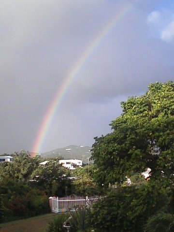
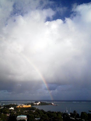
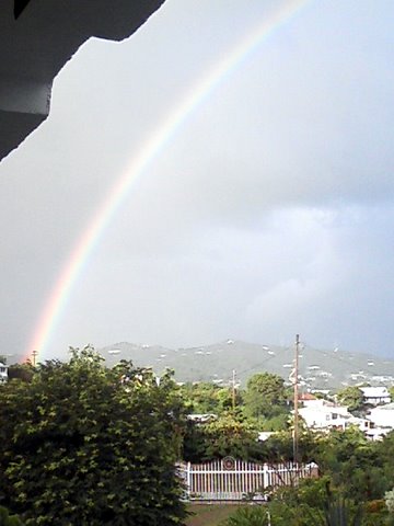
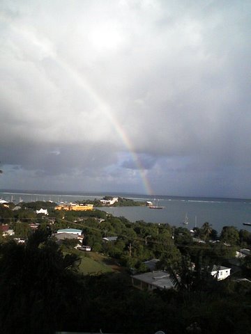
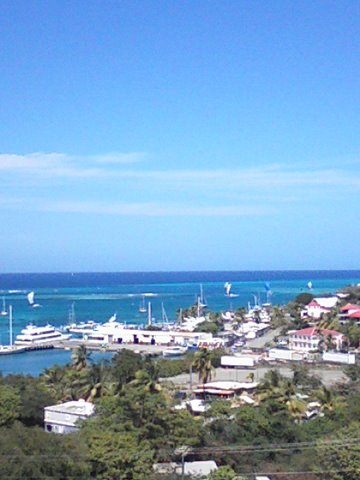
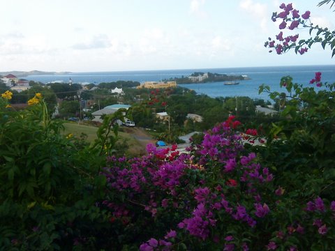
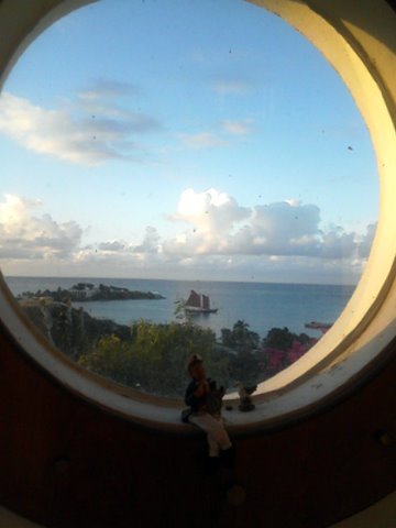
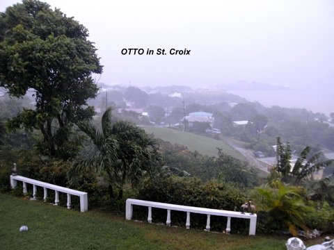
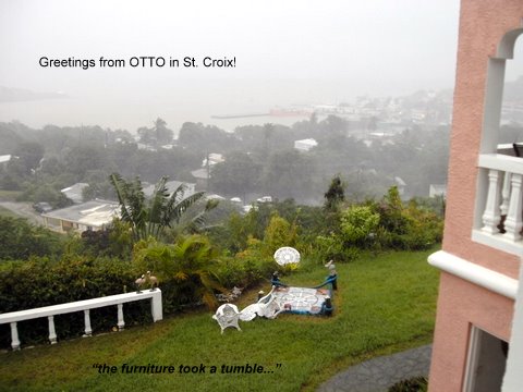
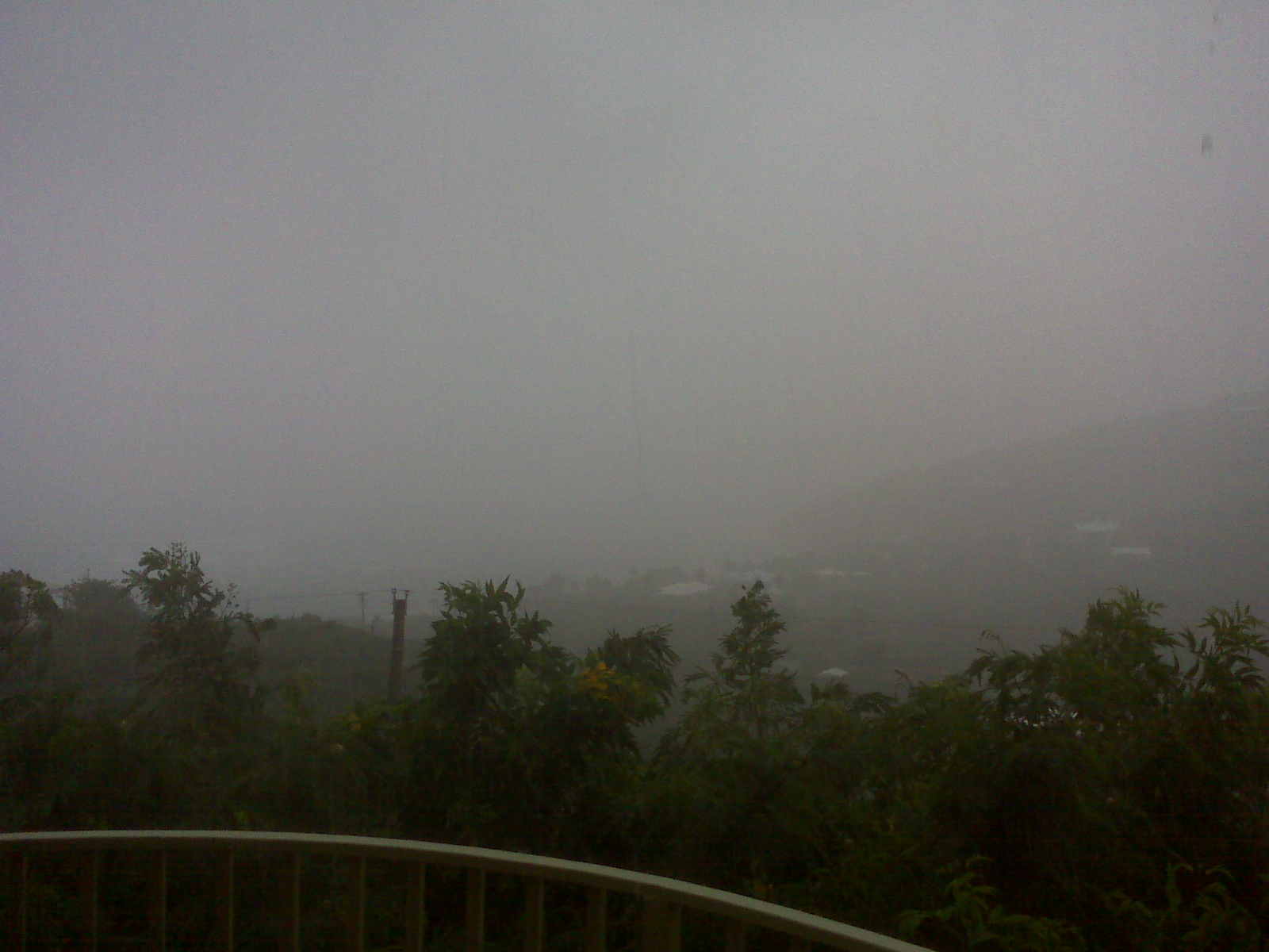
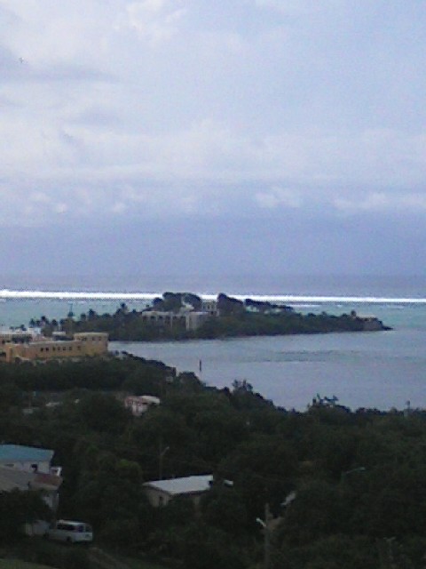
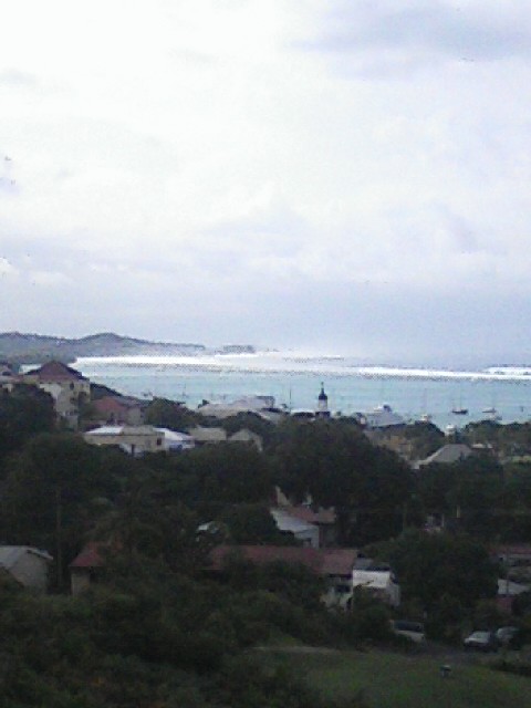
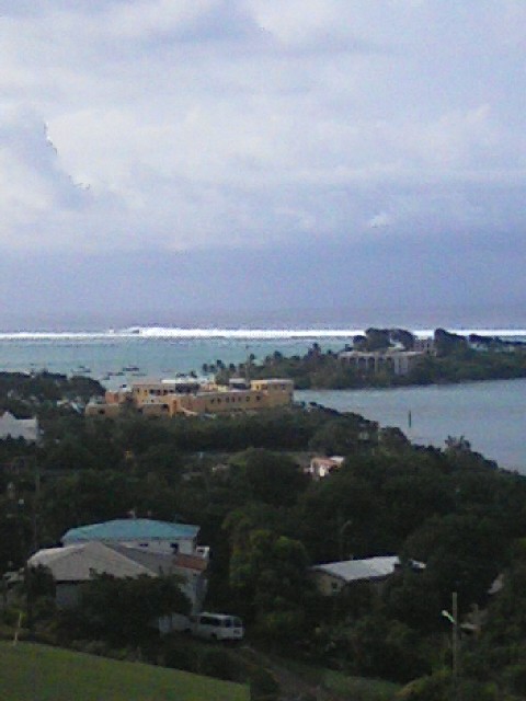
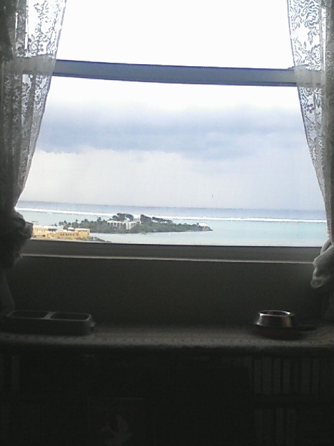
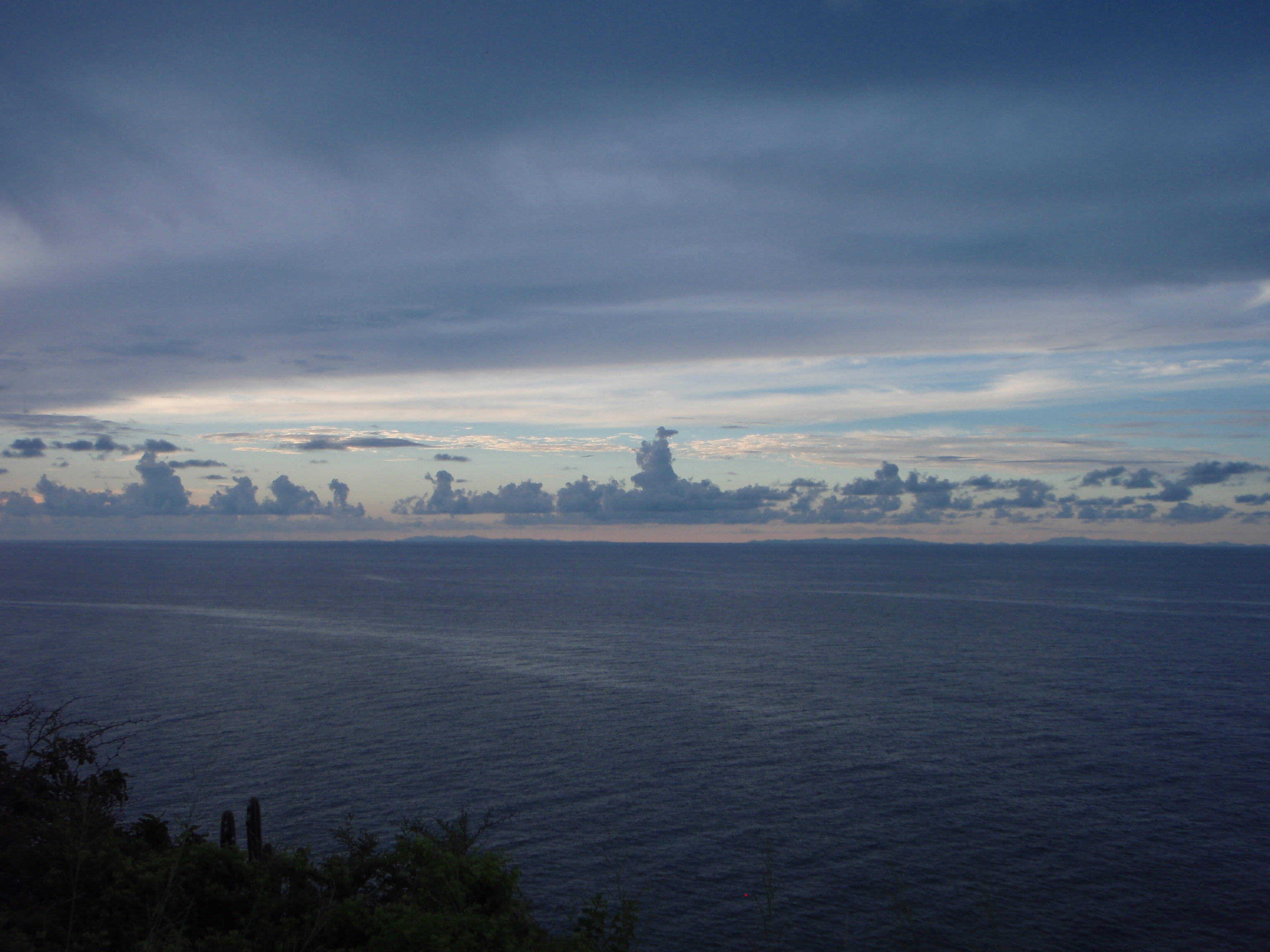
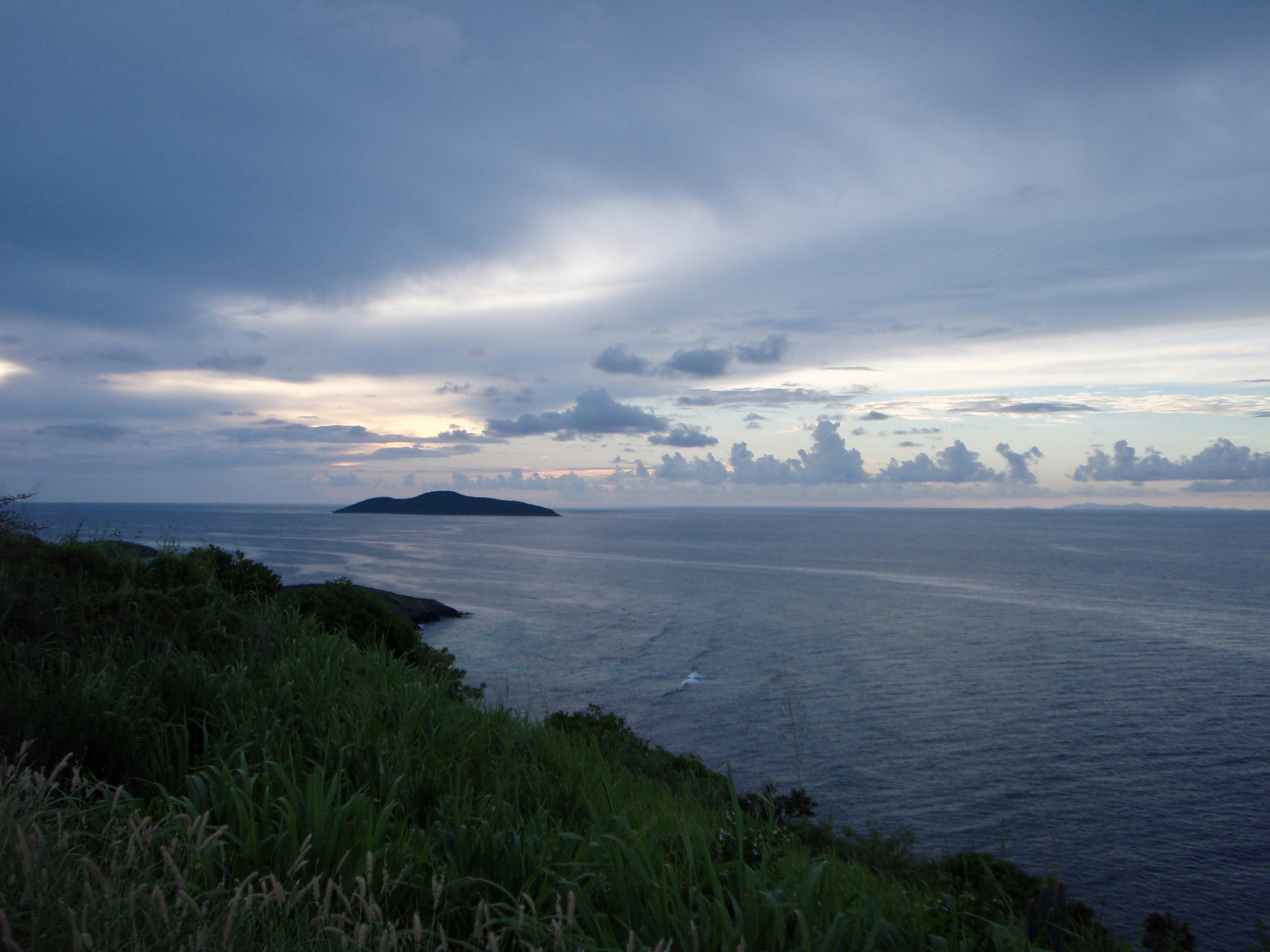
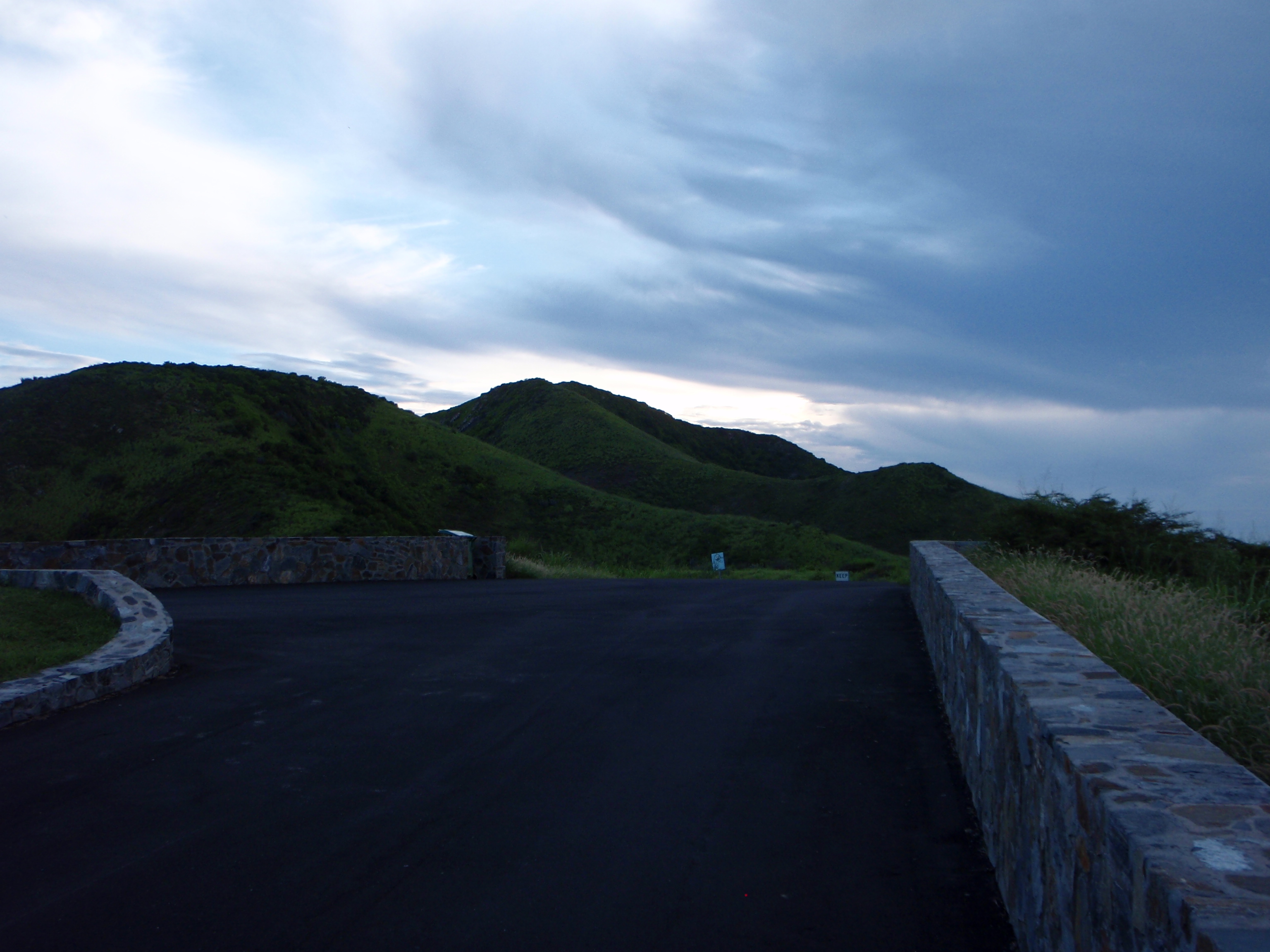
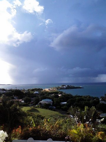
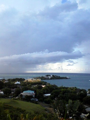
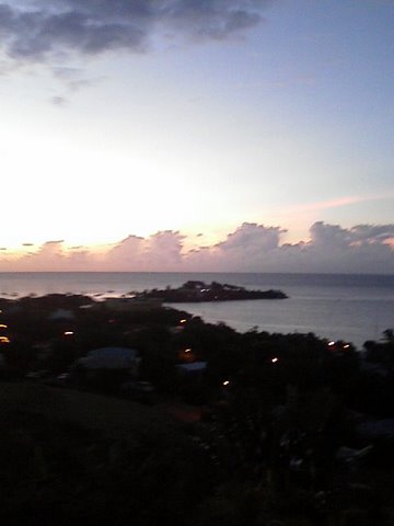
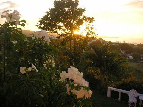