
|
- - - 2008 Hurricane Season - - -
|
- Of Floods and Earthquakes
|
- From: "Michelle" <themiche at tstt.net.tt>
- Date: Sun, 21 Dec 2008 10:23:12 -0400
|
|
Well, the northwest
peninsula of Trinidad is really getting it these days. Thursday's and Friday's
floods were bad. I myself was driving on the highway alongside the Diego Martin
river on Thursday night, in driving rain in the dark. The river and the road was
the same level and the river was raging! By the time I got home to Maraval the
next day, daylight showed nature's prowess. Scenes on the news gave us a full
view of the ravages of the Maraval river, and a section of the same Diego Martin
highway which had collapsed. The losses were heavy. Landslides on the North
Coast road, the west end of it .. landslides in Santa Cruz, Paramin and
Cocorite... all in the northwest. It rained again all day yesterday
and into the night. This morning though, the NNE wind prevails with dry air
advection south. I exhale in relief ... today we will dry out a bit and then
..... rumble, bump, shake, rumble .. walls creaking ...earthquake! 4.9 on the
Richter they say. Location? A few miles north of the Northwest peninsula. I
watch the rain sodden hills behind me with trepidation ,.. Please .. no
mudslides, and PLEASE, no more coral snakes in the
house.
|
|
- It seems unfair...and NOW WHAT?
|
- From: Alex Staunton <dtkcomp2002 at yahoo.com>
- Date: Sun, 21 Dec 2008 06:14:49 -0800 (PST)
|
Hello EVERYONE And Season's Greetings to All!!!
Well, Well, Well, what a Leap Year this has been for Trinidad and Tobago. For many parts of Trinidad we have just suffered the fourth major Flood event thanks to a new round of rains in what has been a four month period. To say this is UNFAIR seems an understatement -especially for those who have been hard HIT!
My thoughts and Prayers are certainly with them- many have been reeling from a very Muddy run-up to XMas unfortunately.
Affected areas: Landslides:
- North Coast Road
- Saddle Road Santa Cruz
- Lady Young Road
- Diego Martin
Flooding:
- Gasparillo
- La Pastora Village Santa Cruz
- La Seiva, Maraval
- Las Cuevas
- Santa Cruz
- Anderlica Maraval
- Perseverance Road Maraval
- Paramin Village
- Diamond Vale, Temple Street, Tomato Trace in Diego Martin
- Valsayn Trace St Joseph
And as Robert had prayed earlier in the Year when we had the worst of Floods on November 18th that we fortunate still since there were no earthquakes- Yet, this time around as I feared that one would materialise -IT DID…
At approximately 8:55 a.m. this -Sunday 21st December we were rocked by a brief but POTENT EARTHQUAKE of Magnitude -preliminary estimate of 4.9- hopefully there will be no significant damage to report though soils in both Trinidad and Tobago are water logged.
There may be aftershocks but I'm sure we'll take that in stride too...
Let's not be Complacent as Trinidad as well as the V.I have been listed as 'DUE' for a major Quake at some point- though of course God forbid. Let's all prepare as best as we can and be ready to lend a helping hand.
*(A pic is attached from one of the news papers concerning the floods)
As we Prepare to celebrate the Coming of the Divine Child who brought Hope to all MANKIND LET'S PRAY THAT THE GRACE OF JESUS CHRIST WILL BE WITH US ALL!
God's Richest Blessings to all and do keep TnT in Your prayers Please...
Alex.
|
Attachment:
fullfrontwraparound.jpg
Description: JPEG image
|
|
- Tuesday's Floods in One Word!
|
- From: Alex Staunton <dtkcomp2002 at yahoo.com>
- Date: Wed, 19 Nov 2008 19:22:56 -0800 (PST)
|
The Trinidad Guardian Newspaper could not have stated it better...
----------------------DISASTER--------------------------------------------------
The attached Pic PROVES THAT A PICTURE IS WORTH 1000 WORDS- Very SAD for All Trinis, but we'll Overcome.
Alex. |
Attachment:
GWEB_19-11-08_FRONT.jpg
Description: JPEG image
|
|
- North & Western Trinidad Flooding-GRIM!!!
|
- From: Alex Staunton <dtkcomp2002 at yahoo.com>
- Date: Wed, 19 Nov 2008 19:05:02 -0800 (PST)
|
Greeting to all!
After an ABSOULTELY DISASTROUS DAY OF FLOODS like Yesterday in North Trinidad and in particular Port of Spain and environs -ITS HARD TO KNOW WHERE TO START!
TRULY THIS HAS BEEN THE WORST FLOODING EVER WITNESSED IN MANY PARTS OF NORTH TRINIDAD INCLUDING THE CAPITAL CITY BY THE ACCOUNTS OF MOST IF NOT ALL.
There is Simply no way to underemphasize this. At certain points of the day Yesterday the scenes from many areas in North Trinidad Especially in Port of Spain looked more like the Aftermath of KATRINA in New Orleans back in 2005! It was really JAW DROPPING!
Not in my Wildest dreams did I think such an extent of Flooding was likely Yesterday...
Even as I had said that we were 'Bracing for Floods' -I was still left Shocked and Astounded by all the Devastation that Followed- Among the LITANY of Destruction includes: Numerous Flooded homes and Business places along the East West Corridor (at Unprecedented Levels in most cases), washed Away bridges and Foot Paths in many areas, Highway collapse in at least one area, Land slides (two cars were even pushed right over a precipice- at Lady Young Road near Port of Spain), Several land slips and Regrettably there has been the loss of two Young Lives due to hill side collapse and raging flood waters.
-May their souls Rest in Peace!
Of course, Many Persons are still in disbelief while others are quite fed-up, or vexed as we say here and 'mad as hell'. And Talk about Hell...Yesterday's Traffic was one for the History books and many of those in Port of Spain simply resigned themselves to park or 'crawl' for several hours as Robert indicated.
If Grenada had Rain -Squared then Trinidad's rainfall may have been twice that in some parts!... IT WAS FLOOD CHAOS AND POSSIBLY THIS MAY HAVE BEEN THE FLOOD OF ALL FLOODS- UNFORTUNATELY, more Rain is forecast and we have had some today. But It appeared to be rather light here in Tunapuna, hopefully it was not too bad elsewhere. No doubt many spent today cleaning up in several areas. For those of us who are the 'lucky' ones there is a point in what Lisa and Robert was saying in terms of better and right planning and foresight by Governments but more so in terms of Robert's statement that we HAVE to exercise more prudence and sensibility as regards our environment and our day to day actions. We all have to take responsibility and blame when Catastrophic weather events like these Occur. Our maturity and onus must increase.
Certainly, I choose not to be (though Justified) pessimistic or cynical -As a young, Vibrant Nation Trinidad will overcome this -BUT MUST WE be destined to Overcome unfortunate events such as this so REGULARLY when such major effects can be reduced/ eliminated? That's a burning question I propose.
These links show some of the unbelievable pics from today's papers:
(Other related articles also have pictures -no doubt tomorrow will also feature more pics as well)
Let us all be vigilant and keep greatest precaution/ sensibility at all times as a key attitude/ mindset.
May God Bless us All in our joys and our 'man made' sorrows!
Alex,
(Upper) Tunapuna. |
|
|
- Oh well.
|
- From: R K <feb1660 at yahoo.com>
- Date: Wed, 19 Nov 2008 10:51:46 -0800 (PST)
|
Well, here we go again. Another round of flooding with no end in sight. Still the lazy incompetent authorities will not deal with problems at the root and continue to plaster the sores.
We as a people still refuse to exercise simple discipline and use a garbage bin. Chicken bone, box and cup out the car window on the highway at speed (when you get to go) is the norm, as is the beer or rum bottle and anything else.
Will we never ever learn? So we cannot depend on the government, well then can we do our part and use a bin?
Waterways are clogged with waste and that accounts for a great deal of the flooding, but you know what? Tomorrow morning we will do it again...
Thinking... "one lil cup? One lil (plastic) bottle? Nah man! I can't clog a drain wid dat!" or .....not thinking at all... now that is a bigger problem.
The rain is down again and the transport woes of commuters will be worse today because less taxi drivers will leave home today than yesterday. On my short drive home yesterday evening I had a well dressed lady try to stop me as if I was a taxi. I was driving a pick-up. On a dry day this debutante probably would not be caught dead in "a ol' pick-up truck"... LOL But that is how desperate it gets in situations like this.... and the traffic?? Oh man!
It's like the old nursery rhyme..
"Here we go 'round the mulberry bush,
The mulberry bush, the mulberry bush..."
Except now it's not "so early in the morning" anymore. We're a forty-six year old nation, old enough to have begun to repeat our mistakes, learning very little as we go. As a people will we ever grow up or are we to remain doomed to "small island thinking"? only copying the wrong things from "foreign" but having no courage to step out and do something different, unique and right.
Television, the internet and education has done little to elevate the average level of "common sense" across the spectrum of our population and I see it as a leadership problem, help me if I am wrong. I began to lose hope for this country ever so slowly a while back... God has to intervene in a big way for anything to change meaningfully.
I'd rather not go on and on and will end with two last comments in prayer..
1. Lord we who trust in you are in your hands, and those who don't... we place
them in your hands.
2. Lord an earthquake now with the hillsides saturated as they are would be
mega-disastrous, help us to understand the extent of your mercy and love.
Robert Krucia,
Port of Spain.
|
|
- Ooops!
|
- From: Lisa Poliah <lisa at seaviewnet.com>
- Date: Wed, 19 Nov 2008 11:46:50 -0400
|
Please ignore the 'link' below. :-[ It must be time for a second cup of
coffee!
Stay cool! 8-)
|
|
- Another drenched day
|
- From: Lisa Poliah <lisa at seaviewnet.com>
- Date: Wed, 19 Nov 2008 11:42:46 -0400
|
Hello folks,
T and T is in for another wet day. The skies over San Fernando are
overcast this morning and thunderstorms are expected later on this
afternoon. Once again the government has revealed its ignorance when it
comes to proper planning and foresight. A quick look at the dailies show
pictures and stories of the damage due to flooding that took place in
Port of Spain and other parts of the country. It looked like the
aftermath of a hurricane yet there was none in sight!
Landslides, collapsed bridges and muddy water gushing through the main
streets of the city and when the Prime Minister is asked for a comment
from a reporter, he conveniently becomes mute....again.
With the weather showing no sign of letting up, Trinis who suffered
through yesterdays onslaught are bracing for another gloomy day. Maybe
by some small miracle they will be spared.
Here's hoping that the day fares better for everyone else in the region.

Take care and always be safe,

Lisa.
<cid:part1.07090503.03070800 at seaviewnet.com>
|
|
- Bracing for Floods...
|
- From: Alex Staunton <dtkcomp2002 at yahoo.com>
- Date: Tue, 18 Nov 2008 11:11:16 -0800 (PST)
|
Greetings to All!
Well, to quote someone earlier it has been absolutely raining 'elephants and giraffes' in most parts of Trinidad at least so far this afternoon. There has been a slight wind reversal as well, and with soils already saturated around the island -this afternoons rough weather may prove to be too much for low -lying areas. I'll be tuned in to reports from the news...but from my vantage point the white-out conditions seem very serious.
Hopefully we won't have the likes of Grenada, but judging from what we already got in the previous rainfall events and then added to this -some inconvenient effects are more than likely for us.
Today's Papers carried the all too familiar scenes for those who know of Port of Spain when its wet - of the street flooding and major puddling throughout the capital. Sadly, this is now a norm for heavy rainfall conditions.
Let us all be Vigilant!
God's Blessing to Everyone! |
|
|
- Tragic...Continued
|
- From: Alex Staunton <dtkcomp2002 at yahoo.com>
- Date: Mon, 17 Nov 2008 15:40:54 -0800 (PST)
|
(an Unexpected glitch) occured; the 'Joys' of telecommunications!?...
Anyway As-aforementioned -This was the main Headline for both the Trinidad Newsday and Express Newspapers- these are the links with photos from the story:
So far Today the rains abated -Until early this evening that is and it has been coming down ever since in a mostly moderate type of rainfall. No doubt extra vigilance is required by All Trinis living in such dangerous areas and of course in places prone to flooding.
As stated in the Papers Yesterday, In its 6 pm bulletin, the Meteorological Office said TnT received sporadic levels of rainfall activity over the past 48 to 60 hours. Showers are expected over the next 24 hours (which we ARE getting) and the Met Office advised that this continued rainfall “will add to the already substantial water levels which now pervade as a result of the recent weather event.”
Hopefully, there will be nothing of consequence to report at all!
Preparation and safety are Always Key!!!
God's Blessing and protection be with us All!
|
|
|
- Tragic...
|
- From: Alex Staunton <dtkcomp2002 at yahoo.com>
- Date: Mon, 17 Nov 2008 15:28:09 -0800 (PST)
|
Good Evening All From a wet and drippy Trinidad!
Unfortunately, just what I was hoping against has very sadly unfolded over the weekend. A Tradgedy involving Barbara Emmanuel, 67, who lived alone and was trapped in her house -when it came sliding down the steep hill just after 3 pm in Le Platte Village, Maraval (Northern Trinidad). This is really disastrous as apparently this same woman had suffered from three land slips before near her home, however, this time, the soaking rains proved too much for the steep slopes to bear.
May Her Soul and All who have perished this year due to weather events - Rest In Peace!
I do hope that this very horrible disaster is a strong wake-up call for all those living in such precarious areas and for those who -perhaps worse cause such areas by their activity further uphill on the land to become so unstable for others.
This was the main headline for both the Trinidad
|
|
|
- Inclement Indeed...
|
- From: Alex Staunton <dtkcomp2002 at yahoo.com>
- Date: Sat, 15 Nov 2008 07:38:16 -0800 (PST)
|
Good Morning to all!
Since early yesterday into this morning it has been rather wet, Yes, although we have had days of sporadic showers these latest bouts have been REAL intense. However, this morning has been the most inclement of all with waves of showers moving through accompanied by some strong gusts near 20kts or higher. A weather bulletin -Number one has been issued here in Trinidad.
No doubt from the looks of the satelite pics -Tobago is included as well. Hopefully no major flooding will result. Unfortunately, in our Trinidad context in particular -flooding is inevitable and unlike Tommie girl's malady in the Nature Isle Dominica with the view being interrupted -Here a lot more gets affected than just the view in TnT.
Nonetheless, each Year the same flooding saga and monthly woes continue with every rainy season. On a very Sad note last Monday the 10th Nov was particularly deadly as one life (young boy) was lost due to very heavy rainfall with near similarity to a mini storm -at least in North Trinidad. He fell into a very swollen storm drain at the height of the torrential rains.
May His Soul Res in Peace!
I pray that nothing more of fatal proportions will play out this weekend - We have enough losses of life here as it is already from the 'Man made' disasters every day. May God help us!
So Here's to the End of an already devastating and deadly Atlantic Hurricane season. My Heartfelt Prayers for those in Little Cayman and Cayman Brac and Of course our sisters and brothers in ravaged Haiti.
May God's grace continue to help us All! |
|
|
- Overcast
|
- From: Lisa Poliah <lisa at seaviewnet.com>
- Date: Fri, 31 Oct 2008 11:00:35 -0400
|
Hello to all,
Lots of heavy clouds above but nothing other than the slight drizzle we
had earlier this morning. In spite of this,the sun just came out. :-)
It is expected that we'll have scattered showers and perhaps isolated
thunderstorms this afternoon.
Among the visitors in T and T presently, a group of students are here
for the first time and have been eagerly looking forward to their trip
for weeks. Enjoying the warm weather and the beaches is a top priority!
:-D Hope you guys are having lots of fun. I'll keep my fingers crossed
for your sake that we head into a pleasant weekend.One that's not too
hot but just cool 8-) with a little rain and lots of sunshine!
To everyone at Stormcarib, enjoy  the rest of the day!

Lisa.
|
|
- Kite flying?
|
- From: Lisa Poliah <lisa at seaviewnet.com>
- Date: Wed, 29 Oct 2008 14:29:55 -0400
|
Hey folks,
This would be perfect weather for kite flying. It's been windy for much
of the day so far and although dark clouds are overhead, once in awhile,
the sun comes out.
Weather wise, the region appears relatively quiet even with the presence
of an area of low pressure between the Cape Verde Islands and the Caribbean.
According to the experts, the chance of development is low, but I'll
keep my fingers crossed as a precaution :-D
T and T could see isolated thunderstorms later this afternoon.
U.S citizens residing/working in T and T have begun to vote ahead of the
Nov.5th election. I'm eager to see a rejection of the old style of
politics that doesn't work and the acceptance of ideas that are
progressive and just. Hint, hint to the people of T and T, if we are
to move forward we need to do the same.
I might be going out on a limb here but if the world could vote in the
U.S election, this would be Obama country. :-D
Enjoy the afternoon in the Windies!

Take care everyone and be safe,

Lisa
|
|
- Day's end
|
- From: Lisa Poliah <lisa at seaviewnet.com>
- Date: Mon, 27 Oct 2008 19:22:33 -0400
|
Hey folks,
There was not a cloud in the sky today rather lots of sunshine.
Isolated thunderstorms are a possibility later tonight but at this
moment, it's a lovely evening, cool and breezy. If this trend continues,
it will benefit Divali the Festival of Lights tomorrow.
It's customary that the day before a holiday is always very busy in T
and T and today was no exception. The Hindu community would have been
busy making last minute preparations for what should be a peaceful and
enjoyable day tomorrow.
Visitors to T and T at this time would be fortunate to get an
opportunity to see the lighting of the deyas tomorrow night.
Weather permitting of course!

Have a great night all, take care  and be safe,

Lisa
|
|
- Saturday morning
|
- From: Lisa Poliah <lisa at seaviewnet.com>
- Date: Sat, 25 Oct 2008 11:18:23 -0400
|
Good morning folks,
It's partially cloudy but we've also got a hint of sunshine so it's not
too hot. It's just cool 8-)
Judging from the forecasts, T and T can expect scattered thunderstorms
later this morning and into the afternoon. For now, the weather is
excellent for anyone thinking of heading to the beach. :-)
I can tell it's a busy day for many in San Fernando just by the number
of cars that have passed by on my street for the morning. Have to head
out eventually and I'm sure the traffic is terrible. Not enough roads
and poor public transportation in an oil based nation, but that's
another story as the possibility of a global recession looms.
The Atlantic appears quiet for now. I'd like it to stay that way so we
can all an make it to the end of November! :-)
Enjoy the rest of the day,
Take care and as always, Be Safe

Lisa.
|
|
- Afternoon thunderstorms
|
- From: Lisa Poliah <lisa at seaviewnet.com>
- Date: Fri, 24 Oct 2008 14:55:42 -0400
|
Hello folks,
This morning was mostly cloudy and clearly a sign of things to come. A
heavy downpour accompanied by loud thunder started about twenty minutes
ago. It has lessened somewhat to a slight but steady drizzle now. With
the sky as overcast as it is, looks like Friday afternoon will be just
what the forecast for T and T predicts.
Scattered showers and T storms into the evening and partly cloudy skies
later on tonight.
Friday evening plans for many Trinis might have to take place indoors :-(

Saw  DearMissMermaid's variety of examples of the LIAT acronym. :-D
Here's one more, Leave Island Any Time!

Have a great Friday evening guys!

Take care and be safe,

Lisa
|
|
- Receipe for Serious Flooding...
|
- From: Alex Staunton <dtkcomp2002 at yahoo.com>
- Date: Thu, 23 Oct 2008 12:10:08 -0700 (PDT)
|
The heavens are still leaking down upon us here in TnT as I begin to write, but the question of flooding is already irrelevant, and quite far gone to be frank! Its now a question of how serious it will eventually be this time around. From the likes of Yesterday which was no where as bad as today when there was unfortunately enough street and flash flooding -see- http://www.newsday.co.tt/day/1,23826.html#foto OR THE ATTACHED PIC - (Of Yesterday in Port of Spain)
-However, today has only been Worse... Except far worse in some areas. And from the looks of the satelite pictures it could be a lot worse if we continue to get rained upon -perhaps more so Tobago.
The rainy assault began in earnest about 10:30 a.m. at Tunapuna and then proceeded to get even more stormy climaxing by about 11:30 a.m. At its peak it was difficult to talk over the rain if one was outside. I hadn't heard it pour so hard for a while... Let's hope there aren't Major flooding situations anywhere yet today.
Sadly the foliage has continued to take a beating with the driving rain and just a few trees around have succumbed already. I suppose with all the saturation of the soil before... or maybe our Trini trees are not as sturdy as we once thought.
Anyway from the satelite pics it looks like Tobago had it really rough- I'll listen for anything from the Sister isle- Hopefully it will not be as bad as the inclement weather they suffered on Sept 7th earlier this year.
Continue to be Vigilant and safe everybody.
God's Peace to all! |
Attachment:
5-1a_TOWN_FLOODS_(1).jpg
Description: JPEG image
|
|
- Weather
|
- From: R K <feb1660 at yahoo.com>
- Date: Tue, 21 Oct 2008 09:28:52 -0700 (PDT)
|
We are seeing a great deal of acvtivity to the North and North West of the island. Very overcast and thunder seemingly without end. I believe the ITCZ is presently closeby. Not much rain or wind at this point but we're totally overcast with what looks like "blue/black" cloud from the west around to the north. Hard to say what the afternoon will bring but rain could be an understatement....
|
|
- O -mazing facts continue
|
- From: Alex Staunton <dtkcomp2002 at yahoo.com>
- Date: Mon, 20 Oct 2008 18:04:45 -0700 (PDT)
|
Greetings to All!
Although Omar's most major Mahem was dealt to our fellow sister islands further to the north - we in Trinidad and Tobago were not left entirely out of Omar's Ominous and odious impacts. Ofcourse, the likes of St. Lucia and Dominica's storm surge was not experienced here -but I thought I would attach a small picture of what the bays near Chaguaramas in the extreme North West of Trinidad normally look like whenever there is a strong swell affecting the bay from the West as Omar caused. Its Not a very pretty sight at all and the same area during normal conditions has at least a couple of feet of sand extending below a four froot drop -so the surge on that day was building -Omar's actual effects may have been even worse...(The current photo appears in the Trinidad and Tobago Express- http://www.trinidadexpress.com/index.pl/article_news?id=161390005 )
-But I did say we were not left unscathed- on Tuesday night as was Reported by Robert in Port of Spain -we did have a brief moment of inclement weather with wind reversal (gusty winds and rain) associated with a stray feeder band from a then strengthening Omar.
While Wind reversal is not that common here in Trinidad, however since the start of October when Omar was attempting to form it has almost been a daily occurence. Anyway the real rough weather came on Thursday 16th -in the afternoon while islands like Dominica were still battling their storm surges -we in the Tunapuna, St. Joseph and St. Augustine areas of the 'East -West Corridor' in Trinidad had our own 'Mini-Omar'.
It was actually a small shoot-off feeder band associated with the larger bands which were yet giving the Nature island a pounding from large swells...
Sad or shocking, but true; the met office here resisted associating the foul weather with Omar and stated instead that 'Two thunder storms had collided over the area' -this was the line as printed in the newspaper (Trinidad Express- Thursday 17th Oct). Well, what an 'O-mazing' collision it was which produced Tropical storm force wind gusts that downed several trees and tree limbs including some at the U.W.I -St. Augustine campus and blew off some roofs in the Tunapuna area and St. John's community. Heavy flooding was also suffered, and as if that wasn't enough some frightening fork lightning was witnessed along with booming peals of thunder to match. The power succumbed- to Nobody's surprise and traffic gridlock followed with no traffic lights functioning in the immediate area.
Indeed, this was no easy weather event for those who had to endure the ordeal which lasted about 45 mins tops- Scary!
Thank God- only 45mins- because any longer could have truly been devastating for the areas concerned. Yet, the MERCY of God continues to be with us... This very bad spell of weather- call it a 'Freak storm' as we Trinis will was NOT even felt in areas just outside of St. Joseph, or Tunapuna/ St. Augustine. Weather can be Bizzare.
This recent terrifying weather is another reminder to us here in Trinidad that such deadly storm events can strike any of our islands- There's no room for Complacency! Lets all hope for the best in the rest of this Year's Atlantic Hurricane Season and whatever else happens lets all be as BEST prepared as we can be- Collisions or No Collisions -LOL...
God's Blessings to All recovering from Odious Omar!!! |
__________________________________________________
Do You Yahoo!?
Tired of spam? Yahoo! Mail has the best spam protection around
http://mail.yahoo.com Attachment:
n12.jpg
Description: JPEG image
|
|
- Downpour!
|
- From: Lisa Poliah <lisa at seaviewnet.com>
- Date: Mon, 20 Oct 2008 17:20:40 -0400
|
Hi folks,
T and T has been overcast for much of the day with scattered showers at
various times. San Fernando just had a heavy downpour for about ten
minutes but the skies have cleared up now. I don't think that will
last because the forecast predicts isolated thunderstorms tonight and
from my vantage point, the clouds seem to be gathering for further rain.
I don't mind as long as I'm indoors later. :-D
Yesterday's tropical wave really didn't affect San Fernando. We had
rains in the early afternoon but there were no high winds to speak of.
There were reports of flooding in communities on the outskirts of the
southern city but this is customary as it is mainly due to poor
maintenance on the part of the authorities. I've said this before,
haven't I ? >:o
Hope that everyone who endured Omar are getting back to a normal
routine. The most important thing is that you are all safe. :-)
Have a great evening and take good care,

Lis.
|
|
- Also.
|
- From: R K <feb1660 at yahoo.com>
- Date: Wed, 15 Oct 2008 06:50:04 -0700 (PDT)
|
We seem to have a minor event sneaking up to our south east. Looks like a rainmaker but since things are heating up I'm watching it. I suppose just in case Omar does not cause any trouble here, this is back-up huh?
Dave maybe you'll get Joey Stevens on of these days, parrot and all! LOL
Seriously though it looks like you're located right in the action area for Omar, be careful.
Robert.
Port of Spain.
|
|
- OK
|
- From: R K <feb1660 at yahoo.com>
- Date: Wed, 15 Oct 2008 06:29:50 -0700 (PDT)
|
The rain did not last very long but we have had moments of things just not being "right".
The low cloud continued and the lightning in the distance had swung around to the south east by 2.00 a.m., I went to bed then.
It's still totally overcast this morning but still relatively little rain in the city.
Our worse case scenario would be a feeder band ripping through the Gulf of Paria as Omar winds up and moves away, it seems to be inhaling this morning before it chugs out into the Atlantic.
Such bands have historically done significant damage to the south coast and the north east Gulf coast from Sea Lots to Chacachacare including the "Down the Islands" area. Flooding would be another possibility (what's that again?). The good thing is we're in the south eastern
quadrant and that's not the most severe. I realize I am being sarcastic but we just don't get it here and I doubt if we ever can... go ahead just throw that garbage anywhere!
Fortunately Omar should not see a lot of land. I pray our neighbors to the north get through this safely, God be with you all.
Robert.
|
|
- Omar-gosh!
|
- From: R K <feb1660 at yahoo.com>
- Date: Tue, 14 Oct 2008 20:02:53 -0700 (PDT)
|
The weather is definitely changing tonight. We just had a south to south westerly gust I'd say to about 35 mph. Almost total and very low cloud cover, the sky looks red from the lights of Port of Spain, very eerie.
The wind is now steady at around 20 mph.
Earlier tonight there was consistent lightning in the distance to the south west. I guess this is Omar's edge. This thing is being fed hot air off of South America. It's been very hot and humid here all day.
No rain yet.
83 F
1024mb
68% Humidity
Will post if there is anything more and significant.
I expect we will get a bit of a swipe as Omar matures tonight and it's unusual track for it's location passes it north west of us. Ooops... here comes the rain, I may go off line if there is a lot of
lightning.
Robert
Port of Spain.
|
|
- Intermittent showers
|
- From: Lisa Poliah <lisa at seaviewnet.com>
- Date: Wed, 08 Oct 2008 18:23:42 -0400
|
Good evening folks,
After several hot days I welcomed the showers and thunderstorms that
were scattered throughout the course of today. The evening is much
cooler and there is
the possibility of rain tonight. The Atlantic looks quiet for now but
taking a look at Jeff Masters blog today we just might see some activity
in a couple of days.
Fortunately the hurricane season ends less than two months, the global
financial crisis that seems to be looming may last much longer. Markets
closed down again today and I have to wonder how the Caribbean will
fare. No doubt it's on the minds of many people in the region but the
question is whether it's on the minds of the leaders?
Got to go,
Have a great night everyone
Take care and be safe,

Lisa.
|
|
- Keeping Haiti in mind.
|
- From: Lisa Poliah <lisa at seaviewnet.com>
- Date: Tue, 30 Sep 2008 13:40:15 -0400
|
Hi folks,
Weather wise things look quiet for all of us and I'm sure we're in
agreement that we want it to stay that way. :-) With just two months
before the end of the hurricane season, I'll keep my fingers crossed.
Digicel (Trinidad) recently started a fund raising drive in efforts to
assist ravaged Haiti. Citizens can text ' help' to 5151. Texting is
unlimited and the cost of each text is $ 2:00 (TT)
Does any one know if this has been implemented throughout the Caribbean?
Undoubtedly things are getting harder in T and T as inflation climbs and
the government continues to spend our money recklessly but I do hope
that my fellow Trinbagonians can each put a little and let the law of
large numbers work to help Haiti in any way that we can.
After all, that level of devastation could have been on our doorstep.
While the forecasts predict isolated showers and thunderstorms this
afternoon, it's very hot in South Trinidad and hardly any breezes. This
makes for great day at the beach. :-) Tomorrow is a holiday and many
will have this in mind.
Have a great afternoon.
As always take care and be safe.
Lis.
|
|
- Waterspout
|
- From: "Michelle" <themiche at tstt.net.tt>
- Date: Wed, 24 Sep 2008 11:04:28 -0400
|
|
An afternoon
thunderstorm produced this waterspout over the Gulf (of Paria) today. This photo
was taken from the Fort George hills.
Attachment:
Waterspout.jpg
Description: JPEG image
|
|
- Checkin' in
|
- From: Lisa Poliah <lisa at seaviewnet.com>
- Date: Wed, 17 Sep 2008 17:40:18 -0400
|
Hi folks,
After a hotbed of activity in the past few weeks it's good to see that
the Atlantic is quiet. Far too many people have buckled under the wrath
of the storms that passed their way. If I'm not mistaken the current
death toll from Ike's destruction in Texas and environs stands at fifty.
Of course Haiti's situation is much more horrendous.
The U.N World Food Programme has tripled deliveries to Haiti's survivors
today, but damage to roads and bridges means supplies can only be
transported by air and sea. The poorest nation in the western
hemisphere will be setback even further. Politicians and deadly
hurricanes ... what a toxic cocktail!
On a lighter note, while good ole T and T had scattered thunderstorms
this morning, the evening has turned out quite pleasant.
This will bode well for the organisers of the San Fernando Jazz Festival
on this weekend.
Got to run, hope all is well in the islands this evening.

Take care and be safe.
Lisa.
|
|
- UNBELIEVABLE WEATHER...BUT WHAT IF
|
- From: Alex Staunton <dtkcomp2002 at yahoo.com>
- Date: Sun, 7 Sep 2008 17:29:41 -0700 (PDT)
|
What a Sunday it has been – Whilst we may still be in the rainy season –today’s weather was nothing short of being REAL stormy. ..Today we had some WILD -unbelievable weather in most parts of Trinidad and from what I heard Tobago as well.
THIS HAS BEEN AN UNFORTUNATE TREND…At Upper Tunapuna the rains came down in a fury shortly after midday and were accompanied by some of the fiercest thunderstorms in recent memory. Remarkably the power stayed on but unfortunately the Street and Flash Flooding were occurring again as well as some areas even having havoc from Gusty winds in Western Trinidad perhaps similar to that which was experienced in Grenada. This system has lasted the whole day almost and was probably due to atmospheric instability owing to the ‘nearby’ tropical systems of Ike and what’s left of Josephine. This season is certainly demanding the attention of most persons in the tropics…
HOWEVER WORST YET -Today’s weather was a nasty reminder of the previous devastatingly inclement weather which wreaked destruction in Trinidad over the past weeks. Firstly there was the ‘storm’ of August 23rd to 24th weekend which was a real Storm event not rivaled or paralleled by any recent stormy weather seen here in- North, West, East and Central Trinidad.
Really, there was SO MUCH flooding –that its reported even a few homes were washed out to sea in the north area near Diego Martin. Of course- many people are still stunned from all this and I suppose unfortunately there is indifference along with it as well. Indeed sadly we are ‘used’ to flooding in Trinidad, but this particular Low Pressure system –which then became Tropical Storm Gustav and later Hurricane Gustav-had been extraordinary in force -But for only about an hour and a half maximum thankfully at its worst! Many dare not think of the potential for damage with a named storm or Hurricane here… Some houses suffered from flooding not necessarily because of ground level inundation but due to the fact that the wind was pushing
water under the sheaves of roofs and ceilings- AMAZING! Some areas which never experienced flooding before did -this time around- it was that bad in some places like La Horquetta, Malaoney Gardens, Bon Air -Trincity, Valsayn.
Not to mention Roofs were even blown off in areas like Talparo, Tunapuna East, Tabaquite, Brazil village including parts of Arima and outskirts, and several bill boards were destroyed especially near the area of the horse race track on the Churchill Roosevelt Highway. Several trees suffered broken limbs and a few were even snapped right at the trunk in some areas along the East-West Corridor of Trinidad- This storm’s brief but intense fury in Trinidad will not soon be forgotten…
But enough about that particular bout of stormy weather –This round of bad weather today has been particularly rough. It may bring added woes to areas already badly flooded and adversely affected by winds during the heavy rain storms in Central and South Trinidad last week. Then we experienced unprecedented inundation once more in certain areas never known to have had such floods as in parts of Claxton Bay and environs.
Sadly in this Season Trinidad must still face the Question – What IF WE were to have a storm or Hurricane here…Hopefully its not a Question that will be answered soon in a realistic tropical storm event, but Nevertheless it is one that this Republic unfortunately may not be able to long evade…
May God Bless us all in this season and God’s mercy and courage to all those in Ike’s Path and to those now recovering...
Special Prayers and Love of course for Our sisters and brothers in HAITI! |
|
|
- Rollin' off the assembly line.
|
- From: Lisa Poliah <lisa at seaviewnet.com>
- Date: Thu, 28 Aug 2008 18:18:21 -0400
|
Hello folks,
They don't carry labels 'Made in China' but from the look of things,
there's mass production in the Atlantic waters. Although a busy season
was predicted I must admit that I didn't think the maps would be so
crowded. Unfortunately the death toll from Gustav's stomp across Haiti
is still climbing even as he approaches Jamaica.
>From reading Tracy's post, it seems the island is starting to feel the
effects. If only it were possible to send a Trini sunset and cool
evening Jamaica's way. :-)
Meanwhile it's good to know that Hanna will (fingers crossed) steer
clear of Tortola and environs. Hopefully she won't be too big a
migraine for Bermuda and the Bahamas. We just have to keep our eyes
glued to the maps to see what happens next even with the other two waves
in the area like coloured balloons floating across NHC's site.
T and T can expect isolated thunderstorms and showers later tonight
but for now it's a beautiful evening. Wish I could share it with
Haiti, DR and Jamaica.
Take care guys and be safe.
Special shout out to Tracy and all in Jamaica, take good care of yourselves.

Lisa.
|
|
- Wow
|
- From: "Dr. Lesel Ali-De Silva" <leselali at gmail.com>
- Date: Sat, 23 Aug 2008 14:10:42 -0400
|
|
Wow! Between the blinding lightning, roaring thunder and vicious downpour. I'd say what you're seeing on the satellite is reflective of whats going on here. Just got word my uncle's roof just collapsed in Talparo. Trincity mall is under over one foot of water. As the heavens open up even more here in the west (and all over the country) I hope everyone lies low and keeps under cover! Going to unplug all my appliances now...
|
|
- INvest 94-L
|
- From: Carib Queen <c_q05 at yahoo.com>
- Date: Sat, 23 Aug 2008 10:46:01 -0700 (PDT)
|
Hey Everyone,
As i type, Chaguanas and i'm thinking the whole of Trinidad is now experiencing invest 94-l. The rain is really pouring down with occasional lightening and of course thunder.Although it's only 1:35pm it looks like 6pm outside. Forecasters have said that this disturbance is expected to bring heavy rains and gusty winds to the windwards and Leewards today into tonight. Satellite images paint an ugly picture.I'm not venturing out anytime soon..i'm think it's time for that chicken soup with split peas and coconut milk. Stay safe everyone!!
RCielto
|
|
- Takin' d lime inside
|
- From: Lisa Poliah <lisa at seaviewnet.com>
- Date: Fri, 22 Aug 2008 12:57:04 -0400
|
Hello folks,
It was great to see Jamaica and T and T taking gold and silver for the
Caribbean earlier. :-) Congrats to the entire region! I'm so proud
that our relay team finally get to be on the Olympic podium. The boys
from T and T deserve it! They lifted my spirits this morning from the
dumps of the usual things synonymous with T and T, rising prices,
dengue, corruption...
With a tropical wave approaching, celebrations over the weekend will
have to be moved indoors. ' We takin' d lime inside.'
Nothing will stop Trinis this weekend.
The sky is overcast in the south and it looks like we'll be getting some
rain soon.
I'm off to get supplies for a birthday/Beijing silver medal lime. It's a
double celebration tomorrow. :-D
Take care neighbours,
Enjoy the rest of the day and as always,  be safe.

Lisa.
|
|
- Heavy showers today.
|
- From: Lisa Poliah <lisa at seaviewnet.com>
- Date: Tue, 19 Aug 2008 20:49:15 -0400
|
Hello folks,
T and T had its share of thunderstorms during much of today as a result
of the tropical wave upon us. Things are a bit clearer tonight but it's
still relatively warm in spite of all the rain we had earlier.
It was quite a weekend between Tropical Storm Fay's movements and
Caribbean glory in Beijing. Jamaica and T and T should be proud as it
gives us a moment of optimism and joy away from the glaring concerns of
crime and poverty.
It is indeed sad to know that lives were lost as Fay made her way across
the islands. I hope that this is not repeated as the season moves ahead.
Got to go,
Take care everyone and be safe.

Lisa.
|
|
- A lot to answer for.
|
- From: R K <feb1660 at yahoo.com>
- Date: Sun, 17 Aug 2008 20:04:34 -0700 (PDT)
|
*(REAL VEX)*
On July 22nd in a post titled "Hello Dolly" I made reference to the mosquito population explosion and the failure of our local authorities to deal proactively with this perennial occurance and the potential for dengue, a relatively simple problem.
I was immediately saddened to learn of the death of a child tonight in the news in the south of the island from this very disease. Apparently there have already been quite a few cases.
What a burning shame!
My only comfort is that every one of us must answer to God for our
stewardship over the authority he gave us in life but that is of little comfort to the dead child and relatives now. A simple problem like a mosquito!
Robert Krucia
Port-of-Spain
|
|
- Good news...so far.
|
- From: Lisa Poliah <lisa at seaviewnet.com>
- Date: Thu, 14 Aug 2008 19:03:10 -0400
|
Hello folks,
I just had a look at some of your reports posted during the course of
today. It's good to know that although some of you had heavy showers,
thankfully 92L didn't approach the islands as a depression or TS. A few
friends of mine are keeping a watchful eye on the activity in the
Atlantic and crossing fingers that they will not have to postpone their
travel plans for next week. Of course I've advised them to check out
this site for info. :-)
Although it was partly cloudy in San Fernando today, it was very hot.
Luckily it's getting cooler as we get closer to the sunset hour. It's
one of my favourite times of the day as the warm glow and gentle breezes
filter into the house. Of course this great moment is fleeting
because once it gets dark, Trinis start locking doors and closing
windows. After all, this is ' bandit country.' But that's another story...
If the forecasts are right, Trinidad and Tobago can expect isolated
thunderstorms tomorrow. I'm willing to take the risk and leave my
umbrella home. :-)
Have a great night everyone.
Take care and be safe especially you guys up the island chain in the
path of 92L.
Lisa.
|
|
- August a must!
|
- From: adesh nanan <adeshcnanan at hotmail.com>
- Date: Tue, 12 Aug 2008 05:11:12 +0000
|
The tropical wave that is approaching the islands although days away must be watched closely due to the large area of convection associated with it.This looks ominous for further development and only prayers can shift its path.
Dr Adesh Nanan
Invite your mail contacts to join your friends list with Windows Live Spaces. It's easy! Try it!
|
|
|
- After the rains.
|
- From: Lisa Poliah <lisa at seaviewnet.com>
- Date: Wed, 06 Aug 2008 19:18:03 -0400
|
Hello folks,
After scattered showers and thunderstorms yesterday, today was sunny but
somewhat cool in South Trinidad. It was comfortable to move around and
get things done without sweltering heat. Forecast predicts isolated
thunderstorms later on tonight and I don't think Trinis have a problem
with that once were safe, dry and asleep :-)
There doesn't appear to be anything close to the islands to warrant
cause for major concern for now but I'll wait on the weather experts to
make the call if necessary.
Perhaps they can shed some light on what's going on off Africa. Then
again there's no need for that, I'll rely on Stormcarib of course! ;-)
Have a great night, take care and be safe.
Lisa.
|
|
- One to Watch!
|
- From: adesh nanan <adeshcnanan at hotmail.com>
- Date: Mon, 4 Aug 2008 01:58:34 +0000
|
The heavy convection associated with a strong tropical wave coming of the African coast appears to be a direct threat to the lesser Antilles.The thundershowers are staying with the system and if this continues could become a hurricane sooner than later
Dr Adesh Nanan
Connect to the next generation of MSN Messenger Get it now!
|
|
|
- A few showers.
|
- From: Lisa Poliah <lisa at seaviewnet.com>
- Date: Wed, 30 Jul 2008 17:48:21 -0400
|
Hello folks,
T and T had sporadic showers during the course of the day and in San
Fernando, looks like the pattern will continue for the evening. There
are quite a few gray clouds above but as we head towards the sunset
hour, it's still humid.
It's a four day week for the twin isles with the Emancipation holiday
on Friday and the extended forecast anticipates scattered thundershowers
throughout the weekend. Let's hope it doesn't put a damper on outdoor
festivities in particular.
Along with everyone else I'm looking at 98L and it's potential for
development. Already four degrees above T and T it might not be cause
for concern for Trinis, but of course, we'll keep an eye out for all
our neighbours. :-)
Have a great night,
Take care, be safe and stay cool 8-)

Lisa
|
|
- Ask and?
|
- From: R K <feb1660 at yahoo.com>
- Date: Tue, 29 Jul 2008 05:02:20 -0700 (PDT)
|
Good morning everyone.
It has been a little dryer these last three days. The weekend weather was pretty nice. Less rain and some beautiful bright sunshine when it mattered. I asked and I received, thank you Lord.
The ground was approaching saturation point and was absorbing very little or no water, any more rain would have certainly brought on more flooding. Out in a recreation field on Saturday the water was ponding to an inch or so in the lower areas and you would require good shoes to keep your feet dry. Fortunately we have dried out some and can go on.
Now all this is where I am in the west. I was told that it rained in Sangre Grande almost almost all night on Friday. Other parts of the island continue to get intermittent showers but it's been better for the most
part. We will see what this week brings.
Robert.
Port of Spain.
|
|
- Touchin' base
|
- From: Lisa Poliah <lisa at seaviewnet.com>
- Date: Fri, 25 Jul 2008 19:06:05 -0400
|
Hey folks,
Don't know if you can sense my joy...it's Friday afternoon. Need I say
more? :-D
It's been hot and dry throughout the day. Looking forward to a beautiful
sunset over the Gulf of Paria.
Might take some photos and if they look okay, I'll share. If not, please
don't ask 'what about those pics you took?' :-[
According to forecasters there is the possibility of isolated
thunderstorms tonight and tomorrow. While I don't want a deluge, light
showers for us Southerners would be welcome.
Have a great weekend all. Will be keeping an eye on anything in the
vicinity of ten degrees North.
Take care and be safe.
Lisa.
|
|
- Next...
|
- From: R K <feb1660 at yahoo.com>
- Date: Fri, 25 Jul 2008 05:54:15 -0700 (PDT)
|
Good morning everyone. Brilliant sunshine this morning, bright blue skies. Wednesday ended with the expected showers in the afternoon and yesterday's were intermittent with periods of brilliant sunshine, all pretty normal. The two systems I was watching struggled and broke up in the ITCZ and were eventually non issues thank God. The next couple of days look the same; I'd really like a drier weekend please Lord? Reading Lisa's post I took a look over Africa and found this (file attached). If it's doing that over land, I don't want to guess what could happen when it hits open water. Of more immediate concern is the system presently sitting on the equator and 30W. It's sizable and unless I miss my guess, isn't that the same low that was south of the zero line and on the
Meridian two days ago? I've never seen that happen but even at my age, in geographical time, I "just come" as we say. At 30W it's about what, 2000 miles away? So this is the next one to keep an eye on unless something pops up ahead of it. Watching 97L over the last two days I was amazed at the size of the area it was influencing over the Northern Atlantic giving the impression that if it had the chance it would really make its presence felt. Shipping in the Atlantic would have a good idea of the effects, must be pretty lumpy out there. Take care all, have a great weekend and watch those waves. Robert P.O.S. 
Attachment:
SDDI-20080725-1100-RGB-09-AIR-00-800.jpg
Description: JPEG image
|
|
- Sunshine, rain and ?
|
- From: Lisa Poliah <lisa at seaviewnet.com>
- Date: Thu, 24 Jul 2008 20:31:53 -0400
|
Hi folks,
I suppose if this were politics we'd say the weather was flip-flopping
for most of the day. Every time I turned around it was either a shower
of rain or brilliant sunshine.
For tonight, forecasters anticipate scattered showers and thunderstorms.
If so, things may get cooler later on.
Taking a look at the activity off Africa and wondering what's going on.
It looks well defined but no comment from the NHC just yet. If this
was closer it would probably generate conversation among the experts.
While it might be too soon to tell, I wonder if this could become 98L?
Another wait and see situation.

Have a goodnight everyone,
Take care and be safe.

Lisa.
|
|
- Tropical wave nearby
|
- From: Lisa Poliah <lisa at seaviewnet.com>
- Date: Wed, 23 Jul 2008 19:07:24 -0400
|
Hi everyone,
The weather was a bit cloudy this afternoon only resulting in a few
drizzles intermittently but not enough to reduce the heat. Predictions
suggest that 97L won't be a threat to the islands, let's hope it stays
that way.
A tropical wave is approaching and should be upon us sometime over the
weekend. Heavy rains will mean flooding and losses for residents and
farmers in low lying areas again! Begs the question are we really a
developing nation or far less? >:o
Looking at Dolly pound Texas as a Cat1 is a reminder of how
overwhelmingly ill prepared Trinidad and Tobago is for a tropical storm.
Those in authority are too preoccupied with power. No wonder they can't
get their act together for even the ITCZ.
Checked out Jeff Masters blog (Wunderground) a while ago and he's
hinting at a tropical wave rolling off Africa in 4-5 days. ( I think)
July is turning out to be quite busy for weather buffs.

Wherever you are in the Windies, have a great evening.
Take care, be safe and stay cool 8-)

Lisa.
|
|
- NEW ACTION ALREADY!
|
- From: R K <feb1660 at yahoo.com>
- Date: Wed, 23 Jul 2008 08:16:59 -0700 (PDT)
|
7N 45 W.
This system sprang up rather quickly this morning and looks like just bad weather for now but I'd say it's size warrants a look every so often just to see what it's doing. It's forward speed is also notable. I'm thinking rotation possible by afternoon although it seems to be having just a little trouble of its own.
Things seem to be really heating up. Another system behind that before you get to Invest 97 (?? ) who comes up with these names? LOL
This is reminding me of a few years ago when a string of systems stretched across the Central Atlantic, two or three of which qualified for names (became tropical storms), August is not here yet.
Outside looked sunny this morning with practically very light SE winds but there is quite a bit of cloud and it is changing. I'm
guessing some seasonal afternoon rain.
Robert
P.O.S.
|
|
- Always room for laughter
|
- From: Lisa Poliah <lisa at seaviewnet.com>
- Date: Tue, 22 Jul 2008 20:40:12 -0400
|
Couldn't let this one go by, I just saw my fellow Trinidad
correspondent's comment about the behaviour of Dolly and towards the
end of a stressful day it was a good laugh. :-D At times these storms
do tend to mimic the characteristics of the sexes. Some thing to laugh
or think about as we make it through Hurricane season 2008. :-)
Till  tomorrow,

Lisa.
|
|
- Dolly and 97L
|
- From: Lisa Poliah <lisa at seaviewnet.com>
- Date: Tue, 22 Jul 2008 20:21:25 -0400
|
Just touching base and hoping all is well with the Stormcarib family.
T and T has had its share of heat over the past few days but this is
bearable considering that 94L is churning its way towards Mexico and
Texas as Hurricane Dolly.
I admit that I thought the system would have eventually weakened given
its lingering dance through the islands. Mother nature has a mind of
her own.
The tropical wave off the Cape Verde islands has been christened Invest
97L and for now the NHC says potential for development is low. Keep a
watchful eye on the East as always.
The weather is a little cooler now in the South, let's see what tomorrow
brings.
Take care, be safe and have a good night.

Lisa.
|
|
- Hello Dolly.
|
- From: R K <feb1660 at yahoo.com>
- Date: Tue, 22 Jul 2008 08:12:15 -0700 (PDT)
|
By now everyone would have figured out what Dolly is made of and remember when that system passed through the Winwards last week. It never fails to amaze me what these things can become. Call me what you want but with the system behaving the way it was when it went by, I though it was female *(ducking and running as I say that)*. Read the fine print please.
*If there is no room for humor in here I'll readily apologize and take that back.
There was severe flooding to the South of the island and several areas saw houses with notable damage to belongings.
Scanning Eastward we look good to average for the next couple days. We just had a short shower here in POS but it is the rainy season so that is expected.
A
system just coming off the West African Coast spooled up like it was on fast forward this morning. Thankfully it's 15N already, if it does sustain and develop, hopefully that far north it will do a "Bertha-like" track and stay away from land totally.
Trinidad is nice and green from the steady rains we have been having, so much for the drought that our dear PM predicted last November, which was really a feeble attempt to distract the population from the crime crisis and poor resource management of WASA.
With the rain and the lush vegetation comes the normal explosion of the mosquito population. No spraying taking place yet by the IVC. We will have to wait for a month of dengue cases to warrant that, forget pro-active strategies, 20/20 is really 20/MT.
I am venting....., enough! Chups (sucking teeth).
Robert Krucia.
Port of Spain.
|
|
- Chaguanas
|
- From: Carib Queen <c_q05 at yahoo.com>
- Date: Fri, 18 Jul 2008 13:03:16 -0700 (PDT)
|
Hi i'm a new correspondant from Chaguanas. The sun finally showed up in all its brillance after 2 days of overcast skies. However, as i left Chaguanas and made my way to San Fernando this morning I encountered intermittent showers although the sun was still out. Right now the sky is completely overcast with an occ'asional cool gust of wind and light drizzle...a nice evening for making pizza. To those 'liming' later please be careful on the roads.Have a great weekend.
Rhonda Cielto
|
|
- Holding up
|
- From: "Dr. Lesel Ali-De Silva" <leselali at gmail.com>
- Date: Thu, 17 Jul 2008 17:03:49 -0400
|
|
Thanks to Tobago for the pics!! Driving back home from Centeno in the East to the West, the heavy clouds, brisk wind and intermittent rain followed me all the way home. Got some pics of the clouds from my phone. Wished I stopped on the Foreshore to get a shot of the water - usually very calm but today rough and muddy. Have to say (so far) the satellite images look far worse that what's on the ground. Of course no one here seems concerned! Noticed everything was quiet at the supermarket and all the gas stations I passed.
Lesel
Attachment:
east.jpg
Description: JPEG image
Attachment:
nor_range.jpg
Description: JPEG image
|
|
- Sudden burst of winds in Tobago
|
- From: "Earl Belfast" <earl.belfast at dec.uwi.edu>
- Date: Thu, 17 Jul 2008 14:50:58 -0400
|
|
Just while ago we had some sudden winds here that showed how things can change at a moments notice where the weather is concern.
it seems that was the tail end of the system that was affecting leeward islands including Trinidad and Tobago.
The winds were pretty heavy but the gust was short live nevertheless.
The photos if i get them loaded shows whats happening on the south western end of the island of Tobago where i live.
It may not be obvious in the shot but those coconut trees are swaying .
You might be able to see my neighbor pine trees up the hill bending in the gust.
I could guest that it will be a more windy up on the easter coast and north eastern side of the island. this is normally the case for most weather systems approaching the island.
Earl Belfast
Attachment:
DSC02024.JPG
Description: JPEG image
Attachment:
DSC02027.JPG
Description: JPEG image
Attachment:
winds in tobagotoday.wmv
Description: video/ms-wmv
|
|
- Yet again.
|
- From: R K <feb1660 at yahoo.com>
- Date: Wed, 16 Jul 2008 19:33:56 -0700 (PDT)
|
Thank God we have been spared yet again. This thing has tic-tac-toed around us and now it's almost a non event in Trinidad (not disappointed).
Things have been a little weird though, driving back from Chaguaramas late this evening the Gulf was flat calm, and almost no wind at all, calm before the storm I thought but so far we have not had any rain. So for now I guess we're OK.
The sat loop shows the system's effect on weather over the S.American continent, drawing moisture and heat off the land as it gets closer.
Word finally got out during the afternoon and I heard talk out side about the system so people are now aware, I just wish it would be more timely. Oh well, life goes on.
Robert Krucia
Trinidad.
|
|
- Tobago Update
|
- From: "Earl Belfast" <earl.belfast at dec.uwi.edu>
- Date: Wed, 16 Jul 2008 19:24:53 -0400
|
|
I took the liberty to take kids to the beach this evening because the see was flat like ice.
I took the liberty take some photos while i was there showing clouds .. It was a windless evening at the beach the whole island was quiet.
Note that the photos shown are of the eastern side of the island pointing towards where the system should be approaching.
News bulletting says the system 200 miles east is weakening but still pose the potential for thunders storm espcially inthe eastern part of Tobago.
earl
Attachment:
IMG_0330.jpg
Description: JPEG image
Attachment:
IMG_0331.jpg
Description: JPEG image
Attachment:
IMG_0332.jpg
Description: JPEG image
|
|
- 94L
|
- From: Lisa Poliah <lisa at seaviewnet.com>
- Date: Wed, 16 Jul 2008 14:07:34 -0400
|
Hi everyone,
Looks like the weather watchers who believed that 94L would turn into a
tropical depression are going to be right. Even novices like myself have
learned that you can never take your eyes off these systems. It's storm
watch 101. :-)
The probability of 94L becoming a TD has increased during the course of
today. It's current location is 12.2N 56.5W. Winds 35mph (30kts).
Not yet heard any bulletins via the media and I want to give the benefit
of the doubt that I was preoccupied at the time when vital public
information was released. However, the skeptic in me persists.
Many people are trying to recover from the damage due to flooding over
the past few days. From the numerous reports given, what should be
urgent assistance is merely trickling in. While flooding cannot be
entirely avoided, in Trinidad this persistent problem is largely due to
negligence and excuses on the part of the authorities.
The rains have held up in the southern city (San Fernando) giving some
folks a chance to trim trees and hedges before another downpour.
Keeping an eye on the Windward Isles.

Take care and be safe.
Lisa.
|
|
- So far so good.... no?
|
- From: R K <feb1660 at yahoo.com>
- Date: Wed, 16 Jul 2008 10:04:25 -0700 (PDT)
|
Finally got through to someone on the west side Tobago, it was still calm there with some sunshine and no idea of what was going on up to about an hour ago..
Weather Underground has the winds up to 35mph. The SE quadrant seems to be winding up and that is directly East of Trinidad. It's overcast here and we have had a couple light local showers for the morning but nothing significant yet. Looking to the NE it's cloudy and very dark. Occasional SE wind gusts to about 15mph, then pretty still otherwise.
That thing is looking nastier by the hour on the sat pic. Once it enters the Caribbean Sea it will need watching.
Robert Krucia
Port of Spain.
|
|
- Tobago
|
- From: R K <feb1660 at yahoo.com>
- Date: Wed, 16 Jul 2008 08:23:06 -0700 (PDT)
|
As I watch the loops and the SW track this system has suddenly taken, Eastern Tobago must be under showers by now. Attempts to call a couple friends there prove futile, no response. Will try a few others.
I called the Met office. Bulletin released to media but they seem to be waiting for 12.00 noon to release this.... go figure. It involves flash flood warnings.... by then Tobago would have seen the deluge.
Robert Krucia,
Port of Spain.
|
|
- Hmmm.
|
- From: R K <feb1660 at yahoo.com>
- Date: Wed, 16 Jul 2008 07:56:28 -0700 (PDT)
|
Taking a look at the system NE of us and it's current track Tobago should be experiencing some showers soon. It seems to have ramped up significantly since I looked at it around 6.30 this morning.
There has been nothing on the news as far as I know, maybe I am over reacting? Am I the only one watching this?
Robert Krucia.
Port of Spain
|
|
- Keeping an eye on 94L
|
- From: Lisa Poliah <lisa at seaviewnet.com>
- Date: Mon, 14 Jul 2008 15:58:55 -0400
|
Hi folks,
Greetings from the rain soaked South :-( . Trinidad and Tobago has had
what feels like, our fair share of heavy rains and thunderstorms.
Casting a glance at 94L now 1200 miles east of the Lesser Antilles,
there is cause for concern.
As is customary, there have been reports of flooding in some of the low
lying areas in Trinidad and the possibility of a system affecting T and
T is worrisome for those who have already had a rough couple of days.
The rains have stopped for now but the gray skies are a reminder that
there's more to come. One can only hope that the relevant agencies move
quickly to ensure the drains and watercourses are free flowing. Should
have been done already, but that's another story... :-)
Keeping an eye on  94L.

Stay dry, stay cool 8-)  and of course, be safe.

Lisa.
|
|
- Tobago sporadic rain
|
- From: "Earl Belfast" <earl.belfast at dec.uwi.edu>
- Date: Mon, 14 Jul 2008 12:43:21 -0400
|
Hi Tobago has been experiencing sporadic rain and a few thunders in between since 6:00 am this morning .. The wind is pretty mellow nothing to be concern about..
Looking at the system developing east of us is a bit worrying and will keep an eye on it and keeping you guys up to date.
Earl Belfast
|
|
- Huh?
|
- From: R K <feb1660 at yahoo.com>
- Date: Mon, 14 Jul 2008 08:51:52 -0700 (PDT)
|
Hello all,
Hi fellow weather watchers.
I have not been posting recently because I've just been otherwise occupied but I have been keeping an eye on things quietly up to now, however......
A (rotating) motion in the ocean has gotten my attention. Dave you had it at roughly 8N and 37W. It's being observed and we'll just have to wait and see what it does. I don't like to see systems this far south, we are very often in Trinidad spared but not immune.
It's far better when they behave like Bertha who has boogied her butt well away from land except Bermuda where it could be a lot worse but it isn't thank God....
I'm going to watch this one closely, it's literally close to home. God be with
us all.
Robert Krucia
Port of Spain.
|
|
- Bertha
|
- From: Lisa Poliah <lisa at seaviewnet.com>
- Date: Fri, 04 Jul 2008 16:18:04 -0400
|
Hey folks,

Happy 4th of July to all the U.S citizens in the Caribbean.
It's good to see that no one has had to pull out hurricane supplies for
Bertha. Although you can't turn your back on these storms at least this
time we get to watch from a distance.
The weather in T and T this afternoon is clear and cool. No heavy
showers, just a few gentle breezes and sunshine. Our reservoirs and
dams are full to acceptable levels again thanks to the rains we had over
the past week and a half.
A second quake occurred off Galeota Point at about 2:15a.m yesterday.
Although we didn't feel anything on land, the guys on the offshore
platforms got a shake. It was just over 5 on the scale. This time
around, the papers are printing safety instructions for both hurricanes
and earthquakes.
Be that as it may, life goes on...

It's a  great Friday afternoon, make some time to enjoy it! :-)

Take care and be safe.

Lisa
|
|
- Lots and lots of rain
|
- From: Lisa Poliah <lisa at seaviewnet.com>
- Date: Sat, 28 Jun 2008 18:03:47 -0400
|
Hi folks,
It's fair to say we are drenched in T and T. Trinis had their share of
heavy showers and thunderstorms during the course of today. The skies
are clearing a bit so I can open the 'washed' windows again. One less
chore for me :-D
About that earthquake early Friday morning... a lot of people didn't
feel it, those who did, said they got quite a shake. Apparently it was
also felt in Grenada and measured 4.6 ( I think) :-\
No reported injuries or damage.
The rains might have stopped many in their tracks this morning, putting
on hold the usually busy Saturday routine. Judging from the sounds of
vehicles on the roads now it seems San Fernando is on the move again.
Trinis are notorious for having 'hot foot', we can't sit still for too long.
Hope you guys enjoy what's left of the weekend. It goes too quickly.
Take care and be safe,
Lisa.
|
|
- Lots of rain
|
- From: Lisa Poliah <lisa at seaviewnet.com>
- Date: Thu, 26 Jun 2008 16:52:39 -0400
|
Hello everyone,
I've been having problems with my internet service provider...agggain!
Top heavy management with exorbitant salaries but shoddy service,
particularly when it rains. >:o
Many Trinis have welcomed the rains, especially the farmers. Haven't
heard any reports of flooding so far. The people in low lying areas of
the country would be grateful.
We had heavy showers this morning and although the rains have held up
this afternoon the skies look like they'll burst again.
I wouldn't mind as long as I'm indoors. :-)

Enjoy the evening folks.
Stay dry and cosy.

Lisa.
|
|
- Thanks for the ITCZ
|
- From: adesh nanan <adeshcnanan at hotmail.com>
- Date: Wed, 25 Jun 2008 11:59:32 +0000
|
We need the rainfall especially for our reservoir levels to rise .
The sky is grey ,rain is falling and a cold wind is blowing
Dr Adesh Nanan
Explore the seven wonders of the world Learn more!
|
|
|
- Peals of Thunder
|
- From: adesh nanan <adeshcnanan at hotmail.com>
- Date: Tue, 24 Jun 2008 11:54:15 +0000
|
My 5 year old son says the peals of thunder overhead is a giant beating his big drums.There are very dark clouds overhead as the rain begins to fall.Very high humidity and a cold breeze is blowing ever so gently
The satellite picture shows more rain and looming in the distance off the dreaded African coast is a potential spinner.
Dr Adesh Nanan
Connect to the next generation of MSN Messenger Get it now!
|
|
|
- Thunderstorms in South.
|
- From: Lisa Poliah <lisa at seaviewnet.com>
- Date: Fri, 20 Jun 2008 17:06:38 -0400
|
Hello folks,
We have had heavy rains and thunderstorms in San Fernando, South
Trinidad all day. The skies are overcast now and the rains have stopped
but, it is anticipated that there will be showers later this evening. It
may put a damper on plans for some Trinis but others wouldn't be
stopped. After all, it's Friday! :-)
Hope all is well with the everyone from the Stormcarib crew. As the
weekend is now upon us, have a good one!
Take care and be safe,

Lisa.
|
|
- horrible weather
|
- From: "Dr. Lesel Ali-De Silva" <leselali at gmail.com>
- Date: Fri, 20 Jun 2008 14:23:48 -0400
|
|
What a horrible day! It's been raining heavily all day, and the thunder and lightning started by lunch time. It fried most of the servers in our office compound - somehow mine is still up. NOT looking forward to driving home this afternoon Centeno (in the east) to Westmoorings (in the west). Normally takes me about an hour - god knows what it will be today. Envy anyone who is home in bed right now!!
Lesel
|
|
- Heavy Showers!
|
- From: adesh nanan <adeshcnanan at hotmail.com>
- Date: Fri, 20 Jun 2008 04:11:54 +0000
|
The humidity is high and the temp is 28.The wind is absent as the tropical wave approaches
Dr Adesh Nanan
Explore the seven wonders of the world Learn more!
|
|
|
- Heavy skies.
|
- From: Lisa Poliah <lisa at seaviewnet.com>
- Date: Thu, 12 Jun 2008 15:26:53 -0400
|
Hi folks,
Some of you were lucky earlier as you got showers from 91L . The skies
are heavy in San Fernando, South Trinidad and the rain has just started
falling. It's a light but constant shower with thunder rolling in the
distance. What sweet relief! :-D
From the weather reports we can expect showers, the occasional
thunderstorm and gusty winds. We'll wait to see how it plays out this
evening.
For those who say this tropical wave is a practice run for the season, I
concur :-)
Continue to enjoy your day or what's left of it.

Take care guys and be safe,
Lisa.
|
|
- Invest 91
|
- From: Lisa Poliah <lisa at seaviewnet.com>
- Date: Wed, 11 Jun 2008 17:39:27 -0400
|
Hi folks,
It's been hectic for most of today and this is the first chance I had to
sit in front my PC. I see things are looking interesting down Trinidad's
way with Invest 91. Special hello to Nichs in Dominica. Thanks for the
heads up! :-) At Stormcarib someone's always keeping an eye out for you
when you don't have a moment to do it for yourself. :-)
This morning was quite hot and dry. At about 3:30p.m a few dark clouds
hovered above and I thought we may have gotten some showers but they
soon dissipated. The sun is back out but it's also windy. From where I
am located, the view of the Gulf of Paria looks a bit hazy.
Will tune in to Trini weather at 7:00p.m for further info on Invest 91
and check in with the Stormcarib family later.
Have a great afternoon,

Stay cool 8-)
|
|
- A Scorcher!
|
- From: Lisa Poliah <lisa at seaviewnet.com>
- Date: Tue, 10 Jun 2008 20:20:04 -0400
|
Hello folks,
Just when we thought things might cool down , today proved to be
different. It was a real scorcher. The heat was unbearable for
everyone I spoke to and it was somewhere around 6:00p.m when it got
a little cooler.
While I wish for rain, it's the last thing needed in China as workers
continue to control the quake lakes in an effort to prevent further
flooding in a disaster that has affected so many lives. Let's hope the
hurricane season is kinder to the Caribbean.
I think tonight Trinis may keep the windows open and the fans and air
condition units will be on for hours.
Have a good night and stay cool 8-) even if I can't :-D
Lisa.
|
|
- Here comes the rain!
|
- From: Lisa Poliah <lisa at seaviewnet.com>
- Date: Sat, 07 Jun 2008 02:46:53 -0400
|
Very early Saturday morning folks,
I'm up because the thunder woke me and I'm not complaining. The tropical
wave is near and no one's happier than this Trini. :-) Later on today
I've got a few things to do but willing to go through a rainy day to get
them done.
Hey Sunny Skies in Curacao, hope you got some rain too since we've been
pleading with Mother Nature for quite a few days. :-D
Warm welcome to all the new correspondents. It's nice to know that the
Stormcarib family is growing!
There's a light but steady shower now with thunder every couple of
minutes. I've pulled back my curtains so I can catch a glimpse of lightning.
Yes, I'm so happy the rains have come but of course I won't pull the
curtains during a hurricane! :-D
Have a great  Saturday everyone.
Take care and be safe.

Lisa.

P.S  I'm going back to bed....zzzzzz.
|
|
- Approaching tropical wave
|
- From: adesh nanan <adeshcnanan at hotmail.com>
- Date: Sat, 7 Jun 2008 02:45:33 +0000
|
The humidity is 70% and there is now a steady downpour .The plants will be happy as there has been a very dry spell.
Dr Adesh Nanan
Discover the new Windows Vista Learn more!
|
|
|
- Mostly cloudy but no rain.
|
- From: Lisa Poliah <lisa at seaviewnet.com>
- Date: Wed, 04 Jun 2008 16:57:34 -0400
|
Hi folks,
Special hello and welcome to our newest correspondent from Mexico! :-)
Glad you could join us.
It seems some of you have been lucky in getting much needed rain. T and
T continues on a dry and humid path with no real showers to speak of.
Such is life, can't always get what you want. For the sake of the
plants, I'll be hopeful.
As is customary, every year at this time there is always discussion in T
and T about our disaster preparedness ability. Pity talk doesn't
translate into action. We continuously see examples of the devastation
caused by natural disasters and yet we're sitting idly by.
Oh yeah I forgot the saying that our politicians are inclined to
believe, 'God is ah Trini' :-D
Have a fantastic afternoon, stay cool,be safe and enjoy the rains for me
:-)
Lisa.
|
|
- Keeping an eye on the African coast
|
- From: Lisa Poliah <lisa at seaviewnet.com>
- Date: Mon, 02 Jun 2008 17:29:31 -0400
|
Hi folks,
As we have officially entered the hurricane season no doubt we are all
looking in the same direction.
Trinidad had a few scattered showers this morning and there is the
possibility of further showers tonight. We can expect more rain with the
approaching tropical wave. Looking past that to the African coast, just
in case whatever seems to be rolling off now, begins to take form.
Weather watchers know only too well how quickly things can change. The
Met Office in T and T has alerted us to the start of the season and
there are some Trinis who dutifully prepare themselves every year. Let's
hope the number grows.
Stay Cool 8-)   and take care!

Lisa.
|
|
- Update
|
- From: adesh nanan <adeshcnanan at hotmail.com>
- Date: Mon, 2 Jun 2008 11:04:58 +0000
|
Hi Gert,
The approaching tropical wave has the possibility of heavy rainfall
Dr Adesh Nanan
Discover the new Windows Vista Learn more!
|
|
|
- Tropical Storm Alma
|
- From: Lisa Poliah <lisa at seaviewnet.com>
- Date: Thu, 29 May 2008 16:40:24 -0400
|
Hello everyone,
Port of Spain had it's share of isolated showers today, however San
Fernando has been sunny with very few clouds in sight. South Trinidad
is dry and at times dusty. A shower or two would be welcome relief. A
couple of breezes rolling in just as I write but, on the eve of
tomorrow's Public Holiday there doesn't seem to be a hint of rain. Maybe
later.
Trinidad is no stranger to the name Alma as the island was hit by
Tropical Storm Alma in August,1974 before dissipating in the mountains
of Venezuela. If memory serves me that was the last direct hit. That
explains our luck and sometimes our complacence.
To our friends in Central America please stay safe.
To the rest of the Stormcarib family, have a great evening.
Lisa.
|
|
- I'm back
|
- From: Lisa Poliah <lisa at seaviewnet.com>
- Date: Wed, 14 May 2008 15:40:13 -0400
|
Hello everyone,
How are you all? Well I wasn't away on vacation rather my internet
provider was. The company was in the process of upgrading the service
but as is customary in T and T, in order to get better service you are
downgraded to virtually none for a couple of weeks. Then you have to
hope you haven't been billed for it >:o
I hope you guys had a great weekend, in particular the MOMS! :-)
Forecasters predicted scattered thunderstorms for T and T today but so
far San Fernando is slightly overcast with cool breezes coming in from
the Gulf of Paria
We've had some sweltering days in the past week but today isn't so bad.
Lots of dry weather only made worse by on going construction in
different parts of the island.
Port of Spain is a dust bowl and allergy medicines are a big seller.
Looking on at the unfolding tragedy in the aftermath of China's
earthquake. The islands have been really lucky so far. As June
approaches we can only hope that the weather gods treat us kindly.
Enjoy the afternoon and take care,
Lisa
|
|

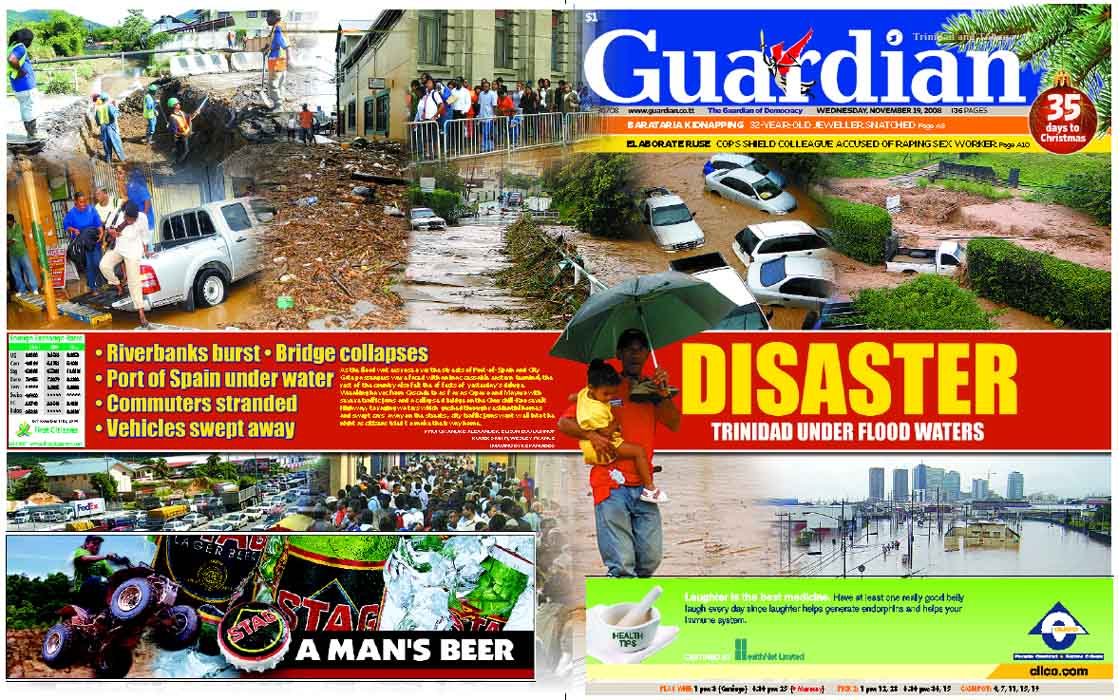
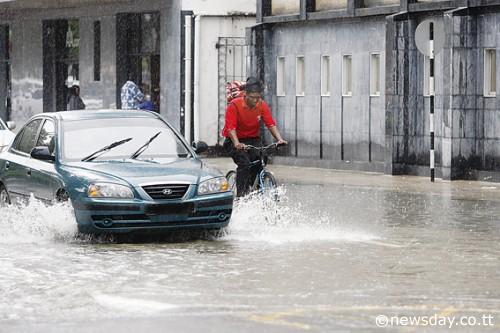
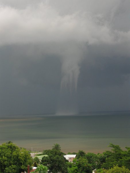
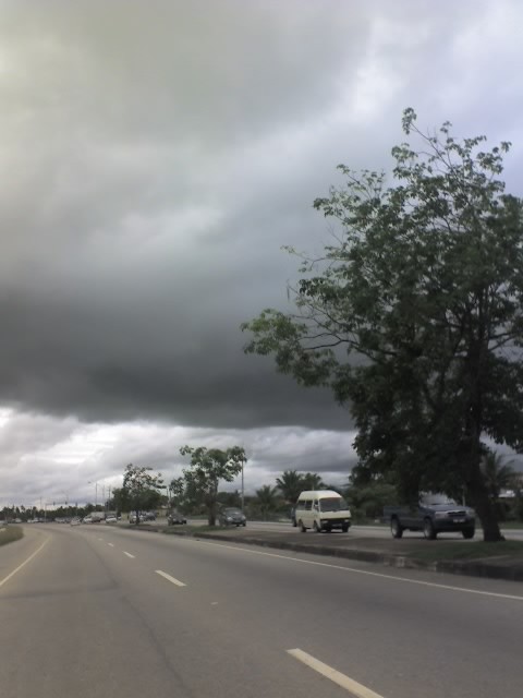
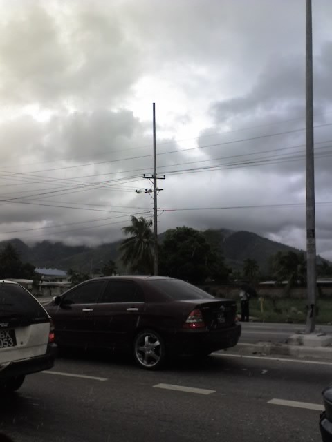
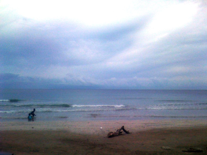
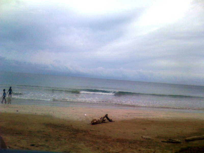
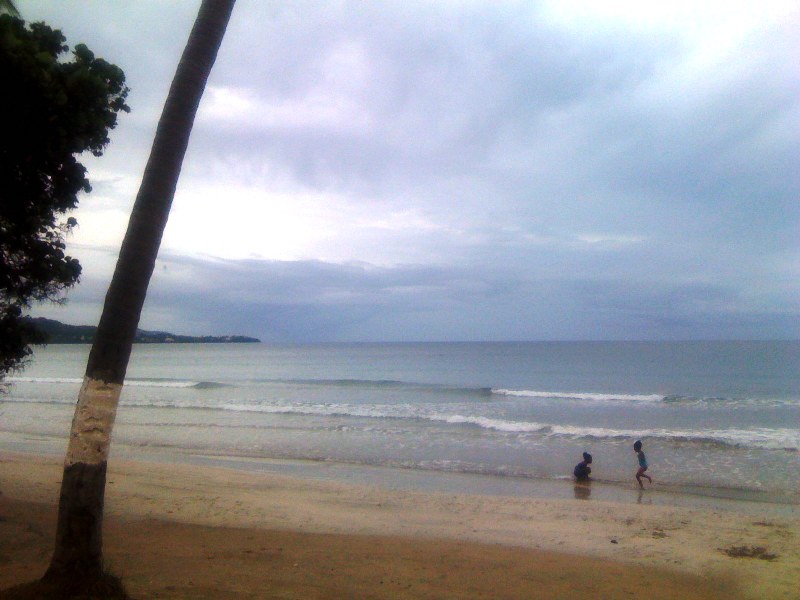