
|
- - - 2008 Hurricane Season - - -
|
- Halos and Coronas
|
- From: Susan Mains <susanroaming at yahoo.com>
- Date: Thu, 7 May 2009 22:01:16 -0700 (PDT)
|
Good Evening Everyone, Haven't posted for a while, but thought this would be a good time to check back in and let you know that you could see a beautiful lunar corona around the moon earlier tonight. It is smaller than last night's lunar halo, but you could actually see the rainbow colours in the halo this evening. For lunar halos, like the huge one you could see from Jamaica last night, the effect is "mostly due to the refraction of moonlight (or sunlight) that passes through ice crystals present in thin clouds at the atmosphere (colored halos)." So if you get a chance, and have a clear view from the island (and other places too), you may be able to see the corona again later if there's some thin cloud around the moon. And, it's a lovely cool, relatively (!) calm evening here
in Kingston just now. We had some very light rain a couple of hours ago, but it's stopped now. Walk good. ******************************** Susan Mains Kingston, Jamaica
|
|
- It's raining!!!
|
- From: Blayz Brooks <blayzbrooks at yahoo.com>
- Date: Mon, 27 Apr 2009 20:03:57 -0700 (PDT)
|
After severe drought, the rains have finally arrived in Western Jamaica. Since
the start of the year, only 113mm/4.45 inches of rain has fallen at my weather
station in Ironshore (8km west of Montego Bay Airport.)The average rainfall for
the period is 234mm/9.21, so there is a deficit of some 121mm or 4.45inches.
The last two week have seen much welcomed rain, much of the landscape had turn
brown and there were many bush fires roaming the countryside. The rain has
brought the radiant green across the hills and valleys, also the muggy, heat
has started, daily temperatures has started reaching 30-31 degrees c with RH of
80-100%.
The past few months have been very difficult for our people. The economy is
struggling, many persons have losing their jobs, the cost of living has
increased ,their was the recent attempted hijacking at the airport providing
bad press for our Island and tourism and now the government has announced a
oppressive tax package including a $15 Jamaican per litre dollars gas tax,
taxes on print material (books), computers, etc even salt, but we still have a
lot to give thanks, We are lucky we do not have swine flu. We are a resilient
people and I know we will survive 2009, after all it raining.
|
|
- Daily extremes, Cool Saturday morning ,warm evening.
|
- From: Blayz Brooks <blayzbrooks at yahoo.com>
- Date: Sat, 14 Feb 2009 18:30:46 -0800 (PST)
|
It was a cool Saturday morning in Montego Bay, Jamaica. The low was 19.3 deg
c/66.7 deg F. The afternoon was warm by February standards 29.9 deg C /85.9 deg
F. This year has been cool. The highs have been 24-25 deg c, and there has been
many mornings with lows at 20-21 deg C. Last week , heavy rain affect NE
parishes of Jamaica.Mainly, St. Mary and Portland with hundreds marooned,
bridges, road and infrastructure damaged. The recovery efforts are well
underway.

Attached is the Monthly weather averages for Montego Bay.
Attachment:
Monthly Averages of Climatological Data for Montego Bay.doc
Description: MS-Word document
|
|
- Update
|
- From: "Richard Cox" <rich.cox at modsmanagement.co.uk>
- Date: Mon, 9 Feb 2009 11:58:19 -0000
|
Galena Point, St Mary Jamaica
Winds 14Knots Gusting to 24Knots ENE, wave height 4 Metres.
Seas very rough with light rain.
|
|
|
- Cold
|
- From: Blayz Brooks <blayzbrooks at yahoo.com>
- Date: Wed, 4 Feb 2009 20:05:24 -0800 (PST)
|
Today was a cool day, windy day with low dew points and high pressure as a strong cold front moved through. The high was 79 deg F/26 deg c, the
low 72 deg F/22 deg C. The temperature is still falling and a low of 20 deg c/68
deg F is forecast early Thursday morning. It is a bit windy with an Arctic High
Pressure system in control. Winds are between 16-23kts and the pressure is at 11pm
is 1022mb and rising which way above normal is. Dew points are at 18 deg c, way
below normal. It will be an interesting 48 hrs. The big question is how cold
will it get?
I will be searching for that sweater .
Regards....Blayz 11:04est 4feb09
|
|
- cool weather
|
- From: Blayz Brooks <blayzbrooks at yahoo.com>
- Date: Thu, 22 Jan 2009 18:16:16 -0800 (PST)
|
A cold front now located east of the island, has brought some cool temperatures to the island. While it is nowhere near the 6 deg c observed in Miami this morning. It was still cold by yard standards. In Montego Bay the temperature throughtout day hovered 22 deg c. Today was 8 deg c below normal,skies were mostly cloudy with the occasional drizzle.
This month has been cool, and dry. Since the start of the year . It has rained thrice with a total accumulation of 7mm/0.28in.The daily highs have been near 28 deg c.
The city is currently hosting the Jamaica Jazz and Blues festival,which attracts hundreds of visitors.The 3 day forecast is for mostly sunny skies.
Today President Obama did a lot of work.He ordered the closing of Guantanamo Bay prision, banned torture and named several envoys to the Middle East,Afganistan and Pakistan.
|
|
- Best Wishes
|
- From: "sue morris" <sue.island at cwjamaica.com>
- Date: Wed, 24 Dec 2008 13:12:42 -0500
|
|
good food, good friends,
great times, best wishes, from the management & staff of Island
Village.
happy holidays to
all
|
|
|
- Galena Point, St. Mary
|
- From: "Rich Cox" <richcox at elfinsoftware.com>
- Date: Sun, 23 Nov 2008 23:30:02 -0500
|
Galena Point, St. Mary – We have had a week of high
seas, 3m waves with a Wind Speed of 12Knts gusting to 20 Knts ENE. Not good for
the garden as the sea spray is covering plants 400ft away from the ocean. Lets
hope the SW formations don’t become organised.
|
|
|
- The day after St.James was battered by heavy rains.
|
- From: Blayz Brooks <blayzbrooks at yahoo.com>
- Date: Wed, 19 Nov 2008 17:31:12 -0800 (PST)
|
It was a cool and windy day in Montego Bay. Today’s high at the Sangster International Airport (elevation 10ft /3m) was 26 deg C/78 deg F. For much of today winds were blustery NNE between 20 and 25mph, making it feel chillier. We had no measurable rainfall in the city. The moisture seems to have moved east with the drier, cooler air in place.
Today is a day of damage assessment for the city after yesterday’s torrential days.Below is the Jamaica Gleaners article…..
Rains batter St James - Tucker residents marooned for hours
published: Wednesday | November 19, 2008
Adrian Frater, News Editor
Students of Catherine Hall Primary School make their way home after the Office of Disaster Preparedness and Emergency Management ordered schools closed due to flooding in some areas of St James. - photo by Adrian
Frater
Western Bureau:
Residents of some sections of Tucker, St James, were marooned in their homes for hours yesterday, as flood waters associated with heavy rains, which have been lashing the parish since late Monday night left them trapped.
"We can't come out," shouted a resident across the flooded area that separated her home from the main road. "We can't go out to work and we can't go out to get food."
Rain intensified
The rain, which has been falling intermittently for the last three days, intensified between late Monday night and early yesterday morning, disrupting normal life, causing landslides and forcing the closure of at least one school in Montego Bay.
At the problematic John's Hall Quarry, it was a case of history repeating itself as a huge chunk of the roadway broke away. Other roads in proximity to that area experienced damage.
Water halfway up trees
On the farm at Barnett Estate Limited, which runs adjacent to the Irwin main road, there were large pools of water, some reaching as high as halfway up trees, and the nearby Barnett River rose to within inches of the main road.
Nearby, at the Howard Cooke Primary School, located in the Catherine Hall area, classes were dismissed shortly after 10 a.m. on the advice of the Office of Disaster Preparedness and Emergency Management (ODPEM) as the Barnett River came perilously close to breaching its banks.
"I got a call from the ODPEM instructing us to dismiss school and send home the children," said Mavis Moses, the principal at Howard Cooke Primary. "We sent out an advisory, via the media, and the parents have been coming in to collect their children."
Montego Bay Mayor Charles Sinclair said the council's disaster team and the superintendent of roads and works at the parish council had been out on the streets, all morning, assessing the situation.
"As soon as the team gets back in, we will evaluate the situation and make a determination as to what action we will need to take," Sinclair said. "As is customary, we stand ready to offer whatever assistance we can."
adrian.frater at gleanerjm.com
surface map source:http://www.weathermatrix.net/weather/incoming/tropics.png

|
|
- Serious Cold Front
|
- From: Blayz Brooks <blayzbrooks at yahoo.com>
- Date: Tue, 18 Nov 2008 15:48:57 -0800 (PST)
|
It is a wet, cool and windy evening in Montego Bay and across Jamaica. Since last night, the winds have been out of the NE between 15-25mph and the temperatures have been 3 degrees cooler, but this is nothing when compared to the heavy rains affecting portions of the island. This is by far the strongest cold front to affect the island since the start of the year.
My home parish of St.James and the neighbouring parish of Trelawny have been experiencing torrential rainfall. Based on media reports It has been pouring rain in the hilly interior of St.James. Montego Bay extends from the base of these hills to the coast ,with the Barnett River running through the city. The result has been a tremendous amount of water flowing through the Barnett River and threatening portions Western Montego Bay. I live in the other end of the city and we have picked up 40mm/1.56in in the past 24hrs add that to the enhanced rain from the hilly interior and the result is schools closing early and persons on edge.
The local weather service has issued a flash flood waring for all Northern Parishes. November 18, 2008 at 12:00 p.m.
NEWS RELEASE
***FLASH FLOOD WARNING NOW IN EFFECT FOR NORTHERN PARISHES***
The Meteorological Service has issued a Flash Flood Warning for low-lying and flood-prone areas of northern parishes until 5:00 a.m. tomorrow.
A FLASH FLOOD WARNING means that flooding has been reported or will occur shortly. Motorists and pedestrians should not attempt to cross flooded roadways or other low-lying areas as strong currents are likely. Residents in low-lying areas should be on the alert for fast rising waters and be ready to move quickly to higher ground.
The island is being affected by a Stationary Front that currently extends across the island from the North Atlantic Ocean. Throughout last night and early this morning, Doppler radar reported moderate to heavy showers and isolated thunderstorms across the island, especially western and northern parishes.
The forecast is for
continued outbreaks of showers and isolated thunderstorms today and tonight; therefore, flash flooding is expected over low-lying areas. Windy conditions and temperatures slightly lower than normal are also expected.
Fishers and other marine interests, mainly north of the island, are advised to exercise caution as gusty winds and rough seas may also be encountered in the vicinity of showers and thunderstorms.
The Meteorological Service will continue to monitor the situation.
Pef
Below is the radiojamaica.com report…..
Cold front results in flooding out West
|
Tuesday, 18 November 2008 |
|
Torrential rains have been lashing some sections of the country since Monday leaving several areas flooded.
The Meteorological Service says Jamaica will continue to experience increased showers and windy conditions due to a cold front west of the island.
The frontal system is moving slowly eastward and is expected to linger near Jamaica resulting in increased showers, thunderstorms and winds, especially over northern parishes.
Parts of St. James, Trelawny and St. Mary have been feeling the brunt of the system.
Torrential rains have left some persons stranded and have forced some schools to close early in St. James
The raging Barnett River which has overflowed its banks has flooded sections of Catherine Hall in Montego Bay.
The Howard Cooke Primary school was dismissed
early to allow the children to make their way home safely before the situation worsened.
The river is also threatening the road in the vicinity of the West Gate Bridge and has washed away part of a tyre shop located near a Shell Service Station close to the bridge.
In the Irwin, St. James, several residents were stranded as a river in the community flooded the road, destroying makeshift bridges which led to their homes.
Debris is strewn all along the road from Irwin into the neigbouring Orange community where the Sudbury All Age School did not open as only four teachers and fewer than 20 students turned out as the road is impassable due to the raging Sipple Gut River which has flooded its banks.
The rains forced teams from the National Works Agency to stop drain a cleaning
exercise.
Roads impassable
Meanwhile the National Works Agency (NWA) is keeping an eye on roads on western Jamaica which are already inundated.
NWA Communications Manager Stephen Shaw says several roads are impassable.
"In Trelawny, the road from Adelsie to Salt Marsh through the Davis Pen community is inundated and persons should not attempt to use it ... the road from Falmouth to Springvale is also inundated in the community of Granville."
In the meantime, parents of children at the DRB Grant Basic School in
Catherine Hall, St. James are being asked to collect their children as the school is being threatened by a nearby river.
PIHL & NWA blamed for flooding
And residents of Banana Street in Port Maria are pointing fingers at construction company PIHL and the NWA for their flooded homes.
"My mother was living here for 53 years and never had a flood and the whole street is flooded because of PIHL and the Works Agency (NWA) ... they had installed some culverts and none of them is working and without the culverts, all the water heading for the people dem house," said Keisha McLeary a long time resident of the community.
Ms McLeary added that she woke up to water which was almost as high as her bed.
"My sofa, everything |
End……………………….
Please don't try cross flooded roadways,TURN AROUND DON'T DROWN!
|
|
- ODPEM News Release #1: Cold Front Continues to Affect Island - Reports from the ODPEM
|
- From: KMorris at odpem.org.jm
- Date: Tue, 18 Nov 2008 14:19:01 -0500
|
Good Day Ladies & Gentlemen:
Please see attached a revised version
of the above:
Apologies for the incorrect heading
in the former release.
With kind regards,
Ms. Kerry-Ann Morris
Information Officer
Office of Disaster Preparedness and Emergency Management (ODPEM)
12 Camp Road, Kingston 4, Jamaica
Tel: (876) 928-5111-4 ext. 6102 * Fax: (876) 928-5503 * Email: kmorris at odpem.org.jm
"Everytime you smile at someone, it is an action of love, a gift to
that person, a beautiful thing." Mother Teresa
If you are receiving this mail in error or you want to remove yourself
from future mailings, please to send your request to kmorris at odpem.org.jm
with "Removal Request" as the subject.
----- Forwarded by Kerry-Ann
Morris/ODPEM on 11/18/2008 02:17 PM -----
| Kerry-Ann Morris/ODPEM
11/18/2008 01:55 PM
|
|
To
|
|
|
cc
|
|
|
Subject
| ODPEM News Release #1: Cold Front Continues
to Affect Island - Reports from the ODPEM |
|
Good Afternoon Ladies & Gentlemen:
Please see attached ODPEM News Release
#1 concerning the effect of the cold front on the island's weather:
With kind regards,
Ms. Kerry-Ann Morris
Information Officer
Office of Disaster Preparedness and Emergency Management (ODPEM)
12 Camp Road, Kingston 4, Jamaica
Tel: (876) 928-5111-4 ext. 6102 * Fax: (876) 928-5503 * Email: kmorris at odpem.org.jm
"Everytime you smile at someone, it is an action of love, a gift to
that person, a beautiful thing." Mother Teresa
If you are receiving this mail in error or you want to remove yourself
from future mailings, please to send your request to kmorris at odpem.org.jm
with "Removal Request" as the subject.
Attachment:
Press Release1_Tuesday, November 18, 2008.doc
Description: Binary data
Attachment:
Press Release1_Tuesday, November 18, 2008.doc
Description: Binary data
|
|
- ODPEM News Release #1: Cold Front Continues to Affect Island - Reports from the ODPEM
|
- From: KMorris at odpem.org.jm
- Date: Tue, 18 Nov 2008 13:55:46 -0500
|
Good Afternoon Ladies & Gentlemen:
Please see attached ODPEM News Release
#1 concerning the effect of the cold front on the island's weather:
With kind regards,
Ms. Kerry-Ann Morris
Information Officer
Office of Disaster Preparedness and Emergency Management (ODPEM)
12 Camp Road, Kingston 4, Jamaica
Tel: (876) 928-5111-4 ext. 6102 * Fax: (876) 928-5503 * Email: kmorris at odpem.org.jm
"Everytime you smile at someone, it is an action of love, a gift to
that person, a beautiful thing." Mother Teresa
If you are receiving this mail in error or you want to remove yourself
from future mailings, please to send your request to kmorris at odpem.org.jm
with "Removal Request" as the subject.
Attachment:
Press Release1_Tuesday, November 18, 2008.doc
Description: Binary data
|
|
- Heavy Rains in Kingston
|
- From: Susan Mains <susanroaming at yahoo.com>
- Date: Sat, 8 Nov 2008 21:29:09 -0800 (PST)
|
Good evening everyone, Hoping that everyone is safe as they deal with Paloma in our sister islands to the north and west. This morning started off sunny with a pleasant breeze, but from lunchtime the clouds moved in and the rains started. We are now having heavy rains here in Kingston this evening, so there could be quite a bit of flooding on the roads. Walk good. ******************************** Dr. Susan Mains Department of Geography and Geology The University of the West Indies, Mona Kingston 7, Jamaica, West Indies. Tel: (876) 927-2728 Fax: (876) 977-6029 Web: http://www.mona.uwi.edu/geoggeol/Staff/spmains.htm
|
|
- ODPEM News Release #4: REMINDER: BOG WALK GORGE STILL CLOSED!
|
- From: KMorris at odpem.org.jm
- Date: Sat, 8 Nov 2008 20:43:56 -0500
|
Good Evening Ladies & Gentlemen:
Please see below ODPEM News Release
#4 concerning the closure of the Bog Walk Gorge:
Please to issue this notice to the public
with the Emergency Tone.
All ODPEM News Releases can be viewed
at http://www.odpem.org.jm/news/default.asp.
With kind regards,
Ms. Kerry-Ann Morris
Information Officer
Office of Disaster Preparedness and Emergency Management (ODPEM)
12 Camp Road, Kingston 4, Jamaica
Tel: (876) 928-5111-4 ext. 6102 * Fax: (876) 928-5503 * Email: kmorris at odpem.org.jm
"Everytime you smile at someone, it is an action of love, a gift to
that person, a beautiful thing." Mother Teresa
If you are receiving this mail in error or you want to remove yourself
from future mailings, please to send your request to kmorris at odpem.org.jm
with "Removal Request" as the subject.Attachment:
Press Release4_Saturday, November 8, 2008.doc
Description: Binary data
|
|
- ODPEM Press Release #3: Latest Flood Reports from ODPEM
|
- From: KMorris at odpem.org.jm
- Date: Sat, 8 Nov 2008 20:41:58 -0500
|
Good Evening Ladies & Gentlemen:
Please see attached ODPEM News Release
#3 concerning flood reports received in the ODPEM Emergency Operations
Centre thus far:
All ODPEM News Releases can be viewed
at http://www.odpem.org.jm/news/default.asp.
With kidn regards,
Ms. Kerry-Ann Morris
Information Officer
Office of Disaster Preparedness and Emergency Management (ODPEM)
12 Camp Road, Kingston 4, Jamaica
Tel: (876) 928-5111-4 ext. 6102 * Fax: (876) 928-5503 * Email: kmorris at odpem.org.jm
"Everytime you smile at someone, it is an action of love, a gift to
that person, a beautiful thing." Mother Teresa
If you are receiving this mail in error or you want to remove yourself
from future mailings, please to send your request to kmorris at odpem.org.jm
with "Removal Request" as the subject.
Attachment:
Press Release4_Saturday, November 8, 2008.doc
Description: Binary data
|
|
- Ochi
|
- From: "sue morris" <sue.island at cwjamaica.com>
- Date: Sat, 8 Nov 2008 17:23:06 -0500
|
|
Afternoon all
Firstly - thoughts and prayers from all of us to all those
who have experienced Paloma and who have yet to receive the visit.
We have had incredible thunder and lightning this
afternoon - long, loud rumbling thunder and incredible lightning. Amazingly the
light stayed on - can you imagine!! Usually it trips off when a leaf falls off
the tree.
It has been overcast all day, some rain and breezy. The
surf is great, rolling in from the north and crashing on the rocks in front of
the house.. The sky has had an eerie glow to it all day, just letting us know
that there is something out there passing us by.
Bogwalk Gorge is closed again and I haven't heard yet from
Treasure Beach - hope they are okay in that area.
Hopefully the sun will be back out tomorrow - got washing
to do.
Sue M
|
|
|
- ODPEM News Release #1a: Oil Spill At PETROJAM
|
- From: KMorris at odpem.org.jm
- Date: Sat, 8 Nov 2008 15:42:39 -0500
|
Good Day Ladies & Gentlemen:
Please see attached ODPEM News Release
#1a concerning an oil spill that occurred at PETROJAM earlier today:
All ODPEM News Releases can be viewed
at http://www.odpem.org.jm/news/default.asp.
With kind regards
Ms. Kerry-Ann Morris
Information Officer
Office of Disaster Preparedness and Emergency Management (ODPEM)
12 Camp Road, Kingston 4, Jamaica
Tel: (876) 928-5111-4 ext. 6102 * Fax: (876) 928-5503 * Email: kmorris at odpem.org.jm
"Everytime you smile at someone, it is an action of love, a gift to
that person, a beautiful thing." Mother Teresa
If you are receiving this mail in error or you want to remove yourself
from future mailings, please to send your request to kmorris at odpem.org.jm
with "Removal Request" as the subject.
Attachment:
Press Release1a_Saturday, November 8, 2008.doc
Description: Binary data
|
|
- ODPEM News Release #2: REMINDER: Bog Walk Gorge Closed As Rains Continue
|
- From: KMorris at odpem.org.jm
- Date: Sat, 8 Nov 2008 15:39:52 -0500
|
Good Day Ladies & Gentlemen:
Please see atttached News Release #1
concerning the closure of the Bog Walk Gorge due to the persistent rains
associated with hurricane Paloma, which is not a direct threat to Jamaica:
All ODPEM News Releases can be viewed
at http://www.odpem.org.jm/news/default.asp.
With kind regards
Ms. Kerry-Ann Morris
Information Officer
Office of Disaster Preparedness and Emergency Management (ODPEM)
12 Camp Road, Kingston 4, Jamaica
Tel: (876) 928-5111-4 ext. 6102 * Fax: (876) 928-5503 * Email: kmorris at odpem.org.jm
"Everytime you smile at someone, it is an action of love, a gift to
that person, a beautiful thing." Mother Teresa
If you are receiving this mail in error or you want to remove yourself
from future mailings, please to send your request to kmorris at odpem.org.jm
with "Removal Request" as the subject.Attachment:
Press Release2_Saturday, November 8, 2008.doc
Description: Binary data
|
|
- ODPEM News Release 1: Flash Flood Warning Continues for Jamaica - Reports of Flooding to the ODPEM
|
- From: KMorris at odpem.org.jm
- Date: Sat, 8 Nov 2008 15:36:11 -0500
|
Good Day Ladies & Gentlemen:
Please see atttached News Release #1
concerning the current weather conditions across the island being influenced
by hurricane Paloma, which is not a direct threat to Jamaica:
All ODPEM News Releases can be viewed
at http://www.odpem.org.jm/news/default.asp.
With kind regards
Ms. Kerry-Ann Morris
Information Officer
Office of Disaster Preparedness and Emergency Management (ODPEM)
12 Camp Road, Kingston 4, Jamaica
Tel: (876) 928-5111-4 ext. 6102 * Fax: (876) 928-5503 * Email: kmorris at odpem.org.jm
"Everytime you smile at someone, it is an action of love, a gift to
that person, a beautiful thing." Mother Teresa
If you are receiving this mail in error or you want to remove yourself
from future mailings, please to send your request to kmorris at odpem.org.jm
with "Removal Request" as the subject.Attachment:
Press Release1_Saturday, November 8, 2008.doc
Description: Binary data
|
|
- South Coast
|
- From: "Ann Lyons" <ann.lyons at gmail.com>
- Date: Sat, 8 Nov 2008 07:12:38 -0500
|
Good morning - and sympathies to the Caymans - I feel for you all. Judging by how bad it is here, on the South Coast of Jamaica, miles from Cayman, I can only guess how bad it is. We are experiencing very hurricane like condiitons. The sea is frightening - very high and wild. I haven't checked but we have to hope all the fishermen are in - we didn't really have a lot of warning about Paloma so it is possible there are some left out in this. It is raining off and on with thunder and lightening. Our winds are gusty but high at times. Treasure Beach is usually a pretty dry place and it has been raining all week so there is a lot of standing water but no flooding at this time. I waited to send this until after the 7 a.m. news and there was no mention of a storm - go figure. Good luck to all.
--
Ann Lyons
><((((º>.¸.·´¯`·...><((((º>.¸¸.·´¯`·...><((((º>
ann.lyons at gmail.com
|
|
- mostly cloudy, not much rain in Jamaica, not looking good for Little Cayman.
|
- From: Blayz Brooks <blayzbrooks at yahoo.com>
- Date: Fri, 7 Nov 2008 20:49:52 -0800 (PST)
|
It has been a rainy week in Montego Bay; the island has been under a flash flood warning since the 31st of October. The rain has been fairly light with only 30mm/1.16in since October 1.The significant element this week has been the cloud cover. We have not seen the sun in over a week. The forecast calls for a wet weekend, which I canʼt complain about at least it is not 113mph winds. All the local agencies are closely watch Paloma
Tonight, many Jamaicans are monitoring the developments in our sister islands Grand Cayman, Cayman Brac and Little Cayman. Many Jamaicans have family in the Caymans and both our islands enjoy close relationships. Grand Cayman is a bit lucky as a last minute jog has spared them the sustained hurricane winds, but this jog is very bad news for Little Cayman where sustained winds of 115mph is possible.
We wish everyone in Cayman the best of luck.
so far in Grand Cayman as heard on www.radiocayman.gov.ky
gust up 100 mph reported by ham radio operators in Grand Cayman.
some rain gauges in the Eastern district reporting 10 inches of rain.
Coverage
http://www.hurricanecity.com/live.htm
local updates(Cayman0
www.gov.ky/
|
|
- FW: Max Weather Paloma, Nov 8, 2008, 0330Z Cayman's IMMEDIATE DANGER !!!!!
|
- From: NegrilTracy at aol.com
- Date: Fri, 7 Nov 2008 22:47:08 EST
|
Title: AOL Email
Please pass this along.
Our thoughts are with everyone in Paloma's path this
weekend...
Tracy
In a message dated 11/7/2008 10:29:09 P.M. Eastern Standard Time,
MaxWeather writes:
THE CAYMAN ISLANDS EAST OF GRAND CAYMAN ARE IN
IMMEDIATE DANGER OF STORM SURGE AND EXCESSIVE HIGH
SEAS.
FOR CUBA, IT WILL BE
WORSE!
At 10 PM, 11/7/08, Paloma passed 35 miles to
the East of Grand Cayman, God was looking down on you, had it been to
the West, we would have lost many of you.
FOR LITTLE CAYMAN AND CAYMAN BROC, EXPECT
STORM SURGE OF AT LEAST 15 FEET WITH 20-35 FOOT WAVES. (Wave
analysis below) This is going to happen soon, do what you
have to do. Expect these events within the next 2-4
hours. Time now: 10:30 EST.
The West end of Jamaica
can expect 10-15 foot storm surge with up to 15 foot waves by 7
AM.
Only information regarding the Cayman's for
now ...
Paloma Information, all:
God Bless you and keep you safe,
Max
|
|
|
|
- ODPEM News Release #1: Section of Apartment Building Collapses in Trench Town – No Injuries Reported
|
- From: KMorris at odpem.org.jm
- Date: Wed, 5 Nov 2008 15:23:31 -0500
|
Good Day Ladies & Gentlemen:
Please see attached ODPEM News Release
concerning a collapsed building in Trench Town, Kingston:
With kind regards,
Ms. Kerry-Ann Morris
Information Officer
Office of Disaster Preparedness and Emergency Management (ODPEM)
12 Camp Road, Kingston 4, Jamaica
Tel: (876) 928-5111-4 ext. 6102 * Fax: (876) 928-5503 * Email: kmorris at odpem.org.jm
"Everytime you smile at someone, it is an action of love, a gift to
that person, a beautiful thing." Mother Teresa
If you are receiving this mail in error or you want to remove yourself
from future mailings, please to send your request to kmorris at odpem.org.jm
with "Removal Request" as the subject.
Attachment:
Press Release1_Wednesday, November 5, 2008.doc
Description: Binary data
|
|
- what to say
|
- From: "sue morris" <sue.island at cwjamaica.com>
- Date: Wed, 5 Nov 2008 16:52:51 -0500
|
|
well, the weather on the north coast in Ochi is
??????????
Take your pick - sunny, overcast, wet, windy - it just
depends on what time of the day you stick your head out the door.
However, it is warm without the humidity, so sleeping is
wonderful. This is the time of the year that we all wait for - the blanket comes
out of the cupboard - yes, single - ONE blanket. You always have to check to
make sure the lizards have not chewed on it or some other thing has set up house
in it - throw it in the washing machine and then dry it out in the wonderful
breeze.
yes man, that is our preparation for winter coming - don't
ya just love it. After spending many cold winters in the far north with
snow and ice up to my elbows, winter in Jamaica or any of the islands is pure
heaven - so all you snowbirds out there, pack up your bag and come to
visit.
Word is just out on the new TD - we have been getting
rains from this system for a few days now so not surprising that it is
developing - season not over until the end of the month, so not time to let down
your guard. I think we have had enough rain though, so let it pass through
quickly and let the sunshine out
Stay dry
Sue M
|
|
|
- First cold front of the season.
|
- From: Blayz Brooks <blayzbrooks at yahoo.com>
- Date: Thu, 30 Oct 2008 19:40:26 -0700 (PDT)
|
The first cold front of the season moved across Jamaica on Tuesday ,it probably decided it likes Jamaica and has become stationary. Montego Bay has been experiencing cooler than normal temperature about 2 deg c below average, but most noticeable have been the 20-30mph winds blowing the branches around.
Montego Bay have not experienced much rainfall from the system while according to media reports the eastern end of the island have swamped with rain.The evening news showed some roads, fordings and gulleys which have become raging rivers. I hope people exercise good judgement and not attempt to cross them. Borrowing the U.S nws slogan TURN AROUND, DON'T DROWN.The metservice has issued a A flash flood warning for the entire island until 5 a.m tommorrow.
|
|
- ODPEM Press Release #3: Bog Walk Gorge Remains Closed Until 12 Noon Friday, October 31, 2008
|
- From: KMorris at odpem.org.jm
- Date: Thu, 30 Oct 2008 16:59:12 -0500
|
Good Evening Ladies & Gentlemen:
Please see attached ODPEM Press Release
#3 concerning the current situation in the Bog Walk Gorge as a result of
the continuous rains:
Press Releases 1-2 can be viewed at
ODPEM's website: http://www.odpem.org.jm/news/default.asp
With kind regards,
Ms. Kerry-Ann Morris
Information Officer
Office of Disaster Preparedness and Emergency Management (ODPEM)
12 Camp Road, Kingston 4, Jamaica
Tel: (876) 928-5111-4 ext. 6102 * Fax: (876) 928-5503 * Email: kmorris at odpem.org.jm
"Everytime you smile at someone, it is an action of love, a gift to
that person, a beautiful thing." Mother Teresa
If you are receiving this mail in error or you want to remove yourself
from future mailings, please to send your request to kmorris at odpem.org.jm
with "Removal Request" as the subject.Attachment:
Press Release3_Thursday, October 30, 2008.doc
Description: Binary data
|
|
- ODPEM Press Release #2: Bog Walk Gorge Closed
|
- From: KMorris at odpem.org.jm
- Date: Thu, 30 Oct 2008 11:55:14 -0500
|
Good Day Ladies & Gentlemen:
Please see attached ODPEM Press Release
#1 concerning the current weather conditions across the island:
Press Release #1 can be viewed here
at ODPEM's website: http://www.odpem.org.jm/news/default.asp
With kind regards,
Ms. Kerry-Ann Morris
Information Officer
Office of Disaster Preparedness and Emergency Management (ODPEM)
12 Camp Road, Kingston 4, Jamaica
Tel: (876) 928-5111-4 ext. 6102 * Fax: (876) 928-5503 * Email: kmorris at odpem.org.jm
"Everytime you smile at someone, it is an action of love, a gift to
that person, a beautiful thing." Mother Teresa
If you are receiving this mail in error or you want to remove yourself
from future mailings, please to send your request to kmorris at odpem.org.jm
with "Removal Request" as the subject.
Attachment:
Press Release2_Thursday, October 30, 2008.doc
Description: Binary data
|
|
- Raining in Kingston
|
- From: Susan Mains <susanroaming at yahoo.com>
- Date: Thu, 30 Oct 2008 09:51:59 -0700 (PDT)
|
Hi All, We've been having thunderstorms and rain since last night. The thunderstorms have now eased up, but it's still raining a bit.This has led to quite a lot of flooding in gulleys and roads. I've attached some pictures and a short video to show some of the current conditions here in Kingston.
Hope all is well with everyone.
******************************** Susan Mains Kingston, Jamaica
Attachment:
flooded road Mona.JPG
Description: JPEG image
Attachment:
misty mountain.JPG
Description: JPEG image
Attachment:
Video of flooded road.MOV
Description: QuickTime movie
|
|
- ODPEM Press Release #1: Rains To Continue into the Weekend – Public Advised to be Cautious
|
- From: KMorris at odpem.org.jm
- Date: Thu, 30 Oct 2008 10:39:01 -0500
|
Good Day Ladies & Gentlemen:
Please see attached ODPEM Press Release
#1 concerning the current weather conditions across the island:
With kind regards,
Ms. Kerry-Ann Morris
Information Officer
Office of Disaster Preparedness and Emergency Management (ODPEM)
12 Camp Road, Kingston 4, Jamaica
Tel: (876) 928-5111-4 ext. 6102 * Fax: (876) 928-5503 * Email: kmorris at odpem.org.jm
"Everytime you smile at someone, it is an action of love, a gift to
that person, a beautiful thing." Mother Teresa
If you are receiving this mail in error or you want to remove yourself
from future mailings, please to send your request to kmorris at odpem.org.jm
with "Removal Request" as the subject.
Attachment:
Press Release1_Thursday, October 30, 2008.doc
Description: Binary data
|
|
- thank goodness
|
- From: "sue morris" <sue.island at cwjamaica.com>
- Date: Thu, 16 Oct 2008 09:26:28 -0500
|
|
Have just been reading the reports from our neighbours to
the east - looks for the most part that things are not as bad as they could have
been.
thank goodness for that - we never want to hear of
devastation and destruction
Strange weather happening in Ochi area - thunder,
lightning, rain, wind, choppy seas, calm seas, blue skies, heat, cool - just put
on all your clothes and you will be ready for whatever type of weather we are
having at the current 30 minute interval - it changes that quickly.
Ocho Rios has been the benefactor of Hurricane Omar as
several of the cruise ships destined for the eastern Caribbean, diverted and
have come our way - we are extremely greatful for this as the extra business
will really boost up the town in these trying times.
Hope all managed to stay safe - our prayers are still
continuing for all
Sue M
|
|
|
- 86 mph gust reported by personal weather station KVICHRIS5 in St. Croix
|
- From: Blayz Brooks <blayzbrooks at yahoo.com>
- Date: Wed, 15 Oct 2008 20:57:47 -0700 (PDT)
|
A personal weather station on St. Croix reporting sustained winds of 65mph and gust 86.3 mph.St. Croix is still quite lucky , a jog to the east has spared them the 115mph winds.
|
|
- St.Croix feeling the effects of Hurricane Omar
|
- From: Blayz Brooks <blayzbrooks at yahoo.com>
- Date: Wed, 15 Oct 2008 19:27:27 -0700 (PDT)
|
Itʼs a nice, bright night with full moon outside in Montego Bay. On Monday, while sandwiched between T.D six and T.S Omar, Montego Bay experienced some moderate rainfall with a total accumulation 19mm/0.75in.
I have been listening to live stream WSTX-AM out of St.Croix. These are some of the reports coming over the air.
· Report of 50mph winds in the eastern end of that Island.
· A caller has reported two sunken boats in the harbour.
· Several trees down, many roads flooded, others blocked by trees.
· A caller reported a large cashew tree blocking the Highway project and Melvin Highway.
· The island is without power due to internal generation problem.
· Surge reported coming over the Christiansted boardwalk.
· At 8pm est. Hurricane Omar located 80 miles SSW of St. Croix. Hurricane Omar to move over the eastern end of St. Croix between 1-3 am. Sustained winds of 65-95mph, with gust to 110mph expected.
Live Hurricane Omar coverage streaming from Christiansted, U.S.V.I wstx-am www.mainstreamnetwork.com/listen/player.asp?station=wstx-am&
Our best wishes, hopes and prayers go out to the people of Virgin Islands. It will be a rough night, but the sun will shine tomorrow.
Posted Wednesday 15th October 9:00pm ast.
|
|
- Quick Update from Galena Point - St. Mary
|
- From: "Rich Cox" <richcox at elfinsoftware.com>
- Date: Tue, 14 Oct 2008 06:59:06 -0500
|
Wind 13.4 Knts ESE gusts to 17 Knts, Thunder Clouds and
showers, heavy thunder storm overnight.
Rain 29mm in last 24 hrs.
Sea Wave Height 3 – 3.5m, not good boating or fishing
weather.
|
|
|
- NANA
|
- From: "sue morris" <sue.island at cwjamaica.com>
- Date: Sun, 12 Oct 2008 16:37:10 -0500
|
|
Heads up peeps
It's not over until it's over- TS Nana is hovering in the
Atlantic.
Ocho is now overcast - thunder, some rain, temps are great
though, so we can put up with a likkle sprinkle
Sue m
|
|
|
- perfect morning
|
- From: "sue morris" <sue.island at cwjamaica.com>
- Date: Sun, 12 Oct 2008 09:45:55 -0500
|
|
What a great morning in Ocho Rios - sunny, clear skies,
perfect temps, no humidity, slight waves - who could ask for anything
better
The past week has been full of strange weather - storms
popping up out of no where, seas strong one minute and flat as a pancake the
next, heat and humidity coming from nowhere and then disappearing - is this
signs of t'ings out there still to come.
Still 6+ weeks to go folks, don't lose focus or get
complacent - this is when ya get bit!!!!!!!!
BUT, for the moment, we are going to enjoy this
spectacular morning
Sue M
|
|
|
- Olympic team tours the island, afternoon rain.
|
- From: Blayz Brooks <blayzbrooks at yahoo.com>
- Date: Wed, 8 Oct 2008 18:59:06 -0700 (PDT)
|
Yesterday was pure excitement as the city of Montego Bay welcomed Jamaica’s Olympic team. Thousands of Montegonians came out to greet the team that has made the country so proud. Usain Bolt was presented with the Keys to the City and the team was honoured by the city.
Almost every year at this time, Jamaica has a conjunctivitis “pink eye” outbreak. This year has been no different with St.James hit hard. Personally, I think there might be a connection to the weather, with October been so wet, but there have been no studies to determine the reason. I have caught the infection several times over the years and it is not pleasant. Your eyes feel gritty or grainy, the eyes get very red or pink and a yellow/grey discharge causes the eyes to close shut when one wakes in the morning. This occurs over a period of two weeks. It is more contagious than the cold or flu. The best way to protect yourself is to constantly wash your hands, also stock up on some saline eye drops. There have been times where one person with the infection goes to school or work and the entire class
or office within a week has the infection. So if you contract the infection, please stay home until you get better.
There were scattered clouds throughout the day, which turned mostly cloudy and rain this afternoon. At home, 11km, ESE of the Sangster International Airport, we picked up 17mm/0.66in of rainfall. The basin is quiet; we might have to watch the Caribbean Sea for a named storm next week.
|
|
- ODPEM News Release #1: nternational Day for Disaster Reduction (IDDR), Wednesday, October 10, 2008 - Theme: “Hospitals Safe From Disasters”
|
- From: KMorris at odpem.org.jm
- Date: Tue, 7 Oct 2008 14:51:02 -0500
|
Good Day Ladies Gentlemen:
Please see below ODPEM News Release
concerning the local activities for International Day for Disaster Reduction
(IDDR), being observed on Wednesday, October 8, 2008:
With kind regards,
Ms. Kerry-Ann Morris
Information Officer
Office of Disaster Preparedness and Emergency Management (ODPEM)
12 Camp Road, Kingston 4, Jamaica
Tel: (876) 928-5111-4 ext. 6102 * Fax: (876) 928-5503 * Email: kmorris at odpem.org.jm
"Everytime you smile at someone, it is an action of love, a gift to
that person, a beautiful thing." Mother Teresa
If you are receiving this mail in error or you want to remove yourself
from future mailings, please to send your request to kmorris at odpem.org.jm
with "Removal Request" as the subject.Attachment:
Press Release1_Tuesday, October 9, 2008.doc
Description: Binary data
|
|
- Showers in Kingston and St. Andrew
|
- From: Susan Mains <susanroaming at yahoo.com>
- Date: Mon, 6 Oct 2008 22:04:45 -0700 (PDT)
|
oops, sorry, just correcting that heading below. ******************************** Susan Mains. Kingston, Jamaica
|
|
- Showers in Kingston/St. Sndre
|
- From: Susan Mains <susanroaming at yahoo.com>
- Date: Mon, 6 Oct 2008 22:01:52 -0700 (PDT)
|
Good Evening, Well, it's been changeable weather again today. Had fairly heavy rain this morning in St. Andrew, this then cleared up a bit, then some more sporadic showers followed in the afternoon. It's currently dry, but cooler and humid. I've attached some pictures of this morning's rain--with the clouds hiding the nearby mountains--and the washing nowhere to be seen! ******************************** Susan Mains, Kingston, Jamaica
Attachment:
cloudsmoving down.JPG
Description: JPEG image
Attachment:
herecomestherain.JPG
Description: JPEG image
Attachment:
rainygarden.JPG
Description: JPEG image
Attachment:
there goes the laundry.JPG
Description: JPEG image
|
|
- Rainy days,week long celebration for Usain Bolt.
|
- From: Blayz Brooks <blayzbrooks at yahoo.com>
- Date: Fri, 3 Oct 2008 18:57:03 -0700 (PDT)
|
Rains, Rain go away
This afternoon, a strong thunderstorm moved across the Montego Bay area. The thunderstorm produced heavy rain and lightning sending commuters scurrying for cover. As the storm moved closer to the house I heard a loud boom and the power went, this was after 4p.m.One hour later I called the light company, and I was told a crew was already out to repair the problem. They did a good job as the power was restored by 6pm. Yesterday, I assembled and sited my new rain gauge, the new one is digital and wireless, and so I no longer have to go out in dangerous conditions. At point this afternoon, we were getting 2mm of rain per minute; the rain has since tapered off.
Todayʼs accumulation is 0.92inches/23mm. Yesterday we experienced some light showers total accumulation 0.02in/1mm. Since I returned to the island on Monday, It has been very stick and humid, it has also rained every rained everyday in the same time period between 1-4pm.This type of activity is normal for October. It is our rainiest month. The culprit this week has been a persistent surface trough with an embedded surface low near Honduras. This has been producing showers and thunderstorms over the entire northwestern Caribbean. Areas in Eastern Cuba have experienced daily amounts 0f 75-80mm of rain, not that much here, but the humidity and the monsoon like showers have been creating misery.
A very interesting new story,posted in the UK's Guardian newspaper.
Jamaican leader ,Bruce Golding says Bush seeks help on athletics
link http://www.guardian.co.uk/sport/feedarticle/7843882
|
|
- Montego Bay
|
- From: Patricia Steffan <daventrish1 at hotmail.com>
- Date: Fri, 3 Oct 2008 14:07:14 -0400
|
Experiencing heavy rain, thunder and lightning for the past 10 minutes. This trend of rain by 1pm daily has been here since Tuesday. The plants and dogs are lovin' the rain. Thought I would leave you all with this little funny. Have a great and productive day.
http://www.youtube.com/watch?v=tXvYhiHhWhQ&eurl=http://www.billpress.com/videos/
Dave and Trish
Positive Solutions
Stay up to date on your PC, the Web, and your mobile phone with Windows Live. See Now
|
|
|
- heat building up
|
- From: "sue morris" <sue.island at cwjamaica.com>
- Date: Thu, 2 Oct 2008 12:06:51 -0500
|
|
What strange weather we are having - it is either a
beautiful morning that turns upside down later in the day, or the morning starts
off overcast, dull and heading towards gloomy, so we rush out of the house with
umbrella, coat, garbage bag or whatever will keep us dry, and pray that the
windshield wipers will be able to keep up, only to have the sun shining and
laughing at us for the rest of the day.
Tis very hard to predict anything and schedule the
washing!!!!! Yesterday afternoon we had one whale of a thunderstorm, great
lightning, serious thunder and some torrential rain. Lasted less than 30 minutes
and left us with thick, heavy humidity which sent everyone running to the water
coolers and the ocean for relief.
Some likkle t'ings going on over there in the Atlantic
that we shouldn't take our eyes off, the weather patterns are too off kilter
this year for us to ignore. My hubby has been digging in to the hurricane stores
thinking I am not noticing, so this weekend, I am taking inventory and sending
him to the store !!!!!! HAH, wishful thinking *S*
Enjoy the peace and heat while we have it
Sue M
|
|
|
- October a wet month for Jamaica, busy for the Caribbean.
|
- From: Blayz Brooks <blayzbrooks at yahoo.com>
- Date: Thu, 2 Oct 2008 08:16:55 -0700 (PDT)
|
October gets off to a stormy start; Hurricane forecaster predicts 3 named storms for October
Yesterday, Montego Bay experienced heavy rainfall. The rain began at 12:35pm and lasted for two hours. Only some minor street flooding reported. October is traditionally Jamaica’s wettest month. Below is what a normal October looks like in Montego Bay, based on the Monthly Average of Climatological Data for the Montego Bay Sangster International airport.
October max temp 30.4deg c Min temp 23.1 deg c Rainfall 166mm Number of rainy days 13 Relative Humidity 7am 86% 1pm 75% Sunshine 7.5hours
The Caribbean Institute for Meteorology and Hydrology (http://www.cimh.edu.bb/curprecip.htm )is predicting wetter than usual conditions for the Caribbean region over the next two months.
Below is their discussion,
“Sep-Oct-Nov 2008
El Niño Southern Oscillation is currently in a neutral state; however the upper atmosphere still indicates a La Niña signal: hence convective systems traversing the Atlantic basin and into the Caribbean Sea region will meet favourable upper air conditions.
The Northern Caribbean area is forecasted to receive above normal rainfall for this period.
The Belize area is expected experience wet to normal conditions.
In the Southern Caribbean the precipitation totals over the forecasted period are expected to be well above normal.
The Eastern Caribbean area is forecasted to experience above normal rainfall for the next three months.
Temperature: Throughout the Caribbean, air temperature is expected to warmer than usual. This is especially for the North-western Caribbean region (Jamaica, Cuba, Bahamas and Belize)’’.
So far they have been accurate as this September was much wetter than average.
Hurricane forecaster predicts three named storms in October
By Ken Kaye
October 2, 2008 (source Sun Sentinel)
We're not in the clear yet, storm prognosticator William Gray says.
Gray and his research associate Phil Klotzbach call for an active month of October with three named storms, including two hurricanes, they said in a report Wednesday.
The reason the Colorado State University forecasters expect this month to be busy: warm sea surface temperatures across the tropical Atlantic combined with low sea level pressures.
So far, 12 named storms including six hurricanes, three intense, have developed.
|
|
- rain again in Kingston
|
- From: Susan Mains <susanroaming at yahoo.com>
- Date: Tue, 30 Sep 2008 07:37:06 -0700 (PDT)
|
Hello, Got up to a sunny morning, but it has quickly turned to showers. So, am now looking out my window at some very low clouds, which are slowly passing through. Yes, Sue--there goes the washing. Again! ******************************** Susan Mains. Kingston, Jamaica.
|
|
- showery evening in Kingston
|
- From: Susan Mains <susanroaming at yahoo.com>
- Date: Mon, 29 Sep 2008 23:35:38 -0700 (PDT)
|
Good evening or , Good early morning (!) everyone, The weather was sunny and hot today here in Kingston. And, it is now in the wee hours, cooler and showery in the city. The rains are relatively light and coming on and off as they pass through. Hope you all have a restful evening. Walk good. ******************************** Susan Mains, Kingston, Jamaica.
|
|
- mroning from the north coast of the rock
|
- From: "sue morris" <sue.island at cwjamaica.com>
- Date: Fri, 26 Sep 2008 12:29:30 -0500
|
|
It is beginning to get steamy here again in Ochi. On my
way in to work I was tempted to turn around and go home for another shower.
Oceans temps are waaaaaaaaaaaay warm, so my humble prediction is that "it's not
over til the fat lady sings", we still have a ways to go.
I spy some t'ing over there in the Atlantic which I think
we need to keep a likkle eye on over the next likkle while.
Today is still, clear skies to the north with a few darker
ones to the east, which probably means rain this afternoon - go figure, the
washing is on the line. I think I am going to write the next farmer's almanac
based on my washing days. My new trust jeep has working wind shield wipers
still, so I am in good shape with that, it is only the washing business that
projects the weather for this area.
The dogs have a new best friend at the house, one nice big
land crab with some serious pincers, the 2 big doofus canines seem to think this
crab wants to play instead of having a chunk of their noses for lunch. It is a
no brainer as to who will come out the loser with this one.
Things are quiet in Ochi at this time, hotels and
businesses are doing refurbishing and tidying up for the upcoming season which
will be here before we know it, that means the end of the year is also not far
away - good grief
Stay dry and safe
Sue M
|
|
|
- Media Advisory: OAS Presents ODPEM with Cheque Valued US$20,737 for post-Tropical Storm Gustav Recovery Efforts
|
- From: KMorris at odpem.org.jm
- Date: Thu, 25 Sep 2008 14:04:27 -0500
|
Godo Day Ladies & Gentlemen:
Please see attached Media Advisory concerning
the presentation of a cheque valued at US$20.737 from the OAS to ODPEM
towards the post-T.S. Gustav recovery efforts:
For all of you who can attend, your
coverage of this event is most anticipated.
With kind regards,
Ms. Kerry-Ann Morris
Information Officer
Office of Disaster Preparedness and Emergency Management (ODPEM)
12 Camp Road, Kingston 4, Jamaica
Tel: (876) 928-5111-4 * Fax: (876) 928-5503 * Email: kmorris at odpem.org.jm
"Everytime you smile at someone, it is an action of love, a gift to
that person, a beautiful thing." Mother Teresa
If you are receiving this mail in error or you want to remove yourself
from future mailings, please to send your request to kmorris at odpem.org.jm
with "Removal Request" as the subject.
Attachment:
Media Advisory1_Handing Over_OAS Cheque_T.S. Gustav Recovery.doc
Description: Binary data
|
|
- Changeable Thundery Skies in Kingston
|
- From: Susan Mains <susanroaming at yahoo.com>
- Date: Wed, 24 Sep 2008 21:28:08 -0700 (PDT)
|
Good evening everyone, Well, thunderstorms have certainly become a regular occurrence during the last few days. Had a big one yesterday afternoon, then a flashy one--which was dry where we are--last night. And, had a big, but fairly quick downpour in the middle of this afternoon. The mornings have been fairly bright though, with some cloudy patches here and there. It's calm just now, and a bit cooler this evening. And that wonderful sound of crickets is lovely and clear again. ******************************** Susan Mains Kingston 7, Jamaica.
|
|
- good to be home
|
- From: "sue morris" <sue.island at cwjamaica.com>
- Date: Wed, 24 Sep 2008 12:39:58 -0500
|
|
Back from my trip to "foreign" - great trip to Ft.
Lauderdale and Orlando, and very productive from a business
standpoint.
So good to be home to sit beside the ocean, swelter in the
heat, do the washing and it is still hanging on the line 3 days later, mozzies
are kicking up all over the place, I don't think anyone fed them while I was
away.
We have had a lot of thunder and lightning, clear skies
and then heavy downpours - hence the washing problem !!
I left the north coast for Kingston early this morning,
beautiful skies, slight ripple on the sea, ship coming in to port. It is breezy
and a likkle overcast in Kingston and soon time to head back to the comfort of
the north coast. We travelled the road through Sligoville this morning as the
Bogwalk Gorge is still being worked on after Gustav's visit - not too long and
it will be back open.
The Sligoville Road is not too bad, some potholes and a
few crazy drivers, but all in all not a bad trip. The new highway that will
by-pass Mount Rosser is well under way and we are all anxious for it's
completion.
It is good news to us here that the system over DR is
breaking apart and the remnants will probably head to the north - Thank You to
all who had influence over that decision.
Stay safe and dry
Sue M
|
|
|
- Afternoon Rain
|
- From: Susan Mains <susanroaming at yahoo.com>
- Date: Thu, 18 Sep 2008 22:06:54 -0700 (PDT)
|
Good evening, Well, it started off bright this morning here in Kingston, then became increasingly overcast until we had some big thundery clouds at noon. Then from lunchtime there was some really heavy downpours for the first couple of hours in the afternoon. In fact, this became a lesson in how quickly flash floods happen. I was out driving as the rains began and within about 20 minutes several routes and road fordings in the northeast area of the city and in Saint Andrew were deluged with water. With the assistance of a tractor and some helpful folks along the side of the road, I, and some other motorists, eventually managed to cross an area that had become temporarily impassable. But I would strongly advise people not to drive through any flooded areas if there is any doubt about
the depth of water--looks are definetely deceiving--the strength of the currents catches a lot of people by surprise. The sudden change in road conditions and visibility was quite fearsome. Happily, the weather has now cleared up a bit. It is no longer raining here, but the humidity is very high. The temperatures have also dropped and the crickets are singing. ******************************** Susan Mains, Kingston, Jamaica
|
|
- Finally Friday
|
- From: "sue morris" <sue.island at cwjamaica.com>
- Date: Fri, 12 Sep 2008 10:15:20 -0500
|
|
It is a great morning in Ochi, sun is out, likkle cloud in
the sky, slight breeze and ripples on the water - what a great way to end a
week.
I travelled back from Kingston through Junction on
Wednesday and was able to see some of the areas that were affected by extremely
high water, also took a good look at St. Mary banana plantation - phew, even
though there is damage, when we look at how others have and are faring with the
current STORM, we were very lucky.
Ike will not be forgotten in a long time, he just seems to
go on and on and on, creating havoc every where he ventures. We are so thankful
he decided not to visit Jamaica and plant his destruction in our back
yard.
Good day for the beach, temps are great - getting ready to
pack for the sales trip, hope the weather in Ft. Lauderdale and Orland cooperate
while we are there
Sue M
|
|
|
- Brighter in Kingston
|
- From: Susan Mains <susanroaming at yahoo.com>
- Date: Thu, 11 Sep 2008 20:31:10 -0700 (PDT)
|
Good Evening, Well, the weather was quite bright and sunny today here in Kingston, with only a couple of very brief showers. Tonight there's a nice bright moon and it's clear and a bit cooler. Hope that everyone is keeping safe in the face/aftermath of Hurricane Ike--looks like it could continue to have a huge impact. ******************************** Susan Mains, Kingston, Jamaica
|
|
- ODPEM Press Release #1: 20th Anniversary of Hurricane Gilbert ’s Impact on Jamaica
|
- From: KMorris at odpem.org.jm
- Date: Thu, 11 Sep 2008 07:09:34 -0500
|
Good Day Ladies & Gentlemen:
Please see attached ODPEM Press Release
concerning the upcoming 20th anniversary of Hurricane Gilbert:
With kind regards,
Ms. Kerry-Ann Morris
Information Officer
Office of Disaster Preparedness and Emergency Management (ODPEM)
12 Camp Road, Kingston 4, Jamaica
Tel: (876) 928-5111-4 * Fax: (876) 928-5503 * Email: kmorris at odpem.org.jm
"Everytime you smile at someone, it is an action of love, a gift to
that person, a beautiful thing." Mother Teresa
If you are receiving this mail in error or you want to remove yourself
from future mailings, please to send your request to kmorris at odpem.org.jm
with "Removal Request" as the subject.
Attachment:
Press Release1_Wednesday, September 10, 2008_Gilbert.doc
Description: Binary data
|
|
- sunshine hmmmmmmm
|
- From: "sue morris" <sue.island at cwjamaica.com>
- Date: Tue, 9 Sep 2008 09:02:31 -0500
|
|
It is a strange morning in Ochi - skies are heavy with
cloud and we have something that is trying to pass itself off as sunshine peep
out every so often.
Seas have a slight ripple and occasionally a likkle bigger
ripple - must be a ship passing by somewhere out there. The horizon is very
clear this morning - haven't seen that for a few days, so it is a welcome
sight.
yesterday, temps were quite cool, the humidity has not
caught back up to where it left off, for that we are thankful. The ocean temps
are waaaaaaaaaay warm - more so than I can remember in all the years of living
here. "hurricane magnet" says the hubby - let's hope not
A very slight breeze has just popped up, blowing the
almond leaves around just a bit. This could turn out to be a lovely
day.
I am heading to Ft. Lauderdale on a sales blitz for a week
on Sunday, so am watching Ike's progress very carefully - not the slightest bit
interested in meeting the man face to face!!
We have about 82 days left in this season and it can't
come soon enough for many in the Caribbean region. For now, enjoy the
day
Sue m
|
|
|
- Galena Point St. Mary
|
- From: "Rich Cox" <richcox at elfinsoftware.com>
- Date: Tue, 9 Sep 2008 06:38:53 -0500
|
Monday 8th September 2008
As Ike passed over Cuba I made the trip from Galena St Mary
to Kingston. We had occasional heavy rain and some thunder in St. Mary which
cleared as we passed the mountains to Kingston. Rain fall at Galena point indicated
at 15mm in the last 24hrs.
Tuesday 9th September 2008
Wind 4 Knots ESE (112.5Deg), 1011 hPa, Sea Swell 4ft.
|
|
|
- changeable in Kingston
|
- From: Susan Mains <susanroaming at yahoo.com>
- Date: Mon, 8 Sep 2008 07:09:20 -0700 (PDT)
|
Hello, as expected, the weather's been pretty changeable here in Kingston this morning--in fact, it's rainy and sunny at the same time right now! So, far it's been alternating between showers and wee patches of brightness, so hopefully the patches of brightness will get bigger gradually later on (hopefully?!). ******************************** Susan Mains. Kingston, Jamaica
|
|
- Overcast in Ochi
|
- From: "sue morris" <sue.island at cwjamaica.com>
- Date: Mon, 8 Sep 2008 07:19:08 -0500
|
|
Last night we were treated to a great light show in the
sky coming from the north, east and south. Got a little rain about 10 PM, lots
of breeze, good size waves breaking over the reef
Must have rained some more during the night as it was wet
everywhere this morning. Winds are gusting from all directions, sometimes quite
strong, sea is rough, skies are heavy so I would imagine we will get some more
rain during the course of the day, hopefully not too much as we still have some
instable areas up in the hills.
Not a good day for the beach, so folks will have to find
some other activities
Sue m
|
|
|
- calm evening
|
- From: Susan Mains <susanroaming at yahoo.com>
- Date: Sun, 7 Sep 2008 19:47:33 -0700 (PDT)
|
|
Just returned from an evening walk and although Jamaica is now under a Tropical Storm Watch--due to the possible effects of the outer edges of Hurricane Ike--the weather is now calm in Kingston. Just saw some occasional lightning off in the distance in the direction of the northwest, beyond the Blue Mountains. Looking at the weather forecasts for this week, it will probably be pretty changeable over the next few days.
********************************
Susan Mains, Kingston, Jamaica
|
|
- Spoke too soon...
|
- From: Corinne.Smith at digicel.blackberry.com
- Date: Sun, 7 Sep 2008 21:44:51 +0000
|
The sun is out again and the hills have that shiny, fresh scrubbed green of
spring...
Sent from my BlackBerry® device from Digicel
|
|
- Thunderstorms and Heavy Rains
|
- From: Susan Mains <susanroaming at yahoo.com>
- Date: Sun, 7 Sep 2008 12:32:18 -0700 (PDT)
|
Hi, just a quick update. We had a lovely sunny morning, but the weather has now changed considerably. It is 2.30pm and as I type there are thunderstorms and it is raining very heavily, and the visibility is very poor. The wind hasn't picked up too much in this part of Kingston. Hope everyone is keeping safe. ******************************** Susan Mains, Kingston, Jamaica
|
|
- Update
|
- From: "Corinne Smith" <corinne at smithwarner.com>
- Date: Sun, 7 Sep 2008 14:24:31 -0500
|
I hate to imagine what is going on in Great Inagua and the eastern tip of Cuba,
because even the furthest edges of this storm are whipping up some foul weather
in Kingston. The sky is dark and rain is pounding our roof right now, coming
for a while straight down, then from the east and now from the south. Overhead
looks like the shifting blackness of a swarm of locusts... can barely see the
mountains right behind us as the clouds gather and swirl. And the thunder...
like a giant, sinister bowling alley in the sky. God speed Cuba...

Corinne
|
|
- Glorious
|
- From: "sue morris" <sue.island at cwjamaica.com>
- Date: Sun, 7 Sep 2008 14:02:54 -0500
|
|
Just a superb day in Ocho Rios today - blue skies, breeze
coming from the north west, plenty of sunshine, a little chop to the
ocean.
From what the folks are telling us we will probably get
some rain in the upcoming days, so whatever washing there was to be done got
done and with the breeze it was dry in short order.
Well, the uninvited resident in my house has been moved
out permanently - thank goodness. This one was stubborn and it took a likkle
while for the message to get through
I think we all have friends or know someone who has
friends or family in Turks, Great Inagua and other areas close by, and some of
the news is not good. I spoke to someone this morning who has a business on
Grand Turk and what he had been able to gather was that the damage was
devastating to that island. This is when we must all pull together and assist in
whatever way, big or small, possible. They will all need as much help as
possible.
When we have a disaster hit Jamaica, the offers of
assistance come from all over the world, so we always try to return the
assistance when we can.
Hopefully all the prayers will help and the loss of life
will be minimal.
Please everyone, also remember Haiti - a nation that has
been truly devastated over the past week.
Stay safe
Sue M
|
|
|
- Pleasant evening weather
|
- From: Susan Mains <susanroaming at yahoo.com>
- Date: Sat, 6 Sep 2008 17:55:32 -0700 (PDT)
|
It's early evening here in Kingston and the weather is pleasant. The sky is cloudy in patches, with a bit more cloud coverage over the Blue Mountains. The weather has been changeable today: lovely, bright sunny morning, then thunder and a brief shower at lunchtime, then a bit more sun, then cloudy again. Our thoughts are going out to our Caribbean neighbours facing Hurricane Ike. I've received several news updates in relation to Haiti, which appears to be facing a very grave situation. A colleague, involved in non-governmental organizations here in Jamaica, has passed on some links that provide more context to the situation and relief efforts: http://www.wfp.org/english/?ModuleID=139&Key=1483&elemId=6
The UN World Food Program site
http://www.padf.org/
http://www.panamericanrelief.org/
Pan American Development Foundation and its affiliate,
Pan American Relief Organization. PADF is an affiliate of the
Organization of American States (OAS); they have been sending relief supplies
to Haiti, as well as Cuba. http://www.redcross.org/article/0,1072,0_312_8119,00.html
American Red Cross article and link for donations
http://www.oxfam.org.uk/oxfam_in_action/emergencies/ Oxfam Emergencies site
http://www.wunderground.com/education/haiti.asp Weather Underground site
Sending greetings for a safe weekend.
Susan. ********************************
Susan Mains, Kingston, Jamaica
|
|
- Sunny weather,but not for long.
|
- From: Blayz Brooks <blayzbrooks at yahoo.com>
- Date: Sat, 6 Sep 2008 10:37:26 -0700 (PDT)
|
quick update....
Its a nice Saturday morning. The sunny is out in full force,but the cool sea breeze makes the weather pleasant.
Big changes are on the way. Starting late Sunday going into monday,Jamaica will begin to feel the effects of Hurricane Ike.Mostly cloud skies are forecast with frequent outbreaks of showers and thunderstorms.Normal conditions will return on Tuesday. Our hearts and prayers goes out to the people of the Turks and Caicos,the Southeastern Bahamas,Hispaniola and Eastern Cuba.
Radio Turks and Caicos is stream live coverage
(the live stream link is near the bottom that websites page.)
previous update...
Since Tropical Storm Gustav, Jamaica has been stuck in a wet pattern. Almost every afternoon dark, ominous cloud appear. At first, it rains mostly in the distance, but it eventually fills in and drenches everything. Although the recent rains have been good for agriculture and the otherwise parched lawns, the rain can make one crazy. If the rain touches the clothes, it causes them smell funny and have to be washed again. Not to mention, the mud which is carried into the house as soon as the door is opened and the puppies rush in.
Todayʼs rain was much localized, while it rained here, the Sangster International Airport, 8km to the west experienced no rainfall. More hit and miss showers are forecast. The next chance for a real soaking will be on Sunday, when outer bands associated with Hurricane Ike moves across Jamaica. Yesterday, some dark, threatening clouds moved through producing 20mm/0.79in of rainfall. I ran for my camera and the pictures are attached.
|
|
- Some Showers and Transportation Changes
|
- From: Susan Mains <susanroaming at yahoo.com>
- Date: Fri, 5 Sep 2008 21:17:33 -0700 (PDT)
|
The weather in Kingston and South/East Saint Andrew has been changing between sunny periods, cloudy spells and some short showers today. Just popped outside and, although it's a bit damp, there's no rain and it's cooler, with a clear sky this evening. In terms of some weather-related transportation issues: The Hope River Bridge at Harbor View (on the South Coast, east of the Norman Manley International Airport), which was washed away during Tropical Storm Gustav, has now been temporarily replaced by a Bailey bridge. This recently opened bridge is single-lane and not for heavy vehicular traffic, but has enabled the anxiously anticipated reconnection of Kingston with much of the Eastern part of the island. Flat Bridge, and many
sections of the main road through Bog Walk Gorge, have been seriously damaged and are impassable, so this main artery between the South and North Coasts (particularly between Kingston/Spanish Town and Ocho Rios) is, well, not an artery for the time being... ******************************** Dr. Susan Mains Department of Geography and Geology The University of the West Indies, Mona Kingston 7, Jamaica, West Indies. Tel: (876) 927-2728 Fax: (876) 977-6029 Web: http://www.mona.uwi.edu/geoggeol/Staff/spmains.htm
|
|
- Afternoon Thunderstorms
|
- From: Blayz Brooks <blayzbrooks at yahoo.com>
- Date: Fri, 5 Sep 2008 20:17:55 -0700 (PDT)
|
Since
Tropical Storm Gustav, Jamaica has been stuck in a wet pattern. Almost every afternoon
dark, ominous cloud appear. At first, it rains mostly in the distance, but it
eventually fills in and drenches everything. Although the recent rains have
been good for agriculture and the otherwise parched lawns, the rain can make
one crazy. If the rain touches the clothes, it causes them smell funny and have
to be washed again. Not to mention, the mud which is carried into the house as
soon as the door is opened and the puppies rush in.
Todayʼs rain
was much localized, while it rained here, the Sangster International Airport,
8km to the west experienced no rainfall. More hit and miss showers are forecast.
The next chance for a real soaking will be on Sunday, when outer bands associated
with Hurricane Ike moves across Jamaica. Yesterday, some dark, threatening
clouds moved through producing 20mm/0.79in of rainfall. I ran for my camera and
the pictures are attached.
I am
going on vacation, so there will be no blog post for at least the next two
weeks.
Attachment:
DSCN1055.jpg
Description: JPEG image
Attachment:
DSCN1057.jpg
Description: JPEG image
Attachment:
DSCN1060.jpg
Description: JPEG image
Attachment:
DSCN1061.jpg
Description: JPEG image
|
|
- Prayers
|
- From: "sue morris" <sue.island at cwjamaica.com>
- Date: Fri, 5 Sep 2008 21:12:32 -0500
|
|
With such a beautiful day in Ochi today - it is hard to
imagine that many of our neighbours are going to be experiencing the wrath of
Ike within a short period of time.
Our prayers are with all of you to weather the storm
safely. Material things can eventually be replaced, human life has no
refill.
Be safe friends, we in Jamaica are praying for all of
you
Sue M
|
|
|
- STATEMENT TO PARLIAMENT BY THE PRIME MINISTER HON. BRUCE GOLDING ON TROPICAL STORM GUSTAV.
|
- From: Blayz Brooks <blayzbrooks at yahoo.com>
- Date: Wed, 3 Sep 2008 19:00:58 -0700 (PDT)
|
The Prime Minister of Jamaica yesterday made a statement to parliament on Tropical Storm Gustav. Speech below...source JIS
Significant sections of the island were severely impacted by Tropical Storm Gustav between Thursday and Friday of last week. While Gustav was not at hurricane strength during its passage across Jamaica, its effect was pronounced because it moved so slowly across the island with extended periods of heavy rainfall resulting in widespread flooding. Total rainfall recorded over the period August 27 -30 ranged between 12 inches in Mandeville and St. Elizabeth to over 19 inches in sections of the Corporate Area. Although wind speed was less than was experienced from Hurricanes Dean and Ivan, significant wind-related damage was done to buildings and crops, especially bananas, in eastern parishes where Gustav made its initial impact. A total of 12 persons are confirmed to have died in circumstances directly related to the effects of Tropical Storm Gustav. Reports, however, suggest that this number could be even higher.
Our hearts go out to the families of those persons who died in these circumstances. I have instructed the Ministry of Labour and Social Security to make contact with each of these families and to be prepared to provide assistance with funeral expenses where this is necessary.
It is estimated that between 3,500 and 4,000 persons were temporarily displaced during the passage of the storm. Some 2,000 of those were housed in 100 shelters across the island. Currently, only 10 shelters remain open accommodating 248 persons whose houses were destroyed or extensively damaged.
It is too early to provide precise estimates of the value of the damage to roads, infrastructure, buildings, utility services, crops and livestock. Preliminary data suggest that over 200 houses were totally destroyed or damaged, extensive damage done to roads, drainage structures and river courses, as well as damage to agriculture especially banana cultivations.
Of 368 roads that were blocked, 298 have so far been cleared in some cases allowing single lane access. Work continues to restore access on the remaining 70 roads but some will need extensive repairs to render them navigable.
The collapse of the Harbour View Bridge has been given priority because of its arterial importance. A temporary Bailey Bridge for moderate weight vehicles as well as pedestrians has been erected and a fording across the Hope River is to be built to accommodate heavy duty vehicles pending the construction of a new permanent structure. The bridge at Georgia in St. Mary also collapsed. The span of this bridge is too long to allow for the installation of a Bailey Bridge and therefore the alternate route through Belfield will have to be used until a new bridge can be constructed.
The Ministry of Labour and Social Security has already commenced the necessary field work to identify those families whose houses were destroyed or extensively damaged. Those are located primarily in Portland, St. Thomas and the eastern sections of St. Andrew. The government will provide assistance to these persons in rebuilding or repairing their houses. In instances where the original site is considered dangerous or unsafe, efforts will be made to provide suitable lands on which these families can be relocated. This is particularly so in the case of those families whose houses were washed away by raging rivers.
The case of persons who have built houses along the banks of the Hope River demands particular attention. A number of houses along these river banks in Tavern and Kintyre collapsed into the river resulting in the death of 4 persons. Several other houses remain precariously perched on the edge of the river with sections of some houses suspended in mid-air with a sheer drop of more than 100 feet above the river. No building should ever have been allowed to be erected at such a location.
I have established a Task Force under the direction of the Minister of Transport and Works and including representatives of the NWA, Ministry of Water & Housing, KSAC, Water Resources Authority, National Land Agency and the Ministry of Labour and Social Security to undertake the following:
(1) Define a "no-build" boundary beyond which no construction of any building is to be allowed.
(2) Institute measures to monitor the area to prevent any further building activity
(3) Identify those persons currently occupying lands beyond the "no-build" line
(4) Identify alternative lands for the relocation of these persons starting with those whose buildings are in the greatest danger.
(5) Provide assistance toward and enforce the relocation of these persons.
Schools that were being used as shelters have been vacated and this will facilitate the reopening of school which has had to be rescheduled as a result of the Storm. Ten schools have suffered significant roof damage and emergency work will be carried out to effect repairs as quickly as possible. Six schools may be forced to delay reopening because of significant damage to or blockage of the roads leading to these schools.
Even where schools suffered no serious damage, considerable clean-up work has had to be done because of flooding and the pile up of debris. I wish to commend the Principals and Teachers for the gigantic efforts they have been making to have the schools ready for reopening.
Thirteen communities in St. Thomas, Portland, St. Andrew and St. Catherine remain marooned because of landslides and breakaways. Work continues to restore access. Where roads are blocked by landslides, these are being cleared. In instances where road sections have collapsed rendering the road impassable, corrective works will inevitably take more time but will be implemented as a matter of urgency. In the meanwhile, ODPEM has been airlifting food supplies to affected communities.
The damage to the banana industry is particularly distressing given the fact that the industry was just recovering from the devastation caused by Hurricane Dean and shipment of export fruit had started only two weeks ago.
Approximately 25,000 or 4% of the total number of JPSCo. Customers are still without electricity. The delay in completing the restoration is due more to the lack of access to where the fault is located because of damage to roads than to the severity of the fault. Work continues in collaboration with the National Works Agency and communities without electricity will be gradually restored leading to full restoration by the end of the week.
A number of water supply systems were disrupted or damaged by dislocation of pipelines, blocked intakes, turbidity. National Water Commission crews are working at full strength to carry out the necessary repairs. A number of systems remain non-functional until electricity is restored to the particular area or until work crews are able to gain access to the installations. Approximately 85% of water supply systems are currently in operation. The parish situation report is as follows:
CLARENDON
Of the 43 water supply facilities, 4 systems are still affected.
ST. CATHERINE
Of the 79 systems, 30 systems are still affected in some way (including several facilities connected to the Rio Cobre Pipeline).
ST. MARY
Of the 34 facilities, 8 are still affected (including the Agualta Vale / Nutsfield Relift that has been vandalised and the cables stolen).
PORTLAND
Of the 29 facilities, 4 are still affected.
ST. THOMAS
Of the 40 facilities, 16 facilities are still out of operation.
KINGSTON AND ST. ANDREW
Of the 105 water supply facilities, 31 systems are still affected (mainly in rural St. Andrew)
MANCHESTER
Of the 14 water supply facilities, 2 systems are still affected.
ST. ELIZABETH
Of the 20 water supply facilities, 2 systems are still affected.
ST. ANN
Of the 55 water supply systems, 4 systems are still affected.
TRELAWNY
Of the 22 water supply facilities, 6 systems are still affected.
ST. JAMES
Of the 49 water supply facilities, 15 systems are still affected.
HANOVER
Of the 19 water supply facilities, 3 systems are still affected.
WESTMORELAND
Of the 20 water supply facilities, 2 systems are still affected.
Estimates of the cost to repair the damage to roads, infrastructure, public buildings especially schools and health facilities, water and sewage systems and to provide assistance to persons whose houses have been damaged or destroyed should be completed within a week. The cost is expected to be significant and will pose challenges for the budgetary framework. These are challenges that must be met and appropriate adjustments will have to be made to meet these unforeseen obligations while preserving the integrity and credibility of the government's fiscal programme.
In times like this, we have always been able to count on the goodwill of friends both here and abroad. The Spanish Government through the Spanish Agency for International Development Corporation has arranged for a shipment of 7 tons of relief supplies from its Logistic Humanitarian Centre in Panama. Despite the fact that she is off the island, the US Ambassador has contacted me indicating the anxiety of her government to assist.
The Ministry of Foreign Affairs and Foreign Trade and the PIOJ will coordinate the approaches that might be made and discussions that might be held with our bilateral and multilateral partners.
This morning, we launched a Disaster Recovery Fund with a contribution of $20 Million from Supreme Ventures Ltd. An appeal is being made to other private sector companies to support the effort. Jamaica National Building Society through its remittance arm JN Money Services and Grace Kennedy Remittance Services through Western Union have agreed to provide facilities to enable Jamaicans in the Diaspora to contribute to the Fund. It is proposed to dedicate the Fund to assist in the rebuilding of houses for persons whose houses were destroyed or extensively damaged.
The Ministry of Finance and the Public Service is in discussions with the relevant Ministries and Agencies to ensure the timely provision of funds to meet the cost of the emergency works and relief measures that are being carried out. Further provisions await the submission and certification of detailed estimates.
As Members of Parliament are expected to be proactive especially in situations like this, I have instructed that each Member of Parliament should be permitted to utilize $2M of their CDF balances for relief/repair related expenditure. It is to be understood that this is not an additional provision but an advance from the undisbursed balances on each constituency's account. This, of course, would be separate from the provision of $2M allowed for emergency/distress expenditure.
The Leader of the Opposition has called for certain areas to be declared disaster areas. Such a declaration can only be made where the Office of Disaster Preparedness reports to the Minister that conditions exist endangering public safety for the remedy of which no powers exist under any other law or that powers are required which extend beyond even those provided by the Disaster Preparedness and Emergency Management Act. The Office of Disaster Preparedness and Emergency Management has conveyed no such report to me.
Despite the damage that has been sustained, it must be noted that mitigation measures carried out earlier this year by the National Works Agency and the various Local Authorities resulted in less damage being experienced than has been the case in the past. Given the large volume of rain dumped on the island by Gustav, it is rewarding to observe that many communities that would normally have been ravaged by flood waters were able to withstand the onslaught with relatively minor dislocation. It is a lesson in the value of pre-emptive action that must not be ignored.
We must be mindful of the fact that we are only half way through the hurricane season. There may well be more hurricanes to come. We must therefore remain alert and prepared. Where drains have been blocked and river courses silted as a result of Gustav, we must move swiftly to have these cleared in preparation for the next one and this will be part of the initiatives to be pursued in parallel with the restoration work that is now required.
I wish to pay tribute to the emergency services - the ODPEM and its network of relief coordinators, the Meteorological Services, the Local Authorities, the NWA, our workers in the health services, the security forces, fire services, the utility services, the Cadet corps, the Ministry of Labour and Social Security and all the relevant agencies for their effort in managing this disaster. I also want to express gratitude to the voluntary organizations - Red Cross, Salvation Army, Food for the Poor - for again rising to the occasion and coming to the assistance of so many people during this crisis. Finally, to the thousands of Jamaicans who lent a hand, reached out to their neighbours, who demonstrated that when they are in distress, we are our brothers' keepers, I express the gratitude of the government and people of Jamaica.
Jamaica is no stranger to disasters of this kind. We have taken our blows before, we picked ourselves up and we kept on going. We have done it before. We will do it again.
|
|
- 19.8mm of rain from Hanna,
|
- From: Blayz Brooks <blayzbrooks at yahoo.com>
- Date: Wed, 3 Sep 2008 14:02:48 -0700 (PDT)
|
Montego
Bay experienced some rainfall from the outer bands of Hanna. The 24hr rainfall
total is 19.8mm. Today, we had periods of clouds and sun. The skies are dominated
by cumulus and stratocumulus of different bases and dense, patches of cirrus
from Tropical Storm Hanna.
Based on reports from a personal weather
station on Pine Cay, Turks and Cacios, that island has been experiencing tropical
storm conditions since yesterday. So far highest gust is 66mph and highest sustained winds is
36mph.The lowest pressure was reported a
few minutes ago…989mb.
I have
been monitoring the local radio station Radio Turks and Cacios, I have heard no
damage reports. What have been outstanding is the amount of our local dancehall
music been played there.
Jamaica
to the World……
Live coverage
http://www.rtc107fm.com/
|
|
- Sun, sun and more sun
|
- From: "sue morris" <sue.island at cwjamaica.com>
- Date: Wed, 3 Sep 2008 13:44:53 -0500
|
|
What a fantastic day in Ocho Rios, clear blue skies,
sunshine, stiff breeze blowing so the temps are fantastic. The sea is a bit
choppy,but you can't have it all *S*
We hosted the live internet launch of Jamaica Tourist
Boards new revamped website this morning on the big screen in the movie theatre.
It was great and for all who missed it " I sorry for ya"
The new web-site can be viewed online at
It is great and very interactive, and certainly worth
looking at.
We, of course are all watching the activity in other parts
of the Caribbean closely, as we don't need a Gustav replica to come and bite us.
There are still a few areas in the near surrounds of St. Mary who are without
electricity, I have given up on my phones. Spoke with the customer care centre
this morning and was advised that they have done the internal checks and can't
find a problem, so they will schedule external checks at some point in time
(can't tell me when that may be)
SO, I informed them that maybe the phone cable that lays
on the ground beside my driveway might have something to do with the problem and
actually could even possible be the cause of the problem - only to be told by
the young lady that "she was not sure that would be the problem, and in due
course they will schedule external checks if they think the problem is an
external problem"
NOW, how on earth can you fight that one!!!!! - ya
don't even try
All is well in Ocho Rios now the sun is out
Sue m
|
|
|
- Hope bridge at Harbourview...
|
- From: "David Williams" <jammy4ever at gmail.com>
- Date: Tue, 2 Sep 2008 13:33:36 -0500
|
|
is now open to foot traffic but vehicular traffic will not be allowed for another day at least...and when completed will be strictly enforced for weight capacity....even larger buses will not be able to cross......for large trucks..ie cement and steel, a fording is being constructed at the foot of the mountain in harbourview.....a join effort between Carib cement and Jamaica premix...this should be open today...rains from Hanna and Ike looks like it might hamper restoration....just be prepared....
|
|
- Slow Down
|
- From: "sue morris" <sue.island at cwjamaica.com>
- Date: Tue, 2 Sep 2008 11:07:42 -0500
|
|
And now we have Josephine - Phew this is keeping everyone
really busy and hopefully causing a lot more folks to become more
informed.
heads Up Peeps, no time to rest
Sue M
|
|
|
- Montego bay
|
- From: Patricia Steffan <daventrish1 at hotmail.com>
- Date: Tue, 2 Sep 2008 10:48:58 -0400
|
Apparently Hanna missed the sign to turn north. We are experiencing heavy rain and wind here. These recent storms have seriously damaged my ability to believe predicted paths. These last few seem to have minds of their own.
I am so thankful for the relative ease with which the Gulf coast dealt with Gustav, as an American that was so angry and disappointed in the response to Katrina and Rita, I am glad that no credit is being given to the idiots at Bushco. Notice how they blame their failures on governors, some false media report that said NO dodged a bullet, and even that idiot Brown, interviewed last night said "it was a failure of communication", never mind the fact that he had zero disaster experience, but I rant.
Stay dry and keep a close eye on these seemingly unpredictable storms.
Dave and Trish
Talk to your Yahoo! Friends via Windows Live Messenger. Find Out How
|
|
|
- Rain In Ochi
|
- From: "sue morris" <sue.island at cwjamaica.com>
- Date: Tue, 2 Sep 2008 08:11:14 -0500
|
|
It is a wet soggy morning in Ocho Rios
Thank goodness the washing was all done, dry and put away
over the weekend as this looks like it might be with us for a few days. Seems we
are experiencing the outer bands of Hanna - let's hope that she stays to the
north of us and doesn't do a Gustav and take an Olympic jog to the
south.
The winds are coming out of the north west, as is the
tide, which is not good for our beaches. The nor-westers suck the sand right off
the beach, send it out to sea, give it a good bath and give it back - thank you
very much, but it really would be okay to just leave it where it was to start
with.
Still have no land lines working - Careless & Wortless
guarantee that someone will call within 5 days - hmmmmmmmm problem is that the
only number left to call is my cell phone and that service is with the
competition, so ya know how dat goes!!!!!
I took a walk up Main Street yesterday, to see how t'ings
were, and decided to take a quick detour to the bank. HAH - the front doors to
the bank were unable to close as there were so many people jammed into the place
waiting in some sort of chaotic line, decided to give it a miss and try again
today, on my way back to the Village, I looked in at Western Union - whoa, same
situation as the bank, jam packed out the door - thank goodness for
remittances.
Damage surveys are being done over the island - some areas
were hit hard and damages will reach billions of Jamaican dollars. The banana
crop in St. Mary is about 70% lost and further round in the Duckenfield area it
is completely devastated. The wigs say there will be enough banana for the local
population and none for export. Usually after these storms, we don't see banana
anywhere for about 8-10 months and it a stampede when you know there is some
around.
A few years ago we had a new cruise ship visit the Ocho
Rios pier and as is customary, we were invited onboard to meet the Captain etc.
Refreshments are always available at these functions and in this particular
instance there were bananas on the refreshment table.
Once these were spotted , there was no holding anyone back!!!!
The Captain looked at this bunch of folks quite strangely,
wondering what on earth type of people represented this town called Ocho Rios -
when explained to him, he instructed the staff to bring more bananas to the
conference room so we could each carry some home.
You never miss anything until you can;t have it anymore,
so the moral is treasure everything as much as possible while you
can.
TD10 - well, why not - just add another one into the mix
and give it a good shake - everyone on their toes and stay there, interesting
time ahead.
Prayers to all those in the Gulf States and further inland
who are dealing with Gustav - so important to be prepared, stay safe and use the
brain you were given.
More later
Sue M
|
|
|
- ODPEM Press Release #27: Post-T.S. Gustav Shelter Updates
|
- From: KMorris at odpem.org.jm
- Date: Mon, 1 Sep 2008 18:16:26 -0500
|
Good Evening Ladies & Gentlemen:
Please see attached ODPEM Press Release
#27 re: post-T.S. Gustav shelter updates:
You can read past Press Releases from
the ODPEM National Emergency Operations Centre (NEOC) on T.S. Gustav and
Jamaica at http://www.odpem.org.jm/news/default.asp.
With kind regards,
Ms. Kerry-Ann Morris
Information Officer
Office of Disaster Preparedness and Emergency Management (ODPEM)
12 Camp Road, Kingston 4, Jamaica
Tel: (876) 928-5111-4 * Fax: (876) 928-5503 * Email: kmorris at odpem.org.jm
"Everytime you smile at someone, it is an action of love, a gift to
that person, a beautiful thing." Mother Teresa
If you are receiving this mail in error or you want to remove yourself
from future mailings, please to send your request to kmorris at odpem.org.jm
with "Removal Request" as the subject.Attachment:
Press Release27_Monday, September 1, 2008.doc
Description: Binary data
|
|
- ODPEM Press Release #26: Post T.S. Gustav Updates
|
- From: KMorris at odpem.org.jm
- Date: Sun, 31 Aug 2008 23:04:44 -0500
|
Good Evening Ladies & Gentlemen:
Please see attached ODPEM Press Release
#26 concerning the post-T.S. Gustav relief and recovery efforts to date:
You can read past Press Releases from
the ODPEM National Emergency Operations Centre (NEOC) on T.S. Gustav and
Jamaica at http://www.odpem.org.jm/news/default.asp.
With kind regards,
Ms. Kerry-Ann Morris
Information Officer
Office of Disaster Preparedness and Emergency Management (ODPEM)
12 Camp Road, Kingston 4, Jamaica
Tel: (876) 928-5111-4 * Fax: (876) 928-5503 * Email: kmorris at odpem.org.jm
"Everytime you smile at someone, it is an action of love, a gift to
that person, a beautiful thing." Mother Teresa
If you are receiving this mail in error or you want to remove yourself
from future mailings, please to send your request to kmorris at odpem.org.jm
with "Removal Request" as the subject.
Attachment:
Press Release26_Sunday August 31, 2008.doc
Description: Binary data
|
|
- Overcast Sunday,pictures after Hurricane Gustav
|
- From: Blayz Brooks <blayzbrooks at yahoo.com>
- Date: Sun, 31 Aug 2008 17:50:50 -0700 (PDT)
|
It's an overcast Sunday afternoon in Montego Bay, Jamaica. We are closely watching major Hurricane Gustav roaring towards Central Louisiana. Our prayers and well wishes go out to the people of Louisiana , also the many Jamaicans studying and working in the tourism industry in the area. There are some local television stations online ,streaming live continuous coverage the links are
WWL tv New Orleans
http://www.wwltv.com/video/?nvid=57429&live=yes
WDSU New Orleans
http://www.wdsu.com/video/17347538/index.html
Below the pictures I tookfrom my neighbour after Gustav


|
|
- TS Gustav SIT REP #4: Update on casualties, persons in shelter Jamaica; Aug 31, 2008
|
- From: "Situation Reports - Public" <webmaster at cdera.org>
- Date: 31 Aug 2008 16:04:55 -0000
|
|
SITUATION REPORT # 4
Update on casualties, persons in shelter Jamaica; Aug 31, 2008
The Event: Hurricane Gustav, which impacted Jamaica on August 29 as a Tropical Storm, has left a total of 10 confirmed fatalities and 1123 persons in shelter.
As a consequence of the devastation caused by Tropical Storm Gustav, reports from the Office of Disaster Preparedness and Emergency Management (ODPEM) have revealed that as of 10:00pm Saturday (August 30)50 shelters remained open housing 862 persons island wide (details of the shelters are available as a PDF document Release #23).
ODPEM also reports that a total of ten (10) fatalities have already been confirmed and that the police is investigating other unconfirmed causalities. The National Works Agency (NWA) has been able to clear several roadways while others have been cleared to allow single lane access. Some roads remain blocked and as such are closed to vehicular traffic (See PDF document Release #24).
Reconnaissance is still being undertaken to determine the full scale of the damage caused by Gustav.
Regional Response:
The passage of Gustav is a Level 1 response. This means: “Local incidents within a Participating State are dealt with in the regular operating mode of the emergency services. The local national focal point is required to submit, on a timely basis, information on the emergency event for the purposes of consolidating regional disaster records”.
Next Advisory: CDERA will continue to monitor the situation and provide advisories as necessary.
Please see accompanying PDF files for details
Contact Details: The CDERA CU 24hr contact number is 246 425 0386
Attachment:
Press%20Release%2024.pdf
Description: Adobe PDF document
Attachment:
Press%20Release%2023.pdf
Description: Adobe PDF document
|
|
- ODPEM Press Release #25: Update on Populated Shelters Across Jamaica
|
- From: KMorris at odpem.org.jm
- Date: Sun, 31 Aug 2008 14:28:07 -0500
|
Good Day Ladies & Gentlemen,
Please see attached ODPEM Press Release
#25 concerning shelters currently open across Jamaica post-T.S. Gustav:
You can read past Press Releases from
the ODPEM National Emergency Operations Centre (NEOC) on T.S. Gustav and
Jamaica at http://www.odpem.org.jm/news/default.asp.
With kind regards,
Ms. Kerry-Ann Morris
Information Officer
Office of Disaster Preparedness and Emergency Management (ODPEM)
12 Camp Road, Kingston 4, Jamaica
Tel: (876) 928-5111-4 * Fax: (876) 928-5503 * Email: kmorris at odpem.org.jm
"Everytime you smile at someone, it is an action of love, a gift to
that person, a beautiful thing." Mother Teresa
If you are receiving this mail in error or you want to remove yourself
from future mailings, please to send your request to kmorris at odpem.org.jm
with "Removal Request" as the subject.Attachment:
Press Release25_Sunday August 31, 2008.doc
Description: Binary data
|
|
- News Release 24
|
- From: cnichols at odpem.org.jm
- Date: Sat, 30 Aug 2008 22:24:56 -0500
|
Please see the attached
(See attached file: Press Release24_Saturday August 30, 2008.doc)
Cheryl A. Nichols
Training Manager
ODPEM
12 Camp Road
Tel: 928-5111/4
Fax: 928-5503
Email: cnichols at odpem.org.jm
Attachment:
Press Release24_Saturday August 30, 2008.doc
Description: MS-Word document
|
|
- News Release 23
|
- From: cnichols at odpem.org.jm
- Date: Sat, 30 Aug 2008 20:41:44 -0500
|
please see the attached
(See attached file: Press Release23_Saturday August 30, 2008.doc)
Cheryl A. Nichols
Training Manager
ODPEM
12 Camp Road
Tel: 928-5111/4
Fax: 928-5503
Email: cnichols at odpem.org.jm
Attachment:
Press Release23_Saturday August 30, 2008.doc
Description: MS-Word document
|
|
- Galena Point St. Mary
|
- From: "Rich Cox" <richcox at elfinsoftware.com>
- Date: Sat, 30 Aug 2008 22:40:54 +0100
|
|
Galena Point St. Mary
Sun Shine and mostly clear sky, Max 11 Knots S-SW,
34 Deg C.
|
|
|
- Back to normal in Montego Bay.
|
- From: Blayz Brooks <blayzbrooks at yahoo.com>
- Date: Sat, 30 Aug 2008 12:00:50 -0700 (PDT)
|
It is a beautiful Saturday, morning in Montego Bay, Jamaica. The city is back at normal, many persons are headed off to work. The power, internet, cable television, water etc… is back, so I am back in my comfort zone. The chairman of Air Jamaica announcing all flight to and from Jamaica will be on schedule. She said, persons with flights today, will have priority and those persons should proceed to the airport as normal. To prevent a backlog of flights, they are trying to get as much flights through both International Airports as possible. If you have plans to visit Jamaica, It okay to come. The beach from my roof looks absolutely wonderful.
In Montego Bay, and the resort areas ,we experienced tropical storm conditions and some intense rainfall. Luckily, no damage to speak of only some large twigs and branches blown off. According to news reports Eastern and Central Jamaica did not fare as well.
Preliminary figures update from various newspapers, radio and television stations
There are 2000 persons in 100 emergency shelters. At least four communities are completely cut off by flood waters with airlifts planned for those areas. At least 150 houses destroyed, 130 roads blocked and 4000 persons displaced. Sadly, 11 persons have been killed by Hurricane Gustav in Jamaica, and there are still many persons not accounted for. Many of the people who died were washed away by flooded waters, or when landslides covered their houses.
I took some pictures, but I am having some problems uploading them. I will upload them when I can until then you can view go Jamaica's Gustav's galleries at http://go-jamaica.com/weather/gallery/
|
|
- ODPEM Press Release #22: Reports from Across the Country - Public Urged to Be Cautious
|
- From: KMorris at odpem.org.jm
- Date: Sat, 30 Aug 2008 13:44:32 -0500
|
Good Day Ladies & Gentlemen:
Please see attached ODPEM Press Release
#22, reports from across the country:
You can read past Press Releases from
the ODPEM National Emergency Operations Centre (NEOC) on T.S. Gustav and
Jamaica at http://www.odpem.org.jm/news/default.asp.
With kind regards,
Ms. Kerry-Ann Morris
Information Officer
Office of Disaster Preparedness and Emergency Management (ODPEM)
12 Camp Road, Kingston 4, Jamaica
Tel: (876) 928-5111-4 * Fax: (876) 928-5503 * Email: kmorris at odpem.org.jm
"Everytime you smile at someone, it is an action of love, a gift to
that person, a beautiful thing." Mother Teresa
If you are receiving this mail in error or you want to remove yourself
from future mailings, please to send your request to kmorris at odpem.org.jm
with "Removal Request" as the subject.Attachment:
Press Release22_Saturday August 30, 2008.doc
Description: Binary data
|
|
- Short Showers
|
- From: "sue morris" <sue.island at cwjamaica.com>
- Date: Sat, 30 Aug 2008 13:07:08 -0500
|
|
We are having short heavy thunder showers that last about
5 minutes - skies are clear to the east so sunshine will be back in a few
minutes.
The heat is beginning to build, so the showers are
welcome, the birds are out in force as are the crickets - they are really out of
sync. Lizards are starting to peep out from wherever it is they go when a storm
comes - they know there is plenty food for them.
We had an unfortunate death in Jamaica - a middle-aged
gentleman decided to climb his breadfruit tree and pick a nice breadfruit for
his dinner, he did not want to wait until after the storm has passed through.
The tree limb he was standing on broke and he fell to the ground and
unfortunately did not survive.
It really brings home the fact that we must take all
precautions and not put ourselves or others at risk
Sue M
|
|
|
- CDERA Situation Report #3 - Tropical Storm Warning for Jamaica discontinued as Gustav passes
|
- From: "Situation Reports - Public" <webmaster at cdera.org>
- Date: 30 Aug 2008 16:28:44 -0000
|
|
Tropical Storm Warning for Jamaica discontinued as Gustav passes
SITUATION REPORT # 3
The Event: Hurricane Gustav, which impacted Jamaica on August 29 as a Tropical Storm, and is now a category 3 hurricane, no longer poses a major threat to Jamaica. Jamaica’s Meteorological Service has lifted the Tropical Storm Warning that was in effect for the island. A significant decrease in rainfall has already been observed over eastern parishes and will soon be experienced across the rest of the island. Weather conditions will therefore return to normal today.
The Prognosis: At 1100 am EDT, the center of Hurricane Gustav was located near latitude 21.2 North longitude and 82.1 West or about 185 miles (295 km) East of the western tip of Cuba.
Gustav is getting a little stronger as it moves toward the Northwest near 14 mph (22 km/hr).
Maximum sustained winds are near 125 mph (205 km/hr) with higher gusts. Gustav is a category three hurricane on the Saffir-Simpson scale
National Response: Jamaica
Communities affected
As at 9:00 a.m. EST, August 30, 2008, a total of 72 communities have been reported affected to the National Emergency Operations Centre (NEOC), most of which are from the parishes of St. Catherine, Kingston and St. Andrew.
Casualties and Injuries
As at 9:00 a.m. EST, August 30, 2008, there have been four (4) confirmed deaths due to Gustav in Jamaica, with several persons still missing. There have been no further confirmation of casualties or injuries arising from Hurricane Gustav.
Shelters
As at 9:00 a.m. EST, August 30, 2008, checks by the Office of Disaster Preparedness and Emergency Management (ODPEM) with the Parish Disaster Offices have revealed that there are 1605 persons being housed in 96 shelters island-wide.
Infrastructure
As at 9:00 a.m. EST, August 30, 2008, the National Works Agency (NWA) has begun clearing roads and restoring access to communities. Work is being done to repair the Kintyre Bridge and the Nutmeg Bridge in August Town, as well as the Westmoreland Bridge in St. Mary.
At 7:32 am EST on Saturday, August 30, 2008, the ODPEM indicated that the situation in Jamaica is such that:
-
There is slow access through the south-south east corridor of the island; and
-
The Banana industry suffered significant damage, with 70-100% major crop loss in parts of the island.
Utilities
As at 9:00 a.m. EST, August 30, 2008, the Jamaica Public Service Company is currently restoring power supply to their customers island-wide, with priority being given to critical customers.
The National Water Commission has reported that 65% of their systems were affected by the weather situation.
Health
As at 9:00 a.m. EST, August 30, 2008, the Ministry of Health continues to offer health care services to the public. Few hospitals reported minor flooding including Port Antonio, Victoria Jubilee and Bellevue Hospitals. Electricity has been restored to a few hospitals are without electricity supply but are using generator. The Ministry continues to respond to health emergencies as well as its surveillance exercise.
Other
As at 9:00 a.m. EST, August 30, 2008, rapid aerial reconnaissance team has been deployed to assess the parishes of St. Andrew, St. Thomas and St. Mary.
ODPEM has advised the Jamaican population to continue monitoring radio and television stations for further advisories and to avoid areas that are at risk from flooding and landslides. The NEOC continues to be activated.
Needs: At 6:00 a.m. EST, August 30, 2008, ODPEM has provided a preliminary list of its immediate supply requirements, which is appended to the bottom of this Situation Report.
Regional Response:
At 9:00 a.m. EST, August 30, 2008, Jamaica has indicated that the aftermath of Gustav is a Level 1 event, meaning that it is a local incident within a CDERA Participating State, which can be dealt with in the regular operating mode of the emergency services, and for which no regional response required.
The CDERA Coordinating Unit will therefore focus on information sharing duties only.
Regional engineering battalions remain on standby to provide support pending an assessment of the damage by Jamaica’s Ministry of Works.
The CDERA Technical Standby Teams have been stood down.
Next Advisory: CDERA will continue to monitor the situation and share Situation Reports as issued by the ODPEM in Jamaica.
Contact Details: The CDERA CU 24hr contact number is 246 425 0386
At 6:08 pm on Friday, August 29, 2008, the National Emergency Operations Centre (NEOC) in Jamaica was operational in response to Tropical Strom Gustav. ODPEM has advised that at this time the event is being managed at Level I. This will be reviewed upon completion of the damage assessment and needs analysis. A reconnaissance mission is planned to provide a complete assessment of the situation and determine the actual needs of the country. ODPEM has provided a preliminary needs list.
Office of Disaster Preparedness and Emergency Management: Immediate Supply Requirements – Tropical Storm Gustav – August 30 2008
| DESCRIPTION |
IN STOCK |
REQUIREMENT |
| Tarpaulin |
810 |
9190 |
| Blankets |
3172 |
6828 |
| Cots |
3759 |
6241 |
| Mattress - Single |
1081 |
8919 |
| Emergency Lighting |
00 |
1000 |
| Mattress - Double |
710 |
4290 |
| Hygiene Kits - Children |
00 |
2500 |
| Hygiene Kits – Adult Male/Female |
00 |
3000 |
| Water Container - Family |
5583 |
14417 |
| Plastic Sheeting |
467 |
533 |
| First Aid Kits (100 Man) |
63 |
137 |
| Lanterns - Battery |
1596 |
3404 |
| LPG Butane 2 Burner Gas Stove |
113 |
387 |
| LPG Cylinder |
60 |
440 |
| Pampers (Mixed Sizes) |
259 |
741 |
| Raincoat (Mixed Sizes) |
97 |
403 |
| Meals Ready to Eat (MRE) |
00 |
3000 |
| Quick Erect Shelters |
00 |
10 |
| Portable Bathrooms |
00 |
150 |
| Logistics Support for IDA/Areal reconnaissance |
|
|
Attachment:
SITUATION%20REPORT%20#3%20-%20Hurricane%20Gustav.pdf
Description: Adobe PDF document
|
|
- ODPEM Media Advisory: Digicel Donates Food and Other Items to ODPEM Towards Tropical Storm Gustav Recovery Efforts
|
- From: KMorris at odpem.org.jm
- Date: Sat, 30 Aug 2008 11:10:14 -0500
|
Good Day Ladies & Gentlemen:
Please see attached ODPEM media advisory
concerning the handing over of relief items to ODPEM from Digicel Jamaica:
Your covergage of this event is most
anticipated.
With kind regards,
Ms. Kerry-Ann Morris
Information Officer
Office of Disaster Preparedness and Emergency Management (ODPEM)
12 Camp Road, Kingston 4, Jamaica
Tel: (876) 928-5111-4 * Fax: (876) 928-5503 * Email: kmorris at odpem.org.jm
"Everytime you smile at someone, it is an action of love, a gift to
that person, a beautiful thing." Mother Teresa
If you are receiving this mail in error or you want to remove yourself
from future mailings, please to send your request to kmorris at odpem.org.jm
with "Removal Request" as the subject.
Attachment:
Media Advisory_Digicel Donation_T.S. Gustav_Saturday, August 30, 2008.doc
Description: Binary data
|
|
- News Release 21
|
- From: cnichols at odpem.org.jm
- Date: Sat, 30 Aug 2008 09:58:56 -0500
|
Please see the attached
(See attached file: Press Release21_Saturday August 30, 2008.doc)

Cheryl A. Nichols
Training Manager
ODPEM
12 Camp Road
Tel: 928-5111/4
Fax: 928-5503
Email: cnichols at odpem.org.jm
Attachment:
Press Release21_Saturday August 30, 2008.doc
Description: MS-Word document
|
|
- News Release No. 21
|
- From: cnichols at odpem.org.jm
- Date: Sat, 30 Aug 2008 09:53:42 -0500
|
Please see the attached
(See attached file: Press Release20_Friday August 29, 2008.doc)

Cheryl A. Nichols
Training Manager
ODPEM
12 Camp Road
Tel: 928-5111/4
Fax: 928-5503
Email: cnichols at odpem.org.jm
Attachment:
Press Release20_Friday August 29, 2008.doc
Description: MS-Word document
|
|
- Wonderful Day
|
- From: "sue morris" <sue.island at cwjamaica.com>
- Date: Sat, 30 Aug 2008 09:40:56 -0500
|
|
Morning All
What a glorious sight this morning - the sun peeping up
over the horizon to the east - very welcome indeed "Thank you Mother
Nature"
We have had a few sun-showers off and on so far since
sunrise - it is breezy, some blue skies, some clouds and lots of sunshine. The
breeze will help dry things up and the sun will start the growth spurt in all
the vegetation.
There has been a lot of damage to the agriculture in
Jamaica, hubby is flying some of the Govt. folks this morning to look at the
situation. News has it that St. Mary Banana has been flattened - they were about
2 weeks away from harvest, so here we go again - NO banana, and if there is any
around, you will have to go to the bank and take a loan to buy
them.
I find this is one of the hardest things after the storms,
the serious lack of fresh produce, and it takes a long time for
recovery.
After the flights this morning I will find out what they
observed and give a better idea.
To all those in Cayman - our thoughts and prayers go out
to you, looks like things were not too bad. To all those in the Gulf States, we
are really praying for you.
Stay safe and treasure life as much as
possible
Sue M
|
|
|
- News Release No. 20 - Hurricane Gustav
|
- From: cnichols at odpem.org.jm
- Date: Fri, 29 Aug 2008 23:49:04 -0500
|
Please see the attached
(See attached file: Press Release20_Friday August 29, 2008.doc)
Cheryl A. Nichols
Training Manager
ODPEM
12 Camp Road
Tel: 928-5111/4
Fax: 928-5503
Email: cnichols at odpem.org.jm
Attachment:
Press Release20_Friday August 29, 2008.doc
Description: MS-Word document
|
|
- SHHHHHHHHH
|
- From: "sue morris" <sue.island at cwjamaica.com>
- Date: Fri, 29 Aug 2008 20:50:48 -0500
|
|
Just very quietly - the rain seems to have
stopped - shhhhhhhhhhh
Things are calm, crickets are chirping, dogs are comatose
on the floor, sea is very calm, maybe the sun will be out tomorrow
Sue M
|
|
|
- ODPEM Press Release #19: Tropical Storm Warning Remains in Effect for Jamaica – Shelters Still Open
|
- From: KMorris at odpem.org.jm
- Date: Fri, 29 Aug 2008 18:05:14 -0500
|
Good Evening Ladies & Gentlemen:
Please see attached ODPEM Press Release
#19 concerning shelters across Jamaica after Gustav:
You can read past Press Releases from
the ODPEM National Emergency Operations Centre (NEOC) on T.S. Gustav and
Jamaica at http://www.odpem.org.jm/news/default.asp.
With kind regards,
Ms. Kerry-Ann Morris
Information Officer
Office of Disaster Preparedness and Emergency Management (ODPEM)
12 Camp Road, Kingston 4, Jamaica
Tel: (876) 928-5111-4 * Fax: (876) 928-5503 * Email: kmorris at odpem.org.jm
"Everytime you smile at someone, it is an action of love, a gift to
that person, a beautiful thing." Mother Teresa
If you are receiving this mail in error or you want to remove yourself
from future mailings, please to send your request to kmorris at odpem.org.jm
with "Removal Request" as the subject.Attachment:
Press Release19_Friday August 29, 2008.doc
Description: Binary data
|
|
- More rain
|
- From: "sue morris" <sue.island at cwjamaica.com>
- Date: Fri, 29 Aug 2008 17:05:04 -0500
|
|
Well the rains come and go, as does the condition of the
skies.
Just as we think we are coming out of it and things are
well on the way to improving - the skies go dark and down comes the
rain.
Sometimes heavy with some breeze, other times just a quick
shower.
Right now the skies are heavy and I just had a call from
Oracabessa telling me that they are having heavy rain at the
moment.
We still have some concerns about the stability of the
hillsides above Ochi, particularly when we get breeze as the ground is so
saturated now that it won't take much to knock over trees. The almond trees in
particular are so shallow rooted and become very unstable in these types of
weather.
Watching Gustav's progress is scary and even though we
have some severely affected areas in Jamaica, things could have been a lot
worse.
One more good thing about having a storm
The grass and gardens will be wonderfully green within 2
days
and another
All the cobwebs get washed off the eaves of the
roof
Actually when you really think about it there are plenty
of good things - so long as you have your act together and are properly prepared
to protect yourself - Can't stress that enough!!!!!
More later
Sue M
|
|
|
- Finally
|
- From: Corinne.Smith at digicel.blackberry.com
- Date: Fri, 29 Aug 2008 19:54:26 +0000
|
Finally a break in the weather. Raining off and on still, but the big wind is
gone. Power is being restored (though not at our house yet) and now the clean
up and drying out begins. Gustav did some serious damage from what we are
hearing on the radio. Read ODPEM reports for details.

Thanks to everyone who sent messages of support.  It warms the heart and soul
to know that people were watching and praying   and that even total strangers
cared enough to write. If you're ever in the neighbourhood...

Signing off for now. Blackberry battery getting low.

Corinne
Kingston

Sent from my BlackBerry® device from Digicel
|
|
- Galena Point - St. Mary
|
- From: "Rich Cox" <richcox at elfinsoftware.com>
- Date: Fri, 29 Aug 2008 19:18:59 +0100
|
|
Galena Point St. Mary at 13:15pm Friday 29th, Steady
rains and a slight wind from the east. Sea 1-2ft wave height, no white caps just
moving along as usual east to west.
Keep Safe and Dry.
|
|
|
- Rains are back
|
- From: "sue morris" <sue.island at cwjamaica.com>
- Date: Fri, 29 Aug 2008 12:57:50 -0500
|
|
Heavy rains over Ochi right now, so we are not out of the
woods yet.
With sporadic internet connection, it is difficult to look
at the radar to see what is out there.
Flow came back on, so we now have cable, it's a bit
scratchy - would imagine that is the satellite communication. Probably improve
as the weather does.
West end of the island experiencing heavy rains and the
last word I received was that conditions are deteriorating - they are just now
getting what we have had for the past many hours.
All is well in Ochi - just a bit waterlogged
Sue M
|
|
|
- ODPEM Press Release #18: Hurricane Warning Downgraded to Tropical Storm Warning as Gustav Moves Away From Jamaica
|
- From: KMorris at odpem.org.jm
- Date: Fri, 29 Aug 2008 12:34:26 -0500
|
Good Day Ladies & Gentlemen:
Please see attached ODPEM Press Release
#18 concerning Jamaica and Tropical Storm Gustav:
You can read past Press Releases from
the ODPEM National Emergency Operations Centre (NEOC) on T.S. Gustav and
Jamaica at http://www.odpem.org.jm/news/default.asp.
With kind regards,
Ms. Kerry-Ann Morris
Information Officer
Office of Disaster Preparedness and Emergency Management (ODPEM)
12 Camp Road, Kingston 4, Jamaica
Tel: (876) 928-5111-4 * Fax: (876) 928-5503 * Email: kmorris at odpem.org.jm
"Everytime you smile at someone, it is an action of love, a gift to
that person, a beautiful thing." Mother Teresa
If you are receiving this mail in error or you want to remove yourself
from future mailings, please to send your request to kmorris at odpem.org.jm
with "Removal Request" as the subject.Attachment:
Press Release18_Friday August 29, 2008.doc
Description: Binary data
|
|
- CDERA News Release
|
- From: Gert van Dijken <gert at vandijken.com>
- Date: Fri, 29 Aug 2008 13:29:59 -0400 (EDT)
|
---------- Forwarded message ----------
Date: 29 Aug 2008 17:08:42 -0000
From: CDERA News Release <webmaster at cdera.org>

Release # 1

FOR IMMEDIATE RELEASE

Jamaica reports significant damage due to TS Gustav

Barbados (CDERA) Aug 29:
The Office of Disaster Preparedness and Emergency Management (ODPEM), Jamaica
has reported significant damage to infrastructure, severe flooding and
landslides in some areas as a result of Tropical Storm Gustav which continues
to linger over the western portion of the island.

A hurricane warning remains in effect for the entire island as torrential
rainfall and windy conditions associated with Gustav continues to affect the
island. At 11:00 am today (EDT) Gustav was located near latitude 18.3 north and
longitude 78.3 west or about 100 miles (or 160 km) west northwest Kingston,
Jamaica, producing gusts of up to 65 miles an hour.

According to reports from ODPEM, trees and light poles have been downed and
several homes have been destroyed. The National Emergency Operations Centre
(NEOC) has been operational and recovery teams have begun to rescue those
trapped or rendered homeless.

There are also reports of extensive flooding in some areas, landslides and
storm surges in others. Several bridges have been destroyed and more than 1520
persons are reportedly in shelters. The Office of Disaster Preparedness and
Emergency Management (ODPEM) has indicated that at this time then event is
being managed at a Level 1.  This means: ?Local incidents within a
Participating State are dealt with in the regular operating mode of the
emergency services. The local national focal point is required to submit, on a
timely basis, information on the emergency event for the purposes of
consolidating regional disaster records?.

This will be reviewed upon completion of the damage assessment and needs
analysis.

A reconnaissance mission is planned for later today (Friday Aug 29) or Saturday
will provide a complete assessment of the situation and determine the actual
needs of the country. In the meantime the CDERA CU is maintaining a standby
mode in case Jamaica requires assistance.

Additional information may be found on CDERA?s website: http://www.cdera.org

For Further Information Contact:
Mrs. Andria Grosvenor
Technical Manager, Preparedness and Country Support
Tel: 246 425 0386

Below is the situation report issued at 11:00am today August 29, 2008:


Message: TS Gustav moves out of Jamaica, heads to Cayman: Aug 29, 2008, 11:00am

ADVISORY # 5

The Event: Tropical Storm Gustav nears the southwestern coast of Jamaica and
heads towards the Cayman Island. At 8.00 EDT today (Friday August 29,) the
centre of TS Gustav was located near latitude 18.3 north and longitude 78.3
west near the western end of Jamaica or about 100 miles (or 160 km) west
northwest Kingston, Jamaica  and about 200 miles (320 km) southwest  of Grand
Cayman.

The Prognosis: Gustav is moving towards the west northwest at about 8 miles per
hour (13kh/hr). It is expected to move towards the northwest by tomorrow. On
this track the centre of Gustav will leave Jamaica this morning and move near
or over the Cayman Islands later today or tonight. Maximum sustained winds
remain near 65 mph (100 km/h) with higher gusts with strengthening expected
without the next couple days.

TS Gustav is expected to become a hurricane later today or tomorrow and could
become a major hurricane before reaching western Cuba. Tropical Strom force
winds extend outwards up to 140 miles (220km/h) from the centre. Coastal storm
surge flooding of between 1 and 3 ft above normal are possible. Gustav is
expected to produce rainfall accumulations of between 6 and 12 inches across
Jamaica and the Cayman Islands. Flashfloods and mudslides are also likely.

National Response:   Jamaica
The Office of Disaster Preparedness and Emergency Management (ODPEM), Jamaica
has advised that 76 shelters are opened across the island, housing 1520
persons. Parish emergency operations centres continue to respond to localized
situations. The Bog Walk Gorge has been closed to vehicular as water has now
reached critical levels. Airlift and rescue operations have been organized for
30 persons in the Judgment Yard area of August Town.

1. Curfews placed on the towns of Port Maria and Annotto Bay between the hours
of 7pm on August 28 and 6am August 29 as a result of looting has been lifted.
2. A car reportedly washed away while attempting to cross the fording at Eleven
Miles, Bull Bay in St. Andrew. The Jamaica Fire Brigade was unable to assist
due to the volume of water in the river.
3. Several communities in the McGregor Gully area have been affected due to the
overflowing of that gully.
4. The St. James and Trelawney infirmaries have been evacuated.
5. Sections of the Bull Bay community in St. Andrew were voluntarily evacuated
while residents of Port Royal have refused to evacuate.
6. Flash flooding and storm surges have been reported in several communities.
26 communities have been affected, 17 of which are in Kingston and St. Andrew.
7. Flooding, landslides, storm surge and wind damage have been reported across
the island.

Infrastructure Damage:
1. The Newcastle main road, Eleven Miles Fording, Airport Road at Harbour View
round-a-bout are impassible due to flooding.
2. Two houses in the Kintyre area of St. Andrew washed away by the River due to
landslides; three houses in St. Thomas destroyed;
3. Hope River Bridge at Harbour View has been damaged by flood waters and is
impassible.
4. The Long Bay Road to Manchioneal, Non Such, Ferry Hill and Sherwood Forest
Road, the Hector?s River to Muirton Road in Portland have been blocked by
landslides, debris and fallen trees. The Fair Prospect to Folly Road also in
that parish has been reduced to a single land access.
5. In St. Thomas the Windsor Forest, Bath to Bath Fountain, Winchester Main
Road, Stokes Hall, Bath to Hordely Crossing, Bath to Barrett Gap, Whitehall to
Golden Valley and Spring Bank Roads have been blocked by fallen trees and
landslides.
6. Also in St. Thomas the Port Morant to Pleasant Hill Rd is open to single
traffic only. Citron Valley to Boroughfield, Bowden Hill to Old Pera has been
blocked by landslides and the Morant Bay to Port Morant main road is flooded.
7. In St. Mary the junction road has been reduced to single lane by fallen
rocks and the Highgate Main Rd has been blocked by a fallen light pole.
8. In Manchester the Spur Tree Main Rd has been blocked by an overturned tanker.
9. The Chapleton to Frankfield Rd in Clarenton has been blocked due to flooding.

Injuries:
The Ministry of Health has reported three injuries: two lacerations and one
injury due to the collapse of the house.

Actions to be taken:
The National Emergency Operations Centre (NEOC) will meet at 2:00pm to discuss
recovery efforts.
A Resonance flight is planned as soon as the all-clear has been given.
Resources are being deployed based on the needs identified.
The International Charter for Space and Major Disaster has been activated.
ODPEM efforts are now concentrated on search and rescue.

ODPEM continues to monitor and the NEOC has been operational.

a) The public has been advised to monitor radios and televisions for further
advisories and to avoid areas that are at risk from flooding and landslides.

b) The public has also been advised to take precautions as heavy rains continue
and rivers remain in spate.

Regional Response:
The Regional Response Mechanism (RRM) remains on standby and continues to
monitor.
CDERA has also placed on standby a contingent of military engineers should
support become necessary.
The CDERA CU and Belize continue to monitor Tropical Storm Gustav with regard
to any potential impacts.
In addition to TS Gustav CDERA CU continues to the monitor two tropical waves
and Tropical Storm Hanna.

TS Hanna
At 5:00am today (Aug 29), the centre of tropical storm Hanna was located near
Latitude 21.7 north, longitude 62.3 west, or about 245 miles (400 kilometers)
north northeast or the Northern Leeward Islands.

Hanna is moving toward the west-northwest at about 14 mp/h (22 km/h). A motion
west northwest and northwest away from the Leeward Is. is expected later today.
Little change of strength today is predicted but it could become a hurricane in
a couple of days.

As a contingency, CDERA CU has contacted the Turks and Caicos Islands and the
Bahamas who also continue to monitor the development of the system.

The CDERA CU is requesting Participating States in the Leeward and Windward
islands to continue monitoring these systems closely and advance any readiness
actions as it becomes necessary.


Next Advisory: CDERA will continue to monitor the situation and provide
advisories as necessary.


Contact Details: The CDERA CU 24hr contact number is 246 425 0386
|
|
- Update
|
- From: Sigrid Singleton <ssinglet1 at shaw.ca>
- Date: Fri, 29 Aug 2008 10:02:41 -0700
|
Writing on behalf of my sister in Kingston, her Blackberry is dying.
Rain and wind are easing slightly in Kingston, but still have no
power or water. Many bridges are out. Local meteorologist says it
will be easing over the next five hours in eastern parishes.
Corinne
|
|
- Update
|
- From: "sue morris" <sue.island at cwjamaica.com>
- Date: Fri, 29 Aug 2008 11:42:58 -0500
|
|
Still raining off and on in Ochi - occasional gusts of
winds, but things are definitely improving.
Looked out to sea a short while ago and can see a
discoloured area of water creeping it's way west. Sure nuff, the White river to
our east has broken it's banks and flooded out the roads on the St. Ann - St.
Mary border. This will drain off quickly but will make it a likkle tricky for
those trying to travel in that area.
Parts of Ocho are without water and power, these are
sporadic. No cable TV - major technical problems they are telling us, call back
in a few hours and we will update - HAH, yeah right, like that will happen.
Thank God for DVD's
Temps are great, breeze is wonderful, we are well on the
way to sunshine peeping out, could even see the stars tonight *S*
Just read Max's email re Hanna - hmmmmmm, the spaghetti's
are all over the place on this one -
Another great thing about TS or Hurricane - you get your
porches and paths washed off
I think we are going to come up with a new booklet - all
the Good T'ings that Storms bring with them
Can't say it enough times - Take Care all in Cayman and
further on on Gustav's path. We are really thinking about you
Sue M
|
|
|
- Report for St. Thomas
|
- From: "jammy4ever" <jammy4ever at gmail.com>
- Date: Fri, 29 Aug 2008 11:18:56 -0800
|
|
Greetings....all I can say is that we are so luck
that this wasn't a hurricane as we received a direct hit, but luckily the winds
and breeze didn't seem to do much damage to the immediate town of Morant
Bay...light and water is still gone, but thank goodness for the
generator.....gased up again this morning....happy to say the road by the
Roselle waterfall did survive....but we are still cut off from Kingston due to
damage to the hope bridge by Harbour View.....not as much leaves and debris in
the yard indicating the low strength of the winds...receiving sketchy reports of
areas cut off in the hills from landslides and fallen trees...will upload some
pics later....
|
|
|
- CDERA SITREP #5: TS Gustav (fwd)
|
- From: Gert van Dijken <gert at vandijken.com>
- Date: Fri, 29 Aug 2008 11:39:32 -0400 (EDT)
|
---------- Forwarded message ----------
Date: 29 Aug 2008 15:02:13 -0000
From: Situation Reports - Public <webmaster at cdera.org>
Subject: CDERA SITREP #5: TS Gustav

ADVISORY # 5
Message:        TS Gustav moves out of Jamaica, heads to Cayman: Aug 29, 2008

The Event: Tropical Strom Gustav nears the southwestern coast of Jamaica and
heads towards the Cayman Island. At 8.00 EDT today (Friday August 29,) the
centre of TS Gustav was located near latitude 18.3 north and longitude 78.3
west near the western end of Jamaica or about 100 miles (or 160 km) west
northwest Kingston, Jamaica  and about 200 miles (320 km) southwest  of Grand
Cayman.

The Prognosis: Gustav is moving towards the west northwest at about 8 miles per
hour (13kh/hr). It is expected to move towards the northwest by tomorrow. On
this track the centre of Gustav will leave Jamaica this morning and move near
or over the Cayman Islands later today or tonight. Maximum sustained winds
remain near 65 mph (100 km/h) with higher gusts, with strengthening expected
within the next couple of days.

TS Gustav is expected to become a hurricane later today or tomorrow and could
become a major hurricane before reaching western Cuba. Tropical Strom force
winds extend outwards up to 140 miles (220km/h) from the centre. Coastal storm
surge flooding of between 1 and 3 ft above normal are possible. Gustav is
expected to produce rainfall accumulations of between 6 and 12 inches across
Jamaica and the Cayman Islands. Flashfloods and mudslides are also likely.

National Response:   Jamaica
The Office of Disaster Preparedness and Emergency Management (ODPEM), Jamaica
has advised that 76 shelters are opened across the island, housing 1520
persons. Parish emergency operations centres continue to respond to localized
situations. The Bog Walk Gorge has been closed as water has now reached
critical levels. Airlift and rescue operations have been organized for 30
persons in the Judgment Yard area of August Town, St. Andrew. The International
Charter for Space and Major Disaster has been activated.

1. Curfews placed on the towns of Port Maria and Annotto Bay between the hours
of 7:00 pm on August 28 and 6:00am August 29 as a result of looting has been
lifted.
2. A car reportedly washed away while attempting to cross the fording at Eleven
Miles, Bull Bay in St. Andrew. The Jamaica Fire Brigade was unable to assist
due to the volume of water in the river.
3. Several communities in the McGregor Gully area have been affected due to the
overflowing of that gully.
4. The St. James and Trelawney infirmaries have been evacuated.
5. Sections of the Bull Bay community in St. Andrew were voluntarily evacuated,
while reports are that residents of Port Royal have not heeded the voluntary
evacuation order.
6. Flash flooding and storm surges have been reported in several communities.
26 communities have been affected, 17 of which are in Kingston and St. Andrew.
7. Flooding, landslides, storm surge and wind damage have been reported across
the island.

Infrastructure Damage:
1. The Newcastle main road, Eleven Miles Fording, Airport Road at Harbour View
round-a-bout are impassible due to flooding.
2. Two houses in the Kintyre area of St. Andrew washed away by the River due to
landslides; three houses in St. Thomas have been destroyed;
3. The Hope River Bridge at Harbour View has been damaged by flood waters and
is impassible.
4. The Long Bay Road to Manchioneal, Non Such, Ferry Hill and Sherwood Forest
Road, the Hector?s River to Muirton Road in Portland have been blocked by
landslides, debris and fallen trees. The Fair Prospect to Folly Road also in
that parish has been reduced to a single land access.
5. In St. Thomas, the Windsor Forest, Bath to Bath Fountain, Winchester Main
Road, Stokes Hall, Bath to Hordely Crossing, Bath to Barrett Gap, Whitehall to
Golden Valley and Spring Bank Roads have been blocked by fallen trees and
landslides.
6. Also in St. Thomas, the Port Morant to Pleasant Hill Rd is open to single
traffic only. Citron Valley to Boroughfield, Bowden Hill to Old Pera has been
blocked by landslides and the Morant Bay to Port Morant main road is flooded.
7. In St. Mary, the Junction Main Road has been reduced to single lane by
fallen rocks and the Highgate Main Rd has been blocked by a fallen light pole.
8. In Manchester, the Spur Tree Main Rd has been blocked by an overturned
tanker.
9. The Chapleton to Frankfield Rd in Clarendon has been blocked due to flooding.

Injuries:
The Ministry of Health has reported three injuries: two lacerations and one
injury due to the collapse of a house.

Actions to be taken:
The National Emergency Operations Centre (NEOC) will meet at 2:00 pm to discuss
recovery efforts.
A Reconnaissance mission is planned for later today (Fri.) or early Saturday,
as soon as the all-clear has been given.
Resources are being deployed based on the needs identified.
ODPEM efforts are now concentrated on search and rescue.

ODPEM continues to monitor and the NEOC has been operational.

a) The public has been advised to monitor radios and televisions for further
advisories and to avoid areas that are at risk from flooding and landslides.

b) The public has also been advised to take precautions as heavy rains continue
and rivers remain in spate.

Regional Response:
The Regional Response Mechanism (RRM) remains on standby and continues to
monitor the situation.
CDERA has also placed on standby a contingent of military engineers should
support become necessary.
The CDERA CU and Belize continue to monitor Tropical Storm Gustav with regard
to any potential impacts.
In addition to TS Gustav CDERA CU continues to monitor two tropical waves and
Tropical Storm Hanna.

TS Hanna
At 5:00am today (Aug 29), the centre of tropical storm Hanna was located near
Latitude 21.7 north, longitude 62.3 west, or about 245 miles (400 kilometers)
north northeast or the Northern Leeward Islands.

Hanna is moving toward the west-northwest at about 14 mp/h (22 km/h). A motion
west northwest and northwest away from the Leeward Is. is expected later today.
Little change of strength today is predicted but it could become a hurricane in
a couple of days.

As a contingency, CDERA CU has contacted the Turks and Caicos Islands and the
Bahamas who also continue to monitor the development of the system.

The CDERA CU is requesting Participating States in the Leeward and Windward
islands to continue monitoring these systems closely and advance any readiness
actions as it becomes necessary.

Next Advisory: CDERA will continue to monitor the situation and provide
advisories as necessary.
|
|
- Quick news
|
- From: "sue morris" <sue.island at cwjamaica.com>
- Date: Fri, 29 Aug 2008 08:12:47 -0500
|
|
Real quick from Ochi
DSL is up and down so will try to send this - Rain, rain,
rain in Ochi at the moment.
Irie FM are talking about all the Good things that a storm
brings and they are great
Trees prune themselves
Phonecard man and likkle shop - "sell off"
Plenty fish to pick up off the roads
more later on those
Ochi at the moment is wet and some winds, ocean has calmed
right down, some slight flooding on Main Street and a little debris - I am in
contact with emergency personnel who are traversing Milford road and into Fern
Gully and Parrytown as we speak, so will update later on that.
Hopefully of the rains ease up we will be okay with
mudslides into the town. One of my staff who lives in Brownstown just called to
tell me "plenty rain" up there and he can't get out yet.
Our phones lines are out, Flow is out, C&W - DSL is
working sporadically, but I think that is the bad phone line connections. We
still have the other utility which I am not going to mention as it may jinx
it.
Just came on the radio that White River has some flooding
due to drain blockages. Looks like we will all be at home for another
day.
Cayman - Heads up people - This gentleman is Nasty and he
means business. Stay safe and take NO risks.
More later
Sue M
|
|
|
- Still wet and tired!!!
|
- From: NegrilTracy at aol.com
- Date: Fri, 29 Aug 2008 07:38:31 EDT
|
Corinne and Ellie:
DITTO!!!
We just had to refuel the
generator and the tarp blew away earlier so I had a flashlight in my teeth while
holding an umbrella in one hand over the tank and the funnel in the other while
my husband poured in the driving rain...we got soaked to the bone then
laughed till we hurt...LOL!!!
We should all have a drink
when this is over...???
One
Love,
Tracy
It's only a deal if it's where you want to go. Find your travel deal here. |
|
|
- News Release No. 17 TS Gustav
|
- From: cnichols at odpem.org.jm
- Date: Fri, 29 Aug 2008 06:29:22 -0500
|
Please see the attached
(See attached file: Press Release17_Friday August 29, 2008.doc)
Cheryl A. Nichols
Training Manager
ODPEM
12 Camp Road
Tel: 928-5111/4
Fax: 928-5503
Email: cnichols at odpem.org.jm
Attachment:
Press Release17_Friday August 29, 2008.doc
Description: MS-Word document
|
|
- Update
|
- From: Corinne.Smith at digicel.blackberry.com
- Date: Fri, 29 Aug 2008 11:08:01 +0000
|
Still no relief in kingston. Thanks all again for thoughts and prayers. Heavy
rain, winds howling.
Sent from my BlackBerry® device from Digicel
|
|
- ODPEM Press Release #16: Bog Walk Gorge Closed As T.S. Gustav Continues to Bring Rain to Jamaica
|
- From: KMorris at odpem.org.jm
- Date: Fri, 29 Aug 2008 03:59:21 -0500
|
Good Morning Ladies & Gentlemen:
Please see attached ODPEM Press Release
#16 concerning T.S. Gustav's impact on Jamaica thus far:
You can read past Press Releases from
the ODPEM National Emergency Operations Centre (NEOC) on T.S. Gustav and
Jamaica at http://www.odpem.org.jm/news/default.asp.
With kind regards,
Ms. Kerry-Ann Morris
Information Officer
Office of Disaster Preparedness and Emergency Management (ODPEM)
12 Camp Road, Kingston 4, Jamaica
Tel: (876) 928-5111-4 * Fax: (876) 928-5503 * Email: kmorris at odpem.org.jm
"Everytime you smile at someone, it is an action of love, a gift to
that person, a beautiful thing." Mother Teresa
If you are receiving this mail in error or you want to remove yourself
from future mailings, please to send your request to kmorris at odpem.org.jm
with "Removal Request" as the subject.Attachment:
Press Release16_Friday August 29, 2008.doc
Description: Binary data
|
|
- Kingston update!!!
|
- From: NegrilTracy at aol.com
- Date: Fri, 29 Aug 2008 02:54:38 EDT
|
Title: AOL Email
It has been raining SO hard for hours now and the wind is
howling which actually drowns out the generator(even our
neighbors said they can't hear it)!!!
Our roof is leaking around the edge seams as well as the door
and window frames so we have floods to deal with and all the towels are
all over the place but that's all for the moment as far as damages
go aside from the tons of wet stuff to deal with when this is
over in spite of all our precautions.
When will the rain let up, any ideas?!?!?!
FYI: Flow is down in all respects despite all their
reassurances of emergency backups to keep it on in a storm so I am
using GPRS on my cellphone to send this but it is SO slow...LOL!!!
Our C&W DSL stayed on all through Dean and our old cable provider
kept a few channels running as well last summer so I am not impressed but
things could be a lot worse.
Stay safe,
Tracy |
It's only a deal if it's where you want to go. Find your travel deal here. |
|
|
- Montego Bay
|
- From: Patricia Steffan <daventrish1 at hotmail.com>
- Date: Fri, 29 Aug 2008 01:43:16 -0400
|
Well, Gustav is everything they said he was then some. We have had steady rain from 9 pm and the winds are very strong easily 50 to 70 mph. Never get over the creepy sounds at night during a hurricane, I can see the Parish offices are all lit up and people are inside moving about. I am glad we still have power. Look out Caymans!
Dave and Trish
Be the filmmaker you always wanted to be—learn how to burn a DVD with Windows®. Make your smash hit
|
|
|
- News Release No. 15 - TS Gustav
|
- From: cnichols at odpem.org.jm
- Date: Fri, 29 Aug 2008 00:41:04 -0500
|
Please see the attached
(See attached file: Press Release15_Friday August 29, 2008.doc)
Cheryl A. Nichols
Training Manager
ODPEM
12 Camp Road
Tel: 928-5111/4
Fax: 928-5503
Email: cnichols at odpem.org.jm
Attachment:
Press Release15_Friday August 29, 2008.doc
Description: MS-Word document
|
|
- Enough already!
|
- From: Corinne.Smith at digicel.blackberry.com
- Date: Fri, 29 Aug 2008 04:15:24 +0000
|
Thanks to everyone who has emailed wishes and support. I think its safe to say
that we underestimated this storm. The last 2 hours. Have been rough. Raining
and blowing more than ever right now. Water is coming in in several places
. Looks like a long night ahead.
Sent from my BlackBerry® device from Digicel
|
|
- ODPEM Press Release #14: T.S. Gustav Now Moving Across Central Jamaica – Country Still Under Hurricane Warning
|
- From: KMorris at odpem.org.jm
- Date: Thu, 28 Aug 2008 21:17:02 -0500
|
Good Evening Ladies & Gentlemen:
Please see attached ODPEM Press Release
#14 for an update on T.S. Gustav's impact on Jamaica:
You can read past Press Releases from
the ODPEM National Emergency Operations Centre (NEOC) on T.S. Gustav and
Jamaica at http://www.odpem.org.jm/news/default.asp.
With kind regards,
Ms. Kerry-Ann Morris
Information Officer
Office of Disaster Preparedness and Emergency Management (ODPEM)
12 Camp Road, Kingston 4, Jamaica
Tel: (876) 928-5111-4 * Fax: (876) 928-5503 * Email: kmorris at odpem.org.jm
"Everytime you smile at someone, it is an action of love, a gift to
that person, a beautiful thing." Mother Teresa
If you are receiving this mail in error or you want to remove yourself
from future mailings, please to send your request to kmorris at odpem.org.jm
with "Removal Request" as the subject.Attachment:
Press Release14_Thursday August 28, 2008.doc
Description: Binary data
|
|
- Holy heavy rain batman!
|
- From: Corinne.Smith at digicel.blackberry.com
- Date: Fri, 29 Aug 2008 02:01:34 +0000
|
The eye has passed but egads its raining hard here in Kingston. Our avocado
tree is threatening to fall over in this wind. It is stronger now than its been
all day, with very strong gusts. Awesome lightning displays too, if you're into
that sort of thing.

Corinne

Sent from my BlackBerry® device from Digicel
|
|
- ODPEM Press Release #13: Shelter Update – Tropical Storm Gustav
|
- From: KMorris at odpem.org.jm
- Date: Thu, 28 Aug 2008 20:17:45 -0500
|
Good Evening Ladies & Gentlemen:
Please see attached ODPEM Press Release
#13 concerning T.S. Gustav and its current effects across Jamaica:
You can read past Press Releases from
the ODPEM National Emergency Operations Centre (NEOC) on T.S. Gustav and
Jamaica at http://www.odpem.org.jm/news/default.asp.
With kind regards,
Ms. Kerry-Ann Morris
Information Officer
Office of Disaster Preparedness and Emergency Management (ODPEM)
12 Camp Road, Kingston 4, Jamaica
Tel: (876) 928-5111-4 * Fax: (876) 928-5503 * Email: kmorris at odpem.org.jm
"Everytime you smile at someone, it is an action of love, a gift to
that person, a beautiful thing." Mother Teresa
If you are receiving this mail in error or you want to remove yourself
from future mailings, please to send your request to kmorris at odpem.org.jm
with "Removal Request" as the subject.
Attachment:
Press Release13_Thursday August 28, 2008.doc
Description: Binary data
|
|
- North Coast Ochi
|
- From: "sue morris" <sue.island at cwjamaica.com>
- Date: Thu, 28 Aug 2008 19:13:35 -0500
|
|
Wonder of wonders - just before dark we had a rosy pink
glow to the sky coming from the west - Mobay must be getting a sunset and we
were getting the reflection to the south.
We had some really heavy wind gusts this afternoon, some
incredible waves, and almost absolutely no rain - what a strange storm this one
is - but there hasn't been anything about Gustav that has proved to be
normal
Completely dark outside now - waves are still crashing
against the rocks - the breeze is wonderful, all is as good as it could be for
the moment. I am hoping that the rains stay away from Ochi so our unstable
hillsides rain remain in their unstable locations for a likkle while longer.
Hopefully the man will cross over the island a little further to the
west.
The reports are not good coming out of Portland, so our
hearts and prayers are with all those in that area and hope that as many
precautions that can be taken have been taken. Doesn't matter if it is TS,
Hurricane or Tropical wave, we have to take all of them seriously and not take
risks.
Well, we will see what the evening brings - at least
nothing that happens will be a surprise, we are long past that.
To all our neighbours in the Caymans - please take care,
you will also be in our thoughts and prayers in the days to come, same way with
all those who find themselves in Gustav's path.
Stay Safe
Sue M
|
|
|
- Back end of Gustav
|
- From: Corinne.Smith at digicel.blackberry.com
- Date: Thu, 28 Aug 2008 23:40:14 +0000
|
Gustav's exit is infinitely more impressive than his entrance. We are about 800
feet above msl and at the foot of the first set of mountains to the north of
Kingston. After about 2 hours of dead calm, the wind is now bloWing steady and
strong with heavy, heavy rain out of the south-east.

Just spoke with a friend in Manchester and she says its raining gently with no
real wind to speak of.

Parts of Kingston below us seem to have electricity, judging from the lights we
saw just before this rain started but up here its mostly dark, except for a few
houses with generators.

Ok, back to my candles...

Corinne

Sent from my BlackBerry® device from Digicel
|
|
- Gustav moves across Jamaica
|
- From: "Situation Reports - Public" <webmaster at cdera.org>
- Date: 28 Aug 2008 23:34:16 -0000
|
|
Advisory #4: Gustav moves across Jamaica
The Event: Gustav is pouring heavy rains on Jamaica as a Hurricane Warning remains in effect. At 5:00pm EDT today (August 28), the centre of Tropical Storm Gustav was located near Latitude 18.1 North, Longitude 76.6 West, or about 15 miles (25 kilometers) east northeast of Kingston, Jamaica or about 310 miles (505 kilometres) east southeast of Grand Cayman.
Prognosis: Gustav is moving toward the west at about 6 mp/h (9km/h) and is expected to turn west northwest and northwest during the next couple of days. On this path the centre of the system will cross Jamaica tonight and move near or over the Cayman Islands Friday or Friday night.
Maximum sustained winds are at about 70 mp/h (110 km/h) with higher gusts. Tropical storm force winds extend outwards up to 45 miles (75 km/h) from the centre. Some weakening is possible as Gustav crosses Jamaica, however the system is expected to strengthen on Friday and Saturday and could become a hurricane by tomorrow. Coastal storm surge of between 1 and 3 feet above normal tide levels can be expected along southern parishes.
Gustav is expected to produce rainfall of between 6 to 12 inches across Jamaica, with isolated maximum amounts of up to 25 inches. Flash flooding and landslides are likely in vulnerable areas.
National Response:
At 3pm today, the Office of Disaster Preparedness and Emergency Management (ODPEM), Jamaica advised that evacuations have been carried out in some vulnerable areas (please see attached for details).
The New Castle main road is impassable. Wind damage has been reported in Happy Grove and Grange Hill in Portland. Storm surge has been reported in Long Bay in the parish.
140 Emergency shelters have been identified across the island and prepared for activation and shelter managers have been placed on standby. So far, 78 persons are reported to be in shelters.
Parish Emergency Operations Centre (PEOC) have been activated
Emergency and relief supplies have been pre-positioned and deployed to regional stores to the North, West and Southern regions
The following pre-impact needs list has been developed.
Pre-Impact List
| Description of Goods |
QTY in Stock |
QTY Required |
| Tarpaulins |
1200 |
8800 |
| Blankets |
2500 |
5500 |
| Water Containers |
3000 |
7000 |
| Sleeping Cots |
3200 |
6800 |
| Hygiene Kit- Family |
---- |
4000 |
| Generator |
25 |
25 |
| Lanterns- Battery |
1200 |
1800 |
| Flashlight |
300 |
650 |
| Foam Pads |
1500 |
3500 |
| Plastic Sheeting (rolls) |
300 |
200 |
| Quick Erect Shelter |
--- |
3 |
Regional Response: The Regional Response Mechanism (RRM) remains on standby and continues to monitor.
Other emergency support personnel also remain on standby to support Jamaica and other territories should this become necessary.
The CDERA CU and Belize continue to monitor Tropical Storm Gustav with regard to any potential impacts.
In addition to TS Gustav CDERA CU continues to the monitor two tropical waves and Tropical Storm Hanna.
TS Hanna
At 5:00pm today (Aug 28), the centre of tropical storm Hanna was located near Latitude 20.7 north, longitude 60 west, or about 260 miles (420 kilometres) northeast or the Northern Leeward Islands.
Hanna is moving toward the west-northwest at about 12 mp/h (19 km/h) and is expected to turn to the northwest later today. On this track Hanna is expected to move away from the Northern Leeward Islands and be centered to the North East of the Bahamas within a few days.
As a contingency, CDERA CU has contacted the Turks and Caicos Islands and the Bahamas who also continue to monitor the development of the system.
The CDERA CU is requesting Participating States in the Leeward and Windward islands to continue monitoring these systems closely and advance any readiness actions as it becomes necessary.
Next Advisory: CDERA will continue to monitor the situation and provide advisories as necessary.
|
|
- 6:30 update
|
- From: NegrilTracy at aol.com
- Date: Thu, 28 Aug 2008 19:32:24 EDT
|
|
Local news channels say the worst is past Kingston but we felt so little
here in Liguanea that we are not so sure about that report so stay tuneded!!! We
are surrounded my mountains which could have deflected the worst of it but will
have to wait and see when we can go outside later as it is still pouring rain
with high winds!!!
We did lose power but the genny is buzzing away so all is well here
and we hope that everyone in Jamaica stays safe tonight...more later  Tracy
It's only a deal if it's where you want to go. Find your travel deal here. |
|
|
- ODPEM Press Release #12: Tropical Storm Gustav Moves Across the Island – Several Shelters Open
|
- From: KMorris at odpem.org.jm
- Date: Thu, 28 Aug 2008 18:26:37 -0500
|
Good Evening Ladies & Gentlemen:
Please see attached ODPEM Press Release
#12 concerning Tropical Storm Gustav and its current effects across Jamaica:
You can read past Press Releases from
the ODPEM National Emergency Operations Centre (NEOC) on T.S. Gustav and
Jamaica at http://www.odpem.org.jm/news/default.asp.
With kind regards,
Ms. Kerry-Ann Morris
Information Officer
Office of Disaster Preparedness and Emergency Management (ODPEM)
12 Camp Road, Kingston 4, Jamaica
Tel: (876) 928-5111-4 * Fax: (876) 928-5503 * Email: kmorris at odpem.org.jm
"Everytime you smile at someone, it is an action of love, a gift to
that person, a beautiful thing." Mother Teresa
If you are receiving this mail in error or you want to remove yourself
from future mailings, please to send your request to kmorris at odpem.org.jm
with "Removal Request" as the subject.
Attachment:
Press Release12_Thursday August 28, 2008.doc
Description: Binary data
|
|
- Spoke too soon...
|
- From: Corinne.Smith at digicel.blackberry.com
- Date: Thu, 28 Aug 2008 22:52:22 +0000
|
The power went off just after my last post, which is about the time the wind
pickeD up, a tree fell across the road just down the hill, and then
transformers started blowing all around the neighbourhood. Its been very calm
for the last two hours or so; perhaps it was the eye? Its picking up again now,
and coming from the opposite direction so hopefully this means the end of
gustav soon. For Kingston, at least.

Corinne

Sent from my BlackBerry® device from Digicel
|
|
- update Roofs blown off,trees uprooted and powerlines downed in EasternJamaica,Center of Gustav moving across Jamaica
|
- From: Blayz Brooks <blayzbrooks at yahoo.com>
- Date: Thu, 28 Aug 2008 15:40:55 -0700 (PDT)
|
Minutes after posting the have picked up in Montego Bay.We has a gust to 35mph.
(the blog post below fw:more information on the storm was a response to a email someone sent asking about current conditions and was sent to storm carib by mistake.)
|
|
- Fw: MORE INFORMATION ON STORM
|
- From: Blayz Brooks <blayzbrooks at yahoo.com>
- Date: Thu, 28 Aug 2008 15:31:06 -0700 (PDT)
|
Montego Bay is okay for now,but Eastern Jamaica has been experiencing tropical storm force winds.Gust up to 60mph has been report.Currently,there are no reports of casualties and many persons are in shelters.
Attachment:
smiley31[1].gif
Description: GIF image
|
|


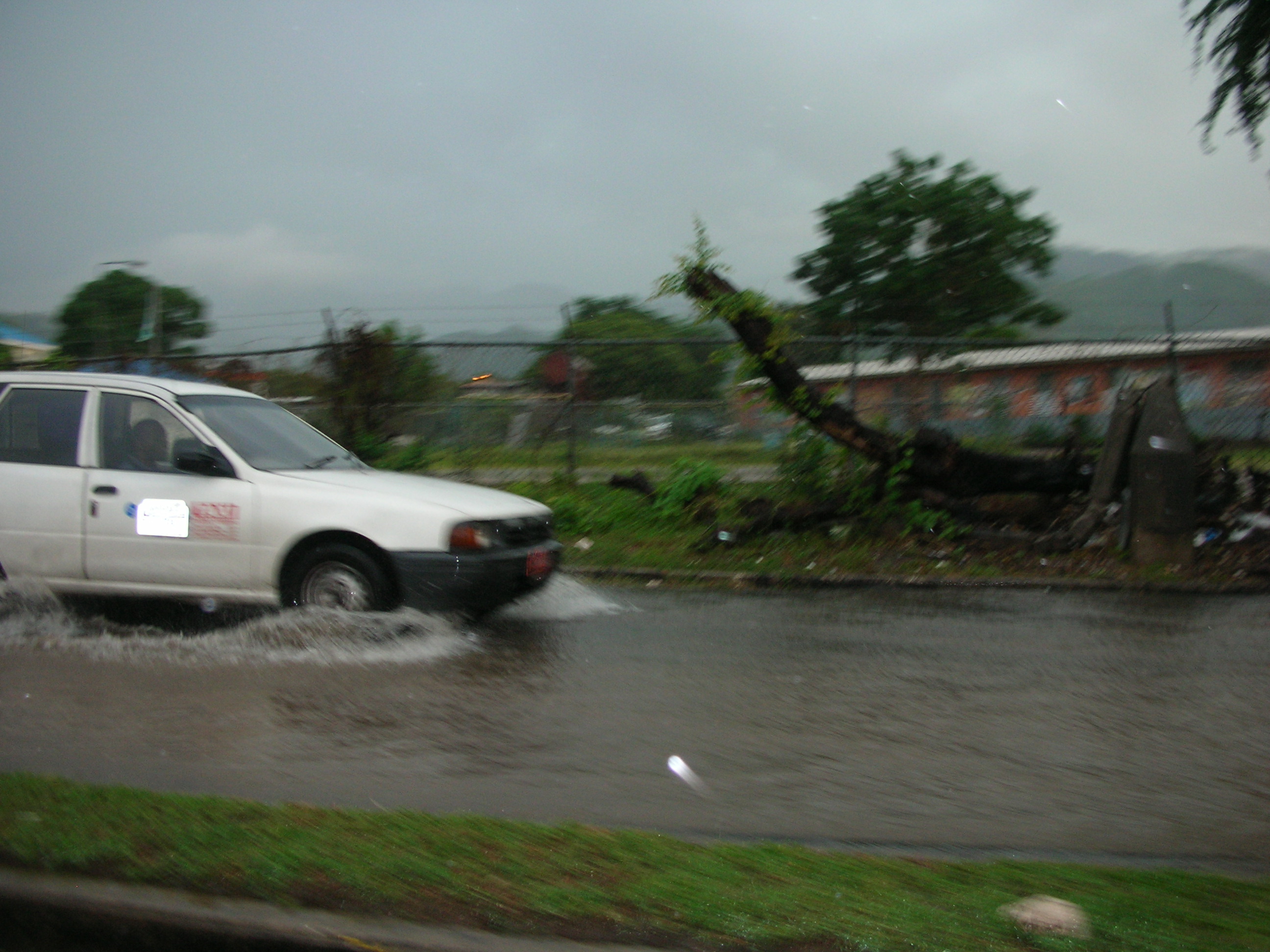
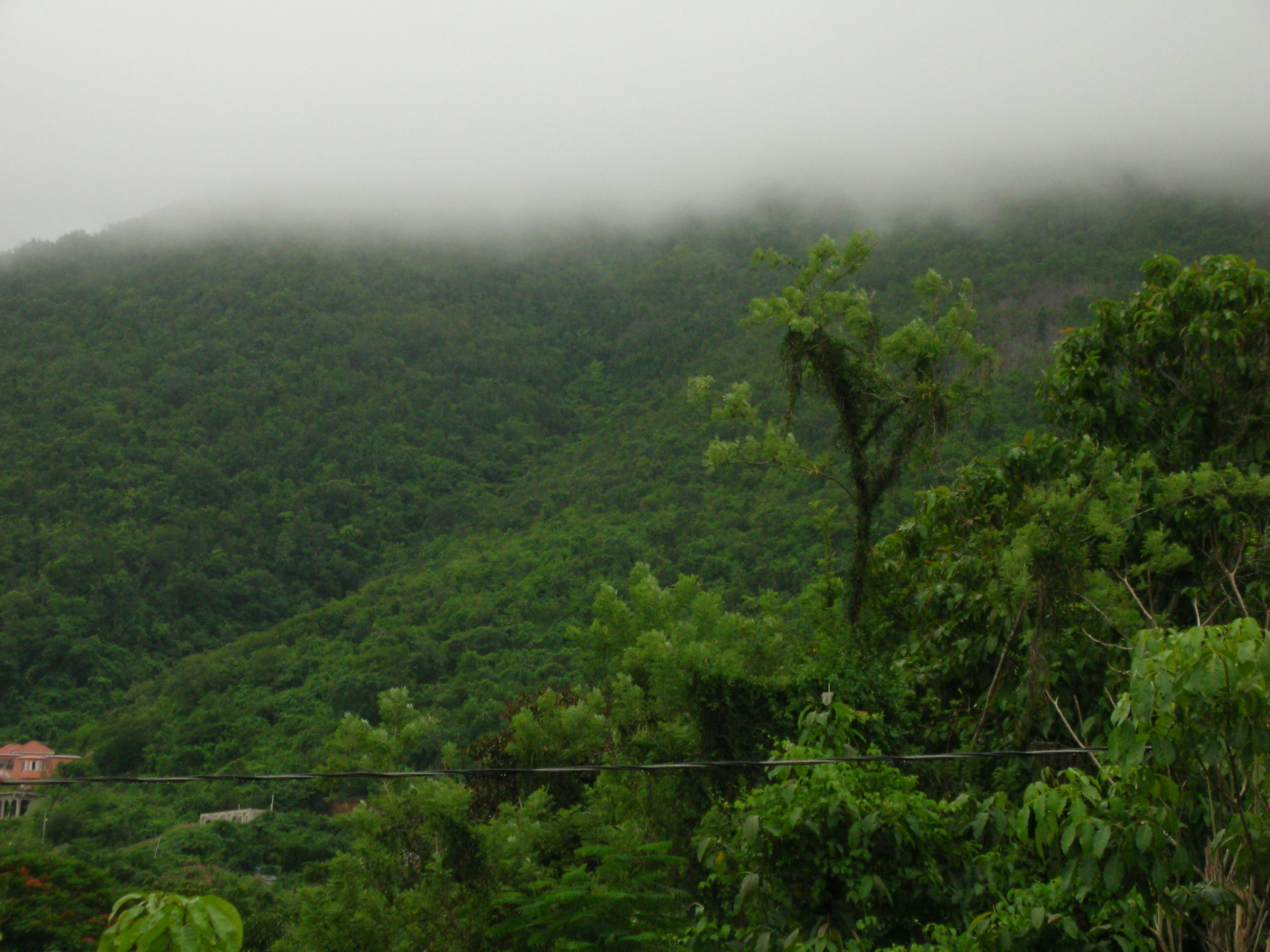
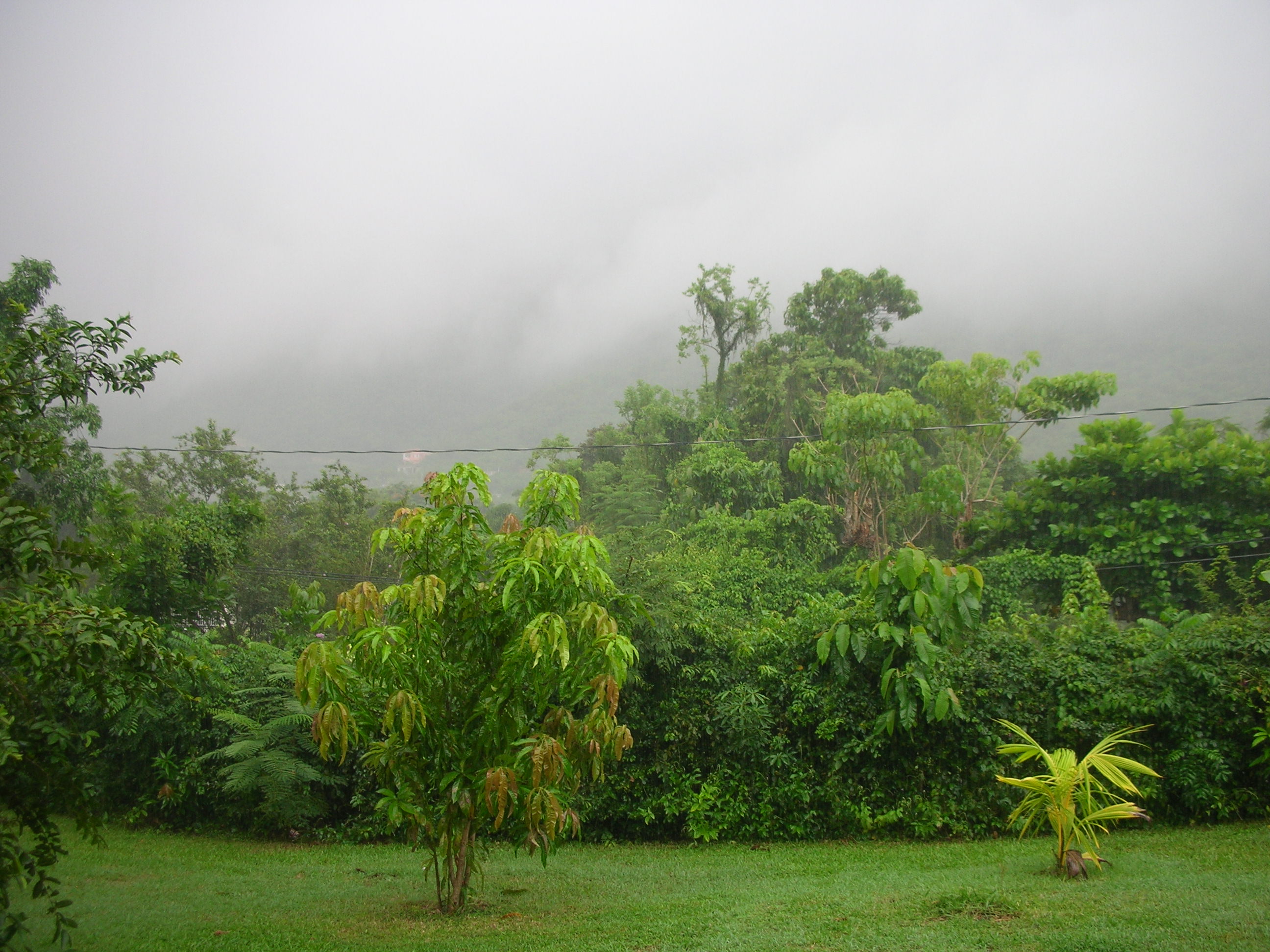
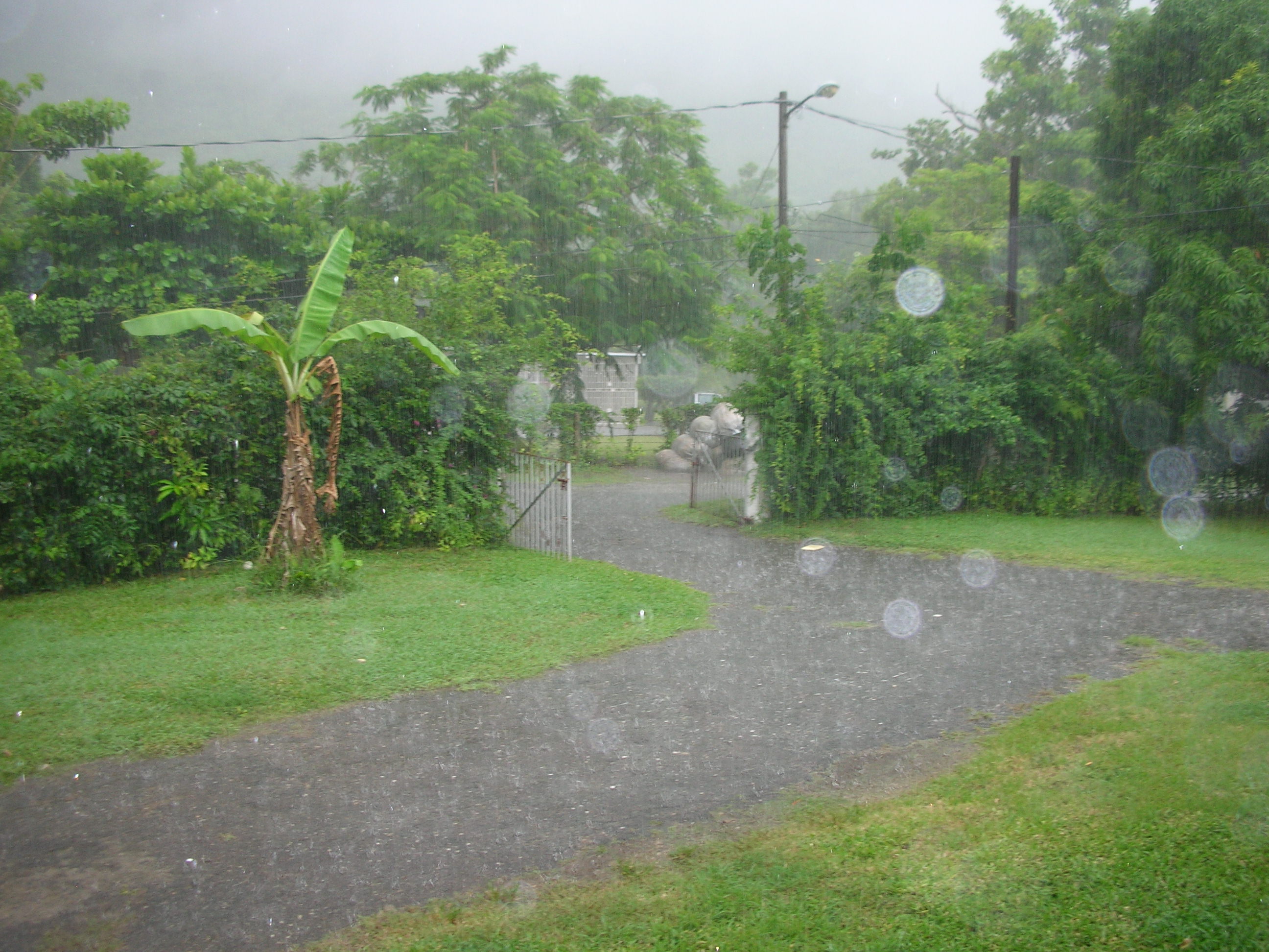
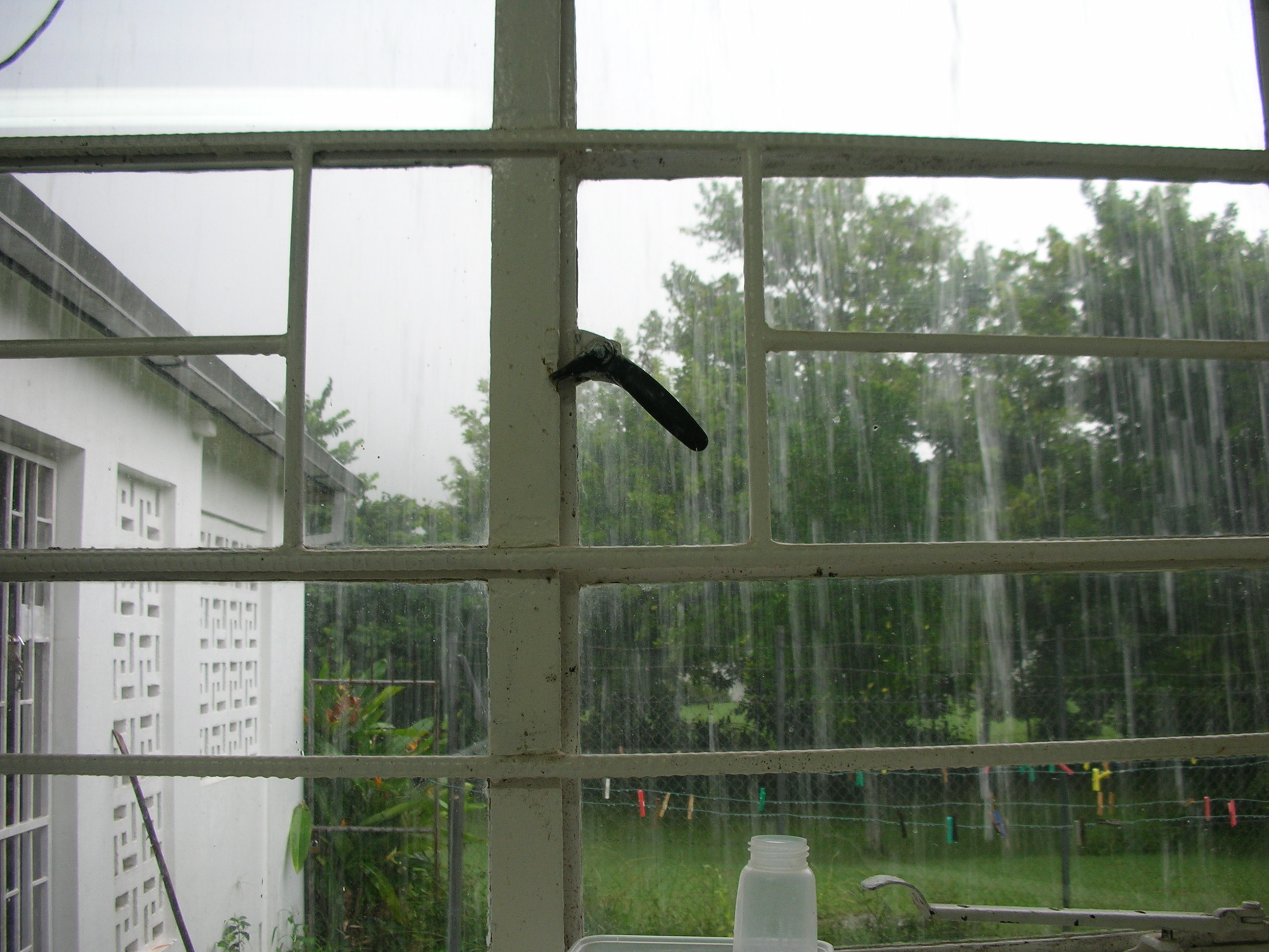
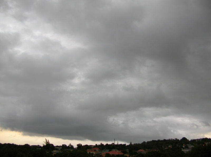
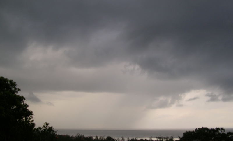
![smiley31[1].gif](gifmhLmgkYvSo.gif)