|
|
- Updates from the Islands -- - St.Maarten/St.Martin - - |
|
|
| - Update | |
| |
|
| - Update | |
| |
|
| - Update | |
| |
|
| - Update | |
| |
|
| - Update | |
| |
|
| - Merry Christmas | |
| |
|
| - update | |
| |
|
| - this is one for the history books! | |
| |
|
|
| - Is hurricane season really over? |
|
|
It's December
folks!
no tropical depressions or
storms are supposed to occur in December, right?
well, take a look at
this forecast!
SPECIAL TROPICAL DISTURBANCE STATEMENT
NWS TPC/NATIONAL HURRICANE CENTER MIAMI FL 415 PM EST WED DEC 3 2003 SATELLITE IMAGERY AND SURFACE OBSERVATIONS INDICATE
THAT AN AREA OF
DISTURBED WEATHER LOCATED OVER THE SOUTHWESTERN CARIBBEAN SEA BETWEEN JAMAICA AND COLOMBIA IS BECOMING BETTER ORGANIZED. THE SYSTEM IS MOVING NORTHWARD AT ABOUT 10 MPH AND THIS GENERAL MOTION IS EXPECTED TO CONTINUE FOR THE NEXT DAY OR TWO. UPPER-LEVEL CONDITIONS ARE SOMEWHAT FAVORABLE FOR ADDITIONAL DEVELOPMENT TO OCCUR...AND A TROPICAL DEPRESSION COULD FORM DURING THE NEXT DAY OR SO. AN AIR FORCE RESERVE UNIT RECONNAISSANCE AIRCRAFT IS SCHEDULED TO INVESTIGATE THE SYSTEM TOMORROW...IF NECESSARY. FORECASTER STEWART
|
| - Sad News from French St. Martin |
|
hirty-six whales beached themselves on the coast of this Caribbean island and died within hours despite the efforts of people who tried to push some back out to sea. The short-finned pilot whales were believed to have beached themselves Monday night, and by noon Tuesday all were dead. The animals were found before dawn by a man on his way to a dump in the French Caribbean territory, which shares an island with Dutch St. Maarten. Residents and tourists later gathered around the whales, which were up to 15 feet long. People were able to push two whales back into the water, but they returned and beached themselves again, appearing exhausted, said Paul Ellinger, of the St. Maarten Nature Foundation. He said it seemed the whales had become disoriented. "What's clear is that they got off course. What caused them to go off course? We'll have to check," Ellinger said. "It could be all kinds of reasons; the temperature of the water, their sonar system. It could have been anything." Short-finned pilot whales usually swim in pods, and when a leader goes astray the entire pod often follows, Ellinger said. Biologists were keeping three carcasses to investigate. The whales covered the beach along the shallow Grand Cailles Bay, the mouth of which is fringed with coral reefs. The whales bore injuries apparently sustained when they ran aground. French police arrived Tuesday morning and closed off the spot as workers dug beach-side graves to bury the remaining whales. |
| - Update | ||
| ||
|
Last night we felt an earthquake in St Maarten at about 10:51
PM.
We heard this loud rumbling coming in our direction. Then our whole
house shook. Then the rumbling passed us and continued off in the other
direction.
I
Here are the statistics on this earthquake as reported by the
University of the West Indies Seismic Research Unit.
On Saturday evening 22 November at
The picture to the left shows the location of
the earthquake. The
focal depth was approximately 17km. The magnitude was
3.4. If you felt this event please contact us
at: saying where you were and
what you
felt |
| - Update |
|
|
The sun must be shining somewhere but not here in St.
Maarten
 My mangos are happy though. Maybe I'll have mangos for Christmas
this year
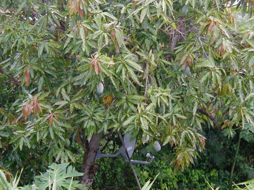 |
| - Update |
|
|
I stand corrected:
the sun WAS shining...briefly.
The storm clouds are rolling in again
  |
| - Update |
|
|
All I have to say
is:
the sun is shining this
morning!
YES!!!!!!!!!
 |
| - Update |
|
|
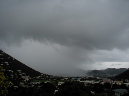
it's 8:00 PM and it has been raining
for almost 2 hours
the ground is saturated. We cannot
take much more rain
but look what seems to be heading our
way!
 |
| - Update |
|
|
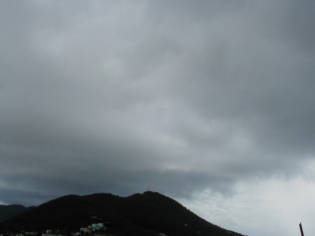
good morning
It's Friday and no sun yet!
I just read this analysis on another
weather site:
The models advertise the system (97L)
NOT getting very far away from the islands as originally expected ... although
it appears that the system doesn't look to develop significantly now, just the
fact that it MAY linger around the vicinity isn't good news for areas that have
been totally inundated by flooding rainfalls ...
so if that analysis is correct, the
sunny Caribbean will remain cloudy for awhile.
I think I am getting sick of
this!
 |
| - Update |
|
|
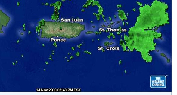
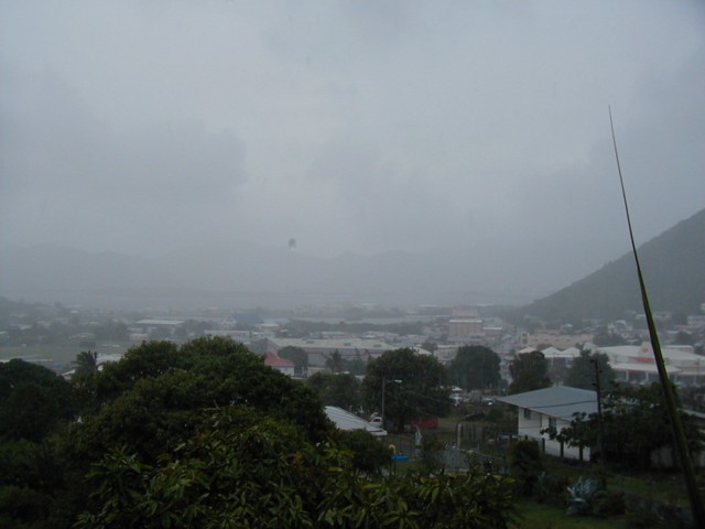
Is it over yet?
Today is cloudy and drizzly on St. Maarten, BUT it is not raining!  we had a very heavy rain last night
and then it rained off and on all night.
the system is on the move ,slwoly drifting Northeast,
so they tell us to expect more rain but
not as heavy as before.
I think St. Maarten has had 9 +
inches. ( That is nothing compared to Puerto Rico which has had 20 inches
in some places.. I send dry wishes to all my friends
there.)
Here the Salt Pond and the fresh
water pond are overflowing in places.
To make matters worse, the
government pump isn't working so they cannot really pump the water out into the
sea as they usually do.
way to go!
natural disasters and man made
disaters to go along wiht it.
you would think they would be better
prepared!
Rain ,Rain go
away!
Come again another day! like
next year maybe?
|
| - Update |
|
|
Here on
St. Maarten we had 6 inches or rain on Monday. Yesterday was raining
lightly off and on all day until last night when the heavens opened up again. We
must have had another 2 to 3 inches overnight.
today so far is cloudy but I can see patches of blue skies Schools are cancelled for the day becauise of the weather..There are a lot of rocks and debris on the roads but I think everywhere is passable. We have been lucky with only minor flooding. It seemed like so much rain to us but we are talking about maybe 8 inches max so far and with Lenny in 1999 we had 18 inches! |
| - Update |
|
|
Rain! Rain! Rain! Lots of
rain!
we received 6 inches of rain yesterday and more
than that in some parts of the island. And it is still raining although right
now it is light rain.
Our local Met Office said to expect more of the
same for awhile. They are watching the system since models seem to show that it
might move Northeast over the next few days.
Today is St. Martin Day. All activities
had to be cancelled.
There also are a lot of unhappy tourists on the
island who will be going home with no
suntans.
|
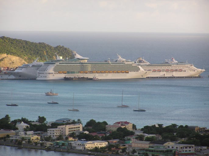
| - Update |
|
|
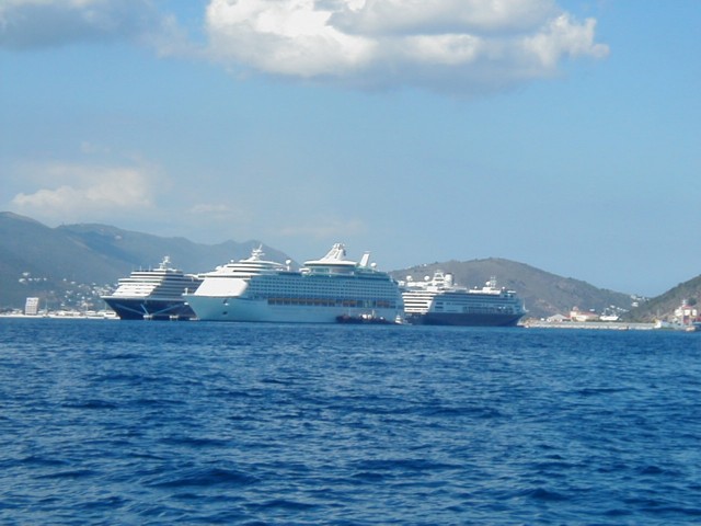
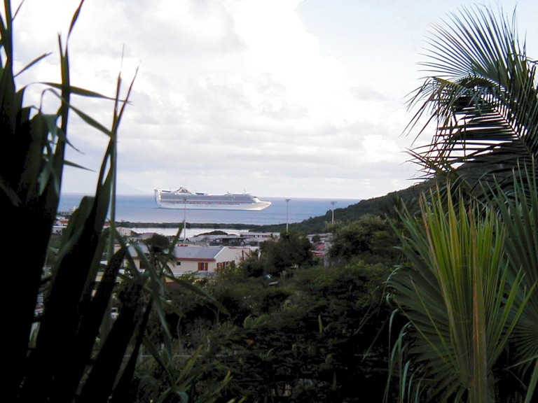
Good morning from St.
Maarten
we have lots of wind
here right now. I found a lot of my plants blown over during the
night.
we are also experiencing some
squalls..heavy rain, high wind, blowing through quickly and then
gone.
My friends are still sailing.
They will have some choppy seas today I am sure
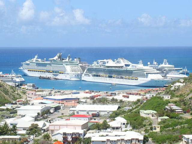
Here is a picture of some
cruise ships that were in town the other day..
enjoy!
 |
| - Update |
|
|
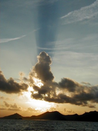
The weather in the
Northern Caribbean has been beautiful the past few days. Today is more
cloudy with rain showers however.
I just returned yesterday from 3 days sailing
around St. Maarten, Anguilla, and St. Barths. The seas were extremely calm
.
This was yesterday's sunset over St. Maarten as
we were sailing over from St. Barths
 |
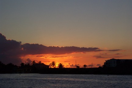
| - Update |
|
|
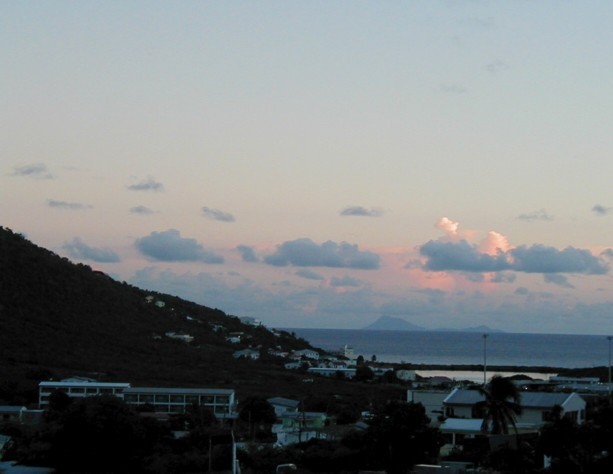
It's another beautiful day in the Caribbean for which we are very thankful.
Nicholas is staying away and the season is almost over.
the Hurricane Season that is.
Now we are getting ready for the Tourist Season which we hope will be a
good one for St. Maarten.
the sunrises and sunsets in October are usually spectacular.
I took this partial sunset from my house.
Notice the island of St. Eustatius (Statia) in the background.
 |
| - rain,rain,don't go away |
|
|
the tropical rain is finally
bringing us some rain instead of just drizzle
yes!
we need it
badly!
Bring us more! but no
flooding please!
 |
| - Update |
|
|
Today was a beautiful clear
day.
We could see Saba, Statia,
St. Kitts, Anguilla, and St Bart's very sharply.
the sea was like a
lake
this picture was taken from
my house tonight as one of the cruise ships was sailing West off into the
sunset.
All's well in the Caribbean
tonight!
 |
| - Update |
|
|
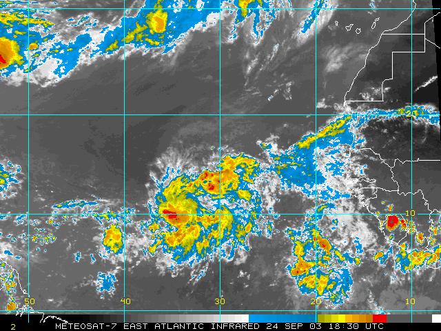
The Cape Verde season should be winding down about
now. but there is a tropical wave just SW of the Cape Verde islands that looks
impressive.
It sure is something for us in the islands to
watch, I think
 |
| - Update |
|
|
Good morning
After a night of wonderful much needed rain, we
had a lovely sunrise this morning on St. Maarten.
Have a good day,
everyone!
 |
| - Update |
|
|
Last night we had some thunder and lightening
and a nice hard rain fell for maybe 10 minutes.
That was the first rain we have had in a long
time and we need more.
I hope that small disturbance east of us will
not form into anything but will bring us some of that much needed
rain.
|
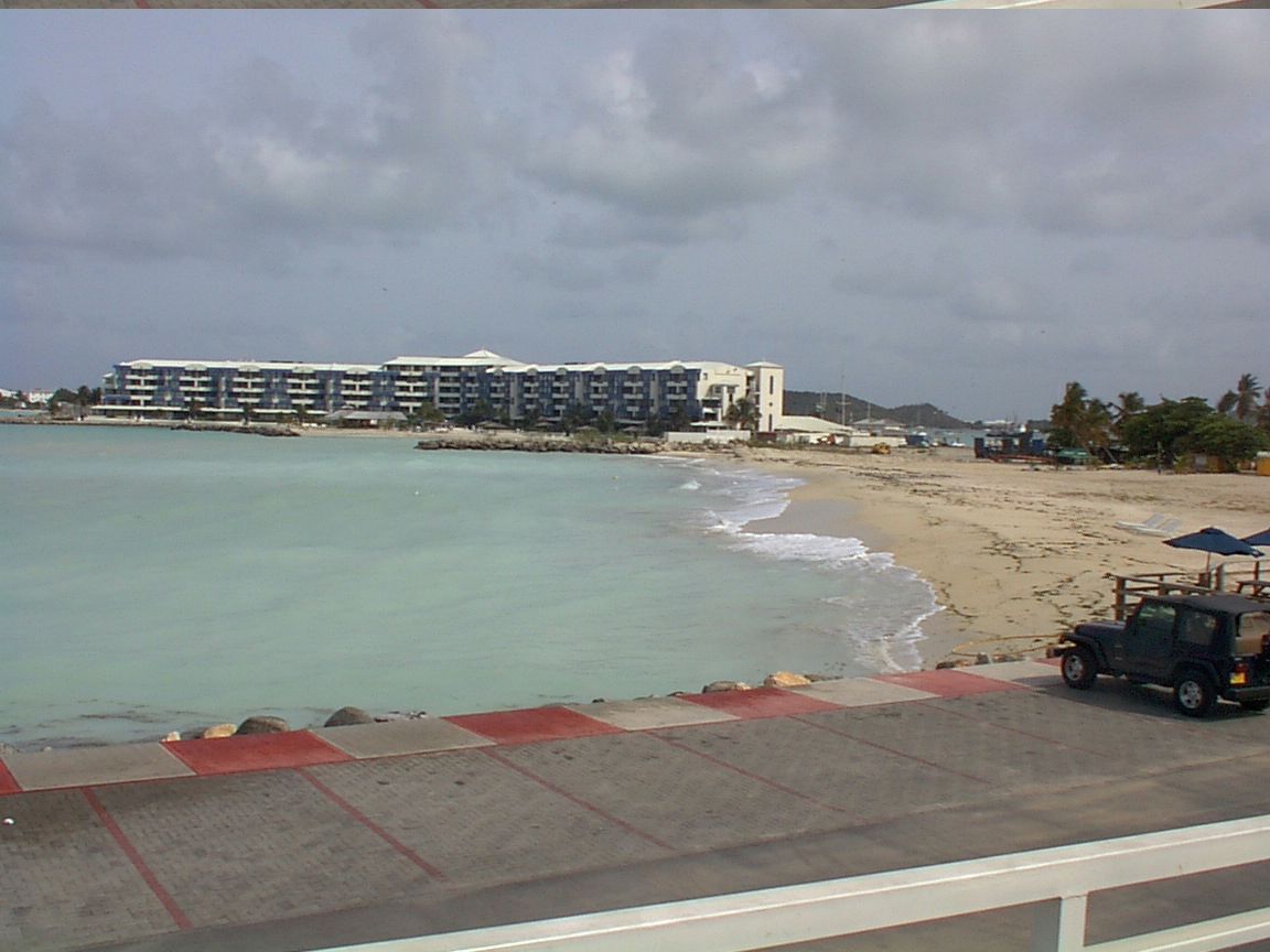
| - Kim Sha Beach | |
| |
|
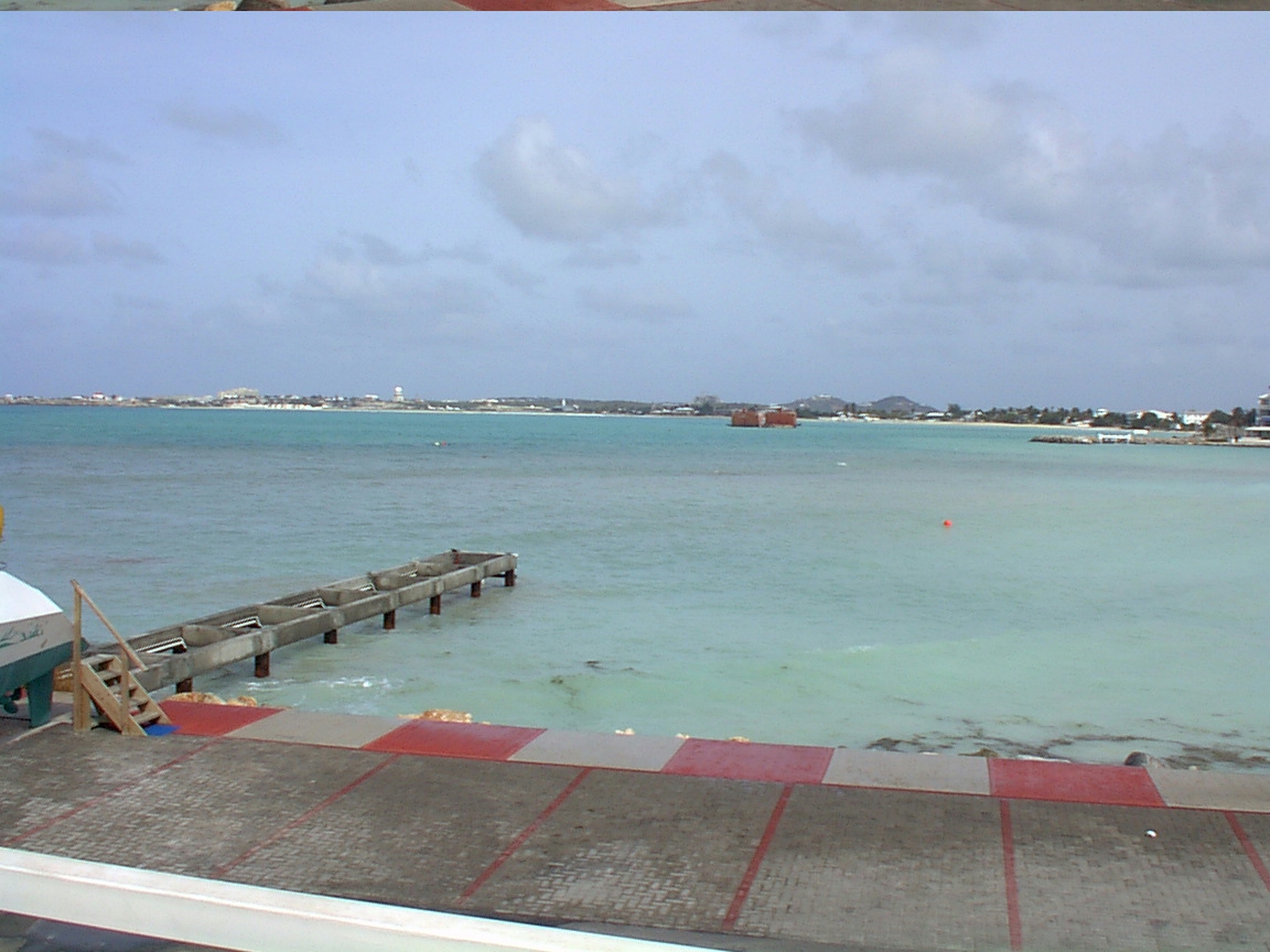
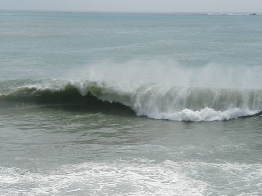
| - Isabel Swells at Kim Sha | |
| |
|
| - Update |
|
sorry. I made a typo that message board is http://www.storm2k.org |
| - Update |
|
|
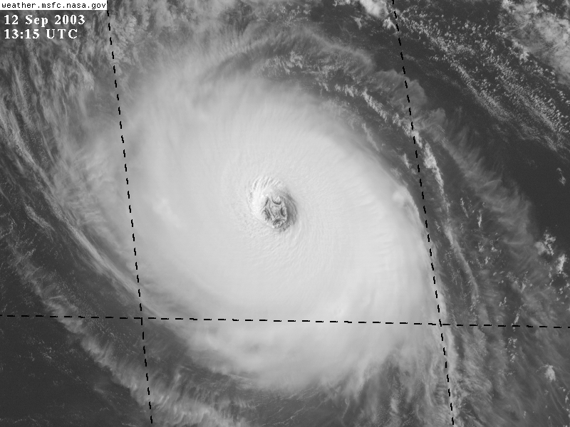
well, thankfully Isabel is no threat to the
islands.
today is very hot and there is no breeze at all.
Isabel is sucking up all the energy
I thought you might be interested in this satellite
picture of Isabel taken this morning
There are 5 identically sized cyclonic
convective complexes in the eyewall. This is normally only seen on Recon Radar!
(Normally just one or two of them) They are rotating around the center of
circulation which is also the same size as the convective complexes. These are
the same types of complexes that created wide paths of extreme damage in S FL.
I lifted this from the Tropics message board
at
which is a great site for up to date information
and discussions.
It's truly amazing and scary!!!!!!!!
 |
| - Update |
|
|
It's another beautiful day in
St. Maarten
I hope our friends in Bermuda
are getting back on track.
we've spent another few days
worrying about Isabel. With each advisory though ,the threat to the islands
seems to be diminishing.
I thought maybe you would
like to see this satellite photo of Isabel. she's
impressive.
Let's hope she stays away
from all land.
 |
| - Update |
|
|
go to
for the latest regional
forecast discussion out of Puerto Rico.
I like this site
because they focus on the possibilites a little closer to
home.
anyone heard anything from
any of our friends in Bermuda?
|
| - Update |
|
|
this is a portion of
the curent area forecast discussion on Isabel from Puerto Rico 3:10 PM Saturday
September 6
IN THE LONGER RANGE...TROPICAL STORM ISABEL HAS
FORMED ACROSS THE
EASTERN TROPICAL ATLANTIC PAST 12 HOURS...AND WAS MOVING WESTWARD THIS AFTERNOON. THIS SYSTEM IS FORECAST TO MAINTAIN A GENERAL WESTWARD MOTION FOR THE NEXT 24 HOURS...THEN MOVE MORE WEST NORTHWEST THROUGH THU OR FRI...GENERALLY PARALLEL TO THE TRAJECTORY OF FABIAN. A SIMILAR WEAKNESS AT THE MIDDLE AND UPPER LEVELS THAT ACTED TO TURN FABIAN IS EXPECTED TO EXIST NORTH OF THE LOCAL AREA NEXT WEEKEND AS ISABEL APPROACHES THE LEEWARD ISLANDS...WHICH IS EXPECTED TO TURN ISABEL MUCH IN THE SAME MANNER AS FABIAN... NORTHWEST...THEN NORTH OF OUR AREA. HOWEVER...THE LAST FEW RUNS OF THE GLOBAL MODELS HAVE GENERALLY TRENDED THE SHARP NW THEN N TURN LATER AND LATER...OR SLIGHTLY FARTHER WEST...AND ISABEL MAY COME NERVOUSLY CLOSE TO THE LEEWARD ISLANDS...AND POSSIBLY THE VIRGIN ISLANDS. WE HAVE PLENTY OF TIME TO OBSERVE ISABEL AS IT TAKES THE NEXT 4-5 DAYS TO CROSS THE ATLANTIC AND APPROACH THE NE CARIBBEAN... AND MODEL GUIDANCE WILL LIKELY SHIFT DURING THIS TIME. THE BEST ESTIMATE FOR ARRIVAL TO THE LOCAL REGION WOULD BE VERY NEAR THE NORTHERN LEEWARD ISLANDS FRIDAY MORNING...AND ALONG THE LONGITUDE OF THE VIRGIN ISLANDS SATURDAY. SATELLITE PHOTOS THIS AFTERNOON...AT
18Z...SUGGESTED THE CENTER OF
ISABEL NEAR 13.6N 34.5W WITH OUTFLOW LOOKING GOOD ACROSS ALL BUT MUCH OF THE EASTERN SEMI CIRCLE. DEEP CONVECTIVE CLUSTERS WEST AND SOUTHWEST OF THE LOW LEVEL CIRCULATION CENTER CONTINUE TO WRAP INTO THE CENTER FROM THE SOUTH...AND GRADUAL INTENSIFICATION IS EXPECTED. DEEP WARM WATERS AWAIT ISABEL WEST OF 39 WEST...AND MORE SIGNIFICANT DEEPENING MAY THEN OCCUR. INTERESTINGLY...PAST TWO RUNS OF GFDL HAVE STARTED OFF WITH A MOTION S OF W...WHILE RECENT QUIKSCAT PASSES HAVE SHOWN ISABELS MAIN CIRCULATION STILL EMBEDDED WITHIN MONSOONAL TROUGHING EXTENDING WSW FROM THIS CENTER. THE LOW LEVEL CIRCULATION MAY BE SHIFTING SLIGHTLY WSW ATTM AND ATTEMPTING TO ENTRAIN THE DEEP CONVECTION IN THE SW QUAD. BASED ON THE LATEST FORECAST FROM TPC...ENE LONG PERIOD SWELLS FROM ISABEL WOULD BEGIN TO AFFECT THE REGIONAL WATERS FRIDAY. ALL INTEREST ACROSS THE NORTHEAST CARIBBEAN SHOULD CONTINUE TO MONITOR THE PROGRESS OF ISABEL. |
| - Bermuda damage |
|
The Royal Gazette has updated their web site with stories of the damage in Bermuda http://www.theroyalgazette.com/apps/pbcs.dll/frontpage |
| - Fw: Emergency Alert System to be Tested at 9.00AM on Fr | |
| |
|
| - Update |
|
|
to all the residents of the lovely island of
Bermuda, I wish you safe passage of Fabian.
It is a terrible experience to go through one of
these storms
Be careful and good luck!
we love your island
 |
| - Update |
|
|
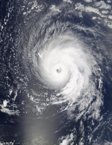
seas have subsided
blue skies starting to appear again
here is a satellite picture taken this
afternoon
awesome looking storm
the islands look like little ants in
comparision
we are at
18.1 N, 63.1 W those 2 little spots right on the outskirts of that storm ( above the text "2 SEP") are Anguilla and St. Maarten 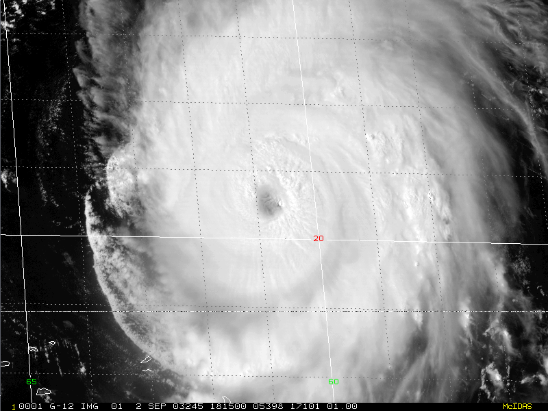 |
| - Update |
|
|
all quiet on St. Maarten
blue skies with a few gray clouds here and
there
but no rain
there's a gentle breeze blowing
but surf is up!
 |
| - Fw: SxmGIS - Advisory #1/3.45PM - Public Advised to continue monitoring the Track of Hurricane Fabian | |
| |
|
| - Update |
|
|
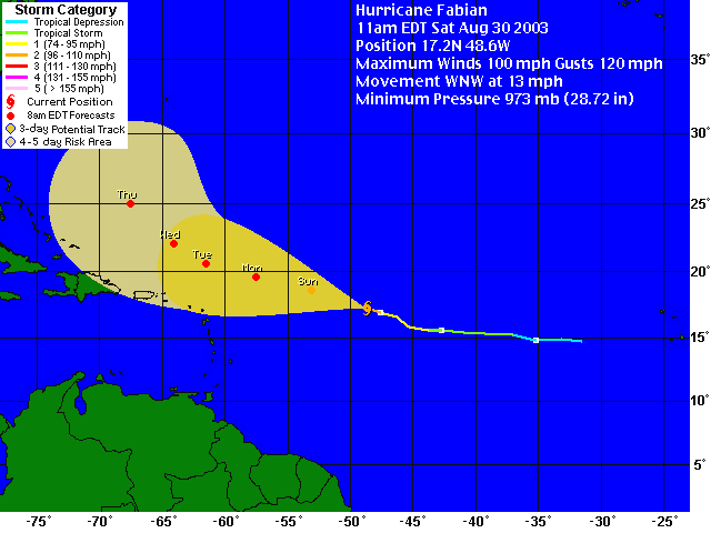
AT 5 PM AST...2100Z...THE CENTER OF HURRICANE
FABIAN WAS LOCATED
NEAR LATITUDE 19.1 NORTH... LONGITUDE 57.8 WEST OR ABOUT 275 MILES...445 KM...EAST-NORTHEAST OF BARBUDA IN THE NORTHERN LEEWARD ISLANDS. FABIAN IS MOVING TOWARD THE WEST-NORTHWEST NEAR 12 MPH ...19 KM/HR...AND THIS MOTION IS EXPECTED TO CONTINUE FOR THE NEXT 24 HOURS. MAXIMUM SUSTAINED WINDS ARE NEAR 145 MPH...230 KM/HR...WITH HIGHER GUSTS. FLUCTUATIONS IN STRENGTH ARE COMMON WITH MAJOR HURRICANES AND COULD OCCUR OVER THE NEXT 24 HOURS. HURRICANE FORCE WINDS EXTEND OUTWARD UP TO 50 MILES... 85 KM... FROM THE CENTER...AND TROPICAL STORM FORCE WINDS EXTEND OUTWARD UP TO 140 MILES...220 KM. ESTIMATED MINIMUM CENTRAL PRESSURE IS 942 MB...27.82 INCHES. LARGE SWELLS AND DANGEROUS SURF CONDICTIONS WILL BE AFFECTING THE NORTHERN LEEWARD ISLANDS...THE VIRGIN ISLANDS...AND PUERTO RICO...OVER THE NEXT DAY OR TWO. I think most of the worrying
is over. Looks like Fabian will just give us some high
seas.
I'm breathing a sigh or
releif and maybe I can sleep well tonight.
 |
| - Fw: SxmGIS - Week Long Hurricane Awareness Campaign Starts Monday | |
| |
|
| - Update |
|
This storm is getting too close for comfort. when is it going to turn north as all the forecasts say? they ( the professionals) better be right. |
| - Update |
|
|
YES! It's looking better all the time that Fabian
will miss the Northern islands.
Keep going WNW, Fabian
meanwhile it's another beautiful day in St.
Maarten
 |
| - Fw: SxmGIS - Disaster Management Office Calls on Community to Monitor Closely the Progress of Tropical Storm Fabian | |
| |
|
| - Fw: SxmGIS - Disaster Coordinator Winston Salomon Welcomes Five-Day Hurricane Forecasts | |
| |
|
| - Fw: SxmGIS - Height of Hurricane Season Approaching, Disaster Management Coordinator Calls on Community to be Prepared | |
| |
|
| - Update |
|
|
no rain in St. Maarten yesterday or today so
far
all quiet
yesterday we had several cruise ships
in
 |
| - Beautiful Sunny Weather on the Friendly Island | |
| |
|
| - Update |
|
|
It has been a cloudy day in St. Maarten. a few showers but nothing to
speak of.
I found this beautiful flower blooming last night from one of my
cactuses
(hope this shows up in my post. I never tried graphics
before)
|
| - Rain showers | |
| |
|
| - Cloudy, Cool & Nice Showers of Rain | |
| |
|
| - Fw: SxmGIS - General Public Advised to Monitor Progress of Tropical Depression #6 Nearing Lesser Antilles Island Chain | |
| |
|
| - Fw: SxmGIS - 13 National Hurricane Shelters Available to Accommodate 2200 Persons for 2003 Hurricane Season | |
| |
|
| - Fw: SxmGIS - Hurricane Mobility Passes Now Available to be Collected | |
| |
|
| - Fw: SxmGIS - All Residents Asked to Cooperate in Island-wide Clean-up Campaign: Operation District Clean Sweep | |
| |
|
| - =?Windows-1252?Q?Fw:_SxmGIS_-_Advisory_#5_Montserrat_Volcanic_Eruption_?==?Windows-1252?Q?=96_Expectations_for_Sunday_Evening_and_Monday?= | |
| |
|
| - =?Windows-1252?Q?Fw:_SxmGIS_-_Advisory_#4_Montserrat_Volcanic_Eruption_?==?Windows-1252?Q?=96_St._Maarten_Airline_Update:_All_Flights_Cancelled?= | |
| |
|
| - Fw: SxmGIS - Advisory #3 Montserrat Volcanic Eruption - St. Maarten Airline Update | |
| |
|
| - Fw: SxmGIS - Advisory #2 Montserrat Volcanic Eruption | |
| |
|
| - Fw: SxmGIS - Advisory #1 Montserrat Volcanic Eruption | |
| |
|
| - Fw: SxmGIS - Hurricane Exercise to Involve Over 180 Persons | |
| |
|
| - Fw: SxmGIS - Final Week for Requesting Hurricane Mobility Passes | |
| |
|
| - Fw: SxmGIS - "Effective Disaster Mitigation," for Hurricane Season 2003 | |
| |
|
| Back to top |