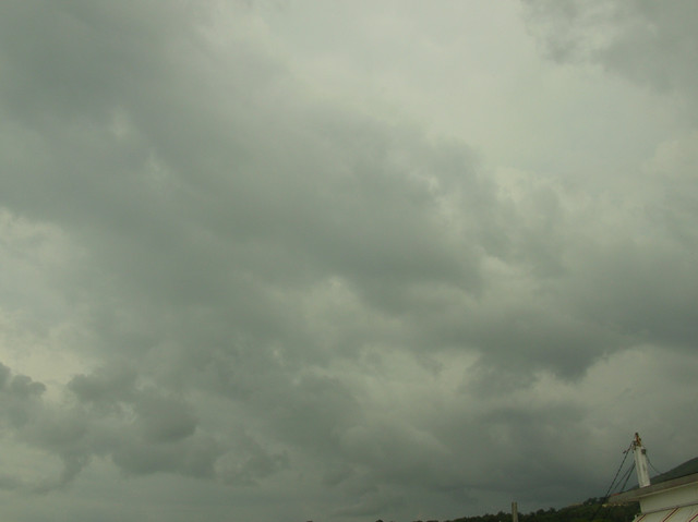
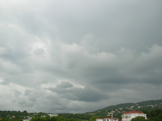
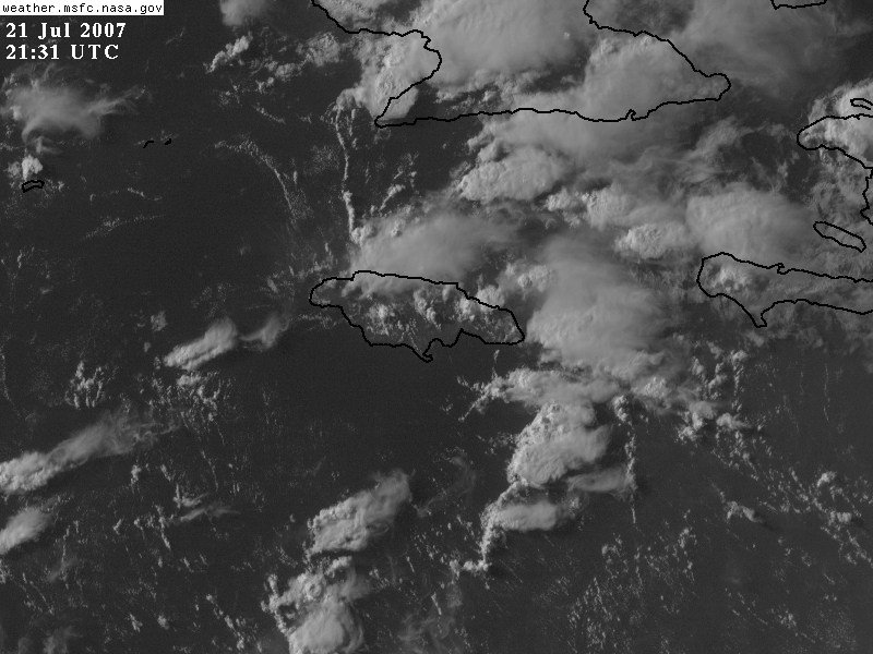
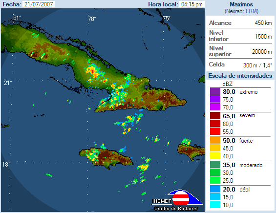
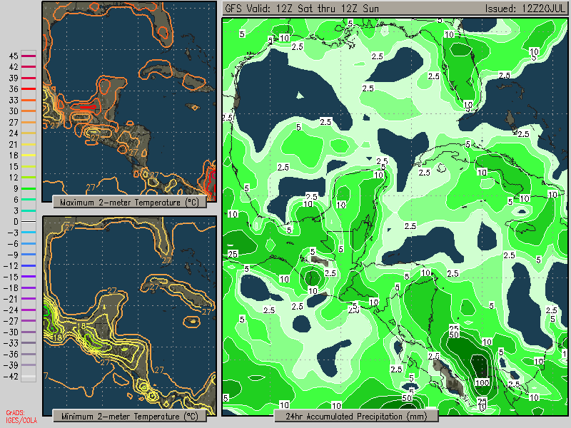
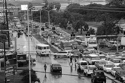
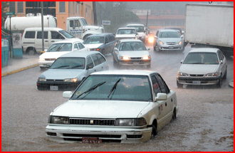
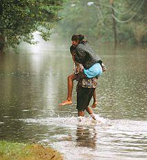
Its a bright sunny day here in Montego Bay,Which is a great change compared to what we have been experiencing last weekwhen very heavy rains lashed the island.Yesterday the preliminary damage estimate was set at about 90 million Jamaican dollars.The parishes most affected were St.Catherine,St.Thomas,Portland and St.Mary.
Jeff Masters blog reports we will have a very active hurricane season ,this is what he said in today's blog.
It's going to be a very active 2007 hurricane season in the Atlantic, according to
NOAA's seasonal forecast issued today. The NOAA team predicts a very high (75% chance) of an above-normal hurricane season, a 20% chance of a near-normal season, and only a 5% chance of a below-normal season. They expect
13-17 named storms, 7-10 hurricanes, and 3-5 major hurricanes (a normal season has 10-11 named storm, 6 hurricanes, and 2 intense hurricanes). Most of these storms are expected during the usual August-October peak of hurricane season, but NOAA does not give any breakdown of which portions of the coast are more likely to be affected. They give two reasons for predicting an above-normal hurricane season:
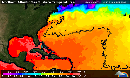
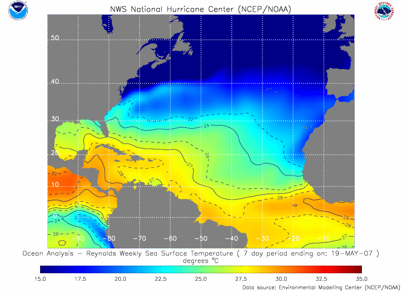
1) A continuation of conditions since 1995 that have put us in an active hurricane period (in particular, the fact that sea surface temperatures in the Atlantic Main Development Region for hurricanes are currently about 0.6 C above normal, Figure 1).
2) The strong likelihood of either neutral or La Niña conditions in the tropical Pacific Ocean.
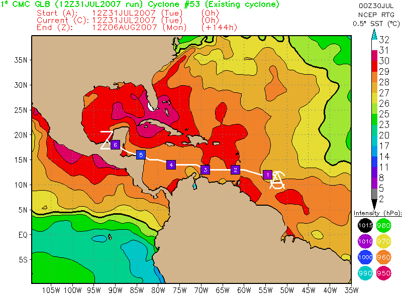
 Figure 1.
 Top: Tropical Atlantic Ocean temperatures in the Main Development Region for hurricanes (green box) were 0.6 C above average
during March and April 2007. This anomalous warmth is expected to persist though hurricane season. Bottom: The 0.6 C above average temperatures are consistent with the exceptionally warm temperatures seen since 2003. Image credit: NOAA.
How good are these forecasts?NOAA's long lead hurricane outlook team, which consists of scientists from NOAA's Climate Prediction Center (lead: Gerry Bell), National Hurricane center (NHC), and the Hurricane Research Division (HRD), have been making seasonal hurricane forecasts since 1998. If one grades their May forecasts based on predictions of a below average, average, or above average season, NOAA has done pretty well. Seven of their nine forecasts have been correct. Their only failures occurred last year, when they called for a very active season (it was a normal year, with 10 named storms, 5 hurricanes, and 2 intense hurricanes), and 2001, when they called for a normal year (it was a very active year, with 15 named
storms, 9 hurricanes, and 4 intense hurricanes).
Steering currents for JuneIt's now possible to say something about the steering currents for the upcoming Atlantic hurricane season, which officially begins June 1. A hyperactive Atlantic hurricane season is no big deal if the steering currents are your friend! The forecast jet stream pattern for the next two weeks from the
GFS model is similar to last year's pattern. I except we'll see a series of troughs of low pressure marching across the Atlantic Ocean through early June, which is typical for this time of year. The Bermuda High is in its usual location, and there are no signs of the unusual steering pattern of 2005 that brought so many hurricanes over the U.S.. It is still to early to say what the steering patterns will do during peak hurricane season, August through October, though.
The Dr. Bill
Gray/Phil Klotzbach's team at Colorado State University issues their updated Atlantic hurricane season forecast on May 31 next week, and I'll be sure to make a post about that forecast.
Jeff Masters
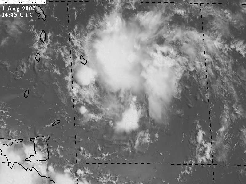
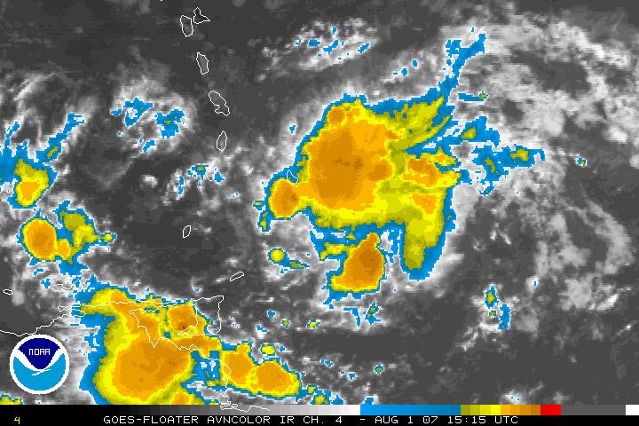
June 1st marks the official start of the Atlantic hurricane season. But this early in the season, most of the Atlantic basin is historically unfavorable for storm formation. One area prone to June tropical storms is over the western Caribbean Sea. From here, storms may head northwest; others veer northward and northeastwards, even striking Florida. Another breeding area is over the open Gulf of Mexico and Bay of Campeche, from whence storms usually head northwards.
Rarer are storms that arise over the western Atlantic Ocean near the Bahamas.
Partly cloudy, warm and humid. Winds will be light and variable
Realfeel®: 30 °C
Low: 24 °C
Humid with times of clouds and sun. Winds from the NE at 12 km/h.
Realfeel®: 36 °C
High: 30 °C
Partly cloudy, warm and humid. Winds will be light and variable
Realfeel®: 28 °C
Low: 25 °C
Humid with intervals of clouds and sunshine; breezy in the afternoon. Winds from the NE at 19 km/h.
Realfeel®: 33 °C
High: 30 °C
Partly cloudy, warm and humid. Winds from the ENE at 4 km/h.
Realfeel®: 29 °C
Low: 25 °C
Humid with considerable cloudiness. Winds from the NE at 11 km/h.
Realfeel®: 35 °C
High: 30 °C
Cloudy most of the time, warm and humid. Winds will be calm
Realfeel®: 28 °C
Low: 25 °C
Rather cloudy and humid. Winds from the NE at 16 km/h.
Realfeel®: 35 °C
High: 30 °C
Mainly cloudy, warm and humid. Winds will be light and variable
Realfeel®: 28 °C
Low: 25 °C
Choose the right car based on your needs.
Check out Yahoo! Autos new Car Finder tool.
http://us.rd.yahoo.com/evt=48518/*http://autos.yahoo.com/carfinder/;_ylc=X3oDMTE3NWsyMDd2BF9TAzk3MTA3MDc2BHNlYwNtYWlsdGFncwRzbGsDY2FyLWZpbmRlcg--
hot CTA = Yahoo! Autos new Car Finder tool


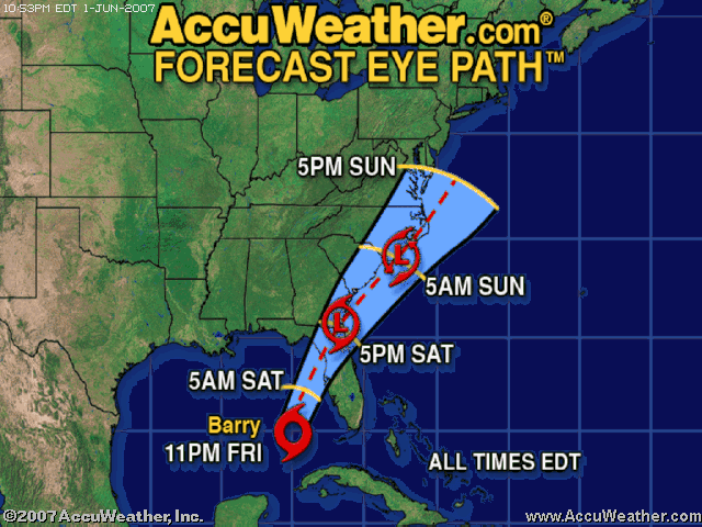
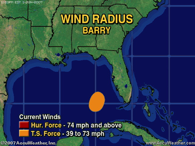
 Barry has brought welcome rainfall to drought-stricken and wildfire-ravaged Florida and Georgia. Most places in north Florida and on the peninsula recieved at least an inch of rainfall from Barry, but a few places had over six inches. Although this much rainfall was badly needed, some flooding was reported in West
  Barry will continue moving northward over the next couple of days close to the East Coast. Rain will spread into the Mid-Atlantic states through Sunday, which will impact outdoor events in the region, as discussed in the
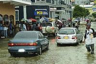


