|
|
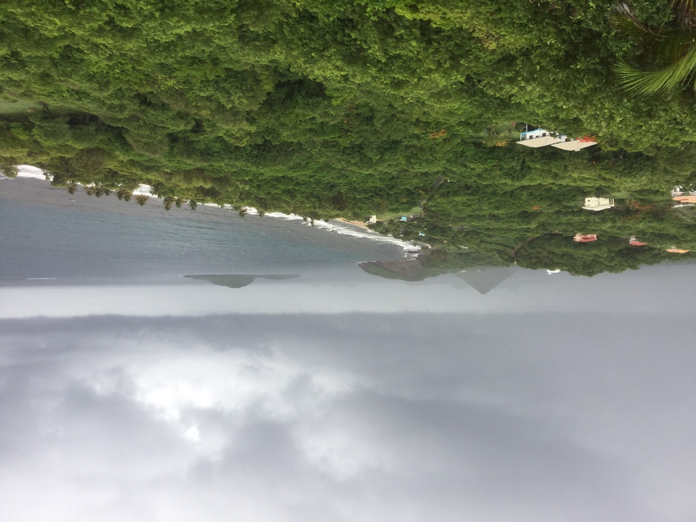
- - - 2015 Hurricane Season - - -
|
- Rain over next 24 hours - maybe!
|
- By Christopher Bolt <gommier at gmail.com>
- Date: Wed, 4 May 2016 07:35:20 -0400
|
Hi, below is a snippet from the NHC. The high overcast cloud we have
had for the last few days is still with us, and is the source of the
heavy rain we have just had. Still coming from the SW (Not the East as
normal).
NHC:

BROKEN TO OVERCAST HIGH CLOUDS ARE OVER THE WINDWARD
ISLANDS. EXPECT OVER THE NEXT 24 HOURS FOR SCATTERED SHOWERS TO
BE OVER THE E CARIBBEAN E OF 70W.

Hogan
|
|
- Still we are covered with high cloud from Venezuela!
|
- By Christopher Bolt <gommier at gmail.com>
- Date: Mon, 2 May 2016 07:07:32 -0400
|
Good morning,
We had a some more rain over night. All courtesy of this high cloud from
Venezuela. It is bringing some more of that spitting rain we had
yesterday. The cloud doesn't look as thick as yesterday. It looks on the
satellite imagery that it is affecting the whole of the Lesser
Antilles. It is caused by 'Upper level Diffluence', whatever that
means. What I do know is this morning's shower will be almost cold, with
3 days of no Sun.
Have a nice holiday, even if there isn't much Sun.

Hogan
|
|
- Welcome rain - but does it have to be on holiday W/E?
|
- By Christopher Bolt <gommier at gmail.com>
- Date: Sun, 1 May 2016 08:08:41 -0400
|
Hi all,
Plenty of lovely rain over night. Well over an inch I think (pool level
rise). This is all due to some high level rain coming from he SW. It is
difficult to tell if it will continue to give us rain, but it does look
like another mostly overcast day (my guess). It is still spitting here
in Westerhall. With not a sign of the Sun or any blue sky. The satellite
images show more stuff coming up from Venezuela, where they do seem to
be having some heavy, well needed, rain. I hope they are having enough
to start filling their reservoirs. Here the mains water is off more
than on, mostly air comes out, or may even go in when the tap is opened,
hopefully the overnight rain will help this situation. I wish I had
left the car out to get a wash, I hate using the limited water to wash
it, well that is my excuse!
To those who have beach outings planned for this weekend, yes us, I hope
the rain keeps off, at least during daylight hours.
To those who's gardens need the rain, and that also includes us, I wish
for more of that wet stuff, but again, overnight will do.
Thanks to Sheltered Solutions, this is the first time I have been able
to check the recently repaired roof for leaks - it seemed to pass last
night's test.
A final quick glimpse outside. Still overcast, looking brighter, no
spits of rain, at the moment.
Have a great holiday weekend.

Hogan
|
|
- High cloud courtesy of Venezuela
|
- By Christopher Bolt <gommier at gmail.com>
- Date: Fri, 22 Apr 2016 08:07:01 -0400
|
Hi all,
I have been very quiet recently due to the fact that we haven't had any
weather. That isn't strictly true, it has been dry and lots of Sun.
The last few days have been different, especially this morning. We have
an almost solid blanket of high cloud. Most of the time our weather
comes from the East. This is where our rain comes from. But this high
cloud comes from the South-west. To be more precise from the tops of a
large build-up of clouds/thunder storms over Venezuela. They have had an
extreme drought there, but over the last couple of days they have had
some storms pass through. The tops of which have been ripped off into
the high level South-westerly winds. Thus our current blanket. This can
be seen clearly on satellite imagery, see:
http://www.ssd.noaa.gov/goes/east/tatl/flash-avn.html
At lower levels, there are a few small showers between us and Barbados,
but they seem to be fading as the approach us. Maybe there could be the
odd small shower, more likely towards the North of Grenada and
Carriacou. If they arrive, my guess is about 10:00 this morning. The
current radar shows them on a path between the islands. Maybe Bathway
area (Sally & Cliff)!
We need the rain!

Hogan
|
|
- No promises, but there may be rain showers today.
|
- By Christopher Bolt <gommier at gmail.com>
- Date: Fri, 25 Mar 2016 10:54:40 +0000
|
The radar is showing a bunch of rain showers heading for Grenada.
Arriving (hope) later this morning.
Hogan
|
|
- Is it just possible there could be some showers this afternoon?
|
- By Christopher Bolt <gommier at gmail.com>
- Date: Fri, 18 Mar 2016 15:00:38 +0000
|
I just looked at the Barbados radar and there appears to be a clump of
showers moving in the general direction of Grenada. With a bit of luck
Grenada could get some mid afternoon?
Hogan
|
|
- The remnants of a cold front is struggling to reach Grenada
|
- By Christopher Bolt <gommier at gmail.com>
- Date: Thu, 10 Mar 2016 13:45:40 +0000
|
Hi folks,
Sorry I have been quiet recently. But I am watching from afar and
worried about the garden, lack of rain. I see that there is the tail
end of a cold front trying to get down to Grenada. The Barbados weather
radar shows that some showers have scraped down to the Grenadines. The
question is will they manage to give Grenada some welcome rain, before
fizzling out?
Pleased to hear from any of you if any decent rain falls.

Hogan
|
|
- There goes the laundry....
|
- By storm tracker <grenadatracker at gmail.com>
- Date: Thu, 8 Oct 2015 09:09:11 -0400
|
|
Had to run out in a rain poncho and collect the laundry from all over the driveway. My potted plants knocked over, coconuts are down. Some squall!!
|
|
- Looks like a morning of rain coming.
|
- By Christopher Bolt <gommier at gmail.com>
- Date: Thu, 8 Oct 2015 08:41:57 -0400
|
If the radar is correct!

Hogan   (shortest post yet!)
|
|
- I was going to do a post this morning
|
- By Christopher Bolt <gommier at gmail.com>
- Date: Wed, 7 Oct 2015 13:09:25 -0400
|
I was about to send a post to the group this morning, saying I think
there could be some rain and heavy showers. But I didn't as I thought it
would go North of us. How wrong can one be!!!! We have just had over 1
inch of rain in just over 1 hour.
I think the rainy season has started! There is still plenty of rain out
to our East, but looks as if most will go North of us. But I would have
been wrong this morning, I could be wrong this afternoon.
Hogan
|
|
- Joaquin now Hurricane near Bahamas
|
- By Christopher Bolt <gommier at gmail.com>
- Date: Thu, 1 Oct 2015 08:20:59 -0400
|
Joaquin is very close to Bahamas, but predictions are it will move North
and the main part will miss them.
Here we have that high overcast, hazy Sun. Caused by clouds sweeping off
of Venezuela.
Yesterday we, in Westerhall at least, had a small shower, but not as
much as I had hoped for. There are no rain showers showing on the
Barbados radar in our area.
Hogan
|
|
- Update - maybe rain later?
|
- By Christopher Bolt <gommier at gmail.com>
- Date: Wed, 30 Sep 2015 09:23:03 -0400
|
Hi,
I was just looking at Martinique radar, when I noticed a couple of
larger blips at the extreme limit of their radar. I then accidentally
clicked on my Barbados radar link, which I haven't looked at for some
time as it has been out of order for so long. Only to find that it is
working again (at last). Sure enough it is showing some bigger blobs to
our East. They are well over 100 miles away, but moving in this general
direction (hope). So maybe, just maybe, we could get some rain later today?
I just tried digging some weeds up, but the ground is like concrete. It
needs the rain.
Hogan.
|
|
- The breeze has returned.
|
- By Christopher Bolt <gommier at gmail.com>
- Date: Wed, 30 Sep 2015 07:28:38 -0400
|
After a very hot and almost windless day, yesterday, the breeze has
returned. Small fluffy clouds at low level, but quite a lot of high
cloud blowing in from S. America.
There is still no real sign of rain, just a very small number of very
small blips on the radar, and hardly any in our area.
Further afield and no threat to us, just East of the Bahamas, is Joaquin
a tropical storm. It is moving in a SWesteryly direction; strange for
tropical storms, obviously picked up bad habits from it's predecessor
(Ida). The experts have it turning back North before it reaches the
Bahamas. I hope they are correct.
Looking at the overnight temperature at the airport, it seems the lowest
we had was 28C (82F), that is hot!
Note: that is one of the easy temperatures to remember in both C&F, just
reverse the digits!
So hopefully, with the breeze and a slightly hazy Sun, at least for part
of the day, it might feel slightly cooler today.
Hogan
|
|
- Ida still messing a round in Atlantic. Eclipse Sunday.
|
- By Christopher Bolt <gommier at gmail.com>
- Date: Sat, 26 Sep 2015 19:51:12 -0400
|
Well, Ida (Tropical Depression) is still wobbling around mid Atlantic
and upsetting the fish.
Here it is dry and no sign of any real rain.
But what is 100% certain is that tomorrow (Sunday) there will be an
eclipse of the Moon. And we are in the best place to see it. Starting
around 20:00 (8pm) Although you may not notice much until 21:00(9pm)
local time the Moon will slowly slip into the shadow of the Earth. The
eclipse will be at it's fullest (Moon darkest) at 22:51. Not only this,
but it will be a Super Moon, being the closest to the Earth this year at
a mere 357,000 km (approx), it will be the biggest full moon this year.
So don't forget to stay up late on Sunday. Although we will get many
Lunar eclipse in the future, this one is at a convenient time and one of
the biggest for some time.
This also applies to any other readers of this blog in the Eastern
Caribbean.
Hogan, and sorry to hijack the weather thing for a bit of astronomy, but
not much else to discuss with the weather!
|
|
- Got last nights wrong!
|
- By Christopher Bolt <gommier at gmail.com>
- Date: Thu, 24 Sep 2015 07:24:13 -0400
|
The blob of showers I mentioned last night are currently passing between
us and Tobago. There is a chance that we could get a shower from one.
Apart from that it looks like another nice day.
Ida is still out there wandering around aimlessly. Each prediction over
the last couple of days has it going North or Northwest, but still it
goes SEasterly. It's current position is about 1200 miles NE of us. The
predictions, for what they are worth, have it moving NW, then turning SW
over the next 5 days (if it survives that long).
Have a nice day.

Hogan
|
|
- Ida wanders aimlessly in Mid Atlantic.
|
- By Christopher Bolt <gommier at gmail.com>
- Date: Wed, 23 Sep 2015 17:02:48 -0400
|
Ida has moved further South today (not much). Apparently she will not do
much until later in the week when she is expected to start to move North.
We just had a couple of very small showers here. The radar shows a few
showers scattered out to our East. Further out there is a small blob of
cloud which possibly could come through over night, or is that wishful
thinking?
Apart from that all is quiet in our area, apart from the digger
preparing a site below us. Still it is 5pm, it should stop soon!
Hogan
|
|
- IDA, like my wife, does not have a good sense of direction.
|
- By Christopher Bolt <gommier at gmail.com>
- Date: Tue, 22 Sep 2015 20:55:39 -0400
|
Since this morning, Ida is continuing to backtrack to almost where it
was this time yesterday. So where will it go from here? I bet there are
some interesting discussions by the experts!
I also got it wrong today. I thought it would be 'mostly dry', well I
guess that wasn't far wrong, unless you were in Grand Anse area, and
probably other areas. But here in Westerhall we did not receive much.
But did spot a waterspout about a mile off shore.
So I will come back in the morning to see if Ida has listened to the
experts and gone NNW instead of SSE.
Hogan
|
|
- Ida, where is she going?
|
- By Christopher Bolt <gommier at gmail.com>
- Date: Tue, 22 Sep 2015 06:23:47 -0400
|
Good morning,
Well, it looks like another mostly dry day today. Not a blip on the
weather radar for our area.
Ida seems to have stalled in the Atlantic. It even seems to have drifted
back along it's track over night. It is still worth keeping an eye on
it. It is not behaving like a normal tropical storm. Her current
position is 21N 49W.
Just looked outside. A beautiful day, a few fluffy clouds, a gentle
breeze from the east. Could be another hot day.
Hogan
|
|
- Raining..
|
- By Sally Stalker <stalker at spiceisle.com>
- Date: Fri, 18 Sep 2015 17:32:53 -0400
|
I've been watching the Rugby and not the weather and when I raised my head to
see what was happening, found it was raining hard!  The day started well, sunny
and hot.  Very clammy as well with a little breeze from the east which appears
to have fizzled out.
The garden is sparkling tho' and England beat Fiiji...man,  those Fijians are
built like brick walls!

Sent from my iPad
|
|
- Rumbling in the distance.
|
- By Christopher Bolt <gommier at gmail.com>
- Date: Fri, 18 Sep 2015 15:25:48 -0400
|
So far the rain has kept off, despite my wife doing some outside
painting, but it does seem the moist air, I mentioned this morning, has
crept up from Trini. More rumbling! Now the sky (down South) is just
high overcast. No visible sign of rain from East, via South to West. But
dark skies to the North.
What is happening up North, Sally?

Hogan
|
|
- I was just about going to say another dry day....
|
- By Christopher Bolt <gommier at gmail.com>
- Date: Fri, 18 Sep 2015 06:21:04 -0400
|
I had just looked at the weather images and was just about to say that
it looks like another dry day, when I heard this faint noise on the
roof! yes rain. Looking again at the radar I see a small blip further up
the island. I still stick to my feelings that (on the whole) it will be
like yesterday. The air to our east is dry, but there is an area of
moist air pushing up from the Trinidad region, I guess.
The two disturbances are still out there, but following predicted paths
away from us.
Hogan
|
|
- Another dry spell
|
- By Christopher Bolt <gommier at gmail.com>
- Date: Thu, 17 Sep 2015 06:31:25 -0400
|
Although there is always a chance of a shower, it does appear that we
are having another spell of dry weather, at least today?
There are two areas of concern in the Atlantic, one (the nearest to us
at over 1000 miles) has become Tropical Depression Nine. The other, just
to the SE of Nine, currently known as 95L actually appears to have more
spin than Nine and looks more impressive on satellite images. Both are
predicted to move towards the North and should therefore be of no worry
to us. TD9 is already on a fairly Northerly track, but 95L has not
started it's turn North yet.
Today seems to be starting similar to yesterday. A slight Easterly
breeze, small fluffy clouds in a hazy sky.
Have a great day.

Hogan
|
|
- Breezy and dry
|
- By Christopher Bolt <gommier at gmail.com>
- Date: Wed, 16 Sep 2015 06:45:46 -0400
|
As remnants of the tropical storm Henri affects the UK today, here in
Grenada we have a dry and breezy morning. It is hazy with a few small
clouds. The radar is clear of any rain, but the satellite images show a
blob of rain approaching Trinidad. It doesn't look as if that will
affect us.
Out in the Atlantic are two disturbances, both of which are predicted to
go North, harmlessly into the North Atlantic.
Have a great day

Hogan.
|
|
- Oh no, it's back!
|
- By Sally Stalker <stalker at spiceisle.com>
- Date: Tue, 15 Sep 2015 11:16:50 -0400
|
The wandering weed is back drifting shorewards in long orange bands...We had a
little respite there but it seems the weed can't keep away.  It is sad to watch
the beaches in the north and east littered with evil smelling rotting weed.  I
have not been to Levera  beach recently the rains make the road from Bathway to
Levera very muddy, I hope our rather peculiar currents have by passed the beach
this time around.  The hatchlings have enough of a struggle to survive without
the weed.

It has rained on and off for at least a week now and everywhere is looking very
emerald isleish!  My flowers are bedraggled but the trees and shrubs are
smiling away.  There is an abundance of pears , mangoes and cabbage but limes
are not much in evidence and have been small and lacking in juice.   With all
this water perhaps the next crop will be better.

My new neighbour- to- be has stockpiled the top soil from his levelled plot
close to the perimeter of my land and the lovely rich black virgin soil is
trickling into my garden beds..do I feel guilty? Should I shovel it back? Or
rather, should he who does in the garden ( sorry, Miz Loomis, look away or read
another island blog) shovel it back? Hee, hee, hee.

Sent from my iPad
|
|
- More thunder storms..
|
- By Sally Stalker <stalker at spiceisle.com>
- Date: Sun, 13 Sep 2015 17:47:52 -0400
|
Three so far.  Yesterday a friend on the West Coast said she was sitting in the
middle of an electric storm; the South East was sitting in sunshine and the
North had no idea what was going on!  To day the thunder started around four
and it was slightly different than previously, more like God and a.n.other
we're having a row way, way up.  All this was accompanied by monsoon like rain.
 The garden will love it!
The atmosphere is well washed and the last of the light is filtering through
the clouds. It is also pleasantly cool with a fine breeze soughing through my
casuarinas.

Sent from my iPad
|
|
- Noisy & Wet
|
- By Christopher Bolt <gommier at gmail.com>
- Date: Sun, 13 Sep 2015 16:18:05 -0400
|
Thunder, Lightning and heavy rain. No painting today, but did cast some
concrete!
Well we needed the rain, but not all in one go!

What is the river like Daniella?

Hogan
|
|
- Showers today?
|
- By Christopher Bolt <gommier at gmail.com>
- Date: Sun, 13 Sep 2015 05:48:37 -0400
|
Looking at the radar and satellite images I see many showers coming
soon, possibly even before I can send this. Ad looking out at the pre
sunrise sky I see showers approaching .
There is a system SW of the Cape Verdes which is given a 70% chance of
developing in next 5 days, but should turn safely into the Atlantic.
In a hurry before it starts to rain here.

Hogan
|
|
- Into a dry area
|
- By Christopher Bolt <gommier at gmail.com>
- Date: Fri, 11 Sep 2015 07:51:31 -0400
|
Just to mention this is the last episode of the painter.
He turned up yesterday morning, and the rain started. So he managed to
do some work out of the rain. With the skies looking pretty grim, and
the rain still falling, he decided he would give up doing the rest. I
told him that despite what the weather looked like I was sure the rain
would stop soon. So he had lunch and sure enough the rain stopped and
he was able to finish the work, uninterrupted. The veranda fence has
been done - well for another couple of years!
Now, of course, it looks like a bit of a drier (short) period. We have
the remnants of Grace slipping past the north of the lesser Antilles,
with Barbuda appearing to get the worst of the rain, going by the radar.
It looks like Dominica has been spared.
There are no rain showers appearing on the radar, to our east. The
satellite images show another area of moist weather about a day or so
away, but there are signs of that breaking up. We could have some high
hazy cloud passing over us, today, from the SW. I guess this is part of
the high level winds that have helped breakup any big storms coming
towards the Lesser Antilles. This high cloud seems to be whipped off the
tops of storms in the NW of Venezuela and Columbia. It is interesting to
note that most years we sit on our veranda in the evening and watch
lightning flashing, in the distance, all along the NE coast of
Venezuela and over Trinidad, but this year we have not seen any storms
in that area.
Further afield there is an area of interest just South of the Cape
Verdes, this only has a 30% chance of it developing in the next 5 days,
but worth watching. Also there is a new storm (Henri) which is NE of
Bermuda heading North in an arc that will skim Newfoundland and then off
across the Atlantic. Watch out UK!
So hoping that we have at least one dryish day, but the tank still needs
more rain water.
All the best

Hogan
|
|
- Oh not another..
|
- By Sally Stalker <stalker at spiceisle.com>
- Date: Thu, 10 Sep 2015 11:09:47 -0400
|
| 3.07am and the North of Grenada was woken with a mighty crash and now at 11.oc am the grumbling and flashing has just abated. It is raining steadily and the islands are covered in a mist of rain. I can’t believe the sun is shining down South and Chris is painting! Grenada is only 20 x12 miles, a tiny State with an incredible eco system!
It is cool and of course very damp. The wind has died and nothing moves. The farmers, a grumpy lot at the best of times are actually smiling. But it has been a rough night. |
|
|
- More rain?
|
- By Christopher Bolt <gommier at gmail.com>
- Date: Thu, 10 Sep 2015 08:41:23 -0400
|
As I said yesterday, the painter gave up and went home. After that the
rain stopped, well up here that is. I saw many showers pass South of
Grenada.
Today the radar is showing lots more showers in the vicinity, some heavy
just North of this part of Grenada. The painter has not turned up, maybe
for the best.
But the Sun is out for now. A slight breeze. Blue sky to the South, but
clouds to the East. I can also see some light rain showers to the East
and rain is falling in the mountains ------
Ahh the painter has arrived. I think I will change my forecast -IT WILL
RAIN!
Hogan
|
|
- Painter gave up and went home!
|
- By Christopher Bolt <gommier at gmail.com>
- Date: Wed, 9 Sep 2015 10:03:36 -0400
|
I told the painter when he arrived that we would have rain. But he
painted a pillar on the windward side with white Weatherguard. It rained
(as expected) and now the terracotta tiled steps are flowing with white
emulsion.
The radar shows the rain fizzling out, but we are only at the beginning
of the tropical wave. The satellite images show plenty of high cloud and
some, what looks like to me, rain clouds bubbling up to our east. I
think we could have more rain at any time today - although the painter
has gone, so the rain may also!
Hogan
|
|
- Meanwhile 'oop North
|
- By Sally Stalker <stalker at spiceisle.com>
- Date: Wed, 9 Sep 2015 08:17:45 -0400
|
It is very overcast with a good strong breeze blowing in and the sea is very
restless.

 The massive thunderstorm on Monday night cleared the air and shattered my
nerves.  Living on a hill I have the sensation of being intimately involved
with the elements and I have never lost my respect for the power of nature.
Spending some years in Punta Gorda in the south of Belize I experienced the
most spectacular pyrotechnics and noise level.  Something to do with the ring
of mountains on the Guatemalan side. Here the storms move in and pass over
quickly. I can watch them coming.  Grenadian farmers believe a massive
thunderstorm heralds the start of the rainy season, sadly we can no longer rely
on that one!
The village farmers are ready for the rain to come and no pipe water ever grows
such sweet  produce.

Driving in to The Big Nutmeg yesterday I was appalled at the terrible stench of
rotting weed in the seaside villages of Maquis and Soubise. The people of those
villages live smack on the sea and refused to move inland after Ivan.  The sea
is their livelihood, I am shocked that no effort has been made to remove this
weed!  How can they live with that smell!


Sent from my iPad
|
|
- Rain & Painters
|
- By Christopher Bolt <gommier at gmail.com>
- Date: Wed, 9 Sep 2015 06:33:00 -0400
|
Yesterday the painters continued their work on the veranda, but
fortunately did not get to the windward side. The rains came and it
would have got very wet.
Today the only bit left to paint is the bit that gets the weather. And,
yes, there is another tropical wave coming through and bringing with it
a large area of rain which is just off to our East. It looks like it
will arrive soon after the painters. Mrs Crumble always says that as
soon as we get paint brushes out it starts raining. These 3 days have
proved her right, considering we have hardly had rain for weeks!
Grace really looks as if she has been on a diet. But her slimmed down
body is still heading for the Guadeloupe area, due Friday morning.
We have had a shower in the last hour. I can see high cloud out to our
East, hiding the just risen sun, this is probably the spill out (my
term) from the rain that is heading our way. Otherwise it is a lovely
morning with a slight breeze.
Have a nice day and think of us and our veranda painting!

Hogan
|
|
- The rain came.
|
- By Christopher Bolt <gommier at gmail.com>
- Date: Tue, 8 Sep 2015 06:53:55 -0400
|
Good morning,
Yesterday we had painters in, to paint among other things, our veranda
fence. The weather looked fine and the painters wanted to continue
painting the unsheltered windward facing fence. I said I didn't want
them to do that as it was going to rain. With almost cloudless skies, I
think they thought I was mad. But I insisted thy didn't, instead they
painted an area which wouldn't be affected by rain. As the afternoon
went on I started to doubt my own prediction, it wouldn't be the first
time I was wrong. But just as they were leaving, and the paint would
have still been wet, the rain did come. As those of you here will know
we had a good bit of rain yesterday evening, with lightning and thunder.
That tropical wave is moving away, still a couple of showers near by.
But it is looking like a better day for painting the fence today.
There is another tropical wave approaching, but that is more likely to
be tomorrow, and beyond that is Grace. Not very strong and it's path has
been lowered, slightly, more towards Guadeloupe, and with Dominica on
it's Southerly flank, maybe more rain there, that will be Friday. Let us
hope they don't get much.
So today, hopefully, no rain until the paint dries!

Hogan
|
|
- Well I'll be danged.....
|
- By Sally Stalker <stalker at spiceisle.com>
- Date: Mon, 7 Sep 2015 15:11:37 -0400
|
Brought up on Westerns I thought that "danged" was a near enough equivalent to
what I really said when I woke to rain and strong winds.  Yesterday was
"danged" hot and airless and today there's a dramatic change. The wind is
blowing from the...mumble, mumble mumble and is enormously refreshing.  Oh yes,
I'll give it a try...blowing from the North East...but would that be the Trade
Winds?   Please forgive me for my total ignorance.

To continue, the day is beautiful and reminiscent of years gone by when it
seemed day after day we had this lovely weather.

He what does in the garden cut three fonds off my glorious Bismark Palm because
they got in the way when he cut the grass.  I had all weekend to get myself
under control!  This morning I was waiting for him, took him gently to the
tree, spoke at length about symmetry, balance, visuals...then lost it!  Oh
dear, and I had  considered very carefully how I would handle myself!  Awful,
isn't it when one loses it...one ends up feeling guilty and ashamed of the
almighty tantrum! And I didn't cut the danged fonds off..he did!

There is no sign of the Sargassum weed...not since Danny passed have I seen the
merest blob.  Has it all gone home or moved on to some other part of the world?
 I was getting quite attached to those rafts of weed drifting with the currents
but they left a dang bad smell when beached.

Sent from my iPad
|
|
- Ahh - rain.
|
- By Christopher Bolt <gommier at gmail.com>
- Date: Mon, 7 Sep 2015 07:16:57 -0400
|
For once I was correct. We had a little shower during the night. The
area of clouds and moisture shown on the satellite images has reached
us. The radar is showing more sowers to our East. It looks like a day of
clouds and possibly rain, maybe heavy later.
Grace is on course for landfall in the area of Antigua, by Saturday
morning, but should only be depression by then.
Hogan
|
|
- Rain maybe?
|
- By Christopher Bolt <gommier at gmail.com>
- Date: Sun, 6 Sep 2015 18:45:12 -0400
|
I know I have said this before and have been proved wrong. But there is
an area of cloud (hopefully rain) approaching a line between Tobago and
Barbados. Could this possibly bring us some rain over night?
Grace seems to be following the predicted path towards the Northern of
the Lesser Antilles. It should be no more than a Tropical Depression by
then. Let's hope Dominica does not get dumped on again!
Have a good Night and maybe some rain.

Hogan
|
|
- 91L- rapidly through TD - now Tropical Storm Grace.
|
- By Christopher Bolt <gommier at gmail.com>
- Date: Sat, 5 Sep 2015 18:56:21 -0400
|
This is all as it passes South of the Cape Verdes.
The current thoughts are that it is heading for the Northern Lesser
Antilles with arrival expected about Friday. If it follows that path it
is likely to struggle. If it comes further South then it could build.
As for the showers I mentioned we could have today, well Sally saw one
to North of the top end of the island and I saw one pass by out to the
South. So I was partly right. Most of the showers passed further up in
the Windwards.
I see more cloud on satellite imagery out to the East of Trinidad, but
too far away to be picked up on radar. Maybe some rain tomorrow?
Hogan
|
|
- Oops...there goes the tropical wave
|
- By Sally Stalker <stalker at spiceisle.com>
- Date: Sat, 5 Sep 2015 11:17:18 -0400
|
I must say I thought  Chris was seeing things when I looked out my window this
morning.  There was a big bowl of blue sky with some darling fluffy clouds on
the horizon.  Not a sign of rain anywhere!  I should know by now that the
weather is like friendship, remarkably unpredictable!

The fluffy clouds reared up, looked nasty and rapidly became a fast moving wave
of rain pushing a lovely strong breeze ahead.  Yippee!  I ran to close windows,
heard a brief pitter patter and that was it...gone!  Not even enough  to water
the plants. The lovely rain band had raced past my hill, wiggled its fingers at
me and dumped its load north of the island. It had come from the South
East...ha!  I say that with pride, I believe I have the compass sussed!

It is not as hot as yesterday and there is a slight breeze but it is hazy.  I
don't fancy the Hash galloping over the island in this weather.

Sent from my iPad
|
|
- 91L just South of the Cape Verdes.
|
- By Christopher Bolt <gommier at gmail.com>
- Date: Sat, 5 Sep 2015 06:35:09 -0400
|
It has a 70% chance of developing into a cyclone in the next 2 days as
it moves West.
Here there are signs of a slight change, with just the chance of some
showers in the area. There is a weak tropical wave about to pass through
and there are signs of the ITCZ wibbling in our direction, is this
wishful thinking. We could do with a little rain.
Have a good weekend.

Hogan
|
|
- Feeling hot,hot hot....
|
- By Sally Stalker <stalker at spiceisle.com>
- Date: Fri, 4 Sep 2015 13:52:09 -0400
|
And I couldn't get up the energy to even think of the meaning behind that Soca
rhythm!  We are all wilting here. The East coast is getting a gentle breeze
which freshens in the evening but the West coast is very still.  Going in to
the Big Nutmeg yesterday I was shocked to see the temperature was 34 Celsius.
The air conditioning in my car died...and the car not a year old. It chose a
great day! At least the car kept going.
Found he what does the garden sitting under a palm tree shucking nuts...I say
nothing, what can you say?!   It's too hot to quarrel.  The nuts disappear into
the great diaspora.  Mental note, discuss praedial larceny with....oh can't be
bothered.
Looking at the rest of the world, it is quite scary out there! The news is
truly awful, everywhere. So I am thankful for my teeny bit of Paradise tucked
away in the Caribbean.
By the way, has anyone told the Geographers that the Wide Sargasso Sea has
moved to the Caribbean?
Last question, is El Niño our friend?
Sent from my iPad
|
|
- Another dry day
|
- By Christopher Bolt <gommier at gmail.com>
- Date: Fri, 4 Sep 2015 11:38:57 -0400
|
Yet again a hot dry day. No sign of any rain in our area.
Over the other side of the Atlantic is 91L, just come off of Africa. The
few models have it following a westward course and slowly turning more
northerly as the week goes on.
Have a nice day

Hogan
|
|
- No weather.
|
- By Christopher Bolt <gommier at gmail.com>
- Date: Wed, 2 Sep 2015 08:02:40 -0400
|
I couldn't think of what to say today. Fred is weakening and following
it's predicted path harmlessly (hope) into the North Atlantic.
The rest of the Atlantic, between us and the Cape Verdes, only has one
weak tropical wave in it. The Synopsis chart shows the Monsoon Trof, but
no ITCZ. Both the same as far as I am concerned. I looked up the
difference and they still seem to mean the same. But the satellite
images show a band of clouds where it (whatever you want to call it) is,
from about 30W to 50W straggling the 10N line of latitude.
Here, this morning, there is a slight breeze from the East. Very few
clouds, a few more over the mountains. The horizon is just a fuzz. There
are no showers showing on the radar, out to the East. In fact there is
only the odd teeny weeny blip to be found anywhere in the range of the
Martinique radar.
I am guessing it could be another hot day today.

Hogan
|
|
- No rain on radar, yet it is raining!
|
- By Christopher Bolt <gommier at gmail.com>
- Date: Tue, 1 Sep 2015 07:12:02 -0400
|
We are having some light rain as I do this post. It is not showing on
the Martinique radar.
There is no wind at all this morning, a few clouds. There are no blips
on the radar in this part of he Caribbean, to speak of. And the
Satellite imagery shows no significant weather on our side of the
Atlantic. So it looks like a few days with little or no rain, maybe!
Fred is moving up NW in into mid Atlantic, so does not look like a
threat to the Caribbean.
Have a nice day,

Hogan
|
|
- Hurricane Fred - yes it is a hurricane already!
|
- By Christopher Bolt <gommier at gmail.com>
- Date: Mon, 31 Aug 2015 08:03:41 -0400
|
Good morning all,
The Low I have mentioned for the last couple of days is no longer on the
charts. But looking East I see some 'Towering Cumulus moving in and I
can also see the rain dropping from them. The radar confirms we have a
clump of showers , heading our way. It is getting darker.
Fred is now a hurricane and looks like it is passing through the Cape
Verdes,
not good for them, but looks OK for us as it travels NW.
Have to send this as my post is getting out of date! Winds gusting and
rain on the roof. Have a good day.
Hogan
|
|
- Tropical storm Fred
|
- By Christopher Bolt <gommier at gmail.com>
- Date: Sun, 30 Aug 2015 07:24:51 -0400
|
A tropical wave having just popped off of Africa and has already been
named Tropical Storm Fred, after rapidly passing through the Tropical
Depression (Six) stage! This is the most Easterly I ever remember seeing
a named storm. The only good news for us (in Grenada) is that it already
appears to be taking a North-Easterly course. But this looks bad news
for the Cape Verdes. Most Storms start just south of the Cape Verdes,
but this one has started before reaching them and appears to be heading
straight for them. Most models have Fred continuing up into the
Atlantic, but some including the NHC seem to have it turning on a more
Westerly course (at about 20N) after passing the Cape Verdes.
Plenty of much needed showers over night. The various radar & satellite
images show that we are still in an area of showers. The 'low' that I
have mentioned is still moving slowly in our general direction and still
has a few heavy looking showers associated with it. If it continues on a
Westerly path, we may get some rain associated with it tomorrow?
Have a great day

Hogan
|
|
- A good downpour
|
- By Sally Stalker <stalker at spiceisle.com>
- Date: Sat, 29 Aug 2015 10:41:38 -0400
|
I awoke to a crash of thunder, pouring rain and a small shivering dog standing
on my chest.  The farmers will be pleased was my first thought.  I live in an
area where people farm huge tracts of hillside, mostly laid to peas and sorrel
.  They have no tools but their cutlass and no access to running water.  These
big deposits of rain are essential.   The downside for me is that the rain also
washes away my phone and ergo, my internet.  But as I said before, in the face
of real misery elsewhere, who am I to  even grind my teeth!    I hope the aid
to Dominica is alleviating some of the misery.  Nothing will alleviate the
memories.

The sun is now shining intermittently but it is hazy and dull most of the time.
The temperature is rising as are the mosquitoes and sand flies.  It is a
miracle of nature that one teeny fragile insect can enter my house a long way
from where I sit and head straight for me.....then add a few more little
insects and "one is not amused!"

Safe weekend.


Sent from my iPad
|
|
- Rain over night
|
- By Christopher Bolt <gommier at gmail.com>
- Date: Sat, 29 Aug 2015 07:33:43 -0400
|
We had a good shower over night and there looks like more to come. The
radar shows some more showers, some heavy, approaching Grenada over the
next hour or two. The rain seems to be part of a tropical wave about to
pass through. Just beyond this wave is the 'Low' I mentioned. It is
shown on the synopsis chart as part of a tropical wave and part of a
kink in the ITCZ. The satellite imagery shows numerous clouds bubbling
up in it. So it looks as if we could have more showers in the next
couple of days.
Our thoughts go out to those affected by TS Erika in Dominica. This was
'only' a tropical storm, but it shows what damage the rain from a TS can
do. Apparently they had about 12 inches of rain in 24 hours.
We are off to a beach do today, fortunately we will have cover, at Wild
Woods, so we are protected from rain or Sun!
All the best

Hogan
|
|
- Sad for Dominica..
|
- By Sally Stalker <slstalker13 at gmail.com>
- Date: Fri, 28 Aug 2015 17:38:00 -0400
|
What awful news from Dominica!  Thoughts and prayers go out to you all and hope
that help is already with you.
The air has returned to us here in Grenada but the sun remains powerful.  We
had a very good downpour in the night. "That'll please him wot does in the
garden" sez II.  But blow me down if I don't find him watering the plants at
six in the morning. I say nothing, unmanned.
My neighbours to be have now ruptured my mains water pipe and sainted woman
that I am, I bit my tongue.  After all what is doing without water for a bit
compared to losing your life, home and happiness.
I know, move over Mother Theresa but joking aside (which is very difficult for
me), I am deeply affected by the Dominican disaster...there but for a turn of
the tail or a wiggle of the body, go we.


Sent from my iPad
|
|
- Dominica
|
- By "Jacqueline Dowden" <jacquie at spiceisle.com>
- Date: Fri, 28 Aug 2015 16:44:53 -0400
|
So very sad to hear the news and see the photographs and video out of Dominica, a terrible tragedy. Our thoughts are with you....... Jacquie. |
|
|
- Back to normal?
|
- By Christopher Bolt <gommier at gmail.com>
- Date: Fri, 28 Aug 2015 07:08:32 -0400
|
With Erika moving away, the weather returns to normal, well what seems
to be normal for this year! There is an Easterly breeze. plenty of
bubbly clouds, but only a few scattered showers visible on the radar.
There is a weak tropical wave that may bring a bit of rain over the
weekend, I stress MAY. Beyond that there is the 'LOW' playing with the
ITCZ but threatening to break away. This could be another chance for us
to get some rain. And way way across the Atlantic, just about to leave
West Africa, is another system to watch.
Hogan
|
|
- Erika now giving us a nice South-South-Easterly breeze.
|
- By Christopher Bolt <gommier at gmail.com>
- Date: Thu, 27 Aug 2015 08:10:44 -0400
|
It is enough to rattle our wind chime which is normally out of the
normal Easterlies.
NHC have Erika over Antigua, but both satellite and radar images have
further South, also Guadeloupe reported 1006mb at 04:00 whereas Antigua
reported a low of 1008 at the same time.
Anyway, we had a nice shower over night. But none in our area now.
In the Atlantic, SW of the Cape Verdes, there is a weak 'Low' embedded
in the Inter Tropical Convergence Zone. NHC have marked it on their
synopsis chart, so I it might be worth watching. It is at about 9N 30W.
A last look out:  Sunshine,breeze and hardly a cloud.

Now to go and enjoy the breeze.

Hogan
|
|
- All the air is being sucked out of Grenada!
|
- By Christopher Bolt <gommier at gmail.com>
- Date: Wed, 26 Aug 2015 17:44:41 -0400
|
Hi all,
We have no breeze at all here in Westerhall. Unlike Barbados which is
receiving SSW winds of 20 mph. We must just be at the distance where the
trade winds are neutralised by the air trying to go towards Erika.
This afternoon we received te clouds that I mentioned this morning. We
could see rain out at sea. We could see rain towards Grand Anse and the
airport. Also saw Westerhall point and Ft Jeudy get a small sprinkling.
But we hardly received any rain at all. We did here some distant
rumblings also.
The sea is like a millpond. Should have gone to Spray Bay for a dip!
Have heard from friends in the UK that they have had monsoon like rain
in places there today.
Have a good evening.

Hogan
|
|
- Now that we are breathing a little easier...
|
- By Sally Stalker <stalker at spiceisle.com>
- Date: Wed, 26 Aug 2015 11:10:04 -0400
|
Man, it's hot!  Even at six in the morning as the sun establishes itself and I
rush into the garden, well shuffle maybe, the heat is building. This is typical
when storms are around, air is sucked out leaving a blanket of moist
airlessness. My, am I becoming the little know all   Strangely the night was
cool.  I think being a weather guru must be very difficult these days!

The red beard around the island grows longer and has changed the sound of the
waves on the shore to more of a thump than a soothing swoosh.  Not so sweet to
sleep to at night.

He what does the garden decided not to water the plants.. There's rain coming!
I look at Chris' forecast, cast my eyes over a cloudless sky and debate a
fracas...I need to assert myself, be firm, be determined.  So I go and have a
cup of coffee resisting any temptation.

Only the near islands are in sight, the haze is deep.  Is this Sahara dust?  I
run my fingers over my desk and am enthralled with the ochre deposit....is it
Sahara dust or dust from my neighbour's land clearance. Sahara dust is much
more romantic and tolerable than my neighbour's dust and less irritating.

I have to say I am grateful for the information the weather gurus give me on
this site and on other sites. Although I trivialise, I mean only to lighten the
seriousness a little without taking away from the underlying importance of
knowledgeable information....now I have poured ashes over my head!

Sent from my iPad
|
|
- TS Erika continues on path towards Antigua
|
- By Christopher Bolt <gommier at gmail.com>
- Date: Wed, 26 Aug 2015 06:50:31 -0400
|
Erika, although a tropical storm, looks bigger than Danny, it is due to
pass through Antigua about 2am tomorrow. One of it's outer spiral arms
has been giving Barbados some rain this morning and hopefully we may get
some of these showers today.
The radar and satellite images show some showers moving towards us from
the direction of Barbados. But as recently the showers seem to be easing
off as they approach us.
There is no breeze this morning, the sea is calm, even mirror like in
the bays below me. Out to the East I can see a small shower, but that
one is likely to pass to our South. I can also see some rain in the
mountains. So it does look like a slight change in the weather. Hope!
Have a nice day.

Hogan
|
|
- 98L now topical storm Erika
|
- By Christopher Bolt <gommier at gmail.com>
- Date: Tue, 25 Aug 2015 07:21:18 -0400
|
Good morning all,
It is a beautiful morning, with just a few clouds sitting on top of the
mountains. Hardly any breeze and the sea is calm.
Danny disintegrated, just a few remnants left behind.
Now we have TS Erika to watch. It is galloping across the Atlantic at
about 20mph. NHC has it passing in the Antigua area, Thursday, still as
a tropical storm.
The rain I was hoping for from the tail of Danny has also disappeared.
There are just a few very small showers between us and Barbados,
travelling in our direction, but diminishing as they come. Maybe a we
could get a small shower later in the day, if we are lucky.
Cup of tea time now. Have a nice day.

Hogan
|
|
- Danny and it's tail (last para added from previous post).
|
- By Christopher Bolt <gommier at gmail.com>
- Date: Mon, 24 Aug 2015 08:31:42 -0400
|
Looking at the airport weather for these islands, they are getting rain
but not too much wind. Antigua (Being to the North of the storm) is
getting slightly more. It has dropped to tropical depression. So the
islands should benefit from the rain, but hopefully not much more.
Down here there is hardly a breeze. It is a nice day with few clouds. It
looks like it could be a hot day unless the breeze picks up.
98L is still out there and picking up strength. A 90% chance of
developing into a cyclone in the next 2 days. It is further north than
Danny was at this point in the Atlantic. Most of the models have it
going north of the Leewards and up into the Atlantic.
Behind that is another tropical wave, just passing south of the Cape
Verdes. This has a 10% chance of developing in the next 24 hours.
The Atlantic tropical wave conveyor belt is in full working order.
Rene, we watched several sailing boats come along the south coast
yesterday afternoon. It looks as if the race went well? I bet you are
pleased it wasn't today (hardly any wind)?
I would just like to add that 'Danny's tail' I mentioned yesterday seems
to have been severed from the main body and has formed a nice cluster of
what looks like showers to the east of Trinidad. If they continue, and
if they can come a little bit further north, maybe we will get some rain
in the next day or so?
Hogan
|
|
- Danny just passing through the Dominica/Guadeloupe/Antigua region
|
- By Christopher Bolt <gommier at gmail.com>
- Date: Mon, 24 Aug 2015 08:20:57 -0400
|
Looking at the airport weather for these islands, they are getting rain
but not too much wind. Antigua (Being to the North of the storm) is
getting slightly more. It has dropped to tropical depression. So the
islands should benefit from the rain, but hopefully not much more.
Down here there is hardly a breeze. It is a nice day with few clouds. It
looks like it could be a hot day unless the breeze picks up.
98L is still out there and picking up strength. A 90% chance of
developing into a cyclone in the next 2 days. It is further north than
Danny was at this point in the Atlantic. Most of the models have it
going north of the Leewards and up into the Atlantic.
Behind that is another tropical wave, just passing south of the Cape
Verdes. This has a 10% chance of developing in the next 24 hours.
The Atlantic tropical wave conveyor belt is in full working order.
Rene, we watched several sailing boats come along the south coast
yesterday afternoon. It looks as if the race went well? I bet you are
pleased it wasn't today (hardly any wind)?
Hogan
|
|
- Danny moves south, slightly.
|
- By Christopher Bolt <gommier at gmail.com>
- Date: Sun, 23 Aug 2015 17:55:19 -0400
|
Danny seems to be losing it's strength, and it's track has moved
slightly south. It now looks like it is heading more towards
Dominica/Guadeloupe area.
As I said earlier, Danny has a tail which drops down towards the south
west of it, hopefully that will give us some rain later tomorrow,
wishful thinking.
Meanwhile 98L is halfway across the Atlantic, all models have it up near
Antigua (again) or further north.
Over the last half hour we have heard some deep rumbling. There are no
signs of thunder, we were just wondering if anyone else has heard them?
The nearest we can see any towering clouds is Venezuela, and that is too
far to hear thunder.
Have a good evening.

Hogan
|
|
- A lovely morning, but little breeze.
|
- By Christopher Bolt <gommier at gmail.com>
- Date: Sun, 23 Aug 2015 07:21:04 -0400
|
Good morning,
Danny is still on course for Antigua region, as a tropical storm, or
less. Hopefully hey will get some of the rain they need without the
high winds.
Down here it is a fairly still morning, a few small clouds, very little
breeze. No rain to be seen in the Windward islands. Very little decent
cloud showing on the satellite images, unless we get a bit from the
'tail' of Danny, which drops south of the tropical storm.
Over the other side of the Atlantic is the next potential storm, it is
a bit West of the Cape Verdes, a lot further north than where Danny was
at that point in the Atlantic. Most models show it turning north before
reaching the Lesser Antilles, but really it is too early to tell. It
does look as if Grenada will be safe (hope) from this one (98L). It has
a 30% chance of developing in the next 48 hours as it moves west.
Then there is another tropical wave coming off of Africa. That already
has a 20% chance of developing into a Cyclone in the next 48 hours (50%
in the next 5 days).
Hope you all have a great Sunday. Did the round the Island race go
ahead, how is it going, in this slight breeze?
Hogan
|
|
- Danny still on course for Antigua as a Tropical Storm
|
- From: Christopher Bolt <gommier at gmail.com>
- Date: Sat, 22 Aug 2015 06:48:36 -0400
|
Good morning,
The Sun has just risen, it is a beautiful morning, hardly a breeze and
very few clouds in the sky. The horizon is a bit hazy, but at least I
can see it, unlike the last few days.
Danny has now reached the latitude of Dominica and is still on course
for Antigua Monday morning, probably as a tropical storm. Some models
have it passing just north of Antigua.
So we in Grenada are looking as if we have missed this one, and
hopefully it will just bring some needed rain to the islands up north,
and not too much wind to where it passes through. We could do with some
rain here, but not likely from Danny
The next tropical wave is just passing the Cape Verdes, so don't put
your guard down.
Have a good day.

Hogan
|
|
- Danny is following the predicted path.
|
- From: Christopher Bolt <gommier at gmail.com>
- Date: Fri, 21 Aug 2015 07:47:06 -0400
|
Danny is still following a path towards the Antigua area, expected
landfall Monday morning. It, hopefully, will reduce to tropical storm by
then. If it sticks to it's predicted path then we should get little
affect this far away, other than (maybe) a slight dropping off of our
normal trade winds as it passes north of us, followed by a slight change
of wind direction (from SE) after it passes. With a bit of luck we may
get he odd shower.
René, please don't base your decision on my forecast, but, it doesn't
look too bad for the round the island race, at the moment?
Over the other side of the Atlantic we have another system brewing. It
is too early to see what it will do, but NHC are giving it a 5 day
forecast of becoming a cyclone. More on this later.
Hogan
|
|
- Flash, Bang Crash......
|
- From: "Jacqueline Dowden" <jacquie at spiceisle.com>
- Date: Fri, 21 Aug 2015 01:21:18 -0400
|
Just had a flash of lightning and really loud crash of thunder along with pouring rain…….. then it stopped! Rain stopped, no more thunder no more lightning …… yet. Yep….. that was it. |
|
|
- Danny now a hurricane.
|
- From: Christopher Bolt <gommier at gmail.com>
- Date: Thu, 20 Aug 2015 17:54:34 -0400
|
It is now hurricane Danny. Although it is expected to drop to Tropical
storm strength by Sunday before it reaches Antigua (the current landfall
target).
And I have no idea what has caused this overcast misty sky. It is not
like a normal wave going through.
Hogan
|
|
- My word it's hazy...
|
- From: Sally Stalker <stalker at spiceisle.com>
- Date: Thu, 20 Aug 2015 08:57:40 -0400
|
Him what does the garden is off this week and "Rawlins"  is here to attack the
ever encroaching bush, cut down the nuts and advise on the elimination of
mongooses or is it mongeese?

Rawlins' cutlass is an extension of his arm and nothing daunts him not even a
week of total wipe out during Carnival!  So Rawlins attacked the neighbour's
offensive tree and that's that!  You don't mess with the Irish!

It is very weird weather!  I cannot see the islands not even the island across
the bay.  I hope it's not cataracts causing everything to look misty..it is
quite warm but there is a good breeze blowing in from...well blowing in.
Rawlins is swaying around in his coconut tree at least thirty feet
up...s'truth!  The Sargassum is piling up on lovely Bathway beach, at this rate
the Wide Sargasso Sea will have have moved to Grenada!  We are worried for the
Turtle babies. I wonder why Heads of State do not just organise their nations
to get out, for a wage and clean the stuff off the beaches instead of having a
Syposium.  Areas in Grenada like Soubise and Marquis are stifled by the stink
of the weed.

So Danny is approaching and hopefully the various elements interfere to keep it
away or kill him off, fingers crossed and I'll keep chewing the gum!  At least
I have lots of coconut water!


Sent from my iPad
|
|
- Danny is struggling with Sahara dust
|
- From: Christopher Bolt <gommier at gmail.com>
- Date: Thu, 20 Aug 2015 06:37:07 -0400
|
Good morning,
Danny has just reached 12.1N with 4 days until it reaches the islands.
It's still forecast to arrive near Guadeloupe as a tropical storm or
hurricane cat 1. It is really struggling with the Sahara dust to it's
North & North-East. But the Sahara air is being gobbled up by it. It is
still predicted to reach Hurricane force by Saturday and remain so
through Monday, then reduce to TS.
It is very hazy here this morning, no sign of any significant rain on
the radar. We still have a weak tropical wave passing through, but it
doesn't seem to be bringing any rain. We could do with some.
All the best

Hogan of Grenada
|
|
- Tropical Storm Danny
|
- From: Christopher Bolt <gommier at gmail.com>
- Date: Wed, 19 Aug 2015 08:02:32 -0400
|
Good morning all,
The (what looks like) good news for us in Grenada is the the predicted
path of Danny has been moved further north over night. Many of the
models take it north of Antigua, but the NHC path is towards
Guadeloupe/Antigua region. Let us hope the models saying it will go up
into the Atlantic are correct.
Danny is still a tropical storm. The satellite image shows it sucking in
the more moist air from the south, but less on it's northern side. I
guess the dry Saharan air is slowing it's growth somewhat.
Hopefully, with the storm forecast to go up north and that it will not
reach the Antigua area until Monday, the island race can take place over
the weekend?
Danny's current position is 11.3N 39.6W
The other tropical wave is almost on us, but does not appear to have any
significant rain in it.
Sorry to hear about your problems Sally, and sorry we didn't make it up
there.
Hogan of Grenada
|
|
- Here we go...
|
- From: Sally Stalker <stalker at spiceisle.com>
- Date: Wed, 19 Aug 2015 01:59:42 -0400
|
Well it couldn't last, could it?  But with the orange alert for Kick 'em Jenny
and the masses of Sargassum weed, one's mind tended to wander.  So here comes
the first storm!  Cape Verde is tattooed on my brain.  I will be drawn there
one day, I know it.  It has great music but sadly it will always be associated
with trouble.
It has been a traumatic week without the news from Cape Verde.  My soon to be
neighbour decided to do a bit of bushwhacking, cut down a tree which felled my
telephone wire, which caused my telephone to catch fire, my modem to jump three
feet and suffer death pangs leaving me incommunicado for five days.  I bit my
tongue, I really did, clamped my mouth tight shut and said  nothing rude or
horrible.  I even surprised myself!  But I did break out in a rash, you just
can't bottle it up!  I wonder if any of my knee-capping IRA friends are still
around!
So off to get nerdy things like chewing gum, well if it soothes football
Managers it should be worth trying.
Hope you all keep safe and well clear of Danny Boy

Sent from my iPad
|
|
- Tropical Storm Danny
|
- From: Christopher Bolt <gommier at gmail.com>
- Date: Tue, 18 Aug 2015 17:24:36 -0400
|
96L-TD4- TS Danny
Due to reach the area of the Lesser Antilles on Monday (ish). It is
still too early to say where, but most models are predicting somewhere
north of us, but forecasting is still somewhat guess work.
Just in case, do sensible things like making sure there isn't anything
in the gardens that can become an airborne weapon of mass destruction.
Get some supplies in. Looks like we will be sharing tinned tuna with the
cat!
Don't stock fridges or freezers up, it doesn't last if there is a
prolonged outage.
The last I looked, Danny was at 10.9N 37.0W for info Ivan was about
120miles further south than Danny, at this point across the Atlantic.
Now everyone in the Lesser Antilles is hoping it doesn't hit them. We
want it to go further north, many further north don't want it there.
Let us hope it picks up this Sahara dust which will weaken it. Where has
that wind shear gone when you need it?
Hogan of Grenada
|
|
- 96L has become Tropical Depression 4
|
- From: Christopher Bolt <gommier at gmail.com>
- Date: Tue, 18 Aug 2015 11:04:20 -0400
|
NHC ave upgraded 96L to TD4 with it looking as though it will become a
Tropical Storm very soon. They are also predicting it will become a
hurricane by Friday. The cone of probability is centring at a latitude
just north of Barbados. It looks as if it will be be in the area of the
lesser Antilles about Monday. The models show a big split as to where it
will head, but the most southerly is just north of Grenada (at the moment).
|
|
- 96L now 70% in 48 hours
|
- From: Christopher Bolt <gommier at gmail.com>
- Date: Tue, 18 Aug 2015 05:42:38 -0400
|
It is also 80% in 5 days. It does appear to have moved slightly further
north over night. Now 10.2N. The predicted paths have also shown a
slight move to the North, the centre of most predictions is now in the
Guadeloupe area in 6-7 days. But there are still a couple of models that
have it further south, in our area.
The weekend wave I mentioned earlier, seems to be bubbling up again,
with some heavy convection about 400miles East of us. If that continues
then it should reach us sometime tomorrow morning (ish). I would like to
see a bit of rain.
Hogan of Grenada
|
|
- 96L update
|
- From: Christopher Bolt <gommier at gmail.com>
- Date: Mon, 17 Aug 2015 18:10:48 -0400
|
Hi,
From what I can see, 96L has started a very slight move in WNW
direction. We need to see it move further towards the North. Also the
other tropical wave I mentioned this morning seems to have been ripped
apart by wind-shear and a bit of help from dry air.
Let us hope that 96L also gets it's top knocked off by wind shear afer
it passes 50W. It is currently 9.8N, 32.2W. I really want to see that
above 10N by the morning. I know all of us in the Lesser Antilles don't
want to welcome 96L, or any other tropical storm. We all would like to
see it pass out north of the islands. But for us in Grenada, we need it
well north of 12N very soon.
I hear that there is a round the island race this weekend, so we need it
to pass well north or disintegrate well before Saturday, let's hope for
the latter.
Hogan of Grenada
|
|
- 96L still out there.
|
- From: Christopher Bolt <gommier at gmail.com>
- Date: Mon, 17 Aug 2015 06:45:31 -0400
|
Good morning all,
Although it (96L) is still given a 50% chance of developing into a
tropical depression in the 5 days, the satellite image shows the centre
has broken up somewhat over night. It is still moving in a westerly
direction. The experts are saying it should meet higher levels of wind
shear as it reaches our side of the Atlantic which should stop
development. Let us hope they are correct.
Between us and 96L is another tropical wave, which could bring us some
rain in about 3 days time. It is about 1000 miles east of us and has
some impressive clouds.
Hogan of Grenada
|
|
- Well we went from 10 in 48 hours to 50%
|
- From: Christopher Bolt <gommier at gmail.com>
- Date: Sun, 16 Aug 2015 16:47:31 -0400
|
96L has now been upgraded to 50% in 48 hours (60% in 5 days). The NHC
only took 10 hours to change it from 10% to 50% - maybe they need a new
computer?
It is a bit too early to see what path it will take, but early
predictions have it travelling due West, with a slight turn north later
in the week. It is currently SSW of Cape Verdes, at 10degs North and 28.3W
This looks like the first disturbance we should really keep an eye on.

Hogan of Grenada
|
|
- Well I got it wrong for Friday
|
- From: Christopher Bolt <gommier at gmail.com>
- Date: Sun, 16 Aug 2015 05:00:46 -0400
|
Good morning Grenada,
In my last post I predicted heavy rain and possibly thunderstorms in the
afternoon. Well, around 2pm the skies blackened and we left the beach.
But nothing happened. When I looked at the radar & satellite images, the
big blob of rain arrived on our doorstep, then just disappeared! Some
rain appeared further north, but no where near as much as I thought
would happen, nor to the point what NHC predicted.
Now, way over the other side of the Atlantic, just south of the Cape
Verdes is 96L, It only has about 10% chance of developing in the next 48
hours, but it does have some impressive clouds. It is a week away, but
worth watching.
I hope you all enjoy the rest of the weekend.

Hogan of Grenada
|
|
- The next tropical wave approaching.
|
- From: Christopher Bolt <gommier at gmail.com>
- Date: Fri, 14 Aug 2015 07:06:41 -0400
|
Good morning,
It appears we have another tropical wave approaching. There seems to be
some heavy showers associated with this one. NHC says we, in the
Windward islands, can expect some some heavy showers and thunderstorms
this evening. Looking at the radar and satellite images, I would put it
earlier than that, more like this afternoon.
There is a large blip showing on both Trinidad and Martinique radar. It
is currently approaching just north of Tobago. Plus many scattered
showers in a line up just east of the Lesser Antilles. Barbados has
already had some.
The Atlantic still remains clear of any nasty blobs, so far. I hope it
stays that way.
Have a great day.

Hogan of Grenada
|
|
- So what weather for the parade?
|
- From: Christopher Bolt <gommier at gmail.com>
- Date: Tue, 11 Aug 2015 10:43:11 -0400
|
I have many people asking what I think about the weather for carnival?
One of those difficult forecasts. We are in an area of a tropical wave.
There are showers in the vicinity, but most appear to be passing to the
north of us. But we could still pick up a shower at any time. The radar
shows a relatively dry area out to our east, so I am hoping that it will
remain fairly dry for the parade. I must stress HOPING. The Inter
Tropical Convergence Zone (ITCZ) has kinked up to our latitude according
to the synopsis chart, so this could bring some heavier showers,
hopefully much later today or overnight.
Let us hope for a dry parade. We will be there. We have had a sneak
preview of some costumes and they look really nice. Hope they don't get wet.
Hogan of Grenada
|
|
- Tropical wave approaching.
|
- From: Christopher Bolt <gommier at gmail.com>
- Date: Sun, 09 Aug 2015 18:01:43 -0400
|
There is a slow moving tropical wave about 500NM east of the Lesser
Antilles. Hope it is slow enough to be after Tuesday, Will see what it
is like tomorrow after J'ouvert, if I am in a state to see what is going on!
Hogan of Grenada
|
|
- Lots of rain, but where from?
|
- From: Christopher Bolt <gommier at gmail.com>
- Date: Thu, 06 Aug 2015 07:43:09 -0400
|
Good morning all,
I am trying to have a chat to someone on Skype, but can't do it until
the rain stops (on the roof). Looked at tall the weather bits and I
can't fathom where it came from, or for that when it will end. There is
only the odd small blip on Martinique radar (apart from on top of us).
Nothing really from the east, where you would expect it to come from. No
tropical wave on the NHC synopsis chart, just a 'Low' but that is a bit
far out in Atlantic. I am sure experts can explain it, but not me!
My guess is it seems to have come from nowhere and will disappear soon
after I send this - think it is brightening up as I type.
The rest of the Atlantic seems OK, for now.

Hogan of Grenada
|
|
- 94L seems to be breaking up.
|
- From: Christopher Bolt <gommier at gmail.com>
- Date: Fri, 31 Jul 2015 17:46:01 -0400
|
The blob I mentioned a couple of days ago (94L) has somewhat broken up.
NHC are saying that there is only a 10% chance of it developing in the
next 5 days (the same percentage as 48 hours).
There are reports of another wave coming off of Africa.
We have just had a nice couple of showers. Both my wife and myself
thought the other had closed the bedroom window - result a good bit of
mopping! Also a small leak in guest bedroom ceiling - I though Shelter
Solutions had fixed that a few months ago. Guess the silicone has dried
up! A trip up on the roof when it is dry and see if I can spot where it
is coming from.
Reading the more professional blogs, it looks as if we are still being
protected by a combination of dry Sahara air/dust and strong wind shear.
This is, as I understand it, where the higher altitude wind is opposing
the lower trade winds. Thus ripping the tops off of any storm clouds
thus reducing their power. This I have seen, where the few towering
clouds that we have noticed, have their tops skimmed off to the East.
Also by this time of year we can normally see lightning in the distance,
over Trinidad or Venezuela, but not this year, so far.
Hogan of Grenada
|
|
- Maybe some showers today?
|
- From: Christopher Bolt <gommier at gmail.com>
- Date: Thu, 30 Jul 2015 07:35:51 -0400
|
With a small tropical wave passing through and with many showers to the
NE of Grenada, it does look as if some of them might pass through
Grenada during today. Some already seem to be in the Carriacou area. It
looks like the further north, the more likely to have a chance of
showers, some could be heavy.
Further afield there is a an area of concern just SSW of the Cape Verdes
(94L). The NHC have it as less than 10% chance of developing in the next
two days. The few models are showing it moving in a WSW direction for
the first few days, then moving in a more WNW direction. The overall
(current) prediction, if this blob continues, is towards the northern
part of the Lesser Antilles (about 6-7 days). Worth watching!
Hogan of Grenada
|
|
- The north of Grenada today
|
- From: Sally Stalker <stalker at spiceisle.com>
- Date: Sat, 25 Jul 2015 12:34:03 -0400
|
And here's our weak tropical wave!
Sent from my iPad
|
|
- Looks like we are about to get a good bit of rain.
|
- From: Christopher Bolt <gommier at gmail.com>
- Date: Sat, 25 Jul 2015 07:16:36 -0400
|
A weak tropical wave is just passing through and the radar has a large
blob of rain about to hit us. Nothing serious, could do with some rain.
Nothing else reported so far about Kick-em-Jenny. News from up north is
all is quiet.
Hogan of Grenada
|
|
- Cool St Patrick..
|
- From: Sally Stalker <stalker at spiceisle.com>
- Date: Fri, 24 Jul 2015 17:14:49 -0400
|
A beautiful day to day but warm.  There is a little breeze if you stand in the
right place and the sea is calm.  Yesterday in spite of the anxiety about
Jenny, the fishermen went out so there will be plenty of fish in the markets.
It is strange living 5 kms away from a grumbling undersea volcano.  Most of the
time one doesn't think about it but yesterday's blip made me stop and consider.
 It is not the fear of a tsunami but the fear of an earthquake that makes me
shiver.  It would be monumentally destructive if the auld biddy blew her top!
But hey, think of Californians.  Now that's living coolly.  So are we living
coolly up here in St Pat's?  I carried out a mini survey yesterday in Sauteurs.
 "Too much pressure, it's too much pressure" I overheard a young woman say.
"You mean living near Jenny?" I said sympathetically.  " No, man, that guy
keeps asking me to go to a bar with him".  Right.  Get your priorities right!!
In the MNIB our veggie shop, the topic of conversation was about Carnival
coming up soon.  My questions were met with shrugs....take it as it comes.  In
the meantime I am told the supermarkets in St George were doing a roaring
trade.  When my phone came back into use I began to get calls from friends in
the big nutmeg.  "What's it like up there.  Can you see ash?"  Hello?!!  There
were numerous pleas to decamp....can't do that!  I would be like that Italian
Captain who left his ship first!  Not to mention my lovely castle.  So here I
am alive, ready to fight another day!  Along with cool St Patrick.

Sent from my iPad
|
|
- My neighbour K 'em Jenny...
|
- From: Sally Stalker <stalker at spiceisle.com>
- Date: Thu, 23 Jul 2015 18:52:59 -0400
|
Well here I sit on the edge of a ridge trying to feel cool and relaxed and not
doing too bad a job!

I never felt the tremor or quake which wobbled the houses and the hearts at 1
am this morning.  I was surprised on reaching for my electronics as I woke that
there was nothing...cell out, phone out, no internet....just the sound of
silence!  Now that was unusual but one learns to expect the unexpected with
Lime!   But no cell...that was weird.  The landline returned quite quickly and
the calls came in!  Leave now; there' s a bed here; get out now.  Hard not to
be panic' but as I looked out the window people were swimming, cars were
ambling along, himself wot does in the garden was chewing his breakfast....oh
and the birds were singing.   My memory of approaching disaster  was of a
terrible quiet in the natural world.

So now it is evening.  It is still but cool. I have the keys to the doors in
place, a bag to put the littlest dog in while I heft the other two.  There's
water and a small dish in the bag.  My clothes are ready to grab or throw on
and I have a torch!  I think no alcohol tonight or should I?  It will feel like
a cleansing diet and I might go into shock, so maybe just one..

Strange how we feel disasters only happen to other people!

Sent from my iPad
|
|
- Most interestingly..
|
- From: Sally Stalker <stalker at spiceisle.com>
- Date: Mon, 20 Jul 2015 09:29:50 -0400
|
It has been a truly lovely weekend with that mixture of sun and rain so
essential to the garden. I put in a new rose called Peace and pruned the
orchids.  The Mango tree is now producing enough for the house, the Morrocoys
and passing kids.
Looking out to Carriacou and with Bathway beach below I am so saddened to see
the red menace drifting on the shores.  The East coast has been badly affected
and the smell as you drive through the villages of Soubise and Maquis is quite
overpowering.  It smells like the stink bombs my brothers favored in their
youth!

There are volunteer teams out trying to clear the main turtle beach for the
hatchlings.  I am fascinated by this weed invasion.  I cannot recall it being
so bad in days of yore, in fact I cannot recall ever seeing it in my misspent
youth but then I was probably too busy to notice.

The first time I came across the Sargasso Sea, never having paid much attention
in Geography class, was when I read Jean Rhys' book, The wide Sargasso Sea. The
sea is a vast patch of ocean named for the free floating seaweed called
Sargassum.  It is located entirely within the Atlantic Ocean. It is  unique in
that it harbors a huge variety of marine species.  The sea is defined only by
ocean currents, has no land boundaries.  Ok, ok no more lecture but isn't it
fascinating!   I assume, like everything else in our extraordinary world, the
Sea is subject to changing patterns.  Do yachts sail through this Sea? Surely
not...or would they?

I do worry a bit about the recent quakes off the coast of Barbados.  I don't
think we felt anything up here but I recall the massive shaking we received
when there was a quake off Venezuela last year. Do I now have to add quakes to
my ever increasing list of scary things!  Sigh!


Sent from my iPad
|
|
- Tropical wave passing through
|
- From: Christopher Bolt <gommier at gmail.com>
- Date: Mon, 20 Jul 2015 06:40:16 -0400
|
There is a tropical wave passing through the Eastern Caribbean, but you
wouldn't know it. The Martinique radar shows a few small showers from
just East of Barbados up to Guadeloupe. So it is possible that there
could be the odd shower later today. Just beyond Barbados is a string
of, what looks like, heavier showers stretching out for about 300 miles
in an ESE direction . If these continue then it is possible that they
could bring some heavy showers later today and over night? It is a shame
that the Barbados weather radar is still out of action as they would be
appearing on that by now.
Still hoping for the odd shower or two.
Can anyone tell me what the state of the seaweed is on the East and
North coast now?
Hogan of Grenada
|
|
- Remnants of 93L
|
- From: Christopher Bolt <gommier at gmail.com>
- Date: Sun, 19 Jul 2015 09:23:57 -0400
|
Hi all,
Off to a beach do today. So far it looks like it should be a fine day. I
don't know about you, but we could do with some rain which, maybe in two
days time, we could get a shower or two from what is left of the blob I
mentioned a couple of days ago. It is about 600 mile off to our east. It
is no longer showing on NHC storm warnings but is on the synopsis chart
as a tropical wave. It is visible on satellite images as a few lumpy
bits of cloud.
So now off to the beach.

Hogan of Grenada
|
|
- First Atlantic blob worth looking at.
|
- From: Christopher Bolt <gommier at gmail.com>
- Date: Thu, 16 Jul 2015 22:12:54 -0400
|
I have been watching a tropical wave half way across the Atlantic. It
has been held back by Sahara dust to it's north and wind shear. But NHC
have just given it a 10% chance of developing in the next 48 hours. It
is about 4 days away and the consensus of the models have it going in
the direction of the north of the island chain but not developing much.
Worth keeping an eye on.

Hogan of Grenada
|
|
- Hmm looks like lots of rain between us and Barbados.
|
- From: Christopher Bolt <gommier at gmail.com>
- Date: Sat, 11 Jul 2015 13:12:04 -0400
|
Looking at both the radar and the satellite rain seems to be spreading
in our direction. I hesitate as it does seem to be heading more on a
NWesterly direction. The sky to our East looks a bit cloudy. This all
seems part of the tail end of a weak Tropical Wave that has just passed
through. So maybe we will have some reasonable rain this afternoon. Just
in time for a BBQ at a friend's house.
No Sargasso seaweed down south, but hear and see from photos that it is
pretty grim up north. Someone should be gathering it for compost?
Hogan of Grenada
|
|
- On the sister isle..
|
- From: Sally Stalker <stalker at spiceisle.com>
- Date: Mon, 6 Jul 2015 12:22:58 -0400
|
As we bumped our way through the rain and mountainous clouds over Grenada, my
heart sank!  More bad weather, not a good month to holiday in the Caribbean,
well in my part of the Caribbean!  But it wasn't always like this, I remember
long sunny calm days in June.
We landed in Carriacou in blustery but rain free conditions but the kids had
enjoyed the small plane ride.  Hope surfaced, maybe my luck will change!
Carriacou is in low season and low season means very, very quiet!  The kids
were stunned, "wow this makes Grenada look like a rave up".  Who foisted two
teenagers on me!   Things got worse! No Electricty , no water and heaven
forbid! No wifi and hell on wheels, no food!  The Island was shut down for the
day!  Strangely the kids were unfazed and the only one with palpitations was me!
To day they are going to the Cays, the highlight of their holiday.  The sea is
choppy but the sun is shining weakly and it is not raining.   Please, please
demons, let them swim with turtles, see iguanas and get a tan, have a hearty
BBQ on some distant shore and come home thrilled.
I of course will be refuelling my tanks for our next leg of the holiday.  Flat
out, cold compress on brow and eyes closed.
I hear it is raining in Grenada.  Sigh!

Sent from my iPad
|
|
- I hesitate to add my two bits ...
|
- From: Sally Stalker <stalker at spiceisle.com>
- Date: Tue, 30 Jun 2015 15:05:02 -0400
|
Today is a total washout, the first this Hurricane season!  There is always a
thunder storm before the arrival of intense rain and sure enough there was a
cough and a rumble and the heavens opened and remained open.  Sounds rather
biblical, don't you think.
Himself -what -does -the -garden turned up bright and early to collect his pay
cheque ( it's his day off ).  He was anxious to buy his melon seeds to plant so
I suspect the farmers knew the rains were coming.
The two Grans staying with me from UK post exams are a bit glum.  There is a
heat wave in the UK and everyone's tanning beautifully.  One of the Grans is
still milky white and the other has a built in tan but is usually very dark by
the end of week one.  I am a bit reluctant to send them back like this, their
embarrassment will be intense!
This must be a tropical wave passing through, it is very stormy up here.
I hope all your boats are shipshape and safe for the season and that you had a
super sailing season....there you go!

Sent from my iPad
|
|
- Can I stick my head out?
|
- From: Christopher Bolt <gommier at gmail.com>
- Date: Wed, 10 Jun 2015 22:10:00 +0100
|
It just looks like there be some rain tomorrow. Hope.

Hogan of Grenada
|
|
- Could we see some rain in next couple of days?
|
- From: Christopher Bolt <gommier at gmail.com>
- Date: Thu, 28 May 2015 17:19:40 +0100
|
Looking at the Synopsis chart, radar and satellite images it does seem
that there is a weak tropical wave out to the East of Grenada. The radar
is showing what, to me , looks like some rain between Grenada and
Barbados and a larger area of cloud further down to the SE.
Unfortunately it seems to be moving from the SE towards the NW,
currently missing Grenada. But hopefully the wave will continue to move
westward? Maybe, and with a bit of luck, Grenada could have some well
needed rain over the next couple of days - well the garden needs it.
Sent from afar. Therefore no eye witness report but I am happy to hear
first-hand reports, especially if there is some decent rain.
Hogan of Grenada
|
|
- Congratulations to both Grenada and Barbados at Chelsea.
|
- From: Christopher Bolt <gommier at gmail.com>
- Date: Tue, 19 May 2015 15:40:36 +0100
|
Both received GOLD at Chelsea Flower Show, well done. Just caught a (too
small) glimpse of the Grenada display, on the TV.
Well done - I am sure the climate of the SE Caribbean helps, despite the
dry patch we are going through!
I am currently in the UK watching Grenada weather from a distance. I
can't see any real rain on the horizon, unfortunately for our garden.
Some high cloud drifting off of South America.
Here in the UK it is quite chilly, with some heavy showers between some
sunshine. Rather breezy, but warming as the week goes on. Good for Chelsea.
Hogan of Grenada
|
|
- A couple of blips on radar?
|
- From: Christopher Bolt <gommier at gmail.com>
- Date: Tue, 12 May 2015 06:13:43 -0400
|
Don't hold your breath, but I see a couple of small blips on radar,
which could bring a small shower soon. The Martinique radar shows tham
approaching, but Trinidad radar shows them just passing South. I have
always suspected Martinque radar is slightly adrift.
But we do seem to be in an area of slightly more cloud streaming across
the Atlantic. But it may not have much, if any, rain for us.
Hogan of Grenada
|
|
- DRY
|
- From: Christopher Bolt <gommier at gmail.com>
- Date: Fri, 08 May 2015 11:25:15 -0400
|
But is that a small shower half way between here and Barbados, and
heading our way?
Don't hold your breath. It is tweeny weeny, but is it possible there are
some more showers possible tomorrow?
The garden and the water tank needs it.
Believe it or not, I typed this 5 hours ago but forgot to send it! The
rain did come. Not enough yet though.
Hogan of Grenada
|
|
