
|
|
- Updates from the Islands -- - St.Croix (USVI) - - |
|
|
| - P.S. |
|
Thank you for your emails. Be safe out there! Watch and pray!
God bless you always!

Isabel
Flowers from my garden. Sent from my iPhone |
| - Good Night / Good Bye |
|
I have a very busy life ahead, who doesn't , especially at this time of year.
As you know, those who know, I usually do not send reports beyond Nov. 30th
unless there is something noteworthy to report. I heard on the weather radio
that there might be such an event towards the end of this coming week in which
case you shall be informed. Have a happy everything and especially a blessed
Christmas and best wishes for a healthy, happy New Year 2015! AND may God bless
us all!

Isabel
Sent from my iPhone |
| - Beautiful ! |
|
Hello, dear friends and neighbors in the Caribbean !

Tomorrow is the last day of our quiet hurricane season. We have much to be
thankful for and we did that on Thanksgiving day and everyday. We have no idea
what our future weather may hold, but we certainly are having some beautiful
weather at the moment, and though it doesn't look as if there is anyone, around
judging from the photo, we are actually having many visitors who have
experienced lots of sunshine and also some scattered showers. I will sign off
tomorrow as I always do at the
end of each season. Have a good night and may God bless us all.

Isabel
Sent from my iPhone |
| - The Rainbow Promise |
|
Never again would God send rain for 40 days and 40 nights--straight, to punish
humanity for its iniquities, and He set a rainbow to remind us of this promise.

This morning I saw this rainbow, with its shadow, and the day turned out one of
the bluest, greenest, refreshing days. We have been having rain for at least
two full days, mostly occasional heavy showers with white out conditions. For
tomorrow there is rain in the forecast again, hopefully nothing too drastic for
the funeral. Be well, be good, be thankful, be generous. If we can't say
something nice to someone in response, say nothing. Have a good night and may
God bless us all.

Isabel
Sent from my iPod |
| - The Rainy Season has arrived! |
|
|
Good night, All! What ever you do, be safe out there! So much water in Barbados and gale force winds only indicate one thing, another tropical wave with serious characteristics that has gone by unnoticed by the NHC and yet we are still in the official Hurricane Season. But, right now, they have other major concerns. |
| - After the Stormy Comditions |
|
We are back to normal as seen in the photo. Soon the season will be over, but
this past rainstorm is an indication that we don't always need a hurricane to
create the havoc that this storm did. I parked in back of the Primary Care
Center on Friday and when I returned to my car the water was above my ankles.
Flooding everywhere along the route.
We have to be ready for weather emergencies at all times during the year. Have
a good night and May God bless us all.

Isabel
Sent from my iPod |
| - Extremely Stormy Conditions |
|
It almost feels like a tropical storm on our hill! Perhaps it is! So far we are hearing only about a trough interacting with another system! It is really stormy the likes of which we haven't seen during this hurricane season even when GONZALO threatened us. The Flash Flood Watch has just been extended to 2:15 a.m. There is major flooding on St. Croix! Some areas are completely cut off. This has been an amazing surprise system of which we only found out on Thursday night through VI Alert.. Were they ever on target. It started early on Friday morning just as they said catching many unprepared. Schools opened and had to close early; some never left there homes due to the long trek through flooded areas. Even the Public transportation VITRAN shut down at 11:30 a.m. due to deteriorating road conditions. This can last all weekend. My grandson is suppose to swim with his team from the Buccaneer Hotel to Buck Island on Sunday. We shall see. May God bless us all. Isabel Sent from my iPod |
| - Rainy and wet St. Croix | |
| |
Attachment:
IMG_3541.jpg Attachment:
IMG_3540.JPG |
| - Flash Flood Watch in effect |
|
Thunderstorms are rolling through. Heavy rain. According to NOAA Weather Radio
it should last until tonight; VI Alert says Saturday morning.

Blessings,
Isabel
Sent from my iPod |
| - Flash Flood Watch .....? |
|
Well, well, well, this alert was sent out this evening by VI Alert. I did not see any such indication on stormcarib . As a matter of fact, one of their graphics indicated that no significant weather was expected in the next 24 hrs. Well, well, I guess we just have to wait and see who is right. Mercy! May God bless is all. Isabel Sent from my iPod |
| - Mostly Sunny..... |
|
With a flash flood watch in effect for this afternoon. We had heavy rain last
night but not as much as was expected. Have a great day.

Blessings,
Isabel
Sent from my iPod |
| - Rain, Rain, Rain! |
|
There's a mixed bag of systems hanging over the region and it's even possible
for a short lived cyclone to emerge from this before it gets swallowed up by
something else. In the meanwhile this rain can hang around for a few days. On
the other hand, it could be a very sunny day tomorrow. Hope so for the
vacationers. Have a good night! May God continue to bless us all.

Isabel
Sent from my iPod |
| - Cold Front.? |
|
Good night, All!

The satellite Imagery shows very stormy conditions approaching with a Cold
Front. We had a very heavy downpour this evening and according to NOAA Weather
Radio we are to have numerous showers and thunderstorms overnight and through
Tuesday into Wednesday. My grandson's concern is that the lawn will grow too
fast. He just mowed it today. 😝 May God bless us all.

Isabel

Sent from my iPod
Sent from my iPod |
| - Finally! A Steady Rain. |
|
|
Good Night, All! Though I am happy about the rain, I have mixed feelings about it. It means that in one week we are going to have an explosion of mosquitoes and right now that's the last thing we need. People are falling like Dominoes with the Chikungunja Virus caused by mosquitoes. Just when someone is feeling great, it zaps them. The repellent spray has to be used regularly. |
| - 95 L - A Fizzle for Us |
|
Not much in the way of rain, but the clouds are always fascinating to watch :
Blessings, Isabel Sent from my iPod |
| - A "Disturbance" to our East |
|
Good afternoon, all!

Seems like the long awaited rain could be on the way. There are rumbling clouds
moving over. It is a huge, mess of storminess from the Lesser Antilles a
hundred miles out in the Atlantic. It is being watched for development. We are
to expect gusty winds and heavy rain through Tuesday (more like Thursday for us
as NOAA has been saying. In the meanwhile, there is a new name to check off for
the season -HANNA! The Tropical Storm formed this morning in the vicinity of
Nicaragua. It may not be alive for long. "Our" disturbance does not have much
of a chance for developing into a cyclone according to the NHC. However, this
is SANDY's month and timing...so, we all have to pay attention in this region
and beyond as it moves WNW at 10-15 mph.
Stay well. Beware of the " Chuncamonga "! That is Chik's latest name. God bless
the sick and suffering, and all of us.

Isabel
Sent from my iPod |
| - Twin Tropical Waves Approaching!! |
|
Just read that a pair of tropical waves will begin affecting the Lesser Antilles tomorrow with squalls, showers and t'storms. They're coming in pairs now!! I guess that is the system that should get here by Thursday. Thank God, there's a lot of wind shear, or this could have been a serious deal. We had another dry, beautiful day, and I'm glad for the many visitors, but we do need rain, if only just at night. 😍 Keep smiling, or begin if you don't, however, if you have a good reason to weep, do so. May God bless us all. Isabel Sent from my iPod |
| - A Very Quiet Spell |
|
Hello' it's been a while since I've written, but we lead a very busy life, and
are also dealing with health issues. We are longing for some rain and I was
happy to hear on NOAA Weather Radio that a Tropical Wave should be arriving on
Thursday next week. That's a long way off. Well, as long as we see it
materialize. Our friends in the Southern islands have been rained on far too
long. It's our turn now 😉. Be well, be good, a may God bless us all.

Isabel
Sent from my iPod |
| - Tropical Depression Nine - HANNA? |
|
Good night, All! Computer models has this Depression moving towards the East at the moment. Hmmmm....reminiscent of LENNY, which came from the West. Not good. We must watch this one closely !! May God bless us all. Isabel Sent from my iPod |
| - Bravo Bermuda! |
|
|
According to the first reports, you seemed to have fared very well. That's great. Thank God for prayers answered. You would have had a catastrophic event if GONZALO had been a Cat 4 - 5. So glad you survived it well.
|
| - Bermuda vs GONZALO !! |
|
|
You can do it, people of Bermuda! We know what a stressful situation you are faced with at the moment. Many are praying for you, especially when we have been through a similar experience. Even though GONZALO is a cat 4 (130mph), there is a lot of wind shear trying to tear it apart. Check if you will on this website, the Central Atlantic--AVN Infared loop, and click on it for animation. You are going to notice how the wind is really strong! We shall pray that the wind manages to tear it apart or at the very least diminish its intensity. For your consolation, I would like you to know that I, a grandmother, survived a cat 4 alone! I shall attach the story so that you can find out what happened and how I survived. Our advantage in St. Croix is that Lenny move to our South, but it was so huge that it could very well have been on top of us. My prayers are with you and I know you are going to come out fine. You do have to remember to follow the rules. People often get killed because they are out there where they should not be. Don't follow the example of The Weather Channel reporters, they are getting paid. It's your life, so take care and be safe and may God bless us all. Isabel (The "D" on the document refers to Daniel who is almost 15 years old.) Attachment:
D'sHurricane99R.pdf |
| - GONZALO GONE! |
|
G'Morning!

While the storm is becoming another major one in the Atlantic we can be
grateful that it did not remain in the Caribbean and at most we got a good
drill in preparing for a hurricane. We received very little rain from it. It
did rain during the closest point of approach but I was in Dreamland and all I
saw were the puddles on the porch and some water on the floor which came in
under the back door. That was an indication that it must have been heavy, wind
driven rain. The photo included was taken early this morning and in the
meanwhile, the sun is shining and the kids in private schools have a second
holiday which they can enjoy. Our granddaughter is going to school since the
middle of August so she can afford to have an extra day. The Public Schools
started after Labor Day. They opened today even though they announced last
night that they would be closed. The kids are probably upset!

We have to watch 91 L now. Hope it does not come this way. It's a big Mama and
it could eventually be Hanna if it does not stop flaunting so many colors! Have
a great day and may God bless us all.

Isabel
Sent from my iPod |
| - GONZALO Update |
|
|
Good Night, All! I thought I would wait up, but I'm getting rather "teepee" and I think I prefer to be woken up at 2:00 a.m.. I hope I don't sleep through the storm. At this moment, the wind is increasing and perhaps as NOAA Radio said, after midnight the rain, etc. should begin in earnest. All day we had squalls, no serious rain. Well, the schools are closed tomorrow, so GONZALO should rain and thunder and lightning to make it justifiable. I shall update tomorrow morning. Sweet dreams and may God bless us all. Isabel |
| - HURRICANE GONZALO ! |
|
|
Good Evening. All! My prayers go out to the folks in Anguilla and Barbuda, which I heard was hard hit by GONZALO. Earlier I read an update from a correspondent there and it was still quiet, no rain, etc.. That must have been a sudden impact. We have been having squalls all day with heavy rain at times. It is expected to get heavier and more steady as the evening and night progresses. We are ready. My wish is for rain and although we are being told we could get 4 - 8 inches, 12 inches in some areas, that's not usually the case. Anyway, I am happy with whatever we get as long as GONZALO behaves like gentleman and stops blowing off roofs and power lines. I will check in later, if I can, with an update on conditions here. At the moment it is very cloudy with occasional squalls. Schools are closed tomorrow in anticipation of the worst part of the storm. The kids are happy. They always like an extra holiday. So, until later. Be well, be happy, pray and may God bless us all. |
| - TS GONZALO |
|
|
Good night, All! This storm is right on target! Isn't this, after all, the second peak of the Hurricane season..?? It's definitely not a late season storm. I keep reminding some people that the season is until the end of November and can even go beyond. All we have to do is be prepared and we won't get caught by surprise. This storm was on latitude 17.0 N last night. I took note of the coordinates, so I was surprised that it dropped to lat.16. Now it's a Tropical Storm on the verge of becoming a hurricane and plans to move WNW right up to St. Croix. There is conflicting information of when we will begin to feel the effects of the storm. NOAA said tonight and NHC said Monday night. It is encountering some struggle and perhaps that is the reason for it. Whatever the case, we should be getting a lot of rain from this storm, the fear is in it becoming a powerful hurricane. The pressure dropped to 1002mb at the 8:00 p.m.update and was located at 16.4N 59.7W. We are at 17.7N 64.8W. Wind had increased to 45 mph with gusts to 55. It was moving West at 10mph. Another had the movement at 9mph. The slower it moves, the worse the conditions with heavy rain. |
| - A Double Whammy |
|
Good Afternoon, gentle folk of paradise!

We have not one, but two systems out there heading this way. The NHC does not
seem very concerned about #2, yet it's larger than #1. That's probably because
it is moving into an unfavorable area for development. On the other hand, #1
should begin showing some muscle on Sunday night. It has increased in intensity
during the last several hours and could have Depression Status early next week.
If it gets a name, it will be "Gonzalo". The cone of uncertainty seems to be in
the direction of Florida though it often recurves. It certainly bears watching,
not only the island chain and us, but down the road, especially if it develops.

 We have been having some great weather these days. We even managed to take out
our painful "sacks of bones" 😄 for a dip in the sea ( in photo). We had a
wonderful short outing trying to take advantage of the nice weather before the
"gusty winds and heavy rains" arrive. We are looking forward to the rain so I
hope we are not going to be disappointed. So, let's track those two systems and
be prepared! Enjoy the holiday weekend and may God bless us all.

Isabel
Sent from my iPod |
| - Invest 90L |
|
|
Goodnight, All, sleep well, especially ye sufferers of the Chikunkunga, like myself and my husband. My third week and I still have those bad forearm muscle pains, stiff knees, swellings, and overall discomfort.I heard that that can go on for months! Yikes!! Now, we are told by NOAA and the NHC that a Tropical Disturbance with a 60% potential of becoming a cyclone in 5 days, is bearing down on us. Did I read that it slowed from 10mph to 3..? That could be good or bad. Good because it can just disintegrate altogether, and bad because it could be reorganizing and getting stronger. Computer models has the storm coming right through us with gusty winds and heavy rain Monday into Tuesday, but it intensifies into a cyclone after it passes us.However, if it slowed down, it would take longer to get here. We have been told by NOAA to monitor this system closely, those of us who live here. I believe it would also be for those who live on the islands impacted before us.Let us watch and pray, and may God bless us all. Isabel , |
| - Our Painted Sky |
|
Good afternoon, folks! I'm sending out this beautiful live painting
photographed by my daughter. What an awesome sight.!!

Also, beware of 90L. It's 700 miles away, moving at 10 mph. It may not come
close enough for a direct hit, but we could get some stormy conditions by the
middle of next week.

Please monitor this system especially those of us in the Northern Lesser
Antilles. We don't need this now with so many people sick with Chikunkunya.
There's no energy left for anything else, much less a storm.!

Be well, be happy, and may God bless us all.

Isabel
Sent from my iPod |
| - Passing Rain |
|
We saw passing rain today. What a sight that must've been for tourists basking
in the sun on Protestant Cay- the place we locals call "the Key"..there is no
rain in the forecast for the next several days, unless it sneaks by in a cloud.
😉 Be well, be happy, and have a good night. May God bless us all.

Isabel
Sent from my iPod |
| - Thunder! Lightning! Rain! |
|
That was early this morning. I certainly did not expect that. It rumbled a good part of the day, with occasional heavy downpours! We needed the rain. NOAA Radio is telling is about another TW expected on Wednesday evening. I can see it on the Satellite Imagery. Dave is beginning to count down the weeks left to the season, but nevertheless, wants us to be prepared for anything. So, let's take it day by day, enjoying each one as it comes. And may God bless us all. Isabel Sent from my iPod |
| - The Tropical Atlantic--is waking up. |
|
|
Hello and Good night to Everyone! Just when it looked as if it was all dried up, it is full of very lively, colorful TWs all the way across.! Well, does that mean anything? I hope at least some rain. Steve Gregory mentioned the possible formation of a system by late next week. That one would form in the Western Caribbean, naturally it should go West. but LENNY decided He wanted to come to the Eastern Caribbean and we had to deal with that storm the middle of Nov. So, it's not over until it's over. We must keep an eye to the weather. |
| - The Atlantic -Dead and Buried? |
|
|
Good night, folks! I've been out of the loop for a while. I'm still feeling the effects of the Chik Virus, but also gotten somewhat busy. I was sorry to hear that Trinidad and Tobago suffered quite a whallop. Sorry for all the people who suffered, and did so "unexpectedly". Sure, we could see it moving very low and heading in that direction, but with such power in this storm it could easily have been labeled a Tropical Depression. People have a tendency to pay more attention to such a system than to just rain. I really think that the Atlantic is considered closed for the season, dead and buried, at least the NHC and some expert weather bloggers seem to think so. I refuse to believe that until the end of Nov. I prefer to be cautious. In the meanwhile, it seems as if we will have to look out for ourselves. If you have a NOAA Weather Radio you will get information for your area. I listen to it all the time and they let us know if anything noteworthy is heading our way. So between that and the Satellite Imagery, we have a way to figure out if anything is going to hit us. Right now, there is a very large TW heading towards Trinidad and Tobago again, unless it lifts higher you are going to get hit again. Pay attention to that system. I wish we would get some of that rain. It hasn't really rained here for quite a spell. |
| - 96L is Meandering in the Atlantic |
|
|
Hello Again! (Still recovering from the Chik) At mid morning today, VITEMA sent out a Flash Flood Watch Alert. It was sunny, sky was blue. I figured that all the rain was going to arrive any minute, but it didn't. It has been a mix of sun and clouds and now we have a fantastic sky to finish off the remaining daylight hours. So, what prompted the Alert? Perhaps when it does get here it will be too much to handle all of a sudden. Well, we're ready for anything! We can use every drop.As for writing off the season, I won't do that just yet. So, let's enjoy each day, Chik or no Chik, and pray that it remains quiet. May God bless us all.Attachment:
1366635373470.jpg |
| - Where Was I...? |
|
|
Hello! I must have been unconscious during the chimichanga, that is, the chikunkunga! The last entry I have in my notebook is 95L and was I ever shocked today when I saw 96L halfway between Africa and the Antilles. Not only that, but it was heading off to the NE. Now, it has changed direction and is heading SE and has dropped a notch. The Computer models has it coming in this direction. The good news from the NHC is that it is not expected to develop into a cyclone. Really? We shall wait until it passes before we let our guard down. The one coming off the coast tomorrow Friday is the one that is forecast to become a hurricane just before the Lesser Antilles, if that info still stands. All we can do is watch and pray, and hope for the best. May God bless us all. |
| - Evening Clouds |
|
Good Night, All!

We've been having little showers throughout the day. NOAA has not been
transmitting for two days. Everything is quieter than quiet. That's great! May
it remain this way; just maybe some more rain? The African coast may still have
a surprise or two in the wings. Remember Super Storm SANDY? That's where it
came from in October. I cannot mention that often enough. It's not over until
it's over. May God bless us all.

Isabel
     Evening clouds


Sent from my iPod
|
| - Caught....in the Storm! |
|
The chik storm, that is.. Hello! I have been sick with this chik virus since Sunday night. It came on abruptly which is one of the signs. Again, thanks to Jane I knew what to expect. It was just horrible. I am well into the third full day and beginning to see little old me slowly getting back to normal. I understand that it can be weeks, or longer, before I am completely over this. We haven't had rain recently, just one beautiful day after another, however, it was brought to my attention that a TW of concern is coming off the African coast on Friday and could threaten the Lesser Antilles by the first days of October. Let's stay tuned and be ready in case of anything. May God bless us all. Isabel Sent from my iPod |
| - The Storm of a Different Sort |
|
|
Good night, All! I guess judging from all the people who are sick and have been sick with the Chikungunya, or the "Chickenganya" Virus, it is like a storm that has ravaged not one place, but everywhere. People immediately flock to their hospitals, whereas, the treatment for such a painful and uncomfortable illness, is rest. I encourage you to read Jane Higgins'(St. Thomas) sharing of what she and her husband went through with it. I'm sure it is going to be a great source of encouragement for those of us who may still get this illness. I like the part of floating in the sea, total relaxation. Ahhhhhhh..... |
| - 95L - Movement W ,or NW, or WNW (NOAA) |
|
|
That sounds like it could be her, the next in line. Not naming any names..Fresh off the coast of Africa. Keep an eye on it. |
| - "Numerous Showers!" |
|
Good Morning!

We are being "impacted" with heavy showers this morning. It's wonderful! Just
yesterday some friends came to work in our "secret garden" and precisely we
mentioned how this rainy season has been so sparse with rain. This is a good
drenching rain, a soaker, good for the soil, and we are grateful. A tropical
wave is in the forecast for Monday. Have a wonderful day and may God bless us
all.

Isabel
Sent from my iPod |
| - Fwd: HUGO's 25th Anniversary |
|
|
Today people remembered HUGO, and will for the next few days with exhibits, and special reports like our local newspapers , and the CBS local channel showing a documentary on what this monster of a hurricane did to St. Croix. We are certainly thankful that we have been spared another one as that since then. We have had very little rain for a while now, But something must be coming as I was hearing "numerous showers" on the Weather Radio. I hope some of that is for us. Ian seems to think that the Lesser Antilles will be impacted in 24 hrs. I sure won't mind.---------- Forwarded message ---------- From: Isabel Cerni <isabelcerni at gmail.com> Date: Wed, Sep 17, 2014 at 10:39 PM Subject: HUGO's 25th Anniversary To: Isabel Cerni <isabelcerni at gmail.com> Good Night, Folks! Today, and for the next days people will be reluctantly drawing from their Memory Banks the horror they experienced with HUGO. Sent from my iPod Attachment:
photo.JPG |
| - Night is falling... |
|
And it is going to break at dawn.

Good Evening!

We have so many reasons to be thankful. This could have been a horrendous
season for us had it not been for the SAL and the wind shear protection. If you
want to experience the Baja Cat 3 Hurricane Odile read it on Dr. Masters blog.
It gives an almost hourly account of the progress of the storm as the TWC
meteorologist and cameraman had to battle it from inside a hotel. The
description was so similar to what was experienced on St. Croix with HUGO. We
still have to live in a state of preparedness as there are still many TW coming
off the coast of Africa. At the moment they seem harmless.
Sent from my iPod |
| - A Beautiful Monday Morning |
|
93 L has vanished!! Is it hiding somewhere? Suspense!
I'm sorry for the folks in Baja who have been hit by Hurricane Odile. I hope
and pray they all make it safely through.
May God bless them and us.

Isabel
Sent from my iPod |
| - 93L - Too Early to Tell |
|
|
Hello again! There we have it! 93L-The storm that was forecast to go West, is now headed WNW, --or, is it..? Here is what Steve Gregory posted: "While the odds favor the system turning to sea (assuming it does develop) - it really is far too early to venture even an educated guess as to the potential threat to land areas later next week." |
| - 9/11 - Like Yesterday |
|
|
Good Night, All ! We suffered again through 9/11 with all those dear people who lost loved ones that day. Going to the top of the tower on the 110th floor reserved for visitors was one of our favorite things to do when we lived in NY. A fantastic sight and safe. Looking down the cars were like small matchboxes, the people like ants. I imagined how it must have been for all of those poor souls trapped above the blazing floor where the plane crashed, with no place to go. Some jumped out of the windows. At street level onlookers saw so many pieces of debris floating down only to discover to their horror that it was people falling to their deaths!! For those who lost loved ones that terrible day it must have seemed like yesterday..We are going to remember them at a special Patriotic event at Holy Cross Church on Oct. 12th, where the names of our own who died in combat during the ensuing war, will be displayed. We start at 4:00 p.m. with yours truly as the coordinator. We have been doing this since 2001. Our weather continues quiet, with some showers here and there, but at the moment, the wave behind Tropical Storm EDOUARD, slated as being significant by next week, is somewhat worrisome. This is the one on a westerly course, which could soon become the next named storm. I won't be surprised if it develops quickly. I would like to know what Gert and Dave think about this. Let's keep an eye on that one and prepare, in case. May God bless us all. Isabel |
| - 25th Anniversary of Hurricane HUGO - Sept. 17th |
|
|
Hello, All !! What a day this has been! Wonderful and beautiful. The sea was flat and tempting, but no space available to go to the beach. Hopefully tomorrow. Is anyone going to celebrate..? I doubt it very much.Well, guess what! In one week is the 25th anniversary of this nightmare of a hurricane. And guess what again. Steve Gregory (Dr. Masters' colleague) said there is a "convective complex' over the far eastern edge (of Africa) associated with a developing Wave that may become significant next week when it moves out over the Atlantic". This Wave is going to stay on a Westerly course. According to the mapped out areas of the various Waves, this one stays on track all the way through the islands, unlike the others which are turning NNW, If this information is accurate and this TW holds together, it definitely will become "significant". It should arrive here in a week and a half, more or less, depending on the speed. Let's pray that it changes course, and that it does not become another nightmare.Track it on your hurricane map. May God bless us all. |
| - 4 Name Storms - 101st Day of the Hurricane Season |
|
|
Good Night, Folks! Not bad for 2014. We had 7 last year by this time, and they were elsewhere except for GABRIEL which was close; did not impact us directly. Attachment:
DSCN1259.JPG |
| - The Clouds took Over |
|
|
Good Night, All! Neither rain nor sunshine was victorious. It remained very cloudy the rest of the day in my neighborhood. There's a lot of chirpiness out there, sounds like a concert. |
| - Rain Vs. Sunshine |
|
Good Morning!

Thanks to wind shear from the West the thunderstorms were shredded and the
Sun's rays were able to win over the rain. Will it be an all day victory? Well,
for the sake of those having outdoor activities, I wish them a dry, sunny day.
We are nevertheless grateful for the rain. We have to keep an eye to the
weather, towards Africa as that continent is spitting out some mighty storms.
It is by the grace of God, that these systems have encountered dry air and wind
shear, or we would've had an action packed season with the likes of all the big
hurricane names of the past. Watch and pray that the rest of the season remains
safe for our little islands. May God bless us all.

Isabel
Sent from my iPod |
| - Rainy Sunday in the forecast |
|
|
Good Night, All! I keep hearing on NOAA Weather Radio that we're going to have a tropical wave pass through here Sunday into Monday. Judging from the blob to our East in the Satellite Imagery, we should be in for "numerous showers" and thunderstorms all through Sunday /Monday. We shall see. Those blobs are often deceiving. It will be interesting to see if the weather "deteriorates from tonight." I intend to get a good night's sleep. Have a good one. May God bless us all.Isabel |
| - Tracking Invest 90L |
|
|
Good Evening! Checking in again today. At 18GMT (6:00 p.m.) the location of 90 L was at 13.2N 20.1W Was moving West at 15mph Wind Speed 25 mph. The NHC gives it a 40% chance of development in the next five days. The pressure is 1009mb. If the pressure drops we know that it is strengthening. The moisture around this huge system could very well defy the dry air ahead making all the other computer model projections more accurate than the reliable ones, and those are all directed towards us! Lion? Lamb? or fish? Let's hope and pray that 90L is a fish storm. May God bless us all.We had some rumbles late this afternoon but so far not much rain out of this tropical wave. Disappointing in a way, on the other hand, everything is growing so fast. The Tortoisemb. s' compound has two double Hibiscus bushes planted there especially for them. They just love Hibiscus flowers and leaves. At the moment there's an abundance with all the showers we've been having from the various tropical waves |
| - Invest 90L : LION.. ? Lamb.. ? or Fish.. ? |
|
|
Good Morning ! Invest 90L came off the coast of Africa like a roaring lion. The NHC has already given it a 40% chance of developing during the next 5 days. Is it going to remain a lion? Or is it going to be mild as a lamb.? Or is it going to join all the other fish in the open Atlantic..? If you guess the fish, then you may be right. The reliable models are heading it out to open sea, passing far from the Lesser Antilles. Lastly, it could very well fizzle like the others. There is a wide area of SAL waiting nearby to snuff it out. |
| - Tropical Waves on the Move! |
|
|
Happy September! We are expecting one of those T.Waves to bring showers on Tuesday, as a matter of fact, they already started. We are grateful for the refreshing rain. One thing we do have to remember is to protect ourselves from mosquitoes by not allowing them to deposit eggs in standing water. Discard any containers around the garden or yard that can collect water, except for those that are designated for such. It's good to cover full buckets with a fine mesh perhaps adding a few drops of Bleach to prevent eggs from hatching. This is typical of the rainy season, mosquitoes! But they can be kept at bay by taking precautions. It there anything else coming our way that deserves our undivided attention? Stay tuned! May God bless us all. |
| - A Showery Day |
|
|
Good Night, All! This has been a delightful sunny/showery day. In comparing with last year's weather same time of month, it definitely is wetter this year. We were truly blessed with the weather we had then with all the folks coming from the mainland for the 50th celebration. The entire time they were here from start to finish, 5 days, it was absolutely beautiful. It started raining when the last ones left with the approach of Tropical storm Gabriel. That was truly a blessing! Tomorrow should be a drier day, hopefully, for the folks who are enjoying a little vacation, or just the long Labor Day Weekend. |
| - Clouds courtesy of 97L |
|
Or are they..?

Hello! There has been some confusion around  this system-97L. It is now
referred to as ex-97L, but it is predicted to become a threat to Mexico.
However, we have been given the all clear for the weekend, yet NOAA Weather
Radio has it coming through us as a weak tropical wave low pressure system on
Friday night through Sunday. Confusing.? It would not matter to me when or in
what form if it wasn't for the celebration on Sunday. At the moment we have
these clouds which could already be the effects of this broad, disorganized
system. I am also tracking the BIG one, rather, the "large and powerful"
tropical wave that is exiting the coast of Africa on Friday. That is definitely
one to watch!
May God bless us all!

Isabel
Sent from my iPod |
| - Keeping an Eye on the African Coast! |
|
|
Good Afternoon! We're having a wonderful, breezy day with threatening clouds from the weak wave that's passing through. Perfect day for landscaping. My focus is not in our vicinity, it's all the way to Africa where the "mother" of all tropical waves is going to emerge on Friday night. Can you imagine that even before it hits the sea it already has a 40% of developing. It is predicted to become a Tropical Storm the day after it emerges!! Dr. Masters puts it this way, ,," A large and powerful tropical wave will........" Never heard of anything like that before, but that could very well be the way HUGO started out. That was a monster and this one looks as if it could follow that example. Let's pray that it does not. As for 97L, though NOAA Weather Radio keeps saying that it is coming up to the Northernmost islands, the satellite imagery shows it going West through the Central Caribbean. However, it can still climb higher into our neighborhood. It is forecast to do that on Friday night through Sunday. |
| - Another Wet Weekend.? |
|
|
So it seems. Hello and goodnight. I am falling asleep, so this will be short. If you are planning anything for the weekend. The forecast is a wet one. This comes with Invest 97L. It could show signs of developing by Friday. Stay tuned and plan well. May God bless us all. Isabel |
| - Invest 97 L |
|
|
Goodnight, All! May God bless us all. Isabel |
| - Morning Glory ! |
|
Happy Sunday !

I was treated to this beautiful scene while many of you in our  vicinity still
slept, so I want to share it with you and also with  you in other parts of the
world who follow stormcarib. May you enjoy a beautiful day. We've been having
showers on and off and there is even a thunderstorm or two in the forecast. I
am looking East towards Africa with the hope that the second wave, the stronger
of the two, does not become a serious threat. However, this is the time of year
when we can expect cyclones to form. We hope they don't form, but the key is to
be ready. Some people don't even want to hear about, nor prepare, they rather
take the bull by the horns and hope they survive. God help us and bless us all
this day.

Isabel
Sent from my iPod |
| - Invest 96L Headline |
|
This was our local newspaper today. I'm sure this story was repeated on some of
your islands with the same effects. I hope that those of you who needed rain,
got it. After the last torrential rain last night, it has been quiet. Blessings!

Isabel
Sent from my iPod |
| - CRISTOBAL About to be Born |
|
|
Hello, Everyone (reading this blog)! We had a beautiful, quiet day! T.S. CRISTOBAL is forecast to develop tonight east of the Bahamas. Then brush the coast of Georgia and the Carolinas. I must call my friend who lives on Myrtle Beach. She may not even be aware of this system. |
| - Invest 96 L on the Move... |
|
Good Evening!

I think everyone needed a boat today. It was great! Such RAIN as we haven't
seen for a long time. I'm sure all cisterns are full, and if they aren't there
are two similar Tropical Waves headed this way. Read Dr. Jeff Masters blog on
wunderground. At the bottom of the page in reference to the Atlantic; he
mentions them. RAIN is good, beyond that we must remain in a state of
preparedness. Shortly after I took this photo I got caught in a huge downpour
coming from that cloud. That is where 96L is tracking, leaving behind a lot of
rain for at least another day. Stay safe, be well, and may God bless us all.

Isabel
Sent from my iPod |
| - Torrential Rain ! |
|
A Very SOGGY Hello to you! It's been RAINING on and off all morning courtesy of Invest 96 L. The long awaited rain arrived ! Yes!!! No whimpy showers that come and go so quickly they don't even touch the ground. This was saturation at it's height. It is forecast sto continue into Saturday. The Flash Flood watch has been extended. The down side is that we have no electicity so this post will be sent when it does. (It just did!!} be well, be happy and may the good Lord bless you. Isabel Sent from my iPod!!. |
| - Rumbles & Flashes....... |
|
|
some brief showers accompanied those and that was that. It seems to be all over, but not quite. There's still a lot behind. This system is moving fast, now at 25mph. Maybe tomorrow will clarify the existence of this disturbance, which is still expected to become a cyclone, 80% now, in five days. This is probably the beginning of a more active time in the hurricane season. Prepare, and stay prepared. Those of you following these systems from far away; thank you for keeping in touch, for reading the weather updates. God bless you and us all. Isabel |
| - Invest 96L - Still Being Investigated |
|
|
Good Afternoon! After all this hoopla, are we really going to get some rain out of 96L? We have a Flash Flood Watch in effect from tonight Thursday to Saturday morning. It could mean a lot of rain, but then it can mean nothing. Time will tell. 96L has suddenly jumped to a speed of 20mph. We have been having a sunny/cloudy day so far. This morning we had a few heavy downpours that lasted a minute or so. Since then, nothing else. However, as VI Alert informed us, it arrives late tonight. Stay safe here, or wherever you are. May God bless us all. Isabel |
| - Invest 96L - Cyclonic Formation Possible |
|
Good Morning! Regardless of formation, NOAA tells us in the Virgin Islands and Puerto Rico that we should prepare for gusty winds and heavy rainfall from tonight through Friday and perhaps longer. It is a broad system with a 70% potential of becoming the next name storm. Have a great day. May God bless us all. Isabel Sent from my iPod |
| - Crucian Weather |
|
Mon, dat is ah braahd mess ou' deh toh deh Eeas! Is dat goin toh beh de Nex
starm..? Iz goin toh beh ruf! I hoep eh duz deh fizzle😝! Wee wan jus plain
whata, noh haricane! Noh sah! Ah sarry foh dem peeple dong Saut. Eh look like
deh goin get it bad. Deh wheda hieer is reeely hat! Deh sea whata is wharm. I
whent foh a dip wid deh adder haf liate dis aftanoon. Mon, deh whata wuz suh
wharm. Das haricane fiuul rite deh suh! I hoep das nat ah haricane farmin dong
deh. Well, everibady, be preepare, okay? Gad bless yuh all..

Isabel
Your Crucian weather lady 😊
Sent from my iPod |
| - Invest 96 L looking like the next Name Storm.? |
|
|
Good night, All! Here we are, a few days away from imminent impact with whatever 96L has in store. We may not even get rain out of it, but certainly some people are going to get more than their share of it. The wind was already near Depression stage, and the SST is warmer as it approaches the Lesser Antilles. Talk about heating up. I got into my car around 1:00 p.m. to return home and the car thermometer above the dash board registered 108 degrees. I immediately had to think of the dear, small children being left in hot cars for hours!! A punishable negligence. |
| - The "C" Storm - To be or not to be |
|
Dave thinks it can. Today was the anniversary of CAMILLE. We don't want a C
storm like that !  The system in the Central Atlantic bears watching. It is
arriving around here for the weekend according to NOAA. May God bless us all.

Isabel
Sent from my iPod |
| - The Atlantic - Is Snoozing ! |
|
It rained in "fits and starts" during the weekend, just as predicted. Out in
the middle of the Atlantic, 95L is going through the same motions as the others
- waxing and waning. Sometime during the upcoming weekend it should be in our
area. It continues quiet out there and we are very grateful. May God bless is
all.

Isabel
Sent from my iPod |
| - Tropical Wave |
|
Good Morning, All!

The remnants of 94L have arrived and are forecast to stick around today and
tonight, perhaps part of Sunday as well. Good! We need whatever rain we can get
out of these systems. We may not get anything out of the next two. Have a great
day.ay God bless us all.

Isabel
Sent from my iPod |
| - Invest 95 L !! |
|
|
There it is! Invest 95L ! Just as I thought. It is currently at 14.7N 19.6W Moving WNW at 10 mph Wind 35 mph It probably will be a DEPRESSION in the next 24 hrs as it already has a 50% chance of developing into a cyclone. For now, we must keep track of this new system 95L,and right behind it is another more vigorous one, that most probably with be another Invest tomorrow if not an outright Tropical Storm (my opinion!). Those two could very well be Cristobal and Dolly! No fear! They will most likely get ambushed when they get into that dusty air.! Have sweet dreams and may God bless us all. Isabel |
| - When is it going to be labeled..? |
|
|
I was studying the Tropical Wave that's in the middle of the Atlantic, a Low Pressure System of 1010 mb. What does it take to call it an Invest? BERTHA was at 1012 when it became an Invest. Perhaps there's not enough convection, spin, and whatever other ingredient is required. Anyway, it looks like RAIN to me, and the one behind it as well. The computer models are not having anything "interesting" out there at least for another week when a certain system will move off the coast of Africa. Stay tuned. We're now at the peak of the season which lasts until the middle of October, according to Dave, I always thought it was shorter than that. Again, I must say, I'm glad that the Atlantic is not a clean slate. It's dusty. We would have had as many storms as the Pacific. They are already on their 11th with KARINA. So, give thanks to ABBA up there for the dust. We hope the waves reach us with some much needed rain. Be well, be happy, and be prepared. May God bless us especially today.! |
| - The Ever Protective SAL |
|
Hello there! As you know 94L no longer exists as such. It got swallowed up by the mighty Storm Buster -- DUST ! Unless the tropical waves become Dust Busters we may not get much rain. When last did we get a good soaking rain that left the ground saturated, happy, and productive? Well, on our island it could be raining much more in other areas than in Christiansted where I live, but with the very brief showers we've been having, the drops don't seem to touch the ground! Of course, I'm exaggerating, they do touch and dry up right away. We need rain. Now, according to NOAA Radio, we should be having some "unstable" weather this weekend with the remnants of 94L. I don't see it on the Satellite Imagery. It's probably coming in as a "phantom", if it does. We've had those before. Right now we're having hazy skies courtesy of the Sahara. I must admit we've been having a lovely breeze today. I think we need to focus more on earthquake/tsunami preparedness. Last night's earthquake 30 miles west of St. Thomas was a 4.9 ! They're getting bigger! What would we do in case of such a scenario? May God bless us all. Isabel Sent from my iPod |
| - Tracking 94L |
|
Hello, Hello! We can breathe easy as 94L now has a 0% chance of developing, that is , according to the NHC. Computer models still have it arriving here on Friday or Saturday as rain. At least I hope we get that. Don't know about you, but I plan to keep checking. There is another big one off the coast of Africa. It has not been mentioned. Let's pray that the SAL sticks around. May God bless us all. Isabel Sent from my iPod |
| - Watching 94L ! |
|
|
Good Afternoon to everyone here and beyond! Our weather here has been showery on and off since Sunday afternoon as predicted due to the weak Tropical Wave that is passing through. We should still feel some effects from it on Tuesday, however, it's not bad enough to keep anyone from enjoying the weather. You walk, you get wet, and you dry off soon enough. Let's call it Wash n' Dry Weather. |
| - The Super Moon |
|
Good Night, All!

I leave you with the Super Moon. Hope you saw it live. The best time to
appreciate it's grandeur is at the rising. Perhaps we can catch the setting.
That must be awesome too, however, there's a 50% chance of rain, and it may not
even be visible. Surprises are always available with Nature though. Sweet
dreams. Blessings,

Isabel
Sent from my iPod |
| - Invest 94L- Something to Watch! |
|
|
Good Evening! It is no surprise at all to hear that we have another mighty Tropical Wave with potential in the East Atlantic. At lunchtime, I caught the last words on the Weather Radio, "formation chance through 5 days 30%..", later it went up to 40%. The chances for the formation of a cyclone are looking good (bad for us) if this system continues to skirt the protecting Sahara Dry Air Layer (SAL) and has low wind shear in its path, it will be BIG. At the moment it has the perfect ingredients for it to grow into a powerful CRISTOBAL if it does. We must keep track of this system. When BERTHA was halfway here it measured 500 miles across at one point. Imagine if that had not disintegrated to a Tropical Storm by the time it arrived here with winds topping 50 mph with higher gusts. It would have been HUGE! Lately, I've been watching Hurricane HUGO video footage, which we taped off of the various TV Network coverage in New York. We watched helplessly while HUGO approached St. Croix and islands before and after with winds exceeding the catastrophic level. The wind gauge at the airport broke at over 200 mph! It was a devastation of major proportions! This year is the 25th anniversary of HUGO, the hurricane of hurricanes! It took three weeks before we had any contact with St. Croix. I came down a month later to see family and settle insurance claims for our Condo back then and found the island with hardly any greenery where much existed before. Dear readers, we CAN have another HUGO! Let's not be complacent. It is only because of the SAL that we are not yet half way through the alphabet. We really should take time to thank God that we are not being bombarded by storms at this time. I also noticed that there's a definitive track towards the Lesser Antilles as 94 L also is tracking. The ideal is for these systems to curve out to open sea and harm no one. I suggest that besides praying we should make sure we have a plan in case we have to deal with a major storm this season. We might very well get through without anything worse than BERTHA, but still its wise to prepare for the worse until the season is over. Remember LENNY..? 140mph winds close to our South. That one arrived the middle of November, everyone thought the Hurricane Season was over! It ends on Nov. 30th and can even go beyond that. Stay tuned to The Weather Channel, the Weather Radio (NOAA), newspaper, and whatever other media you may have. Let's pray and hope that Invest 94L will be nothing more than a good rainmaker and just bring us some much needed rain. May God Bless us all! Isabel |
| - Today's Sunset |
|
Good Evening!  After this morning's stormy rain, we have not had anything else.
I think it swept by fast and a bit more to the South. Perhaps the one on Sunday
will bring more rain! We shall see! Anyone noticed the enormous T. Waves coming
off the coast of Africa? Be ready! May God bless us all.

Isabel
Sent from my iPod |
| - Twin Tropical Waves on the Way |
|
That's right! One is arriving later today, although we've had a preview this
morning and it has been breezy and overcast ever since. The Satellite Imagery
on this website shows othe T. Wave. There seems to be lots of convection with
it and could very well be something to contend with later on. A second Tropical
Wave is arriving Sunday into Monday. Actually, there seems to be a continuous
train of "inclement" weather all the way to Africa. Looks like a wet weekend
ahead. Rain or shine, it's always nice weather. Blessings!

Isabel
Sent from my iPod |
| - Nice Weather |
|
|
It's been quite nice, with scattered showers yesterday and today. We expect another tropical wave to pass by on the weekend. I hope it does not mess with anyone's plans. We still need lots more rain. The Saharan dust all over the Atlantic is still in place and until it clears, we should not have to worry about anything bigger than BERTHA. She was a breeze! A strong breeze, but nothing dangerous. However, it still does not explain why some areas had to go for more than 24 hrs without electricity. Now, the Pacific, on the other hand, has no dust and therefore, they have their 10th storm (?) ! Both ISELLE and JULIO are going to affect Hawaii in some way or another. They are getting ready. We know the feeling of anxiety before a storm. I wish them well. May God bless them and us all. |
| - All is Well |
|
BERTHA was on the way to becoming a hurricane when I saw the graphics this
morning. Thank God it was gentle for us. We got some much needed rain. We hope
to get some more soon. The Pacific is once more very active while the Atlantic
is quiet, that is, unless the dust clears. Let's hope and pray that we get the
rain without the storms. May God bless us all.

Isabel
Sent from my iPod |
| - BERTHA's Orchids |
|
As mentioned on the previous update. This is a photo taken of the photo from
another iPod, therefore, it may be a bit fuzzy. Blessings!

Isabel
           BERTHA's Orchids 2014

Sent from my iPod
|
| - Quiet Time..... |
|
Until the next. BERTHA gave us some dramatic hours begin ing at three in the morning until midday. Power was knocked out until late afternoon, no Internet, no cell phones. We are very grateful for the soaking of the land that was so thirsty. The wind was very strong from time to time, but not strong enough to destroy the orchids on the tree, There is a large Tropical Wave in the middle of the Atlantic, but obviously there is nothing special about it to Investigate, as yet. If so, we shall be hearing about it soon. Be well, be happy. Have a nice Sunday and may God bless us all. Isabel Sent from my iPod |
| - Stormy BERTHA |
|
Electricity has just now been restored after four and a half hours in our area. The wind has been howling and the rain has been pelting. It has calmed down for the moment. NOAA has more thunderstorms in the forecast for later. Will check back then. Blessings! Isabel Sent From my iPod |
| - RAINING PITCHFORKS !! |
|
It's coming down real heavy. We could get up to five inches of rain, according to NOAA. Will check back later. Blessings! Isabel Sent from my iPod |
| - T.S.BERTHA |
|
|
There's a quiet breeze out there. Very refreshing. According to the CPA results the center of the storm should be here by 9:54.A.M. Heavy rain is expected and even the possibility of tornadoes. We are under a Tropical Storm warning. We all look forward to the rain. I hope that what NOAA Radio repeats will become a reality--RAIN! May God bless and protect us from tornadoes! Isabel |
| - BERTHA on the WAY! |
|
|
Good evening, I just checked the closest point of approach and the results are as follows:How long is the dust going to stick around? We should check on this website and see for ourselves. The bright orange color is the dust, some times more than other days. If that lifts, we're in big trouble with all the tropical waves that are exiting the coast of Africa. Keep informed. |
| - Tropical Storm BERTHA |
|
|
It formed tonight, a couple hours ago, and we're under a tropical storm Watch. The approx. closest point of approach (cpa) to us will be 95 miles to our south, on Saturday 1:42 p.m. I remember when HORTENSE passed 100 miles to our south, we had a deluge! At the moment our weather is quiet, but beginning Friday noon, the wind should pick up. We shall be grateful to God for whatever rain we will receive from this system as it heads towards the Dominican Republic and beyond. NOAA is urging us to monitor it carefully. May God bless us all. |
| - IS That You, BERTHA...? Or, Plain Old 93L..? |
|
|
Good evening, ALL! IsabelI guess many of us are sitting in suspense. Are we going to get the RAIN? According to Dave we can benefit greatly from this system if it does come this way. It seems to be moving WNW now, so that should be in agreement with NOAA that it will arrive here in whatever form on Saturday morning, through Sunday. At the 11:00 P.M. update tonight, we should be getting the results of the Hurricane Hunters research today. The wind measured up to 55 mph, so as Dave says on his update, we should put away all loose objects outside, just in case. I will check back later. Remember, this is just the beginning, there are many tropical waves on the way. A huge one is just coming off the coast of Africa. Blessings! |
| - Will She Skip Rope.? |
|
|
It has happened in the past years that some systems don't follow the rules, the steps, the phases. Now 93L is a tropical wave, the next step should be a tropical Depression, but in looking at the impressive satellite animated pictures this evening, I see it coming together. Is Bertha planning to skip to Tropical Storm immediately? That can happen. At this point I think most of us in the parched islands of the Caribbean are laying down the welcome mat for this system no matter in what form as long as it brings lots of rain with it. Before this day is spent, we shall see if BERTHA emerges, if not, it definitely will be tomorrow. We shall all be waiting with bated breath to see what 93 L will do next. I remember beckoning SANDY when it was a tropical wave, then just before the islands it started to drop to the south, then west, then up the Northeast Coast and the rest is history. Will BERTHA skip rope.? And is she coming this way.? We shall see tomorrow. May God bless us all. Isabel |
| - Another Beautiful Day |
|
Visitors are arriving regularly. They know it's the hurricane season, we hope.
These two systems in the Atlantic have been tracked well before they emerged,
so anyone planning a trip here could check first. It takes one week, more or
less, for a system to make it across. So, plan well. Blessings!

Isabel
Sent from my iPod |
| - Tracking 93L |
|
The first threat passed just below us. Not even a drop of rain. This one is tracking in the same direction and could pass either on top of us, or above us, or recurving out to open seas. This system is very large, so one way or the other we should be feeling some effects from it this weekend. It could very well recurve before it gets to the Island chain, as another report says, therefore, we have to monitor it carefully. Let's remain always prepared for the worse while hoping and praying for the safest outcome. May God bless us all. Isabel Sent from my iPod |
| - Comparing '13 with '14 |
|
I can't believe it's been 4 days since my last post. It's been very busy and
boring all the same without a change in the weather. Lots of haze, clouds, and
very breeeeezy! Not a drop out of T.D. Two, so perhaps T. D. Three next week
will bring some..? It's so dry that we are getting 3000 gallons tomorrow. How
anything can actually bloom, gets me. The Flamboyant or Flaming Trees have been
absolutely bright and beautiful; a treat for our visitors. The local yellow
plums should be ripe and juicy soon, all they need is the sun and they've been
getting plenty of it.

So, keep an eye out for T. D. Three soon to form with a 40% chance in the
middle of the Atlantic. It should be affecting the Lesser Antilles by the end
of this coming week, according the update I just heard. Be prepared. May God
bless us all.

Isabel
Sent from my iPod |
| - The Hidden Pelican |
|
We are experiencing gusty winds from time to time, so much so that the pelican
is scared and the iPod font size grew. No need to be scared, whatever is
passing is passing. It does not look as if we are gong to get the 70% chance of
rain, the stormy weather, now nor on Friday; by then it would have all passed,
or..? I sometimes wonder what the position of the line indicating a tropical
wave means. Maybe someone can explain it. In our case it seems to be
approaching, yet just below us, the bulk of the rain is already on its way
elsewhere. I just know that if we continue wishing and pining, the day could
come when we cry, "enough already!". Both droughts and too much rain are
killers. Just be thankful for what we have. Live the moment. Right now, I'm
going be creative and do some housework and get this lack of rain off my mind.
May God bless us always.

Isabel
Sent from my iPod |
| - The Remnants of T.D. Two.... |
|
Are moving west at 25 mph and is expected to affect the region tonight with
gusty winds and showers. The wind has picked up considerably and heavy, dark
clouds are slowly taking over. It looks promising for rain. May God bless us
all.

Isabel
Sent from my iPod |
| - T.D.Two will be going POOF...? |
|
|
That's great! At least we don't have to worry about it developing into a cyclone. And by the looks of it, we shall still be getting lots of rain. We sure can use it.. That, according to NOAA should reach St. Croix by Thursday and Friday. Remember, there are many tropical waves on the way from Africa. Any of them, given the right ingredients, can become a cyclone. Let's remain vigilant and prepared for the rest of the hurricane season. May God bless us all. |
| - Tropical Depression two !! |
|
|
T.D.Two Advisory 1 11.6 N 43.8 W Wind speed 35mph 1012 mb WNW at 16 mph For us in St. Croix here is the result of my search based on our latitude and longitude: "The eye of the storm is about 1459 miles away. If the system keeps moving at its current speed of 16 mph and directly toward you, it will take 91.2 hrs.(Friday, July 25 at 12:12 p.m. AST) to reach you." |
| - Tracking Invest 92 |
|
While doing so we can enjoy the blessings of our beautiful weather. We just
have to be aware that we are in the midst of the hurricane season and our
priority should be to make sure we do not have to run around the last minute
looking for material that is hard to find on that eleventh hour. This is an
island, merchandise must be shipped in; before, during, and after a storm,
especially a bad one, is no time to move around looking for food. Keep
non-perishable food and drinking water in stock for emergencies. Remember HUGO!
Perhaps I have to think of HUGO now because the BAMM computer model had it
tracking the same route when last I checked. May God bless us all.

Isabel
Sent from my iPod |
| - Eye of the Needle/ or of the Storm |
|
Invest 92 is tracking in this direction. One of the computer models BAMM has it
going right through us. The weather now is breezy and partly cloudy with always
a chance of scattered showers. Please monitor this system. May God bless us all.

Isabel
Sent from my iPod |
| - A TW to Watch! |
|
|
Our friends in Trinidad & Tobago are having some mighty fierce weather to contend with these days, however, the TW to the east could pose something even more threatening, so I think everyone there should make sure to be in a state of readiness. There is nothing to fear but fear itself, especially If everything is in place and there's nothing else one can do in the face of an oncoming weather challenge. Don't leave prayer, do so and hope for the best. We must remember always that it does not have to be a cyclone, a weather system with a name, just a fierce rainstorm can cause a lot of damage and even death if caught unprepared. Don't venture out for anything! Saturation by each passing TW eventually causes landslides, flash flooding, and the like that increases in intensity. IsabelWe have a very quiet day today with some hazy conditions. Rain is in the forecast, but it is not falling here, in my "neck of the woods". We can expect thunderstorms in the afternoon, but I don't see any sign of that as yet. However, the wave to the south(animated) has a push upwards in our direction that could eventually bring us some rain. One thing is certain, there are many TWs on the way. The Atlantic is definitely stirring. Let's keep an eye on it. Be well, be prepared, and may God bless us all. |
| - The Atlantic "Stirs" |
|
That's the very latest word. To get the full story I suggest you read the full
report at the very end of Dr. Jeff Masters blog on this website at wunderground
now written by his colleague while he's away. Fascinating in depth reporting on
what the Philippines and lands beyond are dealing with, and what's coming for
us. Whenever the word "interesting" is mentioned by the weather experts, it
usually means bad news. There's a lot of action between Africa and our islands,
many "easterly waves" and the atmosphere is slowly becoming more conducive for
the formation of storms. There is one particular wave on 30W that has to be
monitored very carefully. Folks! In another 10-15 days we are going to be ripe
and ready, wide open for the beginning of storms in our neighborhood. Let's
hope and pray that we do not have to deal with a BIG one this year. May God
bless us all and, if I were you, I would take the words of the Kitty Calendar
seriously.

Isabel
Sent from my iPod |
| - Can't Complain About the Weather |
|
|
It's just great. We have the warmth, the refreshing showers, splashes of bright flora everywhere, that lovely breeze! Can we go through the entire Hurricane Season like this? Would be great, won't it! However, it is that time of year, and we do have to prepare, just in case. The only hurricane of the season might be the one that hits us! So, prepare we must.! There is a train of tropical waves in the Atlantic. Tonight into tomorrow we should get some rain from the one affecting the Lesser Antilles. Would be nice. Our lawn is brownish, but I don't think I want to spray paint it with that new green stuff that lasts up to three months. Let me have the rain! We definitely should be having more and more of it if those waves don't get blown away by the strong winds aloft. Let's take it a day at a time and thank God, may he bless us all. Have a good night. |
| - Caught By A Cloud! |
|
The day was absolutely beautiful! Then late afternoon we went for a swim and
while enjoying the perfectly clear sea, we noticed some very dark, threatening
clouds approaching. It had been a long time since we had a rain swim and we
loved it! Diamonds in the sea! After we left, it continued raining for a while.
A 50% chance rain is in the forecast for Friday. Have a good night and may God
bless us all.

Isabel
Sent from my iPod |
| - Tropical Waves |
|
|
One, two, three, poof ! The dry air and strong wind are definitely not conducive to formation of a storm at this time. There are three waves crossing the Atlantic right now and one humungus one is just getting ready to take the plunge into the Atlantic.As they approach the island chain they disintegrate. See it in the animated screen on this website. That does not mean that some rain does not get through. It is very much what has been happening. Scattered Showers at night or during the day. They are refreshing and at least the plants get watered, even if it's not enough for the cisterns.I'm particularly concerned about the BIG tropical wave that's going to head this way and the Low pressure system behind it. Let's keep an eye on it. It's definitely getting more active and soon the dry air will disappear and the strong wind will die down, unless the El NIño kicks in and keeps things under control. We shall pray and see, and may God bless us all.
Isabel |
| - The Amazing Sun/Son |
|
Before I lay me down to sleep this night, I must share this image, which was
seen by the whole World Cup world during the Final Game in Brazil. It was such
a spectacular sight with the setting sun behind the famous statue of Christ the
Redeemer, that the cameraman had to slip away from the game for a moment, not
once, but twice. I managed to capture the image the second time with my iPod.
What a treat for the world that was, a real blessing. Later, that night,
according to the news, the moon also did the same! Scientifically, it was a
larger moon, which happens only so often. That was a most graceful touch to the
"best World Cup ever". May God bless us one and all.

Isabel
The tropical waves are beginning to march across the Atlantic from Africa. I foresee a lot of action if the dust lifts and leaves the path clear. Sent from my iPod |
| - Fantastic !! |
|
That word sums up the whole day thus far; and this afterglow of the sunset was
like the icing on the cake! Day 43 of the
Hurricane Season continues the way it should. A trough is in the forecast
mostly for  Northeast of the Caribbean this evening into tomorrow. Does not
look like rain any time soon.
This is only the middle of July; we have ample time to check our emergency
supplies and replenish what we have. Now with the the World Cup out of the way
we can focus on other things. What an exciting event that was for the World! I
always say that the best team should win, but this time we definitely were for
the winning team, the champions! It's all about family, friends. Fortunately
the weather was good today for the Final. Be good, be well, be happy, may God
bless you, the Champions, and the whole world.

Isabel
Sent from my iPod |
| - And The Day Passed...(see previous) |
|
I went down to my Secret Garden. What peace and serenity. I wished that this
hurricane season would not render us a blow as we have seen in the past. But
each day is unlike any other; each season is unlike any other. We must prepare
as if it will be a bad one while hoping that it will be gentle. May God bless
us all. Have a wonderful Sunday.

Isabel
Sent from my iPod |
| - And The Day Passed.... |
|
Into history, it went. No two days are alike. Weather wise this  day was
different to yesterday's. Our day was certainly different and it ended with a
poster picture to remember. The N Typhoon that impacted Japan is going to be
picked up as a T Wave into a jet stream from Japan crossing part of the U.S. in
a few days dropping the temperature....to the 60's? Weather is amazing! Now
THAT is quite a change! I
Sent from my iPod |
| - Strange -Kind -of -Weather |
|
Dusty looking, heavy- ready to burst clouds that don't , suddenly windy, suddenly calm, sunny then not, anyway, whatever the case, I prefer this day to what Sao Paolo, Brazil had with torrential rains that caused such flooding as to "force thousands to flee" according to a Blip (Brief) in today's St. Croix Avis. The floods displaced more than 18,000 people in more than 100 cities. Tomorrow, Brazil vs The Netherlands for third place in the FIFA World Cup definitely will not be in Sao Paolo. The "sports arenas, schools, and other public buildings" are being used as shelters. I think they will still want to see the game, regardless. Soccer is in their blood, it goes with their Samba. They do both with great skill. What we need, nevertheless, is some of the rain that others are getting, some, not huge amounts. I noticed that the symbol for a (an) LPS was just off the coast of Africa, hopefully that disintegrates if it hasn't already. May God bless us all and help us to prepare well. Isabel Sent from my iPod |
| - The Indifferent Weather Cat |
|
Hello, my name is Skypee. I'm an indoor cat, so I really don't care what the
weather is outdoors. I get playtime if anyone has time to play, I get fed, I
can sleep anywhere I want to, that is, except the "office" because I tend to
push piles of papers and magazines and such to the floor, even though I tread
carefully; you know us cats. My ears DO perk up when I hear heavy rain on the
roof, like these days, or when a sudden wind stirs and the branches go crazy,
otherwise, I could not care less about the weather. I'm good..
That's Skypee alright. Quite an intelligent cat. And he knows he's handsome! He puts up with the Weather Radio and The Weather Channel everyday, and lately with the FIFA World Cup. He's indifferent , but so charming! God bless us all, especially those in Suriname who suffered a "freak storm" and Mexico which experienced an earthquake. Isabel Sent from my iPod |
| - Typhoons and Hurricanes |
|
They are the same under the category of MONSTERS. Japan has been battered by a Cat 4 Typhoon and at this moment is still suffering its effects. We know that we can also suffer the same, as we have in the past. It is wise and compassionate to pray for them in this time of need.ay God bless them and us all. Isabel "Practice kindness in all things " (From the KITTY calendar ) Sent from my iPod |
| - July 7- day 37 - Anything Brewing? |
|
There is blob in the Atlantic between Africa and us. It has to
struggle through some dust, so that does not look like a likely
candidate for anything right now. We are having scattered showers
every now and then, that's when these "galleries" come in handy, to
escape getting wet, and also, to get some shade from the sun. These
galleries are part of the charm of Christiansted. Let's keep an eye to
the weather and be prepared. May God bless us all, especially the
birthday children of today, of which I know at least two.

Isabel

You have been sent 1 picture.


BILD0002.JPG

These pictures were sent with Picasa, from Google.
Try it out here: http://picasa.google.com/
Attachment:
BILD0002.JPG |
| - No Threat of a Hurricane(at the moment / Always a Tsunami Threat |
|
|
This evening we decided to see something else, other than sports, especially the Fifa World Cup. We saw the movie The IMPOSSIBLE, a true story about a family who experienced the Tsunami in Thailand where they were vacationing over the Christmas holidays in 2004.. In case you haven't seen it, those of us living in areas with a permanent threat of a Tsunami. See that movie. It left me shaking, Google the Tsunami in Thailand to see videos and get an even better idea of what that region suffered on the 2nd day of Christmas. Perhaps there are lessons to be learned. How does one prepare for such a catastrophe..!?. How does one prepare..? The 350,000 people who died in that Tsunami did not stand a chance. The earthquake that generated the 500mph Tsunami happened very far away. We know what we have to do in case of a hurricane, do we know how to prepare in the event of a Tsunami? Two impressive tropical waves are on the way. One is in the sea and one is still on land; notice that they are higher now than those before. The dust will probably take care of them, probably. Visibility was down to 6 miles today Have a good night. Let's try to be ready for anything and may God bless us all. |
| - Hazy Sunset Courtesy of the Sahara Desert |
|
We had a mixed bag of weather today, but all in all, it turned out just fine
for the bride and groom at our parish this afternoon. At home we had an
exciting World Cup day, the weather was excellent as far as I am concerned, but
that last game with the Netherlands vs Costa Rica shocked the wits out of
everyone who was sure that it would be an easy win for the Dutch. No way! They
had to work for their money! It went to Penalty Shots and of course with a
brand new change of goalkeeper for the Dutch, they won! I think the Costa
Ricans can be very proud. They were really great!
As for the Dutch, good luck the rest of the way! As for us, in the Caribbean,
may we have a safe rest of hurricane season with God's richest blessings. Have
a good night!

Isabel
Sent from my iPod |
| - ARTHUR and The 4th....see previous |
|
amazing and one of the best things I heard leading up to this day was that we should all read and study the Declaration of Independence. Great idea! Our weather was mostly sunny and breezy, getting more so with tropical moisture in the area Sent from my iPod |
| - ARTHUR and The 4th |
|
Some folks had to cancel their plans for this day due to the hurricane,
however, it could have been worse, like another SANDY-type? The fireworks from
NYC and DC were great, the performances were just
Z Sent from my iPod |
| - July 3rd - Scattered Showers |
|
The first storm, ARTHUR, is now a hurricane heading up along the Northeast
Coast. Certainly any holiday celebrations will have to be canceled in the areas
most affected. Severe weather went through NYC last night, said my daughter,
and there was flooding everywhere. That system had nothing to do with the
hurricane; it came from the interior. We, on the other hand, are having
scattered showers more frequently, which is great after the dry spell. A
Tropical Wave is approaching on Saturday, and so it will be from now on. I hope
ARTHUR has not opened " a can of worms". May God bless us all.

Isabel
Sent from my iPod |
| - A Quiet Hurricane Season....hmm |
|
As we lay ourselves down to sleep this night, let us hope and pray that soon to
be Hurricane ARTHUR is not going to start off a trail of storms. Here we are,
in July, and already the first name storm will become, if it isn't already, the
first hurricane of the season! And it is a "creepy, crawler"at that! It is
finally now at 8 mph. Let's track the space between this one and the next and
see if it really is going to be more active than predicted. Most important of
all, hurricane preparedness should be high on our list. May God bless us all.

Isabel
    Taken at Shoy beach this evening.

Sent from my iPod
|
| - ARTHUR, The first Storm on the First. |
|
It could be a rather unusual 4th with Lightning and Thunder as ARTHUR makes its way up the Northeast coast! God bless us all and God bless America! Isabel Sent from my iPod |
| - So Far, So Good |
|
Good Morning All!

My post last night was a wake up  call; my directions were way off! It must
have been very late, however, there is a Tropical Wave to our east which is
forecast to bring us some wet weather on Tuesday evening according to NOAA
Radio. I suggest for those of you with interests in eastern Florida and the
Bahamas to monitor 91L. Later on, the target could be the Northeast. Read Dr.
Masters' blog about this system on stormcarib . Have a great day and may God
bless us all.

Isabel
Sent from my iPod |
| - June 29th--Disturbance 91 L to be Monitored ! |
|
|
ATTENTION PLEASE: Word from the National Weather Center is that the disturbance 91L has the potential to become a Tropical Depression by midweek. It has a high chance 60% of developing through 48 hrs and an 80% chance through 5 days. Where is it headed.? Southward to Southwestward off the east coast of Florida. The Bahamas has to pay close attention and if it continues moving Southwestward it can come in this direction. At the moment there are strong winds aloft blowing from west to east as has been the case for the last month or more. There is no keeping the disturbance from being swept up and through our area. Please take a moment to see the animated movement of 91L on this website, pay attention to all weather forecasts, and in particular to updates of this system. We don't want to be caught off guard. Though we usually expect our first threats to come from Africa, that does not always have to be the case. This can be serious. We definitely cannot, should not discard it as non-threatening as long as it remains active. We have been seeing hazy skies, some very dark clouds at times, and an occasional shower. We would like more rain, but as this is typically our dry season, I'll be patient and wait for the rain to arrive; however, if 91L travels this far we shall have more than rain to contend with in the near future. Is everything in place? Do we have our emergency supplies. How about others who are not as mobile as we are. Is there, perhaps, an elderly, unattended person living near you that would need some help in the case of an emergency? Bring it to the attention of your nearest church, or to the Red Cross which is working with the Salvation Army to reach out to the most vulnerable via churches and other institutions, organizations, etc. or do whatever you can, we can, to help them. We can be their voices, hands and feet. May God bless us all. |
| - Visiting LENNY'S Entry Point |
|
We had a wonderful time at the Friends of Denmark's Summer get together which
has a long history. The potluck had ample delicious choices. We saw an
interesting "dusty" sunset and threw our written "woes" into a bonfire as part
of the tradition. I remembered that Hurricane LENNY came from the west bringing
with it huge amounts if sea and sand and a buoy weighing about a ton was
deposited in the ballpark located near the shore. Though the hurricane did not
make landfall in Fredriksted, it was close enough to feel the impact.
We are all hoping for a quiet season. May God bless us all. Isabel Sent from my iPod |
| - Quiet Time |
|
More and more locals are heading out and away on vacation including my daughter
and two grands who left today. So, now it's dry and quiet. We were amazed at
the heavy rain which fell during the USA/GERMANY World Cup match in Brazil
today.  It rained for nine hours prior to the game and there was serious
flooding everywhere. That's definitely not the kind of rain I want to see
around here. A simple, quiet rain is good enough. If we feel the need to keep
busy talking,just remember what the Kittty  calendar says:
May God bless us all! Isabel Sent from my iPod |
| - Bougainville Weather |
|
Dry weather. The most beautiful time for the Bougies to shine. What amazing
colors! Parts of the island especially flourish with this beauty where
homeowners made it the prima donnas of their landscaping. Expertly shaped they
are a sight to behold. The pink ones in my secret garden are allowed to grow
and spread with some maintenance so that they do not take over. Rain for them
is bad news, that's why they were happy today that the tropical wave was so
weak that it did not drop a drop. The clouds threatened late this afternoon and
the breeze stiffened, and that was that. We hope that the next T wave will
bring lots of rain, the other trees and plants need it. So do we. May God bless
us all

Isabel
Sent from my iPod |
| - Our Summer Weather |
|
It is also Autumn, Winter, and Spring with some slight variations. At this
time, we expect more rain especially from the tropical waves coming from
Africa. NOAA Radio tells us that one will pass through on Wednesday. Same
system Ian wrote about...? There is a trail of dust behind it which will add
some haze  to our sunshine, otherwise, we have perfect weather. This photo was
taken in our lower (secret) garden. The old, old Divi-Divi tree has a large
canopy, good for shelter from the Summer heat. Be well, be happy, and may God
bless us all.

Isabel
Sent from my iPod |
| - Another Gorgeous Day |
|
And a very busy Sunday it was too! Our Siamese cat, Skypee, was very happy we
saw the USA / Portugal World Cup game elsewhere. Finally, some peace and quiet!
(Not for long....)

Blessings,
Isabel
Sent from my iPod |
| - Day 20 |
|
|
Summer is about to begin on the mainland. May it be a safe one. So far, there is more severe weather and more destruction there than here, yet there are people who are afraid to travel here at this time because of the hurricanes. Have no fear. Come on down. Enjoy the beauty of our island. At most, you will get a few showers which are much needed. The tropical wave I mentioned in my last post is still on track, but having a hard time.The westerly winds are very strong, pushing everything eastward. We are enjoying whatever breeze we get.Be well, enjoy your Summer! May God bless and keep us safe. Isabel |
| - Anyone for Wet Weather? |
|
|
There is a Tropical Wave approaching which should bring us "numerous" showers during Friday and overnight into Saturday. The chance of this actually materializing is to be seen as the winds aloft are so strong that they are battling the Wave not allowing to move ahead as it would. The animated frames, again, will show what it looks like, this battle. I would like the Wave to get through; we need the rain. This evening, until midnight, there was a Block Party in Christiansted courtesy of the Tourism Department, with Captain Morgan himself, parading on the Boardwalk, no doubt with his ladies. Music, food, shops, lots of fun sounds like. We did not make it there, but it's nice to know it was held and the weather was dry for that event. Such outdoor events do need dry weather. Be well, be happy, and may God bless us all. Isabel |
| - Evening Sunset |
|
This evening while I was at a meeting, my husband took a picture of this
beautiful sunset. It was heralding the heavy rain that fell an hour later while
I was still at the meeting. It pounded on the roof so hard that everyone looked
up in wonder. It had not rained for quite sometime, not that heavy. When it
passed we picked up our stuff and left in a hurry just in case the
thunderstorms I heard about this morning were coming next. We were all grateful
for the rain.
Blessings!

Isabel

Sent from my iPod
|
| - The 18th day of the Hurricane Season |
|
A  smattering of showers was all we received from the two waves that passed by
over the weekend. It's been very hazy.  We need rain. This sounds like the same
song each year.
May God bless us all.

Isabel
One of four. They could use some rain. Sent from my iPod |
| - Rain..? Wow ! |
|
Well, some showers, but that was the most of wet weather in quite a while. I
was hoping for some and I got some. Listening to NOAA Radio this evening I
heard that there are two tropical waves approaching; one overnight into
Father's Day (sorry..) and another on Monday. If it will be as said we should
be getting some good rain out of those waves. Don't let the weather spoil your
day. Work around it and celebrate anyway. Often at this time with the strong
winds blowing west to east the waves don't have a chance of getting through.
It's like a water truck that broke down on the way here. Soon we are going to
see an increase of waves coming to our neighborhood. Somehow they are getting
through the dust. Let's wait and see!  May God bless all the good dads on
Father's Day and may the others learn from them. Have a Happy!  May God bless
us all.

Isabel
Sent from my iPod |
| - Fruit Trees and the Weather |
|
Sun and rain are the two ingredients that are of utmost importance to growing
healthy trees and good fruit. This Sugar Apple tree is thriving even though the
soil is not that rich, but it hasn't rained for a while and it can dry out.
Lizzy enjoys resting on the branches, like in this case. You would have to find
her. She's looking at you. I hope we get a good, soaking rain soon. It hasn't
done that for a while. The strong upper level winds are blowing away the
moisture. Check and animate one of the frames on stormcarib and you shall see
what I mean. That's good for keeping storms from developing but bad as far as
much needed rain is concerned. Have a good night and may God, our Father bless
us all.

Isabel
Sent from my iPod |
| - A Perfect Dayl |
|
Let us prepare well for any emergency that could affect  us during these next
6 months, while we enjoy each day. We had a beautiful day, hot, but with a nice
breeze blowing. Lots of visitors in town. Brazil won the first game as was
expected. It makes on wonder about referees... A beautiful sunset was the icing
on the cake to end a perfect day. Thank  God we have relative quiet. May we all
be blessed.

Isabel
P Sent from my iPodi |
| - Day 11 - Hurricane Season 2014 |
|
Quiet..Quiet..Quiet. That's the way I like it, however, it's only the 11th day
of the H Season. For us, it's more like Aug/Sept. before we see threatening
Tropical Waves developing into storms. Our first storm last year, GABRIELA,
passed by during the second week of Sept. It was a mild season, that's why two
years in a row would be unusual, especially with the crazy weather all over the
world. Let's pray and hope for the best. May God bless us all.

Isabel
    Dark clouds today ---no rain


Sent from my iPod
|
| - Find the Frigate Bird? |
|
Once upon a time, long ago, when I was a child, we called the Frigate Bird, the
"Weather Bird", because it often hovered high above as if announcing an
imminent change of weather. It's tail opened and closed like a pair of
scissors. This morning as I sipped my last bit of Blender Weight Loss Breakfast
Smoothie, I spotted one solitary weather bird as I tilted my head up. Can you
see it? Rain is in the forecast as "isolated showers" perhaps that is why there
is only one bird "on duty". Weather is fascinating. The best part is that it
cannot be controlled by man. Tornadoes and hurricanes can be stopped in their
tracks, but man has not found the solution. It is up to each one of us to pray,
be alert, and always obey the civil authorities to avoid personal catastrophes,
and pray some more! May God bless us all.

Isabel
Sent from my iPod |
| - El Niño, El Wimpo, El Fizzle?? |
|
|
Well, well, well, does that increase the hurricane potential on a more frequent basis? El Niño was supposed to protect us from hurricanes. This could very well be the scenario that I feared, All we can do is keep track of the waves as they move off the coast of Africa and hope that nothing big forms. As a matter of fact, at the moment there are some very large waves coming off the coast. We need to look at our preparations. It's never too early. May God bless us all. Isabel |
| - A Fuzzy, Wuzzy Day |
|
A good Sunday night to everyone! Nights are cool, but days are hot. When the haze hangs around it feels hotter, however, the sea is soooooo inviting. Many homes also have swimming pools, air conditioning, so one way or the other one can stay cool. And while we have quiet weather, in Arkansas where my niece lives it's another story. Winds of over a hundred miles per hour stormed through her neighborhood in Blytheville last Friday! That would be a category 2 storm for us. So far it's quiet here. I expect it to be quiet at least until August/September. And perhaps the whole season will be quiet. Only God knows! May we be blessed as we keep an eye on the weather. Isabel Sent from my iPod |
| - The Future--No Hurricane Season |
|
Due to climate change I understand that we can expect hurricanes throughout the
year, eliminating the 6 month period from June to November.  That will
definitely keep us on our toes. In addition, tornadoes are going to become the
new norm.
We can sit and ponder this ghastly situation and pray it never becomes a reality. May the Holy Spirit renew the face of the earth and may God bless us always. Isabel Sent from my iPod |
| - The 6th Day of the Hurricane Season |
|
|
Isabel |
| - Goodbye, brave Pooch! |
|
This morning we said goodbye to our pet---the dog who would be a rabbit,
therefore, got the name "Bunny". So named by his owner, our friend, who left
him in our care several years ago before he died. Bunny was 85 in human years.
So, on this fine day, blue sky with white puffy clouds, he left us and I can
just see him in that beautiful place destined for humans and animals where pain
and old age, hurricanes and tornadoes, disasters and wars are no more. Bunny,
unlike his brother, who went years earlier, was not afraid of thunder; a brave,
amazing dog, who blind as he was, saw his way around. We are going to miss him
as some of you out there can understand. May God bless us all.

Isabel
Sent from my iPod |
| - The runaway post last night....... |
|
|
Did not allow me to add the text to the African Tulip tree..(previous post/photo). IsabelHello, again! It so happens that that tree was self-planted. We thought it was a Guava at first, but our friend, an expert gardener, identified it as an African tulip; And so it grew and grew, buffeted by all the troughs, tropical waves, storms, and hurricanes that went by. Every storm did some pruning. We saw how the branches went flying during Omar's fury four years ago. My husband tried to cut it down halfway twice during its lifetime, for the sake of the view, but before we knew it, it was back up again, same height. If a tree is meant to grow to 75 ft., it will, no matter what. It has had an abundance of glorious blossom, Tulips, which are the size of coffee cups, which fill with rainwater for the birds. We've seen them high above, taking a drink. The birds also like to chase each other through the branches. They use it for singing their hearts out, they let out the most interesting bird calls, and are very entertaining. So, the African Tulip Tree expects to stick around no matter what happens this hurricane season. After all, it has been permanently rented by the birds for more than ten years. Let's enjoy the days and the beauty that surrounds us. Take time to breath, to live each day to its fullest, prepare for what may come, and be mindful of those in need. May God bless us all. |
| - The African Tulip tree and the Weather |
|
|
Sent from my iPod |
| - St. Croix Prepares |
|
As you see from the newspaper we are doing everything possible to instruct the
population here about hurricane preparedness and other disaster rescues. We
have to know what to do or we will be totally lost and personally devastated.
We see it on the news all the time. I am hoping and praying for a truly quiet
time. I'm sure you are too. All the best to everyone, and may God bless us all.

Isabel
Sent from my iPod |
| - A Safe and Very Happy Hurricane Season to All !! |
|
Hellooooooooooo, Gert, Dave, Caribbean Correspondents, and Stormcarib friends
around the world!

I am happy to be back, happy that we are being promised a "quiet" hurricane
season, and just plain happy!
A week ago I attended a "Preparing Together" meeting at the Red Cross Center.
With the collaboration of the Salvation Army a new initiative is being made to
help the most vulnerable in the community in case of a disaster. It requires
the cooperation of everyone in the community to be attentive to the needs of
the elderly and physically challenged population, the most vulnerable, in the
event of a disaster.

Preparedness, in general, refers to everyone. We have to start stocking up on
non perishables, we're already late! Two storms have been predicted between
June and July, could be far fetched, but then, maybe not. So, let's not have
leaden feet and get moving! The El Niño effect  may not be in place, to help
eliminate the storms, until late in the season. In the meanwhile, let's get
ready. Enjoy the flowers, like those of the golden/ orange Flamboyant tree in
our garden, and the fruit of the season (for us at the moment, only the Mesple
and local red plums are ready for the picking, before long our Sour Sap, Sweet
Sap, Sugar Apples and local Yellow plums should also be ready.)

A hurricane season can be a happy one if we are not hit with a disaster. So,
let's pray, and may God bless us all!!

Isabel


Sour Sap is five times more effective that Chemo Therapy. It kills cancer cells.
Sent from my iPod Sent from my iPod |
| - Update |
|
Good Afternoon from East STX. Since 2014 Atlantic Hurricane Season starts in only 4 days, being prepared by testing that my reports will post if we are TC is headed our way. Time now to finish preparations.. Cordelia |
| Back to top |
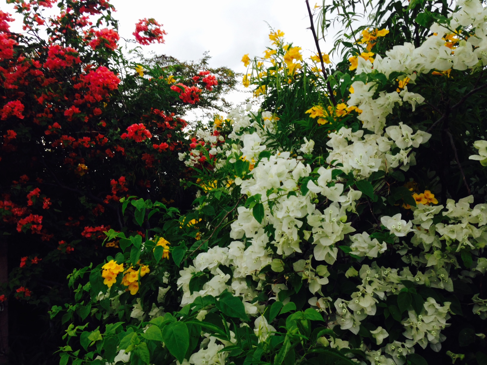

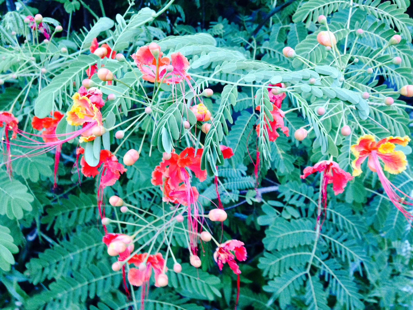
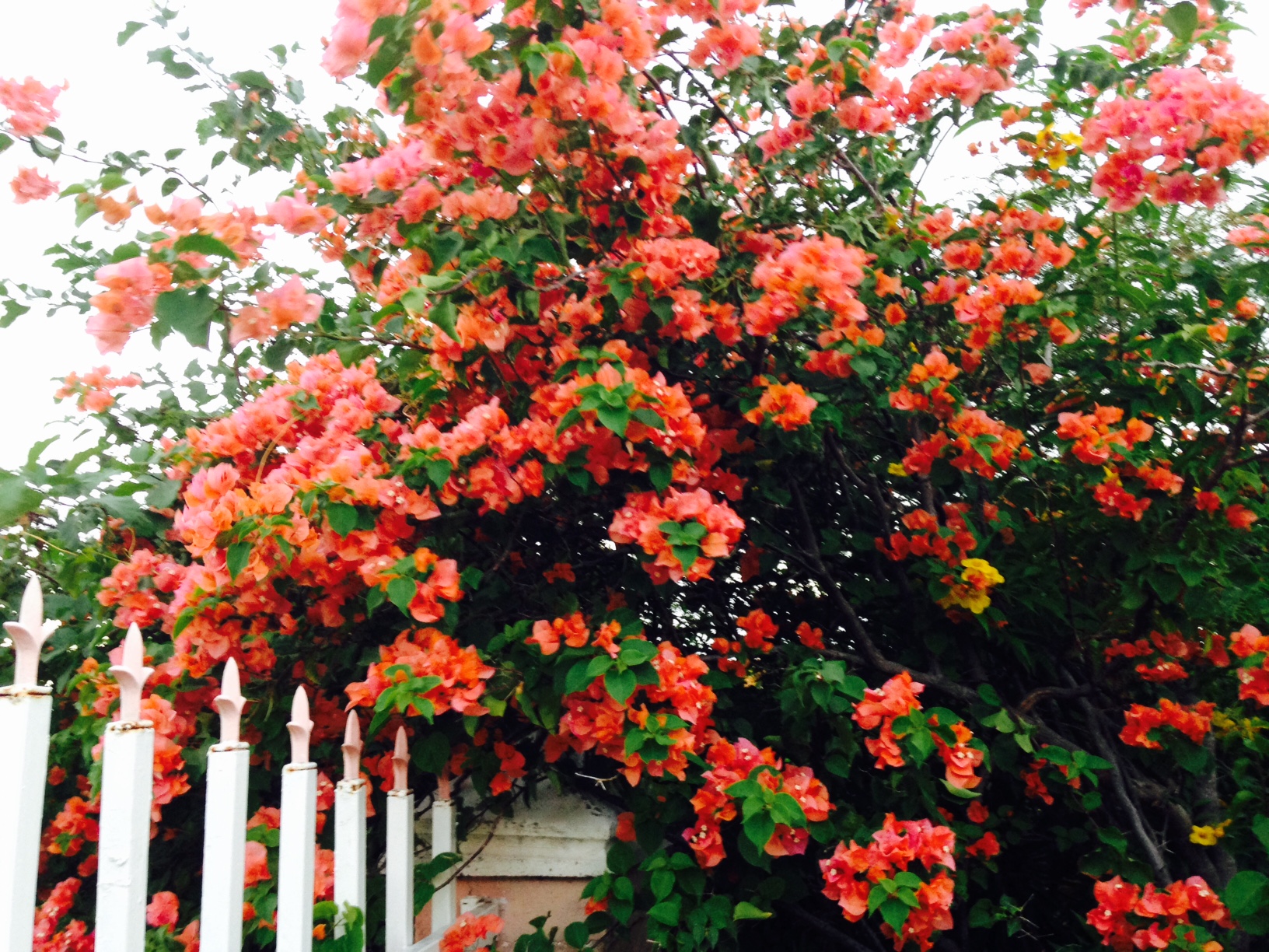


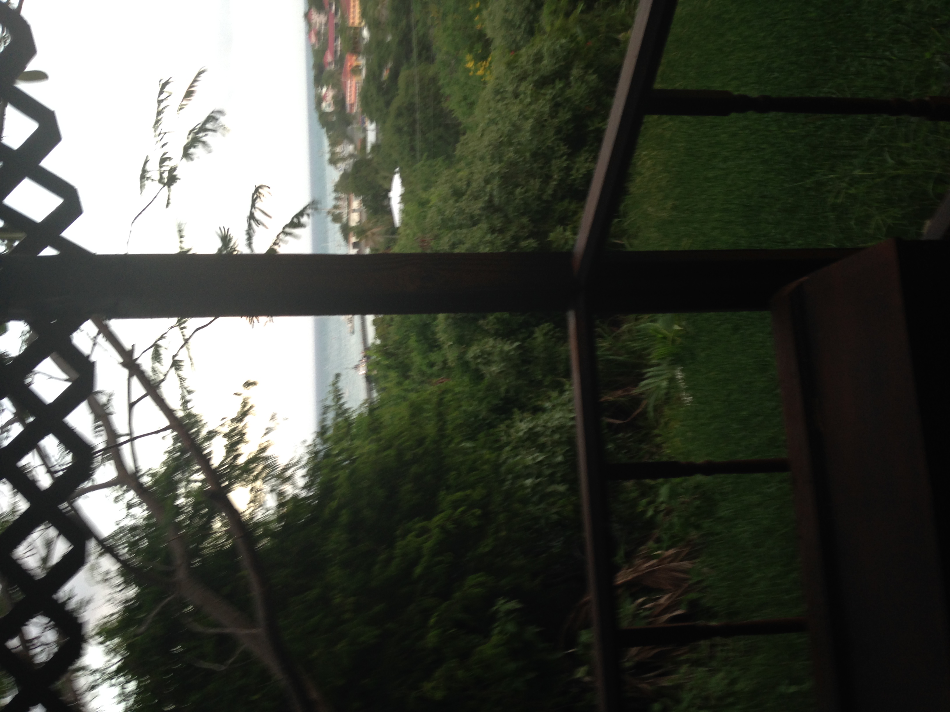
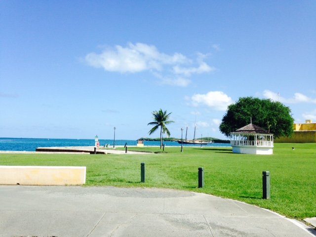
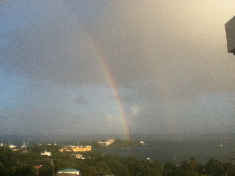
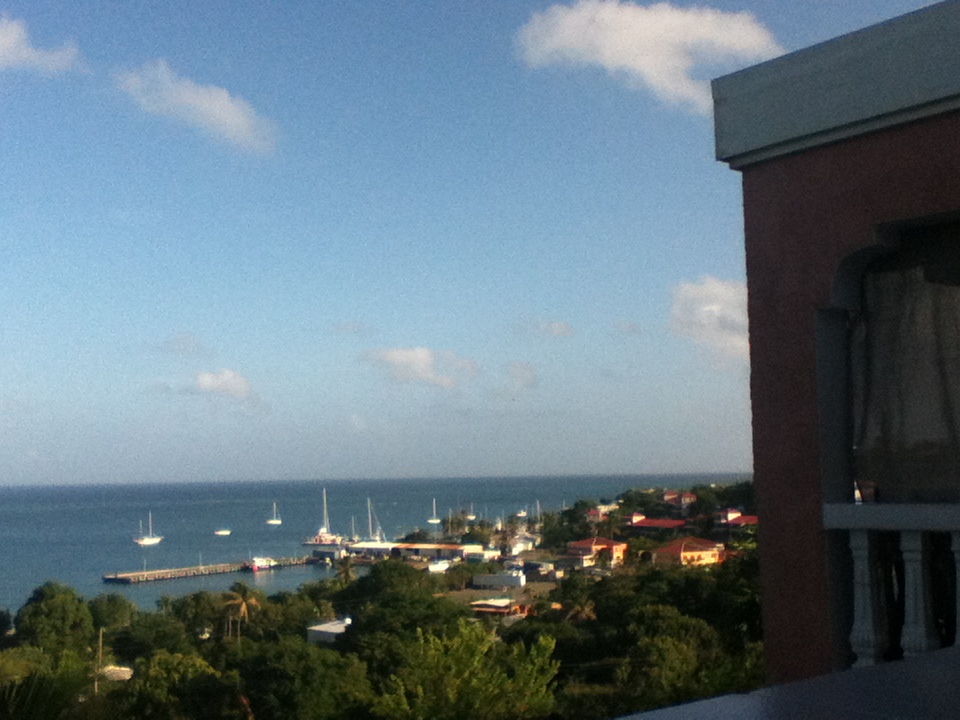
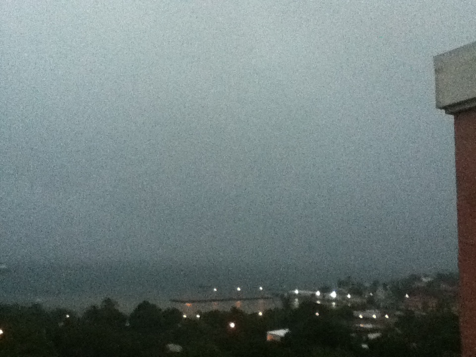

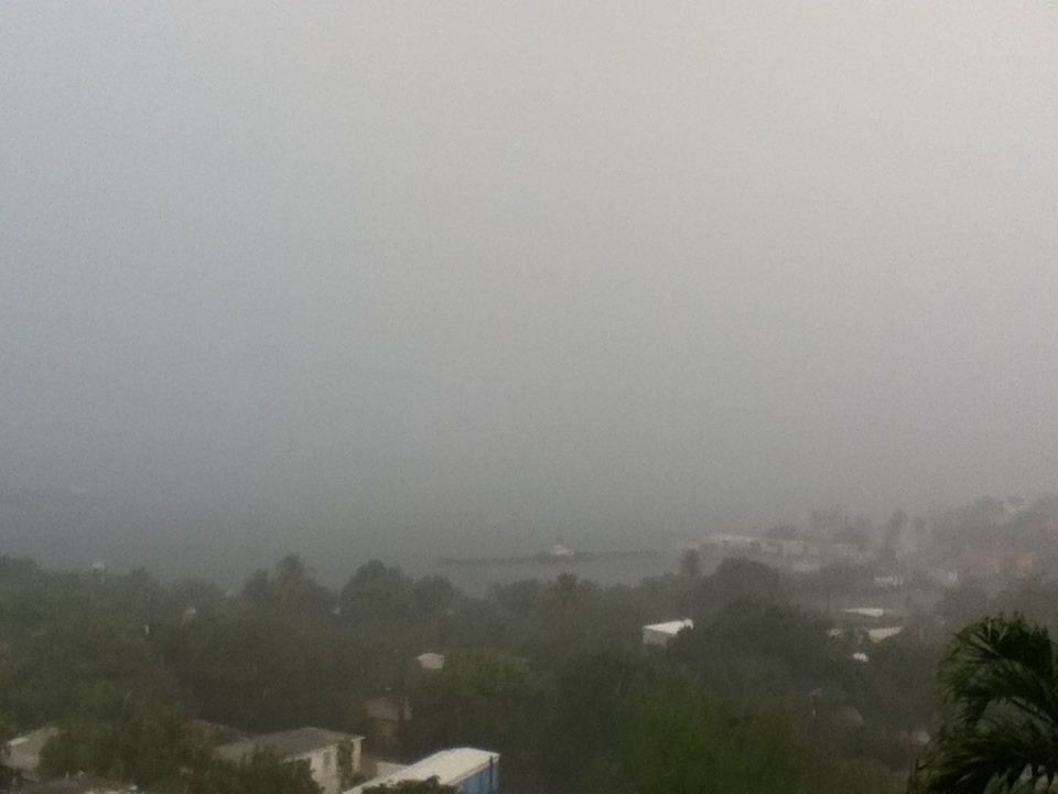
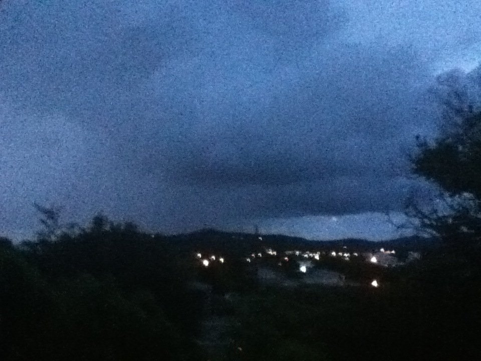

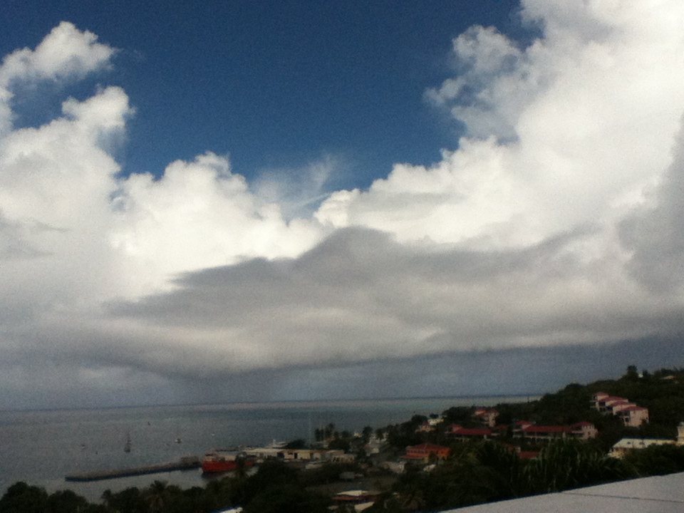
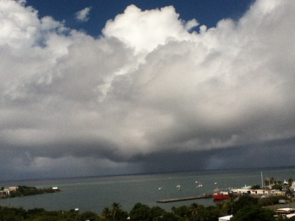
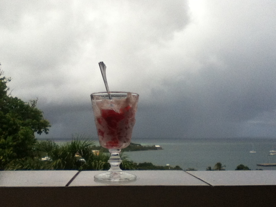

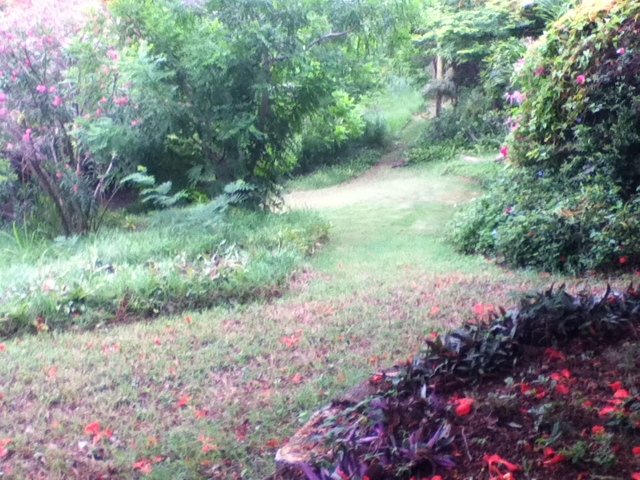

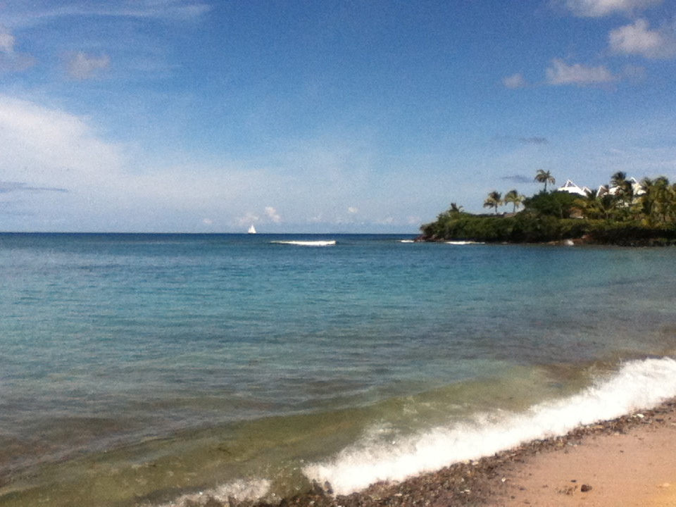

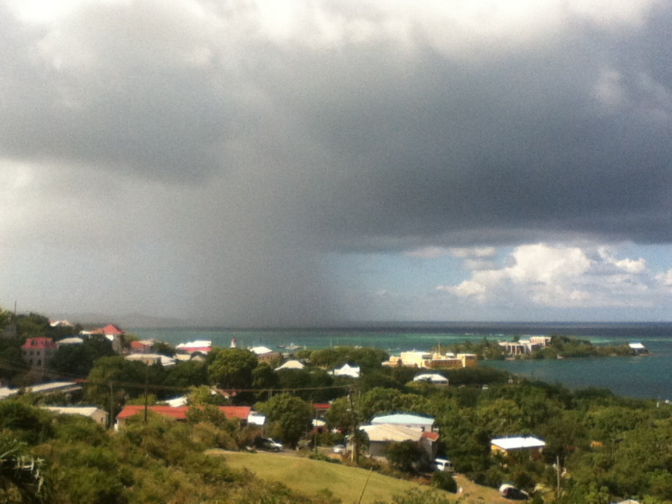

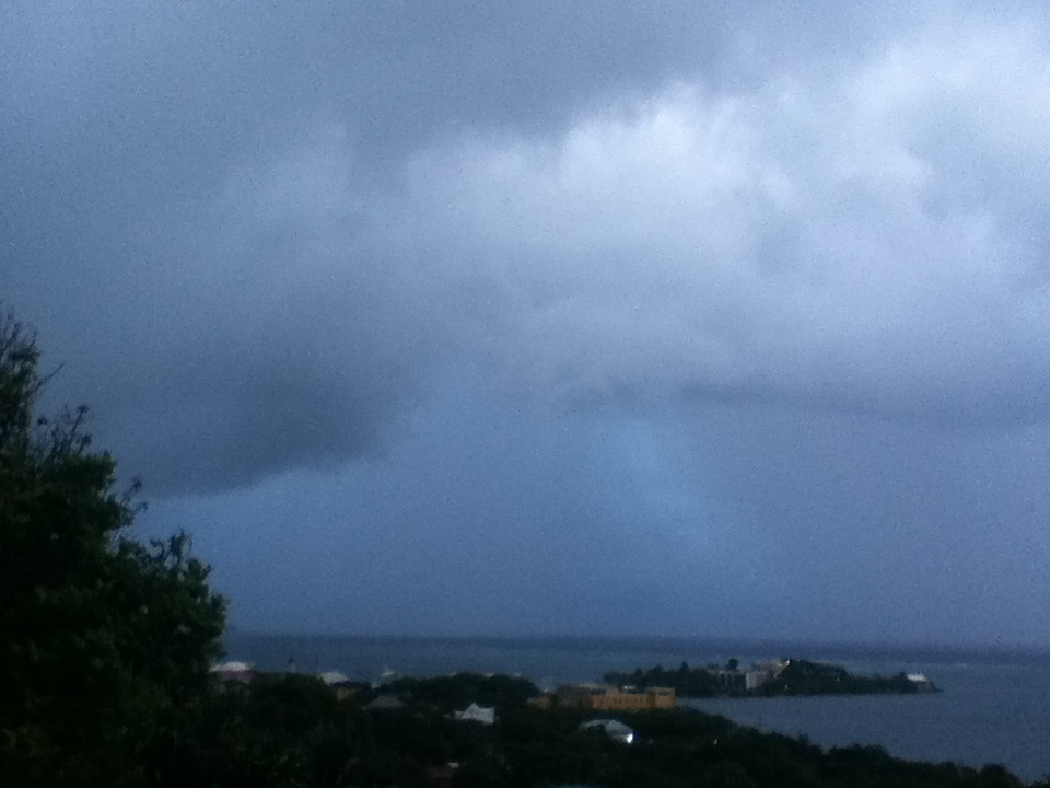


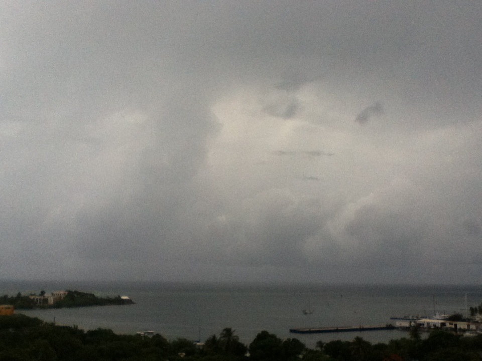
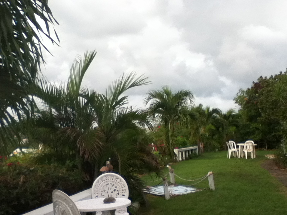
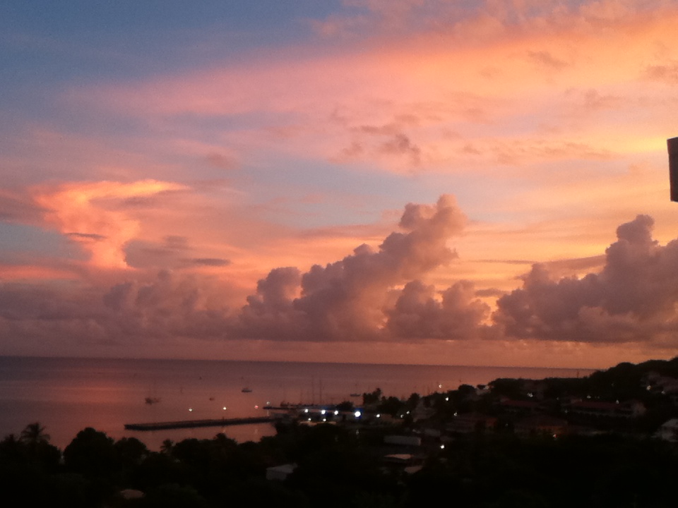

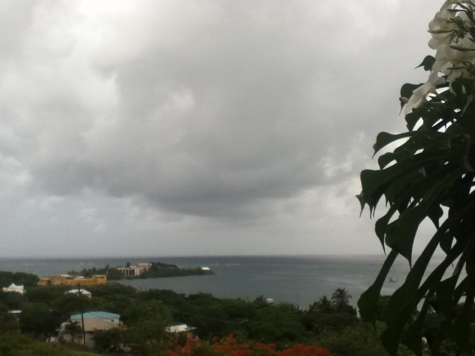
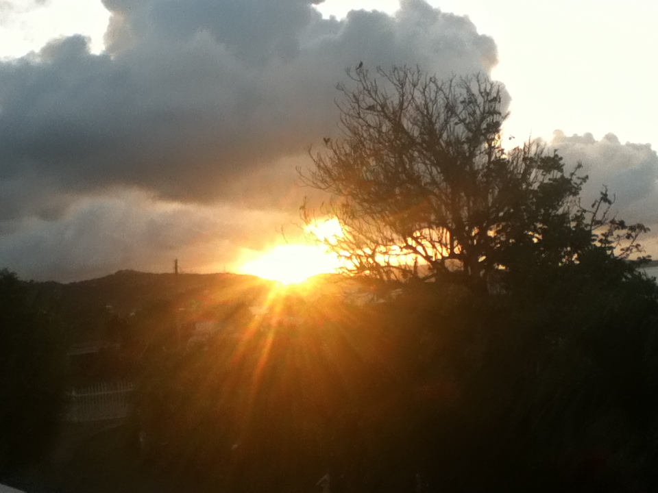

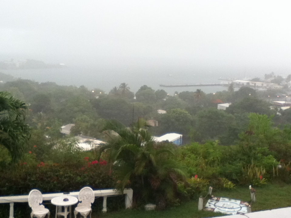
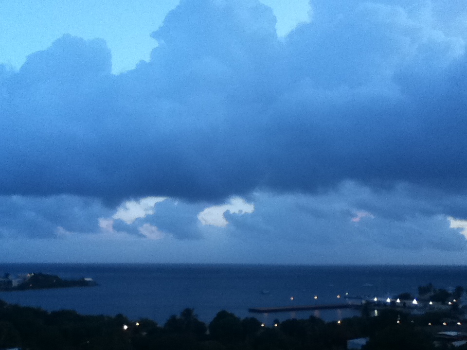
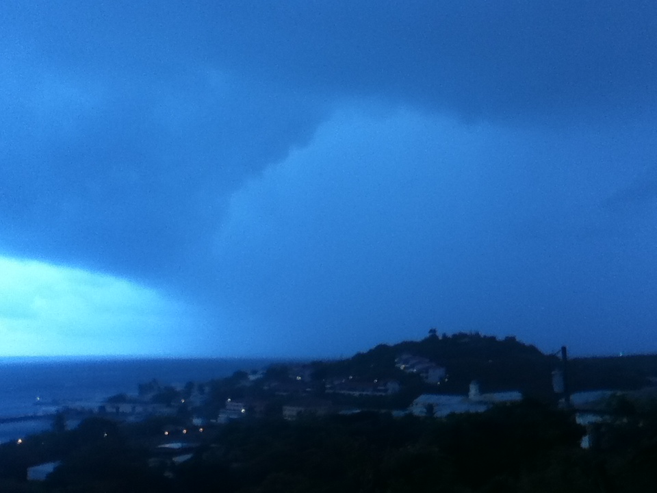

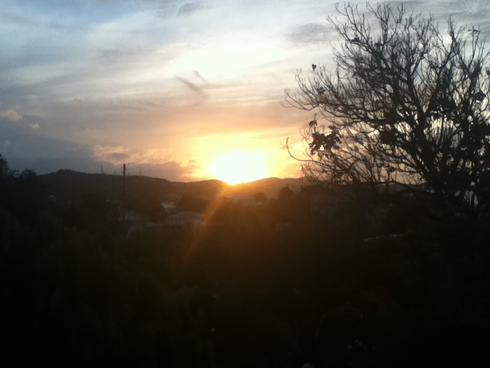
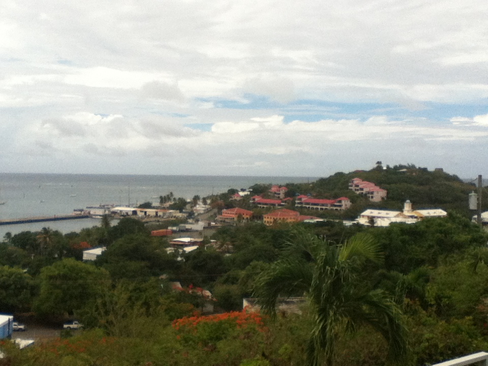


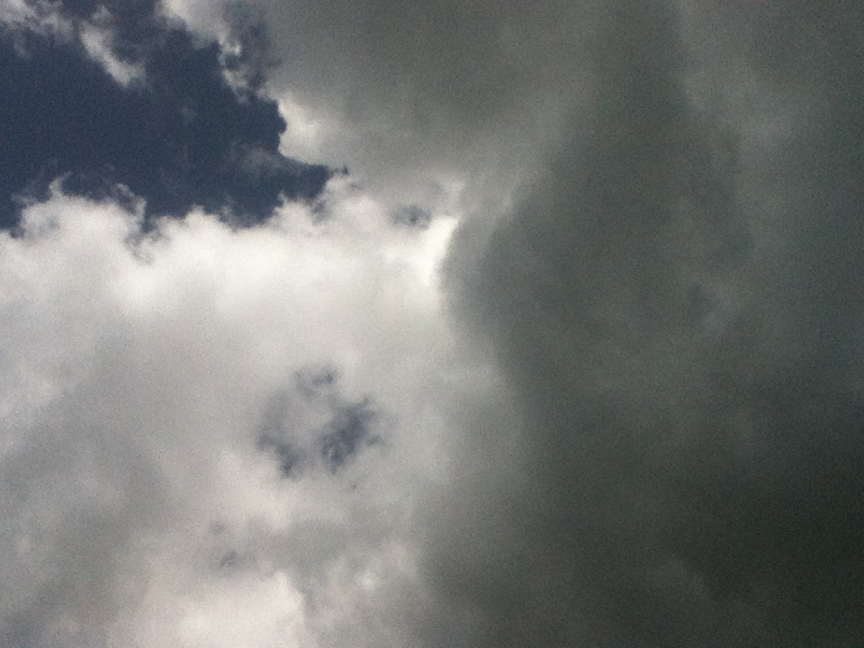

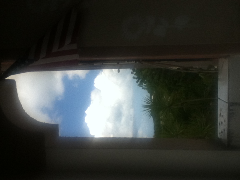


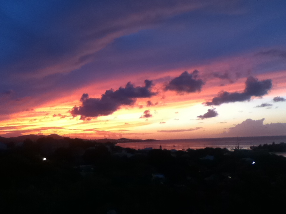
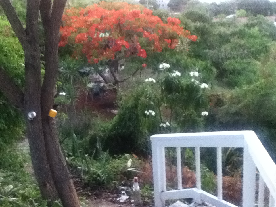
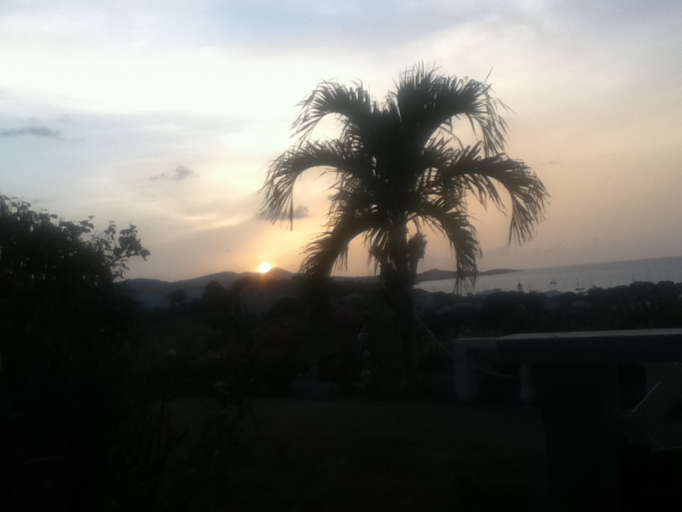

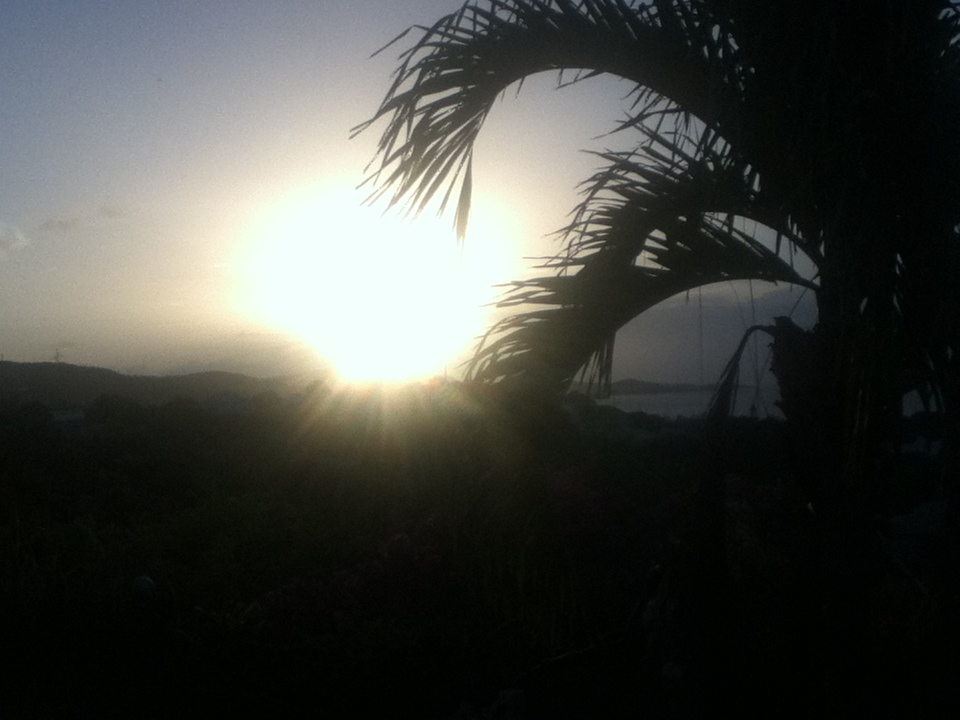
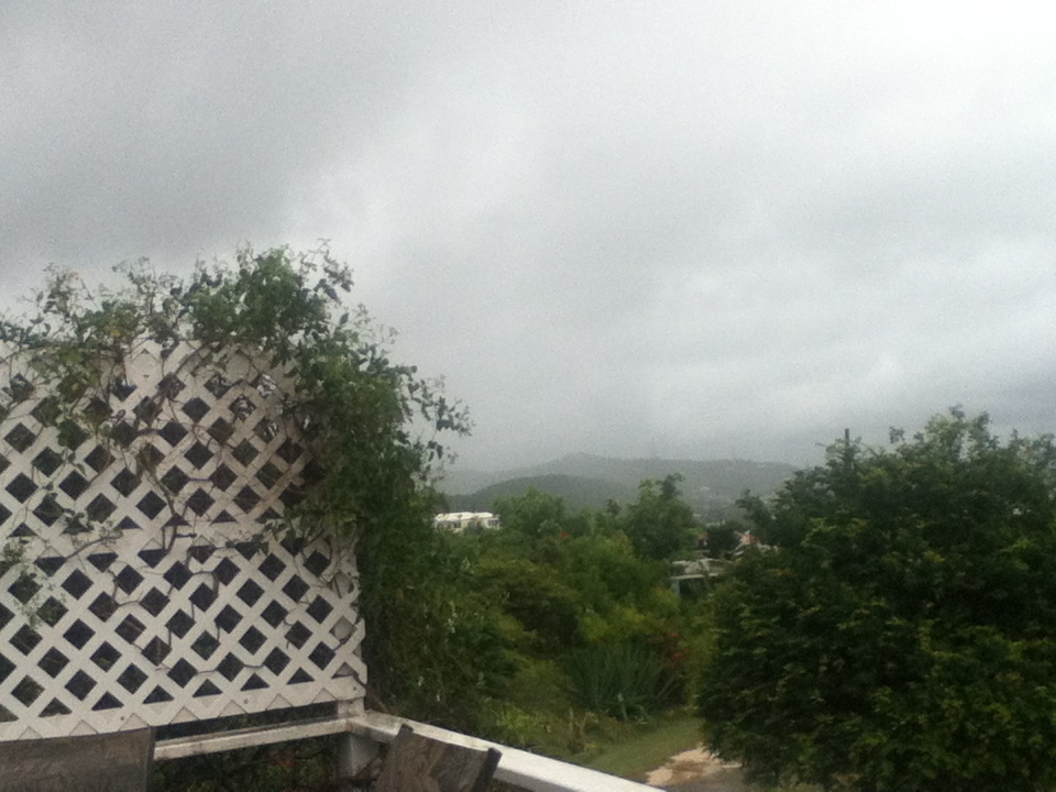
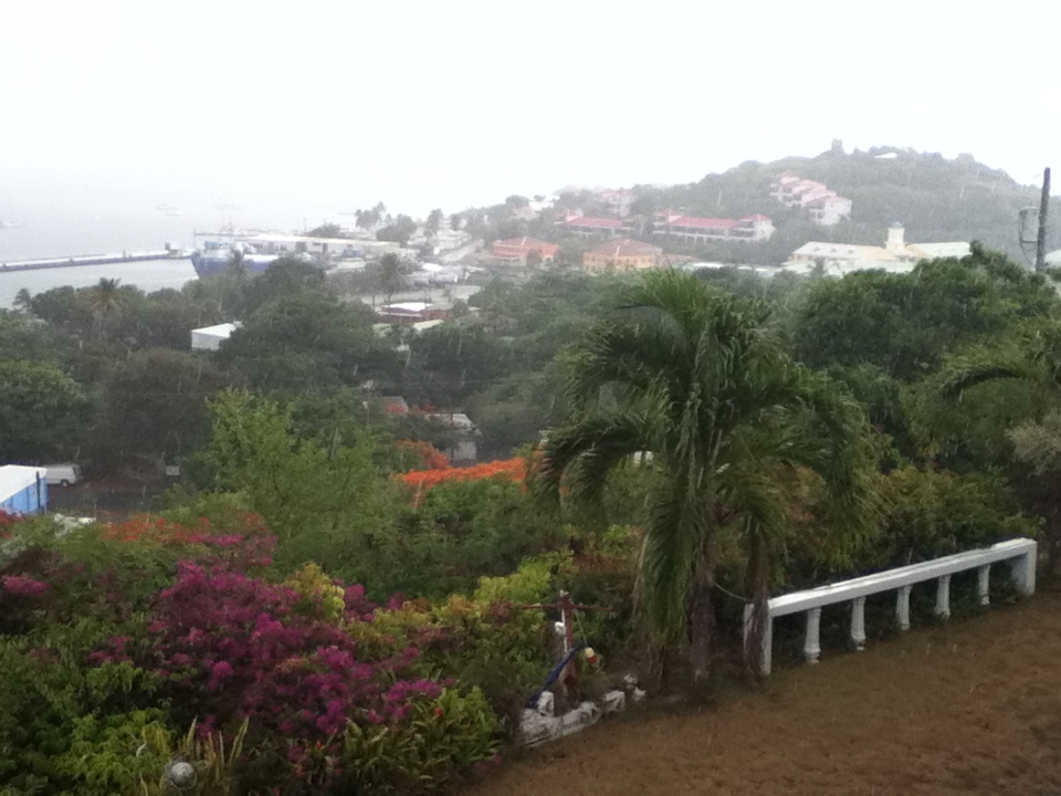


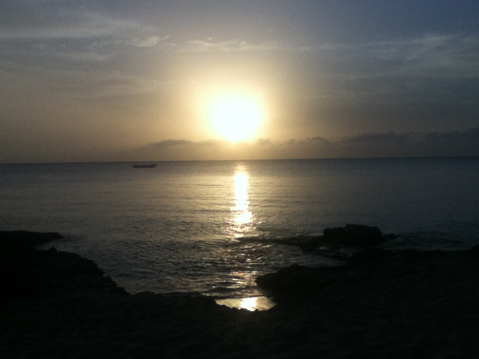
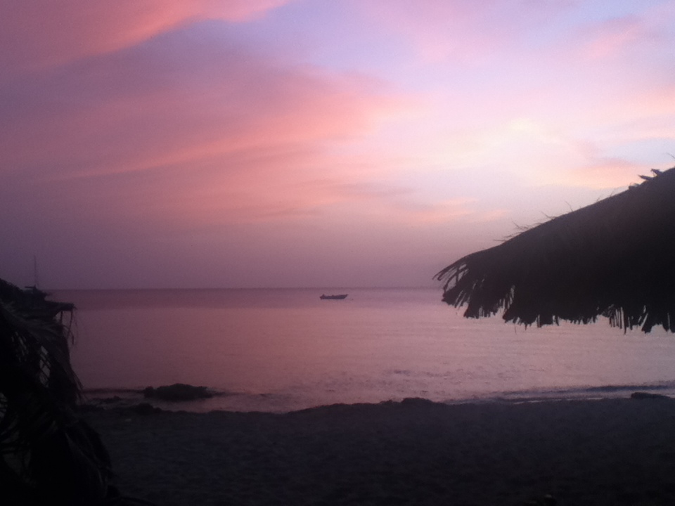


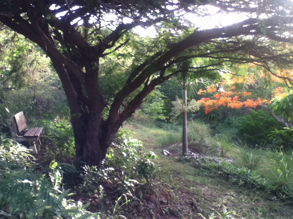


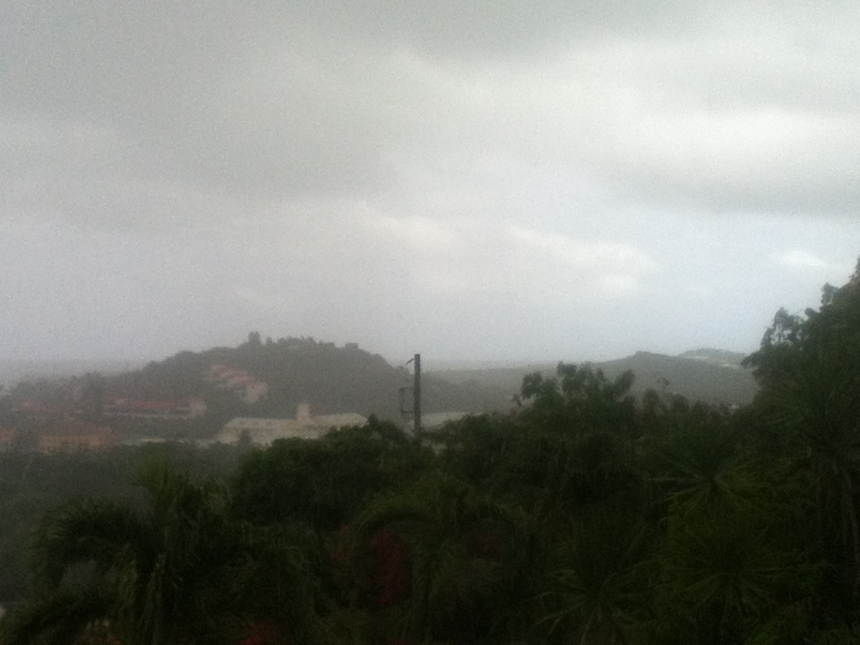

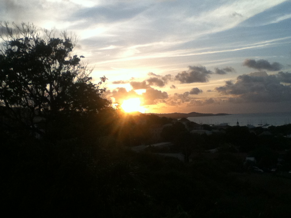
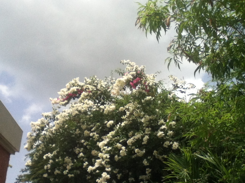
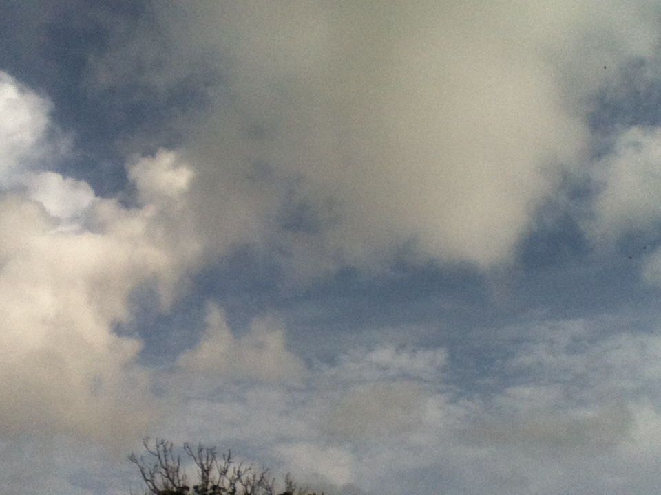


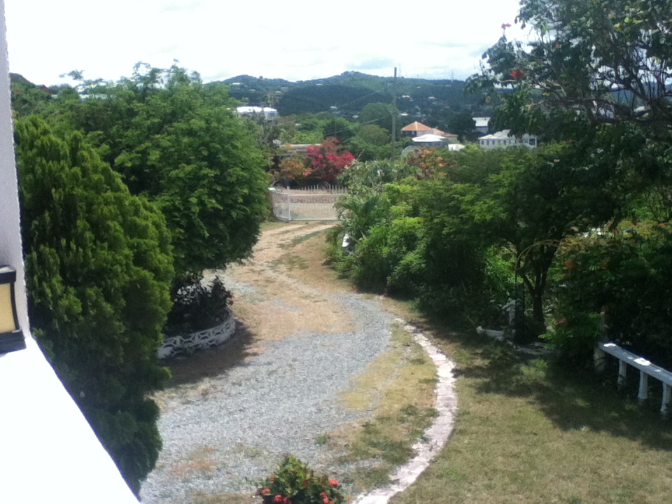
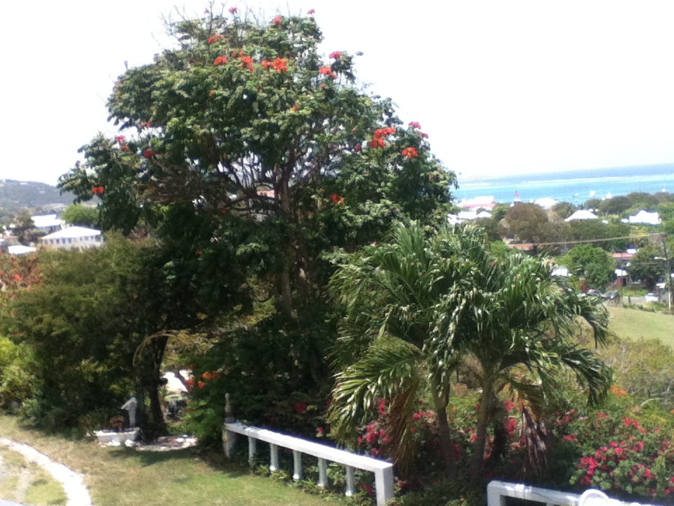


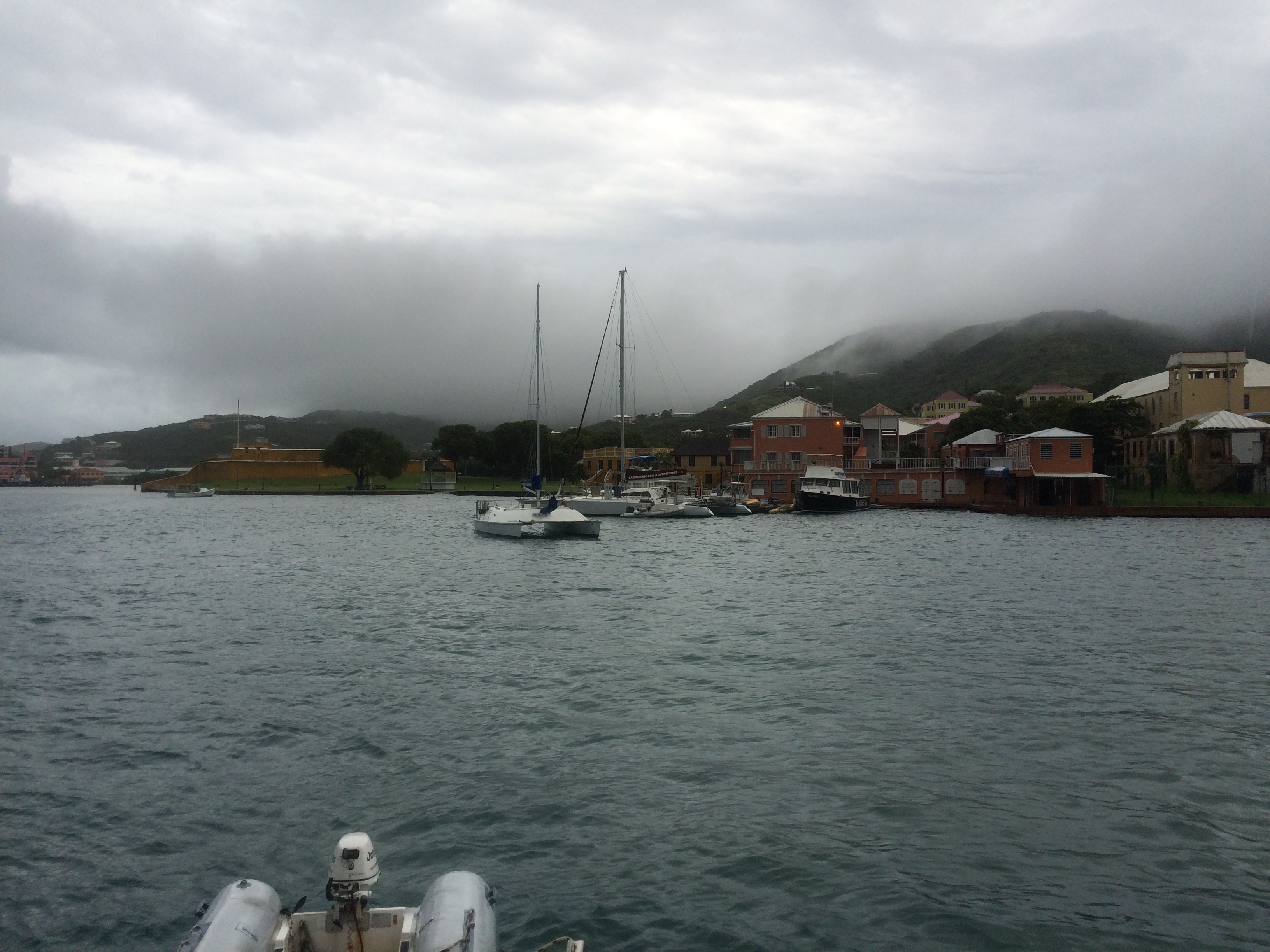
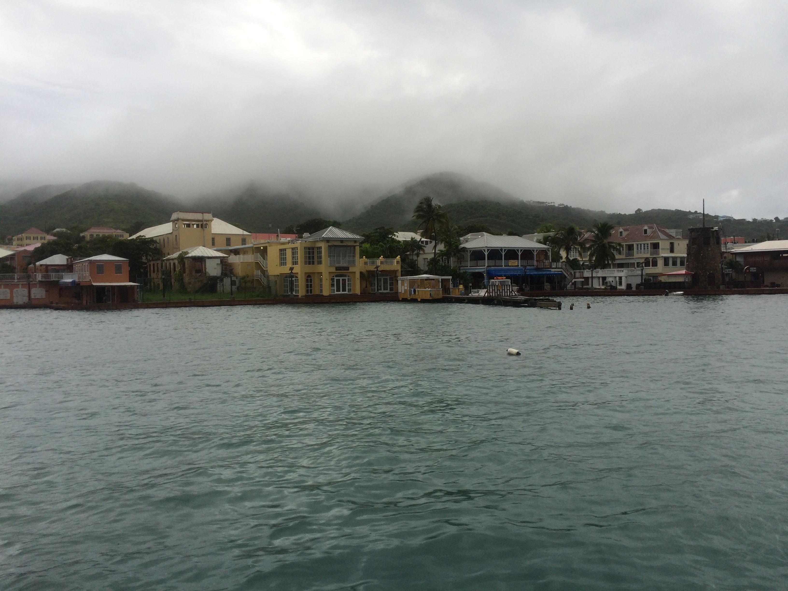
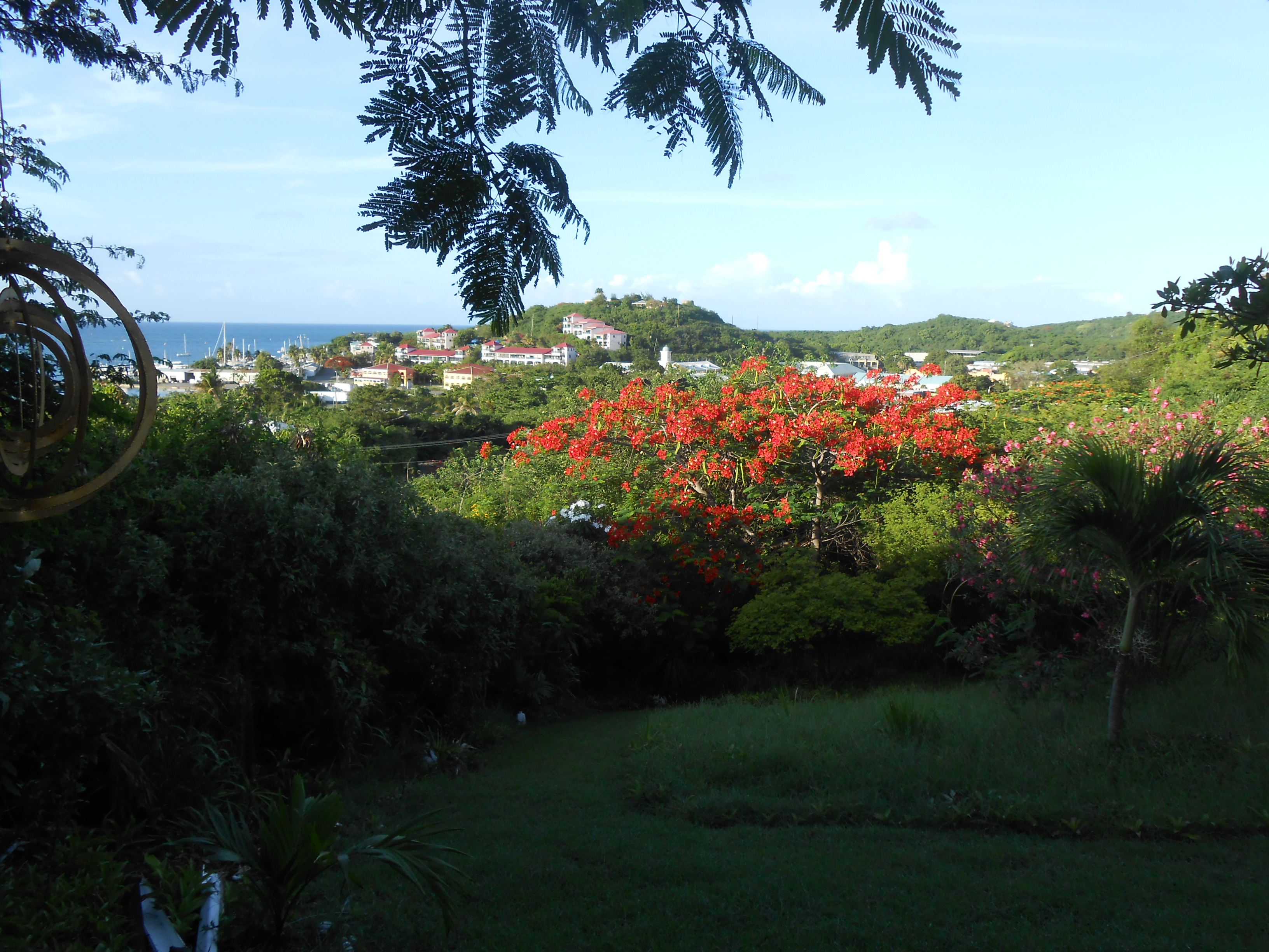
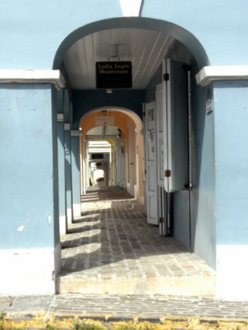