|
|
- - - 2012 Hurricane Season - - -
|
- still rainy
|
- From: freedoreno <freedoreno at gmail.com>
- Date: Thu, 25 Oct 2012 22:22:17 -0400
|
|
we still have rain the whole time
my cistern is full of the rainwater, its the good impact of Sandy, but a lot of peoples are affected . Especially in the south and the peoples live down by the sea. All the water comming down from the hills and flooding tents and houses.
please Find here the OCHA Haiti situation report N01 on the Tropical Storm Sandy's Impact on Haiti for 24 - 25 October 2012. Thomas
|
|
- normaly rain in Port au Prince
|
- From: freedoreno <freedoreno at gmail.com>
- Date: Wed, 24 Oct 2012 20:36:37 -0400
|
normaly rain in Port au Prince Hello all there, here is a norrmaly rain and not much wind in Port au Prince for this moment. From the south coast i got information for some much more rain then here.
The alert stay on red and we hope for all peoples here in town sandy will not so bad with us
|
|
- Haiti 27 August 9PM
|
- From: Bill Vastine <whvastine at gmail.com>
- Date: Mon, 27 Aug 2012 20:54:36 -0400
|
|
Local internet still down, just got back 3g cell service about 6pm this evening and have jacked cell phone into laptop to communicate.... Passage of Tropical Storm ISAAC on Haiti
Partial balance - Status of road
Saturday, August 25, 2012
Tropical Storm Isaac has not had a major impact on the country in terms of damage to road infrastructure. However, sections of roads have still been cut or damaged at the metropolitan area of Port-au-Prince and in some regions of the country. Here is a partial assessment of registered until 1 in the afternoon.
Blocked due to falling trees
• At Kenscoff, Ball, Well-Blin, Sofa Green Road and Brothers, branches and trunks of trees obstructing the passage.
• A Cayes Jacmel, the coastal road is paralyzed due to falling trees and electric son perched on the edge of the road. Same situation near the entrance of the club Indigo in Saint-Marc, Vialet in the town of Petit-Goave.
• There was no major damage recorded at Gonaives. In the Northwest and Artibonite no major problems were reported.
• Some sections of road in the north including Port-Margot, Blind are blocked. Same scenario between Jacmel and Cotes de Fer. RIBBED IRON road Gris-Gris linking the city center and other sections are cut at the local rider at the start of the village.
Blocked due to flooding
• Several stretches of road are blocked because of flooding. Here is the information received from the EJOC until 12am today:
• The road is flooded and nine blocked.
• The intersection Fleuriot is also flooded and the area known as Marin to the Bon Repos suffered the same fate. An SOS has been launched by the city of Croix-des-Bouquets to help the people of this area.
• The national road number 1 is flooded at the Croix-des-Missions
Roads may be blocked due to swollen rivers
• Reports from Leogane have reported swollen river. Part of the communal section of Mapou Buissonnière was evacuated because the levees that protect the area are threatening to give the pressure of the river.
• At the entrance to Petit Goave, the river is in flood. The waters rise above the deck
NB: other sections of roads have suffered damages including at Fragneau City Delmas 75 and Martissant. We are waiting for confirmation.
Sources: MINUSTHA-EJOC, MTPTC, Unicef
--
whv
|
|
- Isaac Bears Down
|
- From: "Cassidy Rush, Fonkoze" <crush at fonkoze.org>
- Date: Sat, 25 Aug 2012 10:51:48 -0400 (EDT)
|
|
|
|
|
August 25, 2012
Isaac Bears Down
Good morning Fonkoze follower,
Electricity and internet are intermittent as of last night, so I'm looking to get you up-to-date in case I go off the grid.
Our Kore W Project Manager Tyler Tappendorf has this report from Port-Au-Prince:
"The winds picked up last night around 9pm and lasted through most of the night. While rain accompanied the winds, the rain did not appear to be very heavy. As of this morning around 7am, the winds have died off completely and now we are getting steady rains (though I still wouldn't say 'heavy' at this point). From the satellite views, it looks like the center of the storm is now north of the southwest peninsula of Haiti, while the majority of the moisture is still south of Haiti. I'm assuming this means we're still in for a drencher for most of today.
"I did a drive around downtown Port-au-Prince this morning and must say I was surprised how little damage the storm has appeared to cause thus far. No major trees down, just scattered twigs and leaves. Roads were clear (which is rare even after we just have a night of heavy rains). There were a few food stands (metal frames) that had been blown over near the presidential palace, but besides that I could see no other significant damage. I'm sure that the tents and shacks where people are staying, however, did not fare so well. Tarps and sticks would have undoubtedly suffered damage during the sustained high winds. Overall, the damage thus far was much less than the squall line of storms which raced over Port-au-Prince on July 16 with much higher winds. As we all know, floods are the most likely source of damage here so if the rains continue and get heavier, we could very well see some flooding later today."
We will need support for all our ongoing programs to alleviate poverty and strengthen client resilience. Then follow us on Twitter and like us on Facebook to continue receiving updates from Port-Au-Prince.
Sincerely, Cassidy Rush External Communications Specialist, Fonkoze |
|
|
Fonkoze USA / 1700 Kalorama Road, Suite 102/ Washington, D.C. 20009
www.fonkoze.org |
|
|
|
|

|
|
|
- hard blow
|
- From: rudy victor <rudyvictor at yahoo.com>
- Date: Sat, 25 Aug 2012 07:23:19 -0700 (PDT)
|
it's been a rough night i've never seen this since hurricane allen in 1980 ,from 11 pm to about 430 am port au prince was under wind higher than 30 mi/h with 50 to 60 mi/h gust.A lot trees down,bilboards,but in the country side it is a hard blow ,after the drought the floods in the plain of archaie all the plantations are gone,in the southeast part of the country it is worst all the rivers left their banks, scores of roof are gone ,so far two deaths but with difficult communication i am sure the death told will
climb. &n
bsp; rudolph h victor |
|
- heavy winds in Jacmel, Cayes-Jacmel
|
- From: Daniel O'Neil <doneil at padf.org>
- Date: Sat, 25 Aug 2012 12:20:55 +0000
|
There have been heavy winds in the Jacmel-Cayes Jacmel area that have destroyed many of the tin. The biggest impact appears to be on the banana and plantain plantations which are largely flattened. The storm
is still sitting on Port-au-Prince. At 8:00AM, the sky was still quite dark. The storm is now moving slowly past the Artibonite where it is expected to cause additional flooding in the Gonaives area. The sad thing with a storm like this is that it will hit
all of the country causing localized damage in nearly all the 10 departments
Dan O’Neil
www.padf.org
|
|
|
- Petionville, Haiti 24 August 9PM
|
- From: Bill Vastine <whvastine at gmail.com>
- Date: Fri, 24 Aug 2012 21:09:05 -0400
|
reports of flooding in downtown/low areas already. Also report of storm slowing in forward motion....not good for rain totals. currently 77 degrees, have had light rains at this location, now seems to be a "lull" no wind, no rain.....have had previous winds in excess of 30mph (gusting) and intermitant rains. all is quite at this moment, expect that to change rapidly. all comms, internet, television, mobile have been up & down over last few hours. shall comment on current local conditions as internet availbilty allows.
--
whv
|
|
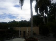
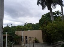
- 5:00 PM Petionville Haiti 24 August
|
- From: Bill Vastine <whvastine at gmail.com>
- Date: Fri, 24 Aug 2012 16:51:05 -0400
|
|
Petionville 24 August 4:40 PM
81 degrees
Winds variable 4 to 20 mph, gusting to 30
Humidity 74%
No significant rain as of yet. Now observing low cloud
cover moving swiftly from east/north east to west. Heavy cloud cover makes it
seem a couple of hours later (available daylight).
Latest track projections have storm center passing within
76miles/122km of this location at approx. 12:54 AM in the morning.
Light showers beginning as I write this current
reporting.
--
whv
Attachment:
3.19 PM.jpg
Description: JPEG image
Attachment:
4.28 PM.jpg
Description: JPEG image
Attachment:
10.25 am 24 August.jpg
Description: JPEG image
Attachment:
12.15 pm 24 August.jpg
Description: JPEG image
|
|
- Urgent Update: Tropical Storm Isaac
|
- From: "Carine Roenen, Fonkoze" <fonkozeusa at fonkoze.org>
- Date: Fri, 24 Aug 2012 12:04:17 -0400 (EDT)
|
|
|
|
|
August 24, 2012
Urgent Update: Tropical Storm Isaac
Dear Friend of Fonkoze,
Right now, we are about to face our first test of the hurricane season: Tropical Storm Isaac.
It is predicted to make landfall on Haiti sometime today, and at last report, could drop as much as 12 inches of rain in certain parts of the country, along with winds upwards of 75 MPH.
For many of our clients, this will be devastating. They will lose merchandise, crops and farm animals; their houses will be damaged, their personal belongings ruined.
We will help them recover. Thanks to Kore W, our microinsurance program that covers all Fonkoze clients, we are ready to give all clients in areas hit by intense rain and wind a $125 payout, forgive their existing loan balance, and give them a new loan when they want it.
Please take a moment to give what you can today in support of all our ongoing programs to alleviate poverty and strengthen client resilience, then follow us on Twitter and like us on Facebook to continue receiving updates from Port-Au-Prince.
Sincerely,
Carine Roenen
Director, Fonkoze
|
|
|
Fonkoze USA / 1700 Kalorama Road, Suite 102/ Washington, D.C. 20009
www.fonkoze.org |
|
|
|
|

|
|
|
- Still clear in Port-au-Prince
|
- From: Daniel O'Neil <doneil at padf.org>
- Date: Fri, 24 Aug 2012 12:55:54 +0000
|
Isaac might finally make its march north, but for the moment it is still clear.
Our biggest worry is that it might like it here and want to stay! As long as it
doesn't linger the impact shouldn't be too bad.

Dan
|
|
- Haiti report 10:PM 23 August
|
- From: Bill Vastine <whvastine at gmail.com>
- Date: Thu, 23 Aug 2012 22:11:13 -0400
|
|
Still....uncomfortable outside, little wind, humid, overcast. Currently: 84 degree winds at 4mph variable humidity at 66% pressure at 29.77 Location: 18.6n /72.3w at 112ft
Warm and sticky......full cloud cover, little breeze. Talking to Mom on skype in San Antonio, Texas.....having a wee bit of the ruhm....just because. Update tomorrow and/or as conditions warrant............whv
--
whv
|
|
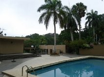
- Petionville, Haiti 5:45 PM 23 August
|
- From: Bill Vastine <whvastine at gmail.com>
- Date: Thu, 23 Aug 2012 17:56:18 -0400
|
|
Current weather: Partly cloudy/sunny and hot most of the day. Now overcast with very lite drizzle. 93 Degrees Winds at 4 mph north Humidity at 52% Laid in supplies this afternoon, water, food, rum....a must have for the hurricane party...
Current projected storm path puts storm eye appox 40 miles from this location just after midnight Friday. Concerned about large size, rotation & aspects of Port-au-Prince essentially being in a bowl. Loose rubble, and post earthquake conditions shall not handle large rains well. Expect to experience massive flooding, landslides, and certainly loss of life, particulary in the some 415,000 population still in tents, lean to's, and temporary shelter. Haiti has been very lucky with weather since the quake, I feel this may come to an end with this storm. If the rainfall quantities are anywhere close to predictions, we shall experience yet another disaster in Haiti.....seems to never end.
--
whv
Attachment:
Petionville east.png
Description: PNG image
Attachment:
Petionville, showing East.png
Description: PNG image
|
|
- Clouds are building up
|
- From: Daniel O'Neil <doneil at padf.org>
- Date: Thu, 23 Aug 2012 20:33:08 +0000
|
We are starting to get dark clouds in Port-au-Prince—looks like they are the far outer bands of the storm.
Dan O’Neil
www.padf.org
|
|
|
- Fwd: Update from Haiti
|
- From: Gert van Dijken <gert at vandijken.com>
- Date: Thu, 23 Aug 2012 08:49:09 -0700
|
Report from Haiti
--
Gert van Dijken
Caribbean Hurricane Network
http://stormcarib.com
---------- Forwarded message ---------- From: Daniel O'Neil <doneil at padf.org>Date: Thu, Aug 23, 2012 at 8:10 AM
[...]
We have beautiful blue skies today with only slight hints of clouds. The country is on full alert preparing for the storm. The 11:00 forecast has pushed the storm’s path further west. It is now forecast to just miss the Dominican Republic
and make landfall as a hurricane near Jacmel. However, it is a weak, poorly organized and very wide storm—roughly 1,000 miles wide! The point where it makes landfall will be less important than the rain that will fall. As a poorly organized storm, it may linger.
Haiti’s worst damage has come from tropical storms that moved slowly, not from major hurricanes.
Daniel J. O’Neil
Senior Director for Caribbean Programs
Pan American Development Foundation
|
|
- Fw: wet macroburst in port au prince
|
- By rudy victor <rudyvictor at yahoo.com>
- Date: Tue, 17 Jul 2012 06:54:01 -0700 (PDT)
|
----- Forwarded Message -----
From: rudy victor <rudyvictor at yahoo.com>
Sent: Monday, July 16, 2012 6:59 PM
Subject: wet macroburst in port au prince
hello from port au prince ! The tropical wave that crossed the island today created conditions for deep moist convection to erupt over a large portion of the country . with dry air aloft and some at the surface condition were right for some of them to produced some micro and macroburst.In the capital, a gust of 47.9 m/h was recorded around 1h53 in the afternoon before the anemometer stopped working,but in petion ville there were even higher gust as a result some trees were uprooted, roofs were blown away,lots of branches on the ground and cahotic situation on the somes steets this afternoon. |
|
- glad for rain
|
- By freedoreno <freedoreno at googlemail.com>
- Date: Mon, 18 Jun 2012 11:05:48 -0400
|
|
glad for rain
since this hot period we got yesterday and today the first rain. We was really glad this was not a strong one for the first time. But... on the satellite looks not good for this evening.
See also here... this is a good blog to watch the season.
|
|
- to hot
|
- By freedoreno <freedoreno at googlemail.com>
- Date: Mon, 4 Jun 2012 14:26:52 -0400
|
|
to hot
we don't need a big rain but we need. this is not a normally rain time . Normally we get every day 4 pm a rain, daily . But this year is hot like 2 month later . if its rain then not before 10 pm.
Since 1 week we wait for rain , all is dirty. But we have a soon shine and this make it to hot for this time. I think we get a special year in the carib. But good to know only the Lord know whats going on.
freedoreno
|
|
- only wind today
|
- By freedoreno <freedoreno at googlemail.com>
- Date: Wed, 23 May 2012 15:20:11 -0400
|
|
only wind today
the invest 94 is not so far from here and somebody says it will be moved to NE. But, thanks to god we have only a little bit wind here in the moment. And also, we need nothing bad anymore in the moment here.
I think the people in Florida have to watch more for this invest 94 freedoreno
|
|


