
|
|
- Updates from the Islands -- - St.Croix (USVI) - - |
|
|
For the most recent reports from St.Croix see this page.
| - A Thundering Wave! |
|
|
Good Afternoon, We are being affected at the moment by a tropical wave. (Could that possibly be a CCKW ( Convectively-Coupled Kevin Wave) that the Ph.D student was referring to in Dr. Jeff Master's Blog? The student thinks that by MARIA meeting up with this CCKW it will intensify again. However, Dr.Masters does not think this should have much of an effect on TS MARIA as it is very disorganized at the moment and wind shear should keep it this way for a few days.) By Saturday TS MARIA should make it's presence very well felt by heavy rain if nothing else. Sandbags are being distributed at various locations here to prepare for a big rain event. Guidance is received by the NWS (National Weather Service) in Puerto Rico. Now, if the storm is falling apart as it seems, according to the experts, the step down is usually a Depression and that is always packed with heavy rain, so whatever the case, we should be prepared for lots of rain. That should fill our cisterns, those of us who have them. Great for us, at least we won't have to buy some 6000 gallons. We are urged to monitor this storm as it can be unpredictable. First it was going to the north of us, now to the south, and next--not even the best meteorologist knows. So, let's pay attention to the local guidance; the Weather Channel cannot help us locally. Be careful out there and may God bless us all. Isabel |
| - Wednesday's Children - MARIA & NATE |
|
|
Good night, folks! Both TS MARIA and TS NATE formed on Wednesday. A threat for us in the Atlantic, and, hopefully some rain for Texas in the Bay of Campeche. It's so bad there that they are even wishing for a tropical system. As my nephew there told someone, "be careful what you wish for". KATIA is stirring up the ocean big time causing havoc on the northeast shores, otherwise, there's no direct impact to land as with IRENE. That makes three players plus the remnants of Lee still dumping tons of rain where they don't need rain. The one of most concern to us, of course, is TS MARIA. It should be in our neighborhood by Saturday morning. Prior to that there's a tropical wave in the forecast for tonight into tomorrow. We are here ready and waiting; our cisterns could use some more water. It is quiet, with the 'noise' of a thousand frogs and crickets. I think they anticipate the rain. NOAA Weather Radio expects a 70 % chance of rain for us tonight beginning after midnight and for tomorrow the same. As for TS MARIA on the weekend, we are to expect 5 inches of rain, more or less. It will certainly dampen some plans. Let's see what the morrow brings, in the meanwhile we can get some much needed sleep. God bless us all. isabel |
| - Our Next Visitor - TD #14/Tropical Storm |
|
|
Good Night, All! A Tropical Depression #14 has developed from what was once 95L. We are in the cone of uncertainty with a line of entry between Guadeloupe and Antigua. It is forecast to become a strong Tropical Storm before it reaches our area on Saturday. We are having some rather hot weather and have not had some real rain in a while, so a Tropical Wave which is now 95L with a 10% chance of developing into a cyclone, will approach our islands Wednesday into Thursday, and will definitely be most welcome. This will bring us much needed rain and cooler air. My husband was just saying today that he will probably have to buy water soon. I told him to hold off, perhaps Mother Nature will provide it free of charge. After IRENE and her aftermath, we definitely are NOT looking forward to another strong tropical storm, much less to MARIA, if that be it's name. (The contender in the GOM could easily get the "M" name if it develops faster.) A strong tropical storm is one that is on the border of becoming a hurricane. This one is supposed to become a Cat 1 after it passes us up through PR and out into the Atlantic again, perhaps to join KATIA, which has been a rather slow mover. Now, here's where we have to pay attention. The only thing written on stone were the Ten Commandments of God,--information regarding a storm can change, for instance, one of the forecast models has this storm becoming a Cat 1 hurricane before it reaches our islands. This can easily happen if it slows down. It is already showing signs of slowing down. That is bad news as this gives cyclones a chance to grow in size and in intensity. At the moment, it seems to be following a pattern similar to IRENE, which became a Cat 1 hurricane after it passed us. Let's pray that this is the way it will follow if it has to be. Please keep an eye on this system and be prepared for the worse while hoping for the best outcome. If areas in our homes, businesses, churches, and schools get flooded just with heavy rain, then we can expect flooding with this system. A "towel brigade" comes in handy! Be ready and God bless us all. Isabel My photo: Cloud Towers - Remembering 9/11 will be posted on the Weather Channel. I don't know when. If any of you should happen to see it, please let me know in case I miss it. Thank you! If you did not see it attached to my update of 9/02, you can still check it out. |
| - Climbing to the Peak of the Season... |
|
|
Good night, all! I hope it is a good one, because once again we have a threat from Africa (Invest 95L)and I'm sure there is some concern. True, there are those who are absolutely sure that this one will also go north; so did many people when HUGO was coming. I say, it's better to be safe than sorry. We have to prepare as if it's coming right through us and rejoice if it passes us by. This one should be affecting us in 6 to 8 days, on time for the weekend, if it does get here. We are urged to "keep a close eye on 95L." The Weather Channel, NOAA Radio, Internet, and the newspaper, should keep us properly informed and updated. God bless us all. Isabel |
| - A Beautiful Day! |
|
|
Greetings! Today was absolutely beautiful. We went out today under clear, blue skies and returned home in the light of a bright, half-moon. Lightning flashed every now and then on the way home. Where it came from we did not know. All I know now is that KATIA, a category 2 hurricane is currently located a few hundred miles to our north. It is a powerful hurricane with 105 mph winds, gusts to 125mph, moving slowly at 12 mph. When we were outside, this evening, we felt a very cool breeze coming from the direction of the hurricane. I thank God that KATIA did not pass through our little islands. Such monstrous hurricanes cause a lot of destruction and loss of life. We still have cause to worry and keep our guard up. According to Dr. Jeff Masters, "the NOGAPS forecast model is predicting that a tropical wave currently near the coast of Africa could develop in a tropical depression late this week and arrive in the Northern Lesser Antilles by Saturday or Sunday.." Another storm is predicted for the Bay of Campeche moving towards the northeast. And so it goes, if the number of name storms predicted for this year become a reality, we should be seeing the T-storm somewhere, one day. Have a wonderful life, a wonderful week, day, hour, moment... You never know. Today I posted with the Weather Channel the photo of the clouds which you saw in my update of Sept. 2. It was approved and will be shown on the Weather Channel with the title "Cloud-Towers, Remembering 911" God bless us and our loved ones. Isabel |
| - Thanks for reading the updates! |
|
|
Greetings! I want to wish everyone reading this post and all the updates, in the Caribbean. on the mainland, in Europe, and wherever else you might be, a very good, happy, relaxing Sunday! KATIA should be passing directly above us tomorrow, but unless she drops down to latitudes 17 or 18, we have nothing at all to worry about. We can enjoy the pool party at our friends on the East End of the island. On the satellite imagery KATIA looks BIG and ever so close. I get the feeling that she might be wanting to hang out later on with TS LEE.. Perish that thought! LEE is a "super-soaker". He's bad company. Just imagine what would happen if those two should meet.! We are already concerned about more rain for the Northeast. This afternoon we heard rumbles of thunder, and the sky got very cloudy at one point. To my knowledge it did not rain. I was too drowsy after lunch.; the swim, water aerobics, and a very hot day, that can do it. If those clouds broke over our island it must have been in the vicinity of the airport when correspondent Susan Beck returned home today after her harrowing experience with slow moving TS LEE in Louisiana. (See her update for the details.) The National Weather Service wants us to know that soon everything will be coming through the Caribbean and we should be ready. I will share it in the next post. I am very tired at this wee hour of the morning. So until then, have a great day, and may God bless us all. Isabel |
| - Tropical Sotrm Lee |
|
|
Well, I have been stateside visiting my parents for 3 weeks and managed to encounter TS Lee this morning all by myself driving to the airport at 245am. So, I left my parents house in Baton Rouge at 245am and manage to get to the New Orleans airport at 430am. I honestly do not think I will ever do that again. Every few miles the radio emergency bleeped in saying a tornado warning was for this particular area and I was just about to pass that exit on the interstate in my little rental car. I must say, I am a very good traveler and this morning my nerves were rattled with the amount of rain falling in a very short period of time. I could not see the white lines designating the lanes on the interstae as I was driving, that is how hard the rain was falling. Finally
made it to the aiport and returned the rental car and ended up soaking wet from the knees down. Flight was pretty much on time except for us sitting on the ramp for 30 minutes as a thunderstorm passed thruogh the area. The flight was very bumpy BUT we made it to Miami and if I could have gotten onto the ramp I would have gotten ont he tarmac and kissed the concrete. Very stressful morning. I am very concerned about south Lousisiana and the amount of rain that is predicted for them this weekend. I grew up in the south and I can honestly say that I have never ever seen so much rain come down at one time. Very un-nerving. PLEASE stay safe everyone. I know you do not check this website for your updates, but if you do please pay attention to every warning and watch that is issued for your area. I must honestly say I have a new respect for Mother Nature......She is so unpredictable and we all must reamin
always aware of our surroundings. I rememeber sayting a little prayer to myself as I entered the interstae onramp this mroning and at one point almost turned around when I could not see a thing in front of the car. But somehow I made it through everything...I think missing the hubby for almost 3 weeks had alot to do with it too! Just kept saying to myself, if I can just get to the Bonnet Carre bridge, I am home free! Landed on our beautiful isalnd to a rain st gorm of all things!!!!!! Told the hubby if I do not see rain storms ever again, life would be grand.
So, retiring for the evening with a full belly of the most awesome meal from the Galleon. Always keeping my eyes on the tropics and always thinking of my game plan and a also a plan b!
It is truly a beautiful evening tonight...not much wind at all, but the sunset was worth a thousand word!!
Stay Safe!
Susan |
| - Clouds : Treats and Memories |
|
Good Evening!

Today was another gorgeous day on our island. It started out with a
big, awesome treat, two humungus cloud formations that looked like
vanilla ice cream cones! I took the picture at 6:00 a.m. and soon
after, the clouds broke up. One has to be quick;  unlike yesterday's
wispy no-hurry clouds, these "ice cream cones" did not last long. I
was wondering if it had anything to do with KATIA maybe pushing clouds
along? Nah! It's just Mother Nature's way of saying, "I'm not all bad,
just because this year has been chaotic.." So, there was that amazing
sight as seen from my porch. Christiansted Fort to the left and the
Cay, -Protestant Cay, as it is known, just below and between the two
formations.

On the other hand, and on a more serious note, my husband said it
reminded him of 9/11 and the Twin Towers. How appropriate then, with
the infamous
day around the corner for a 10th anniversary. We always took our
visiitors to the very top of the viewing tower, the 110th floor. In a
matter of seconds an elevator made it to the top. A fantastic view!
The cars below looked smaller than matchbox cars! They were our
favorite buildings in New York City where we lived with a view of the
twin towers. The weather was clear, a beautiful day, on the most
terrible of days for the city, for the world in a way, as 80 countries
were represented there. Unfortunately, the perpetrators needed a
clear, cloudless day to get a good view of their targets. And soon, a
massive cloud of smoke, dust, and gloom settled over the city which
started out with such promise after various rainy days prior to 9/11.

It is bittersweet, this picture, while it looks like a favorite Summer
treat, two vanilla ice cream cones, it also brings back sad memories
of that infamous day. I thank God that since then 13 attempts have
been foiled in the city alone, as well as others elsewhere.

Enjoy the fine weather whenever it is fine, and use the rainy days for
finer things, like togetherness with family and friends, perhaps
enjoying some ice cream cones. God bless us all and God bless the
United States of America!

Isabel
You have been sent 1 picture.


PICT0001.JPG

These pictures were sent with Picasa, from Google.
Try it out here: http://picasa.google.com/
Attachment:
PICT0001.JPG |
| - Can we trust KATIA? |
|
|
Hello Caribbean & Beyond! Our weather continues tranquil and paradise-like. I was floating on the sea late this afternoon looking up at the wispy, white clouds that were not in a hurry, at all, to go anywhere. The sky was blue. The sun was setting, and the very thin sickle of a moon hung way up there almost on the same side as the sun, just somewhat more to the left and higher. I almost thought I would see a boy with a fishing rod sitting on the lower tip! (Just kidding!) If we don't "stop to smell the roses" we'll never be able to enjoy the marvels I did on the very first day of this month, my 48th wedding anniversary. My husband and I shared this gift of the sea with another couple unknown to us; four people on such a beautiful beach. Come on down or up from wherever you are and you can also share "our" beach. As for KATIA, she's not trustworthy and I will be sure to keep watching until she either hits us or is out of here to the north. She is very tricky. She dropped back to a TS status only to confuse us. She's ballooning out now on my screen like a huge tomato with very dark, red colors. That means she's intensifying and carrying a tremendous load of convection. It seems strange for such a large system to pass us without a drop of rain !? We shall find out this weekend. We are going to one of our favorite haunts on the East End for a pool party on Sunday; a decision based on the all clear signal. Let us not be disappointed, KATIA! We will not be "out of the woods" for a long time. There is another large wave, which should soon catch the attention of the NHC. They're busy with the TD in the Gulf of Mexico. That wave should become something for us to watch. I think the Caribbean will most likely have to deal with that one as it is lower than KATIA. Anyway, let's take it a day at a time. God bless us all. Isabel |
| - Watching KATIA ! |
|
|
We are indeed, watching KATIA. She should pass over 300 miles to our north. That would be nice, however, we have been "urged" -in our local newspaper, The AVIS, to monitor it as any small wobble would bring it closer. We are all too familiar with that scenario. This is expected to become a Cat. 3 by Sunday/Monday. Definitely something to watch. In the meanwhile, we are having lovely days and twinkly nights, refreshing breezes and the occasional brief showers. We are hoping that there has been enough moisture for our "Pokey"-- the Red Footed Tortoise, which disappeared in the jungle of our lower garden two months ago. In order to distract us from that minor tragedy we bought two baby ones--"Peewee & Weepee" amazing little creatures of God, so perfect in every detail. We still hope to find Pokey. Well, they don't have to watch the weather, we do. As soon as KATIA ceases to be a concern we have to turn our attention to the next one which is already being studied by the experts as a future threat. So, let's enjoy life and always keep an eye to the weather. God bless us all. Isabel |
| - A Female Monster in the Making.? |
|
|
It's after midnight. Quiet time, my favorite time. However, as I watch KATIA grow, well, it's too fast. I visualize a Cat 5 -on a higher scale easily. We are in the era of "frightful hurricanes". We should not be too confident that the forecast models have it all figured out. They don't. Mother Nature has a mind of her own. If it's moving to the north of the Lesser Antilles we don't have to worry too much about it as we are farther to the south, but the possibility has already been raised that KATIA can slide a bit to the south bringing it closer to, or directly on top of the northeastern islands. Last year, some of the BIG ones like EARL, IGOR, OTTO, TOMAS did not impact us directly, but they were such big hurricanes that they caused our schools to be closed a few times as a result of the hazardous weather two such systems produced within that same week. So, KATIA would have to be much, much farther to the north for us to avoid a repeat of the same. Let's hope and pray and watch. God bless us all. Isabel |
| - Swimming in Hurricane Fuel ! |
|
|
Hello and goodnight! These days we are swimming in hurricane fuel! It's not as bad as it sounds. It is crystal clear, and warm. It's beautiful to behold from a distance, turquoise, aqua, and deep dark blue! That's exactly why KATIA is heading this way. She also wants to enjoy the perfect fuel to energize her. Our tranquil days, at the moment, could be momentarily disrupted over the weekend. Most forecast models are taking her to the north of the Leeward Islands, some closer that others. Crown Weather is "leaning towards a track that eventually takes this very close to, if not right over the Northeastern Caribbean next weekend.." Let's hope they are wrong. Let's also remember that six years ago today KATRINA made a name for herself and KATIA is replacing that infamous name! How we wish she would just go fishing! Have a wonderful day tomorrow and keep an eye on TD12 (KATIA). God bless us all. Isabel |
| - What's THAT Out There! |
|
|
Good night, all! Yes, what's that out there. It's already at 100% potential for development. Even as we watch with awe the massive flooding all over the northeast, especially in Vermont, it's hard to believe that a hurricane went that far with such a huge impact. Water is more dangerous that wind--unless you defy the warnings and go out there and get hit by flying debris! The folks in Cape Hatteras are cut off with no access in or out with food and water for only three days. They will have to get supplies flown in by helicopter or eventually by boat, so said CNN news. The wave that entered the Caribbean did not come close enough to rain on our Sunday as the forecast indicated. Vacationers were having a ball racing around on the jet skies in the harbor directly ahead of us. So, between a generator in the distance, the jet skies, and someone trimming grass, well, it made for a very noisy Sunday afternoon. Now it's quiet as quiet can be. Praise the Lord! And now, back to that troublesome disturbance. According to Crown Weather it should be a TD or a TS by Tuesday/Wednesday. I think it's developing faster than they think! Unless something happens to disrupt it, the European model has it as a powerful hurricane east of the Bahamas. Most of the forecast models has it passing to the north of the Virgin Islands, this time closer to St.Thomas. I'm assuming that it will already be a powerful hurricane by the time it reaches this area, similar to some of the big ones last year. We have to watch this and all systems carefully. TS IRENE was closer to us than we were told it would be, --like right on top of us! It's best to track it from now and be ready for it. JOSE formed parallel to the northeast coast heading to Bermuda, so the K storm is next. KATIA. God help us! Is she going to be as bad a IRENE.?? I pray not! Blessings to all. Isabel |
| - Rumbles to the East.. |
|
|
Good Afternoon, There's a huge blob to our south, and a trough closer to us entering the Caribbean. It has been very hot and just perfect for a storm. There has been some rumbling in the distance from the trough. All eyes are on IRENE and ....Who's paying attention to us? I can understand their concern. I am too, I have loved ones in Queens and they are not accustomed to tropical systems. The flooding in NYC is going to be huge. Hard to imagine Battery Park, Wall Street, etc.. under water. Con Edison will have to shut down electrical power. The scenario is bleak, yet there are still roamers out there risking their lives and that of others. The authorities are pleading with the people to stay indoors! Also, I think something can come of the disturbance to the south. I understand that the GOM is getting ready for some action there with the protective ridge lifting. If that blob gets there it could mean trouble for them. We are heading into the peak of the hurricane season soon and with some rather hefty waves coming off the coast of Africa we cannot become too complacent. We have to continue monitoring the tropical waves and follow any guidance that is available to help us along. There is still a good amount of hurricane season left. In between time, we can enjoy the days we have, one at a time. Have a wonderful Sunday! God bless us all. Isabel |
| - Two to Watch! |
|
|
Hello, and Good Saturday morning! Those of us here who have people along the Northeast Coast watch nervously as IRENE gets closer to them. I heard that many folks on Cape Hatteras refused to leave. They are now being pummeled slowly by 100 mph winds at 13mph. Rain will amount to 8 inches, probably more. Will anything or anyone be left on Cape Hatteras? That will be seen in the aftermath. The hardy New Yorkers are getting ready! As for us, we had the whole beach to ourselves this afternoon, my husband and I. The sea was so smooth and clear. The blue sky dotted here and there with little wispy clouds. This beach is next to one of the finest, oldest hotels on the Island--The Buccaneer. Along the beach are multimillion dollar houses, however, all beaches are open to the public, that is the law here, to insure that the locals can use the beaches if they want to do so. We enjoyed this reverie for a spell. According to Crown Weather, there are two waves coming off the coast of Africa that need to be monitored as they are focused on the Lesser Antilles and by next week we should know their plan. In the meanwhile, we're going to get a few sprinkles from a wave that's entering the Caribbean Sea. Enjoy your weekend. God bless us all. Isabel |
| - Frightful IRENE |
|
|
Hello Again in this Wee hour of the morning of the 26th!! While we enjoy very tranquil weather and had a swim late this afternoon in a very smooth sea at our favorite, nearby beach, everyone along the Northeast coast is rushing to complete preparations for the arrival of Hurricane IRENE. That was us last weekend when it was looking more and more serious by the minute, especially when we had to contend with more than we expected. It's no fun. We sympathize with all the folks along the coast. I am concerned that my friend in Hilton Head, So. Carolina and her daughter were told that there was no need to evacuate. I see the hurricane barreling towards them and know that they must be nervous. I've been in touch with the folks in New York. They have their instructions and know who must evacuate and when. These are very tense hours for them as Hurricane IRENE prepares to include them as a part of her history. There will definitely be loss of life and property, but must there always be fools who want to ride out a storm? And, if so, why do the authorities allow them to endanger the lives of children. I saw one such case today. I could not believe what I was hearing! A web cam was left at his property along the shore and he was wished "good luck"! The reporter will be returning to see what if anything was left. As for 90L,--it's going to meander out in the Atlantic, looking for a good place for Jose's fishing trip. Have a good day ahead. Take it a day at a time. There are many foot soldiers lining up and ready for their marching orders out of Africa across the Atlantic. God bless us all. Isabel |
| - Keeping an EyE on 90 L |
|
|
Good night, all! We still have a strange-looking sky after Hurricane IRENE even though it's in the Bahamas.The sun has been peeking out every now and then. I think everyone has some cleanup chore to do, especially if you have a garden, or a "yard" as they call it here. We've had our work cut out for us. Power is almost completely restored. Cell phone service is spotty, but should all be back to normal by Thursday, we're told. IRENE has become a monster in the meanwhile and I'm sorry for the people along it's path. A friend at Hilton Head was told that she does not have to worry as the storm is going to be far enough away from the coast. That's what they told us, but IRENE did not agree with them. She came on top of us! And now, my big concern is 90L. It's been dropping lower, currently at 10.8N 30.5W. It should become a Depression soon with a 70% potential for development. Hopefully, it will go out to sea, but being that it's very low and the movement is now west or west north west, it could be in our neighborhood as a hurricane next week. The Forecast models on Stormpulse were sure it was going up, then they erased that and are all over the place. I think they are not as sure with this one as with IRENE. They were of one mind with that one. We are very concerned for the folks along the northeast coast. We have friends and family all along, especially in NY, and I know that just about everyone here has someone along the coast. They are going to have to deal with a hurricane such as they have not seen in decades, according to the Weather Channel. I hope everyone heeds the warnings and evacuate their areas if they are told to do so. As for us, let's keep an eye on 90L (most likely to be named JOSE soon) and pray that it goes far away. God bless us all. Isabel |
| - The Aftermath of TS IRENE |
|
|
Fortunately it was not a major storm, but it felt like it! According to the report in our local newspaper, St. CROIX AVIS,-"Even with all the scientific models, real-time satellite imagery and modern technology, weather forecasting is not rocket science". That brings us back to the fact that Mother Nature has a mind of her own. I tracked the storm from it's very beginning and it had it 's eye on this area. The "spaghetti" computer models all were in accordance that the storm was going to follow the path it took. On the weather radio (NOAA) it was stated that IRENE was going to travel along the south very close to to St. Croix or right over it. The computer models were stuck together like unstirred spaghetti on the path indicated by NOAA. The 50mph storm seemed stronger and as someone said it was a "Force 1". That's a new term in my book, but it'll do to show that the storm had to be stronger. It came in on East End and came through to West end where major flooding was reported. "Some roads were made impassable by rising flood waters," said Police Chief Christopher Howell. The AVIS report goes on to say that, "Damage, in general, on St. Croix was minimal, with Irene's impact limited to uprooted trees, fallen branches, downed power lines, blown transformers and some minor structural damage." All of that chaos naturally disrupted on an island-wide scale: electricity, cell, TV, and Internet outages. Woe to us! How are we to exist without these essentials! Not me, I said "good night, Irene" and I was out like a light. Nevertheless, it would be more than nice if we did not have to go through all this all over again in the near future. Let's be on guard and always be prepared. God bless us all. Isabel |
| - "Goodnight, IRENE" |
|
|
Finally! Here I am after the lashing of TS IRENE. It started before noon on Sunday and continued through a good part of the night. Electrical power was out for more than 12 hours, Internet until a short while ago, and Sprint is still out! We never lost cell phone service before. They must be having a very big problem. It was clear to us that the storm was moving in our general direction just by the fierce looks of the sea, the wind and the dramatic sky. IRENE was, nevertheless, too quiet for me. If I don't hear some sky-shattering thunder and witness the intense lightning flashes that precede it, well, it's not a real storm, but that's me. I heard that the other end of the island good the whole works. IRENE passed over St. Croix judging from the images on the Weather Channel. We were right in the eye. It suddenly got very quiet at one point. There was hardly a movement out there. All trees were still. I went outside to check on our Red Footed Tortoise, Speedy; the baby ones, Peewee and Weepee are inside. After about 15 minutes the breeze started picking up again and soon it was getting stronger. I never retired so early in my life! So, it was "good night, IRENE" . When I woke up it was only midnight. What! I usually retire around midnight! I got some much needed rest, how ironic, that a storm should provide that. We have to maintain a state of preparedness for some time still. IRENE was only number 9; we're only halfway there! So, let's stay focused. Hurricane IRENE woke us up a bit, and put me back to sleep. I think in general most people are prepared. We should be thankful that it was not a hurricane when the storm arrived. I hope and pray that the remaining ones will be as gentle as IRENE. God bless us all. Isabel |
| - All is good on the East End |
|
|
Just hung up with Hubby again and he is a happy dry clam! He said WAPA came on at about 9am this morning. Cell service (ATT that is) is still down. The Dish network is up (I think that is why he is so happy...wife not home...remote control to himself!) Internet is up and running too!
So, sitting here and the ABC news just reported that the private home on Necker Island was destroyed by a lightening strike. WOW. If you have ever seen Necker Island and the beautiful house there...what a loss indeed.
Well, stay safe and alert Bahama and Florida, they ar saying Irene is getting stronger :( |
| - All is good this morning |
|
|
Just hung up with the husband to get a report on how they made out through the night. He said that the ginger thomas tress were bare down the hillside from us, lots of leaves on balcony and in the pool, but all in all they did fine. Internet is down, ATT cell is down, power is still down, that went out last night. He actually went into the office this morning for a bit and he drives the south road to get to Hovensa. He said other than a few trees down in the south lane of the south road past Haypenny beach road all was fine. No power lines in the road at all.
All kitties showed up as normal for their breakfast, so it appears things are back to "normal" or as normal as they can be without power in our neighborhood.
According to the weather maps, Irene is now a hurricane and has slowed a wee bit from when it plowed over St. Croix yesterday evening. The track now has it taking a more eastern Florida seaboard route. Please stay alert and PLAN now!!
Take care,
Susan |
| - Darkness on East End |
|
|
Well, Wapa lasted all day and then poof about 40 minutes ago it went out and hubby is on generator right now. :( Will be a hot night with shutters up on all of the windows and no breeze going thru the house. Still not too much rain he said, but the winds have been quite impressive. He was off to try to get some sleep so he can go to work in the morning. I told him that the winds are predicted to stay gusty through tomorrow afternoon, so he might have another leisure day to himself. He did mention that the balcony had a tremendous amount of leaves and debris on it, so if he stays home it will defintiely be a clean up day. Must make him a nice dinner when I get back on island Labor Day weekend to make up for not being there in time of need.
Just in reading all of the updates, it looks like DR and Bahamas are in for a good lashing. PLEASE again prepare now. My husband said that this all happened so fast this morning and if we were not prepared it with our hurricane plan it would have been much much worse that what he is dealing with now.
Take Care,
Susan |
| - BLOWING!!! |
|
|
Well, just hung up with the husband and he is doing fine. We still have dish network, cell fone and WAPA! WOW! I am not sure about the internet though since he shut his computer down when the first power surge came thru at about 2pm. WAPA has been on the majority of the day. He said it has gone out about 3 times, but came back on within minutes.
I told him according to all of the maps he should be inthe thick of things right about now. He said yes, the winds are there and are blowing out of the east at about 35 - 40 with higher gusts coming through. He said not much rain all day until when I called and it just started dumping buckets outside and blowing into the hurricane shutters. Thank gosh he put those up, he did that at about 5pm when I told him he is going to be in for a rough few hours and he was thankful for putting them up he said or we would have had water in the house. At about 6pm he saw a few kite surfers out in front of the Divi taking advantage of the wind. Yikes, that is kind of scary to be out in that kind of weather.
Well, so far so good on the East End. 1 kitty cat stayed on the balcony to ride out the storm, smart kitty! Hubby felt sorry for him a nd gave him a can of WET cat food. Hoping the rest of our feral cat colony is hunkered down for the night somewhere safe.
Stay Safe everyone. I apologize for not being on island to provide pictures or video. Only word of mouth this time.
Susan
|
| - Winds are picking up |
|
We've had rain and gusty winds since around noon. The winds are definitely increasing now. Internet is out, cable is still working, power is still on ... Hope I didn't jinx it! We've got the backup plan in place - generator and DVD player ready to go. All is well here :) ~Jill~ Sent from my iPhone |
| - TS Irene ... we're ready! | |
| |
|
| - Ready! |
|
|
Well, it always seems that when a tropical storm decides to roll through our parts I am stateside leaving the hubby back on island to hold down the fort. I just hung up with him and asked him if he was aware of what was happening and he said he had figured something was brewing out there since it was raininig a little this morning and it was pretty breezy. Gave him the scoop and said to prepare. We are always well stocked and have a plan in place so that we can spring into action when needed, thank goodness I am a planner! So, everything is tied down outside, shutters going up this afternoon, maybe sooner if the winds get too brisk. I am hoping Isabel or Jill will post from STX this morning to let us know how it is on their end of the island. I will try my hardest to
put in updates for the far eastern side of the island based on fone calls to the hubby throughout the day as long as we have fone service. PLEASE stay safe and say a prayer for DR and then Florida down the road. At least they have time to prepare, with us getting the warning status at 7pm last night, that sure didn't give anyone much time to get things together. That is why it is so important to always have your hurricane plan in place ready to activate at any time.
Take Care,
Susan |
| - TS Irene | |
| |
|
| - T.S. IRENE |
|
|
Good Night! T.S. IRENE is with us. I heard the "Breaking News" on the Weather Channel shortly after 7:00 p.m. Whatever happened to the T.D. status? That would make about three times this season. Dave was right. It should have been upgraded to Tropical Depression earlier. So, now we have IRENE. How bad is it going to get for us? There is a Warning out already. We have to be prepared. It could even be a Hurricane before it actually arrives on Sunday. According to one of the updates the Hurricane Hunters found the wind getting to that point. There was a prediction that it could be a Cat 1. This sounds accurate. No matter what the strength we had better be ready! We've had a very stiff breeze most of the day and occasionally dark clouds, no rain as yet. There's been a festival as the ball park all day and I've been hoping that they would pack up and leave before the heavy rain gets here. They are probably totally unaware of TS IRENE. If the weather goes "downhill" before I retire, I shall send another update. God bless us all. Isabel |
| - Orchids for IRENE, or JOSE, or KATIA? |
|
|
Good Night, All! We have two new sprays of orchids on our Divi Divi tree. In 2008, before OMAR arrived at our door, one spray blossomed. My daughter and I admired it and thought for sure that that was the last we were going to see of it. Well, as it turned out, the 130 mph wind was unable to destroy the delicate petals, and yet branches torn from all the trees covered the ground. It took us several weeks to clear our property of garden debris, which was taken away in a trash removal bin. The bin was deposited within our gate to stay for as long as needed. What memories! Now, we are being threatened by another storm. How close is it going to get to us? That's yet to be seen. It has currently a 60% chance of development (maybe more at this time ) and the possibility increases by the hour that we are going to be impacted in one way or another by a Tropical Storm. The name of it depends on the three invests in the Atlantic.The one closest to us is 97L. If you are reading this from the mainland, or Europe, and have family and friends here, know that you can email me if you are unable to reach anyone in case we are impacted by this or any of the hurricanes this season. That's what this website, and my assistance as a special correspondent for St.Croix is expected to do. At the moment I'm hearing two conflicting reports: The TV weatherman said we should expect the storm on Sunday night into Monday, but on the Weather Radio and Stormpulse we can expect it on Saturday into Sunday. The storm is moving West at the moment on 12 N, that's rather low, we're on 17N, however, we still have Friday and most of Saturday, it could move up or change to a NW direction. That's why it's important to monitor these tropical systems. So, let's monitor, watch, and pray! God bless us all! Isabel |
| - Have a Quiet Night! |
|
|
It's very quiet. Many people are unaware of the "goings on" with the weather and what's coming. More and more often I hear the words "tropical cyclone arriving in the Caribbean" this weekend. Watch and pray! God bless us all. Isabel |
| - SAL to the Rescue? |
|
|
Good Afternoon! It seems that the Saharan Air Layer is trying to snuff out that large tropical wave to our east, which is now known as Invest 97. It is being investigated by the National Hurricane Center for possible "trouble" in the Caribbean and the mainland. At 10% potential for development it does not look very impressive, especially with the Saharan dust interrupting any attempts to get organized. However, it is heading in this direction and even as a tropical wave it can cause chaos as one did in Dominica just recently. We can not discard it as a nonentity, it is a tropical system, and is worth watching indeed. If you haven't done so, please take time to check the link that Dave gave us yesterday in his report "TICK TOCK, TICK TOCK". Very interesting! Keep watching as you enjoy the next days. Our weather so far has been most enjoyable with a welcome breeze. The sea has been somewhat choppy, but our favorite beach nearby is usually protected and perfect for a swim and exercise. I check back later to see where we stand with 97L. Blessings! Isabel |
| - What Suspense!! |
|
|
A Good Night to All! We had an interesting day (Wednesday) with 93L backfiring all throughout. Sunny spells, then cloudy, menacing clouds. We still managed to dry the clothes the old fashioned way, with Mother Nature's help. Now, we're looking to the east at what just about all the forecast models, and all my reliable sources, believe will be one to deal with soon. It is now a Low Potential Disturbance at 10% with room to grow. With everything in its favor we may very well be looking at a very mean one. It's hard to believe that we could have a Depression, or worse, at our doorstep by the weekend. A slower development is best, but we have to take it as it comes, no choice there! I expect to see a very busy supermarket when I drop in for my regular visit, unless this system dissipates. My prayers are with those who will be impacted by 93L, which is gradually on the increase at 60% now. We received one short lived blow from it and it was fierce! One must take all measures to protect life and property, especially life, in the event of a storm. These tropical cyclones are to be feared and respected. What awesome power! God, help us through this season in good and bad times. Isabel |
| - Cloudy Sat, Shiny Moon... |
|
|
Goodbye 93L! We got very little out of that system. Even now the Satellite Imagery shows a lot of clouds trailing back a long way, they seem to be dry clouds. The moon was shining down on us! So, thank God that 93L did not develop. The global forecasters did not think it would. They are watching more interesting features which should make the Headlines. As a matter of fact, forecasters are all in agreement that we're in for a trail of hurricanes in the near future. When you look at the big picture of the globe, the Atlantic side, those are not cotton balls across the African continent and over the Atlantic. Those are tropical waves with a high potential to become cyclones. Let's not become too complacent. We have lots to do. God bless us all. Isabel |
| - Strange weather lurking out there |
|
|
Well, I managed to get the walk in this morning with no drizzles at all. Went out to run errands at 12pm and it was still overcasted pretty good but still no rain Got to Kamart at Sunny Isle and boy the sky just came down! The wind was blowing hard and then the rain started falling. Just as I ran to the car with my cat food balanced on my head and bags strewn on my arms soaked to the bone. Just my luck! I managed to get home on the east end driving through downtown and it just drizzled on and off the entire time. At the house, it didn't look we received much rain at all! Soooo...looking at the radar right now it looks like we are totally under the gun! Well, it is not raining, and the wind is dead. Maybe we will get a little rain
tonight to feed the cistern :) Just a reminder for everyone to please stay alert as we head into our high season of activity.
Happy Tuesday,
Susan
|
| - 93L is passing by |
|
|
Good Afternoon! Just before 1:00 p.m. we were blasted by very strong, gusty winds and heavy rain that caused whiteout conditions. We looked as our strong, 75ft. African Tulip tree with its thick trunk got whipped around as if were a small, weaker tree. The rain was icy cold. It had been threatening all morning, but cleared each time. This storminess arrived in a hurry and left just as fast. However, we can have this kind of weather for the rest of the day and night. 93 L is closer to us than the computer models are showing. At the moment it's perfect for siesta.The main concern at the moment is what the NHC is watching for our area possibly by the weekend. It is too soon to tell for sure, but the computer models seem to be in agreement about this one. All we can do is watch and pray. God bless us all. Isabel |
| - Its raining now. |
|
|
Its finally raining now. How long will it last? -- Ehsan A Said |
| - Reporting some Lightening |
|
|
Hello Folks, I am reporting some lightening and thundering in the distance. I can believe it! -- Ehsan A Said |
| - As usual. |
|
|
When good rain storm systems about to approach St. Croix it either misses us to the south or north of us or just plain dry out. -- Ehsan A Said |
| - That Mysterious Disturbance! |
|
|
Good night, all! Some of us are still tracking 93L. It has been quite mysterious. In whatever form, it's going to impact our weather around the middle of the week. The NHC must be watching it as well, but so far are not giving it much importance. Why worry, then? Because they are them and we are us. We are the ones who will be in the midst of it. We have been as fortunate as in 2005 with the same list of names this season. Everything passed us to the north or to the south. Let's hope this will be the trend this year. Keep an eye on this system. God bless us all. Isabel |
| - Saharan Dust Stifles 93L ! |
|
|
Good Night, All! We can breathe easy! Dry air has virtually put a stop to a very menacing disturbance. However, it's like sweeping dust under a carpet, it's still there. 93L will continue as a Tropical Wave due to enter the Lesser Antilles by Tues-Wed. That does not mean it's going to arrive as a TW, it could very well be a TD, or a TS, or even an H storm. I don't even want to spell those out. Rather not even think about it. Right now we are having beautiful weather, with some welcome cooling showers once in a while. It's great weather. Many visitors are arriving to enjoy this special time of year. The sea is clear to the floor, it is warm, and these days the setting sun in the horizon greets the full moon to the east, before it leaves us. We were in the sea enjoying a conversation precisely about stormcarib when the awesome sight, the huge ball called the Sun glowed its golden colors on the sea. When we went to our parked vehicles, there was the huge ball called the Moon just beginning it's trip across the sky. Our friend said, "We are so blessed." Indeed we are. We had the span of beach to ourselves, then that spectacular sight. The best things is life are really free, they come from our Heavenly Father. Have a great weekend. Keep an eye on 93L. God bless us all. Isabel |
| - Awfully / Wonderfullly Quiet! |
|
|
Wonderfully quiet at the moment. Awfully, because it's like the quiet before the storm. The big, bright moon seems to be racing through the sky, but in reality it's the clouds that are moving swiftly by. A lovely tropical breeze. All is well. We are blessed! On Saturday we should know more about 93L and whether it becomes a tropical depression, or a tropical storm, and most especially if it is still coming in our direction. Until then, good night, and God bless us all. isabel |
| - Attention, Caribbean Islands! |
|
|
Dear Friends and Neighbors in the Caribbean, We must keep a watch and prepare for the possible, very possible strike of a Tropical Storm, or worse along the island chain. At the moment the folks as Crown Weather have Martinique as a target and onwards to Jamaica. A large storm, as this one seems to be, especially if it absorbs 92L, would affect most of us in the Windward and Leeward islands. If we have not been paying attention as yet, it is time. Our local newspaper, The AVIS, is usually very good at printing updates on these systems that could threaten us. The local radios stations likewise, in addition, the Weather Channel every ten minutes to the hour, and more frequently when the threat becomes greater with the passage of time. It is my hope that everyone will pay attention to one or all the media to keep informed and be prepared. 93 L could already become a Depression or a Tropical Storm by this weekend, according to Crown Weather. It is still a good distance away, but movement is to the west bringing it clearly through the island chain if it does not change it's direction. Then, we have what was once EMILY as 94L which is also threatening us! I remember noticing that one of the many computer models had EMILY curving down toward us again. The computer models are not always a reliable source, but interesting to see where they think the systems are going, so its good to follow along as most of the time they are accurate. Be well, be prepared, and God bless us all. Isabel |
| - "92 L and 93 L - the beginning of a potentially..... |
|
|
very dangerous 45 days with possibly several hurricanes going on....." Good night, all! The above quote is from Crown Weather.The report started with a word of caution to all of us in the path of any of the storms coming from the east. " I want to emphasize and stress that invests 92L and 93 L may be the catalysts of a very busy, very long and very dangerous late August and September across the Atlantic Basin.....and the ingredients are now in place...." Please to check Crown Weather for more details. As I write, I realize that it's only a matter of a few days before we are dealing with a tropical system. Now is the time to get the last minute details in place. We are going to be inundated with information soon concerning these two developing systems, but in the meanwhile spread the word so that everyone can take the proper measures to protect life and limb. We had a dry, lovely day today but had to skip the evening swim for a recital at the Field of Peace Music Camp, which our granddaughter attended faithfully for six weeks. All the participants excelled in the pieces they played. Be well. Be ready, and God bless us all. Isabel |
| - Rings of Interest in the Tropics |
|
|
It's Thursday already! Yikes! Where did the time go! Well, for the last ten minutes I've been studying those "rings"-the circled areas of disturbed weather. There are FOUR of them! Numbers 1 and 4 are the ones we need to watch very carefully. Dave thinks we need only worry about #4 known as 93L. However, the computer models have #1 or 92L as scraping by very close to the north of us. If you check the map at Stormpulse, or at Artemis, you will see the circled areas.Click on the forecast models to see what they think. All of that is subject to change as we have seen with other storms. The fact of the matter is that we're "heating up" for real and must pay close attention to anything coming from the east. We've had some rain from the wave that is currently in the Caribbean Sea. This rain should continue through Thursday. We just had an intense shower. Dave thinks that this wave could become something of concern for the Western Caribbean and the GOM. That would make it a 5th circle! So, let's pay attention, not only here but all along the East Coast of the mainland. God bless us all. Isabel |
| - Potential Disturbance in the Quiet Atlantic |
|
|
Greetings! Potential disturbance #2 in the Atlantic is on the drawing board. This is the large tropical wave that was being studied for development. It is traveling west. A long way to get here. You can bet that all eyes will be on that one. We are about to enter the acceleration point of the hurricane season. We may even see three or four developing disturbances in August according to the experts as they compare with former years. FRANKLIN and GERT are late. They arrived in July in 2005. They still have to appear on our tracking maps this season. We don't want them, but they must, or must they? Well, they are storms # 6 and # 7 of nineteen this season, so I guess they will show up sooner or later. Let's track this disturbance, perhaps it will avoid us all together. In 2005, FRANKLIN went towards Bermuda and GERT made landfall in Tampico, Mexico. Compare and track in case this disturbance means business. God bless us all. Isabel |
| - The Atlantic Basin is Quiet -- Really? |
|
|
Not for long. This is the hurricane season 2011. A very active season,remember.? Just let's have everything nice and ready so that we don't have to rush around too much. The onslaught can be sudden and terrible as I read today. God bless us all. |
| - What's up, Doc? |
|
|
Good Afternoon! Last night there was a very skinny disturbance approaching the Windward Islands. It was long, reaching up quite a way. A few minutes ago I logged on and now there is this BIG blotch that should mean something. The animated movement of this blotch is headed in our direction. I heard on the radio that a wave will be entering the Eastern Caribbean tonight, passing south of PR on Sunday. No mention of us who come before PR. At the moment we have a mix of Saharan dust and clouds, very breezy and nice. Looks like we'll definitely get some showers out of this one, around the middle of the week, another wave should be entering the Caribbean. Until later when I update. Blessings, Isabel |
| - The upgraded hurricane season.. |
|
|
Thank God it's quiet now, but are we ever in for an active season! Now, we are told there will be more storms, and in addition, those storms that bypassed us last year, well, we may not be so lucky this year. So, it means we have to get our act together, check roofs if you need to, check shutters, start getting rid of all the junk around the place that can fly. If I had a neighbor who needed help to dispose of such things, I would help him/her. Remember, when the wind blows, that debris can damage YOUR house. We had a galvanized sheet that crashed against our front door during one of the storms a few years back, fortunately it's a steel door. It left a scar as a reminder. A galvanized sheet like that blowing at more than 100 mph can slice a person in half, an animal, anything! Flying house beams have pierced tree trunks! We're talking about "frightful hurricanes". So, let's not relax too much. We went for a swim late this afternoon at our favorite beach nearby. It was just lovely! Just four people, two on either end. That's the way I like it. At first, the skin was warmer than the sea, then the sea was warmer than the skin. Reflection: I was swimming in hurricane fuel!! Yet, I wouldn't trade it for anything in the world. Be good, do the homework, be prepared. God bless us all. Isabel |
| - EMILY at FIVE ! |
|
|
I don't mean EMILY at five years of age, I mean at 5 mph! Approaching Haiti, be safe, we pray! I hope she will be as gentle there as she was here. We managed to attend the Wake on Tuesday in dry weather, but no sooner than we arrived home, it RAINED and stormed BIG TIME! That was about the worst we got. The funeral on Wednesday morning went well until a heavy, windy downpour; it sent everyone scurrying about closing windows. After that it was quiet again, with just a few minor spritzes. But going back to EMILY at five: On July 19, 2005 she made landfall in Mexico. In 2005 there were five name storms in July. There were five in August including KATRINA which killed 6000, that's why this year there will be KATIA instead. Dave noticed two big tropical waves "contenders"--one coming off the coast of Africa and the other currently in Central Africa on the way to the coast. Let's hope that the Saharan dust in the middle of the Atlantic will stifle them as it has others; the wave following EMILY would have had a chance to develop if not for the dust/dry air. Originally it was thought that the moist air prepared by EMILY would help it. Well, the dust swooped down and perhaps we'll still be getting the remnants by Sunday. Wait and see! These systems can get feisty and determined. God bless us all. Isabel |
| - Breezy morning |
|
|
Just a few minor rain showers passing through during the night to make the balcony wet this morning, but nothing to write home about. It is hazy gray and still windy here ont he East End. According to the radar, Puerto Rico is having some serious rain this morning with St Croix missing most of it. The seas are still pretty active out front, but I am assuming that will die down tonight into tomorrow. So, all in all not much rain to speak of at all from Emily. Will check the cistern level today to see if I need to do a rain dance any time soon. We should be at a good level with the passing showers we have had over the past month.
Stay safe Haiti and DR, then Emily heads for The Bahamas, which we love too!
Off to walk while it is nice a cool outside with the winds blowing and the sun is tucked behind the clouds!
Happy Wednesday:)
Susan |
| - Emily's RAIN ! |
|
|
Good evening! Shortly before 6:00 p.m. the first rain bands arrived with a fury. It all lasted a half an hour, but we are told to expect these to be repeated through the night. EMILY has slowed down to 12 mph. This is where it becomes nerve-wrecking. We like these tropical systems to move quickly through to avoid the massive flooding and landslides. Our flat island, dotted here and there with hills, valleys, and mountains, tends to flood easily even with just a heavy downpour, but of more concern are places like PR, the DR, and Haiti. Many people tend to die as a result of these systems especially if they move slowly. Let's pray that EMILY speeds up and rather bring relief to those places that need it. God bless us all. Isabel |
| - Alas the RAIN |
|
|
Boy talk about rain!!! So, hubby walked in from work at 545pm tonight and we just commented that we have not had a drop of rain all day long except for the little drizzles this morning. He said the same, that he also did not have much rain at the office. Well, we both stood dumbfounded when at 6pm the clouds rolled in and the wind started kicking up then the rain, from ALL directions! Scrambled to close all of the windows on the south side of the house since the rain was coming in. It lasted for only 10 minutes and now it is still very windy but thte rain has subsided for now. I can look out over the water and see some breaks in the clouds. Took a few pics just as the sky let loose, not sure how well they came out, but will
post anyway. Still have Wapa, Dish and cell service, so all is good on the homestead for the night. I have a feeling though this is not over in the least bit.
Please stay safe and alert. Good Luck to DR and Bahamas...I see the track has shifted a little biot more East than earlier.
Susan Attachment:
Emily 013.jpg Attachment:
Emily 015.jpg Attachment:
Emily 016.jpg Attachment:
Emily 014.jpg |
| - EMILY is Slowing down... |
|
|
Well, no rain yet from EMILY, but that is coming later we are told. It's overcast and quite breezy with some gusts stronger at times.This morning I heard on the weather radio that Emily is going to slow down. She has done so already from 17mph to 14mph. She is "meandering" according to them. Judging from past storms, that could mean that the storm is reorganizing itself into a stronger system and could also change course somewhat. That's why we cannot become complacent and expect that it will just continue the way it is at the moment. So, we'll be going ahead with our plans for the afternoon and just keep an eye to the weather. I will post later on with another update. Blessings! Isabel |
| - Beautiful morning |
|
|
I paid for being up in the middle of the night and slept until 730am! I heard a good rain shower move through about 4am, so a little bit of rain still left on the balcony. This morning is actually beautiful. A little hazy with some wind but no rain right now. The wind in fact is not that brisk because the pesky bugs are still buzzing around outside. In fact the sun is trying to peak out just a little bit. According to the closest point, Emily should pass 125 miles south of here about 130pm. I keep hoping for just a little bit of rain to fill the cistern up to the tippy top.
Crossing my fingers. Just took a few pics of the seas and they are churned up pretty good down by the Divi. But notice also how beautiful and green the hillsides are right now!
So, for now, we are great and look like we will miss the bullet this time. Just like everyone is saying this was a trial run. Yes, I agree. Keep alert though because there are a few red blobs that look interesting coming off of Africa.
Happy Tuesday,
Susan Attachment:
8211 011.jpg Attachment:
8211 012.jpg Attachment:
8211 010.jpg |
| - A little wind |
|
|
I think I retired too early this evening or at least I hope that explains the reason why I am UP at 2am! Not a drop of rain since our little drizzle late in the evening. The winds appear to be picking up just a little bit, reports at the airport are saying 20mph our of the east with gusts to 26mph. I would say that is also correct on the East End right now. My little weather station is reporting almost the same with the pressue dropping. Still have 2 kitties hanging on the balcony tucked in on thier blankets. Smart kitties! So far so good. I will keep you posted. |
| - She has a name! |
|
|
Well Emily has been named. I have been watching the reports coming from down island and it looks like alot of people have received alot of rain so far, but all looks to be decent shape. Ran the errands this afternoon and again, noone really out at Gallows Bay. Got in and out of the bank and post office in record time. This afternoon was actually very nice here. Hot with a little bit of wind and still hazy. From the looks of the closest point gri d on the site, Emily should be 105 miles south of St Croix at about 400pm tomorrow afternoon. The wind has picked up a little bit and it just finished drizzling. Herb garden is safe in the store room and cat toys are picked up outside...cats are all accounted for and milling aobut outside the door meowing for their
nighly treats...other than that, I left most of the other outdoor things alone. (rod iron chairs, BBQ pit etc.) I think they will be fine. If the rains blow from the south, I will be in trouble as always with water in the house....mental note to replace the weather stripping at the bottom of the door this weekend again.
PLEASE everyone stay safe and alert and good luck to our friends in DR and the Bahamas.
According to the map, it looks like there might be a little more action heading our way next week with the nice red blobs between here and Africa.
I will post again in the morning.
Susan |
| - T.S. EMILY in the neighborhood |
|
|
The 5th name storm of the season was named EMILY around 7:30 p.m. this evening in the vicinity between Dominica and Martinique. It seems to be tracking far enough to our south so that the impact will not be as intense. However, we are to expect heavy rain and gusty winds. Our skies were cloudy before sunset, the breeze was stiff, and the rain should get here later, especially overnight. The closest point to us should be Tuesday afternoon with the effects lasting through Wednesday and probably beyond judging from the trail of thick clouds. We have to take all the measures necessary to protect ourselves during the duration of this tropical system in our vicinity. Keep track and may God bless us all. Isabel |
| - What's in a Name? |
|
|
In this case, heavy rain, gusty winds, and even loss of life if some people are caught off guard. That's why we have to be ahead of the system. Monitoring every move it makes. We've had name storms forming near us or on top of us. We have to use common sense and do what we need to do to protect ourselves from strong winds and heavy rain. It does not take much rain to flood some areas. So, be careful out there and pay attention to the updates on radio, TV, Internet, newspaper, whatever media you use to keep informed. Until the next post. God bless us all. Isabel |
| - Sunny Morning |
|
|
Waking up to a nice morning, some sun, nice wind.. just a normal Monday morning. I have been reading everything I can get my hands on for the possiblity of this storm heading in our direction. In looking at the storm, there is a definite spin on it, so I am expecting this thing to be named this morning. I am suprised that it was not named at the 8am update. We will just sit tight for the update to come in. I have a few errands to run this morning, so it will be interesting to see if people are milling about stocking up or if the places will be deserted like yesterday :(
More later. Have a happy Monday,
Susan |
| - Get Ready for EMILY ! |
|
|
Good Morning! Yes, it's quiet and looking good for today, but what a change since my last post! The elongated tropical wave has consolidated into a rotating mass of convection, which according to the hurricane expert, Dr. Rick Knab of the Weather Channel, will most likely be named today. All of our emergency systems are in place, have met with the governor and will continue to monitor this system very closely. We are all encouraged to pay attention as advisories may soon begin for this possible Tropical storm today. I will post later with whatever information is available. God bless us all. Isabel |
| - A Disoriented Tropical Wave |
|
|
Good night, all! The menacing tropical wave (Invest 91)`is looking less and less impressive, but still has a 90% potential for developing... After seeing two videos this evening on the internet about how these waves develop, the atmospheric conditions that play a very important part in this process, its best if we stay on alert. According to the latest report there are two clusters, the first one broke off from the main one that the NHC is watching. These two should consolidate soon and when that happens the development of a tropical depression or storm could be so fast that the warning will be somewhat short for us and the surrounding islands that would be immediately affected. That's why we are being asked to monitor this particular wave. By Monday morning we should know more. So, hang in there and may God bless us all Isabel |
| - Beautiful day on St Croix |
|
|
Today has just been ideal on island! This morning, not too much wind so the walk around the neighborhood was a little steamy to say the least . I did manage to get ALL of the laundry done today instead of Wednesday just in case the weather was not cooperating. We just had a quick shower move through just about 10 minutes ago and it is still drizzling just a little bit. Of course it only rains after I repotted the basil plants and watered them too. So...once again, I might have killed my basil from too much water. Green thumbs I do not have at all!
SO, I have been checking the weather forecast off and on all day and I find it very strange that nothing has been posted yet regarding this system that appears to be affecting St. Lucia and her neighbors as we speak. Hubby just got back from the Hardware Store and he said it was deserted, so I hope people on island are really paying attention to their surroundings becasue if this storm stays on the track that is predicted, I think we might be in for a rough beginning of the week with some pretty good wind and lots of rain. Filled up propane tanks and replenished needed peanut butter (Hubby's favorite snack with apples!)
As I am typing, the rain has stopped and the sky is blue again! Awww...gotta love Mother Nature!
Please everyone stay safe and alert, as we all know the weather can change at the drop of a hat.
Have a nice Sunday evening,
Susan |
| - Re:Correcting last update |
|
|
Good Sunday Morning! I was up so late that the number 90 was on my mind. I must correct it immediately to Invest 91, not 90 as I wrote. It sounded so perfect 90 / 90. Well, it's my mistake. BUT make no mistake about it, 91L is now at the round number of 100% potential for development into a tropical cyclone and is probably already a Depression. I see it looking rather ragged in the satellite imagery as if it's being sheared by the wind. That would be a big plus for us, because the computer models are relentless in their direction toward us. It dropped south a bit since last night, maybe it is going to go west, after all, and the models will also change. Even if it passes us to the south there will still be an impact of sorts. HORTENSE passed up to the south in '96 and it was intense. We cannot speculate, just wait and see what Mother Nature's plan will be in the very near future. Let's be attentive and try to enjoy this day as best we can. God bless us all. Isabel |
| - 90 L has now a 90% Potential! |
|
|
I think that by daylight Sunday morning EMILY will become a Depression. Without a doubt she will become a Name to contend with in the near future. She's headed in our direction, and soon the warmer waters are going to bring out her true colors. She is BIG in size and probably will be powerful too and very dangerous. We'd better be prepared to batten down the hatches at the word "Go!" This is a very serious matter. I hope everyone is listening up, that relatives and friends far away are paying attention. This website is precisely to keep everyone updated on conditions locally on each island. That is very helpful. Let's keep our eyes on this potential cyclone and pray that everyone gets through safely. God bless us all. Isabel We've been having brief heavy downpours for a couple of days now. |
| - Rain showers |
|
|
Well on and off showers all day today, breezing right through the East End. I am looking out over the water now and there is a big black cloud that is now moving east, so we might be done for now. Local Paper's headline is mentioning the Tropical wave to our East and to be prepared. Stocked up on the batteries and water today, so now we are organized and "ready" just in case. It appears that the nasty system has an 80 percent chance of becoming a little monster soon. I glanced at Windguru and it is predicting 55 - 60 mph winds here starting at 8am on Wednesday. That changed slightly since this morning, so I am thinking that no one knows for sure at this time what the wave will do! I will
keep you posted and in the meantime I am loving our little showers here and there to keep the cisterns nice and full and the pool beautiful and not running down the side of the mountain yet! Please please stay alert and get prepared. It is coming to that time in the season for us on island to always watch to our East for anything at any time.
Happy Saturday,
Susan |
| - EMILY on the Weekend? |
|
|
Good afternoon! So far it's good and will be until EMILY comes around with effects possibly being felt on Sunday night already. There's an 80% potential for a tropical cyclone to develop, so I think those who have a Depression forming by today, Saturday, may be right in their judgment. However, I've noticed with the last ones, they jumped from a tropical wave to a tropical storm. Locally, we should know that sometimes the others experts are a bit slow when it comes to advisories for our islands, therefore, we need to follow whatever VITEMA instructs us. I've noticed that some folks seem oblivious to this weather threat and I hesitate to say anything in the case of my good friend who is having her husband's funeral scheduled for Wednesday morning. Relatives are arriving for it and no account seems to be taken about a possible hurricane being on or around us. It's as if they don't know, or expect it to go somewhere else. I guess we have to take it hour by hour. God bless us all. Isabel |
| - Keeping an EYE out! |
|
|
Well, everyone is fully aware of the tropical wave which currently has a 50% chance of development. It is still more than a 1000 miles away and has lots of room for growth. It is larger and growing, so no matter what route it takes I think we are all going to feel the impact in some way or another. Our weather is quiet at the moment, but this system is expected to reach by Tuesday; I have noticed, however, that the speed is now down to 14 mph from 20. That in itself is an indication that it will grow; also that it will take longer to get here. We had an immense storm last year that measured 1200 miles from South America to the Northern Leeward islands. The computer models have it coming up in our area, possibly as a hurricane. Some think it's going to the south. We'll just have to take it moment by moment and monitor it carefully. Let's get ready for whatever comes, and may God bless us all. Isabel |
| - Oboy. |
|
|
I just heard the "H" word on the radio. In the past, if Guadeloupe gets hit, then we do, too. Or it seems that way. Good luck to all, we have been spared for a few years, hey? Live in the middle of the road, and you might be hit by a truck occasionally. Cheers, Melissa ~~~~~~~~~~~~~~~~~~~~~~~~~~~~~~~~~~~~~~~~ Melissa E. Keyes St. Croix, U.S.Virgin Islands |
| - Focus on the Next Wave! |
|
|
Good night, all! I hope that on Friday you will take time to study the next wave. It is far from "little". It is already down to 1008 mb and has a 20% chance for development at the moment. The Hurricane Center is focusing on this wave because of the possible threat to the islands and beyond. It should be in our area in four days . It is also labeled a "monsoon trof" (trough). Study that wave. Will keep you posted from my view. Dr. Steve Lyons of the Weather Channel wrote that a trough is more "favorable for development of tropical waves because it has its own spin, its own thunderstorms, and is already an axis with winds spinning in a counterclockwise circulation." This "circulation" was detected in the next wave. As for the current wave. We were told that we have a space of quiet before we get "hit" with the rest of the wave around 2:00 a.m. I'm hoping that it has been destroyed by the strong upper level winds. I just hope we have dry weather this weekend. We have an event coming up that cannot be postponed. God bless us all. Isabel Google "Monsoon trough" to learn more about it. |
| - Rolling Thunder / Rain is here |
|
|
Good Afternoon! Just before 3:30 p.m. the tropical wave arrived bringing with it the wind, rain, and rolling thunder. It's all very gentle, nothing like what Dominica experienced earlier. If it had not been for the battering wind that tore this wave apart from what it was yesterday, it would have been a lot worse for all of us, but then this is the season. This, however, is just a baby compared to what the Hurricane Center is monitoring in the middle of the Atlantic. A large tropical wave/monsoon trof is showing signs of a circulation which will be approaching the Antilles in four days time according to the Tropical Update on the Weather Channel. We just have to hope that our friend, the battering wind, will still be in place and will tear that one apart too. I will update later. Be safe out there. Blessings! Isabel |
| - Another beautiful morning |
|
|
Well yesterday was very strange. It started out pretty, got the laundry cooked on the line and then about 6pm it started to thunder and lightening. We had to run to a friends house in Solitude to feed a hungry kity cat while friends are away for a few days. Driving back to the house, it started to pour buckets and buckets of rain. The husband said it only rains really hard when we have to unload things out of the car. Sure enough we got in the house soaking wet. An hour later though it dried up nicely. So, aside from having a nice downpour for aobut 10 minutes every day, life is grand on island. From the looks of the radar we are suppose to get the tropical wave tonight and tomorrow, we shall see. Not much else happening
here. Just another beautiful day on island! |
| - Evening Storm! |
|
|
We hardly returned from the beach around 6:30 when suddenly it started raining "pitchf09orks". Lots of lightning and thunder around too. The "other" weatherman said it was the leading edge of the tropical wave to our east. The wind is trying to tear it apart, but it is still expected to make some sort of an appearance Thursday night through Friday. I suspect that if it holds together it will be a name storm later on. Of this system the updates from the affected islands mention having hours of rain, mudslides, etc.. Judging from this evening's taste, it's going to be a very wet end to the week. I'll update tomorrow. Right now, it's calm, and the frogs are having their heartiest concert ever since that storm. Blessings! Isabel |
| - Rain? |
|
|
According to previous topical waves, it seems more likely all of the tropical wave's activity that is currently affecting the eastern islands will more likely pass to the north and south of us. There is an upper level low north of Puerto Rico that is blowing off the cloud tops of this tropical wave. This is why the majority of the activity ends up to the north and south of us. My prediction for the rest of the day and tomorrow is on and off scattered showers and sunshine in between. -- Ehsan A Said |
| - Current Conditions... |
|
|
...are very quiet. However, there's a rather ominous-looking BLOB approaching the islands to the east which seems to have come out of nowhere. Those types I call "Phantom blobs"-- they are there all the while moving silently across the ocean, then suddenly, there it is! That's the tropical wave that we expect Thursday night through Friday. I've been hearing about it on the Weather Radio. They expect it to last only through Friday? It looks rather large, well, maybe it's a fast mover. Would be nice, our parish is having an outdoor event on Sunday. According to our weatherman it should be dry, but he's notorious for being wrong, I hope he's right this time. Have a good night and God bless us all. Isabel The above mentioned blob appeared on tonight's satellite imagery. |
| - Between Waves |
|
|
Good Night, Folks! We were spared the brunt of the tropical wave which was a potential disturbance which was Invest 90. It was watched closely by many especially those planning to come down to the Territory for a visit. The next wave will probably get here in another week if it holds together. The one that was being watched and circled for possible development by the Weather Channel, midway between Africa and the Antilles, "seems" to have fizzled. The one after that looks like something to contend with in the near future. Any outdoor function at this time of year is risky, for visitors if its "wet and sunny" at the same time, not all is lost, one can still do sightseeing and enjoy time at the beautiful beaches. One has to grab the time between waves to do just that. We must remember that each tropical wave that comes off the coast of Africa, especially heading towards August, is a potential threat for us and to the mainland. In the meanwhile let's enjoy the quiet. God bless us all. Isabel |
| - Rumbles ! |
|
|
Good Night, All! The weather has not happened the way the script was written, however, we had a nicer day than the weatherman said; not his fault. No one knows the secrets of Mother Nature. The Tropical Wave still has a lot of potential to become "someone" later on, too much wind in our vicinity and lingering Saharan dust. Texas wants one of these systems. May it go their way. They need the rain. We are still under a Flash Flood Watch as we can still get some heavy downpours until Sunday afternoon. That seems unlikely at this point unless the wind pushes it back towards us. We have had only very brief showers, and currently rumbles of thunder and some lightning, Heavy rain is in the forecast for overnight and Sunday. Enjoy! God bless us all. Isabel |
| - Windy afternoon |
|
|
Good Afternoon!
So, I just looked at Stormcarib.com and according to the radar it looks like we are in for a rough afternoon with all of the red and yellow on top of us! Well, right now it is just very windy....LOVE it since we do not even have the fans on in the house. It sprinkled only for a brief time this morning and I am looking out over the sea now and it is dark, but no rain in sight. Ran errands this afternoon and I was on a mission to find some basil and rosemary plants....SUCCESS...the Herb Man was at the crossing at Cheeseburgers and I was thrilled to death that his plants were so beautiful. Bought basil, rosemary and thyme and I even bought some fresh okra that I will cook down tomorrow with some fresh tomatoes! Life is grand on the island!! Sitting tight waiting for the predicted rain to hit this evening and tomorrow. I will keep you posted! As of now
though, the East End has just had a few brief hard showers this morning with some good wind.
Please please stay alert and make sure that your "hurricane closet" is up to date and stocked. From the looks of what is coming off of Africa we might see something very soon, unfortunately.
Have a wonderful Saturday evening.
Susan |
| - Stormy Night Ahead... |
|
|
Good night, folks! A mighty blast followed a mighty flash earlier this evening. I thought that the sky was crashing down. This an active tropical wave which is forecast to increase in activity with the passing hours as it passes through. It is now a disturbance of medium potential with a 30% chance of becoming a cyclone. As it crosses into the very warm Caribbean Sea the threat becomes a stronger possibility.Let's keep an eye on it and see what tomorrow brings. God bless us all. Isabel |
| - Wet and Sunny |
|
|
Good Afternoon! I went into the supermarket this morning and it was sunny. As I checked out, it was pouring! As I left the store, it was sunny..I parked in the worst part of the parking lot, in a pool! I had to walk on "air" to get into the car. Fortunately, I can do it. Ha! The tropical wave, which is a potential disturbance with a now 20% chance of developing, is now Invest 90. Computer models has it passing to the south of St. Croix. It is some 400 miles east of the Windward Islands with a W / WNW movement. We have been having wet and sunny weather throughout the day and that should intensify with wind of 25mph speed by late this afternoon and tonight. The bulk of this weather should happen tomorrow, Saturday. Let's keep an eye to the weather. Blessings, Isabel |
| - A Potential Disturbance to our East |
|
|
Good night, All! A 10% chance is not much, but that's how it begins. We must keep track of this one and hope it breaks up or comes to nothing down the road as well. It is some 800 miles away so it still has a chance of become something significant. If we see the percentage rising then we know it's looking serious. All we need do is have all our emergency supplies in place and go about our normal lives. We do expect, according to the forecast, lots of rain. Be well, be safe and may God bless us all. Isabel |
| - The First Three.. |
|
|
A while ago I found my 2005 list of the hurricanes for that season and how we fared. The first three of that season by the same names as this season, made landfall, all of them. This year, ARLENE went to Mexico, BRET brushed past the Bahamas, and CINDY is going out to sea. Not bad. It would be nice if we have smooth sailing this year. At the moment we are watching another wave that is aiming at us for the weekend. It does not seem to be of any concern to the experts, as yet. I'm sure they are keeping an eye on it. So, we can breathe easy for now. Have a good night, and God bless us all. Isabel |
| - Mixed Smiles of Sunshine |
|
The weather has been between smiling  and crying and crying  ! One minute it was sunny and the next it was raining. ! One minute it was sunny and the next it was raining. The strangest time is when it's sunny and raining! That meant to some that "the devil is beatin 'e wife". And so it has been these days here. Is that going to change for a more serious kind of convection, or what?! I was noticing an elongated mess, the next tropical wave, along the chain of islands. That should arrive by the weekend. In the wings, on the way, there is another large tropical wave, if the dust does not interfere with it soon it should be something to contend with. Let's enjoy what we have while we have it, even if its mixed smiles of sunshine. And I do hope the visitors would be more cautious. An 80 yr old man went deep sea diving in Cane Bay, a famous diving spot here. He was found unconscious below and died shortly after he was brought to the surface. What a tragedy for the family and their friends. May God bless them and us all. Isabel |
| - Passing Waves |
|
|
Heavy downpours throughout Monday in some parts of the island more than in others. We are being told on the Weather Radio (NOAA) that the rain should be around more on Tuesday but it's very quiet and judging from the sat imagery,all the convection, the wave itself has been whisked, or blown off towards the north. We can expect the tropical waves to be more frequent now. Have a good night and good Tuesday and may God bless us all. Isabel |
| - T.S. BRET |
|
|
Good night, All! I hope everyone had a very pleasant day today. I don't know about you, but it seems to me that BRET formed rapidly into a tropical storm. I did not even know it was already a Depression, when suddenly it became a name storm. Did I hear NOAA Radio say that BRET was moving Southeast.? Yes, I verified it; It's not moving much, only 2 mph. It is currently near the Bahamas. I'm noticing a trend of rapidly developing storms this year. And now Dave McDermott's "Foot soldiers" have begun their march in earnest. Some very large tropical waves are in the wings. They look like trouble. We had a huge downpour today before noon and that was that for the rest of the day. We stayed in to watch the Women's Soccer World Cup match between USA / JAPAN. It went into extra time, then a shootout. The game was intense to the last minute. Never a dull moment. We are happy that JAPAN won. Some of the players are still hurting from the loss of loved ones and friends during the earthquake/tsunami. The country needed this victory to help in the healing process. So, even though we supported the USA, we are happy for JAPAN. I was remembering during the match that there was a Typhoon MA-ON headed in that direction. I hope it passed them by. It was a great day! Now, let's keep an eye on BRET and on the "foot soldiers". Blessings! Isabel |
| - Beautiful Morning! | |
| |
|
| - Quiet Days and Quiet Nights |
|
|
There is a mighty roar coming from Africa. It's coming from the biggest, longest BLOB I've ever seen coming off the coast of Africa. It must be a giant Lion King. That would make it the mother of all tropical waves. I'm going to track that one closely and pray that it will just go away. So far these days it's been very nice for folks who pay a mint to come visit and stay in a hotel. I was asked recently if I am not going on a vacation. I told them, "I'm on a vacation 365 days a year! " I believe in blooming where I'm planted. I'm here on my home turf, my birthplace and very happy to be here. I like to see our visitors have the kind of weather they are hoping to get so that they can do all of those fun activities they look forward to doing. I always wish that it would rain only at night so that the daytime hours would be bright and cheerful. So, enjoy these days while they last and may God bless us all. Isabel |
| - Is Everyone Ready for Hurricane Season 2011 ?? |
|
|
DO NOT LET THE QUIET ATLANTIC FOOL YOU! IT'S NOT GOING TO STAY THAT WAY! WE ARE ONE AND A HALF MONTHS INTO THE HURRICANE SEASON WITH NO MAJOR THREAT AT OUR DOOR, BUT IT'S ONLY A MATTER OF TIME BEFORE THAT CHANGES. A YOUNG GIRL AT THE MUSIC CAMP TODAY SAID THAT SHE AND HER MOM WERE GOING TO START STOCKING EMERGENCY SUPPLIES IN CASE OF A HURRICANE. THAT'S AN EXAMPLE WE ALL SHOULD FOLLOW. GOD BLESS US ALL! Isabel Special note: Amateur Ham Radio Operators who do this as a hobby should be given some more consideration. If they have valuable information about a threatening storm in their vicinity, it should be investigated to see if it "holds water". No information should be turned down as invaluable because the person is not affiliated to the net of operators. This happened to someone I know who now refuses to have anything to do with the hurricane center, because he felt that the information he had was more up to date than what the hurricane center was telling us. It is crucial for us to know where we stand not just on the tracking map but in reality. HAM RADIO OPERATORS be ready for action! |
| - Time to Get Ready |
|
|
Good Afternoon, The weather has been mixed today. No major rain event to talk about, just constant threats. However, we were inside watching the FIFA Women's World Cup Soccer match between the USA / FRANCE. What an exciting match! Both sides were just fantastic, but only one can win. For us, we are happy it's the USA. They go on to the Final Match on Sunday against JAPAN or SWEDEN, they are tied at the momentn1:1. The weather is quiet and inviting for a swim at SHOYS our favorite beach next to the Buccaneer Hotel. If we do get any rain it will be later tonight; there is a 60% chance in the forecast. It looks as if the tropical wave is too far to the south, so unless it moves up a bit, we should be able to continue with dry, possibly "spotty" showers for the next days. Looking ahead a bit, there is a bloody looking wave heading out of Africa. That probably will take a couple of days yet, maybe more, then one and a half weeks to our vicinity. It's not wise to wait for the last minute to finish preparations. We still have a wee bit of time to get ready. In the meanwhile, we can breathe easy. Be well, be ready, and God bless us all. Isabel |
| - Time to Remember the Past Season |
|
|
It's late, after midnight, and it's also getting late for preparing for what's to come this hurricane season. Looking back at 2010, we were blessed that the monstrous storms that passed us by only disrupted our lives temporarily, we were never hit by one, but we had such high waves and such torrential rains that people did die and schools were closed for days. It's predicted to be equally active this year, except that we may have closer encounters this time around. Are we prepared for any situation? Good! A tropical wave to our east has a 10% chance of developing. Though the forecast is for it to pass to our south, with a WNW movement mentioned in the report should bring it very near to us from the south on Wednesday/Thursday. One went right through us, even though it was to pass to the south. That's why we should keep monitoring these systems. Be well, be ready, and God bless us all. Isabel |
| - A Boring Spell.? |
|
|
They: When is hurricane season in St. Croix.? me: We're in it! They: It started? Isn't that dangerous? me: There's nothing out there! Nor here! They: But it's the hurricane season! me: So, it is! ARLENE visited Mexico already! They: Who's Arlene.? me: The very first storm on the list for 2011! They: What list.!? me: The list of names for the storms this year! They: Are there going to be storms this year.? me: We hope not, but if we do they will have names. They: It's so quiet, it does not seem like a hurricane season. me: We like it quiet and boring. They: So, you just sit around and wait for a hurricane? me: No, I hurry up and enjoy whatever time I have. They: That sounds morbid! me: It makes sense if you know the before, during, and aftermath of a hurricane like HUGO! They: I guess we just have to stick around and enjoy the hurricane season. me: It's an experience of a lifetime. They: Is July a possibility for a hurricane? me: The chance increases.. They: This July looks downright quiet.. me: Boring, isn't it? They: Yeah, on second thought, we kind of like it quiet and boring, too. me: July is a good month for beach fun, barbecues, boating, music, dancing, etc.etc.etc. They: The others were afraid to come because of hurricane season! me: "There's nothing to fear but fear itself". Hurricane preparedness is the key to a stress-free hurricane season. Enjoy your stay! ******************************* It's raining at the moment. |
| - Our Friend Bret |
|
|
We have a friend, in New York, by the name of Bret. We hope and pray that he does not turn up for a visit, especially as a storm! There is a very big tropical wave with the label "monsoon trof" that just came off the coast of Africa, which bears watching. Dave brought it to our attention yesterday. We are grateful for the ensuing quiet after the tropical waves which came by recently. The Alexander Hamilton celebration I mentioned in my previous update took place. I was very concerned that the weather would spoil the fun. This famous man lived in Christiansted and worked in a building right there on King Street not far from the wharf, park, and Fort. It is right, then, to have an annual celebration in his honor. Let's be on the lookout for trouble from Africa, so that we can be well prepared. It's sure to come along in the near future. God bless us all. Isabel |
| - A Patch of Blue |
|
|
Good afternoon! It's been very cloudy, dizzily, and autumn like, by the looks of the day. It made me want to put on the DVD Fireplace and curl up with a book. No such luck! Life had to continue, things had to get done, and soon I had to drive to mid-island from Christiansted, to pick up my granddaughter at the MUSIC CAMP. On the way there I noticed a patch of blue in the sky. It was otherwise, all overcast. It made me ponder that no matter how sad/bleak things may look at the moment, there's a brighter side waiting to burst through. As in fact it did. The RAIN that was announced for us, did not happen in Christiansted, perhaps it did on other parts of the island. (I don't take into account the rain that falls when I am asleep, unless a trustworthy source tells me it did. Ha!) So, it looks as if the Alexander Hamilton Friday Night Jump Up will get a break and people can go out and enjoy the evening in town, with music coming from all sides, food as usual, and the stores open after hours for business. It's great for visitors and the locals enjoy running into friends they haven't seen for a while! A fun way to get together on the streets and boardwalk of Christiansted. I will post again later if there's anything to report. Read Dave's blog "RAIN"- towards the end he tells us to monitor the wave that just came off the coast of Africa. Be well, be happy, and may God bless us all. Isabel Does anyone remember seeing the movie A Patch of Blue? Who starred in it...? |
| - We are having the DRIPS! |
|
|
The heavy rain has not materialized, but it is supposed to be coming perhaps after midnight. At the moment it's just drippy outside. Judging from the sat imagery the wave does not look that impressive, but sometimes that's deceiving. If the heavy rain does arrive it should last through Saturday, according to NOAA Radio. There is a medium potential disturbance affecting the Florida panhandle with a 40% chance of becoming a cyclone in the next 48 hrs. There's another disturbance soon to enter the Caribbean Sea with a 10% chance of becoming a cyclone. This one is far to our south affecting mostly northern Venezuela and the southern Windward islands. BUT can climb! Check StormPulse if you will. The map has those areas circled and provides lots of other information. Stay tuned to Mother Nature as things get heated up with the passage of time. The island updates help to monitor the progress of the storms and the conditions on each island through the correspondents. Blessings! Isabel |
| - Weather is coming....again! |
|
|
Good Afternoon, folks! This is typical for this time of year: tropical waves with or without convection. It seems as if we are having one each week lasting a few days each time. Heavy rain is in the forecast with this one. I understood that this one was traveling to our south, well, I have to look at the satellite pictures again. NOAA Radio said that clusters of thunderstorms with heavy rain were detected at 10:00 a.m. heading WNW. That's definitely in our direction. I heard rumbling in the distance and decided to rolled up the sun shades on the porch. No need for those at the moment and perhaps not for several days.This one should not last beyond Friday and the weekend looks good for dry weather, but then, the weather has a mind of its own.I will try to post later with another update. Blessings! Isabel |
| - Hazardous Conditions in the Weather Forecast |
|
|
I've been listening to NOAA Radio this morning and studying the satellite imagery on stormcarib with the hope that whatever stormy conditions arrive in our area will still allow us to go for a swim later this afternoon; it's the only time that we can go today. I have not made it to the sea for at least a week due to one thing or another. There are two weather features that are going to affect us. One is a trough for Thursday and the other is a tropical wave from Thursday night through Friday and possibly beyond. It's a rather large spread out wave. These two systems are going to create stormy, hazardous seas and according to NOAA a 70% chance of rain to the islands. At the moment, it's cloudy and the barometer is dropping. That's always a good sign that the weather is changing. So, I hope we can make it to the beach for our self-imposed beach therapy, which does a world of good. I will try to check back later for the end of my day if there has been a change for the worse. Be well, be happy, and God bless you. Isabel |
| - Active Weather Ahead! |
|
|
Good night, all! Another tropical wave is entering the Caribbean in a couple of days and as I write it approaches the Windward Islands. It is expected to pass us to the south, however, some of the activity associated with it will probably reach us. The water trucks have been quiet, the grass trimmers have been noisy, the "towel brigades" have been busy; that should say it all. There's only a short respite between tropical waves. So far, so good, only some inclement weather to deal with; on the other hand, while reading Dr. Jeff Masters weather blog, I found out that 17 people lost their lives in Mexico courtesy of minimal tropical storm ARLENE, the first of the season. What will the others bring? Well, we shall take it a day at a time, one storm at a time; hopefully they don't come in bunches, like bananas. Speaking of which, we have six banana bunches growing at the moment. I hope we get to enjoy the harvest. So, again, be prepared for some active weather in the event the current tropical wave extends into our neck of the woods. Let's keep track! Isabel |
| - Southwest threat! |
|
|
It's past midnight. I just heard on NOAA Radio that we are under a Flash Flood Watch, issued at 10:15 p.m until 6:00 a.m. due to some additional impulses of convection coming from the southwest. Monday does not look dry as of now. Perhaps, though, that blob of convection that looks quite red and threatening, at the moment, will clear out before the daylight hours begin. Whatever the case, it's a good thing, to listen out for watches and warnings as not to get caught unawares. We know how quickly our roads, highway, and byways flood, not to mention the many residences that are prone to suffer from poor drainage in their areas. Be cautious and as NOAA says, be prepared, especially if you are in such an area. God bless us and God bless the United States of America. Isabel |
| - Wet Weather Woes..? |
|
|
I guess it's pretty much the same wet, weather woes all around the Eastern Caribbean neighborhood. However, it was no surprise! Both NOAA Weather Radio gave the alert about this system as well as the satellite imagery on stormcarib, and one can add to that NOAA's Western Atlantic False Color RGB Loop to see exactly what was happening. The blob across the DR to Haiti did what seemed like a backtrack and that coupled with a trough configured a mighty, stormy Sunday afternoon over our island. "Torrential rain" was in the forecast, on the way, in our direction, NOAA Radio reported. And did it ever arrived!! It was just as reported. With one blob moving northeast and the trough moving northwest, there was enough lightning to make up for the lack of artificial fireworks. We lost electrical power for a short while and Internet service for the entire afternoon and evening. I'm only now reporting after checking several times. At the moment it's quiet, but the atmosphere is charged and ready for more action. It would be nice to have a dry Fourth of July for all the BBQs and various activities planned for the day. Well, obviously this is Mother Nature's time of year to shine, albeit with tons of rain. All we can do is make the best of it. If we cannot be outside, then bring the party inside and celebrate LIFE as long as we can have it. Thank God that it's not worse and pray that it does not get so as we progress in this hurricane season. We still have time to finish those preparations. Let's do it. Blessings! Isabel Pay attention to the tropical waves coming off the coast of Africa. Thankfully, the Saharan dust has dipped momentarily, keeping them low, but as I said before, soon that dust is going to evaporate and at the moment there is a very large wave halfway here. Let's hope that breaks up soon. Study the satellite imagery on stormcarib, scroll down and track the waves; know what's coming, before it gets here and prepare. Sooner or later these waves will become name storms. A very active year has been predicted. |
| - One of Many to Come |
|
|
It's very quiet now. Earlier today we were surprised by the tropical wave that was expected tonight. The wind picked up, the sky was very dark, and the rain came down heavy with whiteout conditions. It was sporadic, but intense while it lasted. Thunder rumbled. This lasted through the afternoon. It was not a nice day to travel by air. I'm glad it was not me. I had my experience when I flew from Honolulu to Maui with my husband. We encountered a storm in the air with lightning on both sides of the small airplane. It jumped about as if avoiding a strike. Soon the pilot announced that he was returning to Honolulu to change to a another airplane that could climb above the storm. We boarded a small jet and that got us safely there. Even so, it was a tricky landing.There was a lot of ponding from the heavy rain that fell with that storm. The driver told us all about it as he zigzagged his way through the streets to our hotel. // The quiet may not last the night as more rain is in the forecast for Saturday; and looking ahead, there are several tropical waves wending their way across the Atlantic. One of them is labeled a "monsoon trof". Enjoy the weekend. God bless us all. Isabel |
| - The Weather Train.. |
|
|
Good night, All! Another tropical wave is scheduled to stop by, like a train at a station, Friday into Saturday. Substantial rain is expected, especially on Saturday, but it always depends on various factors. At the moment the upper-level wind is puffing at the clouds. As we used to say, "the wind chased the rain away!" That was disappointing when we needed the rain. We've had a good share of rain lately, so we don't mind if the wind chases the rain away this weekend with all the activities planned for Emancipation and Fourth of July. Already there are fears that the fireworks in Frederiksted have been canceled! If that's the case, it is most probably because of the weather. The weather always gets the blame. Well, whether we like the weather or not, we have to adjust accordingly. Be prepared and be happy. God bless us all and God bless the United States of America. |
| - Re: Tropical Storm ARLENE |
|
|
One moment the tropical wave went from a wave to a tropical storm. It skipped the second stage. It never was a Depression. Is this an omen of things to come. The hurricane expert on the Weather Channel went so far as to say that it could become a Depression but did not even give it that much expectation. I was so surprised later in the day when I heard it had reach TS status. It's kind of worrisome to think that a tropical storm can form almost as quickly as a tornado. This could be catastrophic in the open Atlantic. It goes to show that we must be ready for anything this hurricane season. Currently, there is a wave that will affect us by Friday night into Saturday. There are two fairly sized ones in the Atlantic, another one is coming off the coast of Africa, and the dust is lifting. July should be a very busy month. Will I have to tease our friend Bret.? Or, will we be seeing Dave's friendly "weather" face on TV2 ? As he said, you wouldn't want to see me. If we do, it means there's a storm threatening us. So, we don't want to see Dave all season! God bless us all. Isabel |
| - DUSTY BRUMA! |
|
|
It sounds like "it's dusty! Get the broom, Ma!" Well, it is dusty! (cough,cough!); and the Spanish word bruma means "haze" . Good Afternoon! We have whiteout, hazy conditions in the distance! In looking at picture 4 of stormcarib you can see how far the Saharan dust stretches. All the way to our neighborhood. But what a crazy thing! Thanks to the dust we can't have storm formations! I don't think it's going to last much longer, though. I think it's going to lift and dissipate soon. Just on time for the big, monsoon trof / tropical wave that stepped off the coast of Africa. We could be looking at something in the near future if it holds together. Let's keep track of it. In the meanwhile, there will be irritated throats, eyes, and respiratory problems for those who tend to have that condition..Singing, like this morning, is definitely a challenge. It comes out kind of croaky! Embarrassing! But at least the weather is dry until the weekend when we are going to get sideswiped by another wave. So said the weatherman. I had trouble seeing the last one because of all the dust. I asked my husband, "Can YOU see the wave he's pointing at..?" It was there and it did hit us as he said, with heavy rain more in one place than another, but I think that everyone felt the vibrating thunder and perhaps also saw the bolts of lightning! One thing I must say about the weather, you can't do anything about it, so, enjoy it! If you grumble you will only make it worse for yourself. Blessings! Isabel |
| - Impressive big red blob! | |
| |
|
| - Under the BLOB! |
|
|
Good Afternoon, We're currently under the BLOB on satellite imagery! We had another thunderstorm rolling by a while ago. Not as impressive as the one early this morning. Felt as if the house vibrated then,--and this is a very solidly built house! We're in for this type of "onslaught" for the rest of the day, through the night and some of tomorrow, according to NOAA Radio. The best part about these storms is that the air is so much cooler. It has been rather hot here. The next wave is halfway already and will probably be here by the weekend if it does not dissipate before. There's a huge Saharan dust ball in the middle of the Atlantic. The long term picture is that it will disappear and the Atlantic will be free for intensive tropical action. Be ready. God bless us all. Isabel |
| - Active Weather Ahead! |
|
|
Hi'yall! This day sure was a busy one, a good one. Hope it was the same for everyone. In the midst of everything else we had the visit of a "trof" between 11 a.m. and noon. A trof.?? Sounds like a creature out of science fiction, doesn't it? It brought thunder and heavy rain to Christiansted. It only rains on one part of the island sometimes. I remember when we moved into our new house, we needed water for the cisterns. One night we heard heavy rain approaching! Galvanized roofs make a lot of noise. We have many in the neighborhood.You can hear the rain getting closer. We were so excited. We needed the rainwater. We turned on the lights on the front deck and actually waited for it. It arrived and passed us to the left with just a few, measly drops on the floor that we could count!! That was a great letdown. That's tropical weather for you. You can actually see RAIN pass by!! Now, with the arrival of the next tropical wave tomorrow through Tuesday, the whole island should "get wet".We are talking here about the whole conglomeration of effects, and all. That's the difference between RAIN and a typical Tropical Wave. Each day is a gift. Let's see what tomorrow's package brings! God bless us all. Isabel |
| - Next Tropical Wave after the Mango Melee |
|
|
Good night, all! Thankfully, the next T.W. is not arriving, we hope, until Monday. On Sunday is the annual Mango Melee where all varieties of mangoes will be on display at the St. George Botanical Garden, from very large ones to tiny tiny ones. There is always a mango eating contest, lots of activities, food, local beverages, pies, and candies. So, no rain, please. However, when it does arrive, this wave is forecast to bring very active weather to our island. Thanks to the Saharan dust, the waves don't stand much of a chance to form into cyclones, unfortunately for us, that dust is going to disappear after a while and then it's all open to storm formations. Last year was VERY scary, mon. We don't want a repeat performance! For you boaters out there, especially, small craft, NOAA Radio says that Thursday to Friday the waves are going to go up to 8 feet! It's going to be treacherous. One has to be experienced in that field to be out there, even so, this is definitely no time to "throw caution to the wind". It is wise to respect all advisories. It's for one's own good. With that said, I'll bid you well tomorrow. If I wasn't so tired I would tell you about our adventure on Robinson Crusoe Island (Archipelago of Juan Fernandez) especially the part when our boat had to climb some very high waves...ugh! Hope I don't get nightmares! Thank God for life! Isabel |
| - The BLOB Train from Africa |
|
|
Greetings! What an impressive sight! A train of blobs extending from the Windward Islands to Africa! Will the first name storm step off of one of these blobs? There is concern for the one to the south which when animated looks as if it's inching northwest in our neighborhood. Whatever the case, it's entering what is called a "favorable zone" for formation at this time. If the winds continue to be hostile, and the Saharan dust continues to stifle these waves there's no chance of Ms.Arlene going into action. However, another wave was pointed out on our local/news report as approaching us by Monday with more activity than the last two. One reason being that it is higher than the others. This wave was singled out for attention because it bears watching. I guess that's all we can do now. Watch the BLOB train and be prepared throughout the season for one or more unwanted guests. Blessings! Isabel |
| - Tranquility Reigns, for the moment |
|
|
A Good Night to All! This is truly a tranquil, tropical night! This is the month of June when it's typically tranquil, so not much is expected in the way of tropical activity. However, we have had some rather unusual weather patterns lately that indicate a change in the "typical". The same has been seen on the mainland. The weather has reached such extreme levels in 2011 that it can go down in history as one of the most violent ever. There is so much dramatic WEATHER coming in the next months that it is better not to look too far ahead, just live one day at a time and make sure that everything is in place in case of a major storm. No last minute run to the store for hurricane supplies. There probably won't be much left anywhere in the mad dash. Get it now during this tranquil period. It is not going to last. Neither the supplies nor the tranquility will last. Are we paying attention to the "rhythm" of the earth? Tornadoes, volcano eruptions, floods, fires, earthquakes, and soon hurricanes will add to the percussion. For the moment, all is well here, I hope the same goes for everyone in the entire Caribbean. God bless us all. Isabel |
| - Weak Tropical Waves are a Prelude |
|
|
Good Night, All! This current trop. wave delivered quite a blow to parts of Trinidad, but lost a lot of it's punch over land here. Most of it remained over water. For boaters it's especially rough. This trend will continue for the next months with all the waves that are coming from Africa. With time they will be getting larger, stronger. Dave went so far as to "suggest" that there could be a name storm by the end of this month? Is that so, Dave? It won't surprise me this being an historic years for storms on the mainland. It makes our hurricane season somewhat more intense, right Gert? H,m,m,m. Well, vacationers on land and sea should equip themselves with all the terminology of hurricanes from the trop. wave to the full blown Cat 5. All of this information is available on the Internet or any FEMA office, here it would be VITEMA (Virgin Islands Territorial Emergency Management Agency). Visitors need to know what to do when the sun is brilliant, the sea is blue, the sand is white, the flora is stunning, BUT there's a storm on the way! Leave or stay? That, I understood from the program on the Weather Chanel the other night, is the nightmare FEMA is faced with in the event that a Cat 3 hits NYC. People will not listen when the weather is so beautiful prior to the arrival of a deadly hurricane. They expect that thousands of people are going to die. Horrors!. That hurricane is overdue. FEMA is preparing for it just as VITEMA is preparing in the event a hurricane hits our island or comes close enough to do considerable damage. We all have to be preparing for such an event. Are we..? God help us! Isabel |
| - The NEXT Tropical Wave |
|
|
Good Evening, Folks in the U. S. Virgin Islands! As we already have heard, there is another T. W. "passing" our region in a few days. This same system has caused havoc in Trinidad. Please be sure to read the last updates from the Trinidad-Tobago correspondents. "Four roofs blown off, trees uprooted in a coastal town..." and that from a Tropical Wave..?? Our weatherman on TV2 said that the wave is traveling northwest and it should be in our neighborhood late Sunday into Monday. These storms have a mind of their own. However, he added that we may not get too much out of it. That's what we understood from the last one and were we in for a surprise! We were told that it would pass so far to our south that we, in St. Croix, would just feel the outer fringes of it. WELL, those fringes were enormous! This next system is another surprise in the making. It either will dissipate somewhat, or be as strong or stronger than the previous one. There is concern also about the third wave. This one is more menacing. It was labeled a "Monsoon Trof " before it left the African coast.Let's face it! We were warned of a very active hurricane season for 2011. We must check our list "twice"; get everything we would need in an emergency situation and pray that it does not get too nasty out there. God bless us all. Isabel |
| - In Between Raindrops |
|
|
I wish everyone a good night, but before you turn in, I want you to know that all went well with the Big event today (See previous update). It has only "spritzed" on and off, more off than on. We are supposed to be in a drier trend leading up to Father's Day this Sunday.There's going to be a Father/kids Fun Day at the Recreation Center in our neighborhood at the park.(A tough one for the kids who don't have a Father around.) Otherwise, a great idea. The weather should hold out quite reasonably until Sunday night into Monday when another wave approaches. We need the rain to cool us off. The temp. has been on the 90 degree mark everyday with the heat index higher. It's sticky, icky, hot. I find it hotter, earlier, more like July. I do believe that there's a good reason for introducing the words "monsoon trop" and applying them to waves that could contain that kind of intense precipitation. Let's hope we do not get too many of those. God bless us all. Isabel |
| - Gray Hazy day | |
| |
|
| - Weak wave or a tropical monsoon? |
|
|
What a hammering we've been getting since just before 6:00 p.m. when the first thunderstorm came through. We invited a friend along for a swim ten minutes away; it was sunny with no sign of an imminent storm on the way. There we were just floating in the lake-like sea when we noticed the dark clouds. The rumbling we heard earlier was not going away it was come towards us. We scrambled out as quickly as possible and were hardly in the car when the flood gates opened up. What intense rain! There were pauses in between the three storms so far. This last one was the biggest and more intense. Incredible lightning, tremendous thunder, and downpours far too intense to come from a "weak" tropical wave. What will a strong one be like, then? This has been very monsoon-like! I think this season is going to be full of surprises! I hope this system is out of here for the funeral (check my previous update for details). God bless us all. Isabel |
| - Hello/Goodbye "Weak Wave" |
|
|
Good Day! After a sunny, hanging- up- the- laundry on the line, kind of morning, it has suddenly turned very dark and threatening! Of course, here comes the weak wave that has been in the forecast for a few days. It will probably leave almost as soon as it arrives. That would be merciful. Tomorrow, is the BIG funeral for an equally BIG-hearted former Governor Juan Francisco Luis. It is going to be transmitted by the local media so there has been lots of activity for days around Holy Cross Catholic Church in Christiansted. Because of the huge amount of people expected, three tents have been set up to help accommodate the overflow, and there will be monitors outside so that everyone gets a chance to hear the tributes and participate in the funeral service. I expect to be there a good five hours helping out, which includes leading the singing at the earlier Mass. It's going to be quite a day. So, let's hope the rain is out of here by tomorrow. It would be a big help to everyone in attendance. Otherwise, we're happy for the rain! Blessings! Isabel |
| - Weather: To be continued.... |
|
|
A Good Afternoon to all! After a sunny start to the day it became cloudy with rumbling thunder in the distance coming from those dark clouds to the west of us. We had quite a heavy downpour a short while ago. This looks as if it's going to continue. As we look at the broad picture, we see the mass of convection that affected Haiti and the surrounding region. Is that coming back this way via another route? Well, even if it didn't, I see a healthy looking wave in the Atlantic to our east. I saw it as it emerged from the coast of Africa and wondered if that could be a threat to us. I hope not. However, according to the AVIS editiorial of June 8th, "...Not only is the rain coming more often, it is getting more and more severe. And this isn't just the case in the Virgin Islands." and again, "Whether we like it or not, and regardless of what we do, we are facing a new weather reality to which we are going to have to adjust. " Which brings me to the sound I mentioned in yesterday's update. It was a siren, one of four, intended to warn of Tsunami threats but can also be used for hazardous weather, like yesterday's. The threat of a Tsunami is probably as great as a hurricane since seismic activity in the region has increased and there are fears that there could be one big enough to cause a Tsunami. Well, at least we now have sirens to warn us, before we had nothing. That's progress! So, now we have to hope that we don't ever have a Tsunami. Let's take it a day at a time and may God bless us. Isabel |
| - A Weather Wallop! |
|
|
It's as if the afternoon and everyone is trying to recover from a weather wallop!! Around mid morning, I went with my granddaughter to get mangoes from a friend. As we checked around on the lawn for the recently fallen ones, a rumbling of thunder sent us packing. There's usually lightning where that came from. At home, not too long after, the dark thickening clouds let out a deluge and a half! An unusual sound like a siren from somewhere in the vicinity turned out to be VI Alert. Over a speaker they announced a Flash Flood Warning. (That was definitely a new addition!) The already flooded roads were going to be even more so. Very hazardous driving as I experienced earlier. It was the heaviest rain we'd had since it started raining on Monday night. Now the sun is trying to make a comeback, with each day looking better than the next. There are still some residue showers in the forecast, but noticing the satellite imagery on stormcarib, a few minutes ago, the BLOB seems to be moving steadily away. It's moving east, just hope it does not decide to go west and make a return visit. Tropical waves are hopping off the coast of Africa as they do this time of year and soon they will become more dramatic as the weeks go by. Are we ready? God bless us all. Isabel |
| - WET Weather! |
|
|
Hello, out there! What a beautiful WET day! Any day that we're alive and well is a beautiful day! Unfortunately, the same cannot be said for Haiti, where there have been flooding fatalities. The latest update from there is 11 fatalities. The big blob we see on Stormcarib is the second one that Dave told us about, coming up from South America. The first one is still near Jamaica. That's the one that's causing pain and suffering in Haiti and perhaps the other islands as well. The heavy rain has been relentless in those areas. The worst part of this is that it's only the beginning of the season when we can expect tropical waves, some of them bearing bad news wherever they make landfalls as tropical storms and hurricanes. I fell asleep last night during a thunderstorm. Since then the rain has not let up, sometimes lighter, sometimes heavier downpours. Thunderstorms are in the forecast for later. I was out earlier; there's flooding and rushing water everywhere. Near the post office, in Christiansted, there is a very deep two-level water duct about 6 - 7 ft wide, which was recently cleaned out of about 3 ft. of dirt and debris. That was very good planning by the PWD. The raging water coming down from the mountains today would have spilled over the sides if that had not been done. I heard of one school closing; I would not be surprised if others followed suit. Those of us who live here should exercise caution when we drive about. Those who follow these updates from a distance can keep informed of conditions here and on the other islands through correspondents to this website. Be careful and God bless you. Isabel |
| - A Rainy Sunday Evening |
|
|
Good evening! The much announced rain has arrived. It is a gentle rain with some rumbles in the distance. The perfect setting for practicing piano with my granddaughter. I understand from NOAA that the worst part begins tonight with flooding on Monday and Tuesday. One expert is hinting that this can extend well beyond. I always feel sorry for visitors who had big plans of doing a lot of excursions, but for others it's a way to do some reading, relaxing, or tackle the many indoor things that need doing, like my piles of papers, for instance, and all that stuff we tend to collect and is waiting precisely for a rainy day. So, here it is! For our local residents and our visitors I can only caution you to be careful out there if you go out. It's not wise to venture far from home when there is a "Flash Flood Watch" in effect. God bless us all! Isabel |
| - A Pesky, Meandering Disturbance.. |
|
|
It certainly is! Why does it not make up it's mind; however, the Computer Models know more than Mother Nature, it seems. They have it going off in various directions. Not in our direction, according to them. With mixed feelings I say, "that's good", but we do need some MN's refreshment. It is practically in the same position, the only change as of 2:00 p.m. today is that it is an itsy bit stronger with winds of 30 instead of 25. We're like wilting plants in a sweltering heat. The rain is coming they say. Everyone is looking for a breeze, a cool spot. A bird just banged against my window. According to my grandson it was a bird. For a moment I thought it was a ball, but no one is playing outside at the moment. So, even the birds are trying to find a cooler spot. We'll continue to keep an eye on this unpredictable system. I get the feeling that it's going to be a very busy season. Have a great weekend! God bless you. Isabel |
| - Medium Potential Disturbance #! in the Caribbean |
|
|
Good night all! Most likely you are all aware of the "almost" stationary disturbance in the Caribbean. I quote almost because it is moving ever so slowly in our direction. ENE at 7mph. This morning it was on lat 14 now it's at 16. It has increased in potential from LOW to MEDIUM..The forecast for the Virgin Islands is for rain beginning on Sunday, maybe sooner, ending perhaps on Tuesday. It is crawling so it's hard to tell what's going to happen.(There is even a chance that it can become a cyclone in the next 48 hrs.) All I can remember is that we had a hurricane, which stood in one area ever so long, similar to this disturbance, and then headed towards us at 130mph. If you guessed OMAR, you are right! Let's hope and pray that this will not be a repeat performance. That would be quite early in the season, wouldn't it? God bless us all. Isabel |
| - Greetings, Caribbean Neighbors and Beyond! |
|
|
It's been six months of " other things ", though I must say we've had some significant rain with lots of flooding. Imagine having to get a ride full circle to a car that's parked across the street but you can't get to it because there's a river between you and it! That was my brother's dilemma. That same evening we were at friends enjoying the evening by the pool when IT arrived. We raced upstairs where we enjoyed pizza with the kids during which I requested that the lights be turned off so that we could also enjoy Mother Nature's Night Show. What a spectacular one it was at that ! Almost nonstop lightning, earsplitting thunder, and torrential RAIN! Wow! I never had pizza like that before. Talk about fun! Then, since we could not drive back as yet, we decided to see the South African Adventure movie DUMA (highly recommended!- Google it for more info.) Halfway through, the RAIN slackened up a bit and we made a scramble for the car taking the movie with us to see the rest of it at home. The roads were all flooded; there was a Rescue vehicle out and about, just in case. All in all, I must say that we've fared quite well these last months, weather wise. I hope and pray that the next six months of hurricane season, will not be life-threatening for anyone. Dave said that he will be reporting on TV2 in the event of a threat to the islands. Well, as much as we love "Super Dave" , we rather not see him. However, we appreciate your mail, Dave. And thank you, Gert, for making all this possible. I wish everyone in the region and on the mainland, a safe hurricane season. We know the rules, and those rules are definitely not meant to be broken. This evening Massachusetts was battered by tornadoes. There's apparently a lot of damage. I called friends near Boston whose daughter is almost ready to give birth to twins, and as we spoke, the power went. Daylight tomorrow will show how badly Massachusetts was hit. AND I hope the twins were not forced to make an early appearance. God bless and protect us all! Isabel |
| - Another rainy morning | |
| |
Attachment:
/Media Card/BlackBerry/pictures/IMG00254.jpg |
| - Fw: IMG00250.jpg | |
| |
Attachment:
IMG00250.jpg |
| - Strange grey morning | ||
| ||
|
| - Good Evening! | |
| |
|
| - RAIN!! | |
| |
|
| - Happy May Days | |
| |
|
| Back to top |

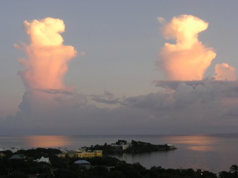
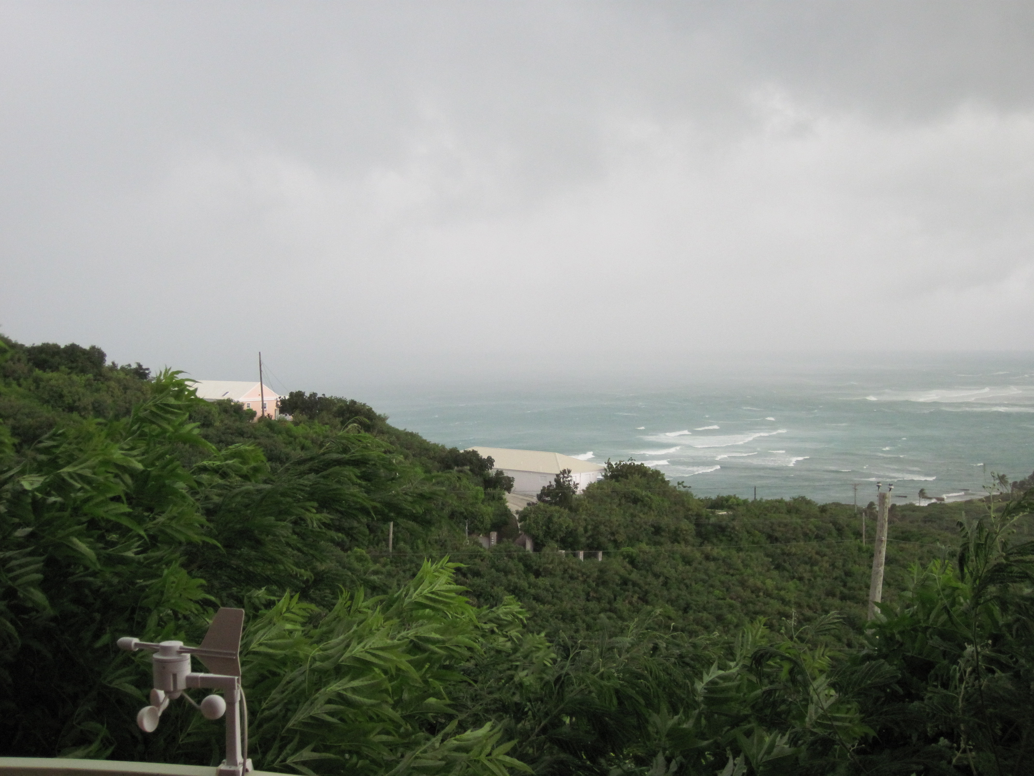
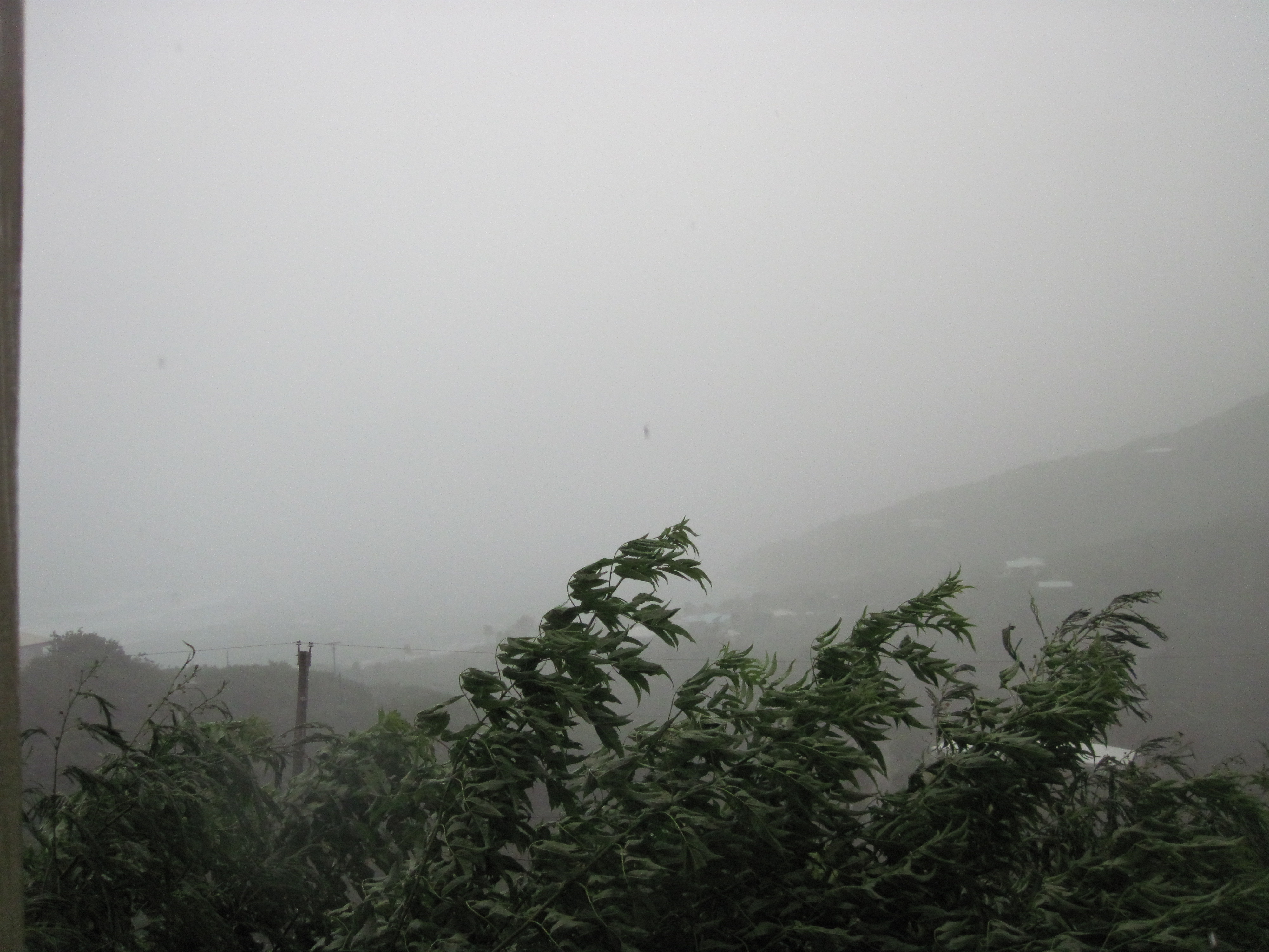
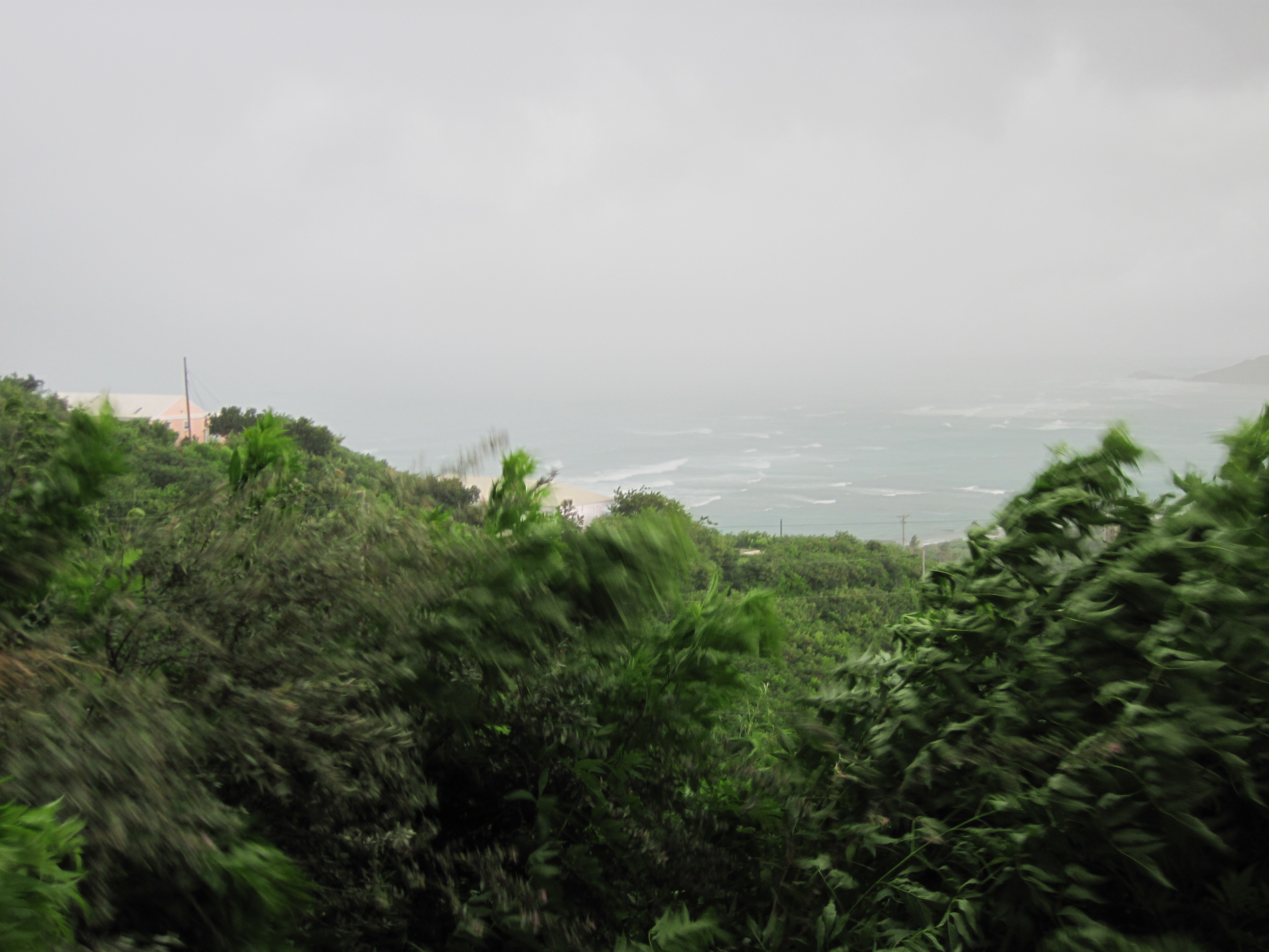
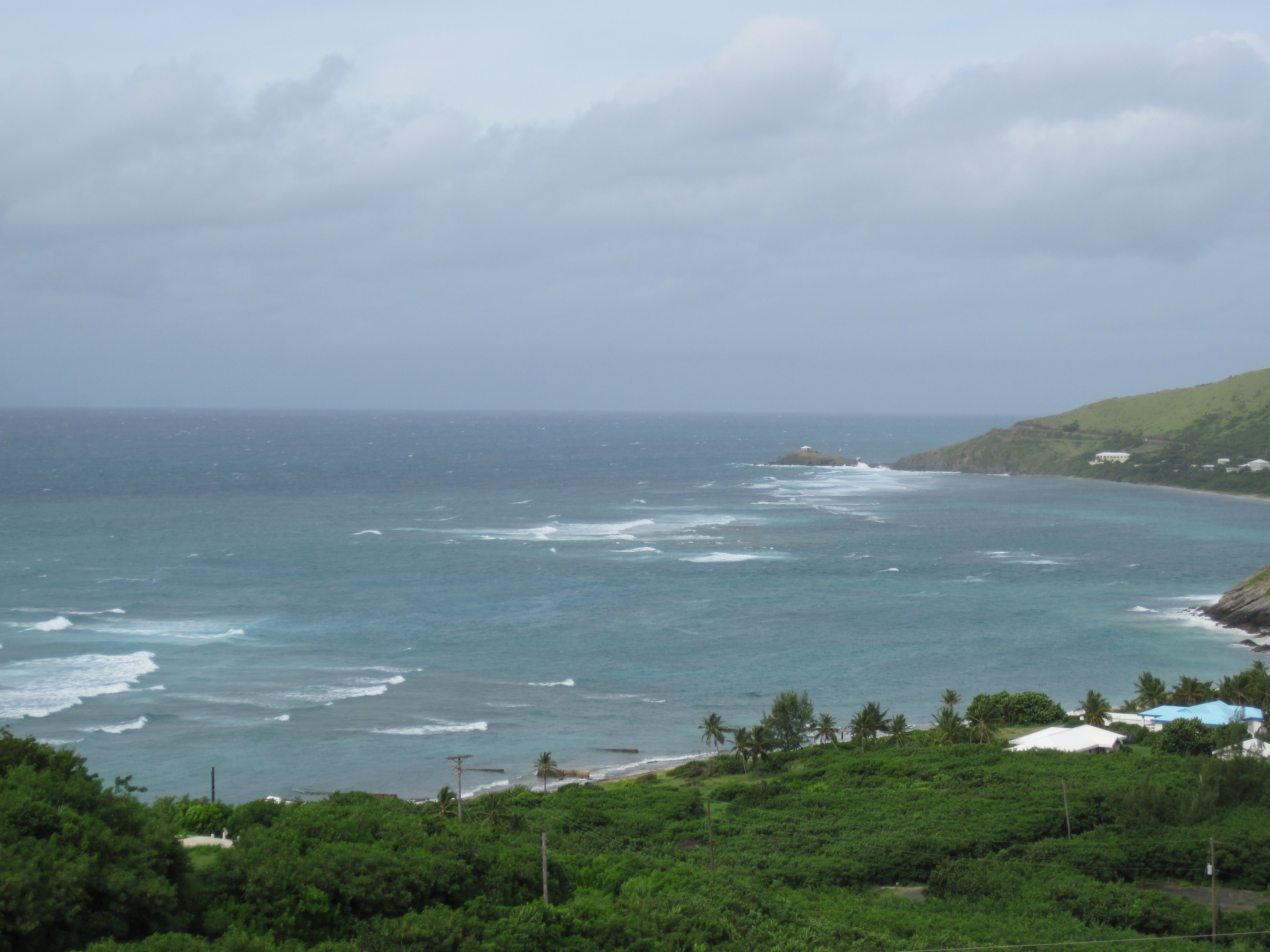
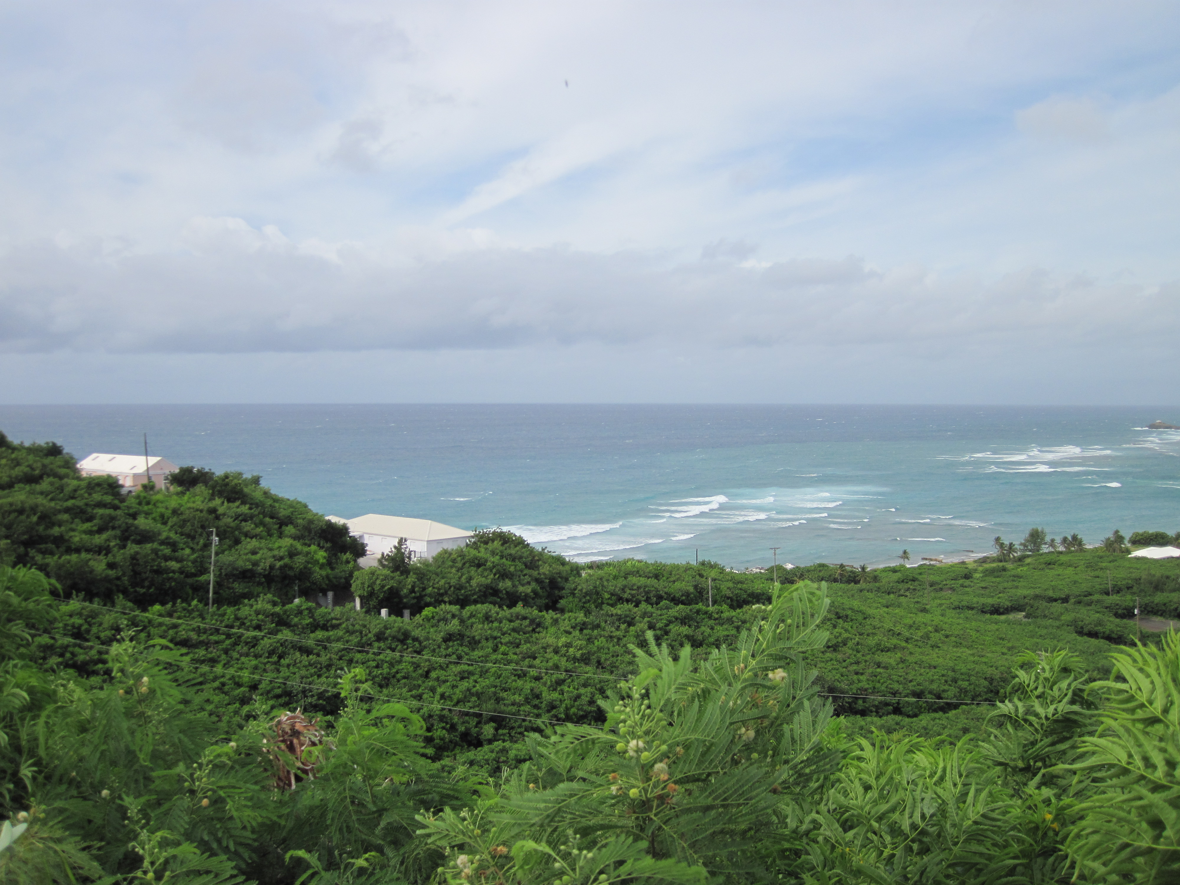
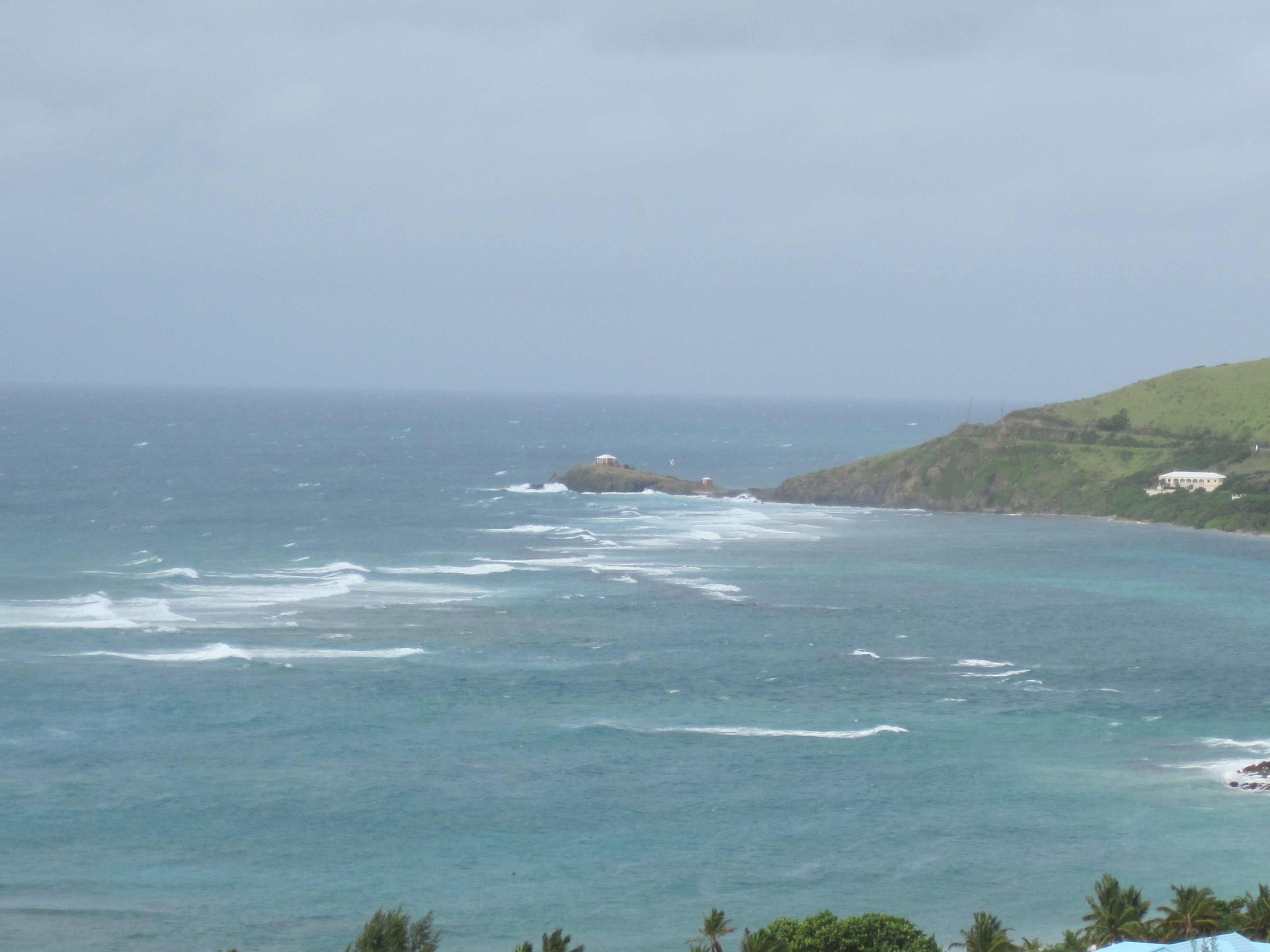
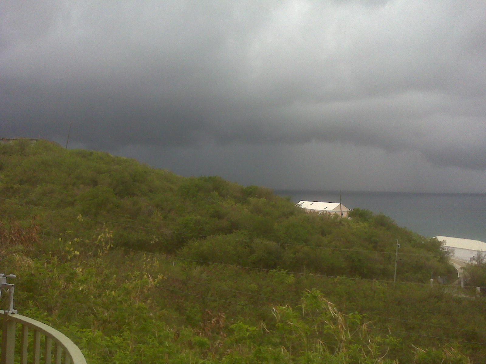