|
|
- - - 2011 Hurricane Season - - -
|
- Rain again
|
- By jan farara <janfarara at hotmail.com>
- Date: Sat, 10 Dec 2011 14:28:34 +0000
|
|
I spoke too soon.!!! . Dawn was clear and then the weather went downhill from there. First overcast then a cold wind, now rain AGAIN. Visibility zero , no land no sea . From my upstairs studio its like living in a grey cloud . Lets hope it improves. Jan
|
|
|
- Amazing
|
- By jan farara <janfarara at hotmail.com>
- Date: Sat, 10 Dec 2011 11:40:47 +0000
|
|
After more and more days of squelchy muddy ground and impossible to cut grass and weeds,last night was amazing! It was the last night of agents week and the skies were clear with a soft pink and cerulean sunset and the moon riding early and high. As we entered the main door of Admirals Inn we were confronted with everyone's idea of the perfect setting for dinner in the tropics,. This was a private affair for the influential but as it was early no one barred our way. Dozens of round tables were covered in crisp white cloths and crystal glasses out in the open against the backdrop of pink sky, no rain in sight. White jacketed waiters scurried about but still had time to direct us to the current art showing inside. Strolling to the fair at Copper and Lumber Store we passed a member of the staff tying his bow tie and putting on his white jacket obviously late. but unstressed. Inside the hotel everything was upbeat, wine and rum were being handed out and an award winning local chef was making appetizers. Our up market hotels were being promoted and some of my paintings were on show by Sugar Ridge Art Gallery. We wandered outside for some seafood and the mega yachts against the moonlit sky were a sight to behold. Every outside table was full but turning over fast so we sat and ate crab cakes and conch chowder and made the acquaintance of a retired cruising couple on their way back up to the States after 2 years on a 37 footer. as we picked up our car and drove home every restaurant and bar in English Harbour and Falmouth was full and overflowing on to the sidewalk.. After an awful summer of rain and more rain and mud and a zero economy on all fronts the beginning of the season was truly amazing. Lets hope that the weather and the economy continue to improve.
|
|
|
- Water!
|
- By "eliantigua at gmail.com" <eliantigua at gmail.com>
- Date: Thu, 10 Nov 2011 05:05:40 -0400
|
Man, I haven't seen rain like this in years. I think its been about 4 hours now. Will have been some flooding for sure. Hope everyone is ok. Eli
Sent from my HTC
+1268 7257263
www.adventureantigua.com
|
|
- I-feel-ya
|
- By "eliantigua at gmail.com" <eliantigua at gmail.com>
- Date: Tue, 27 Sep 2011 18:04:12 -0400
|
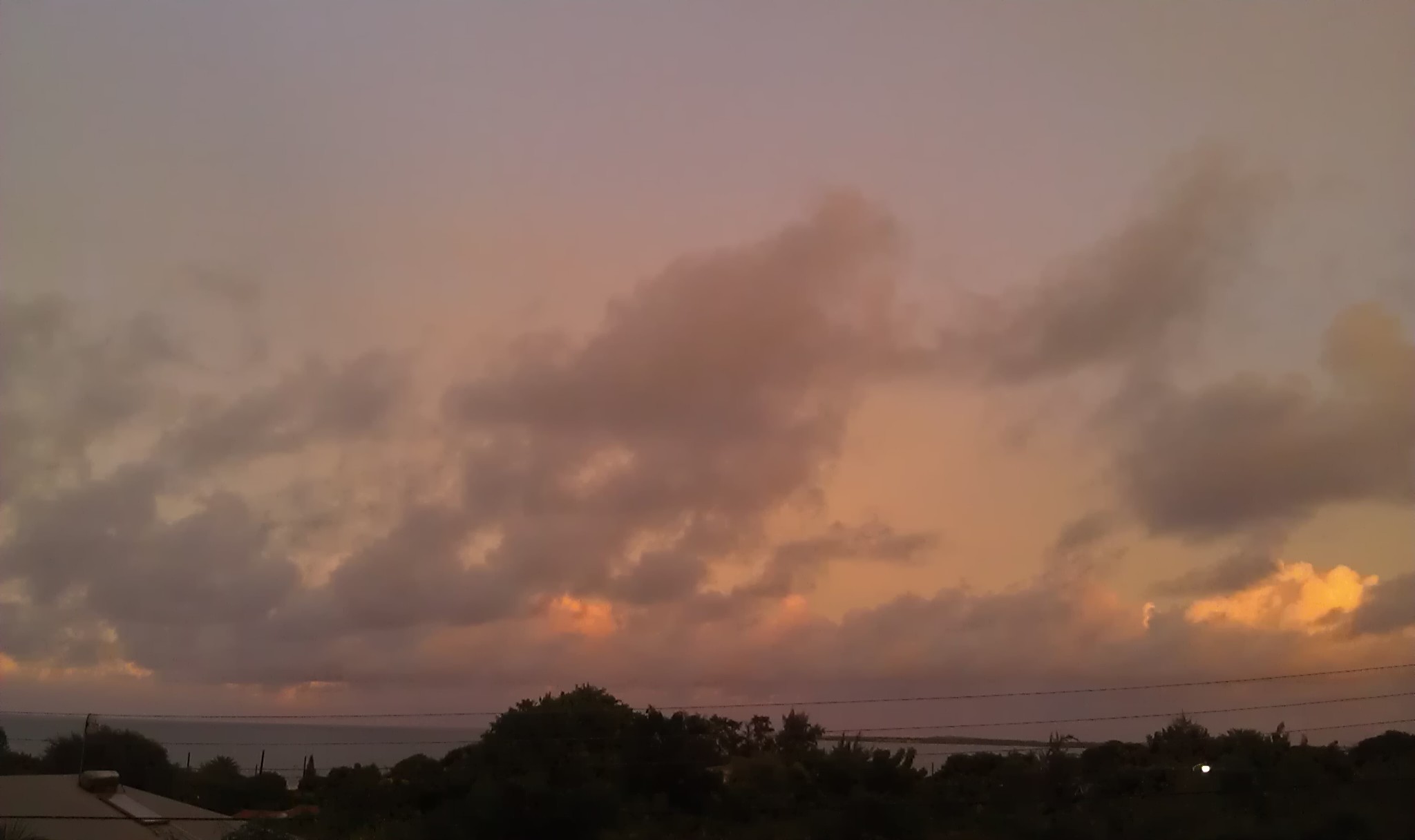
Wow! After lunch today things got exciting in Antigua with torrents of rain, some crazy lightning, dog terrifying thunder and even a 4.5 earthquake! As u can see in the image, things settled down just in time for sunset and the NHC report that the storm regenerated into a depression practically on top of us. Thankfully its 4cast to go north. Hopefully soon as I have had a fishing plan for tomorrow.
Sent from my HTC
+1268 7257263
www.adventureantigua.com
Attachment:
IMAG1350.jpg
Description: JPEG image
|
|
- looks like some fun surfing conditions this weekend
|
- By eli fuller <eliantigua at gmail.com>
- Date: Thu, 22 Sep 2011 07:12:18 -0400
|
All surfers in the Caribbean pray for hurricanes that approach the Caribbean, turning north, avoiding all land, and sending perfect long period waves our way. Although this latest version isn't a hurricane all forecasts suggest that the surfing could be pretty good this weekend.
This means that even though the fishing tournament was postponed, some of us will still be on the water.
According to all forecasts this tropical storm "Ophelia" will weaken as it gets closest to the islands also turning north and missing all of the Caribbean. Good news for everyone except fishermen.
--
+1 268 725 7263
http://www.adventureantigua.com
http://www.sailing-antigua.com
http://www.antiguaisland.blogspot.com
http://www.twitter.com/antigua
|
|
- Atlantic Tropical Storm OPHELIA Advisory Number 1
|
- By Martha Watkins Gilkes <gilkesm at candw.ag>
- Date: Wed, 21 Sep 2011 05:53:48 -0400
|
Here we go again.
BULLETIN
TROPICAL STORM OPHELIA ADVISORY
NUMBER 1
NWS NATIONAL HURRICANE CENTER MIAMI FL AL162011
1100 PM EDT TUE
SEP 20 2011
...NEW TROPICAL STORM FORMS OVER THE CENTRAL TROPICAL
ATLANTIC...
SUMMARY OF 1100 PM EDT...0300
UTC...INFORMATION
-----------------------------------------------
LOCATION...12.2N
40.1W
ABOUT 1585 MI...2555 KM ESE OF THE NORTHERN LEEWARD ISLANDS
MAXIMUM
SUSTAINED WINDS...40 MPH...65 KM/H
PRESENT MOVEMENT...W OR 270 DEGREES AT 9
MPH...15 KM/H
MINIMUM CENTRAL PRESSURE...1006 MB...29.71
INCHES
WATCHES AND WARNINGS
--------------------
THERE ARE NO
COASTAL WATCHES OR WARNINGS IN EFFECT.
DISCUSSION AND 48-HOUR
OUTLOOK
------------------------------
AT 1100 PM EDT...0300 UTC...THE
CENTER OF TROPICAL STORM OPHELIA WAS
LOCATED NEAR LATITUDE 12.2
NORTH...LONGITUDE 40.1 WEST. OPHELIA IS
MOVING TOWARD THE WEST NEAR 9
MPH...15 KM/H...AND THIS GENERAL
MOTION IS EXPECTED TO CONTINUE FOR THE NEXT
48 HOURS WITH AN
INCREASE IN FORWARD SPEED.
MAXIMUM SUSTAINED WINDS
ARE NEAR 40 MPH...65 KM/H...WITH HIGHER
GUSTS. SOME GRADUAL STRENGTHENING IS
FORECAST DURING THE NEXT DAY OR
SO.
TROPICAL-STORM-FORCE WINDS EXTEND
OUTWARD UP TO 175 MILES...280
KM...MAINLY TO THE NORTH OF THE
CENTER.
ESTIMATED MINIMUM CENTRAL PRESSURE IS 1006 MB...29.71
INCHES.
|
|
|
- watching INVEST 98L
|
- By Martha Watkins Gilkes <gilkesm at candw.ag>
- Date: Tue, 20 Sep 2011 08:08:10 -0500
|
WIND GURU shows lots of rain for antigua friday/ sat. with the approach of this system.. if named would be OPHELIA! too early to say what she will do but worth watching... today is a beautiful sunny day....
1. A LARGE LOW PRESSURE SYSTEM IS LOCATED ABOUT 1500 MILES EAST OF THE
WINDWARD ISLANDS. THUNDERSTORM ACTIVITY IS GRADUALLY INCREASING AND
BECOMING BETTER ORGANIZED...AND ENVIRONMENTAL CONDITIONS ARE
EXPECTED TO REMAIN CONDUCIVE FOR A TROPICAL DEPRESSION TO FORM
DURING THE NEXT COUPLE OF DAYS. THIS DISTURBANCE HAS A HIGH
CHANCE...70 PERCENT...OF BECOMING A TROPICAL CYCLONE DURING THE
NEXT 48 HOURS AS IT MOVES WESTWARD AT 5 TO 10 MPH
|
|
|
- What storm?
|
- By jan farara <janfarara at hotmail.com>
- Date: Sun, 11 Sep 2011 13:36:54 +0000
|
|
After 2 days of watching and wondering and wearing out the weather apps on the computer, lots of good weather info on facebook...who knew. Even trying to watch ABS ,an event in itself, we were no wiser on the whereabouts and strength of Maria. Even my friend Maria had nothing to add about her disorganized status.!!! She woke me [ the storm not my friend] at 2 am with lightening and a large clap of thunder. A few rain showers in the night and more lightening and thunder but still no wind. Its now 10 am just grey and drizzly ,a good morning for a Sunday breakfast, cooked by my husband..right day too.! Thrilled that it was really a non event and hoping everyone else fares as well as us.
|
|
|
- 9/ 11. Memorial
|
- By Martha Watkins Gilkes <marthawatkinsgilkes at gmail.com>
- Date: Sun, 11 Sep 2011 08:46:15 -0400
|
Maria winds. Continue to. Howl on the east coast.  But our airport is open now.
And it is much calmer on the west side.

Watching the. 9 /11. Memorial on tv.   The day. That changed all of our lives
forever.
|
|
- MARIA dumps...
|
- By Alan Scholl <scholla at candw.ag>
- Date: Sun, 11 Sep 2011 06:36:13 -0400
|
Starting at 3:30AM this morning, Maria unleashed her stored energy, while the
wind was not strong, the thunder was formidable. It jarred me and the
neighbourhood dogs out of our slumber. It has been raining very heavy since
then with occasional breaks. At this moment, it is quiet except for the
croaking of nearby Cuban tree frogs, thunder in the distance and a few birds
beginning their morning routine. Looking at the Guadeloupe, radar there may be
still a bit more before the day is done.

Alan Scholl
|
|
- Maria howling
|
- By Martha Watkins Gilkes <marthawatkinsgilkes at gmail.com>
- Date: Sun, 11 Sep 2011 03:29:05 -0400
|
The  Howling wind of Maria woke me up.  Now 3:30 a.m.   Sorry  that   my  wind
guage is  down.   Odd, friends on the north end of the isle are getting
nothing, at least they  were not  last  night late.   Not  much rain however.
Advisory says.  Worst winds. are. North of us, thank goodness.  I. Wonder how
Barbuda. Is faring & look forward to the. All clear. Looking at the. Sat pic
and. The massive cloud over us. I think we will. Face   This most  Of rest of
Today ... Sunday.
       Watching. Yet another low. Behind this.
|
|
- MARIA IS HERE
|
- By Martha Watkins Gilkes <gilkesm at candw.ag>
- Date: Sat, 10 Sep 2011 19:50:01 -0500
|
| What ever she is ( as she has changed so often - still Tropical storm?? ) ... she is here.. we are getting quite strong gusty winds on the east coast here at Half moon bay ..... and the sat pic looks like she is over us.. no rain yet... but for sure strong gusts... Hope this will blow thru quickly...
|
|
|
- Glass calm
|
- By eli fuller <eliantigua at gmail.com>
- Date: Sat, 10 Sep 2011 13:08:42 -0400
|
|
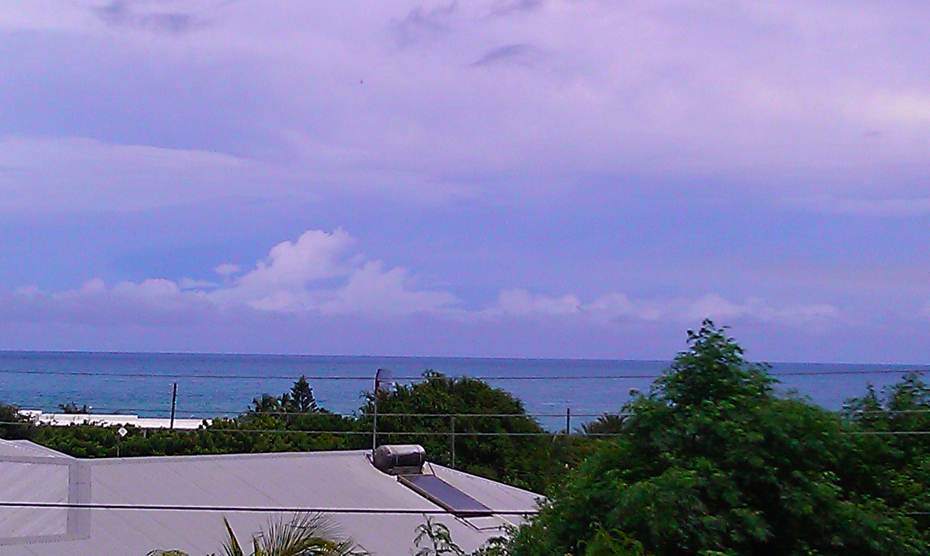
Moderately cloudy but mostly sunny so far. Now winds down to nothing on north shore. Fat lady singing?
www.adventureantigua.com
Attachment:
IMAG1266.jpg
Description: JPEG image
|
|
- Sunny and light
|
- By Alan Scholl <scholla at candw.ag>
- Date: Sat, 10 Sep 2011 08:34:51 -0400
|
It is bright and sunny but as Martha indicated, be on your guard, the bulk of
what was to be expected has not yet arrived but slow as she may be, it will
come!

Alan Scholl
|
|
- OMG the track!!
|
- By eli fuller <eliantigua at gmail.com>
- Date: Sat, 10 Sep 2011 07:59:42 -0400
|
haha, i keep hearing people freak out about storm tracks. It's true about the projected course from 5 am was showing a run over Antigua, but remember that from the moment a tropical wave gets
strong enough to be called a Tropical Depression, the National Hurricane
Center has to give it a forecast track. This line is where the center
of circulation is forecast to go. That's what it means and in this case
Maria's center of circulation isn't very impressive and so far the
morning is sunny and nice. Winds are blowing at about 20 mph and not
much is going on. The radar meteo.fr/temps/…animMOSAIC2.html
shows plenty of rain on its way. If you click the animation you can see
which way the radar "pinged" rain is moving. The storm isn't a very
well organized storm and the NHC issued a statement at 5 am titled
"Maria refuses to strengthen" which was good news to us all here in Antigua
and Barbuda.
Tomorrow will be a beach day but i may have to cancel the bbq later
when we can expect heavy rain and some gusts up to 50 mph.
Just now the NHC said:
SATELLITE AND RADAR IMAGERY INDICATE THAT THE CIRCULATION OF MARIA
CONTINUES TO BECOME LESS DEFINED.  IF THIS TREND CONTINUES...MARIA

COULD DISSIPATE AS A TROPICAL CYCLONE LATER TODAY.
--
+1 268 725 7263
http://www.adventureantigua.com
http://www.sailing-antigua.com
http://www.antiguaisland.blogspot.com
http://www.twitter.com/antigua
|
|
- Fairly quiet...
|
- By Alan Scholl <scholla at candw.ag>
- Date: Sat, 10 Sep 2011 06:27:37 -0400
|
Just woke up to a quiet day, there is some evidence of a bit of wind but other
than a small gust about two minutes ago, there isn't much happening in the
McKinnons area. Birds are still flying around foraging for their morning meal.
The blob is still to the East so suspect some activity yet to come.

Alan Scholl
|
|
- TAKE IT SERIOUS
|
- By martha gilkes <marthawatkinsgilkes at gmail.com>
- Date: Sat, 10 Sep 2011 06:19:09 -0500
|
FOR THOSE who dont read DAVES wise words on STORM CARIB...am posting here to remind you... while most of us are "hurricane savvy" on antigua from going through so many storms, some are taking this "light" as just a TROPICAL STORM ( when you have been through a CAT 4 LUIS at 150 plus miles, 50 MPH DOES seem "slight"... HOWEVER.. pls read Daves words below.. and see the CLOSETS POINT ... only 2.8 miles!
DAVE SAYS: Just a quick note, just because Maria seems barely a tropical storm, don't underestimate it! It is a big storm, with tropical storm winds expanding outward up to 175 miles, with the northern side being the strongest. Also, Maria has slowed down somewhat, making it more susceptible for strengthening. If you are under a tropical storm warning, better take it serious!
Results for Antigua (17.12N, 61.78W):
The approximate Closest Point of Approach (CPA) is located near 17.2N, 61.8W or about 2.8 miles (4.5 km) from your location. The estimated time of when the center of the storm will be at that location is in about 11 hours and 59 minutes from now (Saturday, September 10 at 6:18PM AST). |
|
|
|
- NOT MUCH GOING ON YET
|
- By martha gilkes <marthawatkinsgilkes at gmail.com>
- Date: Sat, 10 Sep 2011 06:01:22 -0500
|
| ONLY HAD A COUPLE OF HARD RAIN SQUALLS IN THE NIGHT BUT NOW, THIS EARLY MORN, IT IS PICKING UP AS I SEND THIS MSG... LOOKING AT THE SAT PHOTOS SEEMS WE WILL HAVE TO WAIT IT OUT LONGER THAN EXPECTED... THROUGH THE DAY AT LEAST, IT SEEMS... WHILE WE ARE HAVING A STORM IN ANTIGUA ROBIN LEACH, ONE TIME LONG TIME RESIDENT OF JUMBY BAY ANTIGUA IS CELEBRATING HIS BIG BIRTHDAY IN LAS VEGAS WITH 100 GUESTS! a 3 day affair with the big party tonight...was due to be there but fate changed the course of my sails and alas... i am here IN THE MIST OF a storm instead! HAPPY BIRTHDAY ROBIN... ANTIGUA LOVES YOU FOR ALL YOU HAVE DONE FOR THE ROCK! |
|
|
- Maria
|
- By John Fuller <johnefuller at gmail.com>
- Date: Sat, 10 Sep 2011 01:13:27 -0400
|
|
Sorry now 1010
|
|
- Maria
|
- By John Fuller <johnefuller at gmail.com>
- Date: Sat, 10 Sep 2011 01:12:00 -0400
|
|
Pressure now 1011
|
|
- Maria
|
- By John Fuller <johnefuller at gmail.com>
- Date: Sat, 10 Sep 2011 00:24:49 -0400
|
|
Pressure 1011mb. Wind one 25 its.no rain.
one squall with 35 kts
|
|
- SEP 9
|
- By John Fuller <johnefuller at gmail.com>
- Date: Fri, 9 Sep 2011 21:13:38 -0400
|
|
THE NE COAST THIS PM
Attachment:
IMAG0006.jpg
Description: JPEG image
|
|
- STORM MARIA
|
- By Martha Watkins Gilkes <gilkesm at candw.ag>
- Date: Fri, 9 Sep 2011 16:15:50 -0500
|
We just had our first squall with hard rain and gusty winds here at Half Moon bay on the Atlantic side.. around 4 p.m. Did not last long.
Glad I am battened down... our airport is closing at 6 p.m. tonight and opens tomorrow at 4 p.m. My airline pilot husband had to make a last
"run" to St kitts and hopes to nip back in by the 6 p.m. deadline..... I HOPE SO TO!! not nice to be "home alone" in a storm! Looks like using the STORM CARIB TOOLS looks like we will get the main part tomorrow from noon on with hopefully MAX wind of 55 knots
( 63 miles per hour) ... which is thankfully NOT A HURRICANE but can certainly blow things about. Hope everyone is prepared and thankful we are not facing a CAT 4 HURRICANE as we have in the past... Hope we dont lose electricity but they have mentioned that.
Results for Antigua (17.12N, 61.78W):
The eye of the storm is about 323 miles (520 km) away. If the system keeps moving at its current speed of 14 mph and directly towards you, it will take around 23.1 hours (Saturday, September 10 at 1:06PM AST) to reach you.FORECAST VALID 11/0000Z 17.9N 64.5W
MAX WIND 45 KT...GUSTS 55 KT.
34 KT...150NE 90SE 0SW 100NW.
|
|
|
- Getting ready for MARIA
|
- By Alan Scholl <scholla at candw.ag>
- Date: Fri, 09 Sep 2011 08:30:13 -0400
|
Just took a look at the meteo.fr radar and as Eli
indicated, hmm, it is literally on our doorstep. While
there was a beautiful sun peeking out of the clouds this
morning, it probably won't be like that for most of the
weekend. The real issue with this storm will be the water
that will be dumped on the islands. 40-50mph we can
survive but the flooding will again slow down the recovery
to normalcy after MARIA passes.
Alan B Scholl
www.digitalphoto.ag
|
|
- remember, the main strength of the squalls will be on the north side of the "track line"
|
- By eli fuller <eliantigua at gmail.com>
- Date: Fri, 9 Sep 2011 07:47:22 -0400
|
The radar image attached shows squalls coming in fast. Winds on the north of Antigua are blowing nicely at about 20 knots with some higher gusts. I think tonight we could see some 40s and plenty of rain. Take your favorite plant pots into the house and put an extra anchor out from the boat. Don't brush this off as a "nothing". It is a tropical storm and even tropical depressions can kill.
--
+1 268 725 7263
http://www.adventureantigua.com
http://www.sailing-antigua.com
http://www.antiguaisland.blogspot.com
http://www.twitter.com/antigua
Attachment:
201109091130-Mosaique.gif
Description: GIF image
|
|
- Maria BACK ON THE PLAYING FIELD
|
- By Martha Watkins Gilkes <gilkesm at candw.ag>
- Date: Fri, 9 Sep 2011 07:44:39 -0500
|
MARIA IS BACK  and  coming our  way..  our  schools close at  11 a.m.      She
will be a  TROPICAL STORM and not a hurricane thank goodness..  but  by
tomorrow  SAT. am  we will  be getting the start..
just  checking out more now...
|
Older reports from Antigua have been moved to another page.
|
