
|
- - - 2010 Hurricane Season - - -
|
- First invest of the year
|
- By Katy Young <katy at sbms.co.tt>
- Date: Wed, 20 Apr 2011 22:43:54 +0100
|
The first invest of the year: A low pressure area located about 460 miles northeast of san juan
Puerto Rico has developed some shower and thunderstorm activity
near its center. In addition, satellite data and ship reports indicate
gale-force winds are occurring north of the center. Slow development of
this system is possible during the couple of days as it moves
west-northwestward at about 10 mph. There is a low chance, 20 percent,
of this system developing into a subtropical or tropical cyclone before
conditions become less favorable in about 48 hours. Additional
information on this low can be found in high seas forecasts issued by
the NHC/tropical analysis and forecast branch, under AWIPS header
nfdhsfat2 and WMO header fznt02 kNHC. Another special outlook will be
issued on Thursday, Or sooner if necessary.Elsewhere, tropical cyclone formation is not expected during the next 48 hours. Thanks
Katy Young
Director
Store
Bay Marine Services Limited
Unit
B, Bago's
Beach Bar, Pigeon
Point Road,Crown
Point, Tobago
Mailing
Address: PO
Box 130,
Scarborough, Tobago
Website:
www.sbms.co.tt
Email: katy at sbms.co.tt
Phone:
660
8468 Cell: 740 2269 VHF:
Ch06
Directors:
John
R Stickland, Rajesh
Singh & Katy
Young
|
|
- The dry season is here !
|
- By Ian Martin Borde <readkrox51 at gmail.com>
- Date: Sun, 3 Apr 2011 06:01:43 -0400
|
2011 - 04 - 03 Sun.
04 : 30 a.m.
Just a quick note for those who missed the Carnival !
See you next year ? Until then, Good Luck with the Easter bunnies.!. : )

Weather-Wise;
We have entered the dry season, (different to the other territories,
marginally). As we are having two-three (2-3) days of absolutely no
precipitation. Then, when it rains. It lasts less than five minutes.
(More like an over-loaded bladder.)
Night - Time temps. rose to 75 F. min.
Barometric Pressure consistently above 29.85 (Avg. 29.83) 29.98 once a day is normal.
Humidity, compensated by wharfty breezes. (Reminds me of windsurfing in Barbados off The South Coast).
Also pic. of Sailing Association of T'dad & T'bgo.
Some attachments failed ! Ho, hum, ....! : (
Advantage, Ah coming again, ....
Wotless - Trini,
Ian.
|
|
- People !! Brothers and Sisters, Please, Stay Calm .!!!.!!.!.
|
- By Ian Martin Borde <readkrox51 at gmail.com>
- Date: Fri, 11 Mar 2011 09:00:43 -0400
|
Petit Valley, Diego Martin,
Trinidad & Tobago, W.I.
2011 - 03 - 11 Fri.
08 : 30 a.m.
People, Please !
Brothers and Sisters under the Caribbean sun, Remain Calm and Please Do Not Panic , Keep Calm !!!
Any further distribution of Rumours and Electronic Viruses by clicking the wrong buttons, figuratively and literally, will not only add to the Disaster but exacerbate Relief Efforts. Lifes will be lost.
Check only TRUSTED WEBSITES.
1) Draw a bottom - Line !
2) Take ten deep breaths and resign yourself to any higher power, that is Good !!!
3) Pray or at least exercise self-control !
Now:
These are some trusted Web-Sites:
http://www.hawaiinewsnow.com/
http://earthquake.usgs.gov/earthquakes/dyfi/events/hv/60222496/us/index.html
http://earthquake.usgs.gov/earthquakes/recenteqsus/Maps/PR10/13.23.-71.-61.php
Standing By, God Bless,
Lord have Mercy,
Ian
PS: Don' forget the invest SE of Azores !
|
|
- Impossible, ...! Weather Arthritis !!!
|
- By Ian Martin Borde <readkrox51 at gmail.com>
- Date: Sun, 27 Feb 2011 19:43:35 -0400
|
It can't be ! It's impossible !! I even fell asleep with pain and fever !! However all the scientific information supports it !!!
[see: http://www.weather.com/maps/maptype/satelliteworld/caribbeansatellite_large_animated.html ]
I had weather arthritis and the temperature, humidity and pressure in T'dad & T'bgo as per weather .com is dropping from being very high.!.
It' un-understandable and totally and highly impossible .!.!!.!!!.
Standing by,
Ian
www.Facebook.com//readkrox
|
|
- crazy crop weather
|
- By Jamie Ramoutar <jboogy2604 at hotmail.com>
- Date: Tue, 22 Feb 2011 08:53:28 -0400
|
|
judging from the weather last night, if i didnt know better id say that it was mid october...rain(not torrential) but steady accompanied by gusty winds... more crazy weather expected over the next couple days
|
|
|
- Yes, Sirree !! The Bird has surely flown !!!!
|
- By Ian Martin Borde <readkrox51 at gmail.com>
- Date: Tue, 22 Feb 2011 03:26:10 -0400
|
2011 - 02 - 22 Tues.
02 : 00 a.m.
P/Vly, D'go,
T.& T., W.I.
Important House - Keeping Update:
(With little time to do so,
Computer problems,
Added responsibilities, ...?)
Good Night, Good Morning, Good Day, Good Everything, Island People,
What flowers and shrubs are to a gardener, and wind is to a sailor, so too, BIRDS were to my father and now I can't help but inherit his Oneness with Birds and Butterflies !!!!
In the constraint of time, we draw to the attention of readers, The 'Scissors-Tail' Bird : [The largest in the region, The local 'Ground-Hog' of Spring, only seen in Winter months, Flies 1,000 feet above land, near the coast (3/4 mile off), like the pelican (and scarlet ibis) i.e. true hunters don't shoot at them (probably considered a type of sacred)], on Thursday 17th February was seen by me for the first time GOING BACK NORTH. America could look forward to milder weather from now on.
We have two types of seagulls: The normal one and a smaller type (small like a humming-bird) that only flies in droves. Well in a garden close to the Gulf of Paria we saw three small birds at a distance, while in passing. This is a very, very good sign!!! The local wood-pecker, the yellow corn-bird (raven), kiskadee and blue-bird have made a re-entry to our gardens (urban), rather than the probable early entry of the humming-bird (or sea-gulls). (But, waves will start to be more conducive to fishing, gradually!)
Thursday was full moon and there is the tendency to anticipate the dry season.
1) Yes! I will say winter has ended.
2) That does not say the effects of winter have ended.
3) That does not anticipate that the dry season is here.
4?) The end of what happened to Brazil has not ended but is headed north. (Remember their drought and flood).
The following is not related to the above to cause anxiety (but confirmation), Tonight we have had rain, fairly non-stop since 8:00 p.m. yesterday! It is now 3:00 a.m.
One Patrick, out of Tortola addressed my dear friends about a sea shell creature with a back like ribs from a centipede but fatter and wider and less in amount that cling to the rocks at sea tide level with some moss growing on its shell? (Problem with computer!?)
Ans: I was told those go back to ancient time and could be the probable ancestor of leeches and snails. (Sea and Land). There are three names for them in T'dad and T'bgo. But before that, I have read over and over, the only proven aphrodisiac, is oysters. "Sea-Cockroach', 'Pac-Roue' or 'Roue', are some of the names for this sea leech. Sea-Cockroach is distinctive to that type. Pac-Roue is small shell-fish like that cooked with a Tobago recipe. Roue is really 'fish-eggs' (local caviar). (Deep-sea fish from Banking).
By the way, oysters were sold at the two largest round-a-bouts in north and south T'dad in an exotic and herbal spice cocktail at ridiculous prices for years. And rouir in french and patois means to boil, for an extended period, in at least some sort of brine.
God Bless,
Until,
Bro. Ian
www.facebook.com//readkrox
|
|
- 'Out-ah-Timing' Build-Up .!!!.
|
- By Ian Martin Borde <readkrox51 at gmail.com>
- Date: Thu, 10 Feb 2011 08:57:25 -0400
|
2011-02-10 Thurs.
8:40 a.m.
P/Vly, D'go,
T.& T.,W.I.
Is it August 28th.?
Must be summer in Paradise?
Whatever, there is an ominous, (possibly hazardous), buildup we wrote about on my Facebook page since last week-end, that the local weather report confirmed last night.
In days of uncertainty, let's not anticipate the uncertain.
It may be temperatures,
It may be the height of waves and tide,
It may be pressure and humidity, (more about that later?),
It may be winds,
It could be rainfall amounts,
But, We can PREPARE:
What are the causation factors?
There's only one we can see, ...? The ITCZ is making it's way back up, north!!!!!!
{At a time when the cold fronts are at their lowest points for the season??? Hope I'm wrong???}
I was really hoping we were wrong, but if I'm not it is less than 36 hours away from Tobago and Trinidad.
This thing is not only perplexing, It's OUT-AH-TIMING !!!!
Standing By,
God Bless,
Ian M. Borde
|
|
- Cold, Breezy, Northerly Kisses below Dew Point
|
- By Ian Martin Borde <readkrox51 at gmail.com>
- Date: Sat, 22 Jan 2011 06:58:36 -0400
|
2011 - 01 - 22 Sat.
06 : 45 a.m.
P/Vly, D'go,
T.&T., W.I.
Good Morning,
The tumultous season of Carnival has beset the twin island republic of Trinidad and Tobago. The land of organised chaos is a hive of chaos and creative activity. The spirit of fecundity and bacchanal reigns over young and old.
While the ITCZ has for me to see it graphically been a first, gone below the equator!
Not to be left out: Cold, Breezy, Northerly Kisses of Sporadic Rain 2-3 times a day is now giving way to:
High Level Clouds (some with moisture)
Fast Moving Clouds
Dry Midday Conditions
Cold Night Time Moisture
Hooray for the South !!
Trinidad and Tobago has several types of tourism so I have included our welcome capital in photos for you.
Soca and Steelband goodbye,
Bro. Ian
Attachment:
IMG0229A.jpg
Description: JPEG image
Attachment:
IMG0230A.jpg
Description: JPEG image
Attachment:
IMG0231A.jpg
Description: JPEG image
Attachment:
IMG0232A.jpg
Description: JPEG image
Attachment:
Brian Lara - Independence Square Promenade (Public Administration).jpg
Description: JPEG image
Attachment:
Business-Conglomerate Glass Tower.jpg
Description: JPEG image
Attachment:
Financial Entrance.jpg
Description: JPEG image
Attachment:
Financial Tower.jpg
Description: JPEG image
Attachment:
North-South Water Taxi Port_Brian Lara Promenade_Highway Entrance.jpg
Description: JPEG image
Attachment:
Port of Port of Spain.jpg
Description: JPEG image
Attachment:
Stock Exchange Area of Promenade.jpg
Description: JPEG image
Attachment:
Tobago-Caricom-Fishing Jetty.jpg
Description: JPEG image
|
|
- The Beginning of a Convergence Situation !!!
|
- By Ian Martin Borde <readkrox51 at gmail.com>
- Date: Fri, 7 Jan 2011 02:47:56 -0400
|
2011 - 01 - 07 Fri.
1 : 36 a.m.
P/Vly, D'go,
T. & T., W.I.
Good Night, Good Day, Good Morning, Everyone:
The Calm before Convergence:
Joke: This is the second time I'm writing for this decade?
Well, comical or serious, it's all about how you look at it and interface, with other greater and lesser humans. (Assuming we are not all EQUAL, (Ha!))
Trinidad or at least Diego, around lunch-time, yesterday, had a longer than usual, above moderate, rainfall after an approximate 36 hr. rise in temperature and pressure. Since then the temperature is below 'dew-point'. There is constant moisture in the atmosphere, (beginning of a blob), but NOT a white-out!
One can see an exiting cold front at 61 W. Longtitude (32 N.) T'dad's longtitude. And ending on the north coast of Cuba, i.e. < 25 N. Latitude. [Here we may start using exclamation marks! : ) ] For want of a better word the ITCZ, reaches Guadeloupe !!! This trough will continue and be pushed over the leeward islands especially when Colombia gets involved and the new cold front of New York does his share of pushing and compressing. By the way even though it is total condensation taking place, the pressure is slightly above normal.!!.
I am tired and can't explain it better right now. But reading back it seems fairly obvious.!.
As I said I can't simplify it so I will write again soon. Save to say; the element of wind is now always present!
Standing by,
God Bless,
Ian
|
|
- Northerly swells for Tobago
|
- By Katy Young <katy at sbms.co.tt>
- Date: Tue, 4 Jan 2011 18:59:22 +0000
|
Met Crown Point is forecasting northerly swells for the next few days for Tobago.
Weather forecast for Thursday: Variably cloudy with some showers. Winds: ENE-E 10-21 Knts. Seas: Moderate WITH NORTHERLY SWELL.Waves: Above 2.5m in open water and CHOPPY ALONG NORTH COASTAL AREAS
Forecast High : 31⁰C. Humidity range: 60/80%. Forecast Low: 22°C. Heat Index:32 ⁰C
Thanks
Katy
--
Katy Young,
Director,
Store Bay Marine Services,
Unit B, Bago's Beach Bar,
Pigeon Point Road,
Crown Point,
Tobago.
www.sbms.co.tt
|
|
- Night-Time, White-Out !!
|
- By Ian Martin Borde <readkrox51 at gmail.com>
- Date: Sun, 2 Jan 2011 04:01:02 -0400
|
2011 - 01 - 02 Sun.
3 : 35 a.m.
P/Vly, D'go,
T. & T., W.I.
Happy New Year, fellow West Indians,
For the sake of consistent reporting as the possibility of hazardous conditions are NIL, Diego Martin is experiencing heavy showers for 5-15 mins. (with breeze) every 20 mins. - 30 mins. during drizzling precipitation for the night. (Some four (4) hours or so.)
Really I did notice a sudden and drastic climb in Pressure and Temperature yesterday afternoon after lunch. This was out of the ordinary as things have been pretty stable with night time temperatures having reached, 72 F. or 22 C.
This leads to three (3) observations:
- It could be (a sign of things) getting worse. (Holistically or Long - Run)
- Australia comes to mind.
- The dry season started off, - wet - !
So far it's just another romantic Christmas night to spend in a tropical paradise, with plenty left-over food and beverage in the fridge.  : ) : )
The attachments are to convey my deep personal sentiments of the season.
God Bless,
Ian
www.facebook.com//readkrox
Attachment:
IMG0224A.jpg
Description: JPEG image
Attachment:
IMG0226A.jpg
Description: JPEG image
|
|
- Update
|
- By Sameer Maharaj <s_maharaj_7 at hotmail.com>
- Date: Sun, 2 Jan 2011 00:21:48 -0400
|
|
|
|
- Update
|
- By Sameer Maharaj <s_maharaj_7 at hotmail.com>
- Date: Mon, 27 Dec 2010 11:09:46 -0400
|
|
|
|
- Trinidad's turn
|
- By Michelle Rudder <themiche at tstt.net.tt>
- Date: Mon, 27 Dec 2010 01:11:02 -0400
|
|
The Caribbean plate seems to be acting up a bit. Puerto Rico on Christmas Eve, now Trinidad with a 5.1 earthquake on Boxing Day at 9:15pm. Conflicting reports though .. USGS says 5.1 off the Northwest peninsula. Venezuela's FUNVISIS says 4.6 on the Southwest peninsula. Was probably somewhere in between. It did give a good short shake with loud rumbling. People underestimate the seismicity of the Caribbean. Trinidad sits where the Caribbean, Atlantic and South American plates collide. That triple point puts us at higher risk.
|
|
- a LITTLE or MORE of The Same ?!?
|
- By Ian Martin Borde <readkrox51 at gmail.com>
- Date: Thu, 23 Dec 2010 06:30:29 -0400
|
|
2010 - 12 - 23 Thurs.
5 : 15 a.m.
P/Vly, D'go,
T.& T. W.I.
Season's Greetings to my brothers and sisters,
May the Spirit of The Holy Family, transform us, minute by minute, day by day, each day .!!.
What I have been watching, (these winter days), is whether the Cold Northerly Fronts are to;
The West of us, or, The East of us.
All this while, the grand-mothers are teaching the grands and great-grands, to grate ginger and make ginger-beer. Peel, soak and season sorrel, to make wine and drink. Take out the cherries and prunes and fruits, soaked in rum to make black cake! Take sour limes and make rum-punch. Not forgetting 'The Local Brown Cow' i.e. 'Ponche de Creme' from condensed milk.
From obsevation, it seems the southern movement of the sun has re-ignited the Atlantic Ocean !!
At least the weather and the last Invest/Blob said so?
Just as there is still time to wait for New Year's Day. So too, anyone will doubt, that we are waiting for stormy conditions, or floods or landslips.
But,
But, I venture to predict we will have; (T'dad & T'bgo),
a Wet and Windy and Wavey, Christmas which is usual, but somehow everything nowadays is carried or actually in the extreme before it's totally forgotten, or dis-placed and re-placed.!. 
Cheers,
Bottoms up,
(Down and Sideways),
Ian M. Borde
|
|
- Update
|
- By Sameer Maharaj <s_maharaj_7 at hotmail.com>
- Date: Fri, 17 Dec 2010 17:50:44 -0400
|
|
|
|
- Update
|
- By Sameer Maharaj <s_maharaj_7 at hotmail.com>
- Date: Wed, 15 Dec 2010 20:08:48 -0400
|
|
|
|
- The End of , ..., 2010 !!!!
|
- By Ian Martin Borde <readkrox51 at gmail.com>
- Date: Tue, 14 Dec 2010 07:16:05 -0400
|
2010 - 12 - 14 Tues.
6 : 50 a.m.
P/Vly, D'go,
T.& T. W.I.

December New Moon

Good Morning, Good Day, Good Everything, All you Santa Helpers .!!.

Today and Tomorrow at least for me, is the end of MY Hurricane and Wet
Season !!! Really it was The New Moon on Monday 13th. and from Monday
to Friday we can probably predict accurately what will happen when the
sun gets really hot from March onwards, if we carfully observe the
signs !!

Since my last post, we had varied precipitation all but two days
during a twenty-four (24) hour period, from mid-night to mid-night,
i.e. yesterday and about four (4) days ago.

Tomorrow is the 15th. So I guess the resue workers can look forward to
a reprieve or at least a romantic siesta over the Christmas Holidays
while Equipment and Tools are repaired and updated.

Some time in January I will decide to either continue posting, and
even contribute by phone or opt out. (Hardly likely?)

Attachments are failing and fonts are giving trouble. So nothing as
yet to cheer and share about. But it will come when things iron out
themselves.

Guidance, Love and Blessings. Remember; The brain is the sexiest organ
in the body !!!  :-))

Bless
Ian
|
|
- Warnings of rough seas in Tobago over the weekend from Met Crown Point.
|
- By Katy Young <katy at sbms.co.tt>
- Date: Fri, 10 Dec 2010 20:15:47 +0000
|
Warnings of rough seas over the weekend from Met Crown Point.
Weather
for tomorrow: Fair with a few showers, Winds: E 16-22 Knts. Seas:
Moderate occasionally rough. Waves: 2.5 occasionally 3.0m in open water
and around 1.0m in sheltered areas. Forecast High : 30⁰C. Forecast Low:
23°C. Humidity range: 60/80%.
Weather for ...Sunday:
Generally fair..Winds: ENE-E 8-19 Knts. Seas: Moderate occasionally
rough. Waves: 2.5 occasionally 3.0m in open water and around 1.0m in
sheltered areas. Forecast High 31°C. Forecast Low 24C. Humidity range:
55/75%
Weather for Monday: Variably cloudy with some showers.
Winds: ENE-E-ESE 5-11 Knts. Seas: Moderate. Waves: Up to 2.5m in open
water and under 1.0m in sheltered areas. Forecast High: 29°C. Forecast
Low: 22°C. Humidity range: 65/90%
--
Katy Young,
Director,
Store Bay Marine Services,
Unit B, Bago's Beach Bar,
Pigeon Point Road,
Crown Point,
Tobago.
www.sbms.co.tt
|
|
- Our Christmas Card.
|
- By R K <feb1660 at yahoo.com>
- Date: Thu, 9 Dec 2010 21:05:09 -0800 (PST)
|
Our Christmas card to everyone this year.
Weeweechu ! 
It was a romantic full moon when Pedro said, "Hey, mamacita, let's do Weeweechu."
Oh no, not now, let's look at the moon!" , said Rosita.
Oh,
c'mon baby, let's you and I do Weeweechu. I love you and it's the perfect time," Pedro begged.
"But I wanna just hold your hand and watch the moon." , replied Rosita.
"Please, corazoncito, just once, do Weeweechu with me."
Rosita looked at Pedro and said, "OK, one time, we'll do Weeweechu."
Pedro grabbed his guitar and they both sang.....
"Weeweechu a Merry Christmas, Weeweechu a Merry Christmas, Weeweechu a Merry Christmas, and a Happy New Year."
 MERRY CHRISTMAS TO ALL!!! MERRY CHRISTMAS TO ALL!!!
|
|
|
- Summary as the Hurricane Season ends in Tobago
|
- By Katy Young <katy at sbms.co.tt>
- Date: Tue, 30 Nov 2010 12:54:26 +0000
|
Tobago yet again escaped as the Atlantic hurricane season comes to an end. Only Hurricanes Karl and Tomas caused any bad weather.
As Karl started developing, the eye hit the south of Tobago in early/mid September. The result was 25 knot winds and large swells and rain. Thankfully it moved on from us although later caused problems as heavy rain fell in Belize, Mexico and later the US.
Tomas at the end of October looked a lot more serious for Tobago, which along with it's sister island Trinidad was put under topical storm warning. At the last minute Tomas moved north of us causing damage and tragically loss of life in the middle Windward Islands - St Vincent and the Grenadines and St Lucia were worst affected before it moved to Curacao, Jamaica and Haiti. Tobago didn't completely escape with the tail of Tomas bringing heavy rain (although little wind) and thunderstorms which caused flooding and landslides in Tobago.
Store Bay Marine Services will continue to post between now and
June 1st 2011 if any bad weather is heading our way. If you are ever in
Tobago then pop in and see us.
Thanks
Katy
--
Katy Young,
Director,
Store Bay Marine Services,
Unit B, Bago's Beach Bar,
Pigeon Point Road,
Crown Point,
Tobago.
www.sbms.co.tt
|
|
- The Trinidad Triangle.!. , ...., This feeling in my Bones.!!.
|
- By Ian Martin Borde <readkrox51 at gmail.com>
- Date: Sun, 28 Nov 2010 01:50:19 -0400
|
2010 - 11 - 28 Sun.
12 : 45 a.m.
D'go.
T'dad & T'bgo, W.I.

Good Night, Good Morning, Good Day, Good Everything, Everyone:

"A Wedge Support can NOT be The Same Material as the support it is holding!"

On the note of that quote, ..., It was not arthrits, but from Monday
to Thursday gone this week, my muscles could not support my frame! I
was weak with a virus. Now, the steel in my wrist is scratching me
like crazy!!! When that happens, after or within 36 hours there will
be enough rain to cause hazardous conditions.

To be more scientific:
- Thursday, Friday and Saturday, (yesterday), we had copius rain,
flash flooding and landslides.
- All rivers are over the half way mark. (Sunday morning!)
- More rain is in the forecast.

If you look at the maps, ..., the Trinidad and Tobago Triangle is free
of precipatable moisture? To be frank, everywhere else on the ITCZ
girdle is a mess.!. Now what does that say, or, "What am I trying to
say?"

It comes back down to the 'notion' of 'Disparity' again? Something's
going to give.!!.

Example: If all this visible moisture is under surface Low Pressure
and Trinidad's pressure is higher than theirs, (either at high or low
altitude), Or, b) T'dad's temperature is hotter than this cooling
moisture. (T'dad could include Grenada, and part of The Windwards),
Or, c) there is no possibility of further rain in T'dad, then where or
where is all this additional moisture to feed would come from???

WE GOING TO HAVE MORE RAIN AND FLOODING!!! Now to be proactive; let's
not say we will clear the drains and girt the waterways.!. That is
fundamental routine! Let's have a retention and sluce, study
implemented before the dry season. WATER: IS A RESOURCE, IS A CAPITAL
PROJECT, GIVES AND TAKES LIFE!!! Before it is too late!

My two cents,

God Bless,

Bro Ian
|
|
- Disparity and the Good News?
|
- By Ian Martin Borde <readkrox51 at gmail.com>
- Date: Thu, 25 Nov 2010 05:50:02 -0400
|
2010 - 11 - 25 Thurs.
05 : 30 a.m.
T'dad & T'bgo, W.I.

The Good News:

The good news are that a) the pressure is constant. Low and
consistent. So, precipitation is unlikely. b) The wind shear is almost
to the East of us. (Thus, clearing up moisture over us.) So,
conditions may clear up today.

Last night we cleaned up about 30lbs. of debris in the drains around
the house in case of overnight showers.

This morning, the sky is NOT completely overcast.!.

Reminder:
-Trinidad is part of The Amazon or Orinoco River Mouth. There is
probably more marshland in Trinidad than mountains. Specially if you
include neighbouring territory. We are a source of moisture.
-Trinidad is practically on the equator, ITCZ, and one of the first
points from Africa. Trinidad always has Low Pressure. It is near a
warm land mass.
-Trinidad is a Tropical country near a large land mass that heats up
more than open water. Temperatures are always high.

Therefore, when cold fronts reach our shores there is bound to be a
first (1st.) reaction.

God Bless,
Ian (www.facebook.com//readkrox)
|
|
- ITCZ active over Tobago for the next few days
|
- By Katy Young <katy at sbms.co.tt>
- Date: Wed, 24 Nov 2010 13:28:27 -0500
|
Met Crown Point is advising of winds up to 50km/h over the next few days as ITCZ moves across Tobago....
Forecast for today: Cloudy with showers and thundershowers. Flooding, landslides and strong gusty winds
may accompany heavier showers and thundershowers.
Winds: NE-ENE 30-40Km/hr. Seas: Moderate occasionally Rough. Waves: 2.5 to 3.0m in open water and near 1.0m in sheltered areas.
Forecast High : 28⁰C. Forecast Low: 23°C. Heat Index:28 ⁰C
Humidity range: 65/95%
Forecast for tomorrow: Occasionally cloudy with some showers and the isolated thundershower. Winds: NE-ENE 30-40Km/hr.
Seas: Moderate. Waves: Up to 2.5m in open water and under 1.0m in sheltered areas. Forecast High : 30⁰C. Forecast Low: 24°C
Heat Index:31 ⁰C/ Humidity range: 60/85%
Thanks
Katy
--
Katy Young,
Director,
Store Bay Marine Services,
Unit B, Bago's Beach Bar,
Pigeon Point Road,
Crown Point,
Tobago.
www.sbms.co.tt
|
|
- Country White-Out, Yesterday and Today !!
|
- By Ian Martin Borde <readkrox51 at gmail.com>
- Date: Wed, 24 Nov 2010 06:40:20 -0400
|
|
New Moon and Pre - Christmas, - Winter Greetings,
Brothers and Sisters,
11 - 24 Wed.
06 : 20 a.m.
Due to a slow moving ITCZ wave and wind shear to the west and north of us; 
There was an entire country white-out yesterday and possibily for today.!. - It's still raining! - Moderate to Light.
There has been NO substantive reports of damage at this time.!
Areas affected the most by priority are: (Excluding Tobago,)
Toco, Sangre Grande, Mayaro, Arima, Manzanilla.
Apparently not only the ITCZ confluence but South American Low Pressure systems (inc. T'dad & T'bgo), are being pulled to a High Pressure system North - East of us. All this directly over our east coast and islands.
Otherwise generally:
Temperatures have already dropped a few times to 74F. or 24C.
and
Seas are generally ROUGH,
Winds less than 15 kmph.
If there is damage I will post again soon, (but we doubt it).
Bless,
Ian
|
|
- Qu./ "Are conditions more (un)favourable, now?"
|
- By Ian Martin Borde <readkrox51 at gmail.com>
- Date: Wed, 17 Nov 2010 12:38:27 -0400
|
|
2010 - 11 - 17 Wed.
12 : 10 p.m.
Pre - Winter Greetings, Friends:
As per my last post, there should be no doubt, that some activity was being forecast subjectively, by yours truly. This even as; There is no satellite indication of same. Weather conditions are not severe. Drawing to a close it's hardly probable.
However if you were in T'dad over this time we had (localised), daily showers that were more than a drizzle. Copius amounts of moisture fill our atmosphere without precipitation. In other words, normal conditions during any (active) hurricane season. (Before my last post) I even began to usher in the fat lady,...! That's why I'm writing. Let's not do that!
I can't interpret winds and shear and cold fronts, so my question is. "Are conditions (cold front very eastward), more unfavourable now to allow, Childern of 94L i.e. 94a - Belize, 94b - Jamaica,Haiti, 94c - Windwards (Trinidad and Margarita) to develop as everybody will agree not Cat.1 status but be more than a bother???
Simple.!.
If it is that conditions are not favaourable for tropical disturbance formation now, forget the fat lady, I will play the piano and we will all sing out loud,  . Christmas songs and all.  
Enjoy the season, ....
ReadKrox 51
Ian M. Borde
|
|
- Holy, bucket a drop, Batman! It aint over?
|
- By Ian Martin Borde <readkrox51 at gmail.com>
- Date: Sat, 13 Nov 2010 15:24:02 -0400
|
|
2010-11-13 Sat.
01:10 p.m.
Happy Caribbean Week-End, Everyone,
Just when we lowered our guard and tried to correspond on this website, with [Digicel: Coral 450] semi-smart phone about how sunny it was. The prospect of going to the Mall and shop. Get a picnic menu and friends together for tomorrow. Which by the way never seemed to work, ...? (Got to talk to Dave and Gert, ....) The weather changed, literally, out of the BLUE!
For some 45 mins. between 12:00 - 1:00 p.m. today we had thunder, street flooding, and moderate to heavy rain. (Localised to Petit Valley.)
So? What's so big about that? That's been happening since the drought in May?
"...., Because when I checked the satellite images, while it is convergence from the sea because of no land breezes, it is all part of not a blob, but a big mess about to announce itself."
This is my feeling. I was really hoping quite contrarily as it's time to do some Christmas window Shopping. However I doubt I'm wrong. We are disappointed, not to say the least, ...?
God Bless,
Ian
|
|
- Give us ah ease, please!!
|
- By Ian Martin Borde <readkrox51 at gmail.com>
- Date: Sun, 7 Nov 2010 03:36:39 -0400
|
|
2010 - 11 - 07 Sun.
3 : 05 a.m.
Good Morning, Good Day, Good Everything, Everyone,  
After this season, I hope all and sundry will come to realize, .... A storm is not a centre or an eye. It is not a graphic, animated phenomenon depicted on a computer. It is not a one night nightmare.
It is a condition or season of year when The West Indies is like a pressure cooker.
We would love to say (write) about the Christmas 'Jasmine' flowering in Federation Park. (Yes, Federation Park), Or, taking the family to see Santa in the Zoo and then honeymooning with the young children in tow, through the Botanical gardens and President's Grounds. Picnicing on sno-cone and coconut water. (Wonder what honeymooning in Haiti is like?)
Sorry, no way ma'm, Tomas has different ideas. Like a true hunter and fisherman, we are looking at the 'feeder'. Where are the feeders? And the answer is, "60 W. Longtitude".
Let's thank God firstly, that as eventful a season we had, the torridicity, and impact esp. on the mainland U.S.A. was, "How to say?" "A breeze." May the souls of all fatalities; Pacific and Atlantic, rest in the Light and Peace, that only God can give! May we learn from our mistakes. And give humanitarian LOVE, when needed, i.e. not only in disasters.
Looking forward to an ease in this hurricane season,
God Bless,
Bro. Ian
|
|
- Oh look!
|
- By R K <feb1660 at yahoo.com>
- Date: Fri, 5 Nov 2010 09:56:02 -0700 (PDT)
|
| | | | | Tomas is looking like somebody is Hoovering his strength out of him. That's good news for Haiti, Eastern Cuba and Jamaica.
If this continues by tomorrow maybe contrary Tomas will be no mas.
Robert Krucia Port of Spain
Trinidad.
| | |
| |
| | |
|
|
- Cloudy conditions and rain over the next few days for Tobago
|
- By Katy Young <katy at sbms.co.tt>
- Date: Wed, 3 Nov 2010 19:42:19 +0000
|
Latest from Met Crown Point:
A Tropical Wave crossing Tobago at present will continue to bring cloudy conditions.
Tonight we could see a few showers. Tomorrow, with the sun peeping
through the clouds at times, we may hear a few peals of thunder
accompaning some showery periods.
Friday should be a much improved day.
Thanks
Katy
--
Katy Young,
Director,
Store Bay Marine Services,
Unit B, Bago's Beach Bar,
Pigeon Point Road,
Crown Point,
Tobago.
www.sbms.co.tt
|
|
- Crow.
|
- By R K <feb1660 at yahoo.com>
- Date: Tue, 2 Nov 2010 05:56:14 -0700 (PDT)
|
| | | | | Well I'll happily eat crow this morning. In spite of the sharp showers yesterday, the news last night did not report any severe flooding.
Street flooding that I saw myself, ran off quickly and was all that seemed to have taken place.
Thank God.
Robert Krucia Port of Spain Trinindad
| | |
| |
| | |
|
|
- Chups.
|
- By R K <feb1660 at yahoo.com>
- Date: Mon, 1 Nov 2010 11:56:47 -0700 (PDT)
|
| | | | | o O o 0 O o O o 0 o O o 0o O o O o 0 o O o 0 o O o 0 o O o o O o 0 o o 0 O o 0 o O o 0 o O o 0 o O o 0 o o O o 0 o O o 0 o O o 0 o O o 0 o O o 0 o O o 0 o O o 0 Glub glub glub glub O o O o 0 o O o 0
You get the idea, chups. It has hit to the east and spread westward, hills invisible under the wall of pouring water. I am waiting on flood reports.
Had a report West Mall/Westmooring area has had rain for last 45 minutes. High wind but no way of getting a wind speed. Diego Martin almost certainly flooded as well as downtown Port of Spain.
To the East it looks pretty ominous.
This will certainly put Tomas in the Trini history books. Will report as I hear anything else of consequence.
Robert Krucia Port of Spain Trinidad | | |
| |
| | |
|
|
- Rain.
|
- By R K <feb1660 at yahoo.com>
- Date: Mon, 1 Nov 2010 10:42:04 -0700 (PDT)
|
| | | | | A thunderstorm has begun over the north western peninsular, from around Diego Martin westward. I am watching to see if this will spread eastward along the Northern Range as this is a natural (relief) rainmaker with north/northeasterly winds.
There are many houses along the hills, on both sides, some on steep slopes with pillars supporting deck type structures. I'd not want to own one of these even in "normal" weather.
In the foothills of the Northern Range we have many little "nooks" and valleys like Petit Valley, The Upper Bournes Road area north of St. James, St. Anns, Maraval and many more going
eastward that suffer flood damage during the rainy season when we have heavy showers. I am praying that we do not get too much of this northerly flow.
It is totally overcast at the moment with a warm westerly. Nothing from the met office that I know of, hopefully I am concerned for nothing.
I was looking at the pics of St. Lucia and Barbados. Heartbreaking.
Robert Krucia Port of Spain Trinidad.
| | |
| |
| | |
|
|
- Perverted path.
|
- By R K <feb1660 at yahoo.com>
- Date: Mon, 1 Nov 2010 08:37:11 -0700 (PDT)
|
| | | | | Tomas has to be redefining hurricane path prediction models. It's done very little the "experts" said and continues to defy historical norms. The drunken driver behavior continues, somebody should breathalyse this looney of a hurricane.
Now I see
the rear mass of this system heading south and growing. Margarita and Venezuela are about to get a taste of "Two-mas".
It even looks like it wants to spread eastward toward Trinidad, or certainly the western Gulf of Paria.
I am keepng an eye on this.
Additionally there is a system to the east of us in the Atlantic that seems to be winding up, there is certainly some "steam" coming out of that funnel. Very busy end of the season here!
Amazing!
Robert Krucia Port of Spain
| | |
| |
| | |
|
|
- Flooding in parts of Tobago
|
- By Katy Young <katy at sbms.co.tt>
- Date: Mon, 1 Nov 2010 13:06:25 +0000
|
There are now reports of flooding and landslides following yesterday's thunderstorms and heavy rain. Roxborough has been worst affected, with homes flooded by up to three feet of water. There has also been flooding and landslides in Belle Garden, Mt St George, Argyle, Canaan, Mt Pleasant, Crown Point and Pembroke.
Today the weather is much calmer with a bit of a breeze. The sea at the moment appears pretty calm.
Thanks
Katy
--
Katy Young,
Director,
Store Bay Marine Services,
Unit B, Bago's Beach Bar,
Pigeon Point Road,
Crown Point,
Tobago.
www.sbms.co.tt
|
|
- Flooding in Tobago
|
- By Lorne Ramsoomair <lorne_ramsoomair at yahoo.com>
- Date: Sun, 31 Oct 2010 18:03:35 -0700 (PDT)
|
Happening Now: The PM is now enroute to North East Tobago
|
|
- Tobago update
|
- By Katy Young <katy at sbms.co.tt>
- Date: Sun, 31 Oct 2010 16:42:47 +0000
|
The Tropical Storm Warning for Tobago has now been lifted.
We've had thunderstorms and heavy rain overnight and this morning but not much wind. Some roads were blocked this morning but the flood water appears to be receeding now. There is still surface water and a few trees are down but no signs of other damage so far.
Thanks
Katy
--
Katy Young,
Director,
Store Bay Marine Services,
Unit B, Bago's Beach Bar,
Pigeon Point Road,
Crown Point,
Tobago.
www.sbms.co.tt
|
|
- Tomas' Tail -
|
- By Michelle Rudder <themiche at tstt.net.tt>
- Date: Sun, 31 Oct 2010 12:05:30 -0400
|
To our correspondent, Storm Tracker, out in Grenada. In the west of Trinidad, under those white cloud tops shown on the IR satellite is ... nada. In Diego Martin, we had one short heavy shower around 7am, then nothing. It looks more ominous on the satellite than it is. In the east, though, Toco and Tobago got heavy squalls last night and early morning. Maybe as the system goes more west, we will get some more later in the afternoon. But, as it drifts further north, this maybe as bad as it gets for us.
This is the link to Trinidad's radar. You can see Grenada on it as well. (You have to install Microsoft Silverlight to view).
http://metoffice.gov.tt/satellite_imagery/Silverlight_radar_imagery.aspx
|
|
- Update
|
- By Lorne Ramsoomair <lorne_ramsoomair at yahoo.com>
- Date: Sun, 31 Oct 2010 06:26:10 -0700 (PDT)
|
It's fairly overcast here in Couva .
Trinidad and Tobago will be getting some rain as Tomas's tail gives us a swipe.
Flood prone areas should exercise appropriate precaution.
Very glad to hear Tomas has passed St. Vincent. St. Lucia, we hope you folks are ok...sound off if you can.
God Bless, and stay safe.
Lorne
Attachment:
1.jpg
Description: JPEG image
|
|
- Is this a feeder band!
|
- By adesh nanan <adeshcnanan at hotmail.com>
- Date: Sun, 31 Oct 2010 05:00:58 +0000
|
Tomas has taken a new shape and the satellite picture shows the possible engulfing like a hungry amoeba of the islands of Tobago and Trinidad
It is a good thing that both islands are on alert and ready for any eventuality
Dr Adesh Nanan
|
|
|
- And her comes his tail.
|
- By Michelle Rudder <themiche at tstt.net.tt>
- Date: Sat, 30 Oct 2010 23:46:46 -0400
|
|
Tomas' is toting a large tail here, and it is about to make its way across Trinidad and Tobago.
|
|
- Our Prayers to Saint Vincent and The Grenadines!!
|
- By Lorne Ramsoomair <lorne_ramsoomair at yahoo.com>
- Date: Sat, 30 Oct 2010 15:44:53 -0700 (PDT)
|
As I write this I have low battery but just to let our stormcarib friends know
that we have received a hard hit from tomas many roofs gone destruction
evrywhere and tomas has slowed down.keep praying for st vincent and our friends
in st lucia.take care all
|
|
- Oh Tomas(s)
|
- By R K <feb1660 at yahoo.com>
- Date: Sat, 30 Oct 2010 12:50:35 -0700 (PDT)
|
| | | | | Had to, just had to comment on Tomas.
This drunken driver sped toward Trinidad yesterday like a true lunatic. Then slammed on the brakes around 5.00 pm... stuck in a reverse for a few miles. Then turned right and slid around Barbados last night into this morning taking off some roofs there I understand.
Then scooted north west around Dominica, now this evening on the IR loop it looks like he's swiped a paw south again round Grenada and punched himself in the arse right between St. Vincent and Barbados! (see
pic)
Tomas you are one for the books! We know you're not done.
I am also watching the "bottom feeder" (bands) in the South East quadrant heading this way off South America. What we missed yesterday may not have passed us today. It is very very hot here In Trinidad
Tomas you're a
pervert!
Robert Krucia
Trinidad
| | |
| |
| | |
Attachment:
TAP1.jpg
Description: JPEG image
|
|
- Tropical Storm warning discontinued for Trinidad but still in place for Tobago
|
- By Katy Young <katy at sbms.co.tt>
- Date: Sat, 30 Oct 2010 20:08:21 +0100
|
Latest from National Weather Service:
TOMAS INTERMEDIATE ADVISORY NUMBER 5A
NWS TPC/NATIONAL HURRICANE CENTER MIAMI FL AL212010
200 PM AST SAT OCT 30 2010
...TOMAS LASHING ST. LUCIA AND ST. VINCENT WITH STRONG WINDS
AND HEAVY RAINS...
SUMMARY OF 200 PM AST...1800 UTC...INFORMATION
----------------------------------------------
LOCATION...13.4N 61.0W
ABOUT 10 MI...15 KM NE OF ST. VINCENT
ABOUT 25 MI...40 KM S OF ST. LUCIA
MAXIMUM SUSTAINED WINDS...75 MPH...120 KM/HR
PRESENT MOVEMENT...WNW OR 290 DEGREES AT 12 MPH...19 KM/HR
MINIMUM CENTRAL PRESSURE...992 MB...29.29 INCHES
WATCHES AND WARNINGS
--------------------
CHANGES WITH THIS ADVISORY...
THE GOVERNMENT OF TRINIDAD AND TOBAGO HAS DISCONTINUED THE TROPICAL
STORM WARNING FOR TRINIDAD.
SUMMARY OF WATCHES AND WARNINGS IN EFFECT...
A HURRICANE WARNING IS IN EFFECT FOR...
* ST. VINCENT AND THE GRENADINES
* ST. LUCIA
* MARTINIQUE
A TROPICAL STORM WARNING IS IN EFFECT FOR...
* BARBADOS
* DOMINICA
* TOBAGO
* GRENADA
A HURRICANE WARNING MEANS THAT HURRICANE CONDITIONS ARE EXPECTED
SOMEWHERE WITHIN THE WARNING AREA...IN THIS CASE WITHIN 12 HOURS.
PREPARATIONS TO PROTECT LIFE AND PROPERTY SHOULD BE COMPLETE.
A TROPICAL STORM WARNING MEANS THAT TROPICAL STORM CONDITIONS ARE
EXPECTED SOMEWHERE WITHIN THE WARNING AREA...IN THIS CASE WITHIN
THE NEXT 12 HOURS.
FOR STORM INFORMATION SPECIFIC TO YOUR AREA OUTSIDE THE UNITED
STATES...PLEASE MONITOR PRODUCTS ISSUED BY YOUR NATIONAL
METEOROLOGICAL SERVICE.
DISCUSSION AND 48-HOUR OUTLOOK
------------------------------
AT 200 PM AST...1800 UTC...THE CENTER OF HURRICANE TOMAS WAS
LOCATED NEAR LATITUDE 13.4 NORTH...LONGITUDE 61.0 WEST. TOMAS IS
MOVING TOWARD THE WEST-NORTHWEST NEAR 12 MPH...19 KM/HR...AND THIS
MOTION IS EXPECTED TO CONTINUE WITH A GRADUAL DECREASE IN FORWARD
SPEED TONIGHT AND SUNDAY. ON THE FORECAST TRACK...THE CENTER OF
TOMAS WILL PASS NEAR ST. LUCIA AND ST. VINCENT THIS AFTERNOON...
AND ENTER THE EASTERN CARIBBEAN SEA BY TONIGHT.
MAXIMUM SUSTAINED WINDS ARE NEAR 75 MPH...120 KM/HR...WITH HIGHER
GUSTS. TOMAS IS A CATEGORY ONE HURRICANE ON THE SAFFIR-SIMPSON
SCALE. SOME STRENGTHENING IS FORECAST DURING THE NEXT 48 HOURS.
HURRICANE-FORCE WINDS EXTEND OUTWARD UP TO 25 MILES...35 KM...FROM
THE CENTER...AND TROPICAL-STORM-FORCE WINDS EXTEND OUTWARD UP TO
175 MILES...280 KM. DURING THE PAST HOUR...A SUSTAINED WIND OF
48 MPH...78 KM/HR...WITH A GUST TO 69 MPH...110 KM/HR...WAS REPORTED
ON ST. LUCIA. A WIND GUST TO 51 MPH...82 KM/HR...WAS RECENTLY
REPORTED ON MARTINIQUE.
THE MINIMUM CENTRAL PRESSURE RECENTLY MEASURED BY AN AIR FORCE
RESERVE RECONNAISSANCE AIRCRAFT WAS 992 MB...29.29 INCHES.
HAZARDS AFFECTING LAND
----------------------
WIND...TROPICAL STORM CONDITIONS ARE OCCURRING ON ST. LUCIA...ST.
VINCENT...AND MARTINIQUE...AND WILL SPREAD ACROSS THE REMAINDER OF
THE WARNING AREA THROUGHOUT THE DAY AND INTO THIS EVENING.
HURRICANE CONDITIONS ARE EXPECTED WITHIN THE HURRICANE WARNING
AREA THIS AFTERNOON AT ANY TIME.
RAINFALL...TOMAS IS EXPECTED TO PRODUCE TOTAL RAIN ACCUMULATIONS
OF 4 TO 6 INCHES...WITH POSSIBLE ISOLATED MAXIMUM AMOUNTS OF 8
INCHES...ACROSS PORTIONS OF THE WINDWARD AND SOUTHERN LEEWARD
ISLANDS.
STORM SURGE...A DANGEROUS STORM SURGE WILL RAISE WATER LEVELS BY
AS MUCH AS 1 TO 3 FEET ABOVE NORMAL TIDE LEVELS WITHIN AREAS OF
ONSHORE FLOW. THE SURGE WILL BE ACCOMPANIED BY LARGE AND
POTENTIALLY DESTRUCTIVE WAVES. Thanks
Katy
--
Katy Young,
Director,
Store Bay Marine Services,
Unit B, Bago's Beach Bar,
Pigeon Point Road,
Crown Point,
Tobago.
www.sbms.co.tt
|
|
- Update
|
- By Lorne Ramsoomair <lorne_ramsoomair at yahoo.com>
- Date: Sat, 30 Oct 2010 11:40:32 -0700 (PDT)
|
I know I speak for everyone here in Trinidad and Tobago when I say our thoughts and prayers are with our good neighbors to the north and the north-west.
Please stay safe and God Bless,
Lorne
Attachment:
at201021_5day.gif
Description: GIF image
Attachment:
at201021_model.gif
Description: GIF image
|
|
- Tomas Update
|
- By Katy Young <katy at sbms.co.tt>
- Date: Sat, 30 Oct 2010 15:55:47 +0100
|
Latest..T&T Inter-Island ferry service will resume at 4pm today.
Latest from National Weather Service:
BULLETIN
HURRICANE TOMAS ADVISORY NUMBER 5
NWS TPC/NATIONAL HURRICANE CENTER MIAMI FL AL212010
1100 AM AST SAT OCT 30 2010
...TWELFTH HURRICANE OF THE SEASON BEARING DOWN ON ST. LUCIA
AND ST. VINCENT...
SUMMARY OF 1100 AM AST...1500 UTC...INFORMATION
-----------------------------------------------
LOCATION...13.3N 60.7W
ABOUT 40 MI...65 KM SSE OF ST. LUCIA
ABOUT 35 MI...55 KM E OF ST. VINCENT
MAXIMUM SUSTAINED WINDS...75 MPH...120 KM/HR
PRESENT MOVEMENT...WNW OR 290 DEGREES AT 15 MPH...24 KM/HR
MINIMUM CENTRAL PRESSURE...993 MB...29.32 INCHES
WATCHES AND WARNINGS
--------------------
CHANGES WITH THIS ADVISORY...
THE GOVERNMENT OF BARBADOS HAS REPLACED THE HURRICANE WARNING
WITH A TROPICAL STORM WARNING FOR BARBADOS
SUMMARY OF WATCHES AND WARNINGS IN EFFECT...
A HURRICANE WARNING IS IN EFFECT FOR...
* ST. VINCENT AND THE GRENADINES
* ST. LUCIA
* MARTINIQUE
A TROPICAL STORM WARNING IS IN EFFECT FOR...
* BARBADOS
* DOMINICA
* TRINIDAD AND TOBAGO
* GRENADA
A HURRICANE WARNING MEANS THAT HURRICANE CONDITIONS ARE EXPECTED
SOMEWHERE WITHIN THE WARNING AREA...IN THIS CASE WITHIN 12 HOURS.
PREPARATIONS TO PROTECT LIFE AND PROPERTY SHOULD BE COMPLETE.
A TROPICAL STORM WARNING MEANS THAT TROPICAL STORM CONDITIONS ARE
EXPECTED SOMEWHERE WITHIN THE WARNING AREA...IN THIS CASE WITHIN
THE NEXT 12 HOURS.
FOR STORM INFORMATION SPECIFIC TO YOUR AREA IN THE UNITED
STATES...INCLUDING POSSIBLE INLAND WATCHES AND WARNINGS...PLEASE
MONITOR PRODUCTS ISSUED BY YOUR LOCAL NATIONAL WEATHER SERVICE
FORECAST OFFICE. FOR STORM INFORMATION SPECIFIC TO YOUR AREA OUTSIDE
THE UNITED STATES...PLEASE MONITOR PRODUCTS ISSUED BY YOUR NATIONAL
METEOROLOGICAL SERVICE.
DISCUSSION AND 48-HOUR OUTLOOK
------------------------------
AT 1100 AM AST...1500 UTC...THE CENTER OF HURRICANE TOMAS WAS
LOCATED NEAR LATITUDE 13.3 NORTH...LONGITUDE 60.7 WEST. TOMAS IS
MOVING TOWARD THE WEST-NORTHWEST NEAR 15 MPH...24 KM/HR...AND THIS
MOTION IS EXPECTED TO CONTINUE WITH A GRADUAL DECREASE IN FORWARD
SPEED TONIGHT AND SUNDAY. ON THE FORECAST TRACK...THE CENTER OF
TOMAS WILL PASS NEAR ST. LUCIA AND ST. VINCENT THIS AFTERNOON...
AND ENTER THE EASTERN CARIBBEAN SEA BY TONIGHT.
RECENT REPORTS FROM AN AIR FORCE RESERVE RECONNAISSANCE AIRCRAFT
INDICATE MAXIMUM SUSTAINED WINDS HAVE INCREASED TO NEAR 75 MPH...
120 KM/HR...WITH HIGHER GUSTS. TOMAS IS A NOW CATEGORY ONE
HURRICANE ON THE SAFFIR-SIMPSON SCALE. ADDITIONAL STRENGTHENING
IS FORECAST DURING THE NEXT 48 HOURS.
HURRICANE-FORCE WINDS EXTEND OUTWARD UP TO 25 MILES...35 KM...FROM
THE CENTER...AND TROPICAL-STORM-FORCE WINDS EXTEND OUTWARD UP TO
175 MILES...280 KM. DURING THE PAST HOUR...A WIND GUST TO 53 MPH...
85 KM/HR...WAS REPORTED ON ST. LUCIA.
THE MINIMUM CENTRAL PRESSURE RECENTLY ESTIMATED BY AN AIR FORCE
RESERVE RECONNAISSANCE AIRCRAFT WAS 993 MB...29.32 INCHES.
HAZARDS AFFECTING LAND
----------------------
WIND...TROPICAL STORM CONDITIONS ARE OCCURRING ON ST. LUCIA...AND
WILL SPREAD ACROSS THE REMAINDER OF THE WARNING AREA THROUGHOUT THE
DAY. HURRICANE CONDITIONS ARE EXPECTED WITHIN THE HURRICANE WARNING
AREA BY EARLY AFTERNOON.
RAINFALL...TOMAS IS EXPECTED TO PRODUCE TOTAL RAIN ACCUMULATIONS
OF 4 TO 6 INCHES...WITH POSSIBLE ISOLATED MAXIMUM AMOUNTS OF 8
INCHES...ACROSS PORTIONS OF THE WINDWARD AND SOUTHERN LEEWARD
ISLANDS.
STORM SURGE...A DANGEROUS STORM SURGE WILL RAISE WATER LEVELS BY
AS MUCH AS 1 TO 3 FEET ABOVE NORMAL TIDE LEVELS WITHIN AREAS OF
ONSHORE FLOW. THE SURGE WILL BE ACCOMPANIED BY LARGE AND
POTENTIALLY DESTRUCTIVE WAVES.
Latest from the Tropical Storm Risk Helpdesk
N Atlantic: Storm Alert issued at 30 Oct, 2010 15:00 GMT
Hurricane TOMAS (AL21) is forecast to strike land to the following likelihood(s) at the given lead time(s):
Red Alert Country(s) or Province(s)
St. Lucia
probability for CAT 1 or above is 90% within 9 hours
probability for TS is 100% currently
St. Vincent and the Grenadines
probability for CAT 1 or above is 90% within 9 hours
probability for TS is 100% currently
Yellow Alert Country(s) or Province(s)
Martinique
probability for CAT 1 or above is 10% within 9 hours
probability for TS is 100% currently
Barbados
probability for TS is 100% currently
Dominica
probability for TS is 95% within 9 hours
Grenada
probability for TS is 85% within 9 hours
Guadeloupe
probability for TS is 80% within 9 hours
Montserrat
probability for TS is 55% in about 21 hours
the Dominican Republic
probability for CAT 1 or above is 15% in about 69 hours
probability for TS is 45% in about 69 hours
Haiti
probability for CAT 1 or above is 15% in about 93 hours
probability for TS is 45% in about 93 hours
Jamaica
probability for CAT 1 or above is 10% in about 93 hours
probability for TS is 20% in about 93 hours
Yellow Alert City(s) and Town(s)
Port-au-Prince (18.4 N, 72.3 W)
probability for CAT 1 or above is 10% in about 93 hours
probability for TS is 40% in about 69 hours
Kingston (18.0 N, 76.8 W)
probability for CAT 1 or above is 10% in about 117 hours
probability for TS is 20% in about 93 hours
Green Alert Country(s) or Province(s)
Antigua and Barbuda
probability for TS is 45% in about 21 hours
St. Kitts and Nevis
probability for TS is 40% in about 21 hours
Puerto Rico
probability for TS is 40% in about 45 hours
the Virgin Islands
probability for TS is 40% in about 33 hours
Aruba
probability for TS is 35% in about 69 hours
Green Alert City(s) and Town(s)
St. Croix (17.7 N, 64.9 W)
probability for TS is 40% in about 33 hours
Santo Domingo (18.7 N, 69.9 W)
probability for TS is 35% in about 69 hours
Note that
Red Alert (Severe) is CAT 1 or above to between 31% and 100% probability.
Yellow Alert (Elevated) is CAT 1 or above to between 10% and 30% probability, or TS to above 50% probability.
Green Alert (Low) is TS to between 31% and 50% probability.
CAT 1 means Hurricane strength winds of at least 74 mph, 119 km/h or 64 knots 1-min sustained.
TS means Tropical Storm strength winds of at least 39 mph, 63 km/h or 34 knots 1-min sustained.
Will continue with updates as and when..
Thanks
Katy
Katy Young,
Director,
Store Bay Marine Services,
Unit B, Bago's Beach Bar,
Pigeon Point Road,
Crown Point,
Tobago.
www.sbms.co.tt
|
|
- Update from Tobago
|
- By Katy Young <katy at sbms.co.tt>
- Date: Sat, 30 Oct 2010 15:35:14 +0100
|
So far this morning in Tobago we've had a few light rain showers and there is a slight breeze. We are still under a Tropical Storm warning and everyone is being advised to stay vigilant for at least the next 24 hours. We could still get heavy showers and gusty wind (although WindGuru have gusts of 21 knots now for tomorrow morning). Tomas is now 140 miles from Scarborough but the latest models still have it tracking towards St Vincent.
Will keep you updated throughout the day
Thanks
Katy
--
Katy Young,
Director,
Store Bay Marine Services,
Unit B, Bago's Beach Bar,
Pigeon Point Road,
Crown Point,
Tobago.
www.sbms.co.tt
|
|
- I M P A C T
|
- By Ian Martin Borde <readkrox51 at gmail.com>
- Date: Sat, 30 Oct 2010 10:28:21 -0400
|
|
2010 - 10 - 30 Sat.
9 : 50 a.m.
Good Morning, Good Day, Good Everything, Everyone,
The Windward Islands from Guadeloupe to Tobago, have been impacted by EARLY Tropical Storm Tomas, since 3:15a.m. What we have had is re-curviture of the nucleus from facing south-east to facing west. Thus some stationery motion over Barbados and intensification. As predicted the radius of the eye WAS very small, if not totally inconsistent. Thus numerous convection rather than a HURRICANE. We can expect this type of weather till the sun comes up Monday morning. Peaking, this evening and tonight as a veritable hurricane. Because of night-time barometric pressures and temperatures.
The situation is changing. (Once again as predicted.)
The forward motion of the Cyclone has virtually stopped not auguring well for St. Vincent St. Lucia (and Dominica). The SPAN of the Storm is devastatingly wide. All will be affected.
The point is:
The point is brace for further and more intense impact and wind down to a more secure domestic environment, without critizing and complaining, but complying with the authorities.
The nice part is the difference between storm weather and steak, ..., (ans.) you got to use alot of tenderiser.
God Bless,
Ian M. Borde
|
|
- Dodging the Bullet
|
- By adesh nanan <adeshcnanan at hotmail.com>
- Date: Sat, 30 Oct 2010 11:26:52 +0000
|
The sky is blue in Palmiste Trinidad and the birds are singing
The island is still under a tropical storm warning
From the reports in Barbados the devastation is widespread from fallen trees to roofs blown off
Could you imagine if Tomas had hit Trinidad
It would have been catastrophic
I know that the Government had put mechanisms in place but the damage would have been major
Thank God that the system moved like magic Northward
Dr Adesh Nanan
|
|
|
- HOLDING OUR BREATH
|
- By "david & juliette gonzales" <rengon at tstt.net.tt>
- Date: Sat, 30 Oct 2010 03:30:21 -0400
|
|
Its 3am and Trinidad holds its breath as Tomas
miraculously compacts and shifts to the North to hopefully just skirt our
North-East. Trinidadians, for first time I know, really took the storm warnings
seriously. I hope we can exhale in the morning. Our thoughts are with you in
Tobago and up the islands.
David Gonzales
|
|
|
- Update
|
- By Jamie Ramoutar <jboogy2604 at hotmail.com>
- Date: Fri, 29 Oct 2010 21:20:21 -0400
|
weather conditions in trinidad are calm and humid tonight...today was chaos in the two capitals...as people scramble to make last minute preperations for the onslaught of tropical storm Tomas when it was thought to make a direct hit, but due to the slight northern movent we r no longer in its direct path...but the tropical storm warnings remain in effect...this system is pretty big. And the local news channels here are saying that there is a possibility of it being upgraded to a hurricane later tonight. Which means that the reaches of this system will extend further outward.
|
|
|
- Our Prime Minister
|
- By Lorne Ramsoomair <lorne_ramsoomair at yahoo.com>
- Date: Fri, 29 Oct 2010 17:05:04 -0700 (PDT)
|
Kamla Persad Bissessar This evening I will be hosting a meeting of all emergency heads
including the Police Service, the Defence Force, Office of Disaster Preparedness
and Management, CEPEP and other heads at the Diplomatic Centre this
evening at 8:30 pm, concerning the potential impact of Tropical Storm Tomas on our Country. I want you all to be vigilant as what is
happening around you, your loved ones and your property.
|
|
- From our Met Office in Trinidad
|
- By Lorne Ramsoomair <lorne_ramsoomair at yahoo.com>
- Date: Fri, 29 Oct 2010 16:48:57 -0700 (PDT)
|
	 Bulletin#2

Date: Friday 29th of October 2010
ISSUED AT:05:50PM

Tropical Storm Warning remains in effect for
Trinidad and Tobago, Grenada and its
dependencies.
A Tropical Storm Warning means that Trinidad and
Tobago, Grenada and its dependencies can expect
Tropical Storm conditions within 36 hours.
At 5:pm today, Friday October 29, the centre of
Tropical Storm Tomas was located near 11.1ºN
latitude 57.5ºW longitude or about 300
kilometers east of Tobago.
Tropical Storm Tomas is moving to the
west-northwest at about 28 km/hr. Tomas is
expected to continue on this general track over
the next 24 to 48 hours during which it is
forecast to intensify as environmental conditions
are conducive for
 strengthening.
Maximum sustained winds are near 65km/hr with
higher gusts. Tropical Storm force winds extend
outwards up to 50 km mainly to the southwest and
southeast quadrants. Minimum central pressure is
998mb.


Tobago, Trinidad, particularly Northern Trinidad,
Grenada and its dependencies will therefore be
mostly exposed to Tropical Storm conditions from
about midnight tonight.
Tomas is expected to produce total rainfall
accumulations of 75 to 100mm or possibly 125 to
150 mm over Tobago, Northern Trinidad, Grenada
and its dependencies. South and Central Trinidad
could experience 25 to 75mm in some locations.
Sea conditions are also anticipated to become
very disturbed and adversely affect marine and
coastline interests.
Citizens and all concerned are advised to closely
follow the directions and advise of their Disaster
Emergency Managers at this time. Adopt all
necessary
 measures to preserve life and
property.


Repeating Tropical Storm Tomas 5:00pm position:
11.1ºN latitude 57.5ºW longitude or about 300
kilometers east of Tobago.
The Trinidad and Tobago Meteorological Services
will issue another bulletin at 9:00pm later
today. Please refer to the Trinidad and Tobago
Meteorological Services website,
www.metoffice.gov.tt, for further details and
stay tuned to your regular broadcast media.


B. Thomas
|
|
- Update
|
- By Lorne Ramsoomair <lorne_ramsoomair at yahoo.com>
- Date: Fri, 29 Oct 2010 16:35:08 -0700 (PDT)
|
Public Advisory:
TROPICAL STORM TOMAS ADVISORY NUMBER   1
NWS TPC/NATIONAL HURRICANE CENTER MIAMI FL     AL212010
500 PM AST FRI OCT 29 2010

...THE NINETEENTH NAMED STORM OF THE SEASON FORMS SOUTHEAST OF THE
WINDWARD ISLANDS...TROPICAL STORM WARNINGS ISSUED...


SUMMARY OF 500 PM AST...2100 UTC...INFORMATION
----------------------------------------------
LOCATION...11.1N 57.5W
ABOUT 200 MI...320 KM SE OF BARBADOS
ABOUT 290 MI...470 KM ESE OF ST. VINCENT
MAXIMUM SUSTAINED WINDS...40 MPH...65 KM/HR
PRESENT MOVEMENT...WNW OR 295 DEGREES AT 17 MPH...28 KM/HR
MINIMUM CENTRAL PRESSURE...998 MB...29.47 INCHES


WATCHES AND WARNINGS
--------------------
CHANGES WITH THIS ADVISORY...

THE GOVERNMENT OF BARBADOS HAS ISSUED A TROPICAL STORM WARNING FOR
BARBADOS...AND ST. VINCENT AND THE GRENADINES.

THE GOVERNMENT OF FRANCE HAS ISSUED A TROPICAL WARNING FOR
MARTINIQUE.

THE GOVERNMENT
 OF ST. LUCIA HAS ISSUED A TROPICAL STORM WARNING
FOR ST. LUCIA.

THE GOVERNMENT OF TRINIDAD AND TOBAGO HAS ISSUED A TROPICAL STORM
WARNING FOR TRINIDAD AND TOBAGO...AND GRENADA.

THE GOVERNMENT OF BARBADOS HAS ISSUED A TROPICAL STORM WATCH FOR
DOMINICA.


SUMMARY OF WATCHES AND WARNINGS IN EFFECT...

A TROPICAL STORM WARNING IS IN EFFECT FOR...
* BARBADOS...MARTINIQUE...ST. LUCIA...ST. VINCENT AND THE
GRENADINES...GRENADA...AND TRINIDAD AND TOBAGO

A TROPICAL STORM WATCH IN IN EFFECT FOR...
* DOMINICA

A TROPICAL STORM WARNING MEANS THAT TROPICAL STORM CONDITIONS ARE
EXPECTED SOMEWHERE WITHIN THE WARNING AREA...IN THIS CASE WITHIN
24 HOURS.

A TROPICAL STORM WATCH MEANS THAT TROPICAL STORM CONDITIONS ARE
POSSIBLE WITHIN THE WATCH AREA...IN THIS CASE WITHIN 24 HOURS.

FOR STORM INFORMATION SPECIFIC TO YOUR AREA...PLEASE MONITOR
PRODUCTS ISSUED BY YOUR NATIONAL
 METEOROLOGICAL SERVICE.


DISCUSSION AND 48-HOUR OUTLOOK
------------------------------
AT 500 PM AST...2100 UTC...THE CENTER OF TROPICAL STORM TOMAS WAS
LOCATED NEAR LATITUDE 11.1 NORTH...LONGITUDE 57.5 WEST. TOMAS IS
MOVING TOWARD THE WEST-NORTHWEST NEAR 17 MPH...28 KM/HR...AND THIS
GENERAL MOTION IS EXPECTED TO CONTINUE FOR THE NEXT COUPLE OF DAYS.
ON THE FORECAST TRACK...THE CENTER OF TOMAS IS EXPECTED TO PASS
THROUGH THE CENTRAL WINDWARD ISLANDS SATURDAY AFTERNOON.

MAXIMUM SUSTAINED WINDS ARE NEAR 40 MPH...65 KM/HR...WITH HIGHER
GUSTS.  STRENGTHENING IS FORECAST DURING THE NEXT 48 HOURS...AND
TOMAS COULD BECOME A HURRICANE BY SUNDAY.

TROPICAL-STORM-FORCE WINDS EXTEND OUTWARD UP TO 45 MILES...75 KM
FROM THE CENTER.

THE MINIMUM CENTRAL PRESSURE RECENTLY REPORTED BY AN AIR FORCE
RESERVE UNIT RECONNAISSANCE AIRCRAFT WAS 998 MB...29.47 INCHES.


HAZARDS AFFECTING
 LAND
----------------------
RAINFALL...TOMAS IS EXPECTED TO PRODUCE TOTAL RAIN ACCUMULATIONS
OF 3 TO 5 INCHES...WITH POSSIBLE ISOLATED MAXIMUM AMOUNTS OF 8
INCHES...ACROSS PORTIONS OF THE WINDWARD AND SOUTHERN LEEWARD
ISLANDS.

STORM SURGE...A STORM SURGE COULD PRODUCE LOCALIZED COASTAL FLOODING
WITHIN AREAS OF ONSHORE FLOW.  THE SURGE WILL BE ACCOMPANIED BY
LARGE AND POTENTIALLY DESTRUCTIVE WAVES.


NEXT ADVISORY
-------------
NEXT INTERMEDIATE ADVISORY...800 PM AST.
NEXT COMPLETE ADVISORY...1100 PM AST.

$$
FORECASTER STEWART
|
|
- The northward drift is occurring
|
- By Michelle Rudder <themiche at tstt.net.tt>
- Date: Fri, 29 Oct 2010 18:57:53 -0400
|
Yes, the northward drift is occurring, so that means Trinidad is no longer in the path of a direct or close hit. We will get some wind and rain, but not nearly as bad as it appeared it would be this morning.
Barbados, Grenada, St. Lucia please keep safe.
|
|
- O.D.P.M.
|
- By Lorne Ramsoomair <lorne_ramsoomair at yahoo.com>
- Date: Fri, 29 Oct 2010 11:01:45 -0700 (PDT)
|
Tropical wave intensifying. Prepare for heavy showers & gusty winds over 55Km/hr from around midday (tomorrow) and continuing into the weekend.
Monitor official updates.
(From my mobile Phone)
|
|
- Latest warning from Trinidad and Tobago Meteorological Service
|
- By Katy Young <katy at sbms.co.tt>
- Date: Fri, 29 Oct 2010 17:16:36 +0100
|
Date: Friday 29th of October 2010
ISSUED AT:10:02AM
ACTIVE TROPICAL WAVE INFORMATION BULLETIN 4
ACTIVE AND VIGOUROUS TROPICAL WAVE 650KM EAST OF
TRINIDAD AND TOBAGO
At 5.00am today the area of low pressure associated with the very active Tropical Wave is now centered approximately 650km east of Trinidad and Tobago and has become better organized.
The wave is moving toward the west to west-northwest at 24 to 32 kmh and there is a 60% chance of intensifying into a Tropical Depression over the next 24 to 48 hours. Environmental conditions are favourable for further development.
The leading periphery of the wave should begin affecting Trinidad and Tobago during the late afternoon/evening. Moderate to heavy showers can be expected along with isolated thundershowers capable of producing 1 to 2 inches of rainfall. These downpours can yield moderate to severe street or flash flooding and strong bursts of gusts in excess of 50kmh.
As the wave continues to intensify and move closer to Trinidad and Tobago showery activity can yield 3 to 4 inches and possibly 5 to 6 inches from early Saturday into Sunday. Wind speeds with gusts in excess of 55kmh are likely.
All interests in Trinidad and Tobago are asked to regard the possibility of these severe weather conditions seriously and adopt measures which would safeguard lives and property and pay close attention to information being issued by the Trinidad and Tobago Meteorological Services.
WE WISH TO UNDERSCORE THAT AT THIS TIME TRINIDAD AND TOBAGO IS NOT UNDER ANY TROPICAL STORM THREAT, WATCH OR WARNING.
The Trinidad and Tobago Meteorological Services is closely monitoring this weather situation and will issue another bulletin at 6:00 pm today or sooner if the situation warrants.
Will post with updates as and when they come through
Thanks
Katy
--
Katy Young,
Director,
Store Bay Marine Services,
Unit B, Bago's Beach Bar,
Pigeon Point Road,
Crown Point,
Tobago.
www.sbms.co.tt
|
|
- From our Met Office in Trinidad
|
- By Lorne Ramsoomair <lorne_ramsoomair at yahoo.com>
- Date: Fri, 29 Oct 2010 08:55:27 -0700 (PDT)
|
ACTIVE AND VIGOUROUS TROPICAL WAVE 650KM EAST OF
TRINIDAD AND TOBAGO


At 5.00am today the area of low pressure
associated with the very active Tropical Wave is
now centered approximately 650km east of Trinidad
and Tobago and has become better organized.

The wave is moving toward the west to
west-northwest at 24 to 32 kmh and there is a 60%
chance of intensifying into a Tropical Depression
over the next 24 to 48 hours. Environmental
conditions are favourable for further
development.


The leading periphery of the wave should begin
affecting Trinidad and Tobago during the late
afternoon/evening. Moderate to heavy showers can
be expected along with isolated thundershowers
capable of producing 1 to 2 inches of
 rainfall.
These downpours can yield moderate to severe
street or flash flooding and strong bursts of
gusts in excess of 50kmh.

As the wave continues to intensify and move
closer to Trinidad and Tobago showery activity
can yield 3 to 4 inches and possibly 5 to 6
inches from early Saturday into Sunday. Wind
speeds with gusts in excess of 55kmh are likely.


All interests in Trinidad and Tobago are asked to
regard the possibility of these severe weather
conditions seriously and adopt measures which
would safeguard lives and property and pay close
attention to information being issued by the
Trinidad and Tobago Meteorological Services.


WE WISH TO UNDERSCORE THAT AT THIS TIME TRINIDAD
AND TOBAGO IS NOT UNDER ANY TROPICAL STORM
THREAT, WATCH OR WARNING.

The Trinidad and Tobago Meteorological Services
is closely monitoring this weather situation and
will issue another
 bulletin at 6:00 pm today or
sooner if the situation warrants.


E. Moolchan
Meteorologist
|
|
- 80% chance of Tropical Cyclone
|
- By Katy Young <katy at sbms.co.tt>
- Date: Fri, 29 Oct 2010 16:20:26 +0100
|
10-29-2010
11.15am
Latest from Stormpulse shows that Invest 9IL has an 80% chance of turning into a Tropical Cyclone within the next 48 hours. It is moving west- northwestwards at 15-20mph. This system will bring heavy rain and strong gusty winds. It is currently 635 miles from Scarborough.
Windguru currently shows wind gusts of 24 knots midmorning tomorrow and rainfall of 16.8mm for Tobago.
Will post with the next update later
Katy
--
Katy Young,
Director,
Store Bay Marine Services,
Unit B, Bago's Beach Bar,
Pigeon Point Road,
Crown Point,
Tobago.
www.sbms.co.tt
|
|
- Update
|
- By Jamie Ramoutar <jboogy2604 at hotmail.com>
- Date: Fri, 29 Oct 2010 07:18:22 -0400
|
good morning,
the system west of us is getting better organised, and you can see a some circulation around it...NHC has upgraded to a 60% chance of it developing into a tropical system. it is relatively fast moving and most of the models have it passing either directly over or very near to T&T...even it it doesnt develop into a tropical system or it misses us..either way its gonna have adverse effects on us...expect severe thunderstorms and major flooding...thgis system looks really big and reealllly wet....be safe TT
|
|
|
- Is this for real
|
- By adeshcnanan at hotmail.com
- Date: Thu, 28 Oct 2010 21:18:58 +0000
|
Will this system approaching Trinidad and Tobago move North in time
Well God is a Trinidadian so I believe it will move very late just clipping
Tobago
If not prepare for very severe thundershowers

Dr Adesh Nanan
Sent from my BlackBerry® wireless device available from bmobile.
|
|
- Active Tropical Wave bringing heavy showers and gusty winds to Tobago.
|
- By Katy Young <katy at sbms.co.tt>
- Date: Thu, 28 Oct 2010 20:58:18 +0100
|
Latest from Met Crown Point...An active Tropical Wave is about 1500Kms east of Trinidad and Tobago.
The forward edge of this system could start affecting Tobago by FRIDAY
NIGHT into Saturday morning, bringing with it Heavy Showers, Gusty
Winds, Thundershowers, Flash Flooding and even a few Landslides.
Seas may become rough in local Squalls.
Small Craft operators and Sea bathers should exercise appropriate caution.
All citizens are advised to take every precaution necessary to protect
themselves against the possible effects of the anticipated adverse
weather conditions.
Forecast for tomorrow.
Variably cloudy with some showers and late afternoon thundershowers. Winds: E-ENE 11-19 Knts. Seas: Normal occasionally moderate. Waves: 2.0 to 2.5m in open water less than 1.0m in sheltered areas. Forecast High : 30⁰C. Forecast Low: 24°C. Heat Index:31 ⁰C. Humidity range: 65/90%
Forecast for Saturday.
Cloudy to overcast with showers and thundershowers. Gusty winds, flash or street flooding and landslides may accompany heavy showers or thundershowers. Winds: E-ESE 11-22 Knts with higher GUSTS in heavy showers or thundershowers.
Seas: Moderate; at times rough. Waves: 2.5 to 3.0m in open water and in excess of 1.0m in coastal and beach areas.
Forecast High : 28⁰C. Humidity range: 70/95%. Forecast Low: 23°C. Heat Index:29 ⁰C
Thanks
Katy
--
Katy Young,
Director,
Store Bay Marine Services,
Unit B, Bago's Beach Bar,
Pigeon Point Road,
Crown Point,
Tobago.
www.sbms.co.tt
|
|
- 50 - 60 W. Longtitude !!.!!
|
- By Ian Martin Borde <readkrox51 at gmail.com>
- Date: Thu, 28 Oct 2010 14:25:29 -0400
|
Hi and Hello .!.

Busy, will post more info later, (promise!)!
Here goes:

Significant Features;
(i) 15-20 knots is too fast to be devastatingly cyclonic. Therfore
predict, convectional thunderstorm activity, with a small radius for
the centre!
(II) There is an identifiable centre. (It will last out to Trinidad).
(iii) The closest high pressure to end it's cycle is south of the
Azores and the tip of Florida, NOT South America.!.
(iv) No matter what scenario, ...., the history for this year is
between  3",4" - 20" ins. of rainfall, and the likelihood, (it will
linger in the Windwards i.e. Martinique to Trinidad, inc. Margarita
and the Dutch Antilles.

Between 50 - 60 W. Longtitude alot can happen. That is to life and
property, preparation, to effect minimal damage. But, whatever stance
one takes it has to be done before 48 hours. [Remember this affects
me, (my island), and there will be subjective bias.!.]

God Bless,

Ian
|
|
- Uh Oh...
|
- By Lorne Ramsoomair <lorne_ramsoomair at yahoo.com>
- Date: Thu, 28 Oct 2010 08:29:33 -0700 (PDT)
|
There are no severe weather bulletins issued by the Met Office here in TnT at the time I write this Email,
but I don't like the look of this bad boy (Invest 91) one single bit!!
Anybody knows if it has the potential to become a Tropical Storm by tomorrow? I'm getting fairly alarmed here.
Lorne
Attachment:
1.gif
Description: GIF image
Attachment:
2.gif
Description: GIF image
Attachment:
at201091_sat.jpg
Description: JPEG image
Attachment:
Invest_91.gif
Description: GIF image
|
|
- Hmmmmm
|
- By Michelle Rudder <themiche at tstt.net.tt>
- Date: Wed, 27 Oct 2010 17:50:04 -0400
|
|
Well, I haven't posted in a long while. About two years actually, but I have been checking out the site daily and enjoying DearMissMermaid et al.
Now what I see in the Central Atlantic is worrisome. The forecasts models have been back and forth with this since Saturday, and only this afternoon has the NHC acknowledged its presence.
|
|
- Risk of showers over the next days
|
- By Katy Young <katy at sbms.co.tt>
- Date: Wed, 20 Oct 2010 21:09:03 +0100
|
Latest from Met Crown Point:
Tomorrow: Fair periods with a few cloudy showery intervals..
Winds: ENE 8-16 Knts. Seas: Normal. Waves: Up to 2.0m in open water and under 1.0m in sheltered areas..
Forecast High : 30⁰C. Humidity range: 65/90. Forecast Low: 25°C
Friday: Variably cloudy with some showers and the risk of an isolated thundershower.
Winds: ENE-E 11-16 Knts. Seas: Normal. Waves: Up to 2.0m in open water and under 1.0m in sheltered areas..
Forecast High : 29⁰C. Humidity range: 65/95%. Forecast Low: 24°C
Thanks
Katy
--
Katy Young,
Director,
Store Bay Marine Services,
Unit B, Bago's Beach Bar,
Pigeon Point Road,
Crown Point,
Tobago.
www.sbms.co.tt
|
|
- Ole People talk
|
- By Lorne Ramsoomair <lorne_ramsoomair at yahoo.com>
- Date: Sun, 17 Oct 2010 10:56:35 -0700 (PDT)
|
Trinidad and Tobago, http://www.youtube.com/watch?v=35x_rwyBh-8Help us to restore The Calypso! No significant weather systems inbound for TnT Please stop dumping plastic bottles and other rubbish into or near our drainage systems. Lorne
|
|
- Bad Arthritis .!.!!.!.
|
- By Ian Martin Borde <readkrox51 at gmail.com>
- Date: Sun, 17 Oct 2010 04:50:00 -0400
|
|
2010 - 10 - 17 Sun.
4 : 30 a.m.
Good Morning, Good Day, Good Everything, Everyone !!
Bad Arthritis
Port of Spain and Diego Martin, got a 20 minute period of very heavy rain and wind, each day, yesterday and the day before! That's when my arthritis started.!.
Yesterday I knew from experience we would have the same weather today. Except for a longer period and MAYBE twice during the day. (Maybe not Port of Spain and Diego Martin). Whatever, the pattern of graphic science, barometric pressure and arthritis, lead me to believe we, (not neccessarily a generalised Trinidad, but Tobago and the rest of the Caribbean vicinity), will have increasingly bad weather up to 6-7 days from now climaxing, between Monday night and Wednesday. Remember this is 'ole folks' talk and experience.
What I don't know as yet is if the system will form near Trinidad and then move out. ( This one is unlikely with the barometric pressure). or, more likely, will be an already formed system moving into our area. (More likely).
Until, the pudding is here to prove its reliabilty, this is: "Speculation, my dear Watson, just speculation."
God Bless,
Ian
|
|
- Triple Ten, Perfect Score, (Weather), 10-10-10
|
- By Ian Martin Borde <readkrox51 at gmail.com>
- Date: Tue, 12 Oct 2010 05:07:18 -0400
|
2010-10-12 Tues.
1:25 a.m.

Good Night, Good Day, Good Everything, Everyone;

Sunday, was
Triple Ten,
Time to;
.!. - Dry Out - Bathe in the Sun - Spread your Wings - Sail Away - or
- Fly into the Sky - .!.

The barometric pressure is above 29.85 ins. Cloud cover is less than a
third. (And it's all white puffs.), ( No cirrus, except for a spot
Sunday, at sunrise.) Normal tap water is warm. Clothes dry within a
day. Breeze refreshing at times, still at times. Waves less tha 2.5
ms.

The parrots fly at normal altitude and their regular times. The
pelicans, corbeaux, egrets, perch lazily and feed in human territory.
The raven or samll, black birds have given way to the humming and
yellow birds. Dragon flies and bush bugs outnumber the mosquitoes as
pests.

The black-carpet and drains are clean, almost silver. Infrastucture,
walls, hillsides, fencing, that need painting or repair are most
evident, now. Branches and leaves are scattered everywhere. But
nothing like garbage or debris.

Children had mid-term assesements. The traffic (cross my fingers and
knock on wood) is tolerable. Inflation that seemed to be heading for
20% has every reason to deflate amd the economy re-bound, AS MOTHER
NATURE IS DOING.

the two addendi to this is that:
while Trinidad is no longer " an atm machine" not only to the other
islands but also to it's citizens and the days of "free",
over-spending, (budget surpluses), and the like is over. Our
comittement to the Caribbean would never stop. If only there was more
factual and investigative, "free" but un-sensational reporting, one
will find that ( to remain nameless ), the development of key
industrial sector development on islands that suffered major setbacks
came afterwards, in no small measure with our islands participation
after the disaster. (To remain nameless ) The Caribbean will always
stand united and Jamaica is our big brother, whether as Gov't, private
sector or N.G.O.'s

The second is, with any sustained high pressure and complimentary
high, SST's or even, low pressure blobs, this high pressure (that
hasn't happened as yet) will attract blobs, westerly if not
southerly???

One thing we know, we know little.!.

Happy sun-bathing,
God bless,
Bro Ian
Attachment:
Maracas 1.jpg
Description: JPEG image
Attachment:
Maracas 6.jpg
Description: JPEG image
|
|
- Update
|
- By Jamie <jboogy2604 at hotmail.com>
- Date: Mon, 11 Oct 2010 21:29:16 -0400
|
The heat today was unbearable!!! Hope relief comes soon.

Sent from my iPod
|
|
- Forecast for the next few days in Tobago
|
- By Katy Young <katy at sbms.co.tt>
- Date: Mon, 11 Oct 2010 21:05:42 +0100
|
Latest from Met Crown Point:
Tomorrow: Generally fair apart from the isolated shower. Winds: E 8-19 Knts. Seas: Normal. Waves: Up to 2.0m in open water and under 1.0m in sheltered areas. Forecast High : 32⁰C. Humidity range: 55/75%. Forecast Low: 25°C
Weather for Wednesday:
Variably cloudy with a few showers and the chance of an isolated thundershower.Winds: E-ESE 8-16 Knts. Seas: Normal.
Waves: Up to 2.0m in open water and under 1.0m in sheltered areas.Forecast High : 30⁰C. Humidity range: 60/85%. Forecast Low: 25°C
Thanks
Katy
--
Katy Young,
Director,
Store Bay Marine Services,
Unit B, Bago's Beach Bar,
Pigeon Point Road,
Crown Point,
Tobago.
www.sbms.co.tt
|
|
- Sunday Calypso
|
- By Lorne Ramsoomair <lorne_ramsoomair at yahoo.com>
- Date: Sun, 10 Oct 2010 10:41:24 -0700 (PDT)
|
|
|
- Update
|
- By Lorne Ramsoomair <lorne_ramsoomair at yahoo.com>
- Date: Mon, 4 Oct 2010 07:32:19 -0700 (PDT)
|
After living in the U.K. for so many years I had become accustomed to a relatively standard type of weather...Sun-rain, Mon-rain, Tues-rain...you get the picture.
It still amazes me how variable the weather can be for such a small Island.
While the north and south of the island had heavy rain and thundershowers on Sunday, Couva was hot and sunny all day!
I hope everyone's ok and you didn't get flooded!
Stay safe!
From a hot and sunny Couva,
http://www.panoramio.com/photo/27820828
Lorne
|
|
|
- Fierce Weather over, Diego Martin, Trinidad & tobago.!.!!.!.
|
- By Ian Martin Borde <readkrox51 at gmail.com>
- Date: Mon, 4 Oct 2010 01:51:32 -0400
|
|
2010-10-04 Mon.
1 : 30 a.m.
I woke at 11:22 p.m. knowing something was wrong!
At 12:04 a.m. the rest of the family woke and there was wind and outside distant rumbling, flashes of light!
Then at 12:24 a.m. It was on us. The palm trees bent! The branches of trees were horizontal! (South to North)! It was raining so hard and the breeze was so fierce, you wouldn't get soaked down wet. As a matter of fact it was dry and hot.
At 1:06 a.m. the rumblings became closer and rapid! (Cloud to cloud)! The breeze were more gusts of 12-25 mph. in intervals, AND THEN RAIN!!!! Rain like it never rained! At 12:24 the breeze died down.
Now we have moderate to heavy rainfall! 1:42 a.m.
THERE WILL BE DAMAGE CONTROL IN THE MORNING!!!
Until, (may Almighty God help this to reach)!
readkrox51
|
|
- Update
|
- By Jamie Ramoutar <jboogy2604 at hotmail.com>
- Date: Sun, 3 Oct 2010 23:15:43 -0400
|
Thunderstorms approaching from the south west. the light display is amazing... meanwhile my pitbull is hiding under my bed...lol...its sucha afunny sight to see such a huge dog scared...
hope it pours, the heat today was unbearable
|
|
|
- "Disturbed weather" moving North of Tobago
|
- By Katy Young <katy at sbms.co.tt>
- Date: Fri, 1 Oct 2010 19:53:10 +0100
|
2010-10-01
1450
Latest from Met Crown Point:
The area of 'Disturbed Weather' that was east of the Windward Islands
yesterday has now become less organized, with much of the remaining
activity moving onto a latitude north of Tobago. As a result this weekend is expected to enjoy much better weather than previously anticipated. The weather should be in the main - fair - with some showers or thundershowers occurring on Sunday.
Forecast for tomorrow:
Few brief daytime showers. Winds: SE-SSE 5-13 Knts. Seas: Normal occasionally moderate. Waves: 2.0m to 2.5m in open water and near 1.0m in sheltered areas. Forecast High : 32⁰C. Humidity range: 65/85%. Forecast Low: 25°C. Heat Index:33⁰C
Forecast for Sunday:
Variably cloudy with few showers and isolated thundershowers.Winds: SE-SSE-S 6-16 Knts. Seas: Normal occasionally moderate. Waves: 2.0m to 2.5m in open water and near 1.0m in sheltered areas. Forecast High 31°C. Forecast Low: 25°C. Heat Index:32C. Humidity range: 70/95%
Forecast for Monday:
Fair, occasionally cloudy with the chance of the isolated shower or thundershower. Winds: SE- ESE 8-16Knts. Seas:Normal. Waves: Up to 2.0m in open water and less than 1.0m in sheltered areas. Forecast High: 32°C. Forecast Low: 25°C. Heat Index: 33⁰C. Humidity range: 65/90%
The showers from earlier have now cleared up. Standing water on the roads around Crown Point is disappearing.
Thanks
Katy
--
Katy Young,
Director,
Store Bay Marine Services,
Unit B, Bago's Beach Bar,
Pigeon Point Road,
Crown Point,
Tobago.
www.sbms.co.tt
|
|
- Two days of heavy showers and thundershowers
|
- By Katy Young <katy at sbms.co.tt>
- Date: Fri, 1 Oct 2010 13:03:41 +0100
|
2010-1-10
0749
Latest from Trinidad and Tobago Meterological Service:
There is a broad area of 'Disturbed Weather' east of the Windward Islands associated with the merger of two (2) tropical waves (approximately 1300 kilometers east of the
Windward Islands). Within the dense cloud mass, there are very active showers and thundershowers. There is evidence of cyclonic turning in the cloud signature.
Collectively, the tropical waves are advancing slowly forward in a west-northwesterly direction.
.
This system may bring heavy showers and thunder showers accross Tobago over today and tomorrow
As is usual with such conditions, flash/street flooding, gusty winds and
landslides could accompany these condotions in areas so prone.
Choppy seas may accompany local squalls.
WE WISH TO UNDERSCORE THAT AT THIS TIME TRINIDAD AND TOBAGO IS NOT UNDER ANY TROPICAL STORM THREAT, WATCH OR WARNING.
Forecast for today:
Cloudy with some showers and isolated thundershowers. Winds: ESE-SE 4-13 knts. Gusting, in local squalls to 24 knts. Seas: Normal occasionally moderate.
Waves: 2.0 to 2.5m in open water and sometimes choppy in local squalls.
Forecast High : 28⁰C. Humidity range: 65/95%. Forecast Low: 23°C
Forecast for tomorrow:
Partly cloudy with showers and isolated thundershowers. Winds: SE-SSE 5-13 Knts with occasional higher gusts. Seas: Normal occasionally moderate. Waves: 2.0 to 2.5m in open water and near 1.0m in sheltered areas.
Forecast High : 30⁰C Humidity range: 65/90% Forecast Low: 24°C
There has been rain overnight and there are areas of standing water.
It is grey and overcast in Crown Point with persistent rain at the moment.
Thanks
Katy.
--
Katy Young,
Director,
Store Bay Marine Services,
Unit B, Bago's Beach Bar,
Pigeon Point Road,
Crown Point,
Tobago.
www.sbms.co.tt
|
|
- Phantoms in 'The Storm Theatre' Opera ?
|
- By Ian Martin Borde <readkrox51 at gmail.com>
- Date: Thu, 30 Sep 2010 02:58:58 -0400
|
|
2010-09-30 Thurs.
02:00 a.m.
Good Night, Good Day, Good Everything, West Indians, et al.
The Son of Nicole, Grand - Son of Matthew, has taken nine (08) lives so far. May their souls and the souls of all the faithfully departed 'Rest in Peace'.
From descriptions here, on Stormcarib, this is the worst a Caribbean island has suffered for the season.!.!!.!. All recognition goes out to everyone however. e.g. Guatemala. (Whether Atlantic or Pacific). - Somehow we feel, it is the one least prepared for? -
" Nuff said! " Except for the prediction of where will it go next? For those who have 'ears to hear', The Dominican Republic seems to be telling us something, ...?
Recap, 1):
God bless Bermuda! Thank You, Lord!!
Recap 2):
The pressure in T'dad & T'bgo has been fluctuating on the low side (just above 29.8 ins.) leaving us in a state of ' Petite Careme' or Indian Summer, i.e. hot and humid, interspersed with heavy gusts before rainfall, when there was no sign of wind or rain, before. - Rain only, once a day, around lunch.!. -
Recap 3): There was isolated flooding of some proportion, in these sporadic and isolated outbursts.
Now: The pressure has gone down again but this time 'The (other) Phantom' is visible as a blob. Not just yellow, but the red in The Trinidad Triangle is growing. This is how and where at least three ?Invests? started. Including, son of 'Nicole".
I hope this enlightens, your readership. For it is my interpretation of the truth. And I stand ready, at all times, to learn and serve, ....
God bless,
Bro Ian
|
|
- Update
|
- By Jamie Ramoutar <jboogy2604 at hotmail.com>
- Date: Wed, 29 Sep 2010 20:22:12 -0400
|
so the met office at piarco issued a bullettin for this evening for severe weather, torrential showers, thunderstorms, gusty winds, street and flash flooding, landslides etc.
but its 8:25 and i can count every star in the sky...the met office at piarco is always misleading...as far as i can see the weather may arrive tomorrow afternoon which is associated with that wave approaching the windwards... but im no meteorologists...lets see if im right..
|
|
|
- Happy Republic Day!
|
- By Lorne Ramsoomair <lorne_ramsoomair at yahoo.com>
- Date: Fri, 24 Sep 2010 06:05:42 -0700 (PDT)
|
Happy Republic Day TnT!!!
http://www.youtube.com/watch?v=5VCYlLG8VR8&feature=related
|
|
|
- Showers and Thunderstorms for Trinidad and Tobago over the next few days
|
- By Katy Young <katy at sbms.co.tt>
- Date: Mon, 20 Sep 2010 20:40:08 +0100
|
Latest from Met Crown Point: The ITCZ and a surface level Trough of low pressure are working in
tandem to produce sporadic showers and thundershowers over Trinidad,
Tobago and the Windward Islands.
These conditions could continue for another two days.
It is possible for 'Flash Flooding' and 'Land Slides' to follow these conditions in areas so prone.
Weather for tomorrow: Occasionally cloudy with some showers and the risk of isolated thunder-showers, Winds: VRB 5-11 knts.
Seas: Normal. Waves: 1.5 to 2.0m in open water and almost calm in sheltered areas.
Forecast High : 30⁰C, Humidity range: 65/90%, Forecast Low: 23°C, Heat Index:31 ⁰C
Weather for Wednesday: Cloudy with showers and thunder-showers. Winds: E-ENE 8-16 knts, with higher gusts in local squalls.
Seas: Normal to moderate; occasionally choppy in squalls. Waves: Up to 2.5m in open water and under 1.0m in sheltered areas.
Forecast High : 28⁰C. Humidity range: 70/95%. Forecast Low: 23°C. Heat Index:29⁰C
Thanks
Katy
--
Katy Young,
Director,
Store Bay Marine Services,
Unit B, Bago's Beach Bar,
Pigeon Point Road,
Crown Point,
Tobago.
www.sbms.co.tt
|
|
- To Beloved, Bermuda! , .... remember to, " Stay ! Calm !! " DON'T PANIC !!!
|
- By Ian Martin Borde <readkrox51 at gmail.com>
- Date: Sat, 18 Sep 2010 21:30:43 -0400
|
|
2010 - 09 - 18 Sat.
08 : 45 p.m.
Good Night, Good Day, Good Everything, Everyone, esp. 'Bermuda!'
Hi! And, Well, "It's nigh!" The craziness of preparing for a Cat.3 Storm lasting over 27 hours is soon to give way to the courage of the King of The Food Chain and His Love for His Fellow Mankind!
Bucket Brigade, 'No man is an island!'
The usual, 2nd Steps in Emergency Procedures, like e.g. 1/ call for help. 2/ examine the situation 3/ call for help and assistance. 4/Identify yourself. 5/Remove the danger or the victim from the danger. 6/ call for help. are not as important NOW as staying, C A L M !!!
We repeat, don't panic, BUT, ' S T A Y C A L M ' !!!
I have opened up an individual, personal account with Facebook, as 'Read Krox' i.e. readkrox51 at gmail.com, NOT, in any offical capacity.!. BUT as A PLACE READILY AVAILABLE, TO CHAT REAL TIME, as I hardly sleep and am trained to do such.!.
In other words I will have tips for you TO STAY CALM.!.!!.!.
Bond, Be Nostalgic, Sing, Pray, work as a Team, Catnap, (Yes, Even Party, within reason), but keep a level head and Stay Calm.
Keep in touch,
God Bless,
Bro Ian
|
|
- Batten down the hatches Bermuda!
|
- By Lorne Ramsoomair <lorne_ramsoomair at yahoo.com>
- Date: Sat, 18 Sep 2010 12:46:17 -0700 (PDT)
|
Just reminding Susan, Keith, Marion and indeed all of the population of Bermuda to be, and stay safe. Don't go outside to do any sightseeing during the hurricane!
All our prayers,
All of us in Trinidad And Tobago
|
|
|
- Warnings of choppy seas and gusts over the next 2 days in Tobago
|
- By Katy Young <katy at sbms.co.tt>
- Date: Fri, 17 Sep 2010 13:59:04 +0100
|
Latest from Met Crown Point.
Today....Occasionally cloudy with some showers and the risk of isolated thunder-showers, Winds: VRB 3 - 11 Knts.
Seas: Normal but with a STRONG NORTHERLY COMPONENT.
Waves: 1.5 to 2.0m in open water but sometimes VERY CHOPPY ALONG THE NORTH COAST.
Forecast High : 30⁰C. Humidity range: 65/90%. Forecast Low: 23°C
Tomorrow...Cloudy with showers and isolated thunder-showers. Winds: SSE-SE 8 - 22 Knts15-40. with higher gusts in heavy showers or thundershowers. Seas: Normal but WITH SWELL FROM VARYING DIRECTIONS..
Waves: 1.5 to 2.0m in open water but CHOPPY AT TIMES ALONG COASTAL AREAS..
Forecast High : 28⁰C. Humidity range: 70/95%. Forecast Low: 23°C
Thanks
Katy
--
Katy Young,
Director,
Store Bay Marine Services,
Unit B, Bago's Beach Bar,
Pigeon Point Road,
Crown Point,
Tobago.
www.sbms.co.tt
|
|
- Possible showers or thundershowers across Trinidad and Tobago
|
- By Katy Young <katy at sbms.co.tt>
- Date: Tue, 14 Sep 2010 15:13:03 +0100
|
Latest from Met Crown Point...HURRICANE IGOR is well north of Trinidad & Tobago and poses no threat to us.
However feader bands associated with moisture flowing into this system
may bring some showers or thundershowers across our islands.
Weather for tomorrow...
Fair, occasionally cloudy with the isolated shower or thunder-shower. Winds: Variable 4 - 10 knots with higher gusts near heavy showers or thundershowers.Seas: Moderate occasionally rough. Waves: 2.5 to 3.0m in open water and choppy at times in sheltered areas. Forecast High : 32⁰C. Forecast Low: 25°C. Heat Index:34 ⁰C. Humidity range: 65/90%
Thanks
Katy
--
Katy Young,
Director,
Store Bay Marine Services,
Unit B, Bago's Beach Bar,
Pigeon Point Road,
Crown Point,
Tobago.
www.sbms.co.tt
|
|
- Phew ! ...., A September to Remember !!
|
- By Ian Martin Borde <readkrox51 at gmail.com>
- Date: Sun, 12 Sep 2010 12:40:30 -0400
|
2010 – 09 – 12 Sun.
11 : 40 a.m.

SEPTEMBER TO REMEMBER

1/      This is NOT a Trial Run, This is THE REAL THING.!.!!.!.

(There it is folks. My real post. Short and not Sweet.)  I would love
to say “Hi!” and that everything will pan out well, this and the
coming week, in Paradise. But that is not so.!.

2/      I will like to give respect where respect is due. And wish Mr.
Fuller a healthy and wealthy, retirement. Even though we have not met,
(that I know about). His contribution is being used by me, which is a
form of flattery, by me and others.

I know or think I understand what Dave and Gert have to go thru. And
it is not easy. Hats off, bottoms up, Cheers, to All.!.

In the West Indies everyone critizes and does nothing but go through
heavy DENIAL. So, my 2 cents is; 36 hours before the storm, we (the
web page) should have a reception area (pre-allocated funding and
bandwidth) to filter visitors who input data (raw, emergency or
otherwise) but (inc. flora and fauna) and those who get information to
use elsewhere.- Those who input also need the page for info to input
!! -

3/      Earl intensified, in the Caibbean, over the islands. Gaston went
straight thru. Arthritis, Astrology, History, Scientists, et al, say
it, the Nature Indicators are there.!.
Igor, Invest 92L and Depression 12, can only be bad news. It will
probably be a worst case scenario !!!!!

Nobody else but StormCarib has ever allowed me to write three
alternative posts in one.

Brotherhood and Respect,
God Bless,
Ian M. Borde
|
|
- Update
|
- By Jamie Ramoutar <jboogy2604 at hotmail.com>
- Date: Fri, 10 Sep 2010 22:34:10 -0400
|
|
after waiting patiently aaallll day...the rain has just begun to fall...the sky looks like its about to snow... lol...
|
|
|
- So far, ..., All, Safe and Sound.!.!.
|
- By Ian Martin Borde <readkrox51 at gmail.com>
- Date: Fri, 10 Sep 2010 20:20:11 -0400
|
In case there is need for an update from readkrox51; All, so far has
been safe and sound;

What precipitation we had came from : ) 2,000 feet up : ) Seriously,
very high clouds and very light sprinkles.!. Half hour ago the
pressure began rising back to some normalcy.

An attachment of what the day was like is my pic of sunset about an hour ago.

There are however three new factors to consider, not mentioned before:

One bad:
Afterwards, beware the feeder bands.

Two Good:
There is some Sahara Dust.
Igor and 92L share the same ITCZ Moisture.

Until, (but we are not out of range, yet. Posting for equanimity).

God Bless,
Ian
Attachment:
IMG0168A.jpg
Description: JPEG image
|
|
- Update
|
- By Jamie Ramoutar <jboogy2604 at hotmail.com>
- Date: Fri, 10 Sep 2010 16:25:46 -0400
|
92L seems to be geting a bit more organised...with allot of activity near its center...can actually see a bit of circulation happening... grenada seems to be getting some heavy showers abt now...any correspondents from grenada reading this please correct me if im wrong. meanwhile the radio and tv stations here were warning us of adverse or severe weather...but there is nothing to talk about except the incessive heat and occasional puffy cloud blowing by...at least in san fernando where i am that is... an earlier post from trinidad mentioned that the barometric pressure in T&T has dropped which means severe weather expected. still waiting i guess.
|
|
|
- Update
|
- By Jamie Ramoutar <jboogy2604 at hotmail.com>
- Date: Fri, 10 Sep 2010 10:52:52 -0400
|
good morning,
i awoke this morning in anticipation of seeing this system develop further...but at the moment it seems to be at a standstill. from the satellite images i can see a bit more cloud cover on the southern side of the island... conditions here in San Fernando have been pretty good all morning, with the occasional passing puffy cloud. but it has been deteorating slowwwwly...a little more cloud cover now.
if this system develops further and dumps anymore rain on the island it can be catastrophic for those in low lying areas. And those living near the caroni river... i think that point cannot be stressed enough... but, in true trini style from the convos that ive both heard and taken part in, people arent worried and they stand by the ole phrase "God is a trini."
|
|
|
- Pressure dropped since 2:00 a.m.
|
- By Ian Martin Borde <readkrox51 at gmail.com>
- Date: Fri, 10 Sep 2010 08:18:51 -0400
|
The barometric pressure for Port of Spain [weather.com: 29.83 ins.]
(since 2:00 a.m. ) is normally accurate to mean there will be
hazardous weather conditions. (i.e. whole of T'dad & T'bgo).

Standing by,
God Bless,
Ian

Ps. "Got some sleep!"
|
|
- Tobago may get hit again, today.!.
|
- By Ian Martin Borde <readkrox51 at gmail.com>
- Date: Fri, 10 Sep 2010 02:36:23 -0400
|
2010-09-10 Fri.
2:05 a.m.

Sorry, really sorry, but take with a pound of salts.!.

Tobago may get a second strike, is my belief:

1) I have a new responsibility and was very busy this week.
2) As a consequence, I don't have time lapse data, enough to analyse
98%, accurate.!.
3) It is a torment, (emotionally), to predict and analyse for me,
myself. i.e. T'dad & T'bgo.
4) However, I don't believe, I can wait much more.!.

The meat of The Post:

Diego Martin, where we live was spared the hazardous, lighting,
thunder, wind, rain, waves and tide. But, that does not mean we had
none. Simply it was not hazardous.

From what I see the Depression/Storm is doing what it is supposed to
do in the vicinity of T'dad & Tobago longtitude and latitude.

- It appears stationary.(feeding from the next wave.)
- It is a stationary, Serious Storm. (Formation, Circulation, Centre building)
- It, ( whatever you interpret the eye, hurricane conditions,
graphics, to mean), it is forming off the coast of Mayaro. ( - Hence;
Tobago, Mayaro, Manzanilla, (less; Toco, Sangre Grande, Arima, Biche,)
may get a second stike.!.!.

The Good,   and   The Bad,    News !!

The majority is looking for High Pressure (i.e. Land and Mountains).
that is South America.

Some will break off and go; Somewhere between skirting the coast of
Venezuela and Colombia or North (little west); (i.e. Jamaica, Cuba and
Haiti.)

I know little but what I have experience in and knowledge, I share if
the second or third party agrees to receive it.

God Bless,
Standing by,

Ian M. Borde
|
|
- 40% chance of tropical Storm over Tobago
|
- By Katy Young <katy at sbms.co.tt>
- Date: Thu, 9 Sep 2010 17:26:18 +0100
|
Apologies for confusion for the earlier posting - should be 40% chance of tropical storm according to latest on Stormpulse website. Still swells here on Tobago and wind
Katy
--
Katy Young,
Director,
Store Bay Marine Services,
Unit B, Bago's Beach Bar,
Pigeon Point Road,
Crown Point,
Tobago.
www.sbms.co.tt
|
|
- Heavy swells hit Tobago
|
- By Katy Young <katy at sbms.co.tt>
- Date: Thu, 9 Sep 2010 12:44:03 +0100
|
Heavy swells are hitting Tobago...there is currently a tropical storm right over the island - strong winds and rain, along with a high tide. Winds of around 40 mph.
Thanks
Katy
--
Katy Young,
Director,
Store Bay Marine Services,
Unit B, Bago's Beach Bar,
Pigeon Point Road,
Crown Point,
Tobago.
www.sbms.co.tt
|
|
- Warnings of high tide debris in Tobago
|
- By Katy Young <katy at sbms.co.tt>
- Date: Wed, 8 Sep 2010 19:18:00 +0100
|
Warning from Met Crown Point of high tide debris in the vicinity of Lambeau, Cable Beach, Pigeon Point, Argyle, Speyside and Roxborugh. These conditions are expected to last until Saturday 11th September.
Rest of the forecast - showers for the rest of today and tomorrow. Tomorrow - Winds: Easterly 8 - 30 knts.
Seas: Normal. Waves: Near 2.5m in open water and below 1.0m in sheltered areas
Forecast High : 31⁰C. Forecast Low: 25°C. Humidity range: 65/90%
Thanks
Katy
--
Katy Young,
Director,
Store Bay Marine Services,
Unit B, Bago's Beach Bar,
Pigeon Point Road,
Crown Point,
Tobago.
www.sbms.co.tt
|
|
- What a Season !!!
|
- By Ian Martin Borde <readkrox51 at gmail.com>
- Date: Fri, 3 Sep 2010 04:06:03 -0400
|
2010 - 09 - 03 Fri.
3 : 45 a.m.

What a Season !!
We are expecting the Unexpected !!
and
Watching Many Phenomenon Unfold !!

Is that a 'Tropical' Storm affecting and forecasted to skirt The US.
Coast Line and Canadian Provinces. In pool they say, "Walking the
dog!" (a rather un-tamed one).

Then there's Bermuda, at the same time, with three alerts, for the
season, so far.

Now, for Trinidad and Tobago, is that Gaston cloning himself further South!
After, Earl and Fiona, a Depression that became Storm Gaston, may have
fizzled out North of a Tropical Wave that may very well become a Low
Pressure System!!!

High Tech, Low Tech, Hit the Deck!!!

-----------ooooooooooo-------------

Something to think about, ...;
If the picture, I took two days before Hurricane Daniel was at its
closest point, would load and reach Stormcarib in these adverse times.
I would like to say that fishermen in the 1960's and 1970's would not
have ventured out to sea, with skys like that.

God bless,
Ian
Attachment:
Pre Danisl 1.jpg
Description: JPEG image
|
|
- Thunderstorms in Tobago
|
- By Katy Young <katy at sbms.co.tt>
- Date: Thu, 2 Sep 2010 19:36:13 +0100
|
Thunderstorms and heavy rain last night and all today so far associated with an ITCZ over this area of Caribbean at the moment. Some standing water on hard surfaces. There is another high tide today too - with waves of up to 2.5m in open sea.
For more high tide information go to - http://www.sbms.co.tt/weather/
According to Met Crown Point there should be some showers around tomorrow morning and then the skies should be clearing.
Thanks
Katy
--
Katy Young,
Director,
Store Bay Marine Services,
Unit B, Bago's Beach Bar,
Pigeon Point Road,
Crown Point,
Tobago.
www.sbms.co.tt
|
|
- Waves of up to 2.5m expected to hit Tobago tomorrow
|
- By Katy Young <katy at sbms.co.tt>
- Date: Wed, 1 Sep 2010 20:38:59 +0100
|
15.26
2010-9-1
According to Met Crown Point waves of up to 2.0 to 2.5m are likely tomorrow in open water, with less than 1.0m in sheltered areas.
Rest of the forecast for tomorrow:
Mostly fair, but with the chance of an isolated afternoon shower or thundershower.
Sunrise: 5:53am
Sunset: 6:12 pm
Winds: ESE-E 11-16 knts.
Seas: Normal occasionally moderate.
Forecast High : 32⁰C
Humidity range: 65/80%
Forecast Low: 26°C
Heat Index:35 ⁰C
Thanks
Katy
Katy Young,
Director,
Store Bay Marine Services,
Unit B, Bago's Beach Bar,
Pigeon Point Road,
Crown Point,
Tobago.
www.sbms.co.tt
|
|
- The Sting is in The Tail !!!
|
- By Ian Martin Borde <readkrox51 at gmail.com>
- Date: Wed, 1 Sep 2010 05:40:41 -0400
|
|
2010 - 09 - 01 Wed.
5 : 10 a.m.
Good Morning, Good Day, Good Everything, Everyone !!
The Sting is in The Tail !
After Hurricane Earl, 'The Raging Bull', in Our Neighbourhood, how can anyone talk of doom sayers, negative forecasters, and alarmists chasing ambulances like hungry dogs.
If history is anything to go by? Hind-Sight is 20/20 Vision? And the Taiwan Cyclone, last year. And The Pakistani Floods, of this year are anything to go by;
As a few Words of Caution:
It is in the debris and persistent rain afterwards that; the Deaths Occur.!.!!.!.
The rainfall in the tail is what the damage to property in the winds, did not destroy.
Even, even if history is wrong. Depression to be, Gaston, is between 5 - 15 N. Latitude and is already half way across, at 40 W. Longtitude. Fiona is already here. What if, dissipating or not, (it means for other storms), if Fiona goes thru the other side of Guadeloupe???
To put a smile on everyone's face; Let's do like the frogs and put on our Wellingtons and Go, "Knee-Deep, Knee-Deep !!".
I really, really, know what everyone is going thru.
By the way could we subsidize the purchase of generators and lessen electricity restictions, please? (It's archaic.)
Brotherly Love,
God bless,
Ian M. Borde
Read Krox 51
|
|
- Fiona
|
- By Lorne Ramsoomair <lorne_ramsoomair at yahoo.com>
- Date: Tue, 31 Aug 2010 08:03:07 -0700 (PDT)
|
Public Advisory:
TROPICAL STORM FIONA ADVISORY NUMBER   4
NWS TPC/NATIONAL HURRICANE CENTER MIAMI FL     AL082010
1100 AM AST TUE AUG 31 2010

...FIONA CONTINUES WEST-NORTHWESTWARD...NO CHANGE IN STRENGTH...


SUMMARY OF 1100 AM AST...1500 UTC...INFORMATION
-----------------------------------------------
LOCATION...15.9N 55.3W
ABOUT 440 MI...705 KM E OF THE LEEWARD ISLANDS
MAXIMUM SUSTAINED WINDS...40 MPH...65 KM/HR
PRESENT MOVEMENT...WNW OR 285 DEGREES AT 24 MPH...39 KM/HR
MINIMUM CENTRAL PRESSURE...1006 MB...29.71 INCHES


WATCHES AND WARNINGS
--------------------
CHANGES WITH THIS ADVISORY...

NONE.

SUMMARY OF WATCHES AND WARNINGS IN EFFECT...

A TROPICAL STORM WARNING IS IN EFFECT FOR...
* ST. MARTIN AND ST. BARTHELEMY

A TROPICAL STORM WATCH IS IN EFFECT FOR...
* ANTIGUA...BARBUDA...MONTSERRAT...ST. KITTS...NEVIS...AND ANGUILLA
* ST. MAARTEN...SABA...AND ST.
 EUSTATIUS

A TROPICAL STORM WARNING MEANS THAT TROPICAL STORM CONDITIONS ARE
EXPECTED SOMEWHERE WITHIN THE WARNING AREA WITHIN 36 HOURS.

A TROPICAL STORM WATCH MEANS THAT TROPICAL STORM CONDITIONS ARE
POSSIBLE WITHIN THE WATCH AREA...IN THIS CASE WITHIN 36 HOURS.

INTERESTS ELSEWHERE IN THE NORTHERN LEEWARD ISLANDS SHOULD MONITOR
THE PROGRESS OF FIONA.  ADDITIONAL WATCHES OR WARNINGS MAY BE
REQUIRED FOR A PORTION OF THIS AREA LATER TODAY.

FOR STORM INFORMATION SPECIFIC TO YOUR AREA...PLEASE MONITOR
PRODUCTS ISSUED BY YOUR NATIONAL METEOROLOGICAL SERVICE.


DISCUSSION AND 48-HOUR OUTLOOK
------------------------------
AT 1100 AM AST...1500 UTC...THE CENTER OF TROPICAL STORM FIONA WAS
LOCATED NEAR LATITUDE 15.9 NORTH...LONGITUDE 55.3 WEST. FIONA IS
MOVING TOWARD THE WEST-NORTHWEST NEAR 24 MPH...39 KM/HR. A TURN
TOWARD THE NORTHWEST WITH A DECREASE IN FORWARD SPEED IS
ANTICIPATED
 DURING THE NEXT DAY OR SO. ON THE FORECAST TRACK...THE
CENTER OF FIONA IS EXPECTED TO PASS NEAR OR NORTHEAST OF THE
NORTHERN LEEWARD ISLANDS EARLY WEDNESDAY.

MAXIMUM SUSTAINED WINDS ARE NEAR 40 MPH...65 KM/HR...WITH HIGHER
GUSTS.  SOME GRADUAL STRENGTHENING IS POSSIBLE DURING THE NEXT DAY
OR SO.  AN AIR FORCE RECONNAISSANCE AIRCRAFT IS SCHEDULED TO
INVESTIGATE THE STORM THIS AFTERNOON.

TROPICAL STORM FORCE WINDS EXTEND OUTWARD UP TO 140 MILES...220 KM
TO THE NORTHEAST OF THE CENTER.

ESTIMATED MINIMUM CENTRAL PRESSURE IS 1006 MB...29.71 INCHES.


HAZARDS AFFECTING LAND
----------------------
WIND...TROPICAL STORM CONDITIONS COULD SPREAD OVER PORTIONS OF THE
NORTHERN LEEWARD ISLANDS TONIGHT OR EARLY WEDNESDAY.
__________________________________________________________________

Good news is Fiona is a Tropical Storm and seems to be staying
that way whilst in our neighborhood.
Trini's having to travel to the Leeward Islands tomorrow
please be aware of Public Advisories for possible changes in
weather patterns. (This means you old friend)

Stay safe,
Lorne
|
|
|
- Earl
|
- By Lorne Ramsoomair <lorne_ramsoomair at yahoo.com>
- Date: Mon, 30 Aug 2010 00:22:46 -0700 (PDT)
|
SUMMARY OF WATCHES AND WARNINGS IN EFFECT...

A HURRICANE WARNING IS IN EFFECT FOR...
* ANTIGUA...BARBUDA...MONTSERRAT...ST. KITTS...NEVIS...AND ANGUILLA
* SAINT MARTIN AND SAINT BARTHELEMY
* ST. MAARTEN...SABA...AND ST. EUSTATIUS
* BRITISH VIRGIN ISLANDS

A HURRICANE WATCH IS IN EFFECT FOR...
* U.S. VIRGIN ISLANDS
* PUERTO RICO INCLUDING THE ISLANDS OF CULEBRA AND VIEQUES

A TROPICAL STORM WARNING IS IN EFFECT FOR...
* U.S. VIRGIN ISLANDS
* PUERTO RICO INCLUDING THE ISLANDS OF CULEBRA AND VIEQUES
DURING THE STORM
By the time the storm makes landfall it is far too late to change
your mind and try to flee to a safer location. You must have everything
you need by this point and be prepared to ride out the storm.
Once the storm hits, you must:
- Listen to the radio, or TV if you still have power, and check for updates
- Stay away from all windows - huddle in a hallway or the bathroom
- If flooding threatens your home, turn off electricity at the main breaker
- If you lose power, turn off major appliances - such as the air conditioner or water heater - to reduce damage
- Do not use electrical appliances, including your computer
-
Do not go outside - when the eye of the storm passes over your area,
there will be a short period of calm, but the eye will pass and the wind
will increase and will come from the opposite direction. Do not go
outside to see "what the wind feels like" - you will have a good chance
of being struck by flying debris
- Stay away from electrical equipment - don't use your phone, take a bath or shower during the storm.
Once the storm passes
More deaths actually occur after a hurricane than during. These
deaths come from people being curious about the extent of the damage,
and then coming into contact with downed power lines or unstable trees,
etc.
These tips will help you to remain safe in the aftermath of a storm:
- Remain indoors until an official "all clear" is given
- Do not
touch fallen or low-hanging wires of any kind under any circumstances.
Stay away from puddles with wires in/near them. Do not touch trees or
other objects in contact with power lines.
- Use phones for emergencies only.
-
Call police or utility companies immediately to report hazards such as
downed power lines, broken gas or water mains, overturned gas tanks,
etc.
- Watch for weakened roads, bridges, tree limbs or porches that could collapse unexpectedly
- After power is restored, check the refrigerator for any spoiled food .
- When reinstalling a CB, TV or satellite antenna, check in all directions to be sure no power lines are nearby
- If trying to clear debris from trees, check in all directions for power lines
- Do not operate charcoal grills, propane camping stoves or generators indoors
-
Always be aware of your surroundings and stay as up to date as possible
on storm conditions and damages. It cannot be stressed enough how
dangerous sight seeing is in the wake of a hurricane. For your own
safety, follow these tips and stay safe.
All our prayers
|
|
|
- Earl
|
- By Lorne Ramsoomair <lorne_ramsoomair at yahoo.com>
- Date: Sun, 29 Aug 2010 11:40:48 -0700 (PDT)
|
SUMMARY OF WATCHES AND WARNINGS IN EFFECT...

A HURRICANE WARNING IS IN EFFECT FOR...
* ANTIGUA...BARBUDA...MONTSERRAT...ST. KITTS...NEVIS...AND ANGUILLA
* SAINT MARTIN AND SAINT BARTHELEMY
* ST. MAARTEN...SABA...AND ST. EUSTATIUS

A HURRICANE WATCH IS IN EFFECT FOR...
* BRITISH VIRGIN ISLANDS
* U.S. VIRGIN ISLANDS
* PUERTO RICO INCLUDING THE ISLANDS OF CULEBRA AND VIEQUES

A TROPICAL STORM WARNING IS IN EFFECT FOR...
* BRITISH VIRGIN ISLANDS
* U.S. VIRGIN ISLANDS
* PUERTO RICO INCLUDING THE ISLANDS OF CULEBRA AND VIEQUES

HURRICANE CONDITIONS ARE EXPECTED WITHIN THE HURRICANE WARNING AREA
WITHIN THE NEXT 24 HOURS.  PREPARATIONS TO PROTECT LIFE AND
PROPERTY SHOULD BE RUSHED TO COMPLETION.

Looks like you've got some wind and rain coming folks.
From all of us here in T&T,
BE SAFE AND GOD-BLESS!!!
|
|
|
- Focus, ... Rally and Let's Focus.!!.
|
- By Read Krox <readkrox51 at yahoo.co.uk>
- Date: Sat, 28 Aug 2010 16:18:01 +0000 (GMT)
|
2010 - 08 - 28 Sat.
11 : 40 a.m.
Good Morning, Good Day, Good Everything, Everyone !!
First of all, I would like to forgive the last post for a lack of information.!. It's just that every so often, in life, one has to exhale !!!
Now, come on, we know this was expected. Am I sensing an air of panic. Come on, Let's focus.!.
The question is: - WHAT NEEDS TO BE DONE? -
Starting with Danielle, it is still south of Bermuda, so what can be done post-Danielle (minimal damage) and pre-Earl and Fiona?
Now Earl:
[We have to construct a system or process, with sub-routines, based on a MODULE.]
[These Modules must be a worst case scenario, a best case scenario, and what lies in between, 85% probability]
[The processes must define or identify: 1) What can happen? (as the outcome of a cause or history) 2) What can be done about it? 3) Post-Mortem, How is success defined? 4) Who will carry out the Input and Feed-back of The Sub-Routines? 5) Build the system backwards, based on a worst case scenario.!.!!.!.
Module 1) Earl, after passing thru, - North of Guadeloupe -, as numerous thunderstorms, 14 - 20 N Latitude, with Gusts, of 40 mph. ( in other words, a little disorganised) and waves over 6 feet. Develops as a (small) Hurricane, south of Puerto Rico.
Module 2) Earl. develops as a Category one Hurricane, 125-250 miles north of Puerto Rico (and south of Bermuda).
Note: I feel somehow, Guyana and Venezuela, will be involved, (if not with Earl, with at least one).
I have pictures, and other indicators, that it is here: Other things are more important now. Eg. My e-mail address is over subscribed and srver errors, all over the net.
I know how you feel, right now.
By the way, the measure of success is; This is a test run, ...! So, don't panic! Earl is still a storm. Not a Hurricane!
Stay safe and sound,
Help, when you can,
Remember the less abled,
Ian M. Borde
|
|
|
- So far, ..., yet, ...!
|
- By Ian Martin Borde <readkrox51 at gmail.com>
- Date: Thu, 26 Aug 2010 01:31:03 -0400
|
|
2010 - 08 - 26 Thurs.
1 : 20 a.m.
So far, I would like to say;
Gracias al Dios!
Rendez graces au Dieu!
Thanks be to God, for His mercy!
This is all so near yet so far! We pray for the citizens of Bermuda to be spared from Danielle, as we have been.!.!!.!.
I don't like Earl !!
Or (Fiona) or Danielle for that matter.!.
I love Saharan Dust!!! Long Live Dust !!
Good Night, Sleep well, Give thanks,
Keep praying and preparing,
Ian M. Borde
|
|
- On the button .!.
|
- By Ian Martin Borde <readkrox51 at gmail.com>
- Date: Tue, 24 Aug 2010 05:58:40 -0400
|
|
2010 - 08 - 24 Tues.
5 : 25 a.m.
Good Morning, Good Day, Good Everything, Everyone !!
This year, we ( or the professional forecasters ), seemed to be on the button, each and every time, so far! One can only hope that the safety and welfare of the The Tropical Basin, was enhanced, because of this!! ( - Remember, Haiti! - ) That's why, I believe, it is better to panic and prepare than not to plan and prepare at all.!.
So said, T'dad and T'bgo, yesterday and the day before, had on each day; periods of 20 - 30 mins. of heavy showers twice in the day! Followed by drizzle, within a two hour periods. A partial white-out. Pavement to pavement flood in the lower half of my street!
In between, the birds sing and the frogs croak and people lime. By the way, besides the prevalence of 'squitoes, it was unusal to see, earlier on, a second swarm of rain flies (termites) for the season.!. (Humpf).
The African hurdlers are off the blocks, with Danielle and ?Earl? getting past the first hurdle (ITCZ), in good form and shape. Will these runners know they have a right bend to make as soon as possible, or will they play a practical joke, and throw down the hurdles, (50 - 60 W. Longtitude and 20 N. Latitude), like bowling pins.!. I am ready to make a BOLT for it! (smile). But,The Tropical Seas, (read Barbados) have 4 - 6 foot waves going already.!.
Once again: 1) Don't Panic 2) Call for help 3) Water (drinking water) 4) Power supply 5) Communications and Transport 6) Non perishable food, small tools, and I.D. Documents, (inc. shelter and emergency nos. 7) Help your brother and sister (esp. lesser abled) as a team, ...!
Remember the days of bucket bridgade,
God Bless,
Ian M.Borde
|
|
- Motor-Bike Arthritis stepping up to the Plate .!.
|
- By Ian Martin Borde <readkrox51 at gmail.com>
- Date: Fri, 20 Aug 2010 00:15:00 -0400
|
|
2010 - 08 - 19 Thurs.
11 : 30 p.m.
Good Night, Good Day, Good Everything, Everyone !!
This post is a little disparate, as it is divided into three parts; including, superstition and random thoughts! (Nothing Exotic!)
My arthritis has had me down for about four days now being under productive! At 2:00 p.m. today after a fairly heavy shower of rain, I fell asleep, (probably with slight fever). When I woke up my left ankle was a mess. Pain !!! That's what you get from downplaying a sure God-given sign !! Two pain-killers and rhematuoid fever after, I am writing to say that from now, till the next 7 days, we can expect severe or hazardous weather in the environment of The Caribbean. Climaxing 4-5 days from now! That is if the arthritis as always is correct ?? Besides which (humph) 4-5 days from now is full moon!!!
The second but no less important, is that the scientists probably know it already, but to the novice like myself, there are four grey areas to look at carefully. These I believe are where blobs dissipate or threaten in the Western Atlantic. One seems to be around The Yucatan peninsula. One between Bermuda and The Virgin Islands. One between 50 - 60 degrees Longtitude, ( off Barbados and Trinidad and Tobago). No less important, the last, is around 10 degrees Latitude, where the ?Invest? leaves the ITCZ and is born.!. Just a thought! By the way, we can probaly re-trace the tracks of the three previous storms and two depressions, in the History archives for this year.!.
The Third disparate point I will like to make is: When electricity goes. Even if it is a bird or branch and it lasts for more than half an hour. Water goes. When water goes, it does not come back till two hours after electricity, and muddy. Meanwhile, trying to phone the electricity company on a mechanical (land-line) phone is difficult as most phones in the house are electrical. The mobile/cellular company service may be down for a while due to excessive traffic.!. - Get the picture -
Let's leave on the note that "The pumpkin is never too heavy for the pumpkin branch.!." We are in the 21st century and there is nothing new under the sun. [ or clouds, : ) ] We are well equipped and had enough blue, white and sunny days to prepare and plan. The future is in our hands, today.
God Bless,
Ian
|
|
- Tobagonian thunderstorms
|
- By Katy Young <katy at sbms.co.tt>
- Date: Mon, 16 Aug 2010 14:27:58 +0100
|
0923 16-8-10
Thunderstorms over Store Bay in the early hours of this morning - thunderclaps right over the anchorage. Still overcast here with small amounts of standing water this morning..
The weather for the rest of today from the Trinidad and Tobago Meteorological Service - Fair to partly cloudy with the chance of a few isolated showers.
Winds: NE-ENE 12-30km /h. Seas: Normal. Waves: Up to 2.0m in open water and less than 1.0m in sheltered areas. Forecast High: 32°C. Forecast Low: 25°C. Heat Index: 34⁰C. Humidity range: 55/75%
Katy
--
Katy Young,
Director,
Store Bay Marine Services,
Unit B, Bago's Beach Bar,
Pigeon Point Road,
Crown Point,
Tobago.
www.sbms.co.tt
|
|
- Non-stop.
|
- By R K <feb1660 at yahoo.com>
- Date: Mon, 16 Aug 2010 05:44:07 -0700 (PDT)
|
| | | | | Well it continues to rain this morning much as expected. I am hoping it clears out by late morning. Possibly we're looking at another round of flooding in low lying areas yet again.
We had a moderate earthquake (5) early on Saturday morning.
With the earth soaked from the steady rain over the last few weeks, this combination can be a trigger for major landslides not unlike the one that covered a man and a girl on the Lady Young Road last Thursday night was it? They were rescued and okay though thank God.
This provokes memory of the Caracas disaster a few years ago. We have to be mindful
of this.
Given the further development of the area of moisture over the Indian Ocean, I will be keeping an eye across Central Africa for heavy rains and possible flooding this week. If that happens, we will really need to watch out over the following week or two.
| | |
| |
| | |
|
|
- Normal?
|
- By R K <feb1660 at yahoo.com>
- Date: Sat, 14 Aug 2010 04:42:58 -0700 (PDT)
|
| | | | | Looking again at the Indian Ocean, I've never seen that. It that normal activity? It certainly is a lot of moisture. Any real experts to comment please?
| | |
| |
| | |
|
|
- Uh-oh.
|
- By R K <feb1660 at yahoo.com>
- Date: Sat, 14 Aug 2010 04:30:48 -0700 (PDT)
|
| | | | | Here we go again. Today looks like more rain with more flooding. Over the next couple weeks will it be similar weather? Looking Eastward into the Indian Ocean the Zone looks extremely active. Makes me think the season is really about to change gears, it's that time so watch out all and be prepared. We had a mild earthquake around 3.42 this morning. No reports yet but I'll guess 4.5- 4.8 ish.
| | |
| |
| | |
|
|
- REDUCED RAINFALL?
|
- By adesh nanan <adeshcnanan at hotmail.com>
- Date: Wed, 11 Aug 2010 11:47:38 +0000
|
The more southerly shift in the ITCZ could spell reduced rainfall to Trinidad bringing a halt to repeated severe flooding.
The approaching tropical wave should not interact maximally with the ITCZ to produce torrential showers
Any heavy showers may come from the southwestern side of the island but this will be only sporadic and not enough to cause catastrophic flooding
|
|
|
- ATTACHMENT!
|
- By "Jamie" <jboogy2604 at hotmail.com>
- Date: Wed, 11 Aug 2010 01:42:00 +0000
|
Attachment mentioned in previous posting.
Apparently it did not load. Lol. Here it is!!!
Sent from my BlackBerry® device from Digicel
Attachment:
Weather bulletin.png
Description: Binary data
|
|
- FLOOD WARNING!!
|
- By "Jamie" <jboogy2604 at hotmail.com>
- Date: Wed, 11 Aug 2010 01:39:39 +0000
|
Attached is a bulletin I acquired, issued by the Meteorological Office of
Trinidad and Tobago. In accordance to the adverse or severe weather patterns
that Trinidad And Tobago has been experiencing for the past week.   Please take
heed. This can be catastrophic, as more severe weather is expected tomorrow
afternoon and continuing for a couple days on an already heavily saturated
ground. God speed to all flood prone and to all affected people.
Sent from my BlackBerry® device from Digicel
|
|
- Tropical wave approaching Tobago
|
- By Katy Young <katy at sbms.co.tt>
- Date: Tue, 10 Aug 2010 21:28:57 +0100
|
An active Tropical Wave is approaching Trinidad and Tobago and should begin to affect the islands some time tomorrow, according to the latest information from Met Crown Point.
Heavy showers and thundershowers with possible flooding and land slides may accompany the heavier showers.
Weather for tomorrow:
Fair at first, gradually becoming cloudy with showers and isolated Thundershowers.
Winds: ESE-SE 12-25km/h, Waves: Up to 2.0m in open water and less than 1.0m in sheltered areas, Forecast High : 30⁰C, Forecast Low: 25°C, Humidity range: 60/85%
Weather for Thursday
Cloudy with showers and thundershowers..Flooding and landslides may accompany heavy precipitation in areas so prone..
Winds: E 12-20km/h, Seas: Slight occasionally Normal, Waves: 1.0 to 2.0m in open water and almost calm in sheltered areas, Forecast High : 28⁰C, Forecast Low: 24°C, Humidity range: 70/95%.
Katy
--
Katy Young,
Director,
Store Bay Marine Services,
Unit B, Bago's Beach Bar,
Pigeon Point Road,
Crown Point,
Tobago.
www.sbms.co.tt
|
|
- PHOTOS!!!!
|
- By "Jamie" <jboogy2604 at hotmail.com>
- Date: Mon, 9 Aug 2010 21:55:41 +0000
|
Attached are some pics I managed to take. Whilst sweeping the water out of the
gallery before it gets into
The house.
Sent from my BlackBerry® device from Digicel
Attachment:
IMG00555-20100809-1709.jpg
Description: JPEG image
Attachment:
IMG00554-20100809-1706.jpg
Description: JPEG image
Attachment:
IMG00556-20100809-1726.jpg
Description: JPEG image
|
|
- RAIN RAIN AND MORE RAIN!!!
|
- By "Jamie" <jboogy2604 at hotmail.com>
- Date: Mon, 9 Aug 2010 21:34:50 +0000
|
Over the past hour or so, the weather in south trinidad has deteorated
significantly. Its a total wash out. Skies are dark grey and visibility is low.
Also some major thunderstorms accompanied by gusty winds at times. Its the
closest thing I've ever seen to a hurricane right now. WOW IS IT WRONG THAT IM
EXCITED????
Sent from my BlackBerry® device from Digicel
|
|
- Blue and White, Silver Linings, ..., in a storm of overcast Grey .!.!.!!.
|
- By Ian Martin Borde <readkrox51 at gmail.com>
- Date: Mon, 9 Aug 2010 05:40:19 -0400
|
|
2010-08-09 Mon.
5:00 a.m.
Pleasant Morning, Good Day, Good Everything,
Firstly, I will like to, THANK, GOD !! As far as June is to August, that while there were more than a few roofs blown off, there is no major report of Gale Force Winds or Storm devastation !! The latest in His act of Mercy was the sparing of Bermuda, yesterday.
Next: The Acts of Brotherly Compassion and Humanitarian Relief, esp. evidenced this week gone, in Trinidad & Tobago, leave my family assured that, the future which is in the hands of a 'younger' generation, understands the role they have to play to 'inherit the Earth'.
To continue: I or we agree, with the government, the weather forecasters and the storm discussions, that this week will see a continuation of above normal rainfall or to be straight-forward, nascient storm conditions. This is the point: Interspersed with Hot and Humid, Blue and White Skies.!.!!.!. Ideal, for planning and preparation !!
Attached below are some picture representations of how to look for The Silver Lining. (Even the parasitic vine is a running orchid.)
(I empathise with all those who do research and write professionally, or as a hobby.)
God Bless,
Ian M. Borde
Attachment:
(Exora, flowers).jpg
Description: JPEG image
Attachment:
(Flowers, exoras).jpg
Description: JPEG image
Attachment:
Weather.jpg
Description: JPEG image
|
|
- Colin 11
|
- By R K <feb1660 at yahoo.com>
- Date: Fri, 6 Aug 2010 03:23:20 -0700 (PDT)
|
| | | | | Can't help noticing what looks like a very fast moving spiral on the west side of Colin and wondering what the wind speed is like in there. This looks like Colin is winding up for round two, or maybe just throwing a short lived tantrum. Glad it's in open water, hope it stays there but for Bermuda.
People here really feeling the effects of last weekend's flooding and it's still raining everyday. East of us still typical for this time of year, we really needed the rain when it initially came. Now we could use a little sunshine to dry out a bit.
| | |
| |
| | |
|
|
- Bad weather for the next few days
|
- By Keith Ferreira <Keith.Ferreira at sta.uwi.edu>
- Date: Wed, 4 Aug 2010 08:44:46 -0400
|
Hi, Trinidad and Tobago has been experiencing “bad or adverse”
weather for a few days now, but to my mind it hopefully hit the peek on Monday
last. The Caura river over flowed it’s banks as never before and what
made matters worse, is that it was a public holiday here and rain or sunshine, Trines
like their river lime, but I had to help pull many cars/people from the river. The
forecast is for more of the same .
b safe
Keith Ferreira
Keith.Ferreira at sta.uwi.edu
"The
pessimist complains about the wind; the optimist expects it to change; the realist adjusts
the sails."
Don't walk in front of me, I may not follow. Don't walk
behind me, I may
not lead. Just walk beside me and be my
friend.
Watch your thoughts, for they become words;
Watch your words, for they become actions;
Watch your actions, for they become character;
Watch your character, for it becomes destiny.
CONFIDENTIALITY: This email (including any attachments) may contain confidential, proprietary and/or privileged information. Any duplication, copying, distribution, dissemination, transmission, disclosure or use in any manner of this email (including any attachments) without the authorisation of the sender is strictly prohibited. If you receive this email (including any attachments) in error, please notify the sender and delete this email (including any attachments) from your system. Thank you.
|
|
|
- I am NOT an Authority, ..., but we are our brother's keepers !!
|
- By Ian Martin Borde <readkrox51 at gmail.com>
- Date: Mon, 2 Aug 2010 23:37:36 -0400
|
|
2010-08-02 Mon.
10:50 p.m.
Good Night, Good Day, Good Everything, StormCarib correspondents and readers,
In T'dad & T'bgo: Today is the holiday to mark yesterday's Observance of Emancipation Day.!.
Today also, was a total white/wipe out. Rain, from10:30 a.m. in Diego Martin, until ,... it is still overcast but drying . One news program said 3/4 of the island flooded. That's quite possible. Just a thought: (I am sorry for Venezuela right now.) My take is; It will rain again, 3:00 - 4:00 a.m. tonight again. At least during the day again tomorrow, {as Colin? pulls moisture ahead of it (from South America, (Orinoco) T.W.} !!
This Wednesday 4th July, between 10:30 a.m. and 4:00 p.m. tropical depression #4 will be closest to Trinidad and Tobago. That is approx. 600 miles NE. Winds by then will be well over 50mph. in the depression/storm. Guessing his girth and we being on the more foceful side to be over 150miles and impinging on us !!
In education, mathematics and computing, there is a clause called; 'Recap or Recall' !!
From first hand victims of Flora in Tobago. I can't remember, I think it's Hugo in Dominica. And the most recent one in Grenada. Hurricances are not a few horrendous hours or a miserable night?!? It is a day and a half to two, of; beginning drizzle, then driving wind, rain and water. Then half day to one and a half days of drizzle and showers.
Recall also! That we are our brothers' keepers'.
In emergency relief efforts of rescue, resusication and restoration, one compares it, (i.e. the rescue routine/process) as a system of a bucket bridgade. A system of sub-routines. Each calling and responding in a helpful manner !! Inter alia: "No Man is An Island"
Recall also:
The simplest depression is multi-fold. That is 1) Wave, Tidal and Storm Surge 2) Wind 3) Water ( From above, below and across).
Lastly recall, that after the storm there is a lot of debris to clear. that is influenza, shock, pollutants, etc. etc. etc,...!!!!
May we all see the light of day for many years to come because it is a trully beautiful sight ot be alive and see the sun rise and set.
God Bless,
Your bro,
Ian
|
|
- Watching path of low pressure system!
|
- By adesh nanan <adeshcnanan at hotmail.com>
- Date: Mon, 2 Aug 2010 04:00:29 +0000
|
The low pressure system east of the lesser Antilles is moving west. The centre of this system can form anywhere from 8N to 14N in the next 24 hours
If the system intensifies rapidly ,it could pose a threat to Tobago
Once again a system is intensifying on the weekend where there is no weather bulletin issued
Dr Adesh Nanan
|
|
|
- Wishing on a Full Moon !!
|
- By Ian Martin Borde <readkrox51 at gmail.com>
- Date: Tue, 27 Jul 2010 15:30:47 -0400
|
|
2010-07-27 Tues.
3 : 15 p.m.
Good Afternoon, Good Day, Good Everything !!
The attached pictures are of The Moon, the night before Full Moon. That's because The Full Moon on Mon. 26th July was obscured by clouds. (distant rain clouds!).
While those at home made our respective wishs for The Full Moon Monday, the electorate were wishing as well. The New Administration has been given a clear mandate and majority. Here's wishing all well.
Weather-wise, we have (in Diego martin), experienced a total whiteout since 4:00 a.m. It started with moderate to heavy rainfall, at dawn, then moisture and drizzle, then from 1:30 p.m. to 2:00 p.m. moderate to heavy rainfall in Diego Martin.
There's alot more to write. But, save to say, if it didn't have potential for others besides myself, I would not be writing/typing. :)
By the way, thanks to all for the encouragement.
Remember the lesser abled,
Stay safe,
God Bless,
readkrox51
Ian M. Borde
Attachment:
IMG01A.jpg
Description: JPEG image
Attachment:
IMG0116A.jpg
Description: JPEG image
|
|
- The saharan dust has vacated, my allergies and the heat abated.
|
- By "Jamie" <jboogy2604 at hotmail.com>
- Date: Tue, 27 Jul 2010 10:56:23 +0000
|
The saharan dust responsible for my allergies is gOne and the ITCZ has lifted
its margins and is sitting n top Of us. Awoke to pitter patter on the roof,
pulled the drapes and saw a beautiful grey sky. Judging from the the Satellite
pics, it looks like its gonna be a rainy day.
Sent from my BlackBerry® device from Digicel
|
|
- La pli ca veneh !!!
|
- By Ian Martin Borde <readkrox51 at gmail.com>
- Date: Thu, 22 Jul 2010 09:03:24 -0400
|
|
2010-07-22 Thurs.
8:50 a.m.
Good Morning, Good Day, Good Everything,
La pli ca veneh [Rain coming! (in Patois)]
Yesterday, Wednesday 21st. was totally overcast. This started about 10:00 p.m. the night before, with thunder claps. However, it was not a total white-out! There was some rain for about an hour or more around dawn. No discernible breeze accompanied it.
The attached pictures are at 6:00 p.m. yesterday, 21st. July. Today, Thursday 22nd. July, began hazy to sunny, but all eyes and senses are trained to the sky and horizons.
May all our brothers and sisters remain safe and sound.
God Bless,
Ian
Attachment:
IMG0110A.jpg
Description: JPEG image
Attachment:
IMG0111A.jpg
Description: JPEG image
Attachment:
IMG0112A.jpg
Description: JPEG image
Attachment:
IMG0113A.jpg
Description: JPEG image
Attachment:
IMG0114A.jpg
Description: JPEG image
|
|
- Arthritis never wrong !
|
- By Ian Martin Borde <readkrox51 at gmail.com>
- Date: Sun, 18 Jul 2010 22:57:38 -0400
|
|
2010-07-18 Sun.
10:30 p.m.
Good Night, Good Day, Good Everything !!
Well it is extremely hot right now. I don't know if it is only pre-inclement weather or part of rhemautoid fever.
Trinidad has not been getting the weather the rest of you all got and reported. The last three days (at least for me), was good for bonding, resting, and catching up. No extra gardening, laundry dried same day on the line, and dusty forgotten corners were given a face lift. As is usual to make things a perfect 10 in the Tropics; Friends passed by.
We noticed the blogs, the radar, the pictures,..., locally, now, the expansive, high grey clouds trying to catch a Venezuelan bus.
And of course, THE RISING HEAT.
These as we know are tell tale signs or food for the fodder. (Just check the (emptiness of) The Trinidad Triangle.) Whatever, my arthritis is never wrong. It says beginning now and climaxing after 3-4 days from now, severe weather will dominate a limited horizon. I will bet my suffering and pain I'm right.
Well hopefully, more friends will make an appearance before then.
God Bless,
Ian
|
|
- Dust,!
|
- By "Jamie" <jboogy2604 at hotmail.com>
- Date: Sun, 11 Jul 2010 02:49:50 +0000
|
Saharan dust has blanketed the caribbean, and my allergies are killing me. And
if that doesn't do the job the heat will.

Sent from my BlackBerry® device from Digicel
|
|
- Tonight's Blob, bigger than Yesterday's, ..., "What does that say?"
|
- By Ian Martin Borde <readkrox51 at gmail.com>
- Date: Fri, 9 Jul 2010 06:20:34 -0400
|
|
2010-07-09 Fri.
5:55 a.m.
Good Morning, Good Day, Good Everything, Fellow West Indians,
Getting to the point, The Blob we all see off Martinique, St. Lucia and St. Vincent and The Grenadines is bigger and has more high level intensity than the one yesterday, over Trinidad and Tobago, and Grenada and St. Vincent last night.
Yesterday''s blob lasted, in Diego Martin, for some eight (8) hours. From, Dawn; circa 6:30 a.m. - 2:30 p.m. Only between 2:30-3:00 p.m. did the moisture and precipitation abate, allowing the sun to be a small circle of white in a COMPLETELY OVERCAST Sky. There was rain and drizzle, rain and drizzle, on and off, on and off!!!
Please note there were no reports of damage, flooding or gusty winds!!! At least that we know of.
Thank, God! There were no gusty conditions. Pictures are attached. Some of the green mountains.
Permit me to say, that past experience, the barometric line, the sahara dust and the experience of this year's blobs, 'The possibility of it dipping south (towards Venezuela) is a poossible outcome'. In other words, let's take into account, that: "The only thing we know, now that it is on our door step, is that we know, little !!!"
My previous post have some tips that came in handy for me in my younger days.
God bless,
readkrox51
Ian M. Borde
Attachment:
IMG0087A.jpg
Description: JPEG image
Attachment:
IMG0088A.jpg
Description: JPEG image
Attachment:
IMG0089A.jpg
Description: JPEG image
Attachment:
IMG0090A.jpg
Description: JPEG image
|
|
- Heavy Showers Approaching!
|
- By adesh nanan <adeshcnanan at hotmail.com>
- Date: Thu, 8 Jul 2010 10:41:46 +0000
|
Heavy showers overhead in Palmiste ,San Fernando
There is thunder rolling in the distance
Satellite picture shows strong tropical wave approaching, bracing for heavy showers and thundershowers
Dr Adesh Nanan
Hotmail: Free, trusted and rich email service. Get it now.
|
|
|
- One for the money, Two for The Show, ..., Three??, ..., One is going to Blow!!!
|
- By Ian Martin Borde <readkrox51 at gmail.com>
- Date: Wed, 7 Jul 2010 07:56:08 -0400
|
|
2010 - 07 - 07 Wed.
7:30 a.m.
Good Morning, Good Day, Good Everything,
Judging more from Scientific Satellite Imagery and no matter how I try I can't see any Trinidad Triangle diminuition;
There are three blobs sharing the 'ITCZ' zone, to the east and south of T'dad & T'bgo. (10 degress Latitiude). The likely hood of them impinging on The Caribbean is a definite.
The properties they possess, will be clearer later as only Time and God, will tell, ...!
At present, we have the sun slightly obscured by white clouds and the possibility of a light, day-time shower. More than adequate to stock up on neccessary medications, power supplies and communication devices. Read and revise, (keep handy) identification items, non-perishable food and simple tools, precautionary brochures and only heed offical, confirmed reports and not gossip, panic and confusion.
We are in the 21st century and have never before been more developed and prepared for any eventuallity.
It's just another day in Paradise.
God Bless,
Ian
Ps. Always help the lesser abled !!
|
|
- One to Watch!
|
- By adesh nanan <adeshcnanan at hotmail.com>
- Date: Wed, 7 Jul 2010 11:27:58 +0000
|
The tropical wave located at 39W looks ominous as it moves westward
This is a possible low pressure area that may develop rapidly due to the amount of moisture ahead of it
Dr Adesh Nanan
Hotmail: Trusted email with powerful SPAM protection. Sign up now.
|
|
|
- Rain!!!!!
|
- By "Jamie" <jboogy2604 at hotmail.com>
- Date: Sun, 4 Jul 2010 16:06:28 +0000
|
Good morning fellow islanders. Its been raining steadily all morning in
trinidad. The entire island is overcast and some places are getting heavier
showers than others. Getting out of bed this morning was a task in itself. Lol.
But its sunday my only day off from work and the household chores needs to get
done.

Right now all I can think of doing is flopping over the sofa and look at movies
all day.
Sent from my BlackBerry® device from Digicel
|
|
- Rain and winds.
|
- By "Jamie" <jboogy2604 at hotmail.com>
- Date: Thu, 1 Jul 2010 22:20:26 +0000
|
Its raining VERY HEAVILY in san fernando right now. The sky is the darkest I've
seen in a looong while and the winds are very gusty at times.
Sent from my BlackBerry® device from Digicel
|
|
- Long Respite, ..., Water Lillies, Butterflies, ..., and The Next blog (blob).
|
- By Ian Martin Borde <readkrox51 at gmail.com>
- Date: Wed, 30 Jun 2010 13:11:02 -0400
|
|
2010 - 06 - 30 Wed.
12 : 45 p.m.
Good Afternoon, Good Day, Good Everything,
Welcome to The Month of July,
Trinidad & Tobago had some excellent, tropical sunshine and island breezees, with the odd social gathering, (lime), in wonderful outdoor conditions. The vegetation is lush and green, with the hill-sides the same, after convectional, brief showers continued to irrigate, from the mountaintops to the plains and swamps, of flora and fauna, humankind and beasts.
The fruit flowers are now joined by, (at least in my garden), butterflies and is that a water lilly attached below? I don't know the name or variety, so could some one help me identify my 'water lily'. I've got two!!!
This same convectional rainfall, however, is giving way to blob/TW overcast skys.
Notice I did not say precipitation, or wind, but skies. The winds on aggregate since my last post have picked up to a level where; I wonder, "..., if it's like this now, imagine?" This was not so before with the first two TW's.
In life or death situations "One can never be late." but, in the context of whether Alex's effect on Texas is early. "One must NEVER be LATE".
Have to go back to gardening, laundry, and transportation duties.
Happy School Holidays !!
God Bless,
readkrox51
Attachment:
IMG0084A.jpg
Description: JPEG image
Attachment:
IMG0085A.jpg
Description: JPEG image
|
|
- Tropical Wave to cross Tobago on Thursday - Warning of Strong Gusty Winds
|
- By Katy Young <katy at sbms.co.tt>
- Date: Tue, 29 Jun 2010 21:13:01 +0100
|
2010-0629
17.11
Latest from Met Crown Point:
A fast moving Tropical Wave is expected to cross Trinidad & Tobago
on Thursday bringing with it showers, thundershowers and strong gusty
winds.
From early Thursday seas are expected to become choppy even along
coastal areas and 'SEA BATHERS AND SMALL CRAFT OPERATORS' are advised to
exercise extreme caution.
Katy Young,
Director,
Store Bay Marine Services,
Unit B, Bago's Beach Bar,
Pigeon Point Road,
Crown Point,
Tobago.
www.sbms.co.tt
|
|
- Update
|
- By Katy Young <katy at sbms.co.tt>
- Date: Tue, 29 Jun 2010 14:05:34 +0100
|
2010-06-29
08.59
Looking at the charts there appears to be patches of low pressure heading our way - sweeping over Tobago on Wednesday night and over the weekend. Wind Guru is currently showing wave heights of between 2-2.6m for Thursday and Friday - wave direction is predicted to be ENE or NE over Thursday, Friday and Saturday which could make landing tricky, especially further up the island. By Sunday it should have flattened off.
Forecast for today: Wind ENE-E-ESE, 8-16knts. Waves of up to 1.5m in open water and calm in sheltered areas. Temp high of 32 degrees C, low of 25 degrees C.Humidity range 55-80%. There's a risk of issolated showers throughout the day, especially this afternoon.
Katy Young,
Director,
Store Bay Marine Services,
Unit B, Bago's Beach Bar,
Pigeon Point Road,
Crown Point,
Tobago.
www.sbms.co.tt
|
|
- Is this a little spinner forming in the Atlantic ?
|
- By adesh nanan <adeshcnanan at hotmail.com>
- Date: Sat, 26 Jun 2010 01:17:12 +0000
|
At this time there is a little spinner that appears to be accumulating some clouds around it. I do hope that it is my imagination running wild since it is another weekend and these systems have a tendency to just show up without any warning.
The spinner is very southerly placed at this time and if there is any rapid build up could threaten Trinidad and Tobago
We need to monitor this possibility just in case . Please take note that it may be another false alarm
This is not a case of crying wolf
Dr Adesh Nanan
Your E-mail and More On-the-Go. Get Windows Live Hotmail Free. Sign up now.
|
|
|
- ??
|
- By "Jamie" <jboogy2604 at hotmail.com>
- Date: Tue, 22 Jun 2010 18:21:24 +0000
|
Although satellite images show no cloud cover over trinidad, san fernando has
become EXTREMELY overcast over the past hour or so. Clouds are moving in
opposite directions. Which never is a good sign.
Sent from my BlackBerry® device from Digicel
|
|
- Beautiful rainfall
|
- By "Jamie" <jboogy2604 at hotmail.com>
- Date: Mon, 21 Jun 2010 16:00:57 +0000
|
In San Fernando, it has been raining since late last evening. And has only just
desist.  The rains fell softly and steadily all night creating a beautiful
lullaby as it hit the roof of the house and onto the floor.

My guess its because of the fact that the ITCZ is directly over us and because
of the few waves lined up and has been crossing  over us.

Keep dry TNT and drive safely on the roads they're very slick.
Sent from my BlackBerry® device from Digicel
|
|
- Rain to continue
|
- By Katy Young <katy at sbms.co.tt>
- Date: Mon, 21 Jun 2010 13:39:40 +0100
|
2010-06-21
08.34
Heavy rain showers all last night and rain looks set to continue this morning. Standing water on many roads in Crown Point and the Trinidad and Tobago Meterological Service is warning that there could be street and flash flooding in prone areas. More heavy rain showers are expected overnight and into tomorrow (Wind Guru is predicting 11 milimetres of rain in three hours from 5am on Tuesday)
Winds ESE-E, 8-16knts, waves of up to 2.5m in open water and under 1.0m in sheltered areas. Temp high of 28 degrees C and a low of 24 degrees C. Humidity 65-90%
Katy Young,
Director,
Store Bay Marine Services,
Unit B, Bago's Beach Bar,
Pigeon Point Road,
Crown Point,
Tobago.
www.sbms.co.tt
|
|
- It's Here (apparently) !!
|
- By Ian Martin Borde <readkrox51 at gmail.com>
- Date: Mon, 21 Jun 2010 01:29:32 -0400
|
|
Whatever, or whoever, we were preparing for seems to be with us.
I really don't know. But, Tobago, Toco and Manzanilla, seems to have had rain whole day yesterday and tonight.
Where I live, in Diego, since mid-night, we had tropical wave weather, without the gusty winds. That is over 20-30 mins. of heavy rain. (More like an hour, and continuing to drizzle.)
- This is during a period since Friday of precipitation and moisture in the air. -
I don't know (or I am just saying so).
What to say? I guess the morning will tell !!
readkrox51
|
|
- Happy Father's Day, follow up.
|
- By Ian Martin Borde <readkrox51 at gmail.com>
- Date: Sun, 20 Jun 2010 06:20:11 -0400
|
|
These are the pictures of the Barbados blob effect in Trinidad before it dissipated. They did not appear in the first e-mail.
Attachment:
B'dos blob #1.jpg
Description: JPEG image
Attachment:
B'dos blob #2.jpg
Description: JPEG image
Attachment:
B'dos blob #3.jpg
Description: JPEG image
Attachment:
B'dos blob #4.jpg
Description: JPEG image
Attachment:
B'dos blob #5.jpg
Description: JPEG image
Attachment:
B'dos blob #6.jpg
Description: JPEG image
|
|
- Happy Father's Day !!!
|
- By Ian Martin Borde <readkrox51 at gmail.com>
- Date: Sun, 20 Jun 2010 06:09:46 -0400
|
|
2010 - 06 - 20 Sun.
5 : 40 a.m.
Good Morning, Good Day, Good Everything,
HAPPY FATHER'S DAY:
To all the Dads out there; May your love-light shine in this fruitful season!!
Well, we are well into the rainy season! The water-shed between dry and stormy has long since passed!! It may even be a time for meditaton and thanksgiving! For some reason I (my family), seem to ge getting a lot of rest and relaxation. It is always said in emergency work, that: "Last minute actions only add to the danger, leave well enough alone!"
We have attached some pictures. They comprise two batches. One, when the blob was over Barbados, before it dissipated. (Trinidad pictures). Seven days after, when the TW, that never became Alex, had a 50% chance of developing. Before it headed into the shear. The point is; By now we should have established our markers, pointers and signs, of when weather that can produce hazardous conditions are coming!!! That leaves me to say that the TW is on a direct path to Haiti, today. or, so it seems.
Whatever happens the old is giving way to the new, ...! The young fruit have ripened, became old and rotted on the ground. This caused flies and worms. And these, will provide food for, .... The hatchlings that will fly when the buttressed trees, like: poui, flambouyant, pine, cedar, bois float, sand box, ..., send their seeds, wild and far, in the wind. All, in the coming dry season.
An old West Indian saying is, "Water, water everywhere, yet not a drop to spare."
I see signs of rain coming. I either will go back to sleep now or after church.
God Bless,
Until,
Ian M. Borde
Ps. The hue and shape of these celestial panoramas are real.
Attachment:
Never Alex #1.jpg
Description: JPEG image
Attachment:
Never Alex #2.jpg
Description: JPEG image
Attachment:
Never Alex #3.jpg
Description: JPEG image
Attachment:
Never Alex #4.jpg
Description: JPEG image
Attachment:
Never alex #5.jpg
Description: JPEG image
Attachment:
Never alex #6.jpg
Description: JPEG image
|
|
- Tropical wave approaching Tobago
|
- By Katy Young <katy at sbms.co.tt>
- Date: Sat, 19 Jun 2010 15:35:17 +0100
|
2010-06-19
10.30am
An approaching Tropical Wave is expected to bring showers and isolated
thunder-showers to Tobago from before dawn tomorrow.
The usual street and flash flooding and associated land slips may
accompany this event.
It is also possible that wind speeds may gust in excess of 35km/h in
heavier showers and thundershowers.
Wind E 8-19knts, waves up to 2.5m in open water and below 1.0m in sheltered areas. Temp high of 28 degrees C, temp low of 24 degrees C. Humidity range 65-90%
Katy Young,
Director,
Store Bay Marine Services,
Unit B, Bago's Beach Bar,
Pigeon Point Road,
Crown Point,
Tobago.
www.sbms.co.tt
|
|
- One To Watch Carefully !
|
- By adesh nanan <adeshcnanan at hotmail.com>
- Date: Fri, 18 Jun 2010 10:58:10 +0000
|
The system that is moving towards the lesser Antilles at 14N has heavy showers and thundershowers .It is forecasted to continue moving in a westerly direction however at this time it is moving in a southerly direction bringing the showers more toward a 13N location.
If this trend continues over the next few hours ,the system will be bringing heavy showers and thunder showers to Tobago.The area has a lot of moisture and could become more favourable for enhanced activity
Dr Adesh Nanan
Your E-mail and More On-the-Go. Get Windows Live Hotmail Free. Sign up now.
|
|
|
- Surprising Development !
|
- By adesh nanan <adeshcnanan at hotmail.com>
- Date: Fri, 18 Jun 2010 10:43:30 +0000
|
The birds are chirping, there is clear blue sky overhead however satellite picture shows that the cloud buildup near Antigua is suprisingly drifting southward towards Tobago for the next three hours and if this trend contiunes it appears that the cloud build has come full circle and may threathen us again
Dr Adesh Nanan
Hotmail: Trusted email with Microsoft’s powerful SPAM protection. Sign up now.
|
|
|
- Ominous Black Clouds
|
- By "Jamie" <jboogy2604 at hotmail.com>
- Date: Wed, 16 Jun 2010 13:34:44 +0000
|
This is my first posting to this site excited to be on the team.

Some black ominous clouds are approaching from the southern coastline
associated with the tropical wave that's passing by today which would explain
the heat were getting this morning.

I hope this system doesn't affect my travels in the morning to margarita. More
than likely it WOULD.
Sent from my BlackBerry® device from Digicel
|
|
- Uh oh.
|
- By R K <feb1660 at yahoo.com>
- Date: Mon, 14 Jun 2010 06:51:02 -0700 (PDT)
|
| | | | | Hello fellow correspondents, Gert, Dave.
12N 38W
9.50.am
I see beginnings of rotation..... Also maybe a drift to the North/North-West... hoping it misses everybody, goes into the open Atlantic and fizzles out.
Trinidad still not ready for a major hurricane, lot of talk from the powers that be though.
Robert Krucia.
Port of Spain.
| | |
| |
| | |
|
|
- Tropical Cyclone update
|
- By Katy Young <katy at sbms.co.tt>
- Date: Mon, 14 Jun 2010 12:37:51 +0100
|
2010-06-14
07.36
The National Huricane Centre is now saying that there is a 60% chance that this area of low pressure, which is currently 1025 miles south west of the Cape Verdes will develop into a tropical cyclone within the next 48 hours. Current models now show that this potential cyclone will track west-northwestward to northwestward at about 15 mph and will NOT pass over Trinidad or Tobago.
Katy Young,
Director,
Store Bay Marine Services,
Tobago.
www.sbms.co.tt
|
|
- FW: Ominous build up in the Atlantic !
|
- By adesh nanan <adeshcnanan at hotmail.com>
- Date: Mon, 14 Jun 2010 01:02:43 +0000
|
From: adeshcnanan at hotmail.com
To: tab at stormcarib.net
Subject: Ominous build up in the Atlantic !
Date: Mon, 14 Jun 2010 00:54:55 +0000
The forecast models for the low pressure east of Trinidad are scary
It has been a long time since Trinidad has been included as a possible target.
We cannot take this occurence lightly as the conditions continue to be favourable for rapid development
There was severe flooding recently and this event could become catastrophic
The rainfall with this system could be very heavy at times if it passes close to the North of Trinidad
Our drainage system is deplorable and we have not cleared enough water courses to minimise the high levels of water that can affect our low lying communities
Our shelters must also be identified early and our citizens given adequate warning
If it is a false alarm, so be it, but it is better to be prepared than fail to prepare
Dr Adesh Nanan
Hotmail: Trusted email with powerful SPAM protection. Sign up now.
Your E-mail and More On-the-Go. Get Windows Live Hotmail Free. Sign up now.
|
|
|
- Tropical cyclone now upgraded
|
- By Katy Young <katy at sbms.co.tt>
- Date: Sun, 13 Jun 2010 19:41:55 +0100
|
The National Hurricane Centre has now upgraded the tropical cyclone to a 50% chance. Two models are still showing it passing over Trinidad.
--
Katy Young,
Director,
Store Bay Marine Services,
Tobago.
www.sbms.co.tt
|
|
- Developing tropical cyclone
|
- By Katy Young <katy at sbms.co.tt>
- Date: Sun, 13 Jun 2010 15:35:25 +0100
|
2010-06-13
10.15am
The latest NWS Tropical Prediction Center National Hurricane Center models show a 30 per cent chance of a tropical cyclone (winds of 50-70 mph) developing which could reach Tobago and Trinidad in the next four days (Wednesday/Thursday). This low pressure system is currently 800 miles south west of the southernmost Cape Verde Islands but it looks set to move west-nothwestward at around 10-15mph.Two of the forecast models currently have it passing over Trinidad. It is one to definately keep an eye on.
Katy Young,
Director,
Store Bay Marine Services,
Tobago.
www.sbms.co.tt
|
|
- The Trinidad Triangle ??
|
- By Ian Martin Borde <readkrox51 at gmail.com>
- Date: Fri, 11 Jun 2010 05:44:59 -0400
|
|
2010 - 06 - 11 Fri.
5 : 20 a.m.
Good Morning, Good Day, Good Everything,
It's been a while. And what a day it is. The frogs and crickets are singing for their intended spouses and fooling their prey. Which hopefully include mosquitoes and fruit flies. The (termites) rain flies have long since migrated since late May. The Flamboyant trees are not flowering as they should have by now. And the birds are still singing and mating but for shorter periods and flying less and higher.
Every day since my last post, we had rain. Sometimes twice for the day, with showers in the late evening, morning or night. Not just the average mid-day shower. There were no reports during this time of hazardous episodes. As a matter of fact, if it's possible for me to say so, some problem regions/districts seems to have alleviated or work is going on.
I have a different take on the trough/jet stream that dispersed the last wave/blob over Barbados. It may not be a recurrence of last year's trough systems, unfortunately. It may be the next blob, (heat in the Atlantic between 50 - 30 degrees Longtitude), 'pulling' moisture to feed it. I don't know.
Anyway, now is exams time for my daughter and the school children and she has to go in the Friday traffic. With me. (smile).
Until, maybe even later today,
readkrox51
|
|
- Heavy showers for Tobago
|
- By Katy Young <katy at sbms.co.tt>
- Date: Thu, 10 Jun 2010 15:02:25 +0100
|
09.52
2010-06-10
Already had several heavy showers this morning leaving standing water around Crown Point. More showers and thunderstorms expected throughout the day and there are warnings of the risk of flash flooding and landslides.
Forecasters are indicating that there will be some respite in the weather tonight into Friday.
Winds SE-ESE, winds 8-16 knts, waves of up to 2.5m in open water and 1.0m in shelterted areas. Temp high of 27 degrees C, low of 24 degrees C. Humidity range of 70-95%
Katy Young,
Director,
Store Bay Marine Services,
Unit B, Bago's Beach Bar,
Pigeon Point Road,
Crown Point,
Tobago.
www.sbms.co.tt
|
|
- Weak tropical wave over Tobago
|
- By Katy Young <katy at sbms.co.tt>
- Date: Tue, 8 Jun 2010 14:27:02 +0100
|
09.30
2010-06-08
Expecting occasional heavy rain/showers and possibly thunderstorms as a weak tropical wave crosses Tobago today. Skies are already overcast here and grey and there has been some showers in Crown Point. The wind is also picking up.
The Trinidad and Tobago Meterological Service is predicting wind gusts in excess of 40km/h and is also warning that there could be flooding and land slides after heavier or prolonged showery periods.
Winds E-ENE, 13-22knts, seas normal occasionally moderate, waves of up to 2.5m in open water and less than 1.0m in sheltered areas. Temp high of 28 degrees C and a low of 24 degrees C and humidity range of 65-90%
Katy Young,
Store Bay Marine Services,
Tobago
www.sbms.co.tt
|
|
- The Corpus Christi Week-End
|
- By Ian Martin Borde <readkrox51 at gmail.com>
- Date: Fri, 4 Jun 2010 05:31:48 -0400
|
|
2010 - 06 - 04 Fri.
5 : 00 a.m.
Good Morning, Good Day, Good Everything,
Since my last post, our twin island republic has experienced 4 - 5 days of glorious, tropical sunshine and somewhat less but yet persistent mosqitoes' bites. Temperatures began to almost pass the 33 C figure. The last two days saw small mid-day showers and a beautiful but indescribable Sahara Haze.
Yesterday was a public holiday. My daughter and I, took my partially, ambulant mom to Holy Mass for the feast of Corpus Christi. We then came back to mangoes!!! Mangoes everywhere!! Seeing the satellite images and feeling the moisture in the air; we had an extended lunch - breakfast of hot dogs and chicken and chips. This we did while washing what will have been week-end laundry. Then while my daughter did her home work, I cleared the yard of loose material and cleared the drains, finishing by 5:45 p.m.
Luckily we did this. At 8:45p.m. yesterday, until 3:00a.m. today, there was an alternating between 4 -5 moderate showers, drizzle and moisture in the atmosphere. In true training style and as an effect of the hard work; we had a deep sleep, during all this. I suspect this blob today will not be as bad as the one last week. That is today. There is some affect going on between 50 - 60 degress Longtitude. Saturday and Sunday may be a different matter though.
Will keep you posted,
Until,
Ian M. Borde
|
|
- Holiday, Tomorrow !!
|
- By Ian Martin Borde <readkrox51 at gmail.com>
- Date: Sun, 30 May 2010 06:10:41 -0400
|
|
2010 - 05 - 30 Sun.
5 : 30 a.m.
Good Morning, Good Day, Good Everything !!
It's dawn, on Indian Arrival Day in T'dad & T'bgo. Tomorrow, however, is the public holiday. Tomorrow, is also, our 12th Wedding Anniversary, but my wife is no longer with us, mortally. Next Sunday, is my 52nd. Birthday.
Yesterday, Saturday, we went to the supermarket, to get among other things, flour and yeast. The sky had no golden globe but patches of white cloud amongst mainly grey overcast and drizzle. Today, we intend to take mom to the pool, at The Sailing Association. Today or Tomorrow? Otherwise, we will stay home and bake moist brownies and crunchy cookies, with my daughter. Then, watch a DVD of ['Lightning Thief' with Percy Jackson] (for the third time), and surprise Madonna, with a skit of [ 'Vibert gets a dog' by Paul Keens-Douglas].
Today is the last day of forecasted inclement weather with this band of Tropical Waves. And as the attached picture shows; The mist and cloud is lifting over The Fort George Hilltop, with the rising sun and (yay!) patches of blue forcing over the horizon. The Trinidad Triangle is in effect today. Let's see what tomorrow will bring?
Until,
Ian M. Borde
Attachment:
5 30 05-30.jpg
Description: JPEG image
|
|
- Tropical wave still over Tobago
|
- By Katy Young <katy at sbms.co.tt>
- Date: Sat, 29 May 2010 14:20:17 +0100
|
09.10
2010-05-29
Moderate and heavy showers since early hours of this morning - and it looks set to continue for a while yet. Areas of flooding around Crown Point, standing water on many roads and a small part of Cable Beach has been washed into the sea by flood water (see photo).
The Trinidad and Tobago Meterological Service is warning that there is a potential for land slippage and minor landslides in hilly areas on Tobago due to the sustained rain we've been having but again it is stressing that Trinidad and Tobago are NOT under any tropical storm threat, watch or warning.
Wind ESE, 8-16knts, waves of up to 2.0m in open water and less than 1.0m in sheltered areas. Humidity range 70-95%. Temp high of 28 degrees C and a low of 24 degrees C Warnings of possible isolated thunderstorms.
Katy Young,
Director,
Store Bay Marine Services,
www.sbms.co.tt
Attachment:
SBMS 004.jpg
Description: JPEG image
|
|
- Tobago Weather Update
|
- By Katy Young <katy at sbms.co.tt>
- Date: Fri, 28 May 2010 16:59:22 +0100
|
11.42
2010-05-28
Another fast moving tropical wave is expected to traverse Trinidad and Tobago throughout the day which could result in showers and maybe the odd isolated thunderstorm.
Crown Point is overcast with only isolated showers. Winds E/ESE, 6-16knts, seas normal, occasionally moderate, waves 2.0m to 2.5m in open water and less than 1.0m in sheltered areas. Highs of 31 degrees C, humidity - 65-80%.
Most standing water in Crown Point has gone down - although some isolated patches still remain.
The Trinidad and Tobago Meterological Service has issued a PRECAUTIONARY continuance of flood alert as of 09.56 this morning. It says residents need to be vigilant about landslides/slips but stresses that the island is NOT under ANY tropical storm threat, watch or warning.
Katy Young
Director,
Store Bay Marine Services,
www.sbms.co.tt
|
|
- Citizen Advisory !!
|
- By Ian Martin Borde <readkrox51 at gmail.com>
- Date: Fri, 28 May 2010 10:38:23 -0400
|
|
2010 - 05 - 28 Fri.
10 :10 a.m.
Good Morning, Good Day, Good Everything, fellow West Indians,
It may be noted that the following SHOULD NOT be the norm in posting here, because:
- It can lead to excess and sensation. (Not StormCarib style)
- It's a post-mortem.
- Skilled and Trained professionals have to deal with these circumstances.
But,
I will word it for us to see what we are dealing with, this May 28th 2010. Assuming Trinidad had the brunt of one of the first episodes to come.
- There is a Citizen Advisory to exercise Caution to avoid further damage to property and life, for the next five days.
- One death was reported in Sangre Grande area.
- Visual report of a house in a landslide in Tobago.
- After Her Inaugaration May 26th, Honourable Madam Prime Minister lead flood relief efforts, for the day, May 27th.
- Water restrictions raised ONLY for affected citizens to CLEAN-UP.
As we are intimating; This may be a sequence that will follow wherever next Tropical Waves go and remain sustained or organised.
The smiling sun is shining for the better part of the morning. HOWEVER, rain is threathening. Certain areas by phone have showers.
The point is:
the point is, Don't Panic but Prepare.
I remain in service,
Ian M. Borde
|
|
- RAINY SEASON ARRIVES IN TOBAGO
|
- By Katy Young <katy at sbms.co.tt>
- Date: Wed, 26 May 2010 15:04:21 +0100
|
|
2010-05-26
0950
I'm Katy Young - latest hurricane correspondent to sign up to StormCARIB. I live in Tobago and help run Store Bay Marine Services - established to offer everything for domestic and visiting sailors to Tobago - from repairs to laundry, WI-FI and other internet. Our website is www.sbms.co.tt
Onto the weather:
Rainy season has arrived in Tobago. Between 2pm yesterday to 8am this morning around 130mm of rainfall. Lots of standing water around this morning. Cloudy with risk of more showers today and possibly thunderstorms. This morning been drizzling. According to the Trinidad Tobago Meterological Service - wind E-ESE 10-21knts, sea moderate, occasionally rough with waves of up to 3.0m, but could be 1.0m in sheltered areas. Temp high of 30 degrees c, humidity between 67-90%.
Katy
|
|
- Down South, ...???
|
- By Ian Martin Borde <readkrox51 at gmail.com>
- Date: Wed, 26 May 2010 05:39:03 -0400
|
|
2010 - 05 - 26 Wed.
5:05 a.m.
Good Morning, Good Day, Good Everything !!
Well, since my last post, the Tropical Waves impacted on areas just short of T'dad and further south. Until yesterday they dissipated. Leaving temperatures cooler than the 34 - 36 degrees sometimes in April. The winds or gentle breezes were constant and refreshing. The skies were for 4 - 6 hours daily, in daylight, more than half way filled with middle level overcast clouds, with the isolated daily sprinkle on the mountain tops.
For approximately, 12 hours until 10:00 p.m. yesterday, moderate rain fell on and off. (Some telephone friends say whole day.) Then, I don't know about other parts of the island, but in Diego Martin, rain fell from moderate to heavy whole night. I drove about but there was no flooding and the river was less than half way up. The wave is still over us but it is mainly drizzling since 4:30 a.m. Last night there were vague thunder claps in the distance.
Today is the changing of the guards, (to the National Treasury). We welcome Honorable Madam, Prime Minister, Kamla Persad-Bissessar! Not only the guard is changed but apparently the system of reporting to the land owners has taken place. We wish Her, a safe and sagacious term of offfice. T'dad & T'bgo is one of the wealthest countries in The Western Hemisphere. NO DOUBT, THERE WILL BE A HONEYMOON PERIOD. In the spirit of Guiness and Puncheon, my wish is; there will be no witch hunting! But, that justice is served.
I'm trying to attach pictures for the first time. They did not come out bad. It is full moon (more or less) and the lights in the pictures are less than 50 feet away. It's the conditions.
Until,
God Bless,
readkrox51
Attachment:
IMG0031A.jpg
Description: JPEG image
Attachment:
IMG0032A.jpg
Description: JPEG image
Attachment:
IMG0033A.jpg
Description: JPEG image
Attachment:
IMG0034A.jpg
Description: JPEG image
Attachment:
IMG0035A.jpg
Description: JPEG image
|
|
- Sustained, Early Morning Shower, Today !!
|
- By Ian Martin Borde <readkrox51 at gmail.com>
- Date: Tue, 18 May 2010 07:58:00 -0400
|
|
2010 - 05 - 18 Tues.
7 : 25 a.m.
Dear Fellow Islanders,
Apparently, to me, The Tropical Waves are dissipating off The Guyanas, ( or north South-America), and the Trinidad Triangle, less and less. They seem to be more sustained, (trying to organize), more than early to mid - May. The last five (5) days, excluding Saturday, from last Thursday saw rainfall each day.This morning, at 2:30 for five minutes and 5:30 - 6:30 a.m. (more than an hour). Understand, that this is moderate; light to normal rainfall and not heavy showers! This morning typifies a tropical wave over Trinidad weather, or rainy season, early morning showers. ( To be followed by mid-day thunder-showers.) Tide is low lunch time.
Between Port of Spain and Maracas Beach on the North Coast, lies a moutainous village called Maraval. Maraval is part of the Ward or Municipality of Diego Martin. I live in Diego Martin. Yesterday, we drove through Morne Coco Road, (Diego Martin - Maraval mountain road link), and villages of Cameron, Les Plattes, and foothills of Saut D'Eau, Paramin. There were literally a few stones in the road, in odd spots. One maybe two piled like very small leaning pyrmaids against the cliff sides. Apparently brought down by shower activity.
The point is that heavy weathering and loosening of rock, will have taken place over the 100 or more dry days of drought we experienced.
God is Good !! And He probably holidays in The West Indies. So let's continue to enjoy this Paradise, preparing, planning and preserving our safety and surroundings.
Until probably, Thursday or Saturday,
Respectfully,
readkrox51
|
|
- New Moon in May, New Me on Storm Carib, New rainy season and harvest time.
|
- By Ian Martin Borde <readkrox51 at gmail.com>
- Date: Fri, 14 May 2010 08:38:52 -0400
|
|
2010 - 05 - 14 Fri.
8 : 15 a.m.
Hi, Fellow Islanders,
First, we thank Gert and Storm Carib, for welcoming us to this useful web-site. Here we not only keep in touch with each other and monitor the weather, but the abundance of ambrosia and flora and fauna of Paradise are revealed for all to see.
Trinidad and Tobago just came out of a very dry season. A drought, as a matter of fact. However, around the time when snow was reported to have fallen in Florida, a little after this, I saw in all places, (the highway on the fore-shore from Port of Spain), a 'sissors tail' bird making his way back to the temperate regions he came from. In the water off the fore-shore at this same time 'pelicans' were feeding, profusely! Right now in May, the 'humming-bird' is feeding whole morning in my garden.
For the last two weeks, therabout, we had rain for 5 - 20 minutes once a day, every 4 - 5 days, without flooding, landslides or hazardous episodes. NORMAL RAIN. I am looking forward to fresh fruit and food prices getting lower. The (beggining of rainy-season) 'poui' tree has already blossomed over a month ago. the ' flamboyant' tree will blossom next around June, exams' time.
I come with experience in emergency and trauma volunteerism, and the happenings of Haiti, cause me to get involved, although we would much rather keep a low profile.
I feel welcome,
Thanks again,
readkrox51
|
|


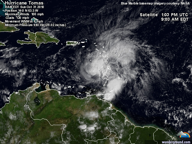
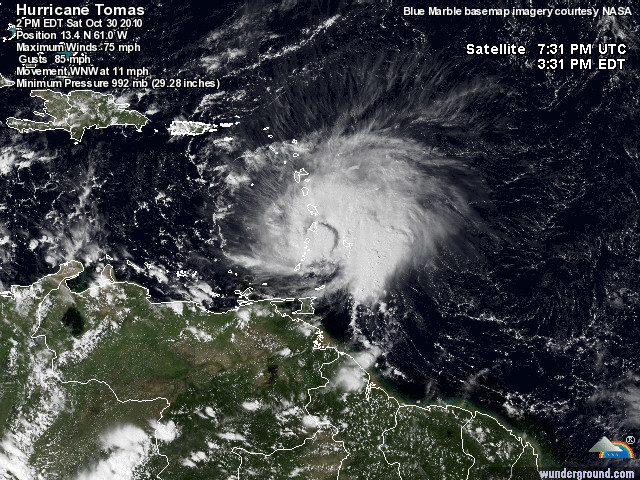
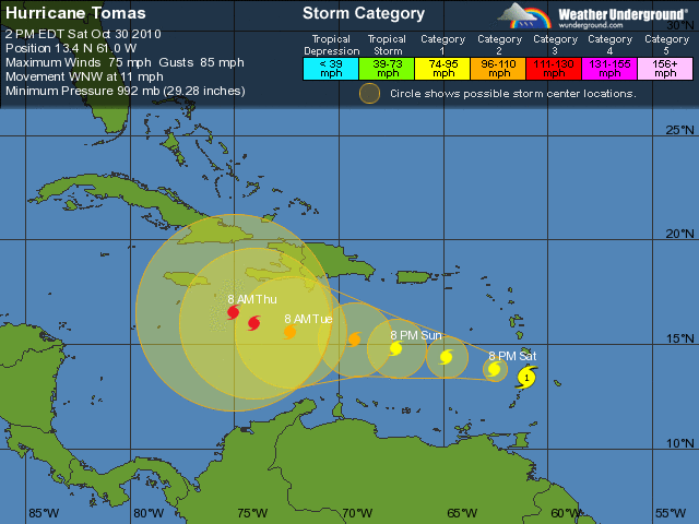
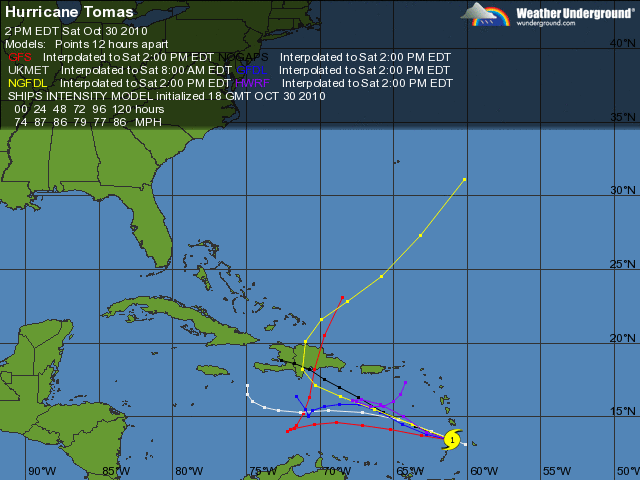
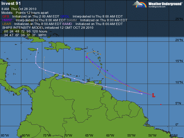
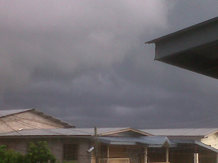
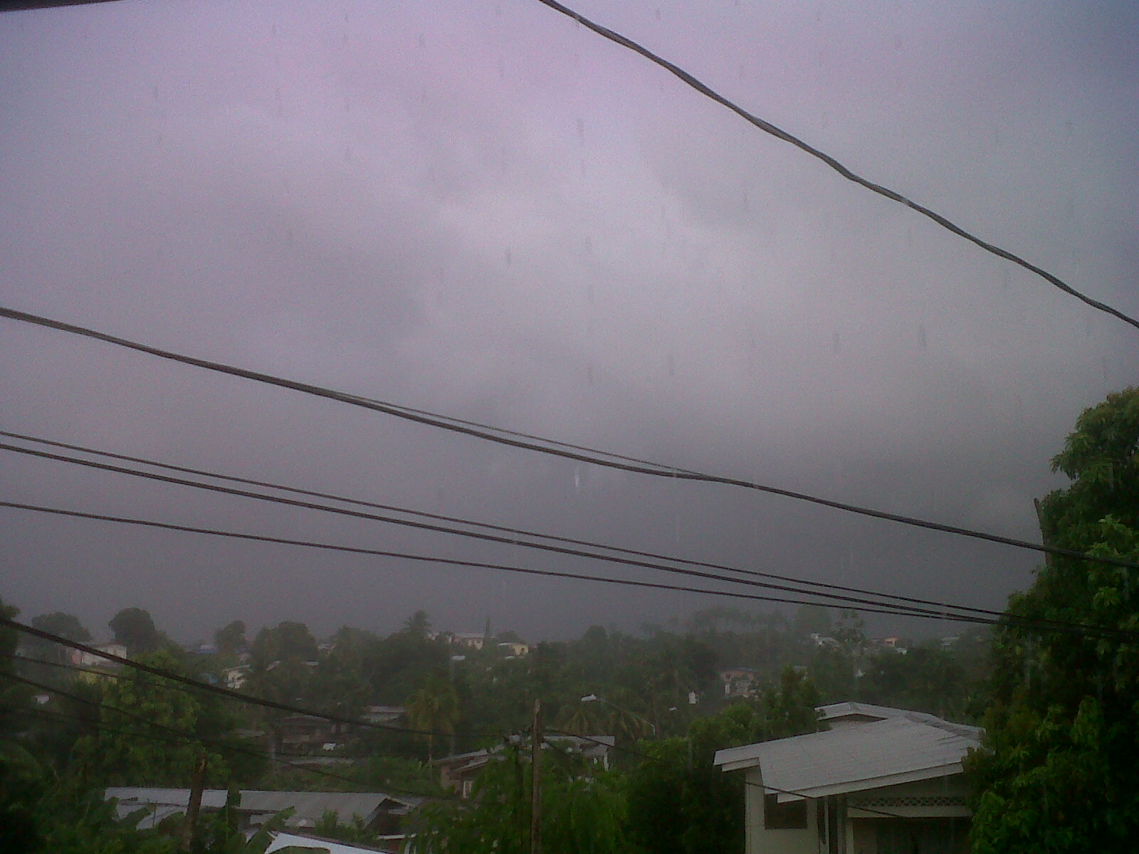
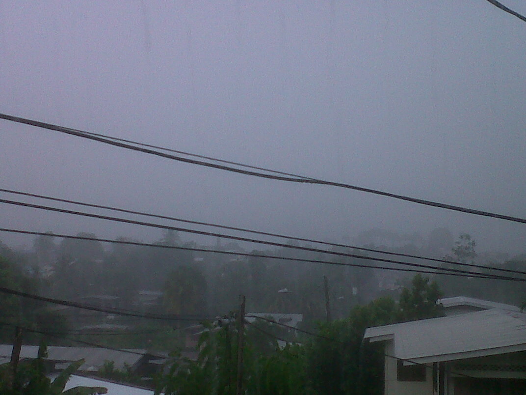
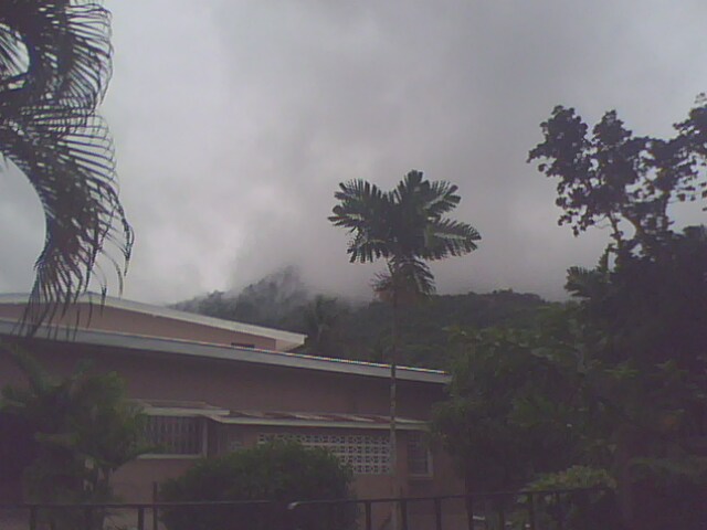
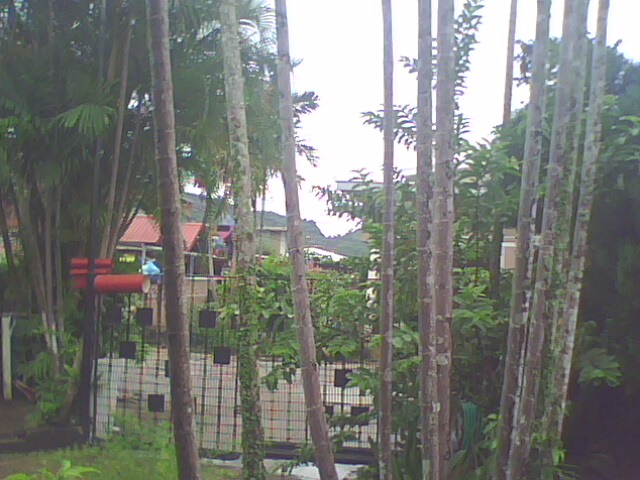
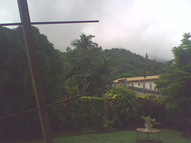
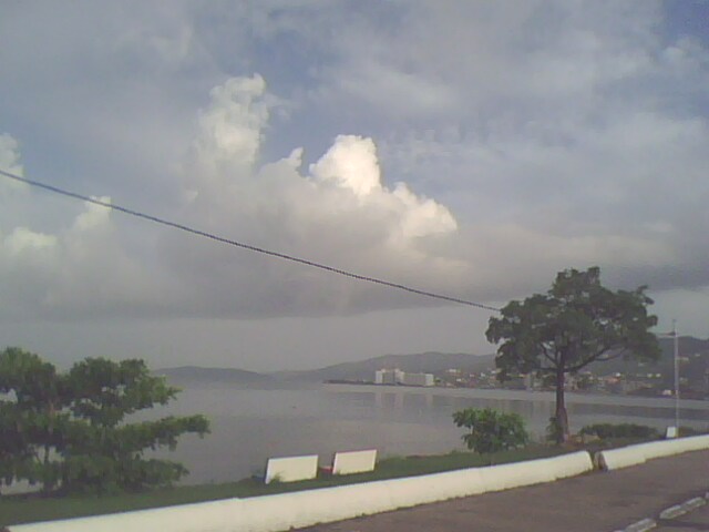
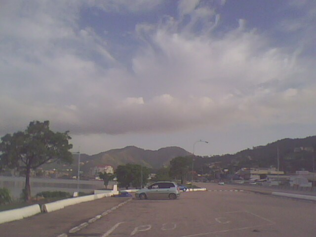
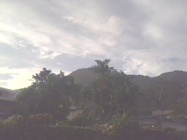
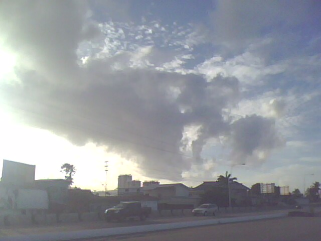
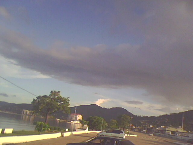
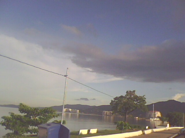
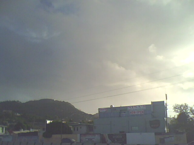
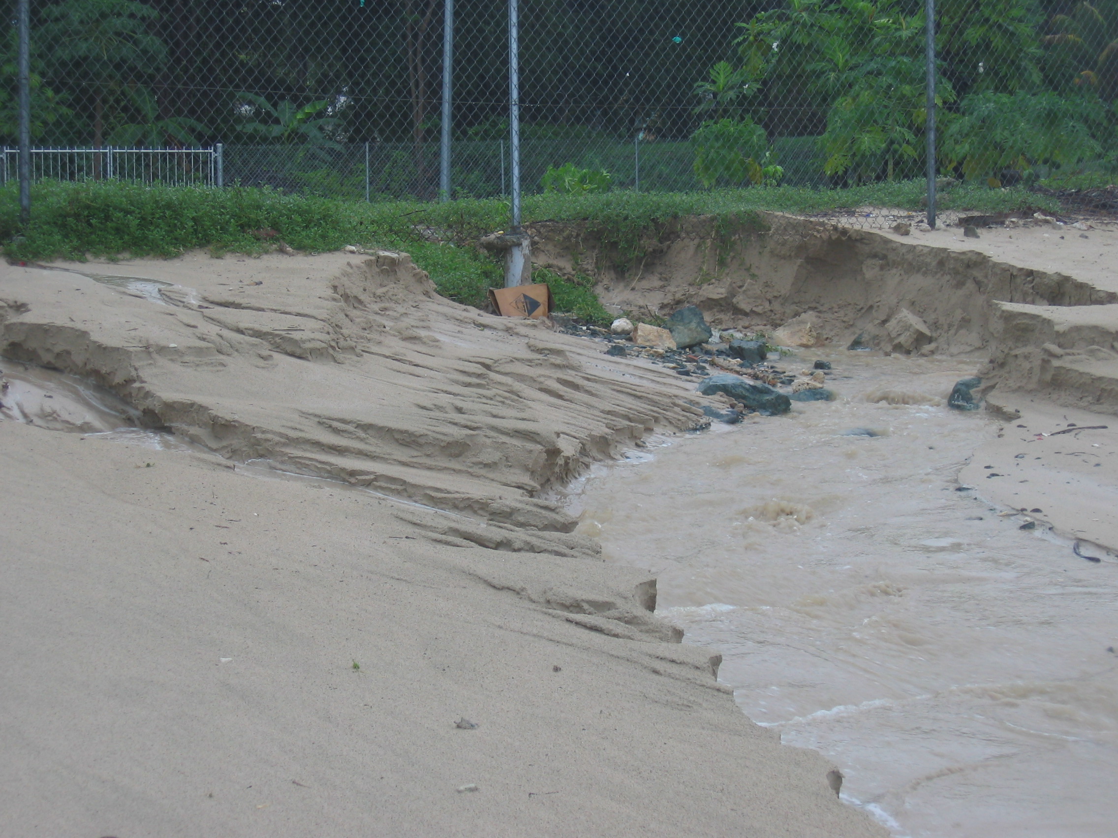