
|
- - - 2010 Hurricane Season - - -
|
- 2011
|
- By "John Fuller" <fullerj at candw.ag>
- Date: Sat, 2 Apr 2011 13:14:57 -0400
|
|
|
|
- Waves again
|
- By eli fuller <eliantigua at gmail.com>
- Date: Thu, 25 Nov 2010 16:21:02 -0400
|
|
Happy Thanksgiving to the Americans reading. The waves are on their way back and all the north and west facing shores should prepare for some heavy ground swell action starting tomorrow evening through the weekend. There is wind this time too so I'll try windsurfing in the waves instead of regular surfing.
Be careful if you are boating.
Eli Fuller
http://www.twitter.com/antigua
http://www.adventureantigua.com
http://www.antiguaisland.blogspot.com
+12687257263
|
|
- High surf advisory
|
- By eli fuller <eliantigua at gmail.com>
- Date: Fri, 12 Nov 2010 11:58:58 -0400
|
|
If you have a boat in the Caribbean you should be aware that some significant ground swell action will be happening Saturday and Sunday. I have seen many boats get into trouble over the years during similar events.
We'll be surfing for the second time in a week. Thankfully on a weekend!
Eli Fuller
http://www.twitter.com/antigua
http://www.adventureantigua.com
http://www.antiguaisland.blogspot.com
+12687257263
|
|
- waves
|
- By eli fuller <eliantigua at gmail.com>
- Date: Mon, 8 Nov 2010 18:02:23 -0400
|
as the forecast predicted, the surf is picking up. Looks like tomorrow may be a good day for a "board" meeting as my friend Ace calls them. This weekend in the Jolly Harbour regatta but with a maximum gust of 5 knots and huge north swells in the forecast some of us may be surfing instead because you don't see a better forecast for that very often. Anyway, for all the non surfers, be careful of large north swells tomorrow, Wednesday and again on the weekend.
--
+1 268 725 7263
http://www.adventureantigua.com
http://www.sailing-antigua.com
http://www.antiguaisland.blogspot.com
http://www.twitter.com/antigua
|
|
- After the storm
|
- By jan farara <janfarara at hotmail.com>
- Date: Mon, 1 Nov 2010 11:50:36 +0000
|
|
A wet start to Independence day!! Funny that most islands seem to have some sort of celebrations around this time. So sorry to hear of damage and loss of life on some islands. We here in Antigua are a bit soggy and our already terrible roads have developed more crevices and potholes and fairly fast running streams, but other than that and our stalled economy we seem to be fine. Antigua used to have a problem growing produce because there was no rain.. now it seems we have too much! Im surprised that no-one has thought of importing wellington boots as they are needed just to go out for a drink. I have my first set of cruise ship visitors to my studio on Thursday and Im hoping that they can navigate the roads. We really need the tourists to have a good experience in Antigua and I wish the government would put roads and the port high on their to do list. The photos of the collapsed road in St Lucia were awful and I hope it doesn't take too long for them to fix it. Lets hope that's the end of the storms though we have another month to go fingers crossed! Jan
|
|
|
- STORMY SUNDAY MORNING
|
- By "MARTHA WATKINS GILKES" <gilkesm at candw.ag>
- Date: Sun, 31 Oct 2010 08:25:54 -0400
|
We woke up to heavy overcast skies and gusty winds and Hugh seas pounding on our door step... The view out to LITTLE COVE - (photo posted last night) shows VERY ROUGH SEAS...
Had a bit of a rough night with the electricity on and off several times and earlier no Internet but am back up for the time.
From Hurricane center:
800 AM AST SUN OCT 31 2010
.TOMAS SLOWLY MOVING AWAY FROM THE WINDWARD ISLANDS...HEAVY RAINS
LINGER OVER MUCH OF THE LESSER ANTILLES...( Which includes Antigua)
So sorry to read it may head towards HATI...
|
|
|
|
- Hurricane tomas in antigua
|
- By Martha Watkins Gilkes <gilkesm at candw.ag>
- Date: Sat, 30 Oct 2010 16:06:51 -0500
|
We did not expect the ROUGH SEAS in Antiuga.. and tomorrow is suppose to BE WORSE... you can compare these shots with what I posted for Hurricane IGOR on Sep. 16th - refer to earlier posting. Very concerned about my coral reef restoration project ( also posted on this on Sep. 16th...) but far too rough to get in the water - last 7 shots show the site...
Barbados is HARD HIT it seems with 75 % without power. Thinking of friends in Grenada St Vincent and St. Lucia...
IMG_5629 LITTLE COVE GETTING ROUGH
IMG_5630
IMG_5633 HALF MOON BAY BEACH ON EAST COAST
IMG_5635
IMG_5640
IMG_5643
IMG_5648
IMG_5650
IMG_5651
IMG_5652
IMG_5653
|
|
|
- IMG00012-20101030-1124.jpg
|
- By "taino" <fullerj at candw.ag>
- Date: Sat, 30 Oct 2010 15:25:15 +0000
|
Blowing
Sent from my BlackBerry® device from Digicel
Attachment:
IMG00012-20101030-1124.jpg
Description: JPEG image
|
|
- Tomas over Barbados
|
- By eli fuller <eliantigua at gmail.com>
- Date: Sat, 30 Oct 2010 06:38:18 -0400
|
|
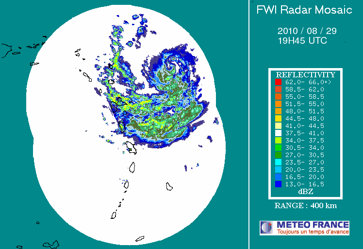
As u can see in this image, the eye of TS tomas passed right over Barbados and they are now about to get the north east side of it.
It looks like we will see some rain from the northern most bands later. This will have caught Barbados with their pants off as one reporter said. I hope everyone is ok. Someone told me that the spaghetti models are all over the place and its anyone's guess where this storm goes after it passes st. Vincent and st. Lucia.
Eli Fuller
http://www.twitter.com/antigua
http://www.adventureantigua.com
http://www.antiguaisland.blogspot.com
+12687257263
Attachment:
201010301000-Mosaique.gif
Description: GIF image
|
|
- "God is a Bajan"
|
- By eli fuller <eliantigua at gmail.com>
- Date: Fri, 29 Oct 2010 21:29:29 -0400
|
|
Looking at squalls stretching from north of us all the way down to Tobago at this hour on radar. Sat maps show Tom looking more like a hurricane now with strongest stuff north of the center going right for Bim. Every time my Bajan friends speak about hurricane season I hear someone say "God is a Bajan" and while I don't ever agree with them, I hope He looks after them over the next 24 hours.
Eli Fuller
http://www.twitter.com/antigua
http://www.adventureantigua.com
http://www.antiguaisland.blogspot.com
+12687257263
|
|
- SUNNY TROPICAL DAY
|
- By "MARTHA WATKINS GILKES" <gilkesm at candw.ag>
- Date: Mon, 11 Oct 2010 14:46:30 -0400
|
|
|
|
IT IS A BEAUTIFUL DAY in Antigua! Nice to have our lovely weather back for the time!! |
|
|
| |
| |
|
|
|
|
|
- IMG00944-20101006-1310.jpg
|
- By "taino" <fullerj at candw.ag>
- Date: Sat, 9 Oct 2010 03:56:13 +0000
|
The boys had a bath
Sent from my BlackBerry® device from Digicel
Attachment:
IMG00944-20101006-1310.jpg
Description: JPEG image
|
|
- IMG00947-20101006-1329.jpg
|
- By "taino" <fullerj at candw.ag>
- Date: Sat, 9 Oct 2010 03:54:18 +0000
|
Even Antigua has waterfalls now
Sent from my BlackBerry® device from Digicel
Attachment:
IMG00947-20101006-1329.jpg
Description: JPEG image
|
|
- BEAUTIFUL SUNSHINE
|
- By "MARTHA WATKINS GILKES" <gilkesm at candw.ag>
- Date: Thu, 7 Oct 2010 09:42:34 -0400
|
 THIS MORNING THE SUN IS OUT IN ALL OF HER GLORY!! THIS MORNING THE SUN IS OUT IN ALL OF HER GLORY!! What a welcome site to dry things out. But a lot of our roads have had damage from the flooding and some are still flooded. At least the sun is out! |
|
|
|
- Tropical Storm Otto dumps rain
|
- By Andre Sharpe <andresharpe1 at gmail.com>
- Date: Wed, 6 Oct 2010 22:59:31 -0400
|
It is raining torrentially at this point. The thunderstorms have subsided a bit, however, the rain is very steady. Many roads are flooded and driving is quite the task. At this rate there could be some degree of flood water damage.
--
Andre
|
|
- DROWNED and wind swept
|
- By "MARTHA WATKINS GILKES" <gilkesm at candw.ag>
- Date: Wed, 6 Oct 2010 21:51:17 -0400
|
Goodness... The heavens have opened up...I spoke to soon on all counts hoping it was passed.... But since my last post it has been a wild ride with the "elements".. Did not have time to even log on.. My power was out from 1 am today until early evening.... And now.. 10 PM the heavens open again to give us showers of blessings ! Which we don't need.. What is this weird system!? |
|
|
|
- Endless rain
|
- By "taino" <fullerj at candw.ag>
- Date: Thu, 7 Oct 2010 00:38:11 +0000
|
Been raining since Saturday. The boys are getting moldy.
Sent from my BlackBerry® device from Digicel
|
|
- TUESDAY IN ANTIGUA
|
- By "MARTHA WATKINS GILKES" <gilkesm at candw.ag>
- Date: Tue, 5 Oct 2010 08:10:43 -0400
|
 To all.. We are slowly getting back to "normal".... The schools are opening today as the weather should continue to improve. There was not much rain during the night and it is not raining now, although our Met Office says we may get light showers off and on. However, here on the highest ridge on the east coast it is still VERY GUSTY and the wind is still coming from the South ( normally comes from the other way!) So I for one will be happy when it settles down as it is a bit annoying to be so "blowy" To all.. We are slowly getting back to "normal".... The schools are opening today as the weather should continue to improve. There was not much rain during the night and it is not raining now, although our Met Office says we may get light showers off and on. However, here on the highest ridge on the east coast it is still VERY GUSTY and the wind is still coming from the South ( normally comes from the other way!) So I for one will be happy when it settles down as it is a bit annoying to be so "blowy"
HAVING SAID that.. Dont like that BIG HOT RED BLOB not too far behind this one! TIME TO DRY OUT! |
|
|
|
- WEATHER REPORT
|
- By "MARTHA WATKINS GILKES" <gilkesm at candw.ag>
- Date: Mon, 4 Oct 2010 08:44:17 -0400
|
They have just announced all schools are closing due to potential flash floods... And they also said the weather will deteriorate more after lunch... So it is NOT A DAY FOR THE BEACH!! Unless you are a duck or a fish! |
|
|
|
- Rain ah rass
|
- By eli fuller <eliantigua at gmail.com>
- Date: Mon, 4 Oct 2010 07:41:01 -0400
|
|
Yes people, the wet stuff is coming down all over the Caribbean at the moment. Friends from Curacao in the south to Barbados in the east r complaining about flash flooding. I feel very sorry for those who came here this week looking for sun. Looks like they may have to wait until much later in the week to get a tan. Very strange weather as seen on radar and sat maps. Winds forecast to be around 20 from the south too.
Told my crew it would b a good day for over the side hull cleaning!
Barnacles don't care about rain.
Eli Fuller
http://www.twitter.com/antigua
http://www.adventureantigua.com
http://www.antiguaisland.blogspot.com
+12687257263
Attachment:
IMG_20101004_073113.jpg
Description: JPEG image
|
|
- RAIN RAIN and MORE RAIN
|
- By "MARTHA WATKINS GILKES" <gilkesm at candw.ag>
- Date: Mon, 4 Oct 2010 05:08:04 -0400
|
IT IS A VERY VERY WET EARLY MONDAY MORNING.. Now 5 am! And I spoke too soon on my last posting as WE HAVE BEEN GETTING POURING RAIN FOR MOST OF THE NIGHT! It is too early to have a local weather report but Looking at the satellite pic looks like we will be in for more rain for the day at least! Some people say we NEED IT but our main road to HALFMOON Bay is STILL flooded from
Hurricane EARL requiring a diversion through Freetown Village... Am sure that low area will MUCH DEEPER now! At least it is RAIN and not WIND! |
|
|
|
- RAIN
|
- By fullerj at candw.ag
- Date: Mon, 4 Oct 2010 02:40:30 +0000
|
Fantastic rain here now
Sent from my BlackBerry® device from Digicel
|
|
- no stormy weather
|
- By "MARTHA WATKINS GILKES" <gilkesm at candw.ag>
- Date: Sun, 3 Oct 2010 14:30:46 -0400
|
WE HAVE BEEN EXPECTING BAD WEATHER THIS WEEKEND ON THE ROCK FROM ALL REPORTS -- WIND GURU/ ETC
But SO FAR other than some hard rain yesterday it is just
Overcast and gray with the odd wind gust and the wind out
Of the south which is not our norm! So hopefully we will continue to have NOTHING MUCH!! |
|
|
|
- Quiet stress.
|
- By jan farara <janfarara at hotmail.com>
- Date: Thu, 30 Sep 2010 19:07:44 +0000
|
|
How can a quiet hurricane free summer be stressful? I don't know. I think its the STUFF that is packed away in case . Not having a fully functioning patio...half our house. All my cushions on the patio are white canvas and after one heavy rain they are brown and its 2 days work to wash them and put them back on, or we are rushing around in the middle of the night rescuing them. Normal straight down rain is fine, similar to the kind we have been getting for the last month almost every night. Its the instant horizontal kind that our house doesn't like!!! I love plants growing but we grow mostly weeds The few fruit trees that were planted earlier this year were cut down by my stepson, you know...earplugs in ,lawn mower going, brain not engaged. But he planted them . How do you forget that you planted trees.!!!. Do I put everything back together or not? When do I put everything back.? More problems . Antigua has a big garage sale on Saturday and deciding what to get rid of...or not. My husband finds getting rid of electrical things that he doesn't need and never used very difficult. I need a crystal ball. Does anyone know when the economy in the Caribbean will improve? Even my little dog is stressed as the HUGE nexdoor puppy likes our house. Max retreats upstairs as he knows the puppy is definitley not smart enough to climb...YET!! Jan
|
|
|
- Beautiful summer days In Antigua
|
- By "MARTHA WATKINS GILKES" <gilkesm at candw.ag>
- Date: Thu, 30 Sep 2010 07:53:15 -0400
|
Just to say we are having beautiful summer days on the rock just now! Sea is lovely and calm with gentle breezes! Hope it stays this way for the rest of the season..but we know we still have some weeks left in the "H" Season!
|
|
|
|
- LISA HAD BEEN NAMED!
|
- By "MARTHA WATKINS GILKES" <gilkesm at candw.ag>
- Date: Tue, 21 Sep 2010 19:04:33 -0400
|
AT LEAST she is already NORTH OF THE LEEWARDS so wont pose a threat! We REALLY REALLY need a break so thank goodness!! But tis the season!! That is why we watch daily with the greatest interest!! ( kind of like playing a game of batgammon.. but with waves moving round the big blue sea!!) -
From National Hurricane Center...
...LISA GETTING BETTER ORGANIZED AS IT DRIFTS NORTHWARD OVER THE FAR EASTERN TROPICAL ATLANTIC...
|
5:00 PM EDT Tue Sep 21
Location: 18.3°N 31.6°W
Max sustained: 45 mph
| |
|
|
|
- "best 7 days of surfing ever"
|
- By eli fuller <eliantigua at gmail.com>
- Date: Mon, 20 Sep 2010 09:23:18 -0400
|
Antiguan surfers usually are not as happy as those in Barbados or Tobago, but this week they were over the moon with the gifts that Hurricane Igor sent to them. For seven days they surfed non stop at beaches all around the island. I even managed to get some of the smaller fading waves over the past two days. My wife shot a few images here: http://antiguaisland.blogspot.com/2010/09/best-7-days-of-surfing-ever.html
On another note, I feel for the people and the ecology of Bermuda. While the comparatively wealthy island will bounce back in no time, i'm sure the reefs and marine environments will not be the same for a very long time.
Was anyone else amazed by the amount of US coverage Bermuda got? Can you imagine CNN and all the other networks spending as much time and money on a storm report from a place like Dominica?
|
|
- ta daaaa
|
- By eli fuller <eliantigua at gmail.com>
- Date: Sat, 18 Sep 2010 08:31:04 -0400
|
According to the long range (180 hour) animated forecasting tool from magicseaweed, the Atlantic will be relaxed over the next week. This would be good news because it feels like we have had way too much to be concerned with lately. The stress of storms tugs away at you even when there's no threat to your little island. With all the media coverage of Igor, we are all very concerned about Bermuda and with very good reason. Igor is very large even though it has weakened. We are still getting swells and winds from that storm even though it totally missed us.
My wife spent two weeks there on a sea turtle study in Bermuda, and you just know something like this will be bad news for all of them too!
Check the seaweed for some good news even though it may be short lived: http://magicseaweed.com/msw-surf-charts2.php?chart=22&res=750&type=wind&starttime=
--
+1 268 725 7263
http://www.adventureantigua.com
http://www.sailing-antigua.com
http://www.antiguaisland.blogspot.com
http://www.twitter.com/antigua
|
|
- STILL IGOR ON OUR ISLAND
|
- By Martha Watkins Gilkes <gilkesm at candw.ag>
- Date: Sat, 18 Sep 2010 07:23:27 -0500
|
Goodness.. as they say, it "aint over till the fat lady sings"...and she does not seem to be around!
Many don't think of the sea damage from these storms...the turtle nests lost along the beaches due to high surge, the coral and reef damage... see below for an effort yesterday where in spite of rough seas we worked all day trying to save coral nearly smothered by sand from Hurricane EARL AND IGOR.. heading back now to do more on this effort! Glad i am not a delicate coral in this rough sea!
IGOR is not finished with us yet and from last night we have been getting outer bands of whipping winds lashing us --still going on this morning - Our met office reports wind/rain/ rough seas with small craft warning still! So looks like we are in for a windy/ possibly wet weekend!  At least it is now a CAT 2 as it heads toward Bermuda! At least it is now a CAT 2 as it heads toward Bermuda! |

POOR LITTLE PRETTY CORAL.. nearly smothered in HURRICANE SAND
sand covering the coral grid
SAND COVERING THE CORAL
BROKEN CORAL
BLOWING SAND OFF THE CORAL
USING SCUBA AIR TO BLOW OFF SAND
|
|
|
- FRIDAY EARLY MORNING ON THE ROCK
|
- By "MARTHA WATKINS GILKES" <gilkesm at candw.ag>
- Date: Fri, 17 Sep 2010 07:23:34 -0400
|
IT IS A GRAY OVERCAST DAY ! AND IF you look at the SAT photo on STORM CARIB it is no surprise as it looks like there is a blanket over us from the outer bands of YOU KNOW WHO.. That ugly thing..I wont even say the name!! But he seems to be hunched over us ... I will sure be glad when he moves on for good....and we get back to "normal".. .although I DONT LIKE this below.. But then we know we are still in the prime time of hurricane season ( actually SEP 10th IS THE HEIGHT.. But it sure is not OVER!!)
From DAVES COMMENTS on the STORM SITE!!!....
10N, 40W: Next area to pay attention too. Maybe south into the Central Caribbean. Maybe a curve to the Northern Antilles. Hmmm.
African coast: Very active with next round of pretenders waiting to take their shot! 10-14 days.
Bottom line: Over 40% of season still remains. Fortunately, with the amount of activity and strength of storms, for the most part, it has been lacking in severe damage, injuries, and fatalities. This "lucky" scenario will not last long I believe. They say beware the Ides of March. If there are Ides in October and November, I'll beware them this season. Previous storms have taken immense amounts of energy from the sea surface but heat goes well below!
Meanwhile.. For me great news. ONE OF THE VICTIMS OF HURRICANE EARL WAS THIS BEAUTIFUL TREE.... The most spectacular tree in my garden..
a RAINBOW SHOWER TREE 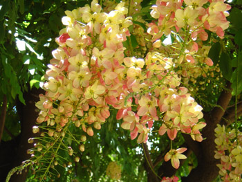
"Gorgeous tropical tree having long clusters of yellow to pink flowers". IT WAS KNOCKED FLAT and was chained sawed with about 2 feet of the stump left! ( GUESS IT SERVES ME RIGHT FOR BEING OFF ISLAND AND NOT HERE TO TRY TO CLEAN UP!!) however...
THIS MORNING THERE IS A TINY SPROUT coming out!! ALAS.. SO WE WILL HAVE
FLOWERS AGAIN IN DUE COURSE!  |
|
|
|
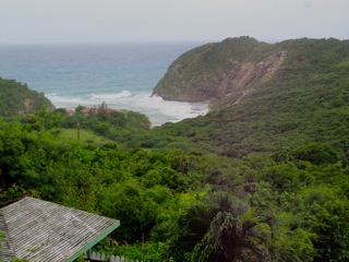
- HALF MOON BAY BEACH
|
- By Martha Watkins Gilkes <gilkesm at candw.ag>
- Date: Thu, 16 Sep 2010 10:15:25 -0500
|
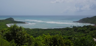
BIG ROLLERS are coming in today at HALF MOON BAY on the Atlantic side just below my house.... as you can see here. They say Hurricane Earl will be the nearest to antigua at 1 am tomorrow FRIDAY so we expect to continue to see rough seas.... bad for our beautiful beaches and of course the nesting turtles and the delicate sea creatures. Otherwise it is a sunny day with light winds.
|
|
|
- IGOR
|
- By Steve Coghlan <steve at candw.ag>
- Date: Thu, 16 Sep 2010 09:14:57 -0400
|
Large sea swells and intermittent rain showers
are the only real effects that we are feeling at the moment, as
powerful Hurricane Igor meanders past us to the NE. Winds are
light and variable from the NW and West.
Satellite images invoke memories of 1995, when Luis impacted us so
strongly. Our thoughts and best wishes go out to the folks in
Bermuda who are making preparations to possibly face the full
effects of this storm later in the weekend.
|
|
|
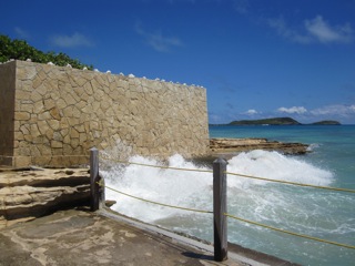
- antigua ROUGH SEAS TODAY
|
- By Martha Watkins Gilkes <gilkesm at candw.ag>
- Date: Wed, 15 Sep 2010 12:34:27 -0500
|
WE HAVE VERY ROUGH SEAS TODAY AS YOU SEE...AND THE VIEW TO LITTLE COVE FROM MY HOUSE IS ROUGH.. THE SHOT WITH THE COCKATOO IS HOW THE COVE USUALLY IS .. VERY CALM.. WE ARE JUST THANKFUL WE ONLY HAVE WAVES AND NO WIND! Otherwise it is sunny and a lovely day..just dont go body surfing!
IMG_5347
IMG_5348
IMG_5358
IMG_5370
IMG_5372
IMG_5375
IMG_5378
IMG_5381
IMG_5387
IMG_5403
IMG_5404
IMG_5407
jpg00030
|
|
|
- IGOR turns...
|
- By Alan Scholl <scholla at candw.ag>
- Date: Tue, 14 Sep 2010 20:03:58 -0400
|
At 18.8N Mr.Igor has followed the expected turn north. While I had confidence
in the models, I could not help but wonder for a bit if we would have
experienced more of IGOR than anticipated. Many of us here are breathing a sigh
of relief tonight, I hope this is the last of the big ones. I expect a few more
spun of the African coast but hopefully no major storms!

 at Eli, wishing your dad a speedy recovery!

Alan S
|
|
- An update on the Captain and the weather
|
- By eli fuller <eliantigua at gmail.com>
- Date: Tue, 14 Sep 2010 19:42:38 -0400
|
|
The last time I wrote here I mentioned that I was in Barbados looking after my dad who was about to get angioplasty. The op didn't go well and we were air lifted to Miami's Baptist which is one of the best cardiac hospitals in the world. They were amazing!
With support and love from around the world the procedure to his heart went well yesterday.
Thanks so much everyone. Dad was released today and was in a fishing store with his wife and my sister when I last spoke to him in Miami!
I flew back to Antigua today and could see hurricane swells rolling in from the Atlantic as we flew up past St. Martin towards Antigua. Before sunset I could see some of these swells breaking on the outer reefs on the north side. I guess all my surfing friends will have been scoring some waves today. Can imagine it will be better tomorrow. There is a warning about these swells on the nhc site. They will be around for a few days. The sunny light winds made it a lovely afternoon here.
Am sure dad will be posting here again at any moment.
Hopefully not about any storms getting too close yo Antigua. Thank God he's ok and thank God we've dodged another hurricane.
If you are a smoker reading this please know hurricanes are no where near as deadly as your "habit". Its never too late to stop and your life is worth it.
Eli Fuller
http://www.twitter.com/antigua
http://www.adventureantigua.com
http://www.antiguaisland.blogspot.com
+12687257263
|
|
- There certainly is a God!
|
- By "MARTHA WATKINS GILKES" <gilkesm at candw.ag>
- Date: Tue, 14 Sep 2010 19:25:19 -0400
|
I AM WEATHER WORN.... And hope to have a break for a while! We are getting
Big surge action now around some of our coast.. But that is all!
Antigua...  and the Leeward Islands - and it seems all islands, except perhaps Bermuda....... Have been spared of the wrath of IGOR the terrible... and the Leeward Islands - and it seems all islands, except perhaps Bermuda....... Have been spared of the wrath of IGOR the terrible...
If you WIKIPEDIA the name IGOR it will make your hair stand on end as he did terrible things ( mainly to beautiful young women)  as a villain - usually a hunch backed assistant to Frankenstein or Count Dracula etc... as a villain - usually a hunch backed assistant to Frankenstein or Count Dracula etc...
.. See the link below.. So it is no shock that he turned into something so terrible as he danced towards our little paradise.
( who names these things anyway!! Humbug on him/them  for putting that name in the 2010 Hurricane season..) for putting that name in the 2010 Hurricane season..)
Check out
I grew up in the deep south as a Southern Baptist... And went to church almost as many times as the Preacher did... And can probably recite almost as many bible verses as the preacher can! Along the way, as many do, I stopped walking the straight and narrow but I can tell you last night with this killer hurricane coming our way I have never prayed as hard for anything as I did for that NORTH TURN promised by the Hurricane Center! I called all my friends who have a link to the Almighty to please pray too and my southern ma-ma still living in the Bible belt of the deep south called out all her prayer group to join it! Whatever worked.. That or the forces of nature I AM THANKFUL!! I have seen enough hurricane action to last a lifetime.. .but I seem to be destined to witness more!
I have been through the eyes of four hurricanes... Three on the ground in Antigua: The eye of LUIS, category 4, Sep 4th /5th 1995 ... GEORGES, 1998 and Jose in 1999 ( followed by the very odd and late season ( in November) LENNY - not an eye but a weirdo- that's another story for another time) and
Hurricane Fabian ( when I flew through the eye with the Hurricane Hunters as it was about to hit Bermuda) At this point, Fabian was at its strongest: a Category 4 hurricane with a peak flight-level wind (at 10,000 feet) of 140 knots and a sea-level pressure of 942 millibars. I feared for my Bermuda buddies then as I do NOW!
If you want some heavy reading of hurricane destruction and then get up and go after....... On Storm Carib go to ARCHIVES and click on 1998 GEROGES and SPECIAL reports by special reports - and then Antigua... And SCROLL WAY DOWN.. You will finally come to a rather lengthily missive I wrote after the destructive hurricane..
Date: thus, 24 Sep 1998 12:07:43 -0300
From: MARTHA WATKINS GILKES (gilkesm at candw.ag)
Subject: LIFE AFTER HURRICANE...
Dear Friends September 24th, 1998
I write you this with a heavy heart as it has been such a traumatic time
Going through this dreadful Hurricane George's
Rereading this makes me want to get down on my knees and be double thankful TONIGHT I am not walking in my shoes again as above... And thankful I will wake up to a slightly hurricane hit surroundings from EARL.. But not to the destruction Wicked IGOR would have wrought!
I sure hope this IS IT FOR the 2010 HURRICANE season even if we are NOT AT THE END of the season ( remember Lenny in mid NOVEMBER !!)
Hope I won't be recounting any weather action to any of you till next year !!
Thanks to all who care about us on the rock and whose HEARTS ARE WITH US.... We know you are and that helps as we know we are not alone!! - like the song!!!
When you walk through a storm
Hold your head up high
And don't be afraid of the dark
At the end of the storm
Is a golden sky
And the sweet silver song of the lark
Walk on through the wind
Walk on through the rain
Though your dreams be tossed and blown
Walk on walk on with hope in your heart
And you'll never walk alone
You'll never walk alone
ON WARDS AND UPWARDS as they say! |
|
|
|
- TUESDAY MORNING IN ANTIGUA
|
- By "MARTHA WATKINS GILKES" <gilkesm at candw.ag>
- Date: Tue, 14 Sep 2010 07:25:33 -0400
|
It is a beautiful morning again today and we wake up with the great news that HURRICANE IGOR is now making that slight turn and is 285 degrees and as The Hurricane center is reporting:
SUMMARY OF 500 AM AST...0900 UTC...INFORMATION
----------------------------------------------
LOCATION...17.9N 51.7W
ABOUT 750 MI...1205 KM E OF THE NORTHERN LEEWARD ISLANDS
ANTIGUA IS 17.1 so this is making us feel much more "secure" in not being blasted....
"but as Gert says, it needs to get over that 18 degree latitude hump before we start breathing a sigh of relief." so we await the 11 a.m. Details hoping to see that continued turn. Thankfully STORM JULIA seems to be destined to stay far out in the Atlantic also. But of course the hurricane season is NOT OVER yet!
We do expect some strong sea swells and can see this slightly starting as I look out to the Atlantic from my view point...
Good news also that Lawyer Fuller is doing better ( see earlier postings) so await words of wisdom from the back room boys in due course!
|
|
|
|
- WATCHING AND WAITING
|
- By "MARTHA WATKINS GILKES" <gilkesm at candw.ag>
- Date: Mon, 13 Sep 2010 17:31:17 -0400
|
It is pretty nerve wracking to watch this monster storm on our doorstep! ( and I am usually a pretty cool calm person)....but this is SUCH a killer storm - Heaven help those in the path! ( and I am usually a pretty cool calm person)....but this is SUCH a killer storm - Heaven help those in the path!
I am "trusting" in the TURN all but one of the models are showing...... But still getting "sort of" ready... Already been to the grocery store to stock up.. And we are pulling our boat up on higher ground this afternoon as Nat. Hurricane Ctr saying Antigua will start getting big swells tonight. Cant wait until the 11 p.m. Advisory to see if the turn HAS STARTED... And bet I will wake up at 2 am to ck on that one! Have dear friends in Bermuda so certainly hope that is not in Igors path! |
|
|
|
- The Devil's eye
|
- By Alan Scholl <scholla at candw.ag>
- Date: Mon, 13 Sep 2010 15:28:21 -0400
|
Looking at Hurricane IGOR brings backs some LUIS memories. The eye is clearly
defined, this I call the Devil's eye. All the models predict a more northward
track with a turn expected within a day or so, I hope they are right this time,
not sure the Eastern Caribbean can take a hit from a Cat4 storm to further add
to our economic woes! There is no strong High north of the system so I expect
it's predicted turn, however, our friends in Bermuda may have a nasty one
headed there way. I assume by now preparations are well under way!

Alan S
|
|
- MONSTER HURRICANE IGOR
|
- By "MARTHA WATKINS GILKES" <gilkesm at candw.ag>
- Date: Mon, 13 Sep 2010 06:03:51 -0400
|
This early morning wake up on Antigua is our typical beautiful start to the day... Very quiet and calm.. Hard to believe there is the CAT 4 hurricane barreling directly at us... WITH A NORTH TURN PREDICITED. As mentioned before we certainly hope for that TURN as this strong of a hurricane would blow us all apart with great devastation. So anxiously watching each update for
The track. 1995 LUIS was a cat. 4 and it did terrible damage. Our local weather has not mentioned this at all ... I think after all the activity lately they don't want to alarm people...
Will be keep watching this!
|
|
|
|
- IS JULIA FORMING
|
- By "MARTHA WATKINS GILKES" <gilkesm at candw.ag>
- Date: Sun, 12 Sep 2010 09:27:38 -0400
|
Looks like the Leewards will be lucky with a north turn of IGOR ( I will still feel happier with a bit more of a NORTH CURVE) Lets keep watching 
... But goodness IS JULIA RIGHT BEHIND!?? As something is forming and the Hurricane Center has noted it... Also the weather channel talking about it.
Today is sunny and DRY which is great for getting CLEANED UP and drying wet "things"... Planning a lunch party next Sunday and can you imagine my invites say "PENDING NO HURRICANE".... The price of living in paradise! |
|
|
|
- WEATHER AND JOHN FULLER
|
- By "MARTHA WATKINS GILKES" <gilkesm at candw.ag>
- Date: Fri, 10 Sep 2010 11:09:49 -0400
|
So sorry to read Elis Posting on Lawyers Fuller heart problems but happy they
Caught it and are dealing with it NOW... For us "old timers on STORM CARIB".. John
( and I) were THE START ( in 1996!) way back when Gert had the brilliant idea to create a STORM CARIB REPORTING SITE! So FOR SURE THE BOYS IN THE BACK ROOM AND STORM CARIB need him around!
He is also one our top lawyers on the island...and was the lawyer/defender of the dolphins when I lead a big legal battle over some low life's trying to capture 12 wild dolphins annually in Antigua waters! LAWYER FULLER won that battle - this is a bit on that for you "marine mammal lovers"...
SO I WISH HIM WELL IN HIS SPEEDY RECOVERY and will look forward to a BACKROOM BOYS STORM CARIB PERSONAL REPORT soon! |
|
|
|
- Under the weather in Barbados
|
- By eli fuller <eliantigua at gmail.com>
- Date: Fri, 10 Sep 2010 08:38:30 -0400
|
|
I joined my dad (john fuller) four days ago on a trip down to Barbados. Its been raining for much of the time and there's been flood watches too. After another night and morning of rain I see some blue skies out there now trying to turn today into a sunny one. We have not been here for sun though. We're here to see a heart specialist.
After some tests, an agiogram and consultations with other specialists in Miami a decision to stint today was made. Bypass isn't an option.
The old man will be fine but he needs to stop smoking at the very least. The few "boys in the back room" that are left need the captain to keep looking east.
Will give an update on the conditions in Barbados at noon.
Eli Fuller
http://www.twitter.com/antigua
http://www.adventureantigua.com
http://www.antiguaisland.blogspot.com
+12687257263
|
|
- IGOR on THURSDAY morning
|
- By "MARTHA WATKINS GILKES" <gilkesm at candw.ag>
- Date: Thu, 9 Sep 2010 07:17:59 -0400
|
defiantly like the MODELS for IGOR shown on Storm CARIB - on the right of IGOR TOOLS - all showing a NORTH TRACK like the "good old days" of the earlier storms this season... But check out that weird light green line .... Looks like a odd minded "LENNY storm" for those who remember Lefty Lenny!
TOMORROW - September 10th is the PEAK of hurricane season! Happy to wake up today to a beautiful very calm day in "Paradise.".. |
|
|
|
- IGOR IS BORN!!!
|
- By "MARTHA WATKINS GILKES" <gilkesm at candw.ag>
- Date: Wed, 8 Sep 2010 19:09:49 -0400
|
 NOT HAPPY TO SEE that TROPICAL STORM IGOR is on the loose! born earlier today! NOT HAPPY TO SEE that TROPICAL STORM IGOR is on the loose! born earlier today!
Check the NHC .. which reports :
THE NATIONAL HURRICANE CENTER IS ISSUING ADVISORIES ON TROPICAL
STORM IGOR...LOCATED ABOUT 80 MILES SOUTH OF PRAIA IN THE CAPE
VERDE ISLANDS.
LOCATION...13.9N 23.9W
PRESENT MOVEMENT...W OR 275 DEGREES AT 6 MPH
THIS IS still a LONG way from the Leewards.. but many of the models show the same track as YOU KNOW WHO.. and then who..and finally who .....( or last 3 visitors!)
Too early to have LOCAL reports..and i am sure they dont want to freak people out... ( i dont want to either.. but HEADS UP!!! better to be over prepared!
Check out Intellicast track!
|
|
|
|
- BEAUTIFUL MORNING IN ANTIGUA
|
- By "MARTHA WATKINS GILKES" <gilkesm at candw.ag>
- Date: Tue, 7 Sep 2010 06:52:30 -0400
|
Woke to our usual beautiful tropical morning with the sunrise sharing beautiful oranges and pinks...and our birds singing... Had the odd rain shower off and on during the night but not much to "write home about"! AND IT SEEMS the Atlantic is calm for the next few days at least! Also great news that it seems Gaston WONT reform and hit other islands in the path! ON WARDS AND UPWARDS to getting back to "normal" on the rock!  |
|
|
|
- Flying into the eye of a HURRICANE!
|
- By "MARTHA WATKINS GILKES" <gilkesm at candw.ag>
- Date: Mon, 6 Sep 2010 21:28:07 -0400
|
sort of IRONIC that Gaston is dancing around me on the SAME DATE ..but hopefully as only a big PUFF...
Hope I have only good news when we all wake up tomorrow! |
|
|
|
- QUIET ON THE HOME FRONT
|
- By "MARTHA WATKINS GILKES" <gilkesm at candw.ag>
- Date: Mon, 6 Sep 2010 19:53:01 -0400
|
Things are very quiet now.. Waiting on the 8 p.m. Advisory... We did have on the East coast...( the first to get things) a first wave of rain showers  about an hour ago...and our met office says the main activity will be in the early morning hours ... Mainly rain.. But some wind gusts up to 30 knots.... NOTHING LIKE Hurricane EARL .... But if the rain is heavy some of the low lying areas may have problems! Only September 6th and the 10th is THE PEAK!! So we have to stay alert as all of us "seasoned hurricane watchers" know.... P.S. Wonder what the back room boys are up to... They are so quiet.. No good am sure!! about an hour ago...and our met office says the main activity will be in the early morning hours ... Mainly rain.. But some wind gusts up to 30 knots.... NOTHING LIKE Hurricane EARL .... But if the rain is heavy some of the low lying areas may have problems! Only September 6th and the 10th is THE PEAK!! So we have to stay alert as all of us "seasoned hurricane watchers" know.... P.S. Wonder what the back room boys are up to... They are so quiet.. No good am sure!! |
|
|
|
- the fat lady clears her throat
|
- By eli fuller <eliantigua at gmail.com>
- Date: Mon, 6 Sep 2010 08:07:53 -0400
|
|
I don't think i remember a tropical wave ever giving people so much stress. Of course to simply call the group of clouds just east of us a tropical wave without elaborating would be unfair. This thing did turn into a depression and then briefly into a tropical storm before it hit some dry weather and fizzled back to a tropical wave.
I was one of the people stressed out about it mainly because we had just been hit by strong tropical storm conditions from Hurricane Early which passed north of us. The reminder of what these things can do if given the chance to catch you off guard was still fresh in our minds. With some of the original forecasts suggesting that Gaston would give us worse than Earl did, stress was a modest description of what went on with many of us.
Thankfully the dry air and cooler waters chilled out Gaston all the way back down to a strong tropical wave giving us some relief from the post earl stress syndrome. The NHC and many others kept on suggesting that this wave would get stronger and at one point gave it a 90% chance of developing into a tropical depression. The stress levels rose again.
Even now with it very close to us people are worried about it regenerating. I may be crazy, but at this point I am not worried about the tropical wave that was once a tropical storm. It looks like most of the cloud activity has gone a bit north, it looks like it isn't organizing very well, and its too close to turn into a dangerous hurricane.
I can just hear some people "chupsing" at the last statement. Of course a tropical wave can turn into something very dangerous very quickly. Flooding alone from a tropical wave could cause problems, but not this one. I think the fat lady is singing already here in Antigua about the wave that was once Gaston.
|
|
- NEXT STORM/ HURRICANE ??
|
- By "MARTHA WATKINS GILKES" <gilkesm at candw.ag>
- Date: Sun, 5 Sep 2010 21:41:52 -0400
|
GOODNESS what is going on with this hurricane season!! I have been "walk about"...like crocodile DUNDEE ...during the last week in the Cayman Islands ( was remote on a boat at sea so did not even have Internet and missed the action! ) and missed EARL but returned home to a trashed garden and others having more serious damage... Some sinking boats etc.... And now we may have something else dancing around us! 
Some seem to think it is all over... BUT
I say WATCH OUT.. Have just researched several sites....including National Hurricane Center
And ACCUWEATHER and of course STORM CARIB.. And there are conflicts.. BUT GASTON MAY WELL REFORM and be on our doorstep in about 40 hours... Around NOON ON TUESDAY.. So HEADS UP is what I say.. And be ready.... Any problems you had during EARL... Clean it up NOW in case..... Just checking some leaking areas I had now!!  HEY all.. Please stay alert.... HEY all.. Please stay alert....
|
|
|
|
- Sunsets
|
- By jan farara <janfarara at hotmail.com>
- Date: Sun, 5 Sep 2010 21:43:32 +0000
|
|
Soo glad that Gaston seems to gone bye,bye!! A lot of friends have had power on and off as trees seem to have been causing a problem with the wires, a lot of problems for such a mild hurricane...as hurricanes go. Patio furtiture is back out inluding the windchimes. Rainy and grey today but no wind and the temp is a lot cooler. Attaching a painting I started the day after the storm Just caught a squall at sunset off the coast. Also 2 small ones of our usual weather!!!!!Jan
|
Attachment:
DSCN0545.JPG
Description: JPEG image
Attachment:
DSCN0375.JPG
Description: JPEG image
Attachment:
DSCN0373.JPG
Description: JPEG image
|
|
- the only certainty is that we need to be prepared
|
- By eli fuller <eliantigua at gmail.com>
- Date: Thu, 2 Sep 2010 08:59:32 -0400
|
|
Yesterday, Gaston was named out in the Atlantic shortly after windguru started saying Antigua was going to be getting hurricane conditions next tuesday/wednesday. People started stressing right away as is normal when a storm forms out east of us and starts looking like it wont go North into the Atlantic. We have already seen the model tracks jump around a bit as well as the predicted strengths. Nobody can be sure where this storm will end up or even if it will hit anywhere in the Caribbean, BUT we must prepare for a direct hit just in case that id happens. In fact, I would tell anyone from Grenada north to get your hurricane plans in order for this storm of the next one. We will have to wait and see and i'm sure that you will see constant reports on this site over the next few days. This link gives you an idea of the prediction models. As you can see several have Gaston going South of Antigua and some have it going North. This can only mean that we need to be prepared. I am going to my mom's house today to help get it more prepared than it was for the tropical storms conditions that we experienced in Hurricane Earl. More to come.
|
|
- Hurricane Blvd?
|
- By Alan Scholl <scholla at candw.ag>
- Date: Wed, 1 Sep 2010 18:37:03 -0400
|
With FIONA gone, GASTON has us in his crosshairs! The tracks will once again
bring him pretty close to Antigua and Barbuda, this week has certainly returned
our reputation as Hurricane Alley as we have four storms develop in 11 days.

Windguru.cz indicates 60knots gusting to 74 knots on Tuesday Sep 7th at 2000UTC
4PM local. They have accurate over the last two storms so this time we are in
for some wind if they are correct!

Alan Scholl
|
|
- SOMEWHAT QUIET
|
- By Andre Sharpe <andresharpe1 at gmail.com>
- Date: Wed, 1 Sep 2010 07:41:09 -0400
|
No major events occurring thus far. It rained a bit earlier here on the north of the island but everything else is calm. A bit overcast and the temperature is quite cool. Expecting a bit more rain later on.
--
Andre
|
|
- Change
|
- By eli fuller <eliantigua at gmail.com>
- Date: Wed, 1 Sep 2010 06:41:01 -0400
|
|
We haven't had winds over 5 knots in Jolly Harbour in 24 hours. I see they had some light rain on d north side, but nada here. Radar showed heavy rains sitting just offshore since about 9 pm last night but Fiona fooled them. Didn't fool windguru tho. They forecast no rain and no wind up until now and light winds today with some rain. I don't think this thing was ever a Tropical storm. Could still get heavy rain today though I suppose.
Eli Fuller
http://www.twitter.com/antigua
http://www.adventureantigua.com
http://www.antiguaisland.blogspot.com
+12687257263
|
|
- Quiet night but rain has started
|
- By Alan Scholl <scholla at candw.ag>
- Date: Wed, 1 Sep 2010 05:04:15 -0400
|
It has been either a very quiet night or have been sleeping very soundly. It
just started to rain though very light.I heard some thunder in the distance and
a few lightning flashes were also just seen followed by more thunder.

5AM posItion is 17.4N 60.2W

Alan Scholl
|
|
- Earl and
|
- By jan farara <janfarara at hotmail.com>
- Date: Tue, 31 Aug 2010 16:41:29 +0000
|
|
Earl came through with a lot of fanfare and luckily just brushed us at cat 2. Lots of flooding in low lying areas and saw the emergency vehicles' out at Yorks late yesterday afternoon. We saw a lot of people wading around in pretty deep nasty water, not sure if someone was lost. Antigua Village car park has been renamed Antigua Village pond!!!! The sea looked as though it belonged off the coast of England not our turquoise coast. No power ,no internet ,intermittent mobile reception and that was from 5.pm on Sunday!!! Still no power at Buckleys...40 hours. Propane has just been delivered to some gas stations and James staked them out . We can now cook and use water, as our generator uses propane gas. I have mentioned before that our road can only loosly carry that name. Last Thursday we were woken early by a grader and roller turning our craters and fissures into a smooth beautiful surface, this is a few days before they knew we getting a tropical storm at the least. After inches of runoff we now have MORE fissures ,craters and a little extra. rocks and boulders. Keeping the shutters up as we should be getting Fiona tonight ,hopefuly less water and wind than Earl. Power just came back on.Off to wash all the wet sheets and towels so we can do more mopping tomorrow. Jan
|
|
|
- Fiona lost some of her attitude
|
- By Ellen Deboeck <ellen at searchantigua.com>
- Date: Tue, 31 Aug 2010 12:18:32 -0400
|
Hi All,
It seems that our dear Fiona is going to leave us with some rain for now. I hope that she means it and does not cause us any damage. So far, it is looking better.
Keep u posted.
www.SearchAntigua.com
www.AntiguaPressReleases.com
Tel: (268) 561-0044

This message, including any attachments, is intended only for the use of the individual(s) to which it is addressed and may contain information that is privileged or confidential. Any other distribution, copying or disclosure is strictly prohibited. If you are not the intended recipient or have received this message in error, please notify me immediately by reply e-mail and permanently delete this message including any attachments, without reading it or making a
copy. Do not disclose its contents to any third party, or use its contents.
|
|
- fiona still very weak and still going north of the caribbean. YAY
|
- By eli fuller <eliantigua at gmail.com>
- Date: Tue, 31 Aug 2010 10:54:56 -0400
|
|
The NHC was quite early in their 11 am report, but say that Fiona is only at 35 knots sustained and is still supposed to go a little further north of Barbuda than Earl did. For those of you geographically challenged, Barbuda is north of Antigua which means that the "storm" will be quite far from antigua.
I think that Fiona is only just on the verge of being strong enough for them to call it a tropical storm and thankfully it's track is good news for us here.
Looks like tours are on for thursday without any doubt.
|
|
- March of storms
|
- By Alan Scholl <scholla at candw.ag>
- Date: Tue, 31 Aug 2010 07:08:30 -0400
|
Power returned at  11:40pm last night after a 32 hour absence. As soon as the
watches and warnings were dropped for EARL we now have FIONA and another Invest
right behind her wagging tail. I hope they maintain their paths and strengths,
but I do dread the one that will urn the bullseye right toward us.

Alan Scholl
|
|
- Sunshine
|
- By eli fuller <eliantigua at gmail.com>
- Date: Tue, 31 Aug 2010 07:53:33 -0400
|
|
Just uploaded a photo on my twitter showing what a nice morning I am waking too. Looking ay what Earl became, I'm just so happy that Antigua was spared. Only a few places had flooding and I didn't hear of any structural damage. Some visitors and others who have never experienced a hurricane will be annoyed to hear that Antigua didn't actually get a hurricane yesterday. We received Tropical Storm conditions from a weak hurricane Earl as it missed us passing to our north. Of course the flooding, all gone by now, was bad for some low flood prone areas but for the rest of us who have experienced real hurricane conditions, this was nothing more than a very good drill getting us prepped for more to come. This brings me to the very weak Tropical Storm Fiona just east of the Caribbean. All forecasts show Fiona passing further away from us than Earl did AND as a weaker storm. We have to prepare for it just in case the forecasts are wrong but it looks like Fiona wont bother us. Further east the next blob is being given a very low chance at developing at this point. All good news for Antigua and Barbuda at this point. Sadly the same can't be said for other places that experienced Earl are are still in its path. Will upload some photos to my blog later. Eli
Eli Fuller
http://www.twitter.com/antigua
http://www.adventureantigua.com
http://www.antiguaisland.blogspot.com
+12687257263
|
|
- GUA radar snapshot
|
- By Alan Scholl <scholla at candw.ag>
- Date: Sun, 29 Aug 2010 16:06:00 -0400
|
|
Sent from my iPad
|
|
- Warnings issued...Again!!!
|
- By Allan D <top_shatta_ad2002 at hotmail.com>
- Date: Mon, 30 Aug 2010 23:32:40 -0400
|
|
They've barely lifted the storm warnings on the same set of islands that are now once again refreshed with a new one...well, they should've just left it on to save the logistics, lol. Well at least this one(Fiona) doesn't look so bad but considering that the rain is still pouring on some islands and the ground being saturated, Fiona is definitely not good news for flood prone areas.
|
|
|
- Massive Earl rolling away...
|
- By Allan D <top_shatta_ad2002 at hotmail.com>
- Date: Mon, 30 Aug 2010 23:14:56 -0400
|
It's hard to imagine Earl was just a typical sized tropical storm only 48 hours ago. It has now grown to a monolithic monster covering the entire Eastern Caribbean from far out north in the Atlantic all the way south to the Venezuelas! It's so big, its outflow is practically shearing the one behind it, Fiona apart preventing her from organizing too fast. I just spoke to a friend of mine that work at NHC, despite the size, none of the islands affected so far by Earl has officially reported sustained winds greater than 80 mph which basically means the nastiest of Earl(clocked in at 135 mph) had spared them all, very lucky indeed!

|
|
|
- Antigua
|
- By fullerj at candw.ag
- Date: Mon, 30 Aug 2010 23:38:35 +0000
|
Still no electricity, internet or tv. Can't imagine how it would be if we got a
direct hit from a big one.
Sent from my BlackBerry® device from Digicel
|
|
- Clearing
|
- By eli fuller <eliantigua at gmail.com>
- Date: Mon, 30 Aug 2010 13:46:53 -0400
|
|
Earl, now long gone left behind some some downed trees and many branches. Mostly I think the island was spared. I know we received more than 7 inches of rain last night and this am. Bolans and parts of Jennings were badly flooded and I am sure some of the other flood prone areas were too. A small section of Jolly Harbour got flooding too. Most of the boats were fine, but several sank that were tied up poorly in vulnerable places. People will be back in business tomorrow. This was a great reminder to all those who think preparing for a weak storm is cowardice. Small ones can get bigger and a track that is within 200 miles of you is something that shouldn't be laughed at. Many were totally unprepared for this one. A few images. Don't laugh at how many lines I put on my sloop.
Eli Fuller
http://www.twitter.com/antigua
http://www.adventureantigua.com
http://www.antiguaisland.blogspot.com
+12687257263
Attachment:
IMG_20100830_121116.jpg
Description: JPEG image
Attachment:
IMG_20100830_114254.jpg
Description: JPEG image
Attachment:
IMG_20100830_074137.jpg
Description: JPEG image
|
|
- Wow
|
- By fullerj at candw.ag
- Date: Mon, 30 Aug 2010 09:53:21 +0000
|
Holy s....t!!!!!!
Sent from my BlackBerry® device from Digicel
|
|
- All good so far
|
- By eli fuller <eliantigua at gmail.com>
- Date: Mon, 30 Aug 2010 05:04:17 -0400
|
|
Took a drive around Jolly Harbour from one side to the other just now. No damage to anything that we could see. All boats in and out the water look fine. Winds were high 40s and there was 20 mins of the heaviest rain I've ever seen. In the 45 mins we were gone the canal on the north side rose significantly and started to overflow by the bridge to Harbour Island. Hope the rains ease up, but no sign of that on radar. Looks like we may have had winds in the low 60s but that's just from looking at broken branches. More reports later when sun comes out.
Eli Fuller
http://www.twitter.com/antigua
http://www.adventureantigua.com
http://www.antiguaisland.blogspot.com
+12687257263
|
|
- Eye of Earl passing near Barbuda
|
- By Allan D <top_shatta_ad2002 at hotmail.com>
- Date: Mon, 30 Aug 2010 02:03:36 -0400
|
Look at this big round eye of Earl's, almost beautiful to look at! It's just north of Barbuda, about 20 miles away. Note the thin yellow band of higher radar reflectivity wrapping around the front of the eye itself, that's the almighty eyewall where the most intense wind(in this case, 100mph) and thunderstorms are situated and that is just off the coast of Barbuda. I hope everything stay safe there...

|
|
|
- Hurricane Earl - Impact Estimate 1.0
|
- By Allan D <top_shatta_ad2002 at hotmail.com>
- Date: Sun, 29 Aug 2010 23:29:29 -0400
|
Wind impact on the island of Antigua- this map mainly shows the direction of onshore winds and area affected most at different time frame as Earl passes.

|
|
|
- Worries
|
- By fullerj at candw.ag
- Date: Mon, 30 Aug 2010 01:38:26 +0000
|
No electricity, no internet. Eli sent me latest radar foto... Don't like what's
coming....
Sent from my BlackBerry® device from Digicel
|
|
- Earl draw nears!
|
- By Allan D <top_shatta_ad2002 at hotmail.com>
- Date: Sun, 29 Aug 2010 19:09:19 -0400
|
|
Eye beginning to appear within CDO in one of the last Visible satellite images of the day and should be apparent in Infrared Shortwave later tonight as Earl continues to strengthen. Estimated maximum sustained wind of Earl when it's near closest point to Antigua(3-5 AM) during passage is 90-95 mph with gusts to 110 mph but actual wind speed on the northern shores of Antigua(Fitches Creek, Parham, Jabberwock Beach) would be lower, around 60-70 mph while in Barbuda, winds could exceed 75 mph.
|
Attachment:
GOESFLTimg29810.jpg
Description: JPEG image
|
|
- IMG00338.jpg
|
- By fullerj at candw.ag
- Date: Sun, 29 Aug 2010 22:08:02 +0000
|
North shore
Sent from my BlackBerry® device from Digicel
Attachment:
IMG00338.jpg
Description: JPEG image
|
|
- five boats sorted out and now time to chill
|
- By eli fuller <eliantigua at gmail.com>
- Date: Sun, 29 Aug 2010 14:45:27 -0400
|
|
picked up crew at 5:30am and went through the boats one by one. One is on dry dock, two are on boat lifts tied up tight, and two are tied to piles with anchors and loads of extra lines. The eye is now clearly visible on the Guadeloupe radar and is spinning in a westerly direction as forecast. As soon as i saw those close thunderstorms i heard some thunder in the distance. Its raining in jolly and probably blowing about 20-25 out the north. I hope my friends in Barbuda are ready.
Dozens of boats piled into Jolly Harbour from around the island today. Looks like this is an excellent practice, and I have seen quite a few weaknesses in my storm preparations. Next time i will be better prepared or my wife is gonna kick my rear end!
She's never been through one and is acting like this is a cat 5.
Attachment:
TFFR-400KM-20100829170500.png
Description: PNG image
Attachment:
TFFR-400KM-20100829175500.png
Description: PNG image
Attachment:
TFFR-400KM-20100829174500.png
Description: PNG image
|
|
- IMG00334.jpg
|
- By fullerj at candw.ag
- Date: Sun, 29 Aug 2010 18:03:35 +0000
|
Jolly harbour
Sent from my BlackBerry® device from Digicel
Attachment:
IMG00334.jpg
Description: JPEG image
|
|
- IMG00331.jpg
|
- By fullerj at candw.ag
- Date: Sun, 29 Aug 2010 17:05:52 +0000
|
Wind due north
Sent from my BlackBerry® device from Digicel
Attachment:
IMG00331.jpg
Description: JPEG image
|
|
- EARL
|
- By "John Fuller" <fullerj at candw.ag>
- Date: Sun, 29 Aug 2010 12:20:30 -0400
|
HEARD SOME MORE HAMMERING AND DID SOME OF MY OWN. SHUTTERED
NORTH AND WEST SIDES. HOPE IT KEEPS NORTH. BARBUDA IN THE DIRECT LINE OF FIRE.
WEATHER HERE STILL OK.
|
|
|
- earl
|
- By "John Fuller" <fullerj at candw.ag>
- Date: Sun, 29 Aug 2010 07:32:06 -0400
|
Hearing some hammering in the neighbourhood
|
|
|
- Crap!
|
- By eli fuller <eliantigua at gmail.com>
- Date: Sun, 29 Aug 2010 05:50:49 -0400
|
Why can't EARL do what he's told? Earl has not moved north as expected and the eye is forecast to go directly over barbuda later tonight. We should start getting rain later today Sunday and winds out of the north after lunch today slowly picking up. Radar shows squalls should reach as far south as St. Lucia believe it or not! Tonight
Antigua will experience hurricane conditions according to forecasts. Prepare if you have time. www.nhc.noaa.com for more info. |
|
- DUKE OF EARL
|
- By "John Fuller" <fullerj at candw.ag>
- Date: Sat, 28 Aug 2010 23:58:15 -0400
|
THE FIRST FOOT SOLDIERS OF THE DUKE ARE PASSING THROUGH
NOW.THE SIZE AND PROXIMITY OF THE STORM ARE VERY INTIMIDATING AND ONE HAS TO
CONTINUOSLY REMIND ONESELF THAT IT IS STILL ONLY A TROPICAL STORM AND WILL
(HOPEFULLY) BE ONLY A CAT 1 TOMORROW AND MONDAY….WIND NOW SLOWLY
INCREASING FROM THE EAST.
|
|
|
- EARL
|
- By "John Fuller" <fullerj at candw.ag>
- Date: Sat, 28 Aug 2010 23:36:49 -0400
|
I AGREE WITH YOU ELI, HURRICANE CONDITIONS SUNDAY NIGHT AND
MONDAY. HOPE SOME STORES OPEN TOMORROW. PAD UP.
|
|
|
- Nice and calm
|
- By Alan Scholl <scholla at candw.ag>
- Date: Sat, 28 Aug 2010 21:17:10 -0400
|
Conditions are calm, but hot. The sky is clear, earlier today the wind was
coming out of the north/ northwest. Got some basic emergency supplies, will do
last checks tomorrow, dig in and await EARLs passage!

Stay safe and good luck everyone.

Alan Scholl
|
|
- EARL
|
- By fullerj at candw.ag
- Date: Sat, 28 Aug 2010 16:33:55 +0000
|
Finally from the southwest not as I stated previously from the southeast,
Sent from my BlackBerry® device from Digicel
|
|
- EARL
|
- By "John Fuller" <fullerj at candw.ag>
- Date: Sat, 28 Aug 2010 12:03:44 -0400
|
Probably the most famous Barbudan of the last 50 years was a
man known by all as the “ Earl”. And as this Earl is passing closer
to Barbuda than to any other island (so far) I thought I’d mention the
late Claude Earl Francis of Codrington, Barbuda.
In any event, if the models are to be believed, the wind and
rain will come (in our neck of the woods) from the north, then the northwest
and finally from the southeast.
The boys in the back room (at least those still alive) are
ready for anything.
|
|
|
- Barbuda could get hurricane conditions late sunday night and monday morning
|
- By eli fuller <eliantigua at gmail.com>
- Date: Sat, 28 Aug 2010 11:38:56 -0400
|
|
The track of what is f'cast to be Hurricane Earl is now predicted to be very close to Barbuda's north coast. Although we can all hope for the best we always should prepare for the worst as it doesn't cost much to say you were prepared. They are saying that when Earl is closest to Barbuda it will be a 85 knot hurricane with gusts to 105 knots (120 mph) with the eye about 50 miles north of the windward coast. I doubt Barbuda will experience conditions close to the 120 mph, but this storm doesn't have a good (predicted) track record. Interests in Barbuda and in Antigua should be prepared. I am taking one of my boats out the water tomorrow morning and have canceled my Monday tours.
|
|
- warning to boaters!
|
- By eli fuller <eliantigua at gmail.com>
- Date: Thu, 26 Aug 2010 20:02:13 -0400
|
|
Today earl may have not gone as far north as they had expected with a possible repositioning of the center of the storm further to the south. This means that we may get some rain after all. Windguru is forecasting that we will get wind gusts up to 30 knots on Monday with very large swells and some heavy rains. I would hope that all boaters out there make sure that their boats are not anchored on the west coast of Antigua after Sunday. You will probably lose them if they are as there is no protection at all there unless you are inside a marina.
|
|
- The Atlantic has come alive!
|
- By Alan Scholl <scholla at candw.ag>
- Date: Thu, 26 Aug 2010 20:02:58 -0400
|
The state of the Atlantic gave me a flashback to 1995 when LUIS, MARILYN and
OPAL all sat there slowly cruising across the pond headed our way. The 2010
trio seems to be a little more north of us but will still keep a close watch on
the expected northward turn by EARL.

Today we had a quite a downpour keeping the farmers and garners happy but
possibly a few frowns from the sunbathes and beach goers.

September could be an interesting month, be in a state of readiness!

Alan Scholl
|
|
- Monday could be quite bumpy
|
- By eli fuller <eliantigua at gmail.com>
- Date: Wed, 25 Aug 2010 18:34:44 -0400
|
Although Hurricane Daniel is of no real threat at all to the Caribbean, it seems as though the bumpy weather behind it has taken a more westerly track and is forecast to pass as close as 200 miles to our north and east. A forecast that predicts a storm 5 days out will pass within 200 miles is worth keeping a close at, but is no real worry at this point. Usually when a storm passes 200 miles from us we receive very little change in the wearher but windguru is already forecasting 20 knots from the north west. Here is the latest from Tropical Storm EARL: http://www.nhc.noaa.gov/text/refresh/MI ... 2029.shtmlI'm going to keep an eye on it. Big swells whatever happens, so boaters should check anchors and ask if you are not sure about how big east swell will treat your anchorage on sunday monday tuesday.
|
|
- perfect sailing weather
|
- By eli fuller <eliantigua at gmail.com>
- Date: Tue, 24 Aug 2010 08:14:07 -0400
|
|
Today i have to take some people sailing and it looks like it is going to be a nice one. Will try to tweet a photo or two. Winds blowing at about 15 from the east and there doesn't seem to be any rain on the radar. It's not cloudy but the sky is filled with haze.
I see that all the models are showing both of the storms going way north of the islands before they get close which will make my crew happy. The surfers may even get some swell this week just as the winds get sucked out of here.
The surfing could be some of the best since the last good cold front swell during the winter.
The old man told me that Jeff Masters said that it looked like most of the storms that form will be going north. Not sure how they can figure this out but if it's true then I'd be happy!
|
|
- Squall
|
- By eli fuller <eliantigua at gmail.com>
- Date: Thu, 19 Aug 2010 19:46:06 -0400
|
|
Saw that big squall on the radar this am before I was leaving the dock and thought that it was a good chance we'd get some of it. I hadn't realized how quickly it was coming in from the north and within 30 mins we were dropping sails while seeing a wind line fast approaching. When the tops of the little white caps start to smoke, then you know its blowing. I'm sure we had 40 for a few minutes and then 30 for another half hour. Was wild! The British guests didn't seem too bothered and went swimming as we waited for it to pass bay while anchored inshore. Wasn't much wind for sailing afterwards.
Eli Fuller
http://www.twitter.com/antigua
http://www.adventureantigua.com
http://www.antiguaisland.blogspot.com
+12687257263
|
|
- It's a Rainy Day
|
- By Ellen Deboeck <ellen at searchantigua.com>
- Date: Thu, 19 Aug 2010 10:23:34 -0400
|
Well, today started out as a warm sunny day. Just about 9.45 am, dark clouds covered St.John's and rain started to pour out. Right now, get out the umbrellas and water boots as you are about to get seriously wet in St.Johns.
The rain keeps coming out.....let's hope this is over soon.
www.SearchAntigua.com
www.Facebook.com/SearchAntigua
This message, including any attachments, is intended only for the use of the individual(s) to which it is addressed and may contain information that is privileged or confidential. Any other distribution, copying or disclosure is strictly prohibited. If you are not the intended recipient or have received this message in error, please notify me immediately by reply e-mail and permanently delete this message including any attachments, without reading it or making a
copy. Do not disclose its contents to any third party, or use its contents.
|
|
- Time to check daily
|
- By eli fuller <eliantigua at gmail.com>
- Date: Wed, 18 Aug 2010 08:09:13 -0400
|
|
So windguru, and crownweather are both indicating that the weather models are forecasting a storm to be disturbing the leeward islands Wednesday next week. Of course at 7 days away these can be wrong, but ignoring them totally could be a fatal mistake. Keep checking the forecasts daily.
Eli Fuller
http://www.adventureantigua.com
http://www.antiguaisland.blogspot.com
+12687257263
|
|
- BEAUTIFUL TROPICAL DAY
|
- By "MARTHA WATKINS GILKES" <gilkesm at candw.ag>
- Date: Sun, 15 Aug 2010 08:23:08 -0400
|
Today is really PARADISE in Antigua..  While the summer is hurricane season, this time of the year we get the PERFECT DAYS of FLAT CALM SEAS with crystal clear waters - great for boating and being on the water. When it is blistering hot in so many USA cities we are still cool in comparison! A great time to visit .... While the summer is hurricane season, this time of the year we get the PERFECT DAYS of FLAT CALM SEAS with crystal clear waters - great for boating and being on the water. When it is blistering hot in so many USA cities we are still cool in comparison! A great time to visit ....
Still we have to remember things coming off the African coast and pay attention... There are several waves out there now.... |
|
|
|
- August 10
|
- By fullerj at candw.ag
- Date: Tue, 10 Aug 2010 11:55:38 +0000
|
Sunny,calm,warm,clear and so green.
Sent from my BlackBerry® device from Digicel
|
|
- RAINY DAY in Paradise
|
- By "MARTHA WATKINS GILKES" <gilkesm at candw.ag>
- Date: Mon, 9 Aug 2010 09:56:55 -0400
|
What a heavy overcast rainy day we have on the rock! Thank goodness all carnival activities are over....Does not look like much on the satellite but looking out the Atlantic there are GRAY GRAY clouds! Thank goodness all carnival activities are over....Does not look like much on the satellite but looking out the Atlantic there are GRAY GRAY clouds!
|
|
|
|
- IS COLIN FORMING??
|
- By "MARTHA WATKINS GILKES" <gilkesm at candw.ag>
- Date: Mon, 2 Aug 2010 09:37:27 -0400
|
HAD A RAINY STORMY night and early morning here in Antigua - CARNIVAL MONDAY -- but seems to be shaping up for a sunny day now which is good for all of those "jumping up" in the streets with CARNIVAL.
At least INVEST 90 "died"... But only to then see 91L form.... From the site below this is their take - but we hope if it develops it will track north of the Leewards... Will certainly be watching it for the week..with it possibly coming near Thursday or Friday.
"Some computer models do pick up on this system and bring it close to the northern Lesser Antilles and the eastern Greater Antilles (Puerto Rico and Hispaniola) mid to late week. If this system strengthens into a tropical storm, it would be named Colin." 
|
|
|
|
- invest 90
|
- By "MARTHA WATKINS GILKES" <gilkesm at candw.ag>
- Date: Fri, 30 Jul 2010 19:25:38 -0400
|
Have not been around much to comment on weather...and we have not had much to seriously comment on... But things may change......
I DONT LIKE THE LOOK OF THIS TRACK ALMOST RIGHT OVER ANTIGUA - see link....
READ DAVES COMMENT ABOUT INVEST 90 AND keep an eye out!
TIS THE SEASON!! 
Meanwhile this is ANTIGUAS CARNIVAL JUMP UP... Monday and Tuesday.. So the island is JUMPING!! Thank goodness INVEST 90 is far away!
|
|
|
|
- nice weather at the moment and in other news
|
- By eli fuller <eliantigua at gmail.com>
- Date: Tue, 27 Jul 2010 11:00:36 -0400
|
|
yes, today is lovely out there. All looks fairly clear on the sat maps too for now. Long range 4casts point at trouble in the atlantic from mid august. fingers crossed.
|
|
- ?
|
- By fullerj at candw.ag
- Date: Sun, 25 Jul 2010 17:57:08 +0000
|
ATLANTICUS VACUUS
Sent from my BlackBerry® device from Digicel
|
|
- Dark
|
- By fullerj at candw.ag
- Date: Fri, 16 Jul 2010 22:06:08 +0000
|
Rain coming. Serious breeze. Dark and cool. Looking for soap and a scrubbing
brush to administer to the boys
Sent from my BlackBerry® device from Digicel
|
|
- Windy in Wadadli
|
- By eli fuller <eliantigua at gmail.com>
- Date: Tue, 13 Jul 2010 18:54:58 -0400
|
|
Yesterday was a lovely day of sailing for me on the Carriacou with sunny skies and fresh winds at about 15 to 18. The seas offshore had a strong green algae looking tinge which I didn't like, but all else was nice. Today our power boat took a bunch if guests around the island and it probably didn't get below 18 for the day with plenty of haze and a few squalls mixed in. Its gotten worse after 4 pm and radar shows more squalls to S and E. Check twitter.com/antigua for yesterday's mobile images. L8r
Eli Fuller
http://www.adventureantigua.com
http://www.antiguaisland.blogspot.com
+12687257263
|
|
- Antigua nice
|
- By eli fuller <eliantigua at gmail.com>
- Date: Tue, 6 Jul 2010 08:37:04 -0400
|
|
Well the rains have gone, leaving behind quite a bit of haze and a fresh breeze. Today we're sailing and conditions look good. Nothing worrisome on the horizon.
Eli Fuller
http://www.adventureantigua.com
http://www.antiguaisland.blogspot.com
+12687257263
|
|
- not what they saw in the brochure
|
- By eli fuller <eliantigua at gmail.com>
- Date: Mon, 5 Jul 2010 13:14:53 -0400
|
|
Today started out a little cloudy in Jolly Harbour and the sat and radar showed the wet stuff flowing from south to north just east of Antigua and Guadeloupe. I had two tours booked that i couldn't rebook. My gut told me to cancel them but I had eaten cabbage the night before. The past two days that i canceled trips turned out to be nice days, so today i sent my boats, crew and guests out. The day started out nice, but at 12:15 a band of cloud and rain exploded just to our south east and started moving in. This pic shows actual rain and as you can see, I will have to be doing refunds today. Not good for boating, but the plants are happy.
Attachment:
TFFR-100KM-20100705170500.png
Description: PNG image
|
|
- stormy day
|
- By "MARTHA WATKINS GILKES" <gilkesm at candw.ag>
- Date: Mon, 5 Jul 2010 11:30:23 -0400
|
Today in Antigua is stormy / gray/ heavy overcast with rain off and on... looks like it will be around for a while looking at the satellite! at least it is not an organized storm!
|
|
|
|
- 1995 LOUIS
|
- By fullerj at candw.ag
- Date: Sat, 3 Jul 2010 16:26:24 +0000
|
lissette in Dominica is right. Louis hit us in Antigua and Barbuda very hard in
1995 and went on to Nevis, St. Kitts, St. Barts,St.martin and the VI.
                                  Am in sunny,hot London. Back manana to some
cool breezes.
Sent from my BlackBerry® device from Digicel
|
|
- windward winds
|
- By eli fuller <elifuller at yahoo.com>
- Date: Mon, 21 Jun 2010 16:04:47 -0700 (PDT)
|
today i tried to clear out of antigua for a delivery down to the grenadines, but there was a little problem with the boats papers. Anyway, looking at the windward islands' forecast tonight on windguru for tomorrow makes me think that it was a good thing we had problems today. 26 knots and plenty of rain f'cast for St. Lucia.....similar in many of the other islands.
A very nice day today here after all that rain on friday night and sat. nothing to speak of out in the atlantic at the moment. spk l8r. TTFN
|
|
- a little reminder
|
- By eli fuller <elifuller at yahoo.com>
- Date: Sat, 19 Jun 2010 05:05:28 -0700 (PDT)
|
well well... that tropical wave forced me to cancell a boat trip that had 26 sandals guests yesterday morning. at 5:30 am yesterday the sat images and radar looked like it was going to be a very wet day. then after i cancelled, the skies cleared up and not much happened all day until i agreed to go play golf with my bro at about 2:30. Then the rains started and pretty much came one heavy squall after another until late in the night. Over at dad's for dinner we got hit by a strong one which toppled a few chairs and plant pots. Felt like 40 mph and met said they had a gust over 30 knots.
Some of the rain was crazy heavy and the pasta tasted even better in the excitement.
Now the radar shows some rains south over dominica and islands nearby but we are looking like it will be a muddy but sunscreenable golf day.
I notice that they are forecasting another blow up on windguru for mid week which may mess with my plan of delivering a boat down to the Grenadines. Will keep an eye on it.
All good.
O&O
|
|
- Wind
|
- By fullerj at candw.ag
- Date: Fri, 18 Jun 2010 23:50:43 +0000
|
Just had a gust of 36 mph. Rain.
Sent from my BlackBerry® device from Digicel
|
|
- flare up
|
- By eli fuller <elifuller at hotmail.com>
- Date: Fri, 18 Jun 2010 02:51:11 +0000
|
Wow! Satellite and radar show a crazy looking Tropical wave about to move into the chain. I'm house sitting tonight on d north side and didn't do anything extra on the boats. Hope the squalls don't rattle my chain tonight too much.
all normal at this hour tho.
|
|
|
- the boys
|
- By "John Fuller" <fullerj at candw.ag>
- Date: Sun, 13 Jun 2010 15:39:20 -0400
|
The boys in the back room are grumbling. They may have to
have their annual bath 3 months early.
|
|
|
- Invest 92e
|
- By Alan Scholl <scholla at candw.ag>
- Date: Sun, 13 Jun 2010 10:24:00 -0400
|
Keeping an eye on Invest 92E in the Atlantic!

NWS has it at 30% chance of development!

Alan
|
|
- the days of haze
|
- By eli fuller <elifuller at yahoo.com>
- Date: Thu, 10 Jun 2010 05:08:56 -0700 (PDT)
|
each year the haze seems to get worse and worse. I know i don't like it at all for several reasons. mostly i guess i don't like it because it makes it feel cloudy and my photos come out crappy. I also don't like what they say it's been doing to reefs (as if the reefs needed any more help getting wiped out). I don't think anyone likes what's been found in the "african dust" or "sahara dust". The thought of all that CRAP coming over in what we like to think of as "fresh air" kinda makes me want to jump in the sea and wash off. I will be doing plenty of that today! Anyway, apart from the many things i don't like about the haze, there is always the hurricane thing that may be pretty good during summers like this one. Plenty of dust in the air helps stop storms from forming. For now, the photos won't be that great. I will be on the boat today uploading some to twitter. Check it out!
|
|
- We have entered the hurricane season
|
- By Ellen Deboeck <ellen at searchantigua.com>
- Date: Thu, 3 Jun 2010 15:03:52 -0400
|
Yep, I agree with Martha...June too soon. It has been overcast for some days now and every time you step outside in St.john's, the heat just hits you in the face. We could use a bit of rain to cool down the place indeed.
We'll keep you posted
Ellen
http://www.searchantigua.com
http://www.facebook.com/SearchAntigua.com
http://www.AntiguaPressReleases.com
--
Ellen Deboeck, Operations Manager
Tel: (268) 561-0044 | Cell: (268) 779 0243
Web Development & Internet Services
www.SearchAntigua.com | SearchMontserrat.com | SearchStKitts.com
This message, including any attachments, is intended only for the use of the individual(s) to which it is addressed and may contain information that is privileged or confidential. Any other distribution, copying or disclosure is strictly prohibited. If you are not the intended recipient or have received this message in error, please notify me immediately by reply e-mail and permanently delete this message including any attachments, without reading it or making a copy. Do not disclose its contents to any third party, or use its contents.
|
|
- JUNE TOO SOON?
|
- By "MARTHA WATKINS GILKES" <gilkesm at candw.ag>
- Date: Sat, 29 May 2010 12:19:53 -0400
|
 Greetings from our own little piece of paradise! Greetings from our own little piece of paradise! We are nearly at the start of the potential "big blow season"...we all know reports are NOT GOOD so time to be on our toes ... There is already so much disaster out there with oil spills and earthquakes. Hope we have no bad news to report from our little rock this summer but we will be here watching  and ready to let you know what is going on! and ready to let you know what is going on! |
|
|
|
- Overcast and rain
|
- By Alan Scholl <scholla at candw.ag>
- Date: Fri, 28 May 2010 08:44:14 -0400
|
It has been overcast for the past 3 days with some heavy showers and lightning
last night. Should have some happy farmers and garden lovers.

Alan
Scholla at candw.ag
|
|
- another site with hurricane info
|
- By "John Fuller" <fullerj at candw.ag>
- Date: Mon, 3 May 2010 18:22:10 -0400
|
|
|
|
- FW: Updated Outlook For The 2010 Hurricane Season - Issued on Saturday, May 1, 2010
|
- By "John Fuller" <fullerj at candw.ag>
- Date: Sun, 2 May 2010 16:49:28 -0400
|
DON’T
LIKE TO USE UP YOUR STORAGE GERT AND DAVE BUT THOUGHT THIS INTERESTING. THE SEA
HERE HAS BEEN REMARKABLY WARM AND CALM ALL YEAR

Issued:
Saturday, May 1, 2010 120 pm EDT
Outlook
I decided to
write up an update to the seasonal forecast I wrote back in early March.
I am very concerned that we're in for a very, very busy hurricane season.
The main feature
that is very worrying to me is the latest European model forecast of Sea Level
Pressure Anomalies and Precipitation Anomalies in the Atlantic. The
forecast continues to call for well below normal pressures and well above
normal precipitation totals during the July to September, 2010 timeframe.
What this means in terms of tropical storm and hurricane activity is that lower
pressures mean lighter winds and less wind shear. In addition, the
lighter winds and less wind shear will also mean more available moisture and in
the end warmer sea surface temperatures.
One other thing
to note, note the above average sea level pressures in the East Pacific (Dark
red). This means that the air will be sinking in the east Pacific and
rising in the Atlantic Basin. Rising air promotes more storminess.


Now, one thing to
note is that the European model forecasted negative conditions for the 2009
Hurricane Season at this time last year and it did quite well with that
forecast. So, there is some merit and credibility that the 2010 Hurricane
Season may be quite active.
There are several
hurricane seasons that are a close match to what this hurricane season may be
like. They are 1958, 1964, 1966, 1969, 1995, 1998 and 2005. As for
potential risk areas, I have attached a map outlining all of the tracks during the
7 analog years. A few areas stand out for higher concentration of
landfalls during those 7 analog seasons. These areas include eastern
North Carolina and the outer banks of North Carolina, south Florida and the
northwest Bahamas, the central Gulf coast (from Louisiana to the Florida
Panhandle), the Leeward Islands and Virgin Islands and finally the northwest
Caribbean, including the Yucatan Peninsula, western Cuba and the Cayman
Islands. Elsewhere, along the US coastline and in the Caribbean, don't
let your guard down as you are also at risk this season of a tropical storm or
hurricane.
I suspect that we
will have our first tropical storm sometime in early June. The reason why is
that the first storm of the season formed in early June during 5 out of the 7
analog years. Also, with sea surface temperatures running above normal and
forecast lower than normal surface pressures; I strongly believe we will have
our first storm in early June, if not before then.
As for my
forecast numbers for this year:
16 Named Storms
9 Hurricanes
4 Major Hurricanes
The forecast
numbers are based on the idea that the Atlantic will remain warmer than normal
and that the current weakening El Nino will be neutral during the heart of the
hurricane season. The current Tropical Cyclone Heat Potential map is
displayed below and it shows plenty of heat potential already for the formation
and intensification of tropical storms and hurricanes.
Sea
Surface Temperature Map:

Tropical
Cyclone Heat Potential Map:

So, to sum it up,
I am looking at a hurricane season coming up that will be very active. I
expect neutral ENSO conditions throughout the heart of the hurricane season.
In addition, above average to much above average ocean temperatures and below
average sea level pressures point to an active to very active hurricane season
with the highest risk areas in eastern North Carolina and the outer banks of
North Carolina, south Florida and the northwest Bahamas, the central Gulf coast
(from Louisiana to the Florida Panhandle), the Leeward Islands and Virgin
Islands and finally the northwest Caribbean, including the Yucatan Peninsula,
western Cuba and the Cayman Islands.
This outlook
should be the catalyst to start purchasing supplies and putting your hurricane
kit together during May. Also, take a close look at your homeowners or
renters insurance and ensure that you are properly covered for damages or god
forbid total loss. Also, if you don't have flood insurance and live in a
hurricane zone, I strongly urge you to consider taking on flood
insurance. Your homeowners/renters insurance does not cover for floods
caused by storm surge or river flooding.
|
|
|

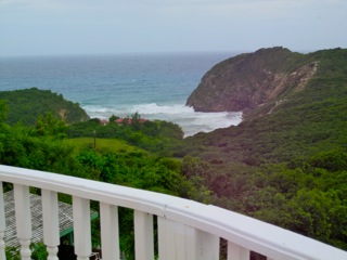
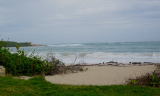
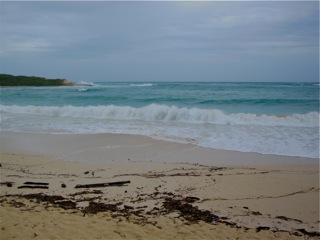
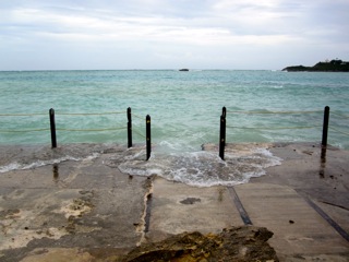
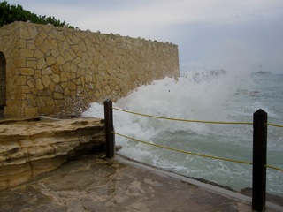
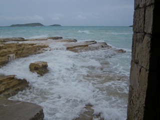
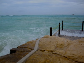

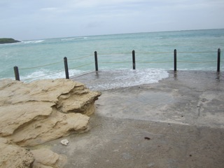
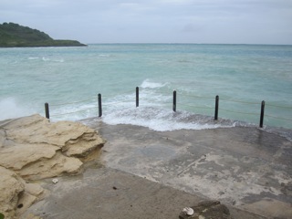

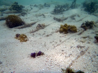
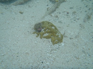
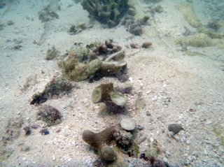
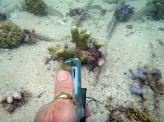
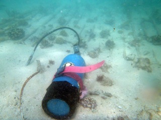
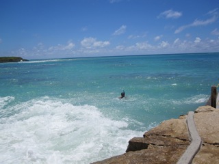
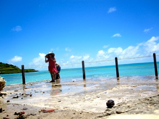
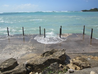
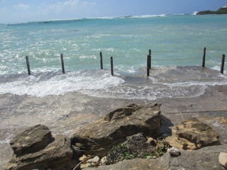
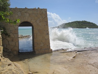
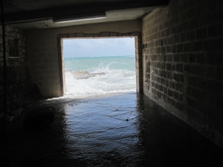
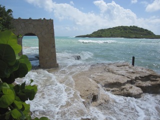
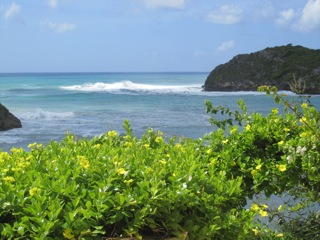
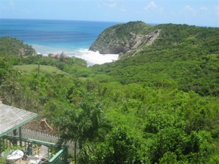
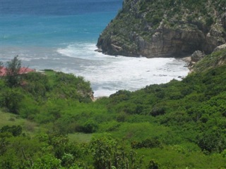
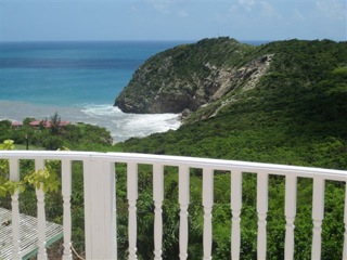


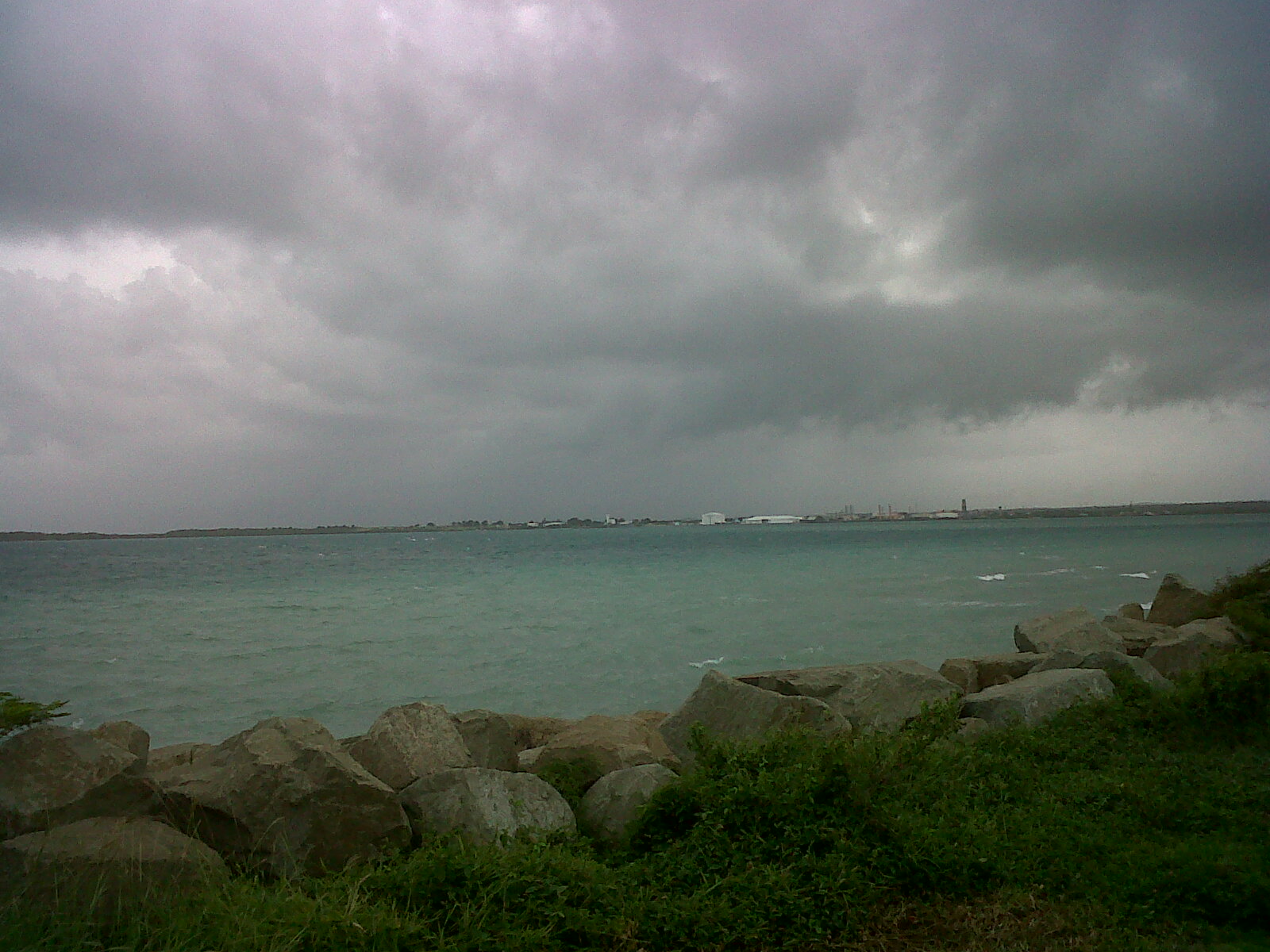
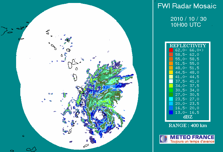
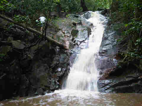
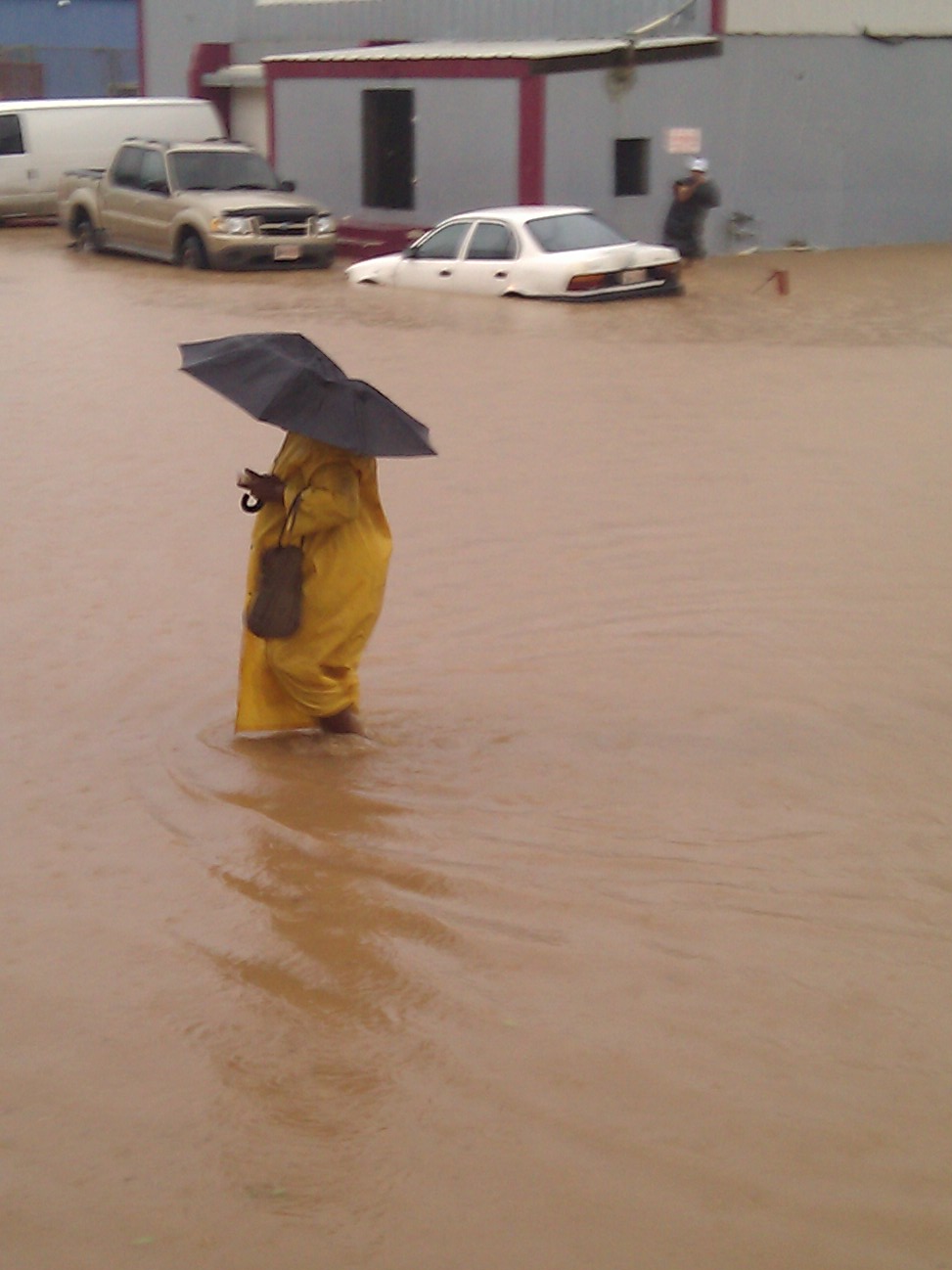
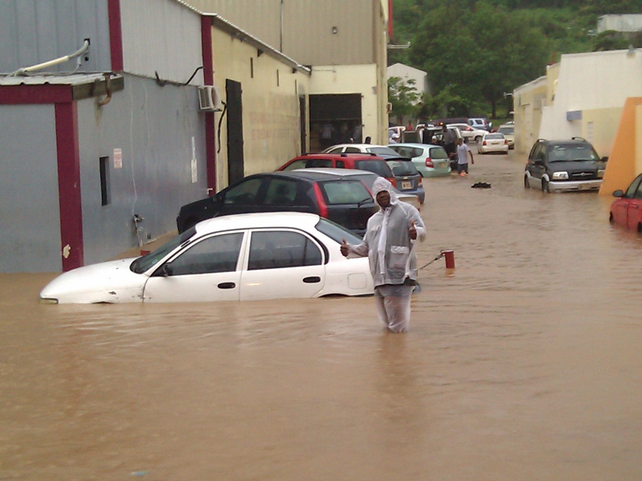
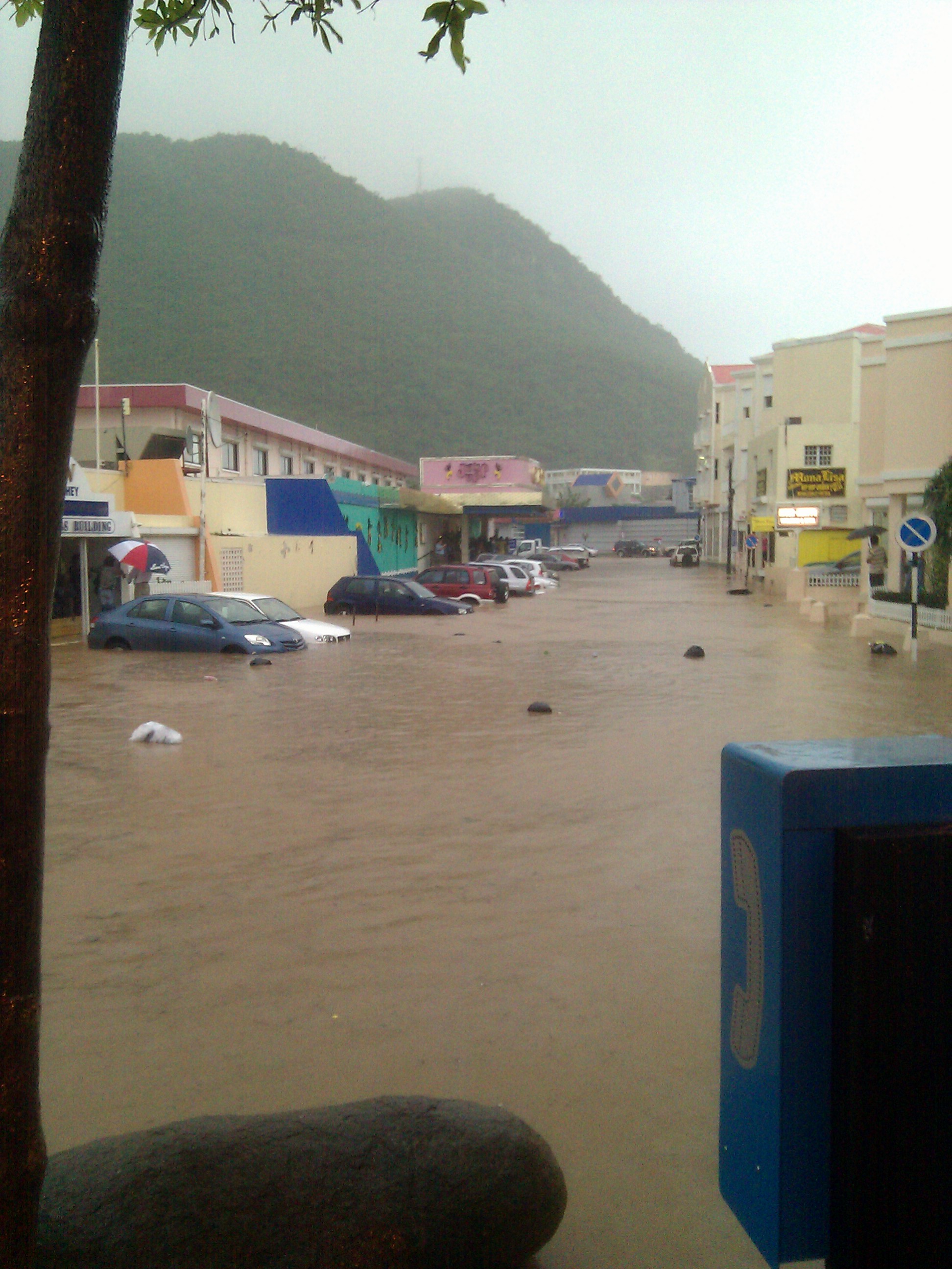
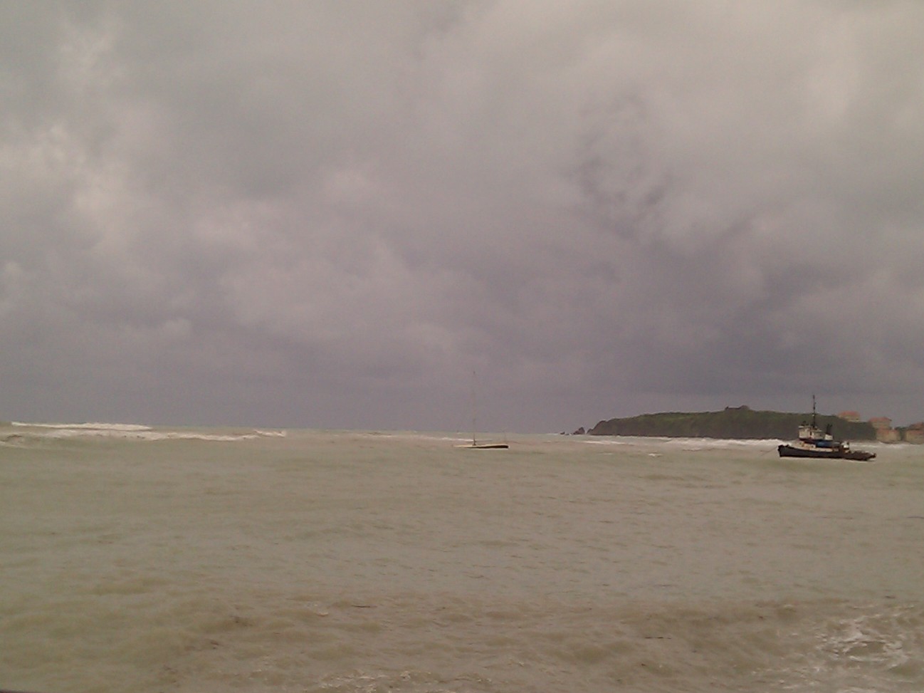
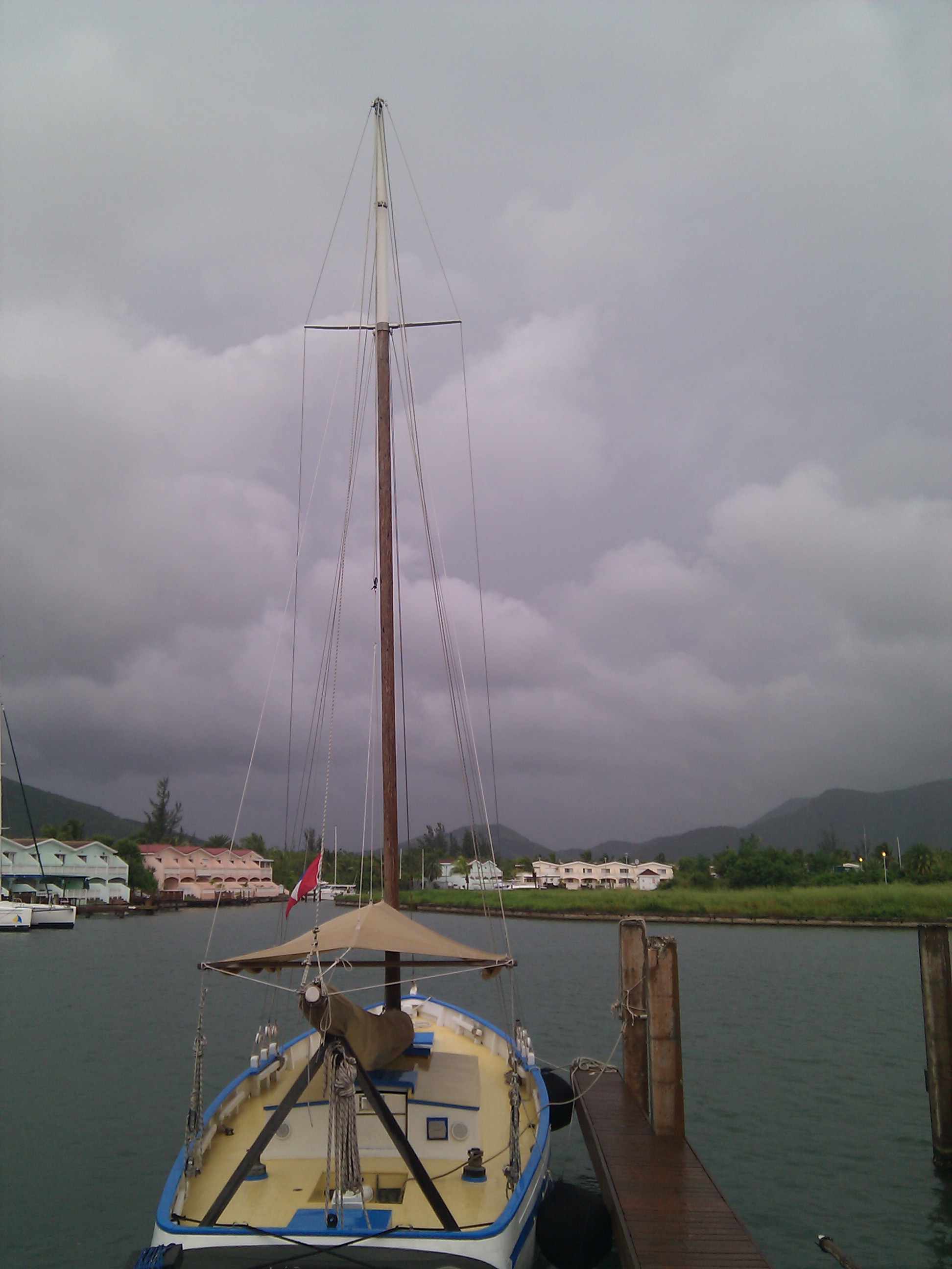
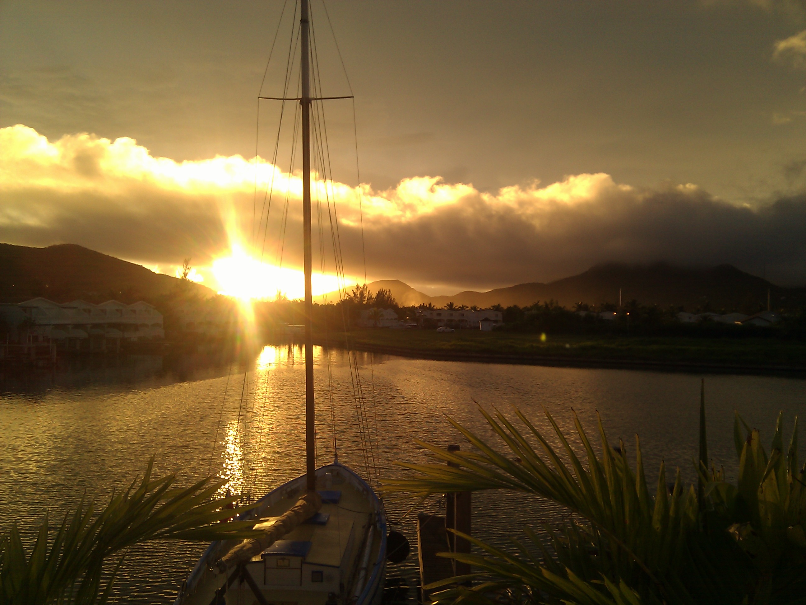
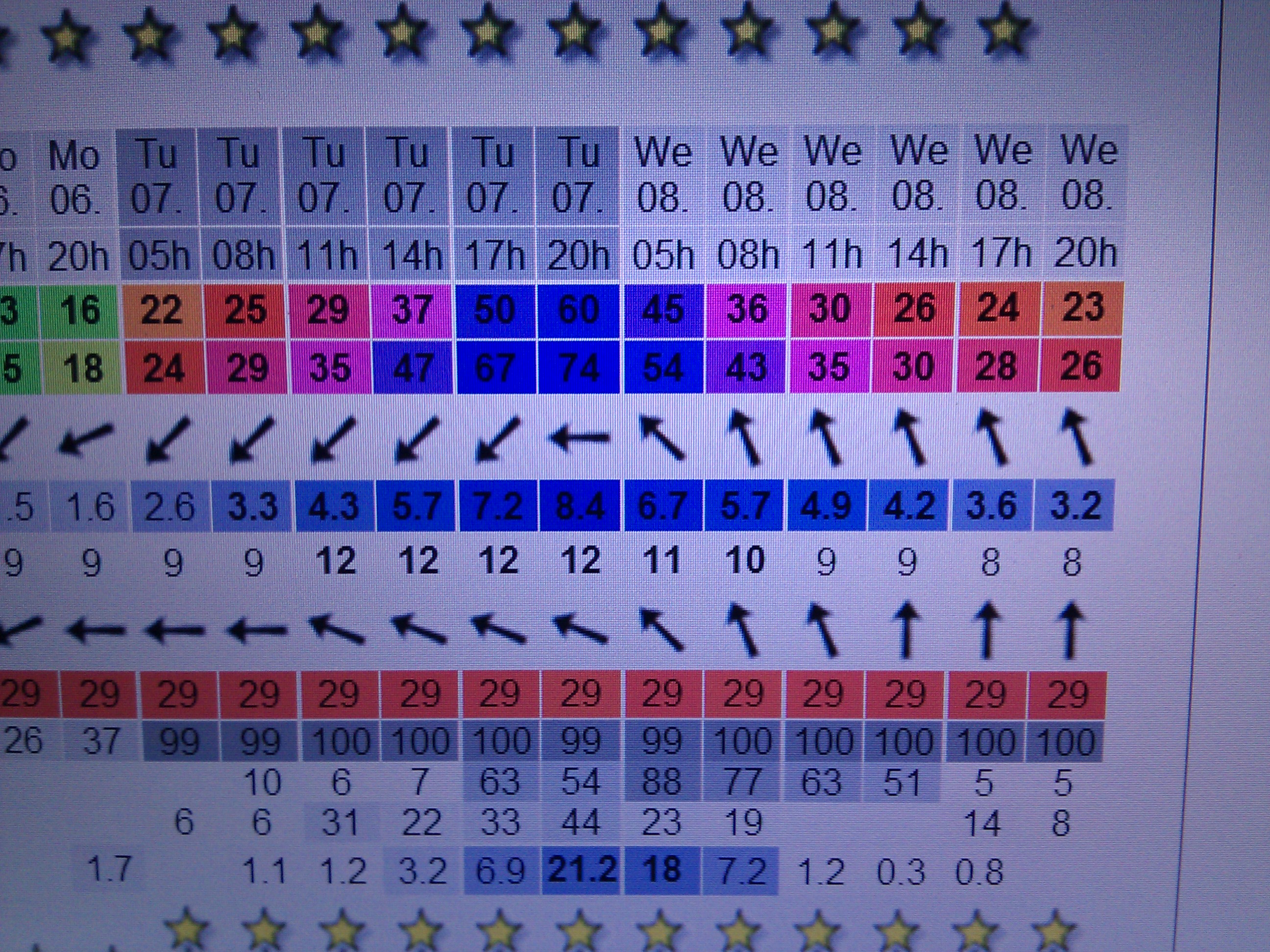
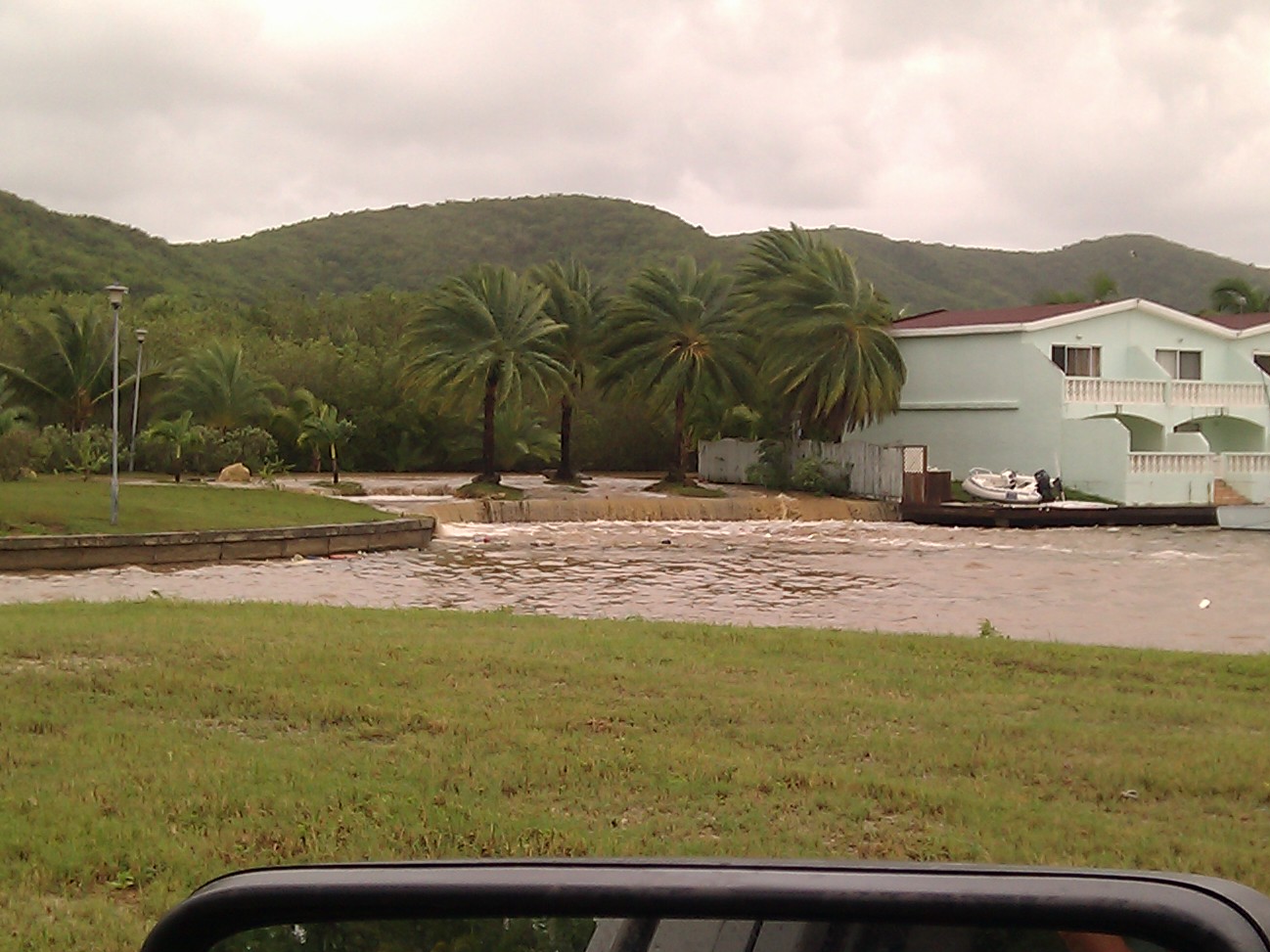
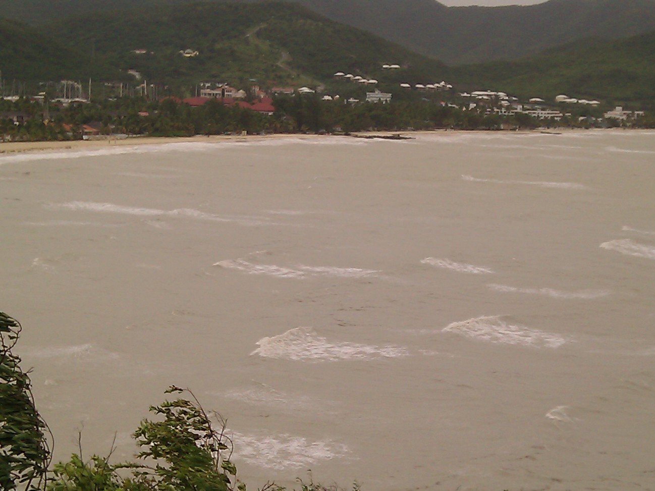
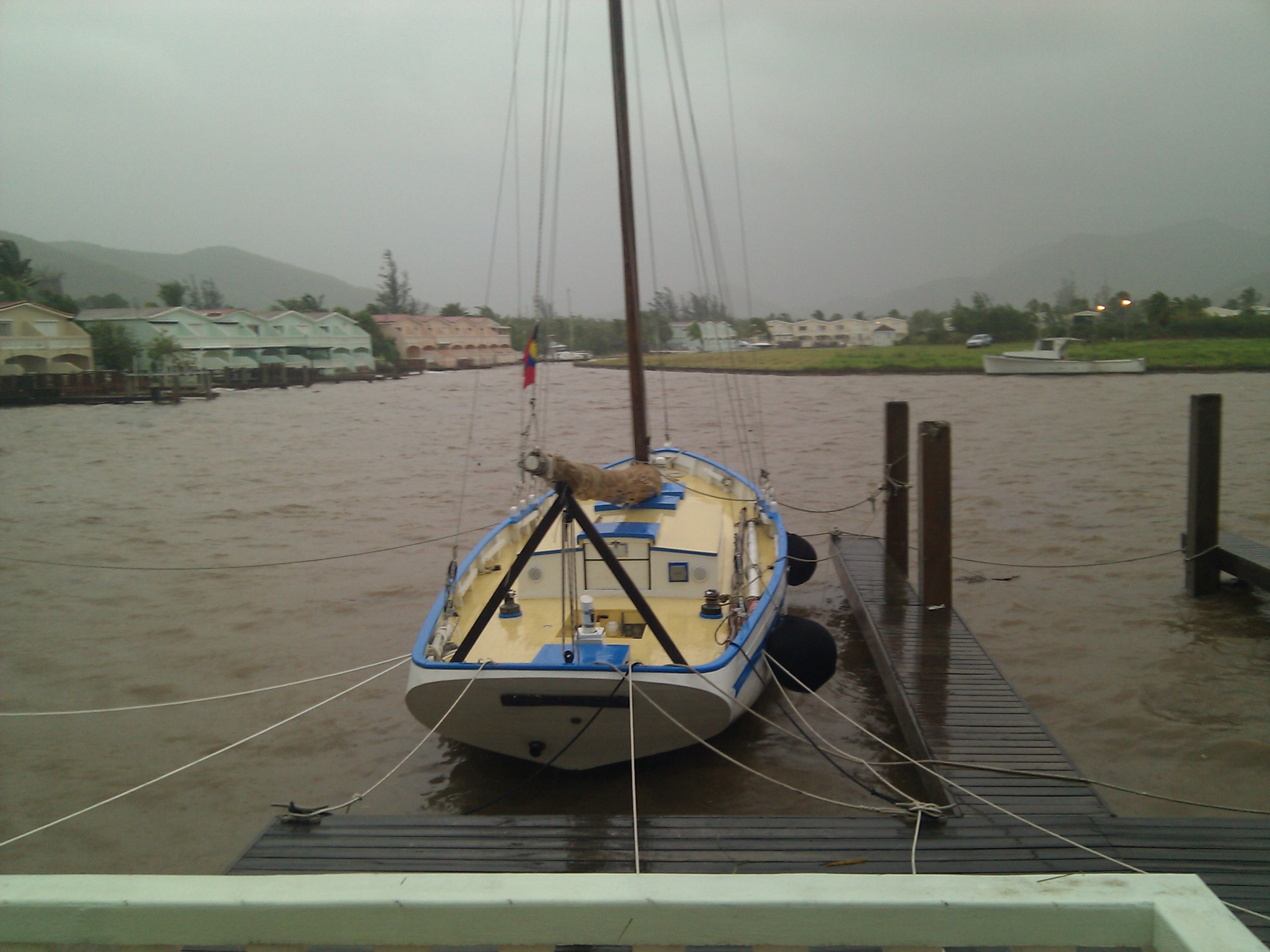
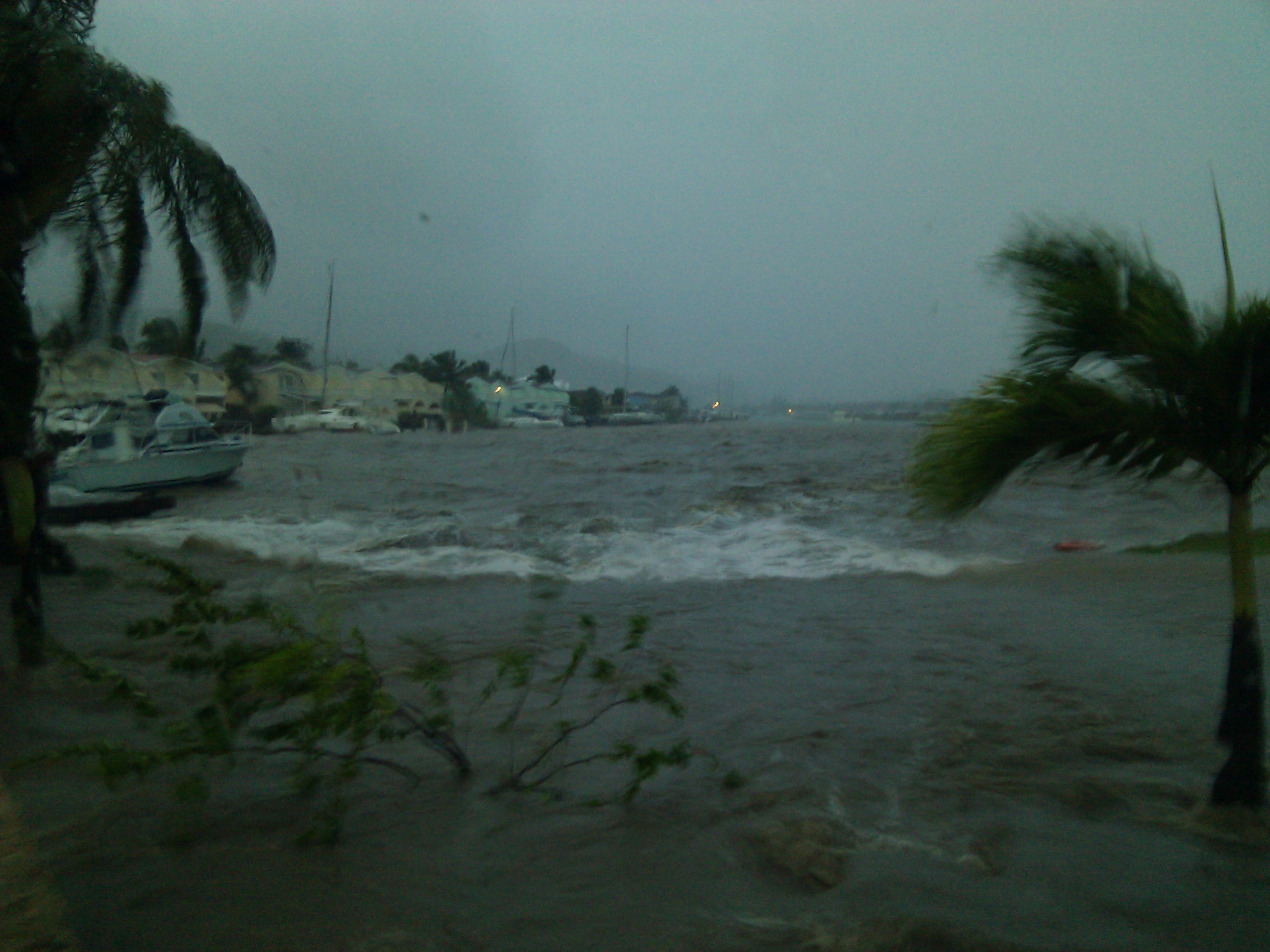
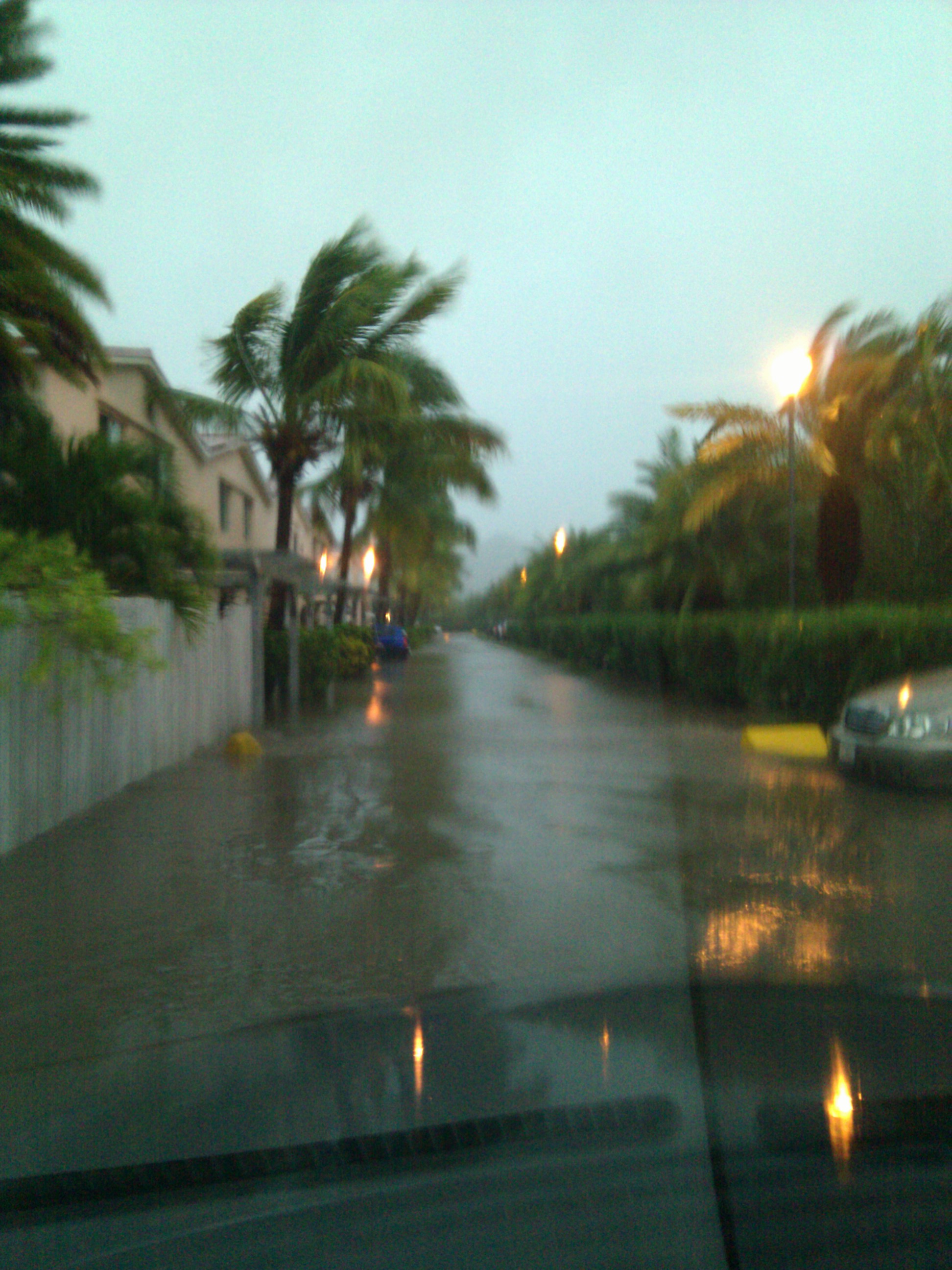
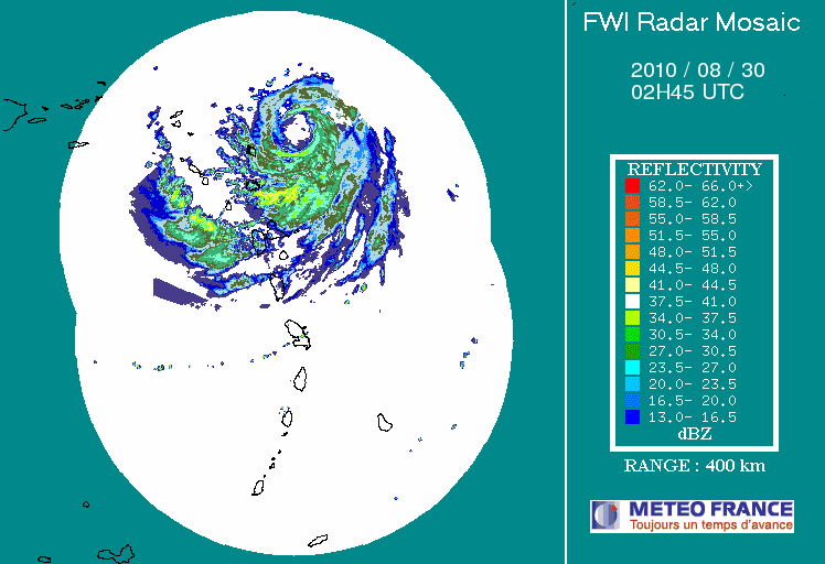
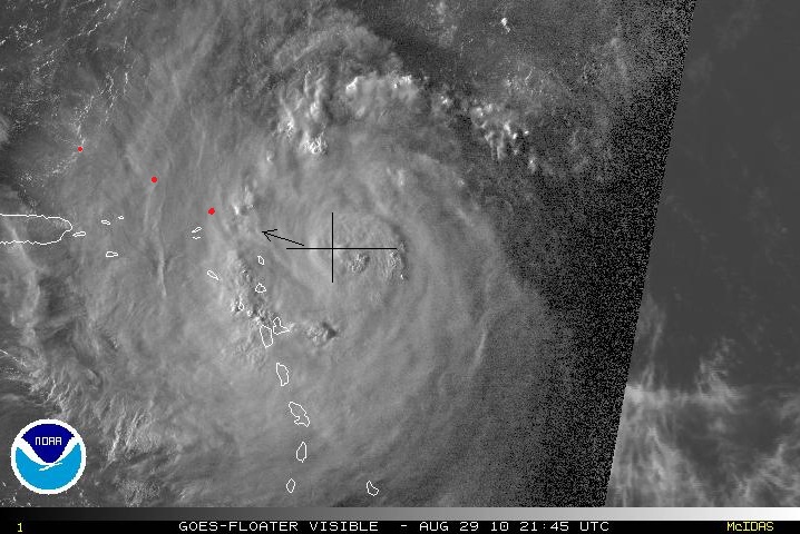
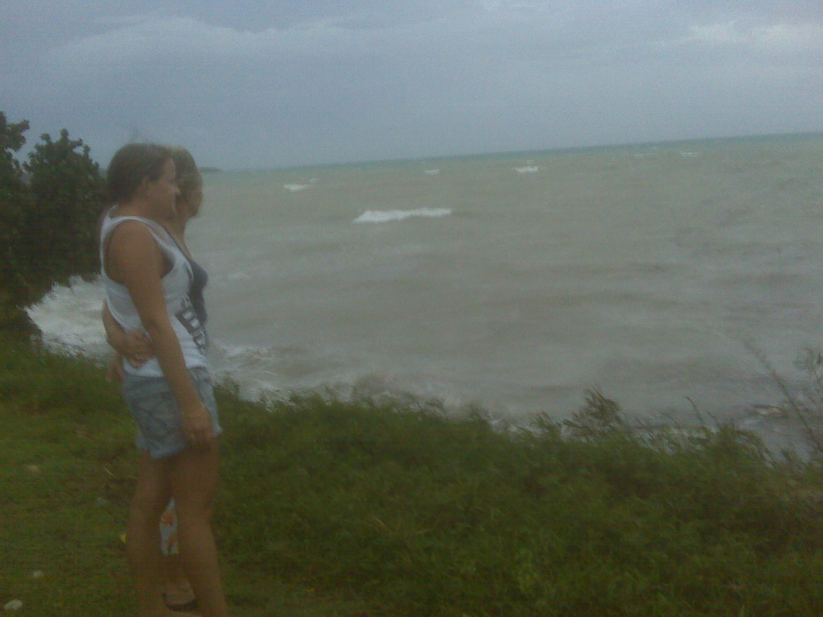
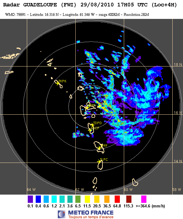
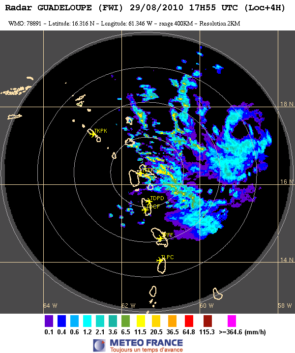
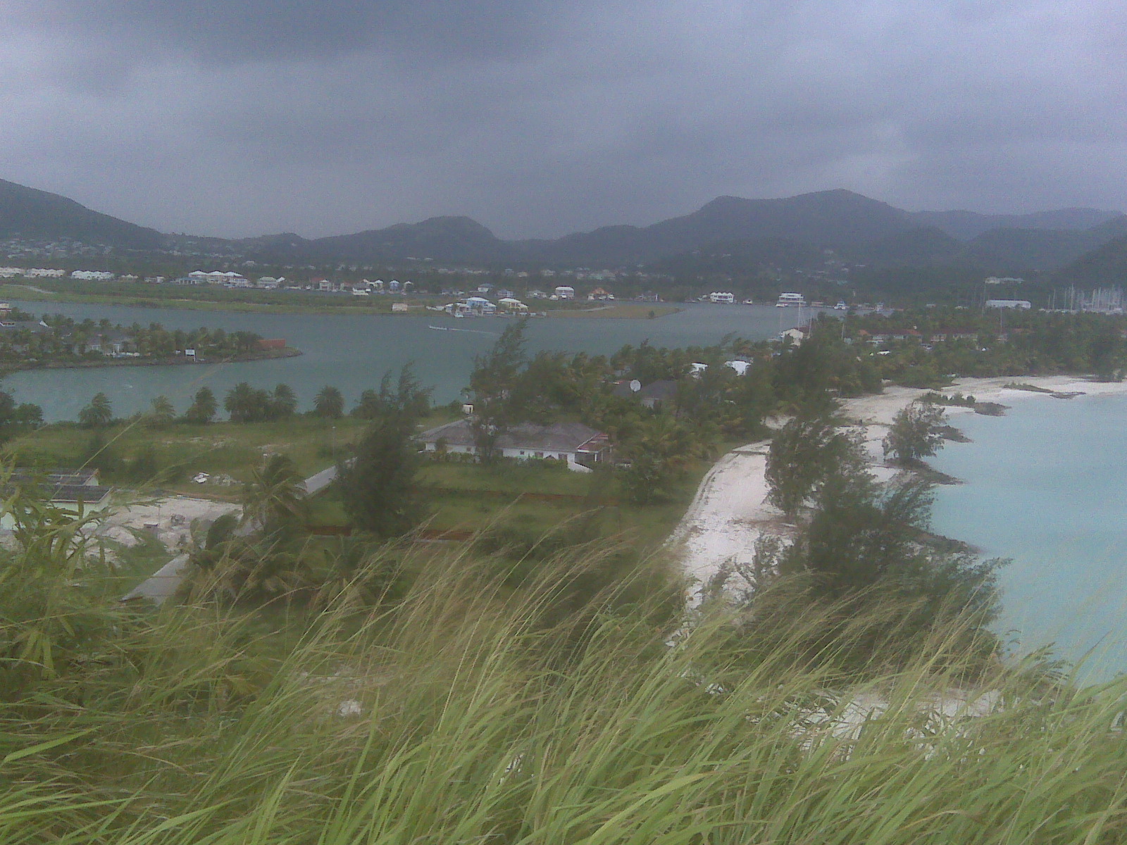
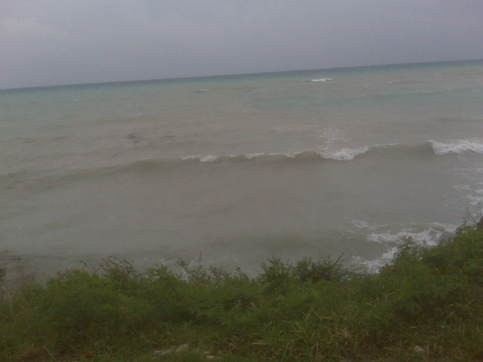
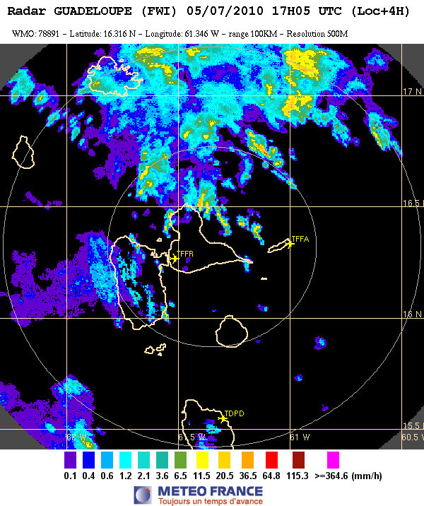