For the most recent reports from Grenada see this page.
- - - 2009 Hurricane Season - - -
- and so the hot dry days go by......
From: "Sally Stalker" <stalker at spiceisle.com>
Date: Sat, 12 Sep 2009 21:24:18 -0400
I cannot believe it! I watched these great big rain
filled clouds roll in from Barbados .....and slide by to dump on Carriacou. We
got a few drops, not even enough to move us off the balcony. There
is a slight breath of air and the sea is very calm. Usually the surf is
pounding down on Bathway Beach. I probably will not sleep without the
pounding of the surf! All the wee beasties are singing away and the
screech owl is obviously having a fine evening’s hunting.
Good night “wild in grenada”, I hope you
are cosy under your duvet!
Sally
- Fred is terminally ill.
From: "Wild in Grenada" <Chris at wildingrenada.com>
Date: Fri, 11 Sep 2009 08:32:08 +0100
Reports say that Fred will not survive long. It has
3 illnesses:-
1) chronic dry air (from the Sahara)
2) Severe dose of wind, wind shear is
increasing.
3) Suffering from a chill, due to moving on a
Northerly course over colder Atlantic waters.
It is well north now and likely to fizzle out in
the next few days.
Back in Grenada:
Radar shows little rain. The Weather station at
Lance-aux-Epines is still showing only 3mm (less than .25 inch) of rain for
September. We should expect more than that per day at this time of
year.
There is a small ripple in the ITCZ which possibly
could bring some rain in a couple days, if we are lucky.
All the best
Hogan of Grenada
- And so the hot dry weather continues.....
From: "Sally Stalker" <stalker at spiceisle.com>
Date: Thu, 10 Sep 2009 21:04:29 -0400
I will not comment on the path of the latest
Hurricane. I have the MOST enormous respect for hurricanes having
been taking by surprise by Hurricane Hattie at the end of October many years
ago. She whipped around, did a u ie (how do Aussies spell that?)
and devastated Belize. Himself helped burn the 300 victims to avoid major
outbreaks of disease.
We have a simply thirst quenching , cool SE (I’m
sure it’s SE; must be) wind whistling through the house to-night
after a very hot day. No rain today but had a great rain storm last
night. Garden missing its twice daily rainfall and no amount of watering
with the hose restores the green and the bloom. Himself continues to swim
peacefully at Levera and the water is cool. Before Ivan the water was
very warm.
Waiting to hear what Wild in Grenada has to say about the
next baby out of Cape Verde. Don’t be fooled..... they are still
comin’
Tootle pip!
Sally
- Fred is following predicted path.
From: "Wild in Grenada" <Chris at wildingrenada.com>
Date: Thu, 10 Sep 2009 04:07:20 +0100
Good morning Grenada,
Fred is now a powerful hurricane and following the
NW path predicted. Hopefully this hurricane will just pass harmlessly through
the Atlantic.
Radar shows no rain - AGAIN. and no sign of any
real rain, just possibly this odd shower.
Have a good day
Hogan of Grenada
- The Dry Spell
From: Nealon Newton <nealondpo at yahoo.com>
Date: Tue, 8 Sep 2009 04:10:33 -0700 (PDT)
It does not suprise me at all that there are no rain anywhere in our vicinity. In fact I've been warning the gardeners that this september, like every other september before will be void of any significant rain. The last significant rain we had was also the first which was on Carnival Tuesday. Now we're in the "Dry Rain-season month". Its that month when we get the most briliant of all blue skies decorated with some spectacularly beautiful cloud displays. I noticed one yesterday while traveling on a bus in Grand Anse. I tried a picture but was disturbed by movement amoung other inhibitants. Take time to randomly examine the skies during this month, you might be amazed at these beautiful heavenly displays. I always am. That said, I don't expect (and admonish) that we get any kinda of rain for atleast another three weeks or so. So start
breaking out the garden hose.
signature:peace and blessings
- Look out for Fred
From: "Wild in Grenada" <Chris at wildingrenada.com>
Date: Tue, 8 Sep 2009 06:42:47 -0400
Fred has formed as a Tropical Storm 11.8N 26.7W
Just north of where Erika started life. All the predictions are for it to move
North soon. Hope they are correct with this one as it already has a distinct
swirl with 2000 miles of Ocean to cross..
A couple of small showers visible out to sea. The
Leeward islands seem to be getting most of the rain these days.
Have a nice day.
And thanks to the people sending comments to my
post yesterday. Both were backing me completely.
Hogan
- Another hot day in paradise.....
From: "Sally Stalker" <stalker at spiceisle.com>
Date: Mon, 7 Sep 2009 18:50:18 -0400
I am beginning to feel rather lost among these knowledgeable
weather-watchers but I have to admit I love it!! Not so much the thirst
for knowledge ( or rain!) rather for the kinship with others who enjoy
living in the Caribbean.
I regret boasting about the rain my garden was receiving
while others were dry. No rain for two days! To- night I am hanging
around waiting to see the iridium flares...6.45.34 on my GMT clock and counting
and guess what. A lorra, lorra cloud.
I am even going to have my drinky-poo a little later in case
I blink.
Sally
- Still no rain on the radar.
From: "Wild in Grenada" <Chris at wildingrenada.com>
Date: Mon, 7 Sep 2009 06:59:31 -0400
Good morning Grenada,
We are 7 days into September and we in Westerhall
(at least our part) have had no rain at all. I see Lance aux Epines has had 3mm
- WOW almost a flood!
Looking at the local weather and the radar it looks
like this could continue. Even when rain showers do appear coming in our
direction they seem to fizzle out.
Apart from Carnival Tuesday, August was also very
dry.
I am going to be slightly controversial, Climate
change will affect all of us, so it is up to all of us to do what we can to
help. It is not just the big countries like the US and China, we all have a bit
we can do. Just one thing that really upsets me is seeing the number of cars in
carparks with no one in them, running their engines to keep the A/C on. These
people must have more money than sense. And they do not care about our
environment, only their own! We can all do our bit, do we need the A/C in
buildings really as cold as we have them? Why not ask the staff and
customers if they could have it slightly less cold?
We have always worried about hurricanes hitting
Grenada, well that could happen increasingly, but what could also happen is the
rains stop (as with this year). Lets all do what we can to help.
Sorry about Eco bit!
Now, back adross the Atlantic, having just left
Africa is 96L. NHC have it as more than 50% chance of developing in the
next 48 hours into a tropical storm. All the models have it tracking North West
harmlessly into the Atlantic. But remember Erika was meant to do that all the
way across, eventually hitting the Leewards albeit very weak
(windwise).
Sorry again for my ECO bit, many people think
Nature will sort it out, But just what if they are wrong?
Please send me your feelings on the
subject.
Hogan of Grenada
- Dry
From: "Wild in Grenada" <Chris at wildingrenada.com>
Date: Sun, 6 Sep 2009 07:08:27 -0400
Another fine morning, too fine. The garden needs
rain, yet I don't see any coming. I see Lance-aux-Epines received 3mm in the
last 24 hours. Westerhall received none.
The plants are struggling. Many cuttings that I put
in that would normally have taken this time of year, are just dead
sticks.
The radar shows a small shower just missed us
(South) then there is nothing east of us within the range of the
radar.
The Tropical waves I mentioned across the Atlantic
seem to be disappearing. Only one is still marked as less than 40% chance of
developing. It does appear that the dry Sahara air is causing the demise of many
a potential storm, and possibly why we are getting so little rain.
Have a nice day
Hogan of Grenada
- IMG00054-20090905-1100.jpg
From: sally at beentheresal.pn
Date: Sat, 5 Sep 2009 15:02:24 +0000
Beautiful day taken with my b'berry.  North East of Grenada
Sent from my BlackBerry® wireless device from LIME.
Woke yesterday to the gentle swish of rain on tiles.  The rest of the day was
alternately wet and dry but constantly hot.  Norman said the wind was so strong
at the Fort (Fort Bedford: Friday is "fort day") that their canvas chairs
nearly blew away.  I was sick with envy!  I had a girlie lunch and we dripped
perspiration but that didn't stop the fun. Annie took photos of Smudge, Mr T
and Tiger for the painting she will do of them.  She's a genius!  I wonder what
Kitty thought of us. She is new to Grenada from the smart set in London and we
are all a bit weird after a lifetime of Lotus Eating!!
I am glad I didn't mention our rainy day yesterday to Hogan. ( Sorry about your
bad hair day.) To day is rainless , hot but with a good s/ e breeze ruffling
the papers on my desk. Well, I think it's s/e.  N says it's disgusting the way
I get it wrong.  I'll have to get one of those thingummies that tell you and
then abandon the wet finger.
Good to be alive!  Hope you all feel the same.
Sally
Sent from my BlackBerry® wireless device from Cable & Wireless
- Sunshine at Lance-aux-Epines
From: "Wild in Grenada" <Chris at wildingrenada.com>
Date: Sat, 5 Sep 2009 10:33:04 -0400
When everywhere else is overcast, Lance-aux-Epines
always seems to be in the sunshine. Photo taken a couple of days ago. Taken from
Westerhall Heights 12X zoom and cropped.
The showers I mentioned earlier are still heading
in our direction, although the biggest look as if they will pass North of
Grenada. Still a few hours off.
From: "Wild in Grenada" <Chris at wildingrenada.com>
Date: Sat, 5 Sep 2009 09:16:12 -0400
Good morning to you all,
The weather here today at 09:00 is hot with a good
breeze.
Looking East, there are some showers passing South
of Barbados, Their track if they continue, may give us some rain later. This
area is part of a weak tropical wave.
Further East are two tropical waves one just West
of the Cape Verdes and another a bit nearer.to us. Both are being given less
than 30% chance of developing in the next 48 hours.
Yesterday was a mixed day for us. We had news that
our granddaughter had shut her fingers in a door and broken her finger! She had
to have an op to repair the damage. She is only 2 years old, very
upsetting. I put my back out turning some cement, still difficult to walk
this morning. But in the evening we went to The Mangrove Hideaway
(Westerhall) for a meal, then on to The Olde Skool Pub, near The Beach
House, to enjoy some music from Treo (steel pans). We had a good evening
there with some good friends.
Today I am resting and hoping for a little
rain.
Hogan of Grenada
- Erika - Dominica
From: "Wild in Grenada" <Chris at wildingrenada.com>
Date: Thu, 3 Sep 2009 13:08:19 -0400
Looking at the info coming from Dominica, they seem
to have had a pretty bad time. The airport info says they have had rain &
Thunder for the last 14 hours! I haven't seen an reports from there yet. A
friend has been in touch with her sister who says they have had lots of
rain.
Here the high cloud is slowly fading. There are
radar echoes of showers off to our NE and SE but no sign of cloud on the
satellite images. I am wondering if they are false echoes bouncing off the heavy
rain in Erika. I saw an example of that earlier today.
Hot and breezy from the East.scattered low clouds
and wispy high clouds. Clear enough, hopefully to see the ISS (with Space
Shuttle Discovery attached) fly over this evening from SW to NE` at 19:10 to
19:14. If you haven't seen this before, it is worth watching. It will look like
a very bright star travelling across the sky. Face South to see it. The ISS will
pass through the 'sting' of Scorpius (the Scorpion) and then through
Sagittarius, It will pass close(ish) to Jupiter (the very bright planet)
then through Aquilla (near the bright star Altair), eventually fading out
near Signus (as the satellite passes into the shadow of the Earth). This is all
as seen from the South of Grenada, but won't vary much further north. If
anyone is interested in Grenada Astronomy info, then please send me an email and
I will add you to an astronomy mail list.
Hogan of Grenada
- LIke Hogan Says
From: storm tracker <grenadatracker at gmail.com>
Date: Thu, 3 Sep 2009 07:41:09 -0400
Well, like Hogan says, we've got cloud...the promise of some rain (needed in the South) and Hoooooooot temperatures. He's probably right, it'll be like this all say, with the odd rainshower on the leeward side of the mountains.
The next trooper off the Coast of Africa looks like it's going to keep our little community chatting together on this website for another week....while our friends up north paddle their way out of Erika, we turn our eyes east once again.
- Thursday Morning 06:50
From: "Wild in Grenada" <Chris at wildingrenada.com>
Date: Thu, 3 Sep 2009 06:52:47 -0400
Good morning Grenada,
This morning the sky is almost fully covered with
thin high cloud. There are a few scattered low clouds which are also scrapping
the top of the mountains. The wind is back to the East and is quite stiff.
No rain in the night.
Erika is still dropping lots of rain over the
Martinique, Dominica, Guadeloupe, Antigua area. Even reached down as far as St
Lucia. No rain reached us in the South of Grenada.
I still see no showers on the radar in our area.
Looks like it could be another dry day.
There is a small tropical wave half way across the
Atlantic currently giving no concern. But there is a large one that has just
left the African coast worth watching.
Stalker, thanks for sending the rain yesterday, we
heard the thunder, but unfortunately the rain got redirected to Springs area.
They had a very heavy shower, we had none. Any more you don't want, please aim a
little more to your left!
Hope everyone has a good day.
Hogan of Grenada
- Two Eyed Monster
From: storm tracker <grenadatracker at gmail.com>
Date: Thu, 3 Sep 2009 02:13:28 -0400
Well, I shouldn't have had a nap after dinner - I'm up at 2 am now. At least I get to check out the 2am update before trying to use a book to get me back to sleep. It's HOT and we're using two fans in our bedroom - which isn't killing the heat, or deterring the explosion of mosquitoes we've had this week.
So Erika is a two-eyed wonder, just like Emily was. Although the Hurricane Centre is reporting that she's barely a tropical storm now, and that her centre is stubbornly clinging to 16.2N....what I see on the satellite imagery (Particularly DVORAK) suggests that a lot of islands that haven't been issued ANY kind of warnings are experiencing pretty much the same weather as those who were put on alerts. Specifically: St. Lucia, St. Vincent, and to a milder extent, the Grenadines.
The other thing that I am noticing is that the NHC forecasting is still using the northern centre as the forecasting benchmark - even though their own weather discussion at 11pm suggested that they expected the storm to form two centres.They're still anticipating that wind shear in the Lesser Antilles will keep the system from developing. But what I am curious about is the Southern section of the storm, which now at least, appears to have become a distinct system, moving in a different direction than the northern part. I don't know if that will last, but it would't surprise me if Erika suprrised us all and morphed into a more Southerly Caribbean storm next week - rather than the sheer battered Leeward storm she's expected to be. Because let's face it - this one has had a mind of it's own since day one.
But, like everyone else - now that it's split in two, it's just a guessing game now.....I really hope the flooding isn't too bad for the islands that didn't get a warning. Clearly wind isn't expected to be a big problem....but flooding particularly for the people who tend to live in marginal lands, without the benefit of cable TV to show them what was out there...is a formidable risk. All our meterological talk on the radio (when warnings are given...and they weren't for some islands being affected now) don't make a lot of sense to the people who are affected by the bad weather most.
It's my view, we still have a lot to learn about disaster preparedness - following these models meant for technologically developed places like the United States, where anyone and their uncle has a TV and can see what's coming. It's my opinion that the experience of St. Lucia and St. Vincent will stand as examples of why CDERA needs to revisit the standard operating proceedures when it comes to warnings and notices for small island states.
- Weather in the North of Grenada
From: "Sally Stalker" <stalker at spiceisle.com>
Date: Wed, 2 Sep 2009 11:51:18 -0400
Well I sent some lovely showers and a wee thunder roll or
two down south to Hogan this morning. Sadly they took the wind with them
and we are sweltering up here. A frisson or two from across Sauteurs tells
me the south has some good winds! The sea is calm at Levera and husband
no 1 tells me he could make little headway swimming this morning contrary
to normal flow. The water was cool unlike before Ivan when the sea was
very warm.
Mrs Tyson and Mr Ruby prefer to stay in their cool new
home.....might join them!
Thank you for all updates.
Stalker.....
- In the NHC weather centre - NOW!?
From: "Wild in Grenada" <Chris at wildingrenada.com>
Date: Wed, 2 Sep 2009 09:16:55 -0400
To all of you wondering what Erika is
doing.
I would love to be a fly on the wall in the NHC
now. I bet the experts are running round like Blue **** Flies or chickens
without heads. All the millions of $s of equipment. Try using your eyes guys.
Please if you don't know what is happening, please say it. You will get more
respect.
The models are still showing a starting point way
outside where all the main activity is, and the course is still showing as
missing the islands. Ask people in Barbados what they think. There seems
to be a street of storm cells running in from the SW of the blob and they are
beginning to get a bit of a battering. The SW street of storms seems to be
spreading out in the direction of Grenada.
Currently the centre of the storm system appears to
be 15N 57W although a recent cell has popped up about 60 miles to the
NW.
To those in Grenada have a look at the posts from
some of the other islands. All of them want to know what is
happening! This system (whatever direction it finally decides to go),
is travelling slow and does seem to have plenty of rain in it. So where it hits
will probably get lots of rain and probably flooding!
To those that receive this post from me direct try
looking at http://www.stormcarib.com/ and look
at the other island reports on the right of the page.
Hogan
- Famous last words
From: "Wild in Grenada" <Chris at wildingrenada.com>
Date: Wed, 2 Sep 2009 06:56:08 -0400
This weird storm appears to have changed direction!
The latest satellite images are showing a distinct movement in a SW direction. I
take my comments back from yesterday. Many comments on the Jeff Masters
Blog are noticing the same.
Barbados is getting 21 MPH SWerly winds. NHC
haven't made any comments yet (par for the course on this storm). They are still
showing predicted paths that are hours old and moving NW. It does seem that
all warnings seem to be coming from amateurs in the islands.
Hopefully this is just a blip in it's course, but
suggest looking around your property and tidy up loose items, just in
case.
I am going out now to check my hurricane shutter
bolts have not rusted!
I will update this as soon as I see an official
comment.
Hogan of Grenada
- Mega-Blob
From: storm tracker <grenadatracker at gmail.com>
Date: Tue, 1 Sep 2009 20:02:28 -0400
Ok, so I said I was retiring my vigil - but boy was I suprised when I saw the system when I had a quick look after dinner!
Erika is one huuuuuuge stationary blob! She's just sitting there, growing in size, even though the centre is supposed to be up by 17N, her 'blob" extends all the way south to nearly 14N.....
No doubt this storm will be the subject of a lot of scrutiny and research by the academics when she's done with us.
Hogan, how widespread do you think the hurricane rumours are? Let me know - perhaps we can get NADMA and various media outlets to provide some reassurances.
- Erina now officially TS6 Erika.
From: "Wild in Grenada" <Chris at wildingrenada.com>
Date: Tue, 1 Sep 2009 17:51:14 -0400
I have heard a rumour going around Grenada that
they have heard there will be a hurricane. What they have heard and
misinterpreted is that Tropical Storm Erika has now been formed from 94L (at
last). Grenada is not in it's path by any stretch of the imagination. But it is
likely to touch the northern most of the Leeward islands. It is currently
at 17N 57W Which is about 300 miles East of Antigua. It is highly unlikely that
we will get any effects from Erika, other than possibly the stuffy conditions we
currently have and maybe the odd shower, probably not directly due to
Erika.
Looks like we have to wait longer for some
rain.
There is another tropical Wave that has just left
Africa. It has come off quite 'High'. But I will keep an eye on
this.
Hogan of Grenada
- Erina (TD5.5) - Now moving due West- Slowly
From: "Wild in Grenada" <Chris at wildingrenada.com>
Date: Tue, 1 Sep 2009 13:01:53 -0400
Yet again Erina is not doing what it is meant
to. The satellite loop (6 hours, shows a definite move Westward. Doesn't
appear any stronger, but watch out Leewards. Barbados is currently getting some
rain that appears to be from an outer southern arm of Erina.
Here it is Hot with no discernable breeze. The sea
is calm and the sky is blue with some clouds. Almost perfect (just a bit of rain
and a slight breeze needed.
- The North East of Grenada
From: "Sally Stalker" <stalker at spiceisle.com>
Date: Tue, 1 Sep 2009 08:12:51 -0400
We had a lot of rain early this morning. It seems to
have cleared the air as I can now see Carriacou and Petite Martinique very
clearly . It is very humid and the garden has not dried out. The
grass and plants love it and are blooming away happily. I think we have
had much more rain up here than in the south of the island. It seems to
be a normal rainy season.
Mrs Tyson and Mr Ruby the Morrocoys (misnamed in extreme
youth!!) have a lovely new house in their garden and refuse to come out for
breakfast. Can’t blame them, it is that sort of weather with only a
slight breeze rustling the plants.
Does anyone really want to read all this!! Ah well.
Stalker of the 43rd
- Erina, TD5.5, (94L)
From: "Wild in Grenada" <Chris at wildingrenada.com>
Date: Tue, 1 Sep 2009 07:24:32 -0400
Good morning,
NHC still haven't recognised 94L as Tropical
Depression! A post from Antigua this morning recommends that they prepare for
some bad weather in the next couple of days. They are not waiting for NHC to
wake up. I think that is very wise. Erina appears to have moved very slowly
in a westerly direction, overnight. Even if it does not officially reach TS
status, if it does hit any islands and is travelling at this slow pace when it
does, it could take some time to pass over.
One of the Southern arms of Erina is showing signs
of thunder storms/ heavy showers, as of 07:00 Tuesday morning. This arm is
approaching Barbados, it is about 200 miles to it's East.
Nearer to us the radar shows (07:00) scattered
showers, with clumps in the area of Carriacou and PM. There are also a
couple of showers a few miles off the South coast of Grenada. The
garden really needs some rain, a few heavy showers is what we need. I don't know
if August broke any records for least rain, but it must have been
close.
Have a good Tuesday.
Hogan of Grenada
- Retiring my vigil
From: storm tracker <grenadatracker at gmail.com>
Date: Mon, 31 Aug 2009 20:34:37 -0400
Just a quick note to say I'm retiring my storm tracking vigil on 94L - unless this rouge system does something completely unusual, I see no reason why it would pose a threat to our Tri-Island State.
Pleasure posting with you all :o)
- OK folks we have to give 94L a name and a number.
From: "Wild in Grenada" <Chris at wildingrenada.com>
Date: Mon, 31 Aug 2009 12:35:12 -0400
So it looks like The NHC don't want to name this
depression. So I think we should give it an ID until they wake up. I
suggest Tropical depression 5.5 (or Five and a half) and TS ERINA We can't use
Erika or TD Six as NHC will steal them some time soon, maybe even for
poor old TD 5.5 (Erina) I am happy for other names. As I said early, there
is a question as to whether it is TS size, but no question it should have been
given TD status.
As at 15:45 (UT) Navy Weather had TD5.5 at 15N
52.1W central pressure 1008.travelling WNW Extrapolated will touch the northern
most islands.
Sorry, but it doesn't look as if we will get any
showers directly from Erina!
Hogan
- WHOD'A THUNK IT.......
From: Nealon Newton <nealondpo at yahoo.com>
Date: Mon, 31 Aug 2009 08:44:16 -0700 (PDT)
..........that in this era of heightened hurricane awareness, one would be waiting all up to 11:30 for an 11:00 am update especially when there is danger looming. On a different note-the spelling to "squall" came back to me right after I posted the message. Since the next tropical wave is like a week away. Our only hope of sum moisture and relief from the heat would be a proper squall from what should be called Erika by now. So I'm keeping my fingers crossed for that.
signature:peace and blessings
- When is the Christening
From: Nealon Newton <nealondpo at yahoo.com>
Date: Mon, 31 Aug 2009 08:23:44 -0700 (PDT)
It is indeed baffling how Erika hasn't been assigned her identity as yet. She sure enough-by the looks of satelite loop, and non-expert observation-has aquired that identity. Meanwhile,here in the south its hottt, and hhhhumid. Erika is robbing us of all the moisture that is forecast to come through, Hopefully she will hit us with a scual (sp) or two.
signature:peace and blessings
- 94L has turned to a NWly direction.
From: "Wild in Grenada" <Chris at wildingrenada.com>
Date: Mon, 31 Aug 2009 07:55:54 -0400
Storm Tracker (Below) has plenty to say about 94L.
I agree that I am surprised that it has not been given, at least, a Tropical
Depression status. It definitely fits into the definition of a Tropical
Depression, if not Tropical Storm. It is a depression and it is in the
tropics. Maybe they are asleep in NHC! Or they are too busy watching
Jimena a cat 4 off the West coast of the US! 94L does now seem to be
moving (albeit late) to a NW direction, but it is not moving very fast. 94L
does have a very distinct swirl and has a large area of storms in it's
centre. I The predictions I have found take it from it's current position
to the north of the Leewards (well most do). If it carries on in this direction
we, in all the Grenada islands, and this is where I differ from Storm
Tracker, are not even going to be aware of it. It is now approaching 15N
(180 miles North) and is over 600 miles to our east.
Looking at the past few years, I cannot find
any named storms that have reversed their direction, once on a NW
track, until it has got above 18N (Noel last year). And there was Omar,also last
year, who started in the Caribbean and went NE instead of NW! But
with Climate change, who knows?
I will be monitoring this one closely, as I am sure
Storm Tracker will. So keep watching this space.
Hogan of Grenada
- Erika should have a name by now
From: storm tracker <grenadatracker at gmail.com>
Date: Mon, 31 Aug 2009 06:43:37 -0400
Well I've been up since 5am doing chores while it's still cool enough in the house to get stuff done....my floor needed a mop after a busy weekend and there's no way I'm doing that in the 100 degree weather brewing storms create!
I'm calling this system Erika now, and I'll let the Hurricane Centre catch up with me, since they didn't issue a 5:30 update on the system this morning. How this system has not been upgraded with a special statement baffles me. The CIMSS satellite overlay images aren't available this morning, there's no up to date models (there should be by 8 am thoug??) and still no warnings. Not acceptable for a system that's so close.
I hope CDERA is paying attention to this - because the Region has really got to get it's act in gear and improve the early warning systems for the Windward Islands.
In the meantime, the centre seems to be clearly forming around 50W and 15N, which is great news for everyone, if it continues to move as sharply northwest as it has over the last 12 hours. There are a whole bunch of monitoring products needed to really get a sense of what this system will be doing - and since it hasn't been "named" yet, the products aren't available yet. Meanwhile...how many of you noticed how easily the Claudettes and Danny's got names in their nebulous blob-like conditions with all the monitoring products focused on them?
Until models are available, the only thing we can look at is surface pressure to get a sense of where this thing will go now - Ship 4104 shows a 1018 high, just north of the Leeward Islands, with some 1015's and 1016's just off shore. So it's quite possible the system will stay below that - leaving it to graze some of us in the Northern Windwards or Leewards. But who? When? How badly?
The system is fully within 29/30 degree SST's now, so rapid intensification wouldn't surprise me.
I don't think Grenada's 'mainland' has much to be concerned about, except maybe some tropical storm conditions...but Carriacou, Petit Martinique and upwards is a different story.
- 94L - Cofused, the experts are.
From: "Wild in Grenada" <Chris at wildingrenada.com>
Date: Sun, 30 Aug 2009 18:32:51 -0400
A good day at the beach. Lovely Sunday on
Grand Anse, with loads of people enjoying themselves. We were sheltered under a
seagrape tree. When we weren't being bombarded by ripe sea grapes dropping
(without help) we were being clambered on by kids trying to grab the grapes
within easy reach. Any tug on the tree brought more down on us. Then the
athletic teenagers started standing on each other to reach the better fruit
higher up - yet again more fell on us. Everyone was happy, everyone was enjoying
themselves, we didn't have to climb the tree to get our supply they just dropped
in our laps.
Hopefully the tree will still have grapes on it
after early next week!
94L is confusing the experts (see Storm
Tracker's previous post. It does appear that this system will gather strength
soon, and it could be rapid, but what course it will take is still a puzzle and
a worry to all the islands. Hopefully by tomorrow night we will have a better
idea. One of the problems is they don't seem to be sure where the centre
of 94L is!
Hogan
- The centre and SST's
From: storm tracker <grenadatracker at gmail.com>
Date: Sun, 30 Aug 2009 17:44:27 -0400
It's still had to get a fix on the centre of this system. At 2pm, the NHC centre positioned a low that spanned all the way from 9N/47W to 17N/45W. They found a 1007mb low at 11N/46W which was probably a dropping pressure in response to the heightened convection we saw earlier today in association with the wave in the warmer water when it was closer to 10N. However, I don't expect that low to drop much more if it remains on a west-northwest path starting around 11 or even 12N becaues the there's a diagonal line of 27 degree SST's following that path too. In fact, the official "centre" of this thing is in 27 degree water. Good news for all of us. Bad news, after 55W though.
What's interesting though, is that the southern portion of the wave(the 9N/47W) remains in 28/29 degree SST's - and the convection in this area remains robust. If some of you are using the products that proivde the SHIP pressures, you will see that there's a 1005mb reading around 12N and 53W and that 1015 bouy I mentioned in my last post is reading as a 1012 mb.
So I guess I have to admit I'm stumpted too. This thing could do anything - even one of those two eyed tricks Emily did. I could guess that the convection over warmer water in that southern portion of the wave could generate a dropping low there....repositioning the storm more south than it is now. But then that west-northwest track may leave it moving just the way it is now, threatening, but not delivering until the very last minute, up near 55W and 15N.
It's all guesswork at this point, so I'm watching and waiting with all of you to see what this thing does next. I think this one is worth a betting pool with the neighbours.
- The rogue storm
From: storm tracker <grenadatracker at gmail.com>
Date: Sun, 30 Aug 2009 08:17:39 -0400
This system is going to be Erika by the end of the day, by the looks of it. Rivalling Emily in her behaviour in an errie sort of way. I don't trust these rogue storms.
Here's the trick - The NHC can't get a fix on this low yet - which is spread from 11N 43W to 7N 49W. CIMSS has positioned the low at 11N and 45W. While the storm is pulling together, the actual 'centre' could develop anywhere between 7-11 and anywhere between 43-50W. What's interesting about that is that the 7N portion of the low is over 30 degree SST's and the 11N portion of the low is in water 2 degree's lower than that. I can't say for sure, but I imagine that could influence where the centre 'officially' develops. I really hope the centre forms away from that 30 degree patch, because we don't want to see rapid intensification once the closed circulation has developed!
I've also noticed that bouy 2190 is recording a surface pressure of 1015. This bouy is located at 14N/55W and I notice that the most recent models diverge at this point - presumably unable to agree on whether the system will turn right or left around it. Surface pressures to the south are much lower than to the north - with surface lows of 1009 near Suriname. Higher up, they're around 1012.
Seems to me these are a lot of factors that are going to make it hard for the models to get a fix on this until it's got closed circulation.
If I were running disaster management show....I'd be putting everyone in the Antillies on a watch today, and fine tune it as we go.
- 94L - has intensified slightly over night.
From: "Wild in Grenada" <Chris at wildingrenada.com>
Date: Sun, 30 Aug 2009 08:09:03 -0400
Morning all,
Looking at the satellite images and some of the
expert reports, it looks like 94L has increased in strength (slightly)
overnight. It now has is a distinct spiral appearance. It's
pressure has dropped to 1009. It has crept slightly north and is currently
around the 12 degs (Grenada latitude). Some of the models are predicting that is
likely to hit the Lesser Antilles, but further north than us. 94L has not
followed predicted paths on it's journey so far, let's hope it does soon, soon
enough to miss all the islands.
A few showers last night, one while cooking on the
BBQ!
Today :- slight breeze, very pleasant. There are a
few small showers halfway between Barbados and Grenada and moving in our
direction, just typical seasonal showers that can pop up almost anywhere at any
time.
Enjoy the rest of your weekend.
Hogan of Grenada.
- Re-organizing
From: storm tracker <grenadatracker at gmail.com>
Date: Sat, 29 Aug 2009 18:36:18 -0400
I'm impatient for the 8pm update - I've been looking at the SST's and now that the low has been in 28 degree weather for about 8 hours, the convection has increased again. Upper level winds are feeding into the low, and lower level winds are feeding out of it. I still haven't been able to find a reliable wind sheer forecast, which will will be the ultimate factor now that the system has moved back into a favourable SST environment, and like Dave says, our sahara dust shield isn't operational at this time. We'll have to dispatch 'Scotty' to fix that!
Either way, I think the lesser antilles will be the end destination for this system, however developed she may be when she get's there. Missing the islands at this point could only happen with the system organizing overnight and making a sharp northward turn into an anticipated trough the NHC hasn't been providing any updates on. Any votes in the hopes of that happening? Hmm.
- Good News? 94L
From: "Wild in Grenada" <Chris at wildingrenada.com>
Date: Sat, 29 Aug 2009 11:00:43 -0400
It looks as if NHC has down graded 94L to less than
30% chance of developing. The satellite images show it breaking up. Maybe we
will just get some rain in about 3 days time?
As Storm Tracker says - don't forget
Emily. What is left of 94L is very close to where Emily started.
Hogan of Grenada
- Don't forget about Emily
From: storm tracker <grenadatracker at gmail.com>
Date: Sat, 29 Aug 2009 08:46:21 -0400
94:L had been travelling in cooler water (27 degrees) over the last 24 hours, and has only just moved back into 28 degree water. This might explain why the system lost its steam. If the system goes north before 50W, it'll be back into 27/8 degrees, which is good for all of us. If it stays on its westward path, it will reach 29/30 degrees by 50W, which is bad for all of us. I see the models have it going north, but I'm also aware that the models have been 99% wrong with this invest so far, and that the system hasn't organized enough to move off the ITCZ overnight, as yesterday's models had predicted.
So - what I'm going to endeavour to find out is whether or not this system will have "Emily" like conditions to develop by the time it reaches 60W. I haven't looked up the shear forecast, etc. yet. For those of you who were in southern Grenada at the time, I know Emily wasn't a big deal for you. But for those of us up North and in Carriacou - she had strengthened over our heads (and we lost our roof). Remember - she entered Grenada's water as a tropical storm at 8pm and left us a catetory 3 by 5 am.
- 94L a bit disorganized.
From: "Wild in Grenada" <Chris at wildingrenada.com>
Date: Sat, 29 Aug 2009 07:14:31 -0400
94L has not developed over night, it still looks
rather ragged with isolated blotches of storms scattered over a large area. The
latest image I have seen shows the centre near 11N 40W with about 1300 miles
still to run before arriving at the islands. There has been little
Northward movement over night and plenty of Westward. Apparently the weaker a
wave is the less chance there is for it to break off and move North. NHC still
have it with between 30% and 50% chance of developing in the next 48
hours. And all predictions still show it bending to a more northerly direction,
with a couple having it scraping the northern Leewards.
By this point West in the Atlantic, Danny had
started his move towards the North. Going back 5 years, Ivan was about 90 miles
further South and already was a Tropical storm and was just about to become a
hurricane cat 1. Ivan took 3 days to get from this point to us.
Having said that the centre of 94L is about 40W
(NHC) the storms cells are spread out several hundred miles in front (to the
west of this point). The leading storms are about 300 miles nearer to
us.
There is another wave leaving Africa.
Today we have had a couple of showers already, just
a sprinkling. The radar doesn't show any current showers to our East. Looks like
reasonable day today.
Enjoy the weekend.
Hogan of Grenada
- 02L vs 94L
From: storm tracker <grenadatracker at gmail.com>
Date: Fri, 28 Aug 2009 17:29:34 -0400
Danny was born at 11.5N and 34W....we were all fortunate enough to find Danny having a mission in life that had nothing to do with people (except for the unfortunate wave watchers in the States). In Grenada, I know we weather watching enthusiasts are all anxiously waiting for the birth of Erika at 34W a week later. Trouble is, she's a full degree south of where Danny was, and she's sure relaxed about getting her spin together so the forecast models can do their job accurately. I'm not sure if 92L would be able to make use of the surface trough that could bring the system out of harms way when it hasn't developed full storm characteristics. Guess we'll have to wait and see.
- A small shower during the night.
From: "Wild in Grenada" <Chris at wildingrenada.com>
Date: Fri, 28 Aug 2009 08:05:00 -0400
Last night was hot with little breeze, one of those
nights that I wish I had air conditioning. I couldn't sleep so got up for a
drink at about 03:00. I switched on the computer to look at the radar. It showed
a shower over what appeared to be the whole of Grenada. As I was looking at this
it did start to rain and it lasted about 10-15 minutes. During this shower the
temperature dropped from 27.1C to 23.9C. The tree frogs started chirping
loudly. Everyone was happy. I was able to go back to bed and
sleep.
This morning the radar shows very few showers and
none in our vicinity, yet.
Yesterday I was told about a weather station that
can be accessed online. It gives weather conditions
(temperature,humidity,pressure, wind speed & direction and rainfall. It is
updated every few seconds and keeps a record of the data, currently going back
to January this year. The site is http://www.spiceweather.com it is in
Lance aux Epines, on the south coast of Grenada. To look at history click
anywhere just below the table where it says Lance Aux Epines.
The interesting thing about last nights records in
the above weather station is that Lance Aux Epines had no rain yet the time we
had it the temperature dropped there!
Now for 94L. It is moving directly West across the
Atlantic. This morning it is just about 30 miles north of where Ivan was at this
position in the Atlantic. All the predicted paths are for it to start to move on
a more north Westerly direction and this should be starting about now! It
will take another 4-5 days to cross the Atlantic. I want to see some northerly
movement by tomorrow. Currently it is 10.2N 32W (half way between us and
the Cape Verdes). 94L can be clearly seen on the satellite loop http://www.ssd.noaa.gov/goes/east/tatl/loop-avn.html
With all the predictions saying it will go north,
it might still be the time to make sure you are well stocked up, just in case.
Drinking water, batteries for torches and radio, basic food stuffs,
make sure cell phones are fully charged, etc.
Another hot day by the looks of it.
All the best
Hogan of Grenada
- 94L - Watch this one carefully!
From: "Wild in Grenada" <Chris at wildingrenada.com>
Date: Thu, 27 Aug 2009 11:48:22 -0400
Hi all,
Sorry, I am a bit late today doing my post.
It was a warm night and it is a hot day. with a slight breeze, Another dry hot
day today with hardly any showers on the radar. None in our area..
My attention is now drawn to just SW of the Cape
Verdes where Invest 94L has started life. This one worries me. It is about the
place where Ivan started life and the models that are looking at it are showing
a Westerly track across the Atlantic. It is at 10.5N which is 1.5degs lower than
us, with about 6-7 days Atlantic travelling in front of it. The conditions are
ripe for it to develop (warm sea temperatures, low Sahara dust levels, and low
wind shear). The thoughts from people with more knowledge than me (and that is
not difficult) think that the sooner it develops the sooner it will move North.
But it does look as if this could develop into a big one.
We must keep an eye on this. All the
best.
Hogan of Grenada
- New wave just South of Cape Verdes
From: "Wild in Grenada" <Chris at wildingrenada.com>
Date: Wed, 26 Aug 2009 17:20:53 -0400
Jeff Masters (Wunder Blog) is commenting on a new
wave off of Africa. It looks quite well formed and what appears to be it's
centre is about 11N. This needs watching closely.NHC give it less than 30%
chance of developing in next 48 hours.
Hogan of Grenada
- Hi Danny!
From: "Wild in Grenada" <Chris at wildingrenada.com>
Date: Wed, 26 Aug 2009 12:24:26 -0400
Danny has just come into existence about
500 miles North of Puerto Rico. It's predicted path is slightly West
of that of Bill. Although it should not go near Florida, I wonder if it will
stop the Launch of the Space Shuttle on Friday. This is their third
attempt.
Looking at the radar, I see only very
small and very few showers scattered in the whole of the Eastern
Caribbean.
Hot, sunny, Breezy and hazy - the weather at
the moment.
Hogan of Grenada
- What 'Rainy Season'?
From: "Wild in Grenada" <Chris at wildingrenada.com>
Date: Wed, 26 Aug 2009 06:51:47 -0400
Good morning (Wednesday 06:50).
We had a very brief shower during the night. The
radar shows a very small stripe of showers moving west, with a small clump of
them about an hour or so East of the Grenadines. These sjhowers are
travelling fast, therefore any that arrive will be short lived. Other than that
everything is quiet in our area - at the moment.
The weather system North of the Caribbean is slowly
developing and heading in a NW direction.
It is a bright lovely morning, almost clear skies,
very little breeze.
Hogan of Grenada
- Lovely blue skies this morning.
From: "Wild in Grenada" <Chris at wildingrenada.com>
Date: Tue, 25 Aug 2009 06:57:53 -0400
Just a few clouds in a mostly clear blue sky this
morning.
92l is still trying to develop north of the Leeward
islands and should be no trouble to us. The Atlantic is very quiet with just one
tropical wave NW of the Cape Verdes.
Radar and satellite images show just the odd shower
to our East.
Hogan of Grenada.
- Iguana in the Mandarin tree....
From: jacqueline dowden <jacquiedowden at hotmail.com>
Date: Mon, 24 Aug 2009 20:03:46 +0000
Jane in St.Thomas.... not quite in the house but hiding in the mandarin tree close to the house. I just hope my cat didn't spy it, or the 6 dogs come to that.
I also hope the picture has come with this email...
Jacquie
check out the rest of the Windows Live™.
More than mail–Windows Live™ goes way beyond your inbox.
More than messages
- The weather system that I mentioned North of Barbados this morning --
From: "Wild in Grenada" <Chris at wildingrenada.com>
Date: Mon, 24 Aug 2009 13:21:56 -0400
The system has been given an 'Invest id of 92L but
HNC still give it less than 30% chance of developing in the next 48 hours. It is
travelling NW along a similar path to Bill at the moment. Strange as Bill should
have stirred up a lot of cold water so it should find it difficult to get the
warm sea to develop.
Hot sunny day here in the South.
Hogan
- Beautiful morning!
From: "stalker" <stalker at spiceisle.com>
Date: Mon, 24 Aug 2009 11:50:12 +0000
It is a beautiful Caribbean morning here in the north of Grenada, still cool
but warming up. Carriacou is shrouded in haze.  The sea is calm and breeze is
light and refreshing.   The mossies are a bit busy, the rains have energised
them.
Husband had a calm swim at Levera.
Have a happy day everyone!


Sent from my BlackBerry® wireless device from Cable & Wireless
- Little to report.
From: "Wild in Grenada" <Chris at wildingrenada.com>
Date: Mon, 24 Aug 2009 07:02:02 -0400
Monday 06:51
Good morning.
There is a wave/front which is creating a large
amount of showers mostly to the North of Barbados and to the East of Guadeloupe.
There are very few (as yet) South of Barbados. This wave is still showing on the
NHC map as less than 30% chance of developing in the next 48 hours. It appears
to be moving NWly, so does not look as if it will affect us in Grenada.
It is a calm morning, scattered low clouds, some
scraping the tops of the southern mountains. Hopefully a bit more sun today than
over the last couple of days.
Hogan
- Area of interest 600 miles East of Leewards.
From: "Wild in Grenada" <Chris at wildingrenada.com>
Date: Sun, 23 Aug 2009 20:27:42 -0400
Good evening,
The rain showers today seemed to split and go N
& S of Grenada. Mostly overcast today. Still it gave us some time to do some
gardening.
NHC have an area of interest 600 miles East of the
Leewards. This area is a well defined tropical wave. It is not expected to
develop into a Cyclone over the next two days. I will see what it looks like in
the morning.
Have a good night.
Hogan
- Not much in the Atlantic - at the moment.
From: "Wild in Grenada" <Chris at wildingrenada.com>
Date: Sun, 23 Aug 2009 07:50:51 -0400
Good morning,
Time 07:45 Sunday
Nothing much out in the Atlantic of any
significance, at the moment!
The radar is showing some rain showers to our East,
which look as if they could touch us very soon.
The sky is mostly cloudy. There is a slight
Easterly breeze.
Have a nice day
Hogan of Grenada
- Re: Saturday AM
From: "stalker" <stalker at spiceisle.com>
Date: Sat, 22 Aug 2009 13:53:07 +0000
From the north of the island. We had a brief but violent thunderstorm last night. Had to close down the electrics and comfort the dogs. The rain was heavy all night and the wind strong. Three inches of rain fell... Today it is raining in the Irish manner, gently falling steadily and the wind is cooling and fairly strong from the south east(? Not a sailor so possibly have that wrong! Sorry!) Bright patches appearing. Have I bored everyone? SS
Sent from my BlackBerry® wireless device from Cable & Wireless
- Saturday AM
From: "Wild in Grenada" <Chris at wildingrenada.com>
Date: Sat, 22 Aug 2009 09:13:40 -0400
Good morning - We are into the
weekend!
Bill - The reports coming from Bermuda do not seem
too bad at the moment. The worst of Bill has past there and is now heading to
scrape along Nova Scotia and Newfoundland coasts. It should have lost a good bit
of it's power by then.
Yesterday evening we had some good lightning! We
didn't hear much of the thunder though as we were in 'The Old Skool Pub' near
the Beach House.
There was some heavy rain during the night. This
morning I woke to blue sky to the West and grey sky to the East.
The grey sky turned to rain, mostly light. We are also having pretty gusty
winds. The sky is brighter to the South with some odd blobs of
blue sky.
Looking at the radar, we are on the southern edge
of a blob of rain stretching up to St Vincent, across to Barbados then South
to a bit north of Tobago. The rain appears to be heavier to the
North. This 'blob' is moving west fairly rapidly and has gaps that,
hopefully, will give us glimpses of sun. It does look as if we could get more
rain as the day goes on. Beyond the range of the radar (East), looking at
the satellite images, there appears to be more of the same. Possibly
with some heavier rain. This is all part of what NHC called a 'tiled' wave.
To me it looks more like the ITCZ has moved North for a while!
The Tropical wave that I mentioned yesterday is
about 1600 miles out to the East. the National Hurricane Centre still have it
marked as something to watch, with a low probability of it becoming a depression
in the next 2 days.
There is another wave just leaving
Africa.
Well I said I could do with some rain for the
garden and tank, looks like I am getting it. Sorry it has come at a
weekend.
Hogan of Grenada.
- Increase risk of showers this evening.
From: "Wild in Grenada" <Chris at wildingrenada.com>
Date: Fri, 21 Aug 2009 17:32:19 -0400
Good evening,
As this tropical wavelet (now a bit bigger than a
ripple) passes through it looks like we could receive more showers this evening.
As I write this the radar is showing a few showers just off the East coast
which are moving towards us but dispersing. Slightly further out is a larger
area of showers that is scraping the South of Barbados and, if the
airport information there is correct, they have just had
39mph wind with gusts to 55mph at 17:00. This weather is heading in our general
direction. These heavy showers tend to build quickly and disappear
just as quick, thus there is no guarantee we will get them. We went
through some heavy rain in Woodlands earlier, but by the time we got to
Westerhall there was very little sign of it.
About 1800 miles away, across the Atlantic is a
tropical wave that is being monitored by NHC.
Have a pleasant evening/night.
Hogan of Grenada
- Beautiful morning - little breeze
From: "Wild in Grenada" <Chris at wildingrenada.com>
Date: Fri, 21 Aug 2009 07:51:10 -0400
Good morning.
Bill follows it's predicted path N. It looks as if
it will pass 200 miles to the West of Bermuda.
Here it is still dry (in the South). There is a
tropical ripple, NHC call it a 'tiled wave' (not sure what that means)
about a day away. I am (still) hoping it will bring our garden some rain. There
appear to be showers in the wave, but not many.
The radar shows a few showers near Barbados, and a
small bead of showers in a line from St Vincent towards Tobago. They have built
slightly in the last hour as they move slowly in our direction. Maybe we will
gat some small showers later today if they continue to build?
All the best.
Hogan of Grenada
- Update on rain from Tobago.
From: "Wild in Grenada" <Chris at wildingrenada.com>
Date: Thu, 20 Aug 2009 17:37:53 -0400
Well, a little rain went past on the East side and
the odd shower approached the South coast, but then fizzled out. The showers are
zipping up through he islands, St Lucia had some thunder and heavy rain from it.
Looks like I will have to wait for some rain.
Hogan.
- A few large clouds to the SE.
From: "Wild in Grenada" <Chris at wildingrenada.com>
Date: Thu, 20 Aug 2009 14:58:38 -0400
Hi there, I am a bit late today.
Today is hot, with a little breeze. No where
near as bad as yesterday. Looking South East towards Tobago, we can see
some cumulonimbus clouds. Over the last hour they have moved near to us. The
radar now shows them past halfway between Tobago and Grenada and heading
generally in our direction.
The sea on the South Coast has calmed down. And the
small swell arriving on Grand Anse has also eased off. The sea is just lapping
against the sand. Try watching Dive Grenada webcam which is updated every few
seconds. http://www.divegrenada.com/webcam.php
Further afield there are a couple of tropical
waves, but they are not posing any immediate threat. Bill is moving
North.
So lets just see what happens in the next couple of
hours from the bits coming NW from Tobago. Personally I am hoping for a bit of
rain.
Hogan of Grenada
- Smoke haze, no breeze, Large rollers on South Coast.
From: "Wild in Grenada" <Chris at wildingrenada.com>
Date: Wed, 19 Aug 2009 07:42:26 -0400
Good morning all,
Very strange weather today, I am guessing it is due
to the proximity of Bill. As at 06:30 (Wednesday) there is no breeze at
all, all is quiet (except for the dogs barking) and this strange background
sound of the rollers breaking on the reef almost a mile away (see Photo
attached). Apart from that the sea is calm. If the breeze doesn't pick up it
will become a pretty hot day. The other problem, due to the lack of wind, is the
fires. People in Grenada love to have bonfires, and as you can see in the photo
there is a haze, mostly from smoke just hanging around.
A look at the webcams on Grand Anse, the swell has
not got there yet, but I guess as Bill starts to send it's waves down from a
more NE direction then the beaches along the NW side of the Point Saline
peninsula will receive some slightly heavier waves, over the next few days.
Maybe enough for surfing near the Aquarium restaurant.
There are no rain showers showing, as yet, on the
Martinique radar, other than some on it's extreme NE range, which is the edge of
Bill. The rest of this area is very quiet. This is the calm before the Bill
storm that we won't get, and neither will any of the Caribbean islands,
thankfully. We have to see how close it gets to Bermuda though, currently it is
expected to travel between the US and Bermuda.
From: "Wild in Grenada" <Chris at wildingrenada.com>
Date: Tue, 18 Aug 2009 08:09:09 -0400
Tuesday 08:00
Bill is following the predicted path. It is now
moving WNW through the Atlantic. It does appear that it should pass
North East of the Leeward Islands. So, for the time we appear safe. So now
our eyes should look across the Atlantic to Africa to watch the waves coming off
of that continent. There is one wave halfway across the Atlantic but does not
appear to be a threat, yet!
So at the moment we are having fine weather,
possibly as Bill is dragging in all the moisture he can find. I for
one, could do with some rain, having recently planted some fruit
trees.
Hogan of Grenada
- ..... and another one bites the dust.
From: jacqueline dowden <jacquiedowden at hotmail.com>
Date: Mon, 17 Aug 2009 14:34:15 +0000
So folks we have one down but it looks to be hotting up out there and as to predicted routes of storms..... well, we here in Grenada recall the predicted route of Ivan and we all know where he went. Of course none of us want it to come near us but in wishing it away from our Island we are, sadly, wishing it on someone else and so my hope is that Bill does exactly what 'they' say it will and go north of our Islands..... I'm sorry Bermuda, please forgive me? I'm also wishing it will either fizzle out or do a 'U' turn before reaching you and disappear into the Atlantic.
So.... this year I decided, as I was working, I would use the fan more in the evenings. Those really HOT evenings when you can't sleep; the solitary mosquito buzzing round your head or the still heat that has you sweating ('feeling the heat' in the case of some of the ladies reading this) buckets just wiggling your big toe! I lug the fan out of the spare room where it was last used by my visiting family in January, plugged it in, turned it on..... nothing. Not a twitch not a whirrrr, nothing. Now I have a husband that loves to tinker with weed eaters, lawn mowers, trucks and just about anything that has an engine and lots and lots of grease!!! My poor motionless fan is still just that, it was beyond his powers of recovery and I am left swatting that dratted mosquito or 'feeling the heat' (definitely sweating in my case) whilst trying in vain to sleep.
The sun is shining, the sky is blue, the Carnival is over and there's no more Bank Holidays until the end of October...... stay safe everyone, be prepared and if we all wish hard enough perhaps the storms will all bounce off our invisible shield and the Islands will be spared this year.
Jacquie
Share your memories online with anyone you want anyone you want.
- Ana in the Caribbean, Bills progress.
From: "Wild in Grenada" <Chris at wildingrenada.com>
Date: Mon, 17 Aug 2009 06:34:48 -0400
Good Morning,
Lovely morning, very little breeze There are
no showers showing in our area, but a big blob(Ana) to the West of
Dominica.
Bill has moved North a bit and is now at approx 14N
and 44W The last few hours it has not moved N quite as fast as it should have.
It is still expected to go North and miss the islands.
We are just getting a small shower as I finish this
post.
Have a nice day
Hogan
- Bill sneaked in while I was at Carnival.
From: "Wild in Grenada" <Chris at wildingrenada.com>
Date: Sun, 16 Aug 2009 06:50:27 -0400
Good morning,
I had a good time at carnival. The weather was good
to us this time.
By this morning, and I am very late with this
update, 90L has gone through TD3 status and is now the second named storm Bill.
Ana is still having difficult holding it's TS
status, due to dry air being sucked. It is about 600 miles East of
Martinique and the predicted path is expected to go through the islands near
Guadeloupe tomorrow.
Bill is currently at 11.4N 37.2W, well over 1000
miles East and slightly further South of Grenada. It is about 180 miles further
North than where Ivan was at this point in the Atlantic. But not far from
where Emily started. All the models show Bill starting to move slightly
Northwards in the next day or so. It is predicted to become a hurricane in two
days time and currently it's path takes it North of the island chain on about
the 20th. I am still waiting to see signs of this northward movement. I
will keep you posted.
Enjoy Sunday but be prepared.
Hogan of Grenada
- TD # 3 born at 11.5 N/34W
From: storm tracker <grenadatracker at gmail.com>
Date: Sat, 15 Aug 2009 12:17:08 -0400
Well Hogan, your 11.8 guess was pretty good...NHC declared TD3's centre at 11.5N. Models have this system tracking due West this weekend, so I will surely be watching out for the predicted turn on Monday when it gets to 44W!
Looks like the weather has lightened up for Carnival, the cloud ceiling looks much higher now. Let's hope those blobs on the satellite stay out at sea!
- First Named storm of 2009 - Ana has come from TD TWO
From: "Wild in Grenada" <Chris at wildingrenada.com>
Date: Sat, 15 Aug 2009 07:54:11 -0400
Good morning all,
To my good friend Anastasia, your (named) storm has
started!
Tropical depression Two, which almost disappeared,
has now regenerated and become Tropical Storm ANA.
Ana is now at 14.6N with most predicted paths
taking it just above the Lesser Antilles, at the moment.
90L has still not reached Tropical Depression state
yet, despite looking very impressive on satellite images. This one is further
South than ANA and a bit more worrying. Currently the centre is near 11.8N
(remember we are at 12N) and it is heading due west, at the moment. All of the
predicted paths are still taking it further North, hopefully North of the
islands.
Closer to home, we had quite a bit of rain during
the nigh (at Westerhall, I guess almost .5 inch As I said yesterday we are
in a small tropical ripple and I feel we could get more showers, but it doesn't
look anything like last Tuesday. I hope not for the rescheduled parade. as at
07:50 the radar shows showers within a triangle Barbados-Tobago-Grenada and
moving in a westerly direction.
Hogan of Grenada
- Progree of TD2 and 90L. Happy carnival Saturday
From: "Wild in Grenada" <Chris at wildingrenada.com>
Date: Fri, 14 Aug 2009 20:36:40 -0400
Well, I have delayed this post as I have been
waiting and watching the progress of 90L and TD2.
Well it is still not clear what exactly is
happening. TD 2 fizzled a bit, but appears to be building again. Most of the
models show it passing north of the Caribbean. 90L still not quite a
tropical depression does look very impressive on the satellite images. It is
expected to be a TD by tomorrow. Many of the predictions show this developing to
hurricane as it nears the northern islands. BUT it is still early and the
predictions are not so accurate on week systems.
For carnival Saturday, the small ripple is moving
towards us. It could bring a few showers but hopefully nothing like last
Tuesday. I am hoping for a good procession with plenty of sun.
Have a good weekend everyone.
Hogan of Grenada
- End of Thursday report.
From: "Wild in Grenada" <Chris at wildingrenada.com>
Date: Thu, 13 Aug 2009 18:08:21 -0400
It is a beautiful evening. Nothing much to
report nearby, just the odd small shower, one has just passed over the North of
the island. A couple well South, and the odd small ones to our East.
There is a small tropical ripple in the ITCZ about
a couple of days out, which will probably have little effect on us.
Tropical Depression Two has almost fizzled out, but
still has a swirl with very few storms. Many of the models have it fading,
although others still feel it could become a tropical storm. It's likely path
should take it north of the island chain.
90L is still looking worrying, but many have it
only slowly developing and hopefully not as bad as the early predictions. Most
models have it creeping further North than Grenada in about a weeks
time.
Hopefully, Saturday will be better than carnival
Tuesday. We will go again to watch it, probably at the Tropicana.
A last glimpse at the radar shows the showers
dispersing.
Enjoy yourselves.
Hogan of Grenada
- Two and 90L
From: "Wild in Grenada" <Chris at wildingrenada.com>
Date: Thu, 13 Aug 2009 07:56:27 -0400
TD TWO has weakened slightly overnight, very little
thunderstorm activity. Still following a Westward track. Still could become the
first named storm unless 90L (see below beats it) Currently at 14N* and 37W.
* Each degree N is equivalent to 60 Nautical Miles)
Grenada stretches from 12N (in the South to 12.5N at the tip of Carriacou and
PM).
The tropical wave that has just come off
of Africa is now 90L and is the one to really watch. It is 11.2N, 22.2W .
The predicted path is still to come across the Atlantic in a generally Westerly
direction but to move slightly North as it nears the islands. Most storms do
this, but we all remember one that didn't. This is still 6-7 days
away.
Lovely morning here today. We had a very small
shower during the night.
All the best
Hogan of Grenada
- SWS track for "Two"
From: storm tracker <grenadatracker at gmail.com>
Date: Wed, 12 Aug 2009 12:26:54 -0400
So I had a look at this week's activities in the Atlantic while eating a bit of lunch at my desk - and discovered that TD#2 appears to have taken a WSW track in the last 6 hours, instead of a due west track the NHC Forecast this morning. If my estimates from the satellite are correct, the storm centre has moved from 14.5N down to 13.8N (There-abouts). I imagine the computer models will spit out a more southern 5 day cone in the next round of forecasting they do.
Grenada Tracker
- Start stocking up on those supplies!
From: "Wild in Grenada" <Chris at wildingrenada.com>
Date: Wed, 12 Aug 2009 10:46:56 -0400
It is possible we could get some heavy showers over
the next day or so, as a Wave passes through.
Tropical Depression Two is moving towards the
Lesser Antilles. It's path is predicted to move North of the island, but this
morning it already seems to have dropped slightly South of the predicted track.
The bigger worry is what is following TD2.
The GFS model has a nasty depression following TD2 to it's SE.
The model is showing this as building as it crosses the Atlantic and it is
predicted to follow a Westerly path. The model shows it as a pretty nasty
storm just East of Barbados by this coming Monday.
Now is the time to check the Storm shutters work
and that you have some emergency supplies. It is still too early to really
predict where (if at all) this system will go, but please, we need to watch
it.
Hogan of Grenada.
- Probably too late for most.
From: "Wild in Grenada" <Chris at wildingrenada.com>
Date: Tue, 11 Aug 2009 22:04:52 -0400
Sorry for the late post.
Carnival was washed out! We hear it is rescheduled
for Saturday. The small shower I predicted turned into many thunder storms and
heavy rains. Unfortunately just after it was announced that it had been
postponed the rains stopped. In the place of the rains came 'Rain Flies' ,
Millions of them! The lizards and other predators, disappeared after they
had feasted on as many as they could eat, we were then left to fend off the bugs
ourselves.
I feel sorry for the people that have come here for
carnival who are leaving Wednesday. Please come again.
There is another wave coming through in the next
few days. Hope it doesn't clash with the carnival precession now on
Saturday.
Tropical Depression Two is still moving West, but
most models show it going North of the islands.
What is following is a little more disturbing. One
model shows this coming further South. Worth watching.
If anyone is still awake to read this, and if the
skies are clear, the Perseid meteor shower (peak) is predicted for between
4-5AM Wednesday morning. The Moon will be bright,this will spoil it
somewhat, but we can expect to see about up to 200 'shooting stars' per
hour, if we are lucky! Look any time after midnight and you should see
many meteorites.
If you are watching the skies between 4-5 AM then
look out for the International Space Station suddenly appearing, near
the Moon, at 04:40. The sky is fairly clear this evening at
10pm.
More tomorrow.
Hogan of Grenada
- The Atlantic weather seems to be warming up.
From: "Wild in Grenada" <Chris at wildingrenada.com>
Date: Tue, 11 Aug 2009 10:18:39 -0400
The splodge that was over Barbados for most of
yesterday and gave us some rain, has mostly disappeared. There are some remnants
of it just to our NE which may give us some showers shortly. This system is
probably what is causing the lack of wind at the moment
99L across the Atlantic is still on a general
Westerly course. It has been upgraded to Tropical Depression TWO, the central
pressure is 1006 (down from 1008 yesterday. The predictions are for it to go
North. It has started much further North than Ivan did, so hopefully we should
be OK.
Between these two is another Tropical wave that is
being monitored. It currently has less than 30% chance of developing much in the
next couple of days.
There are other waves coming across Africa that
need watching.
Lets hope the rain keeps off for the parade today.
Enjoy the rest of Carnival. Just heard a little thunder!
Hogan of Grenada
- Strange weather today.
From: "Wild in Grenada" <Chris at wildingrenada.com>
Date: Mon, 10 Aug 2009 14:16:46 -0400
Hi all,
We have had some strange weather today. This
morning I looked at the weather and all seemed fine down here in Grenada. There
was some weather stretching from Barbados towards St Vincent and St
Lucia.
Then I noticed some rain creeping towards us from
the West and I do mean the West. It was preceded by a North Westerly
wind. Looking at the satellite info, the blob over Barbados has grown and
unfortunately for Barbados, it hasn't moved. But looking at their weather they
have had nine hours of rain and thunder. The NHC has stated that
this is now an area worth watching, but with less than 30% chance of developing
into a tropical storm in the next 48 hours.
It is a small low pressure imbedded in a topical
wave. And looking at how the clouds have spread out over the last couple of
hours I wouldn't be surprised if get more rain and thunder.
The other blob just SW of the Cape Verde's is still
an area of concern. The centre is 14.5 N. 24.9W.
Now back to do some gardening before more rain
comes.
Hogan of Grenada.
- The blob off of Africa.
From: "Wild in Grenada" <Chris at wildingrenada.com>
Date: Sun, 9 Aug 2009 13:48:02 -0400
Hi all,
An update on the tropical wave the other side of
the Atlantic.
The NHC have just upgraded this blob to between
30-50% chance of developing in the next couple of days.
It does have a distinct spin on it. It is currently
at about 12.5 Degs N. and 20.6 W, over 2000 miles away.
Hogan of Grenada
- Panorama. Keeping an eye on the East Atlantic
From: "Wild in Grenada" <Chris at wildingrenada.com>
Date: Sun, 9 Aug 2009 09:10:52 -0400
Hi all, Happy Carnival,
Yesterday the rain kept off for most of Panorama.
With just a little light rain, thankfully between bands. It was only the last
band that was delayed about 20 minutes due to some slightly heavier
rain.
Over night we had some strange rain, that very
heavy stuff that only lasted seconds and was gone. The sound it made on the
roof could easily been from a few seconds of Panorama!
This morning we have woken to slight drizzly
showers but at the moment 08:30 it is quite a heavy and prolonged shower with
rumbles of thunder. I am quite pleased really (for the water tank), but
hope it stops soon so as not spoil Carnival weekend fun.
The current weather is part of a band of weather
stretching to the East past Barbados. To the South of us, and just visible, from
Westerhall are brighter skies. With a bit of luck the brighter weather will
creep up to us as this weather system passes. I think it will still leave
us with some showery weather.
Further afield a tropical wave has come off of
Africa. It is not expected to develop into a tropical depression for a few days,
but the experts are keeping an eye on it.
It was nice meeting Judy yesterday, thanks for the
frank comments about my posts. I do my best, and do get a bit of fun doing it.
Sorry if I am not always up to date, or accurate.
Also, Mike, I enjoyed the discussion about 'Nature
will sort out the global warming', personally I don't think we should take that
chance. Maybe she will, but I am not sure we will like 'her'
ways!
Hogan of Grenada
- Some weather for a couple of days!
From: "Wild in Grenada" <Chris at wildingrenada.com>
Date: Sat, 8 Aug 2009 07:20:14 -0400
There appears to be some rather disturbed weather
heading our way. Looking at the satellites images , and just scraping on to the
extreme range of the radar, there is an area of heavy convection.
With Panorama tonight at the National Stadium, I
hope the rain does not affect it. I will be there.
Hope you all have a fun Carnival!
Hogan of Grenada.
- One photo tells all!
From: "Wild in Grenada" <Chris at wildingrenada.com>
Date: Tue, 4 Aug 2009 08:12:24 -0400
Good morning everyone,
We had a small shower over night. This morning is
sunny, hazy and breezy, as the attached photo shows. Can't really see the
horizon, white horses on the sea (moderate breeze) and the sun shining on
Westerhall Pt and Fort Jeudy.
There is a trough causing heavy storms about 1000
miles away in the Atlantic. It is imbedded in the ITCZ but worth keeping an eye
on.
From: "Wild in Grenada" <Chris at wildingrenada.com>
Date: Mon, 3 Aug 2009 17:55:57 -0400
Correction to previous post - I have changed West
of us to East of us!!! Thanks GT. It seems to have fizzled a bit
anyway.
Well, the Tropical wave is theoretically passing
through now (15:00 Monday). Apart from very fine rain apparently falling from
nowhere, there has been no bad weather. But the radar is showing a band of rain
about 130 miles East of us and heading in our direction. Several
hours away, it could bring rain to us later tonight,
or maybe disperse. I think I need a fresh piece of
seaweed!
I could do with a bit of rain, I am hoping to fill
the pool in just over 1 week, and I need a full tank to do it.
Enjoy the rest of the holiday, we have had some
good weather.
Hogan of
Grenada
- What tropical wave?
From: "Wild in Grenada" <Chris at wildingrenada.com>
Date: Mon, 3 Aug 2009 15:42:33 -0400
Well, the Tropical wave is theoretically passing
through now (15:00 Monday). Apart from very fine rain apparently falling from
nowhere, there has been no bad weather. But the radar is showing a band of rain
about 130 miles West of us and heading in our direction. Several hours
away, it could bring rain to us later tonight, or maybe disperse.
I think I need a fresh piece of seaweed!
I could do with a bit of rain, I am hoping to fill
the pool in just over 1 week, and I need a full tank to do it.
Enjoy the rest of the holiday, we have had some
good weather.
Hogan of Grenada
- 1992 and Andrew
From: "Wild in Grenada" <Chris at wildingrenada.com>
Date: Sun, 2 Aug 2009 16:54:14 -0400
Hi all,
The Wave that I mentioned yesterday, well the
southern portion has hardly moved and does not have much rain, at the moment.
Any convection is still well East of a line from Barbados to Tobago. Hopefully,
if it carries on at this speed, we might have another pleasant day
for some of tomorrow.
Still no named storms brewing. in 2000 Alberto
started on 3rd August, after that we have to go back to 1992 when the first named storm, hurricane Andrew, started on 16
Aug, and that was a 'biggy'.
So please don't think because it is starting quiet
it has to stay that way. Lets hope it does.
We had fairly clear skies here yesterday evening,
enough to get good glimpses of the Space Station.
Have a pleasant evening.
Hogan of Grenada
- May feel the effect of the next wave - tomorrow.
From: "Wild in Grenada" <Chris at wildingrenada.com>
Date: Tue, 1 Sep 2009 08:28:56 -0400
Hi all,
After the nasty weather Wednesday & Thursday we
had a nice day yesterday and today looks good. There is a nice
breeze.
Tomorrow will start to bring the next
wave through the Leewards. It looks fairly weak, but I guess it could bring some
showers.
If anyone is interested, and if it is a clear
evening, the International Space Station (ISS) will be visible from Grenada (and
most of the Eastern Caribbean islands) this evening from about 19:17 (7.17 pm)
this evening (take off a couple of minutes if you are further up in the island
chain). It will come from the NNW and travel to the ESE passing close to the
bright star Vega at 7:18:40 (Grenada only). This is the only good evening
viewing of it this month, from Grenada.
Looks like islands near Antigua will get an even
better viewing with it passing right overhead.
From: "Wild in Grenada" <Chris at wildingrenada.com>
Date: Thu, 30 Jul 2009 10:48:39 -0400
The tropical wave that I mentioned yesterday is
still passing through. The worst of the weather appears to be in a band
stretching from West of St Vincent through to South of Barbados. This seems to
be building a bit towards our direction We could still be hit with
some showers from the trailing edge of this wave. The worst of this weather is
currently in the Grenadines.
The next wave is about 1800 miles away which will
take about 5 days to arrive. It is surrounded by Sahara dust which is probably
reducing it's strength.
Just started to have light rain here in the South
of Grenada after a pleasant start.
Hogan of Grenada
- A weak wave passing through.
From: "Wild in Grenada" <Chris at wildingrenada.com>
Date: Wed, 29 Jul 2009 08:32:28 -0400
Good Morning all,
Over the next 24 hours a weak tropical
wave will pass through the Leewards.. It may bring squally showers and
possibly thunder. At the time of writing this, looking at the radar, most
of the showers appear to bein a band between Barbados and
Carriacou.
Still today has started out much brighter and drier
than yesterday.
The following wave is way across the
other side of the Atlantic. There are still no named storms in the Atlantic
area. As I mentioned in an earlier post, 2004 had it's first named storm
start on 31st July.
You have to go back to 2000 to find the next latest
first storm which started on August 3rd near the Cape Verdes, and that was
Alberto which harmlessly wandered the Atlantic, passing within 300NM of Bermuda,
it did a loop mid Atlantic, before fizzling out over Iceland about
25th August..
From: "Wild in Grenada" <Chris at wildingrenada.com>
Date: Sun, 26 Jul 2009 12:02:10 -0400
Hi all,
Well we were 'Hoping' to go to 'Hope' beach today
for a double birthday party. But the weather has been pretty grim this morning.
We have just had quite a bit of reasonably heavy rain. but it is brightening up
a little. Still overcast. So the party has been moved to a drier
location!
Looking at both the satellite images and the
weather radar it looks as if we are still in for a pretty dull afternoon. But
who knows?
The current weather seems to be surfing just
infront of a small tropical wave. There is another wave many days away,
and something else just popping off of Africa.
If you think it has been quiet, just remember that
the first named storm of 2004 started on 31st July! So quiet beginning is not
necessarily good.
Enjoy the rest of the weekend.
Hogan of Grenada
- Not much happening!
From: "Wild in Grenada" <Chris at wildingrenada.com>
Date: Fri, 24 Jul 2009 17:12:10 -0400
Not much happening with the weather. The tarpaulin
stayed on. A small Tropical wave about 2000 miles away.
Have planted a home grown avocado tree. Some say
they take a long time to fruit from a stone, lets see? Two more to plant out. I
have turned the compost heap!
Interesting, I bought two mango trees for EC$5
each, but it has cost me an additional EC$110 to plant them both, ($55 per day)
for the gardener to dig out all the rubble the builder threw down our plot to
get enough soil to plant them.
This post really does show how little there is
taking place with the weather - SO FAR!
Enjoy the weekend.
- Re: The weather is better than I was expecting!
From: "Sally Stalker" <stalker at spiceisle.com>
Date: Thu, 23 Jul 2009 22:51:00 -0400
Thank you for your e-mails which are fun and helpful! I live in the North of the island on a hill overlooking the Grenadines. We have been very wet and windy recently....I am very jumpy in very high winds these days, the legacy of enduring two severe hurricanes and one Typhoon!
Did you find your tortoises? I have two big fellas now which I raised from babies.
Subject: The weather is better than I was expecting!
2009.07.23 06:50
Good morning all,
Well I thought we were in for a real soaking overnight, but the nasty weather in the current wave seems to have split and is going North of us, and that doesn't seem as bad as last night. But the wave is not through us yet.
I still wish the wind would die down a little. We have finished re-tiling the bottom of the pool and we are trying to keep it dry for as long as possible. The whole pool area is covered with a large tarpaulin rigged up as a 'tent'. I have fixed it by use of bungies, rather than rope. This allows it to 'give', which stops the snatching on the eyelets. It seems to have worked so far!
Looking out to the Atlantic, beyond this wave all seems quiet, for the moment.
We met some people in the Little Dipper last night, and I told them that I thought we were in for some bad weather today, so, 'Choco' maybe the break in the tropical wave may give you more sun than I thought, so hopefully you can go to the beach with your new guests. I just looked at the 'Dive Grenada' Webcam, on Grand Anse, and the sea looks fairly calm. Have fun.
Hogan of Grenada.
- The weather is better than I was expecting!
From: "Wild in Grenada" <Chris at wildingrenada.com>
Date: Thu, 23 Jul 2009 07:13:03 -0400
2009.07.23 06:50
Good morning all,
Well I thought we were in for a real soaking
overnight, but the nasty weather in the current wave seems to have split and is
going North of us, and that doesn't seem as bad as last night. But the wave is
not through us yet.
I still wish the wind would die down a little. We
have finished re-tiling the bottom of the pool and we are trying to keep it dry
for as long as possible. The whole pool area is covered with a large tarpaulin
rigged up as a 'tent'. I have fixed it by use of bungies, rather than rope. This
allows it to 'give', which stops the snatching on the eyelets. It seems to
have worked so far!
Looking out to the Atlantic, beyond this wave all
seems quiet, for the moment.
We met some people in the Little Dipper last night,
and I told them that I thought we were in for some bad weather today, so,
'Choco' maybe the break in the tropical wave may give you more sun than I
thought, so hopefully you can go to the beach with your new guests. I just
looked at the 'Dive Grenada' Webcam, on Grand Anse, and the sea looks
fairly calm. Have fun.
Hogan of Grenada.
- Next Blob and todays rain.
From: "Wild in Grenada" <Chris at wildingrenada.com>
Date: Sun, 19 Jul 2009 20:08:44 -0400
Over the last couple of hours the spinning blob
seems to have disintegrated somewhat. The wave is about 500 miles out in the
Atlantic (a couple of days). And was just showing signs of moving northWestish.
Now I am not sure what it will do.
I am afraid you will have to ask the real experts
where todays rain came form. I guess it was caused by the trailing edge of the
last wave. All I know is it came at the wrong time for us, trying to put
the last few pool tiles in near the drain. I feel some will have to be taken off
again and put back as they got soaked - not good for thinset.
Hogan
- 97L is developing some personality
From: storm tracker <grenadatracker at gmail.com>
Date: Sun, 19 Jul 2009 12:47:21 -0400
Well I didn't think much of 97L this morning, but when I looked at it at lunchtime, I was surprised to see how much personality the system has developed. It looks like it's centered around 12N and 50W so it's something Grenada and the Grenadines should be watching closely. Based on the Dvorak images on the GOES floater, and the lack of Sahara dust, our only defence now is upper level winds. I really wonder what the 2pm discussion will have to say about it.
This one reminds me of hurricane Emily when she was at the same location in 2005.
- Two waves.
From: "Wild in Grenada" <Chris at wildingrenada.com>
Date: Sat, 18 Jul 2009 06:52:57 -0400
The tropical wave that I said would be coming
throught today is mostly passing through North of Grenada, although we could be
receiving some residual showers during the day. NHC are now giving this Wave a
slight chance of developing.
The Wave following the one above is about 1200
miles out in the Atlantic, and can be seen on satellite images as having a
distinct counter clockwise spin. NHC are still predicting less than 30% chance
of it developing in the next 48 hours. It is still about 4 days from
us.
Despite an earlier email of mine saying that Sahara
dust was predicted to be low this year, there does appear to be a lot of it
slowing down the development of any tropical depressions, so far.
Hogan of Grenada
- First spinning blob across the Atlantic.
From: "Wild in Grenada" <Chris at wildingrenada.com>
Date: Fri, 17 Jul 2009 07:10:31 -0400
Hi all,
Quite clearly visible on the Atlantic satellite
imagery is a tropical wave that has a distinct anti-clockwise turn to it. It is
just SW of the Cape Verdes. NHC have it marked as less than 30% chance of
developing much in the next 24 hours. It is over 7 days from us and I will keep
an eye on it. There is a smaller wave due to reach us probably late tomorrow
(Saturday).
Hogan
- Next wave due through Tuesday.
From: "Wild in Grenada" <Chris at wildingrenada.com>
Date: Mon, 13 Jul 2009 22:15:40 -0400
Friday eve 22:15
This wave doesn't look much, hopefully just a few
showers. The one after this is lookings a bit bigger, but that is about 4-5 days
away.
Hogan
- The Atlantic is uncannily quiet
From: "Wild in Grenada" <Chris at wildingrenada.com>
Date: Sat, 11 Jul 2009 09:17:31 -0400
Looking at the Atlantic Satellite images, the Atlantic looks very quiet!
There is also not much in the ITCZ either.
There is a week wave about 4-5 days away.
It is a pleasant day in Grenada. Gentle breeze. We could do with some more
rain though.
Hogan of Grenada
- Current and next wave.
From: "Wild in Grenada" <Chris at wildingrenada.com>
Date: Fri, 10 Jul 2009 07:23:41 -0400
07:20 Friday.
We are currently within the Tropical wave that I
mentioned yesterday. It appears quite week, and we have noy had a huge amount of
rain. But there is a little more of it to pass through, so maybe some more
rain.
The next wave is about 4-5 days away.
Hogan of Grenada
- The latest Tropical wave looks like arriving later today.
From: "Wild in Grenada" <Chris at wildingrenada.com>
Date: Thu, 9 Jul 2009 07:25:28 -0400
07:20 Thursday.
The leasing edge of the latest wave appears to be
about 250 miles away. At it's current speed I think we will get the affects
later today/this evening.
Hogan
- Next tropical wave.
From: "Wild in Grenada" <Chris at wildingrenada.com>
Date: Wed, 8 Jul 2009 17:25:40 -0400
Wed afternoon, the tropical wave is about 700
miles East and moving towards us at about 17 mph. It seems quite weak
and is surrounded by Sahara dust which is limiting the amount of rain. So we may
be getting a little rain over the next couple of days, if we are
lucky!
Hogan
- Next tropical wave
From: "Wild in Grenada" <Chris at wildingrenada.com>
Date: Tue, 7 Jul 2009 06:30:11 -0400
Someone said that they had heard there was another
Tropical wave comming. Well at this time of year it would be surprising if there
wasn't. The next wave is about 1800 nautical miles away and travelling towards
us at about 15-20 knts. So it should reach us in about 4 days time. So far it is
yet another wave, no more. Hopefully it will bring just a little more
rain.
I will continue to watch it's
progress.
Hogan of Grenada
- Wind and rain
From: "Wild in Grenada" <Chris at wildingrenada.com>
Date: Fri, 3 Jul 2009 09:24:24 -0400
Hi,
Well the tropical wave arrived a bit earlier than I
thought. Last night it seemed to push some heavy showers and squally winds
infront of it. Looking at the radar we are in for some more rain and
possibly storms this afternoon (just heard a rumble of distant thunder from
the south.
Hogan
- Raining Cats and Dogs
From: jacqueline dowden <jacquiedowden at hotmail.com>
Date: Wed, 1 Jul 2009 12:10:37 +0000
OK - so who else was awake 3.30 am this morning? For me it was not so much the thunder and lightening as the six very frightened dogs, not small dogs you understand but big strapping Pot Hounds!! I spent the rest of the dark hours sitting in my living watching and listening to the show outside surrounded by dogs and woe betide me if I ventured to the bathroom and a cup of coffee meant a trip to the kitchen (trip almost being the operative word). I now realise the _expression_ 'dogging my every move' could have been thought of by me..... during a storm......
...... Then at 5.30 am in walks the cat!!! Soaking wet and rubbing himself against the dogs to get dry; this is the cat that spent 3 days away from home after Ivan, having spent the entire storm in the bush, this is the cat that is small even by Grenadian standards...... and those six large dogs can only look on with envy at such bravery.
The storm? Oh yes I believe there was a bit of a storm over Grenada in the early hours, me? I shall fall asleep at work and hope no one notices!
Stay Safe,
Jacquie
xx
Invite your mail contacts to join your friends list with Windows Live Spaces. It's easy! Try it!
- Martinique weather radar- blob over Grenada.
From: "Wild in Grenada" <Chris at wildingrenada.com>
Date: Sat, 27 Jun 2009 07:44:41 -0400
Hi all,
This morning is pretty grim, gusty winds, low
visibility and intermittent rain. Attached is the current Weather Radar image as
produced by Martinique radar. As you can see this blob of cloud is over the
southern half of Grenada (at 07:30 27/6/09). The radar picks up thicker clouds
and indicate possible rain. To see upto date images see http://www.meteo.fr/temps/domtom/antilles/pack-public/animation/animMOSAIC2.html .
From: "Wild in Grenada" <Chris at wildingrenada.com>
Date: Thu, 25 Jun 2009 21:40:45 -0400
Well the wave did come through, with a few light
showers one clap of thunder, and some squally winds! Looking at the Martinique
radar it looks as if most of it slipped through between Grenada and St Vincent,
what there was of it.
Hogan
- Another Tropical Wave!
From: "Wild in Grenada" <Chris at wildingrenada.com>
Date: Wed, 24 Jun 2009 14:40:56 -0400
Hi all,
The last tropical wave missed Grenada
completely. But the effects of it went through Barbados and Antigua. Apparently
causing the BA flight to Antigua and Grenada to be delayed due to heavy
rain.
Anyway, there is another wave at 51W (just over 600
miles away) heading in this direction at about 15kt. At that speed it should get
here in about 2 days.
Hopefully this one will bring a bit of rain. We
have two Mango trees to plant and are waiting for the ground to get a
soaking.
Update tomorrow.
Hogan of Grenada
- Lovely clear morning in Grenada
From: "Wild in Grenada" <Chris at wildingrenada.com>
Date: Tue, 23 Jun 2009 10:16:19 -0400
Hi all,
Today (Tuesday) has started out lovely. The horizon
looking south is clear, with hardly a cloud in the sky. The satellite
imagery shows the leading edge of the wave a few hours away.
Barbados has been getting rain showers for about 3 hours (as of 10am).
So enjoy the morning sun, I think we will see rain this afternoon or evening,
may be some thunder.
Hogan
- Tropical wave to pass through Genada Tuesday?
From: "Wild in Grenada" <Chris at wildingrenada.com>
Date: Mon, 22 Jun 2009 15:54:57 -0400
Hi to all those interested in the weather in
Grenada,
A tropical wave is on our doorstep. The leading
edge is about 300 miles east of Grenada. It seems to have breaks in the
convection, so not sure what it will bring. At its current speed and direction
it looks as if we may get some rain tomorrow. But as someone said to me on
the beach yesterday, 'but you are always wrong'. I couldn't disagree with
him. So JL lets see what happens!
All the best folks.
Hogan of Grenada
- Saharan dust - hurricane season!
From: "Wild in Grenada" <Chris at wildingrenada.com>
Date: Sun, 21 Jun 2009 10:06:49 -0400
Hi all, pleasant day today (Sunday) down to a beach
do as soon as I send this. Everything is turning green since the rain arrived
(seemed to coincide with us returning to Grenada!
I have just read an interesting bit on the Jeff
Masters web site about Sahara dust. It appears that the area of the Sahara
that produces large amounts of dust that sweep across the Atlantic, has had
larger than normal rainfall last year. This means there is more vegetation,
which means less dust - it is believed.
Often the Atlantic hurricanes form just south
of the Cape Verdes islands. It is believed that the more dust over
this area of the Atlantic means that less hurricanes form.
So if the predictions are correct that more dust
means less hurricanes, then I guess less dust means possibly more
Atlantic hurricanes!
The first Atlantic storms over the last 4 years
were:
2005 Emily 11-21 July (actually Delia was first but
did a strange route)
2006 Debby 21-28 August
2007 Dean August 13-23 August
2008 Bertha 3-21 July
So far all looks peaceful. There is a slight
tropical wave 2-3 days out in the Atlantic, that may give us some rain and maybe
a thunderstorm or two, if it continues in our direction.
We have started to stock up on supplies, hope you
have.
All the best to you all.
Hogan of Grenada
- Rain - well needed
From: "Wild in Grenada" <Chris at wildingrenada.com>
Date: Sat, 13 Jun 2009 09:01:47 -0400
The tropical wave started to come through
Grenada during the night and has given us some well needed rain. The water
level in the cistern has risen by about a foot. but it looks like the wave has
nearly passed through (9am) so I expect it to start to brighten up
soon.
The buds on a shrub by our veranda appear to
be bursting out as I watch it.
Just what we needed.
Hogan
- All has been very quiet from Grenada.
From: "Wild in Grenada" <Chris at wildingrenada.com>
Date: Wed, 10 Jun 2009 18:54:19 -0400
Hi everyone,
Sorry I have not posted anything here for sometime.
I have been in the UK for nearly 3 month where apart from a couple of weeks of
warm weather (Near Cambridge) most has been rather chilly.
So we are at the beginning of the hurricane season.
All looks OK here, for the time. We have come back to a very dry looking
Grenada. Many of our plants have died, despite the gardener watering them as
much as he could. The water cistern is half full, or rather half empty!.. The
latest satellite images show a large portion of the Atlantic devoid of any real
weather for the time being.
So, just to wish you all a good season, and if you
haven't (and we haven't yet) start stocking up on those basic hurricane
supplies.


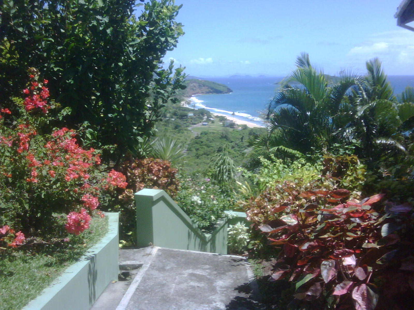
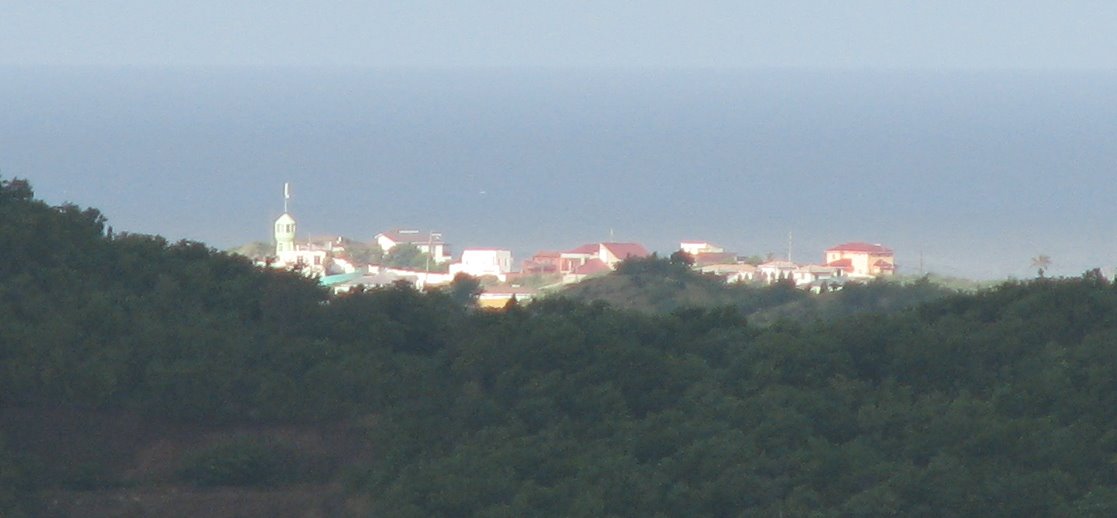
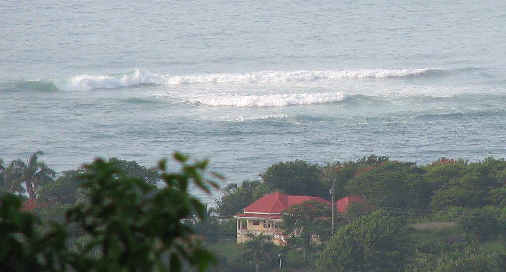
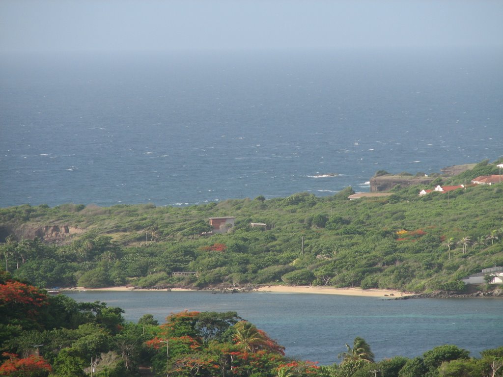
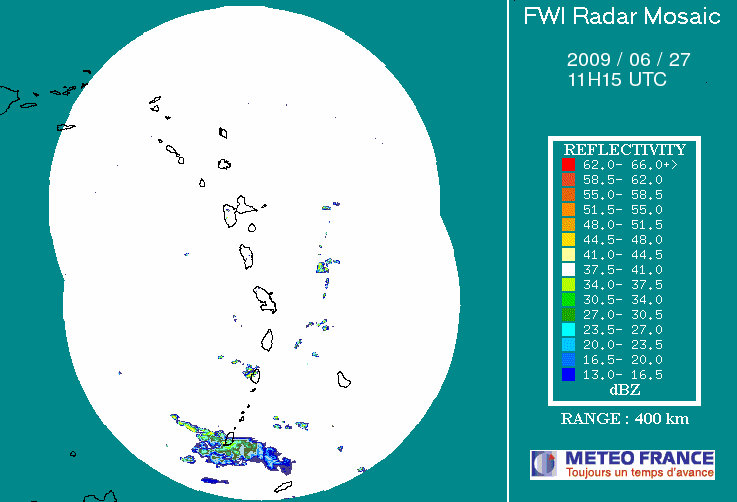