
|
- - - 2008 Hurricane Season - - -
|
- SxmGIS - Hurricane Mobility Pass Application Process Starts April 14
|
- From: Roddy Heyliger <roddyheyliger at yahoo.com>
- Date: Mon, 13 Apr 2009 15:35:31 -0700 (PDT)
|
News Release
Prepared by Roddy Heyliger, Government Information Service (GIS), Ennia Bldg., Longwall Rd., Philipsburg, St. Maarten D.W.I. Tel. 00-599-543-1162, 542-4119, Fax: 543-1169;
For Immediate Release: Monday, April 14, 2009/N078
Hurricane Mobility Pass Application Process Starts April 14
GREAT BAY, St. Maarten (GIS) – The application process for Mobility Passes for the 2009 Hurricane Season which starts from June 1 to November 30, starts as of April 14 only for the business sector and vital organizations. The pass allows the aforementioned to assess possible damage to their property. Potential applicants have until May 22 to present all relevant information related to the process of requesting a Mobility Pass.
For the 2009 season, the application form as well as information sheet can be downloaded from the Fire Department’s website www.brandweersxm.net under the link “Hurricane Information.”
Passes are issued to the following categories: government personnel, personnel of essential companies or organizations, (sub) contractors for Sector ROB-Public Works, transportation passes for hotel staff, business owners and members of vital organizations.
The hurricane pass application procedure is only intended for businesses and vital organizations with respect to their key personnel receiving an exemption to a curfew.
The Office of the Fire Department & Disaster Management is handling the application process for the passes on behalf of the Governor of the Island Territory of St. Maarten.
The hurricane mobility pass system is a mechanism to maintain public order during emergency situations. The Governor assesses the damage after a disaster has occurred and can impose a curfew if the extent of the damage poses a threat to the safety and security of the community.
After a disaster has struck, and a curfew has been imposed, the public roads can only be accessed by emergency crews. The Governor will ensure that the curfew is limited to the essential time that is needed to execute emergency and disaster relief and recovery efforts.
§ Businesses and vital organizations can request personal passes for their key personnel. In principle only one (1) pass is granted per business, but for larger companies more passes can be requested.
§ This pass will allow the bearer to visit his place of business to assess possible damage to the property, ONLY during certain hours that will be stipulated and announced by the Governor in a curfew situation.
§ Proof must be submitted that one has a business on given address and/or is a member of a vital organization for which a pass is requested. Therefore a copy of the most recent business license (2009) should be submitted (or proof of registration at the Chamber of Commerce for vital organizations).
§ The application form has to be completed and submitted to the offices of the Fire Department & Disaster Management, located at Backstreet 56 (upstairs) before May 22, 2009, with all necessary documents attached:
- copy business license fee paid for 2009;
- copy new model Sint Maarten ID-card (old cards are null and void);
§ When the request is submitted per form Nafl. 50,- in leges stamps, to be obtained at the Island Receiver, needs to be included. This is a non-refundable handling fee.
§ One (1) passport picture must be submitted with the request for new applicants.
§ The emergency pass is only valid for the year 2009 hurricane season and will remain the property of the Island Territory. Passes have to be requested on an annual basis.
§ The Governor approves the granting of the hurricane passes to applicants.
§ Persons whose applications have been turned down will be notified on behalf of the Governor. Appeal is not possible.
§ Persons without a valid residency permit will not be issued a pass.
§ One will be informed by email or telephone when to pick up the pass at the Office of the Fire Department & Disaster Management on Backstreet 56 (office hours are Monday – Friday, 8.30 AM – 3.30 PM).
§ The Island Territory is authorized to verify the information that is supplied by the person / business requesting the emergency pass.
§ Failing to comply with the abovementioned procedure, omitting information or handing in the form too late will result in the application being turned down.
For those without internet access, application forms are available at the Fire Department & Disaster Management Office located on Backstreet 56 (upstairs).
# # #
Roddy Heyliger
Government Information Service (GIS)
St. Maarten D.W.I.
Roddy Heyliger
MedPRO - Communications & Public Relations
Cell: 00 599 5204217, 5816323 (Voice Mail)
Email: roddyheyliger at gmail.com
MedPRO - Designed to broaden public knowledge by informing.
Attachment:
SxmGIS NRelease Hurr Mobility Pass Application Process 2009 130409.txt
Description: Binary data
|
|
- Update
|
- From: "Barbara Cannegieter" <barcann at hotmail.com>
- Date: Sun, 8 Mar 2009 09:27:58 -0300
|
The winds continue
high here in St. Maarten.
At this time
the airport reports Wind from
the NE (050 degrees) at 14 MPH (12 KT)
With higher
gusts.
At 7 AM
they reported winds of 18MPH .
The Heineken Regatta
continues but with altered courses due to the wind and large northerly swells.
The racing is more centered around Simpson Bay and Philipsburg and the route to
Marigot was cancelled yesterday. They also cancelled the gunboats and multi
hull races yesterday.
Those were supposed
to take place in the Anguilla channel and it is quite rough out there. A wind
gust of 29 MPH was reported there yesterday and in some areas there were 10
feet swells.
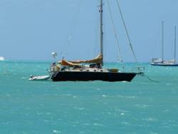
I took this
picture yesterday of some of the boats racing in calmer waters just West
of Philipsburg.

I also took this
picture of the waters in Marigot in the bay which is sheltered. You can see how
choppy the water is so you can imagine what it is like outside in the open sea.
Today is the
last day of racing. The prizes will be given out tonight and the regatta will
end with a bang with The Wailers giving a
concert!
For more
details of the racing, check out the Heineken regatta web site.
http://www.heinekenregatta.com/
http://barcann.livejournal.com
|
|
|
- Update
|
- From: "Barbara Cannegieter" <barcann at hotmail.com>
- Date: Thu, 5 Mar 2009 07:57:20 -0400
|
The Netherlands Antilles Met
Office has issued the following forecast:
|
Weather Forecast for the SSS
Islands valid until Friday morning 06:00 hours, March 06, 2009.
Synopsis:
A cold front, extending from the Western Caribbean, Northeastward across
Puerto Rico will become stationary and dissipates during the
next day or so. A strong high pressure will build across the
Western Atlantic behind the aforementioned front, pushing remnants of
this frontal boundary across the local area. As a result of this, lower
temperatures can be expected across the local islands by today into the
weekend with widely scattered shower activity. As for
marine conditions, expect higher breakers across the North and East
facing coastlines today due to North to Northeasterly swells. A small
craft advisory is in effect until further notice.
Sea
Conditions:
With
wave heights over the open waters of 3 to 7 feet, conditions will
remain moderate to fairly rough.
Special Features: none
Outlook until Saturday morning: Partly cloudy, at times mostly cloudy
with chance of an isolated shower; breezy with lower temperatures and as
for marine conditions, seas may deteriorate even more due to combination
of Northeasterly swells and stronger winds.
Looks like the boats sailing in this weekend’s Heineken
Regatta may have some high seas to contend with.
|
http://www.heinekenregatta.com/
|
|
|
- Update
|
- From: "Barbara Cannegieter" <barcann at hotmail.com>
- Date: Wed, 4 Mar 2009 10:44:19 -0400
|
It’s been a long time since I posted anything here but
I daily check the other reports.
There has not been much to talk about.
The most important weather fact is that we have had no rain
and we need it badly.
The entire island is so dry and the hills are brown.
And our garden is so dry.
Someone send rain please!


http://barcann.livejournal.com
|
|
|
- St. Maarten Seeking to Establish Early Relationship with National Hurricane Center
|
- From: Roddy Heyliger <roddyheyliger at gmail.com>
- Date: Tue, 3 Mar 2009 13:58:35 -0400
|
|
News Release
Written by Roddy Heyliger, Government Information Service (GIS), Ennia Bldg., Longwall Rd., Philipsburg, St. Maarten D.W.I. Tel. 00-599-543-1162, 542-4119, Fax: 543-1169; Email: gis at sintmaarten.net;
For Immediate Release: Monday, March 02, 2009/N046
Commissioner Buncamper seeking to establish early relationship with National Hurricane Center
GREAT BAY, St. Maarten (GIS) – Commissioner of Economic Affairs Maria Buncamper-Molanus, is seeking to establish an early relationship with the National Hurricane Center (NHC) of Miami since the responsibilities of the Central Government meteorological service will be transferred to the Island Territory as of July 1, 2009.
The transfer of tasks and responsibilities is based on the November 24, 2008 agreement that was signed between the Island Territory and the Central Government.
“In anticipation of the takeover, the Central Government will be asked to cooperate with the action plan of St. Maarten which is taking a pro-active approach in preparing for country status and the responsibilities that come with it.
“St. Maarten is in the hurricane belt and we need to establish direct protocols with the NHC out of Miami which has the resources with respect to satellites and aircraft that keep track of these systems throughout the Atlantic, Caribbean and the Gulf of Mexico and provide early warning for the residents,” Commissioner of Economic Affairs Maria Buncamper-Molanus told the Government Information Service (GIS) on Monday.
The 2008 hurricane season according to the U.S. National Oceanic and Atmospheric Administration (NOAA) produced a record number of consecutive storms to strike the United States and ranks as one of the more active seasons in the 64 years since comprehensive records began.
A total of 16 named storms formed in the 2008 season, which included eight hurricanes, five of which were major hurricanes at category three strength or higher.
“According to the NOAA, the 2008 hurricane season continued the current active hurricane era and is the tenth season to produce above-normal activity in the past 14-years.
“The 2008 season overall, is tied as the fourth most active in terms of named storms (16) and major hurricanes (five), and is tied as the fifth most active in terms of hurricanes (eight) since 1944. St. Maarten as an island nation in the hurricane belt, has to ensure that we have direct links with institutions that can provide reliable early warning information in order for residents and businesses to prepare for an approaching storm,” Commissioner Buncamper-Molanus explained.
# # #
Roddy Heyliger
St. Maarten Government Information Service (GIS)
--
Best regards,
Roddy Heyliger
P.O.Box 945, Philipsburg, St. Maarten
Cell: 5204217-primary, 5816323-secondary
Public Relations & Communications
Secondary Email: roddyheyliger at yahoo.com
CONFIDENTIALITY NOTICE
This e-mail message is intended only for the individual(s) to whom it is
addressed. This e-mail may contain information that is privileged,
confidential and exempt from disclosure under applicable law. If you are not
the intended recipient, you are hereby notified that any dissemination,
distribution or copying of this communication is strictly prohibited. If you received this e-mail by accident, please notify the sender immediately and destroy this e-mail and all copies of it.
|
|
- Update
|
- From: "Barbara Cannegieter" <barcann at hotmail.com>
- Date: Wed, 31 Dec 2008 10:06:47 -0400
|
Happy
New Year everyone!
The
last day of 2008 is sunny and bright.
The winds have died down and the rain has
cleared out and it is beautiful Caribbean weather.
Wishing
you all a happy healthy 2009 , and best
wishes for a safe hurricane season!

http://barcann.livejournal.com
|
|
|
- Update
|
- From: "Barbara Cannegieter" <barcann at hotmail.com>
- Date: Mon, 29 Dec 2008 14:52:27 -0400
|
Where
is the sun?
Rain,
rain, rain. Nothing but rain today.
And windy.
The wind bring the rain squalls.
And
the rain squalls and the wind together make it feel cold!
My
indoor thermometer says 72 degrees.
BRRR!

http://barcann.livejournal.com
|
|
|
- Update
|
- From: "Barbara Cannegieter" <barcann at hotmail.com>
- Date: Tue, 23 Dec 2008 08:45:45 -0400
|
The Christmas
winds are here. We have very windy conditions, and had a few showers this morning.
The wind is around 16 MPH out of the East.
The forecast
is:
Today: Easterly,
10 to 18 miles per hour with possible gusts to 24 miles per hour.
Tonight: Easterly, 10 to 18 miles per hour.
Tuesday: Northeast to East, 12 to 20 miles per hour
with possible gusts to 26 miles per hour.
Synopsis: A
ridge of a high pressure system over the Central Atlantic is maintaining a
moderate to fresh Easterly wind flow across the local region. This wind flow
will bring from time to time some cloudiness over the local area, out of which
a brief local shower could develop, during this forecast period.
Furthermore, latest weather forecast guidance suggests some
additional moisture increase across the overall local region
by mid week causing cloudy skies and widespread showers along
with breezy conditions around Christmas day. This outlook however is subject to
change as the forecast guidance adjusts itself with time and becomes more
consistent.
Hazardous
Weather Outlook: None
Special Features: none.
Volcanic
Activity: Soufriere Hills in Montserrat
continues with the event of ash and gas emission. Ash plume extends toward the
West from the summit and remains out of the local region during the forecast
period as Easterly air flow persists across the Northeastern Caribbean.
Outlook
until Wednesday midday: Generally
partly cloudy skies with chance of an isolated shower and increasing
winds to fresh and occasionally strong.
Wishing All my Caribbean neighbors, a wonderful Christmas and a
Happy 2009!


http://barcann.livejournal.com
|
|
|
- Governor: 2008 hurricane season second most destructive on record
|
- From: "Roddy Heyliger" <roddyheyliger at gmail.com>
- Date: Mon, 1 Dec 2008 12:20:50 -0400
|
|
News Release
Written by Roddy Heyliger, Government Information Service (GIS), Ennia Bldg., Longwall Rd., Philipsburg, St. Maarten D.W.I. Tel. 00-599-543-1162, 542-4119, Fax: 543-1169; Email: gis at sintmaarten.net;
For Immediate Release: Sunday, November 30, 2008/N191
Governor: 2008 hurricane season second most destructive on record
GREAT BAY, St. Maarten (GIS) – Chairman of the Emergency Operations Center (EOC) Governor Franklyn Richards on Sunday said that the nation had much to be thankful after a busy 2008 hurricane season with 16 named storm systems that started at the end of May before the start of the season with Tropical Storm Arthur and ended with Paloma in November.
Arthur formed almost a month early, and the last time that this happened was 27-years ago in 1981. This year according to hurricane forecasters is the second-most destructive on record.
Eight hurricanes formed out of the 16 tropical storm systems with five of those becoming major hurricanes of at least category three strength or higher.
"We have to learn from this past hurricane season in order to prepare for the next one. Hurricane Omar was a wake-up call for all of us. Prior to the next season, as a community and as a nation, we need to strengthen our protections and make sure that all of our communities are safer and stronger.
"Let us be thankful that we were speared the full onslaught of a hurricane and count our blessings while we pray for those who are still recovering from the impact of hurricanes during the season.
"I would like to use this opportunity to also thank all the Emergency Support Functions (ESFs), the Government Information Service (GIS), the broadcast and print media and other supporting organizations that played their part prior, during and after the passing of Hurricane Omar.
"I would also like to thank the people for taking the necessary measures to prepare and also for adhering to advisories after the passing of a hurricane. Let us learn from the Omar experience and in the New Year plan and prepare early for the 2009 season," Chairman of the Emergency Operations Center (EOC) Governor Franklyn Richards told the Government Information Service (GIS) on Sunday.
Tropical storm systems that formed for the 2008 hurricane season were Arthur, Bertha, Cristobal, Dolly, Edouard, Fay, Gustav, Hanna, Ike, Josephine, Kyle, Laura, Marco, Nana, Omar and Paloma.
# # #
Roddy Heyliger
St. Maarten Government Information Service (GIS)
--
Best regards,
Roddy Heyliger
P.O.Box 945, Philipsburg, St. Maarten
Cell: 5204217-primary, 5816323-secondary
Public Relations & Communications
Secondary Email: roddyheyliger at yahoo.com
CONFIDENTIALITY NOTICE
This e-mail message is intended only for the individual(s) to whom it is
addressed. This e-mail may contain information that is privileged,
confidential and exempt from disclosure under applicable law. If you are not
the intended recipient, you are hereby notified that any dissemination,
distribution or copying of this communication is strictly prohibited. If you received this e-mail by accident, please notify the sender immediately and destroy this e-mail and all copies of it.
|
|
- Update
|
- From: "Barbara Cannegieter" <barcann at hotmail.com>
- Date: Sun, 9 Nov 2008 08:59:10 -0400
|
Hurricane season just had to
produce a monster storm before it was done.
I am so sorry to read of the
terrible reports coming from the Caymans, particularly Cayman Brac.
I am not sure if we have a Cuba correspondent
or not but I found this report from AP on Yahoo News and thought I would post
it here.
My heart goes out to those in Cuba
too and I hope the Bahamas will have few problems from what is now a tropical storm.
CAMAGUEY,
Cuba – A ferocious Hurricane Paloma roared
ashore in Cuba on Sunday, downing power lines,
flooding the coast and forcing hundreds of thousands of people to evacuate on
an island still recovering from two other devastating storms.
Early
reports of damage were limited, but Cuban state media said the late-season
storm toppled a major communications tower on the southern coast, interrupted
electricity and phone service, and sent sea surges of up to 700 meters along
the coast.
Paloma made landfall near Santa Cruz del Sur late Saturday as an extremely dangerous Category 4 storm, but soon weakened to a
tropical storm with winds of 70 mph (110 kph),
according to the National Hurricane Center in Miami. Forecasters say the Cuban
government has discontinued all warnings associated with Paloma.
The storm
was expected to continue to lose strength as it slowly moved across Cuba and
headed toward the central Bahamas on Monday morning. The storm was expected to
unravel and not threaten the southern tip of Florida.
In the
central-eastern Cuban province of Camaguey, more
than 220,000 people were evacuated from low-lying areas. Another 170,000 people
were moved in the eastern province of Las Tunas.
Cuba
regularly relocates masses of people to higher ground ahead of tropical storms and hurricanes, preventing major losses
of life.
In the
city of Camaguey, 79-year-old Rosa Perez waited out the storm at a government
shelter with her 83-year-old husband and about 900 others from the town of
Santa Cruz del Sur.
Perez was
a toddler when she watched as her mother, older sister and about 40 other
relatives were swept away in a storm surge during
a 1932 hurricane that killed about 3,000 people.
"We're
just waiting to see what happens to our home and our beach," she said.
Fellow Santa Cruz del Sur resident Aida Perez, who is not
related, watched the news with her daughters, ages 19 and 10.
"This
is a really hard blow," the 44-year-old said. She was certain they would
lose their home and everything in it. "What's important is that we are
alive."
Outside
on the nearly deserted, flooded streets, four men struggled in pouring rain to
carry a refrigerator to a more secure building.
At 7 a.m.
EST Sunday, Paloma was near Camaguey. Once packing
winds of 145 mph, the storm had slowed over land and was moving northeast at
about 5 mph (7 kph).
Tropical storm force winds
extended outward up to 115 miles (185 km).
In an
essay published in state media Saturday, former
President Fidel Castro warned that Paloma could
slow Cuba's recovery from hurricanes Gustav and Ike, which hit in late August
and September causing about $9.4 billion in damage and destroying nearly a
third of the island's crops.
The
hurricane center said Paloma could bring parts of the
island battering waves and a life-threatening storm surge of up to 23 feet (7
meters).
Elsewhere,
Paloma knocked out power across much of Grand Cayman
island, downing trees, flooding low-lying areas and ripping off roofs. But
residents appeared unscathed as businesses reopened and electricity and water
service were restored Saturday.
Donovan Ebanks, chairman of the Hazard Management Committee, said
no injuries were reported.
"There
has been minimal, if any, damage on Grand Cayman,"
Ebanks said.
Paloma's fierce winds ripped the
roofs off some buildings on Cayman Brac,
to the east.
___
Associated
Press writers Anita Snow in Havana and Trent
Jacobs in George Town, Cayman Islands,
contributed to this report.
http://barcann.livejournal.com
|
|
|
- Update
|
- From: "Barbara Cannegieter" <barcann at hotmail.com>
- Date: Sat, 8 Nov 2008 13:56:59 -0400
|
My thoughts are with all the
wonderful people on the Cayman islands feeling the wrath of Paloma.
I understand what they are going through.
This is their “Luis”,
the cane that caused so much damage on St. Maarten.
I pray there is no loss of life…
buildings can be rebuilt but a life cannot be brought back.
http://barcann.livejournal.com
|
|
|
- Omar report
|
- From: "T Shell Inn" <info at tshellinn.com>
- Date: Sat, 25 Oct 2008 15:43:26 -0400
|
Sorry
that I am slow to respond. Simpson Bay is pretty much back together. Public
works did a good job of clearing the beach road. The waves came up higher than
expected and sand went through our property, but no structural damage. Some
cars that were not moved were damged by the salt water getting into the
engines.
The
rapid passing of the storm did minimize the damage.
Regards,
Carter
Glass
Turquoise Shell Inn
34
Simpson Bay Rd.
Simpson
Bay, Sint Maarten NA
www.tshellinn.com
Telephone: (USA
011)-599-545-2875
Fax:
(USA 011)-599-545-2846
|
|
|
- Update
|
- From: "Barbara Cannegieter" <barcann at hotmail.com>
- Date: Tue, 21 Oct 2008 09:15:30 -0400
|
|
|
|
- Update
|
- From: "Barbara Cannegieter" <barcann at hotmail.com>
- Date: Mon, 20 Oct 2008 11:49:02 -0400
|
SXM is quickly getting back to normal.
Electricity has been restored to 95% of the people, although load shedding will
be in place for awhile.
I even got my phone lines fixed
this morning and now have phone, Internet, and Cable TV.
Life is good!
Some of the hotels are still not open as they have some damage
from the high seas coming into beach front rooms , etc.
But most of the island is up and running
and ready for business.
http://barcann.livejournal.com
|
|
|
- Sunny, warm...
|
- From: "Roddy Heyliger" <roddyheyliger at gmail.com>
- Date: Sat, 18 Oct 2008 15:29:58 -0400
|
Today (Saturday - 03.30): it's sunny, warm with clear to partly cloudy skies. Everybody is still busy cleaning up after the passing of Hurricane Omar. Much has been done since Thursday.
With respect to the status of the residential area of Pelican, ninety-nine percent of the homes did not suffer any damage. Those that did were located along the beach. The seas came inshore by approximately 100 feet – storm surge.
One house lost part of its seawall. Others suffered from water coming inside. Some hotel rooms on the ground floor of two properties were also inundated with seawater and sand.
-- Best regards, Roddy Heyliger P.O.Box 945, Philipsburg, St. Maarten Cell: 5204217-primary, 5816323-secondary Public Relations & Communications Secondary Email: roddyheyliger at yahoo.com
CONFIDENTIALITY NOTICE This e-mail message is intended only for the individual(s) to whom it is addressed. This e-mail may contain information that is privileged, confidential and exempt from disclosure under applicable law. If you are not
the intended recipient, you are hereby notified that any dissemination, distribution or copying of this communication is strictly prohibited. If you received this e-mail by accident, please notify the sender immediately and destroy this e-mail and all copies of it.
|
|
- Update
|
- From: "Barbara Cannegieter" <barcann at hotmail.com>
- Date: Sat, 18 Oct 2008 12:51:12 -0400
|
Greetings from St. Maarten after
Hurricane Omar paid us a visit.
It was pretty fierce here for
awhile but thankfully Omar didn’t stay around long.
While he was here though he did his
damage… flooding, beach erosion, lots of trees down, electricity poles
down, a few roofs blown off.
All in all, while we were lucky,
the damage ended up being extensive.
There was not much major structural
damage though.
Most of the Dutch side does not
have regular electricity…... it is sort of an on and off affair. It comes and goes.
Power company says it will be 2
weeks before they are back to normal and for now are operating at 10% capacity.
Everyone’s favorite beach
bar, Sunset Beach Bar by the airport, is gone.
We weathered it OK except we lost a
lot of trees in the garden.
The worst thing is that my phone lines are down. Since I have DSL,
this means no internet.
And I have a feeling it might not
get fixed for a good while.
Now this means I am basically cut
off from the outside road. No phone, no electricity, no Cable TV, no internet.
I do have a cell phone and
thankfully we have a generator.
It could be worse !
In order to send this, I will have to find a Wi Fi hot spot or internet café
somewhere.
Since I have not been online, I
have no idea how the other islands fared.
I hope you all are OK and did not let Omar
give you too many problems.
Thinking of you all as we continue
cleaning up after Omar!
Barbara
http://barcann.livejournal.com
|
|
|
- Message Board
|
- From: Gert van Dijken <gert at vandijken.com>
- Date: Fri, 17 Oct 2008 18:26:52 -0400 (EDT)
|
Some people from the island are also posting on the 'Friendly Island
Forum', http://gobeach.com/sxm You can ask specific questions there.
(That board is actually a continuation of the StormCARIB Pleas for Help
forum ( http://help.stormcarib.com ) after Lenny).
Gert

*
**
*** Gert van Dijken ( gert at vandijken.com )
**** Caribbean Hurricane Network - http://stormcarib.com
|
|
- Hurricane OMAR
|
- From: Jenkins Pamela <pamelzoe at yahoo.com>
- Date: Fri, 17 Oct 2008 12:54:31 -0700 (PDT)
|
Dear Gert,

I told you I would contact you and I am..

I am totally shocked just now at what I have seen this morning.
I live on the French side .. Baie Nettle.... Nothing happened there excepst
some trees.. Its life as usual for us. We had electrity except for some short
breaks but no water till yesterday and its on off today.
What is simply amazing... the plastic cover I had on my car didn't move..

However the Dutch side is another sad story..
I passed from Marigot where the Front de Mer received rocks, sand and debris
and has already been cleaned, through Cole Bay where most of the huge
billboards are down to Simpson Bay... Tears came to my eyes after seeing the
destruction.. Around 3 am Thursday morning Laser 101 said that a tornado had
gone through Simpson Bay.. It did... Its all brown and trees down, roofs off
and its bad... Then the shock.

Pelican Key... Pelican beach sand was moved up to the wall; The beach bar is
for total removal, the watersports were drying out what was there; The sales
office gone and full of seawater and sand as is the restaurant Los Gauchos...
They had the bulldozers there to remove the sandback onto the beach.

Flamingo..... Well its worse than Hurricane Lenny where I was in the bathroom
with my small children and waves crashing on the second floor..

This time however the windows smashed in 7101, 7103 and 7102 on the area called
the Point. They absolutely destroyed.
People in the one unit would n't move and now are injured..They also
didn't move in the terrace furniture, I was told over there by some "survivors".
The beach BBQ that was , was pushed out and over the wall and ended up almost
on the terrace of  7107. Most of the rooms on the ground floor are flooded.
The swimming pool was totally full of the beach!
We were there last Saturday enjoying the pool.
The front desk was flooded as the gap between the Flamingo and the villa was
where the sea was able to come all the way up. Sand is everywhere..

Then Simpson Bay village area... People look dismayed at what has happened
there..
Maho and  then    Sunset Beach Bar.... gone.... a wooden shelter is all that is
left.. I couldn't go in to Bliss but a photo of The French Touch means Bliss
must be the same...
The end of the runway. Fence down, runway... sand and rocks.

Mullet Bay   The golf course is covered in sand and was totally flooded... road
still is. Trees are down..

I didn't venture into Philipsburg but Cupecoy area didn't look that bad...
evcen those horrible concrete jungles..

Its extremely sad for St Maarten just as the season is about to begin and as
well with the bad economy..


However as the island people are so used to hurricanes... everybody is out
cleaning, cutting down trees and trying to get back to normal...

Pamela

__________________________________________________
Do You Yahoo!?
Tired of spam?  Yahoo! Mail has the best spam protection around
http://mail.yahoo.com
|
|
- SxmGIS - Update by the Emergency Operations Center on recovery and clean-up efforts
|
- From: "Roddy Heyliger" <roddyheyliger at gmail.com>
- Date: Thu, 16 Oct 2008 19:08:27 -0400
|
News Release
Written by Roddy Heyliger, Government Information Service (GIS), Ennia Bldg., Longwall Rd., Philipsburg, St. Maarten D.W.I. Tel. 00-599-543-1162, 542-4119, Fax: 543-1169; Email: gis at sintmaarten.net;
For Immediate Release: Thursday, October 16, 2008/N000 – 6.00PM
Update by the Emergency Operations Center on recovery and clean-up efforts
GREAT BAY, St. Maarten (GIS) – Chairman of the Emergency Operations Center (EOC) Governor Franklyn Richards, chaired a meeting of the Emergency Support Functions (ESFs) of the Island Government's Disaster Management System that met at 3.00pm on Thursday afternoon to provide an update with respect to their recovery and clean-up efforts after the passing of Hurricane Omar.
Business as usual:
It is business as usual since Thursday afternoon for all businesses on the island. Friday, October 17 will be a normal business day.
Schools
Schools are to remain closed on Friday. In consultation with the Commissioner of Education, an assessment of all public schools will be carried out on Friday. Additional information will be made available on Friday as to the recommencement of classes.
Electricity Service:
Technicians from GEBE according to the Managing Director William Brooks are working diligently to restore the power supply. By Thursday evening, areas with underground cabling should have electricity. For areas with cables above ground, within seven days electricity would have been restored to the affected areas.
Government Services:
All essential staff of the ESFs will remain active on Friday, October 17 during the continued recovery and clean-up efforts.
Government will need to provide a minimum level of basic services on Friday, October 17 to the general public. Department heads and basic staff are to report to work on Friday, October 17 from the following government departments: Census Office, IT Department, General Affairs, the Island Secretariat, the Government Information Service (GIS) and the Island Receiver's Office.
All other government departments not mentioned, the department heads and staff are to remain on standby and be readily accessible if required, according to the Island Secretary Joane Dovale-Meit.
Public Health:
The Hygiene Department has already carried out a number of inspections with respect to food safety. These inspections will be intensified on Friday.
There were three hurricane related calls that the ambulance service responded too and they were all minor injuries.
Family physicians and pharmacies will reopen on Friday, to render services to the community.
Public Works/Infrastructure:
All main roads, 85 per cent have been cleared by road clearing crews who have been working diligently to complete this effort. The clearing of district roads is going very well and would be completed by the weekend.
Telecommunications:
Telcell reported two cell sites being down. Service on Saba has been restored and technicians are working to restore service on St. Eustatius. Approximately 1100 land subscribers are without service. Restoration of services will take up to six weeks. Telem's offices will be open on Friday and customers can report their outages.
Seaport/Airport:
Additional inspections are needed of the Port of St. Maarten. The new cruise pier has suffered damage and there will be a delay in its completion which was set for December 15.
Shipping schedules with respect to the cargo facility will be adapted accordingly based on inspections that need to be carried out around the docking areas. Once the seas subside, these will be carried out.
Due to the high sea swells that dumped rocks and sand on the runway of the Princess Juliana International Airport, and damage to part of the security/safety fence, the airport remained closed on Thursday. Crews were busy cleaning up the runway and repairing the fence in order to be able to meet all international safety aviation requirements. Repair crews were working diligently to get the airport open as soon as possible. The airport is scheduled to reopen on Friday morning.
Conclusion:
EOC Chairman Governor Franklyn Richards would like to thank the members of the Netherlands Antilles Police Force, Section St. Maarten, the VKS Officers, the Marechaussee, and the Royal Dutch Marines, the Emergency Support Functions, and first responders for their outstanding assistance before, during and after the passing of Hurricane Omar.
I would also like to thank the broadcast media, the GIS as well as the print-media for the role that they have played prior to the passing of Hurricane Omar, during the passing of the category three hurricane and now the current phase of recovery and clean-up, in facilitating the necessary information to the general public.
I would like to commend persons who have been cleaning up their surroundings and placing debris and refuse at garbage disposal areas and in bins. Please do continue to do this as all hands are needed on deck to quickly clean-up the island.
I must also use this opportunity to commend the nation for heeding the warnings that were given to prepare for Hurricane Omar and for remaining indoors until the system had passed.
# # #
Roddy Heyliger
St. Maarten Government Information Service (GIS) -- Best regards, Roddy Heyliger
P.O.Box 945, Philipsburg, St. Maarten Cell: 5204217-primary, 5816323-secondary Public Relations & Communications Secondary Email: roddyheyliger at yahoo.com
CONFIDENTIALITY NOTICE This e-mail message is intended only for the individual(s) to whom it is addressed. This e-mail may contain information that is privileged, confidential and exempt from disclosure under applicable law. If you are not
the intended recipient, you are hereby notified that any dissemination, distribution or copying of this communication is strictly prohibited. If you received this e-mail by accident, please notify the sender immediately and destroy this e-mail and all copies of it.
-- Best regards, Roddy Heyliger P.O.Box 945, Philipsburg, St. Maarten Cell: 5204217-primary, 5816323-secondary Public Relations & Communications
Secondary Email: roddyheyliger at yahoo.comCONFIDENTIALITY NOTICE This e-mail message is intended only for the individual(s) to whom it is addressed. This e-mail may contain information that is privileged,
confidential and exempt from disclosure under applicable law. If you are not the intended recipient, you are hereby notified that any dissemination, distribution or copying of this communication is strictly prohibited. If you received this e-mail by accident, please notify the sender immediately and destroy this e-mail and all copies of it.
|
|
- SxmGIS - Prevent Mosquito Breeding in Post Hurricane Omar Period
|
- From: "Roddy Heyliger" <roddyheyliger at gmail.com>
- Date: Thu, 16 Oct 2008 19:06:41 -0400
|
News Release
Written by Roddy Heyliger, Government Information Service (GIS), Ennia Bldg., Longwall Rd., Philipsburg, St. Maarten D.W.I. Tel. 00-599-543-1162, 542-4119, Fax: 543-1169; Email: gis at sintmaarten.net;
For Immediate Release: Thursday, October 16, 2008/N171
Residents must act urgently to prevent mosquito breeding
GREAT BAY, St. Maarten (GIS) – Of great concern to the health department are mosquitos. The public is hereby instructed to eliminate all breeding habitats that they come across that would allow mosquito breeding.
Debris, old tires and standing fresh water in yards are the main source and breeding ground for mosquitoes bringing about an increased risk of mosquito-borne diseases.
Residents are therefore strongly advised to take immediate action making sure there is no standing water in their yards and roof spouts; and disposing responsibly old tires, empty drums, buckets, jars, birdbaths, boats, plant containers, paint cans and other items that can collect water around their homes and businesses. Where standing water exists, one can use small amounts of kerosene, just to cover the surface as a measure to prevent mosquito breeding.
In the case of where containers are used for storing water, residents should keep these covered. Inlets and outlets of cisterns must be covered with a mosquito net or cloth to prevent mosquitos from breeding in the water.
Dengue viruses are transmitted to humans through the bites of infective female Aedes Mosquito. Mosquitoes generally acquire the virus while feeding on the blood of an infected person. After virus incubation for eight to 10 days, an infected mosquito is capable, during probing and blood feeding, of transmitting the virus for the rest of its life. The average life span of an Aedes mosquito in nature is two weeks.
Infected humans are the main carriers and multipliers of the virus, serving as a source of the virus for uninfected mosquitoes.
Measures to protect you and your family from being bitten by a mosquito are: remaining in well-screened or completely enclosed air-conditioned areas, and wearing clothing that reduces the amount of exposed skin.
In addition, the use of insect repellent on exposed skin is recommended. Insect repellents containing DEET are the most effective.
Cover baby cribs with a mosquito net.
With respect to mosquito fogging. This cannot be done on a regular basis because firstly, it is not good for the environment, secondly, the mosquito's could become immune to the chemical used, and thirdly, it doesn't work when it rains.
# # #
Roddy Heyliger
St. Maarten Government Information Service (GIS)
-- Best regards, Roddy Heyliger P.O.Box 945, Philipsburg, St. Maarten Cell: 5204217-primary, 5816323-secondary
Public Relations & Communications Secondary Email: roddyheyliger at yahoo.comCONFIDENTIALITY NOTICE This e-mail message is intended only for the individual(s) to whom it is
addressed. This e-mail may contain information that is privileged, confidential and exempt from disclosure under applicable law. If you are not the intended recipient, you are hereby notified that any dissemination,
distribution or copying of this communication is strictly prohibited. If you received this e-mail by accident, please notify the sender immediately and destroy this e-mail and all copies of it.
-- Best regards, Roddy Heyliger P.O.Box 945, Philipsburg, St. Maarten Cell: 5204217-primary, 5816323-secondary Public Relations & Communications Secondary Email: roddyheyliger at yahoo.com
CONFIDENTIALITY NOTICE This e-mail message is intended only for the individual(s) to whom it is addressed. This e-mail may contain information that is privileged, confidential and exempt from disclosure under applicable law. If you are not
the intended recipient, you are hereby notified that any dissemination, distribution or copying of this communication is strictly prohibited. If you received this e-mail by accident, please notify the sender immediately and destroy this e-mail and all copies of it.
|
|
- SxmGIS - State of Affairs - Governor's statement from earlier today, Thursday, October 16, 2008 - 1.00PM
|
- From: "Roddy Heyliger" <roddyheyliger at gmail.com>
- Date: Thu, 16 Oct 2008 17:27:24 -0400
|
Press statement #3
Hurricane Omar – Thursday, October 16th, 2008
12.30PM
Emergency Operations Center (EOC) – Chairman Franklyn Richards
On Thursday morning October 16th the Emergency Operations Center members met under the Chairmanship of my person to discuss the state of affairs on the island after the passing of Hurricane Omar.
Together with the Disaster Coordinator, Fire Chief Winston Salomon, all Emergency Support Function groups were requested to present a preliminary report on their specific responsibilities and agencies since the passing of Hurricane Omar which was a category three system passing approximately 55 miles from the island during the early morning hours.
Public Works Clean-Up
The Public Works department has commenced an extensive island-wide clean-up effort, which concerns the removal of fallen trees, tree branches, rocks, sand and mud from the road network system. First priority is the main roads, which will also be used to transport all the storm debris and refuse to the landfill. Areas of concern are Pointe Blanche, Beacon Hill, around the Fresh Pond, Simpson Bay amongst other residential areas.
Schools
Schools are to remain closed on Friday. In consultation with the Commissioner of Education, an assessment of all public schools will be carried out on Friday. Additional information will be made available on Friday as to the recommencement of classes.
Electricity
NV GEBE has been able to maintain the power supply until the early hours of this morning. Due to the fact that the inlet of the cooling system at the Cay Bay Power Plant is being blocked by sea weed and sand and the generators could not function at full capacity and had to be shut down totally this morning. Crews are busy cleaning up the inlets related to the intake of the cooling system and once this has been resolved GEBE will be able to restart the power plant as soon as the high sea swells subside.
Water Service
Water service throughout the island has been suspended due to the high sea swells at Cay Bay which have been affecting the water intake system. Once sea conditions improve water service will resume to the various districts.
The island has two days of potable water stored in a number of water storage tanks throughout the island. Once electricity service comes back online in the Cupecoy area, the water plant at that location will be restarted and will produce approximately 3500 m2 per day.
The Cay Bay Water Plant is presently out of service due to the lack of electricity. Once electricity service is resumed to the aforementioned plant, the latter will be able to produce approximately 8000 m3 at start-up and should be back to full production capacity on Friday barring any unforeseen circumstances.
Airport
Due to the sea high swells rocks and sand have been dumped on the runway of the Princess Juliana International Airport runway. Part of the security/safety fence has also been damaged. Crews are busy cleaning up the runway and repairing the fence in order to be able to meet all international safety aviation requirements. Repair crews are working diligently to get the airport open as soon as possible. The airport is scheduled to reopen on Friday morning.
Seaport
The Port of St. Maarten harbour facilities have sustained some damage. The cruise area suffered some minor cosmetic damage. A number of cargo containers were shifted at the cargo storage area due to the heavy winds. Once the seas subside an underwater investigation will be carried out to assess the underwater situation at the cruise and cargo piers. Once the all clear is given, cargo and cruise ship services will resume.
Public Health
Sector Health Care Affairs has reported that there are no major injuries as far as can be ascertained at this point in time. Once the family physician clinics reopen, additional information will become available about possible injuries sustained during the passing of Hurricane Omar. The sector is stressing to observe cleanliness and a hygienic situation during the clean-up effort, to avoid any injuries.
Law & Order
The Police are being assisted by members of the VKS and the Royal Dutch Marines to maintain public safety in the execution of the island-wide curfew. It has been observed the public is not adhering to the curfew, which has been extended to 2.00 PM today Thursday October 16th. The Lt. Governor is urging the population to adhere to the curfew until 2.00PM.
Fire Dept.
The Fire Department has been assessing the general situation on the island since sunrise and assisting with the clean-up operation such as cutting trees, cleaning roads etc. Some main areas of concern are: Beacon Hill, Belair Hillside, Point Blanche, Guana Bay, Dawn Beach, Lowlands and the Cupecoy area.
Conclusion
I would like to reiterate that a formal damage assessment report still has to be compiled in order to have a complete assessment of the total damages sustained from the passing of Hurricane Omar.
I would like to commend persons who have been cleaning up their surroundings and placing debris and refuse at garbage disposal areas and in bins. Please do continue to do this as all hands are needed on deck to quickly clean-up the island. Please be aware that a curfew remains in place until 2.00PM.
I must also use this opportunity to commend the nation for heeding the warnings that were given to prepare for Hurricane Omar. Our emergency support services and first responders have been working diligently before, during and after the passing of Hurricane Omar. I commend them for their outstanding work so far.
We can consider ourselves blessed having been spared the wrought of this system which turned into a major category three hurricane. We must be thankful to the Lord Almighty and go to church this weekend and praise him for having spared our island nation.
In conclusion, an additional update will be provided later this afternoon as it pertains to our recovery operations and clean-up efforts.
Thank You -- Best regards, Roddy Heyliger P.O.Box 945, Philipsburg, St. Maarten
Cell: 5204217-primary, 5816323-secondary Public Relations & Communications Secondary Email: roddyheyliger at yahoo.comCONFIDENTIALITY NOTICE
This e-mail message is intended only for the individual(s) to whom it is addressed. This e-mail may contain information that is privileged, confidential and exempt from disclosure under applicable law. If you are not
the intended recipient, you are hereby notified that any dissemination, distribution or copying of this communication is strictly prohibited. If you received this e-mail by accident, please notify the sender immediately and destroy this e-mail and all copies of it.
Attachment:
Press statement hurricane Omar Oct 16th 2008.doc
Description: MS-Word document
|
|
- Press Release
|
- From: Gert van Dijken <gert at vandijken.com>
- Date: Thu, 16 Oct 2008 15:10:37 -0400 (EDT)
|
From the St.Maarten Tourist Board:

St. Maarten Emerges Unscathed After Passage of Hurricane Omar
Report on aftermath of Hurricane Omar
October 16, 2008
The Government of St. Maarten reports that Hurricane Omar, a Category
Three storm when it passed St. Maarten in the early morning hours of
Thursday, October 16, 2008, did not result in any deaths or significant
damages to its infrastructure or hotel sector. The Government of St.
Maarten also reports that hotels are fully operational and functioning
normally, as well as are the established tourist sites, attractions and
restaurants.
While most of the damage appears to be limited to beach erosion and
scattered debris that are associated with a storm of this caliber, it is
anticipated that within the next 12 hours all public utilities, including
electricity, which experience scattered outages during the storm, will be
fully functional. The Princess Juliana International Airport is expected
to open the morning of October 17th and will resume operating on a normal
schedule, as will banks, financial institutions, supermarkets, hospitals,
pharmacies, and other businesses.
"We are very thankful that our beautiful island only sustained minor
damages and that our residents and guests weathered the storm safely,"
commented Roy Marlin, Commissioner of Tourism. "Currently, we are working
to conduct a thorough inspection of all the resorts, hotels and other
infrastructure facilities to ensure public safety. We are confident that
following this comprehensive inspection that St. Maartenʼs tourism product
will sustain its high quality and character into the upcoming high
season."
*
**
*** Gert van Dijken ( gert at vandijken.com )
**** Caribbean Hurricane Network - http://stormcarib.com
|
|
- French Side
|
- From: Gert van Dijken <gert at vandijken.com>
- Date: Thu, 16 Oct 2008 11:21:43 -0400 (EDT)
|
Just heard something from the French Side. There is no curfew there
anymore. Still hard to drive around due to some downed trees. Not too
much damage, even the houses on Baie Longue (south side of the island
which sustained the highest winds) mostly ok with minimal roof damage.
Gert

*
**
*** Gert van Dijken ( gert at vandijken.com )
**** Caribbean Hurricane Network - http://stormcarib.com
|
|
- Beacon Hill
|
- From: Gert van Dijken <gert at vandijken.com>
- Date: Thu, 16 Oct 2008 10:29:40 -0400 (EDT)
|
I have heard from several people on St.Maarten. Cell phones are working.
That's the good news. There is still a curfew till noon or 1PM, so that
they can repair downed power lines etc. The following I heard directly
from people on the island, but remember that there are always a lot of
rumours and sensational stories right after the storm. Apparently the
Beacon Hill area sustained considerable damage, esp. the oceanfront
properties. The Sunset Bar for example had a lot of damage. Bavaria lost
its roof they said on the radio.
Otherwise things seem not too bad. In Cole Bay minimal damage, just clean
up (coconuts still on the trees), houses/condos on Simpson Bay ok, Oyster
Pond minimal damage. Seems that Beacon Hill got the worst.
Map of the island: http://gobeach.com/sxmmap.htm


*
**
*** Gert van Dijken ( gert at vandijken.com )
**** Caribbean Hurricane Network - http://stormcarib.com
|
|
- Really windy...very high wind gusts...
|
- From: "Roddy Heyliger" <roddyheyliger at gmail.com>
- Date: Thu, 16 Oct 2008 03:08:30 -0400
|
Today (Thursday - 03.10): it is really windy now with very high wind gusts. You can smell the sea spray. There is not much rain at this time.
Everyone stay safe. -- Best regards, Roddy Heyliger P.O.Box 945, Philipsburg, St. Maarten
Cell: 5204217-primary, 5816323-secondary Public Relations & Communications Secondary Email: roddyheyliger at yahoo.comCONFIDENTIALITY NOTICE This e-mail message is intended only for the individual(s) to whom it is
addressed. This e-mail may contain information that is privileged, confidential and exempt from disclosure under applicable law. If you are not the intended recipient, you are hereby notified that any dissemination,
distribution or copying of this communication is strictly prohibited. If you received this e-mail by accident, please notify the sender immediately and destroy this e-mail and all copies of it. |
|
- SxmGIS - Hurricane Omar Now a Dangerous Cat 3
|
- From: Roddy Heyliger <roddyheyliger at yahoo.com>
- Date: Wed, 15 Oct 2008 21:05:41 -0700 (PDT)
|
News Release
Written by Roddy Heyliger, Government Information Service (GIS), Ennia Bldg., Longwall Rd., Philipsburg, St. Maarten D.W.I. Tel. 00-599-543-1162, 542-4119, Fax: 543-1169; Email: gis at sintmaarten.net;
For Immediate Release: Wednesday, October 15, 2008/N171
HURRICANE OMAR NOW A DANGEROUS CATEGORY 3 HURRICANE
GREAT BAY, St. Maarten (GIS) – Hurricane Omar is now a dangerous category three hurricane. Earlier this evening it was a category two but based on the 11.00pm advisory, this has now changed. Omar at 11.00pm was located 30 miles South East of St. Croix and 105 miles West South West of St. Maarten.
Hurricane Omar wind speeds are now 115 miles per hour with higher gusts. Some additional strengthening is possible tonight according to the National Hurricane Center. The hurricane is moving faster at 20 miles per hour which is good for our islands as the system will move quickly away.
Chairman of the Emergency Operations Center (EOC) Governor Franklyn Richards, says weather conditions will continue to further deteriorate tonight.
The island will experience tropical storm conditions as the night progresses.
Islands in the path of a category three hurricane will experience wind speed between 111 to 130 miles per hour; a storm surge of 9 to 12 feet above normal. Some structural damage to small residences and utility buildings. Damage to shrubbery and trees with foliage blown off trees and large trees blown down. Low lying areas would be flooded. Flooding near the coast would destroy smaller structures with larger structures damaged by battering from floating debris.
Governor Richards would like to reassure the nation that all necessary pre-hurricane preparations are in place and all resources are on standby to respond to any emergencies.
Additional advisories will be issued and the public is advised to monitor radio broadcasts.
# # #
Roddy Heyliger
St. Maarten Government Information Service (GIS)
Roddy Heyliger
MedPRO - Communications Consultant
Cell: 00 599 5204217, 5816323
Email: roddyheyliger at gmail.com
Email: medproprfirm at hotmail.com
MedPRO - Designed to broaden public knowledge by informing.
|
|
- Currently, raining; short gusts of wind; sea pounding coastal area; distant thunder...
|
- From: "Roddy Heyliger" <roddyheyliger at gmail.com>
- Date: Wed, 15 Oct 2008 22:11:44 -0400
|
Today (Wednesday - 22.10): it is currently raining with short gusts of wind. I can hear the sea pounding along the coast as well as distant thunder.
Today has been a very busy day for many. This morning workmen were busy securing building and construction sites. Motorists were out and about visiting the grocery stores and supermarkets. They were busy up until 6.00pm this evening doing their last minute hurricane shopping.
Throughout the day we have had rain showers. The ground is soaked and additional rain fall from Hurricane Omar will cause some problems one can expect.
Everyone stay safe. -- Best regards, Roddy Heyliger P.O.Box 945, Philipsburg, St. Maarten
Cell: 5204217-primary, 5816323-secondary Public Relations & Communications Secondary Email: roddyheyliger at yahoo.comCONFIDENTIALITY NOTICE This e-mail message is intended only for the individual(s) to whom it is
addressed. This e-mail may contain information that is privileged, confidential and exempt from disclosure under applicable law. If you are not the intended recipient, you are hereby notified that any dissemination,
distribution or copying of this communication is strictly prohibited. If you received this e-mail by accident, please notify the sender immediately and destroy this e-mail and all copies of it. |
|
- SxmGIS - Press Statement by the Governor - The Approach of Hurricane Omar - National Preparations
|
- From: Roddy Heyliger <roddyheyliger at yahoo.com>
- Date: Wed, 15 Oct 2008 16:53:54 -0700 (PDT)
|
Press Statement Hurricane Omar October 15th 2008
Governor of the Island Territory, St. Maarten
Emergency Operations Center (EOC) – Chairman Franklyn Richards
For Immediate Release: Wednesday, October 15, 2008 – 6.45PM
At 5.00pm Hurricane Omar was located approximately 250 miles South West of St. Maarten or 15.9 degrees North and 66.1 degrees West or 150 miles South West of St. Croix.
The hurricane continues to gain strength and is expected to be a category two hurricane as it passes the North Eastern Caribbean island chain with wind speeds of over 96-110 miles per hour. This does not mean that we will get those types of winds. We are expected to get tropical storm force winds with higher gusts especially in hilly areas.
Hurricane force winds extend 15 miles outward from the center while tropical storm force winds extend outward by 115 miles.
St. Maarten remains under a Hurricane Warning.
As Chairman of the Emergency Operations Center (EOC) I would like to assure you that the Island Government and the Disaster Management Organization is closely monitoring the progress of Hurricane Omar and is taking the necessary steps to prepare for it.
Even though Hurricane Omar is not on a direct path towards our island, we still as a nation need to make the necessary preparations. Most of you should have already prepared at the beginning of the hurricane season for such an eventuality as this. Every year we go through the same drill to have in place a family disaster plan and a disaster supply kit. Now is the time to put them to use.
At this time, I am hereby requesting you to make all necessary preparations to secure your home and businesses by early evening, as weather conditions are expected to deteriorate during the course of Wednesday evening and may continue through Thursday morning.
You should have completed the following tasks in preparation for the passing of Hurricane Omar:
- To clear your homes and yards of all debris that could become airborne, remove any loose or low hanging branches and secure outdoor furniture, gas cylinders etc.
- You are urged to assists elderly neighbors, or neighbors with special needs in shuttering their homes.
- All mariners should have sought safe haven.
- Shuttering your homes should be completed by early this evening.
Curfew:
A curfew will go into effect at 10.00PM Wednesday evening until Thursday morning 10.00AM. A similar curfew will also take place on the French side of the island. The curfew entails that all streets must be clear of all vehicular and pedestrian traffic.
Flooding Threat:
Hurricane Omar is expected to produce between four to eight inches of rainfall with maximum amounts of 12 inches is possible. Flash floods and mudslides are possible and you are therefore urged to avoid areas that are at risk from flooding and landslides until the all clear sign are given.
You are requested to make sure that all waterways in your yards are free from debris or blockage.
Coastal Storm Surge
A coastal storm surge of up to two feet above normal tide levels is expected along with large and dangerous battering waves. Large swells are also expected along some coastal areas that could cause beach erosion and damage to coastal structures. Residents on the South and West coastal areas of the island along beaches should take the necessary measures to protect their home.
Safety of Pets & Livestock
Livestock owners should have finalized preparations to secure their animal holding areas and other infrastructure. Any loose material should be securely fastened in order to avoid damage to property and endangering human lives. Pet owners should make sure that their pets are protected from harm.
The various Emergency Support Functions (ESF-groups) of the island’s disaster management system have been busy on Tuesday and Wednesday making the necessary preparations for the passing of Hurricane Omar.
The Dept of Public Works requests all residents to secure their garbage pails in order to avoid them blowing away.
Two Police Sub Stations will be opened at 8.00pm at the Dutch Quarter Community Center and one at the St. Peters Community Center.
NV GEBE has been following its hurricane preparatory manual. Depending on the developing weather conditions the electricity supply will remain on as long as weather conditions permit. Only if deemed necessary certain power generators will be shut down at the Cay Bay Power Plant. As a precautionary measure the water supply will be shut off island wide from 8 PM tonight (Wednesday, Oct. 15th) until 8 AM tomorrow morning, Thursday, October 16th.
Telem’s as well as UTS cell sites have emergency power back-up, so they should remain functioning. The land lines are mainly underground and service should not be interrupted.
Sector Economy & Tourism is monitoring the hotel sector and the amount of tourists that are on island. Five cruise ships scheduled for today, tomorrow and Friday have cancelled their port of call due to the passing of Hurricane Omar. A price freeze will be implemented if necessary.
Sector Health Care Affairs is ready for any emergency. The preventive health care and hygiene departments play a key role in under these circumstances. The present dengue situation is a concern since more rainfall will probably result in an increase in the mosquito population.
Due to the large amount of rainfall that is expected, residents are strongly advised after the hurricane has passed to check around your yards for any containers that may collect water becoming a breeding ground for mosquitos. All efforts must be made to prevent additional dengue fever cases.
Public works has been preparing the storm water system, the channels, the ponds and everything is in place for the forecasted rainfall that is expected. The level of the Salt Pond will be kept as low as possible. The Great Bay channel will be used for water runoff as long as the southerly swells do not block the entrance. The floodgates will be kept open to guarantee water runoff into the Salt Pond.
Due to the heavy amount of expected rainfall low lying areas might experience flooding, especially around the Fresh Pond, the L.B. Scott Road and the A.Th. Illidge Road.
Public Works is preparing four emergency shelters that can be opened if the need arises.
- St. Peters Community Center
- Dutch Quarter Community Center
- Genevieve de Weever School
- Salvation Army building
These shelters are intended four people that reside in areas that can be prone to flooding. These shelters will be manned by the Military as well as VKS Officers and the public will be informed about the opening of these shelters depending on how the situation develops.
The airport was expected to close late this afternoon.
A contingent of 13 Royal Dutch Marines from Aruba & Curacao has arrived on the island to assist wherever necessary at the Governor’s discretion.
The schools will remain closed until further notice on behalf of the Lt. Governor.
An appeal is being made on all supermarkets and hardware stores to close at 6 PM.
The public is urged not to use the public roads after 7 PM to enable emergency crews to exercise their duties and responsibilities in preparation for the passing of Hurricane Omar that will take place late tonight and into Thursday.
The Prime Minister of the Netherlands Antilles, Mrs. Emily de Jong-Elhage, has expressed her concerns.
The public is advised to use the following emergency telephone numbers:
Police – 911
Ambulance - 912
Fire Department – 919
Residents are strongly advised to continue to monitor radio and TV reports as more advisories will be issued by the Office of Disaster Management & Preparedness with respect to the progress of Hurricane Omar and what measures should be taken.
# # #
Drafted by the St. Maarten Government Information Service (GIS)
Contact: Roddy Heyliger – 5204217, 5816323
Roddy Heyliger
MedPRO - Communications Consultant
Cell: 00 599 5204217, 5816323
Email: roddyheyliger at gmail.com
Email: medproprfirm at hotmail.com
MedPRO - Designed to broaden public knowledge by informing.
Attachment:
SxmGIS Governor Press Statement Ref Hurricane Omar 151008.doc
Description: Binary data
|
|
- SxmGIS - St. Maarten Under a Tropical Storm Warning & Hurricane Watch
|
- From: "Roddy Heyliger" <roddyheyliger at gmail.com>
- Date: Tue, 14 Oct 2008 20:48:43 -0400
|
News Release
Written by Roddy Heyliger, Government Information Service (GIS), Ennia Bldg., Longwall Rd., Philipsburg, St. Maarten D.W.I. Tel. 00-599-543-1162, 542-4119, Fax: 543-1169; Email: gis at sintmaarten.net;
For Immediate Release: Tuesday, October 14, 2008/N170 EOC Advisory #1 – 8.30pm
Tropical Storm Omar considered severe storm and expected to strengthen into a hurricane;
St. Maarten under a Tropical Storm Warning and a Hurricane Watch
GREAT BAY, St. Maarten (GIS) – The Office of Disaster Management & Preparedness (ODMP) would hereby like to inform the community that St. Maarten as of 5.00pm on Tuesday is under a Hurricane Watch and Tropical Storm Warning as Tropical Storm Omar makes its way towards the Eastern Caribbean island chain.
A Tropical Storm Warning means that there is a possible threat of tropical storm conditions within the next 24 hours.
A Hurricane Watch is an indication that hurricane conditions are possible within 36 hours.
Tropical Storm Omar is rapidly intensifying and according to the Netherlands Antilles & Aruba Meteorological Service (NAAMS), the aforementioned Hurricane Watch may be upgraded to a Hurricane Warning on Wednesday as the system nears the island chain.
Precautionary Measures:
Chairman of the Emergency Operations Center (EOC) Franklyn Richards announced on Tuesday afternoon that schools will be closed on Wednesday, October 16.
The Department of Public Works has been busy lowering water levels in the Salt and Fresh Water Ponds and taking other precautionary measures.
Residents are strongly advised to continue to monitor radio and TV reports throughout Wednesday as more advisories will be issued throughout the day by the Office of Disaster Management & Preparedness with respect to the progress of Tropical Storm Omar and what measures should be taken.
# # #
Roddy Heyliger
St. Maarten Government Information Service (GIS) -- Best regards, Roddy Heyliger
P.O.Box 945, Philipsburg, St. Maarten Cell: 5204217-primary, 5816323-secondary Public Relations & Communications Secondary Email: roddyheyliger at yahoo.com
CONFIDENTIALITY NOTICE This e-mail message is intended only for the individual(s) to whom it is addressed. This e-mail may contain information that is privileged, confidential and exempt from disclosure under applicable law. If you are not
the intended recipient, you are hereby notified that any dissemination, distribution or copying of this communication is strictly prohibited. If you received this e-mail by accident, please notify the sender immediately and destroy this e-mail and all copies of it.
|
|
- Update
|
- From: "Barbara Cannegieter" <barcann at hotmail.com>
- Date: Tue, 14 Oct 2008 18:50:00 -0400
|
Latest Omar
discussion has it becoming a CAT 2 as it comes close to us in 36 hours:
ADDITIONAL
STRENGTHENING...POSSIBLY EVEN RAPID INTENSIFICATION... IS EXPECTED SINCE THE
ENVIRONMENT IS NOT FORECAST TO CHANGE MUCH IN THE NEXT DAY OR SO. THE OFFICIAL
INTENSITY FORECAST IS A BLEND OF THE SHIPS...GFDL... AND HWRF MODELS...AND OMAR
IS EXPECTED TO OBTAIN CATEGORY 2 STRENGTH BY THE TIME IT REACHES THE NORTHERN
LEEWARD ISLANDS IN ABOUT 36 HOURS. IT IS WORTH NOTING THAT THE SHIPS MODEL
BRINGS OMAR TO 104 KT BY 48 HOURS. HOWEVER...THE 12Z HWRF MODEL ONLY BRINGS
OMAR TO 88 KT AND THE GFDL ONLY STRENGTHENS THE CYCLONE TO 62 KT. BASED ON A
STRONGER VORTEX INITIALIZED BY THE MODELS FOR THE 18Z CYCLE...OUTPUT FROM THOSE
MODELS DUE OUT IN A FEW HOURS MAY BE QUITE DIFFERENT AND MUCH STRONGER. AS A
RESULT...
SUBSEQUENT NHC
INTENSITY FORECASTS MAY HAVE TO BE ADJUSTED UPWARD.
FORECAST POSITIONS AND
MAX WINDS
INITIAL 14/2100Z
14.0N 68.5W 60 KT
12HR VT 15/0600Z 14.6N 68.0W 70 KT
24HR VT 15/1800Z 15.9N 66.4W 80 KT
36HR VT 16/0600Z 18.0N 64.3W 85 KT
http://barcann.livejournal.com
|
|
|
- SxmGIS - Schools closed on Wednesday; Motorists urged to exercise caution during possible localized flooding conditions
|
- From: "Roddy Heyliger" <roddyheyliger at gmail.com>
- Date: Tue, 14 Oct 2008 17:59:37 -0400
|
News Release
Written by Roddy Heyliger, Government Information Service (GIS), Ennia Bldg., Longwall Rd., Philipsburg, St. Maarten D.W.I. Tel. 00-599-543-1162, 542-4119, Fax: 543-1169; Email: gis at sintmaarten.net;
For Immediate Release: Tuesday, October 14, 2008/N169
Office of Disaster Management & Preparedness announces schools to be closed on Wednesday as a precautionary measure;
Motorists urged to exercise caution during possible localized flooding conditions
GREAT BAY, St. Maarten (GIS) – Tropical Depression #15 that formed on Monday is now Tropical Storm Omar. Omar is located more than 450 miles South West of St. Maarten.
Chairman of the Emergency Operations Center (EOC) Governor Franklyn Richards, announced via the Office of Disaster Management & Preparedness (ODMP) on Tuesday afternoon that schools are to remain closed on Wednesday, October 16.
The measure being taken is of a precautionary nature as Tropical Storm Omar is expected to pass through the islands of the North Eastern Caribbean in the coming days.
Periods of heavy showers and thunderstorms are expected, however additional information will be released.
The Office of Disaster Management & Preparedness (ODMP) is advising the public to closely monitor the progress of the system during the next 24-36 hours and be prepared to exercise a level of caution due to the possibility of localized flooding in low lying areas. Residents living in hill side areas should be vigilant for rock falls due to heavy rains.
Additional advisories will be issued and the public is advised to monitor radio broadcasts.
# # #
Roddy Heyliger
St. Maarten Government Information Service (GIS) -- Best regards, Roddy Heyliger
P.O.Box 945, Philipsburg, St. Maarten Cell: 5204217-primary, 5816323-secondary Public Relations & Communications Secondary Email: roddyheyliger at yahoo.com
CONFIDENTIALITY NOTICE This e-mail message is intended only for the individual(s) to whom it is addressed. This e-mail may contain information that is privileged, confidential and exempt from disclosure under applicable law. If you are not
the intended recipient, you are hereby notified that any dissemination, distribution or copying of this communication is strictly prohibited. If you received this e-mail by accident, please notify the sender immediately and destroy this e-mail and all copies of it.
|
|
- Update
|
- From: "Barbara Cannegieter" <barcann at hotmail.com>
- Date: Tue, 14 Oct 2008 16:41:41 -0400
|
Here we go!
White out conditions here with heavy downpour. Starting already
WTNT35 KNHC 142032
TCPAT5
BULLETIN
TROPICAL STORM OMAR ADVISORY NUMBER 6
NWS TPC/NATIONAL HURRICANE CENTER MIAMI FL AL152008
500 PM AST TUE OCT 14 2008
..OMAR RAPIDLY INTENSIFIES TO NEAR HURRICANE STRENGTH...
..HURRICANE WATCHES AND TROPICAL STORM WARNINGS ISSUED...
AT 5 PM AST...2100 UTC...A HURRICANE WATCH AND A TROPICAL STORM
WARNING HAVE BEEN ISSUED FOR PUERTO RICO AND THE U.S. VIRGIN
ISLANDS.
AT 5 PM AST...THE GOVERNMENTS OF THE NETHERLANDS ANTILLES...ANTIGUA
AND BARBUDA...AND FRANCE...HAVE ALSO ISSUED A HURRICANE WATCH AND A
TROPICAL STORM WARNING FOR THE BRITISH VIRGIN ISLANDS AND THE
ISLANDS OF ANGUILLA...ST. KITTS...NEVIS...SABA...ST. EUSTATIUS...
ST. MAARTEN...ST. MARTIN...AND ST. BARTHELEMY.
AT 5 PM AST...THE GOVERNMENT OF ANTIGUA AND BARBUDA HAS ISSUED A
TROPICAL STORM WATCH FOR THE ISLAND OF MONTSERRAT.
AT 5 PM AST...THE GOVERNMENT OF THE DOMINICAN REPUBLIC HAS
DISCONTINUED THE TROPICAL STORM WATCH FOR THE EASTERN PORTION OF
THE DOMINICAN REPUBLIC.
http://barcann.livejournal.com
|
|
|
- Update
|
- From: "Barbara Cannegieter" <barcann at hotmail.com>
- Date: Tue, 14 Oct 2008 11:55:59 -0400
|
It’s Omar!
OMAR IS MOVING TOWARD
THE EAST-SOUTHEAST NEAR 2 MPH...4 KM/HR. A GRADUAL TURN TO THE EAST AND THEN
NORTHEAST IS FORECAST TODAY...
WITH A SLOW INCREASE
IN FORWARD SPEED EXPECTED ON WEDNESDAY.
Synopsis from the Netherlands
Antilles Met Office:
|
Synopsis: Tropical depression Fifteen has been ugraded
to tropical storm Omar this
morning. The center of tropical storm Omar was located near latitude 14.0
degrees North and 69.0 degrees West or about 355 miles South Southwest of San
Juan Puerto Rico. Omar is moving now toward the East Southeast near 2
miles per hour. A gradual turn to the East and then to the Northeast is
forecast for later today, with a slow increase in speed. Considering the
actual motion and development of the storm the federal governement of the Netherlands Antilles will consider to
issue later this afternoon a tropical storm watch for the islands of
Saba, St. Maarten and St. Eustatius. However, the local community and
authorities must continue preparations for the effects of the storm. A forecast
for further strengthening of this system within the next 24 hours remains a
possibility.
Considering the actual forecast track Omar
will now pass East of Puerto Rico and over the US Virgin islands.
Because of the proximity of the Storm to the SSS islands at that time.
Our islands will experience starting Tuesday night showery
weather and thunderstorms with strong possible gusty winds, which could at
times reach near gale force from Southerly directions. Street flooding
especially over low terrain remains a possibility, mudslides can
occur on hilly terrain.
Marine conditions:
Seas over the Caribbean waters are being stirred up by this tropical storm,
so expect swells from the South to affect the local waters during the
next few days. High surf will affect all South facing coasts and this will
cause significant beach erosion during the coming days. All vessels should be
moored properly or positioned in sheltered waters. A small craft advisory
remains in effect for all the Caribbean offshore waters and passages,
until further notice. A small craft warning may be posted on Tuesday
afternoon or early Wednesday as the system progresses to the North.
The NHC discussion has Omar very close to us in 48 hours.
initial 14/1500z 14.0n 69.0w 35 kt
12hr VT 15/0000z 14.7n 68.3w 45 kt
24hr VT 15/1200z 15.8n 67.3w 55 kt
36hr VT 16/0000z 17.3n 65.6w 60 kt
48hr VT 16/1200z 19.1n 63.6w 65 kt
72hr VT 17/1200z 23.8n 60.0w 65 kt
96hr VT 18/1200z 28.0n 58.0w 65 kt
120hr VT 19/1200z 33.0n 55.0w 65 kt
SXM is 18.1 N, 63.1 W
this is getting too close for comfort!
|
http://barcann.livejournal.com
|
|
|
- SxmGIS - Office of Disaster Management & Preparedness cautions about Tropical Depression #15
|
- From: "Roddy Heyliger" <roddyheyliger at gmail.com>
- Date: Mon, 13 Oct 2008 18:30:29 -0400
|
News Release
Written by Roddy Heyliger, Government Information Service (GIS), Ennia Bldg., Longwall Rd., Philipsburg, St. Maarten D.W.I. Tel. 00-599-543-1162, 542-4119, Fax: 543-1169; Email: gis at sintmaarten.net;
For Immediate Release: Monday, October 13, 2008/N166
Office of Disaster Management & Preparedness says to exercise caution during possible localized flooding conditions
GREAT BAY, St. Maarten (GIS) – Tropical Depression #15 formed on Monday morning 500 miles Southwest of St. Maarten at 11.00am.
Wind speeds are 35 miles per hour gusting to 45 miles per hour. The system is expected to become a Tropical Storm within the next 24 hours and will be named Omar.
Based on the forecast track and intensity at 11.00am on Monday, the system will pass to the West of the island. Weather conditions are expected to deteriorate as the system gets closer to the island.
Tropical storm force winds are expected to blow temporarily over the island, but the main threat is expected to be heavy rainfall starting as early as Tuesday.
Periods of heavy showers and thunderstorms are expected to persist through at least Wednesday.
The Office of Disaster Management & Preparedness (ODMP) is advising the public to monitor the system very closely during the next 24-36 hours and be prepared to exercise a level of caution due to the possibility of localized flooding in low lying areas (for example, Zagersgut, Cul de Sac Basin and Dutch Quarter), known to be prone to flooding, from heavy rains.
Motorists while driving should exercise caution during heavy rainfall.
Residents living in hill side areas should be vigilant for rock falls due to heavy rains.
# # #
Roddy Heyliger
St. Maarten Government Information Service (GIS) -- Best regards, Roddy Heyliger
P.O.Box 945, Philipsburg, St. Maarten Cell: 5204217-primary, 5816323-secondary Public Relations & Communications Secondary Email: roddyheyliger at yahoo.com
CONFIDENTIALITY NOTICE This e-mail message is intended only for the individual(s) to whom it is addressed. This e-mail may contain information that is privileged, confidential and exempt from disclosure under applicable law. If you are not
the intended recipient, you are hereby notified that any dissemination, distribution or copying of this communication is strictly prohibited. If you received this e-mail by accident, please notify the sender immediately and destroy this e-mail and all copies of it.
|
|
- Update
|
- From: "Barbara Cannegieter" <barcann at hotmail.com>
- Date: Mon, 13 Oct 2008 13:53:51 -0400
|
Skies
on SXM remain cloudy. We got about 1 inch of rain early this morning but have
had no rain since then.
The disturbance
is now TD 15 which is forecast to start moving
North east, back towards us.
This is the latest for us from our
local Met Office (they got a little confused between NW and NE though)
http://www.meteo.an/
Synopsis: The low pressure system in the Southeastern Caribbean basin Southwest
of the local area has been upgraded this morning after 11 am. to tropical
depression Fifteen. According to our latest analysis this system will move in a
North to Northwesterly direction
and the center will pass over or close to Puerto Rico on Wednesday. Because of
the proximity of the depression to the Northeastern Caribbean islands, the SSS islands
will experience starting Tuesday evening showery weather and thunderstorms with
strong gusty winds, which could at times reach near gale force. Street flooding
especially over low terrain remains a possibility, mudslides can occur on hilly
terrain.
Marine conditions:
Seas over the Caribbean waters are being stirred up by this tropical system, so
expect swells from the South
to affect our local waters during the next few days. A small craft advisory
remains in effect for all the Caribbean offshore waters
and passages, until further notice. Elsewhere a precautionary statement for
small craft has been set in place.
Atlantic Tropical Weather:
A broad area of low pressure was located this morning about 275 miles South of
the Eastern tip of Sto. Domingo. The system has
continued to develop and became at 11 am tropical depressio
Fifteen. This system is accompanied
by heavy showers and strong gusty winds which will spread out on Tuesday
afternoon into Wednesday over Puerto Rico,
Sto. Domingo and the Northeastern Caribbean region.
Expect
locally heavy rains which could cause life threatening flash floods and
possible mudslides.
All interests should monitor this system closely as the system keeps
moving slowly Northwestwards.
Sunday afternoon a disturbance in the mid Atlantic has developed into a
tropical storm named Nana. Tropical storm Nana
was located this morning at 11 am. near 16.6 degrees North and 40 degrees West,
the storm is moving
West Northwest at 6 miles per hour. Nana is not posing a threat for the islands
in the Northeastern Caribbean.
A tropical wave is along 48/49W South of 10N moving West near 15 to18 miles per
hour. No significant convection
accompanies this wave.
Another tropical wave is along 58/59W South of 20N is moving West near 12 to 18
miles per hour. A mid to upper
level cyclonic turning is observed on satellite near 13N and 40W. isolated
moderate convection accompany this wave
http://barcann.livejournal.com
|
|
|
- Earthquake near US Virgin Islands
|
- From: "Roddy Heyliger" <roddyheyliger at gmail.com>
- Date: Sat, 11 Oct 2008 11:22:24 -0400
|
USGS ENS to me
show details 7:24 AM (3 hours ago) Reply
== PRELIMINARY EARTHQUAKE REPORT ==
***This event supersedes event US2008yaa8.
Region: VIRGIN ISLANDS
Geographic coordinates: 19.282N, 64.832W
Magnitude: 6.1 Mcd
Depth: 25 km
Universal Time (UTC): 11 Oct 2008 10:40:16
Time near the Epicenter: 11 Oct 2008 06:40:16
Local standard time in your area: 11 Oct 2008 06:40:16
Location with respect to nearby cities:
82 km (51 miles) NW (319 degrees) of Settlement, Anegada, British Virgin Islands
95 km (59 miles) NNW (343 degrees) of East End-Long Look, Tortola, British Virgin Islands
95 km (59 miles) NNW (346 degrees) of ROAD TOWN, British Virgin Islands
155 km (96 miles) NE (51 degrees) of Carolina, PR
-- Best regards, Roddy Heyliger P.O.Box 945, Philipsburg, St. Maarten Cell: 5204217-primary, 5816323-secondary Public Relations & Communications Secondary Email: roddyheyliger at yahoo.com
CONFIDENTIALITY NOTICE This e-mail message is intended only for the individual(s) to whom it is addressed. This e-mail may contain information that is privileged, confidential and exempt from disclosure under applicable law. If you are not
the intended recipient, you are hereby notified that any dissemination, distribution or copying of this communication is strictly prohibited. If you received this e-mail by accident, please notify the sender immediately and destroy this e-mail and all copies of it.
|
|
- Update
|
- From: "Barbara Cannegieter" <barcann at hotmail.com>
- Date: Sat, 11 Oct 2008 10:55:21 -0400
|
I saw one report from someone on
St. Maarten who said he felt the earthquake
North of PR this morning. I didn’t
feel a thing.
It’s a rainy day here as the tropical
wave approaches us.
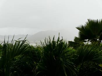
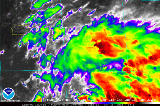
Met Office at the airport reports:
Wind from the ESE (110 degrees) at 9 MPH (8 KT) gusting to 24 MPH (21 KT)
(direction variable)
Visibility 2 mile(s)
Sky conditions mostly cloudy
Weather Heavy rain showers
Towering cumulus clouds observed
Temperature 84 F (29 C)
Dew Point 73 F (23 C)
Relative Humidity 70%
Pressure (altimeter) 29.91 in. Hg (1013 hPa)
|
|
|
- Update
|
- From: "Barbara Cannegieter" <barcann at hotmail.com>
- Date: Wed, 8 Oct 2008 09:39:36 -0400
|
It’s shaping up to be another
hot day in St. Maarten, and it is humid! VERY humid!
We had a thunderstorm last night with some heavy rain,
although it didn’t last long.
This morning it is still cloudy but the sun was trying to break through.

The wind is variable at 1 MPH. That
means no wind!
Everything is incredibly still and the seas are flat.
http://barcann.livejournal.com
|
|
|
- A great day for the beach...
|
- From: "Roddy Heyliger" <roddyheyliger at gmail.com>
- Date: Thu, 2 Oct 2008 10:00:22 -0400
|
Today (Thursday - 10.00): is clear to partly cloudy, warm with a slight breeze.
The seas are flat. Another great beach day.
-- Best regards, Roddy Heyliger P.O.Box 945, Philipsburg, St. Maarten Cell: 5204217-primary, 5816323-secondary
Public Relations & Communications Secondary Email: roddyheyliger at yahoo.comCONFIDENTIALITY NOTICE This e-mail message is intended only for the individual(s) to whom it is
addressed. This e-mail may contain information that is privileged, confidential and exempt from disclosure under applicable law. If you are not the intended recipient, you are hereby notified that any dissemination,
distribution or copying of this communication is strictly prohibited. If you received this e-mail by accident, please notify the sender immediately and destroy this e-mail and all copies of it. |
|
- Clear to partly cloudy...
|
- From: "Roddy Heyliger" <roddyheyliger at gmail.com>
- Date: Wed, 1 Oct 2008 13:11:07 -0400
|
Today (Wednesday - 13.15): is clear to partly cloudy, warm with not much of a breeze. Yesterday was also the same. In the early morning hours we had a little shower as well as last night.
The seas are partly flat with a swell running about two feet.
Another great beach day.
-- Best regards, Roddy Heyliger P.O.Box 945, Philipsburg, St. Maarten Cell: 5204217-primary, 5816323-secondary
Public Relations & Communications Secondary Email: roddyheyliger at yahoo.comCONFIDENTIALITY NOTICE This e-mail message is intended only for the individual(s) to whom it is
addressed. This e-mail may contain information that is privileged, confidential and exempt from disclosure under applicable law. If you are not the intended recipient, you are hereby notified that any dissemination,
distribution or copying of this communication is strictly prohibited. If you received this e-mail by accident, please notify the sender immediately and destroy this e-mail and all copies of it. |
|
- Warm and humid today...
|
- From: "Roddy Heyliger" <roddyheyliger at gmail.com>
- Date: Mon, 29 Sep 2008 09:20:05 -0400
|
Today (Monday - 09.15): is going to very WARM and HUMID. It's sunny to partly cloudy today with a few rain clouds lurking around in the distance.
The seas are once again flat – a great beach day, and their isn't much wind.
TS Kyle has been downgraded and is moving quickly across Nova Scotia at 26 mph while TS Laura in the far Northern Atlantic poses no threat to land, but would be a nuisance to marine traffic.
-- Best regards, Roddy Heyliger P.O.Box 945, Philipsburg, St. Maarten Cell: 5204217-primary, 5816323-secondary Public Relations & Communications Secondary Email: roddyheyliger at yahoo.com
CONFIDENTIALITY NOTICE This e-mail message is intended only for the individual(s) to whom it is addressed. This e-mail may contain information that is privileged, confidential and exempt from disclosure under applicable law. If you are not
the intended recipient, you are hereby notified that any dissemination, distribution or copying of this communication is strictly prohibited. If you received this e-mail by accident, please notify the sender immediately and destroy this e-mail and all copies of it.
|
|
- Sunny to partly cloudy...
|
- From: "Roddy Heyliger" <roddyheyliger at gmail.com>
- Date: Sun, 28 Sep 2008 16:44:18 -0400
|
Today (Sunday - 16.35): it's sunny to partly cloudy today. We had a brief shower of rain this afternoon to maintain the bright greens and all the other colours of the flora on the island.
Today is also warm. The seas are flat and their isn't much wind.
TS Kyle is now a hurricane. Forecast models have it hitting Nova Scotia in the coming days.
In the meantime, the non-tropical low in the central North Atlantic Ocean 700 miles from the Azores Islands is showing signs of development and could become Tropical Storm Laura. Otherwise, the Eastern Atlantic has three tropical waves tracking towards the islands of the Eastern Caribbean. At this time, none of them show any signs of development.
-- Best regards, Roddy Heyliger P.O.Box 945, Philipsburg, St. Maarten Cell: 5204217-primary, 5816323-secondary Public Relations & Communications Secondary Email: roddyheyliger at yahoo.com
CONFIDENTIALITY NOTICE This e-mail message is intended only for the individual(s) to whom it is addressed. This e-mail may contain information that is privileged, confidential and exempt from disclosure under applicable law. If you are not
the intended recipient, you are hereby notified that any dissemination, distribution or copying of this communication is strictly prohibited. If you received this e-mail by accident, please notify the sender immediately and destroy this e-mail and all copies of it.
|
|
- Update
|
- From: "Barbara Cannegieter" <barcann at hotmail.com>
- Date: Sat, 27 Sep 2008 17:42:48 -0400
|
I have to take a small exception with my St. Maarten colleague’s
posting about Kyle.
Kyle has just been designated a hurricane and is expected to
make landfall in either New Brunswick or Nova Scotia.
From NHC:
AT 500 PM AST...2100Z...THE CENTER OF HURRICANE KYLE WAS
LOCATED NEAR LATITUDE 34.3 NORTH...LONGITUDE 69.7 WEST OR ABOUT 315 MILES...
505 KM...WEST-NORTHWEST OF BERMUDA AND ABOUT 485
MILES...780 KM...
SOUTH OF NANTUCKET MASSACHUSETTS.
KYLE IS MOVING TOWARD THE NORTH NEAR 23 MPH...37 KM/HR.
A GRADUAL TURN TOWARD THE NORTH-NORTHEAST IS EXPECTED TONIGHT AND SUNDAY. ON
THE FORECAST TRACK...THE CENTER OF KYLE IS FORECAST TO BE NEAR EASTERN NEW
ENGLAND OR THE CANADIAN MARITIMES LATE SUNDAY.
REPORTS FROM AN AIR FORCE RESERVE HURRICANE HUNTER
AIRCRAFT INDICATE THAT MAXIMUM SUSTAINED WINDS HAVE INCREASED TO NEAR 75
MPH...120 KM/HR...WITH HIGHER GUSTS. KYLE IS A CATEGORY ONE HURRICANE ON THE
SAFFIR-SIMPSON SCALE. SOME ADDITIONAL STRENGTHENING IS POSSIBLE DURING THE
NEXT 24 HOURS.
HURRICANE FORCE WINDS EXTEND OUTWARD UP TO 70 MILES...110
KM...FROM THE CENTER...AND TROPICAL STORM FORCE WINDS EXTEND OUTWARD UP TO 205
MILES...335 KM MAINLY TO THE EAST OF THE CENTER.
THE MINIMUM CENTRAL PRESSURE REPORTED BY THE HURRICANE
HUNTER IS 995
MB...29.38 INCHES.
TIDES OF 1 TO 2 FEET ABOVE NORMAL...WITH LOCALLY HIGHER
LEVELS IN THE BAY OF FUNDY...AND ACCOMPANIED BY LARGE AND DANGEROUS BATTERING
WAVES....ARE EXPECTED ALONG THE COASTS OF OF NEW ENGLAND AND THE CANADIAN
MARITIMES IN ASSOCIATION WITH KYLE.
KYLE HAS ACCELERATED NORTHWARD DURING THE PAST SEVERAL
HOURS...WITH THE INITIAL MOTION NOW 355/20. KYLE REMAINS BETWEEN A DEEP-LAYER
TROUGH OVER THE EASTERN UNITED STATES AND A DEEP-LAYER RIDGE OVER THE CENTRAL
ATLANTIC. THIS PATTERN SHOULD STEER KYLE GENERALLY NORTHWARD FOR 12 HR OR
SO...FOLLOWED BY A TURN TOWARD THE NORTH-NORTHEAST AS KYLE ENTERS THE
WESTERLIES. WHILE THE MODEL GUIDANCE AGREES WITH THIS SCENARIO...THERE HAS
BEEN A SMALL EASTWARD SHIFT IN THE GUIDANCE ENVELOPE. THE GFS...GFDL...HWRF...
AND ECMWF HAVE ALL SHIFTED TO THE RIGHT OF THEIR PREVIOUS
RUNS AND CALL FOR THE CENTER OF KYLE TO MAKE LANDFALL IN EITHER NEW BRUNSWICK
OR NOVA SCOTIA. SEEING THAT THE GUIDANCE SHOWED A RIGHT SHIFT YESTERDAY
AFTERNOON AND A LEFT SHIFT LAST NIGHT...THE NEW FORECAST TRACK WILL REMAIN
CLOSE THE THE PREVIOUS TRACK AND CALL FOR LANDFALL NEAR THE MAINE-NEW BRUNSWICK
BORDER IN ABOUT 36 HR.
http://barcann.livejournal.com
|
|
|
- Sunny...
|
- From: "Roddy Heyliger" <roddyheyliger at gmail.com>
- Date: Sat, 27 Sep 2008 15:20:04 -0400
|
Today (Saturday - 15.15): it's sunny to partly cloudy today. Today is also warm. The seas are flat and their isn't much wind. So far the hurricane season for the latter part of September is panning out to be trouble free. TS Kyle is out in the open ocean and is not expected to be a problem to any landmass.
-- Best regards, Roddy Heyliger P.O.Box 945, Philipsburg, St. Maarten Cell: 5204217-primary, 5816323-secondary Public Relations & Communications Secondary Email: roddyheyliger at yahoo.com
CONFIDENTIALITY NOTICE This e-mail message is intended only for the individual(s) to whom it is addressed. This e-mail may contain information that is privileged, confidential and exempt from disclosure under applicable law. If you are not
the intended recipient, you are hereby notified that any dissemination, distribution or copying of this communication is strictly prohibited. If you received this e-mail by accident, please notify the sender immediately and destroy this e-mail and all copies of it.
|
|
- Overcast...
|
- From: "Roddy Heyliger" <roddyheyliger at gmail.com>
- Date: Fri, 26 Sep 2008 12:08:22 -0400
|
Today (Friday - 12.10): it's overcast to partly cloudy today. We've had some short brief showers for the morning. The seas are flat and their isn't much wind.
-- Best regards, Roddy Heyliger P.O.Box 945, Philipsburg, St. Maarten Cell: 5204217-primary, 5816323-secondary Public Relations & Communications Secondary Email: roddyheyliger at yahoo.com
CONFIDENTIALITY NOTICE This e-mail message is intended only for the individual(s) to whom it is addressed. This e-mail may contain information that is privileged, confidential and exempt from disclosure under applicable law. If you are not
the intended recipient, you are hereby notified that any dissemination, distribution or copying of this communication is strictly prohibited. If you received this e-mail by accident, please notify the sender immediately and destroy this e-mail and all copies of it.
|
|
- Another nice Caribbean day...
|
- From: "Roddy Heyliger" <roddyheyliger at gmail.com>
- Date: Thu, 25 Sep 2008 09:20:43 -0400
|
Today (Thursday - 09.20): it's dry, sunny and partly cloudy. The seas are flat. Today is another nice Caribbean day.
On Wednesday we did have a rain shower to keep things nice and cool.
-- Best regards, Roddy Heyliger P.O.Box 945, Philipsburg, St. Maarten Cell: 5204217-primary, 5816323-secondary
Public Relations & Communications Secondary Email: roddyheyliger at yahoo.comCONFIDENTIALITY NOTICE This e-mail message is intended only for the individual(s) to whom it is
addressed. This e-mail may contain information that is privileged, confidential and exempt from disclosure under applicable law. If you are not the intended recipient, you are hereby notified that any dissemination,
distribution or copying of this communication is strictly prohibited. If you received this e-mail by accident, please notify the sender immediately and destroy this e-mail and all copies of it. |
|
- Another sunny day...
|
- From: "Roddy Heyliger" <roddyheyliger at gmail.com>
- Date: Wed, 24 Sep 2008 09:30:36 -0400
|
Today (Wednesday - 09.35): it's dry, sunny and partly cloudy. The seas are flat. Today is going to be another nice day.
On Tuesday afternoon we had a rain shower to cool things down. -- Best regards, Roddy Heyliger
P.O.Box 945, Philipsburg, St. Maarten Cell: 5204217-primary, 5816323-secondary Public Relations & Communications Secondary Email: roddyheyliger at yahoo.com
CONFIDENTIALITY NOTICE This e-mail message is intended only for the individual(s) to whom it is addressed. This e-mail may contain information that is privileged, confidential and exempt from disclosure under applicable law. If you are not
the intended recipient, you are hereby notified that any dissemination, distribution or copying of this communication is strictly prohibited. If you received this e-mail by accident, please notify the sender immediately and destroy this e-mail and all copies of it.
|
|
- Sunny, ...
|
- From: "Roddy Heyliger" <roddyheyliger at gmail.com>
- Date: Tue, 23 Sep 2008 09:46:47 -0400
|
Today (Tuesday - 09.45): it's dry, sunny and clear to partly cloudy. The seas are flat. Today is going to be a nice day. This morning while walking the dog around 8.30am, some tourists were already enjoying the clear crystal blue waters of the Caribbean Sea.
Last night, it rained throughout the night…short brief showers with the occasional thunder and lightning in the distance. This came from the tail end of the low pressure system that flared up. Signs that something was coming appeared late Monday afternoon when rain clouds started to build all around the island.
Monday, was nice and sunny and clear in the afternoon up to the point when those rain clouds started to build.
The low pressure system that we had over the weekend is really building South of Santo Domingo. Our friends in Haiti may be in for another wet one which they don't need now after what they have already gone through.
There are two more tropical wave systems in the Atlantic East of the islands, but those are not expected to develop into anything at this point in time. So far so good for the hurricane season. We don't expect to receive any weather from those systems as they make their way to the island chain and into the Caribbean Sea.
-- Best regards, Roddy Heyliger P.O.Box 945, Philipsburg, St. Maarten Cell: 5204217-primary, 5816323-secondary Public Relations & Communications Secondary Email: roddyheyliger at yahoo.com
CONFIDENTIALITY NOTICE This e-mail message is intended only for the individual(s) to whom it is addressed. This e-mail may contain information that is privileged, confidential and exempt from disclosure under applicable law. If you are not
the intended recipient, you are hereby notified that any dissemination, distribution or copying of this communication is strictly prohibited. If you received this e-mail by accident, please notify the sender immediately and destroy this e-mail and all copies of it.
|
|
- Update
|
- From: "Barbara Cannegieter" <barcann at hotmail.com>
- Date: Mon, 22 Sep 2008 10:11:53 -0400
|
Good morning
We actually have blue skies this
morning.

It seems as though PR and VI are
still under the gun.
PR is still under a flood
warning.
Two deaths were reported there
also.
According to the NWS out of San
Juan, some places in SE PR received 20-30 inches of rain where rivers are
well above flood stage.
We hope all our friends over
that way are doing OK.
http://barcann.livejournal.com
|
|
|
- Sunny...
|
- From: "Roddy Heyliger" <roddyheyliger at gmail.com>
- Date: Mon, 22 Sep 2008 09:27:37 -0400
|
Today (Monday - 09.30): it's dry, sunny and partly cloudy. Sat pix show that the low pressure system has moved away from our area. The seas are flat and we have a nice breeze.
-- Best regards, Roddy Heyliger P.O.Box 945, Philipsburg, St. Maarten Cell: 5204217-primary, 5816323-secondary Public Relations & Communications Secondary Email: roddyheyliger at yahoo.com
CONFIDENTIALITY NOTICE This e-mail message is intended only for the individual(s) to whom it is addressed. This e-mail may contain information that is privileged, confidential and exempt from disclosure under applicable law. If you are not
the intended recipient, you are hereby notified that any dissemination, distribution or copying of this communication is strictly prohibited. If you received this e-mail by accident, please notify the sender immediately and destroy this e-mail and all copies of it.
|
|
- It's dry...
|
- From: "Roddy Heyliger" <roddyheyliger at gmail.com>
- Date: Sun, 21 Sep 2008 20:06:20 -0400
|
Today (Sunday (update) - 20.05): it's DRY, DRY, DRY after being WET the entire day. The dryness is an indication that the low pressure system that has brought two days of rain to the island is moving away and we can look forward to a sunny day tomorrow. That is what I 'am expecting. Today was also nice and cool after weeks of humid and HOT weather.
Out MET office has posted the following weather forecast for the island:
Weather Forecast for the island valid until Monday midday 12:00 hours September 22, 2008.
HEAVY RAINFALL MAY LIKELY RESULT IN LOCAL FLOODING ACROSS ROADWAYS AND LOW LYING AREA.
Weather:
Today: Mostly cloudy with occasional showers and isolated thunderstorms. Chance of a few local heavy showers or thunderstorms.
Tonight: Mostly cloudy with scattered showers and possible thunderstorms through the morning.
Monday: Mostly cloudy with a few local showers and isolated thunderstorms during the morning.
Winds:
Today: South Southeast, 10 to 20 miles and mainly during showers gusting occasionally to 30 miles per hour.
Tonight: Southeast, 10 to 15 miles. A few occasional gusts possible to 20 miles per hour.
Monday: East Southeast, 10 to 15 miles per hour with occasional gusts to 20 miles per hour.
MARINE CONDITIONS:
Small Craft advisory remains in effect due to gusty winds and above normal waves near isolated thunderstorms.
Coastal and open waters: Generally moderate chop. In and around showers, occasionally choppy.
Winds: Force 4 to 5. Occasionally, force 6.
Seas: 3 to 6 feet. The highest wave action is in or near showers.
Protected waters: Generally light. Occasionally moderate.
Winds: Force 4 to 5. Occasionally, force 6.
Seas: 2 to 3 feet. The highest wave action is in or near showers.
-- Best regards, Roddy Heyliger P.O.Box 945, Philipsburg, St. Maarten Cell: 5204217-primary, 5816323-secondary Public Relations & Communications Secondary Email: roddyheyliger at yahoo.com
CONFIDENTIALITY NOTICE This e-mail message is intended only for the individual(s) to whom it is addressed. This e-mail may contain information that is privileged, confidential and exempt from disclosure under applicable law. If you are not
the intended recipient, you are hereby notified that any dissemination, distribution or copying of this communication is strictly prohibited. If you received this e-mail by accident, please notify the sender immediately and destroy this e-mail and all copies of it.
|
|
- WET outside...
|
- From: "Roddy Heyliger" <roddyheyliger at gmail.com>
- Date: Sun, 21 Sep 2008 10:57:50 -0400
|
Today (Sunday - 10.55): it's a WET day outside, with overcast skies. There is not much wind and the rain showers are intermittent. The seas on the South side of the island are choppy.
This tropical wave system that has been hanging around our area for the past few days should be declared a tropical depression within the next couple of hours.
Temperature: 77.0°F / 25.0°C | Humidity: 78% | Pressure: 30.04in / 1017 hPa | Wind Direction: Variable | Wind Speed: 1mph / 2km/h
-- Best regards, Roddy Heyliger P.O.Box 945, Philipsburg, St. Maarten Cell: 5204217-primary, 5816323-secondary Public Relations & Communications Secondary Email: roddyheyliger at yahoo.com
CONFIDENTIALITY NOTICE This e-mail message is intended only for the individual(s) to whom it is addressed. This e-mail may contain information that is privileged, confidential and exempt from disclosure under applicable law. If you are not
the intended recipient, you are hereby notified that any dissemination, distribution or copying of this communication is strictly prohibited. If you received this e-mail by accident, please notify the sender immediately and destroy this e-mail and all copies of it.
|
|
- Update
|
- From: "Barbara Cannegieter" <barcann at hotmail.com>
- Date: Sun, 21 Sep 2008 10:57:07 -0400
|
Good morning to all
Since I was up early yesterday morning
for the International Coastal Cleanup and since it was raining early this
morning, I took advantage and slept in a little longer.
It’s the best thing to do on a
rainy Sunday morning.
It looks like we got about 1.5
inches of rain over night, most of that being from heavier rain early this
morning.
Currently it is cloudy with a very
slight drizzle , no wind, and I can hear thunder in the distance.
It seems St. Maarten is escaping the
worst of 93L.
Watch out PR and VI though.. I hope there is no flooding over your way.
http://barcann.livejournal.com
|
|
|
- Intermittent showers...
|
- From: "Roddy Heyliger" <roddyheyliger at gmail.com>
- Date: Sat, 20 Sep 2008 13:14:26 -0400
|
Today (Saturday - 13.00): it's overcast today with intermittent rain showers. Also quite breezy on the South side of the island and the seas are choppy. A tropical wave system in the area is influencing our weather.
Temperature: 84.0°F / 29.0°C | Humidity: 70% | Pressure: 29.92in / 1013 hPa | Wind Direction: SE | Wind Speed: 7mph / 11km/h
High: 86 F. / 30, C.; Low: 78 F. / 26 C. -- Best regards, Roddy Heyliger P.O.Box 945, Philipsburg, St. Maarten
Cell: 5204217-primary, 5816323-secondary Public Relations & Communications Secondary Email: roddyheyliger at yahoo.comCONFIDENTIALITY NOTICE This e-mail message is intended only for the individual(s) to whom it is
addressed. This e-mail may contain information that is privileged, confidential and exempt from disclosure under applicable law. If you are not the intended recipient, you are hereby notified that any dissemination,
distribution or copying of this communication is strictly prohibited. If you received this e-mail by accident, please notify the sender immediately and destroy this e-mail and all copies of it. |
|
- Update
|
- From: "Barbara Cannegieter" <barcann at hotmail.com>
- Date: Sat, 20 Sep 2008 12:52:37 -0400
|
It’s a rainy day today
with light showers off and on, but I am glad to say the showers held off this morning
while over 250 volunteers on St. Maarten participated in the International Coastal
Clean Up.
A brief shower in the beginning
gave us a rainbow to inspire us.

The showers held off for the rest
of the morning while Mullet Bay beach was cleaned up.
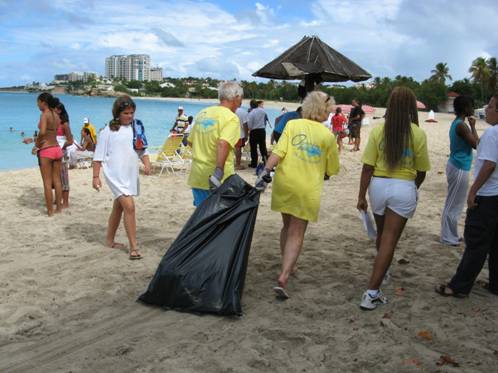
I posted some more pictures on
my blog. Take a look.
http://barcann.livejournal.com
|
|
|
- Overcast...
|
- From: "Roddy Heyliger" <roddyheyliger at gmail.com>
- Date: Fri, 19 Sep 2008 10:43:23 -0400
|
Today (Friday - 10.30): its overcast this morning. Last night we had rain throughout the night. Their have been rain clouds lurking about, otherwise we have a light breeze and it's cool. The seas are near flat.
Temperature: 84.0°F / 29.0°C | Humidity: 70% | Pressure: 29.95in / 1014 hPa | Wind Direction: East | Wind Speed: 12mph / 18km/h
High: 87 F. / 31, C.; Low: 78 F. / 26 C.
Preparations are underway for the annual International Coastal Clean-up at Mullet Bay Beach from 7am to 10am. The number of volunteers has grown over the years from 240 to 370 last year. This clean-up is organized by the St. Maarten Pride Foundation.
-- Best regards, Roddy Heyliger P.O.Box 945, Philipsburg, St. Maarten Cell: 5204217-primary, 5816323-secondary Public Relations & Communications Secondary Email: roddyheyliger at yahoo.com
CONFIDENTIALITY NOTICE This e-mail message is intended only for the individual(s) to whom it is addressed. This e-mail may contain information that is privileged, confidential and exempt from disclosure under applicable law. If you are not
the intended recipient, you are hereby notified that any dissemination, distribution or copying of this communication is strictly prohibited. If you received this e-mail by accident, please notify the sender immediately and destroy this e-mail and all copies of it.
|
|
- Overcast...
|
- From: "Roddy Heyliger" <roddyheyliger at gmail.com>
- Date: Thu, 18 Sep 2008 09:58:19 -0400
|
Today (Thursday -09.55): It's overcast this morning. Last night we had rain accompanied with thunder and lightning. The sun is trying to creep through the clouds. It is humid and warm and the seas are near flat with a one foot swell.
Temperature: 82.4°F / 28.0°C | Humidity: 76% | Pressure: 29.92in / 1013.1hPa | Wind Direction: NE | Wind Speed: 5.0mph / 8.0km/h
High: 87 F. / 31, C.; Low: 78 F. / 26 C.
A tropical wave is currently influencing our weather. It stretches from the British Virgin Islands down to Trinidad & Tobago. We very much welcome the rain. By the weekend it should leave our area and then it's back to sunshine and great days at the beach.
Two other tropical waves are making their way across the Atlantic and should be in our area some time next week. -- Best regards, Roddy Heyliger
P.O.Box 945, Philipsburg, St. Maarten Cell: 5204217-primary, 5816323-secondary Public Relations & Communications Secondary Email: roddyheyliger at yahoo.com
CONFIDENTIALITY NOTICE This e-mail message is intended only for the individual(s) to whom it is addressed. This e-mail may contain information that is privileged, confidential and exempt from disclosure under applicable law. If you are not
the intended recipient, you are hereby notified that any dissemination, distribution or copying of this communication is strictly prohibited. If you received this e-mail by accident, please notify the sender immediately and destroy this e-mail and all copies of it.
|
|
- Update
|
- From: "Barbara Cannegieter" <barcann at hotmail.com>
- Date: Thu, 18 Sep 2008 08:17:19 -0400
|
Good morning
It looks like all the islands are experiencing cloudy rainy weather
this morning as this large elongated wave covers us all.
St. Maarten currently has cloudy skies.
Winds are light from the ENE.
Last night we were attacked from above with a heavy
thunderstorm.
My dogs were so scared they almost jumped into bed with me.
A few cracks of lightning and some loud booms of thunder
woke all of us right up from a sound sleep.
It sounded like it was right over our house.
My rain gauge this morning shows about 1.5 inches of rain
fell.
I suspect we will get more showers throughout the day.
Stay dry everyone!
http://barcann.livejournal.com
|
|
|
- Another beautiful day...
|
- From: "Roddy Heyliger" <roddyheyliger at gmail.com>
- Date: Wed, 17 Sep 2008 09:41:13 -0400
|
Today (Wednesday -09.40): It's clear to partly cloudy and sunny. Their is not much of a breeze and looks like another very warm day ahead – HOT. The seas are flat. We had an early rain shower this morning. I don't expect any rain showers for the rest of the day even though it would be very much welcomed. Last night the wind was very still you could hear a pin drop.
-- Best regards, Roddy Heyliger P.O.Box 945, Philipsburg, St. Maarten Cell: 5204217-primary, 5816323-secondary Public Relations & Communications Secondary Email: roddyheyliger at yahoo.com
CONFIDENTIALITY NOTICE This e-mail message is intended only for the individual(s) to whom it is addressed. This e-mail may contain information that is privileged, confidential and exempt from disclosure under applicable law. If you are not
the intended recipient, you are hereby notified that any dissemination, distribution or copying of this communication is strictly prohibited. If you received this e-mail by accident, please notify the sender immediately and destroy this e-mail and all copies of it.
|
|
- HOT...another beautiful day in paradise...
|
- From: "Roddy Heyliger" <roddyheyliger at gmail.com>
- Date: Tue, 16 Sep 2008 12:49:16 -0400
|
Today (Tuesday -12.50): It's clear to partly cloudy and sunny. Another beautiful day in paradise, with a nice breeze. Today is also a very warm – HOT. The seas are a little choppy. I don't expect any rain showers.
-- Best regards, Roddy Heyliger P.O.Box 945, Philipsburg, St. Maarten Cell: 5204217-primary, 5816323-secondary Public Relations & Communications Secondary Email: roddyheyliger at yahoo.com
CONFIDENTIALITY NOTICE This e-mail message is intended only for the individual(s) to whom it is addressed. This e-mail may contain information that is privileged, confidential and exempt from disclosure under applicable law. If you are not
the intended recipient, you are hereby notified that any dissemination, distribution or copying of this communication is strictly prohibited. If you received this e-mail by accident, please notify the sender immediately and destroy this e-mail and all copies of it.
|
|
- A beautiful sunny day...
|
- From: "Roddy Heyliger" <roddyheyliger at gmail.com>
- Date: Mon, 15 Sep 2008 11:34:16 -0400
|
Today (Monday -11.30): It's clear to partly cloudy and sunny. It's really a beautiful day today. The seas are flat and I don't expect any rain showers.
The tropical wave now over 500 miles from the islands continues to garner my interests as it maintains its level of convection. The system has now changed to a westerly tracking while previously it was on a WNW track. It is definitely something to keep an eye on in the coming days.
-- Best regards, Roddy Heyliger P.O.Box 945, Philipsburg, St. Maarten Cell: 5204217-primary, 5816323-secondary Public Relations & Communications Secondary Email: roddyheyliger at yahoo.com
CONFIDENTIALITY NOTICE This e-mail message is intended only for the individual(s) to whom it is addressed. This e-mail may contain information that is privileged, confidential and exempt from disclosure under applicable law. If you are not
the intended recipient, you are hereby notified that any dissemination, distribution or copying of this communication is strictly prohibited. If you received this e-mail by accident, please notify the sender immediately and destroy this e-mail and all copies of it.
|
|
- Overcast with intermittent showers...
|
- From: "Roddy Heyliger" <roddyheyliger at gmail.com>
- Date: Sun, 14 Sep 2008 15:14:13 -0400
|
Today (Sunday -15.15): It's cloudy and overcast with intermittent rain showers. It has been very warm as well, so we welcome the rain. The seas are flat.
On Saturday it was partly cloudy to cloudy, sunny and HOT. During the evening hours we had a nice rain shower.
Last night the tropical wave over 700 miles from the islands was looking very impressive, but today it looks like its struggling to keep pace as it tracks along towards the islands.
-- Best regards, Roddy Heyliger P.O.Box 945, Philipsburg, St. Maarten Cell: 5204217-primary, 5816323-secondary Public Relations & Communications Secondary Email: roddyheyliger at yahoo.com
CONFIDENTIALITY NOTICE This e-mail message is intended only for the individual(s) to whom it is addressed. This e-mail may contain information that is privileged, confidential and exempt from disclosure under applicable law. If you are not
the intended recipient, you are hereby notified that any dissemination, distribution or copying of this communication is strictly prohibited. If you received this e-mail by accident, please notify the sender immediately and destroy this e-mail and all copies of it.
|
|
- Initiatives underway to help Haiti and TCI...
|
- From: "Roddy Heyliger" <roddyheyliger at gmail.com>
- Date: Fri, 12 Sep 2008 11:24:07 -0400
|
Today (Friday -11.20): It's clear to partly cloudy and sunny. We have a nice breeze so far for the morning. The seas are flat.
A number of initiatives are currently underway on the island to help hurricane victims in Haiti and Turks & Caicos Islands (TCI). The Rotary Club and other civic organizations have mobilized to help their brethren.
Our utility company GEBE which is also a member of CARILEC is willing to assists by sending company personnel to TCI should the request come in for such assistance.
There are two Tropical Waves several hundred miles out into the Atlantic Ocean one behind the next. Any further development is not foreseen at this point in time.
Texans are bracing for a category 1, 2 or 3 hurricane over the weekend. It is still uncertain if hurricane Ike will get stronger just before the eye makes landfall.
-- Best regards, Roddy Heyliger P.O.Box 945, Philipsburg, St. Maarten Cell: 5204217-primary, 5816323-secondary Public Relations & Communications Secondary Email: roddyheyliger at yahoo.com
CONFIDENTIALITY NOTICE This e-mail message is intended only for the individual(s) to whom it is addressed. This e-mail may contain information that is privileged, confidential and exempt from disclosure under applicable law. If you are not
the intended recipient, you are hereby notified that any dissemination, distribution or copying of this communication is strictly prohibited. If you received this e-mail by accident, please notify the sender immediately and destroy this e-mail and all copies of it.
|
|
- So far so good...
|
- From: "Roddy Heyliger" <roddyheyliger at gmail.com>
- Date: Thu, 11 Sep 2008 11:24:35 -0400
|
Today (Thursday -11.15): It's clear to partly cloudy and sunny. The wind is moderate and the seas are flat.
So far so good; things have calmed down in the Atlantic. Well to the South of the island on the Western side of St. Lucia, there is a blob of convection. To the East of the Northern Leeward islands we can see some convection several hundred miles out.
The Atlantic currently has three waves tracking towards the islands over the next few days and into next week. Rain is most welcomed during the evening hours to keep the islands nice and green.
Texans are in full gear with preparations for Hurricane Ike which is on the move. -- Best regards,
Roddy Heyliger P.O.Box 945, Philipsburg, St. Maarten Cell: 5204217-primary, 5816323-secondary Public Relations & Communications Secondary Email: roddyheyliger at yahoo.com
CONFIDENTIALITY NOTICE This e-mail message is intended only for the individual(s) to whom it is addressed. This e-mail may contain information that is privileged, confidential and exempt from disclosure under applicable law. If you are not
the intended recipient, you are hereby notified that any dissemination, distribution or copying of this communication is strictly prohibited. If you received this e-mail by accident, please notify the sender immediately and destroy this e-mail and all copies of it.
|
|
- Cloudy to partly cloudy...
|
- From: "Roddy Heyliger" <roddyheyliger at gmail.com>
- Date: Wed, 10 Sep 2008 11:42:35 -0400
|
Today (Wednesday-11.45): It's cloudy to partly cloudy with some dark clouds passing along. We may be in for a rain shower or two. The wind is moderate and the seas are flat. Another great day for the beach.
-- Best regards, Roddy Heyliger P.O.Box 945, Philipsburg, St. Maarten Cell: 5204217-primary, 5816323-secondary Public Relations & Communications Secondary Email: roddyheyliger at yahoo.com
CONFIDENTIALITY NOTICE This e-mail message is intended only for the individual(s) to whom it is addressed. This e-mail may contain information that is privileged, confidential and exempt from disclosure under applicable law. If you are not
the intended recipient, you are hereby notified that any dissemination, distribution or copying of this communication is strictly prohibited. If you received this e-mail by accident, please notify the sender immediately and destroy this e-mail and all copies of it.
|
|
- This evening...
|
- From: "Roddy Heyliger" <roddyheyliger at gmail.com>
- Date: Tue, 9 Sep 2008 22:12:13 -0400
|
[The Tropical wave that brought some rain showers to our area has moved away and according to the sat pix, there is nothing on the horizon for the time being. We didn't have any rain today and it was very warm as well. It was so clear today that you could see the neighbouring islands of Saba, St. Eustatius, St. Kitts & Nevis as well as Anguilla. This evening its calm; not much wind.]
-- Best regards, Roddy Heyliger P.O.Box 945, Philipsburg, St. Maarten Cell: 5204217-primary, 5816323-secondary Public Relations & Communications Secondary Email: roddyheyliger at yahoo.com
CONFIDENTIALITY NOTICE This e-mail message is intended only for the individual(s) to whom it is addressed. This e-mail may contain information that is privileged, confidential and exempt from disclosure under applicable law. If you are not
the intended recipient, you are hereby notified that any dissemination, distribution or copying of this communication is strictly prohibited. If you received this e-mail by accident, please notify the sender immediately and destroy this e-mail and all copies of it.
|
|
- Update
|
- From: "Barbara Cannegieter" <barcann at hotmail.com>
- Date: Tue, 9 Sep 2008 10:09:08 -0400
|
It is a gorgeous typical Caribbean day today in SXM.
We can see Statia from our porch for a change.
It has been missing for weeks.
I took a look at the web cam at Great Bay Villas.
http://www.thevillasongreatbay.com/netcam.jpg
Here is a still picture I captured from the cam
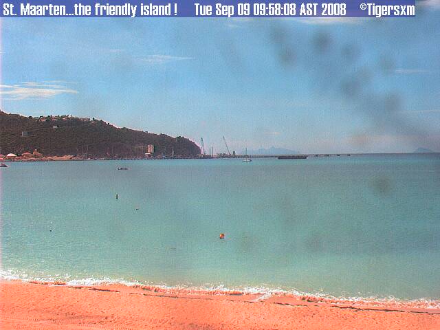 can see can see
If you look closely, you can see all the way to the
right piece of Statia.
And if you look closely again towards the horizon in the middle
of the picture, you can see the outline of the mountains of St. Kitts.
We know it is a beautiful clear day when we can see St.
Kitts!
Don’t forget to donate something to help out the
people of Turks and Caicos!
|
|
|
- A gorgeous day...
|
- From: "Roddy Heyliger" <roddyheyliger at gmail.com>
- Date: Tue, 9 Sep 2008 09:32:25 -0400
|
Today (Tuesday-09.30): It is a gorgeous day so far, with clear to partly cloudy skies. It's sunny and cool so far for the morning.
Last evening we had some nice rain showers which the plants enjoyed very much. There was also an early morning shower as the sun came up.
The seas are flat. -- Best regards, Roddy Heyliger P.O.Box 945, Philipsburg, St. Maarten
Cell: 5204217-primary, 5816323-secondary Public Relations & Communications Secondary Email: roddyheyliger at yahoo.comCONFIDENTIALITY NOTICE This e-mail message is intended only for the individual(s) to whom it is
addressed. This e-mail may contain information that is privileged, confidential and exempt from disclosure under applicable law. If you are not the intended recipient, you are hereby notified that any dissemination,
distribution or copying of this communication is strictly prohibited. If you received this e-mail by accident, please notify the sender immediately and destroy this e-mail and all copies of it. |
|
- Evening weather...
|
- From: "Roddy Heyliger" <roddyheyliger at gmail.com>
- Date: Mon, 8 Sep 2008 23:04:40 -0400
|
Today (Monday-23.00): This evening we had a nice shower of rain. One can also see the lightning on the horizon. This weather is coming from a passing Tropical Wave.
--
Best regards,
Roddy Heyliger
P.O.Box 945, Philipsburg, St. Maarten
Cell: 5204217-primary, 5816323-secondary
Public Relations & Communications
Secondary Email: roddyheyliger at yahoo.com
CONFIDENTIALITY NOTICE
This e-mail message is intended only for the individual(s) to whom it is
addressed. This e-mail may contain information that is privileged,
confidential and exempt from disclosure under applicable law. If you are not
the intended recipient, you are hereby notified that any dissemination,
distribution or copying of this communication is strictly prohibited. If you received this e-mail by accident, please notify the sender immediately and destroy this e-mail and all copies of it.
|
|
- Update
|
- From: Barbara Cannegieter <barcann at hotmail.com>
- Date: Mon, 8 Sep 2008 21:31:18 +0000
|
|
Gert
Thanks for posting all the information about how to donate and help those in Turks and Caicos affected by the hurricane.
I just made my donation and I hope all the storm correspondents will do the same.
I remember how it was here after Luis and how grateful we were for all donations.
It’s time for us to return the help.
Good luck to you all in your rebuilding process.
Barbara
http://barcann.livejournal.com
Get news, entertainment and everything you care about at Live.com. Check it out!
|
|
|
- Another beautiful day in paradise...
|
- From: "Roddy Heyliger" <roddyheyliger at gmail.com>
- Date: Mon, 8 Sep 2008 14:44:34 -0400
|
Today (Monday-14.45): It's sunny, cloudy to partly cloudy. During the morning hours we had a nice rain shower. There is also a nice breeze blowing.
Still running, a small sea swell of about two feet, otherwise another beautiful day in paradise.
-- Best regards, Roddy Heyliger P.O.Box 945, Philipsburg, St. Maarten Cell: 5204217-primary, 5816323-secondary
Public Relations & Communications Secondary Email: roddyheyliger at yahoo.comCONFIDENTIALITY NOTICE This e-mail message is intended only for the individual(s) to whom it is
addressed. This e-mail may contain information that is privileged, confidential and exempt from disclosure under applicable law. If you are not the intended recipient, you are hereby notified that any dissemination,
distribution or copying of this communication is strictly prohibited. If you received this e-mail by accident, please notify the sender immediately and destroy this e-mail and all copies of it. |
|
- Sunny, cloudy to partly cloudy...
|
- From: "Roddy Heyliger" <roddyheyliger at gmail.com>
- Date: Sun, 7 Sep 2008 10:44:43 -0400
|
Today (Sunday-10.45): It's sunny, cloudy to partly cloudy. Yesterday afternoon we did receive some most welcomed rain showers. Just a few minutes we had a sprinkle of rain and I think we will probably have a few of these throughout the day. There is also a nice breeze blowing. Another great day to visit one of our 37 beaches.
The sea swells have subsided and we now have the regular coastal surf.
-- Best regards, Roddy Heyliger P.O.Box 945, Philipsburg, St. Maarten Cell: 5204217-primary, 5816323-secondary Public Relations & Communications Secondary Email: roddyheyliger at yahoo.com
CONFIDENTIALITY NOTICE This e-mail message is intended only for the individual(s) to whom it is addressed. This e-mail may contain information that is privileged, confidential and exempt from disclosure under applicable law. If you are not
the intended recipient, you are hereby notified that any dissemination, distribution or copying of this communication is strictly prohibited. If you received this e-mail by accident, please notify the sender immediately and destroy this e-mail and all copies of it.
|
|
- A great day for the beach...
|
- From: "Roddy Heyliger" <roddyheyliger at gmail.com>
- Date: Sat, 6 Sep 2008 13:12:25 -0400
|
Today (Saturday-13.00): It's sunny to partly cloudy and very warm. We have a nice breeze blowing. We haven't had any rain today. A great day to visit one of our 37 beaches.
The sea swell continues to run along the southern coastline of the island. This is a result of Hurricane Ike even though it's now over 474 miles away and moving further away.
A third yacht broke its moorings on Thursday evening and beached itself on the Great Bay Beach. Damage to the vessel was limited.
-- Best regards, Roddy Heyliger P.O.Box 945, Philipsburg, St. Maarten Cell: 5204217-primary, 5816323-secondary Public Relations & Communications Secondary Email: roddyheyliger at yahoo.com
CONFIDENTIALITY NOTICE This e-mail message is intended only for the individual(s) to whom it is addressed. This e-mail may contain information that is privileged, confidential and exempt from disclosure under applicable law. If you are not
the intended recipient, you are hereby notified that any dissemination, distribution or copying of this communication is strictly prohibited. If you received this e-mail by accident, please notify the sender immediately and destroy this e-mail and all copies of it.
|
|
- Update
|
- From: Barbara Cannegieter <barcann at hotmail.com>
- Date: Fri, 5 Sep 2008 23:14:19 +0000
|
|
We are all crossing our fingers and praying for our friends in Turks and Caicos and the Bahamas.
It was 13 years ago today that Hurricane Luis ravaged St. Maarten.
I know what it is like to go through a storm like that and what the aftermath is like.
I hope none of you have to go through it, and I hope everyone will be safe.
http://barcann.livejournal.com
Invite your mail contacts to join your friends list with Windows Live Spaces. It's easy! Try it!
|
|
|
- Overcast, sunny and warm...
|
- From: "Roddy Heyliger" <roddyheyliger at gmail.com>
- Date: Fri, 5 Sep 2008 17:51:18 -0400
|
Today (Friday-17.50): It's been overcast, sunny and very warm throughout the day. We haven't had any rain today. There is a swell running along the southern coastline of the island. I do believe that this is a result of Hurricane Ike even though it's over 300 miles away and moving further away.
The swells have created challenges for cargo vessels by preventing them from docking at the cargo quay. The vessels had to anchor offshore during the past couple of days.
Two yachts broke their moorings earlier in the week due to the swells, and as a result of the quick action of port authorities, both vessels did not suffer any significant damage.
-- Best regards, Roddy Heyliger P.O.Box 945, Philipsburg, St. Maarten Cell: 5204217-primary, 5816323-secondary Public Relations & Communications Secondary Email: roddyheyliger at yahoo.com
CONFIDENTIALITY NOTICE This e-mail message is intended only for the individual(s) to whom it is addressed. This e-mail may contain information that is privileged, confidential and exempt from disclosure under applicable law. If you are not
the intended recipient, you are hereby notified that any dissemination, distribution or copying of this communication is strictly prohibited. If you received this e-mail by accident, please notify the sender immediately and destroy this e-mail and all copies of it.
|
|
- Calm...
|
- From: "Roddy Heyliger" <roddyheyliger at gmail.com>
- Date: Thu, 4 Sep 2008 20:30:12 -0400
|
Today (Thursday-20.15): It was nice and sunny today. The seas remained with a swell of three to five feet. Here are some pix that I've attached of the surf pounding against the coral shore and beach. Some of the sand at this particular beach (partly) has been taken out by the sea, but will be replenished by nature in due time.
It was nice and calm in the Simpson Bay Lagoon.
This evening is calm.
-- Best regards, Roddy Heyliger P.O.Box 945, Philipsburg, St. Maarten Cell: 5204217-primary, 5816323-secondary Public Relations & Communications Secondary Email: roddyheyliger at yahoo.com
CONFIDENTIALITY NOTICE This e-mail message is intended only for the individual(s) to whom it is addressed. This e-mail may contain information that is privileged, confidential and exempt from disclosure under applicable law. If you are not
the intended recipient, you are hereby notified that any dissemination, distribution or copying of this communication is strictly prohibited. If you received this e-mail by accident, please notify the sender immediately and destroy this e-mail and all copies of it.
Attachment:
040908 rough surf.jpg
Description: JPEG image
Attachment:
040908 weather 004.JPG
Description: JPEG image
|
|
- A beautiful sunny day...
|
- From: "Roddy Heyliger" <roddyheyliger at gmail.com>
- Date: Thu, 4 Sep 2008 10:12:41 -0400
|
Today (Thursday-10.10am): Today we are enjoying clear to partly cloudy skies with a nice breeze. Early in the morning we had a nice rain shower to start off the day and the sun is now brightly shining.
Hurricane Ike can now be considered "Mighty Ike," as he continues to churn out in the open Atlantic Ocean as a Category 4 making it an extremely dangerous hurricane. Ike poses no threat to St. Maarten and its projected track over the next five days also keeps it well away from the shores of the "Friendly Island." The same can also be said of Tropical Storm Josephine.
-- Best regards, Roddy Heyliger P.O.Box 945, Philipsburg, St. Maarten Cell: 5204217-primary, 5816323-secondary Public Relations & Communications Secondary Email: roddyheyliger at yahoo.com
CONFIDENTIALITY NOTICE This e-mail message is intended only for the individual(s) to whom it is addressed. This e-mail may contain information that is privileged, confidential and exempt from disclosure under applicable law. If you are not
the intended recipient, you are hereby notified that any dissemination, distribution or copying of this communication is strictly prohibited. If you received this e-mail by accident, please notify the sender immediately and destroy this e-mail and all copies of it.
|
|
- Ike now a hurricane; It's eye becoming more defined...
|
- From: "Roddy Heyliger" <roddyheyliger at gmail.com>
- Date: Wed, 3 Sep 2008 17:40:21 -0400
|
Today (Wednesday-17.40pm): The sky is clear after an afternoon of intermittent rain showers. The sun is heading towards its sunset while the seas have tamed a bit. The wind is also much less.
Ike has now been upgraded to a hurricane and its eye is becoming more defined. This one is something to watch.
-- Best regards, Roddy Heyliger P.O.Box 945, Philipsburg, St. Maarten Cell: 5204217-primary, 5816323-secondary Public Relations & Communications Secondary Email: roddyheyliger at yahoo.com
CONFIDENTIALITY NOTICE This e-mail message is intended only for the individual(s) to whom it is addressed. This e-mail may contain information that is privileged, confidential and exempt from disclosure under applicable law. If you are not
the intended recipient, you are hereby notified that any dissemination, distribution or copying of this communication is strictly prohibited. If you received this e-mail by accident, please notify the sender immediately and destroy this e-mail and all copies of it.
|
|
- SxmGIS - Governor says September to be quite active with five named storms according to forecasters
|
- From: "Roddy Heyliger" <roddyheyliger at gmail.com>
- Date: Wed, 3 Sep 2008 14:35:22 -0400
|
News Release
Written by Roddy Heyliger, Government Information Service (GIS), Ennia Bldg., Longwall Rd., Philipsburg, St. Maarten D.W.I. Tel. 00-599-543-1162, 542-4119, Fax: 543-1169; Email: gis at sintmaarten.net;
For Immediate Release: Wednesday, September 03, 2008/N130
Governor says September to be quite active with five named storms according to forecasters
GREAT BAY, St. Maarten (GIS) – On September 2 Colorado State University hurricane forecasters Phil Klotzbach and William Gray came out with their September month prediction and pointed out that September will bring above-average activity with five named storms making it a quite active month.
Four of the five storms will become hurricanes with two reaching major hurricane status with winds over 111 miles per hour.
Currently there are three storm systems in the Caribbean and Atlantic Ocean area, namely Tropical Storm Hanna, Ike and Josephine.
"Tropical Storm Ike according to weather forecasting models is expected to pass well North of the North Eastern Caribbean islands which includes St. Maarten, but it's too soon to be sure, and therefore residents should continue to pay attention and monitor weather reports.
"We must be mindful of the fact that we are only half way through the 2008 hurricane season. We must therefore remain alert and prepared," Chairman of the Emergency Operations Center (EOC) Governor Franklyn Richards told the Government Information Service (GIS) on Wednesday.
Governor Richards reminds residents to be prepared as the 2008 hurricane season continues to become more active. "These storm systems are forming very quickly one behind the next and one may not have much time to take the appropriate measures to protect their home and business.
"You are once again urged to clean up anything around your yards that could become airborne and make sure your disaster plan is in place and your disaster kit has at least three days of supplies (eg water, canned food etc)," EOC Chairman Governor Richards once again reiterated.
Tropical storm systems that have already formed for the season are Arthur, Bertha, Cristobal, Dolly, Edouard, Fay and Gustav. June and July were very active, with three named storms forming during the two-month period: Bertha, Cristobal and Dolly.
Bertha became the longest-lived July storm on record. August had slightly above-average activity, largely because of Hurricane Gustav according to Colorado State University forecasters.
The hurricane season runs through November 30.
# # #
Roddy Heyliger
St. Maarten Government Information Service (GIS) -- Best regards, Roddy Heyliger
P.O.Box 945, Philipsburg, St. Maarten Cell: 5204217-primary, 5816323-secondary Public Relations & Communications Secondary Email: roddyheyliger at yahoo.com
CONFIDENTIALITY NOTICE This e-mail message is intended only for the individual(s) to whom it is addressed. This e-mail may contain information that is privileged, confidential and exempt from disclosure under applicable law. If you are not
the intended recipient, you are hereby notified that any dissemination, distribution or copying of this communication is strictly prohibited. If you received this e-mail by accident, please notify the sender immediately and destroy this e-mail and all copies of it.
-- Best regards, Roddy Heyliger P.O.Box 945, Philipsburg, St. Maarten Cell: 5204217-primary, 5816323-secondary Public Relations & Communications
Secondary Email: roddyheyliger at yahoo.comCONFIDENTIALITY NOTICE This e-mail message is intended only for the individual(s) to whom it is addressed. This e-mail may contain information that is privileged,
confidential and exempt from disclosure under applicable law. If you are not the intended recipient, you are hereby notified that any dissemination, distribution or copying of this communication is strictly prohibited. If you received this e-mail by accident, please notify the sender immediately and destroy this e-mail and all copies of it.
|
|
- Weather today...
|
- From: "Roddy Heyliger" <roddyheyliger at gmail.com>
- Date: Wed, 3 Sep 2008 12:04:09 -0400
|
Today (Wednesday-12.05pm): The day started out nice and sunny and clear skies, but this changed around 9.45am when the skies opened up. The rain didn't last too long and there was a slight thunder in the distance. Now it's cloudy, partly sunny and we may be in for another shower which we did receive while writing this report. It's also breezy. I expect we will continue to receive some rain showers throughout the rest of the day. It seems that this weather is coming from TS Hanna's tail section.
The seas are rough with a swell running about two to three feet.
It's really busy out in the Atlantic/Caribbean with Tropical Storms Hanna, Ike and Josephine. -- Best regards,
Roddy Heyliger P.O.Box 945, Philipsburg, St. Maarten Cell: 5204217-primary, 5816323-secondary Public Relations & Communications Secondary Email: roddyheyliger at yahoo.com
CONFIDENTIALITY NOTICE This e-mail message is intended only for the individual(s) to whom it is addressed. This e-mail may contain information that is privileged, confidential and exempt from disclosure under applicable law. If you are not
the intended recipient, you are hereby notified that any dissemination, distribution or copying of this communication is strictly prohibited. If you received this e-mail by accident, please notify the sender immediately and destroy this e-mail and all copies of it.
|
|
- great web site
|
- From: "Darius Roache" <droache41 at gmail.com>
- Date: Tue, 2 Sep 2008 07:37:10 -0500
|
|
this is my first past ,the web site you post that a great site thank you,our weather in saint maarten today is partly cloud.
DAR
|
|
- Update
|
- From: Barbara Cannegieter <barcann at hotmail.com>
- Date: Tue, 2 Sep 2008 12:05:03 +0000
|
|
We are in the thick of it now
..the height of the season!
Hurricane Gustav came ashore and caused a lot of damage, sparing N.O.for the most part thankfully.
Now we have Hurricane Hanna, T.S. Ike, T D 9 and TD 10
The line up has begun. As someone said on TV, it's like airplanes lined up just waiting to land.
We are certainly watching all of them carefully.
At this point, they are all forecast to go north of St. Maarten and the Northern islands, but that can always change.
This is a great web site to track storms that someone just sent me.
http://www.stormpulse.com
I hope our friends in Turks and Caicos and the Bahamas are safe and I hope everyone else stays safe too.
http://barcann.livejournal.com
Connect to the next generation of MSN Messenger Get it now!
|
|
|
- Mixed conditions today...
|
- From: "Roddy Heyliger" <roddyheyliger at gmail.com>
- Date: Sun, 31 Aug 2008 15:08:08 -0400
|
Today (Sunday) is: partly sunny and overcast, no breeze; very humid and warm; and at this time (12.30pm), there is a little rain shower. It seems throughout the day we will be getting some rain showers based on a "mega" area of disturbed weather/Tropical Wave to the East of the islands of the North Eastern Caribbean.
The seas are calm with a swell of one foot. Not much breeze on this side of the island (South coastal area) at the water's edge.
Our thoughts and prayers are with those who have suffered tremendously from Hurricane Gustav.
In the meantime, everybody is gearing up for the new week.
-- Best regards, Roddy Heyliger P.O.Box 945, Philipsburg, St. Maarten Cell: 5204217-primary, 5816323-secondary
Public Relations & Communications Secondary Email: roddyheyliger at yahoo.comCONFIDENTIALITY NOTICE This e-mail message is intended only for the individual(s) to whom it is
addressed. This e-mail may contain information that is privileged, confidential and exempt from disclosure under applicable law. If you are not the intended recipient, you are hereby notified that any dissemination,
distribution or copying of this communication is strictly prohibited. If you received this e-mail by accident, please notify the sender immediately and destroy this e-mail and all copies of it. |
|
- Sunny and partly overcast...on the "Friendly Island"
|
- From: "Roddy Heyliger" <roddyheyliger at gmail.com>
- Date: Sat, 30 Aug 2008 14:22:09 -0400
|
Today (Saturday) is: sunny with a breeze; partly overcast; the seas remain choppy running about two to three feet with a strong coastal breeze.
On Friday seas partly inundated two barges and a salvage boat anchored in the Great Bay harbour.
A primary school also suffered some flooding from early morning rains. Most of the kids returned home for an extra long weekend.
-- Best regards, Roddy Heyliger P.O.Box 945, Philipsburg, St. Maarten Cell: 5204217-primary, 5816323-secondary Public Relations & Communications Secondary Email: roddyheyliger at yahoo.com
CONFIDENTIALITY NOTICE This e-mail message is intended only for the individual(s) to whom it is addressed. This e-mail may contain information that is privileged, confidential and exempt from disclosure under applicable law. If you are not
the intended recipient, you are hereby notified that any dissemination, distribution or copying of this communication is strictly prohibited. If you received this e-mail by accident, please notify the sender immediately and destroy this e-mail and all copies of it.
|
|
- Weather Update: Tail-end of Tropical Storm Hanna...
|
- From: "Roddy Heyliger" <roddyheyliger at gmail.com>
- Date: Fri, 29 Aug 2008 14:01:20 -0400
|
Today (Friday) is: overcast; rain clouds all around; earlier in the morning we had a nice shower; the seas are choppy running about two to three feet with a strong coastal breeze.
Seemingly we are getting some weather from the tail end of Tropical Storm Hanna. The weather started to change on Thursday with a breeze and it being a lot cooler than the previous days where it was HOT and HUMID. Everybody welcomes the change.
Aircraft are also landing at the opposite end of the runway at Princess Juliana International Airport due to the change in wind direction and speed.
-- Best regards, Roddy Heyliger P.O.Box 945, Philipsburg, St. Maarten Cell: 5204217-primary, 5816323-secondary Public Relations & Communications Secondary Email: roddyheyliger at yahoo.com
CONFIDENTIALITY NOTICE This e-mail message is intended only for the individual(s) to whom it is addressed. This e-mail may contain information that is privileged, confidential and exempt from disclosure under applicable law. If you are not
the intended recipient, you are hereby notified that any dissemination, distribution or copying of this communication is strictly prohibited. If you received this e-mail by accident, please notify the sender immediately and destroy this e-mail and all copies of it.
|
|
- Update
|
- From: Barbara Cannegieter <barcann at hotmail.com>
- Date: Fri, 29 Aug 2008 12:24:25 +0000
|
So I have been asking for rain? I got rain!
A heavy thunderstorm hit St. Maarten just before dawn this morning.
One of Hanna's rain bands!
We got about 2.55 inches of rain in under an hour.
It's dry now but gray and cloudy.
More rain to come maybe?
Invite your mail contacts to join your friends list with Windows Live Spaces. It's easy! Try it!
|
|
|
- SxmGIS - Be Prepared, Governor calls on residents as eighth tropical storm forms for the season
|
- From: Roddy Heyliger <roddyheyliger at yahoo.com>
- Date: Thu, 28 Aug 2008 15:34:42 -0700 (PDT)
|
News Release
Written by Roddy Heyliger, Government Information Service (GIS), Ennia Bldg., Longwall Rd., Philipsburg, St. Maarten D.W.I. Tel. 00-599-543-1162, 542-4119, Fax: 543-1169; Email: gis at sintmaarten.net;
For Immediate Release: Thursday, August 28, 2008/N124
Be Prepared, Governor Calls on residents as eighth tropical storm forms for the season
GREAT BAY, St. Maarten (GIS) – With the eighth tropical storm – Hanna - system more than 300 miles to the North of St. Maarten, Chairman of the Emergency Operations center (EOC) Governor Franklyn Richards, is reminding residents to be prepared as the 2008 hurricane season continues to heat up.
Tropical Storm Hanna does not pose any threat to St. Maarten and is expected to continue on a northwest track moving farther away from the island.
Currently churning in the Caribbean is Hurricane Gustav which has left more than 50 persons dead in Haiti and the Dominican Republic. Last week Tropical Storm Fay killed another four in Haiti.
“I urge residents to maintain a state of readiness as we approach the peak month of the hurricane season, September. I am strongly advising you to treat this hurricane season seriously, as it only takes one major hurricane to bring about devastation.
“As a nation, we pray for those who have already been impacted in recent weeks and days from the Dominican Republic to the U.S. State of Florida for a speedy recovery. Our thoughts and prays currently go out to Jamaica and the Cayman Islands who are expected to be impacted by Hurricane Gustav within the next 48 hours.
“Residents should continue to be vigilant in the weeks to come by listening to weather reports in order to keep abreast of what is going on,” Governor Richards told the Government Information Service (GIS) on Thursday.
With six tropical storm systems already behind us, namely Arthur, Bertha, Cristobal, Dolly, Edouard, and Fay the season is living up to what was forecasted at the beginning of the 2008 hurricane season, that it would be a busy one. Currently tropical systems Gustav and Hanna are out in the Caribbean Sea and Atlantic Ocean.
None of the systems have posed a threat to date to St. Maarten, however this does not mean that you don’t have to be prepared, because it only takes one.
Residents, business owners and contractors have been advised from the beginning of the season to draft plans that would protect their families, business operations and construction sites. Hopefully everyone has heeded this advice.
The hurricane season runs through November 30.
# # #
Roddy Heyliger
St. Maarten Government Information Service (GIS)
Roddy Heyliger
MedPRO - Communications Consultant
Cell: 00 599 5204217, 5816323
Email: roddyheyliger at gmail.com
Email: medproprfirm at hotmail.com
MedPRO - Designed to broaden public knowledge by informing.
Attachment:
SxmGIS NRelease Gov Says Be Prepared as Hurr Seas Gets Busy 280808.txt
Description: Binary data
|
|
- Calm as a Lake
|
- From: "Roddy Heyliger" <roddyheyliger at gmail.com>
- Date: Tue, 26 Aug 2008 22:05:17 -0400
|
The Simpson Bay Lagoon: calm as a lake on Tuesday afternoon, August 26.
It's also been very warm-HOT and HUMID. Never experienced an August like this. Is this the calm before the storm? Are we in for a BIG one? -- Best regards, Roddy Heyliger P.O.Box 945, Philipsburg, St. Maarten
Cell: 5204217-primary, 5816323-secondary Public Relations & Communications Secondary Email: roddyheyliger at yahoo.comCONFIDENTIALITY NOTICE This e-mail message is intended only for the individual(s) to whom it is
addressed. This e-mail may contain information that is privileged, confidential and exempt from disclosure under applicable law. If you are not the intended recipient, you are hereby notified that any dissemination,
distribution or copying of this communication is strictly prohibited. If you received this e-mail by accident, please notify the sender immediately and destroy this e-mail and all copies of it. Attachment:
Calm as a lake Aug26 004.JPG
Description: JPEG image
|
|
- Update
|
- From: "Barbara Cannegieter" <barcann at hotmail.com>
- Date: Mon, 25 Aug 2008 16:29:20 -0400
|
|
Heavy thunder ocurring in St. Maarten
all afternoon with black skies to the North and West
Not a drop of rain
though.
Gustav is on the
move.
I hope our friends North and West stay
safe.
|
|
|
- videos of Curacao tornado
|
- From: "Barbara Cannegieter" <barcann at hotmail.com>
- Date: Sun, 24 Aug 2008 12:17:04 -0400
|
|
St. Maarten was surpsrised to hear there
was a tornado in Curacao yesteday. Many of us here have family in
Curacao.
We are glad eveyrone is safe but the
tornado did destroy several houses.
Here are some You Tube videos of the
event
|
|
|
- Update
|
- From: "Barbara Cannegieter" <barcann at hotmail.com>
- Date: Sat, 23 Aug 2008 08:42:51 -0400
|
|
Cloudy skies in St. Maarten this morning as
Invest 94L starts passing to our South.
It's breezy with winds out of the East at
18 MPH
Our garden looks healthy but can
always use more rain though
|
|
|
- Update
|
- From: "Barbara Cannegieter" <barcann at hotmail.com>
- Date: Thu, 14 Aug 2008 16:45:16 -0400
|
|
Heavy rain and white out conditions here in St.
Maarten.
not much wind but it is thundering.
here is a web cam at Pelican Resorts over the hill
from me
|
|
|
- SxmGIS - Public cautioned about localized flooding conditions in low lying areas - URGENT
|
- From: Roddy Heyliger <roddyheyliger at yahoo.com>
- Date: Thu, 14 Aug 2008 08:42:50 -0700 (PDT)
|
News Release
Written by Roddy Heyliger, Government Information Service (GIS), Ennia Bldg., Longwall Rd., Philipsburg, St. Maarten D.W.I. Tel. 00-599-543-1162, 542-4119, Fax: 543-1169; Email: gis at sintmaarten.net;
For Immediate Release: Thursday, August 14, 2008/N116
11.30AM
Office of Disaster Management & Preparedness says to exercise caution during possible localized flooding conditions
GREAT BAY, St. Maarten (GIS) – The Office of Disaster Management & Preparedness (ODMP) is advising the public to exercise a level of caution due to the possibility of localized flooding in low lying areas known to be prone to flooding, from heavy rains and gusty winds that are expected within the next 24-36 hours due to the passing of an area of low pressure associated with a tropical wave.
In the coming weeks the island will experience from time to time Tropical Waves that can cause localized flooding in low lying areas.
Motorists while driving should exercise caution during heavy rainfall.
# # #
Roddy Heyliger
St. Maarten Government Information Service (GIS)
Attachment:
SxmGIS NRelease ODM&P Advises Community to Exercise Caution During Localized Flooding 140808.txt
Description: Binary data
|
|
- Update
|
- From: "Barbara Cannegieter" <barcann at hotmail.com>
- Date: Thu, 14 Aug 2008 11:05:37 -0400
|
|
Looking more ominous on St.
Maarten
|
|
|
- Update
|
- From: "Barbara Cannegieter" <barcann at hotmail.com>
- Date: Thu, 14 Aug 2008 09:05:29 -0400
|
|
Thinking about what 92L will do and where
it will go has been like being on a roller coaster ride. For us in the Northern
Caribbean, we have no worry of a hurricane, but will it bring any of us some
much needed rain?
It's right out there East of St. Maarten. The skies are
partly cloudy and I can hear thunder but no serious rain
yet.
The air is very
still.
Is this the calm before the storm? Or is
this just the calm and that is all we will get? Only time will tell, I
guess.
Our salt pond looks like a lake or a
mirror.
and it looks dark and a little ominous
looking towards Statia to our south.
|
|
|
- spaghetti Plots and 92L
|
- From: "Barbara Cannegieter" <barcann at hotmail.com>
- Date: Sun, 10 Aug 2008 10:58:37 -0400
|
|
Do you all know what a
spaghetti plot is?
I had to look this one up.
Wikipedia says:
Spaghetti Plots are a method of viewing data from an ensemble
forecast.
A meteorological
variable e.g pressure,
temperature
is drawn on a chart for a number of slightly different model runs from an
ensemble. The model can then be stepped forward in time and the results compared
and be used to gauge the amount of uncertainty in the forecast.
If there is good agreement and the contours follow a recognisable
pattern through the sequence then the confidence in the forecast can be high,
conversely if the pattern is chaotic i.e resembling a plate of spaghetti
then confidence will be low. Ensemble members will generally diverge over time
and spaghetti plots are quick way to see when this happens.
So here is the spaghetti plot at this time for
92L , our new invest in the Caribbean.
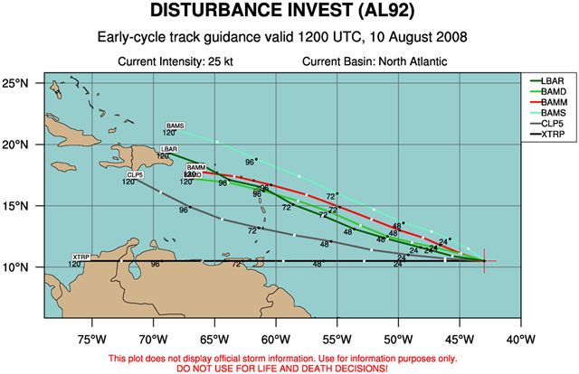
So, the models diverge,looking like strands of
spaghetti.
So, too early to predict, but one we have to
watch, folks, and as they say "Tis the season!"
|
|
|
- Update
|
- From: "Barbara Cannegieter" <barcann at hotmail.com>
- Date: Thu, 31 Jul 2008 10:09:35 -0400
|
|
From the looks of this sky, I thought we
were going to get some much needed rain.
I think Philipsburg got rain. We got 30
seconds of rain and then it just passed over us.
Our garden plants are thirsty and need rain
badly.
I hope Gert's laptop is not getting wet
over on the other side of the hill.
|
|
|
- Update
|
- From: "Barbara Cannegieter" <barcann at hotmail.com>
- Date: Sun, 13 Jul 2008 19:22:40 -0400
|
|
I have been spending a quiet
Sunday here, watching Bertha spin around and not paying attention to anything
else. All of a sudden I notice we have a new invest .94L.
The folks over on Storm2k are
all over this one.
One of the pro mets over
there said this:
"wxman57 wrote:
You guys know me, I'm not one to jump on
development potential whenever I see a cumulus cloud in the tropics. But I do
think that this system has a good chance of becoming Cristobal this week. It's
more than 24 hours away from a depression, probably 48 hours or more, but it's
slowly organizing. As I look at the environment in its path I see considerable
weakness in the ridge to its north as it nears the Caribbean. This should allow
it to gain significant latitude over the coming days. I'd discard the current
BAM runs taking into South America. They don't look realistic at all.
I
think that the northeast Caribbean islands would be at greatest risk by Friday.
Thereafter, we'll have to see just how weak the ridge to the north is and how
strong Cristobal becomes (I've already created a Cristobal folder for my 2009
hurricane talks and I'm saving all images of this system there) by the time it
reaches 60W. With Bertha still hanging around near Bermuda in 4-5 days, this
might allow 94L to track more WNW-NW after reaching the NE Caribbean. Question
is, does high pressure build in to its north, blocking it and shoving it west or
does it take a path similar to Bertha but more west? My initial thought is the
latter. Similar path to Bertha but more west before the turn north. I certainly
wouldn't rule out an east coast threat at this point, but with the Bermuda high
now so weak west of 60W I'm thinking a Gulf threat is not very
likely."
So those of us in the
Caribbean need to watch this one
closely!
|
|
|
- SxmGIS - ODMP Coordinator Salomon announces disaster office theme for hurricane season
|
- From: Roddy Heyliger <roddyheyliger at yahoo.com>
- Date: Thu, 12 Jun 2008 06:46:43 -0700 (PDT)
|
News Release
Written by Roddy Heyliger, Government Information Service (GIS), Ennia Bldg., Longwall Rd., Philipsburg, St. Maarten D.W.I. Tel. 00-599-543-1162, 542-4119, Fax: 543-1169; Email: gis at sintmaarten.net;
For Immediate Release: Wednesday, June 11, 2008/N088
ODMP Coordinator Salomon announces disaster office theme for hurricane season
GREAT BAY, St. Maarten (GIS) – Office of Disaster Management & Preparedness (ODMP) Disaster Coordinator Winston Salomon, has announced the office’s theme for the 2008 Hurricane Season, “It only takes one, be prepared!“
There is no substitute for individual preparedness when it comes to the safety of individuals and their families.
Preparedness is a personal responsibility and not only that of government. Individuals and families should prepare emergency supply kits with food, water, battery operated radios and medicines. Make sure that your home has been checked to see if any necessary repairs are needed and that your storm shutters are functioning well.
The first tropical storm of the season, Arthur, which formed on May 31, has left five confirmed dead and two persons are reportedly still missing in Belize. This is testament that the hurricane season is here.
Tropical storm Arthur immediately made landfall in Northern Belize dumping approximately 15 inches of rain across the country causing flooding in low lying areas. Initial damage assessment reports according to the Caribbean Disaster Emergency Response Agency (CDERA) have indicated that a number of houses have been destroyed, damaged or submerged and approximately 16,000 persons have been affected countrywide.
Disaster Coordinator Salomon added that the very first response to any hurricane lies with each individual and each family and each business which is going to experience a hurricane strike.
“It’s about planning and preparation before the storm. Not a day before, but at the beginning of every season you should have everything in place. If you have not done this as yet, do so now.
“If you have done what you need to do to make sure you are well equipped and prepared to deal with a hurricane strike, we have done our job,” Disaster Coordinator Winston Salomon told the Government Information Service (GIS) on Wednesday.
The 2008 hurricane season officially started on June 1 and runs through November 30.
# # #
Roddy Heyliger
St. Maarten Government Information Service (GIS)
Roddy Heyliger
MedPRO - Communications Consultant
Cell: 00 599 5204217, 5816323
Email: roddyheyliger at gmail.com
Email: medproprfirm at hotmail.com
MedPRO - Designed to broaden public knowledge by informing.
Attachment:
SxmGIS NRelease ODMP Announces 2008 Hurr Season Theme 080608.txt
Description: Binary data
|
|
- Fw: SxmGIS - Corrected Hurricane Shelter Listing for 2008
|
- From: Roddy Heyliger <roddyheyliger at yahoo.com>
- Date: Thu, 12 Jun 2008 06:45:42 -0700 (PDT)
|
News Release
Written by Roddy Heyliger, Government Information Service (GIS), Ennia Bldg., Longwall Rd., Philipsburg, St. Maarten D.W.I. Tel. 00-599-543-1162, 542-4119, Fax: 543-1169; Email: gis at sintmaarten.net;
For Immediate Release: Thursday, June 05, 2008/N084
2008 Hurricane Shelter Listing
GREAT BAY, St. Maarten (GIS) – The Office of Disaster Management & Preparedness (ODMP) on Thursday released the listing of 16 hurricane shelters for the 2008 hurricane season.
The listing is as follows:
1. Christian Fellowship Church - Welfare Road - Cole Bay
2. Dutch Quarter Community Center - Zorg en Rust Road - Lower Prince's Quarter
3. Genevieve de Weever School - Hope Estate - Upper Prince's Quarter
4. John Larmonie Center - Longwall Road - Philipsburg
5. Leonard Connor School - Venus Drive - Cape Bay
6. Leopold Bell School - Union Road - Cole Bay
7. Milton Peters College - L.B. Scot Road - South Reward
8. Raoul Illidge Sports Complex - Welgelegen Road - Cay Hill
9. Salvation Army Building - Union Road - Cole Bay
10. Simpson Bay Community Center - Simpson Bay Road - Simpson Bay
11. St. Maarten Academy - Cupper Drive - Cul-de-Sac
12. Ephese Seventh day Adventist Church - Belvedere
13. Hillside Christian School – Cul de Sac, St. Peters/South Reward
14. New Testament Baptist Church - Philipsburg
15. Sister Marie Laurence School – Middle Region
16. Senior Citizen’s Recreation Center – Hope Estate
# # #
Roddy Heyliger
St. Maarten Government Information Service (GIS)
Roddy Heyliger
MedPRO - Communications Consultant
Cell: 00 599 5204217, 5816323
Email: roddyheyliger at gmail.com
Email: medproprfirm at hotmail.com
MedPRO - Designed to broaden public knowledge by informing.
News Release

Written by Roddy Heyliger, Government Information Service (GIS),  Ennia Bldg.,
Longwall Rd., Philipsburg, St. Maarten D.W.I. Tel. 00-599-543-1162, 542-4119,
Fax: 543-1169; Email: gis at sintmaarten.net;

For Immediate Release: Thursday, June 05, 2008/N084

2008 Hurricane Shelter Listing

GREAT BAY, St. Maarten (GIS) ? The Office of Disaster Management & Preparedness
(ODMP) on Thursday released the  listing of 16 hurricane shelters for the 2008
hurricane season.

The listing is as follows:

1. Christian Fellowship Church - Welfare Road - Cole Bay

2. Dutch Quarter Community Center - Zorg en Rust Road - Lower Prince's Quarter

3. Genevieve de Weever School - Hope Estate - Upper Prince's Quarter

4. John Larmonie Center - Longwall Road - Philipsburg

5. Leonard Connor School - Venus Drive - Cape Bay

6. Leopold Bell School - Union Road - Cole Bay

7. Milton Peters College - L.B. Scot Road - South Reward

8. Raoul Illidge Sports Complex - Welgelegen Road - Cay Hill

9. Salvation Army Building - Union Road - Cole Bay

10. Simpson Bay Community Center - Simpson Bay Road - Simpson Bay

11. St. Maarten Academy - Cupper Drive - Cul-de-Sac

12. Ephese Seventh day Adventist Church - Belvedere

13. Hillside Christian School ? Cul de Sac, St. Peters/South Reward

14. New Testament Baptist Church - Philipsburg

15. Sister Marie Laurence School ? Middle Region

16. Senior Citizen?s Recreation Center ? Hope Estate

# # #

Roddy Heyliger
St. Maarten Government Information Service (GIS)
|
|
- SxmGIS _ Governor Richards National Address for the 2008 Hurricane Season
|
- From: Roddy Heyliger <roddyheyliger at yahoo.com>
- Date: Thu, 12 Jun 2008 06:44:51 -0700 (PDT)
|
Attachment:
Preparing_for_2008_Atlantic_hurricane_season[1].doc
Description: MS-Word document
|
|
- SxmGIS - Governor Richards calls on community to finalize preparations for an active hurricane season
|
- From: Roddy Heyliger <roddyheyliger at yahoo.com>
- Date: Thu, 29 May 2008 16:03:36 -0700 (PDT)
|
News Release
Written by Roddy Heyliger, Government Information Service (GIS), Ennia Bldg., Longwall Rd., Philipsburg, St. Maarten D.W.I. Tel. 00-599-543-1162, 542-4119, Fax: 543-1169; Email: gis at sintmaarten.net;
For Immediate Release: Thursday, May 29, 2008/N078
Governor Richards calls on community to finalize preparations for an active hurricane season
GREAT BAY, St. Maarten (GIS) – Governor Franklyn Richards Chairman of the Island’s Disaster Emergency Management Organization, the Emergency Operations Center (EOC), is calling on the St. Maarten community to finalize preparations this weekend for what has been forecast to become an active 2008 hurricane season which opens on June 1.
The U.S. NOAA Climate Prediction Center latest forecast calls for 12 to 16 named storms, with six to nine becoming hurricanes, of which two to five could become major hurricanes of Category 3 strength or higher. An average hurricane season brings 11 named storms, with six becoming hurricanes, including two major hurricanes.
“I would strongly urge those who haven’t done so already to make preparations this weekend in order not to have to rush and prepare once you have been notified to do so.
“For the past two weeks I and or the Office of Disaster Management have been informing the St. Maarten community about hurricane preparations and I do hope that the advice has been taken seriously.
“Time and time again we have had the experience and have been taught to be prepared and don’t wait until the last minute to gather items together because then it would have already been too late. Prepare early in order for you and your family to be able to ride out the storm in a safe manner,” Governor Richards told the Government Information Service (GIS) on Thursday.
The 2008 Hurricane Season name list is: Arthur, Bertha, Cristobal, Dolly, Edouard, Fay, Gustav, Hanna, Ike, Josephine, Kyle, Laura, Marco, Nana, Omar, Paloma, Rene, Sally, Teddy, Vicky and Wilfred.
# # #
Roddy Heyliger
St. Maarten Government Information Service (GIS)
Attachment:
SxmGIS NRelease Gov Richards Says Finalize Preps for 2008 Hurr Season 290508.txt
Description: Binary data
|
|
- SxmGIS - Office of Disaster Management calls on community to draft Family Disaster Plan and Compile Disaster Supply Kit
|
- From: Roddy Heyliger <roddyheyliger at yahoo.com>
- Date: Sat, 24 May 2008 06:31:11 -0700 (PDT)
|
News Release
Written by Roddy Heyliger, Government Information Service (GIS), Ennia Bldg., Longwall Rd., Philipsburg, St. Maarten D.W.I. Tel. 00-599-543-1162, 542-4119, Fax: 543-1169; Email: gis at sintmaarten.net;
For Immediate Release: Friday, May 23, 2008/N073
Office of Disaster Management calls on community to draft Family Disaster Plan and compile Disaster Supply Kit
GREAT BAY, St. Maarten (GIS) – The Island’s Disaster Emergency Management Organization, is appealing to members of the community to draft a Family Disaster Plan and create a Disaster Supply Kit in preparation for the 2008 hurricane season less than 12 days away.
The Family Plan should be based on your vulnerability to Hurricane Hazards that could affect your family such as storm surge or flooding. By knowing your vulnerability and what actions you should take, you can reduce the effects of a hurricane disaster.
Every home should have a Disaster Supply Kit which would contain certain items you need to have regardless of where you ride out a hurricane.
Securing your home should also be a top priority. There are things that you can do to make your home more secure and able to withstand stronger storms.
Preventing the loss of life and minimizing the damage to property from hurricanes are responsibilities that are shared by all.
Family Disaster Plan
Locate a safe room or the safest areas in your home for each hurricane hazard; Determine escape routes from your home as certain areas could be inundated by flooding and storm surge in low lying areas; Make a plan now for what to do with your pets if you need to evacuate; Post emergency telephone numbers by your phones and make sure your children know how and when to call; Check your insurance coverage; Stock non-perishable emergency supplies and a Disaster Supply Kit.
Disaster Supply Kit
Water, at least one gallon daily per person for three to seven days; Food, at least enough for three to seven days, non-perishable packaged or canned/juices, foods for infants or the elderly, snack foods, non-electric opener, cooking tools/fuel, paper plates/plastic utensils; Blankets/Pillows; Clothing (rain coat, sturdy shoes); First Aid Kit/Medicines/Prescription Drugs; Special items for babies and the elderly; Toiletries/Hygiene items/Moisture wipes; Flashlight and batteries; Battery operated radio; Fully charged cell phone with an extra battery; Cash/Credit Cards; Toys/Books/Games; Important documents should be put in a waterproof container; Tools; Vehicle fuel tanks should be filled a few days before a hurricane strike; Pet care items (medication, amply supply of food and water, a carrier or cage, a muzzle and leash).
Securing You Home
The most important precaution you can take to reduce damage to your home and property is to protect the areas where wind can enter. It is important to strengthen the exterior of your house so wind and debris do not tear large openings in it. You can do this by protecting and reinforcing these five critical areas: roof, straps, shutters, doors and garage doors.
Be sure to ask other family members, friends and neighbors if they are hurricane aware, be prepared and ready.
The 2008 hurricane season officially starts on June 1 through November 30.
# # #
Roddy Heyliger
St. Maarten Government Information Service (GIS)
News Release

Written by Roddy Heyliger, Government Information Service (GIS), Ennia Bldg.,
Longwall Rd., Philipsburg, St. Maarten D.W.I. Tel. 00-599-543-1162, 542-4119,
Fax: 543-1169; Email: gis at sintmaarten.net;

For Immediate Release: Friday, May 23, 2008/N073

Office of Disaster Management calls on community to draft Family Disaster Plan
and compile Disaster Supply Kit

GREAT BAY, St. Maarten (GIS) ? The Island?s Disaster Emergency Management
Organization, is appealing to members of the community to draft a Family
Disaster Plan and create a Disaster Supply Kit in preparation for the 2008
hurricane season less than 12 days away.

The Family Plan should be based on your vulnerability to Hurricane Hazards that
could affect your family such as storm surge or flooding.  By knowing your
vulnerability and what actions you should take, you can reduce the effects of a
hurricane disaster.

Every home should have a Disaster Supply Kit which would contain certain items
you need to have regardless of where you ride out a hurricane.

Securing your home should also be a top priority.  There are things that you
can do to make your home more secure and able to withstand stronger storms.

Preventing the loss of life and minimizing the damage to property from
hurricanes are responsibilities that are shared by all.

Family Disaster Plan
Locate a safe room or the safest areas in your home for each hurricane hazard;
Determine escape routes from your home as certain areas could be inundated by
flooding and storm surge in low lying areas; Make a plan now for what to do
with your pets if you need to evacuate; Post emergency telephone numbers by
your phones and make sure your children know how and when to call; Check your
insurance coverage; Stock non-perishable emergency supplies and a Disaster
Supply Kit.

Disaster Supply Kit
Water, at least one gallon daily per person for three to seven days; Food, at
least enough for three to seven days, non-perishable packaged or canned/juices,
foods for infants or the elderly, snack foods, non-electric opener, cooking
tools/fuel, paper plates/plastic utensils; Blankets/Pillows; Clothing (rain
coat, sturdy shoes); First Aid Kit/Medicines/Prescription Drugs; Special items
for babies and the elderly; Toiletries/Hygiene items/Moisture wipes; Flashlight
and batteries; Battery operated radio; Fully charged cell phone with an extra
battery; Cash/Credit Cards; Toys/Books/Games; Important documents should be put
in a waterproof container; Tools; Vehicle fuel tanks should be filled a few
days before a hurricane strike; Pet care items (medication, amply supply of
food and water, a carrier or cage, a muzzle and leash).

Securing You Home
The most important precaution you can take to reduce damage to your home and
property is to protect the areas where wind can enter.  It is important to
strengthen the exterior of your house so wind and debris do not tear large
openings in it.  You can do this by protecting and reinforcing these five
critical areas: roof, straps, shutters, doors and garage doors.

Be sure to ask other family members, friends and neighbors if they are
hurricane aware, be prepared and ready.

The 2008 hurricane season officially starts on June 1 through November 30.

# # #

Roddy Heyliger
St. Maarten Government Information Service (GIS)
|
|
- Update
|
- From: "Barbara Cannegieter" <barcann at hotmail.com>
- Date: Tue, 20 May 2008 10:09:45 -0400
|
|
Last night was full moon and I took this
shot of the moon over Philipsburg
|
|
|
- SxmGIS - Governor Richards calls on community to prepare for 2008 hurricane season
|
- From: Roddy Heyliger <roddyheyliger at yahoo.com>
- Date: Tue, 13 May 2008 16:10:27 -0700 (PDT)
|
News Release
Written by Roddy Heyliger, Government Information Service (GIS), Dept. Head Erno Labega, Ennia Bldg., Longwall Rd., Philipsburg, St. Maarten D.W.I. Tel. 00-599-543-1162, 542-4119, Fax: 543-1169; Email: gis at sintmaarten.net;
For Immediate Release: Tuesday, May 13, 2008/N067
Governor Richards calls on community to prepare for 2008 hurricane season
GREAT BAY, St. Maarten (GIS) – Governor Franklyn Richards, Chairman of the Island’s Disaster Emergency Management Organization, the Emergency Operations Center (EOC), is calling on the St. Maarten community to start preparing for the 2008 hurricane season and to have those plans in place by June 1st, the beginning of the season.
Even though the official start of the season is still two weeks away, Governor Richards is urging residents to use this period to prepare themselves.
“The month of May for the Caribbean and the U.S. Eastern Seaboard and the Gulf of Mexico, is a period used to prepare for the six-month hurricane season. It makes no sense to make major preparations days or hours before a hurricane strike.
“Prepare early and avoid being caught unprepared. Preparedness starts with every one of us within society. As a community we must plan early and don’t wait until the last moment to rush to get things done because it can result in injury,” Governor Richards told the Government Information Service (GIS) on Tuesday.
Some of the preparations that should be done now are the removal of debris from around homes and businesses; checking hurricane shutters and the roof of your home or business to make sure those windows can close securely and there are no weak spots in the roof.
Putting together a hurricane disaster kit is also another essential part of preparing early as well as stockpiling non-perishables.
The 2008 Hurricane Season name list is: Arthur, Bertha, Cristobal, Dolly, Edouard, Fay, Gustav, Hanna, Ike, Josephine, Kyle, Laura, Marco, Nana, Omar, Paloma, Rene, Sally, Teddy, Vicky and Wilfred.
The 2008 hurricane season officially starts on June 1 through November 30.
# # #
Roddy Heyliger
St. Maarten Government Information Service (GIS)
Attachment:
SxmGIS NRelease Gov Richards Calls on Commun to Start Preparing for 2008 Hurr Season 130508.txt
Description: Binary data
|
|
- Update
|
- From: "Barbara Cannegieter" <barcann at hotmail.com>
- Date: Wed, 7 May 2008 18:47:22 -0400
|
|
It's not Saharan Dust..not
according to this image. The Saharan dust hasn't reached us yet... not much of
it anyway.
So what is it? what is the
haze? It is so hazy that we can't even see Anguilla which is always
visible.
The entire island looks like
this:
And you can barely see where
the sky and sea meet:
It's not cloudy like it is
going to rain.It is haze. Strange!
By the way, it is Sea Turtle
Nesting Season. St. Maarten Pride Foundation, our local environmental group,
sent me some information on it , explaining how people living on the beach
side can help.
I think anyone on any of the
other islands could help in the same way.
Take a look at my blog where
I posted the information.
|
|
|
- Update
|
- From: "Barbara Cannegieter" <barcann at megatropic.com>
- Date: Fri, 2 May 2008 09:19:41 -0400
|
|
Yesterday was both May Day ( Labour Day)
and Ascension Day. In case you were confused about which to celebrate, St.
Maarten gave us all an extra day off today.
I will probably celebrate today the way I
celebrated yesterday...by staying home and reading.
We were blessed last night though by 1 inch
of rain. That is the first measurable rain we have had on the Dutch side of the
island in about a month.
|
|
|
- Update
|
- From: "Barbara Cannegieter" <barcann at megatropic.com>
- Date: Tue, 29 Apr 2008 22:04:49 -0400
|
|
The weather was beautiful in
St. Maarten today. We couldn't have asked for a better day to hold our Grand
Carnival Parade.
I posted some pictures of the
Carnival parade.
Please take a look if you
want.
|
|
|
- Update
|
- From: "Barbara Cannegieter" <barcann at hotmail.com>
- Date: Sun, 27 Apr 2008 11:00:30 -0400
|
|
Rain or no
rain?
St. Martin/Maarten got
both.
MJ from Culebra says there was a St. Martin
band of rain that soaked them. Well, that's right...St.
Martin!
NOT St.
Maarten.
It seems the French side (St.
Martin) ( North side) of the island got soaked , while those of us on the
Dutch side (St. Maarten) were praying for rain. We got a few
drizzles.
And my cistern is dry. We need the
rain badly, but the French got it all yesterday.
That's the tropics for you......a 36 square
mile island and it poured on one side of the island and not on the other
side.
Today is still cloudy but no imminent
threats of rain at this point.
|
|
|

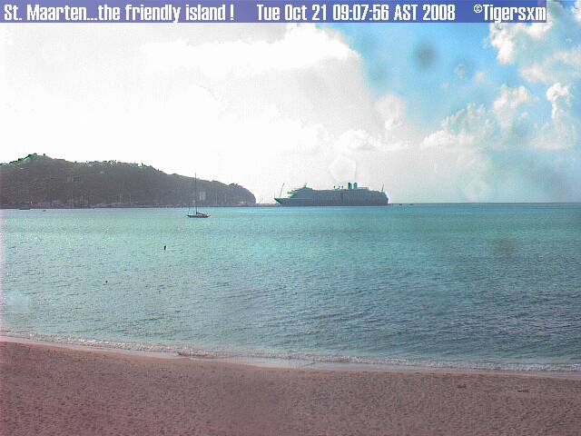
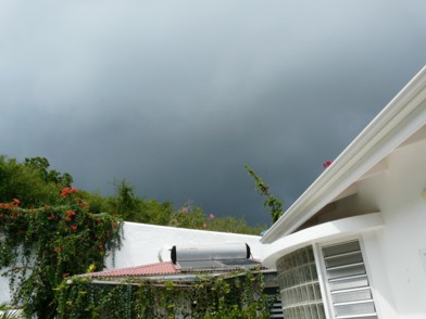
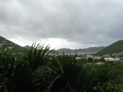

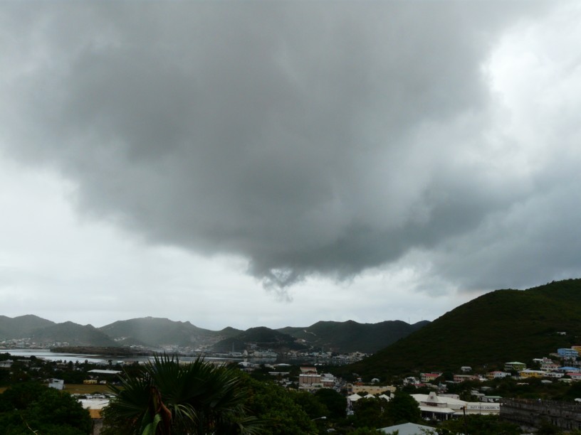
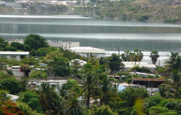
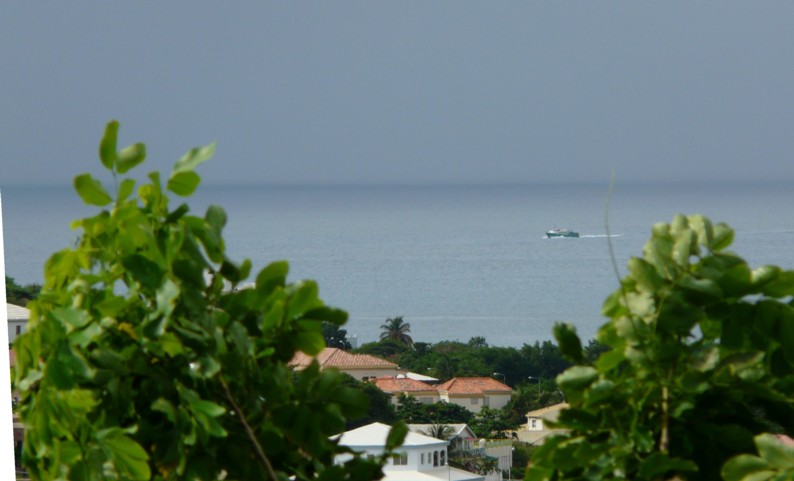
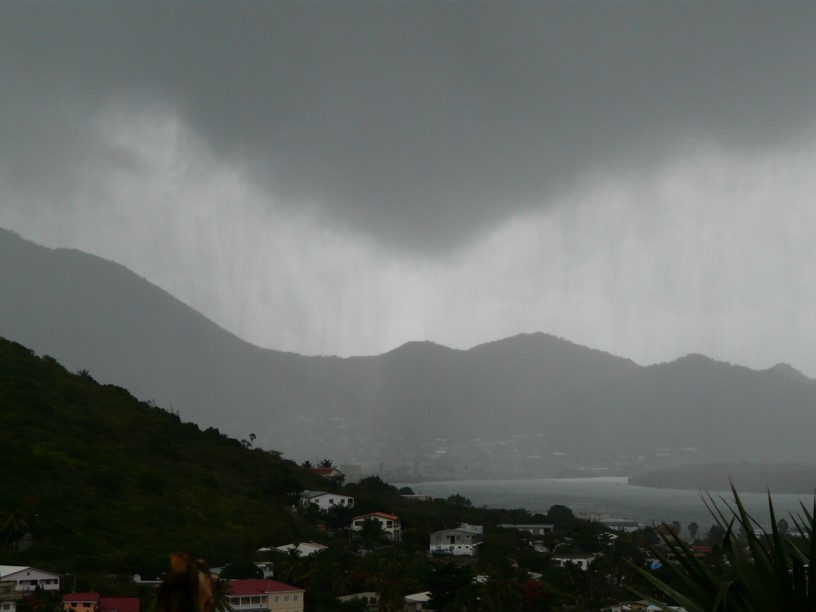
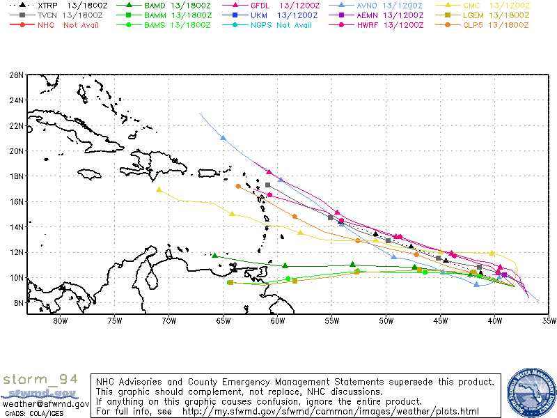

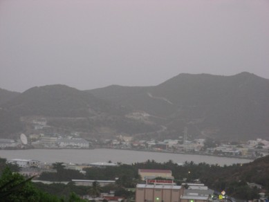
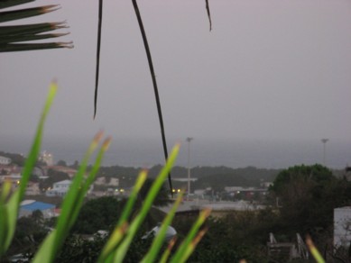
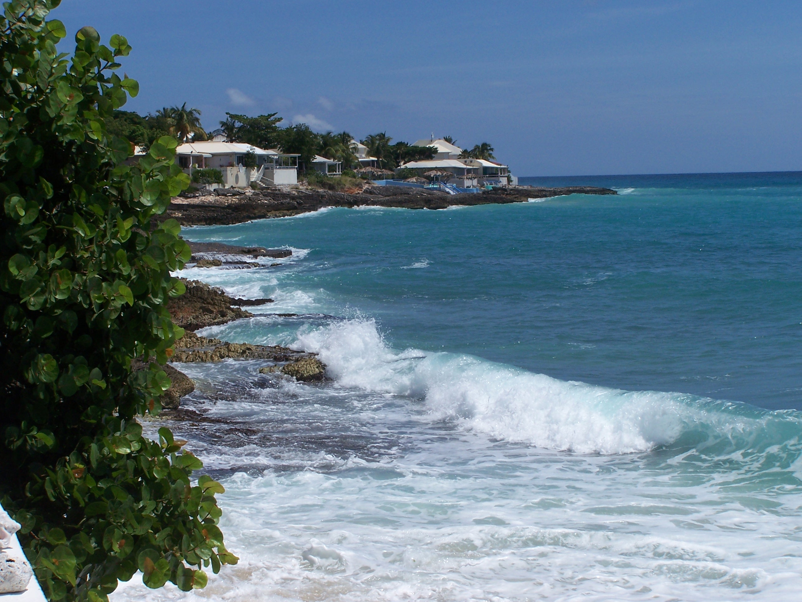
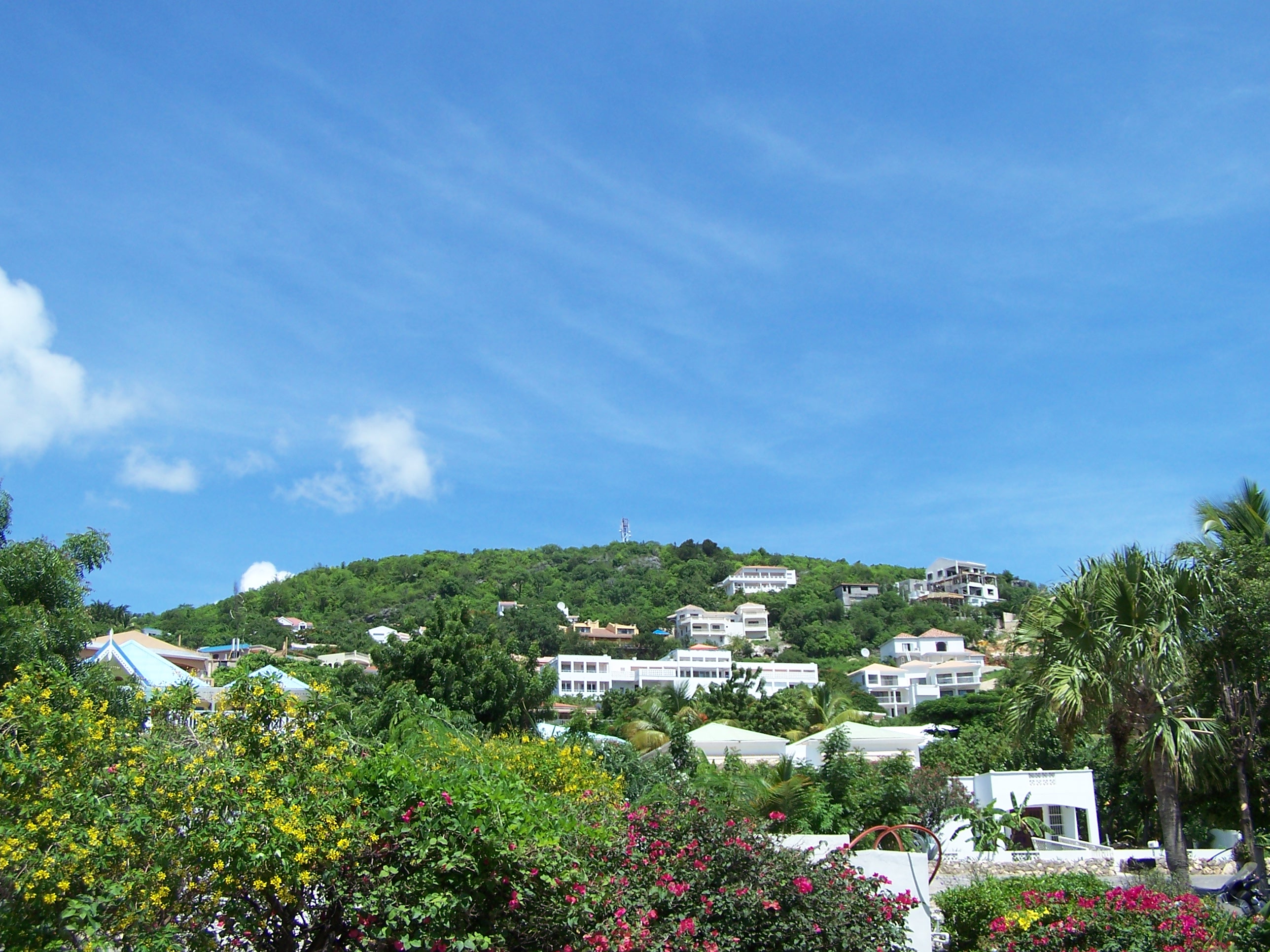
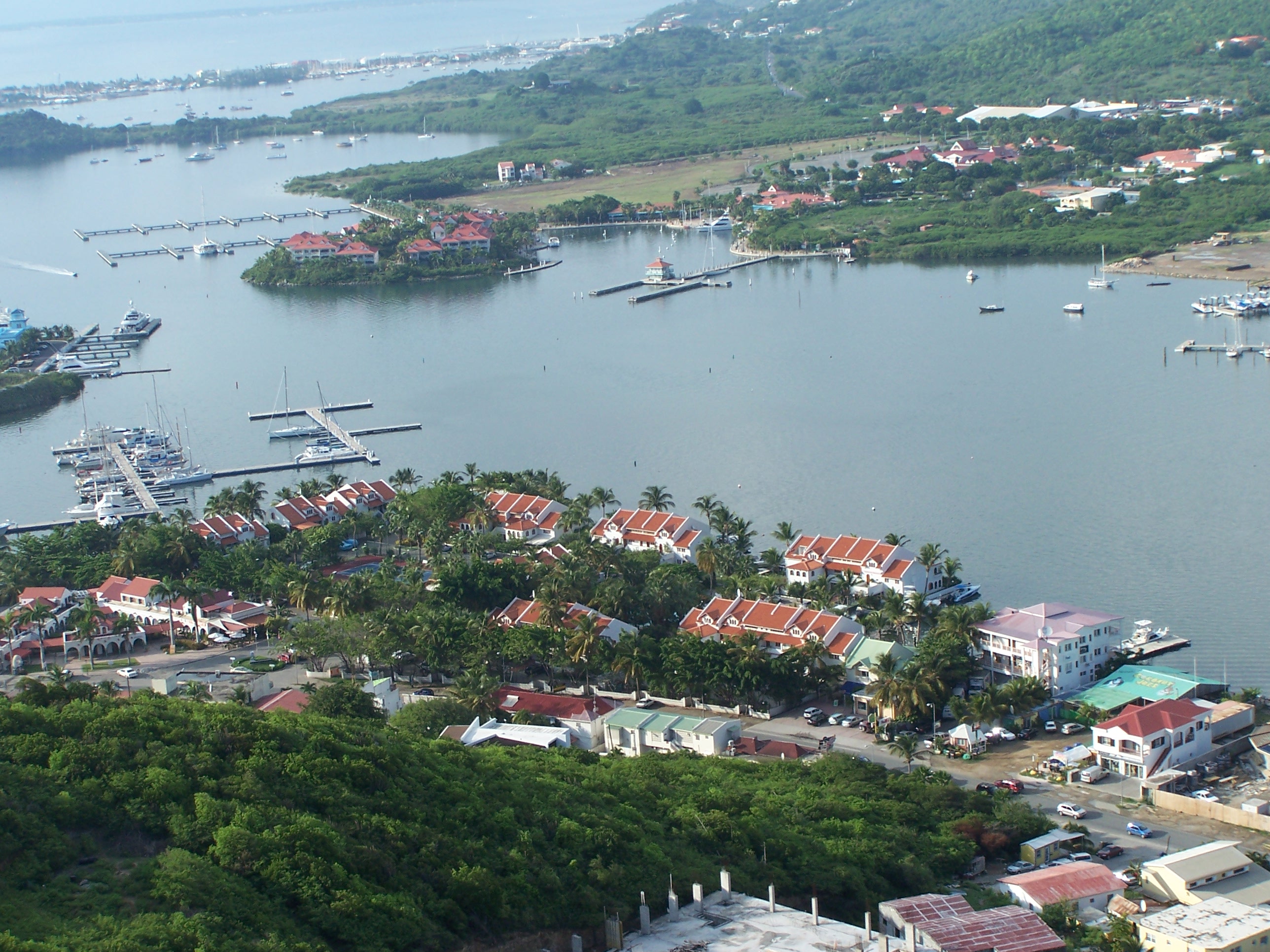